Narrow Results By
Subject
- Agriculture - Crops 1
- Agriculture - Farms 1
- Buildings - Industrial - Factories 10
- Buildings - Religious - Churches 12
- Buildings - Schools 18
- Businesses - Real Estate Agencies 1
- Documentary Artifacts - Maps 1
- Exhibitions 1
- First Nations reserves - British Columbia 10
- Geographic Features - Forests 1
- Geographic Features - Roads 1
- Indigenous peoples - Indian Territory 8
Creator
- Adams, John 2
- Associated Factory Mutual Fire Insurance Cos 1
- Bekins Moving and Storage Company Limited 1
- British Columbia Underwriters' Association 13
- Burnaby Village Museum 1
- Burnett and McGugan B.C. Land Surveyors, New Westminster 5
- Burnett, David H. 2
- Burnett, Geoffrey K. 6
- Burnett & McGugan, Engineers and Surveyors 24
- Century Park Museum Association 1
- City Map and White Print Co. 1
- Coast Map and Blue Print Co. 1
Person / Organization
- All Saints Anglican Church 1
- Armstrong Avenue School 1
- Barnet School 1
- British Columbia Electric Railway Company 1
- Broadview Presbyterian Church 1
- Brownlee, James Harrison 1
- Burnaby Village Museum 1
- Burnett, Geoffrey K. 2
- Ceperley, H.T. 2
- Chinese Market Gardens 1
- Corsbie, Joseph Hardcastle-Cumberland "Joe" 2
- Dominion Bridge Company 1
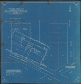
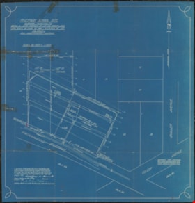
Map of location of Toishan Middle school
https://search.heritageburnaby.ca/link/museumdescription8695
- Repository
- Burnaby Village Museum
- Date
- [between 1919 and 1926]
- Collection/Fonds
- Way Sang Yuen Wat Kee & Co. fonds
- Description Level
- Item
- Physical Description
- 1 map : blueprint ink on paper ; 41.5 x 25.5 cm
- Scope and Content
- Item consists of a topographic map with Chinese characters indicating the location of where the Toishan Middle school will be constructed. Overseas Chinese who originated from Toishan county in China participated in the fundraising efforts for the first phase of building this school (there were thr…
- Repository
- Burnaby Village Museum
- Collection/Fonds
- Way Sang Yuen Wat Kee & Co. fonds
- Description Level
- Item
- Physical Description
- 1 map : blueprint ink on paper ; 41.5 x 25.5 cm
- Material Details
- Map details include elevation contours, marsh, roads, water and rail
- Scope and Content
- Item consists of a topographic map with Chinese characters indicating the location of where the Toishan Middle school will be constructed. Overseas Chinese who originated from Toishan county in China participated in the fundraising efforts for the first phase of building this school (there were three phases in total). The block of text on the bottom right describes the geographical location of the school. It also mentions some of the amenities that they want to add to the school grounds, which requires additional funding.
- Subjects
- Buildings - Schools
- Accession Code
- BV985.5331.9
- Access Restriction
- No restrictions
- Reproduction Restriction
- No known restrictions
- Date
- [between 1919 and 1926]
- Media Type
- Cartographic Material
- Scan Resolution
- 300
- Scan Date
- December 2020
- Scale
- 100
- Notes
- Title based on contents of map
Images
Map of Municipality of Burnaby
https://search.heritageburnaby.ca/link/museumdescription8200
- Repository
- Burnaby Village Museum
- Date
- 1921
- Collection/Fonds
- Burnaby Village Museum Map collection
- Description Level
- Item
- Physical Description
- 1 map : lithographic print, b&w ; 83 x 56 cm
- Scope and Content
- Item consists of a map of the Municipality of Burnaby compiled and published by Dominion Blueprint & Map Company.
- Repository
- Burnaby Village Museum
- Collection/Fonds
- Burnaby Village Museum Map collection
- Description Level
- Item
- Physical Description
- 1 map : lithographic print, b&w ; 83 x 56 cm
- Material Details
- Scale : 1:24,000 inches
- Scope and Content
- Item consists of a map of the Municipality of Burnaby compiled and published by Dominion Blueprint & Map Company.
- Creator
- Dominion Map and Blueprint Co.
- Publisher
- Blue Printers, Map Publishers and Draughtsmen
- Accession Code
- HV976.11.1
- Access Restriction
- No restrictions
- Reproduction Restriction
- No known restrictions
- Date
- 1921
- Media Type
- Cartographic Material
- Scan Resolution
- 340
- Scan Date
- 22 Dec. 2020
- Scale
- 100
- Notes
- Title based on contents of map
- Cardstock map cover reads: "Map / of the / Municipality of / Burnaby / Published by / Dominion Map & Blue Print Co. / Arts and Crafts Bldg /576 Seymour St., Vancouver, B.C. / Blue Printers, Map Publishers and Draughtsmen / Phone Sey 4670 / Price, 50 c."
- Title on map reads: "Burnaby / Municipality."
Zoomable Images
Map of proposed provincial exhibition site at Burnaby Lake
https://search.heritageburnaby.ca/link/museumdescription8703
- Repository
- Burnaby Village Museum
- Date
- [between 1929 and 1931]
- Collection/Fonds
- Burnaby Village Museum Map collection
- Description Level
- Item
- Physical Description
- 1 map : photostat print ; 3 parts 45 x 33.7 cm totalling 45 x 101 cm
- Scope and Content
- Item consists of a tri-part folding map of a proposed Provincial Exhibition site located along the southern and western shore of Burnaby Lake. Exhibtion site on map identifies proposed locations for a golf course, pier, hydroplane landing ramp, sports ground, one-mile horse racing track and various…
- Repository
- Burnaby Village Museum
- Collection/Fonds
- Burnaby Village Museum Map collection
- Description Level
- Item
- Physical Description
- 1 map : photostat print ; 3 parts 45 x 33.7 cm totalling 45 x 101 cm
- Material Details
- Scale [1:1800]
- Scope and Content
- Item consists of a tri-part folding map of a proposed Provincial Exhibition site located along the southern and western shore of Burnaby Lake. Exhibtion site on map identifies proposed locations for a golf course, pier, hydroplane landing ramp, sports ground, one-mile horse racing track and various buildings for mechanical, agricultural and botanical displays.
- Subjects
- Exhibitions
- Accession Code
- BV017.2.9
- Access Restriction
- No restrictions
- Reproduction Restriction
- No known restrictions
- Date
- [between 1929 and 1931]
- Media Type
- Cartographic Material
- Historic Neighbourhood
- Burnaby Lake (Historic Neighbourhood)
- Planning Study Area
- Burnaby Lake Area
- Scan Resolution
- 400
- Scan Date
- 2021-11-18
- Notes
- Title based on contents of map
- Scale on map reads: "150 feet to 1 inch"
- Overall measurements when fully opened: L: 98.0 cm x H: 45.3 cm ; Individual map parts: L: 32.7 cm x H: 45.0 cm
- Commercially printed label on front of portfolio card reads "PLOWRIGHT PRINTING COMPANY / TELEPHONE N.W. 1942 / 39 McKENZIE STREET NEW WESTMINSTER, B.C. / TO: [illegible writing in pencil]" in blue ink. Red typewritten text reads: "PHOTOSTAT OF BURNABY LAKE".
Images
Map of South Western Part of British Columbia
https://search.heritageburnaby.ca/link/museumdescription8688
- Repository
- Burnaby Village Museum
- Date
- 1897
- Collection/Fonds
- Burnaby Village Museum Map collection
- Description Level
- Item
- Physical Description
- 1 map : col. ink on paper ; 68 x 88 cm
- Scope and Content
- Item consists of a "MAP OF THE SOUTH-WESTERN PART OF BRITISH COLUMBIA”. Map identifies geographic land districts of New Westminster District; Coast District; Lillooet District; Yale District, Kamloops Division, Yale Division and districts on Vancouver Island. Map also includes the northern portions…
- Repository
- Burnaby Village Museum
- Collection/Fonds
- Burnaby Village Museum Map collection
- Description Level
- Item
- Physical Description
- 1 map : col. ink on paper ; 68 x 88 cm
- Material Details
- Scale [1:633600]
- Scope and Content
- Item consists of a "MAP OF THE SOUTH-WESTERN PART OF BRITISH COLUMBIA”. Map identifies geographic land districts of New Westminster District; Coast District; Lillooet District; Yale District, Kamloops Division, Yale Division and districts on Vancouver Island. Map also includes the northern portions of the State of Washington below the 49th parallel.
- Publisher
- The Colonist Litho Victoria B.C.
- Responsibility
- Martin, George Bohun
- Accession Code
- BV993.12.12
- Access Restriction
- No restrictions
- Reproduction Restriction
- No known restrictions
- Date
- 1897
- Media Type
- Cartographic Material
- Scan Resolution
- 600
- Scan Date
- 2023-08-17
- Notes
- Transcribed title
- Scale equals 1 inch to 10 miles
- "Compiled and drawn by direction of the Honouable G.B. Martin, Chief Commissioner of Lands and Works, Victoria, B.C."
- Signed by Surveyor General "Tom Kains"
Zoomable Images
Map of the Dominion of Canada
https://search.heritageburnaby.ca/link/museumdescription18944
- Repository
- Burnaby Village Museum
- Date
- 1911
- Collection/Fonds
- Burnaby Village Museum Map collection
- Description Level
- Item
- Physical Description
- 1 map : col. lithographic print on white paper ; 49.5 x 88.5 cm on sheet 63.5 x 90.5 cm
- Scope and Content
- Item consists of a "MAP OF THE DOMINION OF CANADA" produced by the Department of the Interior in 1911 . Text in lower border below map reads "THIS MAP IS PRESENTED WITH THE COMPLIMENTS OF THE ROYAL BANK OF CANADA" "WITH ITS FORTY-SECOND ANNUAL REPORT, 31st DECEMBER, 1911" at bottom centre, with lis…
- Repository
- Burnaby Village Museum
- Collection/Fonds
- Burnaby Village Museum Map collection
- Description Level
- Item
- Physical Description
- 1 map : col. lithographic print on white paper ; 49.5 x 88.5 cm on sheet 63.5 x 90.5 cm
- Material Details
- Scale: 100 miles = 1 inch
- Scope and Content
- Item consists of a "MAP OF THE DOMINION OF CANADA" produced by the Department of the Interior in 1911 . Text in lower border below map reads "THIS MAP IS PRESENTED WITH THE COMPLIMENTS OF THE ROYAL BANK OF CANADA" "WITH ITS FORTY-SECOND ANNUAL REPORT, 31st DECEMBER, 1911" at bottom centre, with list of branches in Canada and in other countries; at left is list of "PRINCIPAL FOREIGN CORRESPONDENTS"; at right is general information, "INCORPORATED 1869", "HEAD OFFICE MONTREAL", with "CAPITAL PAID UP", "RESERVE FUNDS", "AGGREGATE ASSETS" all listed, and "BOARD OF DIRECTORS" listed. Map shows proposed additions to Quebec, Ontario and Manitoba. Provincial and territorial borders, shipping routes, railway lines are identified. Two charts at upper right of distances, red print, one for distances in Canada from Montreal, the other for Montreal, Halifax and Churchill to foreign ports.
- Publisher
- Royal Bank of Canada
- Accession Code
- BV988.56.4
- Access Restriction
- No restrictions
- Reproduction Restriction
- No known restrictions
- Date
- 1911
- Media Type
- Cartographic Material
- Notes
- Title based on contents of map
Map of the Municipality of Burnaby
https://search.heritageburnaby.ca/link/museumdescription14766
- Repository
- Burnaby Village Museum
- Date
- [ca.1913]
- Collection/Fonds
- Burnaby Village Museum Map collection
- Description Level
- Item
- Physical Description
- 1 map : lithographic print, b&w ; 82 x 62 cm
- Scope and Content
- Item is a map of the Municipality of Burnaby, "Published by Archibald Moir and Company, 570 Granville St., Vancouver". Map was published compliments of "Walker Brothers Real Estate Brokers and Insurance Agents", Vancouver.
- Repository
- Burnaby Village Museum
- Collection/Fonds
- Burnaby Village Museum Map collection
- Description Level
- Item
- Physical Description
- 1 map : lithographic print, b&w ; 82 x 62 cm
- Material Details
- Scale 1 inch = 1000 feet
- Scope and Content
- Item is a map of the Municipality of Burnaby, "Published by Archibald Moir and Company, 570 Granville St., Vancouver". Map was published compliments of "Walker Brothers Real Estate Brokers and Insurance Agents", Vancouver.
- Publisher
- Archibald Moir and Company
- Responsibility
- Walker Brothers Real Estate Brokers and Insurance Agents
- Accession Code
- BV988.56.1
- Access Restriction
- No restrictions
- Reproduction Restriction
- No known restrictions
- Date
- [ca.1913]
- Media Type
- Cartographic Material
- Scan Resolution
- 350
- Scan Date
- Dec. 22,2020
- Scale
- 100
- Notes
- Title based on contents of map
Zoomable Images
Map with subdivision of lots on Cumberland Road
https://search.heritageburnaby.ca/link/museumdescription18806
- Repository
- Burnaby Village Museum
- Date
- [190-]
- Collection/Fonds
- Love family fonds
- Description Level
- Item
- Physical Description
- 1 map : hand drawn in graphite on paper ; 27.5 x 21 cm
- Scope and Content
- Item consists of a hand drawn map with subdivision lots labeled A,B,C,D,E,F along Cumberland Road.
- Repository
- Burnaby Village Museum
- Collection/Fonds
- Love family fonds
- Description Level
- Item
- Physical Description
- 1 map : hand drawn in graphite on paper ; 27.5 x 21 cm
- Scope and Content
- Item consists of a hand drawn map with subdivision lots labeled A,B,C,D,E,F along Cumberland Road.
- Accession Code
- BV992.26.26
- Access Restriction
- No restrictions
- Reproduction Restriction
- No known restrictions
- Date
- [190-]
- Media Type
- Cartographic Material
- Scan Resolution
- 600
- Scan Date
- 2022-06-10
- Notes
- Title based on contents of item
- Map, drawn by hand in pencil on brown paper; rectangle divided into lots A, B, C, D, E, F; all lots same size except B which is like a road or easement; "Cumberland Road" is written along one long side of block, "Parts Conveyed" written through lots; dimensions given; smaller drawing in corner of page with total dimensions of block, "1.", and note with arrow to block, "Registered sk of Mr. [sic] Loves see Map 813 Bd. 135"
Images
Municipality of Burnaby
https://search.heritageburnaby.ca/link/museumdescription8702
- Repository
- Burnaby Village Museum
- Date
- [between 1910 and 1930]
- Collection/Fonds
- Burnaby Village Museum Map collection
- Description Level
- Item
- Physical Description
- 1 map : blackline print with col. ; 83 x 53 cm on sheet 92 x 61 cm
- Scope and Content
- Item consists of "Municipality of Burnaby" map outlining waterlines, telephone lines, lights and power lines, and street lights. A section of the upper left corner (borded by Boundary Road to the west; Queens Ave to the east; Burrard Inlet to the north and Parker Avenue to the south) of map is han…
- Repository
- Burnaby Village Museum
- Collection/Fonds
- Burnaby Village Museum Map collection
- Description Level
- Item
- Physical Description
- 1 map : blackline print with col. ; 83 x 53 cm on sheet 92 x 61 cm
- Material Details
- Scale 10 chains = 1 inch
- Scope and Content
- Item consists of "Municipality of Burnaby" map outlining waterlines, telephone lines, lights and power lines, and street lights. A section of the upper left corner (borded by Boundary Road to the west; Queens Ave to the east; Burrard Inlet to the north and Parker Avenue to the south) of map is hand coloured in red with "Queens Avenue" and "Parker Avenue" identified.
- Creator
- Coast Map and Blue Print Co.
- Responsibility
- Municipal Council of Burnaby
- Accession Code
- BV008.24.1
- Access Restriction
- No restrictions
- Reproduction Restriction
- No known restrictions
- Date
- [between 1910 and 1930]
- Media Type
- Cartographic Material
- Scan Resolution
- 300
- Scan Date
- 2022-05-10
- Notes
- Transcribed title
- "COMPILED EXPRESSLY FOR / THE MUNICIPAL COUNCIL OF BURNABY/ BY/ THE COAST MAP AND BLUE PRINT CO/ EMPIRE BLDG VANCOUVER B.C."
Images
Municipality of Burnaby
https://search.heritageburnaby.ca/link/museumdescription13095
- Repository
- Burnaby Village Museum
- Date
- [ca. 1909]
- Collection/Fonds
- Burnaby Village Museum Map collection
- Description Level
- Item
- Physical Description
- 1 map : b&w lithographic print on linen, b&w ; 40 x 43.5 cm
- Scope and Content
- Map of the Municipality of Burnaby issued by Mahon, McFarland and Mahon (Real Estate, Insurance and Loans, Vancouver B.C.). A handrawn red line runs south of Burnaby Lake and between North Road and Boundary Road.
- Repository
- Burnaby Village Museum
- Collection/Fonds
- Burnaby Village Museum Map collection
- Description Level
- Item
- Physical Description
- 1 map : b&w lithographic print on linen, b&w ; 40 x 43.5 cm
- Scope and Content
- Map of the Municipality of Burnaby issued by Mahon, McFarland and Mahon (Real Estate, Insurance and Loans, Vancouver B.C.). A handrawn red line runs south of Burnaby Lake and between North Road and Boundary Road.
- Creator
- Mahon, McFarland & Mahon
- Publisher
- The Angel Engraving Co.
- Accession Code
- HV976.158.6
- Access Restriction
- No restrictions
- Reproduction Restriction
- No known restrictions
- Date
- [ca. 1909]
- Media Type
- Cartographic Material
- Scan Resolution
- 420
- Scan Date
- Dec. 22, 2020
- Scale
- 100
- Notes
- Title based on content of map
- Title on map reads: "Map / of The / Municipality / of / BURNABY / ISSUED BY / Mahon, McFarland & Mahon"
- Map contains the initals "F.R.G." [sic]
- Circular insignia in left corner reads: "THE ANGEL ENGRAVING CO."
Zoomable Images
Municipality of Burnaby
https://search.heritageburnaby.ca/link/museumdescription13096
- Repository
- Burnaby Village Museum
- Date
- 1936
- Collection/Fonds
- Burnaby Village Museum Map collection
- Description Level
- Item
- Physical Description
- 1 map : b&w print on paper ; 59 x 43 cm
- Scope and Content
- Map of the Municipality of Burnaby compiled and published by City Map and White Print Co.
- Repository
- Burnaby Village Museum
- Collection/Fonds
- Burnaby Village Museum Map collection
- Description Level
- Item
- Physical Description
- 1 map : b&w print on paper ; 59 x 43 cm
- Scope and Content
- Map of the Municipality of Burnaby compiled and published by City Map and White Print Co.
- Creator
- City Map and White Print Co.
- Publisher
- City Map and White Print Co.
- Accession Code
- HV976.158.7
- Access Restriction
- No restrictions
- Reproduction Restriction
- No known restrictions
- Date
- 1936
- Media Type
- Cartographic Material
- Scan Resolution
- 600
- Scan Date
- 2022-04-06
- Scale
- 100
- Notes
- Title based on content of map
- Title on map reads: "MUNICIPALITY / OF / BURNABY / BRITISH COLUMBIA / Compiled and Published by / CITY MAP AND WHITE PRINT CO."
- Stamp on map reads: "SFU LIBRARY / SEP 1974 / G. 3514 / B87 / 1936"
- Stamp on map reads: "SFU LIBRARY / AUG 1973 / G. 3514 / B87 / 1936"
- Cirular seal stamp on map reads: "The University of / Library / British Columbia"
Zoomable Images
Municipality of Burnaby - Volume XV and Volume XVIII
https://search.heritageburnaby.ca/link/museumdescription8680
- Repository
- Burnaby Village Museum
- Date
- May 1927
- Collection/Fonds
- Burnaby Village Museum Map collection
- Description Level
- File
- Physical Description
- 4 plans on 4 sheets : col. lithographic prints ; 63.5 x 53.5 cm folded to 53 x 31.5 cm
- Scope and Content
- File consists of four pages of plans removed from a bound book containing a series of fire insurance plans of the Municipality of Burnaby. The first two pages are numbered "A" and "B" and are key plans from "GREATER VANCOUVER B.C. / VOLUME XV / Surveyed _ May 1927 / MUNICIPALITY OF / BURNABY", "PLA…
- Repository
- Burnaby Village Museum
- Collection/Fonds
- Burnaby Village Museum Map collection
- Description Level
- File
- Physical Description
- 4 plans on 4 sheets : col. lithographic prints ; 63.5 x 53.5 cm folded to 53 x 31.5 cm
- Material Details
- Scales [1:1200] and [1:6000]
- Scope and Content
- File consists of four pages of plans removed from a bound book containing a series of fire insurance plans of the Municipality of Burnaby. The first two pages are numbered "A" and "B" and are key plans from "GREATER VANCOUVER B.C. / VOLUME XV / Surveyed _ May 1927 / MUNICIPALITY OF / BURNABY", "PLAN DEPT. FIRE BRANCH _ B.C. INSURANCE UNDERWRITERS ASSN.". Key Plan "B" covers plans: 1505; 1506; 1512 to 1516; 1540 to 1544; 1550 to 1557 and District Lots: 129 to 132; 135 to 138; 205 to 208 and 215 to 218. Key Plan "A" covers plans: 1501 to 1504; 1507 to 1511; 1517 to 1525; 1531 to 1539; 1545 to 1550 and District Lots: 116 to 127 and 186 to 189. Plan "1806" is part of "GREATER VANCOUVER B.C. / VOLUME XVIII / Municipality of Burnaby / May, 1927" and covers District Lot 153. Plan "1807" is from "GREATER VANCOUVER B.C. / VOLUME XVIII / Municipality of Burnaby / May, 1927" and covers District Lots: 99,149 and 152.
- Responsibility
- British Columbia Underwriters' Association
- Accession Code
- HV972.111.2
- Access Restriction
- No restrictions
- Reproduction Restriction
- May be restricted by third party rights
- Date
- May 1927
- Media Type
- Cartographic Material
- Historic Neighbourhood
- Vancouver Heights (Historic Neighbourhood)
- Lochdale (Historic Neighbourhood)
- Capitol Hill (Historic Neighbourhood)
- Central Park (Historic Neighbourhood)
- Alta Vista (Historic Neighbourhood)
- Planning Study Area
- Burnaby Heights Area
- Sperling-Broadway Area
- Lochdale Area
- Parkcrest-Aubrey Area
- Westridge Area
- Willingdon Heights Area
- Capitol Hill Area
- Maywood Area
- Marlborough Area
- Scan Resolution
- 400
- Scan Date
- 2021-11-18
- Notes
- Title based on content of plans
- Scales are measured 1 inch = 100 feet and 1 inch = 500 feet
- See also BV987.1.70d for revised versions of plans
Zoomable Images
Municipality of Burnaby - Volume XV and Volume XVIII
https://search.heritageburnaby.ca/link/museumdescription8681
- Repository
- Burnaby Village Museum
- Date
- May 1927
- Collection/Fonds
- Burnaby Village Museum Map collection
- Description Level
- File
- Physical Description
- 4 plans on 4 sheets : col. lithographic prints, ms. annotations in blue ink ; 63.5 x 53.5 cm folded to 53 x 31.5 cm
- Scope and Content
- File consists of four pages of plans removed from a bound book containing a series of fire insurance plans of the Municipality of Burnaby. Plan "1507" and plan "1517" are from "GREATER VANCOUVER B.C. / VOLUME XV / Municipality of Burnaby / May, 1927". Plan "1507" covers District Lot 186 and plan "1…
- Repository
- Burnaby Village Museum
- Collection/Fonds
- Burnaby Village Museum Map collection
- Description Level
- File
- Physical Description
- 4 plans on 4 sheets : col. lithographic prints, ms. annotations in blue ink ; 63.5 x 53.5 cm folded to 53 x 31.5 cm
- Material Details
- Scale [1:600] and [1:1200]
- Scope and Content
- File consists of four pages of plans removed from a bound book containing a series of fire insurance plans of the Municipality of Burnaby. Plan "1507" and plan "1517" are from "GREATER VANCOUVER B.C. / VOLUME XV / Municipality of Burnaby / May, 1927". Plan "1507" covers District Lot 186 and plan "1517" covers District Lot 116. Plan "1804" and plan "1805" are from "GREATER VANCOUVER B.C. / VOLUME XVIII / Municipality of Burnaby / May, 1927". Plans "1804" and "1805" cover District Lot 153.
- Responsibility
- British Columbia Underwriters' Association
- Accession Code
- HV972.111.3
- Access Restriction
- No restrictions
- Reproduction Restriction
- May be restricted by third party rights
- Date
- May 1927
- Media Type
- Cartographic Material
- Historic Neighbourhood
- Central Park (Historic Neighbourhood)
- Vancouver Heights (Historic Neighbourhood)
- Planning Study Area
- Maywood Area
- Willingdon Heights Area
- Scan Resolution
- 400
- Scan Date
- 2021-11-18
- Notes
- Title based on content of plans
- See also BV987.1.70d for revised versions of plans
- Scale is measured 1 inch = 100 feet
Images
Municipality of Burnaby - Volume XV and Volume XVIII
https://search.heritageburnaby.ca/link/museumdescription8682
- Repository
- Burnaby Village Museum
- Date
- 1927-[1940]
- Collection/Fonds
- Burnaby Village Museum Map collection
- Description Level
- File
- Physical Description
- 4 plans on 4 sheets: col. lithographic prints ; 63.5 x 53.5 cm folded to 53 x 31.5 cm
- Scope and Content
- File consists of four pages of plans removed from a bound book containing a series of fire insurance plans of the Municipality of Burnaby. Plan "1518" and "1519" are from "GREATER VANCOUVER B.C. / VOLUME XV / Municipality of Burnaby / May, 1927". Plan "1518" covers District Lot 116 and Plan "1519"…
- Repository
- Burnaby Village Museum
- Collection/Fonds
- Burnaby Village Museum Map collection
- Description Level
- File
- Physical Description
- 4 plans on 4 sheets: col. lithographic prints ; 63.5 x 53.5 cm folded to 53 x 31.5 cm
- Material Details
- Scale [1:600]
- Scope and Content
- File consists of four pages of plans removed from a bound book containing a series of fire insurance plans of the Municipality of Burnaby. Plan "1518" and "1519" are from "GREATER VANCOUVER B.C. / VOLUME XV / Municipality of Burnaby / May, 1927". Plan "1518" covers District Lot 116 and Plan "1519" covers District Lot 121. Plan "1802" and plan "1803" are from "GREATER VANCOUVER B.C. / VOLUME XVIII / Municipality of Burnaby / May, 1927". Both plans "1802" and "1803" cover District Lot 153.
- Responsibility
- British Columbia Underwriters' Association
- Accession Code
- HV972.111.4
- Access Restriction
- No restrictions
- Reproduction Restriction
- May be restricted by third party rights
- Date
- 1927-[1940]
- Media Type
- Cartographic Material
- Historic Neighbourhood
- Vancouver Heights (Historic Neighbourhood)
- Central Park (Historic Neighbourhood)
- Planning Study Area
- Willingdon Heights Area
- Marlborough Area
- Scan Resolution
- 400
- Scan Date
- 2021-11-18
- Notes
- Title based on content of plans
- See also BV987.1.70d for revised versions of plans
- Scale is measured 1 inch = 50 feet
- Contact Burnaby Village Museum to access plans 1518 and 1519 (these plans have revisions on top - date of revisions is uncertain)
Images
Municipality of Burnaby- Volume XV and Volume XVIII
https://search.heritageburnaby.ca/link/museumdescription8686
- Repository
- Burnaby Village Museum
- Date
- May 1927
- Collection/Fonds
- Burnaby Village Museum Map collection
- Description Level
- File
- Physical Description
- 4 plans on 4 sheets : col. lithographic prints ; 63.5 x 53.5 cm folded to 53 x 31.5 cm
- Scope and Content
- File consists of four pages of plans removed from a bound book containing a series of fire insurance plans of the Municipality of Burnaby. Plan "1520" is part of "GREATER VANCOUVER B.C. / VOLUME XV / Municipality of Burnaby / May 1927" and covers District Lots: 121 and 187. Plann "1521" is part of …
- Repository
- Burnaby Village Museum
- Collection/Fonds
- Burnaby Village Museum Map collection
- Description Level
- File
- Physical Description
- 4 plans on 4 sheets : col. lithographic prints ; 63.5 x 53.5 cm folded to 53 x 31.5 cm
- Material Details
- Scale [1:600] and [1:1200]
- Scope and Content
- File consists of four pages of plans removed from a bound book containing a series of fire insurance plans of the Municipality of Burnaby. Plan "1520" is part of "GREATER VANCOUVER B.C. / VOLUME XV / Municipality of Burnaby / May 1927" and covers District Lots: 121 and 187. Plann "1521" is part of "GREATER VANCOUVER B.C. / VOLUME XV / Municipality of Burnaby / May 1927" and covers District Lots: 121 and 187. Key plan "H" reads: "GREATER VANCOUVER B.C. / VOLUME XVIII / Surveyed _ May 1927 / MUNICIPALITY OF / BURNABY" and covers plans: 1813 to 1822; 1824 to 1832; 1839; 1840; 1853 to 1865 and District Lots: 28; 30; 53; 90 to 93; 95 to 97; 155a; 155b; 155c; 159; 160; 171 to 173. Plan "1801" is part of "GREATER VANCOUVER B.C. / VOLUME XVIII / Municipality of Burnaby / May 1927" and covers District Lot 153.
- Responsibility
- British Columbia Underwriters' Association
- Accession Code
- HV972.111.8
- Access Restriction
- No restrictions
- Reproduction Restriction
- May be restricted by third party rights
- Date
- May 1927
- Media Type
- Cartographic Material
- Historic Neighbourhood
- Fraser Arm (Historic Neighbourhood)
- Vancouver Heights (Historic Neighbourhood)
- East Burnaby (Historic Neighbourhood)
- Edmonds (Historic Neighbourhood)
- Planning Study Area
- Marlborough Area
- Kingsway-Beresford Area
- Windsor Area
- Big Bend Area
- Clinton-Glenwood Area
- Burnaby Heights Area
- Edmonds Area
- Stride Avenue Area
- Scan Resolution
- 400
- Scan Date
- 2021-11-18
- Notes
- Title based on content of plans
- See also BV987.1.70d for revised versions of plans
- Scale is measured 1 inch = 500 feet
Zoomable Images
Municipality of Burnaby - Volume XVI and Volume XVII
https://search.heritageburnaby.ca/link/museumdescription8684
- Repository
- Burnaby Village Museum
- Date
- May 1927
- Collection/Fonds
- Burnaby Village Museum Map collection
- Description Level
- File
- Physical Description
- 4 plans on 4 sheets : col. lithographic prints ; 63.5 x 53.5 cm folded to 53 x 31.5 cm
- Scope and Content
- File consists of four pages of plans removed from a bound book containing a series of fire insurance plans of the Municipality of Burnaby. Page "D" is titled: "GREATER VANCOUVER B.C. / VOLUME XVI / Surveyed _ May 1927 / MUNICIPALITY OF / BURNABY / PLAN DEPT. FIRE BRANCH _ B.C. INSURANCE UNDERWRITE…
- Repository
- Burnaby Village Museum
- Collection/Fonds
- Burnaby Village Museum Map collection
- Description Level
- File
- Physical Description
- 4 plans on 4 sheets : col. lithographic prints ; 63.5 x 53.5 cm folded to 53 x 31.5 cm
- Material Details
- Scale [1:1200] and [1:6000]
- Scope and Content
- File consists of four pages of plans removed from a bound book containing a series of fire insurance plans of the Municipality of Burnaby. Page "D" is titled: "GREATER VANCOUVER B.C. / VOLUME XVI / Surveyed _ May 1927 / MUNICIPALITY OF / BURNABY / PLAN DEPT. FIRE BRANCH _ B.C. INSURANCE UNDERWRITERS ASSN." / KEY PLAN". Plans covered in this "Key Plan" are numbered 1601 to 1626, 1632 and 1651 covering District Lots: 15; 31; 100 to 102; 114; 141 to 144; 147 and 148; 209 to 214. Plan "E" is part of "GREATER VANCOUVER B.C. / VOLUME XVII / Municipality of Burnaby / May 1927" and covers plans: 1701 to 1705; 1711 to 1715; 1723 to 1727; 1729 to 1733; 1737 to 1742 and District Lots: 68 to 74; 80 to 84; 32 to 35 and 38 to 39. Plan marked "F" is a key plan titled: "GREATER VANCOUVER B.C. / VOLUME XVII / Surveyed _ May 1927 / MUNICIPALITY OF / BURNABY and covers plans: 1706 to 1710; 1716 to 1722; 1734 and 1735; 1743 to 1752 and District Lots: 42 to 44; 59; 75 to 80; 83 to 87; 89 to 93 and 130. Plan "1729" is part of "GREATER VANCOUVER B.C. / VOLUME XVII / Municipality of Burnaby / May 1927" and covers District Lots 34 and 35.
- Responsibility
- British Columbia Underwriters' Association
- Accession Code
- HV972.111.6
- Access Restriction
- No restrictions
- Reproduction Restriction
- May be restricted by third party rights
- Date
- May 1927
- Media Type
- Cartographic Material
- Historic Neighbourhood
- Barnet (Historic Neighbourhood)
- Burquitlam (Historic Neighbourhood)
- Central Park (Historic Neighbourhood)
- Burnaby Lake (Historic Neighbourhood)
- Broadview (Historic Neighbourhood)
- Planning Study Area
- Burnaby Mountain Area
- Lyndhurst Area
- Lake City Area
- Cascade-Schou Area
- Garden Village Area
- Douglas-Gilpin Area
- Oakalla Area
- Scan Resolution
- 400
- Scan Date
- 2021-11-18
- Notes
- Title based on content of plans
- See also BV987.1.70d for revised versions of plans
- Scale is measured 1 inch = 500 feet
Zoomable Images
Municipality of Burnaby - Volume XVIII
https://search.heritageburnaby.ca/link/museumdescription8687
- Repository
- Burnaby Village Museum
- Date
- May 1927
- Collection/Fonds
- Burnaby Village Museum Map collection
- Description Level
- File
- Physical Description
- 2 plans on 2 sheets : col. lithographic prints; 63.5 x 53.5 cm folded to 53 x 31.5 cm
- Scope and Content
- File consists of two pages of plans removed from a bound book containing a series of fire insurance plans of the Municipality of Burnaby. Plan "1819" and Plan "1820 are part of "GREATER VANCOUVER B.C. / VOLUME XVIII / Municipality of Burnaby / May 1927. Plan "1819" covers District Lot 95 and plan …
- Repository
- Burnaby Village Museum
- Collection/Fonds
- Burnaby Village Museum Map collection
- Description Level
- File
- Physical Description
- 2 plans on 2 sheets : col. lithographic prints; 63.5 x 53.5 cm folded to 53 x 31.5 cm
- Material Details
- Scales [1:600]
- Scope and Content
- File consists of two pages of plans removed from a bound book containing a series of fire insurance plans of the Municipality of Burnaby. Plan "1819" and Plan "1820 are part of "GREATER VANCOUVER B.C. / VOLUME XVIII / Municipality of Burnaby / May 1927. Plan "1819" covers District Lot 95 and plan "1820" covers District Lots 30 and 95.
- Responsibility
- British Columbia Underwriters' Association
- Accession Code
- HV972.111.38
- Access Restriction
- No restrictions
- Reproduction Restriction
- May be restricted by third party rights
- Date
- May 1927
- Media Type
- Cartographic Material
- Historic Neighbourhood
- Edmonds (Historic Neighbourhood)
- Highland Park (Historic Neighbourhood)
- Planning Study Area
- Stride Hill Area
- Kingsway-Beresford Area
- Scan Resolution
- 400
- Scan Date
- 2021-11-18
- Notes
- Title based on content of plans
- Scales are measured 1 inch = 50 feet
- See also BV987.1.70d for revised versions of plans
Images
Municipality of Burnaby - Volume XVIII and Volume XIX
https://search.heritageburnaby.ca/link/museumdescription8683
- Repository
- Burnaby Village Museum
- Date
- May 1927
- Collection/Fonds
- Burnaby Village Museum Map collection
- Description Level
- File
- Physical Description
- 2 plans on 2 sheets : col. lithographic prints ; 63.5 x 53.5 cm folded to 53 x 31.5 cm
- Scope and Content
- File consists of two pages of plans removed from a bound book containing a series of fire insurance plans of the Municipality of Burnaby. Plan "1832" is from "GREATER VANCOUVER B.C. / VOLUME XVIII / Municipality of Burnaby / May, 1927" and covers District Lots: 98 and 28. Plan "K" is part of a key …
- Repository
- Burnaby Village Museum
- Collection/Fonds
- Burnaby Village Museum Map collection
- Description Level
- File
- Physical Description
- 2 plans on 2 sheets : col. lithographic prints ; 63.5 x 53.5 cm folded to 53 x 31.5 cm
- Material Details
- Scale [1:1200] to [1:6000]
- Scope and Content
- File consists of two pages of plans removed from a bound book containing a series of fire insurance plans of the Municipality of Burnaby. Plan "1832" is from "GREATER VANCOUVER B.C. / VOLUME XVIII / Municipality of Burnaby / May, 1927" and covers District Lots: 98 and 28. Plan "K" is part of a key plan "GREATER VANCOUVER B.C. / Surveyed VOLUME XIX May 1927 / MUNICIPALITY OF / BURNABY / PLAN DEPT. British Columbia Ins. Underwriters Association / FIRE BRANCH / KEY PLAN", "Scale 500 FT = 1 INCH / FOR REPORT SEE VOL. XV" covering plans: 1901 to 1914 and District Lots: 161; 164 to 167; 155c; 155; 172 and 173.
- Responsibility
- British Columbia Underwriters' Association
- Accession Code
- HV972.111.5
- Access Restriction
- No restrictions
- Reproduction Restriction
- May be restricted by third party rights
- Date
- May 1927
- Media Type
- Cartographic Material
- Historic Neighbourhood
- East Burnaby (Historic Neighbourhood)
- Central Park (Historic Neighbourhood)
- Fraser Arm (Historic Neighbourhood)
- Alta Vista (Historic Neighbourhood)
- Planning Study Area
- Windsor Area
- Marlborough Area
- Second Street Area
- Big Bend Area
- Sussex-Nelson Area
- Scan Resolution
- 400
- Scan Date
- 2021-11-18
- Notes
- Title based on content of plans
- See also BV987.1.70d for revised versions of plans
- Scale is measured 1 inch = 500 feet
Zoomable Images
Municipality of Burnaby - Volume XV, Volume XVI, Volume XVII, Volume XVIII
https://search.heritageburnaby.ca/link/museumdescription8685
- Repository
- Burnaby Village Museum
- Date
- May 1927
- Collection/Fonds
- Burnaby Village Museum Map collection
- Description Level
- File
- Physical Description
- 4 plans on 4 sheets : col. lithographic prints ; 63.5 x 53.5 cm folded to 53 x 31.5 cm
- Scope and Content
- File consists of four pages of plans removed from a bound book containing a series of fire insurance plans of the Municipality of Burnaby. Plan "1531" is part of "GREATER VANCOUVER B.C. / VOLUME XV / Municipality of Burnaby / May 1927" and covers District Lots: 116 and 117. Key Plan "C" is part of …
- Repository
- Burnaby Village Museum
- Collection/Fonds
- Burnaby Village Museum Map collection
- Description Level
- File
- Physical Description
- 4 plans on 4 sheets : col. lithographic prints ; 63.5 x 53.5 cm folded to 53 x 31.5 cm
- Material Details
- Scale [1:600] and [1:1200]
- Scope and Content
- File consists of four pages of plans removed from a bound book containing a series of fire insurance plans of the Municipality of Burnaby. Plan "1531" is part of "GREATER VANCOUVER B.C. / VOLUME XV / Municipality of Burnaby / May 1927" and covers District Lots: 116 and 117. Key Plan "C" is part of "GREATER VANCOUVER B.C. / VOLUME XVI / Municipality of Burnaby / May 1927" and covers plans 1623 to 1651 and District Lots: 1 and 2; 4; 6; 8; 10 to 14; 25; 27; 40; 56 to 58; 88 and 89. Plan "1738" is part of "GREATER VANCOUVER B.C. / VOLUME XVII / Municipality of Burnaby / May 1927" and covers District Lots: 34 and 35. Key plan "G" is part of "GREATER VANCOUVER B.C. / VOLUME XVIII / Municipality of Burnaby / May 1927" and covers plans: 1801 to 1813; 1823; 1824; 1833 to 1838; 1841 to 1853 and District Lots: 32; 93; 94; 97 to 99; 149; 150; 152; 155 to 159; 161 to 164.
- Responsibility
- British Columbia Underwriters' Association
- Accession Code
- HV972.111.7
- Access Restriction
- No restrictions
- Reproduction Restriction
- May be restricted by third party rights
- Date
- May 1927
- Media Type
- Cartographic Material
- Historic Neighbourhood
- Central Park (Historic Neighbourhood)
- Fraser Arm (Historic Neighbourhood)
- Alta Vista (Historic Neighbourhood)
- Broadview (Historic Neighbourhood)
- Vancouver Heights (Historic Neighbourhood)
- Burquitlam (Historic Neighbourhood)
- East Burnaby (Historic Neighbourhood)
- Edmonds (Historic Neighbourhood)
- Lozells (Historic Neighbourhood)
- Planning Study Area
- Clinton-Glenwood Area
- Marlborough Area
- Maywood Area
- Windsor Area
- Big Bend Area
- Garden Village Area
- Willingdon Heights Area
- West Central Valley Area
- Cariboo-Armstrong Area
- Lyndhurst Area
- Cameron Area
- Lake City Area
- Edmonds Area
- Second Street Area
- Sperling-Broadway Area
- Lakeview-Mayfield Area
- Scan Resolution
- 400
- Scan Date
- 2021-11-18
- Notes
- Title based on content of plans
- See also BV987.1.70d for revised versions of plans
- Scale is measured 1 inch = 500 feet
Zoomable Images

Municipality of Burnaby - Volume XV, Volume XVI, Volume XVII, Volume XVIII, May 1927
Zoom into ImageMuseum architectural records series
https://search.heritageburnaby.ca/link/museumdescription16033
- Repository
- Burnaby Village Museum
- Date
- 1990-2014
- Collection/Fonds
- Burnaby Village Museum fonds
- Description Level
- Series
- Physical Description
- over 100 architectural drawings + 6 technical drawings + textual records
- Scope and Content
- Series consists of architectural and technical drawings and site plans regarding the buildings and site of Burnaby Village Museum.
- Repository
- Burnaby Village Museum
- Collection/Fonds
- Burnaby Village Museum fonds
- Description Level
- Series
- Physical Description
- over 100 architectural drawings + 6 technical drawings + textual records
- Scope and Content
- Series consists of architectural and technical drawings and site plans regarding the buildings and site of Burnaby Village Museum.
- Names
- Burnaby Village Museum
- Accession Code
- BV019.52
- Access Restriction
- Restricted access
- Reproduction Restriction
- Reproductions subject to FIPPA
- Date
- 1990-2014
- Media Type
- Architectural Drawing
- Technical Drawing
- Textual Record
- Notes
- Title based on contents of series
- Further accruals are expected
- Content within this series is subject to FIPPA and have reproduction and access restrictions have been closed on Heritage Burnaby
Nelson Avenue School site
https://search.heritageburnaby.ca/link/museumdescription11135
- Repository
- Burnaby Village Museum
- Date
- April 12, 1915
- Collection/Fonds
- Ronald G. Scobbie collection
- Description Level
- Item
- Physical Description
- 1 survey plan : blueprint on paper ; 56 x 54 cm
- Scope and Content
- Survey plan of "Nelson Avenue School Site / Burnaby Municipality" "Being the south half of Block 19, except therefrom the north 33 feet, of Lot 99, Gp. 1. New Westminster District".
- Repository
- Burnaby Village Museum
- Collection/Fonds
- Ronald G. Scobbie collection
- Description Level
- Item
- Physical Description
- 1 survey plan : blueprint on paper ; 56 x 54 cm
- Material Details
- Scale 40 feet = 1 inch
- Scope and Content
- Survey plan of "Nelson Avenue School Site / Burnaby Municipality" "Being the south half of Block 19, except therefrom the north 33 feet, of Lot 99, Gp. 1. New Westminster District".
- Creator
- McGugan, Donald Johnston
- Subjects
- Buildings - Schools
- Names
- Nelson Avenue School
- Responsibility
- Burnett & McGugan, Engineers and Surveyors
- Geographic Access
- Irmin Street
- Street Address
- 4850 Irmin Street
- Accession Code
- BV003.83.14
- Access Restriction
- No restrictions
- Reproduction Restriction
- No known restrictions
- Date
- April 12, 1915
- Media Type
- Cartographic Material
- Historic Neighbourhood
- Alta Vista (Historic Neighbourhood)
- Planning Study Area
- Sussex-Nelson Area
- Scan Resolution
- 440
- Scan Date
- 22-Dec-2020
- Scale
- 100
- Notes
- Title based on contents of plan
- Note in black ink on verso of plan reads: "1745"
- Oath on plan reads: "I, D.G. McGugan..." "...and did person- ally superintend the survey..." "...completed on the 5th day of March 1915"; signed by D.J. McGugan, notarized by "R.E. Chapman", sworn "...12th day of April 1915" "Burnett and McGugan" "B.C. Land Surveyors Etc. New Westminster, B.C.."
Images
Nichols Chemical Co. Ltd. - D.D. Coolers Scrubbers and Settling Tanks with Pumps
https://search.heritageburnaby.ca/link/museumdescription11394
- Repository
- Burnaby Village Museum
- Date
- [1928]
- Collection/Fonds
- Nichols Chemical Company fonds
- Description Level
- Item
- Physical Description
- 1 technical drawing : blueprint ; 75.5 x 105 cm
- Scope and Content
- Item consists of technical drawing "D.D. Coolers Scrubbers and Settling Tanks with Pumps", "Nichols Chemical Co. LTD."; "Drawing No. 6314".
- Repository
- Burnaby Village Museum
- Collection/Fonds
- Nichols Chemical Company fonds
- Description Level
- Item
- Physical Description
- 1 technical drawing : blueprint ; 75.5 x 105 cm
- Material Details
- Scale 1:.25
- Scope and Content
- Item consists of technical drawing "D.D. Coolers Scrubbers and Settling Tanks with Pumps", "Nichols Chemical Co. LTD."; "Drawing No. 6314".
- Subjects
- Buildings - Industrial - Factories
- Responsibility
- General Chemical Company
- Geographic Access
- Barnet Road
- Street Address
- 8655 Barnet Road
- Accession Code
- BV998.23.16
- Access Restriction
- No restrictions
- Reproduction Restriction
- No known restrictions
- Date
- [1928]
- Media Type
- Technical Drawing
- Historic Neighbourhood
- Barnet (Historic Neighbourhood)
- Planning Study Area
- Burnaby Mountain Area
- Scan Resolution
- 300
- Scan Date
- 2022-05-10
- Notes
- Title based on contents of item
- "Scale 1/4" = 1'
- Stamp in lower left corner reads: "Private Design", "This Property Exclusively of General Chemical Company"
- Stamp on lower right reads: "Jul 12, 1946"
Images
Nichols Chemical Co. Ltd. - Drawing No. 6312
https://search.heritageburnaby.ca/link/museumdescription11388
- Repository
- Burnaby Village Museum
- Date
- [1928]
- Collection/Fonds
- Nichols Chemical Company fonds
- Description Level
- Item
- Physical Description
- 1 technical drawing : blueprint ; 73.5 x 104.5 cm
- Scope and Content
- Item consists of technical "Drawing No. 6312" "Nichols Chemical Co. Ltd.".
- Repository
- Burnaby Village Museum
- Collection/Fonds
- Nichols Chemical Company fonds
- Description Level
- Item
- Physical Description
- 1 technical drawing : blueprint ; 73.5 x 104.5 cm
- Material Details
- Scale 1:.25
- Scope and Content
- Item consists of technical "Drawing No. 6312" "Nichols Chemical Co. Ltd.".
- Subjects
- Buildings - Industrial - Factories
- Responsibility
- General Chemical Company
- Geographic Access
- Barnet Road
- Street Address
- 8655 Barnet Road
- Accession Code
- BV998.23.10
- Access Restriction
- No restrictions
- Reproduction Restriction
- No known restrictions
- Date
- [1928]
- Media Type
- Technical Drawing
- Historic Neighbourhood
- Barnet (Historic Neighbourhood)
- Planning Study Area
- Burnaby Mountain Area
- Scan Resolution
- 300
- Scan Date
- 2022-05-10
- Notes
- Title based on contents of item
- Hand-stamped horizontally is "MAR 12 1946"
- Stamp on back reads: "Private Design", "The Property Exclusively of General Chemical Company"
- "Scale 1/4" = 1'
Images
Nichols Chemical Co. Ltd. - Drawing No. 6318
https://search.heritageburnaby.ca/link/museumdescription11391
- Repository
- Burnaby Village Museum
- Date
- 1917
- Collection/Fonds
- Nichols Chemical Company fonds
- Description Level
- Item
- Physical Description
- 1 technical drawing : blueprint ; 75.5 x 105 cm
- Scope and Content
- Item consists of technical "Drawing No. 6318", Nichols Chemical Company Limited, Barnet Works B.C. Dated March 28, 1917, corrected June 1, 1918.
- Repository
- Burnaby Village Museum
- Collection/Fonds
- Nichols Chemical Company fonds
- Description Level
- Item
- Physical Description
- 1 technical drawing : blueprint ; 75.5 x 105 cm
- Material Details
- Scale 1:.25
- Scope and Content
- Item consists of technical "Drawing No. 6318", Nichols Chemical Company Limited, Barnet Works B.C. Dated March 28, 1917, corrected June 1, 1918.
- Subjects
- Buildings - Industrial - Factories
- Responsibility
- General Chemical Company
- Geographic Access
- Barnet Road
- Street Address
- 8655 Barnet Road
- Accession Code
- BV998.23.13
- Access Restriction
- No restrictions
- Reproduction Restriction
- No known restrictions
- Date
- 1917
- Media Type
- Technical Drawing
- Historic Neighbourhood
- Barnet (Historic Neighbourhood)
- Planning Study Area
- Burnaby Mountain Area
- Scan Resolution
- 300
- Scan Date
- 2022-05-10
- Notes
- Title based on contents of item
- "Scale 1/4" = 1'
- Date stamp: "JUN 27 1946"
Images
Nichols Chemical Co. Ltd. - Drawing No. 6381
https://search.heritageburnaby.ca/link/museumdescription11395
- Repository
- Burnaby Village Museum
- Date
- 27 Jun. 1946
- Collection/Fonds
- Nichols Chemical Company fonds
- Description Level
- Item
- Physical Description
- 1 technical drawing : blackline print with col. annotations ; 52.5 x 45 cm
- Scope and Content
- Item consists of technical "Drwg 6381" Nichols Chemical Company Limited, with details of equipment installation and dismantling.
- Repository
- Burnaby Village Museum
- Collection/Fonds
- Nichols Chemical Company fonds
- Description Level
- Item
- Physical Description
- 1 technical drawing : blackline print with col. annotations ; 52.5 x 45 cm
- Material Details
- Scale 1:.25
- Scope and Content
- Item consists of technical "Drwg 6381" Nichols Chemical Company Limited, with details of equipment installation and dismantling.
- Subjects
- Buildings - Industrial - Factories
- Responsibility
- General Chemical Company
- Geographic Access
- Barnet Road
- Street Address
- 8655 Barnet Road
- Accession Code
- BV998.23.17
- Access Restriction
- No restrictions
- Reproduction Restriction
- No known restrictions
- Date
- 27 Jun. 1946
- Media Type
- Technical Drawing
- Historic Neighbourhood
- Barnet (Historic Neighbourhood)
- Planning Study Area
- Burnaby Mountain Area
- Scan Resolution
- 300
- Scan Date
- 2022-05-10
- Notes
- Title based on contents of item
- "Scale 1/4" = 1'
- Stamp in lower left corner reads: "Private Design", "This Property Exclusively of General Chemical Company"
- 'Received' stamp on lower right corner, "Jul 9 1946"
Images
Nichols Chemical Co. Ltd. - Drawing No. 50785
https://search.heritageburnaby.ca/link/museumdescription11392
- Repository
- Burnaby Village Museum
- Date
- [1959]
- Collection/Fonds
- Nichols Chemical Company fonds
- Description Level
- Item
- Physical Description
- 1 technical drawing : blueline print ; 87.5 x 111 cm
- Scope and Content
- Item consists of technical drawing identified as No. 50785 with handwritten annotation reading "W.O.M. - 8560". Property Exclusively of General Chemical Company.
- Repository
- Burnaby Village Museum
- Collection/Fonds
- Nichols Chemical Company fonds
- Description Level
- Item
- Physical Description
- 1 technical drawing : blueline print ; 87.5 x 111 cm
- Material Details
- Scale 1:.25
- Scope and Content
- Item consists of technical drawing identified as No. 50785 with handwritten annotation reading "W.O.M. - 8560". Property Exclusively of General Chemical Company.
- Subjects
- Buildings - Industrial - Factories
- Responsibility
- General Chemical Company
- Geographic Access
- Barnet Road
- Street Address
- 8655 Barnet Road
- Accession Code
- BV998.23.14
- Access Restriction
- No restrictions
- Reproduction Restriction
- No known restrictions
- Date
- [1959]
- Media Type
- Technical Drawing
- Historic Neighbourhood
- Barnet (Historic Neighbourhood)
- Planning Study Area
- Burnaby Mountain Area
- Scan Resolution
- 300
- Scan Date
- 2022-05-10
- Notes
- Title based on contents of item
- Stamp on verso reads: "R.L. Johnston"
- "Scale 1/4" = 1'
- Date stampled "Oct. 19 1959"
- Annotation next to date stamp reads: "Dwg Rec'd 10-24-59"
- Stamp at bottom reads: "Property of / General Chemical Division / Allied Chemical & Dye Corporation"
Images
Nichols Chemical Co. Ltd. - Drawing No. 52499
https://search.heritageburnaby.ca/link/museumdescription11390
- Repository
- Burnaby Village Museum
- Date
- 28 Jan. 1947
- Collection/Fonds
- Nichols Chemical Company fonds
- Description Level
- Item
- Physical Description
- 1 technical drawing : blueprint ; 86 x 111 cm
- Scope and Content
- Item consists of technical drawing "Various Plans and Elevations", "Nichols Chemical Company"; drawing "No. 52499".
- Repository
- Burnaby Village Museum
- Collection/Fonds
- Nichols Chemical Company fonds
- Description Level
- Item
- Physical Description
- 1 technical drawing : blueprint ; 86 x 111 cm
- Material Details
- Scale 1:.25
- Scope and Content
- Item consists of technical drawing "Various Plans and Elevations", "Nichols Chemical Company"; drawing "No. 52499".
- Subjects
- Buildings - Industrial - Factories
- Responsibility
- General Chemical Company
- Geographic Access
- Barnet Road
- Street Address
- 8655 Barnet Road
- Accession Code
- BV998.23.12
- Access Restriction
- No restrictions
- Reproduction Restriction
- No known restrictions
- Date
- 28 Jan. 1947
- Media Type
- Technical Drawing
- Historic Neighbourhood
- Barnet (Historic Neighbourhood)
- Planning Study Area
- Burnaby Mountain Area
- Scan Resolution
- 300
- Scan Date
- 2022-05-10
- Notes
- Title based on contents of item
- Stamp on verso reads: "Private Design", "The Property Exclusively of General Chemical Company"; in upper left corner is red circular 'Received' stamp, dated Feb (?) 1947
- "Scale 1/4" = 1'
- "DRAWN_LEIBRICK / CHECKED_L.C.PRAY"
Images
Nichols Chemical Co. Ltd. - Drawing No. 511726
https://search.heritageburnaby.ca/link/museumdescription11393
- Repository
- Burnaby Village Museum
- Date
- 26 Jan. 1962
- Collection/Fonds
- Nichols Chemical Company fonds
- Description Level
- Item
- Physical Description
- 1 technical drawing : blueline print ; 87.5 x 111 cm
- Scope and Content
- Item consists of technical drawing titled "Assy. Det. No. 3 Ore Burner", "No. 511726" of Nichol's Chemical Plant. Includes "Parts Lists" index.
- Repository
- Burnaby Village Museum
- Collection/Fonds
- Nichols Chemical Company fonds
- Description Level
- Item
- Physical Description
- 1 technical drawing : blueline print ; 87.5 x 111 cm
- Material Details
- Scale 1:.25
- Scope and Content
- Item consists of technical drawing titled "Assy. Det. No. 3 Ore Burner", "No. 511726" of Nichol's Chemical Plant. Includes "Parts Lists" index.
- Subjects
- Buildings - Industrial - Factories
- Responsibility
- General Chemical Company
- Geographic Access
- Barnet Road
- Street Address
- 8655 Barnet Road
- Accession Code
- BV998.23.15
- Access Restriction
- No restrictions
- Reproduction Restriction
- No known restrictions
- Date
- 26 Jan. 1962
- Media Type
- Technical Drawing
- Historic Neighbourhood
- Barnet (Historic Neighbourhood)
- Planning Study Area
- Burnaby Mountain Area
- Scan Resolution
- 300
- Scan Date
- 2022-05-10
- Notes
- Title based on contents of item
- "Scale 1/4" = 1'
- Stamped with Print Date: "Jan 26 1962"
Images
Nichols Chemical Co. Ltd. - Sulphide Works
https://search.heritageburnaby.ca/link/museumdescription11387
- Repository
- Burnaby Village Museum
- Date
- 8 Sep. 1906
- Collection/Fonds
- Nichols Chemical Company fonds
- Description Level
- Item
- Physical Description
- 1 technical drawing : blueprint ; 75.5 x 102 cm
- Scope and Content
- Item consists of a technical drawing of "Nichols Chemical Co. of Can. Ltd. Sulphide Works". Index No. 450 Sheet V.
- Repository
- Burnaby Village Museum
- Collection/Fonds
- Nichols Chemical Company fonds
- Description Level
- Item
- Physical Description
- 1 technical drawing : blueprint ; 75.5 x 102 cm
- Material Details
- Scale 1:.25
- Scope and Content
- Item consists of a technical drawing of "Nichols Chemical Co. of Can. Ltd. Sulphide Works". Index No. 450 Sheet V.
- Subjects
- Buildings - Industrial - Factories
- Geographic Access
- Barnet Road
- Street Address
- 8655 Barnet Road
- Accession Code
- BV998.23.9
- Access Restriction
- No restrictions
- Reproduction Restriction
- No known restrictions
- Date
- 8 Sep. 1906
- Media Type
- Technical Drawing
- Historic Neighbourhood
- Barnet (Historic Neighbourhood)
- Planning Study Area
- Burnaby Mountain Area
- Notes
- Title based on contents of item
- "Scale 1/4" = 1'
Nichols Chemical Co. Ltd. - Sulphide Works
https://search.heritageburnaby.ca/link/museumdescription11389
- Repository
- Burnaby Village Museum
- Date
- 14 Sep. 1906
- Collection/Fonds
- Nichols Chemical Company fonds
- Description Level
- Item
- Physical Description
- 1 technical drawing : blueprint ; 75 x 68 cm
- Scope and Content
- Item consists of a technical drawing of "Nichols Chemical Co. of Can. Ltd. Sulphide Works". Index No. 450 Sheet V.
- Repository
- Burnaby Village Museum
- Collection/Fonds
- Nichols Chemical Company fonds
- Description Level
- Item
- Physical Description
- 1 technical drawing : blueprint ; 75 x 68 cm
- Material Details
- Scale 1:.25
- Scope and Content
- Item consists of a technical drawing of "Nichols Chemical Co. of Can. Ltd. Sulphide Works". Index No. 450 Sheet V.
- Subjects
- Buildings - Industrial - Factories
- Responsibility
- General Chemical Company
- Geographic Access
- Barnet Road
- Street Address
- 8655 Barnet Road
- Accession Code
- BV998.23.11
- Access Restriction
- No restrictions
- Reproduction Restriction
- No known restrictions
- Date
- 14 Sep. 1906
- Media Type
- Technical Drawing
- Historic Neighbourhood
- Barnet (Historic Neighbourhood)
- Planning Study Area
- Burnaby Mountain Area
- Scan Resolution
- 300
- Scan Date
- 2022-05-10
- Notes
- Title based on contents of item
- "Scale 1/4" = 1'
- "Note: Where possible lead pipe..."; in lower right corner, in box, "Index No. 450 Sheet V", "Sulphide Works 9 - 14 - 06";
Images
Nichols Chemical Company fonds
https://search.heritageburnaby.ca/link/museumdescription18755
- Repository
- Burnaby Village Museum
- Date
- 1906-1962
- Collection/Fonds
- Nichols Chemical Company fonds
- Description Level
- Fonds
- Physical Description
- 9 technical drawings
- Scope and Content
- Fonds consists of technical drawings of the Nichols Chemcial Company plant and machinery.
- Repository
- Burnaby Village Museum
- Collection/Fonds
- Nichols Chemical Company fonds
- Description Level
- Fonds
- Physical Description
- 9 technical drawings
- Scope and Content
- Fonds consists of technical drawings of the Nichols Chemcial Company plant and machinery.
- History
- In 1905 the Nichols Chemical Company, acid manufacturers based in Montreal, established their chemical plant on on a tract of land along Burrard Inlet, just east of the North Pacific Lumber Company. This company was later amalgamated and acquired by General Chemical and remains in operation on the original waterfront site. Many of workers at the Nichols Chemical Plant lived in bunkhouses in the community of Barnet including Japanese Canadian families who were employed there. Many of these families were laid off and forcibily removed during the internment of the Japanese in British Columbia during World War II.
- Creator
- Nichols Chemical Company Limited
- Accession Code
- BV998.23
- Date
- 1906-1962
- Media Type
- Technical Drawing
- Notes
- Title based on contents of fonds
Okanagan Fishing Guide
https://search.heritageburnaby.ca/link/museumdescription11398
- Repository
- Burnaby Village Museum
- Date
- 1948
- Collection/Fonds
- Burnaby Village Museum Map collection
- Description Level
- Item
- Physical Description
- 1 map : col. ink on paper handcol. ; 24 x 35 cm
- Scope and Content
- Item consists of map titled "Okanagan Fishing Guide / Showing / Major Roads / and the / Best Fish Lakes". Hand drawn map compiled and drawn by W.C. Rueber, Kelowna B.C. of Okanagan Lake area. Advertisement at bottom of page indicates that it may have been produced by "OK USED FURNITURE STORE / 239 …
- Repository
- Burnaby Village Museum
- Collection/Fonds
- Burnaby Village Museum Map collection
- Description Level
- Item
- Physical Description
- 1 map : col. ink on paper handcol. ; 24 x 35 cm
- Scope and Content
- Item consists of map titled "Okanagan Fishing Guide / Showing / Major Roads / and the / Best Fish Lakes". Hand drawn map compiled and drawn by W.C. Rueber, Kelowna B.C. of Okanagan Lake area. Advertisement at bottom of page indicates that it may have been produced by "OK USED FURNITURE STORE / 239 BERNARD AVE., KELOWNA, B.C....". The map was copyrighted in Canada on July 20, 1948, No. 79416.
- Creator
- Rueber, W.C.
- Publisher
- OK Used Furniture Store
- Accession Code
- BV006.24.116
- Access Restriction
- No restrictions
- Reproduction Restriction
- May be restricted by third party rights
- Date
- 1948
- Media Type
- Cartographic Material
- Scan Resolution
- 600
- Scan Date
- 2021-11-23
- Notes
- Transcribed title
- Staining on map with creases from being folded and handcoloured markings with blue pencil
Images
Part of the New Westminster District shewing the Proposed New Municipality of Burnaby
https://search.heritageburnaby.ca/link/museumdescription17544
- Repository
- Burnaby Village Museum
- Date
- 1891 (date of original)
- Collection/Fonds
- Burnaby Village Museum Map collection
- Description Level
- Item
- Physical Description
- 1 map : blueline print with col. ; 59 x 96 cm
- Scope and Content
- Item consists of a map titled "Part of the New Westminster District shewing the Proposed New Municipality of Burnaby". The map shows boundaries of a proposed new municipality of Burnaby including all land outside of the "old" City of Vancouver between Burrard Inlet and the Fraser River and west of …
- Repository
- Burnaby Village Museum
- Collection/Fonds
- Burnaby Village Museum Map collection
- Description Level
- Item
- Physical Description
- 1 map : blueline print with col. ; 59 x 96 cm
- Material Details
- Scale approx. [1:31,680]
- Scope and Content
- Item consists of a map titled "Part of the New Westminster District shewing the Proposed New Municipality of Burnaby". The map shows boundaries of a proposed new municipality of Burnaby including all land outside of the "old" City of Vancouver between Burrard Inlet and the Fraser River and west of North Road. Map also shows the boundaries of the District Lots. Signed by Garden, Hermon and Burwell Provincial Land Surveyors, Vancouver, June 5, 1891. Blueline print is hand-coloured highlighting Burnaby.
- Creator
- Garden, Hermon and Burwell
- Accession Code
- BV994.29.1
- Access Restriction
- No restrictions
- Reproduction Restriction
- No known restrictions
- Date
- 1891 (date of original)
- Media Type
- Cartographic Material
- Scan Resolution
- 300
- Scan Date
- 2022-05-10
- Notes
- Transcribed title
Images
Planning Map of Chinese Market Gardens on Marine Drive
https://search.heritageburnaby.ca/link/museumdescription4297
- Repository
- Burnaby Village Museum
- Date
- [between 1950 and 1959] (date of original), 2017 (date of duplication)
- Collection/Fonds
- Herbert Yee Law family fonds
- Description Level
- Item
- Physical Description
- 1 photograph (tiff) : col. ; 300 dpi
- Scope and Content
- Scanned copy of a survey plan of district lots 163, 162, 157, 158, and 165, near the Chinese Market Gardens along Marine Drive.
- Repository
- Burnaby Village Museum
- Collection/Fonds
- Herbert Yee Law family fonds
- Description Level
- Item
- Physical Description
- 1 photograph (tiff) : col. ; 300 dpi
- Scope and Content
- Scanned copy of a survey plan of district lots 163, 162, 157, 158, and 165, near the Chinese Market Gardens along Marine Drive.
- History
- Survey plan of district lots 163, 162, 157, 158, and 165, which is primarily the area farmed by Chinese and Chinese-Canadian market gardeners around Marine Drive between Royal Oak and Mandeville (present-day Nelson). Two Chinese/Chinese Canadian land owners can be seen on the map: N.G. Wah Sing (or Ng Wah Sing) and Yee Law (or Herbert Law).
- Geographic Access
- Marine Drive
- Accession Code
- BV017.40.2
- Access Restriction
- No restrictions
- Reproduction Restriction
- No known restrictions
- Date
- [between 1950 and 1959] (date of original), 2017 (date of duplication)
- Media Type
- Cartographic Material
- Historic Neighbourhood
- Fraser Arm (Historic Neighbourhood)
- Planning Study Area
- Big Bend Area
- Scan Resolution
- 300
- Scan Date
- 11/19/2017
- Scale
- 100
- Notes
- Title based on contents of copy scan of map
- Herbert Yee Law was donor's father and this map may have originally been his copy of the city planning/engineering documents.
Images
Plan of Subdivision of Block F Lot 1, D.L. 25 Group 1
https://search.heritageburnaby.ca/link/museumdescription18808
- Repository
- Burnaby Village Museum
- Date
- 17 Apr. 1912
- Collection/Fonds
- Love family fonds
- Description Level
- Item
- Physical Description
- 1 plan : black and red ink on linen ; 36 x 28.5 cm
- Scope and Content
- Item consists of Plan of Subdivision of Block F Lot 1, D.L. 25 Group 1 New Westminster District created by Provincial Land Surveyor Geoffrey K. Burnett.
- Repository
- Burnaby Village Museum
- Collection/Fonds
- Love family fonds
- Description Level
- Item
- Physical Description
- 1 plan : black and red ink on linen ; 36 x 28.5 cm
- Material Details
- Scale [1:1200]
- Scope and Content
- Item consists of Plan of Subdivision of Block F Lot 1, D.L. 25 Group 1 New Westminster District created by Provincial Land Surveyor Geoffrey K. Burnett.
- Creator
- Burnett, Geoffrey K.
- Names
- Burnett, Geoffrey K.
- Geographic Access
- Cumberland Street
- Accession Code
- BV992.26.28
- Access Restriction
- No restrictions
- Reproduction Restriction
- No known restrictions
- Date
- 17 Apr. 1912
- Media Type
- Cartographic Material
- Historic Neighbourhood
- East Burnaby (Historic Neighbourhood)
- Planning Study Area
- Cariboo-Armstrong Area
- Scan Resolution
- 600
- Scan Date
- 2022-07-11
- Scale
- 100
- Notes
- Title based on contents of item
- Scale is measured "100 FT = 1 INCH"
- "PLAN OF SUBDIVISION OF BLOCK "F" OF LOT 1, D.L. 25 GROUP 1. NEW WESTMINSTER DISTRICT"; Wright St., Sixth Ave., Fifth Ave., Cumberland St., L.1-8, 11-16; signature of Jesse Love, owner, witness S.P. King?; Geoffrey K. Burnett, P.L.S.; Fred A. Macpherson, Municipal Clerk, April 17, 1912; taxes paid to Dec. 31 1911, signed April 17 1912 by W.H. Griffin, collector"
Images
Plan of Subdivision of Block F Lot 1, D.L. 25 Group 1
https://search.heritageburnaby.ca/link/museumdescription18809
- Repository
- Burnaby Village Museum
- Date
- 17 Apr. 1912
- Collection/Fonds
- Love family fonds
- Description Level
- Item
- Physical Description
- 1 plan : black and red ink on linen ; 36 x 28.5 cm
- Scope and Content
- Item consists of Plan of Subdivision of Block F Lot 1, D.L. 25 Group 1 New Westminster District created by Provincial Land Surveyor Geoffrey K. Burnett.
- Repository
- Burnaby Village Museum
- Collection/Fonds
- Love family fonds
- Description Level
- Item
- Physical Description
- 1 plan : black and red ink on linen ; 36 x 28.5 cm
- Material Details
- Scale [1:1200]
- Scope and Content
- Item consists of Plan of Subdivision of Block F Lot 1, D.L. 25 Group 1 New Westminster District created by Provincial Land Surveyor Geoffrey K. Burnett.
- Creator
- Burnett, Geoffrey K.
- Names
- Burnett, Geoffrey K.
- Geographic Access
- Cumberland Street
- Accession Code
- BV992.26.29
- Access Restriction
- No restrictions
- Reproduction Restriction
- No known restrictions
- Date
- 17 Apr. 1912
- Media Type
- Cartographic Material
- Historic Neighbourhood
- East Burnaby (Historic Neighbourhood)
- Planning Study Area
- Cariboo-Armstrong Area
- Scan Resolution
- 600
- Scan Date
- 2022-07-11
- Scale
- 100
- Notes
- Title based on contents of item
- Scale is measured "100 FT = 1 INCH"
- "PLAN OF SUBDIVISION OF BLOCK "F" OF LOT 1, D.L. 25 GROUP 1. NEW WESTMINSTER DISTRICT"; Wright St., Sixth Ave., Fifth Ave., Cumberland St., L.1-8, 11-16; signature of Jesse Love, owner, witness S.P. King?; Geoffrey K. Burnett, P.L.S.; Fred A. Macpherson, Municipal Clerk, April 17, 1912; taxes paid to Dec. 31 1911, signed April 17 1912 by W.H. Griffin, collector"
Images
Plan of Subdivision of Blocks 1,2.3,6,21 and 23 of District Lot 211
https://search.heritageburnaby.ca/link/museumdescription11111
- Repository
- Burnaby Village Museum
- Date
- [between 1911 and 1912]
- Collection/Fonds
- Ronald G. Scobbie collection
- Description Level
- Item
- Physical Description
- 1 plan : ink on waxed linen ; 60 x 52.5 cm
- Scope and Content
- Item consists of a "Plan of Subdivision of Blocks 1,2.3,6,21 and 23 / of District Lot 211. Group 1 N.W.D. / Burnaby Municipality"
- Repository
- Burnaby Village Museum
- Collection/Fonds
- Ronald G. Scobbie collection
- Description Level
- Item
- Physical Description
- 1 plan : ink on waxed linen ; 60 x 52.5 cm
- Material Details
- Scale [1:1200]
- Scope and Content
- Item consists of a "Plan of Subdivision of Blocks 1,2.3,6,21 and 23 / of District Lot 211. Group 1 N.W.D. / Burnaby Municipality"
- Creator
- Hill & Burnett
- Accession Code
- HV984.57.4
- Access Restriction
- No restrictions
- Reproduction Restriction
- No known restrictions
- Date
- [between 1911 and 1912]
- Media Type
- Cartographic Material
- Planning Study Area
- Burnaby Mountain Area
- Scan Resolution
- 400
- Scan Date
- Dec. 22, 2020
- Scale
- 100
- Notes
- Transcribed title
- Scale is measured "100 feet to one inch"
- Credit on plan reads: "Hill & Burnett_BC_Land Surveyors_Civil Engineers_New Westminster_B.C."
Zoomable Images
![Plan of Subdivision of Blocks 1,2.3,6,21 and 23 of District Lot 211, [between 1911 and 1912] thumbnail](/media/hpo/_Data/_BVM_Cartographic_Material/1984/1984_0057_0004_001_seadragon/1984_0057_0004_001.jpg?w=280)
Plan of Subdivision of Blocks 1,2.3,6,21 and 23 of District Lot 211, [between 1911 and 1912]
Zoom into ImagePlan of Subdivision of Blocks 1,2,3,6,21 and 23 of District Lot 211
https://search.heritageburnaby.ca/link/museumdescription11212
- Repository
- Burnaby Village Museum
- Date
- [between 1911 and 1912]
- Collection/Fonds
- Ronald G. Scobbie collection
- Description Level
- Item
- Physical Description
- 1 plan : ink on waxed linen ; 77 x 53 cm
- Scope and Content
- "Plan of Subdivision of Blks 1,2.3.6.21. and 23 / of District Lot 211, Group ;1 , N.W.D./ Burnaby Municipality"
- Repository
- Burnaby Village Museum
- Collection/Fonds
- Ronald G. Scobbie collection
- Description Level
- Item
- Physical Description
- 1 plan : ink on waxed linen ; 77 x 53 cm
- Scope and Content
- "Plan of Subdivision of Blks 1,2.3.6.21. and 23 / of District Lot 211, Group ;1 , N.W.D./ Burnaby Municipality"
- Creator
- Hill & Burnett
- Accession Code
- HV984.57.5
- Access Restriction
- No restrictions
- Reproduction Restriction
- No known restrictions
- Date
- [between 1911 and 1912]
- Media Type
- Cartographic Material
- Planning Study Area
- Burnaby Mountain Area
- Scan Resolution
- 400
- Scan Date
- Dec. 22, 2020
- Scale
- 100
- Notes
- Transcribed title
- Scale is measured "100 feet to one inch"
- Credit on plan reads: "Hill & Burnett_BC_Land Surveyors_Civil Engineers_New Westminster_B.C."
Zoomable Images
![Plan of Subdivision of Blocks 1,2,3,6,21 and 23 of District Lot 211, [between 1911 and 1912] thumbnail](/media/hpo/_Data/_BVM_Cartographic_Material/1984/1984_0057_0005_001_seadragon/1984_0057_0005_001.jpg?w=280)
Plan of Subdivision of Blocks 1,2,3,6,21 and 23 of District Lot 211, [between 1911 and 1912]
Zoom into ImagePlan of Subdivision of Lot 14 of North part of NW 1/4 of D.L. 150 GR.1 N.W.D
https://search.heritageburnaby.ca/link/museumdescription11117
- Repository
- Burnaby Village Museum
- Date
- 1912
- Collection/Fonds
- Ronald G. Scobbie collection
- Description Level
- Item
- Physical Description
- 2 plans : ink on linen + blueprint ; 21.5 x 27.5 cm
- Scope and Content
- File consists of "Plan of Subdivision of Lot 14 of North / Part of N.W. 1/4 of D.L. 150, GR.1. / N.W.D." and blueprint of same.
- Repository
- Burnaby Village Museum
- Collection/Fonds
- Ronald G. Scobbie collection
- Description Level
- Item
- Physical Description
- 2 plans : ink on linen + blueprint ; 21.5 x 27.5 cm
- Material Details
- Scale [1:1200]
- Scope and Content
- File consists of "Plan of Subdivision of Lot 14 of North / Part of N.W. 1/4 of D.L. 150, GR.1. / N.W.D." and blueprint of same.
- Creator
- Hill & Burnett
- Geographic Access
- Jubilee Avenue
- Accession Code
- HV984.57.10
- Access Restriction
- No restrictions
- Reproduction Restriction
- No known restrictions
- Date
- 1912
- Media Type
- Cartographic Material
- Planning Study Area
- Suncrest Area
- Scan Resolution
- 600
- Scan Date
- 2-Oct-19
- Scale
- 100
- Notes
- Transcribed title
- Notes in red crayon on verso of both plans read: "00079"
- Oval shaped stamp in blue ink on front of blueprint plan reads: "Corporation of Burnaby / Feb. 2 1912 / Engineering Department"
- Stamp in red ink on verso of Blueprint plan reads: "Hill & Burnett / Civil Engineers / B.C. Land Surveyors / New Westminster B.C."
- Handwritten note on front of blueprint plan reads: "T... [sic] approved / subject to 20' Laws [sic] / being given. / Fred L. Macpherson / Engineer / Feb. 6th 1912"
Images
Plan of Survey Lot A of Block 1 District Lot 42
https://search.heritageburnaby.ca/link/museumdescription18823
- Repository
- Burnaby Village Museum
- Date
- June 1957
- Collection/Fonds
- Seaforth School fonds
- Description Level
- Item
- Physical Description
- 1 survey plan : blueline print ; 42.5 x 47 cm
- Scope and Content
- Item consists of a survey plan of Lot A, of Block 1, District Lot 42, Group 1, New Westminster District. According to Explanatory Plan 5421 Burnaby, B.C. Seaforth School and grounds are noted on plan on the corner of Piper Avenue and Government Street.
- Repository
- Burnaby Village Museum
- Collection/Fonds
- Seaforth School fonds
- Description Level
- Item
- Physical Description
- 1 survey plan : blueline print ; 42.5 x 47 cm
- Material Details
- Scale: 1 inch = 50 feet
- Scope and Content
- Item consists of a survey plan of Lot A, of Block 1, District Lot 42, Group 1, New Westminster District. According to Explanatory Plan 5421 Burnaby, B.C. Seaforth School and grounds are noted on plan on the corner of Piper Avenue and Government Street.
- Creator
- Burnett, David H.
- Names
- Seaforth School
- Accession Code
- BV987.2.3
- Access Restriction
- No restrictions
- Reproduction Restriction
- No known restrictions
- Date
- June 1957
- Media Type
- Cartographic Material
- Scan Resolution
- 600
- Scan Date
- 2022-07-07
- Notes
- Title based on contents of item
- Title reads: "PLAN OF SURVEY / LOT "A", OF BLOCK 1 / DISTRICT LOT 42, 'GROUP 1 , / NEW WESTMINSTER DISTRICT / ACCORDING TO EXPLANATORY PLAN 5421 / BURNABY, B.C."
Images
Plot of Royal Engineers' Surveys - North Road
https://search.heritageburnaby.ca/link/museumdescription11155
- Repository
- Burnaby Village Museum
- Date
- [1890]
- Collection/Fonds
- Ronald G. Scobbie collection
- Description Level
- Item
- Physical Description
- 1 survey plan : blueprint on paper ; 61 x 45 cm
- Scope and Content
- Survey plan of "Plot of Royal Engineers' Surveys," "North Road."
- Repository
- Burnaby Village Museum
- Collection/Fonds
- Ronald G. Scobbie collection
- Description Level
- Item
- Physical Description
- 1 survey plan : blueprint on paper ; 61 x 45 cm
- Material Details
- Scale 10 chains = 1 inch
- Scope and Content
- Survey plan of "Plot of Royal Engineers' Surveys," "North Road."
- Geographic Access
- North Road
- Accession Code
- BV003.83.34
- Access Restriction
- No restrictions
- Reproduction Restriction
- No known restrictions
- Date
- [1890]
- Media Type
- Cartographic Material
- Scan Resolution
- 440
- Scan Date
- December 2020
- Scale
- 100
- Notes
- Title based on contents of plan
- Handwritten notes on verso read: "Envelope 369", and mathematical calculat- ions
Images
Portion of New Westminster District with Adjacent Islands and Part of Vancouver Island
https://search.heritageburnaby.ca/link/museumdescription8690
- Repository
- Burnaby Village Museum
- Date
- 1910
- Collection/Fonds
- Burnaby Village Museum Map collection
- Description Level
- Item
- Physical Description
- 1 map : col. ink on canvas ; 68 x 90 cm on canvas 70 x 95 cm
- Scope and Content
- "Map of Portion of New Westminster District with Adjacent Islands and Part of Vancouver Island / Drawn at the Lands and Works Department. Victoria, B.C."
- Repository
- Burnaby Village Museum
- Collection/Fonds
- Burnaby Village Museum Map collection
- Description Level
- Item
- Physical Description
- 1 map : col. ink on canvas ; 68 x 90 cm on canvas 70 x 95 cm
- Material Details
- Scale 1/4 inch = 80 chains
- Scope and Content
- "Map of Portion of New Westminster District with Adjacent Islands and Part of Vancouver Island / Drawn at the Lands and Works Department. Victoria, B.C."
- Geographic Access
- Vancouver
- Accession Code
- BV994.11.9
- Access Restriction
- No restrictions
- Reproduction Restriction
- No known restrictions
- Date
- 1910
- Media Type
- Cartographic Material
- Notes
- Title based on contents of map
- Cleaned by conservator Dec 2009
Price list and plan of subdivision west half Lot 117 - Buckingham
https://search.heritageburnaby.ca/link/museumdescription13094
- Repository
- Burnaby Village Museum
- Date
- [ca. 1913]
- Collection/Fonds
- Burnaby Village Museum Map collection
- Description Level
- Item
- Physical Description
- 1 map : col. lithographic print ; both sides ; 40 x 43.5 cm, folded to 40 x 22 cm
- Scope and Content
- Folded price list and plan of Subdivision of West Half of District Lot 117, Ward V, New Westiminster District "Buckingham". Subdivision is bordered by Boundary Road to the west, John Street to the east, Halifax Street to the south and Amherst Street to the north.
- Repository
- Burnaby Village Museum
- Collection/Fonds
- Burnaby Village Museum Map collection
- Description Level
- Item
- Physical Description
- 1 map : col. lithographic print ; both sides ; 40 x 43.5 cm, folded to 40 x 22 cm
- Material Details
- Scale 1 inch = 200 feet
- Scope and Content
- Folded price list and plan of Subdivision of West Half of District Lot 117, Ward V, New Westiminster District "Buckingham". Subdivision is bordered by Boundary Road to the west, John Street to the east, Halifax Street to the south and Amherst Street to the north.
- Accession Code
- HV976.158.8
- Access Restriction
- No restrictions
- Reproduction Restriction
- No known restrictions
- Date
- [ca. 1913]
- Media Type
- Cartographic Material
- Historic Neighbourhood
- Vancouver Heights (Historic Neighbourhood)
- Planning Study Area
- Burnaby Heights Area
- Scan Resolution
- 96 dpi
- Scan Date
- 4-Jun-20
- Scale
- 100
- Notes
- Title based on content of map
- Title on plan reads: "BUCKINGHAM / W1/2 OF LOT 117, WARD V N.W.D. B.C. / AT THE JUNCTION OF THE BOUNDARY & N. WEST'R ROADS"
- Text on verso of plan reads: "BUCKINGHAM" / FOR SURE ADVANCE / AND QUICK TURN OVER"
- Image link shows side one of price list and plan
Images
Proposed sidewalk on grounds of Kingsway West School
https://search.heritageburnaby.ca/link/museumdescription11917
- Repository
- Burnaby Village Museum
- Date
- March 24, 1932
- Collection/Fonds
- Ronald G. Scobbie collection
- Description Level
- Item
- Physical Description
- 1 survey plan : ink on waxed linen sheet ; 55 x 25 cm
- Scope and Content
- Item consists of a survey plan titled “Plan Showing Proposed / Sidewalk on Grounds of / Kingsway West School”
- Repository
- Burnaby Village Museum
- Collection/Fonds
- Ronald G. Scobbie collection
- Description Level
- Item
- Physical Description
- 1 survey plan : ink on waxed linen sheet ; 55 x 25 cm
- Material Details
- Scale 20’=1”
- Scope and Content
- Item consists of a survey plan titled “Plan Showing Proposed / Sidewalk on Grounds of / Kingsway West School”
- Creator
- McGugan, Donald Johnston
- Names
- Kingsway West School
- Accession Code
- BV003.83.40
- Access Restriction
- No restrictions
- Reproduction Restriction
- No known restrictions
- Date
- March 24, 1932
- Media Type
- Cartographic Material
- Scan Resolution
- 600
- Scan Date
- 15-Jan-2021
- Scale
- 100
- Notes
- Transcribed title
- Note in pencil reads: ‘4222”
Images
Proposed subdivision of D.L. 150, Grp. 1
https://search.heritageburnaby.ca/link/museumdescription11118
- Repository
- Burnaby Village Museum
- Date
- [1912]
- Collection/Fonds
- Ronald G. Scobbie collection
- Description Level
- Item
- Physical Description
- 1 plan : pencil and ink on paper ; 34 x 21 cm
- Scope and Content
- Item consists of a handrawn draft subdivision plan for District Lot 150, Group 1. Plan identifies streets running east off Boundary Road including Dubois; Hurst; Victory and Cade
- Repository
- Burnaby Village Museum
- Collection/Fonds
- Ronald G. Scobbie collection
- Description Level
- Item
- Physical Description
- 1 plan : pencil and ink on paper ; 34 x 21 cm
- Scope and Content
- Item consists of a handrawn draft subdivision plan for District Lot 150, Group 1. Plan identifies streets running east off Boundary Road including Dubois; Hurst; Victory and Cade
- Accession Code
- HV984.57.11
- Access Restriction
- No restrictions
- Reproduction Restriction
- No known restrictions
- Date
- [1912]
- Media Type
- Cartographic Material
- Planning Study Area
- Suncrest Area
- Scan Resolution
- 600
- Scan Date
- April 14, 2021
- Scale
- 100
- Notes
- Title based on contents of plan
Images
Proposed subdivision plans of D.L. 172
https://search.heritageburnaby.ca/link/museumdescription11119
- Repository
- Burnaby Village Museum
- Date
- 1912
- Collection/Fonds
- Ronald G. Scobbie collection
- Description Level
- File
- Physical Description
- 11 plans : blueprints + ink and graphite on waxed linen + ink and graphite on paper + graphite on paper; 53.5 x 31 cm and smaller + textual records
- Scope and Content
- File consists of proposed subdivision plans and field notes pertaining to District Lot 172 Group 1, New Westminster District, Lots 1 & 2, Block 1.
- Repository
- Burnaby Village Museum
- Collection/Fonds
- Ronald G. Scobbie collection
- Description Level
- File
- Physical Description
- 11 plans : blueprints + ink and graphite on waxed linen + ink and graphite on paper + graphite on paper; 53.5 x 31 cm and smaller + textual records
- Scope and Content
- File consists of proposed subdivision plans and field notes pertaining to District Lot 172 Group 1, New Westminster District, Lots 1 & 2, Block 1.
- Creator
- Hill & Burnett
- Accession Code
- HV984.57.12
- Access Restriction
- No restrictions
- Reproduction Restriction
- No known restrictions
- Date
- 1912
- Media Type
- Cartographic Material
- Scan Resolution
- 600
- Scan Date
- 15-Jan-2021
- Scale
- 100
- Notes
- Title based on contents of file
- Credit on plan reads: "Hill & Burnett_Civil Engineers_BC_Land Surveyors_New Westminster_B.C."
Images
RCAF Flying Log Book and navigation maps
https://search.heritageburnaby.ca/link/museumdescription20321
- Repository
- Burnaby Village Museum
- Date
- 1943-1945
- Collection/Fonds
- Joseph H.C. Corsbie fonds
- Description Level
- File
- Physical Description
- 1 book (hardcover) + 1 map : b&w lithograph on paper with annotations in col. ink ; 34.5 x 40.5 cm + 7 maps : b&w lithograph on paper with annotations in col. ink ; 41.5 x 33.5 cm
- Scope and Content
- File consists of a "Royal Canadian Air Force Flying Log Book for Aircrew other than Pilot" assigned to J.H. Corsbie along with eight aircraft navigation maps for flying at night titled; "Newcastle to Prague" and "Hull to Venice" with navigational markings created by Joseph H. Corsbie. Entries in lo…
- Repository
- Burnaby Village Museum
- Collection/Fonds
- Joseph H.C. Corsbie fonds
- Description Level
- File
- Physical Description
- 1 book (hardcover) + 1 map : b&w lithograph on paper with annotations in col. ink ; 34.5 x 40.5 cm + 7 maps : b&w lithograph on paper with annotations in col. ink ; 41.5 x 33.5 cm
- Material Details
- Scale : 1:2,890,000 (approx.)
- Scope and Content
- File consists of a "Royal Canadian Air Force Flying Log Book for Aircrew other than Pilot" assigned to J.H. Corsbie along with eight aircraft navigation maps for flying at night titled; "Newcastle to Prague" and "Hull to Venice" with navigational markings created by Joseph H. Corsbie. Entries in log book provide detailed records of Corsbie's training and flights undertaken on RCAF service aircraft between March 1943 and July 1945 along with units which Corsbie served as observer or air gunner and the aircraft in which he's flown (1943-1944).
- Other Title Information
- Full title of book "Royal Canadian Air Force Flying Log Book for aircrew other than Pilot"
- Responsibility
- Royal Canadian Air Force
- Accession Code
- BV020.31.44
- Access Restriction
- No restrictions
- Reproduction Restriction
- No known restrictions
- Date
- 1943-1945
- Media Type
- Textual Record
- Cartographic Material
- Scan Resolution
- 600
- Scan Date
- 19-09-2023
- Notes
- Title based on contents of file
- 7 maps titled "Hull to Venice / Heights in Feet" include identifier below bottom border reading: "O.R.1373 / Spot-Height Corrections, 1944"_"Compiled and drawn at H.Q./G.S.G.S.-1943"
- 1 map titled "Newcastle to Prague / Heights in Feet" include identifier below bottom border reading: "O.R.1373 / Spot-Height Corrections, 1944"_" H.Q./G.S.G.S.-1943"
Images
Documents
Riverway School site
https://search.heritageburnaby.ca/link/museumdescription11134
- Repository
- Burnaby Village Museum
- Date
- April 16, 1915
- Collection/Fonds
- Ronald G. Scobbie collection
- Description Level
- Item
- Physical Description
- 1 survey plan : blueprint on paper ; 56 x 54 cm
- Scope and Content
- Survey plan of "Riverway School Site / Burnaby Municipality" "Being a 1 acre portion of Lot 159 Group 1, and Lots 30 & 31 of subd. of Bks. 1, 1a, 2, 3, 4 & 5 of Lot 159, Group 1, New Westminster District".
- Repository
- Burnaby Village Museum
- Collection/Fonds
- Ronald G. Scobbie collection
- Description Level
- Item
- Physical Description
- 1 survey plan : blueprint on paper ; 56 x 54 cm
- Material Details
- Scale 40 feet = 1 inch
- Scope and Content
- Survey plan of "Riverway School Site / Burnaby Municipality" "Being a 1 acre portion of Lot 159 Group 1, and Lots 30 & 31 of subd. of Bks. 1, 1a, 2, 3, 4 & 5 of Lot 159, Group 1, New Westminster District".
- Creator
- Geoffrey K. Burnett
- Subjects
- Buildings - Schools
- Names
- Riverway East School
- Responsibility
- Burnett and McGugan B.C. Land Surveyors, New Westminster
- Geographic Access
- Gilley Avenue
- Marine Drive
- Street Address
- 5787 Marine Drive
- Accession Code
- BV003.83.13
- Access Restriction
- No restrictions
- Reproduction Restriction
- No known restrictions
- Date
- April 16, 1915
- Media Type
- Cartographic Material
- Historic Neighbourhood
- Alta Vista (Historic Neighbourhood)
- Planning Study Area
- Clinton-Glenwood Area
- Scan Resolution
- 440
- Scan Date
- 22-Dec-2020
- Scale
- 100
- Notes
- Title based on contents of plan
- Note in black ink on verso of plan reads: "1744" / "Riverway School"
- Oath on plan reads: "I, Geoffrey K. Burnett...and did personally superintend the survey..." "...completed on the 16th day of April 1915"; signed by Geoffrey K. Burnett and notarized by "K.A. Eastman", sworn "...19th day of April 1915"
Zoomable Images
Ronald G. Scobbie collection
https://search.heritageburnaby.ca/link/museumdescription11914
- Repository
- Burnaby Village Museum
- Date
- [1890]-1932
- Collection/Fonds
- Ronald G. Scobbie collection
- Description Level
- Fonds
- Physical Description
- 55 plans + 2 architectural drawings + 1 map + graphic materials + 3 cm of textual records
- Scope and Content
- Fonds consists of survey and subdivision plans, a map and records created by Provincial Land Surveyors Albert J. Hill and Geoffrey K. Burnett and Donald Johnson McGugan and collected by Ronald G. Scobbie. Records include subdivision and survey plans in New Westminster District Group 1 including Dis…
- Repository
- Burnaby Village Museum
- Collection/Fonds
- Ronald G. Scobbie collection
- Description Level
- Fonds
- Physical Description
- 55 plans + 2 architectural drawings + 1 map + graphic materials + 3 cm of textual records
- Scope and Content
- Fonds consists of survey and subdivision plans, a map and records created by Provincial Land Surveyors Albert J. Hill and Geoffrey K. Burnett and Donald Johnson McGugan and collected by Ronald G. Scobbie. Records include subdivision and survey plans in New Westminster District Group 1 including District Lots in Burnaby along with various school sites and church plans; surveying records regarding North Road and a map of the Burnaby Municipality. Fonds is arranged into series: 1) Subdivision and survey plans series 2) School and church plans series 3) Map series
- History
- Ronald G. Scobbie was born in Scotland. After graduating from high school, he worked in the mines of Scotland which led to a career as a land surveyor. Ron immigrated to Canada in 1965 and settled in North Vancouver. In 1967 he became a partner in the surveying company of Hunter, Crockford & Scobbie in New Westminster, eventually owning it under the title Scobbie and Associates between 1980 and 1995. Ron sold the business in 1995 and retired as a BC Land Surveyor in December 2003. Ron was an active member of the B.C. Land Surveyors Association and an avid collector of surveying equipment and maps and plans that document the history of surveying in British Columbia. Upon retirement, Ron donated many historical maps and plans to various repositories located in different geographical regions throughout B.C.
- Scobbie & Associates land surveying company dates back to 1890 when Albert J. Hill first established his practice as a land surveyor in New Westminster. The company went through a series of Surveyors (owners) between 1890 and 1995:
- Albert James Hill (A.J. Hill) [1890] to 1912
- Hill & Burnett 1911 to 1912
- Geoffrey K. Burnett 1912
- Burnett & McGugan 1912 to 1947
- Burnett, McGugan & Hunter 1947 to 1959
- Burnett, Hunter & Douglas 1959 to 1960
- Hunter, Douglas & Crockford 1960 to 1964
- Hunter, Crockford & Associates 1964 to 1965
- Hunter, Crockford & Aplin 1965 to 1967
- Hunter, Crockford & Scobbie 1967 to 1973
- Crockford, Scobbie & Associates 1973-1980
- Scobbie & Associates 1980 to 1995
- Responsibility
- Scobbie, Ronald G.
- Accession Code
- HV984.57
- BV003.83
- Access Restriction
- No restrictions
- Reproduction Restriction
- No known restrictions
- Date
- [1890]-1932
- Related Material
- For other survey and subdivision plans created by land surveyors Albert J. Hill, Geoffery K. Burnett and Donald J. McGugan, see: Burnaby Village Museum Map collection - Survey and Subdivision plans series
- Notes
- Title based on contents of collection
School and church plans series
https://search.heritageburnaby.ca/link/museumdescription18949
- Repository
- Burnaby Village Museum
- Date
- [1910]-1932
- Collection/Fonds
- Ronald G. Scobbie collection
- Description Level
- Series
- Physical Description
- 30 plans + 2 architectural drawings + graphic materials + textual records
- Scope and Content
- Series consists of surveying plans of schools and churches within the Corporation of the District of Burnaby along with graphic material relating to the division of tax spending by the Corporation of the District of Burnaby.
- Repository
- Burnaby Village Museum
- Collection/Fonds
- Ronald G. Scobbie collection
- Description Level
- Series
- Physical Description
- 30 plans + 2 architectural drawings + graphic materials + textual records
- Scope and Content
- Series consists of surveying plans of schools and churches within the Corporation of the District of Burnaby along with graphic material relating to the division of tax spending by the Corporation of the District of Burnaby.
- Accession Code
- BV003.83
- Date
- [1910]-1932
- Notes
- Title based on contents of series
Schou Street School site
https://search.heritageburnaby.ca/link/museumdescription11138
- Repository
- Burnaby Village Museum
- Date
- April 12, 1915
- Collection/Fonds
- Ronald G. Scobbie collection
- Description Level
- Item
- Physical Description
- 1 survey plan : blueprint on paper ; 56 x 54 cm
- Scope and Content
- Survey plan of "Schou Street School Site / Burnaby Municipality" "Being Lot 1-12 inc. of Block 47, of subd. of Blocks 8-12 and 15-49 inclusive, Lot 69, Group 1" "New Westminster District";
- Repository
- Burnaby Village Museum
- Collection/Fonds
- Ronald G. Scobbie collection
- Description Level
- Item
- Physical Description
- 1 survey plan : blueprint on paper ; 56 x 54 cm
- Material Details
- Scale 40 feet = 1 inch
- Scope and Content
- Survey plan of "Schou Street School Site / Burnaby Municipality" "Being Lot 1-12 inc. of Block 47, of subd. of Blocks 8-12 and 15-49 inclusive, Lot 69, Group 1" "New Westminster District";
- Creator
- Burnett, Geoffrey K.
- Subjects
- Buildings - Schools
- Names
- Schou Street School
- Responsibility
- Burnett & McGugan, Engineers and Surveyors
- Geographic Access
- Canada Way
- Grandview Highway
- Gilmore Avenue
- Street Address
- 4054 Norfolk Street
- Accession Code
- BV003.83.17
- Access Restriction
- No restrictions
- Reproduction Restriction
- No known restrictions
- Date
- April 12, 1915
- Media Type
- Cartographic Material
- Historic Neighbourhood
- Broadview (Historic Neighbourhood)
- Planning Study Area
- Cascade-Schou Area
- Scan Resolution
- 440
- Scan Date
- 22-Dec-2020
- Scale
- 100
- Notes
- Title based on contents of plan
- Oath on plan reads: "I, Geoffrey K. Burnett...did person- ally superintend the survey..." "...completed on the 12th day of April 1915"; signed by Geoffrey K. Burnett, notarized by "S.F. Mark", sworn "..12th day.. April 1915" "Burnett and McGugan" "B.C. Land Surveyors Etc. New Westminster, B.C.
- ."handwritten on back, "1751"
- two school buildings are shown on this blueprint, "Old School Building", "New School Building"
![Map of location of Toishan Middle school, [between 1919 and 1926] thumbnail](/media/hpo/_Data/_BVM_Cartographic_Material/1985/1985_5331_0009_002%20Web.jpg?width=280)
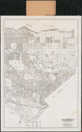
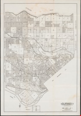
![Map of proposed provincial exhibition site at Burnaby Lake, [between 1929 and 1931] thumbnail](/media/hpo/_Data/_BVM_Cartographic_Material/2017/2017_0002_0009_005.jpg?width=280)


![Map of the Municipality of Burnaby, [ca.1913] thumbnail](/media/hpo/_Data/_BVM_Cartographic_Material/1988/1988_0056_0001_002%20WEB.jpg?width=280)
![Map of the Municipality of Burnaby, [ca.1913] thumbnail](/media/hpo/_Data/_BVM_Cartographic_Material/1988/1988_0056_0001_001_seadragon/1988_0056_0001_001.jpg?w=280)
![Map with subdivision of lots on Cumberland Road, [190-] thumbnail](/media/hpo/_Data/_BVM_Cartographic_Material/1992/1992_0026_0026_001.jpg?width=280)
![Municipality of Burnaby, [between 1910 and 1930] thumbnail](/media/hpo/_Data/_BVM_Cartographic_Material/2008/2008_0024_0001_002.jpg?width=280)
![Municipality of Burnaby, [ca. 1909] thumbnail](/media/hpo/_Data/_BVM_Cartographic_Material/1976/1976_0158_0006_002%20WEB.jpg?width=280)
![Municipality of Burnaby, [ca. 1909] thumbnail](/media/hpo/_Data/_BVM_Cartographic_Material/1976/1976_0158_0006_001_seadragon/1976_0158_0006_001.jpg?w=280)
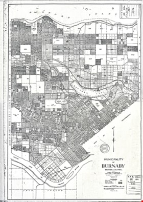
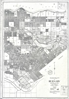


![Municipality of Burnaby - Volume XV and Volume XVIII, 1927-[1940] thumbnail](/media/hpo/_Data/_BVM_Artifacts/1972/1972_0111_0004_003.jpg?width=280)


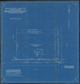
![Nichols Chemical Co. Ltd. - D.D. Coolers Scrubbers and Settling Tanks with Pumps, [1928] thumbnail](/media/hpo/_Data/_BVM_Technical_Drawings/1998_0023_0016_002.jpg?width=280)
![Nichols Chemical Co. Ltd. - Drawing No. 6312, [1928] thumbnail](/media/hpo/_Data/_BVM_Technical_Drawings/1998_0023_0010_002.jpg?width=280)
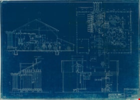
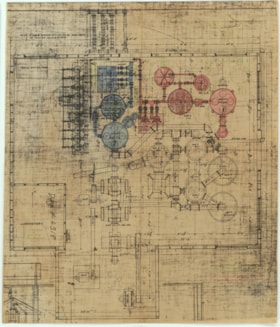
![Nichols Chemical Co. Ltd. - Drawing No. 50785, [1959] thumbnail](/media/hpo/_Data/_BVM_Technical_Drawings/1998_0023_0014_002.jpg?width=280)
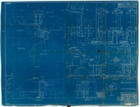
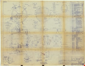
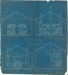
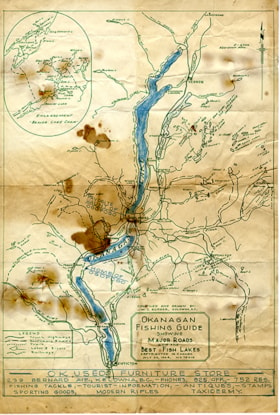
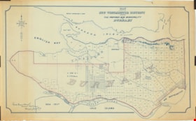
![Planning Map of Chinese Market Gardens on Marine Drive, [between 1950 and 1959] (date of original), 2017 (date of duplication) thumbnail](/media/hpo/_Data/_BVM_Images/2017/2017_0040_0002_001.jpg?width=280)
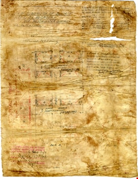
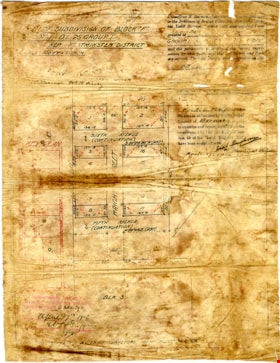
![Plan of Subdivision of Blocks 1,2.3,6,21 and 23 of District Lot 211, [between 1911 and 1912] thumbnail](/media/hpo/_Data/_BVM_Cartographic_Material/1984/1984_0057_0004_002%20Web.jpg?width=280)
![Plan of Subdivision of Blocks 1,2,3,6,21 and 23 of District Lot 211, [between 1911 and 1912] thumbnail](/media/hpo/_Data/_BVM_Cartographic_Material/1984/1984_0057_0005_002%20Web.jpg?width=280)
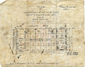
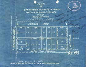
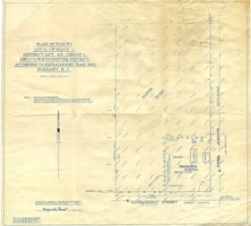
![Plot of Royal Engineers' Surveys - North Road, [1890] thumbnail](/media/hpo/_Data/_BVM_Cartographic_Material/2003/2003_0083_0034_002%20Web.jpg?width=280)
![Price list and plan of subdivision west half Lot 117 - Buckingham, [ca. 1913] thumbnail](/media/hpo/_Data/_BVM_Cartographic_Material/1976/1976_0158_0008_001.jpg?width=280)
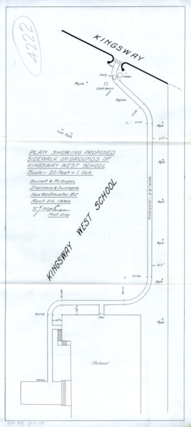
![Proposed subdivision of D.L. 150, Grp. 1, [1912] thumbnail](/media/hpo/_Data/_BVM_Cartographic_Material/1984/1984_0057_0011_001.jpg?width=280)
