Narrow Results By

A Pig's Tale
https://search.heritageburnaby.ca/link/museumdescription14365
- Repository
- Burnaby Village Museum
- Date
- Oct. 2020
- Collection/Fonds
- Burnaby Village Museum fonds
- Description Level
- Item
- Physical Description
- 3 video recordings (mp4) (5 min., 28 sec.) : digital, col., sd., stereo, subtitles
- Scope and Content
- Item consists of part two in a two part video series "A Taste of History" created by Debbie Liang and Joty Gill, University of British Columbia alumni and graduates from the Asian Canadian & Asian Migration Studies program (ACAM). Part two is titled "A Pig's Tale". The film highlights the history o…
- Repository
- Burnaby Village Museum
- Collection/Fonds
- Burnaby Village Museum fonds
- Series
- UBC Partnership series
- Description Level
- Item
- Physical Description
- 3 video recordings (mp4) (5 min., 28 sec.) : digital, col., sd., stereo, subtitles
- Material Details
- Script: Debbie Liang; Joty Gill Narration: Joty Gill Editor: Debbie Liang Subtitles: English; Simplified Chinese; Traditional Chinese Video Appearances: Kathy Lee; Eleanor Lee Illustrations and Animations: Debbie Liang Photos, Images & B-roll: Piggery photo, image courtesy of Elwin Xie; Douglas Road: City of Burnaby Archives, 477-841; Canada Way, City of Burnaby Archives, 556-522, photo by Peg Campbell; Red pig by Debbie Liang; Piglets sleeping, image courtesy of RoyBuri from pixabay, free to use; Chinese Zodiac, image courtesy of RoofOfAllLight from wikimedia, Creative Commons Attribution-Share Alike 4.0 International license; Pictograph for Home by Debbie Liang; Pigs lying down, image courtesy of Elwin Xie; Council minutes all from heritageburnaby.com; Cleanliness illustration set by Debbie Liang; "The Heathen Chinese in British Columbia" from Library and Archives Canada; Laundryman spitting from Daily News, Prince Rupert in 1911; Slicer on counter at Way Sang Yuen Wat Kee & Co., Burnaby Village Museum BV017.7.290; Way Sang Yuen Wat Kee & Co. Store front, Burnaby Village Museum BV017.7.191; Medical Practices Disagreement illustration by Debbie Liang; Butchering pig, image courtesy of Elwin Xie; Chinatown brolls, courtesy of Food2 group from UBC's 2019 ACAM 390 Class; Black Rotary telephone beside ball pen on white printed paper, image courtesy of Pixabay from pexels.com, free to use; Burnaby Lake on a cloudy day, image courtesy of Flying Pegunin from wikipedia; The Vancouver Sun May 4, 1921 from newspapers.com; Vancouver Daily May 3, 1921 from newspapers.com; Reduce number of pigs illustration by Debbie Liang; Black and white photo of piggery, image courtesy of Elwin Xie; 2019 Piggery illustration by Debbie Liang Music and Sound Effects: "Acoustic Mediation 2" from audionautix; Pig Grunting sounds from Kiddopedia Animasl, Creative Commons 0; "Piano moment" & "November" from bensound.com; "Ding sound effect" from freesoundlibrary; Wuxia2_Guzheng_Pipa by PeriTune http://peritune.com; Music promoted by https://www.free-stock-music.com; Attribution 4.0 International (CC BY 4.0) https://creativecommons.org/licenses/by/4.0/ Video adapted from 2019 BVM intern project by Debbie Liang and Marcela Gomez Special thanks to: UBC: Joanna Yang, Jenny Lu, Denise Fong, Henry Yu; BVM: Kate Petrusa, Amy Wilson Changes to music may have been made for the purposes of this video
- Scope and Content
- Item consists of part two in a two part video series "A Taste of History" created by Debbie Liang and Joty Gill, University of British Columbia alumni and graduates from the Asian Canadian & Asian Migration Studies program (ACAM). Part two is titled "A Pig's Tale". The film highlights the history of Chinese pig farms also known as "Piggeries" in Burnaby. The film tells the story of how many of these farms were established by Chinese immigrants along Douglas Road (now Canada Way) between the 1890s and 1920s; the importance of the pig in the Chinese Culture as well as a way for Chinese immigrants to make a living and the racism and discriminatory bylaws that the Chinese pig farmers suffered that finally led to the closure of many of these farms. Content references three documented piggery ranches along Douglas Road: Ah Sam; Young Chung and Hop Hin Yen. The films are supported with voice over in english, subtitles, animation along with historical photographs. One version of the film is supported with subtitles in English while two other versions of the film are supported with subtitles in Simplified Chinese and Traditional Chinese.
- History
- In 2020, due to the restrictions of COVID-19, University of British Columbia student interns with the Burnaby Village Museum Chinese Canadian History in Burnaby project were asked to create virtual experiences to reimagine Burnaby Village Museum's historical Chinese Canadian programming in remote online spaces. Debbie Liang and Joty Gill (UBC alumni and graduates of Dr. Henry Yu's 2019 summer ACAM 390A Global Seminar to Aisa) returned to work with Burnaby Village Museum to create two short films showcasing the history of Chinese Canadian Chop Suey restaurants and piggeries in Burnaby.
- Creator
- Liang, Debbie
- Debbie Liang
- Subjects
- Persons - Chinese Canadians
- Social Issues - Discrimination
- Social Issues - Racism
- Regulations
- Agriculture
- Agriculture - Farms
- Agriculture - Ranches
- Animals - Pigs
- Names
- Liang, Debbie
- Gill, Joty
- Burnaby Village Museum
- University of British Columbia
- Xie, Elwin
- Way Sang Yuen Wat Kee & Company
- Ah Sam
- Young Chung
- Hop Hin Yen
- Responsibility
- University of British Columbia
- UBC Initiative for Student Teaching and Research in Chinese Canadian Studies
- Burnaby Village Museum
- Geographic Access
- Douglas Road
- Canada Way
- Accession Code
- BV020.28.7
- Access Restriction
- No restrictions
- Reproduction Restriction
- No known restrictions
- Date
- Oct. 2020
- Media Type
- Moving Images
- Historic Neighbourhood
- Burnaby Lake (Historic Neighbourhood)
- Planning Study Area
- Douglas-Gilpin Area
- Notes
- Transcribed title
Images


Video
A Pig's Tale, Oct. 2020
A Pig's Tale, Oct. 2020
https://search.heritageburnaby.ca/media/hpo/_Data/_BVM_Moving_Images/2020_0028_0007_001.mp4
Bird's Eye View of the Burnaby Lake Area
https://search.heritageburnaby.ca/link/museumdescription15144
- Repository
- Burnaby Village Museum
- Date
- 1977
- Collection/Fonds
- Century Park Museum Association fonds
- Description Level
- Item
- Physical Description
- 1 map : b&w print on paper ; 43 x 63.5 cm
- Scope and Content
- Item consists of a map titled "Birds Eye View of the Burnaby Lake Area Circa 1910". The overview of the Burnaby Lake area was compiled and drawn at Heritage Village by curator John Adams and artist, Carol Swan. The map identifies the Burnaby Lake inter-urban tram line; roads including: Sperling Ave…
- Repository
- Burnaby Village Museum
- Collection/Fonds
- Century Park Museum Association fonds
- Description Level
- Item
- Physical Description
- 1 map : b&w print on paper ; 43 x 63.5 cm
- Material Details
- Scale indeterminable
- Scope and Content
- Item consists of a map titled "Birds Eye View of the Burnaby Lake Area Circa 1910". The overview of the Burnaby Lake area was compiled and drawn at Heritage Village by curator John Adams and artist, Carol Swan. The map identifies the Burnaby Lake inter-urban tram line; roads including: Sperling Avenue (Pole Line Road); Gilpin Avenue; Douglas Road; trail to Vancouver Westminster Road (Kingsway); Buckingham Avenue; Haszard Street; various farms and residences including: Charles Sprott "Norland"; H.T. Ceperley "Fairacres"; Claude Hill's "Brookfield farm" and "Broadview"; F.J. Hart's "Avalon"; Miss Woodward's former and new home, school and post office; Councillor Edgar's hunting cabin; Edgar Sprott's "Mayfield farm" and "Mayfield Lodge"; F.J. Peers "Greyfriars"; Arthur de Windt Haszard; Bernard Hill's boathouse as well as other landmarks including: Doran's Mill; tram stations; Burnaby Lake Store; logging camps; wood cutter's shacks; ice houses; cranberry bog; Still Creek; Deer Lake; Burnaby Lake; Deer Lake Creek; Provincial Government Reserve Proposed Hospital (later Oakalla Prison).
- Creator
- Adams, John
- Swan, Carol
- Names
- Hill, Arthur Claude
- Sprott, Charles Frederick
- Sprott, Louis "Edgar"
- Hart, Frederick John, 1884-1945
- Ceperley, H.T.
- Woodward, Maude
- Woodward, Harriet
- Peers, Francis J.
- Haszard, Arthur de Windt
- Hill, Bernard R.
- Geographic Access
- Deer Lake Avenue
- Sperling Avenue
- Haszard Street
- Buckingham Avenue
- Accession Code
- BV021.1.3
- Access Restriction
- No restrictions
- Reproduction Restriction
- No known restrictions
- Date
- 1977
- Media Type
- Cartographic Material
- Historic Neighbourhood
- Burnaby Lake (Historic Neighbourhood)
- Planning Study Area
- Burnaby Lake Area
- Related Material
- See also: Life with the Moores of Hart House : pioneer days on Burnaby's Deer Lake
- Scan Resolution
- 600
- Scan Date
- 2021-11-12
- Scale
- 100
- Notes
- Transcribed title
- Compiled by John Adams; illustration by Carol Swan
- The map depicts the Burnaby Lake Tram Line as being double tracked, whereas in reality it was single tracked.
- Map is part of the book "Life with the Moores of Hart House : pioneer days on Burnaby's Deer Lake https://search.heritageburnaby.ca/permalink/museumlibrary6314-102
Images


Bird's Eye View of the Burnaby Lake Area
https://search.heritageburnaby.ca/link/museumdescription17543
- Repository
- Burnaby Village Museum
- Date
- 1977
- Collection/Fonds
- Century Park Museum Association fonds
- Description Level
- Item
- Physical Description
- 1 map : b&w print with watercolour ; 43 x 63.5 cm
- Scope and Content
- Item consists of a map titled "Birds Eye View of the Burnaby Lake Area Circa 1910". The overview of the Burnaby Lake area was compiled and drawn at Heritage Village by curator John Adams and artist, Carol Swan. The map identifies the Burnaby Lake inter-urban tram line; roads including: Sperling Ave…
- Repository
- Burnaby Village Museum
- Collection/Fonds
- Century Park Museum Association fonds
- Description Level
- Item
- Physical Description
- 1 map : b&w print with watercolour ; 43 x 63.5 cm
- Material Details
- Scale indeterminable
- Scope and Content
- Item consists of a map titled "Birds Eye View of the Burnaby Lake Area Circa 1910". The overview of the Burnaby Lake area was compiled and drawn at Heritage Village by curator John Adams and artist, Carol Swan. The map identifies the Burnaby Lake inter-urban tram line; roads including: Sperling Avenue (Pole Line Road); Gilpin Avenue; Douglas Road; trail to Vancouver Westminster Road (Kingsway); Buckingham Avenue; Haszard Street; various farms and residences including: Charles Sprott "Norland"; H.T. Ceperley "Fairacres"; Claude Hill's "Brookfield farm" and "Broadview"; F.J. Hart's "Avalon"; Miss Woodward's former and new home, school and post office; Councillor Edgar's hunting cabin; Edgar Sprott's "Mayfield farm" and "Mayfield Lodge"; F.J. Peers "Greyfriars"; Arthur de Windt Haszard; Bernard Hill's boathouse as well as other landmarks including: Doran's Mill; tram stations; Burnaby Lake Store; logging camps; wood cutter's shacks; ice houses; cranberry bog; Still Creek; Deer Lake; Burnaby Lake; Deer Lake Creek; Provincial Government Reserve Proposed Hospital (later Oakalla Prison).
- Creator
- Adams, John
- Swan, Carol
- Names
- Hill, Arthur Claude
- Sprott, Charles Frederick
- Sprott, Louis "Edgar"
- Hart, Frederick John, 1884-1945
- Ceperley, H.T.
- Woodward, Maude
- Woodward, Harriet
- Peers, Francis J.
- Haszard, Arthur de Windt
- Hill, Bernard R.
- Geographic Access
- Deer Lake Avenue
- Sperling Avenue
- Haszard Street
- Buckingham Avenue
- Accession Code
- BV021.1.4
- Access Restriction
- No restrictions
- Reproduction Restriction
- No known restrictions
- Date
- 1977
- Media Type
- Cartographic Material
- Historic Neighbourhood
- Burnaby Lake (Historic Neighbourhood)
- Planning Study Area
- Burnaby Lake Area
- Related Material
- See also: Life with the Moores of Hart House : pioneer days on Burnaby's Deer Lake
- Scan Resolution
- 600
- Scan Date
- 2021-11-12
- Scale
- 100
- Notes
- Transcribed title
- Compiled by John Adams; illustration by Carol Swan
- The map depicts the Burnaby Lake Tram Line as being double tracked, whereas in reality it was single tracked.
- Map is part of the book "Life with the Moores of Hart House : pioneer days on Burnaby's Deer Lake https://search.heritageburnaby.ca/permalink/museumlibrary6314-102
- This is a print made from original illustration and appears to be hand-coloured with watercolour at a later date.
Images

It Took a While to Get There
https://search.heritageburnaby.ca/link/museumdescription10097
- Repository
- Burnaby Village Museum
- Date
- 2016
- Collection/Fonds
- Burnaby Village Museum Film and Video collection
- Description Level
- Item
- Physical Description
- 1 video recording (mp4) (4 min., 40 sec.) : digital, 25 fps, col., sd., stereo
- Scope and Content
- Kathryn Small has lived in Burnaby almost her entire life. In this video she recounts the path she travelled before finding the 27 year career she settled on and from which she retired in 2008. Having faced discrimination (because she was a woman) which blocked her entering her first choice for a…
- Repository
- Burnaby Village Museum
- Collection/Fonds
- Burnaby Village Museum Film and Video collection
- Description Level
- Item
- Physical Description
- 1 video recording (mp4) (4 min., 40 sec.) : digital, 25 fps, col., sd., stereo
- Scope and Content
- Kathryn Small has lived in Burnaby almost her entire life. In this video she recounts the path she travelled before finding the 27 year career she settled on and from which she retired in 2008. Having faced discrimination (because she was a woman) which blocked her entering her first choice for a career, Kathryn found that her subsequent variety of education and experiences over the next decade well-fitted her for her “life’s work”. Kathryn is convinced that all and any education and experience can play a part in preparing one for one’s chosen career. She is also glad that today discrimination based on gender is finally illegal in Canada. That the title of this video is an intentional double-entendre is evident by the end of the video.
- History
- Kathryn Small has a long connection to Burnaby, her grandparents having settled in the Douglas Road area in 1921 and her parents choosing to live in the same area. Kathryn attended Douglas Road Elementary School and graduated from Burnaby Central High School. After a variety of post-secondary education, work and travel experiences, she then worked for 27 years in Burnaby as a Public Health Inspector/Environmental Health Officer before retiring in 2008. Kathryn still lives in Burnaby.
- Creator
- Small, Kathryn
- Other Title Information
- title supplied by film maker
- Names
- Small, Kathryn
- Geographic Access
- Douglas Road
- Accession Code
- BV016.37.5
- Access Restriction
- No restrictions
- Reproduction Restriction
- May be restricted by third party rights
- Date
- 2016
- Media Type
- Moving Images
- Notes
- Transcribed title
Images
Video
It Took a While to Get There, 2016
It Took a While to Get There, 2016
https://search.heritageburnaby.ca/media/hpo/_Data/_BVM_Moving_Images/2016_0037_0005_001.mp4
Official Sod Turning Ceremony for Heritage Village
https://search.heritageburnaby.ca/link/museumdescription9776
- Repository
- Burnaby Village Museum
- Date
- April 11 1971 (date of original), digitized in 2011
- Collection/Fonds
- Burnaby Centennial '71 Committee collection
- Description Level
- Item
- Physical Description
- 1 video recording (mp4) (3 min., 11 sec.) : digital, 29 fps, b&w, sd., stereo
- Scope and Content
- Film of Vintage car parade ending with the sod turning ceremony at Heritage Park Museum. CBC news item April 11, 1971.
- Repository
- Burnaby Village Museum
- Collection/Fonds
- Burnaby Centennial '71 Committee collection
- Description Level
- Item
- Physical Description
- 1 video recording (mp4) (3 min., 11 sec.) : digital, 29 fps, b&w, sd., stereo
- Material Details
- Script read by Mike Dobson
- Film footage was edited and digitized by Oliver Glaser at Newsreel Productions
- Audio production by emBall Productions
- Scope and Content
- Film of Vintage car parade ending with the sod turning ceremony at Heritage Park Museum. CBC news item April 11, 1971.
- History
- This footage was originally shot in 16 mm, on Sunday, April 11, 1971, and broadcast on CBC television. The original footage was silent: when it was broadcast, a news announcer read from a script to describe the events. In 2011, the footage was digitized. The original script was read by an actor, recorded, and added to the digitized footage to create this film.
- Subjects
- Events - Parades
- Names
- Burnaby Village Museum
- Responsibility
- Canadian Broadcasting Corporation
- Geographic Access
- Deer Lake Avenue
- Accession Code
- BV018.42.1
- Access Restriction
- No restrictions
- Reproduction Restriction
- May be restricted by third party rights
- Date
- April 11 1971 (date of original), digitized in 2011
- Media Type
- Moving Images
- Historic Neighbourhood
- Burnaby Lake (Historic Neighbourhood)
- Planning Study Area
- Burnaby Lake Area
- Notes
- Transcribed title
- BV020.5.708 is the original 16mm silent film that this film was created from
Images
Video
Official Sod Turning Ceremony for Heritage Village, April 11 1971 (date of original), digitized in 2011
Official Sod Turning Ceremony for Heritage Village, April 11 1971 (date of original), digitized in 2011
https://search.heritageburnaby.ca/media/hpo/_Data/_BVM_Moving_Images/2018_0042_0001_001.mp4![Survey and Subdivision plans in New Westminster District Group 1 – Burnaby
, [1908] thumbnail](/media/hpo/_Data/_BVM_Cartographic_Material/1977/1977_0093_0004a_001.jpg?width=280)
Survey and Subdivision plans in New Westminster District Group 1 – Burnaby
https://search.heritageburnaby.ca/link/museumdescription6973
- Repository
- Burnaby Village Museum
- Date
- [1908]
- Collection/Fonds
- Burnaby Village Museum Map collection
- Description Level
- File
- Physical Description
- 10 plans : blueprint ink on paper mounted on 2 sides of cardboard ; 76 cm x 102 cm
- Scope and Content
- Item consists of a large board of four New Westminster District Gp 1 - subdivision plans mounted on one side and six New Westminster District Gp 1 - subdivision plans mounted on the other side. Side A: 1. Blueprint "Plan / of - ReSubdivision / of / Lots 1-18 inclusive / Blocks 20 and 21 / in Sub…
- Repository
- Burnaby Village Museum
- Collection/Fonds
- Burnaby Village Museum Map collection
- Description Level
- File
- Physical Description
- 10 plans : blueprint ink on paper mounted on 2 sides of cardboard ; 76 cm x 102 cm
- Material Details
- Scales [between 1:792 and 1:4752]
- Index number on edge of board reads: "4"
- Scope and Content
- Item consists of a large board of four New Westminster District Gp 1 - subdivision plans mounted on one side and six New Westminster District Gp 1 - subdivision plans mounted on the other side. Side A: 1. Blueprint "Plan / of - ReSubdivision / of / Lots 1-18 inclusive / Blocks 20 and 21 / in Subdivision / of / Lot 53 -Gr.1 / New Westminster District" / "Subdivision Lot Numbers - Shown in Red". Plan is bordered by First Street / Jorgenson's Line / Fourth Avenue and Second Street with Fifith Avenue running through the centre. There is an index in the upper right corner of the plan. Planned is signed by "Peter Byrne" and "William R. Phillips" and dated July 28, 1908. (Geographic location: Burnaby) 2. Blueprint "Plan / of Subdivision / of / Lot 159 / and a Portion of Lot 158 / Group One / New Westminster District". Plan is bordered by Lots 96 and 97; South Wilson Street; North Arm Road and Lot 160 / Power House Road (Lot 155 A). B.C.E.R. Gilley Station is identified in the upper right corner of the plan. (Geographic location: Burnaby) 3. Blueprint plan identified as "Subdvs 10, L 88 and Lot 25, G. 1" Plan identifies Cumberland Street running from top to the bottom and a Ravine running alongside with the Jensen house, stable and barn. (Geographic location: Burnaby) 4. Blueprint Plan of "Lot 153. G. 1 /New Westminster District". Plan identifies the "New Westminster & Vancouver Tramway" and the "New Westminster and Vancouver Road" running through the plan of Lot 53. (Geographic location: Burnaby) Side B: 1. Blueprint plan of "Profile on Proposed North Rd. Diversion". 2. Blueprint plan (no title) showing wood lots north of Burnaby Lake and Brunette River and west of North Road. Various lots are identified as "Heavily Timbered" (Lot 57); "Splendid Fir and Cedar / Heavy Fir etc. / Fine Cedar" (Lots 143, 148); "Rough Light Timber," (Lot 56); "Some Fir and Cedar" (Lot 40). (Geographic location: Burnaby) 3. Blueprint "Plan / of Subdivision / of a Portion / of Lot 87, Gr.1 / New Westminster District". Plan is bordered by Burnaby Lake at the top and Hastings Road / Lot 86 at the bottom and Lot 90 to the east. "Albert J. Hill B.C.LotS." Annotation in ink reads: " J.A. Brownlee, B.C.L.S. / Subdivision / Map 1494 / Bd. 248". Plan is signed by "Peter Byrne, Reeve" (Geographic location: Burnaby) 4. Blueprint plan of Subdivisions along either side of Douglas Road including Lots 117; 119; 74; 80; 79 and 77. (Geographic location: Burnaby) 5. Blueprint "Plan / of / Subdivision of / Lot 27 / in Subdivision / of / Lot 30 / Group One / New Westminster District" Plan is bordered by Lot 26, Lot 28 and Hastings Rd. Lot 27 runs north of Edmonds Street. , "Albert J. Hill, B.C.LotS." (Geographic location: Burnaby) 6. Blueprint plan identified as a "Cultivated Orchard" including the names "W. Grace" and "G. Mead" located north of the North Arm Fraser River and west of "Twentieth Street_ City Boundary". Handwritten annotation in coloured pencil reads: "Portion of Lot 172" (Geographic location: Burnaby)
- Subjects
- Geographic Features - Forests
- Geographic Access
- Cumberland Street
- North Road
- Hastings Street
- Douglas Road
- Accession Code
- HV977.93.4
- Access Restriction
- No restrictions
- Reproduction Restriction
- No known restrictions
- Date
- [1908]
- Media Type
- Cartographic Material
- Historic Neighbourhood
- Burnaby Lake (Historic Neighbourhood)
- Fraser Arm (Historic Neighbourhood)
- Planning Study Area
- Douglas-Gilpin Area
- Burnaby Lake Area
- Scan Resolution
- 300
- Scale
- 72
- Notes
- Title based on contents of file
- Scale is measured in chains. (One chain equals 792 inches)
- The term "Lot" can also refer to a "District Lot”-
Images
![Survey and Subdivision plans in New Westminster District Group 1 – Burnaby
, [1908] thumbnail](/media/hpo/_Data/_BVM_Cartographic_Material/1977/1977_0093_0004a_001.jpg)

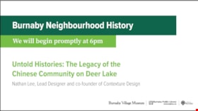
Untold Histories: The Legacy of the Chinese Community on Deer Lake
https://search.heritageburnaby.ca/link/museumdescription14758
- Repository
- Burnaby Village Museum
- Date
- 8 Oct. 2020
- Collection/Fonds
- Burnaby Village Museum fonds
- Description Level
- Item
- Physical Description
- 1 video recording (mp4) (56 min., 15 sec.) : digital, col., sd., stereo ; 29 fps
- Scope and Content
- Item consists of a video recording of a live Zoom webinar hosted by Burnaby Public Librarian, Mariah Gastaldo. The webinar is titled "Untold Histories: The Legacy of the Chinese Community on Deer Lake" and is presented by Nathan Lee, Lead Designer and co-founder of Contexture Design. The zoom webin…
- Repository
- Burnaby Village Museum
- Collection/Fonds
- Burnaby Village Museum fonds
- Description Level
- Item
- Physical Description
- 1 video recording (mp4) (56 min., 15 sec.) : digital, col., sd., stereo ; 29 fps
- Material Details
- Presenter: Nathan Lee
- Host: Mariah Gastaldo
- Date of Presentation: October 8, 6:00 pm - 8:00 pm
- Total Number of tracks: 1
- Total Length of all tracks: 56 min., 15 sec.
- Recording Device: Zoom video communication platform
- Scope and Content
- Item consists of a video recording of a live Zoom webinar hosted by Burnaby Public Librarian, Mariah Gastaldo. The webinar is titled "Untold Histories: The Legacy of the Chinese Community on Deer Lake" and is presented by Nathan Lee, Lead Designer and co-founder of Contexture Design. The zoom webinar is the third in a collection of seven "Burnaby Neighbourhood Speaker series" webinars that were presented and made available to the public between September 29 and October 27, 2020. The live webinar and recording was also made available on the Burnaby Village Museum's facebook page. In this webinar, Nathan Lee speaks about his public art installation that will be installed near the site of the Burnaby Art Gallery in Deer Lake Park. Nathan presents his background research which lead to the project. He tells how the site of the Burnaby Art Gallery and surrounding Century Garden are rich with stories of early settlers and of how British farmers and social elite have shaped the history of this area since the early 1900’s. Nathan's presentation highlights the unseen presence of a Chinese community that is equally profound in its connect. The presentation is supported with slides consisting of historical and contemporary photographs. At the conclusion of his presentation, Nathan takes questions from webinar participants.
- Subjects
- Persons - Chinese Canadians
- Arts - Sculptures
- Geographic Features - Parks
- Agriculture - Farms
- Geographic Access
- Deer Lake Avenue
- Deer Lake
- Deer Lake Park
- Accession Code
- BV020.29.3
- Access Restriction
- No restrictions
- Reproduction Restriction
- No known restrictions
- Date
- 8 Oct. 2020
- Media Type
- Moving Images
- Historic Neighbourhood
- Burnaby Lake (Historic Neighbourhood)
- Notes
- Title based on contents of video recording
- Video recording was edited for publication on Heritage Burnaby. Original mp4 video recording (BV020.29.3.1) is 66 min., 51 sec.
Images

Video
Untold Histories: The Legacy of the Chinese Community on Deer Lake, 8 Oct. 2020
Untold Histories: The Legacy of the Chinese Community on Deer Lake, 8 Oct. 2020
https://search.heritageburnaby.ca/media/hpo/_Data/_BVM_Moving_Images/2020_0029_0003_002.mp4