Narrow Results By
Subject
- Buildings - Agricultural - Stables 1
- Buildings - Commercial - Restaurants 2
- Buildings - Heritage 7
- Buildings - Public - Detention Facilities 1
- Buildings - Religious 1
- Buildings - Religious - Churches 1
- Buildings - Residential 3
- Buildings - Residential - Cottages 1
- Buildings - Residential - Houses 2
- Buildings - Schools 2
- Documentary Artifacts - Architectural Drawings 11
Creator
- Alphonse J. Toebaert 1
- Bernard R. Hill 1
- Bowman and Cullerne 1
- Burnaby Centennial '71 Committee 1
- Burnett, David H. 1
- Burnett & McGugan, Engineers and Surveyors 1
- Cecil Croker Fox 1
- Charles Torrence Limited 1
- City of Burnaby 1
- Copan, Donald Angus "Don" 1
- Donald R. Erb and Associates Architects 6
- Erickson/Massey 1
Person / Organization
- Allen, James Charles 1
- Borstal School 1
- British Columbia Electric Railway 1
- British Columbia Mills Timber and Trading Company 1
- Burnaby School Board 1
- Burnaby Village Museum 24
- Canadian Institute of Mining and Metallurgy 1
- Ceperley, Grace 3
- Ceperley, H.T. 3
- Clarke, Ellen 1
- Clarke, Joseph 1
- Cunningham, Edna 1
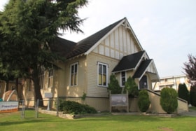
Edmonds Baptist Church
https://search.heritageburnaby.ca/link/landmark575
- Repository
- Burnaby Heritage Planning
- Description
- Church building.
- Associated Dates
- 1912
- Street View URL
- Google Maps Street View
- Repository
- Burnaby Heritage Planning
- Geographic Access
- Walker Avenue
- Associated Dates
- 1912
- Description
- Church building.
- Heritage Value
- Beautifully designed in an Arts and Crafts idiom, this church features a textural mix of finishes including lapped siding and stucco and half timbering in the gables. The British Columbian reported in July 1912 that: "The Baptists of Edmonds will possess a fine and well planned church when the building now commenced is ready for occupation. The architects are J.P. Matheson and Son, of Vancouver, and the contractors, Muttitt and Bell, of New Westminster. The entrance porch fronts Edmonds Road and the west side faces Vancouver Road. It will have a capacity for 272 sittings, spacious aisles and choir platform besides various rooms for Baptistery, vestry and robing apartments."
- Locality
- Edmonds
- Historic Neighbourhood
- Edmonds (Historic Neighbourhood)
- Planning Study Area
- Richmond Park Area
- Architect
- J.P. Matheson & Son
- Builder
- Muttitt and Bell
- Area
- 1471.58
- Contributing Resource
- Building
- Ownership
- Private
- Names
- Matheson, John
- Street Address
- 7135 Walker Avenue
- Street View URL
- Google Maps Street View
Images
Kingsway East School
https://search.heritageburnaby.ca/link/landmark546
- Repository
- Burnaby Heritage Planning
- Description
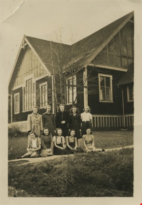
- The Kingsway East School is a two-storey wood-frame Arts and Crafts styled building. The school, and the adjacent cenotaph and memorial tennis courts, comprise Burnaby South Memorial Park.
- Associated Dates
- 1913
- Formal Recognition
- Heritage Designation, Community Heritage Register
- Other Names
- Alan Emmott Centre
- Street View URL
- Google Maps Street View
- Repository
- Burnaby Heritage Planning
- Other Names
- Alan Emmott Centre
- Geographic Access
- Southoaks Crescent
- Associated Dates
- 1913
- Formal Recognition
- Heritage Designation, Community Heritage Register
- Enactment Type
- Bylaw No. 9807
- Enactment Date
- 23/11/1992
- Description
- The Kingsway East School is a two-storey wood-frame Arts and Crafts styled building. The school, and the adjacent cenotaph and memorial tennis courts, comprise Burnaby South Memorial Park.
- Heritage Value
- This school structure completed in 1913, the oldest surviving public education building in the city, was intended to be the auditorium and gymnasium for Burnaby’s first high school. However, because of the 1913 recession and the outbreak of the First World War, it was utilized as the Kingsway East Elementary School for the Edmonds District until 1921. Burnaby South High School opened here in 1922, and after it relocated this building was used for a variety of school purposes until it became redundant. The school was rehabilitated for community purposes in 2002-03 and renamed the Alan Emmott Centre to honor a former Mayor of Burnaby. The impressive scale of the Kingsway East School is indicative of the relative size of the community and its growing demand for schooling at the time of construction, illustrating the value that early community residents placed on education. Built to plans of the Burnaby School Board architect, Joseph Henry Bowman (1864-1943), it also indicates the individual values and design control exercised by the school board during this era. It is also significant for its Arts and Crafts style, allied to the typical Craftsman residential vocabulary, which was employed locally for school buildings of the Edwardian era. By using a common architectural vocabulary, this allowed the institution to reflect the values and aspirations of the local community. The Arts and Crafts style also demonstrated an allegiance to British educational antecedents and a demonstration of loyalty to the Mother Country.
- Historic Neighbourhood
- Edmonds (Historic Neighbourhood)
- Planning Study Area
- Kingsway-Beresford Area
- Function
- Primary Historic--Primary School
- Community
- Burnaby
- Cadastral Identifier
- P.I.D. No. 016-367-154 Legal Description: Lot 1, District Lot 96, Group 1 New Westminster District, Plan 86581
- Boundaries
- The Kingsway East School is comprised of a single municipally-owned property located at 6650 Southoaks Crescent, Burnaby.
- Area
- 6,070.00
- Contributing Resource
- Building
- Landscape Feature
- Structure
- Ownership
- Public (local)
- Documentation
- Heritage Site Files: PC77000 20. City of Burnaby Planning and Building Department, 4949 Canada Way, Burnaby, B.C., V5G 1M2
- Street Address
- 6650 Southoaks Crescent
- Street View URL
- Google Maps Street View
Images
Louis Claude Hill home "Brookfield"
https://search.heritageburnaby.ca/link/landmark725
- Repository
- Burnaby Heritage Planning
- Geographic Access
- Deer Lake Avenue
- Associated Dates
- 1894
- Heritage Value
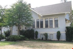
- In 1894, Burnaby pioneer L. Claude Hill built this home near the shore of Deer Lake. Mr. Hill was married that year to Annie Sara Kenrick, and they took up residence in the house until 1906 when they sold the property and built a new home in the vicinity of Buckingham and Sperling. Brookfield was still on the property when the Burnaby Village Museum was planned in 1971 as Heritage Village, but it was removed to make room for other buildings on the site. In 1894, Claude discovered a midden on his farm and recovered many artifacts. In 2002, his descendants donated this valuable collection to the Museum.
- Historic Neighbourhood
- Burnaby Lake (Historic Neighbourhood)
- Planning Study Area
- Morley-Buckingham Area
- Street Address
- 6501 Deer Lake Avenue
Images
Marlborough Elementary School
https://search.heritageburnaby.ca/link/landmark695
- Repository
- Burnaby Heritage Planning
- Geographic Access
- Marlborough Avenue
- Associated Dates
- 1950
- Heritage Value
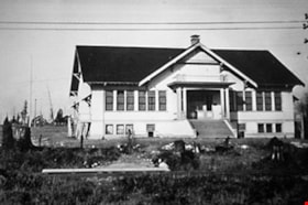
- Marlborough Elementary School was built in 1950 and was the second elementary school to be built in Burnaby after the start of the World War Two housing boom. Its design helped establish the general plans for future schools built in the city during this period - no basements, second stories or high stairways. Classrooms could easily be added, in line, as the need arose. There were additions made to Marlborough in 1952, 1961, 1967 and 1971.
- Historic Neighbourhood
- Central Park (Historic Neighbourhood)
- Planning Study Area
- Marlborough Area
- Street Address
- 6060 Marlborough Avenue
- Street View URL
- Google Maps Street View
Images
Ocean View Burial Park - Mausoleum
https://search.heritageburnaby.ca/link/landmark630
- Repository
- Burnaby Heritage Planning
- Geographic Access
- Imperial Street
- Associated Dates
- 1928
- Description
- Cemetery site.
- Heritage Value
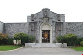
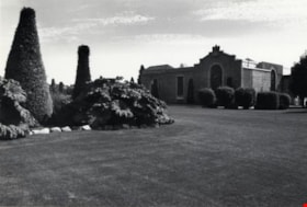
- In 1928, the design for the Ocean View Abbey was provided by San Francisco architect Wallace H. Hubbert, who specialized in the design of mausoleums. This was the first large-scale mausoleum and columbarium constructed in British Columbia. Although planned to be a much larger structure initially, only one wing was completed in 1931 before the Great Depression halted further additions. Hubbert was born in San Francisco in 1891 and attended the San Francisco Architectural Club. From 1914-15, he worked for famed architect Bernard Maybeck, and during the Depression years he temporarily closed his solo practice and worked for Miller & Pflueger from 1935-1939. He died in San Francisco in 1948. Hubbert was responsible for the designs of the Sunset Mausoleums in Berkeley and Eureka, Evergreen Mausoleum in Oakland and others in Merced and Santa Monica.
- Locality
- Alta Vista
- Historic Neighbourhood
- Alta Vista (Historic Neighbourhood)
- Planning Study Area
- Suncrest Area
- Architect
- Wallace H. Hubbert
- Area
- 359280.00
- Contributing Resource
- Building
- Ownership
- Private
- Street Address
- 4000 Imperial Street
Images
Sperling-Broadway Neighbourhood
https://search.heritageburnaby.ca/link/landmark789
- Repository
- Burnaby Heritage Planning
- Associated Dates
- 1955-2008
- Heritage Value
- By the 1970s, the Sperling-Broadway Neighbourhood was characterised as one of the Municipality's fastest growing residential areas. In 1980, it was estimated that slightly less than half of the homes were single-family residences, while the remaining development was taking the form of townhouse and high-rise apartments. The emphasis shifted back to single family housing during the construction of planned subdivisions such as the Camrose subdivision in the 1980s and the area remains primarily residential in nature. The neighbourhood is well-served by park facilities and is also home to the Burnaby Mountain Golf Course.
- Historic Neighbourhood
- Lochdale (Historic Neighbourhood)
- Planning Study Area
- Sperling-Broadway Area
Images
Suncrest School
https://search.heritageburnaby.ca/link/landmark694
- Repository
- Burnaby Heritage Planning
- Geographic Access
- Rumble Street
- Associated Dates
- 1953
- Heritage Value
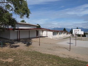
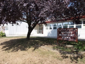
- The new Suncrest subdivision developed in the early 1950s, resulting in 312 new homes in 1951, with an additional 100 being planned. As a result, enrolment pressure resulted in the construction of Suncrest School in 1953. Additions to the original structure were made in 1954 and a library, change rooms and staffroom were added in 1969.
- Historic Neighbourhood
- Alta Vista (Historic Neighbourhood)
- Planning Study Area
- Suncrest Area
- Street Address
- 3883 Rumble Street
- Street View URL
- Google Maps Street View
Images
T.O. Townley Estate 'Deerholme'
https://search.heritageburnaby.ca/link/landmark545
- Repository
- Burnaby Heritage Planning
- Description
- The T.O. Townley Estate, 'Deerholme,' is located on a lake front property on the north shore of Deer Lake Park. The main house is a two-and-one-half storey symmetrical-massed wood-frame Colonial Revival structure, with flanking one-storey wings, a side gable roof and a central front entry.
- Associated Dates
- 1913
- Formal Recognition
- Heritage Designation, Community Heritage Register
- Other Names
- Thomas & Frances Townley Estate, Loftus House
- Street View URL
- Google Maps Street View
- Repository
- Burnaby Heritage Planning
- Other Names
- Thomas & Frances Townley Estate, Loftus House
- Geographic Access
- Price Street
- Associated Dates
- 1913
- Formal Recognition
- Heritage Designation, Community Heritage Register
- Enactment Type
- Bylaw No. 9807
- Enactment Date
- 23/11/1992
- Description
- The T.O. Townley Estate, 'Deerholme,' is located on a lake front property on the north shore of Deer Lake Park. The main house is a two-and-one-half storey symmetrical-massed wood-frame Colonial Revival structure, with flanking one-storey wings, a side gable roof and a central front entry.
- Heritage Value
- 'Deerholme' was built as the retirement estate of Lieutenant-Colonel Thomas Owen Townley (1862-1935) and his wife, Frances M. Townley. Townley was a pioneer resident of the Lower Mainland of British Columbia: he served as a lawyer, Registrar of Land Titles for New Westminster District and Mayor of Vancouver for one term in 1901. Built in 1913, this is one of the most significant of the Deer Lake estate houses and was the last of grand Edwardian era mansions built on the lots surrounding the lake. The area had been opened up for development two years earlier by the construction of the British Columbia Electric Railway Interurban Line. The estate speaks of a gracious way of life achieved by society's elite during the Edwardian era, supported by the use of domestic servants. Grand in scale, architecturally sophisticated and set in a bucolic landscape, this residence demonstrates the social status of the owner in the privileged classes of the rapidly developing social structure of Burnaby. The house is also significant as one of the earliest designs by the son of Thomas and Frances Townley, architect Fred Laughton Townley (1887-1966), who had graduated in architecture in 1911 from the University of Pennsylvania. In this house for his parents, he demonstrated his deft understanding of the American Period Revival styles learned during his schooling in the United States. The prevailing local taste for British-derived architecture dictated that this was a style he was rarely able to use until the Colonial Revival styles became more popular in the 1920s. F.L. Townley was a founding partner in Townley and Matheson, which achieved significant success as one of the most accomplished local architectural firms, culminating in their best-known commission, Vancouver City Hall, 1935-36.
- Defining Elements
- Key elements the define the heritage character of ‘Deerholme’ include its: - integration with its south-sloping lakefront site, which contains many original landscape features (extant rockeries, formal drive, tennis lawn, open fields, and specimen shrubs and trees) - two-and-one-half storey form with flanking one-storey wings - side gable roof with symmetrical shed dormers, three at the front and three at the rear - complex fenestration, including multi-paned wooden-sash double-hung windows, 6-over-1 on the ground floor and 6-over-9 on the second floor, and multi-paned wooden-sash casements in the dormers - pair of prominent exterior brick chimneys on each side elevation, clad with rough-cast stucco up to the roof level, and each with four chimney-pots - rough-cast stucco cladding - design elements typical of the Colonial Revival style, such as composed classical formality, side gable roof and balanced symmetrical massing - exterior architectural elements, such as classical columns, window shutters, fanlight feature window, multi-paned quarter-round windows flanking the chimneys, and projecting square brackets in the gables - superior level of design and craftsmanship throughout, including refined interior woodwork such as fireplaces, interior columned screen between hallway and living room and a staircase with Colonial Revival details - significant mature trees (such as Red Oaks, Silver Maples, and Copper Beech). - original guest house and stables, which survive on an adjacent property at 6176 Price Street
- Historic Neighbourhood
- Burnaby Lake (Historic Neighbourhood)
- Planning Study Area
- Douglas-Gilpin Area
- Architect
- Fred Laughton Townley
- Function
- Primary Current--Estate
- Primary Historic--Estate
- Community
- Burnaby
- Cadastral Identifier
- P.I.D. No. 002-652-111 Legal Description: Parcel 'C' (Explanatory Plan 12891) , Blocks 4 and 5, District Lot 79 Group 1, New Westminster District, Plan 536
- Boundaries
- ‘Deerholme’ is comprised of a single municipally-owned property located at 6110 Price Street, Burnaby.
- Area
- 14,099.52
- Contributing Resource
- Building
- Landscape Feature
- Ownership
- Public (local)
- Other Collection
- City of Vancouver Archives: T.O. Townley Residence, Original Plans, Add. MSS. 1399, Temporary No. 61, Location 920-D
- Documentation
- Heritage Site Files: PC77000 20. City of Burnaby Planning and Building Department, 4949 Canada Way, Burnaby, B.C., V5G 1M2
- Street Address
- 6110 Price Street
- Street View URL
- Google Maps Street View
Images
Willingdon Heights Neighbourhood
https://search.heritageburnaby.ca/link/landmark670
- Repository
- Burnaby Heritage Planning
- Associated Dates
- 1925-1954
- Heritage Value
- Willingdon Heights was another new subdivision developed in Burnaby during the post-World War Two building boom. A brochure about the development published in 1948 proclaimed "the Willingdon Heights 500 home development project in Burnaby fulfills its promise to provide a self-contained community for former members of the armed services and their families...the largest single veteran housing project in Canada as far as homes for individual ownership is concerned, Willingdon Heights development was planned by the Central Mortgage and Housing Corporation...At this date the earlier built rows of homes have passable roads and the owners are improving lawns and gardens in spare time...eventually additional stores and professional services will be installed and recreational projects will add to the amenities of a community of congenial residents..."
- Planning Study Area
- Willingdon Heights Area
Images
Burnaby Centennial '71 Committee collection
https://search.heritageburnaby.ca/link/museumdescription12986
- Repository
- Burnaby Village Museum
- Date
- 1970-1971
- Collection/Fonds
- Burnaby Centennial '71 Committee collection
- Description Level
- Fonds
- Physical Description
- 57 architectural drawings + approx. 45 cm of textual records + 94 photographs + 1 video recording (mp4) + 1 film reel
- Scope and Content
- Collection consists of records documenting the planning and development of the Burnaby Centennial '71 Committee's commemorative project, Heritage Village (Burnaby Village Museum) prior to it's opening in November 1971. These records were created and/or accumulated by various members of the Burnaby…
- Repository
- Burnaby Village Museum
- Collection/Fonds
- Burnaby Centennial '71 Committee collection
- Description Level
- Fonds
- Physical Description
- 57 architectural drawings + approx. 45 cm of textual records + 94 photographs + 1 video recording (mp4) + 1 film reel
- Scope and Content
- Collection consists of records documenting the planning and development of the Burnaby Centennial '71 Committee's commemorative project, Heritage Village (Burnaby Village Museum) prior to it's opening in November 1971. These records were created and/or accumulated by various members of the Burnaby ’71 Centennial Committee sub-committee, Heritage Village staff and the Century Park Museum Association.
- History
- The Burnaby Centennial '71 Committee was formed in accordance with the British Columbia Centennial '71 Act and was directed by the Provincial Centennial '71 Committee. In April 1970, a representative group of Burnaby citizens were appointed to the committee. Members of the committee included: Ex-Officio Mayor Robert W. Prittie; Chairman, James A. Barrrington; Vice Chairman, Gordon H. Skene; Secretary-Treasurer, Charles B. Brown; Alderman, John D. Drummond; Mrs. Joan Johnston; Mrs. Martin Dunsmuir; Miss Rose Bancroft; Msgr. J.E. Brown; Messrs. Elmer Buckingham; A.B. "Sandy" Stewart; Vic Stusiak; Fraser Wilson; Don Copan and Richard Smith. The purpose of the committee was to ensure that all Burnaby citizens as individuals, family groups or members of community organizations had an opportunity to participate and contribute to celebrations marking the 100th Anniversary of the entry of British Columbia into Confederation and further to make written suggestions of a permanent Centennial project of lasting value and significance to the community. Programs and special events sponsored by the committee included; Flag raising ceremony on January 1, 1971, New Year's Day Ceremony, parades, plays (including "Barkerville '71"), musical events, Burnaby pioneer award presentations, a horse show, lacrosse jamboree, minor baseball, volleyball, tennis, football, soccer, judo and field hockey tournaments, a swim meet, an antique car rally, Easter egg hunt, Rocketry meet, Boy Scouts outdoor action show, Girl Guides "camporee", Midsummer Festival at Burnaby Arts Centre, Rhododendrun Festival at Century Gardens, Variety show, Centennial Ball, Burnaby Rhodendrun Flower show, a Miss Burnaby Pageant, Sports Day, Burnaby Amateur Radio Club party, Centennial '71 Caravan, Centennial High School Art Contest, Sod Turning Ceremony at Heritage park Museum and opening of Heritage Village Museum in November. A sub-committee of the Centennial Committee was responsible for the development of a City of Burnaby permanent commemorative project which became Heritage Village. Sandy Stewart was the sub-committee chair who worked with Richie Smith and Vic Stusiak to develop the concept for an open- air museum reflective of a tram stop community. Architect Rudy Kovacs was hired to come up with a design for the project. Official sod-turning of Heritage Village took place on April 11, 1971. Mayor Bob Prittie officially turned the sod in front of the Elworth house before a crowd of 500. In the spring of 1971, a Heritage Village Director and Curator were hired to oversee the development of the project and acquire artifacts. Salaries were paid through the Parks Commission. The sub-committee continued to assist in overseeing the project to completion. Vic Stusiak set up an administrative structure to govern the new museum. The building of the museum was contracted by Ballarin Bros. Construction at a cost of $121,000 and work began in mid July. Trevi Construction Co. was contracted to do the finished carpentry on the project. The Century Park Museum Association was formed to govern Heritage Village with directors elected on October 26, 1971. Heritage Village officially opened on November 19, 1971 with Mayor Bob Prittie and Governor General Roland Michener in attendance. On January 27, 1972 the committee turned over the Heritage Village Project to the Corporation of the District of Burnaby. After this, the committee was dissolved and all remaining funds were transferred to the Century Park Museum Association which took over the governance of Heritage Village, later known as Burnaby Village Museum.
- Creator
- Burnaby Centennial '71 Committee
- Accession Code
- BV985.6018
- BV000.18
- BV019.52
- BV020.5
- BV022.9
- Date
- 1970-1971
- Related Material
- Century Park Museum Association fonds
- Donald Copan collection
- Burnaby Village Museum fonds
- Arrangement
- Records were accumulated and donated by various donors over time. They were arranged and described by subject and format as discrete items originating from this committee.
- Notes
- Title based on content of collection
- Some records within this collection have restricted access - contact Burnaby Village Museum for further information
- Further accruals are expected
Deer Lake subdivision plan and working notes
https://search.heritageburnaby.ca/link/archivedescription91911
- Repository
- City of Burnaby Archives
- Date
- 1957
- Collection/Fonds
- Burnaby Historical Society fonds
- Description Level
- File
- Physical Description
- 1 folder of textual records + 1 architectural drawing : reproduction ; 61 cm x 65 cm.
- Scope and Content
- File consists of a copy of a subdivision plan depicting DL 85 and 86 and Deer Lake area along with corrospondence from Wm. J. Blackely, Planning Engineer to Blythe Eagle and Blythe Eagle's working notes. Three lots adjacent to Malvern Avenue contain annotations written in dark green crayon.
- Repository
- City of Burnaby Archives
- Date
- 1957
- Collection/Fonds
- Burnaby Historical Society fonds
- Subseries
- Eagles family subseries
- Physical Description
- 1 folder of textual records + 1 architectural drawing : reproduction ; 61 cm x 65 cm.
- Description Level
- File
- Record No.
- MSS055-052
- Access Restriction
- Open access
- Accession Number
- BHS1991-18
- Scope and Content
- File consists of a copy of a subdivision plan depicting DL 85 and 86 and Deer Lake area along with corrospondence from Wm. J. Blackely, Planning Engineer to Blythe Eagle and Blythe Eagle's working notes. Three lots adjacent to Malvern Avenue contain annotations written in dark green crayon.
- Media Type
- Textual Record
- Architectural Drawing
- Notes
- Title based on contents of file
Engineering Department fonds
https://search.heritageburnaby.ca/link/archivedescription43
- Repository
- City of Burnaby Archives
- Date
- 1912-2014
- Collection/Fonds
- Engineering Department fonds
- Description Level
- Fonds
- Physical Description
- 1m of textual records, approximately 2000 cartographic and architecural drawings
- Scope and Content
- Fonds consists of records created by the Engineering department including environmental service files, physical plant plans, and administrative records.
- Repository
- City of Burnaby Archives
- Date
- 1912-2014
- Collection/Fonds
- Engineering Department fonds
- Physical Description
- 1m of textual records, approximately 2000 cartographic and architecural drawings
- Description Level
- Fonds
- Access Restriction
- Subject to FOIPPA
- Reproduction Restriction
- Reproductions subject to FOIPPA
- Scope and Content
- Fonds consists of records created by the Engineering department including environmental service files, physical plant plans, and administrative records.
- History
- In 2020, responsibility for environmental management transferred to Climate Action and Energy, with Engineering retaining responsibility for geotechnical investigations and graffiti management. In 2022, Engineering became responsible for a consolidated Transportation group that aligns transportation planning and implementation functions. Green Fleet and Equipment also moved from Climate Action and Energy to the Public Works division of the Engineering Department. In 2022, Facilities Management was transferred from Engineering to the newly-created Lands and Facilities Department. James Lota served as General Manager, Engineering from 2021-2022. Jozsef Dioszeghy has served in the role since April 2022.
- Creator
- City of Burnaby
- Notes
- Title based on contents of fonds.
Heritage Park
https://search.heritageburnaby.ca/link/museumdescription3872
- Repository
- Burnaby Village Museum
- Date
- Mar. 1971
- Collection/Fonds
- Donald Copan collection
- Description Level
- Item
- Physical Description
- 1 architectural drawing ; 60 x 117 cm, folded to 20 x 30 cm
- Scope and Content
- Architectural drawing of the Heritage Village site by Hopping / Kovach / Grinnell Design Consultants Ltd., showing building locations, elevation, and planning in two phases.
- Repository
- Burnaby Village Museum
- Collection/Fonds
- Donald Copan collection
- Description Level
- Item
- Physical Description
- 1 architectural drawing ; 60 x 117 cm, folded to 20 x 30 cm
- Material Details
- Scale of 1" to 20'
- Scope and Content
- Architectural drawing of the Heritage Village site by Hopping / Kovach / Grinnell Design Consultants Ltd., showing building locations, elevation, and planning in two phases.
- Names
- Burnaby Village Museum
- Accession Code
- BV005.54.781
- Access Restriction
- Subject to FIPPA
- Reproduction Restriction
- Reproductions subject to FIPPA
- Date
- Mar. 1971
- Media Type
- Architectural Drawing
- Historic Neighbourhood
- Burnaby Lake (Historic Neighbourhood)
- Planning Study Area
- Morley-Buckingham Area
- Notes
- Title based on content of drawing
- Drawn by R.K.
Heritage Park - Contract 2 - original site plan and buildings
https://search.heritageburnaby.ca/link/museumdescription11678
- Repository
- Burnaby Village Museum
- Date
- June 1971
- Collection/Fonds
- Burnaby Centennial '71 Committee collection
- Description Level
- File
- Physical Description
- 6 architectural drawings : blackline prints ; 61 x 92 cm
- Scope and Content
- File consists of architectural drawings of Heritage Park covering Contracts number one, two and three. Plans are titled: "Heritage Park / for the Burnaby Centennial Committee / Contract 2 / Job no. 71-006", drawings "A-1 / Site Plan"; "A-2 / Floor Plan / of Buildings / I.G.H. & Q / Contract No. 2";…
- Repository
- Burnaby Village Museum
- Collection/Fonds
- Burnaby Centennial '71 Committee collection
- Description Level
- File
- Physical Description
- 6 architectural drawings : blackline prints ; 61 x 92 cm
- Material Details
- Scales differ
- Scope and Content
- File consists of architectural drawings of Heritage Park covering Contracts number one, two and three. Plans are titled: "Heritage Park / for the Burnaby Centennial Committee / Contract 2 / Job no. 71-006", drawings "A-1 / Site Plan"; "A-2 / Floor Plan / of Buildings / I.G.H. & Q / Contract No. 2"; "A-3 / Elevations / Contract No. 2"; "A-4 / Elevation, / Section & / Details / Contract No. 2"; "A-5 / Building / Sections / Contract No. 2" ; "Structural / Details / Contract No. 2". Site plan includes proposed buildings within Heritage Village identified as: Building A (Admission Gate and entrance); Building B (Baker house); Buildng C (Baker house garage); Building D (Bandstand); Building E (Gas Station); Buildng F (Fire Hall); Building G (East side of Hill Street including Print Shop, Bicycle Shop, General Store, Buggy Shop); Building H (West side of Hill Street including Ice Cream Parlour, Kitchen, Bank, Dentist, Apothecary, Service); Building I (East side of Hill Street including Harness Shop and Blacksmith shop); Building J (Future Exhibits); Building K (Municipal Hall); Building L (Service & Adminstration); Building M (Sawmill); Building N (Shake Splitting and Saw Shop); Building O (Log Cabin); Building P (Shelter next to Farm Yard); Building Q (Tram and Tram Station);
- Names
- Burnaby Village Museum
- Accession Code
- BV019.52.14
- Access Restriction
- Subject to FIPPA
- Reproduction Restriction
- Reproductions subject to FIPPA
- Date
- June 1971
- Media Type
- Architectural Drawing
- Scan Resolution
- 600
- Scan Date
- 2023-03-27
- Notes
- Transcribed Title
- Tag taped to the A-6 reads: "6501 Deer Lake Avenue / Heritage Village 1971" and on verso of tag "Heritage Park / (Deer Lake & Can. Way)"
- Title on verso of plan reads: "MISC._DWGS.--ORGINAL_SITE_PLAN_+_BUILDINGS / "HERITAGE_PARK"--CENTENNIAL_COMMITTEE_JUNE_1971"
Images
Ronald G. Scobbie collection
https://search.heritageburnaby.ca/link/museumdescription11914
- Repository
- Burnaby Village Museum
- Date
- [1890]-1932
- Collection/Fonds
- Ronald G. Scobbie collection
- Description Level
- Fonds
- Physical Description
- 55 plans + 2 architectural drawings + 1 map + graphic materials + 3 cm of textual records
- Scope and Content
- Fonds consists of survey and subdivision plans, a map and records created by Provincial Land Surveyors Albert J. Hill and Geoffrey K. Burnett and Donald Johnson McGugan and collected by Ronald G. Scobbie. Records include subdivision and survey plans in New Westminster District Group 1 including Dis…
- Repository
- Burnaby Village Museum
- Collection/Fonds
- Ronald G. Scobbie collection
- Description Level
- Fonds
- Physical Description
- 55 plans + 2 architectural drawings + 1 map + graphic materials + 3 cm of textual records
- Scope and Content
- Fonds consists of survey and subdivision plans, a map and records created by Provincial Land Surveyors Albert J. Hill and Geoffrey K. Burnett and Donald Johnson McGugan and collected by Ronald G. Scobbie. Records include subdivision and survey plans in New Westminster District Group 1 including District Lots in Burnaby along with various school sites and church plans; surveying records regarding North Road and a map of the Burnaby Municipality. Fonds is arranged into series: 1) Subdivision and survey plans series 2) School and church plans series 3) Map series
- History
- Ronald G. Scobbie was born in Scotland. After graduating from high school, he worked in the mines of Scotland which led to a career as a land surveyor. Ron immigrated to Canada in 1965 and settled in North Vancouver. In 1967 he became a partner in the surveying company of Hunter, Crockford & Scobbie in New Westminster, eventually owning it under the title Scobbie and Associates between 1980 and 1995. Ron sold the business in 1995 and retired as a BC Land Surveyor in December 2003. Ron was an active member of the B.C. Land Surveyors Association and an avid collector of surveying equipment and maps and plans that document the history of surveying in British Columbia. Upon retirement, Ron donated many historical maps and plans to various repositories located in different geographical regions throughout B.C.
- Scobbie & Associates land surveying company dates back to 1890 when Albert J. Hill first established his practice as a land surveyor in New Westminster. The company went through a series of Surveyors (owners) between 1890 and 1995:
- Albert James Hill (A.J. Hill) [1890] to 1912
- Hill & Burnett 1911 to 1912
- Geoffrey K. Burnett 1912
- Burnett & McGugan 1912 to 1947
- Burnett, McGugan & Hunter 1947 to 1959
- Burnett, Hunter & Douglas 1959 to 1960
- Hunter, Douglas & Crockford 1960 to 1964
- Hunter, Crockford & Associates 1964 to 1965
- Hunter, Crockford & Aplin 1965 to 1967
- Hunter, Crockford & Scobbie 1967 to 1973
- Crockford, Scobbie & Associates 1973-1980
- Scobbie & Associates 1980 to 1995
- Responsibility
- Scobbie, Ronald G.
- Accession Code
- HV984.57
- BV003.83
- Access Restriction
- No restrictions
- Reproduction Restriction
- No known restrictions
- Date
- [1890]-1932
- Related Material
- For other survey and subdivision plans created by land surveyors Albert J. Hill, Geoffery K. Burnett and Donald J. McGugan, see: Burnaby Village Museum Map collection - Survey and Subdivision plans series
- Notes
- Title based on contents of collection
Comprehensive Development Plans - Bylaw No. 10747, Rezoning Reference #67-97 (Burnaby Business Park Design Guidelines and Concept Plan)
https://search.heritageburnaby.ca/link/archivedescription85857
- Repository
- City of Burnaby Archives
- Date
- 2006
- Collection/Fonds
- City Council and Office of the City Clerk fonds
- Description Level
- File
- Physical Description
- Architectural drawing
- Scope and Content
- File consists of an amended CD Comprehensive Development District (based on M2 General Industrial District and M5 Light Industrial District uses and density in accordance with the development plan entitled "Burnaby Business Park Design Guidelines and Concept Plan" prepared by the Kasian Kennedy De…
- Repository
- City of Burnaby Archives
- Date
- 2006
- Collection/Fonds
- City Council and Office of the City Clerk fonds
- Series
- Bylaws series
- Physical Description
- Architectural drawing
- Description Level
- File
- Record No.
- 56493
- Accession Number
- 2013-28
- Scope and Content
- File consists of an amended CD Comprehensive Development District (based on M2 General Industrial District and M5 Light Industrial District uses and density in accordance with the development plan entitled "Burnaby Business Park Design Guidelines and Concept Plan" prepared by the Kasian Kennedy Design Partnership and Phillips Farevaag Smallenberg Inc.). These plans include the following addresses; 4930 Emily St., Portion of 5003 Emily St., 5070 Emily Street, Portion of 5149 Emily Street, 5150 Emily Street, 5250 Emily Street, Portion of 5261 Emily Street, 7751 Mandeville Ave., Portion of 7760 Mandeville Ave., 7830 Mandeville Ave., 8039 Minto Street, Portion of 7883 Prairie Street, 7919 Prarie Street, 4990 Tillicum Street, Portion of 7884 Wiggins Street, 7920 Wiggins Street.
- Media Type
- Architectural Drawing
Comprehensive Development Plans - Bylaw No. 9422, Rezoning Reference # 100/89 (Oakalla Development Plan Area)
https://search.heritageburnaby.ca/link/archivedescription14070
- Repository
- City of Burnaby Archives
- Date
- 1992
- Collection/Fonds
- City Council and Office of the City Clerk fonds
- Description Level
- File
- Physical Description
- Architectural drawings
- Scope and Content
- CD plan has accompanying second package titled "Oakalla Development Plan" with text revisions and site sketches
- Repository
- City of Burnaby Archives
- Date
- 1992
- Collection/Fonds
- City Council and Office of the City Clerk fonds
- Series
- Bylaws series
- Physical Description
- Architectural drawings
- Description Level
- File
- Record No.
- 17058
- Accession Number
- 2001-01
- Scope and Content
- CD plan has accompanying second package titled "Oakalla Development Plan" with text revisions and site sketches
- Media Type
- Architectural Drawing
Heritage Park for the Burnaby Centennial Committee- Contract 3- Engineering plans
https://search.heritageburnaby.ca/link/museumdescription11673
- Repository
- Burnaby Village Museum
- Date
- June 17, 1971
- Collection/Fonds
- Burnaby Centennial '71 Committee collection
- Description Level
- File
- Physical Description
- 5 architectural drawings : blackline prints with hand col. annotations (red pencil) ; 56 x 93 cm + 1 architectural drawing : blackline print mounted on foamcore ; 89 x 57 cm
- Scope and Content
- File consists of two sets of architectural drawings of Heritage Park for the Burnaby Centennial Committee with consulting notes and specifications by S.P.Slinn & Co. Ltd. Consulting Engineers. Job No. 7105. Site Plan (M-1) ; Mechanical Floor Plan of Buildings (M-2); Specifications & Details (M-3) a…
- Repository
- Burnaby Village Museum
- Collection/Fonds
- Burnaby Centennial '71 Committee collection
- Description Level
- File
- Physical Description
- 5 architectural drawings : blackline prints with hand col. annotations (red pencil) ; 56 x 93 cm + 1 architectural drawing : blackline print mounted on foamcore ; 89 x 57 cm
- Material Details
- Scales differ
- Scope and Content
- File consists of two sets of architectural drawings of Heritage Park for the Burnaby Centennial Committee with consulting notes and specifications by S.P.Slinn & Co. Ltd. Consulting Engineers. Job No. 7105. Site Plan (M-1) ; Mechanical Floor Plan of Buildings (M-2); Specifications & Details (M-3) and one extra copy of Site Plan- Contract 3- M1 (mounted).
- Names
- Burnaby Village Museum
- Accession Code
- BV019.52.9
- Access Restriction
- Subject to FIPPA
- Reproduction Restriction
- Reproductions subject to FIPPA
- Date
- June 17, 1971
- Media Type
- Architectural Drawing
- Scan Resolution
- 600
- Notes
- Transcribed Title
- Blue stamp on drawing reads: "Received / Jul 5 1971 / Building Inspector's / Office"
- Stamp reads: "Approved July 23, 1971"
Architectural plan - A-1 Project No. 73-0031
https://search.heritageburnaby.ca/link/museumdescription15069
- Repository
- Burnaby Village Museum
- Date
- 1973
- Collection/Fonds
- Elmer Wilson Martin fonds
- Description Level
- Item
- Physical Description
- 1 architectural drawing : blueline print ; 55.5 x 91.5 cm
- Scope and Content
- Item consists of architectural plan, sheet No. A-1 Project No. 73-0031 created by Structures Inc. Cincinnati, Ohio. This plan model was manufactured and sold under patents held by E.W. Martin of Burnaby who designed the paneloc building.
- Repository
- Burnaby Village Museum
- Collection/Fonds
- Elmer Wilson Martin fonds
- Description Level
- Item
- Physical Description
- 1 architectural drawing : blueline print ; 55.5 x 91.5 cm
- Material Details
- Scales differ between 1/4" = 1'-0" and 3" = 1'-0"
- Scope and Content
- Item consists of architectural plan, sheet No. A-1 Project No. 73-0031 created by Structures Inc. Cincinnati, Ohio. This plan model was manufactured and sold under patents held by E.W. Martin of Burnaby who designed the paneloc building.
- Creator
- Structures Incorporated
- Responsibility
- Paneloc Marketing Limited
- Accession Code
- BV019.40.14
- Access Restriction
- No restrictions
- Reproduction Restriction
- May be restricted by third party rights
- Date
- 1973
- Media Type
- Architectural Drawing
- Notes
- Title based on contents of drawing
- Note in red ink at bottom of drawing reads: "PRELIMINARY - NOT FOR CONSTRUCTION"
- Stamp in black ink reads: "Proprietary Notice / This is an unpublished manuscript which is revealed / in confidence. This drawing and information contained / herein is the trade secret of Structures Inc. / The possession of this material/drawing confers no / license or right to produce the product or to re- /produce, transmit or reveal in oral or written form / what is depicted therein without written permission / of Structures Inc."
Architectural plan - A-2 Project No. 73-0032
https://search.heritageburnaby.ca/link/museumdescription15070
- Repository
- Burnaby Village Museum
- Date
- 1973
- Collection/Fonds
- Elmer Wilson Martin fonds
- Description Level
- Item
- Physical Description
- 1 architectural drawing : blueline print ; 55.5 x 91.5 cm
- Scope and Content
- Item consists of architectural plan, sheet No. A-2 Project No. 73-0032 created by Structures Inc. Cincinnati, Ohio. This plan model was manufactured and sold under patents held by E.W. Martin of Burnaby who designed the paneloc building.
- Repository
- Burnaby Village Museum
- Collection/Fonds
- Elmer Wilson Martin fonds
- Description Level
- Item
- Physical Description
- 1 architectural drawing : blueline print ; 55.5 x 91.5 cm
- Material Details
- Scales 11/2"=1'-0" and 3/8"=1'-0"
- Scope and Content
- Item consists of architectural plan, sheet No. A-2 Project No. 73-0032 created by Structures Inc. Cincinnati, Ohio. This plan model was manufactured and sold under patents held by E.W. Martin of Burnaby who designed the paneloc building.
- Creator
- Structures Incorporated
- Responsibility
- Paneloc Marketing Limited
- Accession Code
- BV019.40.15
- Access Restriction
- No restrictions
- Reproduction Restriction
- May be restricted by third party rights
- Date
- 1973
- Media Type
- Architectural Drawing
- Notes
- Title based on contents of drawing
- Stamp in black ink reads: "Proprietary Notice / This is an unpublished manuscript which is revealed / in confidence. This drawing and information contained / herein is the trade secret of Structures Inc. / The possession of this material/drawing confers no / license or right to produce the product or to re- /produce, transmit or reveal in oral or written form / what is depicted therein without written permission / of Structures Inc."
