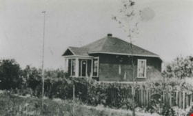
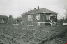
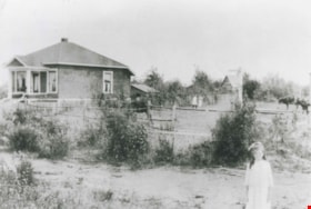
More like 'Douglas Road School'
Narrow Results By
Dairy and Silos at Oakalla
https://search.heritageburnaby.ca/link/archivedescription38129
- Repository
- City of Burnaby Archives
- Date
- [195-] (date of original), copied 1991
- Collection/Fonds
- Burnaby Historical Society fonds
- Description Level
- Item
- Physical Description
- 1 photograph : b&w ; 3.0 x 4.3 cm print on contact sheet 19.8 x 26.2 cm
- Scope and Content
- Photograph of the exterior of the dairy and silos at Oakalla Prison Farm.
- Repository
- City of Burnaby Archives
- Date
- [195-] (date of original), copied 1991
- Collection/Fonds
- Burnaby Historical Society fonds
- Subseries
- Burnaby Image Bank subseries
- Physical Description
- 1 photograph : b&w ; 3.0 x 4.3 cm print on contact sheet 19.8 x 26.2 cm
- Description Level
- Item
- Record No.
- 370-716
- Access Restriction
- No restrictions
- Reproduction Restriction
- Reproduce for fair dealing purposes only
- Accession Number
- BHS1999-03
- Scope and Content
- Photograph of the exterior of the dairy and silos at Oakalla Prison Farm.
- Names
- Oakalla Prison Farm
- Media Type
- Photograph
- Notes
- Title based on contents of photograph
- 1 b&w copy negative accompanying
- Negative has a pink cast
- Geographic Access
- Oakmount Crescent
- Street Address
- 5220 Oakmount Crescent
- Historic Neighbourhood
- Burnaby Lake (Historic Neighbourhood)
- Planning Study Area
- Oakalla Area
Images
Deer Lake Drive
https://search.heritageburnaby.ca/link/museumdescription1085
- Repository
- Burnaby Village Museum
- Date
- [1918]
- Collection/Fonds
- Burnaby Village Museum Photograph collection
- Description Level
- Item
- Physical Description
- 1 photograph : b&w ; 12.9 x 32.9 cm
- Scope and Content
- Photograph is a panorama of Deer Lake Drive, including the Ceperley mansion and the surrounding grounds of the home to the left of the picture. The photograph, taken from the water tower, with Burnaby Lake in the background. In the midground, following the horizon line, power poles can be seen. Far…
- Repository
- Burnaby Village Museum
- Collection/Fonds
- Burnaby Village Museum Photograph collection
- Description Level
- Item
- Physical Description
- 1 photograph : b&w ; 12.9 x 32.9 cm
- Scope and Content
- Photograph is a panorama of Deer Lake Drive, including the Ceperley mansion and the surrounding grounds of the home to the left of the picture. The photograph, taken from the water tower, with Burnaby Lake in the background. In the midground, following the horizon line, power poles can be seen. Farm lands are visible leading down to the homes of the Andersons. An annotation on the back of the photo in pencil reads, "Deer Lake Dr." and an annotation in blue pen reads, "1918."
- Geographic Access
- Deer Lake Drive
- Deer Lake Avenue
- Street Address
- 6344 Deer Lake Avenue
- Accession Code
- HV972.51.12
- Access Restriction
- No restrictions
- Reproduction Restriction
- No known restrictions
- Date
- [1918]
- Media Type
- Photograph
- Historic Neighbourhood
- Burnaby Lake (Historic Neighbourhood)
- Planning Study Area
- Douglas-Gilpin Area
- Scan Resolution
- 600
- Scan Date
- 2023-04-04
Images
Eating your way through Burnaby: A look at Chinese Canadian history through food
https://search.heritageburnaby.ca/link/museumdescription14762
- Repository
- Burnaby Village Museum
- Date
- 27 Oct. 2020
- Collection/Fonds
- Burnaby Village Museum fonds
- Description Level
- Item
- Physical Description
- 1 video recording (mp4) (61 min., 56 sec.) : digital, col., sd., stereo ; 29 fps
- Scope and Content
- Item consists of a video recording of a live Zoom webinar hosted by Kate Petrusa, Burnaby Village Museum assistant curator. The webinar is titled "Eating your way through Burnaby: A look at Chinese Canadian history through food" and is presented by Denise Fong, Planning Assistant for the City of Bu…
- Repository
- Burnaby Village Museum
- Collection/Fonds
- Burnaby Village Museum fonds
- Description Level
- Item
- Physical Description
- 1 video recording (mp4) (61 min., 56 sec.) : digital, col., sd., stereo ; 29 fps
- Material Details
- Presenter: Denise Fong
- Host: Kate Petrusa
- Date of Presentation: October 27 7:00 pm - 8:00 pm
- Total Number of tracks: 1
- Total Length of all tracks:61 min., 56 sec.
- Recording Device: Zoom video communication platform
- Scope and Content
- Item consists of a video recording of a live Zoom webinar hosted by Kate Petrusa, Burnaby Village Museum assistant curator. The webinar is titled "Eating your way through Burnaby: A look at Chinese Canadian history through food" and is presented by Denise Fong, Planning Assistant for the City of Burnaby. The zoom webinar is the seventh in a collection of seven "Burnaby Neighbourhood Speaker series" webinars that were presented and made available to the public between September 29 and October 27, 2020. The live webinar and recording was also made available on the Burnaby Village Museum's facebook page. In this webinar, Denise Fong talks about how Chinese Canadians have played a key role in supplying food to Burnaby’s community through their participation in the local market gardening, green grocer, and restaurant industries. The presentation is supported with historical maps, photographs, documents, census records and stories from recent research on the 1960s-1970s period in Burnaby’s Big Bend and Capitol Hill neighborhoods. In her presentation, Denise also talks about the history of Chinese Immigration in Canada including the political circumstances and legal barriers that Chinese migrants faced in the late nineteenth to early twentieth century. Denise highlights specific Chinese Canadian family farms in Burnaby including; the Jung family farm located on 5460 Douglas Road operated by Jung Chong and his wife Jung Gee Shee; "Hop On Farms" located on Marine Drive, operated by Chan Kow Hong, Sui Ha Hong and family; the Tong Yip Farm located on Byrne Road operated by D.T. "George" Yip and his wife, Yip Chow Won Tai. Denise also highlights her recent research regarding Chinese Canadian corner stores and green grocers in Burnaby including; The Lee Kee grocery store located at 3824 East Hastings Street, owned and operated by Yow Lee Ko and his wife Say Jan Chan; the Burnaby Market located at 3942 East Hastings Street, owned and operated by Chin Yin Wong; the Quon Bros. located at 3702 East Hastings Street.; Y. Hoy Produce Co. located at 4092 East Hastings Street operated by Hoy Yen; Louie's Food Basket located at 5886 South East Marine Drive operated by Hoy Bew Louie, his wife Poy Yee and later by thier son Bing Louie and Tommy's Market located in Burnaby's Edmonds neighbourhood, operated by Tommy Chu. Denise also provides a detailed history of Tommy Chu and family who owned and operated Tommy's Market. Denise tells of how in the early 1970s, Chinese grocers in the lower mainland came together and formed the Lower Mainland Independent Grocers Association and Lower Mainland Grocers Co-Op. The organization was formed to protect the rights and promote businesses of independent grocers. In closing, Denise explains how her research of Chinese Canadian history in Burnaby continues and by the end of the project, the information will be made accessible in the form of a publication.
- Creator
- Burnaby Village Museum
- Subjects
- Persons - Chinese Canadians
- Social Issues - Discrimination
- Agriculture - Farms
- Social Issues - Racism
- Buildings - Commercial - Grocery Stores
- Names
- Fong, Denise
- Jung, Chung Chong
- Tommy's Produce
- Lee Kee Grocery
- Louie's Food Basket
- Louie, Hoy Bew
- Jung, Gee Shee
- Hong, Chan Kow
- Hong, Sui Ha
- Yip, D.T. "George"
- Yip, Chow Won Tai
- Ko, Yow Lee
- Ko, Chan Say Jan
- Burnaby Market
- Wong, Chin Yin
- Quon Bros.
- Y. Hoy Produce Co.
- Yen, Hoy
- Louie, Poy Yee
- Louie, Bing
- Chu, Tommy
- Chu, Sharon
- Chu, Calvin
- Responsibility
- Petrusa, Kate
- Geographic Access
- Hastings Street
- Accession Code
- BV020.29.7
- Access Restriction
- No restrictions
- Reproduction Restriction
- No known restrictions
- Date
- 27 Oct. 2020
- Media Type
- Moving Images
- Historic Neighbourhood
- Fraser Arm (Historic Neighbourhood)
- Vancouver Heights (Historic Neighbourhood)
- Planning Study Area
- Big Bend Area
- Burnaby Heights Area
- Notes
- Title based on contents of video recording
- Video recording was edited for publication on Heritage Burnaby. Original mp4 video recording (BV020.29.7.1) is 72 min., 14 sec.
Images
Video
Eating your way through Burnaby: A look at Chinese Canadian history through food, 27 Oct. 2020
Eating your way through Burnaby: A look at Chinese Canadian history through food, 27 Oct. 2020
https://search.heritageburnaby.ca/media/hpo/_Data/_BVM_Moving_Images/2020_0029_0007_002.mp4The Fecundity of Food and Family: A Natural Niche for Chinese Canadians in Burnaby
https://search.heritageburnaby.ca/link/museumdescription14760
- Repository
- Burnaby Village Museum
- Date
- 20 Oct. 2020
- Collection/Fonds
- Burnaby Village Museum fonds
- Description Level
- Item
- Physical Description
- 1 video recording (mp4) (62 min., 01 sec.) : digital, col., sd., stereo ; 29 fps
- Scope and Content
- Item consists of a video recording of a live Zoom webinar hosted by Burnaby Village Museum's Kate Petrusa. The webinar is titled "The Fecundity of Food and Family: A Natural Niche for Chinese Canadians in Burnaby" and is presented by UBC students, Debbie Liang; Joty Gill; Rose Wu and Wei Yan Yeong.…
- Repository
- Burnaby Village Museum
- Collection/Fonds
- Burnaby Village Museum fonds
- Description Level
- Item
- Physical Description
- 1 video recording (mp4) (62 min., 01 sec.) : digital, col., sd., stereo ; 29 fps
- Material Details
- Presenters: Debbie Liang; Joty Gill; Rose Wu; Wei Yan Yeong
- Host: Kate Petrusa
- Date of Presentation: October 20 7:00 pm - 8:00 pm
- Total Number of tracks: 1
- Total Length of all tracks:62 min., 01 sec.
- Recording Device: Zoom video communication platform
- Scope and Content
- Item consists of a video recording of a live Zoom webinar hosted by Burnaby Village Museum's Kate Petrusa. The webinar is titled "The Fecundity of Food and Family: A Natural Niche for Chinese Canadians in Burnaby" and is presented by UBC students, Debbie Liang; Joty Gill; Rose Wu and Wei Yan Yeong. The zoom webinar is the fifth in a collection of seven "Burnaby Neighbourhood Speaker series" webinars that were presented and made available to the public between September 29 and October 27, 2020. The live webinar and recording was also made available on the Burnaby Village Museum's facebook page. In this webinar, the four UBC students, present their research on Chinese Canadian involvement in food and farming in early Burnaby. The students were participants in a joint partnership between Burnaby Village Museum and the UBC iniative for student teaching and research in Chinese Canadian Studies (INSTRCC), the UBC Asian Canadian & Asian Migration Studies program (ACAM), the UBC Centre for Community Engaged Learning (CCEL), the UBC Faculty of Land and Food Systems, UBC Go Global and UBC St. John's College (SJC). In 2020, due to the restrictions of COVID-19, the interns were asked to create virtual experiences to reimagine Burnaby Village Museum's historical Chinese Canadian programming in remote online spaces. Debbie Liang and Joty Gill (UBC alumni and graduates of Dr. Henry Yu's 2019 summer ACAM 390A Global Seminar to Asia) returned to work with Burnaby Village Museum to create two short films showcasing the history of Chinese Canadian Chop Suey restaurants and Piggeries in Burnaby. Rose Wu and Wei Yan Yeong (students in the UBC Faculty of Land and Food Systems) created a three episode podcast series "Back to the Roots" which delved into the topics of family-operated farming businesses, Chinese contributions to early local and alternative food systems, and Traditional Chinese Medicine and herbalism. The webinar begins with Joty Gill and Debbie Liang talking about their project, “A Taste of History Film Series”. They describe their research and challenges in the development of their two films “Scraps and Dragons” and “A Pig's Tale”. Debbie and Joty support their presentation with slides including excerpts from their films. Rose Wu and Wei Yan Yeong talk about their project which consisted of a three episode podcast series titled "Back to the Roots" which delved into the topics of family-operated farming businesses, Chinese contributions to early local and alternative food systems, and Traditional Chinese Medicine and herbalism. They describe their research, challenges and highlights which resulted in the three podcasts “A Family Farm”; “Where is your food from?” and “Chinese Herbalist Shops and TCM”. Rose and Wei Yan support their presentation with slides including excerpts from their podcasts. At the close of their presentation the students reflect on the importance of sharing personal aspects of Chinese Canadian History and answer questions from webinar participants.
- Creator
- Burnaby Village Museum
- Subjects
- Persons - Chinese Canadians
- Agriculture - Farms
- Agriculture
- Gardens - Market Gardens
- Social Issues - Discrimination
- Social Issues - Racism
- Buildings - Commercial - Restaurants
- Responsibility
- Petrusa, Kate
- Accession Code
- BV020.29.5
- Access Restriction
- No restrictions
- Reproduction Restriction
- No known restrictions
- Date
- 20 Oct. 2020
- Media Type
- Moving Images
- Notes
- Title based on contents of video recording
- Video recording was edited for publication on Heritage Burnaby. Original mp4 video recording (BV020.29.5.1) is 72 min., 25 sec.
Images
Video
The Fecundity of Food and Family: A Natural Niche for Chinese Canadians in Burnaby, 20 Oct. 2020
The Fecundity of Food and Family: A Natural Niche for Chinese Canadians in Burnaby, 20 Oct. 2020
https://search.heritageburnaby.ca/media/hpo/_Data/_BVM_Moving_Images/2020_0029_0005_002.mp4Hill farm
https://search.heritageburnaby.ca/link/archivedescription39334
- Repository
- City of Burnaby Archives
- Date
- [1915]
- Collection/Fonds
- Peers Family and Hill Family fonds
- Description Level
- Item
- Physical Description
- 2 photographs : b&w ; 5 x 10.5 cm on page 24.5 x 32.5 cm (pasted in album and joined to form one panorama)
- Scope and Content
- Photograph of the Hill family farm near Deer Lake. The panorama shows the buildings and fields and off to the right can be seen the Pole Line Road (Sperling Avenue).
- Repository
- City of Burnaby Archives
- Date
- [1915]
- Collection/Fonds
- Peers Family and Hill Family fonds
- Physical Description
- 2 photographs : b&w ; 5 x 10.5 cm on page 24.5 x 32.5 cm (pasted in album and joined to form one panorama)
- Description Level
- Item
- Record No.
- 477-653
- Access Restriction
- No restrictions
- Reproduction Restriction
- No known restrictions
- Accession Number
- 2007-12
- Scope and Content
- Photograph of the Hill family farm near Deer Lake. The panorama shows the buildings and fields and off to the right can be seen the Pole Line Road (Sperling Avenue).
- Media Type
- Photograph
- Notes
- Title based on contents of photograph
- Geographic Access
- Sperling Avenue
- Historic Neighbourhood
- Burnaby Lake (Historic Neighbourhood)
- Planning Study Area
- Morley-Buckingham Area
Images
Jesse Love house
https://search.heritageburnaby.ca/link/archivedescription34497
- Repository
- City of Burnaby Archives
- Date
- [1908] (date of original), copied [between 1975 and 1985]
- Collection/Fonds
- Burnaby Historical Society fonds
- Description Level
- Item
- Physical Description
- 1 photograph : sepia ; 12.6 x 17.6 cm mounted on cardboard 13.5 x 18.8 cm
- Scope and Content
- Photograph of the Jesse Love house and family on Cumberland Road. Two women and four children are standing outside of the house. In 1988, this house was moved to the site of the Burnaby Village Museum at Deer Lake Avenue, where it remains today.
- Repository
- City of Burnaby Archives
- Date
- [1908] (date of original), copied [between 1975 and 1985]
- Collection/Fonds
- Burnaby Historical Society fonds
- Subseries
- Photographs subseries
- Physical Description
- 1 photograph : sepia ; 12.6 x 17.6 cm mounted on cardboard 13.5 x 18.8 cm
- Description Level
- Item
- Record No.
- 021-001
- Access Restriction
- No restrictions
- Reproduction Restriction
- No known restrictions
- Accession Number
- BHS2007-04
- Scope and Content
- Photograph of the Jesse Love house and family on Cumberland Road. Two women and four children are standing outside of the house. In 1988, this house was moved to the site of the Burnaby Village Museum at Deer Lake Avenue, where it remains today.
- Media Type
- Photograph
- Notes
- Title based on contents of photograph
- 1 b&w copy negative accompanying
- Geographic Access
- Cumberland Street
- Street Address
- 6501 Deer Lake Avenue
- Historic Neighbourhood
- East Burnaby (Historic Neighbourhood)
- Planning Study Area
- Cariboo-Armstrong Area
Images
Keel farm house
https://search.heritageburnaby.ca/link/archivedescription36488
- Repository
- City of Burnaby Archives
- Date
- [192-]
- Collection/Fonds
- Burnaby Historical Society fonds
- Description Level
- Item
- Physical Description
- 1 photograph : b&w ; 8.5 x 12.5 cm print
- Scope and Content
- Photograph of the A.J. Keel farm house and orchard, at 5387 Rumble Street. A.J. Keel bought this property, which went from Rumble to Walting, in 1920.
- Repository
- City of Burnaby Archives
- Date
- [192-]
- Collection/Fonds
- Burnaby Historical Society fonds
- Subseries
- Keel family subseries
- Physical Description
- 1 photograph : b&w ; 8.5 x 12.5 cm print
- Description Level
- Item
- Record No.
- 279-001
- Access Restriction
- No restrictions
- Reproduction Restriction
- No known restrictions
- Accession Number
- BHS1992-09
- Scope and Content
- Photograph of the A.J. Keel farm house and orchard, at 5387 Rumble Street. A.J. Keel bought this property, which went from Rumble to Walting, in 1920.
- Media Type
- Photograph
- Notes
- Title based on contents of photograph
- Geographic Access
- Rumble Street
- Street Address
- 5387 Rumble Street
- Historic Neighbourhood
- Alta-Vista (Historic Neighbourhood)
- Planning Study Area
- Clinton-Glenwood Area
Images
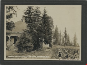
Louis Claude Hill's Strawberry Farm, Burnaby BC
https://search.heritageburnaby.ca/link/museumdescription991
- Repository
- Burnaby Village Museum
- Date
- 1902
- Collection/Fonds
- Burnaby Village Museum Photograph collection
- Description Level
- Item
- Physical Description
- 1 photograph : sepia ; 12.8 x 17.7 cm mounted on grey card 15.0 x 20.0 cm
- Scope and Content
- Photograph of immigrant workers in the field picking strawberries on the farm belonging to Claude Hill. On the left, the Hill family home, Brookfield, can be seen. Claude Hill's daughter, Kitty Hill, is sitting on the steps of the house. The property is the current site of the Burnaby Village Muse…
- Repository
- Burnaby Village Museum
- Collection/Fonds
- Burnaby Village Museum Photograph collection
- Description Level
- Item
- Physical Description
- 1 photograph : sepia ; 12.8 x 17.7 cm mounted on grey card 15.0 x 20.0 cm
- Scope and Content
- Photograph of immigrant workers in the field picking strawberries on the farm belonging to Claude Hill. On the left, the Hill family home, Brookfield, can be seen. Claude Hill's daughter, Kitty Hill, is sitting on the steps of the house. The property is the current site of the Burnaby Village Museum.
- Subjects
- Agriculture - Farms
- Occupations - Agricultural Labourers
- Agriculture - Fruit and Berries
- Buildings - Residential - Houses
- Persons - Chinese Canadians
- Accession Code
- HV973.40.5
- Access Restriction
- No restrictions
- Reproduction Restriction
- No known restrictions
- Date
- 1902
- Media Type
- Photograph
- Historic Neighbourhood
- Burnaby Lake (Historic Neighbourhood)
- Planning Study Area
- Morley-Buckingham Area
- Scan Resolution
- 600
- Scan Date
- 2023-05-09
- Scale
- 100
- Photographer
- Cooksley, William Thomas
- Notes
- Title based on caption accompanying photograph
- Inscribed on the negative and (therefore) printed on recto of photograph reads: "L.C. Hill's Strawberry Farm, Burnaby, B.C." and "W.T. Cooksley, New Westminster, B.C."
- Note written in red pencil on the card reads: "1902 - Grandview H.WAY"
Images
Lubbock family home and farm
https://search.heritageburnaby.ca/link/archivedescription35861
- Repository
- City of Burnaby Archives
- Date
- [197-] (date of original), copied 1986
- Collection/Fonds
- Burnaby Historical Society fonds
- Description Level
- Item
- Physical Description
- 1 photograph : b&w ; 12.7 x 17.8 cm print
- Scope and Content
- Photograph of the Lubbock family home and farm, built in 1898 by Edgar Sprott, brother of former Reeve, Charles F. Sprott. The Lubbock family moved into the house in 1915.
- Repository
- City of Burnaby Archives
- Date
- [197-] (date of original), copied 1986
- Collection/Fonds
- Burnaby Historical Society fonds
- Subseries
- Pioneer Tales subseries
- Physical Description
- 1 photograph : b&w ; 12.7 x 17.8 cm print
- Description Level
- Item
- Record No.
- 204-720
- Access Restriction
- No restrictions
- Reproduction Restriction
- Reproduce for fair dealing purposes only
- Accession Number
- BHS1988-03
- Scope and Content
- Photograph of the Lubbock family home and farm, built in 1898 by Edgar Sprott, brother of former Reeve, Charles F. Sprott. The Lubbock family moved into the house in 1915.
- Media Type
- Photograph
- Notes
- Title based on contents of photograph.
- A note with the photograph indicated that the old street address of this farm was 1 Arbor Lane.
- Geographic Access
- Grandview Highway
- Canada Way
- Burris Street
- Street Address
- 7803 Burris Street
- Historic Neighbourhood
- Burnaby Lake (Historic Neighbourhood)
- Planning Study Area
- Morley-Buckingham Area
Images
Lubbock family home and farm
https://search.heritageburnaby.ca/link/archivedescription35862
- Repository
- City of Burnaby Archives
- Date
- [197-] (date of original), copied 1986
- Collection/Fonds
- Burnaby Historical Society fonds
- Description Level
- Item
- Physical Description
- 1 photograph : b&w ; 12.7 x 17.8 cm print
- Scope and Content
- Photograph of cows grazing on the Lubbock farm with the family home seen in the background. The house was built in 1898 by Edgar Sprott, brother of former Reeve, Charles F. Sprott. The Lubbock family moved into the house in 1915.
- Repository
- City of Burnaby Archives
- Date
- [197-] (date of original), copied 1986
- Collection/Fonds
- Burnaby Historical Society fonds
- Subseries
- Pioneer Tales subseries
- Physical Description
- 1 photograph : b&w ; 12.7 x 17.8 cm print
- Description Level
- Item
- Record No.
- 204-721
- Access Restriction
- No restrictions
- Reproduction Restriction
- Reproduce for fair dealing purposes only
- Accession Number
- BHS1988-03
- Scope and Content
- Photograph of cows grazing on the Lubbock farm with the family home seen in the background. The house was built in 1898 by Edgar Sprott, brother of former Reeve, Charles F. Sprott. The Lubbock family moved into the house in 1915.
- Media Type
- Photograph
- Notes
- Title based on contents of photograph.
- A note with this photograph indicated that the old street address of this property was 1 Arbor Lane.
- Geographic Access
- Grandview Highway
- Canada Way
- Burris Street
- Street Address
- 7803 Burris Street
- Historic Neighbourhood
- Burnaby Lake (Historic Neighbourhood)
- Planning Study Area
- Morley-Buckingham Area
Images
Lubbock farmhouse
https://search.heritageburnaby.ca/link/archivedescription37227
- Repository
- City of Burnaby Archives
- Date
- [1935]
- Collection/Fonds
- Burnaby Historical Society fonds
- Description Level
- Item
- Physical Description
- 1 photograph : sepia ; 5.5 x 8 cm
- Scope and Content
- Photograph of the exterior of the Lubbock farmhouse at Canada Way and Burris.
- Repository
- City of Burnaby Archives
- Date
- [1935]
- Collection/Fonds
- Burnaby Historical Society fonds
- Subseries
- Lubbock family subseries
- Physical Description
- 1 photograph : sepia ; 5.5 x 8 cm
- Description Level
- Item
- Record No.
- 342-001
- Access Restriction
- No restrictions
- Reproduction Restriction
- No known restrictions
- Accession Number
- BHS1994-02
- Scope and Content
- Photograph of the exterior of the Lubbock farmhouse at Canada Way and Burris.
- Media Type
- Photograph
- Notes
- Title based on contents of photograph
- Geographic Access
- Grandview Highway
- Canada Way
- Burris Street
- Street Address
- 7803 Burris Street
- Historic Neighbourhood
- Burnaby Lake (Historic Neighbourhood)
- Planning Study Area
- Morley-Buckingham Area
Images
Lubbock farmhouse
https://search.heritageburnaby.ca/link/archivedescription37228
- Repository
- City of Burnaby Archives
- Date
- [1935]
- Collection/Fonds
- Burnaby Historical Society fonds
- Description Level
- Item
- Physical Description
- 1 photograph : sepia ; 5.5 x 8 cm
- Scope and Content
- Photograph of the Lubbock family farmhouse at Burris Street and Canada Way.
- Repository
- City of Burnaby Archives
- Date
- [1935]
- Collection/Fonds
- Burnaby Historical Society fonds
- Subseries
- Lubbock family subseries
- Physical Description
- 1 photograph : sepia ; 5.5 x 8 cm
- Description Level
- Item
- Record No.
- 342-002
- Access Restriction
- No restrictions
- Reproduction Restriction
- No known restrictions
- Accession Number
- BHS1994-02
- Scope and Content
- Photograph of the Lubbock family farmhouse at Burris Street and Canada Way.
- Media Type
- Photograph
- Notes
- Title based on contents of photograph
- Geographic Access
- Grandview Highway
- Canada Way
- Burris Street
- Street Address
- 7803 Burris Street
- Historic Neighbourhood
- Burnaby Lake (Historic Neighbourhood)
- Planning Study Area
- Morley-Buckingham Area
Images
Lubbock farmhouse
https://search.heritageburnaby.ca/link/archivedescription37229
- Repository
- City of Burnaby Archives
- Date
- [1935]
- Collection/Fonds
- Burnaby Historical Society fonds
- Description Level
- Item
- Physical Description
- 1 photograph : sepia ; 5.5 x 8 cm
- Scope and Content
- Photograph of the Lubbock family farmhouse and garden at Burris Street and Canada Way.
- Repository
- City of Burnaby Archives
- Date
- [1935]
- Collection/Fonds
- Burnaby Historical Society fonds
- Subseries
- Lubbock family subseries
- Physical Description
- 1 photograph : sepia ; 5.5 x 8 cm
- Description Level
- Item
- Record No.
- 342-003
- Access Restriction
- No restrictions
- Reproduction Restriction
- No known restrictions
- Accession Number
- BHS1994-02
- Scope and Content
- Photograph of the Lubbock family farmhouse and garden at Burris Street and Canada Way.
- Media Type
- Photograph
- Notes
- Title based on contents of photograph
- Geographic Access
- Grandview Highway
- Canada Way
- Burris Street
- Street Address
- 7803 Burris Street
- Historic Neighbourhood
- Burnaby Lake (Historic Neighbourhood)
- Planning Study Area
- Morley-Buckingham Area
Images
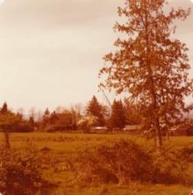
Lubbock's farm
https://search.heritageburnaby.ca/link/archivedescription36517
- Repository
- City of Burnaby Archives
- Date
- 1977
- Collection/Fonds
- Burnaby Historical Society fonds
- Description Level
- Item
- Physical Description
- 1 photograph : col. ; 9 x 8.5 cm
- Scope and Content
- Copyright holder and creator are unknown. Copyright expires in 2053.
- Repository
- City of Burnaby Archives
- Date
- 1977
- Collection/Fonds
- Burnaby Historical Society fonds
- Subseries
- Lubbock family subseries
- Physical Description
- 1 photograph : col. ; 9 x 8.5 cm
- Description Level
- Item
- Record No.
- 289-006
- Access Restriction
- No restrictions
- Reproduction Restriction
- Reproduce for fair dealing purposes only
- Accession Number
- BHS1992-24
- Scope and Content
- Copyright holder and creator are unknown. Copyright expires in 2053.
- Media Type
- Photograph
- Notes
- Title based on contents of photograph
- Geographic Access
- Grandview Highway
- Canada Way
- Burris Street
- Street Address
- 7803 Burris Street
- Historic Neighbourhood
- Burnaby Lake (Historic Neighbourhood)
- Planning Study Area
- Morley-Buckingham Area
Images
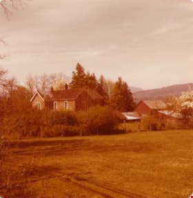
Lubbock's stable and farm house
https://search.heritageburnaby.ca/link/archivedescription36512
- Repository
- City of Burnaby Archives
- Date
- 1977
- Collection/Fonds
- Burnaby Historical Society fonds
- Description Level
- Item
- Physical Description
- 1 photograph : col. ; 9 x 8.5 cm
- Scope and Content
- Photograph of Lubbock's farm taken from Canada Way at Haszard Street. The Lubbock stable and farm house are both visible.
- Repository
- City of Burnaby Archives
- Date
- 1977
- Collection/Fonds
- Burnaby Historical Society fonds
- Subseries
- Lubbock family subseries
- Physical Description
- 1 photograph : col. ; 9 x 8.5 cm
- Description Level
- Item
- Record No.
- 289-001
- Access Restriction
- No restrictions
- Reproduction Restriction
- Reproduce for fair dealing purposes only
- Accession Number
- BHS1992-24
- Scope and Content
- Photograph of Lubbock's farm taken from Canada Way at Haszard Street. The Lubbock stable and farm house are both visible.
- Media Type
- Photograph
- Notes
- Title based on contents of photograph
- Geographic Access
- Grandview Highway
- Canada Way
- Burris Street
- Street Address
- 7803 Burris Street
- Historic Neighbourhood
- Burnaby Lake (Historic Neighbourhood)
- Planning Study Area
- Morley-Buckingham Area
Images
Marine Drive Game Farm
https://search.heritageburnaby.ca/link/archivedescription35158
- Repository
- City of Burnaby Archives
- Date
- 1930 (date of original), copied 1986
- Collection/Fonds
- Burnaby Historical Society fonds
- Description Level
- Item
- Physical Description
- 1 photograph : b&w ; 12.7 x 17.8 cm print
- Scope and Content
- Photograph of the Marine Drive Game Farm, founded and owned by William "Bill" Greenslade's father, William Greenslade, Sr. It was located at 3295 Marine Drive (later renumbered 5421 Marine Drive).
- Repository
- City of Burnaby Archives
- Date
- 1930 (date of original), copied 1986
- Collection/Fonds
- Burnaby Historical Society fonds
- Subseries
- Pioneer Tales subseries
- Physical Description
- 1 photograph : b&w ; 12.7 x 17.8 cm print
- Description Level
- Item
- Record No.
- 204-015
- Access Restriction
- No restrictions
- Reproduction Restriction
- No known restrictions
- Accession Number
- BHS1988-03
- Scope and Content
- Photograph of the Marine Drive Game Farm, founded and owned by William "Bill" Greenslade's father, William Greenslade, Sr. It was located at 3295 Marine Drive (later renumbered 5421 Marine Drive).
- Names
- Marine Drive Game Farm
- Media Type
- Photograph
- Notes
- Title based on contents of photograph
- Geographic Access
- Marine Drive
- Street Address
- 5421 Marine Drive
- Historic Neighbourhood
- Fraser Arm (Historic Neighbourhood)
- Planning Study Area
- Clinton-Glenwood Area
Images
Mayfield farm
https://search.heritageburnaby.ca/link/museumdescription450
- Repository
- Burnaby Village Museum
- Date
- [190-](date of original), copied 1978
- Collection/Fonds
- Burnaby Village Museum Photograph collection
- Description Level
- Item
- Physical Description
- 1 photograph : b&w ; 20.2 x 25.2 cm print
- Scope and Content
- Photograph of a two-storey farmhouse with a large patio, and a ladder on the roof. There is a foot path leading to the house through the garden, and a lake in the background. A catalogue record from 1978 indicates that the farmhouse depicted in the photograph is "Mayfield," the original farmhouse o…
- Repository
- Burnaby Village Museum
- Collection/Fonds
- Burnaby Village Museum Photograph collection
- Description Level
- Item
- Physical Description
- 1 photograph : b&w ; 20.2 x 25.2 cm print
- Scope and Content
- Photograph of a two-storey farmhouse with a large patio, and a ladder on the roof. There is a foot path leading to the house through the garden, and a lake in the background. A catalogue record from 1978 indicates that the farmhouse depicted in the photograph is "Mayfield," the original farmhouse of the Sprott family. The woman standing in the garden is identified as Mrs. Edgar Sprott, and the lake in the background is Burnaby Lake.
- Geographic Access
- Canada Way
- Burnaby Lake
- Accession Code
- HV978.1.4
- Access Restriction
- No restrictions
- Reproduction Restriction
- No known restrictions
- Date
- [190-](date of original), copied 1978
- Media Type
- Photograph
- Historic Neighbourhood
- Burnaby Lake (Historic Neighbourhood)
- Planning Study Area
- Morley-Buckingham Area
- Scan Resolution
- 600
- Scan Date
- 2023-07-25
- Notes
- Title based on contents of photograph
Images
McKenzie family home
https://search.heritageburnaby.ca/link/archivedescription37034
- Repository
- City of Burnaby Archives
- Date
- 1912 (date of original), copied 1992
- Collection/Fonds
- Burnaby Historical Society fonds
- Description Level
- Item
- Physical Description
- 1 photograph : b&w ; 7.6 x 12.6 cm print
- Scope and Content
- Photograph of the McKenzie family home and farm on Laurier Street (now Halligan Street).
- Repository
- City of Burnaby Archives
- Date
- 1912 (date of original), copied 1992
- Collection/Fonds
- Burnaby Historical Society fonds
- Subseries
- Burnaby Centennial Anthology subseries
- Physical Description
- 1 photograph : b&w ; 7.6 x 12.6 cm print
- Description Level
- Item
- Record No.
- 315-497
- Access Restriction
- No restrictions
- Reproduction Restriction
- No known restrictions
- Accession Number
- BHS1994-04
- Scope and Content
- Photograph of the McKenzie family home and farm on Laurier Street (now Halligan Street).
- Media Type
- Photograph
- Notes
- Title based on contents of photograph
- Geographic Access
- Halligan Street
- Historic Neighbourhood
- Edmonds (Historic Neighbourhood)
- Planning Study Area
- Morley-Buckingham Area
Images
McKenzie family home
https://search.heritageburnaby.ca/link/archivedescription37039
- Repository
- City of Burnaby Archives
- Date
- 1912 (date of original), copied 1992
- Collection/Fonds
- Burnaby Historical Society fonds
- Description Level
- Item
- Physical Description
- 1 photograph : b&w ; 8.1 x 12.1 cm print
- Scope and Content
- Photograph of the McKenzie family home and farm on Laurier Street (now Halligan Street) with added rooms at the back and a strawberry patch in front.
- Repository
- City of Burnaby Archives
- Date
- 1912 (date of original), copied 1992
- Collection/Fonds
- Burnaby Historical Society fonds
- Subseries
- Burnaby Centennial Anthology subseries
- Physical Description
- 1 photograph : b&w ; 8.1 x 12.1 cm print
- Description Level
- Item
- Record No.
- 315-502
- Access Restriction
- No restrictions
- Reproduction Restriction
- No known restrictions
- Accession Number
- BHS1994-04
- Scope and Content
- Photograph of the McKenzie family home and farm on Laurier Street (now Halligan Street) with added rooms at the back and a strawberry patch in front.
- Media Type
- Photograph
- Notes
- Title based on contents of photograph
- Geographic Access
- Halligan Street
- Historic Neighbourhood
- Edmonds (Historic Neighbourhood)
- Planning Study Area
- Morley-Buckingham Area
Images
McKenzie family home and farm
https://search.heritageburnaby.ca/link/archivedescription37035
- Repository
- City of Burnaby Archives
- Date
- 1912 (date of original), copied 1992
- Collection/Fonds
- Burnaby Historical Society fonds
- Description Level
- Item
- Physical Description
- 1 photograph : b&w ; 8.6 x 12.7 cm print
- Scope and Content
- Photograph of the McKenzie family home and farm on Laurier Street (now Halligan Street). Cows can be seen in the background and a girl in the foreground.
- Repository
- City of Burnaby Archives
- Date
- 1912 (date of original), copied 1992
- Collection/Fonds
- Burnaby Historical Society fonds
- Subseries
- Burnaby Centennial Anthology subseries
- Physical Description
- 1 photograph : b&w ; 8.6 x 12.7 cm print
- Description Level
- Item
- Record No.
- 315-498
- Access Restriction
- No restrictions
- Reproduction Restriction
- No known restrictions
- Accession Number
- BHS1994-04
- Scope and Content
- Photograph of the McKenzie family home and farm on Laurier Street (now Halligan Street). Cows can be seen in the background and a girl in the foreground.
- Media Type
- Photograph
- Notes
- Title based on contents of photograph
- Geographic Access
- Halligan Street
- Historic Neighbourhood
- Edmonds (Historic Neighbourhood)
- Planning Study Area
- Morley-Buckingham Area
![Dairy and Silos at Oakalla, [195-] (date of original), copied 1991 thumbnail](/media/hpo/_Data/_Archives_Images/_Unrestricted/370/370-716.jpg?width=280)
![Deer Lake Drive, [1918] thumbnail](/media/hpo/_Data/_BVM_Images/1972/1972_0051_0012_001.jpg?width=280)
![Hill farm, [1915] thumbnail](/media/hpo/_Data/_Archives_Images/_Unrestricted/477/477-653.jpg?width=280)
![Jesse Love house, [1908] (date of original), copied [between 1975 and 1985] thumbnail](/media/hpo/_Data/_Archives_Images/_Unrestricted/001/021-001.jpg?width=280)
![Keel farm house, [192-] thumbnail](/media/hpo/_Data/_Archives_Images/_Unrestricted/251/279-001.jpg?width=280)

![Lubbock family home and farm, [197-] (date of original), copied 1986 thumbnail](/media/hpo/_Data/_Archives_Images/_Unrestricted/204/204-720.jpg?width=280)
![Lubbock family home and farm, [197-] (date of original), copied 1986 thumbnail](/media/hpo/_Data/_Archives_Images/_Unrestricted/204/204-721.jpg?width=280)
![Lubbock farmhouse, [1935] thumbnail](/media/hpo/_Data/_Archives_Images/_Unrestricted/316/342-001.jpg?width=280)
![Lubbock farmhouse, [1935] thumbnail](/media/hpo/_Data/_Archives_Images/_Unrestricted/316/342-002.jpg?width=280)
![Lubbock farmhouse, [1935] thumbnail](/media/hpo/_Data/_Archives_Images/_Unrestricted/316/342-003.jpg?width=280)

, copied 1978 thumbnail](/media/hpo/_Data/_BVM_Images/1978/1978_0001_0004_001.jpg?width=280)
