More like 'The "Back Lane"'
Narrow Results By

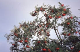
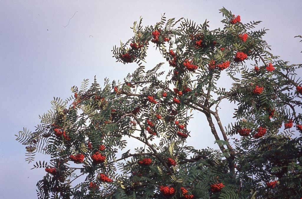
Deer Lake
https://search.heritageburnaby.ca/link/archivedescription91707
- Repository
- City of Burnaby Archives
- Date
- 1994-1996
- Collection/Fonds
- Doreen Lawson fonds
- Description Level
- File
- Physical Description
- 55 photographs : col. slides ; 35 mm
- Scope and Content
- File consists of scenic photographs of Deer Lake and Deer Lake Park, including closeup photographs of the lake and landscape photographs with the lake in the foreground and mountains and skyline visible in the distance. The photographs capture Deer Lake in the fall, winter, and spring. Also inclu…
- Repository
- City of Burnaby Archives
- Date
- 1994-1996
- Collection/Fonds
- Doreen Lawson fonds
- Physical Description
- 55 photographs : col. slides ; 35 mm
- Description Level
- File
- Record No.
- 618-025
- Access Restriction
- No restrictions
- Reproduction Restriction
- No restrictions
- Accession Number
- 2015-15
- Scope and Content
- File consists of scenic photographs of Deer Lake and Deer Lake Park, including closeup photographs of the lake and landscape photographs with the lake in the foreground and mountains and skyline visible in the distance. The photographs capture Deer Lake in the fall, winter, and spring. Also included in the file are four photographs of Deer Lake Park signs.
- Subjects
- Natural Phenomena - Snow
- Geographic Features - Lakes and Ponds
- Plants - Trees
- Geographic Features - Mountains
- Advertising Medium - Signs and Signboards
- Names
- Burnaby Art Gallery
- Media Type
- Photograph
- Photographer
- Lawson, Doreen A.
- Notes
- Title based on contents of photographs
- Geographic Access
- Deer Lake
- Historic Neighbourhood
- Burnaby Lake (Historic Neighbourhood)
- Planning Study Area
- Oakalla Area
Images

![Rhododendron Festival, [1999] thumbnail](/media/hpo/_Data/_Archives_Images/_Unrestricted/535/535-3165.jpg?width=280)
Rhododendron Festival
https://search.heritageburnaby.ca/link/archivedescription98085
- Repository
- City of Burnaby Archives
- Date
- [1999]
- Collection/Fonds
- Burnaby NewsLeader photograph collection
- Description Level
- Item
- Physical Description
- 1 photograph (tiff) : col.
- Scope and Content
- Photograph of an unidentified person taking a photograph of a blooming rhododendron at the Rhododendron Festival at Deer Lake Park.
- Repository
- City of Burnaby Archives
- Date
- [1999]
- Collection/Fonds
- Burnaby NewsLeader photograph collection
- Physical Description
- 1 photograph (tiff) : col.
- Description Level
- Item
- Record No.
- 535-3165
- Access Restriction
- No restrictions
- Reproduction Restriction
- No restrictions
- Accession Number
- 2018-12
- Scope and Content
- Photograph of an unidentified person taking a photograph of a blooming rhododendron at the Rhododendron Festival at Deer Lake Park.
- Media Type
- Photograph
- Photographer
- Bartel, Mario
- Notes
- Title based on caption
- Collected by editorial for use in a May 1999 issue of the Burnaby NewsLeader
- Caption from metadata: "Cool, cloudy weather didn't keep flower lovers, and photographers, from enjoying the blossoms at the annual Rhododendron Festival at Deer Lake Park."
- Geographic Access
- Deer Lake Park
- Historic Neighbourhood
- Burnaby Lake (Historic Neighbourhood)
- Planning Study Area
- Morley-Buckingham Area
Images
![Rhododendron Festival, [1999] thumbnail](/media/hpo/_Data/_Archives_Images/_Unrestricted/535/535-3165.jpg)
![Arborists in a forest, [1999] thumbnail](/media/hpo/_Data/_Archives_Images/_Unrestricted/535/535-3236-1.jpg?width=280)
Arborists in a forest
https://search.heritageburnaby.ca/link/archivedescription98158
- Repository
- City of Burnaby Archives
- Date
- [1999]
- Collection/Fonds
- Burnaby NewsLeader photograph collection
- Description Level
- File
- Physical Description
- 7 photographs (tiff) : col.
- Scope and Content
- File contains photographs of unidentified arborists climbing and working on trees, and photographs of their climbing equipment, ropes, and saws.
- Repository
- City of Burnaby Archives
- Date
- [1999]
- Collection/Fonds
- Burnaby NewsLeader photograph collection
- Physical Description
- 7 photographs (tiff) : col.
- Description Level
- File
- Record No.
- 535-3236
- Access Restriction
- No restrictions
- Reproduction Restriction
- No restrictions
- Accession Number
- 2018-12
- Scope and Content
- File contains photographs of unidentified arborists climbing and working on trees, and photographs of their climbing equipment, ropes, and saws.
- Media Type
- Photograph
- Notes
- Title based on contents of file
- Collected by editorial for use in a June 1999 issue of the Burnaby NewsLeader
Images
![Arborists in a forest, [1999] thumbnail](/media/hpo/_Data/_Archives_Images/_Unrestricted/535/535-3236-1.jpg)

Byrne Creek
https://search.heritageburnaby.ca/link/archivedescription91705
- Repository
- City of Burnaby Archives
- Date
- March 25, 1993
- Collection/Fonds
- Doreen Lawson fonds
- Description Level
- File
- Physical Description
- 40 photographs : col. slides ; 35 mm
- Scope and Content
- File consists of photographs of Byrne Creek. The photographs depict the creek prior to clean-up with the water and paths littered with debris. Also included in the file are photographs of an unidentified man pulling a dead fish from the creek.
- Repository
- City of Burnaby Archives
- Date
- March 25, 1993
- Collection/Fonds
- Doreen Lawson fonds
- Physical Description
- 40 photographs : col. slides ; 35 mm
- Description Level
- File
- Record No.
- 618-023
- Access Restriction
- No restrictions
- Reproduction Restriction
- No restrictions
- Accession Number
- 2015-15
- Scope and Content
- File consists of photographs of Byrne Creek. The photographs depict the creek prior to clean-up with the water and paths littered with debris. Also included in the file are photographs of an unidentified man pulling a dead fish from the creek.
- Media Type
- Photograph
- Photographer
- Lawson, Doreen A.
- Glover, Ken
- Notes
- Transcribed title
- Title transcribed from label on slide sheets
- Note in black ink on recto of slide frames 618-023-11, 618-023-12, 618-023-14, 618-023-33, and 618-023-40 reads: "Ken Glover / BOB"
- Geographic Access
- Byrne Creek
- Historic Neighbourhood
- Edmonds (Historic Neighbourhood)
- Planning Study Area
- Stride Avenue Area
Images

![Fall leaves, [1999] thumbnail](/media/hpo/_Data/_Archives_Images/_Unrestricted/535/535-3374.jpg?width=280)
Fall leaves
https://search.heritageburnaby.ca/link/archivedescription98364
- Repository
- City of Burnaby Archives
- Date
- [1999]
- Collection/Fonds
- Burnaby NewsLeader photograph collection
- Description Level
- Item
- Physical Description
- 1 photograph (tiff) : col.
- Scope and Content
- Photograph of an unidentified person walking underneath a tree with yellow autumn leaves in a park.
- Repository
- City of Burnaby Archives
- Date
- [1999]
- Collection/Fonds
- Burnaby NewsLeader photograph collection
- Physical Description
- 1 photograph (tiff) : col.
- Description Level
- Item
- Record No.
- 535-3374
- Access Restriction
- No restrictions
- Reproduction Restriction
- No restrictions
- Accession Number
- 2018-12
- Scope and Content
- Photograph of an unidentified person walking underneath a tree with yellow autumn leaves in a park.
- Media Type
- Photograph
- Notes
- Title based on original file name
- Collected by editorial for use in an October 1999 issue of the Burnaby NewsLeader
Images
![Fall leaves, [1999] thumbnail](/media/hpo/_Data/_Archives_Images/_Unrestricted/535/535-3374.jpg)
![Ocean View Burial Park, [1999] thumbnail](/media/hpo/_Data/_Archives_Images/_Unrestricted/535/535-3132-1.jpg?width=280)
Ocean View Burial Park
https://search.heritageburnaby.ca/link/archivedescription98052
- Repository
- City of Burnaby Archives
- Date
- [1999]
- Collection/Fonds
- Burnaby NewsLeader photograph collection
- Description Level
- File
- Physical Description
- 2 photographs (tiff) : b&w
- Scope and Content
- File contains photographs of fallen trees and debris at Ocean View Burial Park, with towers visible in the background.
- Repository
- City of Burnaby Archives
- Date
- [1999]
- Collection/Fonds
- Burnaby NewsLeader photograph collection
- Physical Description
- 2 photographs (tiff) : b&w
- Description Level
- File
- Record No.
- 535-3132
- Access Restriction
- No restrictions
- Reproduction Restriction
- No restrictions
- Accession Number
- 2018-12
- Scope and Content
- File contains photographs of fallen trees and debris at Ocean View Burial Park, with towers visible in the background.
- Names
- Ocean View Burial Park
- Media Type
- Photograph
- Notes
- Title based on original file name
- Collected by editorial for use in a March 1999 issue of the Burnaby NewsLeader
- Geographic Access
- Imperial Street
- Street Address
- 4000 Imperial Street
- Historic Neighbourhood
- Alta Vista (Historic Neighbourhood)
- Planning Study Area
- Suncrest Area
Images
![Ocean View Burial Park, [1999] thumbnail](/media/hpo/_Data/_Archives_Images/_Unrestricted/535/535-3132-1.jpg)
![Snow Owl / Burnaby Lake Snow Pictures, [between 1970 and 2001] thumbnail](/media/hpo/_Data/_Archives_Images/_Unrestricted/600/618-020-9.jpg?width=280)
Snow Owl / Burnaby Lake Snow Pictures
https://search.heritageburnaby.ca/link/archivedescription91702
- Repository
- City of Burnaby Archives
- Date
- [between 1970 and 2001]
- Collection/Fonds
- Doreen Lawson fonds
- Description Level
- File
- Physical Description
- 25 photographs : col. negatives ; 35 mm
- Scope and Content
- File consists photographs of a snow-covered Burnaby Lake and a snowy owl perched on a large tree stump.
- Repository
- City of Burnaby Archives
- Date
- [between 1970 and 2001]
- Collection/Fonds
- Doreen Lawson fonds
- Physical Description
- 25 photographs : col. negatives ; 35 mm
- Description Level
- File
- Record No.
- 618-020
- Access Restriction
- No restrictions
- Reproduction Restriction
- No restrictions
- Accession Number
- 2015-15
- Scope and Content
- File consists photographs of a snow-covered Burnaby Lake and a snowy owl perched on a large tree stump.
- Subjects
- Geographic Features - Lakes and Ponds
- Animals - Birds
- Plants - Trees
- Natural Phenomena - Snow
- Media Type
- Photograph
- Photographer
- Lawson, Doreen A.
- Notes
- Transcribed title
- Title transcribed from negative envelope
- Geographic Access
- Burnaby Lake
- Historic Neighbourhood
- Burnaby Lake (Historic Neighbourhood)
- Planning Study Area
- Burnaby Lake Area
Images
![Snow Owl / Burnaby Lake Snow Pictures, [between 1970 and 2001] thumbnail](/media/hpo/_Data/_Archives_Images/_Unrestricted/600/618-020-9.jpg)
Still Creek Flora
https://search.heritageburnaby.ca/link/archivedescription91703
- Repository
- City of Burnaby Archives
- Date
- 1991
- Collection/Fonds
- Doreen Lawson fonds
- Description Level
- File
- Physical Description
- 6 photographs : col. slides ; 35 mm
- Scope and Content
- File consists photographs of colourful flora around Still Creek. Flower species have not been identified.
- Repository
- City of Burnaby Archives
- Date
- 1991
- Collection/Fonds
- Doreen Lawson fonds
- Physical Description
- 6 photographs : col. slides ; 35 mm
- Description Level
- File
- Record No.
- 618-021
- Access Restriction
- No restrictions
- Reproduction Restriction
- No restrictions
- Accession Number
- 2015-15
- Scope and Content
- File consists photographs of colourful flora around Still Creek. Flower species have not been identified.
- Subjects
- Geographic Features - Lakes and Ponds
- Animals - Birds
- Plants - Trees
- Natural Phenomena - Snow
- Media Type
- Photograph
- Photographer
- Lawson, Doreen A.
- Notes
- Transcribed title
- Title transcribed from slide sheet
- Note purple and blue ink on original slide sheet read: "Still Creek / Flora / 1991"
- Geographic Access
- Still Creek
- Historic Neighbourhood
- Burnaby Lake (Historic Neighbourhood)
Images
![Trees in the Park, [1990] thumbnail](/media/hpo/_Data/_Archives_Images/_Unrestricted/371/422-022.jpg?width=280)
Trees in the Park
https://search.heritageburnaby.ca/link/archivedescription38391
- Repository
- City of Burnaby Archives
- Date
- [1990]
- Collection/Fonds
- Burnaby Historical Society fonds
- Description Level
- Item
- Physical Description
- 1 photograph : col. ; 9 x 13 cm
- Scope and Content
- Photograph of a row of trees at an unspecified location within the Deer Lake park.
- Repository
- City of Burnaby Archives
- Date
- [1990]
- Collection/Fonds
- Burnaby Historical Society fonds
- Subseries
- Municipal record subseries
- Physical Description
- 1 photograph : col. ; 9 x 13 cm
- Description Level
- Item
- Record No.
- 422-022
- Access Restriction
- No restrictions
- Reproduction Restriction
- Reproduce for fair dealing purposes only
- Accession Number
- BHS2001-09
- Scope and Content
- Photograph of a row of trees at an unspecified location within the Deer Lake park.
- Media Type
- Photograph
- Photographer
- Wolf, Jim
- Notes
- Title based on contents of photograph
- Geographic Access
- Deer Lake Avenue
- Deer Lake
- Deer Lake Park
- Historic Neighbourhood
- Burnaby Lake (Historic Neighbourhood)
- Planning Study Area
- Douglas-Gilpin Area
Images
![Trees in the Park, [1990] thumbnail](/media/hpo/_Data/_Archives_Images/_Unrestricted/371/422-022.jpg)
![3900 Block of Hastings Street, [between 1965 and 1970] thumbnail](/media/hpo/_Data/_Archives_Images/_Unrestricted/316/366-009.jpg?width=280)
3900 Block of Hastings Street
https://search.heritageburnaby.ca/link/archivedescription37380
- Repository
- City of Burnaby Archives
- Date
- [between 1965 and 1970]
- Collection/Fonds
- Burnaby Historical Society fonds
- Description Level
- Item
- Physical Description
- 1 photograph : b&w negative
- Scope and Content
- Photograph looking west along the lane between the 3900 block of Hastings Street and Albert Street. An unidentified man is walking down the lane.
- Repository
- City of Burnaby Archives
- Date
- [between 1965 and 1970]
- Collection/Fonds
- Burnaby Historical Society fonds
- Subseries
- Municipal record subseries
- Physical Description
- 1 photograph : b&w negative
- Description Level
- Item
- Record No.
- 366-009
- Access Restriction
- No restrictions
- Reproduction Restriction
- Reproduce for fair dealing purposes only
- Accession Number
- BHS1998-12
- Scope and Content
- Photograph looking west along the lane between the 3900 block of Hastings Street and Albert Street. An unidentified man is walking down the lane.
- Subjects
- Geographic Features - Lanes
- Media Type
- Photograph
- Notes
- Title based on contents of photograph
- Geographic Access
- Hastings Street
- Historic Neighbourhood
- Vancouver Heights (Historic Neighbourhood)
- Planning Study Area
- Burnaby Heights Area
Images
![3900 Block of Hastings Street, [between 1965 and 1970] thumbnail](/media/hpo/_Data/_Archives_Images/_Unrestricted/316/366-009.jpg)
![3951 and 3953 Hastings Street, [between 1965 and 1970] thumbnail](/media/hpo/_Data/_Archives_Images/_Unrestricted/316/366-013.jpg?width=280)
3951 and 3953 Hastings Street
https://search.heritageburnaby.ca/link/archivedescription37384
- Repository
- City of Burnaby Archives
- Date
- [between 1965 and 1970]
- Collection/Fonds
- Burnaby Historical Society fonds
- Description Level
- Item
- Physical Description
- 1 photograph : b&w negative
- Scope and Content
- Photograph of the driveway and lane between 3951 and 3953 Hastings Street. A note on the back of the photograph reads: "3951-53 Hastings Street from lane."
- Repository
- City of Burnaby Archives
- Date
- [between 1965 and 1970]
- Collection/Fonds
- Burnaby Historical Society fonds
- Subseries
- Municipal record subseries
- Physical Description
- 1 photograph : b&w negative
- Description Level
- Item
- Record No.
- 366-013
- Access Restriction
- No restrictions
- Reproduction Restriction
- Reproduce for fair dealing purposes only
- Accession Number
- BHS1998-12
- Scope and Content
- Photograph of the driveway and lane between 3951 and 3953 Hastings Street. A note on the back of the photograph reads: "3951-53 Hastings Street from lane."
- Subjects
- Geographic Features - Lanes
- Media Type
- Photograph
- Notes
- Title based on caption
- Geographic Access
- Hastings Street
- Street Address
- 3951 Hastings Street
- 3953 Hastings Street
- Historic Neighbourhood
- Vancouver Heights (Historic Neighbourhood)
- Planning Study Area
- Burnaby Heights Area
Images
![3951 and 3953 Hastings Street, [between 1965 and 1970] thumbnail](/media/hpo/_Data/_Archives_Images/_Unrestricted/316/366-013.jpg)

From Linden Avenue and Vista Crescent
https://search.heritageburnaby.ca/link/archivedescription37676
- Repository
- City of Burnaby Archives
- Date
- 1976 (date of original), copied 1991
- Collection/Fonds
- Burnaby Historical Society fonds
- Description Level
- Item
- Physical Description
- 1 photograph : b&w ; 4.1 x 4.0 cm print on contact sheet 20.2 x 25.3 cm
- Scope and Content
- Photograph taken from an apartment balcony after a snowfall at the corner of Linden Avenue and Vista Crescent facing northwest.
- Repository
- City of Burnaby Archives
- Date
- 1976 (date of original), copied 1991
- Collection/Fonds
- Burnaby Historical Society fonds
- Subseries
- Burnaby Image Bank subseries
- Physical Description
- 1 photograph : b&w ; 4.1 x 4.0 cm print on contact sheet 20.2 x 25.3 cm
- Description Level
- Item
- Record No.
- 370-264
- Access Restriction
- No restrictions
- Reproduction Restriction
- No restrictions
- Accession Number
- BHS1999-03
- Scope and Content
- Photograph taken from an apartment balcony after a snowfall at the corner of Linden Avenue and Vista Crescent facing northwest.
- Media Type
- Photograph
- Notes
- Title based on contents of photograph
- 1 b&w copy negative accompanying
- Negative has a pink cast
- Copied from col. photograph
- Geographic Access
- Linden Avenue
- Vista Crescent
- Historic Neighbourhood
- Edmonds (Historic Neighbourhood)
- Planning Study Area
- Richmond Park Area
Images


Lane behind Venables Street
https://search.heritageburnaby.ca/link/archivedescription51614
- Repository
- City of Burnaby Archives
- Date
- 1970
- Collection/Fonds
- Harold H. Johnston fonds
- Description Level
- Item
- Physical Description
- 1 photograph (jpeg) : b&w
- Scope and Content
- Photograph looking west along the lane behind Venables Street. This photograph was most likely taken outside the home of Harold Johnston at 4447 Venables.
- Repository
- City of Burnaby Archives
- Date
- 1970
- Collection/Fonds
- Harold H. Johnston fonds
- Physical Description
- 1 photograph (jpeg) : b&w
- Description Level
- Item
- Record No.
- 483-076
- Access Restriction
- No restrictions
- Reproduction Restriction
- No reproduction permitted
- Accession Number
- 2008-08
- Scope and Content
- Photograph looking west along the lane behind Venables Street. This photograph was most likely taken outside the home of Harold Johnston at 4447 Venables.
- Subjects
- Geographic Features - Lanes
- Media Type
- Photograph
- Photographer
- Johnston, Harold H.
- Notes
- Title based on contents of photograph
- Geographic Access
- Venables Street
- Street Address
- 4447 Venables Street
- Historic Neighbourhood
- Vancouver Heights (Historic Neighbourhood)
- Planning Study Area
- Willingdon Heights Area
Images
Lane behind Venables Street
https://search.heritageburnaby.ca/link/archivedescription51618
- Repository
- City of Burnaby Archives
- Date
- 1970
- Collection/Fonds
- Harold H. Johnston fonds
- Description Level
- Item
- Physical Description
- 1 photograph (jpeg) : b&w
- Scope and Content
- Photograph looking west along the lane behind Venables Street. This photograph was most likely taken outside the home of Harold Johnston at 4447 Venables.
- Repository
- City of Burnaby Archives
- Date
- 1970
- Collection/Fonds
- Harold H. Johnston fonds
- Physical Description
- 1 photograph (jpeg) : b&w
- Description Level
- Item
- Record No.
- 483-077
- Access Restriction
- No restrictions
- Reproduction Restriction
- No reproduction permitted
- Accession Number
- 2008-08
- Scope and Content
- Photograph looking west along the lane behind Venables Street. This photograph was most likely taken outside the home of Harold Johnston at 4447 Venables.
- Subjects
- Geographic Features - Lanes
- Media Type
- Photograph
- Photographer
- Johnston, Harold H.
- Notes
- Title based on contents of photograph
- Geographic Access
- Venables Street
- Street Address
- 4447 Venables Street
- Historic Neighbourhood
- Vancouver Heights (Historic Neighbourhood)
- Planning Study Area
- Willingdon Heights Area
Images
![Looking west along the back lane, [1978] thumbnail](/media/hpo/_Data/_Archives_Images/_Unrestricted/600/620-040.jpg?width=280)
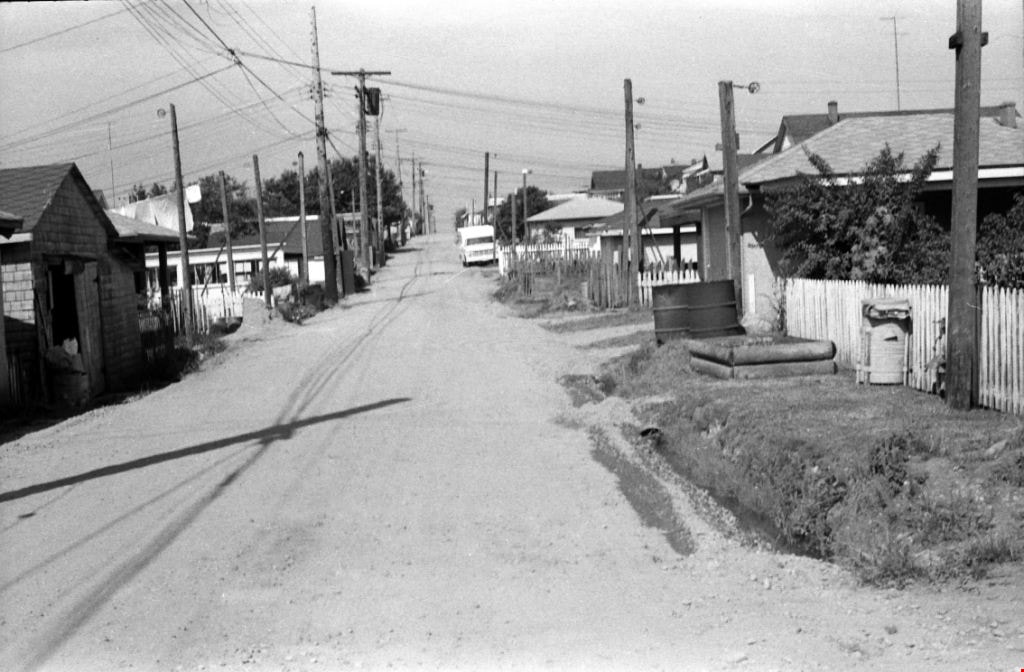
Looking west along the back lane
https://search.heritageburnaby.ca/link/archivedescription91859
- Repository
- City of Burnaby Archives
- Date
- [1978]
- Collection/Fonds
- Small family fonds
- Description Level
- Item
- Physical Description
- 1 photograph : col. ; 13 cm x 9 cm
- Scope and Content
- Photograph of the back lane between Dominion Street and Norfolk Street. The Roberts' house at 5538 Dominion Street is visible between the trees and a Volvo and VW bug are parked on the property. The lane was paved in February 1970.
- Repository
- City of Burnaby Archives
- Date
- [1978]
- Collection/Fonds
- Small family fonds
- Physical Description
- 1 photograph : col. ; 13 cm x 9 cm
- Description Level
- Item
- Record No.
- 620-040
- Access Restriction
- No restrictions
- Reproduction Restriction
- No reproduction permitted
- Accession Number
- 2017-01
- Scope and Content
- Photograph of the back lane between Dominion Street and Norfolk Street. The Roberts' house at 5538 Dominion Street is visible between the trees and a Volvo and VW bug are parked on the property. The lane was paved in February 1970.
- Media Type
- Photograph
- Notes
- Transcribed title
- Title transcribed from donor's notes
- Note in blue ink on verso of photograph reads: "P.3"
- Note in blue ink on verso of photograph reads: "Prob. 1978"
- Note in black ink on verso of photograph reads: "Looking forwards front of house from Back Lane/Driveway / Volvo VW bug"
- Note in blue ink on verso of photograph reads: "If red. [illegible] 1977 or 1978 / (until 1981?) when I got this Red Volvo after [illegible] / [illegible] in Dec 1985 [arrow] 2003"
- Street Address
- 3131 Douglas Road
- 5118 Douglas Road
- 5538 Dominion Street
- Historic Neighbourhood
- Burnaby Lake (Historic Neighbourhood)
- Planning Study Area
- Ardingley-Sprott Area
Images
![Looking west along the back lane, [1978] thumbnail](/media/hpo/_Data/_Archives_Images/_Unrestricted/600/620-040.jpg)
Looking west along the back lane
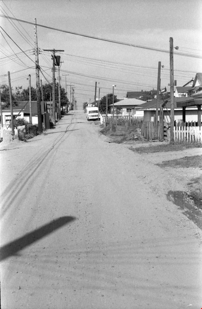
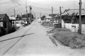
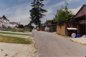
https://search.heritageburnaby.ca/link/archivedescription91860
- Repository
- City of Burnaby Archives
- Date
- June 1994
- Collection/Fonds
- Small family fonds
- Description Level
- Item
- Physical Description
- 1 photograph : col. copy print ; 10 cm x 15 cm
- Scope and Content
- Photograph of the back lane between Dominion Street and Norfolk Street, looking west. The fir tree in the centre of the photograph is one of many planted by John Roberts along the south property line of 5538 Dominion Street. The other trees were removed in 1982 when the Roberts' property was larg…
- Repository
- City of Burnaby Archives
- Date
- June 1994
- Collection/Fonds
- Small family fonds
- Physical Description
- 1 photograph : col. copy print ; 10 cm x 15 cm
- Description Level
- Item
- Record No.
- 620-041
- Access Restriction
- No restrictions
- Reproduction Restriction
- No reproduction permitted
- Accession Number
- 2017-01
- Scope and Content
- Photograph of the back lane between Dominion Street and Norfolk Street, looking west. The fir tree in the centre of the photograph is one of many planted by John Roberts along the south property line of 5538 Dominion Street. The other trees were removed in 1982 when the Roberts' property was largely cleared in order to relocate the house 100 feet west and subdivide the property into 33 foot lots.
- Subjects
- Geographic Features - Lanes
- Media Type
- Photograph
- Notes
- Transcribed title
- Title transcribed from donor's notes
- Note in blue ink on verso of photograph reads: "P.4"
- Note in blue ink on verso of photograph reads: "The Back lane behind 3131 Douglas Rd to 5496 etc Dominion St. / June 1994"
- 5118 Douglas Road renumbered to 3131 Douglas Road in 1958 and to 5538 Dominion Street in 1970 or 1971
- Street Address
- 3131 Douglas Road
- 5118 Douglas Road
- 5538 Dominion Street
- Historic Neighbourhood
- Burnaby Lake (Historic Neighbourhood)
- Planning Study Area
- Ardingley-Sprott Area
Images

Interview with Karen Morcke and Diane Hansen by Kathy Bossort October 9, 2015 - Track 6
https://search.heritageburnaby.ca/link/oralhistory568
- Repository
- City of Burnaby Archives
- Date Range
- 1995-2015
- Length
- 0:16:07
- Summary
- This portion of the interview is about Karen Morcke and Diane Hansen describing the ways in which people benefit from the Burnaby Mountain Conservation Area. They talk about the impact mountain biking has on the environment and on other park users, and on the problem of invasive plant species.
- Repository
- City of Burnaby Archives
- Summary
- This portion of the interview is about Karen Morcke and Diane Hansen describing the ways in which people benefit from the Burnaby Mountain Conservation Area. They talk about the impact mountain biking has on the environment and on other park users, and on the problem of invasive plant species.
- Date Range
- 1995-2015
- Length
- 0:16:07
- Geographic Access
- Burnaby Mountain Conservation Area
- Interviewer
- Bossort, Kathy
- Interview Date
- October 9, 2015
- Scope and Content
- Recording is of an interview with Karen Morcke and Diane Hansen conducted by Kathy Bossort. Karen Morcke and Diane Hansen were two of 23 participants interviewed as part of the Community Heritage Commission’s Burnaby Mountain Oral History Project. The interview is mainly about the history and activities of the Burnaby Mountain Preservation Society of which Karen Morcke and Diane Hansen were founding members, and the environmental and recreational value of the Burnaby Mountain Conservation Area. Karen Morcke also talks about walking the trails on Burnaby Mountain from 1968 to present and her involvement in other environmental groups.
- Biographical Notes
- Diane Hansen was born in Winnipeg in 1941, trained as a nurse in Toronto, and moved with her husband Ingolf Hansen to the Westridge Area in Burnaby in 1971, where Diane lived until 2010. Diane has one daughter Kristin. Karen Morcke was born in Germany in 1940, immigrating to Canada in 1968 to attend SFU. After completing her Masters degree in 1970 Karen was hired by SFU as a language instructor from which she retired in 1995. She has one son Erik and has lived almost continuously in North Burnaby since 1968. Both Diane Hansen and Karen Morcke have been active volunteers in local environmental groups and were founding members of the Burnaby Mountain Preservation Society, which formed about 1989 to lobby for a conservation area that integrated SFU land below the campus ring road with City of Burnaby parkland on Burnaby Mountain. Diane has also been active in wild bird rescue groups. Karen walked the trails on Burnaby Mountain to and from work, and began lobbying for protection of green space on Burnaby Mountain in the 1970s.
- Total Tracks
- 6
- Total Length
- 1:10:35
- Interviewee Name
- Morcke, Karen
- Hansen, H. Diane
- Interview Location
- Karen Morcke's home in Burnaby
- Interviewer Bio
- Kathy Bossort is a retired archivist living in Ladner, BC. She worked at the Delta Museum and Archives after graduating from SLAIS (UBC) in 2001 with Masters degrees in library science and archival studies. Kathy grew up in Calgary, Alberta, and, prior to this career change, she lived in the West Kootenays, earning her living as a cook for BC tourist lodges and work camps. She continues to be interested in oral histories as a way to fill the gaps in the written record and bring richer meaning to history.
- Collection/Fonds
- Community Heritage Commission Special Projects fonds
- Media Type
- Sound Recording
Audio Tracks
Track six of interview with Karen Morcke and Diane Hansen
Track six of interview with Karen Morcke and Diane Hansen
https://search.heritageburnaby.ca/media/hpo/_Data/_Archives_Oral_Histories/_Unrestricted/MSS196-003/MSS196-003_Track_6.mp3![Tree chopping guy, [1999] thumbnail](/media/hpo/_Data/_Archives_Images/_Unrestricted/535/535-3225.jpg?width=280)
Tree chopping guy
https://search.heritageburnaby.ca/link/archivedescription98147
- Repository
- City of Burnaby Archives
- Date
- [1999]
- Collection/Fonds
- Burnaby NewsLeader photograph collection
- Description Level
- Item
- Physical Description
- 1 photograph (tiff) : col.
- Scope and Content
- Photograph of an unidentified man, posing with a handsaw next a dead section of a large hedge on Parker Street.
- Repository
- City of Burnaby Archives
- Date
- [1999]
- Collection/Fonds
- Burnaby NewsLeader photograph collection
- Physical Description
- 1 photograph (tiff) : col.
- Description Level
- Item
- Record No.
- 535-3225
- Access Restriction
- No restrictions
- Reproduction Restriction
- No restrictions
- Accession Number
- 2018-12
- Scope and Content
- Photograph of an unidentified man, posing with a handsaw next a dead section of a large hedge on Parker Street.
- Media Type
- Photograph
- Notes
- Title based on original file name
- Collected by editorial for use in a June 1999 issue of the Burnaby NewsLeader
- Geographic Access
- Parker Street
- Planning Study Area
- Brentwood Area
Images
![Tree chopping guy, [1999] thumbnail](/media/hpo/_Data/_Archives_Images/_Unrestricted/535/535-3225.jpg)
Adolf Machel
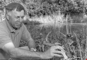
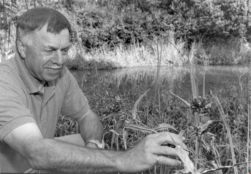
https://search.heritageburnaby.ca/link/archivedescription81182
- Repository
- City of Burnaby Archives
- Date
- August 30, 1998
- Collection/Fonds
- Burnaby NewsLeader photograph collection
- Description Level
- Item
- Physical Description
- 1 photograph : b&w ; 16 x 22.5 cm
- Scope and Content
- Photograph of Habitat engineer for Fisheries and Oceans Canada, Adolf Machel, examining plants in a man-made estuary in Burnaby.
- Repository
- City of Burnaby Archives
- Date
- August 30, 1998
- Collection/Fonds
- Burnaby NewsLeader photograph collection
- Physical Description
- 1 photograph : b&w ; 16 x 22.5 cm
- Description Level
- Item
- Record No.
- 535-1328
- Access Restriction
- No restrictions
- Reproduction Restriction
- No reproduction permitted
- Accession Number
- 2012-11
- Scope and Content
- Photograph of Habitat engineer for Fisheries and Oceans Canada, Adolf Machel, examining plants in a man-made estuary in Burnaby.
- Names
- Machel, Adolf
- Media Type
- Photograph
- Photographer
- Langdeau, Brian
- Notes
- Title based on contents of photograph
- Note in black ink on recto of photograph reads: "75% Bby p. 1 / 1780 - Bby - Brian"
- Trim marks and/or reproduction instructions on recto (scan is cropped)
Images

Clearing underbrush from the ravine
https://search.heritageburnaby.ca/link/archivedescription45327
- Repository
- City of Burnaby Archives
- Date
- 1975, published July 7, 1975
- Collection/Fonds
- Columbian Newspaper collection
- Description Level
- Item
- Physical Description
- 1 photograph : b&w ; 13 x 19 cm
- Scope and Content
- Photograph of a group of residents clearing underbrush from a ravine at Simon Fraser Village where women and children had been attacked in order to help prevent future crimes in that area.
- Repository
- City of Burnaby Archives
- Date
- 1975, published July 7, 1975
- Collection/Fonds
- Columbian Newspaper collection
- Physical Description
- 1 photograph : b&w ; 13 x 19 cm
- Description Level
- Item
- Record No.
- 480-222
- Access Restriction
- No restrictions
- Reproduction Restriction
- Reproduce for fair dealing purposes only
- Accession Number
- 2003-02
- Scope and Content
- Photograph of a group of residents clearing underbrush from a ravine at Simon Fraser Village where women and children had been attacked in order to help prevent future crimes in that area.
- Subjects
- Geographic Features - Rivers
- Plants
- Media Type
- Photograph
- Notes
- Title based on contents of photograph
- Newspaper clipping attached to verso of photograph reads: "Residents at Simon Fraser Village clear underbrush from ravine where women and children have been attacked."
- Historic Neighbourhood
- Burquitlam (Historic Neighbourhood)
- Planning Study Area
- Lyndhurst Area
Images
