
Interview with Alfred Bingham June 10, 1975 - Track 6
https://search.heritageburnaby.ca/link/oralhistory63
- Repository
- City of Burnaby Archives
- Date Range
- 1928-1929
- Length
- 0:09:46
- Summary
- This portion of the interview pertains to Alfred Bingham's employment just as the Depression hit. Alfred tells antecdotes, both amusing and disturbing, about working at a ranch out in Coquitlam.
- Repository
- City of Burnaby Archives
- Summary
- This portion of the interview pertains to Alfred Bingham's employment just as the Depression hit. Alfred tells antecdotes, both amusing and disturbing, about working at a ranch out in Coquitlam.
- Date Range
- 1928-1929
- Photo Info
- Alfred Bingham, April 20, 1947. Item no. 010-066
- Length
- 0:09:46
- Subjects
- Occupations
- Historic Neighbourhood
- British Columbia - Coquitlam
- Interviewer
- Bradbury, Dr. Bettina
- Interview Date
- June 10, 1975
- Scope and Content
- Recording is a taped interview with Alfred Bingham by SFU graduate student Bettina Bradbury June 10, 1975. Major themes discussed are: the Depression, Pioneers, and the Co-operative Movement. To view "Narrow By" terms for each track expand this description and see "Notes".
- Biographical Notes
- Alfred "Alf" Bingham was born in England in 1892 and moved to Canada in 1912. His first job in Canada was laying track for the Grand Trunk Pacific Railway (GTPR) from Edmonton to McBride in 1912. His second was in Vancouver at the Rat Portage Mill on False Creek, working on the Resaw machine. He quit after one week due to poor working conditions. After taking part in the 1919 Winnipeg General Strike as a delegate of the Retail and Mailorder Union (A.F.L.) on the Winnipeg Trades and Labour Council, Alfred moved to Burnaby where he and fellow Burnaby residents Angus McLean and Percy Little worked ten hour days to build a Shingle Mill on the edge of Burnaby Lake for Simpson & Giberson. George Green, carpenter and millwright (author of “The History of Burnaby”) also helped in the construction of the mill. Alfred built his own home from lumber cut from the mill in the Lochdale area on Sherlock Street between Curtis Street and Kitchener Street. On April 10, 1920 Alfred married Mary Jane “Ada” Reynolds. Alfred and Ada often took in foster children during their marriage. Due to her nursing experience, Ada was often called upon to deliver babies in the Burnaby area. Alfred and Ada Bingham were instrumental members of the Army of the Common Good, collecting vegetables and grains from growers in the area and even producing over 125 tons of vegetables from its own gardens to feed children and youth suffering from the lack of resources during the Depression years. The army was in operation for ten years and during that time the members organised the Credit Union movement of British Columbia and drew up the Credit Union act thorough the Vancouver Co-operative Council. They also started Co-Op stores and the Co-Op Wholesale Society. Alfred was also Secretary of the Burnaby Housing committee and in 1946 he became the Secretary of the North Burnaby Labour Progressive Party (LPP). Mary Jane “Ada” (Reynolds) Bingham died on August 9, 1969. Her husband Alfred died on April 29, 1979.
- Total Tracks
- 14
- Total Length
- 1:57:27
- Interviewee Name
- Bingham, Alfred "Alf"
- Interviewer Bio
- Bettina Bradbury teaches history and women's studies at York University. She is the author of Wife to Widow. Lives, Laws and Politics in Nineteenth-century Montreal. (Vancouver: University of British Columbia Press, June 2011), 520p; Working Families. Age, Gender and Daily Survival in Industrializing Montreal. (Toronto: Canadian Social History Series, McClelland and Stewart, 1993); (Republished Toronto: Oxford University Press, 1996) (3rd edition, Toronto: University of Toronto Press, 2007). These interviews were undertaken after she completed her MA at Simon Fraser University in 1975 with the support of an LIP grant.
- Collection/Fonds
- Burnaby Historical Society fonds
- Subseries
- Oral history subseries
- Media Type
- Sound Recording
- Web Notes
- Interview was digitized in 2010 allowing it to be accessible on Heritage Burnaby. The digitization project was initiated by the Community Heritage Commission with support from City of Burnaby Council and the BC History Digitization Program of the Irving K. Barber Learning Centre, University of British Columbia. It was recognized by the Heritage Society of BC with an award in 2012.
Images

Audio Tracks
Track six of interview with Alfred Bingham
Track six of interview with Alfred Bingham
https://search.heritageburnaby.ca/media/hpo/_Data/_Archives_Oral_Histories/_Unrestricted/100-13-20-1/100-13-20-1_Track_6.mp3
Alexandra Bridge in British Columbia
https://search.heritageburnaby.ca/link/archivedescription65748
- Repository
- City of Burnaby Archives
- Date
- 1936
- Collection/Fonds
- Burnaby Historical Society fonds
- Description Level
- Item
- Physical Description
- 1 photograph : b&w hand-tinted into col. ; 17.5 x 24.5 cm [sight] matted in frame 24.5 x 32 cm
- Scope and Content
- Photograph of the Alexandra Bridge in British Columbia. The Alexander Bridge crosses the Fraser Canyon, along the Cariboo Highway, two kilometres north of Spuzzum.
- Repository
- City of Burnaby Archives
- Date
- 1936
- Collection/Fonds
- Burnaby Historical Society fonds
- Subseries
- Ettinger family subseries
- Physical Description
- 1 photograph : b&w hand-tinted into col. ; 17.5 x 24.5 cm [sight] matted in frame 24.5 x 32 cm
- Description Level
- Item
- Record No.
- 428-007
- Access Restriction
- No restrictions
- Reproduction Restriction
- No known restrictions
- Accession Number
- BHS2002-03
- Scope and Content
- Photograph of the Alexandra Bridge in British Columbia. The Alexander Bridge crosses the Fraser Canyon, along the Cariboo Highway, two kilometres north of Spuzzum.
- Media Type
- Photograph
- Photographer
- Edmonds Studio
- Notes
- Title based on contents of photograph
- Note on verso of frame reads: "Spuzzum Bridge / Fraser Canyon"
- Note on recto of matte reads: "Edmonds Studio 1936"
Images


Alexandra Bridge in British Columbia
https://search.heritageburnaby.ca/link/archivedescription85920
- Repository
- City of Burnaby Archives
- Date
- 1933
- Collection/Fonds
- Burnaby Historical Society fonds
- Description Level
- Item
- Physical Description
- 1 photograph : sepia ; 5.5 x 10 cm
- Scope and Content
- Photograph of the Alexandra Bridge in British Columbia. The Alexander Bridge crosses the Fraser Canyon, along the Cariboo Highway, two kilometres north of Spuzzum.
- Repository
- City of Burnaby Archives
- Date
- 1933
- Collection/Fonds
- Burnaby Historical Society fonds
- Subseries
- Ettinger family subseries
- Physical Description
- 1 photograph : sepia ; 5.5 x 10 cm
- Description Level
- Item
- Record No.
- 428-008
- Access Restriction
- No restrictions
- Reproduction Restriction
- No known restrictions
- Accession Number
- BHS2002-03
- Scope and Content
- Photograph of the Alexandra Bridge in British Columbia. The Alexander Bridge crosses the Fraser Canyon, along the Cariboo Highway, two kilometres north of Spuzzum.
- Media Type
- Photograph
- Notes
- Title based on contents of photograph
- Note on verso of photograph reads: "Alexander [sic] Bridge / 1933"
Images

![British Columbia Electric Railway Company line car, [1930] (date of original), copied 1986 thumbnail](/media/hpo/_Data/_Archives_Images/_Unrestricted/204/204-373.jpg?width=280)
British Columbia Electric Railway Company line car
https://search.heritageburnaby.ca/link/archivedescription35515
- Repository
- City of Burnaby Archives
- Date
- [1930] (date of original), copied 1986
- Collection/Fonds
- Burnaby Historical Society fonds
- Description Level
- Item
- Physical Description
- 1 photograph : b&w ; 12.7 x 17.8 cm print
- Scope and Content
- Photograph of the L.6BCER, a British Columbia Electric Railway line car, used to repair overhead power lines along interurban tracks. Photographed near Jubilee Station, between Imperial and Nelson.
- Repository
- City of Burnaby Archives
- Date
- [1930] (date of original), copied 1986
- Collection/Fonds
- Burnaby Historical Society fonds
- Subseries
- Pioneer Tales subseries
- Physical Description
- 1 photograph : b&w ; 12.7 x 17.8 cm print
- Description Level
- Item
- Record No.
- 204-373
- Access Restriction
- No restrictions
- Reproduction Restriction
- No known restrictions
- Accession Number
- BHS1988-03
- Scope and Content
- Photograph of the L.6BCER, a British Columbia Electric Railway line car, used to repair overhead power lines along interurban tracks. Photographed near Jubilee Station, between Imperial and Nelson.
- Subjects
- Transportation - Electric Railroads
- Maintenance Tools and Equipment
- Occupations - Railroad Labourers
- Media Type
- Photograph
- Notes
- Title based on contents of photograph
- Geographic Access
- Central Park Interurban line
- Historic Neighbourhood
- Central Park (Historic Neighbourhood)
- Planning Study Area
- Maywood Area
Images
![British Columbia Electric Railway Company line car, [1930] (date of original), copied 1986 thumbnail](/media/hpo/_Data/_Archives_Images/_Unrestricted/204/204-373.jpg)
![British Columbia Electric Railway Company trams no. 1225 and 1230, [1939] (date of original) thumbnail](/media/hpo/_Data/_BVM_Images/2000/200300240001.jpg?width=280)
British Columbia Electric Railway Company trams no. 1225 and 1230
https://search.heritageburnaby.ca/link/museumdescription1657
- Repository
- Burnaby Village Museum
- Date
- [1939] (date of original)
- Collection/Fonds
- Burnaby Village Museum Photograph collection
- Description Level
- Item
- Physical Description
- 1 photograph : b&w photocopy ; 16.5 x 27.5 cm
- Scope and Content
- Photograph of British Columbia Electric Railway Company trams no. 1225 and 1230 linked together and going through an intersection. The destination board at the front reads, "BURNABY LK", indicating it is the Burnaby Lake line. There are street signs on the lamppost on the street corner at the left …
- Repository
- Burnaby Village Museum
- Collection/Fonds
- Burnaby Village Museum Photograph collection
- Description Level
- Item
- Physical Description
- 1 photograph : b&w photocopy ; 16.5 x 27.5 cm
- Scope and Content
- Photograph of British Columbia Electric Railway Company trams no. 1225 and 1230 linked together and going through an intersection. The destination board at the front reads, "BURNABY LK", indicating it is the Burnaby Lake line. There are street signs on the lamppost on the street corner at the left but only the crossing street sign, "5th AVE" is visible. There are hand painted advertisements for "COAL/ SAWDUST/ WOOD" and "FUEL" in the background.
- Subjects
- Transportation - Electric Railroads
- Geographic Access
- Burnaby Lake Interurban line
- Accession Code
- BV003.24.1
- Access Restriction
- Restricted access
- Reproduction Restriction
- May be restricted by third party rights
- Date
- [1939] (date of original)
- Media Type
- Photograph
- Scan Resolution
- 600
- Scan Date
- 09-Jun-09
- Scale
- 100
- Notes
- Title based on contents of photograph
- Copy print is a digital reproduction of an original photograph
Images
![British Columbia Electric Railway Company trams no. 1225 and 1230, [1939] (date of original) thumbnail](/media/hpo/_Data/_BVM_Images/2000/200300240001.jpg)
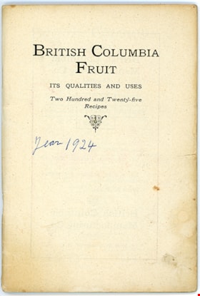
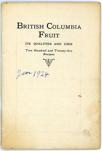
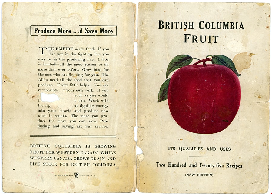
British Columbia fruit : its qualities and uses
https://search.heritageburnaby.ca/link/museumlibrary3822
- Repository
- Burnaby Village Museum
- Edition
- New ed.
- 1918 ed.
- Publication Date
- 1918
- Call Number
- 641.64 BRI
- Repository
- Burnaby Village Museum
- Collection
- Special Collection
- Material Type
- Textual Record
- Accession Code
- BV004.2.2
- Call Number
- 641.64 BRI
- Edition
- New ed.
- 1918 ed.
- Place of Publication
- Vancouver
- Publisher
- British Columbia Fruit Growers' Association
- Publication Date
- 1918
- Printer
- The Sun Job Presses
- Physical Description
- 80 p. : ill. : 18 cm.
- Inscription
- "Year 1924" [Handwritten in blue ink on title page]
- Library Subject (LOC)
- Recipes
- Cooking--British Columbia
- Cookbooks--1910-1919
- Fruit
- Notes
- "Two Hundred and Twenty-five Recipes" -- Title page
Images
![British Columbia Institute of Technology radiation therapy lab, [2002] thumbnail](/media/hpo/_Data/_Archives_Images/_Unrestricted/535/535-3028.jpg?width=280)
British Columbia Institute of Technology radiation therapy lab
https://search.heritageburnaby.ca/link/archivedescription97754
- Repository
- City of Burnaby Archives
- Date
- [2002]
- Collection/Fonds
- Burnaby NewsLeader photograph collection
- Description Level
- Item
- Physical Description
- 1 photograph (tiff) : b&w
- Scope and Content
- Photograph of student Trina La Berge and instructor Jerry Cannon posing next to a row of desktop computers displaying images of scans in BCIT's radiation therapy lab.
- Repository
- City of Burnaby Archives
- Date
- [2002]
- Collection/Fonds
- Burnaby NewsLeader photograph collection
- Physical Description
- 1 photograph (tiff) : b&w
- Description Level
- Item
- Record No.
- 535-3028
- Access Restriction
- No restrictions
- Reproduction Restriction
- No restrictions
- Accession Number
- 2018-12
- Scope and Content
- Photograph of student Trina La Berge and instructor Jerry Cannon posing next to a row of desktop computers displaying images of scans in BCIT's radiation therapy lab.
- Subjects
- Buildings - Schools - Universities and Colleges
- Medical and Psychological Tools and Equipment
- Science and Technology Tools and Equipment
- Media Type
- Photograph
- Photographer
- Joseph, Boaz
- Notes
- Title based on caption
- Collected by editorial for use in a December 2002 issue of the Burnaby NewsLeader
- Caption from metadata: "Student Trina La Berge and instructor Jerry Cannon at BCIT's radiation therapy lab."
- Geographic Access
- Willingdon Avenue
- Street Address
- 3700 Willingdon Avenue
- Historic Neighbourhood
- Burnaby Lake (Historic Neighbourhood)
- Planning Study Area
- Douglas-Gilpin Area
Images
![British Columbia Institute of Technology radiation therapy lab, [2002] thumbnail](/media/hpo/_Data/_Archives_Images/_Unrestricted/535/535-3028.jpg)
![British Columbia School of Pharmacy and Science, [1920] thumbnail](/media/hpo/_Data/_BVM_Images/1985/198800680003.jpg?width=280)
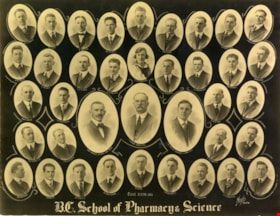
British Columbia School of Pharmacy and Science
https://search.heritageburnaby.ca/link/museumdescription112
- Repository
- Burnaby Village Museum
- Date
- [1920]
- Collection/Fonds
- Burnaby Village Museum Photograph collection
- Description Level
- Item
- Physical Description
- 1 photograph : sepia composite ; 26.5 x 34 cm
- Scope and Content
- Composite photograph of students of the British Columbia School of Pharmacy and Science. Names are listed beneath each of the oval photographs (grouped in four rows). In the top row (from left) are; F. McIntosh "Mat. Med + Botany", O.P. Harrison, H.E. Falk, I.M. Wilson, E.G. McDonagh, G.H. Goodard,…
- Repository
- Burnaby Village Museum
- Collection/Fonds
- Burnaby Village Museum Photograph collection
- Description Level
- Item
- Physical Description
- 1 photograph : sepia composite ; 26.5 x 34 cm
- Scope and Content
- Composite photograph of students of the British Columbia School of Pharmacy and Science. Names are listed beneath each of the oval photographs (grouped in four rows). In the top row (from left) are; F. McIntosh "Mat. Med + Botany", O.P. Harrison, H.E. Falk, I.M. Wilson, E.G. McDonagh, G.H. Goodard, P.J. Bain "Principal". Second row; A. McLennan, C.C. Denny, W.G. Smith, L.P. Landry, E.J. Harrison, B.M. Adams, H.D. Hipwell, and A.W. Barr. Third row; H.L. Fee, C.D. Houghland, A.R. Bush, R.W. Smith, W. James, B.A. McKeown, W.K. Corning, S.R. Davies and G.W.H. Stearman. Bottom row; G. Baillie "Pharmacy + Physics", A.H. Blumenauer, D.J. Bailey, J.Q. Adams, G.P. Doran and S. Foulds "Chemistry".
- Subjects
- Occupations - Teachers
- Names
- British Columbia School of Pharmacy and Science
- McIntosh, F.
- Harrison, O. P.
- Falk, H. E.
- Wilson, I. M.
- McDonagh, E. G.
- Goodard, G. H.
- Bain, P. J.
- McLennan, A.
- Denny, C. C.
- Smith, W.G.
- Landry, L. P.
- Harrison, E. J.
- Adams, B. M.
- Hipwell, H. D.
- Barr, A.W.
- Fee, H. L.
- Houghland, C. D.
- Bush, A. R.
- Smith, R.W.
- James, W.
- McKeown, B. A.
- Corning, W. K.
- Davies, S. R.
- Stearman, G. W. H.
- Baillie, G.
- Blumenauer, A. H.
- Bailey, D. J.
- Adams, J. Q.
- Doran, G. P.
- Foulds, S.
- Henderson, Gibb Gilmour
- University of British Columbia
- Accession Code
- BV988.68.3
- Access Restriction
- No restrictions
- Reproduction Restriction
- No known restrictions
- Date
- [1920]
- Media Type
- Photograph
- Scan Resolution
- 600
- Scan Date
- 1/11/2010
- Scale
- 100
- Photographer
- Weeks, Arthur Benson
- Notes
- Title based on contents of photograph
- Continuation of title: "... - Second Term 1920"
Images
![British Columbia School of Pharmacy and Science, [1920] thumbnail](/media/hpo/_Data/_BVM_Images/1985/198800680003.jpg)
British Columbia School of Pharmacy and Science
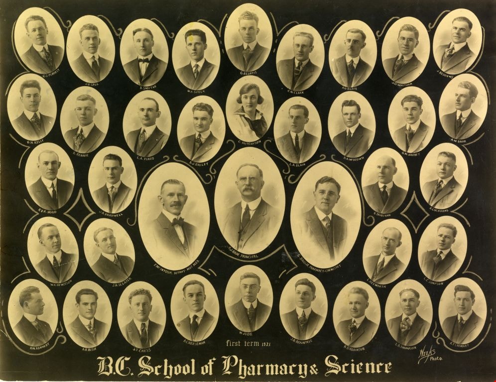
https://search.heritageburnaby.ca/link/museumdescription113
- Repository
- Burnaby Village Museum
- Date
- 1921
- Collection/Fonds
- Burnaby Village Museum Photograph collection
- Description Level
- Item
- Physical Description
- 1 photograph : sepia composite ; 26.5 x 34 cm
- Scope and Content
- Composite photograph of students of the British Columbia School of Pharmacy and Science. Names are listed beneath each of the oval photographs (grouped in five rows). In the top row (from left) are; C.S. Forrest, J.G. Saul, S. Smythe, W.A. Speck, G.E. Curtis, C.N. Clark, A.O. Blain, J.D. Witham and…
- Repository
- Burnaby Village Museum
- Collection/Fonds
- Burnaby Village Museum Photograph collection
- Description Level
- Item
- Physical Description
- 1 photograph : sepia composite ; 26.5 x 34 cm
- Scope and Content
- Composite photograph of students of the British Columbia School of Pharmacy and Science. Names are listed beneath each of the oval photographs (grouped in five rows). In the top row (from left) are; C.S. Forrest, J.G. Saul, S. Smythe, W.A. Speck, G.E. Curtis, C.N. Clark, A.O. Blain, J.D. Witham and J. Beddows. In the second row are; G.H. Kelly, R. Rennie, L.A. Pineo, D.J. Bailey, C. Hutchinson, L.A. Blain, B.A. McKeown, G.M. Harvey and A.W. Barr. In the third row are; R.V.R. Hood, J. R. Bradwell, G. Donovan and R. Cochrane. In the centre (in larger ovals) are; F. McIntosh "Mat. Med + Botany", P. J. Bain "Principal" and G. Baillie "Pharmacy + Physics." In the fourth row are; W.R. Hewitson, J.H. Sclater, L. Heyworth and L.C. Simpson. In the bottom row are; A.W. Kennedy, A.R. Bush, S.T. Chess, A. Cheeseman, W. Jude, J.B. Rountree, H.D. Robinson, L.B. Thompson and K.T. Stewart.
- Subjects
- Occupations - Teachers
- Names
- British Columbia School of Pharmacy and Science
- Forrest, C.S.
- Saul, J.G.
- Smythe, S.
- Speck, W.A.
- Curtis, G.E.
- Clark, C.N.
- Blain, A.O.
- Witham, J.D.
- Beddows, J.
- Kelly, G.H.
- Rennie, R.
- Pineo, L.A..
- Bailey, D. J.
- Hutchinson, C.
- Blain, L.A.
- McKeown, B. A.
- Harvey, G.M.
- Barr, A.W.
- Hood, R.V.R.
- Bradwell, J.R.
- Donovan, G.
- Cochrane, R.
- McIntosh, F.
- Bain, P. J.
- Baillie, G.
- Hewitson, W.R.
- Sclater, J.H.
- Heyworth, L.
- Simpson, L.C.
- Kennedy, A.W.
- Bush, A. R.
- Chess, S.T.
- Cheeseman, A.
- Jude, W.
- Rountree, J.B.
- Robinson, H.D.
- Thompson, L.B.
- Stewart, K.T.
- Henderson, Gibb Gilmour
- University of British Columbia
- Accession Code
- BV988.68.4
- Access Restriction
- No restrictions
- Reproduction Restriction
- No known restrictions
- Date
- 1921
- Media Type
- Photograph
- Scan Resolution
- 600
- Scan Date
- 1/8/2010
- Scale
- 100
- Photographer
- Weeks, Arthur Benson
- Notes
- Continuation of title: "... first term 1921"
Images
![British Columbia Society of Model Engineers, [2000] thumbnail](/media/hpo/_Data/_Archives_Images/_Unrestricted/535/535-2635.jpg?width=280)
British Columbia Society of Model Engineers
https://search.heritageburnaby.ca/link/archivedescription97108
- Repository
- City of Burnaby Archives
- Date
- [2000]
- Collection/Fonds
- Burnaby NewsLeader photograph collection
- Description Level
- Item
- Physical Description
- 1 photograph (tiff) : col.
- Scope and Content
- Photograph of Paul Roy, of the British Columbia Society of Model Engineers, polishing a Model M420 train engine at the Burnaby Central Railway at Confederation Park, ahead of a meeting of the International Brotherhood of Live Steamers.
- Repository
- City of Burnaby Archives
- Date
- [2000]
- Collection/Fonds
- Burnaby NewsLeader photograph collection
- Physical Description
- 1 photograph (tiff) : col.
- Description Level
- Item
- Record No.
- 535-2635
- Access Restriction
- No restrictions
- Reproduction Restriction
- No restrictions
- Accession Number
- 2018-12
- Scope and Content
- Photograph of Paul Roy, of the British Columbia Society of Model Engineers, polishing a Model M420 train engine at the Burnaby Central Railway at Confederation Park, ahead of a meeting of the International Brotherhood of Live Steamers.
- Media Type
- Photograph
- Photographer
- Bartel, Mario
- Notes
- Title based on caption
- Collected by editorial for use in a July 2000 issue of the Burnaby NewsLeader
- Caption from metadata: "Paul Roy makes sure his wife's Model M420 train engine is looking its best as the British Columbia Society of Model Engineers prepare to host a meeting of the International Brotherhood of Live Steamers, August 11-14. More than 500 engineers from as far away as Australia, New Zealand, England, Germany and all across the United States and Canada will gather at the park to swap stories and drive their trains."
- Geographic Access
- Confederation Park
- Willingdon Avenue
- Street Address
- 250 Willingdon Avenue
- Historic Neighbourhood
- Capitol Hill (Historic Neighbourhood)
- Planning Study Area
- Capitol Hill Area
Images
![British Columbia Society of Model Engineers, [2000] thumbnail](/media/hpo/_Data/_Archives_Images/_Unrestricted/535/535-2635.jpg)

Brown's guide to British Columbia
https://search.heritageburnaby.ca/link/museumlibrary4891
- Repository
- Burnaby Village Museum
- Collection
- Special Collection
- Material Type
- Textual Record
- Accession Code
- HV975.15.13
- Call Number
- 317.1 BRO
- Author
- Brown, Conway
- Place of Publication
- Ottawa
- Publisher
- Conway Brown
- Publication Date
- 1934
- Physical Description
- 112 p. : ill. (maps) : 17 cm.
- Library Subject (LOC)
- Guidebooks
- Canada, Western
- British Columbia
- British Columbia--Maps
- British Columbia--Politics and government
- Subjects
- Documentary Artifacts
- Documentary Artifacts - Booklets
- Elections
- Geographic Features - Districts - Electoral Districts
- Notes
- Includes index.
- "This issue contains federal electoral map of B.C. showing boundaries of new ridings clearly, so that every riding is easily distinguished." -- Cover
Images


Burnaby British Columbia : reference and year book 1931
https://search.heritageburnaby.ca/link/museumlibrary4882
- Repository
- Burnaby Village Museum
- Collection
- Special Collection
- Material Type
- Textual Record
- Accession Code
- HV978.48.11
- Call Number
- 317.133 BUR Copy 1
- Place of Publication
- Vancouver
- Publisher
- Burnaby Broadcast
- Publication Date
- 1931
- Physical Description
- 42 p. : ill. : 31 cm.
- Library Subject (LOC)
- Burnaby (B.C.)--Statistics
- Burnaby (B.C.)--History
- Subjects
- Documentary Artifacts
- Documentary Artifacts - Booklets
- Advertising Medium
- Government
- Government - Local Government
- Organizations
- Organizations - Girls' Societies and Clubs
- Notes
- Copy 1 of 2
Images


![Copy of Official British Columbia Road Maps, [193-] thumbnail](/media/hpo/_Data/_BVM_Cartographic_Material/1972/1972_0179_0001_001.jpg?width=280)
Copy of Official British Columbia Road Maps
https://search.heritageburnaby.ca/link/museumdescription18945
- Repository
- Burnaby Village Museum
- Date
- [193-]
- Collection/Fonds
- Burnaby Village Museum Map collection
- Physical Description
- 1 map : lithographic print on sheet ; 43 x 56 cm folded to 22 x 11 cm
- Scope and Content
- Item consists of Road maps of British Columbia presented by Union Oil Company of Canada Limited. Includes seventeen maps printed on both sides of sheet. One side of sheet includes ten separate road maps titled "Cariboo"; "Chilcotin Plateau"; "150 Mile House to Prince George"; "Prince George - Burns…
- Repository
- Burnaby Village Museum
- Collection/Fonds
- Burnaby Village Museum Map collection
- Physical Description
- 1 map : lithographic print on sheet ; 43 x 56 cm folded to 22 x 11 cm
- Material Details
- Scale not defined
- Scope and Content
- Item consists of Road maps of British Columbia presented by Union Oil Company of Canada Limited. Includes seventeen maps printed on both sides of sheet. One side of sheet includes ten separate road maps titled "Cariboo"; "Chilcotin Plateau"; "150 Mile House to Prince George"; "Prince George - Burns Lake"; "Burns Lake - Hazelton"; "Similkameen - Nicola"; "Salmon Arm to Revelstoke"; "Ashcroft to Salmon Arm / Kamloops to Vernon"; "Okanagan Valley"; "Boundary District". Other side of sheet includes seven road maps titled "Vancouver Island"; "Vancouver to Yale"' "Fraser Canyon Section Cariboo Road"; "Lytton to 150 Mile House"; "Arrow and Kootenay Lakes"; "The Kootenays"; "Columbia Valley". When folded, cover of maps reads "COPY OF / OFFICIAL / BRITISH COLUMBIA / ROAD-MAPS" / Presented by / UNION OIL / COMPANY / of Canada Ltd."; verso of cover includes advertisement for Union Motor oil "MOTORITE"; inside cover includes advertisement for Union Gasoline with title reading "See Canada's Evergreen Playground".
- Responsibility
- Union Oil Company of Canada Limited
- Accession Code
- HV972.179.1
- Access Restriction
- No restrictions
- Reproduction Restriction
- No known restrictions
- Date
- [193-]
- Media Type
- Cartographic Material
- Scan Resolution
- 600
- Scan Date
- 2023-08-17
- Notes
- Title based on contents of map
Images
![Copy of Official British Columbia Road Maps, [193-] thumbnail](/media/hpo/_Data/_BVM_Cartographic_Material/1972/1972_0179_0001_001.jpg)

![Flood in British Columbia, [193-?] thumbnail](/media/hpo/_Data/_BVM_Images/2013/2013_0012_0116_001.jpg?width=280)
Flood in British Columbia
https://search.heritageburnaby.ca/link/museumdescription3757
- Repository
- Burnaby Village Museum
- Date
- [193-?]
- Collection/Fonds
- Harold Edward Winch collection
- Description Level
- Item
- Physical Description
- 1 photograph : sepia ; 6.8 x 11.2 cm
- Scope and Content
- Item is a photograph of flooded streets of an unidentified British Columbia town.
- Repository
- Burnaby Village Museum
- Collection/Fonds
- Harold Edward Winch collection
- Description Level
- Item
- Physical Description
- 1 photograph : sepia ; 6.8 x 11.2 cm
- Scope and Content
- Item is a photograph of flooded streets of an unidentified British Columbia town.
- Subjects
- Natural Phenomena - Floods
- Accession Code
- BV013.12.116
- Date
- [193-?]
- Media Type
- Photograph
- Notes
- Title based on contents of photograph
- Photograph is a part of original scrapbook Item BV013.12.11
Images
![Flood in British Columbia, [193-?] thumbnail](/media/hpo/_Data/_BVM_Images/2013/2013_0012_0116_001.jpg)
![Flood waters in British Columbia, [193-?] thumbnail](/media/hpo/_Data/_BVM_Images/2013/2013_0012_0117_001.jpg?width=280)
Flood waters in British Columbia
https://search.heritageburnaby.ca/link/museumdescription3758
- Repository
- Burnaby Village Museum
- Date
- [193-?]
- Collection/Fonds
- Harold Edward Winch collection
- Description Level
- Item
- Physical Description
- 1 photograph : b&w ; 7 x 11.5 cm
- Scope and Content
- Item is a photograph of flooding in an unidentified British Columbia town.
- Repository
- Burnaby Village Museum
- Collection/Fonds
- Harold Edward Winch collection
- Description Level
- Item
- Physical Description
- 1 photograph : b&w ; 7 x 11.5 cm
- Scope and Content
- Item is a photograph of flooding in an unidentified British Columbia town.
- Subjects
- Natural Phenomena - Floods
- Accession Code
- BV013.12.117
- Date
- [193-?]
- Media Type
- Photograph
- Notes
- Title based on contents of photograph
- Photograph is a part of original scrapbook Item BV013.12.11
Images
![Flood waters in British Columbia, [193-?] thumbnail](/media/hpo/_Data/_BVM_Images/2013/2013_0012_0117_001.jpg)
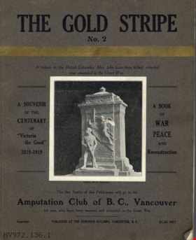
The gold stripe no. 2 : a tribute to the British Columbia men who have been killed, crippled and wounded in the Great War
https://search.heritageburnaby.ca/link/museumlibrary4910
- Repository
- Burnaby Village Museum
- Collection
- Special Collection
- Material Type
- Book
- Accession Code
- HV972.136.6
- Call Number
- 940.46771 GOL
- Place of Publication
- Vancouver
- Publisher
- [s.n.]
- Publication Date
- 1919
- Printer
- Pacific Printers
- Physical Description
- 160, xxviii : ill. ; 30 cm.
- Library Subject (LOC)
- World War, 1914-1918--Literary collections
- World War, 1914-1918--Personal narratives, Canadian
- World War, 1914-1918--Registers of dead--British Columbia
- Veterans, Disabled--British Columbia
- World War, 1914-1918--Canada--Registers
- Notes
- "A book of war, peace, and reconstruction" -- Title page
- "Published for the benefit of The Amputation Club of B.C. in May 1919, the centenary of 'Victoria the Good'" -- Title page
- "A souvenir of the centenary of 'Victoria the Good' 1819-1919" -- Cover
- "The net profits of this publication will go to the Amputation Club of B.C., Vancouver for men who have been maimed and wounded in the Great War" -- Cover
- Includes index.
Images


![Highways map of British Columbia, Alberta and adjacent states, [1930] thumbnail](/media/hpo/_Data/_BVM_Cartographic_Material/1977/1977_0037_0187_001.jpg?width=280)
Highways map of British Columbia, Alberta and adjacent states
https://search.heritageburnaby.ca/link/museumdescription9668
- Repository
- Burnaby Village Museum
- Date
- [1930]
- Collection/Fonds
- Burnaby Village Museum Map collection
- Description Level
- Item
- Physical Description
- 1 map : col. lithographic print ; both sides ; 89.5 x 58 cm, folded to 11.5 x 20 cm
- Scope and Content
- Double sided road map published by Imperial Oil, Ltd. and featuring the main travelled highway routes of British Columbia, Alberta and the Northwestern-most states of the United States of America. The map is a colour lithograph. The main map is green, with the highways highlighted in red. The litho…
- Repository
- Burnaby Village Museum
- Collection/Fonds
- Burnaby Village Museum Map collection
- Description Level
- Item
- Physical Description
- 1 map : col. lithographic print ; both sides ; 89.5 x 58 cm, folded to 11.5 x 20 cm
- Material Details
- Scale 1 inch = 20 miles
- A.R. THOMSON / CHIEF CARTOGRAPHER
- Scope and Content
- Double sided road map published by Imperial Oil, Ltd. and featuring the main travelled highway routes of British Columbia, Alberta and the Northwestern-most states of the United States of America. The map is a colour lithograph. The main map is green, with the highways highlighted in red. The lithograph was created in Canada by Rolph Clark Stone Ltd in Toronto. The opposite side of the map features inset maps of the following: the Trans-Canada Highway, the highway between Prince Rupert and Prince George, the highway through the Canadian Rockies, and the highway through the Peace River District. Small city plan maps of highways through major cities, as well as advertisements for Imperial Oil products, are also found on the opposite side of the main map. This map is one of four produced by Imperial Oil that covered the most populated areas of Canada from coast to coast and paralleled Imperial Oil's distribution service.
- Creator
- Thomson, A.R.
- Publisher
- Imperial Oil Limited
- Accession Code
- HV977.37.187
- Access Restriction
- No restrictions
- Reproduction Restriction
- No known restrictions
- Date
- [1930]
- Media Type
- Cartographic Material
- Scan Resolution
- 600
- Scan Date
- 2023-11-10
- Notes
- Title based on content of map
Zoomable Images
![Highways map of British Columbia, Alberta and adjacent states, [1930] thumbnail](/media/hpo/_Data/_BVM_Cartographic_Material/1977/1977_0037_0187_003_seadragon/1977_0037_0187_003.jpg?w=280)

![Image of British Columbia Music Festival Certificate, [1926] (date of original), copied [2016] thumbnail](/media/hpo/_Data/_BVM_Images/2016/201600430009_001.jpg?width=280)
Image of British Columbia Music Festival Certificate
https://search.heritageburnaby.ca/link/museumdescription4108
- Repository
- Burnaby Village Museum
- Date
- [1926] (date of original), copied [2016]
- Collection/Fonds
- Esther Love Stanley fonds
- Description Level
- Item
- Physical Description
- 1 photograph (tiff)
- Scope and Content
- Copy scan of a certificate from the British Columbia Musical Festival. "This is to Certify that The Vancouver Scottish Orchestra / (Conductor, Thomas Shankie) / has been awarded First place in the competition for / Orchestras - Open - Holding the 'Gold Range' Challenge / Cup for 1926 / in the Briti…
- Repository
- Burnaby Village Museum
- Collection/Fonds
- Esther Love Stanley fonds
- Description Level
- Item
- Physical Description
- 1 photograph (tiff)
- Scope and Content
- Copy scan of a certificate from the British Columbia Musical Festival. "This is to Certify that The Vancouver Scottish Orchestra / (Conductor, Thomas Shankie) / has been awarded First place in the competition for / Orchestras - Open - Holding the 'Gold Range' Challenge / Cup for 1926 / in the British Columbia Musical Competition Festival, 1926."
- Subjects
- Documentary Artifacts - Certificates
- Accession Code
- BV016.43.9
- Access Restriction
- No restrictions
- Reproduction Restriction
- May be restricted by third party rights
- Date
- [1926] (date of original), copied [2016]
- Media Type
- Photograph
- Notes
- Title based on contents of photograph.
- Image is from a binder of family history. Binder 1, orange cover "Old Stanley Family Photo / Old Shankie Family Photos / War Photos - Echo Photos".
- Digital image created from orginal photograph by donor
Images
![Image of British Columbia Music Festival Certificate, [1926] (date of original), copied [2016] thumbnail](/media/hpo/_Data/_BVM_Images/2016/201600430009_001.jpg)
![Interior of British Columbia, [191-] thumbnail](/media/hpo/_Data/_BVM_Images/1987/1987_0049_0002_001.jpg?width=280)
Interior of British Columbia
https://search.heritageburnaby.ca/link/museumdescription140
- Repository
- Burnaby Village Museum
- Date
- [191-]
- Collection/Fonds
- Burnaby Village Museum Photograph collection
- Description Level
- Item
- Physical Description
- 1 photograph : b&w ; 7.5 x 11 cm
- Scope and Content
- Photograph of the landscape in the interior of British Columbia. An unidentified lake is surrounded by sage brush in a hilly area.
- Repository
- Burnaby Village Museum
- Collection/Fonds
- Burnaby Village Museum Photograph collection
- Description Level
- Item
- Physical Description
- 1 photograph : b&w ; 7.5 x 11 cm
- Scope and Content
- Photograph of the landscape in the interior of British Columbia. An unidentified lake is surrounded by sage brush in a hilly area.
- History
- Envelope from donor suggests that the image was taken with a Cameo camera.
- Accession Code
- BV987.49.2
- Access Restriction
- No restrictions
- Reproduction Restriction
- No known restrictions
- Date
- [191-]
- Media Type
- Photograph
- Related Material
- The photograph was printed from negative BV987.49.5, and taken with camera BV987.49.1
- Scan Resolution
- 600
- Scan Date
- 2024-04-02
- Notes
- Title based on contents of photograph
- Note written on verso of photograph reads: "Interior BC"
- Lightly printed on verso of photographic paper is the name "velox" signifying Kodak velox paper from [191-]
Images
![Interior of British Columbia, [191-] thumbnail](/media/hpo/_Data/_BVM_Images/1987/1987_0049_0002_001.jpg)

Central Park Entrance Gate
https://search.heritageburnaby.ca/link/landmark544
- Repository
- Burnaby Heritage Planning
- Description
- The Central Park Entrance Gate is the ceremonial entrance to Burnaby’s historic Central Park from Kingsway, and consists of two massive stone pillars, approximately 7.5 metres high and 1.8 metres square, adjacent gate posts and a low flanking stone wall that curves into the park to the east.
- Associated Dates
- 1913
- Formal Recognition
- Heritage Designation, Community Heritage Register
- Street View URL
- Google Maps Street View
- Repository
- Burnaby Heritage Planning
- Geographic Access
- Imperial Street
- Associated Dates
- 1913
- Formal Recognition
- Heritage Designation, Community Heritage Register
- Enactment Type
- Bylaw No. 9807
- Enactment Date
- 23/11/1992
- Description
- The Central Park Entrance Gate is the ceremonial entrance to Burnaby’s historic Central Park from Kingsway, and consists of two massive stone pillars, approximately 7.5 metres high and 1.8 metres square, adjacent gate posts and a low flanking stone wall that curves into the park to the east.
- Heritage Value
- The Central Park Entrance Gate is significant as a ceremonial entry to a major park, for its connection with the early history of the British Columbia Electric Railway (BCER) and as an important design by an accomplished British Columbian architect. When the original interurban line between Vancouver and New Westminster was constructed in 1891, one of the first stations was located where the tramway crossed the Vancouver-Westminster Road (now Kingsway) within the newly-created Central Park. The interurban line ran through the park on a diagonal right-of-way (the current SkyTrain line, opened in 1986, follows this original alignment). In 1912 an agreement was reached between the successor interurban company, the BCER, and the Central Park Provincial Park Board, to deed additional land for an expanded right-of-way through the Park in exchange for improvements that included the construction of an ornamental stone wall and gate with an iron arch, with an illuminated 'Central Park' sign, adjacent to the interurban station on Kingsway. This was an early and rare example of an electric sign used for a public recreation facility. The Gate is also significant as a surviving early design by Robert Lyon (1879-1963), an Edinburgh-born and trained immigrant who was one of the most accomplished of British Columbia's early architects. After he moved to Vancouver, he was employed by the BCER from 1911 until 1918, and worked on a broad range of projects including some of the grandest and most innovative local industrial structures of the time. The arch was built by the Westminster Ironworks Company, one of the leading firms of its kind in Western Canada, operated by John Reid of New Westminster. The Gate was completed in 1914; in 1968 the decorative ironwork was removed due to corrosion and placed in storage.
- Defining Elements
- Key elements that define the heritage character of the Central Park Entrance Gate include its: - two subtly tapered massive stone pillars, which rise in stages from a larger base to a shaft with random coursed multi-coloured granite with roughly formed grey granite quoins, to a top formed of finely finished grey granite blocks with a coved and bracketed cap - adjacent gate posts with monolithic pyramidal granite caps - low flanking stone wall that curves into the park to the east, constructed of random coursed multi-coloured granite with a river rock triangular cap
- Historic Neighbourhood
- Central Park (Historic Neighbourhood)
- Planning Study Area
- Maywood Area
- Architect
- Robert Lyon
- Builder
- John Reid
- Westminster Iron Works Co.
- Function
- Primary Current--Park Fixture
- Primary Historic--Park Fixture
- Community
- Burnaby
- Cadastral Identifier
- P.I.D. No. 017-767-172 Legal Description: Block B of Lot 2 Except Firstly: Part on Plan 8669 and Secondly: Part on Plan LMP4689 District Lot 151, Group 1, New Westminster District, Plan 3443
- Boundaries
- The property (Central Park) is a municipally-owned park that lies at the western edge of Burnaby, between 49th Avenue to the south, Kingsway to the north, Boundary Road to the west and Patterson Avenue to the east.
- Area
- 853,403.82
- Contributing Resource
- Structure
- Landscape Feature
- Ownership
- Public (local)
- Names
- Lyon, Robert
- Reid, John
- Westminster Iron Works Company
- British Columbia Electric Railway Company
- Central Park Provincial Park Board
- Subjects
- Structures - Fences
- Street Address
- 3883 Imperial Street
- Street View URL
- Google Maps Street View
Images

