Narrow Results By
Creator
- Adams, John 2
- Burnett, David H. 1
- Coleman Lamp and Stove Company 1
- Crawford, T. James (Thomas James) 1
- Dominion Map and Blueprint Co. 1
- Draper, William Nelson 1
- Eaton's 1
- Garden, Hermon and Burwell 3
- Garden, Hermon & Burwell 1
- Government of British Columbia - Department of Lands and Works 1
- Government of Canada - Department of Mines - Geological Survey Branch 1
- Green, George, 1872-1955 9

20th century typewriting : complete course
https://search.heritageburnaby.ca/link/museumlibrary5012
- Repository
- Burnaby Village Museum
- Collection
- Special Collection
- Material Type
- Book
- Accession Code
- BV007.2.1
- Call Number
- 652.3 LES
- Edition
- 6th ed.
- Place of Publication
- Cincinnati
- Publisher
- South-Western Publishing Co.
- Publication Date
- c1952
- Physical Description
- 340 p. : ill. : 20 x 28 cm.
- Library Subject (LOC)
- Typewriting
- Subjects
- Documentary Artifacts - Books
- Historic Neighbourhood
- Edmonds (Historic Neighbourhood)
- Burnaby Lake (Historic Neighbourhood)
- Planning Study Area
- Kingsway-Beresford Area
- Douglas-Gilpin Area
- Geographic Access
- Canada Way
- Southoaks Crescent
- Street Address
- 4939 Canada Way
- 6650 Southoaks Crescent
- Object History
- Was used by Burnaby resident Barbara Copan when she taught typing at Burnaby Central circa 1963-65. It may have originally belonged to Barbara's mother who also taught typing at Burnaby South High School circa 1957 to 1965. She mainly taught typing in night school.
- Notes
- Authors' given name and date as follows: Lessenberry, D.D. (David Daniel), 1896- Crawford, T. James (Thomas James)
Images


Bird's Eye View of the Burnaby Lake Area
https://search.heritageburnaby.ca/link/museumdescription15144
- Repository
- Burnaby Village Museum
- Date
- 1977
- Collection/Fonds
- Century Park Museum Association fonds
- Description Level
- Item
- Physical Description
- 1 map : b&w print on paper ; 43 x 63.5 cm
- Scope and Content
- Item consists of a map titled "Birds Eye View of the Burnaby Lake Area Circa 1910". The overview of the Burnaby Lake area was compiled and drawn at Heritage Village by curator John Adams and artist, Carol Swan. The map identifies the Burnaby Lake inter-urban tram line; roads including: Sperling Ave…
- Repository
- Burnaby Village Museum
- Collection/Fonds
- Century Park Museum Association fonds
- Description Level
- Item
- Physical Description
- 1 map : b&w print on paper ; 43 x 63.5 cm
- Material Details
- Scale indeterminable
- Scope and Content
- Item consists of a map titled "Birds Eye View of the Burnaby Lake Area Circa 1910". The overview of the Burnaby Lake area was compiled and drawn at Heritage Village by curator John Adams and artist, Carol Swan. The map identifies the Burnaby Lake inter-urban tram line; roads including: Sperling Avenue (Pole Line Road); Gilpin Avenue; Douglas Road; trail to Vancouver Westminster Road (Kingsway); Buckingham Avenue; Haszard Street; various farms and residences including: Charles Sprott "Norland"; H.T. Ceperley "Fairacres"; Claude Hill's "Brookfield farm" and "Broadview"; F.J. Hart's "Avalon"; Miss Woodward's former and new home, school and post office; Councillor Edgar's hunting cabin; Edgar Sprott's "Mayfield farm" and "Mayfield Lodge"; F.J. Peers "Greyfriars"; Arthur de Windt Haszard; Bernard Hill's boathouse as well as other landmarks including: Doran's Mill; tram stations; Burnaby Lake Store; logging camps; wood cutter's shacks; ice houses; cranberry bog; Still Creek; Deer Lake; Burnaby Lake; Deer Lake Creek; Provincial Government Reserve Proposed Hospital (later Oakalla Prison).
- Creator
- Adams, John
- Swan, Carol
- Names
- Hill, Arthur Claude
- Sprott, Charles Frederick
- Sprott, Louis "Edgar"
- Hart, Frederick John, 1884-1945
- Ceperley, H.T.
- Woodward, Maude
- Woodward, Harriet
- Peers, Francis J.
- Haszard, Arthur de Windt
- Hill, Bernard R.
- Geographic Access
- Deer Lake Avenue
- Sperling Avenue
- Haszard Street
- Buckingham Avenue
- Accession Code
- BV021.1.3
- Access Restriction
- No restrictions
- Reproduction Restriction
- No known restrictions
- Date
- 1977
- Media Type
- Cartographic Material
- Historic Neighbourhood
- Burnaby Lake (Historic Neighbourhood)
- Planning Study Area
- Burnaby Lake Area
- Related Material
- See also: Life with the Moores of Hart House : pioneer days on Burnaby's Deer Lake
- Scan Resolution
- 600
- Scan Date
- 2021-11-12
- Scale
- 100
- Notes
- Transcribed title
- Compiled by John Adams; illustration by Carol Swan
- The map depicts the Burnaby Lake Tram Line as being double tracked, whereas in reality it was single tracked.
- Map is part of the book "Life with the Moores of Hart House : pioneer days on Burnaby's Deer Lake https://search.heritageburnaby.ca/permalink/museumlibrary6314-102
Images


Bird's Eye View of the Burnaby Lake Area
https://search.heritageburnaby.ca/link/museumdescription17543
- Repository
- Burnaby Village Museum
- Date
- 1977
- Collection/Fonds
- Century Park Museum Association fonds
- Description Level
- Item
- Physical Description
- 1 map : b&w print with watercolour ; 43 x 63.5 cm
- Scope and Content
- Item consists of a map titled "Birds Eye View of the Burnaby Lake Area Circa 1910". The overview of the Burnaby Lake area was compiled and drawn at Heritage Village by curator John Adams and artist, Carol Swan. The map identifies the Burnaby Lake inter-urban tram line; roads including: Sperling Ave…
- Repository
- Burnaby Village Museum
- Collection/Fonds
- Century Park Museum Association fonds
- Description Level
- Item
- Physical Description
- 1 map : b&w print with watercolour ; 43 x 63.5 cm
- Material Details
- Scale indeterminable
- Scope and Content
- Item consists of a map titled "Birds Eye View of the Burnaby Lake Area Circa 1910". The overview of the Burnaby Lake area was compiled and drawn at Heritage Village by curator John Adams and artist, Carol Swan. The map identifies the Burnaby Lake inter-urban tram line; roads including: Sperling Avenue (Pole Line Road); Gilpin Avenue; Douglas Road; trail to Vancouver Westminster Road (Kingsway); Buckingham Avenue; Haszard Street; various farms and residences including: Charles Sprott "Norland"; H.T. Ceperley "Fairacres"; Claude Hill's "Brookfield farm" and "Broadview"; F.J. Hart's "Avalon"; Miss Woodward's former and new home, school and post office; Councillor Edgar's hunting cabin; Edgar Sprott's "Mayfield farm" and "Mayfield Lodge"; F.J. Peers "Greyfriars"; Arthur de Windt Haszard; Bernard Hill's boathouse as well as other landmarks including: Doran's Mill; tram stations; Burnaby Lake Store; logging camps; wood cutter's shacks; ice houses; cranberry bog; Still Creek; Deer Lake; Burnaby Lake; Deer Lake Creek; Provincial Government Reserve Proposed Hospital (later Oakalla Prison).
- Creator
- Adams, John
- Swan, Carol
- Names
- Hill, Arthur Claude
- Sprott, Charles Frederick
- Sprott, Louis "Edgar"
- Hart, Frederick John, 1884-1945
- Ceperley, H.T.
- Woodward, Maude
- Woodward, Harriet
- Peers, Francis J.
- Haszard, Arthur de Windt
- Hill, Bernard R.
- Geographic Access
- Deer Lake Avenue
- Sperling Avenue
- Haszard Street
- Buckingham Avenue
- Accession Code
- BV021.1.4
- Access Restriction
- No restrictions
- Reproduction Restriction
- No known restrictions
- Date
- 1977
- Media Type
- Cartographic Material
- Historic Neighbourhood
- Burnaby Lake (Historic Neighbourhood)
- Planning Study Area
- Burnaby Lake Area
- Related Material
- See also: Life with the Moores of Hart House : pioneer days on Burnaby's Deer Lake
- Scan Resolution
- 600
- Scan Date
- 2021-11-12
- Scale
- 100
- Notes
- Transcribed title
- Compiled by John Adams; illustration by Carol Swan
- The map depicts the Burnaby Lake Tram Line as being double tracked, whereas in reality it was single tracked.
- Map is part of the book "Life with the Moores of Hart House : pioneer days on Burnaby's Deer Lake https://search.heritageburnaby.ca/permalink/museumlibrary6314-102
- This is a print made from original illustration and appears to be hand-coloured with watercolour at a later date.
Images

Bygones of Burnaby : an anecdotal history
https://search.heritageburnaby.ca/link/museumlibrary5462
- Repository
- Burnaby Village Museum
- Author
- McGeachie, Pixie, 1921-
- Publication Date
- 1976
- c1975
- Call Number
- 971.133 MCG COPY 4
- Repository
- Burnaby Village Museum
- Collection
- Digital Reference Collection
- Material Type
- Book
- Call Number
- 971.133 MCG COPY 4
- Author
- McGeachie, Pixie, 1921-
- Place of Publication
- Burnaby, B.C.
- Publisher
- Century Park Museum Association
- Publication Date
- 1976
- c1975
- Physical Description
- 108 p. : ill. ; 23 cm.
- Library Subject (LOC)
- Burnaby (B.C.)--History
- Notes
- 4 copies held: copy 4.
Digital Books
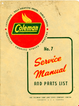
Coleman service manual and parts list
https://search.heritageburnaby.ca/link/museumlibrary3866
- Repository
- Burnaby Village Museum
- Collection
- Special Collection
- Material Type
- Book
- Accession Code
- BV004.99.5
- Call Number
- 796 COL
- Place of Publication
- Toronto
- Publisher
- Coleman Lamp and Stove Co. Ltd.
- Publication Date
- 1950
- Physical Description
- 48 p. : ill. : 28 cm.
- Library Subject (LOC)
- Commercial catalogs
- Gas-lighting
- Gas--Heating and cooking
- Gas appliances
- Camp stoves
- Lamps
- Stoves, Gas
- Camping--Equipment and supplies
- Irons (Pressing)
- Catalogs
- Notes
- Includes index.
Images

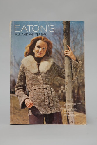
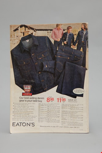
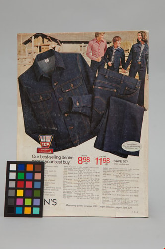
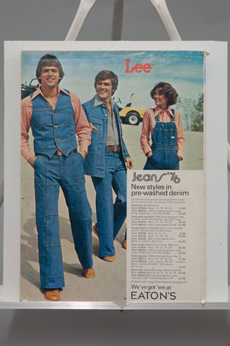
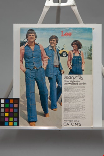
Eaton's catalogue: fall and winter, 1975
https://search.heritageburnaby.ca/link/museumlibrary5421
- Repository
- Burnaby Village Museum
- Collection
- Special Collection
- Material Type
- Book
- Accession Code
- BV012.14.166
- Call Number
- 381 EAT 1975
- Edition
- [Winnipeg]
- Place of Publication
- [Toronto]
- Publisher
- [T. Eaton Co. Ltd.]
- Publication Date
- 1975
- Series
- Eaton's catalogue
- Physical Description
- 894 p. : ill. (some col.) ; 28 cm.
- Library Subject (LOC)
- Manufactures
- Department stores--Canada
- Catalogs
- Names
- T. Eaton Company Limited
Images
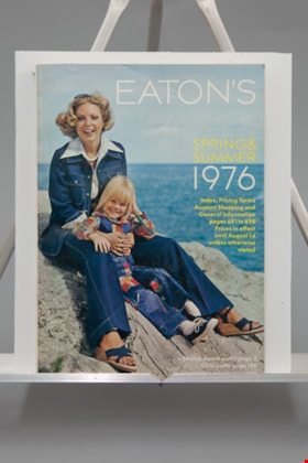
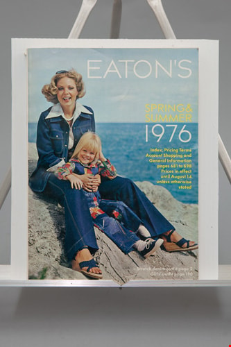
Eaton's catalogue: spring and summer, 1976
https://search.heritageburnaby.ca/link/museumlibrary5423
- Repository
- Burnaby Village Museum
- Collection
- Special Collection
- Material Type
- Book
- Accession Code
- BV012.14.165
- Call Number
- 381 EAT 1976
- Edition
- [Winnipeg]
- Place of Publication
- [Toronto]
- Publisher
- [T. Eaton Co. Ltd.]
- Publication Date
- 1976
- Series
- Eaton's catalogue
- Physical Description
- 698 p. : ill. (some col.) ; 28 cm.
- Library Subject (LOC)
- Manufactures
- Department stores--Canada
- Catalogs
- Names
- T. Eaton Company Limited
Images

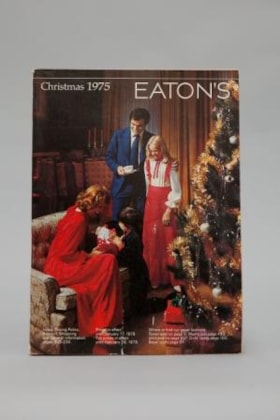
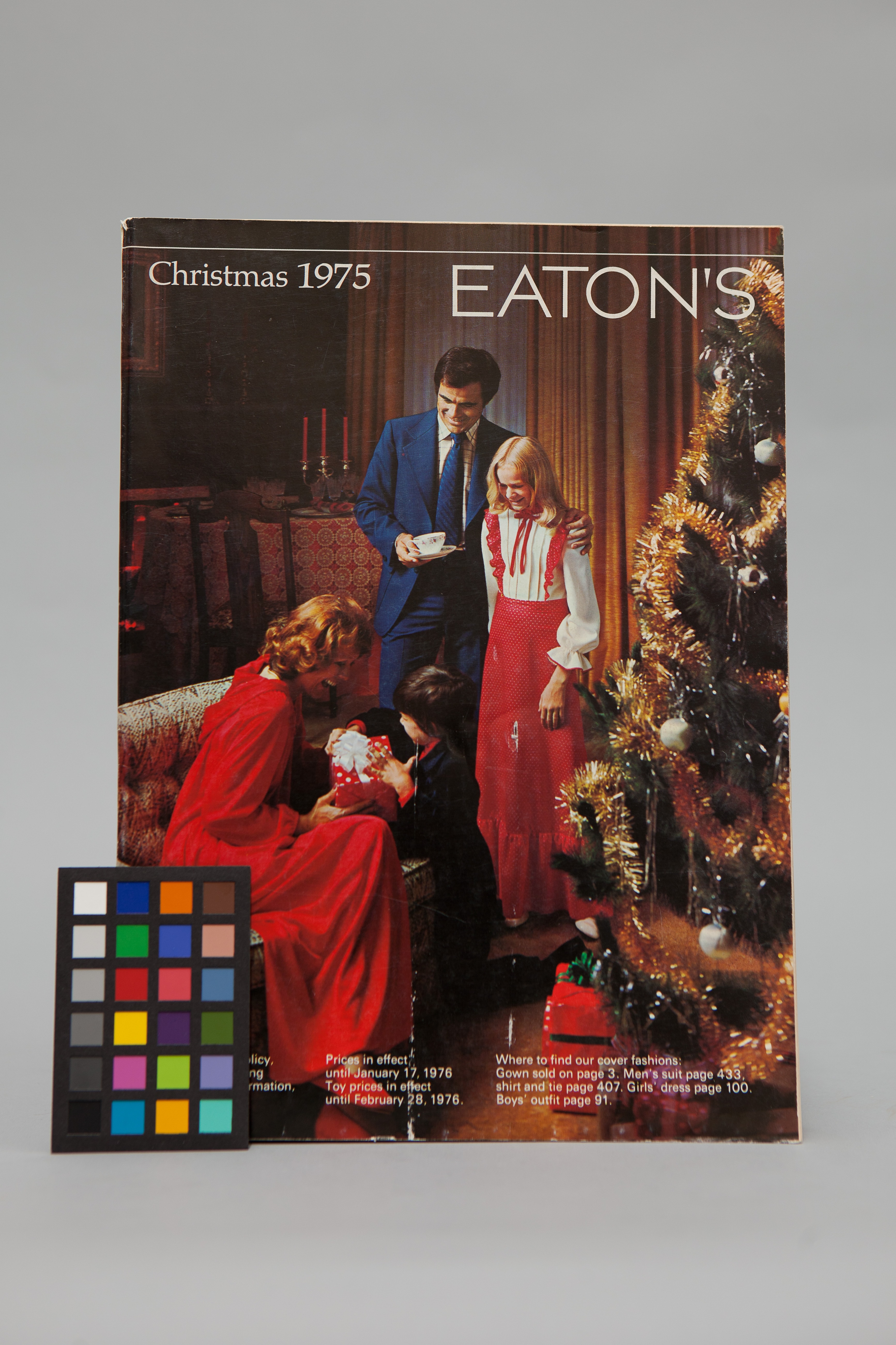
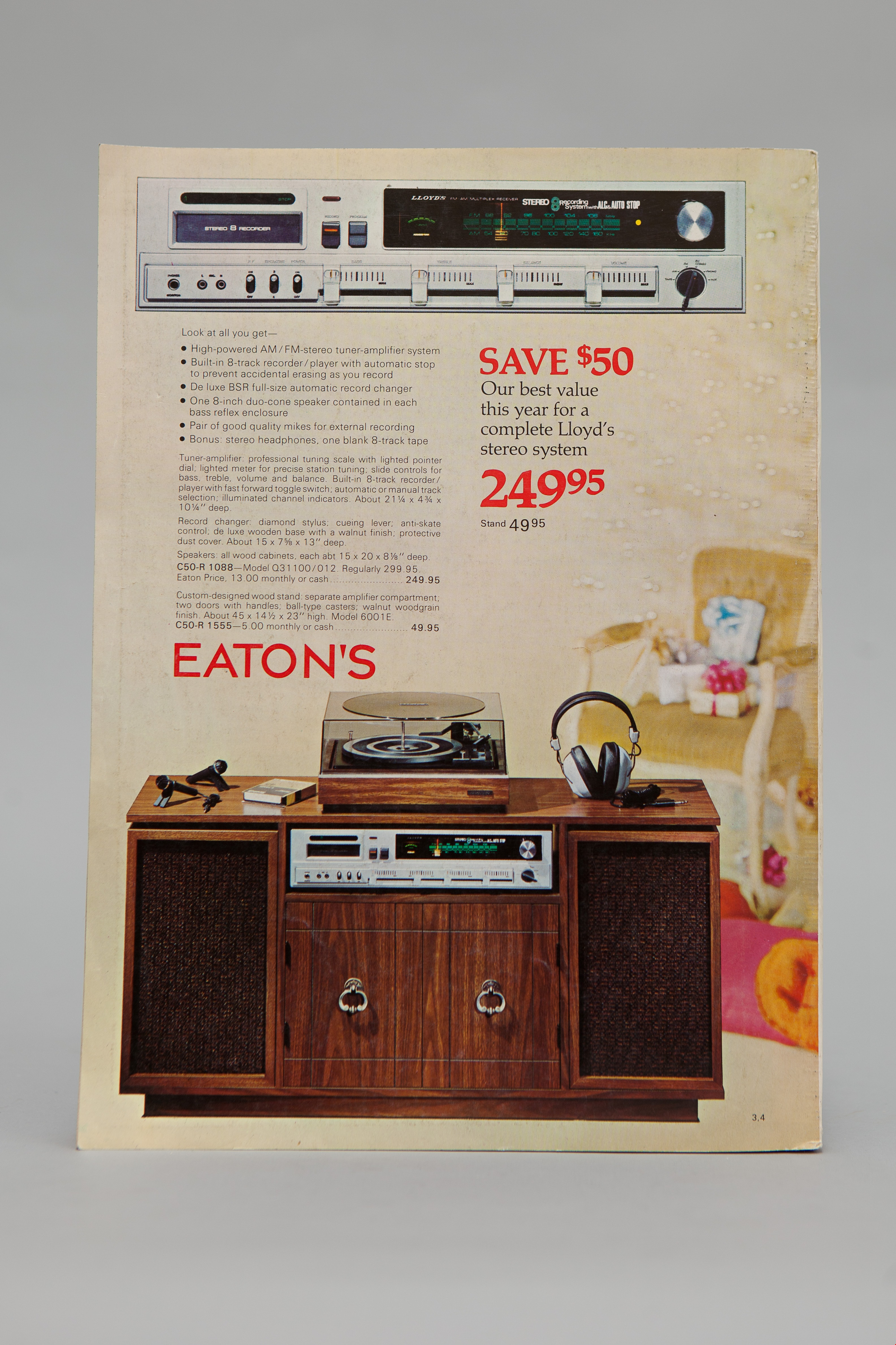
Eaton's christmas 1975
https://search.heritageburnaby.ca/link/museumlibrary3383
- Repository
- Burnaby Village Museum
- Collection
- Special Collection
- Material Type
- Book
- Accession Code
- BV993.1.2
- Call Number
- 381 EAT
- Author
- Eaton's
- Place of Publication
- Winnipeg
- Publisher
- Eaton's
- Publication Date
- 1975
- Physical Description
- 434 p. : ill. : 28 cm.
- Library Subject (LOC)
- Manufactures
- Catalogs
- Names
- T. Eaton Company Limited
- Notes
- Includes index.
- "Let Eaton's Share a Special Moment with You" -- Spine
Images


Map of South Western Part of British Columbia
https://search.heritageburnaby.ca/link/museumdescription8688
- Repository
- Burnaby Village Museum
- Date
- 1897
- Collection/Fonds
- Burnaby Village Museum Map collection
- Description Level
- Item
- Physical Description
- 1 map : col. ink on paper ; 68 x 88 cm
- Scope and Content
- Item consists of a "MAP OF THE SOUTH-WESTERN PART OF BRITISH COLUMBIA”. Map identifies geographic land districts of New Westminster District; Coast District; Lillooet District; Yale District, Kamloops Division, Yale Division and districts on Vancouver Island. Map also includes the northern portions…
- Repository
- Burnaby Village Museum
- Collection/Fonds
- Burnaby Village Museum Map collection
- Description Level
- Item
- Physical Description
- 1 map : col. ink on paper ; 68 x 88 cm
- Material Details
- Scale [1:633600]
- Scope and Content
- Item consists of a "MAP OF THE SOUTH-WESTERN PART OF BRITISH COLUMBIA”. Map identifies geographic land districts of New Westminster District; Coast District; Lillooet District; Yale District, Kamloops Division, Yale Division and districts on Vancouver Island. Map also includes the northern portions of the State of Washington below the 49th parallel.
- Publisher
- The Colonist Litho Victoria B.C.
- Responsibility
- Martin, George Bohun
- Accession Code
- BV993.12.12
- Access Restriction
- No restrictions
- Reproduction Restriction
- No known restrictions
- Date
- 1897
- Media Type
- Cartographic Material
- Scan Resolution
- 600
- Scan Date
- 2023-08-17
- Notes
- Transcribed title
- Scale equals 1 inch to 10 miles
- "Compiled and drawn by direction of the Honouable G.B. Martin, Chief Commissioner of Lands and Works, Victoria, B.C."
- Signed by Surveyor General "Tom Kains"
Zoomable Images

Outline of Burnaby history : jubilee number, 1952
https://search.heritageburnaby.ca/link/museumlibrary3282
- Repository
- Burnaby Village Museum
- Author
- Green, George, 1872-1955
- Publication Date
- 1952
- Call Number
- 971.1 GRE Copy 1
- Repository
- Burnaby Village Museum
- Collection
- Reference Collection
- Material Type
- Book
- Accession Code
- HV972.198.14
- Call Number
- 971.1 GRE Copy 1
- Author
- Green, George, 1872-1955
- Place of Publication
- [S.l.]
- Publisher
- [s.n.]
- Publication Date
- 1952
- Printer
- Wrigley Printing
- Physical Description
- 26, [1] p. : ports.
- Library Subject (LOC)
- Burnaby (B.C.)--History
- British Columbia--History
Images
Outline of Burnaby history : jubilee number, 1952
https://search.heritageburnaby.ca/link/museumlibrary3292
- Repository
- Burnaby Village Museum
- Author
- Green, George, 1872-1955
- Publication Date
- 1952
- Call Number
- 971.1 GRE Copy 11
- Repository
- Burnaby Village Museum
- Collection
- Special Collection
- Material Type
- Book
- Accession Code
- HV972.198.24
- Call Number
- 971.1 GRE Copy 11
- Author
- Green, George, 1872-1955
- Place of Publication
- [S.l.]
- Publisher
- [s.n.]
- Publication Date
- 1952
- Printer
- Wrigley Printing
- Physical Description
- 26, [1] p. : ports.
- Library Subject (LOC)
- Burnaby (B.C.)--History
- British Columbia--History
Images
Outline of Burnaby history : jubilee number, 1952
https://search.heritageburnaby.ca/link/museumlibrary3294
- Repository
- Burnaby Village Museum
- Author
- Green, George, 1872-1955
- Publication Date
- 1952
- Call Number
- 971.1 GRE Copy 13
- Repository
- Burnaby Village Museum
- Collection
- Special Collection
- Material Type
- Book
- Accession Code
- HV972.198.26
- Call Number
- 971.1 GRE Copy 13
- Author
- Green, George, 1872-1955
- Place of Publication
- [S.l.]
- Publisher
- [s.n.]
- Publication Date
- 1952
- Printer
- Wrigley Printing
- Physical Description
- 26, [1] p. : ports.
- Library Subject (LOC)
- Burnaby (B.C.)--History
- British Columbia--History
Images
Outline of Burnaby history : jubilee number, 1952
https://search.heritageburnaby.ca/link/museumlibrary3295
- Repository
- Burnaby Village Museum
- Author
- Green, George, 1872-1955
- Publication Date
- 1952
- Call Number
- 971.1 GRE Copy 14
- Repository
- Burnaby Village Museum
- Collection
- Special Collection
- Material Type
- Book
- Accession Code
- HV972.198.27
- Call Number
- 971.1 GRE Copy 14
- Author
- Green, George, 1872-1955
- Place of Publication
- [S.l.]
- Publisher
- [s.n.]
- Publication Date
- 1952
- Printer
- Wrigley Printing
- Physical Description
- 26, [1] p. : ports.
- Library Subject (LOC)
- Burnaby (B.C.)--History
- British Columbia--History
Images
Outline of Burnaby history : jubilee number, 1952
https://search.heritageburnaby.ca/link/museumlibrary3296
- Repository
- Burnaby Village Museum
- Author
- Green, George, 1872-1955
- Publication Date
- 1952
- Call Number
- 971.01 GRE Copy 15
- Repository
- Burnaby Village Museum
- Collection
- Special Collection
- Material Type
- Book
- Accession Code
- HV972.198.28
- Call Number
- 971.01 GRE Copy 15
- Author
- Green, George, 1872-1955
- Place of Publication
- [S.l.]
- Publisher
- [s.n.]
- Publication Date
- 1952
- Physical Description
- 26, [1] p. : ports.
- Library Subject (LOC)
- Burnaby (B.C.)--History
- British Columbia--History
Images
Outline of Burnaby history : jubilee number, 1952
https://search.heritageburnaby.ca/link/museumlibrary3297
- Repository
- Burnaby Village Museum
- Author
- Green, George, 1872-1955
- Publication Date
- 1952
- Call Number
- 971.1 GRE Copy 16
- Repository
- Burnaby Village Museum
- Collection
- Special Collection
- Material Type
- Book
- Accession Code
- HV972.198.29
- Call Number
- 971.1 GRE Copy 16
- Author
- Green, George, 1872-1955
- Place of Publication
- [S.l.]
- Publisher
- [s.n.]
- Publication Date
- 1952
- Printer
- Wrigley Printing
- Physical Description
- 26, [1] p. : ports.
- Library Subject (LOC)
- Burnaby (B.C.)--History
- British Columbia--History
Images
Outline of Burnaby history : jubilee number, 1952
https://search.heritageburnaby.ca/link/museumlibrary3298
- Repository
- Burnaby Village Museum
- Author
- Green, George, 1872-1955
- Publication Date
- 1952
- Call Number
- 971.1 GRE Copy 17
- Repository
- Burnaby Village Museum
- Collection
- Special Collection
- Material Type
- Book
- Accession Code
- HV972.198.30
- Call Number
- 971.1 GRE Copy 17
- Author
- Green, George, 1872-1955
- Place of Publication
- [S.l.]
- Publisher
- [s.n.]
- Publication Date
- 1952
- Printer
- Wrigley Printing
- Physical Description
- 26, [1] p. : ports.
- Library Subject (LOC)
- Burnaby (B.C.)--History
- British Columbia--History
Images
Outline of Burnaby history : jubilee number, 1952
https://search.heritageburnaby.ca/link/museumlibrary3299
- Repository
- Burnaby Village Museum
- Author
- Green, George, 1872-1955
- Publication Date
- 1952
- Call Number
- 971.1 GRE Copy 18
- Repository
- Burnaby Village Museum
- Collection
- Special Collection
- Material Type
- Book
- Accession Code
- HV972.198.31
- Call Number
- 971.1 GRE Copy 18
- Author
- Green, George, 1872-1955
- Place of Publication
- [S.l.]
- Publisher
- [s.n.]
- Publication Date
- 1952
- Printer
- Wrigley Printing
- Physical Description
- 26, [1] p. : ports.
- Library Subject (LOC)
- Burnaby (B.C.)--History
- British Columbia--History
Images
Outline of Burnaby history : jubilee number, 1952
https://search.heritageburnaby.ca/link/museumlibrary3300
- Repository
- Burnaby Village Museum
- Author
- Green, George, 1872-1955
- Publication Date
- 1952
- Call Number
- 971.1 GRE Copy 19
- Repository
- Burnaby Village Museum
- Collection
- Special Collection
- Material Type
- Book
- Accession Code
- HV972.198.32
- Call Number
- 971.1 GRE Copy 19
- Author
- Green, George, 1872-1955
- Place of Publication
- [S.l.]
- Publisher
- [s.n.]
- Publication Date
- 1952
- Printer
- Wrigley Printing
- Library Subject (LOC)
- Burnaby (B.C.)--History
- British Columbia--History
Images

Part of the New Westminster District shewing the Proposed New Municipality of Burnaby
https://search.heritageburnaby.ca/link/museumdescription17544
- Repository
- Burnaby Village Museum
- Date
- 1891 (date of original)
- Collection/Fonds
- Burnaby Village Museum Map collection
- Description Level
- Item
- Physical Description
- 1 map : blueline print with col. ; 59 x 96 cm
- Scope and Content
- Item consists of a map titled "Part of the New Westminster District shewing the Proposed New Municipality of Burnaby". The map shows boundaries of a proposed new municipality of Burnaby including all land outside of the "old" City of Vancouver between Burrard Inlet and the Fraser River and west of …
- Repository
- Burnaby Village Museum
- Collection/Fonds
- Burnaby Village Museum Map collection
- Description Level
- Item
- Physical Description
- 1 map : blueline print with col. ; 59 x 96 cm
- Material Details
- Scale approx. [1:31,680]
- Scope and Content
- Item consists of a map titled "Part of the New Westminster District shewing the Proposed New Municipality of Burnaby". The map shows boundaries of a proposed new municipality of Burnaby including all land outside of the "old" City of Vancouver between Burrard Inlet and the Fraser River and west of North Road. Map also shows the boundaries of the District Lots. Signed by Garden, Hermon and Burwell Provincial Land Surveyors, Vancouver, June 5, 1891. Blueline print is hand-coloured highlighting Burnaby.
- Creator
- Garden, Hermon and Burwell
- Accession Code
- BV994.29.1
- Access Restriction
- No restrictions
- Reproduction Restriction
- No known restrictions
- Date
- 1891 (date of original)
- Media Type
- Cartographic Material
- Scan Resolution
- 300
- Scan Date
- 2022-05-10
- Notes
- Transcribed title
Images

![Planning Map of Chinese Market Gardens on Marine Drive, [between 1950 and 1959] (date of original), 2017 (date of duplication) thumbnail](/media/hpo/_Data/_BVM_Images/2017/2017_0040_0002_001.jpg?width=280)
Planning Map of Chinese Market Gardens on Marine Drive
https://search.heritageburnaby.ca/link/museumdescription4297
- Repository
- Burnaby Village Museum
- Date
- [between 1950 and 1959] (date of original), 2017 (date of duplication)
- Collection/Fonds
- Herbert Yee Law family fonds
- Description Level
- Item
- Physical Description
- 1 photograph (tiff) : col. ; 300 dpi
- Scope and Content
- Scanned copy of a survey plan of district lots 163, 162, 157, 158, and 165, near the Chinese Market Gardens along Marine Drive.
- Repository
- Burnaby Village Museum
- Collection/Fonds
- Herbert Yee Law family fonds
- Description Level
- Item
- Physical Description
- 1 photograph (tiff) : col. ; 300 dpi
- Scope and Content
- Scanned copy of a survey plan of district lots 163, 162, 157, 158, and 165, near the Chinese Market Gardens along Marine Drive.
- History
- Survey plan of district lots 163, 162, 157, 158, and 165, which is primarily the area farmed by Chinese and Chinese-Canadian market gardeners around Marine Drive between Royal Oak and Mandeville (present-day Nelson). Two Chinese/Chinese Canadian land owners can be seen on the map: N.G. Wah Sing (or Ng Wah Sing) and Yee Law (or Herbert Law).
- Geographic Access
- Marine Drive
- Accession Code
- BV017.40.2
- Access Restriction
- No restrictions
- Reproduction Restriction
- No known restrictions
- Date
- [between 1950 and 1959] (date of original), 2017 (date of duplication)
- Media Type
- Cartographic Material
- Historic Neighbourhood
- Fraser Arm (Historic Neighbourhood)
- Planning Study Area
- Big Bend Area
- Scan Resolution
- 300
- Scan Date
- 11/19/2017
- Scale
- 100
- Notes
- Title based on contents of copy scan of map
- Herbert Yee Law was donor's father and this map may have originally been his copy of the city planning/engineering documents.
Images
![Planning Map of Chinese Market Gardens on Marine Drive, [between 1950 and 1959] (date of original), 2017 (date of duplication) thumbnail](/media/hpo/_Data/_BVM_Images/2017/2017_0040_0002_001.jpg)

Plan of Survey Lot A of Block 1 District Lot 42
https://search.heritageburnaby.ca/link/museumdescription18823
- Repository
- Burnaby Village Museum
- Date
- June 1957
- Collection/Fonds
- Seaforth School fonds
- Description Level
- Item
- Physical Description
- 1 survey plan : blueline print ; 42.5 x 47 cm
- Scope and Content
- Item consists of a survey plan of Lot A, of Block 1, District Lot 42, Group 1, New Westminster District. According to Explanatory Plan 5421 Burnaby, B.C. Seaforth School and grounds are noted on plan on the corner of Piper Avenue and Government Street.
- Repository
- Burnaby Village Museum
- Collection/Fonds
- Seaforth School fonds
- Description Level
- Item
- Physical Description
- 1 survey plan : blueline print ; 42.5 x 47 cm
- Material Details
- Scale: 1 inch = 50 feet
- Scope and Content
- Item consists of a survey plan of Lot A, of Block 1, District Lot 42, Group 1, New Westminster District. According to Explanatory Plan 5421 Burnaby, B.C. Seaforth School and grounds are noted on plan on the corner of Piper Avenue and Government Street.
- Creator
- Burnett, David H.
- Names
- Seaforth School
- Accession Code
- BV987.2.3
- Access Restriction
- No restrictions
- Reproduction Restriction
- No known restrictions
- Date
- June 1957
- Media Type
- Cartographic Material
- Scan Resolution
- 600
- Scan Date
- 2022-07-07
- Notes
- Title based on contents of item
- Title reads: "PLAN OF SURVEY / LOT "A", OF BLOCK 1 / DISTRICT LOT 42, 'GROUP 1 , / NEW WESTMINSTER DISTRICT / ACCORDING TO EXPLANATORY PLAN 5421 / BURNABY, B.C."
Images

![Plot of Royal Engineers' Surveys - North Road, [1890] thumbnail](/media/hpo/_Data/_BVM_Cartographic_Material/2003/2003_0083_0034_002%20Web.jpg?width=280)
Plot of Royal Engineers' Surveys - North Road
https://search.heritageburnaby.ca/link/museumdescription11155
- Repository
- Burnaby Village Museum
- Date
- [1890]
- Collection/Fonds
- Ronald G. Scobbie collection
- Description Level
- Item
- Physical Description
- 1 survey plan : blueprint on paper ; 61 x 45 cm
- Scope and Content
- Survey plan of "Plot of Royal Engineers' Surveys," "North Road."
- Repository
- Burnaby Village Museum
- Collection/Fonds
- Ronald G. Scobbie collection
- Description Level
- Item
- Physical Description
- 1 survey plan : blueprint on paper ; 61 x 45 cm
- Material Details
- Scale 10 chains = 1 inch
- Scope and Content
- Survey plan of "Plot of Royal Engineers' Surveys," "North Road."
- Geographic Access
- North Road
- Accession Code
- BV003.83.34
- Access Restriction
- No restrictions
- Reproduction Restriction
- No known restrictions
- Date
- [1890]
- Media Type
- Cartographic Material
- Scan Resolution
- 440
- Scan Date
- December 2020
- Scale
- 100
- Notes
- Title based on contents of plan
- Handwritten notes on verso read: "Envelope 369", and mathematical calculat- ions
Images
![Plot of Royal Engineers' Surveys - North Road, [1890] thumbnail](/media/hpo/_Data/_BVM_Cartographic_Material/2003/2003_0083_0034_002%20Web.jpg)
![Sectional map and street directory of Vancouver : Dial map of greater Vancouver including adjacent municipalities, [ca. 1950] thumbnail](/media/hpo/_Data/_BVM_Cartographic_Material/2000/2000_0003_0011_001%20WEB.jpg?width=280)
Sectional map and street directory of Vancouver : Dial map of greater Vancouver including adjacent municipalities
https://search.heritageburnaby.ca/link/museumdescription8697
- Repository
- Burnaby Village Museum
- Date
- [ca. 1950]
- Collection/Fonds
- Burnaby Village Museum Map collection
- Description Level
- Item
- Physical Description
- 2 maps and 1 p. of textual records on 1 sheet : lithographic prints, col. ; 55.5 x 75 cm + 2 dials and 25 x 72 cm + directory on sheet 55.5 x 75 cm, folded to 28.5 x 12.5 cm
- Scope and Content
- Item is a sectional map and street directory titled "Dial Map of Greater Vancouver and adjacent Municipalities" with a map on one side titled "Dial Map of Greater Vancouver and Suburbs" including Vancouver, West Vancouver, North Vancouver and Burnaby and includes street car and bus lines, railways,…
- Repository
- Burnaby Village Museum
- Collection/Fonds
- Burnaby Village Museum Map collection
- Description Level
- Item
- Physical Description
- 2 maps and 1 p. of textual records on 1 sheet : lithographic prints, col. ; 55.5 x 75 cm + 2 dials and 25 x 72 cm + directory on sheet 55.5 x 75 cm, folded to 28.5 x 12.5 cm
- Material Details
- Scales 1:42240, 1:144823
- 2 alphabetic dials on narrow strips of paper attached to map by grommets
- Scope and Content
- Item is a sectional map and street directory titled "Dial Map of Greater Vancouver and adjacent Municipalities" with a map on one side titled "Dial Map of Greater Vancouver and Suburbs" including Vancouver, West Vancouver, North Vancouver and Burnaby and includes street car and bus lines, railways, hospitals, parks, block nos. and street indexes with two alphabetic dials, one for Vancouver, the other for New Westminster. The other side of the map includes a map of "Fraser Valley" along with a directory of Vancouver street car and bus routes, business blocks, public buildings, hospitals, bathing beaches, locations of Vancouver fire halls and Vancouver city schools.
- Creator
- Dominion Map and Blueprint Co.
- Publisher
- Sectional Map and Street Directory Company
- Geographic Access
- Vancouver
- Accession Code
- BV000.3.11
- Access Restriction
- No restrictions
- Reproduction Restriction
- No known restrictions
- Date
- [ca. 1950]
- Media Type
- Cartographic Material
- Scan Resolution
- 380
- Scan Date
- 22-Dec-2020
- Scale
- 100
- Notes
- Title based on contents of map
Images
![Sectional map and street directory of Vancouver : Dial map of greater Vancouver including adjacent municipalities, [ca. 1950] thumbnail](/media/hpo/_Data/_BVM_Cartographic_Material/2000/2000_0003_0011_001%20WEB.jpg)


![Subdivision plans in New Westminster District Group 1 – Burnaby
, [1882-1910] thumbnail](/media/hpo/_Data/_BVM_Cartographic_Material/1977/1977_0093_0013a_001.jpg?width=280)
Subdivision plans in New Westminster District Group 1 – Burnaby
https://search.heritageburnaby.ca/link/museumdescription6982
- Repository
- Burnaby Village Museum
- Date
- [1882-1910]
- Collection/Fonds
- Burnaby Village Museum Map collection
- Description Level
- File
- Physical Description
- 4 plans : blueprint on paper mounted on 2 sides of cardboard 76 x 102 cm
- Scope and Content
- Item consists of a large board of two New Westminster District Gp 1 - subdivision plans mounted on one side and two New Westminster District Gp 1 - subdivision plans mounted on the other side. Side A: 1. Blueprint "Plan / of the / Subdivision / of / Lot 98 / G.1, N.W.D. / Scale 4 chs = 1 in. / …
- Repository
- Burnaby Village Museum
- Collection/Fonds
- Burnaby Village Museum Map collection
- Description Level
- File
- Physical Description
- 4 plans : blueprint on paper mounted on 2 sides of cardboard 76 x 102 cm
- Material Details
- Scales [between 1:1584 and 1:3168]
- Index number on edge of board reads: "13"
- Scope and Content
- Item consists of a large board of two New Westminster District Gp 1 - subdivision plans mounted on one side and two New Westminster District Gp 1 - subdivision plans mounted on the other side. Side A: 1. Blueprint "Plan / of the / Subdivision / of / Lot 98 / G.1, N.W.D. / Scale 4 chs = 1 in. / Map No 573" (Geographic location: Burnaby) 2. Blueprint "Plan / of Subdivision of / Lot 157 / Gr.1, New. West. Dist. / Scale 3 chs = 1 in. / Map No. 612". (Geographic location: Burnaby) Side B: 1. Blueprint "Plan / of Subdivision / of a Portion of / Lot 90 / Group One / New Westminster Dist. / Scale 2 chs = 1 in. / Map No. 555". Plan is signed by "Jno Strathern [sic]_P.L.S."n (Geographic location: Burnaby) 2. Blueprint "Subdivision of Lot 31, Group 1. / New Westminster District / As Amended by Order of Court / 1st Sept. 1882 and Numbered 847 / Scale 4 chs = 1in. / Map No 80" (Geographic location: Burnaby)
- Creator
- Stathern, John
- Accession Code
- HV977.93.13
- Access Restriction
- No restrictions
- Reproduction Restriction
- No known restrictions
- Date
- [1882-1910]
- Media Type
- Cartographic Material
- Historic Neighbourhood
- Alta Vista (Historic Neighbourhood)
- Planning Study Area
- Richmond Park Area
- Lakeview-Mayfield Area
- Scan Resolution
- 300
- Scale
- 72
- Notes
- Title based on contents of file
- Scale is measured in chains. (One chain equals 792 inches)
- The term "Lot" can also refer to a "District Lot”
Images
![Subdivision plans in New Westminster District Group 1 – Burnaby
, [1882-1910] thumbnail](/media/hpo/_Data/_BVM_Cartographic_Material/1977/1977_0093_0013a_001.jpg)

![Subdivision plans in New Westminster District Group 1 – Burnaby
, [1890-1910] thumbnail](/media/hpo/_Data/_BVM_Cartographic_Material/1977/1977_0093_0014a_001.jpg?width=280)
Subdivision plans in New Westminster District Group 1 – Burnaby
https://search.heritageburnaby.ca/link/museumdescription6983
- Repository
- Burnaby Village Museum
- Date
- [1890-1910]
- Collection/Fonds
- Burnaby Village Museum Map collection
- Description Level
- File
- Physical Description
- 4 plans : blueprint ink on paper mounted on 2 sides of cardboard 76 x 102 cm
- Scope and Content
- Item consists of a large board of two New Westminster District Gp 1 - subdivision plans mounted on one side and two New Westminster District Gp 1 - subdivision plans mounted on the other side. Side A: 1. Blueprint "Plan of / Subdivision of Lot No. 69 / Group One / New Westminster District / Pro…
- Repository
- Burnaby Village Museum
- Collection/Fonds
- Burnaby Village Museum Map collection
- Description Level
- File
- Physical Description
- 4 plans : blueprint ink on paper mounted on 2 sides of cardboard 76 x 102 cm
- Material Details
- Scales [between 1:1584 and 1:3168]
- Index number on edge of board reads: "14"
- Scope and Content
- Item consists of a large board of two New Westminster District Gp 1 - subdivision plans mounted on one side and two New Westminster District Gp 1 - subdivision plans mounted on the other side. Side A: 1. Blueprint "Plan of / Subdivision of Lot No. 69 / Group One / New Westminster District / Property of Ernest Buse, Esq. / Scale 3 chs = 1 in. / Map No 290". Plan is signed by "Garden, Hermon and Burwell, Dom. Land Surveyor" (Geographic location: Burnaby) 2. Blueprint "Plan / of Subdivision / of Lots 1-19, 36-53 and 69-75 inclusive / in the Subdivision / of / Lot 30 / Group One / New Westminster District / Scale 2 chs = 1 in. Map No 631". Plan is signed by "Jno [sic] Strathern [sic] P.L.S." Names and Lot numbers are handwritten in red pencil in sections along Douglas Road and read: "20 - F / 21 - Fitherstruhaul [sic] / 22 - J.S. Craig / 23 - McGill & Dill / 24 / 25 / 26 / 27 / 28 - School / 29 - School / 30 - D. McDownall / 31 - W.J. Troloow [sic] / 32 - N.C. Nelson / 33 - _[sic] McGill / 34 - T.S.[sic] Craig / 35" (Geographic location: Burnaby) Side B: 1.Blueprint "Plan / of Subdivision / of Centre Portion / of Lot 28 / Group One / New Westminster District / Scale 200' = 1" / Map No 627". Plan is signed by "Jno Strathern / P.L.S." (Geographic location: Burnaby) 2. Blueprint "Plan / of Subdivision / of N.1/2 Lot 100 and S.1/2 Lot 101, / Group One / New Westminster District, BC / Scale 4 chs = 1 in." (Geographic location: Burnaby)
- Names
- Strathern, John
- Accession Code
- HV977.93.14
- Access Restriction
- No restrictions
- Reproduction Restriction
- No known restrictions
- Date
- [1890-1910]
- Media Type
- Cartographic Material
- Historic Neighbourhood
- Broadview (Historic Neighbourhood)
- East Burnaby (Historic Neighbourhood)
- Planning Study Area
- Cascade-Schou Area
- West Central Valley Area
- Second Street Area
- Lake City Area
- Scan Resolution
- 300
- Scale
- 72
- Notes
- Title based on contents of file
- Scale is measured in chains and feet. (One chain equals 792 inches)
- The term "Lot" can also refer to a "District Lot”
Images
![Subdivision plans in New Westminster District Group 1 – Burnaby
, [1890-1910] thumbnail](/media/hpo/_Data/_BVM_Cartographic_Material/1977/1977_0093_0014a_001.jpg)
