Narrow Results By
Decade
- 2020s 71
- 2010s 132
- 2000s
- 1990s 354
- 1980s 372
- 1970s 569
- 1960s 346
- 1950s 419
- 1940s 385
- 1930s 365
- 1920s 314
- 1910s 238
- 1900s 119
- 1890s
- 1880s 12
- 1870s 12
- 1860s 12
- 1850s
- 1840s 5
- 1830s
- 1820s 3
- 1810s 3
- 1800s 3
- 1790s 2
- 1780s 2
- 1770s 2
- 1760s 2
- 1750s 2
- 1740s 2
- 1730s 2
- 1720s 2
- 1710s 2
- 1700s 2
- 1690s 2
- 1680s 2
- 1670s 1
- 1660s 1
- 1650s 1
- 1640s 1
- 1630s 1
- 1620s 1
- 1610s 1
- 1600s 1
Subject
- Agriculture 1
- Agriculture - Farms 5
- Agriculture - Fruit and Berries 4
- Animals - Birds 1
- Arts 3
- Arts - Drawings 1
- Buildings 3
- Buildings - Commercial - Grocery Stores 2
- Buildings - Commercial - Restaurants 3
- Buildings - Commercial - Service Stations 1
- Buildings - Commercial - Stores 1
- Buildings - Heritage 3
Creator
- Amiel, Len 2
- Anderson, Charles, 1958- 1
- Anger, William Henry 1
- Atkinson, Dorothy Mallett 1
- Barman, Jean, 1939- 2
- Bartel, Mario 33
- Baskerville, Peter A. 1
- Binks, James 8
- British Columbia Women's Institute 2
- Brown, Donald N. (Donald Neil), 1919- 1
- Burnaby Community Heritage Commission 1
- Burnaby Historical Society 1
Person / Organization
- Ansdell, Elsie Brown-John 1
- Arora, Maninder 1
- Babey, Beverley 1
- Baker, Ronald J. "Ron" 2
- Bayntun, Charmaine "Sherrie" Yanko 4
- BC Society of Model Engineers (BCSME) 6
- Bhangoo, Bhavna 1
- Bill Copeland Sports Centre 2
- Bingham, Alfred "Alf" 4
- Binning, Dr. Sadhu 2
- Binning, Gurmaje Kaur 1
- Binning, Jagdish 1
![Survey and Subdivision plans in New Westminster District Group 2 - Surrey, Delta
, [1898-1910] thumbnail](/media/hpo/_Data/_BVM_Cartographic_Material/1977/1977_0093_0078_001.jpg?width=280)
Survey and Subdivision plans in New Westminster District Group 2 - Surrey, Delta
https://search.heritageburnaby.ca/link/museumdescription7047
- Repository
- Burnaby Village Museum
- Date
- [1898-1910]
- Collection/Fonds
- Burnaby Village Museum Map collection
- Description Level
- File
- Physical Description
- 10 plans : graphite and ink on paper and linen; various sizes mounted on 2 sides of cardboard 76 x 102 cm
- Scope and Content
- File consists of a large board with four plans in New Westminster District mounted on one side and six plans mounted on the other side. Side A: 1. Plan : black ink on paper with colour (no formal title). Plan covers area in New Westminster District, Group 2 situated along the south shore of the …
- Repository
- Burnaby Village Museum
- Collection/Fonds
- Burnaby Village Museum Map collection
- Description Level
- File
- Physical Description
- 10 plans : graphite and ink on paper and linen; various sizes mounted on 2 sides of cardboard 76 x 102 cm
- Material Details
- Scales vary
- Indexed number on tape on edge of board reads "78"
- Scope and Content
- File consists of a large board with four plans in New Westminster District mounted on one side and six plans mounted on the other side. Side A: 1. Plan : black ink on paper with colour (no formal title). Plan covers area in New Westminster District, Group 2 situated along the south shore of the Fraser River identified as "Indian Reserve / Turner 1868" situated in District Lot 1 between District Lot 2 identified as "Mohun's Line" and "Herring's Line" bordered by lots B and A. Includes note "see plan of subdivision of Lots 3 & 4 Gr. 2". (Geographic location: Surrey) 2. Plan : graphite on paper ; Title reads: "B5N R2W, Sec.26_Sec. 28 / Sec. 35_Sec.36". Plan covers a 60 acre parcel in Sec. 35 with Yale wagon road to the south. Scale: 6 chains = 1 inch (Geographic location: Surrey) 3. Plan : black ink on paper ; Title reads: "Survey for Proposed Highway in Indian Reserve Surrey". Plan covers area of land to the northwest of Lot 2 along the shore of the Fraser River and identfies route of proposed highway, proposed tramway as well at the Great Northern Railway and bridge. Scale: 2 chains = 1 inch 4. Plan : black ink on red lined graphing paper ; Title reads: "Sketch Plan Showing Section of Great Northern R. of W. at Point of Crossing of Proposed Ditch". Plan covers area of Lot 2 in New Westminster District, Group 2. (Surrey) Scale: 1 inch = 5 feet. (Geographic location: Surrey) Side B: 1. Plan : black ink on paper ; Title reads: "Plan of Subdivision of a Portion of Section 13, TP2, Surrey Municipality, New Westminster District, B.C.". Plan covers land bordered by Coast Meridian Road (to the east), Bose Road (to the south) and Pike Road (to the west). Surveyed for D.S. Bayners, Nov. 24, 1908. Scale: 5 chains= 1 inch 2. Plan : black ink on linen with colour ; Title reads: "Traverse of the Waterline in front of Lots 3 and 4, Group 2, New Westminster District with G.N. Railway Right of Way". Plan covers area along the southern shore of the Fraser River with a road crossing the Great Northern Railway and leading to a wharf. Scale: 100 feet = 1 inch (Geographic location: Surrey) 3. Plan : black ink on paper ; Title reads: "Survey of the South Boundary of Sec. 12, Township 2, New Westminster District". Plan covers area south of Bose Road and west of Coast Meridean Road and north of McClellen Road. Scale: 400 feet = 1 inch. Sec.12 (Geographic location: Surrey) 4. Plan : graphite on paper ; Title reads: "Plan of Subdivisioin of a part of S.E. 1/4 of Sec. 7, TP 8". Plan covers area of Section 7 in New Westminster District, Group 2, Township 8. Streets are identified running through lot including, Langley Ave., Robinson Ave, Melrose Ave., Hawthorne Ave., Broadway, Bond Ave., Mable Ave., Breene Ave. and McLelland Ave. and Clover Valley Road. Scale: 200 feet = 1 inch. Note in black ink reads: See Bd. 166 for blue print. (Geographic location: Surrey) 5. Plan : graphite on linen ; Title reads: "Sec.20, B5N R2W". Plan covers area north of Yale Road and is subdivided into parts identified as A, B, C, D, E, and unknown. (Geographic location: Surrey) 6. Plan : black ink and graphite on paper ; (no formal title) Plan covers lots surveyed along Ladner Road identified as A, B and Lots 13, 12 and 11. [Geographic location: Delta]
- Accession Code
- HV977.93.78
- Access Restriction
- No restrictions
- Reproduction Restriction
- No known restrictions
- Date
- [1898-1910]
- Media Type
- Cartographic Material
- Scan Resolution
- 600
- Scan Date
- 2023-06-26
- Notes
- Title based on contents of file
- Note re plans 1A & 3A: The sight of Brownsville was also the former site of the Qayqayt First Nation and one of the main summer villages of the Kwantlen and ʷməθkʷəy̓əm (Musqueam) peoples
- Scale is measured in chains and feet. (One chain equals 792 inches)
Zoomable Images
![Survey and Subdivision plans in New Westminster District Group 2 - Surrey, Delta
, [1898-1910] thumbnail](/media/hpo/_Data/_BVM_Cartographic_Material/1977/1977_0093_0078_003_seadragon/1977_0093_0078_003.jpg?w=280)
Survey and Subdivision plans in New Westminster District Group 2 - Surrey, Delta , [1898-1910]
Zoom into Image

Burnaby Mountain Neighbourhood
https://search.heritageburnaby.ca/link/landmark792
- Repository
- Burnaby Heritage Planning
- Associated Dates
- 1955-2008
- Heritage Value
- Burnaby Mountain had been dedicated as park in 1942, however the original park boundaries were reconsidered in 1952 with the development of the Trans Mountain Pipeline. Although the boundaries were adjusted to accommodate this project, significant conservation and park lands were left untouched. When, in 1962, the government of British Columbia determined the need for additional post-secondary facilities, Burnaby Mountain was chosen as the site for the new Simon Fraser University which opened in 1965. As early as 1964, the idea of establishing a townsite around the university had been discussed by Burnaby, but it was not until the mid-1990s that the idea came to fruition and by the early 2000s, a new housing development know as the UniverCity took shape on the mountain adjacent to the university.
- Historic Neighbourhood
- Barnet (Historic Neighbourhood)
- Planning Study Area
- Burnaby Mountain Area
Images


Burnaby Mountain Secondary School
https://search.heritageburnaby.ca/link/landmark831
- Repository
- Burnaby Heritage Planning
- Geographic Access
- Eastlake Drive
- Associated Dates
- 2000
- Heritage Value
- Burnaby Mountain Secondary School is one of the more recent schools in Burnaby, having opened in 2000 and it serves neighbourhoods in northeast Burnaby and northwest Coquitlam.
- Historic Neighbourhood
- Burquitlam (Historic Neighbourhood)
- Planning Study Area
- Lyndhurst Area
- Street Address
- 8800 Eastlake Drive
- Street View URL
- Google Maps Street View
Images


Central Park
https://search.heritageburnaby.ca/link/landmark728
- Repository
- Burnaby Heritage Planning
- Geographic Access
- Imperial Street
- Associated Dates
- 1891
- Heritage Value
- In 1860, as the Royal Engineers constructed the road from New Westminster to Vancouver (now Kingsway), a military reserve was set aside at the trail's highest point along the ridge. This reserve provided a particularly good scenic look-out since the original forest had burned down prior to 1860, the remaining stumps offered unobstructed views. By the 1880s, the city council of both New Westminster and Vancouver eyed the reserve as potential recreation ground. As construction of the tram line was underway, the Provincial Government moved to designate the whole reserve as a park. On January 14, 1891, the Lieutenant Governor of British Columbia proclaimed it as a public recreation ground.
- Historic Neighbourhood
- Central Park (Historic Neighbourhood)
- Planning Study Area
- Maywood Area
- Street Address
- 3883 Imperial Street
- Street View URL
- Google Maps Street View
Images


Lake City Neighbourhood
https://search.heritageburnaby.ca/link/landmark793
- Repository
- Burnaby Heritage Planning
- Associated Dates
- 1955-2008
- Heritage Value
- When Simon Fraser University opened in 1965, approximately sixteen industrial properties had been developed in the Lake City Industrial Park. In addition, significant tracts of land in the western portion had been pre-cleared and graded in anticipation of additional development, while most of the eastern half remained forested. Some of the early companies to locate in the area were Nabob Foods, Volkswagen Canada, British Columbia Television Broadcasting, Simpson Sears, and H.Y. Louie Company Limited. Both Imperial Oil and Shell Oil established petroleum storage and distribution facilities in the area. Initially a heavy industrial area, by 1979, single family neighbourhoods south of Lougheed Highway and west of Eagle Creek had been largely developed. By the mid1980's, the Burnaby 200 multi-family development along Forest Grove Drive had also been completed.
- Planning Study Area
- Lake City Area
Images


North Road
https://search.heritageburnaby.ca/link/landmark722
- Repository
- Burnaby Heritage Planning
- Associated Dates
- 1859
- Heritage Value
- When New Westminster was chosen as the first site for the capital city of British Columbia in 1859, Colonel R.C. Moody developed a plan to defend the city from American attack by building a road to connect New Westminster to the Burrard Inlet. Although an attack never came, North Road became a well-used route for citizens in the capital city who travelled the road to enjoy a picnic at the beach or to board a ferry for the city of Port Moody. The road's route over the mountain remained in use until the 1960s, when this section was closed to traffic. North Road is the oldest road in the Lower Mainland.
- Planning Study Area
- Burnaby Mountain Area
Images


Taylor Park Elementary School
https://search.heritageburnaby.ca/link/landmark847
- Repository
- Burnaby Heritage Planning
- Geographic Access
- Mission Avenue
- Associated Dates
- 2004
- Heritage Value
- Taylor Park Elementary School was opened in 2004 with 240 students from kindergarten to grade three (with older students attending Stride Avenue Community School). By 2006, Taylor Park had been designated as its own school and extended its classes from kindergarten through grade six.
- Historic Neighbourhood
- Edmonds (Historic Neighbourhood)
- Planning Study Area
- Stride Hill Area
- Street Address
- 7590 Mission Avenue
- Street View URL
- Google Maps Street View
Images

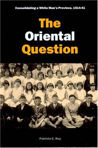
The Oriental question : consolidating a white man's province, 1914-41
https://search.heritageburnaby.ca/link/museumlibrary1414
- Repository
- Burnaby Village Museum
- Author
- Roy, Patricia, 1939-
- Publication Date
- c2003
- Call Number
- 971.1004951 ROY
- Repository
- Burnaby Village Museum
- Collection
- Reference Collection
- Material Type
- Book
- ISBN
- 0774810114
- 0774810106
- Call Number
- 971.1004951 ROY
- Author
- Roy, Patricia, 1939-
- Place of Publication
- Vancouver
- Publisher
- UBC Press
- Publication Date
- c2003
- Physical Description
- 334 p. : ill. ; 24 cm.
- Library Subject (LOC)
- Chinese--British Columbia--History
- Japanese--British Columbia--History
- British Columbia--Race relations
- British Columbia--Politics and government
- British Columbia--Emigration and immigration--History
- British Columbia--Emigration and immigration--Economic aspects
- Immigrants--British Columbia--History
- Notes
- Second in a proposed set of 3 vols. beginning with A white man's province.
- Includes bibliographical references and index.

The triumph of citizenship : the Japanese and Chinese in Canada, 1941-67
https://search.heritageburnaby.ca/link/museumlibrary1415
- Repository
- Burnaby Village Museum
- Author
- Roy, Patricia, 1939-
- Publication Date
- c2007
- Call Number
- 971.1004951 ROY
- Repository
- Burnaby Village Museum
- Collection
- Reference Collection
- Material Type
- Book
- ISBN
- 9780774813815
- 9780774813808
- Call Number
- 971.1004951 ROY
- Author
- Roy, Patricia, 1939-
- Place of Publication
- Vancouver, BC
- Publisher
- UBC Press
- Publication Date
- c2007
- Physical Description
- vii, 390 p. : ill., map ; 24 cm.
- Library Subject (LOC)
- Chinese--British Columbia--History
- Japanese--British Columbia--History
- British Columbia--Race relations
- British Columbia--Politics and government
- British Columbia--Emigration and immigration--History
- British Columbia--Emigration and immigration--Economic aspects
- Immigrants--British Columbia--History
- Notes
- Includes bibliographical references (p. 318-377) and index.
- Limited edition of 400 copies.
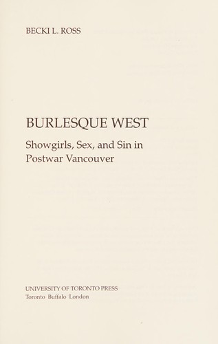
Burlesque West : showgirls, sex, and sin in postwar Vancouver
https://search.heritageburnaby.ca/link/museumlibrary1435
- Repository
- Burnaby Village Museum
- Author
- Ross, Becki, 1959-
- Publication Date
- c2009
- Call Number
- 792.7 ROS
- Repository
- Burnaby Village Museum
- Collection
- Reference Collection
- Material Type
- Book
- ISBN
- 9780802096463
- 9780802096982
- 0802096980
- 0802096468
- Call Number
- 792.7 ROS
- Author
- Ross, Becki, 1959-
- Place of Publication
- Toronto
- Publisher
- University of Toronto Press
- Publication Date
- c2009
- Physical Description
- xix, 373 p., [8] p. of plates : ill. (some col.) ; 23 cm.
- Library Subject (LOC)
- Burlesque (Theater)--British Columbia--Vancouver--History
- Stripteasers--British Columbia--Vancouver--History
- Showgirls--British Columbia--Vancouver--History
- Nightlife--British Columbia--Vancouver--History
- Vancouver (B.C.)--History
- Notes
- Includes bibliographical references (p. [297]-333) and index.
![Allan Rock at BCIT campaign event, [2000] thumbnail](/media/hpo/_Data/_Archives_Images/_Unrestricted/535/535-1684-1.jpg?width=280)
Allan Rock at BCIT campaign event
https://search.heritageburnaby.ca/link/archivedescription95884
- Repository
- City of Burnaby Archives
- Date
- [2000]
- Collection/Fonds
- Burnaby NewsLeader photograph collection
- Description Level
- File
- Physical Description
- 3 photographs (tiff) : col.
- Scope and Content
- File contains photographs of Federal Health Minister Allan Rock speaking with nursing students during a campaign event at BCIT. Photographs show close-ups of Rock and one of the nursing students asking a question, as well as a photograph of Rock speaking as attendees look on in the background.
- Repository
- City of Burnaby Archives
- Date
- [2000]
- Collection/Fonds
- Burnaby NewsLeader photograph collection
- Physical Description
- 3 photographs (tiff) : col.
- Description Level
- File
- Record No.
- 535-1684
- Access Restriction
- No restrictions
- Reproduction Restriction
- No restrictions
- Accession Number
- 2018-12
- Scope and Content
- File contains photographs of Federal Health Minister Allan Rock speaking with nursing students during a campaign event at BCIT. Photographs show close-ups of Rock and one of the nursing students asking a question, as well as a photograph of Rock speaking as attendees look on in the background.
- Subjects
- Elections
- Officials - Elected Officials
- Media Type
- Photograph
- Photographer
- Bartel, Mario
- Notes
- Title based on caption
- Collected by editorial for use in a November 2000 issue of the Burnaby NewsLeader
- Caption from metadata for 535-1684-1: "Federal Health Minister Allan Rock speaks with nursing students during a campaign stop at BCIT."
- Caption from metadata for 535-1684-2: "Federal Health Minister Allan Rock addresses nursing students at BCIT, during an election campaign stop."
- Caption from metadata for 535-1684-3: "Michelle Marisi, a nurse at Vancouver General, studying critical care, raises her concerns with federal Health Minister, Allan Rock."
- Geographic Access
- Willingdon Avenue
- Street Address
- 3700 Willingdon Avenue
- Planning Study Area
- Douglas-Gilpin Area
Images
![Allan Rock at BCIT campaign event, [2000] thumbnail](/media/hpo/_Data/_Archives_Images/_Unrestricted/535/535-1684-1.jpg)
A manual of organic materia medica : being a guide to materia medica of the vegetable and animal kingdoms, for the use of students, druggists, pharmacists, and physicians
https://search.heritageburnaby.ca/link/museumlibrary439
- Repository
- Burnaby Village Museum
- Author
- Maisch, John M. (John Michael), 1831-1893
- Maisch, Henry C. C. (Henry Charles Christian), 1865-1901
- Edition
- 7th ed., rev.
- Publication Date
- 1899
- Call Number
- 615.1 MAI
- Repository
- Burnaby Village Museum
- Collection
- Special Collection
- Material Type
- Book
- Accession Code
- BV988.68.16
- Call Number
- 615.1 MAI
- Edition
- 7th ed., rev.
- Author
- Maisch, John M. (John Michael), 1831-1893
- Maisch, Henry C. C. (Henry Charles Christian), 1865-1901
- Place of Publication
- Philadelphia
- Publisher
- Lea Brothers and Co.
- Publication Date
- 1899
- Printer
- William J. Dornan
- Physical Description
- iii-vi, 523 p. : ill. ; 21 cm.
- Inscription
- inside front page : "Gordon S. Wood" [handwritten in ink] "Kamloops B.C. Jan. 1910"
- Library Subject (LOC)
- Materia medica
- Materia medica, Vegetable
- Botany
- Notes
- Includes index.
- "Seventh edition. Revised by Henry C.C. Maisch."
- "With two hundred and eighty-five illustrations."
- Authors' given name and dates: Maisch, John M. (John Michael), 1831-1893. Maisch, Henry C. C. (Henry Charles Christian), 1865-1901.
A synopsis of the British pharmacopoeia preparations : designed for the use of pharmaceutical and medical students
https://search.heritageburnaby.ca/link/museumlibrary5885
- Repository
- Burnaby Village Museum
- Edition
- 10th ed.
- Publication Date
- c1916
- c1893
- Call Number
- 615.11 HEE 1916
- Repository
- Burnaby Village Museum
- Collection
- Special Collection
- Material Type
- Book
- Accession Code
- BV988.68.13
- Call Number
- 615.11 HEE 1916
- Edition
- 10th ed.
- Place of Publication
- Toronto
- Publisher
- Chas. F. Heebner
- Publication Date
- c1916
- c1893
- Printer
- University of Toronto Press
- Physical Description
- 109 p. ; 20 cm.
- Inscription
- inside front cover: "The J.F. Hartz Co. Limited" [paper sticker label] "Medical Books Toronto" inside front page: "2.00" [handwritten in pencil] "Druggist and Stationer" [purple ink stamp] "G.S. Wood, Phan.B." "Prince George, B.C."
- Library Subject (LOC)
- Pharmacopoeias--Great Britain
- Medicine--Formulae, receipts, prescriptions
- Notes
- Includes index.
- Author full name: Heebner, Chas. F. (Charles Frederick), 1859-1933.
![Aventis Biotech Challenge at BCIT, [2001] thumbnail](/media/hpo/_Data/_Archives_Images/_Unrestricted/535/535-2264.jpg?width=280)
Aventis Biotech Challenge at BCIT
https://search.heritageburnaby.ca/link/archivedescription96642
- Repository
- City of Burnaby Archives
- Date
- [2001]
- Collection/Fonds
- Burnaby NewsLeader photograph collection
- Description Level
- Item
- Physical Description
- 1 photograph (tiff) : col.
- Scope and Content
- Photograph of high school student Sophie Lee holding up a slug balanced on a test tube during the Aventis Biotech Challenge at the British Columbia Institute of Technology.
- Repository
- City of Burnaby Archives
- Date
- [2001]
- Collection/Fonds
- Burnaby NewsLeader photograph collection
- Physical Description
- 1 photograph (tiff) : col.
- Description Level
- Item
- Record No.
- 535-2264
- Access Restriction
- No restrictions
- Reproduction Restriction
- No restrictions
- Accession Number
- 2018-12
- Scope and Content
- Photograph of high school student Sophie Lee holding up a slug balanced on a test tube during the Aventis Biotech Challenge at the British Columbia Institute of Technology.
- Media Type
- Photograph
- Photographer
- Bartel, Mario
- Notes
- Title based on caption
- Collected by editorial for use in an April 2001 issue of the Burnaby NewsLeader
- Caption from metadata: "Sophie Lee, a student at Sir Winston Churchill Secondary School in Vancouver, keeps her eyes on a slug balanced on a test tube of slug slime. Sophie and her lab partner, Iris Liu, were studying the sticky properties of slug slime for the Aventis Biotech Challenge, at BCIT. The Challenge is held to generate interest in biotechnology amongst budding scientists from area high schools, who work on their projects under the guidance of expert biotechnologists."
- Geographic Access
- Willingdon Avenue
- Street Address
- 3700 Willingdon Avenue
- Planning Study Area
- Douglas-Gilpin Area
Images
![Aventis Biotech Challenge at BCIT, [2001] thumbnail](/media/hpo/_Data/_Archives_Images/_Unrestricted/535/535-2264.jpg)

B.C.E.R. Video: Then and now
https://search.heritageburnaby.ca/link/museumlibrary5926
- Repository
- Burnaby Village Museum
- Collection
- Reference Collection
- Material Type
- Moving Images
- Accession Code
- BV013.27.21
- Call Number
- 388.46 TRA VR Ver 1
- Place of Publication
- Vancouver
- Publisher
- Transit Museum Society
- Publication Date
- c2004
- Physical Description
- 1 videodisc (128 min, 43 sec.) : sd., col. ; 4 3/4 in
- Library Subject (LOC)
- Street-railroads
- Electric railroads
- Transportation
- Geographic Access
- Vancouver
- Notes
- Original footage shot on 16mm film in the early 1950's by Ken Hodgsen.
- Summary : Historical film footage of Lower Mainland trams on their various routes as well as an excursion train. Film footage is part of the B.C. Transit Centennial and includes a voice over commentary by Frank Horn and Vic Sharman. Frank worked as a motorman on the BC Electric Railway. The trams are shown travelling through Vancouver, Burnaby, New Westminster, Surrey, North Delta, Langley, Abbotsford, and Chilliwack. The excursion train was filmed in Washington State, U.S.A. The narrators give commentary, describing the routes, landmarks of the past and present, the various kinds of trams and buses seen, drivers’ protocols, and historical information.
- Produced by David Asselin, President, Transit Musem Society
- Cover on verso of DVD case includes photos with description: "Here are three instructors... Vic Sharman, Frank Horne & Don Bellamy for the Downtown Historic Railway (D.H.R.) Who have all had previous experience driving interurbans in the Vancouver area in the 1940's & 1950's"
- Contact Burnaby Village Museum to view video.
Images

![BCIT campus radio, [2004] thumbnail](/media/hpo/_Data/_Archives_Images/_Unrestricted/535/535-1762.jpg?width=280)
BCIT campus radio
https://search.heritageburnaby.ca/link/archivedescription96011
- Repository
- City of Burnaby Archives
- Date
- [2004]
- Collection/Fonds
- Burnaby NewsLeader photograph collection
- Description Level
- Item
- Physical Description
- 1 photograph (tiff) : col.
- Scope and Content
- Photograph of Jen Bacus, a radio broadcast student and staff at the new BCIT campus radio station CFML, standing inside a recording booth next to a light that reads "On Air."
- Repository
- City of Burnaby Archives
- Date
- [2004]
- Collection/Fonds
- Burnaby NewsLeader photograph collection
- Physical Description
- 1 photograph (tiff) : col.
- Description Level
- Item
- Record No.
- 535-1762
- Access Restriction
- No restrictions
- Reproduction Restriction
- No restrictions
- Accession Number
- 2018-12
- Scope and Content
- Photograph of Jen Bacus, a radio broadcast student and staff at the new BCIT campus radio station CFML, standing inside a recording booth next to a light that reads "On Air."
- Subjects
- Telecommunication Tools and Equipment - Radios
- Persons - Students
- Buildings - Schools - Universities and Colleges
- Media Type
- Photograph
- Photographer
- Bartel, Mario
- Notes
- Title based on caption
- Collected by editorial for use in a January 2004 issue of the Burnaby NewsLeader
- Caption from metadata: "BCIT's campus radio station, CFML, is about to go on the air, over the air, as the station has been approved for an FM license by the CRTC. Once the station has secured space on a broadcast tower, it will be able to be heard all over Burnaby, New Westminster, parts of Vancouver and Coquitlam. Jen Bacus is a radio broadcast student, and the station's marketing and promotions director."
- Geographic Access
- Willingdon Avenue
- Street Address
- 3700 Willingdon Avenue
- Historic Neighbourhood
- Burnaby Lake (Historic Neighbourhood)
- Planning Study Area
- Douglas-Gilpin Area
Images
![BCIT campus radio, [2004] thumbnail](/media/hpo/_Data/_Archives_Images/_Unrestricted/535/535-1762.jpg)

BCIT "Fawlty Towers" event
https://search.heritageburnaby.ca/link/archivedescription95722
- Repository
- City of Burnaby Archives
- Date
- [2001]
- Collection/Fonds
- Burnaby NewsLeader photograph collection
- Description Level
- File
- Physical Description
- 2 photographs (tiff) : col.
- Scope and Content
- File contains photographs of students participating in BCIT's annual "Fawlty Towers" competition. Photographs depict students taping index cards together to form towers inside of a gymnasium.
- Repository
- City of Burnaby Archives
- Date
- [2001]
- Collection/Fonds
- Burnaby NewsLeader photograph collection
- Physical Description
- 2 photographs (tiff) : col.
- Description Level
- File
- Record No.
- 535-1580
- Access Restriction
- No restrictions
- Reproduction Restriction
- No restrictions
- Accession Number
- 2018-12
- Scope and Content
- File contains photographs of students participating in BCIT's annual "Fawlty Towers" competition. Photographs depict students taping index cards together to form towers inside of a gymnasium.
- Media Type
- Photograph
- Photographer
- Bartel, Mario
- Notes
- Title based on caption
- Collected by editorial for use in a January 2001 issue of the Burnaby NewsLeader
- Caption from metadata for 535-1580-1: "Davy Chang, a management systems student at BCIT, works on his team's entry in the school's annual "Fawlty Towers" competition. Teams of students were given 90 minutes to see who could design and build the tallest structure, using only cardboard index cards and masking tape."
- Caption from metadata for 535-1580-2: "Forestry students Jocelyn Waldbrook and Kara Epp assemble the walls of what will become their team's tower at BCIT's annual Fawlty Towers competition. Teams of students were given 90 minutes to design and build the tallest tower, using only cardboard index cards and masking tape."
- Geographic Access
- Willingdon Avenue
- Street Address
- 3700 Willingdon Avenue
- Planning Study Area
- Douglas-Gilpin Area
Images

![BCIT Open House, [2000] thumbnail](/media/hpo/_Data/_Archives_Images/_Unrestricted/535/535-2150-1.jpg?width=280)
BCIT Open House
https://search.heritageburnaby.ca/link/archivedescription96526
- Repository
- City of Burnaby Archives
- Date
- [2000]
- Collection/Fonds
- Burnaby NewsLeader photograph collection
- Description Level
- File
- Physical Description
- 2 photographs (tiff) : b&w and col.
- Scope and Content
- File contains photographs of BCIT's annual Open House. Photographs depict robotics/automation students Colin Harraway and Colin Wilson demonstrating a machine that makes battery cells, and Will Dirksen demonstrating confined space rescue with classmate Philip Nishikihama as part of BCIT's occupatio…
- Repository
- City of Burnaby Archives
- Date
- [2000]
- Collection/Fonds
- Burnaby NewsLeader photograph collection
- Physical Description
- 2 photographs (tiff) : b&w and col.
- Description Level
- File
- Record No.
- 535-2150
- Access Restriction
- No restrictions
- Reproduction Restriction
- No restrictions
- Accession Number
- 2018-12
- Scope and Content
- File contains photographs of BCIT's annual Open House. Photographs depict robotics/automation students Colin Harraway and Colin Wilson demonstrating a machine that makes battery cells, and Will Dirksen demonstrating confined space rescue with classmate Philip Nishikihama as part of BCIT's occupational health and safety program.
- Media Type
- Photograph
- Photographer
- Bartel, Mario
- Notes
- Title based on caption
- Collected by editorial for use in an April 2000 issue of the Burnaby NewsLeader
- Caption from metadata for 535-2150-1: "Colin Harraway and Colin Wilson, students in the robotics/automation program at BCIT demonstrate the machine they built to make battery cells, at the school's annual Open House."
- Caption from metadata for 535-2150-2: "Will Dirksen demonstrates confined space rescue with his "victim," Philip Nishikihama, in BCIT's occupational health and saftety program, at the school's annual open house."
- Geographic Access
- Willingdon Avenue
- Street Address
- 3700 Willingdon Avenue
- Historic Neighbourhood
- Burnaby Lake (Historic Neighbourhood)
- Planning Study Area
- Douglas-Gilpin Area
Images
![BCIT Open House, [2000] thumbnail](/media/hpo/_Data/_Archives_Images/_Unrestricted/535/535-2150-1.jpg)
![BCIT solar energy demonstration home, [2001] thumbnail](/media/hpo/_Data/_Archives_Images/_Unrestricted/535/535-1578.jpg?width=280)
BCIT solar energy demonstration home
https://search.heritageburnaby.ca/link/archivedescription95720
- Repository
- City of Burnaby Archives
- Date
- [2001]
- Collection/Fonds
- Burnaby NewsLeader photograph collection
- Description Level
- Item
- Physical Description
- 1 photograph (tiff) : col.
- Scope and Content
- Photograph of Ljubisav Stamenic inside the attic of BCIT's solar energy demonstration home. He is standing near the multiple panels of solar cells.
- Repository
- City of Burnaby Archives
- Date
- [2001]
- Collection/Fonds
- Burnaby NewsLeader photograph collection
- Physical Description
- 1 photograph (tiff) : col.
- Description Level
- Item
- Record No.
- 535-1578
- Access Restriction
- No restrictions
- Reproduction Restriction
- No restrictions
- Accession Number
- 2018-12
- Scope and Content
- Photograph of Ljubisav Stamenic inside the attic of BCIT's solar energy demonstration home. He is standing near the multiple panels of solar cells.
- Media Type
- Photograph
- Photographer
- Bartel, Mario
- Notes
- Title based on caption
- Collected by editorial for use in a January 2001 issue of the Burnaby NewsLeader
- Caption from metadata: "Ljubisav Stamenic, of BCIT, checks out the solar photovoltaic cells in the attic of the school's solar energy demonstration house. The solar energy is converted into electricity which is then fed back into the power grid connected to the house."
- Geographic Access
- Willingdon Avenue
- Street Address
- 3700 Willingdon Avenue
- Planning Study Area
- Douglas-Gilpin Area
Images
![BCIT solar energy demonstration home, [2001] thumbnail](/media/hpo/_Data/_Archives_Images/_Unrestricted/535/535-1578.jpg)
![BCIT solar home construction, [2000] thumbnail](/media/hpo/_Data/_Archives_Images/_Unrestricted/535/535-2104.jpg?width=280)
BCIT solar home construction
https://search.heritageburnaby.ca/link/archivedescription96480
- Repository
- City of Burnaby Archives
- Date
- [2000]
- Collection/Fonds
- Burnaby NewsLeader photograph collection
- Description Level
- Item
- Physical Description
- 1 photograph (tiff) : col.
- Scope and Content
- Photograph of construction worker Jas Chohan checking the level of a foundation wall for a new prefabricated solar home at BCIT. Other pieces of the home on transport trucks are visible in the background.
- Repository
- City of Burnaby Archives
- Date
- [2000]
- Collection/Fonds
- Burnaby NewsLeader photograph collection
- Physical Description
- 1 photograph (tiff) : col.
- Description Level
- Item
- Record No.
- 535-2104
- Access Restriction
- No restrictions
- Reproduction Restriction
- No restrictions
- Accession Number
- 2018-12
- Scope and Content
- Photograph of construction worker Jas Chohan checking the level of a foundation wall for a new prefabricated solar home at BCIT. Other pieces of the home on transport trucks are visible in the background.
- Media Type
- Photograph
- Photographer
- Bartel, Mario
- Notes
- Title based on caption
- Collected by editorial for use in a March 2000 issue of the Burnaby NewsLeader
- Caption from metadata: "Jas Chohan checks the level on a foundation wall being built at BCIT for a new prefabricated solar home, which is being delivered in pieces in the background."
- Geographic Access
- Willingdon Avenue
- Street Address
- 3700 Willingdon Avenue
- Historic Neighbourhood
- Burnaby Lake (Historic Neighbourhood)
- Planning Study Area
- Douglas-Gilpin Area
Images
![BCIT solar home construction, [2000] thumbnail](/media/hpo/_Data/_Archives_Images/_Unrestricted/535/535-2104.jpg)