Narrow Results By
Decade
- 2020s 254
- 2010s 536
- 2000s 756
- 1990s 1075
- 1980s 1277
- 1970s 2064
- 1960s 1520
- 1950s 600
- 1940s 288
- 1930s 230
- 1920s 546
- 1910s
- 1900s
- 1890s 46
- 1880s 10
- 1870s 4
- 1860s 5
- 1850s 3
- 1840s 2
- 1830s 2
- 1820s 2
- 1810s 2
- 1800s 2
- 1790s
- 1780s 2
- 1770s 2
- 1760s 2
- 1750s 2
- 1740s 2
- 1730s 2
- 1720s 2
- 1710s 2
- 1700s 2
- 1690s 2
- 1680s 2
- 1670s 1
- 1660s 1
- 1650s 1
- 1640s 1
- 1630s 1
- 1620s 1
- 1610s 1
- 1600s 1
Subject
- Agriculture 1
- Agriculture - Fruit and Berries 2
- Buildings - Agricultural - Stables 1
- Buildings - Commercial - Grocery Stores 1
- Buildings - Heritage 5
- Buildings - Industrial - Factories 1
- Buildings - Industrial - Saw Mills 2
- Buildings - Public - Detention Facilities 1
- Buildings - Religious 1
- Buildings - Religious - Churches 11
- Buildings - Residential 2
- Buildings - Residential - Cottages 1
Creator
- Bernard R. Hill 1
- Broadbridge Commercial Photo Company 1
- Burchill, Georgine, 1868- 1
- Burnaby Village Museum 2
- Burnett and McGugan B.C. Land Surveyors, New Westminster 5
- Burnett, David H. 1
- Burnett, Geoffrey K. 6
- Burnett & McGugan, Engineers and Surveyors 22
- Cecil Croker Fox 1
- City of Burnaby 1
- Draper, William Nelson 1
- Eagles, Dr. Blythe 1
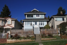
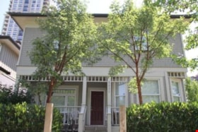
J.S. & Mina Reid Residence
https://search.heritageburnaby.ca/link/landmark600
- Repository
- Burnaby Heritage Planning
- Description
- Residential building.
- Associated Dates
- c.1913
- Street View URL
- Google Maps Street View
- Repository
- Burnaby Heritage Planning
- Geographic Access
- Frances Street
- Associated Dates
- c.1913
- Description
- Residential building.
- Heritage Value
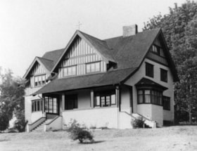
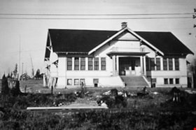
- The gable-on-hipped roofline is this house’s most unique feature. The home is a typical plan of the Foursquare type with the addition of an inset second-storey verandah. The full open front verandah has square columns and closed balustrades. A coloured glass transom was used above the living room window assembly. By 1915, the house was owned by J.S. and Mina Reid (1874-1969).
- Locality
- Vancouver Heights
- Historic Neighbourhood
- Vancouver Heights (Historic Neighbourhood)
- Planning Study Area
- Burnaby Heights Area
- Area
- 377.10
- Contributing Resource
- Building
- Ownership
- Private
- Street Address
- 3851 Frances Street
- Street View URL
- Google Maps Street View
Images
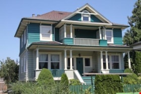
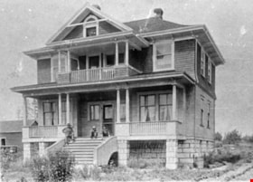
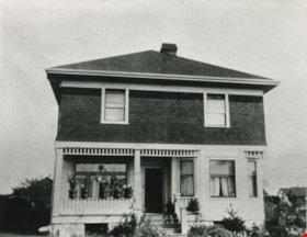
O.G. Naud House
https://search.heritageburnaby.ca/link/landmark509
- Repository
- Burnaby Heritage Planning
- Description
- The O.G. Naud House is a south facing, two-storey house with a bellcast hipped roof, set on a high basement. It features a double-height front verandah supported by classical columns. It is located on Victory Street in the Alta Vista neighbourhood of South Burnaby, and is one of the oldest houses i…
- Associated Dates
- 1908
- Formal Recognition
- Heritage Designation, Community Heritage Register
- Other Names
- Onezime & Charlsie Naud House
- Street View URL
- Google Maps Street View
- Repository
- Burnaby Heritage Planning
- Other Names
- Onezime & Charlsie Naud House
- Geographic Access
- Victory Street
- Associated Dates
- 1908
- Formal Recognition
- Heritage Designation, Community Heritage Register
- Enactment Type
- By-law No. 12316
- Enactment Date
- 26/05/2008
- Description
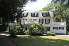
- The O.G. Naud House is a south facing, two-storey house with a bellcast hipped roof, set on a high basement. It features a double-height front verandah supported by classical columns. It is located on Victory Street in the Alta Vista neighbourhood of South Burnaby, and is one of the oldest houses in the area.
- Heritage Value
- Built in 1908, the O.G. Naud House is valued as one of the first houses to be built in the Alta Vista neighbourhood and is a direct link to the first settlement of the area. Close proximity to the B.C. Electric Railway streetcar line, at Royal Oak and Highland Park, permitted easy access to New Westminster and Vancouver. These transportation links, combined with spectacular views of the Fraser Valley, encouraged the early development of this South Burnaby neighbourhood. The O.G. Naud House is architecturally significant as an example of the influence of the Classical Revival style that had been popularized in Eastern Canada. The basic form of the house is a Foursquare, with a double-height verandah that dominates the symmetrically balanced façade, supported on lathe-turned columns. A central entry and regular fenestration further unify the façade composition. Construction employed locally available materials. The rough-cut foundation stone was harvested from boulders from the G. Ledingham property on the south side of Victory Street. The builder and first owner, Onezime George Naud (1858-1951), was originally from St. Albans, Quebec. He worked on railway construction in Alabama, where he met his wife, Charlsie Elizabeth Sims (1869-1974). He later took part in the 1898 Gold Rush in Atlin, then worked as a stonemason on CPR culverts and bridges across B.C. An accomplished stonemason, Naud also worked on the original Vancouver and New Westminster post offices, the Parliament buildings in Victoria, and the Capitol building in Olympia, Washington.
- Defining Elements
- The key characteristics that define the heritage character of the O.G. Naud House include its: - south-facing location, with generous set back from the street, in the Alta Vista neighbourhood of South Burnaby - residential form, scale and massing as expressed by its two-storey height plus full basement, bellcast hipped roof, rectangular plan and front projecting double-height verandah - masonry construction materials such as the rough-cut granite foundation - wood-frame construction, including lapped wooden siding and shingle siding extant under later cladding - Edwardian era features including lathe-turned columns, balustrades of dimensional lumber, scroll-cut bargeboards in front gable, and scroll-cut eave brackets - associated landscape features including lane access to the east, large cedar trees and perimeter plantings
- Historic Neighbourhood
- Alta Vista (Historic Neighbourhood)
- Planning Study Area
- Sussex-Nelson Area
- Function
- Primary Historic--Single Dwelling
- Community
- Alta Vista
- Cadastral Identifier
- P.I.D.003-100-375
- Boundaries
- The O.G. Naud House is comprised of a single residential lot located at 4737 Victory Street, Burnaby.
- Area
- 1099.47
- Contributing Resource
- Building
- Ownership
- Private
- Documentation
- City of Burnaby Planning and Building Department, Heritage Site Files
- Street Address
- 4737 Victory Street
- Street View URL
- Google Maps Street View
Images
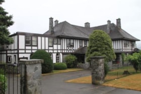
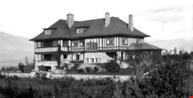
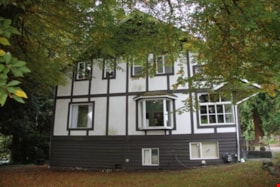
Overlynn Mansion
https://search.heritageburnaby.ca/link/landmark520
- Repository
- Burnaby Heritage Planning
- Description
- Overlynn Mansion is a two and one-half storey British Arts and Crafts mansion, with an exterior composed of a massive native granite rubble-stone base surmounted by distinctive half-timbering, a hip hipped roof, a rare surviving intact interior, and elaborate landscape features including stone wall…
- Associated Dates
- 1909
- Formal Recognition
- Heritage Designation, Community Heritage Register
- Other Names
- Charles J. Peter Mansion
- Street View URL
- Google Maps Street View
- Repository
- Burnaby Heritage Planning
- Other Names
- Charles J. Peter Mansion
- Geographic Access
- McGill Street
- Associated Dates
- 1909
- Formal Recognition
- Heritage Designation, Community Heritage Register
- Enactment Type
- Bylaw No. 10211
- Enactment Date
- 18/09/1995
- Description
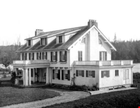
- Overlynn Mansion is a two and one-half storey British Arts and Crafts mansion, with an exterior composed of a massive native granite rubble-stone base surmounted by distinctive half-timbering, a hip hipped roof, a rare surviving intact interior, and elaborate landscape features including stone walls and planted terraces. It is situated in the residential neighbourhood of Vancouver Heights, on a high point of land overlooking Burrard Inlet to the west and the mouth of Lynn Creek to the east. This prominent residence is now part of a large senior citizens development known as Seton Villa.
- Heritage Value
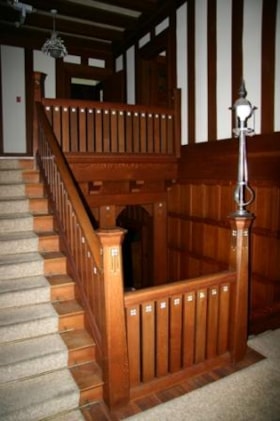
- Overlynn Mansion is valued as a superb example of the work of the noted architectural firm of Maclure and Fox. The architecture of Samuel Maclure (1860-1929) was synonymous with high quality residential design for prominent citizens in both Vancouver and Victoria. Maclure was known for his British Arts and Crafts style with meticulous attention paid to functional and beautiful interiors that utilized native wood combined with luxurious imported fittings. He was a leading exponent of the Art and Crafts design movement in B.C., and established a sophisticated local variation of residential architecture. Maclure’s Vancouver office, in association with his partner Cecil Croker Fox (1879-1916), received some sixty residential commissions between 1909-1915 as a result of the booming local economy and subsequent development of new residential districts. Maclure’s practice in Victoria was equally prolific at the time. Overlynn Mansion is valued as one of Burnaby’s oldest upper-class estates and for its association with the development of Vancouver Heights. In 1909, C.J. Peter and his employer, G.F. and J. Galt Limited, pioneered the development of Vancouver Heights in North Burnaby, believing it to be one of the most picturesque districts in area and an alternative to the CPR’s prestigious Shaughnessy Heights development in Vancouver. Buyers were obligated to build houses worth $3,500 at a time when the average house price was $1,000. Overlynn Mansion, built in 1909 for $75,000, was one of the first houses constructed in Vancouver Heights and by far the most grandiose and impressive. Additionally, this landmark residence is significant and an intact and comprehensive representation of a grand Edwardian era estate home. The interior is notably intact, and retains many highly-refined original features, including substantive millwork of exotic woods, silver-plated and nickel-plated light fixtures, fine plasterwork, tiled fireplaces and exceptional hardware. Landscape features of Overlynn Mansion include the original layout for circulation paths, a porte-cochere, granite posts and stone walls, a sandstone and iron sundial, and mature trees and shrubbery. The house was designated by Burnaby Council in 1995 and was the first heritage building in B.C. to receive legal protection for its interior features.
- Defining Elements
- Key elements that define the heritage character of Overlynn Mansion include its: - prominent corner location on a steep sloping site in the Vancouver Heights neighbourhood - views to Burrard Inlet and the North Shore mountains - residential form, scale and massing as exemplified by its grand two-storey plus basement height and irregular plan - British Arts and Crafts elements such as the rubble-stone granite masonry on the ground floor and foundation level, and decorative half-timbering and rough-cast stucco on the upper storey - compound hipped bell-cast roof, clad with cedar shingles, with shed dormers at the rear - subtle battering of ground floor and foundation level stonework - porte-cochere with hipped roof and battered granite piers - wood-clad projecting bay extensions - irregular fenestration: double-hung 6-over-1 wooden-sash windows; multi-pane casement wooden windows with multi-pane transoms; diamond leaded casement windows; and banks of stained glass windows - five tall rubble-stone granite block stone chimneys - interior features such as the oak, cedar and Yaka (Australian mahogany) panelled walls, oak panelling and staircase walls inlaid with ebony, ivory and brass, stenciled canvas friezes, wooden dadoes and plaster walls, encaustic floor tiles, Australian gumwood floors, oak panelled doors with art glass, oak beamed ceiling with stucco panels, cast plaster vaulted hall and living room ceilings, sterling silver light fixtures including a chandelier and scones, nickel-plated newel light, brass Art Nouveau styled ceiling light, brass stair carpet poles and locks, built-in bookcases and buffet, fireplace with encaustic tiles and fire dogs, imported Medmenham fireplace tiles (the earliest known use outside of the United Kingdom), fireplace mantel with green tile and cast iron firebox, and inglenook fireplace with encaustic tiles and carved mantel and brass fireplace insert - landscape features such as the granite gate posts and iron entrance gate, granite posts and iron fence, granite garden wall, sandstone garden steps, sandstone and iron sundial, granite and concrete terraces adjacent to the house, configuration of pathways and sandstone steps including the front access road, mature deciduous and coniferous tree stock including a Monkey Puzzle Tree and pruned shrubbery throughout the site
- Historic Neighbourhood
- Vancouver Heights (Historic Neighbourhood)
- Planning Study Area
- Burnaby Heights Area
- Organization
- G.F. and J. Galt Limited
- Architect
- Samuel Maclure
- Cecil Croker Fox
- Function
- Primary Historic--Estate
- Primary Current--Multiple Dwelling
- Community
- Burnaby
- Cadastral Identifier
- 004-943-295
- Boundaries
- Overlynn Mansion is a part of a single institutional lot located at 3755 McGill Street, Burnaby.
- Area
- 7912.77
- Contributing Resource
- Building
- Ownership
- Private
- Street Address
- 3755 McGill Street
- Street View URL
- Google Maps Street View
Images
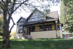
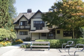
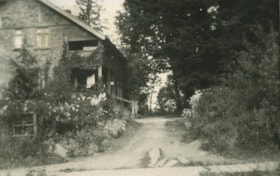
R.F. Anderson House
https://search.heritageburnaby.ca/link/landmark531
- Repository
- Burnaby Heritage Planning
- Description
- The R.F. Anderson House is a large, two-and-one-half storey Arts and Crafts style wood frame house, now located in Deer Lake Park, built as a family home and now used as institutional offices.
- Associated Dates
- 1912
- Formal Recognition
- Heritage Designation, Community Heritage Register
- Other Names
- Robert Fenwick & Bessie Anderson House, Anderson Residence
- Street View URL
- Google Maps Street View
- Repository
- Burnaby Heritage Planning
- Other Names
- Robert Fenwick & Bessie Anderson House, Anderson Residence
- Geographic Access
- Deer Lake Avenue
- Associated Dates
- 1912
- Formal Recognition
- Heritage Designation, Community Heritage Register
- Enactment Type
- Bylaw No. 9807
- Enactment Date
- 23/11/1992
- Description
- The R.F. Anderson House is a large, two-and-one-half storey Arts and Crafts style wood frame house, now located in Deer Lake Park, built as a family home and now used as institutional offices.
- Heritage Value
- The R.F. Anderson House contributes to the overall stylistic ambiance of the area and demonstrates that a range of architectural features can be read as a cohesive whole. Although designed primarily in the British Arts and Crafts genre, as were other residences around Deer Lake, it also displays some influences of the popular Craftsman style. It was constructed in the Deer Lake Crescent subdivision, which was originally promoted as an upper class neighbourhood. It represents one of the first residential developments in the City of Burnaby that required buildings to be of a specific value, thus demonstrating the desire for exclusivity among the successful businessmen who chose to settle in the area. The house and grounds illustrate the social, cultural, lifestyle and leisure sensibilities of a successful local businessman and his family in the early twentieth century; Anderson was a New Westminster hardware merchant and Justice of the Peace. The development of the house and grounds within a controlled suburban context also illustrate the values of the owners in the Deer Lake Crescent subdivision, such as social aspiration, racial exclusivity, demonstration of architectural taste, importance of a landscaped garden, and the provision of facilities for fashionable leisure pursuits such as lawn tennis. The estate makes an important contribution to the residential grouping now preserved within Deer Lake Park, and demonstrates the broad social mix of those who chose to live in the area at a time when it was in transition from a market gardening area to a more exclusive residential community. The R.F. Anderson House is important for its association with local architect Frank William Macey (1863-1935), the first resident architect in Burnaby. Macey was born and trained in England where he was well-respected for having published two standard texts for the architectural profession. He settled in Burnaby in the first decade of the twentieth century and obtained a number of commissions from prominent businessmen who were building grand homes in the new community of Deer Lake. He designed these houses mostly in the British Arts and Crafts style.
- Defining Elements
- Key elements that define the heritage character of the R.F. Anderson House include its: - location within a park setting in relation to the W.J. Mathers House - irregular massing of the exterior and its cladding of drop-siding, with half-timbering and rough-cast stucco in the gables - picturesque irregular roofline, including an alteration in pitch over the front verandah, with cedar shingle cladding - interior plan with its generous entrance hall, staircase, and massive staircase window with leaded-lights - multiple-assembly wooden-sash casement windows - quality of interior features such as the Douglas Fir woodwork (some with original varnish finish); original hardware supplied by Anderson's hardware company; and original fireplaces with ornate tile surrounds - setting with the imprint of the lawn tennis court, now a garden terrace, and some of the original plantings
- Locality
- Deer Lake Park
- Historic Neighbourhood
- Burnaby Lake (Historic Neighbourhood)
- Planning Study Area
- Douglas-Gilpin Area
- Architect
- Frank William Macey
- Function
- Primary Current--Government Office
- Primary Historic--Single Dwelling
- Community
- Burnaby
- Cadastral Identifier
- P.I.D. No. 007-525-931 Legal Description: North 225 feet Lot 'C', District Lot 79, Group 1, New Westminster District, Plan 6884
- Boundaries
- The R.F. Anderson House is comprised of a single municipally-owned property located at 6450 Deer Lake Avenue, Burnaby.
- Area
- 63,100.00
- Contributing Resource
- Building
- Landscape Feature
- Ownership
- Public (local)
- Documentation
- Heritage Site Files: PC77000 20. City of Burnaby Planning and Building Department, 4949 Canada Way, Burnaby, B.C., V5G 1M2
- Names
- Macey, Frank W.
- Street Address
- 6450 Deer Lake Avenue
- Street View URL
- Google Maps Street View
Images
R.M. Edgar House
https://search.heritageburnaby.ca/link/landmark543
- Repository
- Burnaby Heritage Planning
- Description
- The R.M. Edgar House is a particularly large wood-frame Craftsman-inspired bungalow on the south shore of Deer Lake, built as a family estate home. It has a symmetrical front elevation, a deep wrap-around verandah, and a pyramidal roof with massive dormers on each face. Set on a large lot and isola…
- Associated Dates
- 1912
- Formal Recognition
- Heritage Designation, Community Heritage Register
- Other Names
- Robert McBeth & Maude Edgar Residence
- Repository
- Burnaby Heritage Planning
- Other Names
- Robert McBeth & Maude Edgar Residence
- Geographic Access
- Deer Lake Drive
- Associated Dates
- 1912
- Formal Recognition
- Heritage Designation, Community Heritage Register
- Enactment Type
- Bylaw No. 9807
- Enactment Date
- 23/11/1992
- Description
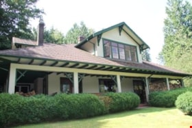
- The R.M. Edgar House is a particularly large wood-frame Craftsman-inspired bungalow on the south shore of Deer Lake, built as a family estate home. It has a symmetrical front elevation, a deep wrap-around verandah, and a pyramidal roof with massive dormers on each face. Set on a large lot and isolated from its neighbours, the house is surrounded by a manicured naturalistic landscape.
- Heritage Value
- The R.M. Edgar House represents an alternative reading of the aesthetic and lifestyle values of those who settled on these lakeside estates in the early twentieth century. By comparison with the grand mansions, set in formally landscaped gardens, on the north shore of Deer Lake, the R.M. Edgar House demonstrates a reverence for the natural, wooded environs, and a deliberate orientation near a stream running through the property. The house is important for its connection with Robert McBeth Edgar, not only a successful and wealthy businessman (partner in the real estate firm Hampton and Edgar) but also an active supporter of the Liberal party, Dominion Returning Officer for Vancouver, and Burnaby Councillor for six years; his contribution to Burnaby and British Columbia was far-reaching and significant. The house illustrates the desire for a simpler lifestyle and retreat into nature of those who settled on the south shore of Deer Lake and also this community's attraction for those of an artistic temperament. Maude Edgar was a poet and broadcaster; and the Edgar's daughter - Ann, known as 'Bebe' - was an accomplished sculptress. This was the first house built on the south shore of Deer Lake.
- Defining Elements
- Key elements that define the heritage character of the R.M. Edgar House include its: - overall bungalow massing and its location facing Deer Lake and backing onto a wilderness of Douglas Fir and moss-covered rocks, with a stream running through the site - remnants of the original landscaping such as the box hedge, rockeries and granite retaining walls - the surrounding naturalistic landscape augmented by ornamental cedars, maples, and rhododendrons - square floor plan with a deep enclosed verandah under a prominent broad hipped roof - symmetrical gable dormers - internal brick chimneys, including one at the centre peak of the roof - Craftsman-influenced exterior with such characteristics as: woodwork brackets on the square verandah pillars; deep overhanging roof eaves; and exposed rafter tails - multiple-assembly 12-paned casement wooden-sash windows in the dormers with 6-paned transoms - rustic Arts and Crafts interior with such items as Douglas fir paneling and large granite fireplace in the Drawing Room
- Locality
- Deer Lake Park
- Historic Neighbourhood
- Burnaby Lake (Historic Neighbourhood)
- Planning Study Area
- Morley-Buckingham Area
- Function
- Primary Current--Single Dwelling
- Primary Historic--Estate
- Community
- Burnaby
- Cadastral Identifier
- P.I.D. No. 001-178-024 and P.I.D. No. 001-178-016 Legal Description: Parcel 'D' (Explanatory Plan 4272) District Lot 85, Group 1, New Westminster District and Parcel 'W' (Explanatory Plan 255) District Lot 85, Group 1, New Westminster District
- Boundaries
- The R.M. Edgar House is comprised of a single municipally-owned property located at 6450 Deer Lake Drive, Burnaby.
- Area
- 11,661.30
- Contributing Resource
- Building
- Landscape Feature
- Ownership
- Public (local)
- Documentation
- Heritage Site Files: PC77000 20. City of Burnaby Planning and Building Department, 4949 Canada Way, Burnaby, B.C., V5G 1M2
- Street Address
- 6450 Deer Lake Drive
Images
Vorce Station
https://search.heritageburnaby.ca/link/landmark664
- Repository
- Burnaby Heritage Planning
- Description
- The Vorce Station is a modest utilitarian passenger tram shelter, originally constructed at the foot of Nursery Street as part of the British Columbia Electric Railway Company’s Burnaby Lake Interurban Line. In 1953, it was moved to a local farm by the Lubbock family, and in 1977 it was relocated t…
- Associated Dates
- 1911
- Formal Recognition
- Heritage Designation, Community Heritage Register
- Repository
- Burnaby Heritage Planning
- Geographic Access
- Deer Lake Avenue
- Associated Dates
- 1911
- Formal Recognition
- Heritage Designation, Community Heritage Register
- Enactment Type
- Bylaw No. 9807
- Enactment Date
- 23/11/1992
- Description
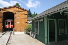
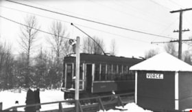
- The Vorce Station is a modest utilitarian passenger tram shelter, originally constructed at the foot of Nursery Street as part of the British Columbia Electric Railway Company’s Burnaby Lake Interurban Line. In 1953, it was moved to a local farm by the Lubbock family, and in 1977 it was relocated to Burnaby Village Museum. The wood-frame structure has a rectangular plan and hipped roof. It is enclosed on three sides, with an open side for access to the train platform and a single long built-in bench across the back of the station.
- Heritage Value
- The heritage value of the Vorce Station is as the last remaining interurban station in Burnaby and one of the few extant structures left in the Greater Vancouver region that were once part of the extensive British Columbia Electric Railway (BCER) interurban system. The Vorce Station was designed and built by the BCER, and is typical of the small local passenger stations on the Burnaby Lake and Chilliwack interurban lines. It was named after C.B. Vorce, the Chief Engineer for the company. The impact of the interurban line on local development was extremely significant, as it connected the cities of New Westminster and Vancouver, and enabled the residents of Burnaby to form a cohesive municipality from the mainly rural lands remaining between the two larger centres. Much of the early development in Burnaby was due to the growth of the interurban rail lines. The heritage significance for this station also lies in its interpretive value within the Burnaby Village Museum. The Vorce Station is an important cultural feature for the interpretation of Burnaby’s transportation history to the public, and is an important surviving feature of the BCER interurban system.
- Defining Elements
- The character defining features of the Vorce Station include its: - rectangular form and pyramidal roof with overhanging eaves - simple vernacular design and utilitarian nature - cedar shingle wall cladding - cedar shingle-clad roof with galvanized pressed tin roof ridges - interior vertical tongue-and-groove panelling - heritage graffiti: initials and messages carved and scrawled on the walls - identifying sign with large letters visible at a distance
- Locality
- Deer Lake Park
- Historic Neighbourhood
- Burnaby Lake (Historic Neighbourhood)
- Planning Study Area
- Morley-Buckingham Area
- Organization
- British Columbia Electric Railway
- Burnaby Village Museum
- Function
- Primary Current--Museum
- Primary Historic--Rail Station
- Community
- Burnaby
- Cadastral Identifier
- P.I.D. No. 011-030-356 Legal Description: Parcel 1, District Lot 79 and District Lot 85, Group 1, New Westminster District, Reference Plan 77594
- Boundaries
- Burnaby Village Museum is comprised of a single municipally-owned property located at 6501 Deer Lake Avenue, Burnaby.
- Area
- 38,488.63
- Contributing Resource
- Building
- Structure
- Landscape Feature
- Documentation
- Heritage Site Files: PC77000 20. City of Burnaby Planning and Building Department, 4949 Canada Way, Burnaby, B.C., V5G 1M2
- Street Address
- 6501 Deer Lake Avenue
Images
William Wilson House
https://search.heritageburnaby.ca/link/landmark512
- Repository
- Burnaby Heritage Planning
- Description
- The William Wilson House is a vernacular two-storey wood-frame Foursquare house with a hipped roof. It is situated at the corner of Wilson Avenue and Central Boulevard in the Metrotown area of Burnaby, adjacent to the SkyTrain line, and is now part of a multi-family residential complex.
- Associated Dates
- 1913
- Formal Recognition
- Heritage Designation, Community Heritage Register
- Other Names
- William & Annie Wilson House
- Street View URL
- Google Maps Street View
- Repository
- Burnaby Heritage Planning
- Other Names
- William & Annie Wilson House
- Geographic Access
- Wilson Avenue
- Associated Dates
- 1913
- Formal Recognition
- Heritage Designation, Community Heritage Register
- Enactment Type
- Bylaw No. 10350
- Enactment Date
- 22/04/1996
- Description
- The William Wilson House is a vernacular two-storey wood-frame Foursquare house with a hipped roof. It is situated at the corner of Wilson Avenue and Central Boulevard in the Metrotown area of Burnaby, adjacent to the SkyTrain line, and is now part of a multi-family residential complex.
- Heritage Value
- The house is valued as the residence of William Wilson (1860-1935) and Annie Wilson (1868-1966) and demonstrates the development of Burnaby from a rural, farming community to an early commuter suburb, and is one of the few remaining early houses in the Metrotown area of Burnaby. Reflecting the area's early history, it was constructed on a subdivided piece of the Wilson’s 3.2 hectare farm that once bordered Kingsway, the primary road linking New Westminster to Vancouver. To develop his subdivided property, Wilson constructed a bisecting street, named it for himself and situated his new home on a large parcel adjacent to the interurban tramline. Constructed in 1913, the William Wilson House is additionally valued as a modest vernacular example of an Edwardian era Foursquare house. Although simple in form, it is distinguished by an inset front verandah, front bay window and clipped ground level corner. Once commonly found in Burnaby, this is a rare surviving example of the homes typically constructed for the working-class families enticed to Burnaby as a consequence of the interurban tramline.
- Defining Elements
- Key elements that define the heritage character of William Wilson House include its: - corner location, adjacent to the old interurban alignment - vernacular Foursquare style as exemplified by its symmetrical form, square floor plan and cubic massing with pyramidal roof - cladding, with narrow lapped wooden siding on the first storey and cedar shingles on the second storey - recessed front verandah, with square columns and ground floor cut-away bay window - regular fenestration, including double-hung 1-over-1 wooden-sash windows, and casement and transom assembly feature window in the living room
- Historic Neighbourhood
- Central Park (Historic Neighbourhood)
- Planning Study Area
- Maywood Area
- Function
- Primary Historic--Single Dwelling
- Primary Current--Single Dwelling
- Community
- Burnaby
- Cadastral Identifier
- 023-352-701
- Boundaries
- The William Wilson House is comprised of a single residential lot located at 6088 Wilson Avenue, Burnaby.
- Area
- 2824.9
- Contributing Resource
- Building
- Ownership
- Private
- Street Address
- 6088 Wilson Avenue
- Street View URL
- Google Maps Street View
Images
Woodward House
https://search.heritageburnaby.ca/link/landmark500
- Repository
- Burnaby Heritage Planning
- Description
- The Woodward House is a two-storey plus basement, wood-framed house with British Arts and Crafts influences. It is set in a wooded landscape on a lakefront property, on Sperling Avenue within the Deer Lake Park Heritage Precinct of Burnaby, with expansive views of the lake.
- Associated Dates
- 1912
- Formal Recognition
- Community Heritage Register
- Other Names
- Maud & Harriet Woodward Residence
- Street View URL
- Google Maps Street View
- Repository
- Burnaby Heritage Planning
- Other Names
- Maud & Harriet Woodward Residence
- Geographic Access
- Sperling Avenue
- Associated Dates
- 1912
- Formal Recognition
- Community Heritage Register
- Enactment Type
- Council Resolution
- Enactment Date
- 26/05/2003
- Description
- The Woodward House is a two-storey plus basement, wood-framed house with British Arts and Crafts influences. It is set in a wooded landscape on a lakefront property, on Sperling Avenue within the Deer Lake Park Heritage Precinct of Burnaby, with expansive views of the lake.
- Heritage Value
- Maud Sarah Woodward (1865-1958), a pioneer nurse originally from England, and her sister Harriet Julia Woodward (1879-1969), one of Burnaby’s first teachers, had this large house built in 1912 to replace the smaller cottage they owned nearby at 5141 Sperling Avenue. Farmer, builder and longtime Deer Lake resident, Bernard R. Hill (1858-1939), was hired as the contractor. The Woodward House played an important role in the Deer Lake community. The Woodward sisters were tireless community organizers and volunteers. This house served a number of functions, and in addition to being the sisters’ home was the local post office until 1949 and also a private kindergarten/school until 1935. Originally designed in the British Arts and Crafts style with a simple rustic exterior of cedar shingles, it is an excellent example of the type of residence constructed by middle-class citizens in the Deer Lake neighbourhood. The B.C. Electric Railway's Burnaby Lake Interurban line, which opened June 12, 1911, fostered the development of Deer Lake as well as other Edwardian era neighbourhoods in Burnaby.
- Defining Elements
- Key elements that define the heritage character of the Woodward House include its: - lakefront location, within the Deer Lake Park Heritage Precinct - residential form, scale and massing as exhibited by its two-storey height, full basement, square floor plan and side-gabled roof - internal red-brick chimneys - British Arts and Crafts features such as cedar shingle siding, extant under later plywood - associated landscape features such as mature coniferous trees
- Historic Neighbourhood
- Burnaby Lake (Historic Neighbourhood)
- Planning Study Area
- Morley-Buckingham Area
- Builder
- Bernard R. Hill
- Function
- Primary Historic--Single Dwelling
- Primary Current--Single Dwelling
- Community
- Deer Lake
- Cadastral Identifier
- P.I.D.002-507-064
- Boundaries
- The Woodward House is comprised of a single residential lot located at 5195 Sperling Avenue, Burnaby.
- Area
- 1788.5
- Contributing Resource
- Building
- Ownership
- Public (local)
- Documentation
- City of Burnaby Planning and Building Department, Heritage Site Files
- Street Address
- 5195 Sperling Avenue
- Street View URL
- Google Maps Street View
Images
Edmonds Baptist Church
https://search.heritageburnaby.ca/link/landmark575
- Repository
- Burnaby Heritage Planning
- Description
- Church building.
- Associated Dates
- 1912
- Street View URL
- Google Maps Street View
- Repository
- Burnaby Heritage Planning
- Geographic Access
- Walker Avenue
- Associated Dates
- 1912
- Description
- Church building.
- Heritage Value
- Beautifully designed in an Arts and Crafts idiom, this church features a textural mix of finishes including lapped siding and stucco and half timbering in the gables. The British Columbian reported in July 1912 that: "The Baptists of Edmonds will possess a fine and well planned church when the building now commenced is ready for occupation. The architects are J.P. Matheson and Son, of Vancouver, and the contractors, Muttitt and Bell, of New Westminster. The entrance porch fronts Edmonds Road and the west side faces Vancouver Road. It will have a capacity for 272 sittings, spacious aisles and choir platform besides various rooms for Baptistery, vestry and robing apartments."
- Locality
- Edmonds
- Historic Neighbourhood
- Edmonds (Historic Neighbourhood)
- Planning Study Area
- Richmond Park Area
- Architect
- J.P. Matheson & Son
- Builder
- Muttitt and Bell
- Area
- 1471.58
- Contributing Resource
- Building
- Ownership
- Private
- Names
- Matheson, John
- Street Address
- 7135 Walker Avenue
- Street View URL
- Google Maps Street View
Images
Kingsway East School
https://search.heritageburnaby.ca/link/landmark546
- Repository
- Burnaby Heritage Planning
- Description
- The Kingsway East School is a two-storey wood-frame Arts and Crafts styled building. The school, and the adjacent cenotaph and memorial tennis courts, comprise Burnaby South Memorial Park.
- Associated Dates
- 1913
- Formal Recognition
- Heritage Designation, Community Heritage Register
- Other Names
- Alan Emmott Centre
- Street View URL
- Google Maps Street View
- Repository
- Burnaby Heritage Planning
- Other Names
- Alan Emmott Centre
- Geographic Access
- Southoaks Crescent
- Associated Dates
- 1913
- Formal Recognition
- Heritage Designation, Community Heritage Register
- Enactment Type
- Bylaw No. 9807
- Enactment Date
- 23/11/1992
- Description
- The Kingsway East School is a two-storey wood-frame Arts and Crafts styled building. The school, and the adjacent cenotaph and memorial tennis courts, comprise Burnaby South Memorial Park.
- Heritage Value
- This school structure completed in 1913, the oldest surviving public education building in the city, was intended to be the auditorium and gymnasium for Burnaby’s first high school. However, because of the 1913 recession and the outbreak of the First World War, it was utilized as the Kingsway East Elementary School for the Edmonds District until 1921. Burnaby South High School opened here in 1922, and after it relocated this building was used for a variety of school purposes until it became redundant. The school was rehabilitated for community purposes in 2002-03 and renamed the Alan Emmott Centre to honor a former Mayor of Burnaby. The impressive scale of the Kingsway East School is indicative of the relative size of the community and its growing demand for schooling at the time of construction, illustrating the value that early community residents placed on education. Built to plans of the Burnaby School Board architect, Joseph Henry Bowman (1864-1943), it also indicates the individual values and design control exercised by the school board during this era. It is also significant for its Arts and Crafts style, allied to the typical Craftsman residential vocabulary, which was employed locally for school buildings of the Edwardian era. By using a common architectural vocabulary, this allowed the institution to reflect the values and aspirations of the local community. The Arts and Crafts style also demonstrated an allegiance to British educational antecedents and a demonstration of loyalty to the Mother Country.
- Historic Neighbourhood
- Edmonds (Historic Neighbourhood)
- Planning Study Area
- Kingsway-Beresford Area
- Function
- Primary Historic--Primary School
- Community
- Burnaby
- Cadastral Identifier
- P.I.D. No. 016-367-154 Legal Description: Lot 1, District Lot 96, Group 1 New Westminster District, Plan 86581
- Boundaries
- The Kingsway East School is comprised of a single municipally-owned property located at 6650 Southoaks Crescent, Burnaby.
- Area
- 6,070.00
- Contributing Resource
- Building
- Landscape Feature
- Structure
- Ownership
- Public (local)
- Documentation
- Heritage Site Files: PC77000 20. City of Burnaby Planning and Building Department, 4949 Canada Way, Burnaby, B.C., V5G 1M2
- Street Address
- 6650 Southoaks Crescent
- Street View URL
- Google Maps Street View
Images
T.O. Townley Estate 'Deerholme'
https://search.heritageburnaby.ca/link/landmark545
- Repository
- Burnaby Heritage Planning
- Description
- The T.O. Townley Estate, 'Deerholme,' is located on a lake front property on the north shore of Deer Lake Park. The main house is a two-and-one-half storey symmetrical-massed wood-frame Colonial Revival structure, with flanking one-storey wings, a side gable roof and a central front entry.
- Associated Dates
- 1913
- Formal Recognition
- Heritage Designation, Community Heritage Register
- Other Names
- Thomas & Frances Townley Estate, Loftus House
- Street View URL
- Google Maps Street View
- Repository
- Burnaby Heritage Planning
- Other Names
- Thomas & Frances Townley Estate, Loftus House
- Geographic Access
- Price Street
- Associated Dates
- 1913
- Formal Recognition
- Heritage Designation, Community Heritage Register
- Enactment Type
- Bylaw No. 9807
- Enactment Date
- 23/11/1992
- Description
- The T.O. Townley Estate, 'Deerholme,' is located on a lake front property on the north shore of Deer Lake Park. The main house is a two-and-one-half storey symmetrical-massed wood-frame Colonial Revival structure, with flanking one-storey wings, a side gable roof and a central front entry.
- Heritage Value
- 'Deerholme' was built as the retirement estate of Lieutenant-Colonel Thomas Owen Townley (1862-1935) and his wife, Frances M. Townley. Townley was a pioneer resident of the Lower Mainland of British Columbia: he served as a lawyer, Registrar of Land Titles for New Westminster District and Mayor of Vancouver for one term in 1901. Built in 1913, this is one of the most significant of the Deer Lake estate houses and was the last of grand Edwardian era mansions built on the lots surrounding the lake. The area had been opened up for development two years earlier by the construction of the British Columbia Electric Railway Interurban Line. The estate speaks of a gracious way of life achieved by society's elite during the Edwardian era, supported by the use of domestic servants. Grand in scale, architecturally sophisticated and set in a bucolic landscape, this residence demonstrates the social status of the owner in the privileged classes of the rapidly developing social structure of Burnaby. The house is also significant as one of the earliest designs by the son of Thomas and Frances Townley, architect Fred Laughton Townley (1887-1966), who had graduated in architecture in 1911 from the University of Pennsylvania. In this house for his parents, he demonstrated his deft understanding of the American Period Revival styles learned during his schooling in the United States. The prevailing local taste for British-derived architecture dictated that this was a style he was rarely able to use until the Colonial Revival styles became more popular in the 1920s. F.L. Townley was a founding partner in Townley and Matheson, which achieved significant success as one of the most accomplished local architectural firms, culminating in their best-known commission, Vancouver City Hall, 1935-36.
- Defining Elements
- Key elements the define the heritage character of ‘Deerholme’ include its: - integration with its south-sloping lakefront site, which contains many original landscape features (extant rockeries, formal drive, tennis lawn, open fields, and specimen shrubs and trees) - two-and-one-half storey form with flanking one-storey wings - side gable roof with symmetrical shed dormers, three at the front and three at the rear - complex fenestration, including multi-paned wooden-sash double-hung windows, 6-over-1 on the ground floor and 6-over-9 on the second floor, and multi-paned wooden-sash casements in the dormers - pair of prominent exterior brick chimneys on each side elevation, clad with rough-cast stucco up to the roof level, and each with four chimney-pots - rough-cast stucco cladding - design elements typical of the Colonial Revival style, such as composed classical formality, side gable roof and balanced symmetrical massing - exterior architectural elements, such as classical columns, window shutters, fanlight feature window, multi-paned quarter-round windows flanking the chimneys, and projecting square brackets in the gables - superior level of design and craftsmanship throughout, including refined interior woodwork such as fireplaces, interior columned screen between hallway and living room and a staircase with Colonial Revival details - significant mature trees (such as Red Oaks, Silver Maples, and Copper Beech). - original guest house and stables, which survive on an adjacent property at 6176 Price Street
- Historic Neighbourhood
- Burnaby Lake (Historic Neighbourhood)
- Planning Study Area
- Douglas-Gilpin Area
- Architect
- Fred Laughton Townley
- Function
- Primary Current--Estate
- Primary Historic--Estate
- Community
- Burnaby
- Cadastral Identifier
- P.I.D. No. 002-652-111 Legal Description: Parcel 'C' (Explanatory Plan 12891) , Blocks 4 and 5, District Lot 79 Group 1, New Westminster District, Plan 536
- Boundaries
- ‘Deerholme’ is comprised of a single municipally-owned property located at 6110 Price Street, Burnaby.
- Area
- 14,099.52
- Contributing Resource
- Building
- Landscape Feature
- Ownership
- Public (local)
- Other Collection
- City of Vancouver Archives: T.O. Townley Residence, Original Plans, Add. MSS. 1399, Temporary No. 61, Location 920-D
- Documentation
- Heritage Site Files: PC77000 20. City of Burnaby Planning and Building Department, 4949 Canada Way, Burnaby, B.C., V5G 1M2
- Street Address
- 6110 Price Street
- Street View URL
- Google Maps Street View
Images
Interview with Alekxos Sarter by Kathy Bossort October 16, 2015 - Track 3
https://search.heritageburnaby.ca/link/oralhistory579
- Repository
- City of Burnaby Archives
- Date Range
- 1910-1960
- Length
- 0:21:54
- Summary
- This portion of the interview is about Alekxos Sarter’s historical overview of early public recreation, and intentions to set aside parkland, on Burnaby Mountain; Acting-Commissioner Richard Bolton’s signing of By Law 1772 that created Barnet Mountain Park in 1942; and her explanation about the fun…
- Repository
- City of Burnaby Archives
- Summary
- This portion of the interview is about Alekxos Sarter’s historical overview of early public recreation, and intentions to set aside parkland, on Burnaby Mountain; Acting-Commissioner Richard Bolton’s signing of By Law 1772 that created Barnet Mountain Park in 1942; and her explanation about the function and kinds of park dedications used in Burnaby.
- Date Range
- 1910-1960
- Length
- 0:21:54
- Geographic Access
- Burnaby Mountain Conservation Area
- Interviewer
- Bossort, Kathy
- Interview Date
- October 16, 2015
- Scope and Content
- Recording is of an interview with Alekxos Sarter conducted by Kathy Bossort. Alekxos Sarter was one of 23 participants interviewed as part of the Community Heritage Commission’s Burnaby Mountain Oral History Project. The interview is mainly about the history of setting aside parkland on Burnaby Mountain from Alekxos Sarter’s perspective and experience as employee in the City of Burnaby Parks, Recreation and Cultural Services. The interview provides an excellent explanation of the history and function of kinds of park dedications used by the City of Burnaby; an overview of issues around including the Trans Mountain tank farm in the conservation area; and the background to the land use and ownership disagreement between the City of Burnaby and Simon Fraser University, its resolution, and the subsequent development of SFU’s UniverCity. Alekxos Sarter talks about Richard Bolton, Burnaby’s Acting-Commissioner who was responsible for dedicating the first park on Burnaby Mountain in 1942, and the creation of a park named after him in UniverCity.
- Biographical Notes
- Alekxos Sarter was born in Vancouver in 1961, to Daine and Kasandra Sarter. She grew up in North Vancouver and since 1994 has lived on a sailboat in False Creek. After attending UBC where she studied landscape architecture, she was hired by the City of Burnaby Parks, Recreation and Cultural Services in 1986. Working first in parks design, Alekxos quickly moved into parks planning, her preferred career. As Research Officer she covers research, planning, public consultation, parks and facility inventory, parkland acquisition, among other duties.
- Total Tracks
- 9
- Total Length
- 2:20:47
- Interviewee Name
- Sarter, Alekxos T.
- Interview Location
- City of Burnaby Parks, Recreation and Cultural Services meeting room
- Interviewer Bio
- Kathy Bossort is a retired archivist living in Ladner, BC. She worked at the Delta Museum and Archives after graduating from SLAIS (UBC) in 2001 with Masters degrees in library science and archival studies. Kathy grew up in Calgary, Alberta, and, prior to this career change, she lived in the West Kootenays, earning her living as a cook for BC tourist lodges and work camps. She continues to be interested in oral histories as a way to fill the gaps in the written record and bring richer meaning to history.
- Collection/Fonds
- Community Heritage Commission Special Projects fonds
- Media Type
- Sound Recording
Audio Tracks
Track three of interview with Alekxos Sarter
Track three of interview with Alekxos Sarter
https://search.heritageburnaby.ca/media/hpo/_Data/_Archives_Oral_Histories/_Unrestricted/MSS196-005/MSS196-005_Track_3.mp3Interview with Dr Blythe Eagles and Dr Violet Eagles 10-Jun-75 - Track 6
https://search.heritageburnaby.ca/link/oralhistory46
- Repository
- City of Burnaby Archives
- Date Range
- 1912-1933
- Length
- 0:07:49
- Summary
- This portion of the interview pertains to Dr Blythe Alfred Eagles and Dr Violet Evelyn (Dunbar) Eagles' thoughts on the distinct areas of Burnaby, municipal planning decisions and the municipal politics of the time.
- Repository
- City of Burnaby Archives
- Summary
- This portion of the interview pertains to Dr Blythe Alfred Eagles and Dr Violet Evelyn (Dunbar) Eagles' thoughts on the distinct areas of Burnaby, municipal planning decisions and the municipal politics of the time.
- Date Range
- 1912-1933
- Photo Info
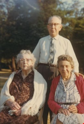
- Mrs. Dunbar, Dr. Blythe Eagles and Dr. Violet (Dunbar) Eagles, June 1967. Item no. 404-002
- Length
- 0:07:49
- Interviewer
- Bradbury, Dr. Bettina
- Interview Date
- 10-Jun-75
- Scope and Content
- Recording is a taped interview with Dr Blythe Eagles and his wife Dr Violet Eagles by SFU (Simon Fraser University) graduate student Bettina Bradbury (and Ross S. McLeod) June 10, 1975. Major themes discussed are: the Depression, the War Years and Burnaby Lake District. To view "Narrow By" terms for each track expand this description and see "Notes".
- Biographical Notes
- Blythe's paternal grandparents, Charles and Maude Eagles immigrated to New Westminster in 1887. Their son Jack married Amelia Jane Johnston, and Blythe Eagles was born in New Westminster in 1902. In 1918 Blythe enrolled at the University of British Columbia, and took a Physiology class with eight other top students - his future wife, Violet Dunbar was the lone woman in the class. Blythe graduated in 1922, winning the Governor General's Gold Medal as top student. He received his MA in 1924 and his PhD in 1926 from the University of Toronto. He then completed his post-doctoral study at the National Institute for Medical Research in London, England. In 1933 Dr. Eagles became head of the Department of Dairying (1936-1955), Chairman of the Division of Animal Science (1955-1967), and Dean of the Faculty of Agriculture (in 1949 until his retirement in 1967). In 1968 he received an Honourary Doctor of Science Award from UBC Blythe was also one of the first appointments to the Burnaby Town Planning Commission. Violet Evelyn Dunbar was born September 29, 1899 in Ontario, the eldest child of John and Mary (Tompson) Dunbar. Violet attained her BA in 1921 and MA in 1922 from the University of British Columbia. In 1922 she attended the Provincial Normal School and within six months had a teaching certificate and taught at Lord Hudson School in 1923. In September 1923 she was awarded a two-year scholarship to the University of Toronto, where she joined Blythe in the Bio-Chemistry Department. She received a second MA and a PhD in 1929. Her graduate studies entailed research in pure proteins and enzymes related to the commercial production of cheese. Through this work she was recognized as one of the leading enzyme chemists in the country, being a senior lab instructor of biochemistry. Violet was one of the founders of the Burnaby Council of Women and active member of the International Council of Women. Blythe and Violet Eagles purchased property at Deer Lake in 1929 and began construction of their home shortly before their marriage on June 25, 1930. The Drs. Blythe and Violet Eagles Estate is a unique expression of the talents and tastes of both the Eagles and Frank Ebenezer Buck (1875-1970) who was head of the Horticultural Department and the Campus Landscape Architect at U.B.C. and established the plan for the Eagles garden while Blythe selected many of the plantings. The Eagles themselves designed the house as a romantic cottage inspired by the British Arts and Crafts style. Violet was an enthusiastic amateur gardener, maintaining and continually developing the garden. The Eagles were active volunteers in the local community as well as at UBC. When Simon Fraser University opened in Burnaby, they became well-known for entertaining dignitaries and special guests of the university in their lavish garden. After Violet's death in 1993, the estate was sold to the City of Burnaby. The funds were used to establish a Chair in Agriculture at the University of British Columbia in their memory.
- Total Tracks
- 11
- Total Length
- 1:24:01
- Interviewee Name
- Eagles, Dr. Blythe
- Eagles, Dr. Violet
- Interviewer Bio
- Bettina Bradbury teaches history and women's studies at York University. She is the author of Wife to Widow. Lives, Laws and Politics in Nineteenth-century Montreal. (Vancouver: University of British Columbia Press, June 2011), 520p; Working Families. Age, Gender and Daily Survival in Industrializing Montreal. (Toronto: Canadian Social History Series, McClelland and Stewart, 1993); (Republished Toronto: Oxford University Press, 1996) (3rd edition, Toronto: University of Toronto Press, 2007). These interviews were undertaken after she completed her MA at Simon Fraser University in 1975 with the support of an LIP grant.
- Collection/Fonds
- Burnaby Historical Society fonds
- Subseries
- Oral history subseries
- Media Type
- Sound Recording
- Web Notes
- Interview was digitized in 2010 allowing it to be accessible on Heritage Burnaby. The digitization project was initiated by the Community Heritage Commission with support from City of Burnaby Council and the BC History Digitization Program of the Irving K. Barber Learning Centre, University of British Columbia. It was recognized by the Heritage Society of BC with an award in 2012.
Images
Audio Tracks
Track six of interview with Dr Blythe Eagles and Dr Violet Eagles
Track six of interview with Dr Blythe Eagles and Dr Violet Eagles
https://search.heritageburnaby.ca/media/hpo/_Data/_Archives_Oral_Histories/_Unrestricted/100-13-08/100-13-08_Track_6.mp3Interview with Rick Sporns by Kathy Bossort October 30, 2015 - Track 4
https://search.heritageburnaby.ca/link/oralhistory606
- Repository
- City of Burnaby Archives
- Date Range
- 1900-2015
- Length
- 0:17:11
- Summary
- This portion of the interview is about Rick Sporn’s discussion of the value of natural areas to Burnaby, the city’s history of protecting green spaces, and the complementary role the Pavilion area plays in the Burnaby Mountain Conservation Area. He talks about how the rose garden and “Playground of…
- Repository
- City of Burnaby Archives
- Summary
- This portion of the interview is about Rick Sporn’s discussion of the value of natural areas to Burnaby, the city’s history of protecting green spaces, and the complementary role the Pavilion area plays in the Burnaby Mountain Conservation Area. He talks about how the rose garden and “Playground of the Gods” sculptures (Kamui Mintara) help Pavilion area visitors more fully appreciate the mountain setting. He also talks about the history of the construction of the Kamui Mintara sculptures.
- Date Range
- 1900-2015
- Length
- 0:17:11
- Names
- Burnaby Mountain Centennial Rose Garden
- Burnaby Mountain Centennial Park
- Kamui Mintara
- Central Park
- Geographic Access
- Burnaby Mountain Conservation Area
- Interviewer
- Bossort, Kathy
- Interview Date
- October 30, 2015
- Scope and Content
- Recording is of an interview with Rick Sporns conducted by Kathy Bossort. Rick Sporns was one of 23 participants interviewed as part of the Community Heritage Commission’s Burnaby Mountain Oral History Project. The interview is mainly about Rick Sporn’s description of the history and design of Burnaby Mountain Centennial Rose Garden and the significance of the Centennial Pavilion area in the Burnaby Mountain Conservation Area. Rick Sporns also talks about his career with the City of Burnaby’s Parks, Recreation and Cultural Services, management of Burnaby Mountain Conservation Area, and the value of natural areas to Burnaby.
- Biographical Notes
- Richard Sporns was born in 1957 in Daly Municipality, Manitoba, to Ulrich and Charlotte Sporns. The family moved to the Burquitlam Area of Burnaby in about 1965. Rick Sporns obtained his BSc degree in biology at SFU and a degree in landscape architecture at UBC. In 1985 he began his career in the City of Burnaby’s Park, Recreation and Cultural Services department where he currently is Assistant Manager - Parks Design. Rick was responsible for designing Burnaby Mountain Centennial Rose Garden, a legacy project proposed by Mark Stockdale to commemorate Burnaby’s 1992 Centennial. The rose garden opened to the public July 18, 1992.
- Total Tracks
- 6
- Total Length
- 1:01:40
- Interviewee Name
- Sporns, Richard "Rick"
- Interview Location
- City of Burnaby Parks, Recreation and Cultural Services meeting room
- Interviewer Bio
- Kathy Bossort is a retired archivist living in Ladner, BC. She worked at the Delta Museum and Archives after graduating from SLAIS (UBC) in 2001 with Masters degrees in library science and archival studies. Kathy grew up in Calgary, Alberta, and, prior to this career change, she lived in the West Kootenays, earning her living as a cook for BC tourist lodges and work camps. She continues to be interested in oral histories as a way to fill the gaps in the written record and bring richer meaning to history.
- Collection/Fonds
- Community Heritage Commission Special Projects fonds
- Media Type
- Sound Recording
Audio Tracks
Track four of interview with Rick Sporns
Track four of interview with Rick Sporns
https://search.heritageburnaby.ca/media/hpo/_Data/_Archives_Oral_Histories/_Unrestricted/MSS196-008/MSS196-008_Track_4.mp3Council Committee series
https://search.heritageburnaby.ca/link/archivedescription139
- Repository
- City of Burnaby Archives
- Date
- 1910-2020
- Collection/Fonds
- City Council and Office of the City Clerk fonds
- Description Level
- Series
- Scope and Content
- Series consists of minutes, agendas, correspondence and reports of committees of Council, including the Court of Revision (up to 2001), Advisory Planning Commission, Bicycle Advisory Committee, Civic Development Committee, Community Heritage Commission, Community Housing and Planning Committee, Com…
- Repository
- City of Burnaby Archives
- Date
- 1910-2020
- Collection/Fonds
- City Council and Office of the City Clerk fonds
- Series
- Council Committee series
- Description Level
- Series
- Scope and Content
- Series consists of minutes, agendas, correspondence and reports of committees of Council, including the Court of Revision (up to 2001), Advisory Planning Commission, Bicycle Advisory Committee, Civic Development Committee, Community Heritage Commission, Community Housing and Planning Committee, Community Issues and Social Planning Committee, Community Policing Committee, Emergency Planning Committee, Environment and Waste Management Committee, Executive Committee, Family Court and Youth Justice Committee, Finance and Economics Development Committee, Traffic and Transportation Committee (Traffic Safety Commission), Traffic and Transportation Committee (Transportation and Transit Division), as well as the minutes of various defunct committees.
- History
- Committees of Council are comprised of Council members and citizens of Burnaby who apply to sit on a committee in a volunteer capacity. In the early years, Council committees did not include citizen participation; committees consisted of two or more councillors nominated by the Reeve, or the entire Council would sit as a committee. One councillor would be selected as committee chair. The Reeve would often sit on committees as well. Committees may also be created on an ad hoc basis to deal with particular issues as they arise. For example, a committee was temporarily formed in 1899 to oversee the construction of the new municipal hall. The earliest committees of Council were the Finance Committee, Board of Works, Board of Health and the Licensing Board. Council would also sit once a year as the Court of Revision. [In addition, Councillors also sat on intermunicipal councils with Vancouver and Coquitlam council members]. By 1910, the number of Council committees had increased in accordance with Burnaby’s development; the earliest committee minutes recorded separately from the minutes of Council date from this year.
- Media Type
- Textual Record
Cumberland Street diversion
https://search.heritageburnaby.ca/link/archivedescription323
- Repository
- City of Burnaby Archives
- Date
- 1911
- Collection/Fonds
- City Council and Office of the City Clerk fonds
- Description Level
- File
- Physical Description
- Textual record and cartographic material
- Scope and Content
- File contains records related to the planning and implementation of a diversion of Cumberland Street including a linen plan.
- Repository
- City of Burnaby Archives
- Date
- 1911
- Collection/Fonds
- City Council and Office of the City Clerk fonds
- Physical Description
- Textual record and cartographic material
- Description Level
- File
- Record No.
- 2016
- Accession Number
- 2001-02
- Scope and Content
- File contains records related to the planning and implementation of a diversion of Cumberland Street including a linen plan.
- Media Type
- Textual Record
- Cartographic Material
- Notes
- Plans/maps are located in file and have not been moved to map case.
Eagles family fonds
https://search.heritageburnaby.ca/link/archivedescription97217
- Repository
- City of Burnaby Archives
- Date
- 1919-1995
- Collection/Fonds
- Eagles family fonds
- Description Level
- Fonds
- Physical Description
- 40 files of textual records and 1489 photographs (6 col. prints, 10 x 15 cm; 1,444 col. slides, 35 mm).
- Scope and Content
- Collection consists of records, correspondence, and photographs created by Drs. Blythe and Violet Eagles related to their home and garden in the Deer Lake area of Burnaby. Also included in the collection are records pertaining the Burnaby Historical Society, the book "The Fraser's History from Glac…
- Repository
- City of Burnaby Archives
- Date
- 1919-1995
- Collection/Fonds
- Eagles family fonds
- Physical Description
- 40 files of textual records and 1489 photographs (6 col. prints, 10 x 15 cm; 1,444 col. slides, 35 mm).
- Description Level
- Fonds
- Access Restriction
- No restrictions
- Reproduction Restriction
- May be restricted by third party rights
- Accession Number
- 2008-10
- Scope and Content
- Collection consists of records, correspondence, and photographs created by Drs. Blythe and Violet Eagles related to their home and garden in the Deer Lake area of Burnaby. Also included in the collection are records pertaining the Burnaby Historical Society, the book "The Fraser's History from Glaciers to Early Settlements" and the Eagles' visit to Robert Burnaby's grave.
- History
- Blythe Eagles's paternal grandparents, Charles and Maude Eagles, immigrated to New Westminster in 1887. Their son Jack married Amelia Jane Johnston, and Blythe Eagles was born in New Westminster in 1902. In 1918, Blythe enrolled at the University of British Columbia and took a Physiology class with eight other top students. His future wife, Violet Dunbar, was the lone woman in the class. Blythe graduated in 1922, winning the Governor General's Gold Medal as top student. He received his MA in 1924 and his PhD in 1926 from the University of Toronto. He then completed his post-doctoral study at the National Institute for Medical Research in London, England. In 1933, Dr. Eagles became head of the Department of Dairying (1936-1955), Chairman of the Division of Animal Science (1955-1967), and Dean of the Faculty of Agriculture (in 1949 until his retirement in 1967). In 1968, he received an Honorary Doctor of Science Award from UBC. Blythe was also one of the first appointments to the Burnaby Town Planning Commission. Violet Evelyn Dunbar was born September 29, 1899, in Ontario, the eldest child of John and Mary (Tompson) Dunbar. Violet obtained her BA in 1921 and MA in 1922 from the University of British Columbia. In 1922, she attended the Provincial Normal School and, within six months, had a teaching certificate and taught at Lord Hudson School in 1923. In September 1923, she was awarded a two-year scholarship to the University of Toronto, where she joined Blythe in the Bio-Chemistry Department. She received a second MA and a PhD in 1929. Her graduate studies entailed research in pure proteins and enzymes related to the commercial production of cheese. Through this work, she was recognized as one of the leading enzyme chemists in the country, being a senior lab instructor of biochemistry. Violet was one of the founders of the Burnaby Council of Women and active member of the International Council of Women. Blythe and Violet Eagles purchased property at Deer Lake in 1929 and began construction of their home shortly before their marriage on June 25, 1930. The Drs. Blythe and Violet Eagles Estate is a unique expression of the talents and tastes of both the Eagles and Frank Ebenezer Buck (1875-1970), who was head of the Horticultural Department and the Campus Landscape Architect at U.B.C. and established the plan for the Eagles garden while Blythe selected many of the plantings. The Eagles themselves designed the house as a romantic cottage inspired by the British Arts and Crafts style. Violet was an enthusiastic amateur gardener, maintaining and continually developing the garden. The Eagles were active volunteers in the local community as well as at UBC. When Simon Fraser University opened in Burnaby, they became well-known for entertaining dignitaries and special guests of the university in their lavish garden. After Violet's death in 1993, the estate was sold to the City of Burnaby. The funds were used to establish a Chair in Agriculture at the University of British Columbia in their memory.
- Media Type
- Textual Record
- Photograph
- Other Title Information
- Title was changed from Eagles family collection to Eagles family fonds to better reflect the nature of the materials.
- Notes
- Title based on contents of collection
- BHS245, BHS331, BHS404, MSS032, BHS314, BHS482, MSS055
Eagles family subseries
https://search.heritageburnaby.ca/link/archivedescription39
- Repository
- City of Burnaby Archives
- Date
- 1912 -1995
- Collection/Fonds
- Burnaby Historical Society fonds
- Description Level
- Subseries
- Physical Description
- Textual records and photographs
- Scope and Content
- Subseries consists of records, correspondence, and photographs created by Drs. Blythe and Violet Eagles related to their home and garden in the Deer Lake area of Burnaby. Also included in the subseries are records pertaining the Burnaby Historical Society, the book "The Fraser's History from Glacie…
- Repository
- City of Burnaby Archives
- Date
- 1912 -1995
- Collection/Fonds
- Burnaby Historical Society fonds
- Subseries
- Eagles family subseries
- Physical Description
- Textual records and photographs
- Description Level
- Subseries
- Access Restriction
- No restrictions
- Accession Number
- BHS1990-11
- BHS1996-21
- BHS2000-04
- BHS1987-07
- BHS1995-06
- BHS1991-18
- BHS1995-03
- Scope and Content
- Subseries consists of records, correspondence, and photographs created by Drs. Blythe and Violet Eagles related to their home and garden in the Deer Lake area of Burnaby. Also included in the subseries are records pertaining the Burnaby Historical Society, the book "The Fraser's History from Glaciers to Early Settlements" and the Eagles' visit to Robert Burnaby's grave.
- History
- Blythe Eagles's paternal grandparents Charles and Maude Eagles immigrated to New Westminster in 1887. Their son Jack married Amelia Jane Johnston, and Blythe Eagles was born in New Westminster in 1902. In 1918, Blythe enrolled at the University of British Columbia and took a Physiology class with eight other top students; his future wife, Violet Dunbar, was the lone woman in the class. Blythe graduated in 1922, winning the Governor General's Gold Medal as top student. He received his MA in 1924 and his PhD in 1926 from the University of Toronto. He then completed his post-doctoral study at the National Institute for Medical Research in London, England. In 1933, Dr. Eagles became head of the Department of Dairying (1936-1955), Chairman of the Division of Animal Science (1955-1967), and Dean of the Faculty of Agriculture (in 1949 until his retirement in 1967). In 1968 he received an Honourary Doctor of Science Award from UBC. Blythe was also one of the first appointments to the Burnaby Town Planning Commission. Violet Evelyn Dunbar was born September 29, 1899 in Ontario, the eldest child of John and Mary (Tompson) Dunbar. Violet obtained her BA in 1921 and MA in 1922 from the University of British Columbia. In 1922 she attended the Provincial Normal School and within six months had a teaching certificate and taught at Lord Hudson School in 1923. In September 1923, she was awarded a two-year scholarship to the University of Toronto, where she joined Blythe in the Bio-Chemistry Department. She received a second MA and a PhD in 1929. Her graduate studies entailed research in pure proteins and enzymes related to the commercial production of cheese. Through this work, she was recognized as one of the leading enzyme chemists in the country, being a senior lab instructor of biochemistry. Violet was one of the founders of the Burnaby Council of Women and active member of the International Council of Women. Blythe and Violet Eagles purchased property at Deer Lake in 1929 and began construction of their home shortly before their marriage on June 25, 1930. The Drs. Blythe and Violet Eagles Estate is a unique expression of the talents and tastes of both the Eagles and Frank Ebenezer Buck (1875-1970), who was head of the Horticultural Department and the Campus Landscape Architect at U.B.C. and established the plan for the Eagles garden while Blythe selected many of the plantings. The Eagles themselves designed the house as a romantic cottage inspired by the British Arts and Crafts style. Violet was an enthusiastic amateur gardener, maintaining and continually developing the garden. The Eagles were active volunteers in the local community as well as at UBC. When Simon Fraser University opened in Burnaby, they became well-known for entertaining dignitaries and special guests of the university in their lavish garden. After Violet's death in 1993, the estate was sold to the City of Burnaby. The funds were used to establish a Chair in Agriculture at the University of British Columbia in their memory.
- Media Type
- Textual Record
- Photograph
- Creator
- Eagles, Dr. Blythe
- Eagles, Dr. Violet
- Notes
- Title based on creator and contents of subseries
- PC245, PC331, PC404, MSS032, PC314, PC482, MSS055
Engineering Department fonds
https://search.heritageburnaby.ca/link/archivedescription43
- Repository
- City of Burnaby Archives
- Date
- 1912-2014
- Collection/Fonds
- Engineering Department fonds
- Description Level
- Fonds
- Physical Description
- 1m of textual records, approximately 2000 cartographic and architecural drawings
- Scope and Content
- Fonds consists of records created by the Engineering department including environmental service files, physical plant plans, and administrative records.
- Repository
- City of Burnaby Archives
- Date
- 1912-2014
- Collection/Fonds
- Engineering Department fonds
- Physical Description
- 1m of textual records, approximately 2000 cartographic and architecural drawings
- Description Level
- Fonds
- Access Restriction
- Subject to FOIPPA
- Reproduction Restriction
- Reproductions subject to FOIPPA
- Scope and Content
- Fonds consists of records created by the Engineering department including environmental service files, physical plant plans, and administrative records.
- History
- In 2020, responsibility for environmental management transferred to Climate Action and Energy, with Engineering retaining responsibility for geotechnical investigations and graffiti management. In 2022, Engineering became responsible for a consolidated Transportation group that aligns transportation planning and implementation functions. Green Fleet and Equipment also moved from Climate Action and Energy to the Public Works division of the Engineering Department. In 2022, Facilities Management was transferred from Engineering to the newly-created Lands and Facilities Department. James Lota served as General Manager, Engineering from 2021-2022. Jozsef Dioszeghy has served in the role since April 2022.
- Creator
- City of Burnaby
- Notes
- Title based on contents of fonds.
Hazel Simnett collection
https://search.heritageburnaby.ca/link/archivedescription71379
- Repository
- City of Burnaby Archives
- Date
- [1910-1996]
- Collection/Fonds
- Hazel Simnett collection
- Description Level
- Fonds
- Physical Description
- 13 files of textual records : ill. (some col.) ; 9 paintings : colour print ; 2 photographs : b&w
- Scope and Content
- Fonds consists of City-generated records, personal records, and political records collected by Hazel Simnett.
- Repository
- City of Burnaby Archives
- Date
- [1910-1996]
- Collection/Fonds
- Hazel Simnett collection
- Physical Description
- 13 files of textual records : ill. (some col.) ; 9 paintings : colour print ; 2 photographs : b&w
- Description Level
- Fonds
- Accession Number
- 2013-22
- 2012-03
- Scope and Content
- Fonds consists of City-generated records, personal records, and political records collected by Hazel Simnett.
- History
- Hazel Simnett was born in Burnaby in 1922 to Frederick and Mary Ann Simnett and grew up looking up to her father who was very involved in labour and unions. A politically active citizen, Hazel Simnett has supported the Canadian Commonwealth Federation (CCF) and the New Democratic Party (NDP). She once ran as a New Democratic Party candidate for Burnaby City Council. Hazel attended Kingsway West Public School and Burnaby South High School in Burnaby. During the 1970s, Hazel was President of the Century Park Museum Association, which governs Burnaby Heritage Museum and published the work "Bygones of Burnaby". Hazel worked on the campaign team of Joan Sawicki from 1990 to 1991, which led Sawicki to be elected as Burnaby-Willingdon riding's MLA. Hazel volunteered her time to be a member of the Burnaby Advisory Planning Commission from 1993 to 1996. In 2006, Hazel won the Burnaby Local Hero Award for her volunteer work at the New Vista Society where she served as chair for a number of years. She also served as a member of the Burnaby Historical Society and established the Hazel Simnett Endowment with the Burnaby Public Library to bring a collection of books on Canadian history and social issues.
- Media Type
- Textual Record
- Photograph
- Graphic Material
- Creator
- Simnett, Hazel
- Notes
- Title based on contents of fonds
- MSS167
