Narrow Results By
Subject
- Advertising Medium 1
- Agriculture 2
- Agriculture - Farms 2
- Buildings - Commercial - Restaurants 1
- Buildings - Heritage 1
- Buildings - Public - Detention Facilities 1
- Buildings - Public - Post Offices 1
- Buildings - Residential 2
- Buildings - Residential - Houses 3
- Documentary Artifacts 1
- Documentary Artifacts - Books 1
- Education 3
Creator
- Albert F. Arnold 1
- Binks, James 1
- Burnaby Village Museum 9
- Carter, David 1
- City of Burnaby 1
- Codd, Lisa 1
- Cooke, Rosemary 1
- Fong, Denise 1
- Frank William Macey 1
- Garden, Hermon & Burwell 1
- Government of British Columbia - Department of Mines and Resources 1
- Government of Canada - Department of Mines - Geological Survey Branch 1
Person / Organization
- Borstal School 1
- Bradbury, Dr. Bettina 1
- Bridge Studios 1
- Brown, Charles B. "Charlie" 1
- Burnaby Public Library 1
- Burnaby Village Museum 3
- Canadian Tamil Congress (CTC) 1
- Chow, Gim Gee Dang 1
- Chow, Hipman "Jimmy" 1
- Chow, Josephine 1
- Chow, Robin Chung Dip 1
- Co-operative Commonwealth Federation "CCF" 1

Lozells Neighbourhood
https://search.heritageburnaby.ca/link/landmark756
- Repository
- Burnaby Heritage Planning
- Associated Dates
- 1905-1924
- Heritage Value
- In 1906 C.T. Piper and Alfred Wiggs built a sawmill at the foot of what is now Piper Avenue along the north shore of Burnaby Lake. These operations and the proximity of the Great Northern Railway encourage settlers to move into this area and among them were Colonel and Mrs. James Ward. They were authorized to open a post office here and Mrs. Ward named it 'Lozells' after the Anglican parish to which she had been a member in Birmingham, England.
- Historic Neighbourhood
- Lozells (Historic Neighbourhood)
- Planning Study Area
- Government Road Area
Images


Family and political photograph album
https://search.heritageburnaby.ca/link/museumdescription3654
- Repository
- Burnaby Village Museum
- Date
- 1914-1977
- Collection/Fonds
- Harold Edward Winch collection
- Description Level
- Item
- Physical Description
- 1 album (ca. 85 photographs)
- Scope and Content
- Item is a photograph album containing ca. 85 photographs, including both personal and work-related subjects such as the Winch family and homes, and Winch's political work and travels. Also included are some textual records relating to Winch's political work.
- Repository
- Burnaby Village Museum
- Collection/Fonds
- Harold Edward Winch collection
- Description Level
- Item
- Physical Description
- 1 album (ca. 85 photographs)
- Scope and Content
- Item is a photograph album containing ca. 85 photographs, including both personal and work-related subjects such as the Winch family and homes, and Winch's political work and travels. Also included are some textual records relating to Winch's political work.
- Names
- Winch, Harold Edward
- Winch, Linda Marian Hendy
- Winch, Grace
- Winch, Eileen
- Winch, Ernest "Ernie"
- Winch, Eric
- Co-operative Commonwealth Federation "CCF"
- New Democratic Party
- Douglas, Tommy
- MacInnis, Grace
- Accession Code
- BV013.12.11
- Date
- 1914-1977
- Media Type
- Photograph
- Textual Record
- Notes
- Title based on contents of photograph
- A selection of photographs from scrapbook have been described at item level (BV013.12.36 to BV015.35.117)
Images

Documents

Central Park Neighbourhood
https://search.heritageburnaby.ca/link/landmark723
- Repository
- Burnaby Heritage Planning
- Associated Dates
- 1891-1904
- Heritage Value
- Central Park was one of the first and fastest-growing communities in Burnaby. Located along the electric tram line and the Vancouver Road (Kingsway), it was also chosen for a government settlement project referred to as the Central Park Small Holdings. The lands held by the Provincial Government were subdivided and sold around 1894 and by 1899 the settlement was large enough to warrant the construction of an Anglican Church there.
- Historic Neighbourhood
- Central Park (Historic Neighbourhood)
- Planning Study Area
- Maywood Area
Images


Government Docks, New Westminster
https://search.heritageburnaby.ca/link/archivedescription39576
- Repository
- City of Burnaby Archives
- Date
- 1910
- Collection/Fonds
- Peers Family and Hill Family fonds
- Description Level
- Item
- Physical Description
- 1 photograph : b&w ; 7.8 x 10.2 cm on page 21.5 x 28 cm (pasted in album)
- Scope and Content
- Photograph of a boat (the "Vite") pulled up to the Government docks at the foot of 8th Street in New Westminster. Queensborough can be seen in the background. The three men in the boat are unidentified.
- Repository
- City of Burnaby Archives
- Date
- 1910
- Collection/Fonds
- Peers Family and Hill Family fonds
- Physical Description
- 1 photograph : b&w ; 7.8 x 10.2 cm on page 21.5 x 28 cm (pasted in album)
- Description Level
- Item
- Record No.
- 477-895
- Access Restriction
- No restrictions
- Reproduction Restriction
- No known restrictions
- Accession Number
- 2007-12
- Scope and Content
- Photograph of a boat (the "Vite") pulled up to the Government docks at the foot of 8th Street in New Westminster. Queensborough can be seen in the background. The three men in the boat are unidentified.
- Subjects
- Recreational Activities - Boating
- Structures - Piers and Wharves
- Geographic Features - Rivers
- Media Type
- Photograph
- Notes
- Title based on contents of photograph
Images


Government Road
https://search.heritageburnaby.ca/link/archivedescription35567
- Repository
- City of Burnaby Archives
- Date
- 1912 (date of original), copied 1986
- Collection/Fonds
- Burnaby Historical Society fonds
- Description Level
- Item
- Physical Description
- 1 photograph : b&w ; 12.7 x 17.8 cm print
- Scope and Content
- Photograph looking east on Government Road from the Haddon family house. One of the men in the photo is Robert Haddon. The other two people are unidentified. Note the loose gravel roadway and the bridge over Eagle Creek.
- Repository
- City of Burnaby Archives
- Date
- 1912 (date of original), copied 1986
- Collection/Fonds
- Burnaby Historical Society fonds
- Subseries
- Pioneer Tales subseries
- Physical Description
- 1 photograph : b&w ; 12.7 x 17.8 cm print
- Description Level
- Item
- Record No.
- 204-425
- Access Restriction
- No restrictions
- Reproduction Restriction
- No known restrictions
- Accession Number
- BHS1988-03
- Scope and Content
- Photograph looking east on Government Road from the Haddon family house. One of the men in the photo is Robert Haddon. The other two people are unidentified. Note the loose gravel roadway and the bridge over Eagle Creek.
- Names
- Haddon, Robert
- Media Type
- Photograph
- Notes
- Title based on contents of photograph
- Geographic Access
- Eagle Creek
- Government Road
- Historic Neighbourhood
- Lozells (Historic Neighbourhood)
- Planning Study Area
- Government Road Area
Images

![Government Road property, [191-] (date of original), copied 1986 thumbnail](/media/hpo/_Data/_Archives_Images/_Unrestricted/204/204-689.jpg?width=280)
Government Road property
https://search.heritageburnaby.ca/link/archivedescription35830
- Repository
- City of Burnaby Archives
- Date
- [191-] (date of original), copied 1986
- Collection/Fonds
- Burnaby Historical Society fonds
- Description Level
- Item
- Physical Description
- 1 photograph : b&w ; 12.7 x 17.8 cm print
- Scope and Content
- Photograph of (left) James Ker (maternal grandfather), (right) Robert Haddon (father), and Gordon Haddon (son), cutting firewood from a large fallen fir with a Wee MacGregor chainsaw on their Hastings Mill property south of the family home on Government Road.
- Repository
- City of Burnaby Archives
- Date
- [191-] (date of original), copied 1986
- Collection/Fonds
- Burnaby Historical Society fonds
- Subseries
- Pioneer Tales subseries
- Physical Description
- 1 photograph : b&w ; 12.7 x 17.8 cm print
- Description Level
- Item
- Record No.
- 204-689
- Access Restriction
- No restrictions
- Reproduction Restriction
- No restrictions
- Accession Number
- BHS1988-03
- Scope and Content
- Photograph of (left) James Ker (maternal grandfather), (right) Robert Haddon (father), and Gordon Haddon (son), cutting firewood from a large fallen fir with a Wee MacGregor chainsaw on their Hastings Mill property south of the family home on Government Road.
- Subjects
- Land Clearing
- Plants - Trees
- Media Type
- Photograph
- Notes
- Title based on contents of photograph
- Geographic Access
- Government Road
- Historic Neighbourhood
- Lozells (Historic Neighbourhood)
- Planning Study Area
- Government Road Area
Images
![Government Road property, [191-] (date of original), copied 1986 thumbnail](/media/hpo/_Data/_Archives_Images/_Unrestricted/204/204-689.jpg)
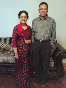
Interview with Samuel Nalliah and Ruth (Angela) Nalliah
https://search.heritageburnaby.ca/link/museumdescription19604
- Repository
- Burnaby Village Museum
- Date
- 1949-2023 (interview content), interviewed 29 May 2023
- Collection/Fonds
- Burnaby Village Museum fonds
- Description Level
- Item
- Physical Description
- 2 sound recordings (wav) (68 min., 6 sec.) + 1 sound recording (mp3) (68 min., 7 sec.)
- Scope and Content
- Item consists of a recording of an oral history interview with Samuel Nalliah and Ruth (Angela) Nalliah conducted by Burnaby Village Museum Registrar, James Binks. 00:00:00 - 00:13:30 Interview opens with introductions. Samuel (Sam) and Angela Nalliah provide biographical details including their p…
- Repository
- Burnaby Village Museum
- Collection/Fonds
- Burnaby Village Museum fonds
- Series
- Museum Oral Histories series
- Subseries
- Many Voices Project Interviews subseries
- Description Level
- Item
- Physical Description
- 2 sound recordings (wav) (68 min., 6 sec.) + 1 sound recording (mp3) (68 min., 7 sec.)
- Material Details
- Interviewer: James Binks Interviewees: Samuel Nalliah and Ruth (Angela) Nalliah Location of Interview: Nalliah family home Interview Date: May 29, 2023 Total Number of tracks: 2 Total Length of all Tracks: 68 min., 6 sec. Digital master recordings (wav) were recorded onto two separate audio tracks, edited and merged together and converted to mp3 for access on Heritage Burnaby Photograph information: Ruth (Angela) Nalliah with husband Samuel Nalliah WARNING: Some of the content discussed in this interview (00:40:58 – 00:57:31) regarding the Tamil genocide may be upsetting to some people.
- Scope and Content
- Item consists of a recording of an oral history interview with Samuel Nalliah and Ruth (Angela) Nalliah conducted by Burnaby Village Museum Registrar, James Binks. 00:00:00 - 00:13:30 Interview opens with introductions. Samuel (Sam) and Angela Nalliah provide biographical details including their parentage, place of birth (Sri Lanka), spoken language and education. Sam Nalliah shares details on his education while living in Sri Lanka, his later education in Wales where he obtained a Master’s Degree in Computer Science and his migration to Halifax in 1978 after obtaining a job at Dalhousie University as a systems analyst. Sam conveys how he decided to relocate from Halifax to Vancouver in 1986 and started his employment with BC Tel. Angela Nalliah shares details on her education and employment after immigrating to Canada from Sri Lanka in 1986. Angela conveys how she first lived in Ottawa, moved to Toronto in 1989 where she began working for TD bank and moved to Vancouver in 1999. 00:13:31 – 00:20:03 Sam Nalliah talks about how he and his wife Angela first met and married in 1999 and moved to Vancouver. Sam shares information on where his other family members immigrated to and why he decided to immigrate to Canada. Angela shares information on other members of her family who immigrated to Canada before her and how her uncle sponsored them all to come. 00:20:04 – 00:29:30 Sam provides further details regarding his family make up including; his first wife, his daughters (born in 1983 and 1985), his step daughter (born in 1991) and his youngest daughter (born in 2000). Sam tells how he worked as a Systems and Operations Manager at Shaughnessy Hospital and later at BC Hydro. Sam provides locations of homes that they lived in Burnaby and Vancouver. Sam and Angela describe what they liked about living in Burnaby, where their daughter attended school and where they did their shopping. 00:29:31 – 00:32:11 Angela talks about working for Prospera Credit Union from 2003 after TD bank downsized. Sam describes how they rented out their house in Vancouver and lived in a rental home in Burnaby that was owned by the City of Burnaby. Sam and Angela recollect the time period that they lived in Burnaby and Vancouver before deciding to move to Surrey in 2015. 00:32:12 – 00:35:59 Sam and Angela provide details regarding their daughter’s post-secondary education and careers. Angela talks about her social activities, volunteer work and involvement with the Thamil Cultural Society of British Columbia, the Women’s Network as well as the Westminster Bible Chapel Church in Burnaby and the Green Timbers Evangelical Covenant Church in Surrey. 00:36:00 – 00:40:57 Sam recalls hearing Prime Minster Pierre Elliott Trudeau speak about the Charter of Rights and Freedoms at Dalhousie University and the effect that his speech made on him. Sam talks about joining the National Democratic Party when Peter Julian was elected as a Member of Parliament for Burnaby. 00:40:58 – 00:57:31 (WARNING: Some of the content discussed in this portion of the interview may be upsetting to some people) Sam and Angela speak about their involvement with the Canadian Tamil Congress (CTC). Angela describes the brutal violence that she witnessed while living in Sri Lanka during the Anti-Tamil state sponsored genocide in the 1980’s. Sam and Angela recollect and discuss their views and actions pertaining to the MV Sun Sea incident where a Thai cargo ship carrying Sri Lankan Tamil refugees to British Columbia were identified as terrorists by the Canadian Government and held in detention facilities. 00:57:32 – 01:08:07 Sam reflects on what he likes about Burnaby. Angela and Sam talk about Hindu temples attended by many Tamil and Sri Lankan people living in Burnaby and the lower mainland. Angela talks about the many cultural events and celebrations that are celebrated within the Tamil and Sri Lankan community including the Pongal Festival. Angela and Sam reflect on how grateful they are to be residents of Canada.
- History
- Interviewees biographies: Samuel (Sam) Nalliah was born in Jaffna, Sri Lanka in 1949. Sam immigrated to Halifax in 1977 after obtaining a position as a systems analyst at Dalhousie University. In 1986, Sam sponsored his parents to come to Canada. In 1986, after being introduced to the milder weather in Victoria, Sam decided to move to British Columbia. He moved to Burnaby in 1990 and began working for BC Tel in Burnaby. Following his job at BC Tel, Sam worked as a Systems and Operations Manager at Shaughnessy Hospital and later at BC Hydro. Ruth (Angela) Nalliah was born in Jaffna, Sri Lanka in 1964 and immigrated to Canada in 1986. As a Tamil living in Sri Lanka in the 1980’s Angela witnessed first hand the brutal violence during the Anti-Tamil state sponsored genocide. In 1986 Angela was relieved to be able to immigrate to Canada after being sponsored by her uncle. Angela first lived and worked in Ottawa and Toronto before marrying Samuel Nalliah in Ottawa in 1999 and the couple moved to Burnaby. Angela worked for TD bank in both Toronto and Vancouver until it downsized in 2003 and she began working for Prospero Credit Union. While living in Burnaby, Angela attended the Westminster Bible Chapel and after moving to Surrey she became a member of the Green Timbers Evangelical Covenant Church. Sam and Angela Nalliah have four daughters and since moving to British Columbia they’ve lived in Vancouver, Burnaby and Surrey. Both Sam and Angela are involved with the Tamil Cultural Association of British Columbia and the Canadian Tamil Congress (CTC) as well as participates in Sri Lankan and Tamil community cultural events. Interviewer biography: James Binks has lived in the Lower Mainland since 2009 after relocating from Ontario. James holds a Bachelor of Arts in Anthropology from the University of British Columbia, where he conducted researched on heritage, environment, and globalization in India, Nepal, and Italy. At Burnaby Village Museum, James contributed to the exhibit “Truths Not Often Told: Being South Asian in Burnaby”.
- Creator
- Burnaby Village Museum
- Subjects
- Education
- Events - Festivals
- Government
- Government - Federal Government
- Migration
- Occupations
- Organizations - Political Parties
- Persons - South Asian Canadians
- Religions
- Religions - Christianity
- Religions - Hinduism
- Rights
- Rights - Human Rights
- Social Issues
- Social Issues - Racism
- Social Issues - Discrimination
- Names
- Nalliah, Ruth "Angela"
- Nalliah, Samuel "Sam"
- Canadian Tamil Congress (CTC)
- Westminster Bible Chapel
- Thamil Cultural Society of British Columbia (TCSBC)
- Responsibility
- Binks, James
- Accession Code
- BV023.16.8
- Access Restriction
- No restrictions
- Reproduction Restriction
- No known restrictions
- Date
- 1949-2023 (interview content), interviewed 29 May 2023
- Media Type
- Sound Recording
- Notes
- Title based on contents of item
- Transcription available upon request - contact Burnaby Village Museum
Images
Audio Tracks
Interview with Samuel Nalliah and Ruth (Angela) Nalliah, 1949-2023 (interview content), interviewed 29 May 2023
Interview with Samuel Nalliah and Ruth (Angela) Nalliah, 1949-2023 (interview content), interviewed 29 May 2023
https://search.heritageburnaby.ca/media/hpo/_Data/_BVM_Sound_Recordings/Oral_Histories/2023_0016_0008_003.mp3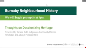
Thoughts on decolonizing heritage
https://search.heritageburnaby.ca/link/museumdescription14757
- Repository
- Burnaby Village Museum
- Date
- 1 Oct. 2020
- Collection/Fonds
- Burnaby Village Museum fonds
- Description Level
- Item
- Physical Description
- 1 video recording (mp4) (88 min., 3 sec.) : digital, col., sd., stereo ; 29 fps
- Scope and Content
- Item consists of a video recording of a live Zoom webinar hosted by Burnaby Village Museum's Kate Petrusa. The webinar is titled "Thoughts on Decolonizing Heritage" and is presented by Kamala Todd - Indigenous Community Planner, Filmmaker, and Adjunct Professor SFU. The zoom webinar is the second i…
- Repository
- Burnaby Village Museum
- Collection/Fonds
- Burnaby Village Museum fonds
- Description Level
- Item
- Physical Description
- 1 video recording (mp4) (88 min., 3 sec.) : digital, col., sd., stereo ; 29 fps
- Material Details
- Presenter: Kamala Todd
- Host: Kate Petrusa
- Date of Presentation: October 1, 7:00 pm - 8:30 pm
- Total Number of tracks: 1
- Total Length of all tracks: 88 min., 3 sec.
- Recording Device: Zoom video communication platform
- Scope and Content
- Item consists of a video recording of a live Zoom webinar hosted by Burnaby Village Museum's Kate Petrusa. The webinar is titled "Thoughts on Decolonizing Heritage" and is presented by Kamala Todd - Indigenous Community Planner, Filmmaker, and Adjunct Professor SFU. The zoom webinar is the second in a collection of seven "Neighbourhood Speaker series" webinars that were presented and made available to the public between September 29 and October 27, 2020. The live webinar and recording was also made available on the Burnaby Village Museum's facebook page. In this webinar, Kamala Todd speaks about how narratives and sense of place shape our connection to the lands we live upon. Kamala highlights how dominant colonial narratives are embedded into the built environment, place names, heritage landscapes, and the very planning of our cities contributing to exclusion and erasure of the hən̓q̓əmin̓əm and Sḵwx̱wú7mesh speaking people, who have lived on their unceded territories since time immemorial.Todd provides her perspectives by asking the questions; How has “Heritage” contributed to colonial harms and erasures? And what will it take to decolonize and re-Indigenize the stories, landscapes, and understandings of the places we call home? The presentation is supported with contemporary and historic photographs. Kamala takes questions from webinar participants and reads from writings of different authors including Stó:lō author, Lee Maracle and Salish poet, Will George.
- Creator
- Burnaby Village Museum
- Subjects
- Indigenous peoples - British Columbia
- Indigenous peoples - Canada - Government relations
- Indigenous peoples - Canada - , Treatment of
- Persons - Pioneers
- Government - Colonial Government
- Monuments
- Responsibility
- Petrusa, Kate
- Geographic Access
- Vancouver
- Accession Code
- BV020.29.2
- Access Restriction
- No restrictions
- Reproduction Restriction
- No known restrictions
- Date
- 1 Oct. 2020
- Media Type
- Moving Images
- Notes
- Title based on contents of video recording
- Video recording was edited for publication on Heritage Burnaby. Original mp4 video recording (BV020.29.2.1) is 103 min., 49 sec.
Images

Video
Thoughts on decolonizing heritage, 1 Oct. 2020
Thoughts on decolonizing heritage, 1 Oct. 2020
https://search.heritageburnaby.ca/media/hpo/_Data/_BVM_Moving_Images/2020_0029_0002_002.mp4
Broadview Neighbourhood
https://search.heritageburnaby.ca/link/landmark750
- Repository
- Burnaby Heritage Planning
- Associated Dates
- 1905-1924
- Heritage Value
- Between 1905 and 1924, the Broadview neighbourhood in Burnaby was settled by almost 100 families who saw the advantage of living in an area that was served by two railway lines - the B.C. Electric Railway and the Great Northern Railway. Touted as being only a 20 minute car ride to the city centre, this neighbourhood expanded during the early 1920s with the promise of a new direct access road to the city being built by the Great Northern Railway company and new blocks being opened up on two government reserves adjoining it.
- Historic Neighbourhood
- Broadview (Historic Neighbourhood)
- Planning Study Area
- Cascade-Schou Area
Images


Duncan & Margaret McGregor Estate 'Glen-Lyon' Mansion
https://search.heritageburnaby.ca/link/landmark518
- Repository
- Burnaby Heritage Planning
- Description
- Overlooking the rich farmland of the Fraser River floodplain, 'Glen-Lyon' is an Edwardian era rural estate, with a tall, two and one-half storey plus basement wood-frame mansion, set in a pastoral and formal landscape with an associated barn and early log pond, located near a ravine and forested ar…
- Associated Dates
- 1902
- Formal Recognition
- Heritage Designation, Community Heritage Register
- Street View URL
- Google Maps Street View
- Repository
- Burnaby Heritage Planning
- Geographic Access
- Marine Drive
- Associated Dates
- 1902
- Formal Recognition
- Heritage Designation, Community Heritage Register
- Enactment Type
- Bylaw No. 12183
- Enactment Date
- 11/12/2006
- Description
- Overlooking the rich farmland of the Fraser River floodplain, 'Glen-Lyon' is an Edwardian era rural estate, with a tall, two and one-half storey plus basement wood-frame mansion, set in a pastoral and formal landscape with an associated barn and early log pond, located near a ravine and forested area adjacent to Marine Drive in South Burnaby.
- Heritage Value
- ‘Glen-Lyon’ is valued as an excellent example of a privately-owned Edwardian era country estate built at the turn of the nineteenth century. The property retains significant heritage features including the Edwardian era mansion with rustic Arts and Crafts features, and elements of a working agricultural landscape. The property was originally the Royal City Mills logging camp, and in 1900 was purchased by Duncan Campbell McGregor (1853-1929) and Margaret Jane McGregor (1875-1960), who named their estate ‘Glen-Lyon’ after Duncan McGregor’s birthplace in Perthshire, Scotland. The McGregors were active in municipal affairs and social activities, and played a significant role in the early development of Burnaby. Duncan McGregor served as a city councillor from 1909 to 1912 and was elected reeve of Burnaby in 1913. Margaret McGregor was instrumental in the formation and fundraising activities of the Victoria Order of Nurses in Burnaby. Additionally, the site is historically significant for its association with early social welfare and correctional reform. The estate was sold in 1926 to an inter-denominational religious organization called the Home of the Friendless, which used it as their B.C. headquarters. The organization was charged with several cases of abuse and neglect in 1937, after which a Royal Commission was formed that led to new legislation to regulate and license all private welfare institutions. 'Glen-Lyon' was sold to the provincial government, and was dedicated in 1939 by the Lt.-Gov. E.W. Hamber for use as the New Haven Borstal Home for Boys and Youthful Offenders (later renamed the New Haven Correction Centre). The Borstal movement originated in England in the late nineteenth century, as an alternative to sending young offenders and runaways to prisons by providing reformatories that focused on discipline and vocational skill. This site’s role as the first North American institution devoted to the Borstal School philosophy was historic, and influenced corrections programs across Canada. The site retains significant features from its development in 1939 as the Borstal School, including a large gambrel-roofed barn designed by Chief Provincial Architect Henry Whittaker of the Department of Public Works that is the only remaining structure of its kind in Burnaby. Between 1941 and 1945 the mansion housed the Provincial School for the Deaf and Blind when the Borstal School was closed temporarily as a war measure during the Second World War.
- Defining Elements
- Key elements that define the heritage character of 'Glen-Lyon' Mansion include its: - location on a sloping site with expansive southern exposure, adjacent to Marine Drive - residential form, scale and massing of the house as exemplified by its two and one-half storey height, above-ground basement and rectangular plan - Arts and Crafts elements of the house such as its stone foundation, multi-gabled roof line with steep central hipped roof, symmetrical cross-gables, side shed dormers, bellcast upper walls sheathed in cedar shingles and lower walls sheathed in narrow clapboard - original exterior features of the house such as the full width front verandah with square columns, central staircase on the southern elevation, original doors and stained glass windows; and the irregular fenestration such as double-hung 1-over-1 wooden-sash windows, bay windows, and projecting windows in the gable ends - original interior features of the house such as the U-shaped main stair designed around two symmetrically placed Ionic columns, and interior trim on the main floor including boxed beams and fireplaces - gambrel-roofed barn with roof vent with finial, sliding hay loft and access doors, small multi-pane windows, and lapped wooden siding - associated landscape features such as the original garden plantings with some exotic and many native specimen trees; the original log pond and its concrete Marine Drive causeway and culvert; rockeries and a rose garden
- Historic Neighbourhood
- Fraser Arm (Historic Neighbourhood)
- Planning Study Area
- Big Bend Area
- Architect
- Henry Whittaker
- Function
- Primary Historic--Estate
- Community
- Burnaby
- Cadastral Identifier
- 003-004-661
- Boundaries
- 'Glen-Lyon' is comprised of a single residential lot located at 4250 Marine Drive, Burnaby.
- Area
- 230873.18
- Contributing Resource
- Building
- Ownership
- Private
- Names
- McGregor, Duncan C. (1853-1929)
- Whittaker, Henry
- Home of the Friendless
- Borstal School
- New Haven Correction Centre
- Subjects
- Buildings - Heritage
- Buildings - Residential - Houses
- Buildings - Public - Detention Facilities
- Buildings - Residential
- Street Address
- 4250 Marine Drive
- Street View URL
- Google Maps Street View
Images


Hastings Barnet Road
https://search.heritageburnaby.ca/link/landmark715
- Repository
- Burnaby Heritage Planning
- Associated Dates
- 1903
- Heritage Value
- Prior to 1900, Hastings Street in Vancouver (named after Rear Admiral George Fowler Hastings, commander of Her Majesty's Pacific Coast Squadron) only extended eastward as far as Renfrew Street. By 1903, however, with operations at the Barnet Mill expanding, a direct route into Vancouver was deemed necessary and the Provincial Government ordered that Hastings be extended to connect with the rough trail known as the Barnet Road.
- Historic Neighbourhood
- Vancouver Heights (Historic Neighbourhood)
- Planning Study Area
- Burnaby Heights Area
Images


Oakalla Prison
https://search.heritageburnaby.ca/link/landmark752
- Repository
- Burnaby Heritage Planning
- Geographic Access
- Royal Oak Avenue
- Associated Dates
- 1912
- Heritage Value
- The Oakalla Prison Farm opened in 1912 and was hailed as the most modern facility of its kind. Initially designed to hold 150 men and 50 women, by the 1950s, the population was well over 1000. A working farm, the prison had its own dairy, vegetable gardens and livestock. From the beginning, the location of Oakalla on 185 acres of scenic land next to Burnaby's Deer Lake was the source of contention with residents petitioning the government to relocate the prison and by 1979 it was decided to close the farm and 64 acres of land were transferred to Burnaby for inclusion on the Deer Lake Park. In 1991, Oakalla closed forever and the buildings were demolished to make way for a new residential housing development and an expansion of the park.
- Historic Neighbourhood
- Burnaby Lake (Historic Neighbourhood)
- Planning Study Area
- Oakalla Area
Images


Ocean View Burial Park - Landscape
https://search.heritageburnaby.ca/link/landmark629
- Repository
- Burnaby Heritage Planning
- Description
- Cemetery site.
- Associated Dates
- 1919
- Street View URL
- Google Maps Street View
- Repository
- Burnaby Heritage Planning
- Geographic Access
- Imperial Street
- Associated Dates
- 1919
- Description
- Cemetery site.
- Heritage Value
- Burnaby’s landmark Ocean View Burial Park was British Columbia’s first non-sectarian cemetery created as a for-profit business enterprise. Organized by a group of local investors headed by Lieut. Col. G.H. Dorrell, the Ocean View Cemetery Company offered a place for burials that was not owned or associated with a civic government, religious or fraternal organization. The cemetery’s design was the vision of Albert F. Arnold, an officer of the Canadian Financiers Trust Company, who was “...always depressed by the lack of beauty in so many places of internment and inevitable neglect that finally reduced them to long-grassed places of unhappy memories.” One local newspaper described the landscape of the cemetery: "The design includes ornamental trees and shrubs, beautiful flower beds and smooth winding walks and drives, with a total absence of the usual somewhat ostentatious reminders of the harvest garnered by the grim reaper."
- Locality
- Alta Vista
- Historic Neighbourhood
- Alta Vista (Historic Neighbourhood)
- Planning Study Area
- Suncrest Area
- Architect
- Albert F. Arnold
- Area
- 359280.00
- Contributing Resource
- Landscape Feature
- Ownership
- Private
- Street Address
- 4000 Imperial Street
- Street View URL
- Google Maps Street View
Images


R.F. Anderson House
https://search.heritageburnaby.ca/link/landmark531
- Repository
- Burnaby Heritage Planning
- Description
- The R.F. Anderson House is a large, two-and-one-half storey Arts and Crafts style wood frame house, now located in Deer Lake Park, built as a family home and now used as institutional offices.
- Associated Dates
- 1912
- Formal Recognition
- Heritage Designation, Community Heritage Register
- Other Names
- Robert Fenwick & Bessie Anderson House, Anderson Residence
- Street View URL
- Google Maps Street View
- Repository
- Burnaby Heritage Planning
- Other Names
- Robert Fenwick & Bessie Anderson House, Anderson Residence
- Geographic Access
- Deer Lake Avenue
- Associated Dates
- 1912
- Formal Recognition
- Heritage Designation, Community Heritage Register
- Enactment Type
- Bylaw No. 9807
- Enactment Date
- 23/11/1992
- Description
- The R.F. Anderson House is a large, two-and-one-half storey Arts and Crafts style wood frame house, now located in Deer Lake Park, built as a family home and now used as institutional offices.
- Heritage Value
- The R.F. Anderson House contributes to the overall stylistic ambiance of the area and demonstrates that a range of architectural features can be read as a cohesive whole. Although designed primarily in the British Arts and Crafts genre, as were other residences around Deer Lake, it also displays some influences of the popular Craftsman style. It was constructed in the Deer Lake Crescent subdivision, which was originally promoted as an upper class neighbourhood. It represents one of the first residential developments in the City of Burnaby that required buildings to be of a specific value, thus demonstrating the desire for exclusivity among the successful businessmen who chose to settle in the area. The house and grounds illustrate the social, cultural, lifestyle and leisure sensibilities of a successful local businessman and his family in the early twentieth century; Anderson was a New Westminster hardware merchant and Justice of the Peace. The development of the house and grounds within a controlled suburban context also illustrate the values of the owners in the Deer Lake Crescent subdivision, such as social aspiration, racial exclusivity, demonstration of architectural taste, importance of a landscaped garden, and the provision of facilities for fashionable leisure pursuits such as lawn tennis. The estate makes an important contribution to the residential grouping now preserved within Deer Lake Park, and demonstrates the broad social mix of those who chose to live in the area at a time when it was in transition from a market gardening area to a more exclusive residential community. The R.F. Anderson House is important for its association with local architect Frank William Macey (1863-1935), the first resident architect in Burnaby. Macey was born and trained in England where he was well-respected for having published two standard texts for the architectural profession. He settled in Burnaby in the first decade of the twentieth century and obtained a number of commissions from prominent businessmen who were building grand homes in the new community of Deer Lake. He designed these houses mostly in the British Arts and Crafts style.
- Defining Elements
- Key elements that define the heritage character of the R.F. Anderson House include its: - location within a park setting in relation to the W.J. Mathers House - irregular massing of the exterior and its cladding of drop-siding, with half-timbering and rough-cast stucco in the gables - picturesque irregular roofline, including an alteration in pitch over the front verandah, with cedar shingle cladding - interior plan with its generous entrance hall, staircase, and massive staircase window with leaded-lights - multiple-assembly wooden-sash casement windows - quality of interior features such as the Douglas Fir woodwork (some with original varnish finish); original hardware supplied by Anderson's hardware company; and original fireplaces with ornate tile surrounds - setting with the imprint of the lawn tennis court, now a garden terrace, and some of the original plantings
- Locality
- Deer Lake Park
- Historic Neighbourhood
- Burnaby Lake (Historic Neighbourhood)
- Planning Study Area
- Douglas-Gilpin Area
- Architect
- Frank William Macey
- Function
- Primary Current--Government Office
- Primary Historic--Single Dwelling
- Community
- Burnaby
- Cadastral Identifier
- P.I.D. No. 007-525-931 Legal Description: North 225 feet Lot 'C', District Lot 79, Group 1, New Westminster District, Plan 6884
- Boundaries
- The R.F. Anderson House is comprised of a single municipally-owned property located at 6450 Deer Lake Avenue, Burnaby.
- Area
- 63,100.00
- Contributing Resource
- Building
- Landscape Feature
- Ownership
- Public (local)
- Documentation
- Heritage Site Files: PC77000 20. City of Burnaby Planning and Building Department, 4949 Canada Way, Burnaby, B.C., V5G 1M2
- Names
- Macey, Frank W.
- Street Address
- 6450 Deer Lake Avenue
- Street View URL
- Google Maps Street View
Images


Russian Submarines at Barnet
https://search.heritageburnaby.ca/link/landmark748
- Repository
- Burnaby Heritage Planning
- Associated Dates
- 1915-1917
- Heritage Value
- This site was a top secret site where 460 men worked on the assembly of five submarines for the Russian Navy during World War I. The Seattle contractor was forbidden from doing the work in the US because of American neutrality regulations and he set up the secret plant here without the knowledge of the Canadian Government.
- Historic Neighbourhood
- Barnet (Historic Neighbourhood)
- Planning Study Area
- Burnaby Mountain Area
Images


Sketch map of the Province of British Columbia showing mining divisions
https://search.heritageburnaby.ca/link/museumdescription18946
- Repository
- Burnaby Village Museum
- Date
- 1907
- Collection/Fonds
- Burnaby Village Museum Map collection
- Description Level
- Item
- Physical Description
- 1 map : col. lithographic print on paper ; 52 x 59 cm
- Scope and Content
- Item consists of a map titled "Sketch map of the Province of / British Columbia / Showing Mining Divisions"; "Department of Mines, / Victoria, 1907". Map includes wagon roads and trails and geographic disticts.
- Repository
- Burnaby Village Museum
- Collection/Fonds
- Burnaby Village Museum Map collection
- Description Level
- Item
- Physical Description
- 1 map : col. lithographic print on paper ; 52 x 59 cm
- Material Details
- Scale not determinable
- Scope and Content
- Item consists of a map titled "Sketch map of the Province of / British Columbia / Showing Mining Divisions"; "Department of Mines, / Victoria, 1907". Map includes wagon roads and trails and geographic disticts.
- Accession Code
- HV977.37.172
- Access Restriction
- No restrictions
- Reproduction Restriction
- No known restrictions
- Date
- 1907
- Media Type
- Cartographic Material
- Scan Resolution
- 600
- Scan Date
- 2023-08-17
- Notes
- Title based on contents of map
- Stamp on verso of map reads: "Compliments of Vancouver Tourist Bureau"
Zoomable Images


Subdivision plans in New Westminster District Group 1 – Burnaby, Vancouver and map - Canada Department of Mines
https://search.heritageburnaby.ca/link/museumdescription6994
- Repository
- Burnaby Village Museum
- Date
- 1890-1909
- Collection/Fonds
- Burnaby Village Museum Map collection
- Description Level
- File
- Physical Description
- 1 plan : graphite on paper + 2 plans : black ink on paper + 1 map : col. on paper mounted on 2 sides of cardboard 76 x 102 cm
- Scope and Content
- Item consists of a large board with one New Westminster District subdivision plan mounted on one side and two New Westminster District subdivision plans and one colour map mounted on the other side. Side A: 1. "Plan / of Subdivision of / Blocks 2, 3, 4, 5, 6 / Lot 77 / Group 1 / New Westminster D…
- Repository
- Burnaby Village Museum
- Collection/Fonds
- Burnaby Village Museum Map collection
- Description Level
- File
- Physical Description
- 1 plan : graphite on paper + 2 plans : black ink on paper + 1 map : col. on paper mounted on 2 sides of cardboard 76 x 102 cm
- Material Details
- Scales 1:720 and 1:1200 and 1:.00001578
- Scope and Content
- Item consists of a large board with one New Westminster District subdivision plan mounted on one side and two New Westminster District subdivision plans and one colour map mounted on the other side. Side A: 1. "Plan / of Subdivision of / Blocks 2, 3, 4, 5, 6 / Lot 77 / Group 1 / New Westminster District / BC. / Scale 100 feet = 1 inch", "Deposited 8th day / of April 1890 / Mowileg [sic] / Dist. Regt". Plan is drawn in graphite with annotations: "AB_Parts_lettered_are_lots_in / the_different_subdivisions" / "Owners: / James E. Hall / P.S.Cabilan [sic] by his attorney Joseph Hall / Joseph Hall / Eliza J. Shannon / John Harrison"; "This plan is correct and is prepared under the / provisions of the Land Registry Act" ; signed by: "Gordon Herman & Burwell / Dominion & Provincial Land Surveryors / Vancouver March 19th/90" . Plan is initialed by: "RB" [sic] (in blue pencil crayon) and measures: 99.5 x 65 cm (Geographic location: Burnaby) Side B: 1. Map titled "Canada / Department of Mines / Geological Survey Branch" / "Hon.W Templeton, Minister / A.P. Low, Deputy Minister / R.W. Brock, Acting Director", Vol. XXXI, Plate I / Compiled under the direction of / James White, F.R.G.S. Geographer /Dep. of Interior". Note above map reads: "To illustrate Mr. James Barrowman's report as Delegate at the Excursion - meeting of the Canadian Mining Institute", "The instiitution of Mining Engineers / Transactions 1908 - 1909", "The Mining Institute of Scotland / Transactions 1908-1909". Map identifies minerals and includes a Legend and Scale: 100 miles = 1 inch 2. "Plan / of Subdivision of / Lot 4 / of Subdivision of / Lot 87. Gr. 1 / New Westminster District / Scale 60' = 1in." Plan is initialed by: "RB" [sic] along with a note "also Board / 48" (in blue pencil crayon) (Geographic location: Burnaby) 3. Plan of "Lot 335 / G. 1" west of Boundary Road and north of River Road - Vancouver. (Geographic location: Vancouver)
- Publisher
- The Mining Institute of Scotland
- Geographic Access
- Vancouver
- Accession Code
- HV977.93.25
- Access Restriction
- No restrictions
- Reproduction Restriction
- No known restrictions
- Date
- 1890-1909
- Media Type
- Cartographic Material
- Scan Resolution
- 300
- Scale
- 72
- Notes
- Title based on contents of file
- Scale is measured in feet and miles.
- The term "Lot" often refers to "District Lot"
Images


![B.C. Parliament Building in Victoria, [ca. 1920] thumbnail](/media/hpo/_Data/_BVM_Images/1985/1985_5899_0003_001.jpg?width=280)
B.C. Parliament Building in Victoria
https://search.heritageburnaby.ca/link/museumdescription1527
- Repository
- Burnaby Village Museum
- Date
- [ca. 1920]
- Collection/Fonds
- Burnaby Village Museum Photograph collection
- Description Level
- Item
- Physical Description
- 1 photograph : b&w ; 6.5 x 9 cm
- Scope and Content
- Photograph of the British Columbia Parliament Buildings, home of the Legislative Assembly of British Columbia located in Victoria. There are people standing on the steps to the front entrance. There is a sign on the lawn in front of the parliament buliding that reads, "PLEASE KEEP OFF THE GRASS."
- Repository
- Burnaby Village Museum
- Collection/Fonds
- Burnaby Village Museum Photograph collection
- Description Level
- Item
- Physical Description
- 1 photograph : b&w ; 6.5 x 9 cm
- Material Details
- stamped on verso, t. "159"
- Scope and Content
- Photograph of the British Columbia Parliament Buildings, home of the Legislative Assembly of British Columbia located in Victoria. There are people standing on the steps to the front entrance. There is a sign on the lawn in front of the parliament buliding that reads, "PLEASE KEEP OFF THE GRASS."
- Subjects
- Government - Provincial Government
- Geographic Access
- Victoria
- Accession Code
- BV985.5899.3
- Access Restriction
- No restrictions
- Reproduction Restriction
- No known restrictions
- Date
- [ca. 1920]
- Media Type
- Photograph
- Scan Resolution
- 600
- Scan Date
- 2024-02-27
- Notes
- Title based on contents of photograph
Images
![B.C. Parliament Building in Victoria, [ca. 1920] thumbnail](/media/hpo/_Data/_BVM_Images/1985/1985_5899_0003_001.jpg)
Oral history interview with Hipman "Jimmy" Chow and Donna Polos
https://search.heritageburnaby.ca/link/museumdescription19146
- Repository
- Burnaby Village Museum
- Date
- 29 Jun. 2022
- Collection/Fonds
- Hipman "Jimmy" Chow and Donna Polos fonds
- Description Level
- Item
- Physical Description
- 3 sound recordings (wav) (02:06:53 min) + 1 sound recording (mp3) (02:06:53 min)
- Scope and Content
- Item consists of an audio recording of an oral history interview with Jimmy Chow and Donna Polos conducted by Denise Fong with assistance from Burnaby Village Museum Assistant Curator, Kate Petrusa. During the interview, Jimmy Chow and Donna Polos discuss; their ancestral background, childhood, pla…
- Repository
- Burnaby Village Museum
- Collection/Fonds
- Hipman "Jimmy" Chow and Donna Polos fonds
- Description Level
- Item
- Physical Description
- 3 sound recordings (wav) (02:06:53 min) + 1 sound recording (mp3) (02:06:53 min)
- Material Details
- Interviewer: Denise Fong Co Interviewer and technical support: Kate Petrusa Interviewees: Hipman "Jimmy" Chow and Donna Polos Location of Interview: Home of Jimmy Chow and Donna Polos on Victory Street, Burnaby Date of interview: June 29, 2022 Total Number of Tracks: 3 Total length of all Tracks: 02:06:53 min Digital master recordings (wav) were recorded onto 3 separate audio tracks, edited and merged together and converted to mp3 for access on Heritage Burnaby
- Scope and Content
- Item consists of an audio recording of an oral history interview with Jimmy Chow and Donna Polos conducted by Denise Fong with assistance from Burnaby Village Museum Assistant Curator, Kate Petrusa. During the interview, Jimmy Chow and Donna Polos discuss; their ancestral background, childhood, places of residence, education, career history, how they met, Jimmy's experience working in the film industry, their home in Burnaby and their neighbourhood, their political activism in Burnaby, Robin Chung Dip's work in Vancouver’s' Chinatown, the gambling scene in Vancouver prior to legalized forms of gambling and their memories of supper clubs in Vancouver. 00:00 - 5:57 Opening introductions where Jimmy Chow and Donna Polos provide information on their full names, their birth places and their ancestral background. Jimmy clarifies that his birth name is Hipman Chow but that he was given the English name “Jimmy” by his father when he came to Canada. Jimmy shares that he was born in 1948, in the Village of Lin Pong Lee, Hoiping, China and immigrated to British Columbia with his mother, Gim Gee Chow in 1950 to escape the Communist Regime and to join his father who had already immigrated to Canada. Jimmy imparts that many Chinese immigrated to British Columbia in search of a better life, referring to it as “Gold Mountain” and that even though they faced extreme racial discrimination that many stayed since they felt that it was better than returning. Donna Polos shares ancestral information on both her maternal and paternal sides of the family. Donna’s mother’s family came from Helsinki, Finland. Donna’s paternal grandmother emigrated from Ukraine to Argentina and then to Winnipeg. Donna’s paternal grandfather, James Kostopolus (renamed Polos) emigrated as a 12 year old orphan from Sparta, Greece to the United States but was denied entry so ended up going to Halifax and eventually made his way to Vancouver. Once in Vancouver, he became a restaurant proprietor and over the years, he owned and operated three restaurants in Vancouver, including; “Jimmy’s Café” (next door the Astoria Hotel); “Home Apple Pie Café” (Princess Avenue & Hastings Street) and a restaurant that was located on Alma Street. 05:58 - 13:28 Jimmy recollects in further detail, the many places that his family lived over the years. Jimmy’s father Robin Chung Dip Chow immigrated to Vancouver at the age of 14 years and worked and lived in Victoria and Vancouver. In 1950, Jimmy and his mother fled China, first to Hong Kong and then to Vancouver to join his father. Soon after arriving in Vancouver, for the next four years, he and his parents lived in Manitoba, Saskatchewan and Quebec City where his father, Robin had work in restaurants and hotels. Jimmy attended school while the family lived in these different places and began to learn English. After four years, the family returned to Vancouver, first living in areas of Chinatown and Strathcona before settling in the neighbourhood of Mount Pleasant. Jimmy shares his memories of growing up in Strathcona and the Mount Pleasant neighbourhood, schools that he attended and the friendships that he made. Jimmy recollects details about the old Bethlehem Lutheran Church that he attended and describes the demands of the education required to become a Lutheran minister. 13:29 - 15:47 Jimmy tells of how his father, Robin Chung Dip Chow had to pay the Chinese Head Tax of $500 when he arrived in Vancouver at 14 years of age (1921) and how his father had to work hard pay off the head tax over the years. Denise Fong and Jimmy Chow, talk about the origin of a photograph portrait of Jimmy Chow that was taken around 1954 and speculate whether it might have been taken by well known portrait photographer, Yucho Chow. 15:48 - 19:33 Donna Polos recollects the many locations that her family lived while she was growing up in Vancouver. First residing at various locations in the downtown east side of Vancouver before moving to a home near Joyce Station where she lived until 21 years old. After 21 years of age, Donna moved in with roommates in Vancouver before moving in with Jimmy in North Burnaby in 1972. In 1976 Donna and Jimmy purchased their home on Victory Street. Both Donna and Jimmy talk about their careers after high school. Jimmy talks about how he worked at the Supervalu grocery store near his house. Jimmy planned to use his savings from his job to travel but instead he used his savings for a down payment on a house with Donna. Donna imparts that after obtaining her teaching degree she began working in Burnaby schools, eventually teaching at Burnaby South. 19:34 - 32:08 Both Jimmy and Donna share their educational background and experiences growing up. Jimmy first attended Florence Nightingale elementary in Strathcona, then Mount Pleasant Elementary and later high school at 24th Avenue and Main Street. Donna lists the schools that she attended including; elementary school in Strathcona, Carlton Elementary School at Kingsway and Joyce, Windermere High School, Vancouver City College (Langara) and the University of British Columbia. Donna and Jimmy reflect on public transportation that was available during the time they were growing up. Donna recollects her childhood growing up in the neighbourhood of Joyce Station, the freedom that she experienced playing outside in nature and what inspired her to become a teacher. Jimmy reflects on some of his mentors and about his first experience seeing movies as a young child at a cinema in Asquith, Saskatchewan. Donna communicates her own experiences of sexism throughout her high school, college and university education (1968-1972). 32:09 - 36:18 Donna talks about her career history and some of her major turning points. Donna recollects starting out as a Chemistry lab assistant, marking math papers before working as a teacher on call and eventually being hired as a teacher at Clinton Elementary School where she taught for nine years. Donna shares a memory of her first experience working as a teacher on call at Gilmore Elementary School and the fire that occurred there. After starting a family (Jimmy and Donna had three children) Donna worked part time teaching while Jimmy worked full time in film. Donna, shares that in 1991, after a near death experience, she became interested in fine art and took drawing and watercolour painting classes. With this experience, Donna experimented with different painting techniques on paper and fabric. Donna tells of how she retired from teaching in 2008 but continued to participate in the schools as an Artist in Residence. 36:19 - 58:18 Jimmy talks about his work and career history. He shares memories of his experiences as a young boy delivering newspapers, working at a local pharmacy, stocking shelves at the local supermarket, and his experience working with troubled youth and of how he thought that he might like to become a social worker. Jimmy tells of how he was uncertain of what to do until he got a job with the CBC in 1973 which eventually launched his career as a property master in the film industry, becoming a member of IATSE and a voting member of the Academy of Motion Pictures. Jimmy describes in detail what it means to be a property master and the work that is entailed in the film industry. 58:19 - 1:07:45 Donna Polos describes her art practice and her connection to Burnaby. Donna recollects how she first started working with textiles and fabrics from a young age and how this later inspired her to develop her own watercolour techniques of painting on paper, canvas and fabrics. Donna describes how she first got started by taking art classes in Burnaby and now has over 31 years of experience working in watercolour. Donna has worked as an Artist in Residence in Burnaby schools, been a member of the Burnaby Arts Council, had her first show in 1997 and has been involved in many art projects over the years. Donna describes the style of her work, first starting with more figurative work, social commentary and still life and that now most of her work is landscape based. Donna coveys that as a political activist in Burnaby, she was an active participant in the development of a tree bylaw, has petitioned to protect renters from demo-evictions and the impacts of future development on the local environment. 1:07:46 - 1:07:59 Background discussion between Denise Fong and Kate Petrusa re interviews. 1:08:00 - 1:26:36 Jimmy provides information on his connection to the local film industry and the changes that have occurred over the years. Jimmy describes the first studios on the North Shore and the eventual establishment of Bridge Studios on Boundary Road. Jimmy shares that in 1988, he and some of his colleagues in the film industry put a proposal together to buy the Bridge Studios but it didn't go through. Since the Bridge Studios and other film studios have been established in Burnaby and Vancouver, the industry has grown exponentially. Jimmy became the 54th member of the local IATSE union. Jimmy describes some of his experiences working on various productions including "Seven Years in Tibet", provides a description of what a film studio is, how it is used and the differences between working in the film industry in the United States and British Columbia. 1:26:37 - 1:32:46 Jimmy and Donna recollect how they first met, buying a house in Burnaby, getting married and starting a family. The two share memories of their wedding in White Rock and Jimmy talks about the Chinese hair cutting ceremony in recognition of their first born child that took place in Chinatown in Vancouver. Jimmy tells of how his parents had hopes of him marrying a Chinese woman and his mother began introducing him to a few young Chinese women from the time he was 16 years old. Jimmy mentions that his parents rarely used Western Medicine and relied on Traditional Chinese Medicine. Donna and Jimmy talk about Jimmy's parents, when they died and how happy his parents were to have grandchildren. 1:32:47 - 1:40:13 Jimmy and Donna talk about their house on Victory Street which they purchased in 1976. They share information on the history of the house, how it was built in 1939 by Norm Clark, how they fell in love with the design of the house and the neighbourhood. 1:40:14 - 1:58:31 Jimmy and Donna share information on their family life in Burnaby, their neighbourhood and favourite places in Burnaby. Donna lists the schools that their three children attended including; Nelson Avenue School, Burnaby South High School and Burnaby Central High School. Both Donna and Jimmy convey that all of their children played soccer and the benefits that the sport provided them. Donna and Jimmy talk about how the neighbourhood has changed over the years, the benefits of where they live, their fondness for built heritage and the many parks and trees in Burnaby. 1:58:32 - 2:02:50 Jimmy begins to share information on his father, Robin Chung Dip Chow's employment history. Jimmy recalls that his father, Robin worked in a variety of jobs over the years and as a young child, Jimmy was uncertain of what his father's job was but thought that he worked in accounting. He mentions that his father stopped working at 45 years of age due to a problem with his Achilles tendon. Jimmy describes his father as an intellectual who worked at gambling houses in Vancouver's Chinatown where people played mah-jong and fan-tan. Jimmy recollects that these were large clubs with lots of employees. His father never gambled but he was good with money so he worked on the management side. Jimmy mentions that while working in the film industry, his father took him and some of his film colleagues into some of the gambling houses in Chinatown to assist them with a production that they were working on. 2:02:51 - 2:06:58 Donna shares her own family history regarding gambling. She mentions that her uncle worked as a high end "bookie" in Vancouver and how in 1968, her uncle was arrested but got let go with just a small fine. Jimmy describes what gambling was like in those days with various sweepstakes, not under the jurisdiction of the government like it is today. Both Donna and Jimmy recollect the popularity of supper clubs their memories of Vie's Chicken and Steak House that was located in Hogan's Alley. Jimmy laments the destruction of Hogan's Alley and the other proposals that were brought forward that would change Chinatown and Strathcona.
- History
- Interviewees biography: Hipman "Jimmy" Chow was born in Lin Pong Lee, Hoiping, China in 1948. In 1950, Jimmy Chow immigrated to Vancouver from China with his mother, Gim Gee Chow to join his father, Robin Chung Dip Chow who'd immigrated to Canada at 14 years of age in 1921. For the first four years after immigrating, Jimmy and his parents lived in Manitoba, Saskatchewan and Quebec before returning to Vancouver around 1954. Jimmy and his family then lived and worked in Vancouver eventually settling in the neighbourhood of Mount Pleasant. In the early 1970s, Jimmy met his future wife Donna Polos and they married in 1981. Donna Polos was born in 1949 to Donald James Polos and Mayme "May" Helen Tilikana Polos and grew up in Vancouver. Between the age of 5 and 21 years, Donna lived in the neighbourhood of Joyce Station. In 1976, Jimmy and Donna purchased and moved into a house on Victory Street in Burnaby where they still live today. While living on Victory Street, they've raised their three children. Donna received her teaching degree and taught in elementary schools for many years. In 1991, after a near death experience, Donna developed an interest in drawing and painting and began experimenting with water colour painting on fabric. Donna has since exhibited her work widely, participated as an Artist in Residence in Burnaby schools and is a member of the Federation of Canadian Artists. Jimmy entered the film industry in 1973, gaining experience and recognition as a property master and has worked on many films over a 45 year career. Interviewer biography: Denise Fong is a historical researcher at Burnaby Village Museum. She has degrees in Anthropology (BA) and Archaeology (MA), and is completing her doctoral degree at UBC in Interdisciplinary Studies. Her primary research interests are in Chinese Canadian history and critical heritage studies. She is the co-curator of BVM’s “Across the Pacific” exhibition, and the Museum of Vancouver’s “A Seat at the Table – Chinese Immigration and British Columbia”.
- Creator
- Burnaby Village Museum
- Subjects
- Buildings - Commercial - Restaurants
- Buildings - Residential
- Buildings - Residential - Houses
- Education
- Geographic Features - Parks
- Geographic Features - Neighbourhoods
- Government - Local Government
- Industries - Film
- Migration
- Occupations
- Occupations - Artists
- Occupations - Grocers
- Occupations - Entrepreneurs
- Occupations - Teachers
- Persons - Chinese Canadians
- Social Issues - Racism
- Sports - Soccer
- Names
- Bridge Studios
- Chow, Gim Gee Dang
- Chow, Hipman "Jimmy"
- Chow, Robin Chung Dip
- Polos, Donna
- Polos, James "Jimmy", 1898-1962
- Polos, Donald James
- Polos, Mayme "May" Helen Tilikana
- Geographic Access
- Victory Street
- Accession Code
- BV022.21.1
- Date
- 29 Jun. 2022
- Media Type
- Sound Recording
- Notes
- Title based on contents of recording
- Hipman "Jimmy" Chow's name in Cantonese is Chow Hipman and in Mandarin is Zhou Xiamin.
Images
Audio Tracks
Oral history interview with Hipman
Oral history interview with Hipman
https://search.heritageburnaby.ca/media/hpo/_Data/_BVM_Sound_Recordings/Oral_Histories/2022_0021_0001_004.mp3
Haddon family home
https://search.heritageburnaby.ca/link/archivedescription35564
- Repository
- City of Burnaby Archives
- Date
- 1919 (date of original), copied 1986
- Collection/Fonds
- Burnaby Historical Society fonds
- Description Level
- Item
- Physical Description
- 1 photograph : b&w ; 12.7 x 17.8 cm print
- Scope and Content
- Photograph of the Haddon family home at 7870 Government Road between Lozells Avenue and Piper Avenue. Three adults and a young child are standing in at the front door.
- Repository
- City of Burnaby Archives
- Date
- 1919 (date of original), copied 1986
- Collection/Fonds
- Burnaby Historical Society fonds
- Subseries
- Pioneer Tales subseries
- Physical Description
- 1 photograph : b&w ; 12.7 x 17.8 cm print
- Description Level
- Item
- Record No.
- 204-422
- Access Restriction
- No restrictions
- Reproduction Restriction
- No known restrictions
- Accession Number
- BHS1988-03
- Scope and Content
- Photograph of the Haddon family home at 7870 Government Road between Lozells Avenue and Piper Avenue. Three adults and a young child are standing in at the front door.
- Subjects
- Buildings - Residential - Houses
- Media Type
- Photograph
- Notes
- Title based on contents of photograph
- Geographic Access
- Government Road
- Street Address
- 7870 Government Road
- Historic Neighbourhood
- Lozells (Historic Neighbourhood)
- Planning Study Area
- Government Road Area
Images
