Narrow Results By
Decade
- 2020s 270
- 2010s 587
- 2000s 1215
- 1990s
- 1980s 2166
- 1970s 3298
- 1960s 2286
- 1950s 1318
- 1940s 1138
- 1930s 1146
- 1920s 1606
- 1910s 911
- 1900s 234
- 1890s 97
- 1880s 27
- 1870s 15
- 1860s 17
- 1850s 6
- 1840s 2
- 1830s 1
- 1820s 1
- 1810s 2
- 1800s 2
- 1790s 2
- 1780s 2
- 1770s
- 1760s 2
- 1750s 2
- 1740s 2
- 1730s 2
- 1720s 2
- 1710s 2
- 1700s 2
- 1690s 2
- 1680s 2
- 1670s 2
- 1660s 2
- 1650s 2
- 1640s 2
- 1630s 2
- 1620s 2
- 1610s 2
- 1600s 2
- 1590s 1
- 1580s 1
- 1570s 1
- 1560s 1
- 1550s 1
- 1540s 1
- 1530s 1
- 1520s 2
- 1510s 1
- 1500s 1
- 1490s 1
- 1480s 1
Subject
- Accidents - Automobile Accidents 2
- Advertising Medium - Signs and Signboards 3
- Animals - Horses 2
- Animals - Poultry 1
- Arts 9
- Arts - Paintings 1
- Buildings 2
- Buildings - Civic 1
- Buildings - Civic - Museums 1
- Buildings - Commercial 18
- Buildings - Commercial - Automobile Dealerships 2
- Buildings - Commercial - Barber Shops 2
Edmonds Street Neighbourhood
https://search.heritageburnaby.ca/link/landmark827
- Repository
- Burnaby Heritage Planning
- Associated Dates
- 1955-2008
- Heritage Value
- The Edmonds Street Neighbourhood is part of the larger Edmonds Town Centre - one of four Town Centres in Burnaby. This neighbourhood is considered to be primarily residential, but a strong local commercial component developed along Edmonds and Kingsway.
- Historic Neighbourhood
- Edmonds (Historic Neighbourhood)
- Planning Study Area
- Edmonds Area
Images
Second Street Neighbourhood
https://search.heritageburnaby.ca/link/landmark826
- Repository
- Burnaby Heritage Planning
- Associated Dates
- 1955-2008
- Heritage Value
- Second Street had its origins in the 1910-1920 era and the Second Street Elementary School was built in 1928. Substantial new housing was built in the late 1940s and 1950s and infilling occurred during the 1960s and 1970s. By the 1980s, the neighbourhood was primarily a single family area with a small number of multi-family buildings.
- Historic Neighbourhood
- East Burnaby (Historic Neighbourhood)
- Planning Study Area
- Second Street Area
Images
Burnaby South Secondary School and The B.C. Provincial School for the Deaf
https://search.heritageburnaby.ca/link/landmark844
- Repository
- Burnaby Heritage Planning
- Geographic Access
- Rumble Street
- Associated Dates
- 1993
- Heritage Value
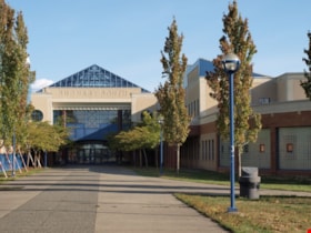
- The original Burnaby South High School was replaced in 1993 and the new Burnaby South Secondary School and BC Provincial School for the Deaf was built at this location. This school was built with the latest technology and modern equipment to ensure it was fully accessible and offers integrated academic, social and recreational activities for its students.
- Historic Neighbourhood
- Alta Vista (Historic Neighbourhood)
- Planning Study Area
- Clinton-Glenwood Area
- Street Address
- 5455 Rumble Street
- Street View URL
- Google Maps Street View
Images
McPherson Park Junior High School
https://search.heritageburnaby.ca/link/landmark710
- Repository
- Burnaby Heritage Planning
- Associated Dates
- 1951-1993
- Street View URL
- Google Maps Street View
- Repository
- Burnaby Heritage Planning
- Geographic Access
- Rumble Street
- Associated Dates
- 1951-1993
- Heritage Value
- In 1950, the Burnaby School Inspector reported: "the recent development of a number of large housing projects and the continuing growth of new homes in settled areas are compelling the Board to consider a building program of major proportions...now under construction, including McPherson Park with 21 classrooms." Enrolment in its first year was 686 students. In the late 1980s and early 1990s, junior high schools were replaced with expanded secondary schools encompassing grades 7 through 12; as a result, McPherson Park Junior High was closed and Burnaby South Secondary School opened.
- Historic Neighbourhood
- Alta Vista (Historic Neighbourhood)
- Planning Study Area
- Clinton-Glenwood Area
- Street Address
- 5455 Rumble Street
- Street View URL
- Google Maps Street View
South Slope Elementary School & The B.C. Provincial School for the Deaf
https://search.heritageburnaby.ca/link/landmark843
- Repository
- Burnaby Heritage Planning
- Geographic Access
- Watling Street
- Associated Dates
- 1992
- Heritage Value
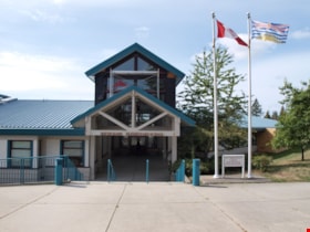
- South Slope/B.C. School for the Deaf opened in 1992 and is one of the newer elementary schools in the City. The 2009 School Growth Plan notes that South Slope/BC School for the Deaf replaced the former Jericho Hill School for the Deaf in Vancouver.
- Historic Neighbourhood
- Alta Vista (Historic Neighbourhood)
- Planning Study Area
- Sussex-Nelson Area
- Street Address
- 4446 Watling Street
- Street View URL
- Google Maps Street View
Images
Garden Village Neighbourhood
https://search.heritageburnaby.ca/link/landmark800
- Repository
- Burnaby Heritage Planning
- Associated Dates
- 1955-2008
- Heritage Value
- Bounded by Moscrop Street to the north, Kingsway and Grange to the south, Willingdon to the east and Boundary Road to the west, the Garden Village Neighbourhood is characterised as a primarily residential area that is well-served due to its proximity to commercial, park and business centres. The north-east corner of the neighbourhood is a typical 1950s subdivision of mostly single family homes located on an irregular street pattern, while the remaining areas saw some transition to multi-family housing types throughout the 1970s and up to the current time.
- Historic Neighbourhood
- Central Park (Historic Neighbourhood)
- Planning Study Area
- Garden Village Area
Images
Capitol Hill Neighbourhood
https://search.heritageburnaby.ca/link/landmark781
- Repository
- Burnaby Heritage Planning
- Associated Dates
- 1955-2008
- Heritage Value
- The Capitol Hill Neighbourhood remained a primarily residential neighbourhood after the population boom of the 1950s and 1960s. The commercial focus remained the Hastings Street corridor, while the City of Burnaby moved to protect a conservation area on the north side of Capitol Hill and dedicated parkland throughout the 1970s and 1980s.
- Historic Neighbourhood
- Capitol Hill (Historic Neighbourhood)
- Planning Study Area
- Capitol Hill Area
Images
Willingdon Heights Neighbourhood
https://search.heritageburnaby.ca/link/landmark777
- Repository
- Burnaby Heritage Planning
- Associated Dates
- 1955-2008
- Heritage Value
- The convenient location of Willingdon Heights to the Trans Canada Highway, Lougheed Highway and Hastings Street has fostered its development as a primarily residential commuter neighbourhood. Characterised in the post-World War Two period by predominantly single-family developments, the neighbourhood has retained this identity despite some higher density apartment buildings now found there.
- Planning Study Area
- Willingdon Heights Area
Images
Subdivision Reference # 5/92 Mayfield Street/6th Street/Goodlad Street Cost Sharing 1992 Municipal Subdivision Program - Advancement for Servicing and Sale by Public Tender (Portion of 7951 Mayfield Street)
https://search.heritageburnaby.ca/link/councilreport10150
- Repository
- City of Burnaby Archives
- Report ID
- 4247
- Meeting Date
- 28-Sep-1992
- Format
- Council - Manager's Report
- Manager's Report No.
- 60
- Item No.
- 14
- Collection/Fonds
- City Council and Office of the City Clerk fonds
- Repository
- City of Burnaby Archives
- Report ID
- 4247
- Meeting Date
- 28-Sep-1992
- Format
- Council - Manager's Report
- Manager's Report No.
- 60
- Item No.
- 14
- Collection/Fonds
- City Council and Office of the City Clerk fonds
Documents
Community Garden Use of IPM Principles Rezoning Reference #26/96 3802 Hastings Street and 3885 - 3897 Pender Street Hastings Street Area Plan
https://search.heritageburnaby.ca/link/councilreport7036
- Repository
- City of Burnaby Archives
- Report ID
- 6496
- Meeting Date
- 22-Jul-1996
- Format
- Council - Manager's Report
- Manager's Report No.
- 20
- Item No.
- 10
- Collection/Fonds
- City Council and Office of the City Clerk fonds
- Repository
- City of Burnaby Archives
- Report ID
- 6496
- Meeting Date
- 22-Jul-1996
- Format
- Council - Manager's Report
- Manager's Report No.
- 20
- Item No.
- 10
- Collection/Fonds
- City Council and Office of the City Clerk fonds
Documents
Cost Report - Construction and paving a lane south of Frances Street - Westerly Property Line of 5030 Frances Street to the Easterly Line of 5030 Frances Street
https://search.heritageburnaby.ca/link/councilreport12052
- Repository
- City of Burnaby Archives
- Report ID
- 6867
- Meeting Date
- 30-Apr-1990
- Format
- Council - Manager's Report
- Manager's Report No.
- 31
- Item No.
- 10
- Collection/Fonds
- City Council and Office of the City Clerk fonds
- Repository
- City of Burnaby Archives
- Report ID
- 6867
- Meeting Date
- 30-Apr-1990
- Format
- Council - Manager's Report
- Manager's Report No.
- 31
- Item No.
- 10
- Collection/Fonds
- City Council and Office of the City Clerk fonds
Documents
Demolition of Municipally Owned Buildings at 3892 Sandell Street, 6575 McKay Street and 5250 Sidley Street
https://search.heritageburnaby.ca/link/councilreport11186
- Repository
- City of Burnaby Archives
- Report ID
- 6739
- Meeting Date
- 27-May-1991
- Format
- Council - Manager's Report
- Manager's Report No.
- 35
- Item No.
- 6
- Collection/Fonds
- City Council and Office of the City Clerk fonds
- Repository
- City of Burnaby Archives
- Report ID
- 6739
- Meeting Date
- 27-May-1991
- Format
- Council - Manager's Report
- Manager's Report No.
- 35
- Item No.
- 6
- Collection/Fonds
- City Council and Office of the City Clerk fonds
Documents
House Demolitions at: 5090 Dover Street; 4614 Hazel Street; 5988 Gilpin Street
https://search.heritageburnaby.ca/link/councilreport6098
- Repository
- City of Burnaby Archives
- Report ID
- 61068
- Meeting Date
- 27-Oct-1997
- Format
- Council - Manager's Report
- Manager's Report No.
- 27
- Item No.
- 24
- Collection/Fonds
- City Council and Office of the City Clerk fonds
- Repository
- City of Burnaby Archives
- Report ID
- 61068
- Meeting Date
- 27-Oct-1997
- Format
- Council - Manager's Report
- Manager's Report No.
- 27
- Item No.
- 24
- Collection/Fonds
- City Council and Office of the City Clerk fonds
Documents
House Demolitions at 5269 Rumble Street; 5270/74 Watling Street and 4273 Pender Street
https://search.heritageburnaby.ca/link/councilreport8677
- Repository
- City of Burnaby Archives
- Report ID
- 4315
- Meeting Date
- 13-Jun-1994
- Format
- Council - Manager's Report
- Manager's Report No.
- 36
- Item No.
- 5
- Collection/Fonds
- City Council and Office of the City Clerk fonds
- Repository
- City of Burnaby Archives
- Report ID
- 4315
- Meeting Date
- 13-Jun-1994
- Format
- Council - Manager's Report
- Manager's Report No.
- 36
- Item No.
- 5
- Collection/Fonds
- City Council and Office of the City Clerk fonds
Documents
Public Hearing Queries - Rezoning Reference #98-6 - 4203 Hastings Street and 4204 Albert Street - Hastings Street Area Plan
https://search.heritageburnaby.ca/link/councilreport5677
- Repository
- City of Burnaby Archives
- Report ID
- 61488
- Meeting Date
- 25-May-1998
- Format
- Council - Manager's Report
- Manager's Report No.
- 15
- Item No.
- 2
- Collection/Fonds
- City Council and Office of the City Clerk fonds
- Repository
- City of Burnaby Archives
- Report ID
- 61488
- Meeting Date
- 25-May-1998
- Format
- Council - Manager's Report
- Manager's Report No.
- 15
- Item No.
- 2
- Collection/Fonds
- City Council and Office of the City Clerk fonds
Documents
Reconfiguration of 400 Block MacDonald Avenue (Pender Street on Hastings Street) Hastings Street Area Plan (X-Ref. Rezoning Reference # 18/92)
https://search.heritageburnaby.ca/link/councilreport8571
- Repository
- City of Burnaby Archives
- Report ID
- 4759
- Meeting Date
- 8-Aug-1994
- Format
- Council - Manager's Report
- Manager's Report No.
- 46
- Item No.
- 10
- Collection/Fonds
- City Council and Office of the City Clerk fonds
- Repository
- City of Burnaby Archives
- Report ID
- 4759
- Meeting Date
- 8-Aug-1994
- Format
- Council - Manager's Report
- Manager's Report No.
- 46
- Item No.
- 10
- Collection/Fonds
- City Council and Office of the City Clerk fonds
Documents
Reconfiguration of 400 Block MacDonald Avenue (Pender Street to Hastings Street) Hastings Street Area Plan (X-Ref. Rezoning Reference # 18/92)
https://search.heritageburnaby.ca/link/councilreport9835
- Repository
- City of Burnaby Archives
- Report ID
- 5603
- Meeting Date
- 22-Feb-1993
- Format
- Council - Manager's Report
- Manager's Report No.
- 13
- Item No.
- 9
- Collection/Fonds
- City Council and Office of the City Clerk fonds
- Repository
- City of Burnaby Archives
- Report ID
- 5603
- Meeting Date
- 22-Feb-1993
- Format
- Council - Manager's Report
- Manager's Report No.
- 13
- Item No.
- 9
- Collection/Fonds
- City Council and Office of the City Clerk fonds
Documents
Request for Area Rezoning - Hardwick Street, Woodsworth Street, Sprott Street and Douglas Road
https://search.heritageburnaby.ca/link/councilreport7199
- Repository
- City of Burnaby Archives
- Report ID
- 25586
- Meeting Date
- 6-May-1996
- Format
- Council - Committee Report
- Collection/Fonds
- City Council and Office of the City Clerk fonds
- Repository
- City of Burnaby Archives
- Report ID
- 25586
- Meeting Date
- 6-May-1996
- Format
- Council - Committee Report
- Collection/Fonds
- City Council and Office of the City Clerk fonds
Documents
Subdivision Reference #58/95 5800 Cedarwood Street and 5858 Gilpin Street and 5926/5962/5988 Gilpin Street
https://search.heritageburnaby.ca/link/councilreport7565
- Repository
- City of Burnaby Archives
- Report ID
- 5384
- Meeting Date
- 6-Nov-1995
- Format
- Council - Manager's Report
- Manager's Report No.
- 51
- Item No.
- 3
- Collection/Fonds
- City Council and Office of the City Clerk fonds
- Repository
- City of Burnaby Archives
- Report ID
- 5384
- Meeting Date
- 6-Nov-1995
- Format
- Council - Manager's Report
- Manager's Report No.
- 51
- Item No.
- 3
- Collection/Fonds
- City Council and Office of the City Clerk fonds
Documents
Street railways : their construction, operation, and maintenance
https://search.heritageburnaby.ca/link/museumlibrary5427
- Repository
- Burnaby Village Museum
- Collection
- Reference Collection
- Material Type
- Book
- ISBN
- 0920805000
- 9780920805008
- Call Number
- 388.46 FAI
- Place of Publication
- Edmonton
- Publisher
- Havelock House
- Publication Date
- 1991
- Physical Description
- vii, 485 p. : ill. ; 22 cm.
- Inscription
- "Railway World / 150 Water Street / Vancouver V6B 1B2 / British Columbia Canada", printed on gold sticker attached to front cover page.
- Library Subject (LOC)
- Street-railroads
- Transportation
- Street-railroads--Maintenance and repair
- Notes
- Includes indexes.
- "A photo-reproduced version of the original of 1892."
- Originally published: New York : Street Railway Pub. Co., 1892.
- Author full name: Fairchild, C. B. (Charles Bryant), 1842-.


