Narrow Results By
Decade
- 2020s 261
- 2010s 388
- 2000s 895
- 1990s 967
- 1980s 939
- 1970s 1548
- 1960s 694
- 1950s 906
- 1940s 793
- 1930s 676
- 1920s 698
- 1910s
- 1900s 266
- 1890s 75
- 1880s 58
- 1870s 9
- 1860s
- 1850s 4
- 1840s 1
- 1830s
- 1820s 1
- 1810s 1
- 1800s 1
- 1790s 1
- 1780s 1
- 1770s 1
- 1760s
- 1750s 1
- 1740s 1
- 1730s 1
- 1720s 1
- 1710s 1
- 1700s 1
- 1690s 1
- 1680s 1
- 1670s 1
- 1660s 1
- 1650s 1
- 1640s 1
- 1630s 1
- 1620s 1
- 1610s 1
- 1600s 1
- 1520s 1
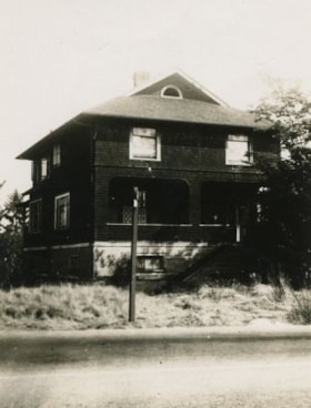
Joseph & Anne Gartlan Residence
https://search.heritageburnaby.ca/link/landmark612
- Repository
- Burnaby Heritage Planning
- Description
- Residential building.
- Associated Dates
- c.1913
- Street View URL
- Google Maps Street View
- Repository
- Burnaby Heritage Planning
- Geographic Access
- Oxford Street
- Associated Dates
- c.1913
- Description
- Residential building.
- Heritage Value
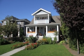
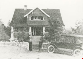
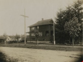
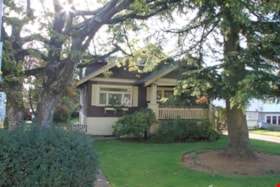
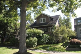
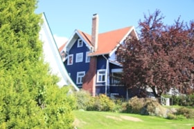
- This house was owned by Joseph Paul Gartlan (1877-1967), a steam shovel engineer for the B.C. Electric Company from 1906 to 1943, and his wife, Annie Claudia Gartlan (née Wood, 1891-1933). Joseph was a long-time resident of the house, remaining until his death in 1967. Typical of the Edwardian era, this bungalow has a side gabled roof with a large front gable over the balcony, an open front verandah with square tapered columns, and a mix of narrow lapped wooden siding, square shingles and diamond shingles in the gable peak.
- Locality
- Vancouver Heights
- Historic Neighbourhood
- Vancouver Heights (Historic Neighbourhood)
- Planning Study Area
- Burnaby Heights Area
- Area
- 374.03
- Contributing Resource
- Building
- Ownership
- Private
- Street Address
- 4111 Oxford Street
- Street View URL
- Google Maps Street View
Images
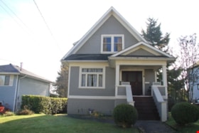
J.R. & Frances Dawson Residence
https://search.heritageburnaby.ca/link/landmark599
- Repository
- Burnaby Heritage Planning
- Description
- Residential building.
- Associated Dates
- c.1912
- Street View URL
- Google Maps Street View
- Repository
- Burnaby Heritage Planning
- Geographic Access
- Cambridge Street
- Associated Dates
- c.1912
- Description
- Residential building.
- Heritage Value
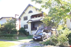
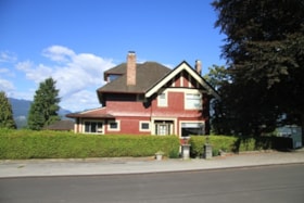
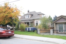
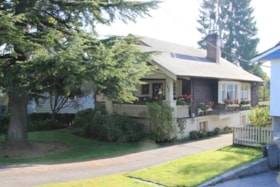
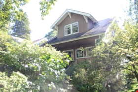
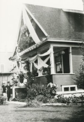
- This beautifully-detailed house displays a highly sophisticated mix of fashionable Arts and Crafts elements. The asymmetrical design has stacked inset verandahs on one side, with the ground floor verandah wrapping around the side of the house. The second floor verandah has an arched opening, supported by short versions of the ground floor columns and accessed by French doors with geometric patterned, multi-paned glazing. A semi-circular lunette window lights the attic, and banked windows with leaded transoms are used on the front façade. Decorative details include triangular eave brackets and square verandah columns with distinctive bracketted capitals. The house has survived in original condition except for a later asbestos siding that was applied over the original shingle siding, and the enclosure of the side verandah. The home was owned by J.R. Dawson and Frances Abigail Dawson (née Thompson, 1853-1938) from 1915 until Frances’ death in 1938.
- Locality
- Vancouver Heights
- Historic Neighbourhood
- Vancouver Heights (Historic Neighbourhood)
- Planning Study Area
- Burnaby Heights Area
- Area
- 566.71
- Contributing Resource
- Building
- Ownership
- Private
- Street Address
- 3746 Cambridge Street
- Street View URL
- Google Maps Street View
Images
J.S. & Mina Reid Residence
https://search.heritageburnaby.ca/link/landmark600
- Repository
- Burnaby Heritage Planning
- Description
- Residential building.
- Associated Dates
- c.1913
- Street View URL
- Google Maps Street View
- Repository
- Burnaby Heritage Planning
- Geographic Access
- Frances Street
- Associated Dates
- c.1913
- Description
- Residential building.
- Heritage Value
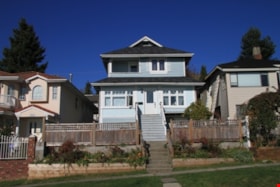
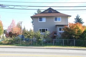
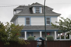
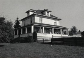
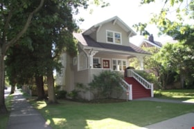
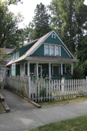
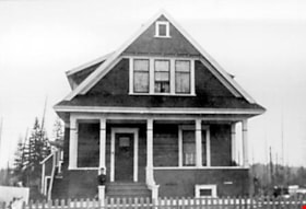
- The gable-on-hipped roofline is this house’s most unique feature. The home is a typical plan of the Foursquare type with the addition of an inset second-storey verandah. The full open front verandah has square columns and closed balustrades. A coloured glass transom was used above the living room window assembly. By 1915, the house was owned by J.S. and Mina Reid (1874-1969).
- Locality
- Vancouver Heights
- Historic Neighbourhood
- Vancouver Heights (Historic Neighbourhood)
- Planning Study Area
- Burnaby Heights Area
- Area
- 377.10
- Contributing Resource
- Building
- Ownership
- Private
- Street Address
- 3851 Frances Street
- Street View URL
- Google Maps Street View
Images
Murphy Residence
https://search.heritageburnaby.ca/link/landmark623
- Repository
- Burnaby Heritage Planning
- Description
- Residential building.
- Associated Dates
- 1913
- Street View URL
- Google Maps Street View
- Repository
- Burnaby Heritage Planning
- Geographic Access
- Gilley Avenue
- Associated Dates
- 1913
- Description
- Residential building.
- Heritage Value
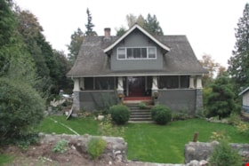
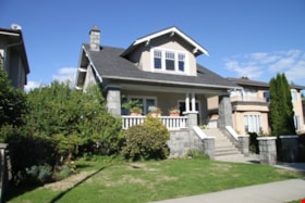
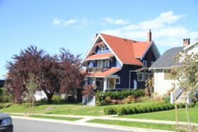
- This bungalow was built for Joshua Robert Murphy (1861-1920), a mill superintendent, and his wife Elizabeth Ann (née Delby, 1871-1956). The Murphys lived in the house at least until Joshua’s death in 1920. A bellcast side gabled roof and central bellcast dormer accentuate the sophisticated construction. A full width verandah supported by tapered columns on tapered granite piers graces the front of the house. Originally, the dormer held an open sleeping porch with a segmental arch supported by short tapered columns matching those below. Despite this alteration, the house is otherwise in substantially original condition.
- Locality
- Alta Vista
- Historic Neighbourhood
- Alta Vista (Historic Neighbourhood)
- Planning Study Area
- Stride Hill Area
- Area
- 1567.37
- Contributing Resource
- Building
- Ownership
- Private
- Street Address
- 8610 Gilley Avenue
- Street View URL
- Google Maps Street View
Images
Peter & Alma Newstrom Residence
https://search.heritageburnaby.ca/link/landmark631
- Repository
- Burnaby Heritage Planning
- Description
- Residential building.
- Associated Dates
- c.1915
- Street View URL
- Google Maps Street View
- Repository
- Burnaby Heritage Planning
- Geographic Access
- Oxford Street
- Associated Dates
- c.1915
- Description
- Residential building.
- Heritage Value
- This bungalow was built and owned by Peter John Newstrom (1861-1947), who later worked as a bricklayer, and his wife Alma Mary (1865-1935). The Newstroms arrived in Canada from Sweden about 1912 and were long-term residents of this home; Peter lived in the house after the death of his wife, until his own death in 1947. Typical of the Craftsman style, the house has a side gabled roof with large front gabled dormer, scroll-cut bargeboards, open front verandah and granite rubble-stone foundation and tapered piers. It retains its original glazed front door assembly.
- Locality
- Vancouver Heights
- Historic Neighbourhood
- Vancouver Heights (Historic Neighbourhood)
- Planning Study Area
- Burnaby Heights Area
- Area
- 566.71
- Contributing Resource
- Building
- Ownership
- Private
- Street Address
- 3865 Oxford Street
- Street View URL
- Google Maps Street View
Images
Robert & Mary B. McLennan House
https://search.heritageburnaby.ca/link/landmark634
- Repository
- Burnaby Heritage Planning
- Description
- Residential building.
- Associated Dates
- 1911
- Street View URL
- Google Maps Street View
- Repository
- Burnaby Heritage Planning
- Geographic Access
- Yale Street
- Associated Dates
- 1911
- Description
- Residential building.
- Heritage Value
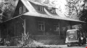
- Robert McLennan was the vice-president of the prominent Vancouver hardware firm of McLennan, McFeely & Company, popularly known as Mc.& Mc. Born in Pictou, Nova Scotia in 1861, Robert McLennan entered the hardware business at age fifteen. The West was an irresistible lure, and after he moved to Victoria in 1884, he took on a friend, Edward J. McFeely, as a business partner. Their business was a success and they soon opened a branch in the rapidly-developing new city of Vancouver. In 1898, Robert went to Dawson, where he opened a branch operation and served as mayor for one year in 1903. He returned to Vancouver in 1904, and as the business expanded, E.G. Prior was taken on as partner. In addition to his business pursuits, the public-spirited McLennan served on many boards and committees. In 1887, Robert returned to Nova Scotia where he married Bessie Archibald McKenzie. They had nine children, one of whom was born in Dawson. Robert died in 1927, and Bessie died in 1941. This grand residence was one of the first to be built in the Vancouver Heights subdivision, and its spectacular location retains panoramic views of Burrard Inlet and the North Shore. This house was undoubtedly designed by a local architect as it is an excellent example of the British Arts and Crafts style, with a shingled exterior, half-timbered gables and prominent brick chimneys. Although the west verandah has been enclosed and the windows altered, the house has been well maintained. Although owned by the McLennans, it may have been an investment property, as they lived for many years at a Vancouver address. In 1926, the house was sold to Vancouver Medical Health Officer, F.T. Underhill.
- Locality
- Vancouver Heights
- Historic Neighbourhood
- Vancouver Heights (Historic Neighbourhood)
- Planning Study Area
- Burnaby Heights Area
- Area
- 576.00
- Contributing Resource
- Building
- Ownership
- Private
- Street Address
- 3789 Yale Street
- Street View URL
- Google Maps Street View
Images
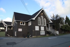
St. Stephen's Anglican Church
https://search.heritageburnaby.ca/link/landmark765
- Repository
- Burnaby Heritage Planning
- Geographic Access
- Cameron Street
- Associated Dates
- 1913
- Heritage Value
- The site of St. Stephen's Anglican Church is one of the historic landmarks of old Burquitlam. Originally this was part of the Alexander and Ethel Evans farm, Saint Phillians. Initial services for the church were held in the Evans home and later in the Burquitlam school. Alexander Evans donated this site to the Anglican Church in trust with the wish that it become a future church and consecrated ground for a family burial plot. In 1913, the parish raised the funds to build the first church. St. Stephen's was consecrated by Bishop de Pencier on September 28, 1913.
- Historic Neighbourhood
- Burquitlam (Historic Neighbourhood)
- Planning Study Area
- Lyndhurst Area
- Street Address
- 9887 Cameron Street
- Street View URL
- Google Maps Street View
Images
Thomas & Jane Sincock House
https://search.heritageburnaby.ca/link/landmark646
- Repository
- Burnaby Heritage Planning
- Description
- Residential building.
- Associated Dates
- 1912
- Street View URL
- Google Maps Street View
- Repository
- Burnaby Heritage Planning
- Geographic Access
- 11th Avenue
- Associated Dates
- 1912
- Description
- Residential building.
- Heritage Value
- This small Edwardian-era bungalow home was built and owned by Burnaby resident Jane Sincock (1848-1940) and her husband Thomas Sincock (1844-1916) as an investment rental property. By 1916, the couple was living in New Westminster, on Bole Street, where Jane, who was born in Cornwall, remained until her death. This substantial bungalow is distinguished by its bellcast hipped roof and dormers, an octagonal corner bay, and a small front verandah supported by square tapered columns. The house retains its original lapped wooden siding though the windows have been replaced.
- Locality
- Edmonds
- Historic Neighbourhood
- Edmonds (Historic Neighbourhood)
- Planning Study Area
- Stride Avenue Area
- Area
- 807.78
- Contributing Resource
- Building
- Ownership
- Private
- Street Address
- 7349 11th Avenue
- Street View URL
- Google Maps Street View
Images
Thomas & Margaret Coldicutt Residence
https://search.heritageburnaby.ca/link/landmark647
- Repository
- Burnaby Heritage Planning
- Description
- Residential building.
- Associated Dates
- 1911
- Street View URL
- Google Maps Street View
- Repository
- Burnaby Heritage Planning
- Geographic Access
- 6th Street
- Associated Dates
- 1911
- Description
- Residential building.
- Heritage Value
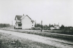
- This house was built by Thomas Davis Coldicutt (1879-1970) and Margaret Jane Coldicutt, pre-eminent local citizens. Thomas Coldicutt was born in Birmingham and arrived in Canada in 1900, finding success in the steamboat industry. In 1902, he married Margaret Jane Styler who had been born in Redditch, Worcester, England, and in 1908 they settled in East Burnaby–some of the first pioneers to the area–and established a fruit farm. Thomas had a successful real estate, insurance and brokerage business, and was elected as a councillor for East Burnaby in 1909. He was also active in civic, political and social circles in Burnaby and became president of the Burnaby Board of Trade. "East Burnaby is booming and the signs of prosperity that may be seen on every hand. Most of these are substantial dwellings, such as effect a permanent improvement to the countryside. Among those whose homes have been completed, or on the point of completion may be mentioned. Councillor Coldicutt, who has built himself a habitation on Second Avenue at a cost of $4,000. (The British Columbian, 1911). In 1913, Coldicutt sold his original farm described as “the show place of Burnaby” to the Burnaby School Board for the development of Second Street School and this house was moved from Second Street and Sixteenth Avenue to this site. It has been extensively altered, but retains its original form, scale and massing.
- Locality
- East Burnaby
- Historic Neighbourhood
- East Burnaby (Historic Neighbourhood)
- Planning Study Area
- Edmonds Area
- Area
- 557.42
- Contributing Resource
- Building
- Ownership
- Private
- Street Address
- 7510 6th Street
- Street View URL
- Google Maps Street View
Images
William & Rachael Karman Residence
https://search.heritageburnaby.ca/link/landmark657
- Repository
- Burnaby Heritage Planning
- Description
- Residential building.
- Associated Dates
- 1911
- Street View URL
- Google Maps Street View
- Repository
- Burnaby Heritage Planning
- Geographic Access
- 14th Avenue
- Associated Dates
- 1911
- Description
- Residential building.
- Heritage Value
- This house was built by East Burnaby pioneers William Karman (1866-1948) and Rachael Karman (1865-1933), both born in Scotland. The Karmans originally farmed a “fruit ranch” on Cumberland Road in the 1890s but retired to this home after selling their former farm for a residential subdivision. Rachel died in 1933, and William was remarried to Mary Selkirk (1904-1981). In pristine condition, this Edwardian-era home has a front gabled roof, with symmetrical saddlebag dormers and a gabled front porch. Cedar shingle cladding is used at the foundation level and in the gable ends, and lapped wooden siding on the main level.
- Locality
- East Burnaby
- Historic Neighbourhood
- East Burnaby (Historic Neighbourhood)
- Planning Study Area
- Edmonds Area
- Area
- 696.46
- Contributing Resource
- Building
- Ownership
- Private
- Street Address
- 8088 14th Avenue
- Street View URL
- Google Maps Street View
Images
Alfred & Ruth MacLeod Cottage
https://search.heritageburnaby.ca/link/landmark503
- Repository
- Burnaby Heritage Planning
- Description
- Located atop a hill on the southern shore of picturesque Deer Lake, the Alfred and Ruth MacLeod Cottage is a one and one-half storey, wood-frame, rustic Arts and Crafts-style bungalow. The cottage is well-maintained, but has been altered through the enclosure of much of its original wraparound vera…
- Associated Dates
- 1913
- Repository
- Burnaby Heritage Planning
- Geographic Access
- Deer Lake Drive
- Associated Dates
- 1913
- Description
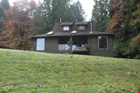
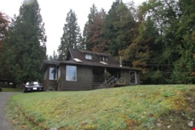
- Located atop a hill on the southern shore of picturesque Deer Lake, the Alfred and Ruth MacLeod Cottage is a one and one-half storey, wood-frame, rustic Arts and Crafts-style bungalow. The cottage is well-maintained, but has been altered through the enclosure of much of its original wraparound verandah. Its sits on the brow of a steep slope, with panoramic views north to Deer Lake.
- Heritage Value
- The Alfred and Ruth MacLeod Cottage is valued as a significant example of the early development of summer estates in Burnaby, specifically in the Deer Lake neighbourhood, that attracted residents from the burgeoning cities of New Westminster and Vancouver. Access to the area was facilitated by the construction of the Burnaby Lake Interurban tramline, which opened in June 1911. This modest, rustic cottage illustrates the desire for a simple country lifestyle and retreat into nature of those who settled on the south shore of Deer Lake. While the grand mansions on the north shore of Deer Lake are set in formally landscaped gardens, the informality of this cottage demonstrates reverence for its natural, wooded surroundings, oriented towards views of Deer Lake. The Alfred and Ruth MacLeod Cottage is important for its connection with prominent New Westminster insurance and real estate broker, Alfred W. MacLeod, and his wife, Ruth. The MacLeods had recently constructed a large city home, and built this cottage as a summer residence in 1913. In 2005, the Alfred and Ruth MacLeod Cottage was purchased by the City of Burnaby and today constitutes part of the Deer Lake Park Heritage Precinct, which is Burnaby's most significant collection of historic sites.
- Defining Elements
- Key elements that define the heritage character of the Alfred and Ruth MacLeod Cottage include its: - secluded setting on the brow of a steep hill on the southern shore of Deer Lake, with expansive views of Deer Lake to the north - residential form, scale and massing as expressed by its one and one-half storey rectangular plan, side-gabled roof, hipped roof over original verandah and two shed dormers - associated landscape features such as mature coniferous and deciduous trees surrounding the property
- Historic Neighbourhood
- Burnaby Lake (Historic Neighbourhood)
- Planning Study Area
- Morley-Buckingham Area
- Function
- Primary Historic--Single Dwelling
- Primary Current--Single Dwelling
- Cadastral Identifier
- P.I.D.000-708-038
- Boundaries
- The Alfred and Ruth MacLeod Cottage is comprised of a single residential lot located at 6466 Deer Lake Drive, Burnaby.
- Area
- 13354.63
- Contributing Resource
- Building
- Ownership
- Public (local)
- Documentation
- City of Burnaby Planning and Building Department, Heritage Site Files
- Street Address
- 6466 Deer Lake Drive
Images
Alfred & Sarah Chrisp Residence
https://search.heritageburnaby.ca/link/landmark556
- Repository
- Burnaby Heritage Planning
- Description
- Rsidential building.
- Associated Dates
- 1913
- Street View URL
- Google Maps Street View
- Repository
- Burnaby Heritage Planning
- Geographic Access
- 11th Avenue
- Associated Dates
- 1913
- Description
- Rsidential building.
- Heritage Value
- This high-quality Craftsman bungalow was built for Alfred John Chrisp (1882-1944) and his wife Sarah Hannah Chrisp (née Hindmarch, 1883-1954). Starting in 1908, Alfred worked as an accountant for the CPR in New Westminster, and he and Sarah were married there in 1910. This house features a front gabled roof and gabled front porch, and is notable for its elaborate stained glass windows in the front door glazing, sidelights and the narrow transom over the front elevation window. Maintaining a very high degree of original integrity, the bungalow features lapped siding at the foundation level, a shingle clad main floor, a combination of casement and double-hung windows and square tapered porch columns.
- Locality
- East Burnaby
- Historic Neighbourhood
- East Burnaby (Historic Neighbourhood)
- Planning Study Area
- Edmonds Area
- Street Address
- 7349 11th Avenue
- Street View URL
- Google Maps Street View
Images
Armstrong Elementary School
https://search.heritageburnaby.ca/link/landmark762
- Repository
- Burnaby Heritage Planning
- Geographic Access
- Armstrong Avenue
- Associated Dates
- 1911
- Heritage Value
- The site for the Armstrong Avenue school was cleared in 1911. In 1955 the original structure was replaced by a new building and additions were constructed in 1962, 1964, 1967 and 1969. Armstrong Avenue was named after J.C. Armstrong, an early property owner of Burnaby who was involved in the effort to make Burnaby a municipality in 1892.
- Historic Neighbourhood
- East Burnaby (Historic Neighbourhood)
- Planning Study Area
- Cariboo-Armstrong Area
- Street Address
- 8757 Armstrong Avenue
- Street View URL
- Google Maps Street View
Images
Arthur Long Residence
https://search.heritageburnaby.ca/link/landmark560
- Repository
- Burnaby Heritage Planning
- Description
- Residential building.
- Associated Dates
- 1912
- Street View URL
- Google Maps Street View
- Repository
- Burnaby Heritage Planning
- Geographic Access
- Stanley Street
- Associated Dates
- 1912
- Description
- Residential building.
- Heritage Value
- Arthur Long, of the Water Rights Office of Victoria, purchased this land from neighbour Henry Ramsay, and built this beautiful Arts and Crafts styled home. The house appears to have many similarities to the neighbouring Ramsay House, which was designed by Vancouver architect R. Mackay Fripp. The house has retained its original complex gabled roof, triangular eave brackets and horizontal siding.
- Locality
- Burnaby Lake
- Historic Neighbourhood
- Burnaby Lake (Historic Neighbourhood)
- Planning Study Area
- Lakeview-Mayfield Area
- Ownership
- Private
- Street Address
- 7828 Stanley Street
- Street View URL
- Google Maps Street View
Images
Coburn House
https://search.heritageburnaby.ca/link/landmark510
- Repository
- Burnaby Heritage Planning
- Description
- The Coburn House is a two and one-half storey plus basement Foursquare farm house. Prominently situated on a rise of land along the east side of Boundary Road overlooking Kingsway, it stands among single-family houses later constructed on its subdivided farm land.
- Associated Dates
- 1910
- Formal Recognition
- Heritage Designation, Community Heritage Register
- Other Names
- Minerva Jane Coburn House
- Street View URL
- Google Maps Street View
- Repository
- Burnaby Heritage Planning
- Other Names
- Minerva Jane Coburn House
- Geographic Access
- Boundary Road
- Associated Dates
- 1910
- Formal Recognition
- Heritage Designation, Community Heritage Register
- Enactment Type
- Bylaw No. 9184
- Enactment Date
- 08/05/1989
- Description
- The Coburn House is a two and one-half storey plus basement Foursquare farm house. Prominently situated on a rise of land along the east side of Boundary Road overlooking Kingsway, it stands among single-family houses later constructed on its subdivided farm land.
- Heritage Value
- The Coburn House is important as a surviving representation of Burnaby’s early settlement period, when the municipality was largely an agricultural and residential suburb. It was built in 1910 by carpenter William Kirkham for Minerva Jane Coburn (1868-1940), and three years later the builder and client were married. Together, they operated the Surprise Poultry Farm, and were frequent participants at the local Central Park Farmers' Institute Exhibitions. This house is valued as an excellent and well-preserved example of a substantial Edwardian era Foursquare farm house. Significant due to its generous size, dominant symmetry, the prominent verandah that wraps around the front and both sides, and the three roof dormers, this house retains a high degree of original material and integrity. The elevated siting of the house, its tall proportions and symmetrical appearance combined with its fine condition make this an excellent example of its type.
- Defining Elements
- Key elements that define the heritage character of the Coburn House include its: - prominent location on Boundary Road, on an elevated site overlooking Vancouver - residential form, scale and massing as expressed by its cubic massing and tall, dominant roof form - Foursquare style as exemplified by its symmetry, square floor plan, pyramidal bellcast roof and three hipped dormers - Edwardian era construction details such as narrow bevelled wooden siding, broad horizontal eave band with scroll-cut eave brackets, and simple window surrounds - wraparound verandah encircling three main facades, with hipped roof, square columns and closed balustrades, connected to one storey extension at rear - projecting bay window on the main floor south facade - original double-hung 1-over-1 wooden-sash windows, some in double assembly on the ground floor - internal red brick chimney
- Historic Neighbourhood
- Central Park (Historic Neighbourhood)
- Planning Study Area
- Garden Village Area
- Function
- Primary Historic--Single Dwelling
- Primary Current--Single Dwelling
- Community
- Burnaby
- Cadastral Identifier
- 002-653-427
- Boundaries
- The Coburn House is comprised of a single residential lot located at 5170 Boundary Road, Burnaby
- Area
- 541.91
- Contributing Resource
- Building
- Ownership
- Private
- Street Address
- 5170 Boundary Road
- Street View URL
- Google Maps Street View
Images
Colonial Finance Company House
https://search.heritageburnaby.ca/link/landmark568
- Repository
- Burnaby Heritage Planning
- Description
- Residential building.
- Associated Dates
- c.1912
- Street View URL
- Google Maps Street View
- Repository
- Burnaby Heritage Planning
- Geographic Access
- Cambridge Street
- Associated Dates
- c.1912
- Description
- Residential building.
- Heritage Value
- 3890 Cambridge Street and 3896 Cambridge Street are nearly identical twins. These modestly-sized pattern book residences each feature a side gabled roof with a central dormer and a central entrance, as well as interesting Craftsman-style detailing such as the bracketed verandah columns, triangular eave brackets and exposed rafter tails. Though the original exterior siding has been covered by a later stucco cladding, the house maintains its original double-hung windows with elaborate multi-paned upper sashes. Built as a revenue property, it was owned by the Colonial Finance Company in 1915.
- Locality
- Vancouver Heights
- Historic Neighbourhood
- Vancouver Heights (Historic Neighbourhood)
- Planning Study Area
- Burnaby Heights Area
- Ownership
- Private
- Street Address
- 3890 Cambridge Street
- Street View URL
- Google Maps Street View
Images
Colonial Finance Company House
https://search.heritageburnaby.ca/link/landmark569
- Repository
- Burnaby Heritage Planning
- Description
- Residential building.
- Associated Dates
- c.1912
- Street View URL
- Google Maps Street View
- Repository
- Burnaby Heritage Planning
- Geographic Access
- Cambridge Street
- Associated Dates
- c.1912
- Description
- Residential building.
- Heritage Value
- 3890 Cambridge Street and 3896 Cambridge Street are nearly identical twins. These modestly-sized pattern book residences each feature a side gabled roof with a central dormer and a central entrance, and an open front verandah. Both houses have later coverings over their original siding; 3890 Cambridge was stuccoed, and this house received more recent vinyl siding, indicating the periodic pressure on homeowners to “upgrade” through the use of new, applied products. Built as a revenue property by the Colonial Finance Company, this house was owned by David Caldwell, the manager of the Caldwell & Carson real estate company in 1915.
- Locality
- Vancouver Heights
- Historic Neighbourhood
- Vancouver Heights (Historic Neighbourhood)
- Planning Study Area
- Burnaby Heights Area
- Street Address
- 3896 Cambridge Street
- Street View URL
- Google Maps Street View
Images
David Graybill Residence
https://search.heritageburnaby.ca/link/landmark571
- Repository
- Burnaby Heritage Planning
- Description
- Residential building.
- Associated Dates
- 1913
- Street View URL
- Google Maps Street View
- Repository
- Burnaby Heritage Planning
- Geographic Access
- Eton Street
- Associated Dates
- 1913
- Description
- Residential building.
- Heritage Value
- Built by David Graybill in 1913, this house is a unique example of a two-storey Arts and Crafts house. The visor roofs, which shield the upper storey windows, and the second storey balcony, which was incorporated into the ground floor verandah roof, add to the house’s character and remain its most notable decorative features. Other defining features are the wide, overhanging eaves with triangular eave brackets. Though the wooden siding has been covered with asbestos shingles–an easily-reversible alteration–the house remains in highly original condition.
- Locality
- Vancouver Heights
- Historic Neighbourhood
- Vancouver Heights (Historic Neighbourhood)
- Planning Study Area
- Burnaby Heights Area
- Ownership
- Private
- Street Address
- 3757 Eton Street
- Street View URL
- Google Maps Street View
Images
D.C. Patterson House
https://search.heritageburnaby.ca/link/landmark517
- Repository
- Burnaby Heritage Planning
- Description
- The D.C. Patterson House is a one and one-half storey plus basement wood-frame Edwardian era residence with a full-width front verandah and symmetrical saddlebag dormers. It is located adjacent to a ravine park and is part of the Winston Gate development.
- Associated Dates
- 1910
- Formal Recognition
- Heritage Designation, Community Heritage Register
- Other Names
- Dugald & Frances Patterson House
- Street View URL
- Google Maps Street View
- Repository
- Burnaby Heritage Planning
- Other Names
- Dugald & Frances Patterson House
- Geographic Access
- 12th Avenue
- Associated Dates
- 1910
- Formal Recognition
- Heritage Designation, Community Heritage Register
- Enactment Type
- Bylaw No. 10062
- Enactment Date
- 11/07/1994
- Description
- The D.C. Patterson House is a one and one-half storey plus basement wood-frame Edwardian era residence with a full-width front verandah and symmetrical saddlebag dormers. It is located adjacent to a ravine park and is part of the Winston Gate development.
- Heritage Value
- This house is significant for its associations with the Patterson family, who were early Burnaby pioneers. Dugald Campbell Patterson (1860-1931) and Frances Mabel Patterson (1872-1960) arrived in 1894 and settled in the Central Park district. In 1910, they relocated to the Edmonds District and built this family residence on Edmonds Street near Kingsway. The Pattersons were community minded citizens who served Burnaby through their involvement with local municipal affairs and politics. Dugald Patterson served as a School Trustee in 1912-13 and was one of the first residents to lobby council to preserve the local ravines as parks. The family name is remembered and honoured by the naming of Patterson Avenue and the Patterson SkyTrain Station located in the Metrotown area. Additionally, the D.C. Patterson House is significant as a fine example of a vernacular Edwardian era family house. The typical design of the Patterson House was taken from an Edwardian era pattern book, and demonstrates how standardized plans were commonly used by local owners and builders to expedite the construction process. This house has survived in an excellent state of preservation. Although moved from its original site, it remains as an intact representation of a middle-class Burnaby residence of the Edwardian era.
- Defining Elements
- Key elements that define the heritage character of the D.C. Patterson House include its: - vernacular residential form, scale and massing as exemplified by its one and one-half storey plus basement height, front gabled roof with hipped return over front verandah, symmetrical saddlebag dormers and rectangular, side hall plan with an asymmetrical front entry - typical Edwardian era construction features such as the deep boxed eaves, lapped wooden siding and cedar shingle roofing - projecting front gable peak, clad in decorative random-coursed square shingles, with eave brackets under and a louvered attic vent - projecting elements on the main floor including a square bay on the east side and a semi-octagonal bay to the west side - full-width open front verandah with irregularly-spaced square columns - closed balustrades with drainage scuppers on the front verandah and rear side porch - regular fenestration, including double hung 1-over-1 wooden-sash windows with proportionately smaller upper sash, triple assembly of windows in the front gable, and leaded glass in main floor front window - original front door with inset bevelled glass light
- Historic Neighbourhood
- Edmonds (Historic Neighbourhood)
- Planning Study Area
- Stride Hill Area
- Function
- Primary Historic--Single Dwelling
- Primary Current--Single Dwelling
- Community
- Burnaby
- Cadastral Identifier
- 003-008-321
- Boundaries
- The D.C. Patterson House is comprised of a single residential lot located at 7106 Eighteenth Avenue, Burnaby.
- Area
- 5176
- Contributing Resource
- Building
- Ownership
- Private
- Street Address
- 7106 18th Avenue
- Street View URL
- Google Maps Street View
Images
East Burnaby Neighbourhood
https://search.heritageburnaby.ca/link/landmark773
- Repository
- Burnaby Heritage Planning
- Associated Dates
- 1905-1924
- Heritage Value
- According to the 1911 December 26 edition of The British Columbian: Optimism is the word that applies to the whole community of East Burnaby. The many improvements carried out by the council during the past two years had been the means of making East Burnaby a thriving settlement, and hence one and all are optimistic as to its future. In the clearing and building line, many fine new homes are being erected...Real estate values have advanced with the times, and a notable feature is the number of better-class houses that are being built in this locality, which proves that East Burnaby is becoming very much alive and elevated.
- Historic Neighbourhood
- East Burnaby (Historic Neighbourhood)
- Planning Study Area
- Edmonds Area
