More like 'doorknob and door plate'
Narrow Results By
Decade
- 2020s 86
- 2010s 41
- 2000s 480
- 1990s 378
- 1980s 370
- 1970s 722
- 1960s
- 1950s 464
- 1940s 421
- 1930s 348
- 1920s 370
- 1910s
- 1900s 172
- 1890s 23
- 1880s 49
- 1870s 3
- 1860s 1
- 1850s 1
- 1840s 1
- 1830s 1
- 1820s 1
- 1810s 1
- 1800s 1
- 1790s 1
- 1780s 1
- 1770s 1
- 1760s 1
- 1750s 1
- 1740s 1
- 1730s 1
- 1720s 1
- 1710s
- 1700s 1
- 1690s 1
- 1680s 1
- 1670s 1
- 1660s 1
- 1650s 1
- 1640s 1
- 1630s 1
- 1620s 1
- 1610s 1
- 1600s 1
Creator
- Barrowclough, G.A. 1
- BC Photo Card Company 1
- Bellinger, Bernard 2
- Binks, James 2
- Burnaby Village Museum 16
- Burnett and McGugan B.C. Land Surveyors, New Westminster 5
- Burnett, Geoffrey K. 3
- Burnett & McGugan, Engineers and Surveyors 22
- Canadian Photo Company 12
- Challoner-Courtenay, E.J. 2
- Dean, H.M. 9
- Digney, Andy 3

Edmonds Baptist Church
https://search.heritageburnaby.ca/link/landmark575
- Repository
- Burnaby Heritage Planning
- Description
- Church building.
- Associated Dates
- 1912
- Street View URL
- Google Maps Street View
- Repository
- Burnaby Heritage Planning
- Geographic Access
- Walker Avenue
- Associated Dates
- 1912
- Description
- Church building.
- Heritage Value
- Beautifully designed in an Arts and Crafts idiom, this church features a textural mix of finishes including lapped siding and stucco and half timbering in the gables. The British Columbian reported in July 1912 that: "The Baptists of Edmonds will possess a fine and well planned church when the building now commenced is ready for occupation. The architects are J.P. Matheson and Son, of Vancouver, and the contractors, Muttitt and Bell, of New Westminster. The entrance porch fronts Edmonds Road and the west side faces Vancouver Road. It will have a capacity for 272 sittings, spacious aisles and choir platform besides various rooms for Baptistery, vestry and robing apartments."
- Locality
- Edmonds
- Historic Neighbourhood
- Edmonds (Historic Neighbourhood)
- Planning Study Area
- Richmond Park Area
- Architect
- J.P. Matheson & Son
- Builder
- Muttitt and Bell
- Area
- 1471.58
- Contributing Resource
- Building
- Ownership
- Private
- Names
- Matheson, John
- Street Address
- 7135 Walker Avenue
- Street View URL
- Google Maps Street View
Images


H.T. Ceperley Estate 'Fairacres' Mansion
https://search.heritageburnaby.ca/link/landmark526
- Repository
- Burnaby Heritage Planning
- Description
- 'Fairacres' is a large, two-and-one-half storey estate house in the British Arts and Crafts style, located in Deer Lake Park, with four associated original outbuildings.
- Associated Dates
- 1911
- Formal Recognition
- Heritage Designation, Community Heritage Register
- Other Names
- Henry Tracy & Grace Ceperley Estate
- Burnaby Art Gallery
- Street View URL
- Google Maps Street View
- Repository
- Burnaby Heritage Planning
- Other Names
- Henry Tracy & Grace Ceperley Estate
- Burnaby Art Gallery
- Geographic Access
- Deer Lake Avenue
- Associated Dates
- 1911
- Formal Recognition
- Heritage Designation, Community Heritage Register
- Enactment Type
- Bylaw No. 9807
- Enactment Date
- 23/11/1992
- Description
- 'Fairacres' is a large, two-and-one-half storey estate house in the British Arts and Crafts style, located in Deer Lake Park, with four associated original outbuildings.
- Heritage Value
- 'Fairacres' is important as a record of the early years of Burnaby, specifically the Deer Lake area, as a place of tranquility and beautiful scenery in which the wealthy and successful in the burgeoning cities of New Westminster and Vancouver chose to retire or to make their family homes. The main house, which anchors in style and setting the outbuildings on the estate, demonstrates the social, cultural, and aesthetic values of local wealthy businessmen and women of the early twentieth century - values such as appreciation of architectural elegance and grand interior spaces, leisure and recreation, formal landscaped gardens and scenic views. Also important is the association with the English-born and trained architect Robert Mackay Fripp (1858-1917), as this was one of his grandest residential commissions. Steeped in the current architectural trends in Great Britain, Fripp designed this sprawling mansion in the Arts and Crafts style, reflected in the architectural detailing and proportions. The style was common at the time and was often used for estate mansions as a symbol of affluence and good, modern taste as well as an affinity for all things British. Quality is displayed inside and out in the finishes and materials, orchestrated by prominent local contractor, James Charles Allen, including imported English materials of specific value such as imported Medmenham tiles in the fireplace surrounds, one of the earliest documented use of these tiles outside the United Kingdom. Detailed features of the interior woodwork were carved by Scottish-born master wood carver George Selkirk Gibson (1867-1942), who was best known for his many commissions for prominent British Columbia architect Samuel Maclure. The outbuildings at 'Fairacres' are an important record of the functioning of a large estate of the time. The Garage and Stables and the Chauffeur’s Cottage accommodated the use of automobiles, horses and carriages, and in concert with the estate's location near the new British Columbia Electric Railway 'Burnaby Lake' interurban line, illustrate the evolving nature of regional transportation and the growing bedroom communities and estates made possible by increasing options for transportation. Other outbuildings accommodated the agricultural activities that helped support the Ceperley estate. The estate was conceived and funded by American-born Grace E. Dixon Ceperley (1863-1917), who had achieved significant wealth through a bequest from her brother-in-law, Vancouver pioneer Arthur Ferguson. Her husband, Henry Tracy Ceperley (1850-1929), also American-born, was a successful and well-respected businessman who made a significant contribution to the development of the City of Vancouver. The construction of 'Fairacres' spawned the transformation of the Deer Lake area from a farming community into a preferred location for elite suburban homes. 'Fairacres' is significant to the City of Burnaby as its first civic heritage conservation project. Acquired in 1966 for conversion to Burnaby’s first art gallery, it was dedicated in 1967 to mark Canada’s Centennial of Confederation.
- Defining Elements
- Key elements that define the heritage character of the ‘Fairacres’ mansion include its: - setting in relation to the gardens, its former market garden, and the vistas to Deer Lake and other grand homes in the area - side gable roof with prominent dormers and cedar shingle cladding - verandah across the eastern (garden) facade, with its view over the landscaped gardens and the distant mountains - porte cochere with its side steps for those arriving by automobile, and central raised step for those alighting from horse-drawn carriages - rich variety of exterior elements that demonstrate the typical Arts and Crafts use of local materials such as cobble stone chimneys and foundations, wide wooden siding and half-timbering - mixture of double-hung and casement wooden-sash windows, many with multi-paned sash - lavish interior spaces, designed for entertaining on a grand scale, including a billiard room with a beamed ceiling and an inglenook fireplace, and generous living and dining rooms arranged off a central hall - quality of the interior materials such as imported Medmenham tiles in fireplace surrounds, window hardware by Hope and Sons, and leaded stained glass - interior wood work including the staircase, and carvings by George Selkirk Gibson - remaining formal Edwardian garden landscape elements, including the cross-axial plan that reflects the relationship of the mansion to its 'outdoor rooms'
- Locality
- Deer Lake Park
- Historic Neighbourhood
- Burnaby Lake (Historic Neighbourhood)
- Planning Study Area
- Douglas-Gilpin Area
- Architect
- Robert Mackay Fripp
- Function
- Primary Current--Museum
- Primary Historic--Estate
- Community
- Burnaby
- Cadastral Identifier
- P.I.D. No. 004-493-311 Legal Description: Block 3 Except: Part subdivided by Plan 26865, District Lot 79, Group 1, New Westminster District, Plan 536
- Boundaries
- ‘Fairacres’ is comprised of a single municipally-owned property located at 6344 Deer Lake Avenue, Burnaby.
- Area
- 17,065.00
- Contributing Resource
- Building
- Landscape Feature
- Ownership
- Public (local)
- Other Collection
- City of Burnaby, Visual Art Collection: Original rendering by R.P.S. Twizell Burnaby Historical Society, Community Archives: Ceperley Photograph Album Burnaby Village Museum, Collection: Carved dining room panels by G.S. Gibson and other hardware items
- Documentation
- Heritage Site Files: PC77000 20. City of Burnaby Planning and Building Department, 4949 Canada Way, Burnaby, B.C., V5G 1M2
- Names
- Ceperley, Grace
- Ceperley, H.T.
- Fripp, Robert Mackay
- Allen, James Charles
- Gibson, George Selkirk
- Street Address
- 6344 Deer Lake Avenue
- Street View URL
- Google Maps Street View
Images


H.T. Ceperley Estate 'Fairacres' Chauffeur's Cottage
https://search.heritageburnaby.ca/link/landmark529
- Repository
- Burnaby Heritage Planning
- Description
- Designed in the British Arts and Crafts style, the Chauffeur's Cottage is situated across from the main entrance to the Ceperley Mansion, and adjacent to the Garage and Stables. A long, narrow single-storey building, it was constructed by joining together two modest estate cottages.
- Associated Dates
- 1911
- Formal Recognition
- Heritage Designation, Community Heritage Register
- Repository
- Burnaby Heritage Planning
- Geographic Access
- Deer Lake Avenue
- Associated Dates
- 1911
- Formal Recognition
- Heritage Designation, Community Heritage Register
- Enactment Type
- Bylaw No. 9807
- Enactment Date
- 23/11/1992
- Description
- Designed in the British Arts and Crafts style, the Chauffeur's Cottage is situated across from the main entrance to the Ceperley Mansion, and adjacent to the Garage and Stables. A long, narrow single-storey building, it was constructed by joining together two modest estate cottages.
- Heritage Value
- The outbuildings at 'Fairacres' are a rare surviving architecturally designed ensemble of agricultural structures that exist in complementary harmony with the main estate house. Architect Robert Mackay Fripp (1858-1917) was retained by the Ceperleys to design several original outbuildings on their estate at the same time as the main house was constructed. The Chauffeur's Cottage illustrates the increasing importance of the automobile in the lives of the wealthy of the early twentieth century. It also demonstrates Grace and Henry Tracy Ceperley's social aspirations and grand-country-estate pretension in having a chauffeur. The cottage's location - close to the garage and convenient, but not adjacent, to the main house - enhances the grand country house landscape design and contributes to the overall composition of the estate's plan. The Arts and Crafts styled Chauffeur's Cottage is important as an indicator of the aesthetic and social sensibilities of the Ceperley family in retaining an architect to design a modest building for staff accommodation.
- Defining Elements
- Key elements that define the heritage character of the 'Fairacres' Chauffeur's Cottage include its: - location, in relation to the main house and in close proximity to the Garage and Stables buildings - side gable roof with cedar shingle cladding - Arts and Crafts architectural features such as the jerkin-headed door hood, a reference to the thatched-roofed cottages of southern England; eight-paned wooden-sash casement windows; and cedar-shingled exterior - two internal brick chimneys - modest, functional interior, with simple trim and lack of pretension
- Locality
- Deer Lake Park
- Historic Neighbourhood
- Burnaby Lake (Historic Neighbourhood)
- Planning Study Area
- Douglas-Gilpin Area
- Architect
- Robert Mackay Fripp
- Function
- Primary Historic--Outbuilding
- Community
- Burnaby
- Cadastral Identifier
- P.I.D. No. 004-493-311 Legal Description: Block 3 Except: Part subdivided by Plan 26865, District Lot 79, Group 1, New Westminster District, Plan 536
- Boundaries
- ‘Fairacres’ is comprised of a single municipally-owned property located at 6344 Deer Lake Avenue, Burnaby.
- Area
- 17,065.00
- Contributing Resource
- Building
- Landscape Feature
- Ownership
- Public (local)
- Other Collection
- Burnaby Historical Society, Community Archives: Ceperley Photograph Album Burnaby Village Museum, Collection: Chinese ‘Tiger Whiskey’ and opium bottles found during restoration
- Documentation
- Heritage Site Files: PC77000 20. City of Burnaby Planning and Building Department, 4949 Canada Way, Burnaby, B.C., V5G 1M2
- Street Address
- 6344 Deer Lake Avenue
Images


H.T. Ceperley Estate 'Fairacres' Garage & Stables
https://search.heritageburnaby.ca/link/landmark530
- Repository
- Burnaby Heritage Planning
- Description
- Designed in the British Arts and Crafts style, the ‘Fairacres’ Garage and Stables is a two-storey wood frame building located on the 'Fairacres' estate, situated to the north of the Chauffeur's Cottage; at the south end of the structure is a single vehicle garage and to the north are several stable…
- Associated Dates
- 1911
- Formal Recognition
- Heritage Designation, Community Heritage Register
- Street View URL
- Google Maps Street View
- Repository
- Burnaby Heritage Planning
- Geographic Access
- Deer Lake Avenue
- Associated Dates
- 1911
- Formal Recognition
- Heritage Designation, Community Heritage Register
- Enactment Type
- Bylaw No. 9807
- Enactment Date
- 23/11/1992
- Description
- Designed in the British Arts and Crafts style, the ‘Fairacres’ Garage and Stables is a two-storey wood frame building located on the 'Fairacres' estate, situated to the north of the Chauffeur's Cottage; at the south end of the structure is a single vehicle garage and to the north are several stables for carriage, riding, and draught horses, a coach house, and tack room; the upper floor was originally a hay loft.
- Heritage Value
- The outbuildings at 'Fairacres' are a rare surviving architecturally designed ensemble of agricultural structures that exist in complementary harmony with the main estate house. Architect Robert Mackay Fripp (1858-1917) was retained by the Ceperleys to design several original outbuildings on their estate at the same time as the main house was constructed. The Garage and Stables building is important as a record of its era when transportation modes were in transition and the horse-drawn carriage, while still in use, was giving way to the automobile. The relative spatial arrangements within the building are a valuable indication of the economy of space associated with the automobile, as compared to the horse. The extent of the stabling arrangements signifies not only the use of carriage horses but also the continued reliance on draught horses in farming activities in this era. As well, it is an indication of the fashionable nature of equestrianism for wealthy families during this time. The building is important as a demonstration of the aesthetics of the Ceperley family in having an architect-designed outbuilding and obtaining craftsmanship and materials of the highest quality for each structure on their estate.
- Defining Elements
- Key elements that define the heritage character of the 'Fairacres' Garage and Stables include its: - location within easy reach of the main house and in close proximity to the Chauffeur's Cottage - floor plan with the garage at one end, close to the Chauffeur's Cottage, and stables and equine facilities at the other - variety and complexity of the roofline, including gable wall dormers, gable-on-hip roof ends, and half-hip extensions - Arts and Crafts architectural features of the exterior such as the shingle wall cladding articulated with a chevron-patterned course of shingles at the first floor level; casement windows; and deep eaves with additional purlins to support the overhang - original stable doors with hand-made forged-iron door hardware - multi-paned wooden-sash windows, some retaining original wire glass
- Locality
- Deer Lake Park
- Historic Neighbourhood
- Burnaby Lake (Historic Neighbourhood)
- Planning Study Area
- Douglas-Gilpin Area
- Architect
- Robert Mackay Fripp
- Function
- Primary Historic--Outbuilding
- Community
- Burnaby
- Cadastral Identifier
- P.I.D. No. 004-493-311 Legal Description: Block 3 Except: Part subdivided by Plan 26865, District Lot 79, Group 1, New Westminster District, Plan 536
- Boundaries
- ‘Fairacres’ is comprised of a single municipally-owned property located at 6344 Deer Lake Avenue, Burnaby.
- Area
- 17,065.00
- Contributing Resource
- Building
- Landscape Feature
- Ownership
- Public (local)
- Other Collection
- Burnaby Historical Society, Community Archives: Ceperley Photograph Album
- Documentation
- Heritage Site Files: PC77000 20. City of Burnaby Planning and Building Department, 4949 Canada Way, Burnaby, B.C., V5G 1M2
- Street Address
- 6344 Deer Lake Avenue
- Street View URL
- Google Maps Street View
Images


Arrow Neon Sign
https://search.heritageburnaby.ca/link/landmark861
- Repository
- Burnaby Heritage Planning
- Description
- Commercial building.
- Associated Dates
- 1961
- Other Names
- Lost in the 50's Drive-in
- Street View URL
- Google Maps Street View
- Repository
- Burnaby Heritage Planning
- Other Names
- Lost in the 50's Drive-in
- Geographic Access
- Edmonds Street
- Associated Dates
- 1961
- Description
- Commercial building.
- Heritage Value
- The Arrow Neon Sign was built in 1961 by the Neonette Sign Company of New Westminster when this property was opened as the Tomahawk Drive-in Restaurant. The restaurant was later known as Lindy's Burger and in 1990, the business was renamed Lost in the 50's Drive-in. It stands 20-foot tall and is composed of a large double-sided hollow steel panel serpentine arrow mounted on a pole supporting a lexan sign panel measuring approximately 8 feet wide by 4 feet tall. The sign was designed with three illuminated features: a round lamp at the top of the pole, a double-sided rectangular fluorescent sign panel box, and two double-sided rows of orange neon arrows that follow the large serpentine arrow. The Arrow Neon Sign remains as a rare surviving example of neon sign art in the city and is the only historic neon sign in South Burnaby. The sign has gained prominence over the years as it has been associated with this small iconic drive-in which has also been utilized as a set for film production. Additionally, the drive-in has played a prominent role in the Edmonds community as a popular setting for recent "Show and Shine" participants to park their classic cars.
- Locality
- Edmonds
- Historic Neighbourhood
- East Burnaby (Historic Neighbourhood)
- Planning Study Area
- Lakeview-Mayfield Area
- Builder
- Neonette Sign Company
- Community
- Burnaby
- Contributing Resource
- Structure
- Ownership
- Public (local)
- Street Address
- 7741 Edmonds Street
- Street View URL
- Google Maps Street View
Images

![Inside J.W. Phillips' studio, [between 1910 and 1914] thumbnail](/media/hpo/_Data/_Archives_Images/_Unrestricted/487/487-065.jpg?width=280)
Inside J.W. Phillips' studio
https://search.heritageburnaby.ca/link/archivedescription66060
- Repository
- City of Burnaby Archives
- Date
- [between 1910 and 1914]
- Collection/Fonds
- J.W. Phillips fonds
- Description Level
- Item
- Physical Description
- 1 photograph : b&w glass negative ; 15.5 x 11 cm
- Scope and Content
- Photograph James William Phillips cooking on a small stove. This photograph is believed to have been taken inside J.W. Phillips' painting and photography studio, located on Phillips family land in Capitol Hill.
- Repository
- City of Burnaby Archives
- Date
- [between 1910 and 1914]
- Collection/Fonds
- J.W. Phillips fonds
- Physical Description
- 1 photograph : b&w glass negative ; 15.5 x 11 cm
- Material Details
- Emulsion measures 15.5 x 11 cm on the glass; entire glass plate measures 16 x 12 cm
- Description Level
- Item
- Record No.
- 487-065
- Access Restriction
- No restrictions
- Reproduction Restriction
- No known restrictions
- Accession Number
- 2008-18
- Scope and Content
- Photograph James William Phillips cooking on a small stove. This photograph is believed to have been taken inside J.W. Phillips' painting and photography studio, located on Phillips family land in Capitol Hill.
- Subjects
- Building Components
- Media Type
- Photograph
- Photographer
- Phillips, James William "Jim"
- Notes
- Title based on contents of photograph
- Geographic Access
- Ellesmere Avenue
- Historic Neighbourhood
- Capitol Hill (Historic Neighbourhood)
- Planning Study Area
- Capitol Hill Area
Images
![Inside J.W. Phillips' studio, [between 1910 and 1914] thumbnail](/media/hpo/_Data/_Archives_Images/_Unrestricted/487/487-065.jpg)

McLean family at a beach and cabin
https://search.heritageburnaby.ca/link/archivedescription85425
- Repository
- City of Burnaby Archives
- Date
- 1963
- Collection/Fonds
- George H.F. McLean fonds
- Description Level
- Item
- Physical Description
- 1 digital file ( 4 min., 26 sec ) : digital , col., si.
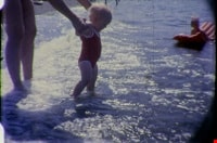
- Scope and Content
- Item consists of one silent colour film and opens with footage of Teresa McLean and her mother, Edna at the oceanside on Bowyer Island and is followed with footage of a man and George McLean building a cabin with help from some of the McLean children. The following footage is a little poor and jump…
- Repository
- City of Burnaby Archives
- Date
- 1963
- Collection/Fonds
- George H.F. McLean fonds
- Physical Description
- 1 digital file ( 4 min., 26 sec ) : digital , col., si.
- Description Level
- Item
- Record No.
- 567-001-10
- Access Restriction
- No restrictions
- Reproduction Restriction
- May be restricted by third party rights
- Accession Number
- 2014-03
- Scope and Content
- Item consists of one silent colour film and opens with footage of Teresa McLean and her mother, Edna at the oceanside on Bowyer Island and is followed with footage of a man and George McLean building a cabin with help from some of the McLean children. The following footage is a little poor and jumpy but continues with views of the family swimming and playing at the beach and playing around the cabin that is under construction.
- Media Type
- Moving Images
- Photographer
- McLean, George H.F.
- Notes
- Title based on content of film
- Films originated in an 8mm format and were digitized by George McLean before being donated to the CBA
Images
Video
McLean family at a beach and cabin, 1963
McLean family at a beach and cabin, 1963
https://search.heritageburnaby.ca/media/hpo/_Data/_Archives_Moving_Images/_Unrestricted/567-001-10.m4v![Fireplace, [196-?] (date of original), copied 1992 thumbnail](/media/hpo/_Data/_Archives_Images/_Unrestricted/315/315-261.jpg?width=280)
Fireplace
https://search.heritageburnaby.ca/link/archivedescription36803
- Repository
- City of Burnaby Archives
- Date
- [196-?] (date of original), copied 1992
- Collection/Fonds
- Burnaby Historical Society fonds
- Description Level
- Item
- Physical Description
- 1 photograph : b&w ; 8.9 x 12.7 cm print
- Scope and Content
- Photograph of a man looking at a fireplace. This is likely Tom Cornforth with the fireplace he built for the family home on Royal Oak Avenue.
- Repository
- City of Burnaby Archives
- Date
- [196-?] (date of original), copied 1992
- Collection/Fonds
- Burnaby Historical Society fonds
- Subseries
- Burnaby Centennial Anthology subseries
- Physical Description
- 1 photograph : b&w ; 8.9 x 12.7 cm print
- Description Level
- Item
- Record No.
- 315-261
- Access Restriction
- No restrictions
- Reproduction Restriction
- Reproduce for fair dealing purposes only
- Accession Number
- BHS1994-04
- Scope and Content
- Photograph of a man looking at a fireplace. This is likely Tom Cornforth with the fireplace he built for the family home on Royal Oak Avenue.
- Subjects
- Buildings Components - Fireplaces
- Names
- Cornforth, Tom
- Media Type
- Photograph
- Notes
- Title based on contents of photograph
- Geographic Access
- Royal Oak Avenue
- Historic Neighbourhood
- Burnaby Lake (Historic Neighbourhood)
- Planning Study Area
- Douglas-Gilpin Area
Images
![Fireplace, [196-?] (date of original), copied 1992 thumbnail](/media/hpo/_Data/_Archives_Images/_Unrestricted/315/315-261.jpg)
Interview with Diane Stiglish by Eric Damer December 4, 2012 - Track 1
https://search.heritageburnaby.ca/link/oralhistory409
- Repository
- City of Burnaby Archives
- Date Range
- 1942-1960
- Length
- 0:08:37
- Summary
- This portion of the recording pertains to Diane Stiglish's memories of her family's mushroom farm. Diane describes how her parents met, married and bought a mushroom farm. She also provides a physical description of the farm and how the work was organized.
- Repository
- City of Burnaby Archives
- Summary
- This portion of the recording pertains to Diane Stiglish's memories of her family's mushroom farm. Diane describes how her parents met, married and bought a mushroom farm. She also provides a physical description of the farm and how the work was organized.
- Date Range
- 1942-1960
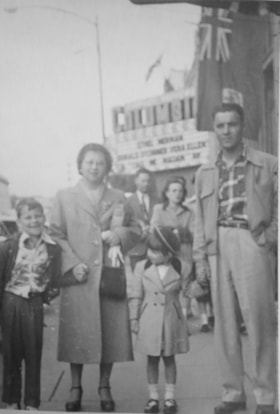
- Photo Info
- Diane Stiglish with her parents and older brother in New Westminster, 1955. Item no. 549-067.
- Length
- 0:08:37
- Interviewer
- Damer, Eric
- Interview Date
- December 4, 2012
- Scope and Content
- Recording is an interview with Diane Stiglish conducted by Burnaby Village Museum employee Eric Damer, December 4, 2012. Major theme discussed: mushroom farming.
- Biographical Notes
- F.J. "Jack" Stiglish (originally spelt Stiglich) and his wife bought a Burnaby home in 1943 at Keswick Street, just south of the Lougheed Highway, and took up mushroom farming. By the time their daughter Diane was born five years later in New Westminster, the F.J. Stiglish mushroom farm was an established business. Mushrooms grown at the F.J. Stiglish farm were sent off to Money’s Mushrooms to be packaged and retailed. Later, mushroom growers bought out Money’s to form the Fraser Valley Mushroom Growers Co-op and nominated Jack Stiglish as their first president. Jack then entered a float in the Pacific National Exhibition (PNE) parade and set up a mushroom booth at the fair. In 1969 Jack Stiglish sold the mushroom farm and he and his wife moved next to their trailer court business just down the road. Diane’s brother Allan Stiglich (his family name returned to the original spelling) moved to Langley to open a large mushroom farm of his own which he established with the help of his father. Diane Stiglish began a career with BC Tel.
- Total Tracks
- 5
- Total Length
- 0:46:06
- Interviewee Name
- Stiglish, Diane
- Interview Location
- Burnaby Village Museum
- Interviewer Bio
- Eric Damer is a lifelong British Columbian born in Victoria, raised in Kamloops, and currently residing in Burnaby. After studying philosophy at the University of Victoria, he became interested in the educational forces that had shaped his own life. He completed master’s and doctoral degrees in educational studies at the University of British Columbia with a particular interest in the history of adult and higher education in the province. In 2012, Eric worked for the City of Burnaby as a field researcher and writer, conducting interviews for the City Archives and Museum Oral History Program.
- Collection/Fonds
- Community Heritage Commission Special Projects fonds
- Transcript Available
- None
- Media Type
- Sound Recording
Images

Audio Tracks
Track one of recording of interview with Diane Stiglish
Track one of recording of interview with Diane Stiglish
https://search.heritageburnaby.ca/media/hpo/_Data/_Archives_Oral_Histories/_Unrestricted/MSS171-026/MSS171-026_Track_1.mp3
Interview with Diane Stiglish by Eric Damer December 4, 2012 - Track 2
https://search.heritageburnaby.ca/link/oralhistory410
- Repository
- City of Burnaby Archives
- Date Range
- 1947-1960
- Length
- 0:09:40
- Summary
- This portion of the recording pertains to Diane Stiglish's memories of her family's mushroom farm. Diane describes how compost was created on the farm, how the mushrooms were dealt with and what chores she was responsible for as a child. She also tells stories of inspectors coming to the farm.
- Repository
- City of Burnaby Archives
- Summary
- This portion of the recording pertains to Diane Stiglish's memories of her family's mushroom farm. Diane describes how compost was created on the farm, how the mushrooms were dealt with and what chores she was responsible for as a child. She also tells stories of inspectors coming to the farm.
- Date Range
- 1947-1960
- Photo Info
- Diane Stiglish with her parents and older brother in New Westminster, 1955. Item no. 549-067.
- Length
- 0:09:40
- Historic Neighbourhood
- Burquitlam (Historic Neighbourhood)
- Interviewer
- Damer, Eric
- Interview Date
- December 4, 2012
- Scope and Content
- Recording is an interview with Diane Stiglish conducted by Burnaby Village Museum employee Eric Damer, December 4, 2012. Major theme discussed: mushroom farming.
- Biographical Notes
- F.J. "Jack" Stiglish (originally spelt Stiglich) and his wife bought a Burnaby home in 1943 at Keswick Street, just south of the Lougheed Highway, and took up mushroom farming. By the time their daughter Diane was born five years later in New Westminster, the F.J. Stiglish mushroom farm was an established business. Mushrooms grown at the F.J. Stiglish farm were sent off to Money’s Mushrooms to be packaged and retailed. Later, mushroom growers bought out Money’s to form the Fraser Valley Mushroom Growers Co-op and nominated Jack Stiglish as their first president. Jack then entered a float in the Pacific National Exhibition (PNE) parade and set up a mushroom booth at the fair. In 1969 Jack Stiglish sold the mushroom farm and he and his wife moved next to their trailer court business just down the road. Diane’s brother Allan Stiglich (his family name returned to the original spelling) moved to Langley to open a large mushroom farm of his own which he established with the help of his father. Diane Stiglish began a career with BC Tel.
- Total Tracks
- 5
- Total Length
- 0:46:06
- Interviewee Name
- Stiglish, Diane
- Interview Location
- Burnaby Village Museum
- Interviewer Bio
- Eric Damer is a lifelong British Columbian born in Victoria, raised in Kamloops, and currently residing in Burnaby. After studying philosophy at the University of Victoria, he became interested in the educational forces that had shaped his own life. He completed master’s and doctoral degrees in educational studies at the University of British Columbia with a particular interest in the history of adult and higher education in the province. In 2012, Eric worked for the City of Burnaby as a field researcher and writer, conducting interviews for the City Archives and Museum Oral History Program.
- Collection/Fonds
- Community Heritage Commission Special Projects fonds
- Transcript Available
- None
- Media Type
- Sound Recording
Images
Audio Tracks
Track two of recording of interview with Diane Stiglish
Track two of recording of interview with Diane Stiglish
https://search.heritageburnaby.ca/media/hpo/_Data/_Archives_Oral_Histories/_Unrestricted/MSS171-026/MSS171-026_Track_2.mp3
Interview with Sev Morin by Rod Fowler April 4, 1990 - Track 2
https://search.heritageburnaby.ca/link/oralhistory538
- Repository
- City of Burnaby Archives
- Date Range
- 1950-1990
- Length
- 00:06:16
- Summary
- This portion of the interview is about Sev Morin’s description of Burnaby’s growth and business development along Kingsway and Hastings, the Lake City Industrial Park, and the purchase of property in 1958 for the Heritage Park and Art Gallery.
- Repository
- City of Burnaby Archives
- Summary
- This portion of the interview is about Sev Morin’s description of Burnaby’s growth and business development along Kingsway and Hastings, the Lake City Industrial Park, and the purchase of property in 1958 for the Heritage Park and Art Gallery.
- Date Range
- 1950-1990
- Photo Info
- Sev Morin (left) of Severin's in Burnaby (formerly the Gai Paree) hosting a gala New Year's celebration, 1979. Item no. 480-712
- Length
- 00:06:16
- Subjects
- Buildings - Commercial
- Buildings - Civic
- Buildings - Industrial
- Buildings - Schools - Universities and Colleges
- Historic Neighbourhood
- Central Park (Historic Neighbourhood)
- Burnaby Lake (Historic Neighbourhood)
- Vancouver Heights (Historic Neighbourhood)
- Edmonds (Historic Neighbourhood)
- Planning Study Area
- Burnaby Heights Area
- Lake City Area
- Burnaby Mountain Area
- Kingsway-Beresford Area
- Douglas-Gilpin Area
- Interviewer
- Fowler, Rod
- Interview Date
- April 4, 1990
- Scope and Content
- Recording is of an interview with Severin "Sev" Morin, conducted by Rod Fowler. Sev Morin was one of eleven participants interviewed as part of the SFU/Burnaby Centennial Committee's oral history series titled, "Voices of Burnaby". The interview is mainly about Sev Morin’s banquet hall, restaurant and night club business on Kingsway, originally named the “Gai Paree Supper Club” (1947-1976) and later “Severin’s” (1976-1985) and “Diego’s” (1985-1994), its function as a Burnaby landmark, and the entertainment and political people he met through his business. He also describes his many volunteer activities in Burnaby, including member of the SFU Senate, Rotary Club, Variety Club and Telethon, fund raising for Burnaby Hospital, and tourism related groups, and his political work for the federal Liberal party. He talks about his parents’ origins, the lives of his brothers Rudy and Rene, and the family’s involvement in establishing the “Gai Paree”. He also shares his views about the business and cultural development of Burnaby. To view “Narrow By” terms for each track expand this description and see “Notes”.
- Biographical Notes
- Severin “Sev” Rene Morin was born September 21, 1927, in Bonneville, Alberta, to Rene Pierre Morin (1878-1963) and Anne Marie (nee Lachiver) Morin (1886-1956). Mr. and Mrs. R. P. Morin and their son Rene Francois (1905-1954) immigrated to Edmonton, Alberta, from France in 1913, where Rene Pierre Morin worked for the C.N.R. and a second son Adolphe “Rudy” Ferdinand (1922-1969) was born, followed by their third son Severin. In 1943, after R.P. Morin retired, the family moved to Burnaby to a house on Sperling Avenue. Sometime earlier the two older Morin brothers found work in Trail at the smelter and developed musical careers. In 1946/47 the Morin family purchased property on Kingsway and built a banquet hall, the “Gai Paree Supper Club”. Sev and Rudy Morin managed the club and Rene F. Morin moved to Burnaby to join them with his band. The supper club, with its live music and dance floor, became a popular meeting place and wedding venue, eventually expanding into a restaurant and nightclub in the 1970s. The “Gai Paree” was renamed “Severin’s” in 1976 and “Diego’s” in 1985, closing finally in 1994. Sev Morin’s business life included three record stores which he owned with his friend Jack Cullen. Through these businesses Sev Morin was well known in the entertainment and hospitality industry. He and his restaurant also hosted political and social events that made the restaurant a community landmark. Sev Morin contributed many volunteer hours to community and charitable organizations, including an appointment to the SFU Senate, fundraising for the Burnaby Hospital, Director of the Variety Club and Rotary Club, and consultant for a variety of tourism related ventures. He also was active in the federal Liberal Party. Sev Morin and his wife Pauline married in 1950 and had three children. Sev Morin died at age 86 on March 28, 2014.
- Total Tracks
- 10
- Total Length
- 00:56:44
- Interviewee Name
- Morin, Severin "Sev"
- Interviewer Bio
- Rod Fowler returned to university as a mature student in the 1980s after working about twenty years in the field of economics and computerization in business in England, Europe and Western Canada. He graduated with a BA from SFU in both History and Sociology in 1987, his MA degree in Geography in 1989, and his PhD in Cultural Geography at SFU. He taught courses in Geography, Sociology, History and Canadian Studies at several Lower Mainland colleges, before becoming a full time member of the Geography Department at Kwantlen University College.
- Collection/Fonds
- SFU/Burnaby Centennial Committee fonds
- Transcript Available
- Transcript available
- Media Type
- Sound Recording
- Web Notes
- Interviews were digitized in 2015 allowing them to be accessible on Heritage Burnaby. The digitization project was initiated by the Community Heritage Commission with support from City of Burnaby Council.
Images

Audio Tracks
Track two of interview with Sev Morin
Track two of interview with Sev Morin
https://search.heritageburnaby.ca/media/hpo/_Data/_Archives_Oral_Histories/_Unrestricted/MSS187-021/MSS187-021_Track%202.mp3![Woodward house, [1910] thumbnail](/media/hpo/_Data/_Archives_Images/_Unrestricted/477/477-190.jpg?width=280)
Woodward house
https://search.heritageburnaby.ca/link/archivedescription38871
- Repository
- City of Burnaby Archives
- Date
- [1910]
- Collection/Fonds
- Peers Family and Hill Family fonds
- Description Level
- Item
- Physical Description
- 1 photograph : sepia ; 6 x 10.5 cm on page 14 x 17.5 cm (pasted in album)
- Scope and Content
- Photograph of the home belonging to Maude and Harriet Woodward, early residents of the Burnaby Lake area. The cottage was a prefabricated building designed by J.J. Mahoney and architect Joseph Bowman and was manufactured in Vancouver by the B.C. Mills Timber and Trading Company and erected here in …
- Repository
- City of Burnaby Archives
- Date
- [1910]
- Collection/Fonds
- Peers Family and Hill Family fonds
- Physical Description
- 1 photograph : sepia ; 6 x 10.5 cm on page 14 x 17.5 cm (pasted in album)
- Description Level
- Item
- Record No.
- 477-190
- Access Restriction
- No restrictions
- Reproduction Restriction
- No known restrictions
- Accession Number
- 2007-12
- Scope and Content
- Photograph of the home belonging to Maude and Harriet Woodward, early residents of the Burnaby Lake area. The cottage was a prefabricated building designed by J.J. Mahoney and architect Joseph Bowman and was manufactured in Vancouver by the B.C. Mills Timber and Trading Company and erected here in 1904. Maude Woodward established a post-office here which was operated by her sister, Harriet. Harriet also began a small private school here, the first in Burnaby Lake. The cottage was enlarged with several additions until 1912 when the Woodwards built a new house.
- Media Type
- Photograph
- Notes
- Title based on contents of photograph
- Geographic Access
- Sperling Avenue
- Street Address
- 5141 Sperling Avenue
- Historic Neighbourhood
- Burnaby Lake (Historic Neighbourhood)
- Planning Study Area
- Morley-Buckingham Area
Images
![Woodward house, [1910] thumbnail](/media/hpo/_Data/_Archives_Images/_Unrestricted/477/477-190.jpg)
![Woodward house, [1912] thumbnail](/media/hpo/_Data/_Archives_Images/_Unrestricted/477/477-191.jpg?width=280)
Woodward house
https://search.heritageburnaby.ca/link/archivedescription38872
- Repository
- City of Burnaby Archives
- Date
- [1912]
- Collection/Fonds
- Peers Family and Hill Family fonds
- Description Level
- Item
- Physical Description
- 1 photograph : b&w ; 4 x 6.2 cm on page 14 x 17.5 cm (pasted in album)
- Scope and Content
- Photograph of the home of Maude Woodward and her sister Harriet Woodward. A caption beneath the photograph reads: "Burnaby Lake Post Office and School 1910-1934."
- Repository
- City of Burnaby Archives
- Date
- [1912]
- Collection/Fonds
- Peers Family and Hill Family fonds
- Physical Description
- 1 photograph : b&w ; 4 x 6.2 cm on page 14 x 17.5 cm (pasted in album)
- Description Level
- Item
- Record No.
- 477-191
- Access Restriction
- No restrictions
- Reproduction Restriction
- No known restrictions
- Accession Number
- 2007-12
- Scope and Content
- Photograph of the home of Maude Woodward and her sister Harriet Woodward. A caption beneath the photograph reads: "Burnaby Lake Post Office and School 1910-1934."
- Media Type
- Photograph
- Notes
- Title based on caption accompanying photograph
- Geographic Access
- Sperling Avenue
- Street Address
- 5195 Sperling Avenue
- Historic Neighbourhood
- Burnaby Lake (Historic Neighbourhood)
- Planning Study Area
- Morley-Buckingham Area
Images
![Woodward house, [1912] thumbnail](/media/hpo/_Data/_Archives_Images/_Unrestricted/477/477-191.jpg)
![Barnet School, [1913] (date of original), copied 1986 thumbnail](/media/hpo/_Data/_Archives_Images/_Unrestricted/204/204-292.jpg?width=280)
Barnet School
https://search.heritageburnaby.ca/link/archivedescription35434
- Repository
- City of Burnaby Archives
- Date
- [1913] (date of original), copied 1986
- Collection/Fonds
- Burnaby Historical Society fonds
- Description Level
- Item
- Physical Description
- 1 photograph : b&w ; 12.7 x 17.8 cm print
- Scope and Content
- Photograph of 7820 Barnet Road including the Barnet School and adjoining teacher's residence. Dr. Carl Eaton once taught there (this photograph was taken by him). Burnaby Mountain is visible in the background.
- Repository
- City of Burnaby Archives
- Date
- [1913] (date of original), copied 1986
- Collection/Fonds
- Burnaby Historical Society fonds
- Subseries
- Pioneer Tales subseries
- Physical Description
- 1 photograph : b&w ; 12.7 x 17.8 cm print
- Description Level
- Item
- Record No.
- 204-292
- Access Restriction
- No restrictions
- Reproduction Restriction
- No restrictions
- Accession Number
- BHS1988-03
- Scope and Content
- Photograph of 7820 Barnet Road including the Barnet School and adjoining teacher's residence. Dr. Carl Eaton once taught there (this photograph was taken by him). Burnaby Mountain is visible in the background.
- Names
- Barnet School
- Media Type
- Photograph
- Photographer
- Eaton, Dr. Carl
- Notes
- Title based on contents of photograph
- Geographic Access
- Barnet Road
- Street Address
- 7820 Barnet Road
- Historic Neighbourhood
- Barnet (Historic Neighbourhood)
- Planning Study Area
- Burnaby Mountain Area
Images
![Barnet School, [1913] (date of original), copied 1986 thumbnail](/media/hpo/_Data/_Archives_Images/_Unrestricted/204/204-292.jpg)
![Riverway East School and Dundonald Church, [between 1911 and 1919] thumbnail](/media/hpo/_Data/_Archives_Images/_Unrestricted/316/325-024.jpg?width=280)
Riverway East School and Dundonald Church
https://search.heritageburnaby.ca/link/archivedescription37152
- Repository
- City of Burnaby Archives
- Date
- [between 1911 and 1919]
- Collection/Fonds
- Burnaby Historical Society fonds
- Description Level
- Item
- Physical Description
- 1 photograph : b&w ; 8 x 12.5 cm print
- Scope and Content
- Photograph of Riverway East (renamed Dundonald) School and Dundonald Untied Church taken from River Road (now Marine Drive). A large pile of cordwood is visible alongside the school.
- Repository
- City of Burnaby Archives
- Date
- [between 1911 and 1919]
- Collection/Fonds
- Burnaby Historical Society fonds
- Subseries
- Disney family subseries
- Physical Description
- 1 photograph : b&w ; 8 x 12.5 cm print
- Description Level
- Item
- Record No.
- 325-024
- Access Restriction
- No restrictions
- Reproduction Restriction
- No known restrictions
- Accession Number
- BHS1996-04
- Scope and Content
- Photograph of Riverway East (renamed Dundonald) School and Dundonald Untied Church taken from River Road (now Marine Drive). A large pile of cordwood is visible alongside the school.
- Media Type
- Photograph
- Photographer
- Disney, John Harold "Jack"
- Notes
- Title based on contents of photograph
- Geographic Access
- Gilley Avenue
- Marine Drive
- Street Address
- 5787 Marine Drive
- Historic Neighbourhood
- Alta-Vista (Historic Neighbourhood)
- Planning Study Area
- Clinton-Glenwood Area
Images
![Riverway East School and Dundonald Church, [between 1911 and 1919] thumbnail](/media/hpo/_Data/_Archives_Images/_Unrestricted/316/325-024.jpg)

Academic Quadrangle construction
https://search.heritageburnaby.ca/link/archivedescription38215
- Repository
- City of Burnaby Archives
- Date
- August 5, 1966 (date of original), copied 1991
- Collection/Fonds
- Burnaby Historical Society fonds
- Description Level
- Item
- Physical Description
- 1 photograph : b&w ; 3.3 x 4.1 cm print on contact sheet 20.5 x 26.8 cm
- Scope and Content
- Photograph of the construction of the Simon Fraser University (SFU) Academic Quadrangle building, phase two. Information at lower right corner of photograph reads, "Academic Quadrangle Building / Phase Two / Simon Fraser University, Burnaby, BC / Z.S. Kiss - Architect / Laing Construction & Equipme…
- Repository
- City of Burnaby Archives
- Date
- August 5, 1966 (date of original), copied 1991
- Collection/Fonds
- Burnaby Historical Society fonds
- Subseries
- Burnaby Image Bank subseries
- Physical Description
- 1 photograph : b&w ; 3.3 x 4.1 cm print on contact sheet 20.5 x 26.8 cm
- Description Level
- Item
- Record No.
- 370-802
- Access Restriction
- No restrictions
- Reproduction Restriction
- No restrictions
- Accession Number
- BHS1999-03
- Scope and Content
- Photograph of the construction of the Simon Fraser University (SFU) Academic Quadrangle building, phase two. Information at lower right corner of photograph reads, "Academic Quadrangle Building / Phase Two / Simon Fraser University, Burnaby, BC / Z.S. Kiss - Architect / Laing Construction & Equipment Ltd, General Contractors / No14 Date Aug 5, 1966, Facing E."
- Media Type
- Photograph
- Photographer
- Frank, Leonard
- Notes
- Title based on contents of photograph
- 1 b&w copy negative accompanying
- Geographic Access
- University Drive
- Street Address
- 8888 University Drive
- Planning Study Area
- Burnaby Mountain Area
Images

![Armstrong Avenue School, [between 1911 and 1919] thumbnail](/media/hpo/_Data/_Archives_Images/_Unrestricted/316/325-016.jpg?width=280)
Armstrong Avenue School
https://search.heritageburnaby.ca/link/archivedescription37144
- Repository
- City of Burnaby Archives
- Date
- [between 1911 and 1919]
- Collection/Fonds
- Burnaby Historical Society fonds
- Description Level
- Item
- Physical Description
- 1 photograph : b&w ; 8.5 x 12.5 cm print
- Scope and Content
- Photograph of the side elevation of Armstrong Avenue School. A man is visible walking along the sidewalk, near the school.
- Repository
- City of Burnaby Archives
- Date
- [between 1911 and 1919]
- Collection/Fonds
- Burnaby Historical Society fonds
- Subseries
- Disney family subseries
- Physical Description
- 1 photograph : b&w ; 8.5 x 12.5 cm print
- Description Level
- Item
- Record No.
- 325-016
- Access Restriction
- No restrictions
- Reproduction Restriction
- No known restrictions
- Accession Number
- BHS1996-04
- Scope and Content
- Photograph of the side elevation of Armstrong Avenue School. A man is visible walking along the sidewalk, near the school.
- Subjects
- Buildings - Schools
- Names
- Armstrong Avenue School
- Media Type
- Photograph
- Photographer
- Disney, John Harold "Jack"
- Notes
- Title based on contents of photograph
- Geographic Access
- Armstrong Avenue
- Street Address
- 8757 Armstrong Avenue
- Historic Neighbourhood
- East Burnaby (Historic Neighbourhood)
- Planning Study Area
- Cariboo-Armstrong Area
Images
![Armstrong Avenue School, [between 1911 and 1919] thumbnail](/media/hpo/_Data/_Archives_Images/_Unrestricted/316/325-016.jpg)
![Armstrong Avenue School, [between 1911 and 1919] thumbnail](/media/hpo/_Data/_Archives_Images/_Unrestricted/316/325-017.jpg?width=280)
Armstrong Avenue School
https://search.heritageburnaby.ca/link/archivedescription37145
- Repository
- City of Burnaby Archives
- Date
- [between 1911 and 1919]
- Collection/Fonds
- Burnaby Historical Society fonds
- Description Level
- Item
- Physical Description
- 1 photograph : b&w ; 8.5 x 12.5 cm print
- Scope and Content
- Photograph of the front of Armstrong Avenue School.
- Repository
- City of Burnaby Archives
- Date
- [between 1911 and 1919]
- Collection/Fonds
- Burnaby Historical Society fonds
- Subseries
- Disney family subseries
- Physical Description
- 1 photograph : b&w ; 8.5 x 12.5 cm print
- Description Level
- Item
- Record No.
- 325-017
- Access Restriction
- No restrictions
- Reproduction Restriction
- No known restrictions
- Accession Number
- BHS1996-04
- Scope and Content
- Photograph of the front of Armstrong Avenue School.
- Subjects
- Buildings - Schools
- Names
- Armstrong Avenue School
- Media Type
- Photograph
- Photographer
- Disney, John Harold "Jack"
- Notes
- Title based on contents of photograph
- Geographic Access
- Armstrong Avenue
- Street Address
- 8757 Armstrong Avenue
- Historic Neighbourhood
- East Burnaby (Historic Neighbourhood)
- Planning Study Area
- Cariboo-Armstrong Area
Images
![Armstrong Avenue School, [between 1911 and 1919] thumbnail](/media/hpo/_Data/_Archives_Images/_Unrestricted/316/325-017.jpg)

Armstrong Street School site
https://search.heritageburnaby.ca/link/museumdescription11133
- Repository
- Burnaby Village Museum
- Date
- 1915
- Collection/Fonds
- Ronald G. Scobbie collection
- Description Level
- Item
- Physical Description
- 1 survey plan : blueprint on paper ; 56 x 54 cm
- Scope and Content
- Survey plan of "Armstrong Street School Site / Burnaby Municipality" "Being a 2 acre portion of Lot 13 Group 1, & according to map 1722 which shows this as Lot E. Block 2 of subdivision of a portion, of Lot 13, Group 1, New Westminster District".
- Repository
- Burnaby Village Museum
- Collection/Fonds
- Ronald G. Scobbie collection
- Description Level
- Item
- Physical Description
- 1 survey plan : blueprint on paper ; 56 x 54 cm
- Material Details
- Scale 40 feet = 1 inch
- Scope and Content
- Survey plan of "Armstrong Street School Site / Burnaby Municipality" "Being a 2 acre portion of Lot 13 Group 1, & according to map 1722 which shows this as Lot E. Block 2 of subdivision of a portion, of Lot 13, Group 1, New Westminster District".
- Creator
- Burnett, Geoffrey K.
- Subjects
- Buildings - Schools
- Names
- Armstrong Avenue School
- Responsibility
- Burnett & McGugan, Engineers and Surveyors
- Geographic Access
- Armstrong Avenue
- Street Address
- 8757 Armstrong Avenue
- Accession Code
- BV003.83.12
- Access Restriction
- No restrictions
- Reproduction Restriction
- No known restrictions
- Date
- 1915
- Media Type
- Cartographic Material
- Historic Neighbourhood
- East Burnaby (Historic Neighbourhood)
- Planning Study Area
- Cariboo-Armstrong Area
- Scan Resolution
- 440
- Scan Date
- 22-Dec-2020
- Scale
- 100
- Notes
- Title based on contents of plan
- Note in black ink on verso of plan reads: "1746"
- Oath on plan reads: "I, Geoffrey K. Burnett...and did personally superintend the survey represented..." "Completed on the 18th day of March 1915"; signed by Geoffrey K. Burnett and notarized by "K.A. Eastman", sworn "...19th day of April 1915"; "Burnett and McGugan., B.C. Land Surveyors. Etc.. New Westminster, B.C.."
Zoomable Images

![Back of Kingsway East School, [between 1914 and 1919] thumbnail](/media/hpo/_Data/_Archives_Images/_Unrestricted/316/325-029.jpg?width=280)
Back of Kingsway East School
https://search.heritageburnaby.ca/link/archivedescription37157
- Repository
- City of Burnaby Archives
- Date
- [between 1914 and 1919]
- Collection/Fonds
- Burnaby Historical Society fonds
- Description Level
- Item
- Physical Description
- 1 photograph : b&w ; 8 x 12.5 cm print
- Scope and Content
- Photograph of the back of Kingsway East School and surrounding fields.
- Repository
- City of Burnaby Archives
- Date
- [between 1914 and 1919]
- Collection/Fonds
- Burnaby Historical Society fonds
- Subseries
- Disney family subseries
- Physical Description
- 1 photograph : b&w ; 8 x 12.5 cm print
- Description Level
- Item
- Record No.
- 325-029
- Access Restriction
- No restrictions
- Reproduction Restriction
- No known restrictions
- Accession Number
- BHS1996-04
- Scope and Content
- Photograph of the back of Kingsway East School and surrounding fields.
- Subjects
- Buildings - Schools
- Names
- Kingsway East School
- Media Type
- Photograph
- Photographer
- Disney, John Harold "Jack"
- Notes
- Title based on contents of photograph
- Geographic Access
- Kingsway
- Mission Avenue
- Street Address
- 6650 Southoaks Crescent
- Historic Neighbourhood
- Edmonds (Historic Neighbourhood)
- Planning Study Area
- Kingsway-Beresford Area
Images
![Back of Kingsway East School, [between 1914 and 1919] thumbnail](/media/hpo/_Data/_Archives_Images/_Unrestricted/316/325-029.jpg)