Narrow Results By
Decade
- 2020s 224
- 2010s
- 2000s 1824
- 1990s 2872
- 1980s 1366
- 1970s 3517
- 1960s 1358
- 1950s 1712
- 1940s 2148
- 1930s
- 1920s 2488
- 1910s 2036
- 1900s 870
- 1890s 250
- 1880s 165
- 1870s 72
- 1860s 123
- 1850s 14
- 1840s
- 1830s 3
- 1820s 2
- 1810s 3
- 1800s 3
- 1790s 2
- 1780s 2
- 1770s 2
- 1760s 2
- 1750s 2
- 1740s 2
- 1730s 2
- 1720s 2
- 1710s 2
- 1700s 2
- 1690s 2
- 1680s 2
- 1670s 1
- 1660s 1
- 1650s 1
- 1640s 1
- 1630s 1
- 1620s 1
- 1610s 1
- 1600s
- 1590s 1
- 1580s 1
- 1570s 1
- 1560s 1
- 1550s 1
- 1540s 1
- 1530s 1
- 1520s 2
- 1510s 1
- 1500s 1
- 1490s 1
- 1480s 1
Subject
- Accidents 6
- Accidents - Automobile Accidents 6
- Accidents - Train Accidents 8
- Advertising Medium 1
- Advertising Medium - Signs and Signboards 18
- Aerial Photographs 2
- Agricultural Tools and Equipment 2
- Agricultural Tools and Equipment - Gardening Equipment 3
- Agricultural Tools and Equipment - Plows 1
- Agriculture 5
- Agriculture - Crops 3
- Agriculture - Farms 32

Agnes & Elizabeth Michie Residence
https://search.heritageburnaby.ca/link/landmark554
- Repository
- Burnaby Heritage Planning
- Description
- Residential building.
- Associated Dates
- c.1935
- Street View URL
- Google Maps Street View
- Repository
- Burnaby Heritage Planning
- Geographic Access
- Yale Street
- Associated Dates
- c.1935
- Description
- Residential building.
- Heritage Value
- This interwar bungalow is beautifully preserved and retains many original features. Symmetrical in design, with two steeply-pitched front gables that flank a central arched gable over the front entrance, it also retains its narrow arched windows and projecting purlins in the front gables. Narrow sidelights flank the front door. The matching front elevation windows are typical of the period, with double-hung sash flanking a plate glass “picture window” with a curved transom; the upper panes are cross-leaded. This house was built by Agnes Michie and Elizabeth D. Michie.
- Locality
- Vancouver Heights
- Historic Neighbourhood
- Vancouver Heights (Historic Neighbourhood)
- Planning Study Area
- Burnaby Heights Area
- Ownership
- Private
- Street Address
- 3894 Yale Street
- Street View URL
- Google Maps Street View
Images


Alta Vista Baptist Church
https://search.heritageburnaby.ca/link/landmark557
- Repository
- Burnaby Heritage Planning
- Description
- Church building.
- Associated Dates
- 1936
- Other Names
- Royal Oak Community Church
- Street View URL
- Google Maps Street View
- Repository
- Burnaby Heritage Planning
- Other Names
- Royal Oak Community Church
- Geographic Access
- Royal Oak Avenue
- Associated Dates
- 1936
- Description
- Church building.
- Heritage Value
- This Baptist congregation originally held services in a tent at the corner of McGregor Avenue and Portland but they soon were able to build a small church. A membership drive by Pastor Arthur James Bowbrick (1875-1961) was so successful that the congregation was able build this fine structure, prominently located at the corner of Victory Street. Although it has been altered with later additions and stucco over the original siding, the original windows and the rooftop belfry remain.
- Locality
- Alta Vista
- Historic Neighbourhood
- Alta Vista (Historic Neighbourhood)
- Planning Study Area
- Sussex-Nelson Area
- Ownership
- Private
- Street Address
- 7175 Royal Oak Avenue
- Street View URL
- Google Maps Street View
Images


Alta Vista Neighbourhood
https://search.heritageburnaby.ca/link/landmark707
- Repository
- Burnaby Heritage Planning
- Associated Dates
- 1925-1954
- Heritage Value
- As with many areas of Burnaby during this period, the years after World War Two marked a rapid growth in residential development in the Alta-Vista Neighbourhood. Subdivisions like Sussex and Suncrest were built and new schools and amenities were constructed to meet the demands of increased population.
- Historic Neighbourhood
- Alta Vista (Historic Neighbourhood)
- Planning Study Area
- Sussex-Nelson Area
Images


Annie Barrett-Lennard Residence
https://search.heritageburnaby.ca/link/landmark559
- Repository
- Burnaby Heritage Planning
- Description
- Residential building.
- Associated Dates
- c.1935
- Street View URL
- Google Maps Street View
- Repository
- Burnaby Heritage Planning
- Geographic Access
- Parker Street
- Associated Dates
- c.1935
- Description
- Residential building.
- Heritage Value
- Built for Annie Barrett-Lennard, this British Arts and Crafts residence has retained many of its original features, such as its stucco and half-timbering exterior with a cat’s slide roof over the front entrance. The steeply-pitched gables, asymmetrical half-massing, leaded windows and pegged joinery are all references to traditional British antecedents.
- Locality
- Capitol Hill
- Historic Neighbourhood
- Capitol Hill (Historic Neighbourhood)
- Planning Study Area
- Parkcrest-Aubrey Area
- Area
- 1227.44
- Contributing Resource
- Building
- Ownership
- Private
- Street Address
- 5450 Parker Street
- Street View URL
- Google Maps Street View
Images


Barnet Neighbourhood
https://search.heritageburnaby.ca/link/landmark681
- Repository
- Burnaby Heritage Planning
- Associated Dates
- 1925-1954
- Heritage Value
- In 1925, the mill at Barnet was under new ownership and was known as the Barnet Lumber Company. It was one of the most successful local employers in Burnaby until the 1930s, when the economic crisis of the Great Depression resulted in a strike at the mill. The City of Burnaby eventually assumed control of the site - including all of the homes - when the company failed to pay its taxes. The City then dismantled the mill and resold the property in two parts - the eastern section would become the Kapoor sawmill and the western portion, the McColl-Frontenac Oil Company.
- Historic Neighbourhood
- Barnet (Historic Neighbourhood)
- Planning Study Area
- Burnaby Mountain Area
Images


Bishop Block
https://search.heritageburnaby.ca/link/landmark562
- Repository
- Burnaby Heritage Planning
- Description
- Commercial building.
- Associated Dates
- 1935
- Street View URL
- Google Maps Street View
- Repository
- Burnaby Heritage Planning
- Geographic Access
- Hastings Street
- Associated Dates
- 1935
- Description
- Commercial building.
- Heritage Value
- This one-storey commercial block retains its original division into three retail units. An eclectic Spanish Colonial Revival character is imparted by the use of visor roofs, covered in metal pantiles, that extend over the recessed entries. The stepped parapets are more reminiscent of the Art Deco style. Each of the three retail spaces retains their plate glass display windows. This commercial block was owned in 1939 by Mary J. Bishop of Vancouver.
- Locality
- Vancouver Heights
- Historic Neighbourhood
- Vancouver Heights (Historic Neighbourhood)
- Planning Study Area
- Willingdon Heights Area
- Ownership
- Private
- Street Address
- 3736 Hastings Street
- Street View URL
- Google Maps Street View
Images


Brentwood Neighbourhood
https://search.heritageburnaby.ca/link/landmark669
- Repository
- Burnaby Heritage Planning
- Associated Dates
- 1925-1954
- Heritage Value
- In July, 1953, Burnaby's Municipal Council gave approval for the construction of a $12,000,000 residential and shopping development to be called Brentwood Park, located on the northeast corner of Lougheed and Willingdon. Plans called for about 400 homes and a 30-acre shopping centre to be built in this new subdivision - the first large residential subdivision in Burnaby to be developed with sewers and paved streets as well as other services.
- Planning Study Area
- Brentwood Area
Images


Broadview Neighbourhood
https://search.heritageburnaby.ca/link/landmark687
- Repository
- Burnaby Heritage Planning
- Associated Dates
- 1925-1954
- Heritage Value
- Development in the Broadview area slowed during World War Two, but after the war, the area became home to a number of industrial sites. The first major plant to be built here was the Dominion Bridge Company which opened in 1930.
- Historic Neighbourhood
- Broadview (Historic Neighbourhood)
- Planning Study Area
- Cascade-Schou Area
Images


Burnaby Lake Neighbourhood
https://search.heritageburnaby.ca/link/landmark700
- Repository
- Burnaby Heritage Planning
- Associated Dates
- 1925-1954
- Heritage Value
- After World War I and the Great Depression of the 1930s, more homes were constructed and subdivisions created in the Burnaby Lake district. The area around Deer Lake gained a reputation for being an "artistic development of commodious homes with park-like grounds."
- Historic Neighbourhood
- Burnaby Lake (Historic Neighbourhood)
- Planning Study Area
- Burnaby Lake Area
Images


Burnaby North High School
https://search.heritageburnaby.ca/link/landmark745
- Repository
- Burnaby Heritage Planning
- Associated Dates
- 1923-1982
- Street View URL
- Google Maps Street View
- Repository
- Burnaby Heritage Planning
- Geographic Access
- Willingdon Avenue
- Associated Dates
- 1923-1982
- Heritage Value
- Burnaby North and Burnaby South were the first high schools built in the City. Before the high school opened, Burnaby students had to travel to Vancouver if they wished to pursue education beyond an elementary level. In 1921, arrangements were made to use the basement of the Presbyterian Church for instruction of local students. By 1922 the Burnaby North High School opened at its first permanent location (4375 Pandora Street - which is now Rosser Elementary). In 1945, the Willingdon Avenue site was built and was used until a new building was constructed in 1961 on Hammarskjold Drive. From 1962, the school was used as Burnaby Heights Junior High school, but it closed in 1982 and the junior high students went to the new Burnaby North on Hammarskjold.
- Historic Neighbourhood
- Capitol Hill (Historic Neighbourhood)
- Planning Study Area
- Capitol Hill Area
- Street Address
- 250 Willingdon Avenue
- Street View URL
- Google Maps Street View
Images


Burnaby South High School
https://search.heritageburnaby.ca/link/landmark770
- Repository
- Burnaby Heritage Planning
- Associated Dates
- 1922-1988
- Street View URL
- Google Maps Street View
- Repository
- Burnaby Heritage Planning
- Geographic Access
- Southoaks Crescent
- Associated Dates
- 1922-1988
- Heritage Value
- Burnaby South and Burnaby North were Burnaby's first high schools. The first rooms of the school were built in 1922 on the same grounds as the Kingsway East Elementary School. In 1940, a two-storey building was erected and additions were made in 1963, 1967 and 1972. Kingsway East closed in 1925 and its buildings were used by the high school for Industrial Arts and Home Economics. In the early 1990s, a new "urban education centre" (Burnaby South/B.C. School for the Deaf) was opened, replacing the old Burnaby South High School.
- Historic Neighbourhood
- Edmonds (Historic Neighbourhood)
- Planning Study Area
- Kingsway-Beresford Area
- Street Address
- 6650 Southoaks Crescent
- Street View URL
- Google Maps Street View
Images


Burquitlam Neighbourhood
https://search.heritageburnaby.ca/link/landmark703
- Repository
- Burnaby Heritage Planning
- Associated Dates
- 1925-1954
- Heritage Value
- By the 1950s, the Burquitlam Neighbourhood was becoming a residential and commercial centre for the northeast section of Burnaby. The Sullivan Heights area was developed as a single-family residential area with the Lyndhurst School opening in 1954. The completion of the Lougheed Highway in 1953 encouraged more commercial and retail development and fostered the growth of the neighbourhood throughout this period.
- Historic Neighbourhood
- Burquitlam (Historic Neighbourhood)
- Planning Study Area
- Lyndhurst Area
Images


Capitol Hill Neighbourhood
https://search.heritageburnaby.ca/link/landmark667
- Repository
- Burnaby Heritage Planning
- Associated Dates
- 1925-1954
- Heritage Value
- Although the Hastings street-car extension to Ellesmere opened in 1913 and there had been much speculation in the area during the real estate boom of 1909-1913, development in Capitol Hill did not really take off until after World War One when workers in Vancouver started to look to Burnaby for affordable but centrally-located neighbourhoods in which to build their homes. The 1913 one-room school had to be replaced in 1923 and in 1948, members of the community came together to build a new Community Hall.
- Historic Neighbourhood
- Capitol Hill (Historic Neighbourhood)
- Planning Study Area
- Capitol Hill Area
Images


Central Park Neighbourhood
https://search.heritageburnaby.ca/link/landmark688
- Repository
- Burnaby Heritage Planning
- Associated Dates
- 1925-1954
- Heritage Value
- Although still largely a rural area during the 1920s, subdivisions began appearing in the Central Park neighbourhood at this time. Development was slowed by the Great Depression of the 1930s but the influx of commercial buildings and new housing initiatives in the post-war boom led to a period of rapid growth especially in the Garden Village subdivision which was undertaken in 1953 with the plan to build 500 modern homes in the 140-acre site. Despite the closure of the interurban line in 1953, the neighbourhood remained an active commercial and residential centre.
- Historic Neighbourhood
- Central Park (Historic Neighbourhood)
- Planning Study Area
- Maywood Area
Images


Chapel Of Peace
https://search.heritageburnaby.ca/link/landmark566
- Repository
- Burnaby Heritage Planning
- Description
- Church building.
- Associated Dates
- 1936
- Formal Recognition
- Heritage Designation, Community Heritage Register
- Other Names
- First United Spiritualist Church
- Street View URL
- Google Maps Street View
- Repository
- Burnaby Heritage Planning
- Other Names
- First United Spiritualist Church
- Geographic Access
- Kincaid Street
- Associated Dates
- 1936
- Formal Recognition
- Heritage Designation, Community Heritage Register
- Enactment Type
- Bylaw No. 13162
- Enactment Date
- 28/01/2013
- Description
- Church building.
- Heritage Value
- This church was built in 1936 as the Chapel of Peace for the Forest Lawn Cemetery. It was located outside the main entrance of the cemetery at the triangular parcel of land bounded by Sprott, Royal Oak and Canada Way. It served as the location for many memorial services, local community worship and weddings. The Anglican Church purchased and relocated the building to its present site in 1955. The church has been altered with the addition of wings and stucco, but retains its steep front gabled roof and some of its arched windows. It is now used as the First United Spiritualist Church.
- Locality
- Burnaby Lake
- Historic Neighbourhood
- Burnaby Lake (Historic Neighbourhood)
- Planning Study Area
- Douglas-Gilpin Area
- Contributing Resource
- Building
- Ownership
- Private
- Street Address
- 5584 Kincaid Street
- Street View URL
- Google Maps Street View
Images


Crabtown
https://search.heritageburnaby.ca/link/landmark674
- Repository
- Burnaby Heritage Planning
- Associated Dates
- 1912-1957
- Heritage Value
- North Burnaby's waterfront was the location of a unique squatter's community known as Crabtown. Although its origins are obscure, it is believed that the first shacks were built before 1912. When the depression of 1913-1917 began, the shacks became permanent homes for impoverished workers. During the Great Depression of the 1930s, the community grew larger. Crabtown was not a slum, but a neighbourhood - the community even rallied together to build a water supply system and trails up the steep bluff with steps and banisters so children could go to school safely. In 1957, the National Harbours Board decided that Crabtown was encroaching on Federal property and evicted all 130 residents. Within a few months, residents were relocated and 114 homes were levelled.
- Historic Neighbourhood
- Vancouver Heights (Historic Neighbourhood)
- Planning Study Area
- Burnaby Heights Area
Images


Duncan & Margaret McGregor Estate 'Glen-Lyon' New Haven Barn
https://search.heritageburnaby.ca/link/landmark852
- Repository
- Burnaby Heritage Planning
- Description
- Designed in a vernacular architectural style, the New Haven Barn is a large gambrel-roofed barn located on the Edwardian era McGregor Estate 'Glen-Lyon,' overlooking the rich farmland of the Fraser River floodplain and near a ravine and forested area adjacent to Marine Drive in South Burnaby.
- Associated Dates
- 1939
- Formal Recognition
- Heritage Designation, Community Heritage Register
- Other Names
- Home of the Friendless, New Haven Borstal Home for Boys and Youthful Offenders, New Haven Correction Centre
- Street View URL
- Google Maps Street View
- Repository
- Burnaby Heritage Planning
- Other Names
- Home of the Friendless, New Haven Borstal Home for Boys and Youthful Offenders, New Haven Correction Centre
- Geographic Access
- Marine Drive
- Associated Dates
- 1939
- Formal Recognition
- Heritage Designation, Community Heritage Register
- Enactment Type
- Bylaw No. 12183
- Enactment Date
- 11/12/2006
- Description
- Designed in a vernacular architectural style, the New Haven Barn is a large gambrel-roofed barn located on the Edwardian era McGregor Estate 'Glen-Lyon,' overlooking the rich farmland of the Fraser River floodplain and near a ravine and forested area adjacent to Marine Drive in South Burnaby.
- Heritage Value
- The site is historically significant for its association with early social welfare and correctional reform. The estate was sold in 1926 to an inter-denominational religious organization called the Home of the Friendless, which used it as their B.C. headquarters. The organization was charged with several cases of abuse and neglect in 1937, after which a Royal Commission was formed that led to new legislation to regulate and license all private welfare institutions. 'Glen-Lyon' was sold to the provincial government, and was dedicated in 1939 by the Lt.-Gov. E.W. Hamber for use as the New Haven Borstal Home for Boys and Youthful Offenders (later renamed the New Haven Correction Centre). The Borstal movement originated in England in the late nineteenth century, as an alternative to sending young offenders and runaways to prisons by providing reformatories that focused on discipline and vocational skill. This site’s role as the first North American institution devoted to the Borstal School philosophy was historic, and influenced corrections programs across Canada. The New Haven Barn is a significant feature from its development in 1939 as the Borstal School, designed by Chief Provincial Architect Henry Whittaker of the Department of Public Works, and is the only remaining structure of its kind in Burnaby.
- Defining Elements
- Key elements that define the heritage character of the New Haven Barn include its: - gambrel-roofed barn with roof vent with finial, sliding hay loft and access doors, small multi-pane windows, and lapped wooden siding
- Historic Neighbourhood
- Fraser Arm (Historic Neighbourhood)
- Planning Study Area
- Big Bend Area
- Architect
- Henry Whittaker
- Function
- Primary Historic--Estate
- Community
- Burnaby
- Cadastral Identifier
- 003-004-661
- Boundaries
- 'Glen-Lyon' is comprised of a single residential lot located at 4250 Marine Drive, Burnaby.
- Area
- 230873.18
- Contributing Resource
- Building
- Ownership
- Private
- Names
- Whittaker, George
- New Haven Borstal Home for Boys and Youthful Offenders
- New Haven Correction Centre
- Borstal School
- Street Address
- 4250 Marine Drive
- Street View URL
- Google Maps Street View
Images


East Burnaby Neighbourhood
https://search.heritageburnaby.ca/link/landmark712
- Repository
- Burnaby Heritage Planning
- Associated Dates
- 1925-1954
- Heritage Value
- After a lull in construction during the World War I period, East Burnaby Neighbourhood's growth resumed during the 1920s when many homes and businesses were constructed. The post-World War Two period also saw rapid construction and the creation of new housing developments in response to a population boom. The neighbourhood remained a primarily single-family residential area.
- Historic Neighbourhood
- Edmonds (Historic Neighbourhood)
- Planning Study Area
- Stride Avenue Area
Images


Edmonds Neighbourhood
https://search.heritageburnaby.ca/link/landmark704
- Repository
- Burnaby Heritage Planning
- Associated Dates
- 1925-1954
- Heritage Value
- The historic growth of Edmonds as a neighbourhood was based on its strategic location on the early interurban line between Vancouver and New Westminster. Even by 1980 when a survey of the residential neighbourhoods was conducted, a full 25% of homes in the area predated 1930. The 1950s was a period of strong housing development, with both single-family and multi-family units being constructed. Although Burnaby's City Hall was moved from Kingsway and Edmonds in the early 1950s, Edmonds remained an important centre in the community.
- Historic Neighbourhood
- Edmonds (Historic Neighbourhood)
- Planning Study Area
- Stride Avenue Area
Images


England House
https://search.heritageburnaby.ca/link/landmark501
- Repository
- Burnaby Heritage Planning
- Description
- The Mary England Residence is a one and one-half storey, wood-frame, Period Revival cottage with a steeply pitched, cross-gabled roof. Situated on Griffiths Drive within the Edmonds neighbourhood of Burnaby, the Mary England Residence has an original attached garage.
- Associated Dates
- 1930
- Formal Recognition
- Community Heritage Register
- Other Names
- Mary England Residence
- Street View URL
- Google Maps Street View
- Repository
- Burnaby Heritage Planning
- Other Names
- Mary England Residence
- Geographic Access
- Griffiths Drive
- Associated Dates
- 1930
- Formal Recognition
- Community Heritage Register
- Enactment Type
- Council Resolution
- Enactment Date
- 26/05/2003
- Description
- The Mary England Residence is a one and one-half storey, wood-frame, Period Revival cottage with a steeply pitched, cross-gabled roof. Situated on Griffiths Drive within the Edmonds neighbourhood of Burnaby, the Mary England Residence has an original attached garage.
- Heritage Value
- The Mary England Residence, built in 1930, is valued as a representation of the period revival styles that were popular in the era between the two World Wars. At this time, it was considered the height of fashion for a house to reflect historical styles, even when combined in an eclectic manner, that expressed a domestic ideal of cozy traditionalism. The Mary England Residence is an exuberant example of this trend. Half-timbering, multi-paned and leaded casement windows and a steeply pitched, cross-gabled roof impart a storybook cottage charm. Its first owner, Mary England, was employed for several years as stenographer at the old Burnaby Municipal Hall. An original attached garage is evidence of the growing presence of automobiles in domestic life of the 1930s. Additionally, the Mary England Residence is a testament to the continued suburban growth of the Edmonds neighbourhood. During the Edwardian era, the area experienced a housing boom. Its proximity to New Westminster, coupled with its regional transportation links, made it an attractive area for middle-class residences. Despite the economic recession of the 1930s, the Edmonds area continued to develop with modest but handsome housing.
- Defining Elements
- Key elements that define the heritage character of the Mary England Residence: - location, in the Edmonds neighbourhood of East Burnaby - residential form, scale and massing as expressed by its one and one-half storey height with full basement, rectangular plan and steeply pitched cross-gabled roof - Period Revival elements such as rough-cast stucco, half-timbering, minimal eave overhangs, arched entry with glazed wooden front door, and arched-top feature window - mixture of windows including: double-hung, multi-paned wooden sash windows in double assembly; 6-over-1 double-hung wooden sash windows in multiple assembly; multi-paned casement windows; and straight-leaded feature windows - external parged chimney and two internal chimneys - attached front-gabled garage - associated landscape features including mature deciduous trees and fruit trees
- Historic Neighbourhood
- Edmonds (Historic Neighbourhood)
- Planning Study Area
- Stride Avenue Area
- Function
- Primary Historic--Single Dwelling
- Primary Current--Single Dwelling
- Community
- Edmonds
- Cadastral Identifier
- P.I.D.011-115-424
- Boundaries
- The Mary England Residence is comprised of a single residential lot located at 7276 Griffiths Drive, Burnaby.
- Area
- 1404.26
- Contributing Resource
- Building
- Ownership
- Public (local)
- Documentation
- City of Burnaby Planning and Building Department, Heritage Site Files
- Street Address
- 7276 Griffiths Drive
- Street View URL
- Google Maps Street View
Images


Ford Motor Company
https://search.heritageburnaby.ca/link/landmark698
- Repository
- Burnaby Heritage Planning
- Geographic Access
- Kingsway
- Associated Dates
- 1938
- Heritage Value
- In 1938, the Ford Motor Company selected Burnaby as its site for a new assembly plant to serve Western Canada. Ford purchased the land which had been owned by the Silver family at Kingsway and Silver Avenue and built its factory using steel from Burnaby's Dominion Bridge Company. During World War II, the plant was used to produce military vehicles. In 1988, the building was demolished and the Station Square development was constructed on the site.
- Historic Neighbourhood
- Central Park (Historic Neighbourhood)
- Planning Study Area
- Maywood Area
- Street Address
- 4600 Kingsway
Images


Forest Lawn Memorial Park
https://search.heritageburnaby.ca/link/landmark579
- Repository
- Burnaby Heritage Planning
- Description
- Cemetery site.
- Associated Dates
- 1935
- Street View URL
- Google Maps Street View
- Repository
- Burnaby Heritage Planning
- Geographic Access
- Royal Oak Avenue
- Associated Dates
- 1935
- Description
- Cemetery site.
- Heritage Value
- Forest Lawn Memorial Park was founded and designed by Albert F. Arnold, who wanted to design a memorial park “which would be a place of perpetual beauty and which would banish the ‘graveyard’ taint from such places forever.” The 145 acres of Forest Lawn were designed as a garden, which overlooks Vancouver and has a magnificent view of the mountains. Called “God’s Acres,” with white-shelled walks and piped sacred music, the design allowed a natural setting to offer solace to grieve. Bronze memorial plaques were used rather than headstones, which would have marred the garden effect. Arnold acted as a consultant to memorial parks all over Canada and the United States and many of his innovations have become standard practice in North American cemeteries. Equipped with its own greenhouses, the park has more than a million plants of all types. The chapel, which sits on the lower southern slopes, is a sophisticated modernist structure that was designed by renowned local architects McCarter & Nairne.
- Locality
- Burnaby Lake
- Historic Neighbourhood
- Burnaby Lake (Historic Neighbourhood)
- Planning Study Area
- Douglas-Gilpin Area
- Architect
- Albert F. Arnold McCarter & Nairne
- Area
- 449910.00
- Contributing Resource
- Landscape Feature
- Building
- Ownership
- Private
- Street Address
- 3789 Royal Oak Avenue
- Street View URL
- Google Maps Street View
Images

![Forest Lawn Memorial Park buildings and lawns, [1958]. City of Burnaby. Photo ID 067-001. thumbnail](/media/hpo/_Data/_Planning_Images/_Unrestricted/Inventory/BBY-3789-Royal-Oak-Av-1958-Archives%20067-001.jpg)

Fraser Arm Neighbourhood
https://search.heritageburnaby.ca/link/landmark708
- Repository
- Burnaby Heritage Planning
- Associated Dates
- 1925-1954
- Heritage Value
- By the late 1920s, the Fraser Arm Neighbourhood in Burnaby was developing into an industrial and manufacturing district. In 1931, the Canadian National Railway built a bridge over the Fraser River from Burnaby to Lulu Island and advertised that over 30 industries were currently operating along the North Fraser. Along with industries, this district remained an important agricultural area for the Lower Mainland. Chinese market gardens continued to develop and thrive and in 1926, the Vancouver Sun estimated that that Chinese farms in the Lower Fraser Valley then supplied 90 per cent of all green vegetables consumed in the Vancouver market area.
- Historic Neighbourhood
- Fraser Arm (Historic Neighbourhood)
- Planning Study Area
- Big Bend Area
Images


Hans & Anna Hau Residence
https://search.heritageburnaby.ca/link/landmark588
- Repository
- Burnaby Heritage Planning
- Description
- Residential building.
- Associated Dates
- c.1935
- Street View URL
- Google Maps Street View
- Repository
- Burnaby Heritage Planning
- Geographic Access
- Canada Way
- Associated Dates
- c.1935
- Description
- Residential building.
- Heritage Value
- Danish builder Hans Jorgensen Hau (1878-1944) and his wife Anna (née Sorenson, 1874-1956), constructed this highly-distinctive Tudor Revival residence circa 1935. This was a time of entrenched traditionalism, and most domestic architecture reflected period revival styles. Tudor elements have been compressed here into a cottage form, including a distinctive front façade with half timbering and brick noggin; on the sides the nogging is rock-dash stucco. Casement windows contribute to the cottage appearance. The rear façade is clad with more utilitarian shingles. A prominent brick chimney exhibits angled and corbelled brickwork. Hau worked as a bricklayer and stonemason, and this house has common elements with the Moore Residence at 5165 Sperling Avenue, which Hau designed and constructed in 1943.
- Locality
- Burnaby Lake
- Historic Neighbourhood
- Burnaby Lake (Historic Neighbourhood)
- Planning Study Area
- Morley-Buckingham Area
- Area
- 2010.52
- Contributing Resource
- Building
- Ownership
- Private
- Street Address
- 5070 Canada Way
- Street View URL
- Google Maps Street View
Images


Isak & Lilly Gronning Residence
https://search.heritageburnaby.ca/link/landmark598
- Repository
- Burnaby Heritage Planning
- Description
- Residential building.
- Associated Dates
- c.1938
- Street View URL
- Google Maps Street View
- Repository
- Burnaby Heritage Planning
- Geographic Access
- Eton Street
- Associated Dates
- c.1938
- Description
- Residential building.
- Heritage Value
- This house was built for Isac Hartvig Peterson “Harry” Gronning (1880-1955), a Norwegian-born butcher, and his wife Lilly Geneva (née Hatton, 1889-1978). The Gronnings married in Vancouver in 1913, and lived in this home until at least Harry’s death in 1955. Designed to simulate a Norman-style cottage, the most distinctive feature of this eclectic bungalow is its round entry tower with a conical roof. Other distinctive features include its rolled roof edges that simulate a thatched roof, and its rounded arch windows surrounded with imitation voussoirs. It retains its original wooden-sash windows with leaded panes.
- Locality
- Vancouver Heights
- Historic Neighbourhood
- Vancouver Heights (Historic Neighbourhood)
- Planning Study Area
- Burnaby Heights Area
- Area
- 566.71
- Contributing Resource
- Building
- Ownership
- Private
- Street Address
- 3766 Eton Street
- Street View URL
- Google Maps Street View
Images


James & Catherine Newton Residence
https://search.heritageburnaby.ca/link/landmark602
- Repository
- Burnaby Heritage Planning
- Description
- Residential building.
- Associated Dates
- 1930
- Street View URL
- Google Maps Street View
- Repository
- Burnaby Heritage Planning
- Geographic Access
- Yale Street
- Associated Dates
- 1930
- Description
- Residential building.
- Heritage Value
- Typical of the Craftsman style, this bungalow has retained its original side jerkin-headed roof, jerkin-headed dormer, twin-course shingle siding and tapered columns on the open front verandah. The panelled and glazed front door, and the multi-paned windows are original. It was built for James Newton (1887-1954), an inspector for the Workman’s Compensation Board, for $3,500 in 1930. James and his wife, Catherine (née McKechnie), lived here until his death in 1954.
- Locality
- Vancouver Heights
- Historic Neighbourhood
- Vancouver Heights (Historic Neighbourhood)
- Planning Study Area
- Burnaby Heights Area
- Area
- 566.71
- Contributing Resource
- Building
- Ownership
- Private
- Street Address
- 3724 Yale Street
- Street View URL
- Google Maps Street View
Images


Jubilee Grove Arch
https://search.heritageburnaby.ca/link/landmark533
- Repository
- Burnaby Heritage Planning
- Description
- The Jubilee Grove Arch sits at the corner of Kingsway and Patterson Avenue. Located within Central Park, the ceremonial arch and its decorative plantings provide a visual anchor to the northeast corner and entry point to the park.
- Associated Dates
- 1939
- Formal Recognition
- Heritage Designation, Community Heritage Register
- Street View URL
- Google Maps Street View
- Repository
- Burnaby Heritage Planning
- Geographic Access
- Imperial Street
- Associated Dates
- 1939
- Formal Recognition
- Heritage Designation, Community Heritage Register
- Enactment Type
- Bylaw No. 9807
- Enactment Date
- 23/11/1992
- Description
- The Jubilee Grove Arch sits at the corner of Kingsway and Patterson Avenue. Located within Central Park, the ceremonial arch and its decorative plantings provide a visual anchor to the northeast corner and entry point to the park.
- Heritage Value
- Jubilee Grove Arch was dedicated as part of the municipality’s celebration of the Jubilee of the coronation of King George V and was dedicated during Burnaby’s annual May Day celebrations in 1935. Much of the construction work was carried out by local citizens under the direction of the Burnaby Engineering Department through a Depression era work relief program that provided a way for local residents to pay their taxes. The garden was also chosen as the site for the ceremonial planting of an oak tree from the Royal Forest at Windsor, in honor of the Coronation of King George VI and Queen Elizabeth in 1937. The original bronze garden dedication plaque and oak tree remain at the site today. The decorative stone arch was erected in 1939 as a symbol of Burnaby's, and the Lower Mainland of British Columbia’s, strong ties to the English monarchy at the time, and the arch’s unveiling during May Day ceremonies shows the social role that such a commemorative feature played both to the local government and people of Burnaby. It was erected just prior to the Royal Visit of 1939, the first time that reigning British monarchs had travelled to Canada. Built of Haddington Island sandstone, the arch itself was reconstructed from a salvaged architectural element of a historic Vancouver landmark. The arch originally framed the entrance door to the Vancouver Club building in Vancouver, built in 1893-94 on West Hastings Street and designed by architect C.O. Wickenden. The building was demolished in 1930, however the arch was stored and rebuilt as the focal point of the Jubilee Grove after being bought by the Municipality of Burnaby. The work was undertaken by Italian-born stone mason Rizieri Stefanini (1879-1954), the owner of Burnaby Monumental Works. The re-use of the arch symbolizes the close tie between Vancouver and Burnaby and the joint evolution of the neighbouring cities.
- Defining Elements
- The Jubilee Grove Arch has character-defining elements that recognize it both as a remnant of a past building and as a new and individual structure. These include its: - axial diagonal placement and prominent corner location marking one of the entries to Central Park - visibility and accessibility as a public monument - hand carved stone blocks of Haddington Island sandstone - decorative twisted-rope motif carved to outline the arch - supporting rusticated sidewalls with planting urns - original bronze dedication plaque - flanking ornamental gardens - Royal Oak tree and plaque
- Historic Neighbourhood
- Central Park (Historic Neighbourhood)
- Planning Study Area
- Maywood Area
- Organization
- City of Burnaby
- Architect
- C.O. Wickenden
- Function
- Primary Current--Park Fixture
- Primary Historic--Park Fixture
- Community
- Burnaby
- Cadastral Identifier
- P.I.D. No. 017-767-172 Legal Description: Block B of Lot 2 Except Firstly: Part on Plan 8669 and Secondly: Part on Plan LMP4689 District Lot 151, Group 1, New Westminster District, Plan 3443
- Boundaries
- The property (Central Park) is a municipally-owned park that lies at the western edge of Burnaby, between 49th Avenue to the south, Kingsway to the north, Boundary Road to the west and Patterson Avenue to the east.
- Area
- 853,403.82
- Contributing Resource
- Structure
- Landscape Feature
- Ownership
- Public (local)
- Documentation
- Heritage Site Files: PC77000 20. City of Burnaby Planning and Building Department, 4949 Canada Way, Burnaby, B.C., V5G 1M2
- Names
- Burnaby Monumental Works
- Street Address
- 3883 Imperial Street
- Street View URL
- Google Maps Street View
Images


Kapoor Mill
https://search.heritageburnaby.ca/link/landmark683
- Repository
- Burnaby Heritage Planning
- Associated Dates
- 1939
- Heritage Value
- In 1939, Mr. Kapoor Singh Siddoo purchased the eastern section of the former Barnet Mill site from the City of Burnaby and founded Kapoor Sawmills Ltd. The mill was struck by disaster in 1947 when a fire caused $500,000.00 in damage to the property. A smaller mill was rebuilt and was in operation until 1959. Mr. Siddoo, who had been considered to be one of the most influential men in Vancouver's East Indian Community, died in 1964. The mill site became inactive except for a sand and gravel storage area that was used by the Kask Brothers Company, and in 1972 the family sold the property to the Municipality of Burnaby who later turned it into the Barnet Marine Park.
- Historic Neighbourhood
- Barnet (Historic Neighbourhood)
- Planning Study Area
- Burnaby Mountain Area
Images


Lake City Neighbourhood
https://search.heritageburnaby.ca/link/landmark702
- Repository
- Burnaby Heritage Planning
- Associated Dates
- 1925-1954
- Heritage Value
- When the Lake City Industrial Park first opened in the 1950's, it was a fairly isolated industrial enclave with convenient access to rail and road transportation routes. The sense of entrepreneurial flare and success that was anticipated for the area is evident in the naming of local streets which include "Production", "Enterprise" and "Venture". The anticipated potential of the area was also demonstrated by the inclusion of many significant development amenities of the time, such as paved streets, site landscaping, rail service, natural gas service, and architectural controls.
- Planning Study Area
- Lake City Area
Images


Lewis & Millicent Physick Residence
https://search.heritageburnaby.ca/link/landmark616
- Repository
- Burnaby Heritage Planning
- Description
- Residential building.
- Associated Dates
- 1939
- Street View URL
- Google Maps Street View
- Repository
- Burnaby Heritage Planning
- Geographic Access
- Boundary Road North
- Associated Dates
- 1939
- Description
- Residential building.
- Heritage Value
- This modest residence was built for Lewis Baker Physick (1905-1971), a freight dispatcher for B.C. Motor Transport Company who later worked for B.C. Hydro, and Millicent Physick (née Edwards, 1894-1971), a hairdresser, who lived here until their respective deaths. Situated on a terraced lot with stone-clad retaining walls, this home was influenced by the British Arts and Crafts style, which remained popular throughout the 1930s. Such stylistic influence can be seen in the second floor overhang, which is supported by false beams, leaded casement windows and steeply pitched roof and front gable. The roofline is enhanced by a jerkin-headed roof on the front gable. Apart from the addition of a later south elevation extension, the house remains in excellent original condition. Located on an elevated site, this residence has an unobstructed view of downtown Vancouver and Burrard Inlet.
- Locality
- Vancouver Heights
- Historic Neighbourhood
- Vancouver Heights (Historic Neighbourhood)
- Planning Study Area
- Burnaby Heights Area
- Area
- 566.71
- Contributing Resource
- Building
- Ownership
- Private
- Street Address
- 420 Boundary Road North
- Street View URL
- Google Maps Street View
Images


Lochdale Neighbourhood
https://search.heritageburnaby.ca/link/landmark668
- Repository
- Burnaby Heritage Planning
- Associated Dates
- 1925-1954
- Heritage Value
- In the 1931 "Burnaby Year Book" the Lochdale neighbourhood is described as follows: "Lochdale…is situated at the intersection of the Hastings-Barnet road at the point where Sperling Avenue crosses…Situated at the intersection…there are an up to date service station and a general store, at which the Lochdale Post Office is situated. Immediately north of this is the seventy acres on which the Shell Oil Co. are to build an up-to-date refinery...On going south on Sperling Avenue can be found some lovely homes of the residents, all of which possess the most beautiful flower gardens, some of which are hobbies, and some being in the nature of a business. Others are engaged in chicken farming...while others find employment at the Barnet Mill about two miles east on the Hastings-Barnet Road."
- Historic Neighbourhood
- Lochdale (Historic Neighbourhood)
- Planning Study Area
- Lochdale Area
Images


Lozells Neighbourhood
https://search.heritageburnaby.ca/link/landmark701
- Repository
- Burnaby Heritage Planning
- Associated Dates
- 1925-1954
- Heritage Value
- Like a lot of residential neighbourhoods in Burnaby during the post-War boom, the Lozells area during the 1925-1954 period was one of new construction and subdivisions. Although more homes were being built, the neighbourhood still retained a somewhat rural characteristic well into the 1950s.
- Historic Neighbourhood
- Lozells (Historic Neighbourhood)
- Planning Study Area
- Government Road Area
Images


Lucy Turner Residence
https://search.heritageburnaby.ca/link/landmark618
- Repository
- Burnaby Heritage Planning
- Description
- Residential building.
- Associated Dates
- 1930
- Street View URL
- Google Maps Street View
- Repository
- Burnaby Heritage Planning
- Geographic Access
- Boundary Road North
- Associated Dates
- 1930
- Description
- Residential building.
- Heritage Value
- This house was built for Lucy Lillian Turner (1881-1959), the daughter of Captain Andrew Jackson Cates of North Vancouver. Lucy Turner was the widow of Robert Ketchson Turner (1871-1918), who was a purser for her father’s Terminal Steam Navigation Company. They were married in 1913; Robert died during the 1918 Spanish Influenza epidemic and was buried at Mountain View Cemetery in Vancouver. Located on an elevated site, this residence boasts an unobstructed view of downtown Vancouver and Burrard Inlet and is situated amidst a context of homes of a similar age and scale. Demonstrating the late influence of the Craftsman style, this one and one-half storey house has triangular eave brackets and exposed rafter tails and purlins. A central wall dormer projects over the central front entry. Though the integrity of the house has been compromised with a later coat of stucco over the original siding, it maintains its double-hung wooden windows and original form, scale and massing.
- Locality
- Vancouver Heights
- Historic Neighbourhood
- Vancouver Heights (Historic Neighbourhood)
- Planning Study Area
- Burnaby Heights Area
- Area
- 566.71
- Contributing Resource
- Building
- Ownership
- Private
- Street Address
- 324 Boundary Road North
- Street View URL
- Google Maps Street View
Images


Mary McNeil Residence
https://search.heritageburnaby.ca/link/landmark620
- Repository
- Burnaby Heritage Planning
- Description
- Residential building.
- Associated Dates
- 1930
- Street View URL
- Google Maps Street View
- Repository
- Burnaby Heritage Planning
- Geographic Access
- MacDonald Avenue North
- Associated Dates
- 1930
- Description
- Residential building.
- Heritage Value
- Built for Mary McNeil, this house is a well-preserved example of an interwar Period Revival cottage, combining eclectic elements such as curved entrance porch buttresses, rolled roof edges, round-arched windows, smooth stucco cladding and imitation voussoirs. The house retains its original window sash with leaded glass panes.
- Locality
- Vancouver Heights
- Historic Neighbourhood
- Vancouver Heights (Historic Neighbourhood)
- Planning Study Area
- Burnaby Heights Area
- Area
- 566.71
- Contributing Resource
- Building
- Ownership
- Private
- Street Address
- 310 Macdonald Avenue North
- Street View URL
- Google Maps Street View
Images


Mary Sutcliffe Residence
https://search.heritageburnaby.ca/link/landmark621
- Repository
- Burnaby Heritage Planning
- Description
- Residential building.
- Associated Dates
- c.1930
- Street View URL
- Google Maps Street View
- Repository
- Burnaby Heritage Planning
- Geographic Access
- Boundary Road North
- Associated Dates
- c.1930
- Description
- Residential building.
- Heritage Value
- Built at a time when historical styles were favoured for domestic construction, this charming cottage residence was built for Mary Seymour Sutcliffe (1870-1959), the wife of retired painter Arthur Sutcliffe (1863-1932). It was inspired by the British Arts and Crafts movement, as displayed in the half-timbering, rounded door hood and the picturesque, jerkin-headed roof with exposed purlins. While this house has a Boundary Road address, the house faces north instead of west, facing an elevated and extraordinary view of Burrard Inlet.
- Locality
- Vancouver Heights
- Historic Neighbourhood
- Vancouver Heights (Historic Neighbourhood)
- Planning Study Area
- Burnaby Heights Area
- Area
- 566.71
- Contributing Resource
- Building
- Ownership
- Private
- Street Address
- 650 Boundary Road North
- Street View URL
- Google Maps Street View
Images


Oak Theatre
https://search.heritageburnaby.ca/link/landmark699
- Repository
- Burnaby Heritage Planning
- Geographic Access
- Kingsway
- Associated Dates
- 1937
- Heritage Value
- After starting the first Oak Theatre in Brandon, Manitoba when talking pictures came along, Andy Digney and his family moved to Burnaby in 1936 and chose the site of their new theatre at the corner of Kingsway and Marlborough. In 1945, Digney sold the theatre but it remained in operation until 1968 when competition forced its closure and demolition. The Oak Theatre - which had opened on August 4, 1937 - was hailed as an artistic masterpiece for its ultra modern white stucco exterior, floodlights and pink-and-green neon marquee. The interior featured a mirrored ceiling, fireplace, and aquarium and had a colour scheme of orchid, royal blue, silver and black.
- Historic Neighbourhood
- Central Park (Historic Neighbourhood)
- Planning Study Area
- Marlborough Area
- Street Address
- 5000 Kingsway
Images


Ocean View Burial Park - Chapel
https://search.heritageburnaby.ca/link/landmark628
- Repository
- Burnaby Heritage Planning
- Geographic Access
- Imperial Street
- Associated Dates
- 1936
- Description
- Church building.
- Heritage Value
- Subsequent work at Ocean View was designed by local architects Sharp & Thompson through the 1950s, including the stone-faced Garden Chapel, built in 1936 as a replica of a Norman church. Prominent stone gates also replaced the original gates at the corner entrance. George Sharp (1880-1974) and Charles Thompson (1878-1961) formed Vancouver’s longest surviving architectural firm in 1908. They were born, educated and articled in London, before arriving in Vancouver via different routes. In 1912, the firm won the competition for the new University of British Columbia.
- Locality
- Alta Vista
- Historic Neighbourhood
- Alta Vista (Historic Neighbourhood)
- Planning Study Area
- Suncrest Area
- Architect
- Sharp & Thompson
- Area
- 359280.00
- Contributing Resource
- Building
- Ownership
- Private
- Street Address
- 4000 Imperial Street
Images


Parkcrest Neighbourhood
https://search.heritageburnaby.ca/link/landmark671
- Repository
- Burnaby Heritage Planning
- Associated Dates
- 1925-1954
- Heritage Value
- On May 10, 1951, the Burnaby News-Courier reported on the new Parkcrest subdivision, saying: "Central Burnaby is the scenic locale of a successful attempt to produce modern houses economically and yet avoid the mass production effect common to other housing developments. That is one of the many highlights peculiar to the new Parkcrest development of 275 homes...By giving home purchasers a wide choice of finishes, extras and colours, hundreds of variations are possible on the six basic floor plans...Travelling time by car to Hastings and Granville from Parkcrest has been clocked at 15 minutes...Both primary and junior high schools are within walking distance. A modern shopping centre is planned for the future...Several streets are laid out in a straight but irregular manner, thus eliminating the prosaic side by side appearance block by block, as in other housing developments."
- Planning Study Area
- Parkcrest-Aubrey Area
Images


Richard & Alice Dunn Residence
https://search.heritageburnaby.ca/link/landmark552
- Repository
- Burnaby Heritage Planning
- Description
- Residential building.
- Associated Dates
- 1939
- Street View URL
- Google Maps Street View
- Repository
- Burnaby Heritage Planning
- Geographic Access
- Jubilee Avenue
- Associated Dates
- 1939
- Description
- Residential building.
- Heritage Value
- This house was built for Richard Dunn, a police sergeant with the B.C. Police force and his wife Alice. This house is a notable example of a Storybook Cottage, dating from just prior to the outbreak of the Second World War. Modest houses of the era often assumed a cottage appearance that provided a romantic ideal of traditional domesticity. With its smooth, planar stucco, severely-clipped roof edges, round-arched door and windows, side arch with a catslide roof, cross-leaded glass and brick detailing, this house is an excellent example of this picturesque housing trend. Located on a corner lot, the house was sited at an angle. The large Chilean Pine, or monkey-puzzle tree, entrance is a remarkable specimen.
- Locality
- Alta Vista
- Historic Neighbourhood
- Alta Vista (Historic Neighbourhood)
- Planning Study Area
- Sussex-Nelson Area
- Ownership
- Private
- Street Address
- 7207 Jubilee Avenue
- Street View URL
- Google Maps Street View
Images


Shell Oil Company
https://search.heritageburnaby.ca/link/landmark675
- Repository
- Burnaby Heritage Planning
- Geographic Access
- Kensington Avenue
- Associated Dates
- ca. 1930-1993
- Heritage Value
- After considering several sites in the Greater Vancouver area, the Shell Oil Company chose 70 acres in North Burnaby with frontage of one third of a mile on Burrard Inlet. Shell proposed to build a four-million dollar plant that would employ up to 2000 - providing some relief in the middle of Burnaby's economic crisis of the Depression years. The site became known as the Shellburn Refinery and was in operation until 1993.
- Historic Neighbourhood
- Lochdale (Historic Neighbourhood)
- Planning Study Area
- Westridge Area
Images


Standard Oil Company / Chevron
https://search.heritageburnaby.ca/link/landmark673
- Repository
- Burnaby Heritage Planning
- Geographic Access
- Willingdon Avenue North
- Associated Dates
- 1935
- Heritage Value
- In 1935 the announcement that the California-based Standard Oil Company was going to build a huge "million dollar" refinery in Burnaby was greeted with cheers by residents who were eager for employment and good news during the Great Depression. The refinery, named Stanovan (aka: Standard Oil - Vancouver) was officially opened in 1936 with the ability to produce 2000 barrels per day. During World War Two, the capacity of the refinery doubled to assist in the war effort. In 1976, the company's name was changed to Chevron Canada Limited.
- Historic Neighbourhood
- Vancouver Heights (Historic Neighbourhood)
- Planning Study Area
- Burnaby Heights Area
- Street Address
- 355 Willingdon Avenue North
Images


Stowe Residence
https://search.heritageburnaby.ca/link/landmark642
- Repository
- Burnaby Heritage Planning
- Description
- Residential building.
- Associated Dates
- 1930
- Street View URL
- Google Maps Street View
- Repository
- Burnaby Heritage Planning
- Geographic Access
- Burris Street
- Associated Dates
- 1930
- Description
- Residential building.
- Heritage Value
- This charming home was built for George Norman Stowe (1885-1955) and his wife Lillian (née Ross) Stowe after they purchased this property from the Municipality of Burnaby in a Depression-era tax sale. George Stowe was a civil engineer with the Provincial Department of Public Works from 1905 until 1950. Inspired by the British Arts and Crafts movement, this stuccoed cottage is notable for its picturesque side gabled roof with sloped eaves, and a jerkin-headed dormer with half-timbering. Multi-paned casement windows are used throughout the house, adding to the picturesque effect. A verandah with a colonnade of pillars on the east side of the home overlooks a ravine.
- Locality
- Burnaby Lake
- Historic Neighbourhood
- Burnaby Lake (Historic Neighbourhood)
- Planning Study Area
- Morley-Buckingham Area
- Area
- 1963.96
- Contributing Resource
- Building
- Ownership
- Private
- Street Address
- 7484 Burris Street
- Street View URL
- Google Maps Street View
Images


Terence & Mary Bodkin Residence
https://search.heritageburnaby.ca/link/landmark643
- Repository
- Burnaby Heritage Planning
- Description
- Residential building.
- Associated Dates
- 1930
- Street View URL
- Google Maps Street View
- Repository
- Burnaby Heritage Planning
- Geographic Access
- Ingleton Avenue North
- Associated Dates
- 1930
- Description
- Residential building.
- Heritage Value
- This British Arts and Crafts residence was built for B.C. Coast Steamship Service seaman Terence William Bodkin (1876-1945) and his wife, Mary Margaret Bodkin (née Horie, 1882-1958), who had married in 1913. Mary, a violin teacher, was born in London and Terrance was from Ireland. The house has retained many of its original features such as its side gabled jerkin-headed roof, half timbering and triple assembly windows, with multi-paned upper sash.
- Locality
- Vancouver Heights
- Historic Neighbourhood
- Vancouver Heights (Historic Neighbourhood)
- Planning Study Area
- Burnaby Heights Area
- Area
- 566.71
- Contributing Resource
- Building
- Ownership
- Private
- Street Address
- 124 Ingleton Avenue North
- Street View URL
- Google Maps Street View
Images


Vancouver Heights Neighbourhood
https://search.heritageburnaby.ca/link/landmark666
- Repository
- Burnaby Heritage Planning
- Associated Dates
- 1925-1954
- Heritage Value
- Vancouver Heights remained an important residential and commercial centre in Burnaby throughout the 1925-1954 period. The area had its own Board of Trade and the North Burnaby Library was created to serve the residents. In 1949, the Hastings streetcars stopped running, but the area retained its reputation as one of the best shopping districts in the city.
- Historic Neighbourhood
- Vancouver Heights (Historic Neighbourhood)
- Planning Study Area
- Burnaby Heights Area
Images


Vancouver Heights Presbyterian Church
https://search.heritageburnaby.ca/link/landmark649
- Repository
- Burnaby Heritage Planning
- Description
- Church building.
- Associated Dates
- 1930
- Street View URL
- Google Maps Street View
- Repository
- Burnaby Heritage Planning
- Geographic Access
- Esmond Avenue
- Associated Dates
- 1930
- Description
- Church building.
- Heritage Value
- This church replaced the first Vancouver Heights Presbyterian Church, which opened in 1911 and later became the Masonic Hall. This site was purchased in 1928, but the new church was not completed until 1930, due to the financial constraints of the Depression era. B.C. Lieutenant-Governor Bruce dedicated the church on Feb. 16, 1931. The building has retained its Classical Revival form and detailing, including its symmetrical design, columns flanking the recessed main entrance and arched windows with keystone detailing. The Vancouver Heights Presbyterian Church was designed by Australian-born architect H.H. Simmonds (1883-1954). After serving in the First World War, Simmonds resumed his local practice, and even during the Depression, his output remained prolific. In the 1920s and 30s, Simmonds was commissioned by the City of Vancouver to replace several pavilions at the Pacific National Exhibition with a consistent grouping of Art Deco buildings including the surviving Livestock Building (1929), Women and Fine Arts Building (1931) and Forum (1933).
- Locality
- Vancouver Heights
- Historic Neighbourhood
- Vancouver Heights (Historic Neighbourhood)
- Planning Study Area
- Burnaby Heights Area
- Architect
- H.H. Simmonds
- Area
- 566.79
- Contributing Resource
- Building
- Ownership
- Private
- Street Address
- 140 Esmond Avenue
- Street View URL
- Google Maps Street View
Images


Westridge Neighbourhood
https://search.heritageburnaby.ca/link/landmark680
- Repository
- Burnaby Heritage Planning
- Associated Dates
- 1925-1954
- Heritage Value
- The Westridge Neighbourhood of Burnaby was created as a new subdivision during the post-World War Two housing boom in Burnaby. Developed by the C.B. Riley Company, it was laid out in a plan contoured to the shapes of the land and was situated to allow residents easy access to main transportation routes.
- Historic Neighbourhood
- Lochdale (Historic Neighbourhood)
- Planning Study Area
- Westridge Area
Images


William & Annie Mawhinney Residence
https://search.heritageburnaby.ca/link/landmark653
- Repository
- Burnaby Heritage Planning
- Description
- Residential building.
- Associated Dates
- c.1930
- Street View URL
- Google Maps Street View
- Repository
- Burnaby Heritage Planning
- Geographic Access
- Buckingham Avenue
- Associated Dates
- c.1930
- Description
- Residential building.
- Heritage Value
- Local farmers William Alexander Mawhinney (1870-1953) and Annie Josephine Mawhinney (née Sutcliff, 1871-1956) built this residence as their retirement home. It was the last of several houses built in the immediate vicinity by members of the Mawhinney family between 1909 and 1930. Born in Ireland, William Mawhinney first came to Burnaby to help his brother Isaiah establish his fruit farm. Due to his farm management experience, in 1908 William became foreman of the Avalon estate at Deer Lake that was owned by F.J. Hart. When he retired in 1930, William had fifty years of experience as a fruit and grain farmer.This house is situated on its lot at an angle, rather than parallel to the street, to take advantage of the view of wooded Buckingham Creek that runs through the northeast section of the property. Complementing the picturesque character of the property is this charming cottage-style residence, which is an excellent example of an interwar Storybook Cottage. During the years between the two World Wars, domestic styles in North America were resolutely historicist. In order to display good taste, it was expected that a house would have an identifiable period revival style. As economics dictated that houses of the time were generally modest, they often assumed a cottage appearance that provided a romantic ideal of traditional domesticity. The American Sesquicentennial reinforced this historicist trend, and the most popular Hollywood movies of the time were swashbuckling costume dramas. With its distinctive roughcast stucco and half-timbering, this house is an excellent example of this housing trend. The rolled roof edges, with steam-bent cedar shingles, simulate a traditional thatched roof. Other picturesque features include a front porch with round-arched openings, battered wall buttresses, an oriel window and diamond-paned leaded casement windows.
- Locality
- Burnaby Lake
- Historic Neighbourhood
- Burnaby Lake (Historic Neighbourhood)
- Planning Study Area
- Morley-Buckingham Area
- Area
- 1848.00
- Contributing Resource
- Building
- Ownership
- Private
- Street Address
- 6011 Buckingham Avenue
- Street View URL
- Google Maps Street View
Images


Willingdon Heights Neighbourhood
https://search.heritageburnaby.ca/link/landmark670
- Repository
- Burnaby Heritage Planning
- Associated Dates
- 1925-1954
- Heritage Value
- Willingdon Heights was another new subdivision developed in Burnaby during the post-World War Two building boom. A brochure about the development published in 1948 proclaimed "the Willingdon Heights 500 home development project in Burnaby fulfills its promise to provide a self-contained community for former members of the armed services and their families...the largest single veteran housing project in Canada as far as homes for individual ownership is concerned, Willingdon Heights development was planned by the Central Mortgage and Housing Corporation...At this date the earlier built rows of homes have passable roads and the owners are improving lawns and gardens in spare time...eventually additional stores and professional services will be installed and recreational projects will add to the amenities of a community of congenial residents..."
- Planning Study Area
- Willingdon Heights Area
Images


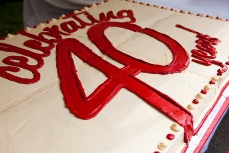
40th anniversary cake, Burnaby Village Museum
https://search.heritageburnaby.ca/link/museumdescription4538
- Repository
- Burnaby Village Museum
- Date
- 11 June 2011
- Collection/Fonds
- Burnaby Village Museum fonds
- Description Level
- Item
- Physical Description
- 1 photograph (jpeg)
- Scope and Content
- Photograph of top of special cake for the 40th anniversary celebrations of Burnaby Village Museum on June 11, 2011.
- Repository
- Burnaby Village Museum
- Collection/Fonds
- Burnaby Village Museum fonds
- Series
- Museum photographs series
- Description Level
- Item
- Physical Description
- 1 photograph (jpeg)
- Scope and Content
- Photograph of top of special cake for the 40th anniversary celebrations of Burnaby Village Museum on June 11, 2011.
- Subjects
- Events - Anniversaries
- Names
- Burnaby Village Museum
- Accession Code
- BV018.14.2
- Reproduction Restriction
- May be restricted by third party rights
- Date
- 11 June 2011
- Media Type
- Photograph
- Photographer
- Scherp, Leanne
- Notes
- Title based on contents of photograph
Images

50-Foot High Stump
https://search.heritageburnaby.ca/link/archivedescription36668
- Repository
- City of Burnaby Archives
- Date
- 1936 (date of original), copied 1992
- Collection/Fonds
- Burnaby Historical Society fonds
- Description Level
- Item
- Physical Description
- 1 photograph : b&w ; 12.5 x 8.5 cm print
- Scope and Content
- Photograph of a stump in Central Park. Typed note at the bottom of the photograph reads, "Hollow stump in Central Park (about centre of park). Fifty feet high. At five feet from ground, fifty feet in circumference as measured by Mr. and Mrs. R.T. Wilson. Central Park, November 1936. / City Archiv…
- Repository
- City of Burnaby Archives
- Date
- 1936 (date of original), copied 1992
- Collection/Fonds
- Burnaby Historical Society fonds
- Subseries
- Burnaby Centennial Anthology subseries
- Physical Description
- 1 photograph : b&w ; 12.5 x 8.5 cm print
- Description Level
- Item
- Record No.
- 315-023
- Access Restriction
- No restrictions
- Reproduction Restriction
- No known restrictions
- Accession Number
- BHS1994-04
- Scope and Content
- Photograph of a stump in Central Park. Typed note at the bottom of the photograph reads, "Hollow stump in Central Park (about centre of park). Fifty feet high. At five feet from ground, fifty feet in circumference as measured by Mr. and Mrs. R.T. Wilson. Central Park, November 1936. / City Archives."
- Media Type
- Photograph
- Notes
- Title based on contents of photograph
- Geographic Access
- Central Park
- Imperial Street
- Street Address
- 3883 Imperial Street
- Historic Neighbourhood
- Central Park (Historic Neighbourhood)
- Planning Study Area
- Maywood Area
Images
