20th century typewriting : complete course
https://search.heritageburnaby.ca/link/museumlibrary5012
- Repository
- Burnaby Village Museum
- Collection
- Special Collection
- Material Type
- Book
- Accession Code
- BV007.2.1
- Call Number
- 652.3 LES
- Edition
- 6th ed.
- Place of Publication
- Cincinnati
- Publisher
- South-Western Publishing Co.
- Publication Date
- c1952
- Physical Description
- 340 p. : ill. : 20 x 28 cm.
- Library Subject (LOC)
- Typewriting
- Subjects
- Documentary Artifacts - Books
- Historic Neighbourhood
- Edmonds (Historic Neighbourhood)
- Burnaby Lake (Historic Neighbourhood)
- Planning Study Area
- Kingsway-Beresford Area
- Douglas-Gilpin Area
- Geographic Access
- Canada Way
- Southoaks Crescent
- Street Address
- 4939 Canada Way
- 6650 Southoaks Crescent
- Object History
- Was used by Burnaby resident Barbara Copan when she taught typing at Burnaby Central circa 1963-65. It may have originally belonged to Barbara's mother who also taught typing at Burnaby South High School circa 1957 to 1965. She mainly taught typing in night school.
- Notes
- Authors' given name and date as follows: Lessenberry, D.D. (David Daniel), 1896- Crawford, T. James (Thomas James)
Images


![1892 Burnaby Centennial, [1992] thumbnail](/media/hpo/_Data/_BVM_Cartographic_Material/2013/2013_0008_0001_001.jpg?width=280)
1892 Burnaby Centennial
https://search.heritageburnaby.ca/link/museumdescription8704
- Repository
- Burnaby Village Museum
- Date
- [1992]
- Collection/Fonds
- Burnaby Village Museum Map collection
- Description Level
- Item
- Physical Description
- 1 map : blueline print ; 71 cm x 119 cm
- Scope and Content
- A birds eye view map of Burnaby, drawn by Mark Lewis, Parks staff, as a Parks-Maintenance Centennial Project for the 1892 - 1992 Burnaby Centennial. It features wildlife found in Burnaby and highlights civic buildings, parks and other prominent structures of the time. This is not a scale map.
- Repository
- Burnaby Village Museum
- Collection/Fonds
- Burnaby Village Museum Map collection
- Description Level
- Item
- Physical Description
- 1 map : blueline print ; 71 cm x 119 cm
- Material Details
- "1892 BURNABY/ CENTENNIAL 1992" printed in a banner across the top of the map Burnaby Centennial logo is located in the lower right side. "ALL WILDLIFE SHOWN CAN STILL / BE FOUND IN THE BURNABY AREA" printed in lower right corner "DRAWN BY / MARK LEWIS / A PARKS-MAINTENANCE / CENTENNIAL PROJECT" printed in the very lower right corner.
- The map is dark blue ink, there is no colour.
- Scope and Content
- A birds eye view map of Burnaby, drawn by Mark Lewis, Parks staff, as a Parks-Maintenance Centennial Project for the 1892 - 1992 Burnaby Centennial. It features wildlife found in Burnaby and highlights civic buildings, parks and other prominent structures of the time. This is not a scale map.
- History
- Drawn by Mark Lewis of the Parks-Maintenance Dept for the 1882 - 1992 Centennial of Burnaby. Mark always loved birds-eye maps, and showed this map to his supervisors while the work was still in progress. They suggested the map could be a Parks Maintenance Centennial Project. Mark agreed, and completed the map, including Burnaby landmarks and sketches of wildlife. Several copies of the map were given to schools so students could colour them.
- Creator
- Lewis, Mark
- Accession Code
- BV013.8.1
- Access Restriction
- No restrictions
- Reproduction Restriction
- No known restrictions
- Date
- [1992]
- Media Type
- Cartographic Material
- Scan Resolution
- 300
- Scan Date
- 05-Jun-2013
- Scale
- 96
- Notes
- Transcribed title
Images
![1892 Burnaby Centennial, [1992] thumbnail](/media/hpo/_Data/_BVM_Cartographic_Material/2013/2013_0008_0001_001.jpg)

A country girl : a new and original musical play
https://search.heritageburnaby.ca/link/museumlibrary4922
- Repository
- Burnaby Village Museum
- Author
- Tanner, James T.
- Edition
- New ed.
- Publication Date
- c1904
- Call Number
- 789 TAN
- Repository
- Burnaby Village Museum
- Collection
- Special Collection
- Material Type
- Book
- Accession Code
- BV997.34.9
- Call Number
- 789 TAN
- Edition
- New ed.
- Author
- Tanner, James T.
- Contributor
- Ross, Adrian, 1859-1933
- Monckton, Lionel, 1861-1924
- Rubens, Paul A. (Paul Alfred), 1875-1917
- Greenbank, Percy, 1878-1968
- Place of Publication
- London
- Publisher
- Chappell & Co., Ltd.
- Publication Date
- c1904
- Printer
- Henderson and Spalding, Marylebone Press
- Physical Description
- 212 p. : 28 cm.
- Inscription
- "E. B. Wilson" [Handwritten twice in pencil on title page]
- Library Subject (LOC)
- Musical revues, comedies, etc.
- Musical plays--Vocal scores
- Musical plays
- Music
- Subjects
- Music
- Names
- Wilson, Elsie
- Object History
- Elsie Wilson - The material in the donation is from her estate. Miss Wilson was a Burnaby resident and music teacher. The brass plaque was on her fathers home "Penrith Castle" on Blenheim St. in Burnaby
- Notes
- "By James T. Tanner. Lyrics by Adrian Ross. Music by Lionel Monckton. Additional lyrics and numbers by Paul A. Rubens. Additional lyrics by Percy Greenbank" -- Title page
- Contributor's full name and dates: Rubens, Paul A. (Paul Alfred), 1875-1917
Images

![All Saints Church, [ca.1910] thumbnail](/media/hpo/_Data/_BVM_Cartographic_Material/2003/2003_0083_0046_001.jpg?width=280)
All Saints Church
https://search.heritageburnaby.ca/link/museumdescription11924
- Repository
- Burnaby Village Museum
- Date
- [ca.1910]
- Collection/Fonds
- Ronald G. Scobbie collection
- Description Level
- Item
- Physical Description
- 1 plan : black ink and watercol. on paper ; 30.45 x 30.5 cm
- Scope and Content
- Item consists of building insurance plan of "All Saints Church / Lot "A" BK 29 DL 98 GP1 N.W.D.". Watling Street is idenfied to the north of the church building and Royal Oak Avenue to the west.
- Repository
- Burnaby Village Museum
- Collection/Fonds
- Ronald G. Scobbie collection
- Description Level
- Item
- Physical Description
- 1 plan : black ink and watercol. on paper ; 30.45 x 30.5 cm
- Material Details
- Scale 1 inch = 20 feet
- Scope and Content
- Item consists of building insurance plan of "All Saints Church / Lot "A" BK 29 DL 98 GP1 N.W.D.". Watling Street is idenfied to the north of the church building and Royal Oak Avenue to the west.
- Subjects
- Buildings - Religious - Churches
- Accession Code
- BV003.83.46
- Access Restriction
- No restrictions
- Reproduction Restriction
- No known restrictions
- Date
- [ca.1910]
- Media Type
- Cartographic Material
- Scan Resolution
- 600
- Scan Date
- 15-Jan-2021
- Scale
- 100
- Notes
- Transcribed title
- Note in pencil on verso reads: ""All Saints Church / Lot "A" BK 29 DL 98 / Scale 1 inch = 20 feet"
- Note in balck in on verso reads: "3704"
Images
![All Saints Church, [ca.1910] thumbnail](/media/hpo/_Data/_BVM_Cartographic_Material/2003/2003_0083_0046_001.jpg)
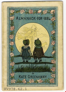
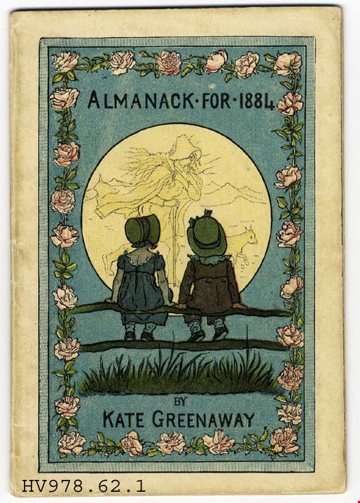
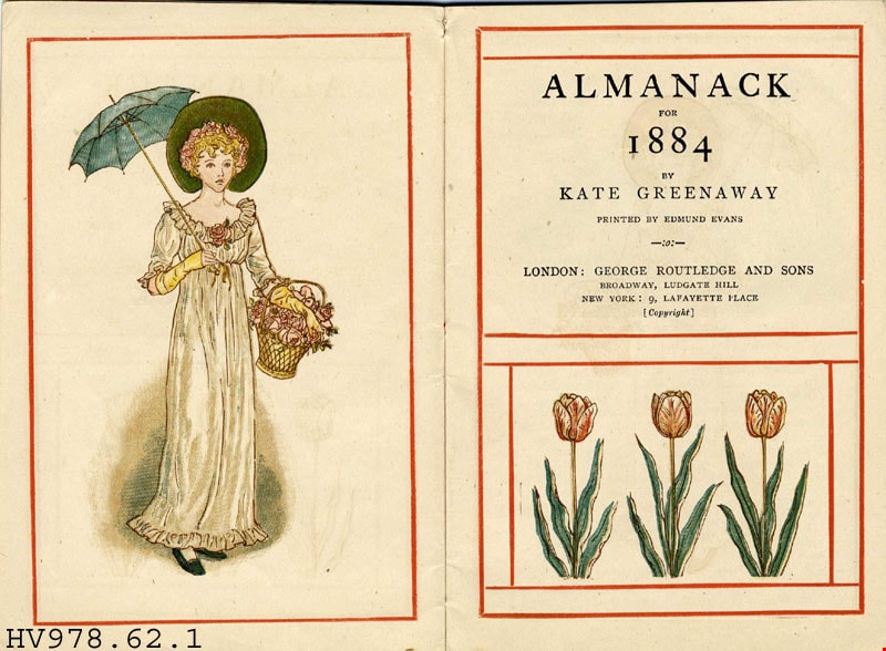
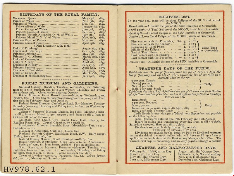
Almanack for 1884
https://search.heritageburnaby.ca/link/museumlibrary4883
- Repository
- Burnaby Village Museum
- Author
- Greenaway, Kate, 1846-1901
- Publication Date
- 1884
- Call Number
- 310 GRE
- Repository
- Burnaby Village Museum
- Collection
- Special Collection
- Material Type
- Book
- Accession Code
- HV978.62.1
- Call Number
- 310 GRE
- Author
- Greenaway, Kate, 1846-1901
- Place of Publication
- London
- Publisher
- George Routledge and Sons
- Publication Date
- 1884
- Printer
- Edmund Evans
- Physical Description
- 1 v. (unpaged) : col. ill. : 14 cm.
- Library Subject (LOC)
- Natural history
- Months
- Seasons
- Almanacs
- Miniature books--Specimens
- Juvenile literature
- Notes
- "printed by Edmund Evans".
- Printer' s dates: Evans, Edmund, 1826-1905.
Images


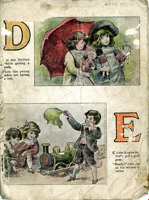
Alphabet rhymes
https://search.heritageburnaby.ca/link/museumlibrary2703
- Repository
- Burnaby Village Museum
- Collection
- Special Collection
- Material Type
- Book
- Accession Code
- HV974.50.13
- Call Number
- 821 ALP
- Place of Publication
- s.l.
- Publisher
- [s.n.]
- Publication Date
- s.d.
- Physical Description
- 1 v. (unpaged) : ill. : 24 cm.
- Library Subject (LOC)
- Children's poetry
- Juvenile poetry
- Alphabets
Images
![Anglican Church, [ca.1910] thumbnail](/media/hpo/_Data/_BVM_Cartographic_Material/2003/2003_0083_0043_001.jpg?width=280)
Anglican Church
https://search.heritageburnaby.ca/link/museumdescription11921
- Repository
- Burnaby Village Museum
- Date
- [ca.1910]
- Collection/Fonds
- Ronald G. Scobbie collection
- Description Level
- Item
- Physical Description
- 1 plan : black ink and watercol. on paper ; 30.45 x 30.5 cm
- Scope and Content
- Item consists of building insurance plan of "Anglican Church / Lot 2 BK 37 DL69, GP.1, N.W.D. (15th Ave. (Dominion) is identified to the north of Lots 1, 2 and 3).
- Repository
- Burnaby Village Museum
- Collection/Fonds
- Ronald G. Scobbie collection
- Description Level
- Item
- Physical Description
- 1 plan : black ink and watercol. on paper ; 30.45 x 30.5 cm
- Material Details
- Scale 1 inch = 20 feet
- Scope and Content
- Item consists of building insurance plan of "Anglican Church / Lot 2 BK 37 DL69, GP.1, N.W.D. (15th Ave. (Dominion) is identified to the north of Lots 1, 2 and 3).
- Subjects
- Buildings - Religious - Churches
- Accession Code
- BV003.83.43
- Access Restriction
- No restrictions
- Reproduction Restriction
- No known restrictions
- Date
- [ca.1910]
- Media Type
- Cartographic Material
- Scan Resolution
- 600
- Scan Date
- 15-Jan-2021
- Scale
- 100
- Notes
- Transcribed title
- Note in pencil on verso reads: "Anglican Church / Lot 2 Bk 37 DL69 / 1"=20' "
- Note in balck in on verso reads: "3704"
Images
![Anglican Church, [ca.1910] thumbnail](/media/hpo/_Data/_BVM_Cartographic_Material/2003/2003_0083_0043_001.jpg)
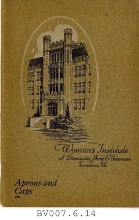
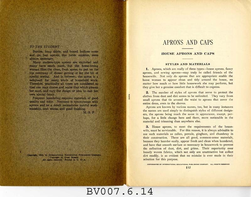
Aprons and caps
https://search.heritageburnaby.ca/link/museumlibrary5000
- Repository
- Burnaby Village Museum
- Author
- Picken, Mary Brooks, 1886-1981
- Woman's Institute of Domestic Arts and Sciences
- Sallie Bingham Center for Women's History and Culture
- Publication Date
- c1922
- Call Number
- 646 PIC
- Repository
- Burnaby Village Museum
- Collection
- Special Collection
- Material Type
- Book
- Accession Code
- BV007.6.14
- Call Number
- 646 PIC
- Author
- Picken, Mary Brooks, 1886-1981
- Woman's Institute of Domestic Arts and Sciences
- Sallie Bingham Center for Women's History and Culture
- Place of Publication
- Scranton, Pa.
- Publisher
- Woman's Institute of Domestic Arts and Sciences
- Publication Date
- c1922
- Physical Description
- 51 p. : ill. : 23 cm.
- Subjects
- Documentary Artifacts - Booklets
- Object History
- Home sewing course used by Burnaby residents in the 1920's
Images


Armstrong Street School site
https://search.heritageburnaby.ca/link/museumdescription11133
- Repository
- Burnaby Village Museum
- Date
- 1915
- Collection/Fonds
- Ronald G. Scobbie collection
- Description Level
- Item
- Physical Description
- 1 survey plan : blueprint on paper ; 56 x 54 cm
- Scope and Content
- Survey plan of "Armstrong Street School Site / Burnaby Municipality" "Being a 2 acre portion of Lot 13 Group 1, & according to map 1722 which shows this as Lot E. Block 2 of subdivision of a portion, of Lot 13, Group 1, New Westminster District".
- Repository
- Burnaby Village Museum
- Collection/Fonds
- Ronald G. Scobbie collection
- Description Level
- Item
- Physical Description
- 1 survey plan : blueprint on paper ; 56 x 54 cm
- Material Details
- Scale 40 feet = 1 inch
- Scope and Content
- Survey plan of "Armstrong Street School Site / Burnaby Municipality" "Being a 2 acre portion of Lot 13 Group 1, & according to map 1722 which shows this as Lot E. Block 2 of subdivision of a portion, of Lot 13, Group 1, New Westminster District".
- Creator
- Burnett, Geoffrey K.
- Subjects
- Buildings - Schools
- Names
- Armstrong Avenue School
- Responsibility
- Burnett & McGugan, Engineers and Surveyors
- Geographic Access
- Armstrong Avenue
- Street Address
- 8757 Armstrong Avenue
- Accession Code
- BV003.83.12
- Access Restriction
- No restrictions
- Reproduction Restriction
- No known restrictions
- Date
- 1915
- Media Type
- Cartographic Material
- Historic Neighbourhood
- East Burnaby (Historic Neighbourhood)
- Planning Study Area
- Cariboo-Armstrong Area
- Scan Resolution
- 440
- Scan Date
- 22-Dec-2020
- Scale
- 100
- Notes
- Title based on contents of plan
- Note in black ink on verso of plan reads: "1746"
- Oath on plan reads: "I, Geoffrey K. Burnett...and did personally superintend the survey represented..." "Completed on the 18th day of March 1915"; signed by Geoffrey K. Burnett and notarized by "K.A. Eastman", sworn "...19th day of April 1915"; "Burnett and McGugan., B.C. Land Surveyors. Etc.. New Westminster, B.C.."
Zoomable Images

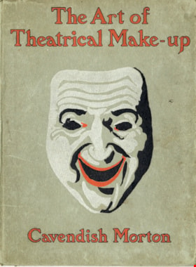
The art of theatrical make-up
https://search.heritageburnaby.ca/link/museumlibrary419
- Repository
- Burnaby Village Museum
- Author
- Morton, Cavendish, 1911-
- Publication Date
- 1909
- Call Number
- 792.02 CAV
- Repository
- Burnaby Village Museum
- Collection
- Special Collection
- Material Type
- Book
- Accession Code
- BV988.44.195
- Call Number
- 792.02 CAV
- Author
- Morton, Cavendish, 1911-
- Place of Publication
- London
- Publisher
- Adam and Charles Black
- Publication Date
- 1909
- Printer
- Ballantyne
- Physical Description
- 137 p. : ill. ; 25 cm.
- Inscription
- Front endpaper: "C.J Caunt" [written in pencil] Back endpaper: "mnh" [written in pencil] "200" [written in pencil] "G.S. Forsyth & Co Vancouver, B.C." [stamped in purple ink]
- Library Subject (LOC)
- Theatrical makeup
- Notes
- "Illustrated with thirty-two reproductions from photographs of the author by himself" -- t.p.
Images
Authorized by the Education Ministry For Lower Division Primary School Use, Volume 10 New Chinese Language Textbook
https://search.heritageburnaby.ca/link/museumlibrary616
- Repository
- Burnaby Village Museum
- Collection
- Special Collection
- Material Type
- Book
- Accession Code
- BV985.360.10
- Author
- Shang Wu Yin Shu Guan
- Place of Publication
- Shanghai
- Publisher
- Commercial Press, Limited
- Publication Date
- 1906
- Physical Description
- 61 p. : ill (some col.), ports, maps ; 22 cm
- Subjects
- Persons - Chinese Canadians
- Object History
- Some books in this accession are marked: "Mr. Chan Y. Leong, 111 Pender St. E., Vancouver B.C., Canada, North America, Western H."
- Sam Kee & Company merchants is the business located at 111 Pender St. E. Vancouver - originally owned by Chan Toy (many alternative names including Chang Toy) which was later run by Chang Yat Leong - presumably the same person as Chan Y. Leong.
- Notes
- Chinese language book
- On double leaves, East Asian binding
Images


Barnet School site
https://search.heritageburnaby.ca/link/museumdescription11140
- Repository
- Burnaby Village Museum
- Date
- May 27, 1915
- Collection/Fonds
- Ronald G. Scobbie collection
- Description Level
- Item
- Physical Description
- 1 survey plan : blueprint on paper ; 56 x 54 cm
- Scope and Content
- Survey plan of "Barnet School Site / Burnaby Municipality" "Being a portion of the west half of lot / 214, Group 1 / New Westminster District”.
- Repository
- Burnaby Village Museum
- Collection/Fonds
- Ronald G. Scobbie collection
- Description Level
- Item
- Physical Description
- 1 survey plan : blueprint on paper ; 56 x 54 cm
- Material Details
- Scale 40 feet = 1 inch
- Scope and Content
- Survey plan of "Barnet School Site / Burnaby Municipality" "Being a portion of the west half of lot / 214, Group 1 / New Westminster District”.
- Creator
- McGugan, Donald Johnston
- Subjects
- Buildings - Schools
- Names
- Barnet School
- Responsibility
- Burnett & McGugan, Engineers and Surveyors
- Geographic Access
- Barnet Road
- Street Address
- 7820 Barnet Road
- Accession Code
- BV003.83.19
- Access Restriction
- No restrictions
- Reproduction Restriction
- No known restrictions
- Date
- May 27, 1915
- Media Type
- Cartographic Material
- Historic Neighbourhood
- Barnet (Historic Neighbourhood)
- Planning Study Area
- Burnaby Mountain Area
- Scan Resolution
- 440
- Scan Date
- 22-Dec-2020
- Scale
- 100
- Notes
- Title based on contents of plan
- handwritten on back "Burnaby Schools" "23R" twice, "1783"
- Oath on plan reads: "I, D.J. McGugan...and did personally superintend the survey..." "completed on the 27th day of May 1915"; signed by D.J. McGugan, notarized by "Walter Edmonds" "sworn "...29th day of May 1915" "Burnett and McGugan" "B.C. Land Surveyors Etc. New Westminster, B.C.";
Zoomable Images


Bayley & Ferguson's Violin Album. 100 popular & classical airs
https://search.heritageburnaby.ca/link/museumlibrary3787
- Repository
- Burnaby Village Museum
- Author
- Moffat, Alfred, 1866-1950
- Publication Date
- c1908
- Call Number
- 784 MOF
- Repository
- Burnaby Village Museum
- Collection
- Special Collection
- Material Type
- Book
- Accession Code
- BV002.67.5
- Call Number
- 784 MOF
- Author
- Moffat, Alfred, 1866-1950
- Place of Publication
- London
- Publisher
- Bayley & Ferguson
- Publication Date
- c1908
- Physical Description
- 109 p. : 31 cm.
- Inscription
- "Violin pieces" [Handwritten in pencil on outer envelope] "W.E. Spain" [Handwritten in pencil on outer envelope] "W. Spain" [Handwritten in blue crayon on title page]
- Library Subject (LOC)
- Violin and piano music
- Violin music
- Piano music
- Object History
- Donor inherited object in 1987 from the estate of her father, William Alexander Spain.
- Notes
- "arranged with pianoforte accompaniments by Alfred Moffat." -- title page
- "Including separate violin part" -- Title page
Images

![Bird's eye view of New Westminster, Burnaby and Vancouver, [ca. 1911] thumbnail](/media/hpo/_Data/_BVM_Cartographic_Material/1983/1983_0012_0001_002%20Web.jpg?width=280)
Bird's eye view of New Westminster, Burnaby and Vancouver
https://search.heritageburnaby.ca/link/museumdescription8199
- Repository
- Burnaby Village Museum
- Date
- [ca. 1911]
- Collection/Fonds
- Burnaby Village Museum Map collection
- Description Level
- Item
- Physical Description
- 1 map : hand painted ; 65.5 x 99 cm
- Scope and Content
- An untitled monochromatic grayscale map of a developer's bird's eye view looking north west from Burnaby Mountain. View includes Burnaby, New Westminster, Vancouver with the North shore in the distance. Burnaby neighbourhood subdivisions of "Burnaby Heights" and "Buena Vista" are featured near the…
- Repository
- Burnaby Village Museum
- Collection/Fonds
- Burnaby Village Museum Map collection
- Description Level
- Item
- Physical Description
- 1 map : hand painted ; 65.5 x 99 cm
- Scope and Content
- An untitled monochromatic grayscale map of a developer's bird's eye view looking north west from Burnaby Mountain. View includes Burnaby, New Westminster, Vancouver with the North shore in the distance. Burnaby neighbourhood subdivisions of "Burnaby Heights" and "Buena Vista" are featured near the centre of the map. These neighbourhood subdivisions were marketed by Real Estate Agents Liebly & Blumer in 1911. Roads, buildings, factories, railways and bridges are identified on the map.
- Subjects
- Businesses - Real Estate Agencies
- Responsibility
- Leibly & Blumer Realty Co. Incorporated
- Accession Code
- HV983.12.1
- Access Restriction
- No restrictions
- Reproduction Restriction
- No known restrictions
- Date
- [ca. 1911]
- Media Type
- Cartographic Material
- Historic Neighbourhood
- East Burnaby (Historic Neighbourhood)
- Vancouver Heights (Historic Neighbourhood)
- Planning Study Area
- Cariboo-Armstrong Area
- Burnaby Heights Area
- Scan Resolution
- 300
- Scan Date
- December 2020
- Scale
- 100
- Notes
- Title based on contents of map
- Note in pencil on verso of photograph reads: "Make tint block of Buena Vista / Blocks only as shown in lots"
Zoomable Images
![Bird's eye view of New Westminster, Burnaby and Vancouver, [ca. 1911] thumbnail](/media/hpo/_Data/_BVM_Cartographic_Material/1983/1983_0012_0001_001_seadragon/1983_0012_0001_001.jpg?w=280)

Bird's Eye View of the Burnaby Lake Area
https://search.heritageburnaby.ca/link/museumdescription17543
- Repository
- Burnaby Village Museum
- Date
- 1977
- Collection/Fonds
- Century Park Museum Association fonds
- Description Level
- Item
- Physical Description
- 1 map : b&w print with watercolour ; 43 x 63.5 cm
- Scope and Content
- Item consists of a map titled "Birds Eye View of the Burnaby Lake Area Circa 1910". The overview of the Burnaby Lake area was compiled and drawn at Heritage Village by curator John Adams and artist, Carol Swan. The map identifies the Burnaby Lake inter-urban tram line; roads including: Sperling Ave…
- Repository
- Burnaby Village Museum
- Collection/Fonds
- Century Park Museum Association fonds
- Description Level
- Item
- Physical Description
- 1 map : b&w print with watercolour ; 43 x 63.5 cm
- Material Details
- Scale indeterminable
- Scope and Content
- Item consists of a map titled "Birds Eye View of the Burnaby Lake Area Circa 1910". The overview of the Burnaby Lake area was compiled and drawn at Heritage Village by curator John Adams and artist, Carol Swan. The map identifies the Burnaby Lake inter-urban tram line; roads including: Sperling Avenue (Pole Line Road); Gilpin Avenue; Douglas Road; trail to Vancouver Westminster Road (Kingsway); Buckingham Avenue; Haszard Street; various farms and residences including: Charles Sprott "Norland"; H.T. Ceperley "Fairacres"; Claude Hill's "Brookfield farm" and "Broadview"; F.J. Hart's "Avalon"; Miss Woodward's former and new home, school and post office; Councillor Edgar's hunting cabin; Edgar Sprott's "Mayfield farm" and "Mayfield Lodge"; F.J. Peers "Greyfriars"; Arthur de Windt Haszard; Bernard Hill's boathouse as well as other landmarks including: Doran's Mill; tram stations; Burnaby Lake Store; logging camps; wood cutter's shacks; ice houses; cranberry bog; Still Creek; Deer Lake; Burnaby Lake; Deer Lake Creek; Provincial Government Reserve Proposed Hospital (later Oakalla Prison).
- Creator
- Adams, John
- Swan, Carol
- Names
- Hill, Arthur Claude
- Sprott, Charles Frederick
- Sprott, Louis "Edgar"
- Hart, Frederick John, 1884-1945
- Ceperley, H.T.
- Woodward, Maude
- Woodward, Harriet
- Peers, Francis J.
- Haszard, Arthur de Windt
- Hill, Bernard R.
- Geographic Access
- Deer Lake Avenue
- Sperling Avenue
- Haszard Street
- Buckingham Avenue
- Accession Code
- BV021.1.4
- Access Restriction
- No restrictions
- Reproduction Restriction
- No known restrictions
- Date
- 1977
- Media Type
- Cartographic Material
- Historic Neighbourhood
- Burnaby Lake (Historic Neighbourhood)
- Planning Study Area
- Burnaby Lake Area
- Related Material
- See also: Life with the Moores of Hart House : pioneer days on Burnaby's Deer Lake
- Scan Resolution
- 600
- Scan Date
- 2021-11-12
- Scale
- 100
- Notes
- Transcribed title
- Compiled by John Adams; illustration by Carol Swan
- The map depicts the Burnaby Lake Tram Line as being double tracked, whereas in reality it was single tracked.
- Map is part of the book "Life with the Moores of Hart House : pioneer days on Burnaby's Deer Lake https://search.heritageburnaby.ca/permalink/museumlibrary6314-102
- This is a print made from original illustration and appears to be hand-coloured with watercolour at a later date.
Images


Bird's Eye View of the Burnaby Lake Area
https://search.heritageburnaby.ca/link/museumdescription15144
- Repository
- Burnaby Village Museum
- Date
- 1977
- Collection/Fonds
- Century Park Museum Association fonds
- Description Level
- Item
- Physical Description
- 1 map : b&w print on paper ; 43 x 63.5 cm
- Scope and Content
- Item consists of a map titled "Birds Eye View of the Burnaby Lake Area Circa 1910". The overview of the Burnaby Lake area was compiled and drawn at Heritage Village by curator John Adams and artist, Carol Swan. The map identifies the Burnaby Lake inter-urban tram line; roads including: Sperling Ave…
- Repository
- Burnaby Village Museum
- Collection/Fonds
- Century Park Museum Association fonds
- Description Level
- Item
- Physical Description
- 1 map : b&w print on paper ; 43 x 63.5 cm
- Material Details
- Scale indeterminable
- Scope and Content
- Item consists of a map titled "Birds Eye View of the Burnaby Lake Area Circa 1910". The overview of the Burnaby Lake area was compiled and drawn at Heritage Village by curator John Adams and artist, Carol Swan. The map identifies the Burnaby Lake inter-urban tram line; roads including: Sperling Avenue (Pole Line Road); Gilpin Avenue; Douglas Road; trail to Vancouver Westminster Road (Kingsway); Buckingham Avenue; Haszard Street; various farms and residences including: Charles Sprott "Norland"; H.T. Ceperley "Fairacres"; Claude Hill's "Brookfield farm" and "Broadview"; F.J. Hart's "Avalon"; Miss Woodward's former and new home, school and post office; Councillor Edgar's hunting cabin; Edgar Sprott's "Mayfield farm" and "Mayfield Lodge"; F.J. Peers "Greyfriars"; Arthur de Windt Haszard; Bernard Hill's boathouse as well as other landmarks including: Doran's Mill; tram stations; Burnaby Lake Store; logging camps; wood cutter's shacks; ice houses; cranberry bog; Still Creek; Deer Lake; Burnaby Lake; Deer Lake Creek; Provincial Government Reserve Proposed Hospital (later Oakalla Prison).
- Creator
- Adams, John
- Swan, Carol
- Names
- Hill, Arthur Claude
- Sprott, Charles Frederick
- Sprott, Louis "Edgar"
- Hart, Frederick John, 1884-1945
- Ceperley, H.T.
- Woodward, Maude
- Woodward, Harriet
- Peers, Francis J.
- Haszard, Arthur de Windt
- Hill, Bernard R.
- Geographic Access
- Deer Lake Avenue
- Sperling Avenue
- Haszard Street
- Buckingham Avenue
- Accession Code
- BV021.1.3
- Access Restriction
- No restrictions
- Reproduction Restriction
- No known restrictions
- Date
- 1977
- Media Type
- Cartographic Material
- Historic Neighbourhood
- Burnaby Lake (Historic Neighbourhood)
- Planning Study Area
- Burnaby Lake Area
- Related Material
- See also: Life with the Moores of Hart House : pioneer days on Burnaby's Deer Lake
- Scan Resolution
- 600
- Scan Date
- 2021-11-12
- Scale
- 100
- Notes
- Transcribed title
- Compiled by John Adams; illustration by Carol Swan
- The map depicts the Burnaby Lake Tram Line as being double tracked, whereas in reality it was single tracked.
- Map is part of the book "Life with the Moores of Hart House : pioneer days on Burnaby's Deer Lake https://search.heritageburnaby.ca/permalink/museumlibrary6314-102
Images


Book of birds
https://search.heritageburnaby.ca/link/museumlibrary4819
- Repository
- Burnaby Village Museum
- Collection
- Special Collection
- Material Type
- Book
- Accession Code
- BV985.6170.1
- Call Number
- 598 BOO
- Place of Publication
- London
- Publisher
- Ernest Nister
- Publication Date
- 1914
- Physical Description
- 1 v. (unpaged) : col. ill. : 27 cm.
- Inscription
- "Ma___ Burd from Nancy Bompa Xmas 1914" [Handwritten in pencil on front endpaper]
- Library Subject (LOC)
- Birds
- Juvenile literature
- Children's literature
- Animals
- Subjects
- Animals - Birds
- Animals
Images

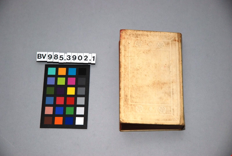
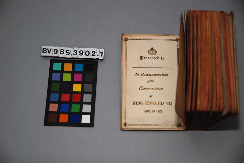
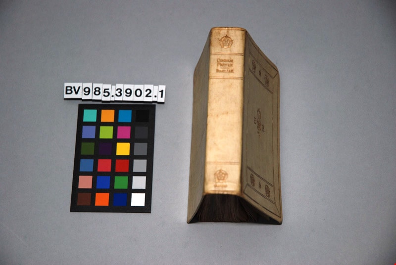
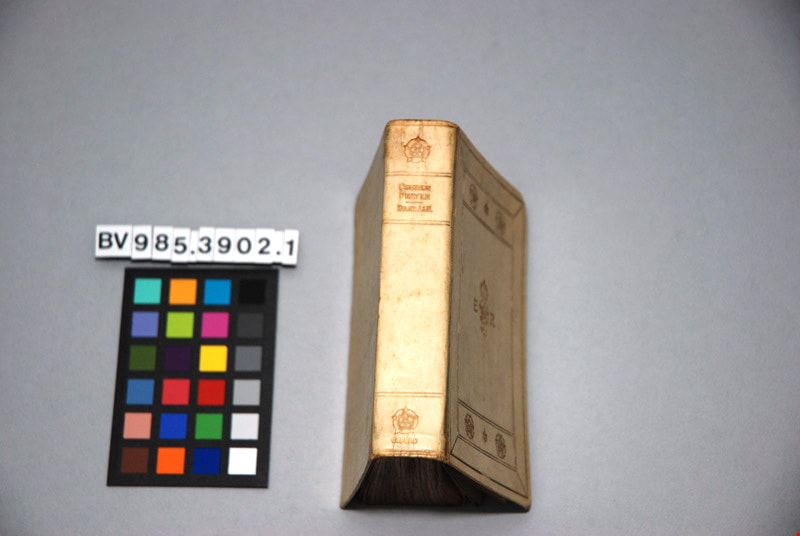
The book of common prayer, and administration of the sacraments, and other rites and ceremonies of the church, according to the use of the Church of England : together with the Psalter or Psalms of David, pointed as they are to be sung or said in churches ; and the form and manner of making, ordaining, and consecrating of bishops, priests, and deacons
https://search.heritageburnaby.ca/link/museumlibrary4865
- Repository
- Burnaby Village Museum
- Author
- Church of England
- Publication Date
- 1902
- Call Number
- 264.03 CHU
- Repository
- Burnaby Village Museum
- Collection
- Special Collection
- Material Type
- Book
- Accession Code
- BV985.3902.1
- Call Number
- 264.03 CHU
- Author
- Church of England
- Place of Publication
- London
- Publisher
- Henry Frowde
- Publication Date
- 1902
- Printer
- Oxford University Press
- Physical Description
- 1 vol. ; 12 cm.
- Inscription
- "THE BOOK OF Common Prayer" "E R" "VII" front centre "COMMON PRAYER" "HYMNS A&M", "OXFORD"; "Presented to [blank] In Commemoration of the Coronation of KING EDWARD VII" "JUNE 26, 1902"; page, "The Royal Commemoration Prayer Book" "Oxford 1902" "FEAR GOD, HONOUR THE KING"; "HORACE HART PRINTER TO THE UNIVERSITY"; 197pp; illustrated
- Library Subject (LOC)
- Church of England--Liturgy--Texts
- Church of England--Prayers and devotions
- Prayer books
Images


The book of knowledge : the children's encyclopaedia, volume i
https://search.heritageburnaby.ca/link/museumlibrary668
- Repository
- Burnaby Village Museum
- Collection
- Special Collection
- Material Type
- Book
- Accession Code
- BV985.3668.1
- Call Number
- 032 MEE v. 1 1918
- Contributor
- Mee, Arthur, 1875-1943
- Thompson, Holland, 1873-1940
- Finley, John H. (John Huston), 1863-1940
- Place of Publication
- New York
- Publisher
- The Grolier Society
- Publication Date
- c1918
- Series
- The Book of Knowledge, v. 1
- Physical Description
- x, 334 p. : ill. : 25 cm.
- Library Subject (LOC)
- Encyclopedias and dictionaries
- Children's encyclopædias and dictionaries
- Notes
- "Editors-in-chief Arthur Mee...Holland Thompson..." -- Title page
- "With an introduction by John H. Finley..." -- Title page
- Contributor's full name and dates: Finley, John H. (John Huston), 1863-1940
- page 1-334
- Volume 1 of 20
Images

The book of knowledge : the children's encyclopaedia, volume ii
https://search.heritageburnaby.ca/link/museumlibrary669
- Repository
- Burnaby Village Museum
- Collection
- Special Collection
- Material Type
- Book
- Accession Code
- BV985.3668.2
- Call Number
- 032 MEE v.2 1918
- Contributor
- Mee, Arthur, 1875-1943
- Thompson, Holland, 1873-1940
- Finley, John H. (John Huston), 1863-1940
- Place of Publication
- New York
- Publisher
- The Grolier Society
- Publication Date
- c1918
- Series
- The Book of Knowledge, v. 2
- Physical Description
- 335-660 p. : ill. : 25 cm.
- Library Subject (LOC)
- Encyclopedias and dictionaries
- Children's encyclopædias and dictionaries
- Notes
- "Editors-in-chief Arthur Mee...Holland Thompson..." -- Title page
- "With an introduction b John H. Findley..." -- Title page
- Contributor's full name and dates: Finley, John H. (John Huston), 1863-1940
- pages 335-660
- volume 2 of 20
Images
The book of knowledge : the children's encyclopaedia, volume iii
https://search.heritageburnaby.ca/link/museumlibrary670
- Repository
- Burnaby Village Museum
- Collection
- Special Collection
- Material Type
- Book
- Accession Code
- BV985.3668.3
- Call Number
- 032 MEE v. 3 1918
- Contributor
- Mee, Arthur, 1875-1943
- Thompson, Holland, 1873-1940
- Finley, John H. (John Huston), 1863-1940
- Place of Publication
- New York
- Publisher
- The Grolier Society
- Publication Date
- c1918
- Series
- The Book of Knowledge, v. 3
- Physical Description
- 662-992 p. : ill.(some col.) : 25 cm.
- Inscription
- "Gross 1955 3 on R Gross" [Handwritten in blue ink on back flyleaf]
- Library Subject (LOC)
- Encyclopedias and dictionaries
- Children's encyclopædias and dictionaries
- Notes
- "Editors-in-chief Arthur Mee...Holland Thompson..." -- Title page
- "With an introduction by John H. Finley..." -- Title page
- Contributor's full name and dates: Finley, John H. (John Huston), 1863-1940
- pages 662-992
- volume 3 of 20
Images
The book of knowledge : the children's encyclopaedia, volume iv
https://search.heritageburnaby.ca/link/museumlibrary671
- Repository
- Burnaby Village Museum
- Collection
- Special Collection
- Material Type
- Book
- Accession Code
- BV985.3668.4
- Call Number
- 032 MEE v.4 1918
- Contributor
- Mee, Arthur, 1875-1943
- Thompson, Holland, 1873-1940
- Finley, John H. (John Huston), 1863-1940
- Place of Publication
- New York
- Publisher
- The Grolier Society
- Publication Date
- c1918
- Series
- The Book of Knowledge, v. 4
- Physical Description
- 993-1312 : ill. : 25 cm.
- Library Subject (LOC)
- Encyclopedias and dictionaries
- Children's encyclopædias and dictionaries
- Notes
- "Editors-in-chief Arthur Mee...Holland Thompson..." -- Title page
- "With an introduction by John H. Finley..." -- Title page
- Contributor's full name and dates: Finley, John H. (John Huston), 1863-1940
- pages 993-1312
- volume 4 of 20
Images
The book of knowledge : the children's encyclopaedia, volume v
https://search.heritageburnaby.ca/link/museumlibrary672
- Repository
- Burnaby Village Museum
- Collection
- Special Collection
- Material Type
- Book
- Accession Code
- BV985.3668.5
- Call Number
- 032 MEE v.5 1918
- Contributor
- Mee, Arthur, 1875-1943
- Thompson, Holland, 1873-1940
- Finley, John H. (John Huston), 1863-1940
- Place of Publication
- New York
- Publisher
- The Grolier Society
- Publication Date
- c1918
- Series
- The Book of Knowledge, v. 5
- Physical Description
- 1313-1638 p. : ill. : 25 cm.
- Library Subject (LOC)
- Encyclopedias and dictionaries
- Children's encyclopædias and dictionaries
- Notes
- "Editors-in-chief Arthur Mee...Holland Thompson..." -- Title page
- "With and introduction by John H. Finley..." -- Title page
- Contributor's full name and dates: Finley, John H. (John Huston), 1863-1940
- pages 1313-1638
- volume 5 of 20
Images
The book of knowledge : the children's encyclopaedia, volume vi
https://search.heritageburnaby.ca/link/museumlibrary673
- Repository
- Burnaby Village Museum
- Collection
- Special Collection
- Material Type
- Book
- Accession Code
- BV985.3668.6
- Call Number
- 032 MEE v. 6 1918
- Contributor
- Mee, Arthur, 1875-1943
- Thompson, Holland, 1873-1940
- Finley, John H. (John Huston), 1863-1940
- Place of Publication
- New York
- Publisher
- The Grolier Society
- Publication Date
- c1918
- Series
- The Book of Knowledge, v. 6
- Physical Description
- iv, 1639-1958, : ill. : 25 cm.
- Library Subject (LOC)
- Encyclopedias and dictionaries
- Children's encyclopædias and dictionaries
- Notes
- "Editors-in-chief Arthur Mee...Holland Thompson..." -- Title page
- "With an introduction by John H. Finley..." -- Title page
- Contributor's full name and dates: Finley, John H. (John Huston), 1863-1940
- pages 1639-1958
- volume 6 of 20
Images
The book of knowledge : the children's encyclopaedia, volume vii
https://search.heritageburnaby.ca/link/museumlibrary674
- Repository
- Burnaby Village Museum
- Collection
- Special Collection
- Material Type
- Book
- Accession Code
- BV985.3668.7
- Call Number
- 032 MEE v. 7 1918
- Place of Publication
- New York
- Publisher
- The Grolier Society
- Publication Date
- c1918
- 1919
- Series
- The Book of Knowledge, v. 7
- Physical Description
- iv, 1959-2278 : ill. : 25 cm.
- Library Subject (LOC)
- Encyclopedias and dictionaries
- Children's encyclopædias and dictionaries
- Notes
- "Editors-in-chief Arthur Mee...Holland Thompson..." -- Title page
- "With an introduction by John H. Finley..." -- Title page
- Contributor's full name and dates: Finley, John H. (John Huston), 1863-1940
- pages 1959-2278
- volume 7 of 20
Images
The book of knowledge : the children's encyclopaedia, volume viii
https://search.heritageburnaby.ca/link/museumlibrary675
- Repository
- Burnaby Village Museum
- Collection
- Special Collection
- Material Type
- Book
- Accession Code
- BV985.3668.8
- Call Number
- 032 MEE v.8 1918
- Place of Publication
- New York
- Publisher
- The Grolier Society
- Publication Date
- c1918
- Series
- The Book of Knowledge, v. 8
- Physical Description
- iv, 2279-2610 : ill. : 26 cm.
- Library Subject (LOC)
- Encyclopedias and dictionaries
- Children's encyclopædias and dictionaries
- Notes
- "Editors-in-chief Arthur Mee...Holland Thompson..." -- Title page
- "With an introduction by John H. Finley..." -- Title page
- Contributor's full name and dates: Finley, John H. (John Huston), 1863-1940
- page 2279-2610
- volume 8 of 20
Images
The book of knowledge : the children's encyclopaedia : volume xix
https://search.heritageburnaby.ca/link/museumlibrary684
- Repository
- Burnaby Village Museum
- Collection
- Special Collection
- Material Type
- Book
- Accession Code
- BV985.3668.17
- Call Number
- 032 MEE v.19 1918
- Place of Publication
- New York
- Publisher
- Grolier Society
- Publication Date
- c1918
- Physical Description
- 327 p. : ill. ; 25 cm.
- Library Subject (LOC)
- Encyclopedias and dictionaries
- Children's encyclopædias and dictionaries
- Notes
- paged 5875 - 6202.
Images
The book of knowledge : the children's encyclopaedia : volume xviii
https://search.heritageburnaby.ca/link/museumlibrary683
- Repository
- Burnaby Village Museum
- Collection
- Special Collection
- Material Type
- Book
- Accession Code
- BV985.3668.16
- Call Number
- 032 MEE v.18 1918
- Place of Publication
- New York
- Publisher
- Grolier Society
- Publication Date
- c1918
- Series
- The book of knowledge
- Physical Description
- 323 p. : ill. ; 25 cm.
- Inscription
- "R Paul G" [handwritten in pencil onpage opposite front pastedown] "Paul Hofer" [handwritten in pencil on title page]
- Library Subject (LOC)
- Encyclopedias and dictionaries
- Children's encyclopædias and dictionaries
- Notes
- paged 5551 - 5874.
Images
The book of knowledge : the children's encyclopaedia : volume xx
https://search.heritageburnaby.ca/link/museumlibrary685
- Repository
- Burnaby Village Museum
- Collection
- Special Collection
- Material Type
- Book
- Accession Code
- BV985.3668.18
- Call Number
- 032 MEE v.20 1918
- Place of Publication
- New York
- Publisher
- Grolier Society
- Publication Date
- c1918
- Physical Description
- 379 p. : ill. ; 25 cm.
- Inscription
- Scribbles in pencil on back pastedown and opposing page
- Library Subject (LOC)
- Encyclopedias and dictionaries
- Children's encyclopædias and dictionaries
- Notes
- paged 6203 - 6582.
- Includes index.
Images
The book of knowledge : the children's encyclopædia, vol. 17
https://search.heritageburnaby.ca/link/museumlibrary682
- Repository
- Burnaby Village Museum
- Collection
- Special Collection
- Material Type
- Book
- Accession Code
- BV985.3668.15
- Call Number
- 032 MEE v.17
- Contributor
- Mee, Arthur, 1875-1943
- Thompson, Holland, 1873-1940
- Finley, John H. (John Huston), 1863-1940
- Place of Publication
- New York
- Publisher
- The Grolier Society
- Publication Date
- c1918
- Series
- The Book of Knowledge
- Physical Description
- 322 p. : ill
- Library Subject (LOC)
- Children's encyclopædias and dictionaries
- Notes
- pages numbered 5228-5550
- Contributors' given names, dates and contribution:
- Mee, Arthur, 1875-1943. (editor-in-chief)
- Thompson, Holland, 1873-1940. (editor-in-chief)
- "with an introduction by John H. Finley, LLD Late President of the College of New York Commissioner of Education of the State of New York"
Images

Boys of the Bible
https://search.heritageburnaby.ca/link/museumlibrary5848
- Repository
- Burnaby Village Museum
- Collection
- Special Collection
- Material Type
- Book
- Accession Code
- BV007.31.5
- Call Number
- 220.9 BOY
- Contributor
- Turner, A. M.
- Place of Publication
- New York
- Publisher
- Sam'l Gabriel Sons & Co.
- Publication Date
- c1916
- Physical Description
- 32 p. : ill. : 28 cm.
- Inscription
- "Presented to Nina Atkinson for Proficiency in bible study and general aptitude: from The East Burnaby Methodist Sunday School August 1917" [Handwritten in pencil on front flyleaf]
- Library Subject (LOC)
- Bible
- Bible. Old Testament
- Juvenile literature
- Notes
- "Illustrated by A. M. Turner" -- Title page
Images

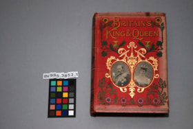
Britain's King and Queen : the story of their lives , with sixty-eight illustrations
https://search.heritageburnaby.ca/link/museumlibrary5110
- Repository
- Burnaby Village Museum
- Author
- Paul, Thomas
- Edition
- New enl. ed.
- Publication Date
- 1902
- Call Number
- 923.1361 PAU
- Repository
- Burnaby Village Museum
- Collection
- Special Collection
- Material Type
- Book
- Accession Code
- BV985.3852.1
- Call Number
- 923.1361 PAU
- Edition
- New enl. ed.
- Author
- Paul, Thomas
- Place of Publication
- London
- Publisher
- John F. Shaw And Co.
- Publication Date
- 1902
- Physical Description
- xii, 387 p. : ill. ; 21 cm.
- Inscription
- "BRITAIN'S KING & QUEEN" "J.F. SHAW & CO." 388pp; sepia floral endpapers, pencil scribbles; several pages of advertising at the end for other books.
- Library Subject (LOC)
- Great Britain--Kings and rulers
Images


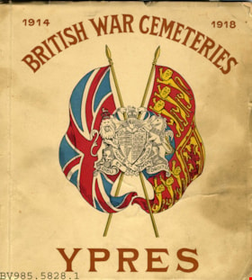
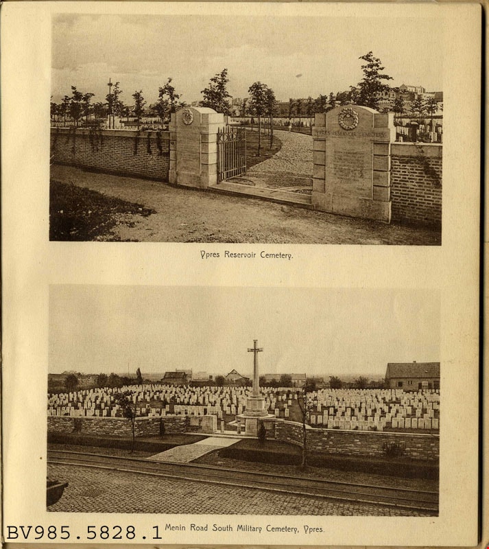
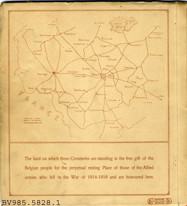
British war cemeteries Ypres : 1914-1918
https://search.heritageburnaby.ca/link/museumlibrary4927
- Repository
- Burnaby Village Museum
- Collection
- Special Collection
- Material Type
- Book
- Accession Code
- BV985.5828.1
- Call Number
- 940.3 BRI
- Place of Publication
- Bruxelles
- Publisher
- Ern. Thill
- Publication Date
- 1920
- Physical Description
- 1 v. (unpaged) : ill. : 21 cm.
- Library Subject (LOC)
- World War, 1914-1918--Monuments--Belgium--Ieper
- War memorials
- National cemeteries--Belgium--Ieper
- Monuments
- National cemeteries
- Soldiers' bodies, Disposition of
- Great Britain
Images

![Broadview Presbyterian Church, [ca.1910] thumbnail](/media/hpo/_Data/_BVM_Cartographic_Material/2003/2003_0083_0049_001.jpg?width=280)
Broadview Presbyterian Church
https://search.heritageburnaby.ca/link/museumdescription11927
- Repository
- Burnaby Village Museum
- Date
- [ca.1910]
- Collection/Fonds
- Ronald G. Scobbie collection
- Description Level
- Item
- Physical Description
- 1 plan : black ink and watercol. on paper ; 30.45 x 30.5 cm
- Scope and Content
- Item consists of building insurance plan of "Broadview Presbyterian Church / Lot 6, BK 31, DL 69 / GP1 N.W.D." . Fourteenth Avenue (Manor) is identified to the north and Douglas Ave. to the east.
- Repository
- Burnaby Village Museum
- Collection/Fonds
- Ronald G. Scobbie collection
- Description Level
- Item
- Physical Description
- 1 plan : black ink and watercol. on paper ; 30.45 x 30.5 cm
- Material Details
- Scale 1 inch = 20 feet
- Scope and Content
- Item consists of building insurance plan of "Broadview Presbyterian Church / Lot 6, BK 31, DL 69 / GP1 N.W.D." . Fourteenth Avenue (Manor) is identified to the north and Douglas Ave. to the east.
- Subjects
- Buildings - Religious - Churches
- Accession Code
- BV003.83.49
- Access Restriction
- No restrictions
- Reproduction Restriction
- No known restrictions
- Date
- [ca.1910]
- Media Type
- Cartographic Material
- Scan Resolution
- 600
- Scan Date
- 15-Jan-2021
- Scale
- 100
- Notes
- Transcribed title
- Note in pencil on verso reads: "Broadview Presbyterian Church / Lot 6, BK 31, DL 69 / 1" = 20' "
- Note in balck in on verso reads: "3704"
Images
![Broadview Presbyterian Church, [ca.1910] thumbnail](/media/hpo/_Data/_BVM_Cartographic_Material/2003/2003_0083_0049_001.jpg)

Burnaby Park track
https://search.heritageburnaby.ca/link/museumdescription11918
- Repository
- Burnaby Village Museum
- Date
- June 30, 1932
- Collection/Fonds
- Ronald G. Scobbie collection
- Description Level
- Item
- Physical Description
- 1 survey plan : ink on waxed linen sheet ; 27 x 39 cm
- Scope and Content
- Item consists of a survey plan titled “Burnaby Park Track”.
- Repository
- Burnaby Village Museum
- Collection/Fonds
- Ronald G. Scobbie collection
- Description Level
- Item
- Physical Description
- 1 survey plan : ink on waxed linen sheet ; 27 x 39 cm
- Scope and Content
- Item consists of a survey plan titled “Burnaby Park Track”.
- Accession Code
- BV003.83.41
- Access Restriction
- No restrictions
- Reproduction Restriction
- No known restrictions
- Date
- June 30, 1932
- Media Type
- Cartographic Material
- Notes
- Transcribed title
- Note in pencil reads: ‘4222”
Images


Burnaby South Secondary School yearbook : 1928-1929
https://search.heritageburnaby.ca/link/museumlibrary7510
- Repository
- Burnaby Village Museum
- Collection
- Special Collection
- Material Type
- Book
- Accession Code
- BV020.7.3
- Call Number
- 373.71 BUR 1929
- Place of Publication
- Burnaby, B.C.
- Publisher
- Burnaby South Secondary School
- Publication Date
- 1929
- Printer
- Ward & Phillips
- Physical Description
- 60 p. : ill., ports. ; 26 cm.
- Library Subject (LOC)
- School yearbooks--1920-1929
- Schools--British Columbia--Burnaby
- School yearbooks
- Historic Neighbourhood
- Central Park (Historic Neighbourhood)
- Planning Study Area
- Windsor Area
- Geographic Access
- Rumble Street
- Street Address
- 5455 Rumble Street
- Object History
- This yearbook belonged to Lauretta Roberts.
- Notes
- High school annual for South Burnaby High School
Images

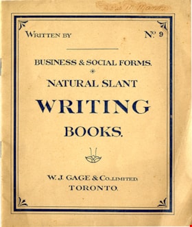
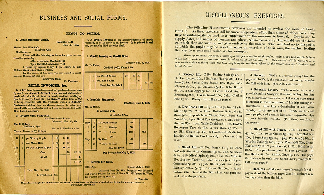
Business & social forms : natural slant writing books, no. 9
https://search.heritageburnaby.ca/link/museumlibrary6450
- Repository
- Burnaby Village Museum
- Collection
- Special Collection
- Material Type
- Book
- Accession Code
- HV973.70.4
- Call Number
- 372.634 GAG
- Place of Publication
- Toronto
- Publisher
- W. J. Gage & Co. Limited
- Publication Date
- c1902
- Physical Description
- 1 vol. ; 24 cm.
- Inscription
- "Doris M Mann" [handwritten in ink on cover]
- Library Subject (LOC)
- Penmanship
Images

Buster Brown the busy body
https://search.heritageburnaby.ca/link/museumlibrary2702
- Repository
- Burnaby Village Museum
- Collection
- Special Collection
- Material Type
- Book
- Accession Code
- HV974.50.10
- Call Number
- 741.5 OUT
- Place of Publication
- New York
- Publisher
- The New York Herald Co.
- Publication Date
- c1908
- Physical Description
- 1 v. (multiple pagings) : col. ill. : 29 x 41 cm.
- Inscription
- "Walter Galloway Bookstore 100 _______ St. E. Vancouver, B.C." [Stamped in black ink on cover verso and title page] "George Herbert Savage" [Handwritten in pencil on title page] "George Herbert Savage 6976 Culloden St. Vancouver B.C." [Handwritten in pencil on title page verso] "From Auntie Maggie Christmas 1919" [Handwritten in pencil on title page verso]
- Library Subject (LOC)
- Comic books, strips, etc.
- United States
Images


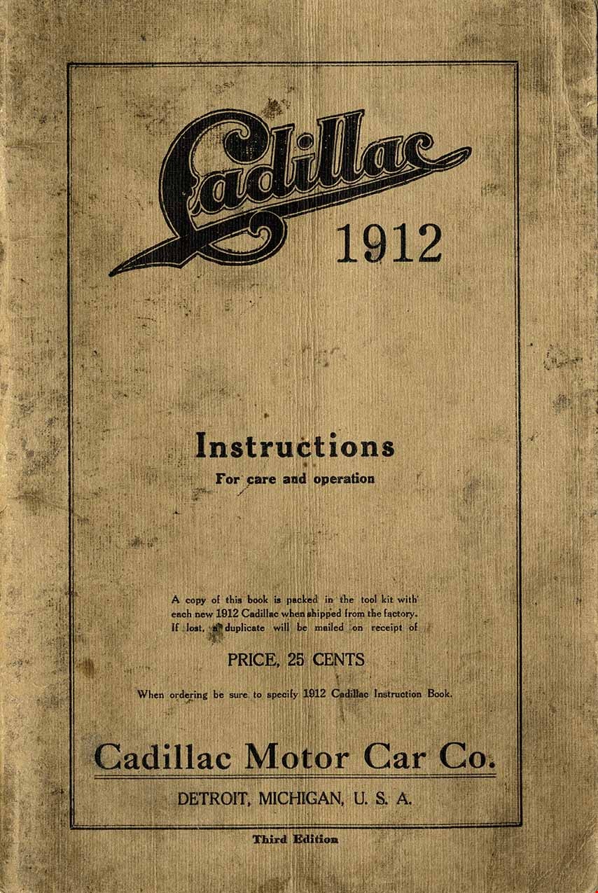
Cadillac 1912 : instructions for care and operation
https://search.heritageburnaby.ca/link/museumlibrary6416
- Repository
- Burnaby Village Museum
- Collection
- Special Collection
- Material Type
- Book
- Accession Code
- HV983.48.16
- Call Number
- 629.2 CAD
- Edition
- Third Edition
- Place of Publication
- Detroit
- Publisher
- Cadillac Motor Car Company
- Physical Description
- 70 p. : ill. ; 23 cm.
- Library Subject (LOC)
- Automobiles--Handbooks, manuals, etc.
Images
Documents
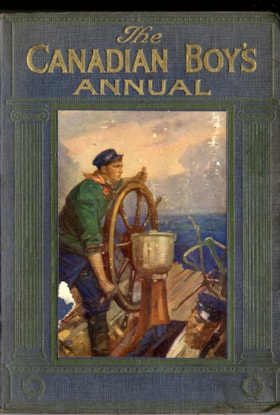
The Canadian boy's annual : 1920
https://search.heritageburnaby.ca/link/museumlibrary3611
- Repository
- Burnaby Village Museum
- Author
- Johnston, Harry H.
- Publication Date
- 1920
- Call Number
- 810.8 CAN
- Repository
- Burnaby Village Museum
- Collection
- Special Collection
- Material Type
- Book
- Accession Code
- BV998.18.1
- Call Number
- 810.8 CAN
- Author
- Johnston, Harry H.
- Place of Publication
- London
- Toronto
- Publisher
- Cassell
- Publication Date
- 1920
- Physical Description
- vii, 232 p., [4] leaves of plates : ill (some col.) ; 24 cm.
- Inscription
- Front endpaper: "Leonard G. Hornett Port Alberni" [written in black ink] "Christmas 1919-1920" [written in pencil underneath "Port Alberni"] "275" [written in pencil]
- Library Subject (LOC)
- Children's literature
- Children's stories
- Short stories
- Gift books
- Periodicals
- Object History
- Purchased by Colin Stevens from the seller.
- Notes
- "Containing stories and articles by Sir Harry H. Johnston, G.G.M.G., Frank H. Shaw, D.H. Parry, Richard Kearton, T.C. Bridges, Captain Gilson, S. Walkey, R.S. Warren Bell, Eric Wook, Percy F. Westerman, H. Mortimer Batten, Captain Oswald Dallas, and many others" -- t.p.
- "With a large number of Illustrations in Colour and Black-and-White" -- t.p.
Images

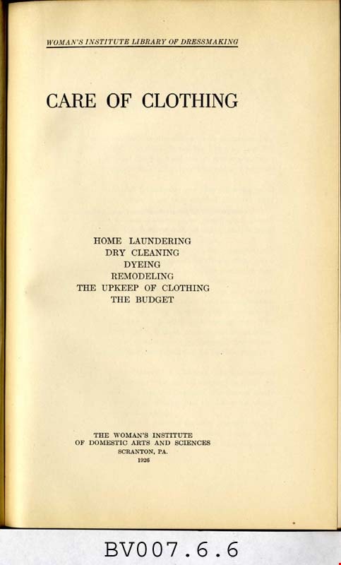
Care of clothing : home laundering, dry cleaning, dyeing, remodeling, the upkeep of clothes, the budget
https://search.heritageburnaby.ca/link/museumlibrary4992
- Repository
- Burnaby Village Museum
- Collection
- Special Collection
- Material Type
- Book
- Accession Code
- BV007.6.6
- Call Number
- 646.4 WOM
- Place of Publication
- Scranton, Pa.
- Publisher
- Woman's Institute of Domestic Arts and Sciences
- Publication Date
- 1926
- c1925
- Physical Description
- vi, xxiv, 262 p. : ill. : 23 cm.
- Library Subject (LOC)
- Clothing and dress
- Laundry
- Subjects
- Documentary Artifacts - Books
- Object History
- Home sewing course used by Burnaby residents in the 1920's
- Notes
- Includes index.
Images

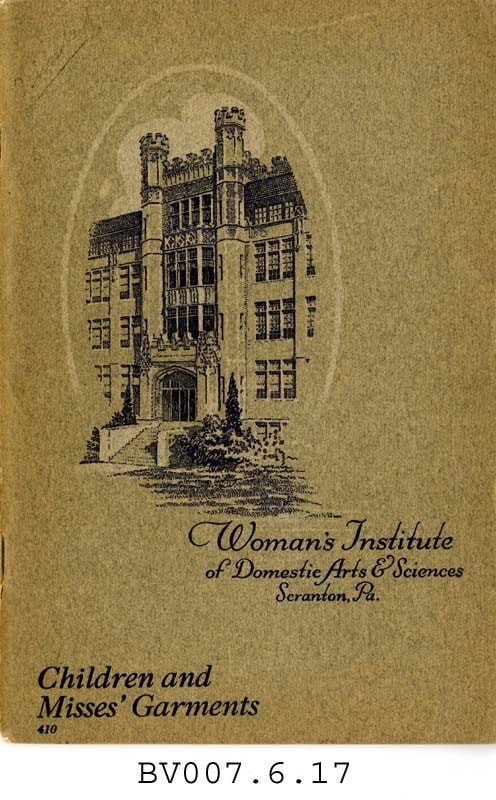
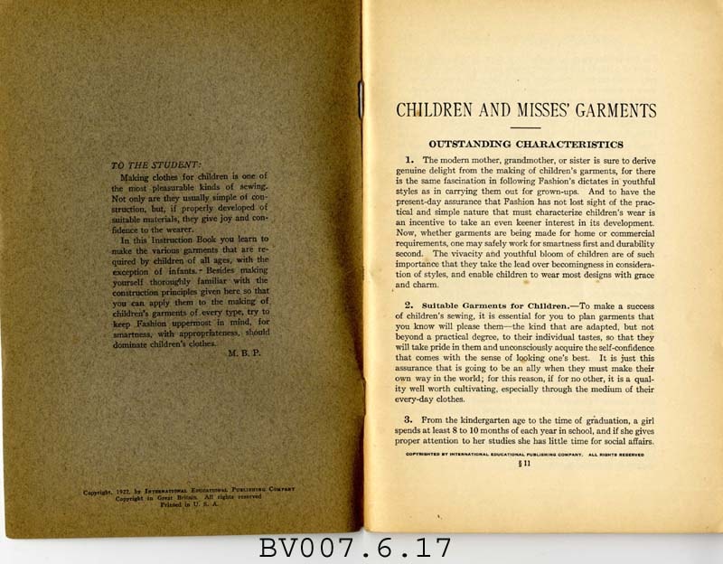
Children and misses' garments
https://search.heritageburnaby.ca/link/museumlibrary5003
- Repository
- Burnaby Village Museum
- Collection
- Special Collection
- Material Type
- Book
- Accession Code
- BV007.6.17
- Call Number
- 746.9 PIC
- Place of Publication
- Scranton, Pa.
- Publisher
- Woman's Institute of Domestic Arts and Sciences
- Publication Date
- c1922
- Physical Description
- 62 p. : ill. : 23 cm.
- Inscription
- "Finished" [Handwritten in pencil on front cover]
- Library Subject (LOC)
- Children's clothing
- Sewing
- Dressmaking--Study and teaching
- Subjects
- Documentary Artifacts - Booklets
- Object History
- Home sewing course used by Burnaby residents in the 1920's
Images
Children's Christmas book
https://search.heritageburnaby.ca/link/museumlibrary5029
- Repository
- Burnaby Village Museum
- Collection
- Special Collection
- Material Type
- Book
- Accession Code
- X3170
- Call Number
- 394.266 CHI
- Place of Publication
- s.l.
- Publisher
- [s.n.]
- Publication Date
- 1920
- Physical Description
- 1 v. (unpaged) : col. ill. : 35 x 20 cm.
- Library Subject (LOC)
- Christmas
- Christmas stories
- Children's stories
- Children's literature
- Etiquette for children and teenagers
- Juvenile literature
Images


Chinese Canadian history in Burnaby resource guide
https://search.heritageburnaby.ca/link/museumlibrary7608
- Repository
- Burnaby Village Museum
- Collection
- Digital Reference Collection
- Material Type
- Digital Resource
- Accession Code
- BV022.8.1
- Call Number
- 971.1 CHI
- Contributor
- City of Burnaby
- Place of Publication
- Burnaby, BC
- Publisher
- City of Burnaby
- Publication Date
- [2022]
- Physical Description
- 36 p. ; ill. (some col.), maps, ports
- Library Subject (LOC)
- Burnaby (B.C.)--History
- Burnaby (B.C.)--Social Life and Customs
- Chinese Canadians--British Columbia--Burnaby--History
- Chinese--British Columbia--History
- Pharmacy--Canada
- Pharmacy--United States
- Pharmaceutical museums
- Directories
- Object History
- Chinese Canadians have contributed to Burnaby’s growth for over a century. The long and intertwining histories between Chinese Canadians, Indigenous people and other communities have shaped the founding of Burnaby and British Columbia. This resource guide was created because their life experiences and important contributions to Burnaby’s development are not widely known.
Images

Digital Books
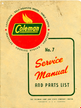
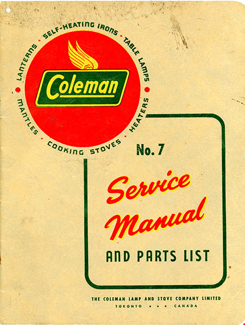
Coleman service manual and parts list
https://search.heritageburnaby.ca/link/museumlibrary3866
- Repository
- Burnaby Village Museum
- Collection
- Special Collection
- Material Type
- Book
- Accession Code
- BV004.99.5
- Call Number
- 796 COL
- Place of Publication
- Toronto
- Publisher
- Coleman Lamp and Stove Co. Ltd.
- Publication Date
- 1950
- Physical Description
- 48 p. : ill. : 28 cm.
- Library Subject (LOC)
- Commercial catalogs
- Gas-lighting
- Gas--Heating and cooking
- Gas appliances
- Camp stoves
- Lamps
- Stoves, Gas
- Camping--Equipment and supplies
- Irons (Pressing)
- Catalogs
- Notes
- Includes index.
Images

Commercial Map of Greater Vancouver and District
https://search.heritageburnaby.ca/link/museumdescription9552
- Repository
- Burnaby Village Museum
- Date
- July 1921
- Collection/Fonds
- Burnaby Village Museum Map collection
- Description Level
- Item
- Physical Description
- 1 map : col. lithograph mounted on linen ; 107 x 138 cm
- Scope and Content
- Commercial map of Greater Vancouver and District. Map depicts district lots, railroads, electric railways, streets, street car stops, schools, buildings, postal block numbers, parks and First Nations reserves. Map covers the geographcial areas of Vancouver, Burnaby, New Westminster, portions of Ric…
- Repository
- Burnaby Village Museum
- Collection/Fonds
- Burnaby Village Museum Map collection
- Description Level
- Item
- Physical Description
- 1 map : col. lithograph mounted on linen ; 107 x 138 cm
- Material Details
- Includes Legend and Index
- Scope and Content
- Commercial map of Greater Vancouver and District. Map depicts district lots, railroads, electric railways, streets, street car stops, schools, buildings, postal block numbers, parks and First Nations reserves. Map covers the geographcial areas of Vancouver, Burnaby, New Westminster, portions of Richmond, West Vancouver, North Vancouver, and Surrey with half mile circles that radiate from Vancouver City Hall on the corner of Main and Hastings. Bottom of map includes an index of street names, along with their corresponding map grid locations. The map is bordered by Marine Drive to the west, North Road to the east, Dempsey Street to the north and 20th Road to the south.
- History
- Bought by donor at thrift store years ago. No known provenance.
- Publisher
- Produced by Photo - Lithography, Colonist , Victoria, B.C.
- Geographic Access
- Vancouver
- Accession Code
- BV018.24.1
- Access Restriction
- No restrictions
- Reproduction Restriction
- No known restrictions
- Date
- July 1921
- Media Type
- Cartographic Material
- Scan Resolution
- 300
- Scan Date
- 16-Jun-20
- Scale
- 100
- Notes
- Transcribed title
- Title on map reads: "COMMERCIAL MAP / OF / GREATER VANCOUVER / AND / DISTRICT / Compiled and Published by / The Vancouver Map & Blueprint Co. Ltd. / 441 Seymour St. Vancouver B.C. / July, 1921".
Images


Complete instructor for the violin
https://search.heritageburnaby.ca/link/museumlibrary3788
- Repository
- Burnaby Village Museum
- Author
- Tours, Berthold, 1838-1897
- Publication Date
- 1900
- Call Number
- 787 TOU
- Repository
- Burnaby Village Museum
- Collection
- Special Collection
- Material Type
- Book
- Accession Code
- BV002.67.6
- Call Number
- 787 TOU
- Author
- Tours, Berthold, 1838-1897
- Place of Publication
- Philadelphia
- Publisher
- Theodore Presser Co.
- Publication Date
- 1900
- Printer
- Wm. H. Keyser & Co.
- Physical Description
- 96 p. : 31 cm.
- Inscription
- "William Spain" [Handwritten in black pencil crayon on front cover] "W. Spain" [Handwritten in blue pencil crayon on blank page before title page]
- Library Subject (LOC)
- Violin--Instruction and study
- Violin music
- Music--Instruction and study
- Object History
- Donor inherited object in 1987 from the estate of her father, William Alexander Spain.
Images

![Copy of Official British Columbia Road Maps, [193-] thumbnail](/media/hpo/_Data/_BVM_Cartographic_Material/1972/1972_0179_0001_001.jpg?width=280)
Copy of Official British Columbia Road Maps
https://search.heritageburnaby.ca/link/museumdescription18945
- Repository
- Burnaby Village Museum
- Date
- [193-]
- Collection/Fonds
- Burnaby Village Museum Map collection
- Physical Description
- 1 map : lithographic print on sheet ; 43 x 56 cm folded to 22 x 11 cm
- Scope and Content
- Item consists of Road maps of British Columbia presented by Union Oil Company of Canada Limited. Includes seventeen maps printed on both sides of sheet. One side of sheet includes ten separate road maps titled "Cariboo"; "Chilcotin Plateau"; "150 Mile House to Prince George"; "Prince George - Burns…
- Repository
- Burnaby Village Museum
- Collection/Fonds
- Burnaby Village Museum Map collection
- Physical Description
- 1 map : lithographic print on sheet ; 43 x 56 cm folded to 22 x 11 cm
- Material Details
- Scale not defined
- Scope and Content
- Item consists of Road maps of British Columbia presented by Union Oil Company of Canada Limited. Includes seventeen maps printed on both sides of sheet. One side of sheet includes ten separate road maps titled "Cariboo"; "Chilcotin Plateau"; "150 Mile House to Prince George"; "Prince George - Burns Lake"; "Burns Lake - Hazelton"; "Similkameen - Nicola"; "Salmon Arm to Revelstoke"; "Ashcroft to Salmon Arm / Kamloops to Vernon"; "Okanagan Valley"; "Boundary District". Other side of sheet includes seven road maps titled "Vancouver Island"; "Vancouver to Yale"' "Fraser Canyon Section Cariboo Road"; "Lytton to 150 Mile House"; "Arrow and Kootenay Lakes"; "The Kootenays"; "Columbia Valley". When folded, cover of maps reads "COPY OF / OFFICIAL / BRITISH COLUMBIA / ROAD-MAPS" / Presented by / UNION OIL / COMPANY / of Canada Ltd."; verso of cover includes advertisement for Union Motor oil "MOTORITE"; inside cover includes advertisement for Union Gasoline with title reading "See Canada's Evergreen Playground".
- Responsibility
- Union Oil Company of Canada Limited
- Accession Code
- HV972.179.1
- Access Restriction
- No restrictions
- Reproduction Restriction
- No known restrictions
- Date
- [193-]
- Media Type
- Cartographic Material
- Scan Resolution
- 600
- Scan Date
- 2023-08-17
- Notes
- Title based on contents of map
Images
![Copy of Official British Columbia Road Maps, [193-] thumbnail](/media/hpo/_Data/_BVM_Cartographic_Material/1972/1972_0179_0001_001.jpg)

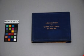
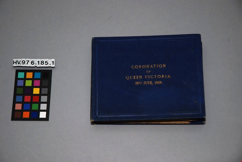
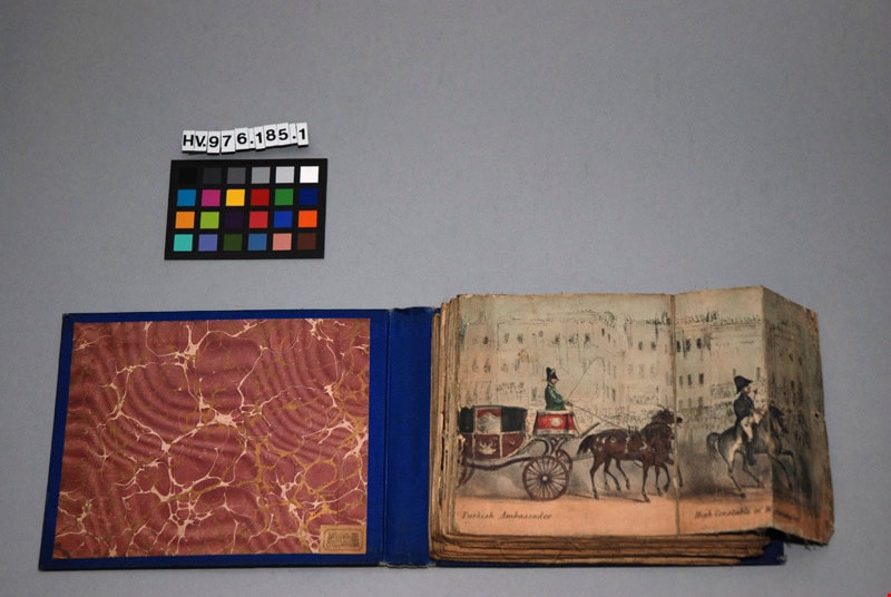
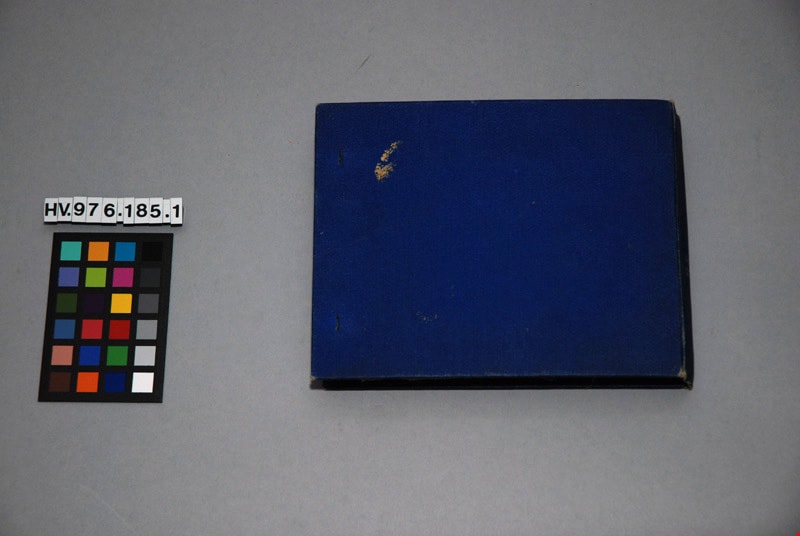
Coronation of Queen Victoria : 28th June, 1838
https://search.heritageburnaby.ca/link/museumlibrary4889
- Repository
- Burnaby Village Museum
- Collection
- Special Collection
- Material Type
- Book
- Accession Code
- HV976.185.1
- Call Number
- 394.4 BRO
- Place of Publication
- Southampton
- Publication Date
- [1838]
- Printer
- Broadbere
- Physical Description
- 1 vol. : ill. (col.) ; 14 x17 cm.
- Inscription
- "CORONATION OF QUEEN VICTORIA" "28TH JUNE, 1838"; sticker "BOUND BY BROADBERE HANOVER BUIL.GS SOUTHAMPTON",
- Library Subject (LOC)
- Victoria, Queen of Great Britain,--1819-1901
- Subjects
- Persons - Royalty
- Souvenirs
- Souvenirs - Royalty
- Documentary Artifacts
- Documentary Artifacts - Books
Images
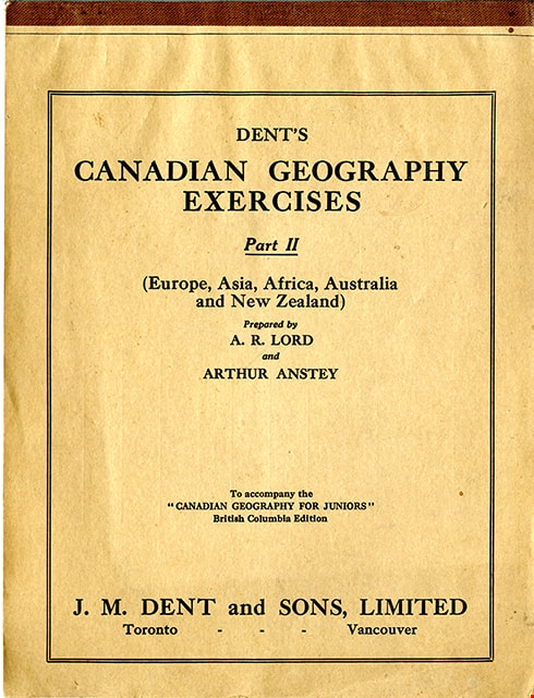
Dent's Canadian geography exercises : part ii, Europe, Asia, Africa, Australia and New Zealand
https://search.heritageburnaby.ca/link/museumlibrary6445
- Repository
- Burnaby Village Museum
- Call Number
- 372.9 LOR
- Repository
- Burnaby Village Museum
- Collection
- Special Collection
- Material Type
- Book
- Accession Code
- HV972.122.67
- Call Number
- 372.9 LOR
- Place of Publication
- Toronto
- Publisher
- J. M. Dent & Sons Limited
- Physical Description
- 34 p. : ill. ; 28 cm.
- Library Subject (LOC)
- Geography
- Juvenile literature
- Notes
- "To accompany the `Canadian Geography for Juniors'"
Images