Jubilee Grove Arch
- Repository
- Burnaby Heritage Planning
- Description
- The Jubilee Grove Arch sits at the corner of Kingsway and Patterson Avenue. Located within Central Park, the ceremonial arch and its decorative plantings provide a visual anchor to the northeast corner and entry point to the park.
- Associated Dates
- 1939
- Formal Recognition
- Heritage Designation, Community Heritage Register
- Street View URL
- Google Maps Street View
- Repository
- Burnaby Heritage Planning
- Geographic Access
- Imperial Street
- Associated Dates
- 1939
- Formal Recognition
- Heritage Designation, Community Heritage Register
- Enactment Type
- Bylaw No. 9807
- Enactment Date
- 23/11/1992
- Description
- The Jubilee Grove Arch sits at the corner of Kingsway and Patterson Avenue. Located within Central Park, the ceremonial arch and its decorative plantings provide a visual anchor to the northeast corner and entry point to the park.
- Heritage Value
- Jubilee Grove Arch was dedicated as part of the municipality’s celebration of the Jubilee of the coronation of King George V and was dedicated during Burnaby’s annual May Day celebrations in 1935. Much of the construction work was carried out by local citizens under the direction of the Burnaby Engineering Department through a Depression era work relief program that provided a way for local residents to pay their taxes. The garden was also chosen as the site for the ceremonial planting of an oak tree from the Royal Forest at Windsor, in honor of the Coronation of King George VI and Queen Elizabeth in 1937. The original bronze garden dedication plaque and oak tree remain at the site today.
The decorative stone arch was erected in 1939 as a symbol of Burnaby's, and the Lower Mainland of British Columbia’s, strong ties to the English monarchy at the time, and the arch’s unveiling during May Day ceremonies shows the social role that such a commemorative feature played both to the local government and people of Burnaby. It was erected just prior to the Royal Visit of 1939, the first time that reigning British monarchs had travelled to Canada. Built of Haddington Island sandstone, the arch itself was reconstructed from a salvaged architectural element of a historic Vancouver landmark. The arch originally framed the entrance door to the Vancouver Club building in Vancouver, built in 1893-94 on West Hastings Street and designed by architect C.O. Wickenden. The building was demolished in 1930, however the arch was stored and rebuilt as the focal point of the Jubilee Grove after being bought by the Municipality of Burnaby. The work was undertaken by Italian-born stone mason Rizieri Stefanini (1879-1954), the owner of Burnaby Monumental Works. The re-use of the arch symbolizes the close tie between Vancouver and Burnaby and the joint evolution of the neighbouring cities.
- Defining Elements
- The Jubilee Grove Arch has character-defining elements that recognize it both as a remnant of a past building and as a new and individual structure. These include its:
- axial diagonal placement and prominent corner location marking one of the entries to Central Park
- visibility and accessibility as a public monument
- hand carved stone blocks of Haddington Island sandstone
- decorative twisted-rope motif carved to outline the arch
- supporting rusticated sidewalls with planting urns
- original bronze dedication plaque
- flanking ornamental gardens
- Royal Oak tree and plaque
- Historic Neighbourhood
- Central Park (Historic Neighbourhood)
- Planning Study Area
- Maywood Area
- Organization
- City of Burnaby
- Architect
- C.O. Wickenden
- Builder
- Rizieri Stefanini
- Burnaby Monumental Works
- Function
- Primary Current--Park Fixture
- Primary Historic--Park Fixture
- Community
- Burnaby
- Cadastral Identifier
- P.I.D. No. 017-767-172
Legal Description: Block B of Lot 2 Except Firstly: Part on Plan 8669 and Secondly: Part on Plan LMP4689 District Lot 151, Group 1, New Westminster District, Plan 3443
- Boundaries
- The property (Central Park) is a municipally-owned park that lies at the western edge of Burnaby, between 49th Avenue to the south, Kingsway to the north, Boundary Road to the west and Patterson Avenue to the east.
- Area
- 853,403.82
- Contributing Resource
- Structure
- Landscape Feature
- Ownership
- Public (local)
- Documentation
- Heritage Site Files: PC77000 20. City of Burnaby Planning and Building Department, 4949 Canada Way, Burnaby, B.C., V5G 1M2
- Names
- Burnaby Monumental Works
- Street Address
- 3883 Imperial Street
- Street View URL
- Google Maps Street View
Less detail
Lake City Neighbourhood
- Repository
- Burnaby Heritage Planning
- Associated Dates
- 1955-2008
- Heritage Value
- When Simon Fraser University opened in 1965, approximately sixteen industrial properties had been developed in the Lake City Industrial Park. In addition, significant tracts of land in the western portion had been pre-cleared and graded in anticipation of additional development, while most of the eastern half remained forested. Some of the early companies to locate in the area were Nabob Foods, Volkswagen Canada, British Columbia Television Broadcasting, Simpson Sears, and H.Y. Louie Company Limited. Both Imperial Oil and Shell Oil established petroleum storage and distribution facilities in the area. Initially a heavy industrial area, by 1979, single family neighbourhoods south of Lougheed Highway and west of Eagle Creek had been largely developed. By the mid1980's, the Burnaby 200 multi-family development along Forest Grove Drive had also been completed.
- Planning Study Area
- Lake City Area
Less detail
Ocean View Burial Park - Chapel
- Repository
- Burnaby Heritage Planning
- Geographic Access
- Imperial Street
- Associated Dates
- 1936
- Description
- Church building.
- Heritage Value
- Subsequent work at Ocean View was designed by local architects Sharp & Thompson through the 1950s, including the stone-faced Garden Chapel, built in 1936 as a replica of a Norman church. Prominent stone gates also replaced the original gates at the corner entrance. George Sharp (1880-1974) and Charles Thompson (1878-1961) formed Vancouver’s longest surviving architectural firm in 1908. They were born, educated and articled in London, before arriving in Vancouver via different routes. In 1912, the firm won the competition for the new University of British Columbia.
- Locality
- Alta Vista
- Historic Neighbourhood
- Alta Vista (Historic Neighbourhood)
- Planning Study Area
- Suncrest Area
- Architect
- Sharp & Thompson
- Area
- 359280.00
- Contributing Resource
- Building
- Ownership
- Private
- Street Address
- 4000 Imperial Street
Less detail
Taylor Park Elementary School
Fire insurance plans - Greater Vancouver - Volume XVIII - Municipality of Burnaby
- Repository
- Burnaby Village Museum
- Date
- 1927-1950
- Collection/Fonds
- Burnaby Village Museum Map collection
- Description Level
- Item
- Physical Description
- 22 plans on 12 sheets : col. lithographic print ; 64 x 54 cm
- Scope and Content
- Item consists of fire insurance plans titled "Greater Vancouver / Volume XVIII / Municipality / of Burnaby" surveyed May 1927, revised in October 1940 and September 1950. Includes a two page key plan (G and H) and twenty associated plans numbered; 1801; 1802; 1803; 1804; 1805; 1806; 1807; 1808; 18…
- Repository
- Burnaby Village Museum
- Collection/Fonds
- Burnaby Village Museum Map collection
- Series
- Fire Insurance plans of Greater Vancouver and Burnaby series
- Description Level
- Item
- Physical Description
- 22 plans on 12 sheets : col. lithographic print ; 64 x 54 cm
- Material Details
- Scales between [1:600] and [1:6000]
- Scope and Content
- Item consists of fire insurance plans titled "Greater Vancouver / Volume XVIII / Municipality / of Burnaby" surveyed May 1927, revised in October 1940 and September 1950. Includes a two page key plan (G and H) and twenty associated plans numbered; 1801; 1802; 1803; 1804; 1805; 1806; 1807; 1808; 1809; 1810; 1811; 1812; 1813; 1814; 1815; 1819; 1820; 1821; 1822 and 1832.
- Creator
- British Columbia Underwriters' Association
- Publisher
- Plan Department of Fire Branch of British Columbia Underwriters' Association
- Accession Code
- BV987.1.70
- Access Restriction
- No restrictions
- Reproduction Restriction
- May be restricted by third party rights
- Date
- 1927-1950
- Media Type
- Cartographic Material
- Scan Resolution
- 400
- Scan Date
- 11/17/2021
- Notes
- Title based on contents of item
- Scale 1 inch = 50 feet
- These plans were removed from a bound book with labels on cover page reading: "Plan No. 90 / THIS INSURANCE PLAN / of / Vancouver VOLUME "8" / IN THE PROPERTY OF THE / British Columbia Insurance Underwriter's Association / Vancouver B.C. / AND IS LOANED / MELVILLE F. THOMSON CO. .../ Date May 26th, 1934"; / "Plan No. 74 / THIS INSURANCE PLAN / OF / VANCOUVER VOLUME "9"" / Plan No. 11 / THIS INSURANCE PLAN / OF / BURNABY VOLUMES 15-19" / "THIS PLAN IS THE PROPERTY OF / THE / BRITISH LAW INSURANCE COMPANY / LIMITED"
- Contact Burnaby Village Museum to view associated fire insurance plans
Less detail
Fire insurance plans - Greater Vancouver - Volume XVII - Municipality of Burnaby
- Repository
- Burnaby Village Museum
- Date
- 1927-1950
- Collection/Fonds
- Burnaby Village Museum Map collection
- Description Level
- Item
- Physical Description
- 4 plans on 4 sheets : col. lithographic prints
- Scope and Content
- Item consists of fire insurance plans titled "Greater Vancouver / Volume XVII / Municipality / of Burnaby" surveyed May 1927, revised in October 1940 and September 1950. Includes a two page key plan (E and F) and two associated plans numbered 1729 and 1738 (located within District Lot 35).
- Repository
- Burnaby Village Museum
- Collection/Fonds
- Burnaby Village Museum Map collection
- Series
- Fire Insurance plans of Greater Vancouver and Burnaby series
- Description Level
- Item
- Physical Description
- 4 plans on 4 sheets : col. lithographic prints
- Scope and Content
- Item consists of fire insurance plans titled "Greater Vancouver / Volume XVII / Municipality / of Burnaby" surveyed May 1927, revised in October 1940 and September 1950. Includes a two page key plan (E and F) and two associated plans numbered 1729 and 1738 (located within District Lot 35).
- Creator
- British Columbia Underwriters' Association
- Publisher
- Plan Department of Fire Branch of British Columbia Underwriters' Association
- Accession Code
- BV987.1.70
- Access Restriction
- No restrictions
- Reproduction Restriction
- May be restricted by third party rights
- Date
- 1927-1950
- Media Type
- Cartographic Material
- Historic Neighbourhood
- Central Park (Historic Neighbourhood)
- Planning Study Area
- Garden Village Area
- Scan Resolution
- 400
- Scan Date
- 2021-11-17
- Notes
- Title based on contents of item
- These plans were removed from a bound book with labels on cover page reading: "Plan No. 90 / THIS INSURANCE PLAN / of / Vancouver VOLUME "8" / IN THE PROPERTY OF THE / British Columbia Insurance Underwriter's Association / Vancouver B.C. / AND IS LOANED / MELVILLE F. THOMSON CO. .../ Date May 26th, 1934"; / "Plan No. 74 / THIS INSURANCE PLAN / OF / VANCOUVER VOLUME "9"" / Plan No. 11 / THIS INSURANCE PLAN / OF / BURNABY VOLUMES 15-19" / "THIS PLAN IS THE PROPERTY OF / THE / BRITISH LAW INSURANCE COMPANY / LIMITED"
- Contact Burnaby Village Museum to view associated fire insurance plans XVIII
Less detail
Fire insurance plans - Greater Vancouver - Volume XV - Municipality of Burnaby
- Repository
- Burnaby Village Museum
- Date
- 1927-1940
- Collection/Fonds
- Burnaby Village Museum Map collection
- Description Level
- Item
- Physical Description
- 11 plans on 8 sheets : col. lithographic print ; 64 x 54 cm
- Scope and Content
- Item consists of fire insurance plans titled "Greater Vancouver / Volume XV / Municipality / of Burnaby" surveyed May 1927 and revised October 1940. Volume XV includes a two page Key Plan (A and B) identifying associated plan numbers and district lots and nine numbered fire insurance plans identifi…
- Repository
- Burnaby Village Museum
- Collection/Fonds
- Burnaby Village Museum Map collection
- Series
- Fire Insurance plans of Greater Vancouver and Burnaby series
- Description Level
- Item
- Physical Description
- 11 plans on 8 sheets : col. lithographic print ; 64 x 54 cm
- Material Details
- Scales between [1:600] and [1:6000]
- Scope and Content
- Item consists of fire insurance plans titled "Greater Vancouver / Volume XV / Municipality / of Burnaby" surveyed May 1927 and revised October 1940. Volume XV includes a two page Key Plan (A and B) identifying associated plan numbers and district lots and nine numbered fire insurance plans identified as; 1507; 1508 ; 1517; 1518; 1519; 1520;1521; 1531and 1532.
- Creator
- British Columbia Underwriters' Association
- Publisher
- Plan Department of Fire Branch of British Columbia Underwriters' Association
- Accession Code
- BV987.1.70
- Access Restriction
- No restrictions
- Reproduction Restriction
- May be restricted by third party rights
- Date
- 1927-1940
- Media Type
- Cartographic Material
- Historic Neighbourhood
- Vancouver Heights (Historic Neighbourhood)
- Planning Study Area
- Burnaby Heights Area
- Willingdon Heights Area
- Scan Resolution
- 400
- Notes
- Title based on contents of item
- These plans are contained within a bound book with labels on cover page reading: "Plan No. 90 / THIS INSURANCE PLAN / of / Vancouver VOLUME "8" / IN THE PROPERTY OF THE / British Columbia Insurance Underwriter's Association / Vancouver B.C. / AND IS LOANED / MELVILLE F. THOMSON CO. .../ Date May 26th, 1934"; / "Plan No. 74 / THIS INSURANCE PLAN / OF / VANCOUVER VOLUME "9"" / Plan No. 11 / THIS INSURANCE PLAN / OF / BURNABY VOLUMES 15-19" / "THIS PLAN IS THE PROPERTY OF / THE / BRITISH LAW INSURANCE COMPANY / LIMITED"
- Fire insurance plans cover various district lots in Burnaby including: District Lot 116,121, 186 and 187.
- Sticker adhered to Key Plan B reads: "
- Contact Burnaby Village Museum to view fire insurance plans that are part of Volume XV
Less detail
Foods, nutrition, and home management manual : home economics circular no. 1
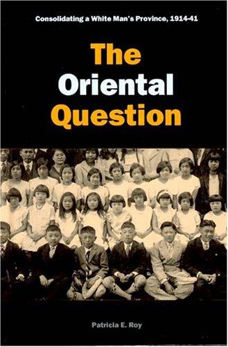
The Oriental question : consolidating a white man's province, 1914-41
The triumph of citizenship : the Japanese and Chinese in Canada, 1941-67
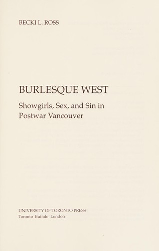
Burlesque West : showgirls, sex, and sin in postwar Vancouver
Allan Rock at BCIT campaign event
- Repository
- City of Burnaby Archives
- Date
- [2000]
- Collection/Fonds
- Burnaby NewsLeader photograph collection
- Description Level
- File
- Physical Description
- 3 photographs (tiff) : col.
- Scope and Content
- File contains photographs of Federal Health Minister Allan Rock speaking with nursing students during a campaign event at BCIT. Photographs show close-ups of Rock and one of the nursing students asking a question, as well as a photograph of Rock speaking as attendees look on in the background.
- Repository
- City of Burnaby Archives
- Date
- [2000]
- Collection/Fonds
- Burnaby NewsLeader photograph collection
- Physical Description
- 3 photographs (tiff) : col.
- Description Level
- File
- Record No.
- 535-1684
- Access Restriction
- No restrictions
- Reproduction Restriction
- No restrictions
- Accession Number
- 2018-12
- Scope and Content
- File contains photographs of Federal Health Minister Allan Rock speaking with nursing students during a campaign event at BCIT. Photographs show close-ups of Rock and one of the nursing students asking a question, as well as a photograph of Rock speaking as attendees look on in the background.
- Subjects
- Elections
- Officials - Elected Officials
- Names
- British Columbia Institute of Technology
- Media Type
- Photograph
- Photographer
- Bartel, Mario
- Notes
- Title based on caption
- Collected by editorial for use in a November 2000 issue of the Burnaby NewsLeader
- Caption from metadata for 535-1684-1: "Federal Health Minister Allan Rock speaks with nursing students during a campaign stop at BCIT."
- Caption from metadata for 535-1684-2: "Federal Health Minister Allan Rock addresses nursing students at BCIT, during an election campaign stop."
- Caption from metadata for 535-1684-3: "Michelle Marisi, a nurse at Vancouver General, studying critical care, raises her concerns with federal Health Minister, Allan Rock."
- Geographic Access
- Willingdon Avenue
- Street Address
- 3700 Willingdon Avenue
- Planning Study Area
- Douglas-Gilpin Area
Less detail
A text book of pharmacognosy; being an account of the more important crude drugs of vegetable and animal origin, designed for students of pharmacy and medicine
- Repository
- Burnaby Village Museum
- Collection
- Special Collection
- Material Type
- Book
- Accession Code
- BV988.68.35
- Call Number
- 615.1 GRE
- Edition
- 6th ed.
- Author
- Greenish, Henry G. (Henry George), 1855-1933
- Place of Publication
- London
- Publisher
- J.& A. Churchill
- Publication Date
- 1933
- Physical Description
- xiv, 564 p. : ill. ; 24 cm.
- Inscription
- "Gibb G. Henderson
777 W W Georgia Street
Vancouver B.C.
Georgia Pharmacy Ltd." [handwritten in black ink on front pastedown]
"GEORGIA PHARMACY LTD.
777 WEST GEORGIA ST.
VANCOUVER, B.C.' [stamped in red ink on top of the front endpaper ]
- Library Subject (LOC)
- Pharmacology
- Names
- Henderson, Gibb Gilmour
- University of British Columbia
- Notes
- Author's full given name and dates: Greenish, Henry G. (Henry George), 1855-1933.
- "With 297 Illustrations" -- title page
- "Professor of Pharmacy to the Pharmaceutical Society of Great Britain and in the University of London; Director of the Pharmacy Research Laboratory of the Pharmaceutical Society ; Hanbury Gold Medalist, 1917; Examiner to the Pharmaceutical Society of Great Britain and to the University of London." -- title page
Less detail
Aventis Biotech Challenge at BCIT
- Repository
- City of Burnaby Archives
- Date
- [2001]
- Collection/Fonds
- Burnaby NewsLeader photograph collection
- Description Level
- Item
- Physical Description
- 1 photograph (tiff) : col.
- Scope and Content
- Photograph of high school student Sophie Lee holding up a slug balanced on a test tube during the Aventis Biotech Challenge at the British Columbia Institute of Technology.
- Repository
- City of Burnaby Archives
- Date
- [2001]
- Collection/Fonds
- Burnaby NewsLeader photograph collection
- Physical Description
- 1 photograph (tiff) : col.
- Description Level
- Item
- Record No.
- 535-2264
- Access Restriction
- No restrictions
- Reproduction Restriction
- Reproduce for fair dealing purposes only
- Accession Number
- 2018-12
- Scope and Content
- Photograph of high school student Sophie Lee holding up a slug balanced on a test tube during the Aventis Biotech Challenge at the British Columbia Institute of Technology.
- Subjects
- Persons - Students
- Science and Technology Tools and Equipment
- Names
- British Columbia Institute of Technology
- Media Type
- Photograph
- Photographer
- Bartel, Mario
- Notes
- Title based on caption
- Collected by editorial for use in an April 2001 issue of the Burnaby NewsLeader
- Caption from metadata: "Sophie Lee, a student at Sir Winston Churchill Secondary School in Vancouver, keeps her eyes on a slug balanced on a test tube of slug slime. Sophie and her lab partner, Iris Liu, were studying the sticky properties of slug slime for the Aventis Biotech Challenge, at BCIT. The Challenge is held to generate interest in biotechnology amongst budding scientists from area high schools, who work on their projects under the guidance of expert biotechnologists."
- Geographic Access
- Willingdon Avenue
- Street Address
- 3700 Willingdon Avenue
- Planning Study Area
- Douglas-Gilpin Area
Less detail
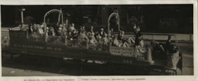
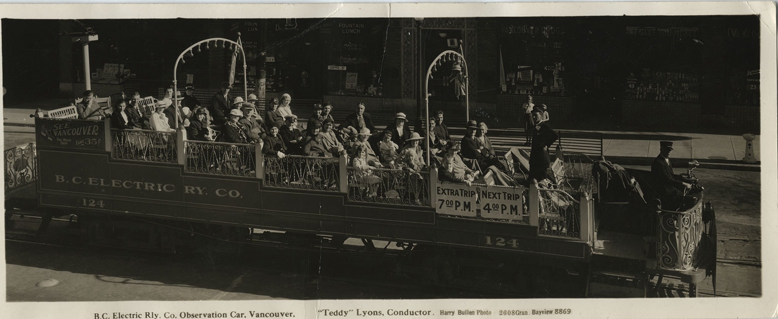
B.C. Electric Railway Co. Observation Car
- Repository
- Burnaby Village Museum
- Date
- July 22, 1934
- Collection/Fonds
- Burnaby Village Museum Photograph collection
- Description Level
- Item
- Physical Description
- 1 photograph : b&w ; 9.5 x 23.5 cm
- Scope and Content
- Photograph of a BC Electric Railway Company Observation car, full of people and conducted by "Teddy" Lyons. The car number is 124, and a sign on the rear end of the car reads, "See Vancouver / Two Hour / Trip / Fare 35c." The photograph was probably taken prior to 4:00 pm, as there are signs hang…
- Repository
- Burnaby Village Museum
- Collection/Fonds
- Burnaby Village Museum Photograph collection
- Description Level
- Item
- Physical Description
- 1 photograph : b&w ; 9.5 x 23.5 cm
- Scope and Content
- Photograph of a BC Electric Railway Company Observation car, full of people and conducted by "Teddy" Lyons. The car number is 124, and a sign on the rear end of the car reads, "See Vancouver / Two Hour / Trip / Fare 35c." The photograph was probably taken prior to 4:00 pm, as there are signs hanging on the car by the conductor that read, "Extra Trip / 7:00 PM" and "Next Trip / 4:00 PM." There are restaurants and various stores which line the street by the tracks in the background. The caption printed on the front bottom of the photo reads, "B.C. Electric Rly. Co. Observation Car, Vancouver. / "Teddy" Lyons, Conductor. Harry Bullen Photo. 2608 Gran. Bayview 8869." Stamped on the back of the photo is "Vancouver, B.C. Jul 22 1934."
- Subjects
- Transportation - Electric Railroads
- Names
- British Columbia Electric Railway Company
- Lyons, Thadeous Sylvester "Teddy"
- Geographic Access
- Vancouver
- Accession Code
- HV972.142.1
- Access Restriction
- No restrictions
- Reproduction Restriction
- No known restrictions
- Date
- July 22, 1934
- Media Type
- Photograph
- Related Material
- For another photograph of BCER car # 124, but from a different year, see photograph HV973.26.143
For another photograph of BCER observation car by Harry Bullen, see HV975.88.1
- Scan Resolution
- 600
- Scan Date
- 2023-04-18
- Photographer
- Bullen, Harry Elder
- Notes
- Title based on contents of photograph
- In "History of Metropolitan Vancouver" at http://www.vancouverhistory.ca/chronology6.htm, it notes that Harry Bullen sold long narrow souvenir photographs of the passengers taken in the car
Less detail
B.C.E.R. Video: Then and now
- Repository
- Burnaby Village Museum
- Collection
- Reference Collection
- Material Type
- Moving Images
- Accession Code
- BV013.27.21
- Call Number
- 388.46 TRA VR Ver 1
- Place of Publication
- Vancouver
- Publisher
- Transit Museum Society
- Publication Date
- c2004
- Physical Description
- 1 videodisc (128 min, 43 sec.) : sd., col. ; 4 3/4 in
- Library Subject (LOC)
- Street-railroads
- Electric railroads
- Transportation
- Subjects
- Transportation - Rail
- Transportation - Electric Railroads
- Transportation
- Geographic Access
- Vancouver
- Names
- British Columbia Electric Railway Company
- Notes
- Original footage shot on 16mm film in the early 1950's by Ken Hodgsen.
- Summary : Historical film footage of Lower Mainland trams on their various routes as well as an excursion train. Film footage is part of the B.C. Transit Centennial and includes a voice over commentary by Frank Horn and Vic Sharman. Frank worked as a motorman on the BC Electric Railway. The trams are shown travelling through Vancouver, Burnaby, New Westminster, Surrey, North Delta, Langley, Abbotsford, and Chilliwack. The excursion train was filmed in Washington State, U.S.A. The narrators give commentary, describing the routes, landmarks of the past and present, the various kinds of trams and buses seen, drivers’ protocols, and historical information.
- Produced by David Asselin, President, Transit Musem Society
- Cover on verso of DVD case includes photos with description: "Here are three instructors... Vic Sharman, Frank Horne & Don Bellamy for the Downtown Historic Railway (D.H.R.) Who have all had previous experience driving interurbans in the Vancouver area in the 1940's & 1950's"
- Contact Burnaby Village Museum to view video.
Less detail
BCIT campus radio
- Repository
- City of Burnaby Archives
- Date
- [2004]
- Collection/Fonds
- Burnaby NewsLeader photograph collection
- Description Level
- Item
- Physical Description
- 1 photograph (tiff) : col.
- Scope and Content
- Photograph of Jen Bacus, a radio broadcast student and staff at the new BCIT campus radio station CFML, standing inside a recording booth next to a light that reads "On Air."
- Repository
- City of Burnaby Archives
- Date
- [2004]
- Collection/Fonds
- Burnaby NewsLeader photograph collection
- Physical Description
- 1 photograph (tiff) : col.
- Description Level
- Item
- Record No.
- 535-1762
- Access Restriction
- No restrictions
- Reproduction Restriction
- Reproduce for fair dealing purposes only
- Accession Number
- 2018-12
- Scope and Content
- Photograph of Jen Bacus, a radio broadcast student and staff at the new BCIT campus radio station CFML, standing inside a recording booth next to a light that reads "On Air."
- Subjects
- Telecommunication Tools and Equipment - Radios
- Persons - Students
- Buildings - Schools - Universities and Colleges
- Names
- British Columbia Institute of Technology
- Media Type
- Photograph
- Photographer
- Bartel, Mario
- Notes
- Title based on caption
- Collected by editorial for use in a January 2004 issue of the Burnaby NewsLeader
- Caption from metadata: "BCIT's campus radio station, CFML, is about to go on the air, over the air, as the station has been approved for an FM license by the CRTC. Once the station has secured space on a broadcast tower, it will be able to be heard all over Burnaby, New Westminster, parts of Vancouver and Coquitlam. Jen Bacus is a radio broadcast student, and the station's marketing and promotions director."
- Geographic Access
- Willingdon Avenue
- Street Address
- 3700 Willingdon Avenue
- Historic Neighbourhood
- Burnaby Lake (Historic Neighbourhood)
- Planning Study Area
- Douglas-Gilpin Area
Less detail
BCIT "Fawlty Towers" event
- Repository
- City of Burnaby Archives
- Date
- [2001]
- Collection/Fonds
- Burnaby NewsLeader photograph collection
- Description Level
- File
- Physical Description
- 2 photographs (tiff) : col.
- Scope and Content
- File contains photographs of students participating in BCIT's annual "Fawlty Towers" competition. Photographs depict students taping index cards together to form towers inside of a gymnasium.
- Repository
- City of Burnaby Archives
- Date
- [2001]
- Collection/Fonds
- Burnaby NewsLeader photograph collection
- Physical Description
- 2 photographs (tiff) : col.
- Description Level
- File
- Record No.
- 535-1580
- Access Restriction
- No restrictions
- Reproduction Restriction
- No restrictions
- Accession Number
- 2018-12
- Scope and Content
- File contains photographs of students participating in BCIT's annual "Fawlty Towers" competition. Photographs depict students taping index cards together to form towers inside of a gymnasium.
- Subjects
- Buildings - Schools - Universities and Colleges
- Persons - Students
- Names
- British Columbia Institute of Technology
- Media Type
- Photograph
- Photographer
- Bartel, Mario
- Notes
- Title based on caption
- Collected by editorial for use in a January 2001 issue of the Burnaby NewsLeader
- Caption from metadata for 535-1580-1: "Davy Chang, a management systems student at BCIT, works on his team's entry in the school's annual "Fawlty Towers" competition. Teams of students were given 90 minutes to see who could design and build the tallest structure, using only cardboard index cards and masking tape."
- Caption from metadata for 535-1580-2: "Forestry students Jocelyn Waldbrook and Kara Epp assemble the walls of what will become their team's tower at BCIT's annual Fawlty Towers competition. Teams of students were given 90 minutes to design and build the tallest tower, using only cardboard index cards and masking tape."
- Geographic Access
- Willingdon Avenue
- Street Address
- 3700 Willingdon Avenue
- Planning Study Area
- Douglas-Gilpin Area
Less detail
BCIT Open House
- Repository
- City of Burnaby Archives
- Date
- [2000]
- Collection/Fonds
- Burnaby NewsLeader photograph collection
- Description Level
- File
- Physical Description
- 2 photographs (tiff) : b&w and col.
- Scope and Content
- File contains photographs of BCIT's annual Open House. Photographs depict robotics/automation students Colin Harraway and Colin Wilson demonstrating a machine that makes battery cells, and Will Dirksen demonstrating confined space rescue with classmate Philip Nishikihama as part of BCIT's occupatio…
- Repository
- City of Burnaby Archives
- Date
- [2000]
- Collection/Fonds
- Burnaby NewsLeader photograph collection
- Physical Description
- 2 photographs (tiff) : b&w and col.
- Description Level
- File
- Record No.
- 535-2150
- Access Restriction
- No restrictions
- Reproduction Restriction
- No restrictions
- Accession Number
- 2018-12
- Scope and Content
- File contains photographs of BCIT's annual Open House. Photographs depict robotics/automation students Colin Harraway and Colin Wilson demonstrating a machine that makes battery cells, and Will Dirksen demonstrating confined space rescue with classmate Philip Nishikihama as part of BCIT's occupational health and safety program.
- Subjects
- Buildings - Schools - Universities and Colleges
- Persons - Students
- Names
- British Columbia Institute of Technology
- Media Type
- Photograph
- Photographer
- Bartel, Mario
- Notes
- Title based on caption
- Collected by editorial for use in an April 2000 issue of the Burnaby NewsLeader
- Caption from metadata for 535-2150-1: "Colin Harraway and Colin Wilson, students in the robotics/automation program at BCIT demonstrate the machine they built to make battery cells, at the school's annual Open House."
- Caption from metadata for 535-2150-2: "Will Dirksen demonstrates confined space rescue with his "victim," Philip Nishikihama, in BCIT's occupational health and saftety program, at the school's annual open house."
- Geographic Access
- Willingdon Avenue
- Street Address
- 3700 Willingdon Avenue
- Historic Neighbourhood
- Burnaby Lake (Historic Neighbourhood)
- Planning Study Area
- Douglas-Gilpin Area
Less detail
BCIT solar energy demonstration home
- Repository
- City of Burnaby Archives
- Date
- [2001]
- Collection/Fonds
- Burnaby NewsLeader photograph collection
- Description Level
- Item
- Physical Description
- 1 photograph (tiff) : col.
- Scope and Content
- Photograph of Ljubisav Stamenic inside the attic of BCIT's solar energy demonstration home. He is standing near the multiple panels of solar cells.


![Allan Rock at BCIT campaign event, [2000] thumbnail](/media/hpo/_Data/_Archives_Images/_Unrestricted/535/535-1684-1.jpg?width=280)
![Allan Rock at BCIT campaign event, [2000] thumbnail](/media/hpo/_Data/_Archives_Images/_Unrestricted/535/535-1684-1.jpg)
![Aventis Biotech Challenge at BCIT, [2001] thumbnail](/media/hpo/_Data/_Archives_Images/_Unrestricted/535/535-2264.jpg?width=280)
![Aventis Biotech Challenge at BCIT, [2001] thumbnail](/media/hpo/_Data/_Archives_Images/_Unrestricted/535/535-2264.jpg)


![BCIT campus radio, [2004] thumbnail](/media/hpo/_Data/_Archives_Images/_Unrestricted/535/535-1762.jpg?width=280)
![BCIT campus radio, [2004] thumbnail](/media/hpo/_Data/_Archives_Images/_Unrestricted/535/535-1762.jpg)


![BCIT Open House, [2000] thumbnail](/media/hpo/_Data/_Archives_Images/_Unrestricted/535/535-2150-1.jpg?width=280)
![BCIT Open House, [2000] thumbnail](/media/hpo/_Data/_Archives_Images/_Unrestricted/535/535-2150-1.jpg)
![BCIT solar energy demonstration home, [2001] thumbnail](/media/hpo/_Data/_Archives_Images/_Unrestricted/535/535-1578.jpg?width=280)
![BCIT solar energy demonstration home, [2001] thumbnail](/media/hpo/_Data/_Archives_Images/_Unrestricted/535/535-1578.jpg)