Deer Lake Park
- Repository
- Burnaby Heritage Planning
- Associated Dates
- 1949
- Heritage Value
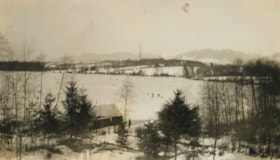
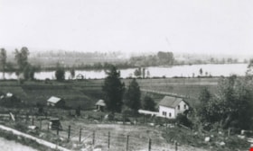
- As Burnaby developed into a more urban suburb of Vancouver and New Westminster the Deer Lake area retained much of its rural character. In 1949 Deer Lake park was established on the lake's eastern shore. The relocation of the Municipal Hall in the mid-1950s to the Deer Lake area began the vision of developing an administrative and cultural centre for Burnaby. The opportunity for developing this centre began with the opening of the Arts Centre, Century Gardens and the Burnaby Art Gallery in 1967. This was followed by the development of the Deer Lake Park as Burnaby's primary urban park.
- Historic Neighbourhood
- Burnaby Lake (Historic Neighbourhood)
- Planning Study Area
- Morley-Buckingham Area
- Street View URL
- Google Maps Street View
Less detail
Digney Speedway
- Repository
- Burnaby Heritage Planning
- Geographic Access
- MacPherson Avenue
- Irmin Street
- Associated Dates
- 1948
- Heritage Value
- Andy Digney built the speedway in South Burnaby in 1948. He was approached by the B.C. Midget Auto Racing Association, who were looking for a good location to race the smaller, racing cars, popular at the time. Digney owned property in the vicinity of present-day Metrotown that was centrally located and easily accessible via the interurban railway. Motorcycles were also raced in the early days of the track. In 1949, when the popularity of midget racing declined, Digney started racing roadsters. However, he struggled to find local drivers, and it was expensive to bring in drivers from elsewhere. In 1951 Digney found a winner: jalopy racing. Local men would buy 1930s cars and strip them down, remove the glass, and weld the doors shut. By early 1952 over forty cars were showing up for jalopy races. By the early 1950s the Speedway was well established, with coverage in the sports pages and on radio. The track closed down in 1958 when Andy retired.
- Historic Neighbourhood
- Alta Vista (Historic Neighbourhood)
- Planning Study Area
- Clinton-Glenwood Area
Less detail
Douglas-Gilpin Neighbourhood
- Repository
- Burnaby Heritage Planning
- Associated Dates
- 1955-2008
- Heritage Value
- The Douglas-Gilpin Neighbourhood developed into a diverse area incorporating residential, business, educational and park districts in the period after 1955. The BCIT site was built in the early 1960s, shortly after the Burnaby Municipal Hall was located on Canada Way near Deer Lake in 1956. The construction of the Municipal Hall at this location fostered the creation of an administrative and business centre adjacent to the park, while the northern and central areas of the neighbourhood retained their primarily residential character.
- Historic Neighbourhood
- Burnaby Lake (Historic Neighbourhood)
- Planning Study Area
- Douglas-Gilpin Area
Less detail
Duncan & Margaret McGregor Estate 'Glen-Lyon' Mansion
- Repository
- Burnaby Heritage Planning
- Description
- Overlooking the rich farmland of the Fraser River floodplain, 'Glen-Lyon' is an Edwardian era rural estate, with a tall, two and one-half storey plus basement wood-frame mansion, set in a pastoral and formal landscape with an associated barn and early log pond, located near a ravine and forested ar…
- Associated Dates
- 1902
- Formal Recognition
- Heritage Designation, Community Heritage Register
- Street View URL
- Google Maps Street View
- Repository
- Burnaby Heritage Planning
- Geographic Access
- Marine Drive
- Associated Dates
- 1902
- Formal Recognition
- Heritage Designation, Community Heritage Register
- Enactment Type
- Bylaw No. 12183
- Enactment Date
- 11/12/2006
- Description
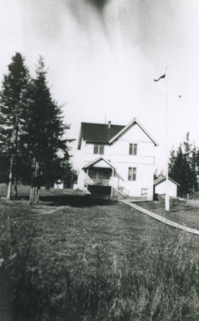
- Overlooking the rich farmland of the Fraser River floodplain, 'Glen-Lyon' is an Edwardian era rural estate, with a tall, two and one-half storey plus basement wood-frame mansion, set in a pastoral and formal landscape with an associated barn and early log pond, located near a ravine and forested area adjacent to Marine Drive in South Burnaby.
- Heritage Value
- ‘Glen-Lyon’ is valued as an excellent example of a privately-owned Edwardian era country estate built at the turn of the nineteenth century. The property retains significant heritage features including the Edwardian era mansion with rustic Arts and Crafts features, and elements of a working agricultural landscape. The property was originally the Royal City Mills logging camp, and in 1900 was purchased by Duncan Campbell McGregor (1853-1929) and Margaret Jane McGregor (1875-1960), who named their estate ‘Glen-Lyon’ after Duncan McGregor’s birthplace in Perthshire, Scotland. The McGregors were active in municipal affairs and social activities, and played a significant role in the early development of Burnaby. Duncan McGregor served as a city councillor from 1909 to 1912 and was elected reeve of Burnaby in 1913. Margaret McGregor was instrumental in the formation and fundraising activities of the Victoria Order of Nurses in Burnaby.
Additionally, the site is historically significant for its association with early social welfare and correctional reform. The estate was sold in 1926 to an inter-denominational religious organization called the Home of the Friendless, which used it as their B.C. headquarters. The organization was charged with several cases of abuse and neglect in 1937, after which a Royal Commission was formed that led to new legislation to regulate and license all private welfare institutions. 'Glen-Lyon' was sold to the provincial government, and was dedicated in 1939 by the Lt.-Gov. E.W. Hamber for use as the New Haven Borstal Home for Boys and Youthful Offenders (later renamed the New Haven Correction Centre). The Borstal movement originated in England in the late nineteenth century, as an alternative to sending young offenders and runaways to prisons by providing reformatories that focused on discipline and vocational skill. This site’s role as the first North American institution devoted to the Borstal School philosophy was historic, and influenced corrections programs across Canada. The site retains significant features from its development in 1939 as the Borstal School, including a large gambrel-roofed barn designed by Chief Provincial Architect Henry Whittaker of the Department of Public Works that is the only remaining structure of its kind in Burnaby. Between 1941 and 1945 the mansion housed the Provincial School for the Deaf and Blind when the Borstal School was closed temporarily as a war measure during the Second World War.
- Defining Elements
- Key elements that define the heritage character of 'Glen-Lyon' Mansion include its:
- location on a sloping site with expansive southern exposure, adjacent to Marine Drive
- residential form, scale and massing of the house as exemplified by its two and one-half storey height, above-ground basement and rectangular plan
- Arts and Crafts elements of the house such as its stone foundation, multi-gabled roof line with steep central hipped roof, symmetrical cross-gables, side shed dormers, bellcast upper walls sheathed in cedar shingles and lower walls sheathed in narrow clapboard
- original exterior features of the house such as the full width front verandah with square columns, central staircase on the southern elevation, original doors and stained glass windows; and the irregular fenestration such as double-hung 1-over-1 wooden-sash windows, bay windows, and projecting windows in the gable ends
- original interior features of the house such as the U-shaped main stair designed around two symmetrically placed Ionic columns, and interior trim on the main floor including boxed beams and fireplaces
- gambrel-roofed barn with roof vent with finial, sliding hay loft and access doors, small multi-pane windows, and lapped wooden siding
- associated landscape features such as the original garden plantings with some exotic and many native specimen trees; the original log pond and its concrete Marine Drive causeway and culvert; rockeries and a rose garden
- Historic Neighbourhood
- Fraser Arm (Historic Neighbourhood)
- Planning Study Area
- Big Bend Area
- Organization
- Home of the Friendless
- Borstal School
- New Haven Correction Centre
- Architect
- Henry Whittaker
- Function
- Primary Historic--Estate
- Community
- Burnaby
- Cadastral Identifier
- 003-004-661
- Boundaries
- 'Glen-Lyon' is comprised of a single residential lot located at 4250 Marine Drive, Burnaby.
- Area
- 230873.18
- Contributing Resource
- Building
- Ownership
- Private
- Names
- McGregor, Duncan C. (1853-1929)
- Whittaker, Henry
- Home of the Friendless
- Borstal School
- New Haven Correction Centre
- Subjects
- Buildings - Heritage
- Buildings - Residential - Houses
- Buildings - Public - Detention Facilities
- Buildings - Residential
- Street Address
- 4250 Marine Drive
- Street View URL
- Google Maps Street View
Less detail
East Burnaby Neighbourhood
- Repository
- Burnaby Heritage Planning
- Associated Dates
- 1925-1954
- Heritage Value
- After a lull in construction during the World War I period, East Burnaby Neighbourhood's growth resumed during the 1920s when many homes and businesses were constructed. The post-World War Two period also saw rapid construction and the creation of new housing developments in response to a population boom. The neighbourhood remained a primarily single-family residential area.
- Historic Neighbourhood
- Edmonds (Historic Neighbourhood)
- Planning Study Area
- Stride Avenue Area
Less detail
East Burnaby Neighbourhood
- Repository
- Burnaby Heritage Planning
- Associated Dates
- 1905-1924
- Heritage Value
- According to the 1911 December 26 edition of The British Columbian: Optimism is the word that applies to the whole community of East Burnaby. The many improvements carried out by the council during the past two years had been the means of making East Burnaby a thriving settlement, and hence one and all are optimistic as to its future. In the clearing and building line, many fine new homes are being erected...Real estate values have advanced with the times, and a notable feature is the number of better-class houses that are being built in this locality, which proves that East Burnaby is becoming very much alive and elevated.
- Historic Neighbourhood
- East Burnaby (Historic Neighbourhood)
- Planning Study Area
- Edmonds Area
Less detail
Edmonds Neighbourhood
- Repository
- Burnaby Heritage Planning
- Associated Dates
- 1925-1954
- Heritage Value
- The historic growth of Edmonds as a neighbourhood was based on its strategic location on the early interurban line between Vancouver and New Westminster. Even by 1980 when a survey of the residential neighbourhoods was conducted, a full 25% of homes in the area predated 1930. The 1950s was a period of strong housing development, with both single-family and multi-family units being constructed. Although Burnaby's City Hall was moved from Kingsway and Edmonds in the early 1950s, Edmonds remained an important centre in the community.
- Historic Neighbourhood
- Edmonds (Historic Neighbourhood)
- Planning Study Area
- Stride Avenue Area
Less detail
Edmonds Neighbourhood
- Repository
- Burnaby Heritage Planning
- Associated Dates
- 1905-1924
- Heritage Value
- From The British Columbian, March 19, 1912: "On the fringe of New Westminster there is…a suburban townsite in Edmonds. During the past eighteen months it has grown and prospered quite phenomenally. It is ideally situated, is in easy communication with New Westminster by two car lines. Its climate is clear and bracing, being exceptionally free from the fogs that are more or less prevalent along the river section and gulf shore...Edmonds, in fact, is one of the finest residential parts of the province. This is fast becoming known and appreciated beyond its borders. Elegant and substantial residences are being erected in various parts, and stores are being put up in convenient localities. The new municipal building is one of the finest in British Columbia for so young a municipality."
- Historic Neighbourhood
- Edmonds (Historic Neighbourhood)
- Planning Study Area
- Edmonds Area
Less detail
Edmonds Street Neighbourhood
- Repository
- Burnaby Heritage Planning
- Associated Dates
- 1955-2008
- Heritage Value
- The Edmonds Street Neighbourhood is part of the larger Edmonds Town Centre - one of four Town Centres in Burnaby. This neighbourhood is considered to be primarily residential, but a strong local commercial component developed along Edmonds and Kingsway.
- Historic Neighbourhood
- Edmonds (Historic Neighbourhood)
- Planning Study Area
- Edmonds Area
Less detail
Frank Walsh Residence
- Repository
- Burnaby Heritage Planning
- Geographic Access
- Boundary Road
- Associated Dates
- 1948
- Description
- Residential building.
- Heritage Value
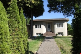
- This Streamline Moderne house is a rare example of this style in Burnaby and remains in excellent condition. Reflecting the influence of technology, industrial design and aerodynamic styling, the house has smooth rounded surfaces, rounded corners, a flat roof and prominent projecting eaves. It was built for prominent North Burnaby businessman Frank Wallace Walsh (1907-1963), who was a mechanic, and his wife Rena.
- Locality
- Vancouver Heights
- Historic Neighbourhood
- Vancouver Heights (Historic Neighbourhood)
- Planning Study Area
- Burnaby Heights Area
- Area
- 566.71
- Contributing Resource
- Building
- Ownership
- Private
- Street Address
- 270 Boundary Road
- Street View URL
- Google Maps Street View
Less detail
Fraser Arm Neighbourhood
- Repository
- Burnaby Heritage Planning
- Associated Dates
- 1925-1954
- Heritage Value
- By the late 1920s, the Fraser Arm Neighbourhood in Burnaby was developing into an industrial and manufacturing district. In 1931, the Canadian National Railway built a bridge over the Fraser River from Burnaby to Lulu Island and advertised that over 30 industries were currently operating along the North Fraser. Along with industries, this district remained an important agricultural area for the Lower Mainland. Chinese market gardens continued to develop and thrive and in 1926, the Vancouver Sun estimated that that Chinese farms in the Lower Fraser Valley then supplied 90 per cent of all green vegetables consumed in the Vancouver market area.
- Historic Neighbourhood
- Fraser Arm (Historic Neighbourhood)
- Planning Study Area
- Big Bend Area
Less detail
Fraser Arm Neighbourhood
- Repository
- Burnaby Heritage Planning
- Associated Dates
- 1905-1924
- Heritage Value
- Fraser Arm - so named because there the tram crossed Gilley Avenue, running down to the North Arm of the Fraser River - was served by the River Road [Marine Drive] which traversed the municipality of Burnaby, leading to both New Westminster and Vancouver. This area did not experience a real estate boom during the 1909-1913 as did many other Burnaby neighbourhoods - in fact, by 1912, only three homes had been built along Riverway as it remained a predominantly agricultural area.
- Historic Neighbourhood
- Fraser Arm (Historic Neighbourhood)
- Planning Study Area
- Big Bend Area
Less detail
Garden Village Neighbourhood
- Repository
- Burnaby Heritage Planning
- Associated Dates
- 1955-2008
- Heritage Value
- Bounded by Moscrop Street to the north, Kingsway and Grange to the south, Willingdon to the east and Boundary Road to the west, the Garden Village Neighbourhood is characterised as a primarily residential area that is well-served due to its proximity to commercial, park and business centres. The north-east corner of the neighbourhood is a typical 1950s subdivision of mostly single family homes located on an irregular street pattern, while the remaining areas saw some transition to multi-family housing types throughout the 1970s and up to the current time.
- Historic Neighbourhood
- Central Park (Historic Neighbourhood)
- Planning Study Area
- Garden Village Area
Less detail
George Derby Centre
- Repository
- Burnaby Heritage Planning
- Geographic Access
- Cumberland Street
- Associated Dates
- 1947
- Heritage Value
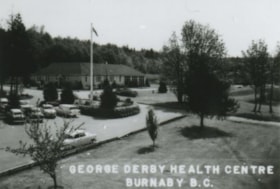
- The George Derby Centre was opened in 1947 as a rehabilitation Centre for young disabled veterans returning from the war. The centre was named after George Cleveland Derby, a World War I veteran who was injured in the Battle of Vimy Ridge and later went on to become a District Administrator in the Department of Solders’ Civil Re-establishment, the forerunner of the Department of Veterans Affairs. His work took him to wartime England where he was awarded the Order of the British Empire in 1943 for patriotic and philanthropic work.
- Historic Neighbourhood
- East Burnaby (Historic Neighbourhood)
- Planning Study Area
- Cariboo-Armstrong Area
- Street Address
- 7550 Cumberland Street
- Street View URL
- Google Maps Street View
Less detail
Gilley's Logging Camp
- Repository
- Burnaby Heritage Planning
- Associated Dates
- 1903
- Heritage Value
- Brothers Herbert, Walter, James and G. Emerson Gilley began operating the Gilley Brothers Logging Company in 1887 and in 1903 took over the logging business of L. T. Dundas, setting up camp on Burnaby Mountain. Gilley logged over 2.5 million board feet of timber and cut 20,000 cords of shingle bolts here. The Gilley Brothers also logged areas of South Burnaby.
- Planning Study Area
- Lake City Area
Less detail
Government Road Neighbourhood
- Repository
- Burnaby Heritage Planning
- Associated Dates
- 1955-2008
- Heritage Value
- After the building boom of the 1950s, the Government Road Neighbourhood became characterised as a stable, single-family residential area. In addition to the residential component, the neighbourhood also has a significant industrial sector, along the north side of Burnaby Lake, and a commercial zone to the north along the Lougheed Highway.
- Historic Neighbourhood
- Lozells (Historic Neighbourhood)
- Planning Study Area
- Government Road Area
Less detail
Hastings Barnet Road
- Repository
- Burnaby Heritage Planning
- Associated Dates
- 1903
- Heritage Value
- Prior to 1900, Hastings Street in Vancouver (named after Rear Admiral George Fowler Hastings, commander of Her Majesty's Pacific Coast Squadron) only extended eastward as far as Renfrew Street. By 1903, however, with operations at the Barnet Mill expanding, a direct route into Vancouver was deemed necessary and the Provincial Government ordered that Hastings be extended to connect with the rough trail known as the Barnet Road.
- Historic Neighbourhood
- Vancouver Heights (Historic Neighbourhood)
- Planning Study Area
- Burnaby Heights Area
Less detail
Hastings Grove Neighbourhood
- Repository
- Burnaby Heritage Planning
- Associated Dates
- 1905-1924
- Heritage Value
- During the height of the real estate boom between 1909 and 1913, Vancouver developer Frederick Munson plotted the subdivision of more than 150 acres of land on Curtis Street east of Sperling Avenue, on the newly logged slopes of remote Burnaby Mountain. Burnaby opened up Curtis Street to facilitate access to Hastings Grove and Munson agreed to pay one-third of the cost but never did. He also paid only $1000.00 down on the agreed price of the land. When he failed to make further payments, the mortgage holders foreclosed and re-sold the properties. People who had bought lots from Munson lost not only the land they though they owned, but also the money they had paid for it. Hastings Grove was a disaster. The converted automobile - which served as the bus - stopped running. The few houses and most of the lots reverted to the Municipality because of non-payment of taxes and are now part of Burnaby Mountain Park. The only remaining building is the old Hastings Grove Store which still stands as an apartment building.
- Historic Neighbourhood
- Lochdale (Historic Neighbourhood)
- Planning Study Area
- Lochdale Area
Less detail
