Narrow Results By

Burnaby’s Chinese Canadian Market Gardens
https://search.heritageburnaby.ca/link/museumdescription4484
- Repository
- Burnaby Village Museum
- Date
- 2018
- Collection/Fonds
- Burnaby Village Museum fonds
- Description Level
- Item
- Physical Description
- 1 video recording (mp4) (3 min., 15 sec.) : digital, 23 fps, col., sd., stereo
- Scope and Content
- This short film was produced by the City of Burnaby Community Heritage Commission to commemorate Burnaby's 125th anniversary. It features the story of market gardens operated by Chinese Canadian families in the Big Bend area.
- Repository
- Burnaby Village Museum
- Collection/Fonds
- Burnaby Village Museum fonds
- Description Level
- Item
- Physical Description
- 1 video recording (mp4) (3 min., 15 sec.) : digital, 23 fps, col., sd., stereo
- Scope and Content
- This short film was produced by the City of Burnaby Community Heritage Commission to commemorate Burnaby's 125th anniversary. It features the story of market gardens operated by Chinese Canadian families in the Big Bend area.
- Publisher
- City of Burnaby
- Other Title Information
- title given by film makers
- Subjects
- Agriculture - Farms
- Names
- Hop On Farms
- Accession Code
- BV018.12.2
- Access Restriction
- No restrictions
- Reproduction Restriction
- May be restricted by third party rights
- Date
- 2018
- Media Type
- Moving Images
- Historic Neighbourhood
- Fraser Arm (Historic Neighbourhood)
- Planning Study Area
- Big Bend Area
- Notes
- Transcribed title
- Reproduction of content is restricted
Images

Video
Burnaby’s Chinese Canadian Market Gardens, 2018
Burnaby’s Chinese Canadian Market Gardens, 2018
https://search.heritageburnaby.ca/media/hpo/_Data/_BVM_Moving_Images/2018_0012_0002_001.mp4
Eating your way through Burnaby: A look at Chinese Canadian history through food
https://search.heritageburnaby.ca/link/museumdescription14762
- Repository
- Burnaby Village Museum
- Date
- 27 Oct. 2020
- Collection/Fonds
- Burnaby Village Museum fonds
- Description Level
- Item
- Physical Description
- 1 video recording (mp4) (61 min., 56 sec.) : digital, col., sd., stereo ; 29 fps
- Scope and Content
- Item consists of a video recording of a live Zoom webinar hosted by Kate Petrusa, Burnaby Village Museum assistant curator. The webinar is titled "Eating your way through Burnaby: A look at Chinese Canadian history through food" and is presented by Denise Fong, Planning Assistant for the City of Bu…
- Repository
- Burnaby Village Museum
- Collection/Fonds
- Burnaby Village Museum fonds
- Description Level
- Item
- Physical Description
- 1 video recording (mp4) (61 min., 56 sec.) : digital, col., sd., stereo ; 29 fps
- Material Details
- Presenter: Denise Fong
- Host: Kate Petrusa
- Date of Presentation: October 27 7:00 pm - 8:00 pm
- Total Number of tracks: 1
- Total Length of all tracks:61 min., 56 sec.
- Recording Device: Zoom video communication platform
- Scope and Content
- Item consists of a video recording of a live Zoom webinar hosted by Kate Petrusa, Burnaby Village Museum assistant curator. The webinar is titled "Eating your way through Burnaby: A look at Chinese Canadian history through food" and is presented by Denise Fong, Planning Assistant for the City of Burnaby. The zoom webinar is the seventh in a collection of seven "Burnaby Neighbourhood Speaker series" webinars that were presented and made available to the public between September 29 and October 27, 2020. The live webinar and recording was also made available on the Burnaby Village Museum's facebook page. In this webinar, Denise Fong talks about how Chinese Canadians have played a key role in supplying food to Burnaby’s community through their participation in the local market gardening, green grocer, and restaurant industries. The presentation is supported with historical maps, photographs, documents, census records and stories from recent research on the 1960s-1970s period in Burnaby’s Big Bend and Capitol Hill neighborhoods. In her presentation, Denise also talks about the history of Chinese Immigration in Canada including the political circumstances and legal barriers that Chinese migrants faced in the late nineteenth to early twentieth century. Denise highlights specific Chinese Canadian family farms in Burnaby including; the Jung family farm located on 5460 Douglas Road operated by Jung Chong and his wife Jung Gee Shee; "Hop On Farms" located on Marine Drive, operated by Chan Kow Hong, Sui Ha Hong and family; the Tong Yip Farm located on Byrne Road operated by D.T. "George" Yip and his wife, Yip Chow Won Tai. Denise also highlights her recent research regarding Chinese Canadian corner stores and green grocers in Burnaby including; The Lee Kee grocery store located at 3824 East Hastings Street, owned and operated by Yow Lee Ko and his wife Say Jan Chan; the Burnaby Market located at 3942 East Hastings Street, owned and operated by Chin Yin Wong; the Quon Bros. located at 3702 East Hastings Street.; Y. Hoy Produce Co. located at 4092 East Hastings Street operated by Hoy Yen; Louie's Food Basket located at 5886 South East Marine Drive operated by Hoy Bew Louie, his wife Poy Yee and later by thier son Bing Louie and Tommy's Market located in Burnaby's Edmonds neighbourhood, operated by Tommy Chu. Denise also provides a detailed history of Tommy Chu and family who owned and operated Tommy's Market. Denise tells of how in the early 1970s, Chinese grocers in the lower mainland came together and formed the Lower Mainland Independent Grocers Association and Lower Mainland Grocers Co-Op. The organization was formed to protect the rights and promote businesses of independent grocers. In closing, Denise explains how her research of Chinese Canadian history in Burnaby continues and by the end of the project, the information will be made accessible in the form of a publication.
- Creator
- Burnaby Village Museum
- Subjects
- Persons - Chinese Canadians
- Social Issues - Discrimination
- Agriculture - Farms
- Social Issues - Racism
- Buildings - Commercial - Grocery Stores
- Names
- Fong, Denise
- Jung, Chung Chong
- Tommy's Produce
- Lee Kee Grocery
- Louie's Food Basket
- Louie, Hoy Bew
- Jung, Gee Shee
- Hong, Chan Kow
- Hong, Sui Ha
- Yip, D.T. "George"
- Yip, Chow Won Tai
- Ko, Yow Lee
- Ko, Chan Say Jan
- Burnaby Market
- Wong, Chin Yin
- Quon Bros.
- Y. Hoy Produce Co.
- Yen, Hoy
- Louie, Poy Yee
- Louie, Bing
- Chu, Tommy
- Chu, Sharon
- Chu, Calvin
- Responsibility
- Petrusa, Kate
- Geographic Access
- Hastings Street
- Accession Code
- BV020.29.7
- Access Restriction
- No restrictions
- Reproduction Restriction
- No known restrictions
- Date
- 27 Oct. 2020
- Media Type
- Moving Images
- Historic Neighbourhood
- Fraser Arm (Historic Neighbourhood)
- Vancouver Heights (Historic Neighbourhood)
- Planning Study Area
- Big Bend Area
- Burnaby Heights Area
- Notes
- Title based on contents of video recording
- Video recording was edited for publication on Heritage Burnaby. Original mp4 video recording (BV020.29.7.1) is 72 min., 14 sec.
Images

Video
Eating your way through Burnaby: A look at Chinese Canadian history through food, 27 Oct. 2020
Eating your way through Burnaby: A look at Chinese Canadian history through food, 27 Oct. 2020
https://search.heritageburnaby.ca/media/hpo/_Data/_BVM_Moving_Images/2020_0029_0007_002.mp4
Fire insurance key plan - Greater Vancouver - Volume XIX - Municipality of Burnaby
https://search.heritageburnaby.ca/link/museumdescription17799
- Repository
- Burnaby Village Museum
- Date
- 1927
- Collection/Fonds
- Burnaby Village Museum Map collection
- Description Level
- Item
- Physical Description
- 1 plan on 1 sheet : col. lithographic print ; 64 x 54 cm
- Scope and Content
- Item consists of a one page fire insurance key plan titled "Greater Vancouver / Volume XIX / Municipality / of Burnaby / Key Plan" surveyed May 1927. Key plan from compilation, "Insurance Plans of Greater Vancouver Plan No. 11, Volumes 15 to 19 Burnaby".
- Repository
- Burnaby Village Museum
- Collection/Fonds
- Burnaby Village Museum Map collection
- Description Level
- Item
- Physical Description
- 1 plan on 1 sheet : col. lithographic print ; 64 x 54 cm
- Material Details
- Scale [1:6000]
- Scope and Content
- Item consists of a one page fire insurance key plan titled "Greater Vancouver / Volume XIX / Municipality / of Burnaby / Key Plan" surveyed May 1927. Key plan from compilation, "Insurance Plans of Greater Vancouver Plan No. 11, Volumes 15 to 19 Burnaby".
- Publisher
- Plan Department of Fire Branch of British Columbia Underwriters' Association
- Accession Code
- BV987.1.70
- Access Restriction
- No restrictions
- Reproduction Restriction
- May be restricted by third party rights
- Date
- 1927
- Media Type
- Cartographic Material
- Historic Neighbourhood
- Fraser Arm (Historic Neighbourhood)
- Planning Study Area
- Big Bend Area
- Scan Resolution
- 400
- Scan Date
- 2021-11-17
- Notes
- Title based on contents of item
- Scale 500 feet = 1 inch
- These plans were removed from a bound book with labels on cover page reading: "Plan No. 90 / THIS INSURANCE PLAN / of / Vancouver VOLUME "8" / IN THE PROPERTY OF THE / British Columbia Insurance Underwriter's Association / Vancouver B.C. / AND IS LOANED / MELVILLE F. THOMSON CO. .../ Date May 26th, 1934"; / "Plan No. 74 / THIS INSURANCE PLAN / OF / VANCOUVER VOLUME "9"" / Plan No. 11 / THIS INSURANCE PLAN / OF / BURNABY VOLUMES 15-19" / "THIS PLAN IS THE PROPERTY OF / THE / BRITISH LAW INSURANCE COMPANY / LIMITED"
- Does not include the corresponding key plan page or associated plans numbered 1901 to 1914
- Contact Burnaby Village Museum to view associated fire insurance plans
Zoomable Images

Fire insurance key plan - Greater Vancouver - Volume XIX - Municipality of Burnaby, 1927
Zoom into Image
Municipality of Burnaby- Volume XV and Volume XVIII
https://search.heritageburnaby.ca/link/museumdescription8686
- Repository
- Burnaby Village Museum
- Date
- May 1927
- Collection/Fonds
- Burnaby Village Museum Map collection
- Description Level
- File
- Physical Description
- 4 plans on 4 sheets : col. lithographic prints ; 63.5 x 53.5 cm folded to 53 x 31.5 cm
- Scope and Content
- File consists of four pages of plans removed from a bound book containing a series of fire insurance plans of the Municipality of Burnaby. Plan "1520" is part of "GREATER VANCOUVER B.C. / VOLUME XV / Municipality of Burnaby / May 1927" and covers District Lots: 121 and 187. Plann "1521" is part of …
- Repository
- Burnaby Village Museum
- Collection/Fonds
- Burnaby Village Museum Map collection
- Description Level
- File
- Physical Description
- 4 plans on 4 sheets : col. lithographic prints ; 63.5 x 53.5 cm folded to 53 x 31.5 cm
- Material Details
- Scale [1:600] and [1:1200]
- Scope and Content
- File consists of four pages of plans removed from a bound book containing a series of fire insurance plans of the Municipality of Burnaby. Plan "1520" is part of "GREATER VANCOUVER B.C. / VOLUME XV / Municipality of Burnaby / May 1927" and covers District Lots: 121 and 187. Plann "1521" is part of "GREATER VANCOUVER B.C. / VOLUME XV / Municipality of Burnaby / May 1927" and covers District Lots: 121 and 187. Key plan "H" reads: "GREATER VANCOUVER B.C. / VOLUME XVIII / Surveyed _ May 1927 / MUNICIPALITY OF / BURNABY" and covers plans: 1813 to 1822; 1824 to 1832; 1839; 1840; 1853 to 1865 and District Lots: 28; 30; 53; 90 to 93; 95 to 97; 155a; 155b; 155c; 159; 160; 171 to 173. Plan "1801" is part of "GREATER VANCOUVER B.C. / VOLUME XVIII / Municipality of Burnaby / May 1927" and covers District Lot 153.
- Responsibility
- British Columbia Underwriters' Association
- Accession Code
- HV972.111.8
- Access Restriction
- No restrictions
- Reproduction Restriction
- May be restricted by third party rights
- Date
- May 1927
- Media Type
- Cartographic Material
- Historic Neighbourhood
- Fraser Arm (Historic Neighbourhood)
- Vancouver Heights (Historic Neighbourhood)
- East Burnaby (Historic Neighbourhood)
- Edmonds (Historic Neighbourhood)
- Planning Study Area
- Marlborough Area
- Kingsway-Beresford Area
- Windsor Area
- Big Bend Area
- Clinton-Glenwood Area
- Burnaby Heights Area
- Edmonds Area
- Stride Avenue Area
- Scan Resolution
- 400
- Scan Date
- 2021-11-18
- Notes
- Title based on content of plans
- See also BV987.1.70d for revised versions of plans
- Scale is measured 1 inch = 500 feet
Zoomable Images


Municipality of Burnaby - Volume XVIII and Volume XIX
https://search.heritageburnaby.ca/link/museumdescription8683
- Repository
- Burnaby Village Museum
- Date
- May 1927
- Collection/Fonds
- Burnaby Village Museum Map collection
- Description Level
- File
- Physical Description
- 2 plans on 2 sheets : col. lithographic prints ; 63.5 x 53.5 cm folded to 53 x 31.5 cm
- Scope and Content
- File consists of two pages of plans removed from a bound book containing a series of fire insurance plans of the Municipality of Burnaby. Plan "1832" is from "GREATER VANCOUVER B.C. / VOLUME XVIII / Municipality of Burnaby / May, 1927" and covers District Lots: 98 and 28. Plan "K" is part of a key …
- Repository
- Burnaby Village Museum
- Collection/Fonds
- Burnaby Village Museum Map collection
- Description Level
- File
- Physical Description
- 2 plans on 2 sheets : col. lithographic prints ; 63.5 x 53.5 cm folded to 53 x 31.5 cm
- Material Details
- Scale [1:1200] to [1:6000]
- Scope and Content
- File consists of two pages of plans removed from a bound book containing a series of fire insurance plans of the Municipality of Burnaby. Plan "1832" is from "GREATER VANCOUVER B.C. / VOLUME XVIII / Municipality of Burnaby / May, 1927" and covers District Lots: 98 and 28. Plan "K" is part of a key plan "GREATER VANCOUVER B.C. / Surveyed VOLUME XIX May 1927 / MUNICIPALITY OF / BURNABY / PLAN DEPT. British Columbia Ins. Underwriters Association / FIRE BRANCH / KEY PLAN", "Scale 500 FT = 1 INCH / FOR REPORT SEE VOL. XV" covering plans: 1901 to 1914 and District Lots: 161; 164 to 167; 155c; 155; 172 and 173.
- Responsibility
- British Columbia Underwriters' Association
- Accession Code
- HV972.111.5
- Access Restriction
- No restrictions
- Reproduction Restriction
- May be restricted by third party rights
- Date
- May 1927
- Media Type
- Cartographic Material
- Historic Neighbourhood
- East Burnaby (Historic Neighbourhood)
- Central Park (Historic Neighbourhood)
- Fraser Arm (Historic Neighbourhood)
- Alta Vista (Historic Neighbourhood)
- Planning Study Area
- Windsor Area
- Marlborough Area
- Second Street Area
- Big Bend Area
- Sussex-Nelson Area
- Scan Resolution
- 400
- Scan Date
- 2021-11-18
- Notes
- Title based on content of plans
- See also BV987.1.70d for revised versions of plans
- Scale is measured 1 inch = 500 feet
Zoomable Images


Municipality of Burnaby - Volume XV, Volume XVI, Volume XVII, Volume XVIII
https://search.heritageburnaby.ca/link/museumdescription8685
- Repository
- Burnaby Village Museum
- Date
- May 1927
- Collection/Fonds
- Burnaby Village Museum Map collection
- Description Level
- File
- Physical Description
- 4 plans on 4 sheets : col. lithographic prints ; 63.5 x 53.5 cm folded to 53 x 31.5 cm
- Scope and Content
- File consists of four pages of plans removed from a bound book containing a series of fire insurance plans of the Municipality of Burnaby. Plan "1531" is part of "GREATER VANCOUVER B.C. / VOLUME XV / Municipality of Burnaby / May 1927" and covers District Lots: 116 and 117. Key Plan "C" is part of …
- Repository
- Burnaby Village Museum
- Collection/Fonds
- Burnaby Village Museum Map collection
- Description Level
- File
- Physical Description
- 4 plans on 4 sheets : col. lithographic prints ; 63.5 x 53.5 cm folded to 53 x 31.5 cm
- Material Details
- Scale [1:600] and [1:1200]
- Scope and Content
- File consists of four pages of plans removed from a bound book containing a series of fire insurance plans of the Municipality of Burnaby. Plan "1531" is part of "GREATER VANCOUVER B.C. / VOLUME XV / Municipality of Burnaby / May 1927" and covers District Lots: 116 and 117. Key Plan "C" is part of "GREATER VANCOUVER B.C. / VOLUME XVI / Municipality of Burnaby / May 1927" and covers plans 1623 to 1651 and District Lots: 1 and 2; 4; 6; 8; 10 to 14; 25; 27; 40; 56 to 58; 88 and 89. Plan "1738" is part of "GREATER VANCOUVER B.C. / VOLUME XVII / Municipality of Burnaby / May 1927" and covers District Lots: 34 and 35. Key plan "G" is part of "GREATER VANCOUVER B.C. / VOLUME XVIII / Municipality of Burnaby / May 1927" and covers plans: 1801 to 1813; 1823; 1824; 1833 to 1838; 1841 to 1853 and District Lots: 32; 93; 94; 97 to 99; 149; 150; 152; 155 to 159; 161 to 164.
- Responsibility
- British Columbia Underwriters' Association
- Accession Code
- HV972.111.7
- Access Restriction
- No restrictions
- Reproduction Restriction
- May be restricted by third party rights
- Date
- May 1927
- Media Type
- Cartographic Material
- Historic Neighbourhood
- Central Park (Historic Neighbourhood)
- Fraser Arm (Historic Neighbourhood)
- Alta Vista (Historic Neighbourhood)
- Broadview (Historic Neighbourhood)
- Vancouver Heights (Historic Neighbourhood)
- Burquitlam (Historic Neighbourhood)
- East Burnaby (Historic Neighbourhood)
- Edmonds (Historic Neighbourhood)
- Lozells (Historic Neighbourhood)
- Planning Study Area
- Clinton-Glenwood Area
- Marlborough Area
- Maywood Area
- Windsor Area
- Big Bend Area
- Garden Village Area
- Willingdon Heights Area
- West Central Valley Area
- Cariboo-Armstrong Area
- Lyndhurst Area
- Cameron Area
- Lake City Area
- Edmonds Area
- Second Street Area
- Sperling-Broadway Area
- Lakeview-Mayfield Area
- Scan Resolution
- 400
- Scan Date
- 2021-11-18
- Notes
- Title based on content of plans
- See also BV987.1.70d for revised versions of plans
- Scale is measured 1 inch = 500 feet
Zoomable Images

Municipality of Burnaby - Volume XV, Volume XVI, Volume XVII, Volume XVIII, May 1927
Zoom into Image
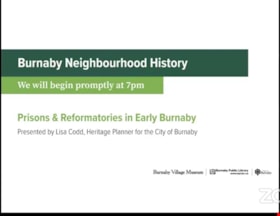
Prisons & Reformatories in Early Burnaby
https://search.heritageburnaby.ca/link/museumdescription14759
- Repository
- Burnaby Village Museum
- Date
- 15 Oct. 2020
- Collection/Fonds
- Burnaby Village Museum fonds
- Description Level
- Item
- Physical Description
- 1 video recording (mp4) (60 min., 53 sec.) : digital, col., sd., stereo ; 29 fps
- Scope and Content
- Item consists of a video recording of a live Zoom webinar hosted by Burnaby Village Museum's Kate Petrusa. The webinar is titled "Prisons & Reformatories in Early Burnaby" and is presented by Lisa Codd, Heritage Planner for the City of Burnaby. The zoom webinar is the fourth in a collection of seve…
- Repository
- Burnaby Village Museum
- Collection/Fonds
- Burnaby Village Museum fonds
- Description Level
- Item
- Physical Description
- 1 video recording (mp4) (60 min., 53 sec.) : digital, col., sd., stereo ; 29 fps
- Material Details
- Presenter: Lisa Codd
- Host: Kate Petrusa
- Date of Presentation: October 15, 6:00 pm - 8:00 pm
- Total Number of tracks: 1
- Total Length of all tracks:60 min., 53 sec
- Recording Device: Zoom video communication platform
- Scope and Content
- Item consists of a video recording of a live Zoom webinar hosted by Burnaby Village Museum's Kate Petrusa. The webinar is titled "Prisons & Reformatories in Early Burnaby" and is presented by Lisa Codd, Heritage Planner for the City of Burnaby. The zoom webinar is the fourth in a collection of seven "Burnaby Neighbourhood Speaker series" webinars that were presented and made available to the public between September 29 and October 27, 2020. The live webinar and recording was also made available on the Burnaby Village Museum's facebook page. In this webinar, Lisa Codd talks about how in the early 20th century Burnaby was home to several correctional and detention institutions that sought to reform their residents, including the Oakalla Prison Farm, New Haven Borstal Home for Boys and Youthful Offenders, the United Church Home for Girls and Home of the Friendless. Lisa supports her presentation with contemporary and historical photographs and research. Lisa pauses throughout the presentation to take questions from webinar participants.
- Creator
- Burnaby Village Museum
- Subjects
- Persons - Japanese Canadians
- Indigenous peoples - British Columbia
- Public Services - Correctional
- Names
- Codd, Lisa
- Oakalla Prison Farm
- New Haven Correctional Centre
- Lower Mainland Regional Correctional Centre
- George, Richardson
- George, Eneas
- George, Alex
- George, Joseph
- Peltier, Leonard
- Home of the Friendless
- Responsibility
- Petrusa, Kate
- Geographic Access
- Oakmount Crescent
- Street Address
- 5220 Oakmount Crescent
- 4250 Marine Drive
- Accession Code
- BV020.29.4
- Access Restriction
- No restrictions
- Reproduction Restriction
- No known restrictions
- Date
- 15 Oct. 2020
- Media Type
- Moving Images
- Historic Neighbourhood
- Burnaby Lake (Historic Neighbourhood)
- Fraser Arm (Historic Neighbourhood)
- Planning Study Area
- Oakalla Area
- Suncrest Area
- Notes
- Title based on contents of video recording
- Video recording was edited for publication on Heritage Burnaby. Original mp4 video recording (BV020.29.4.1) is 73 min.
Images
Video
Prisons & Reformatories in Early Burnaby, 15 Oct. 2020
Prisons & Reformatories in Early Burnaby, 15 Oct. 2020
https://search.heritageburnaby.ca/media/hpo/_Data/_BVM_Moving_Images/2020_0029_0004_002.mp4