Narrow Results By
Subject
- Advertising Medium - Signs and Signboards 1
- Agriculture - Farms 5
- Agriculture - Fruit and Berries 1
- Animals - Cats 1
- Animals - Dogs 5
- Animals - Fowl 1
- Animals - Goats 1
- Animals - Horses 1
- Buildings - Civic - Museums 1
- Buildings - Commercial - Restaurants 1
- Buildings - Heritage 6
- Buildings - Industrial - Mills 1
Creator
- Alphonse J. Toebaert 1
- Bowman and Cullerne 1
- British Columbia Underwriters' Association 1
- Burnaby Village Museum 2
- Damer, Eric 1
- E. Evans and Son 1
- Enoch Evans 1
- Fong, Denise 1
- Lloyd, Frank Ernest 10
- Lloyd's Studio 5
- McCarter & Nairne 1
- Plan Department, British Columbia Insurance Underwriters' Association 1
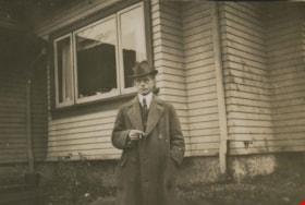
Kenneth Hill
https://search.heritageburnaby.ca/link/archivedescription38878
- Repository
- City of Burnaby Archives
- Date
- 1921
- Collection/Fonds
- Peers Family and Hill Family fonds
- Description Level
- Item
- Physical Description
- 1 photograph : B&w ; 5.5 x 10 cm on page 14 x 17.5 cm (pasted in album)
- Scope and Content
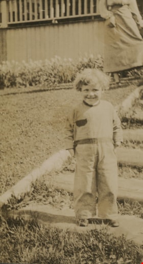
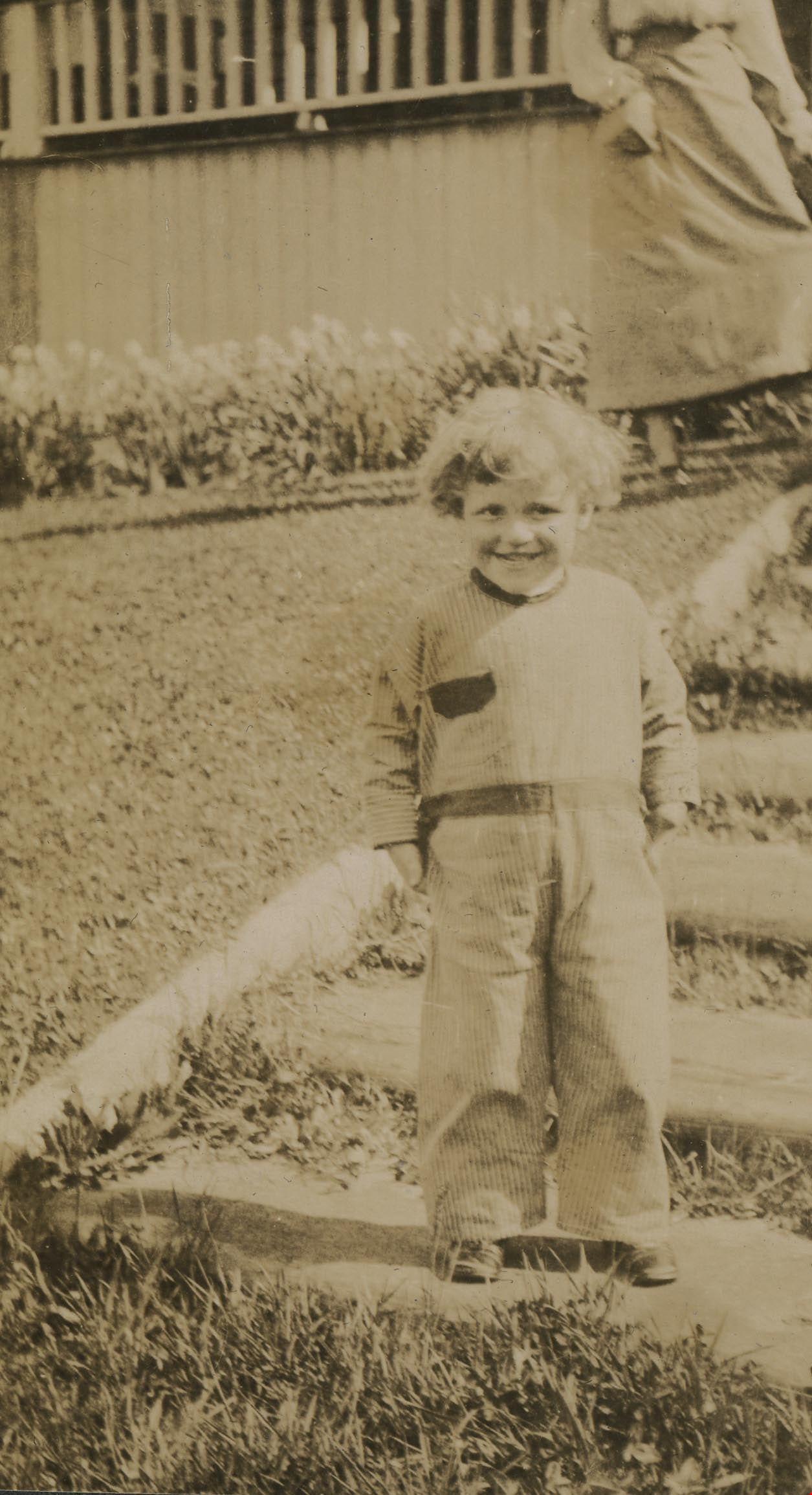
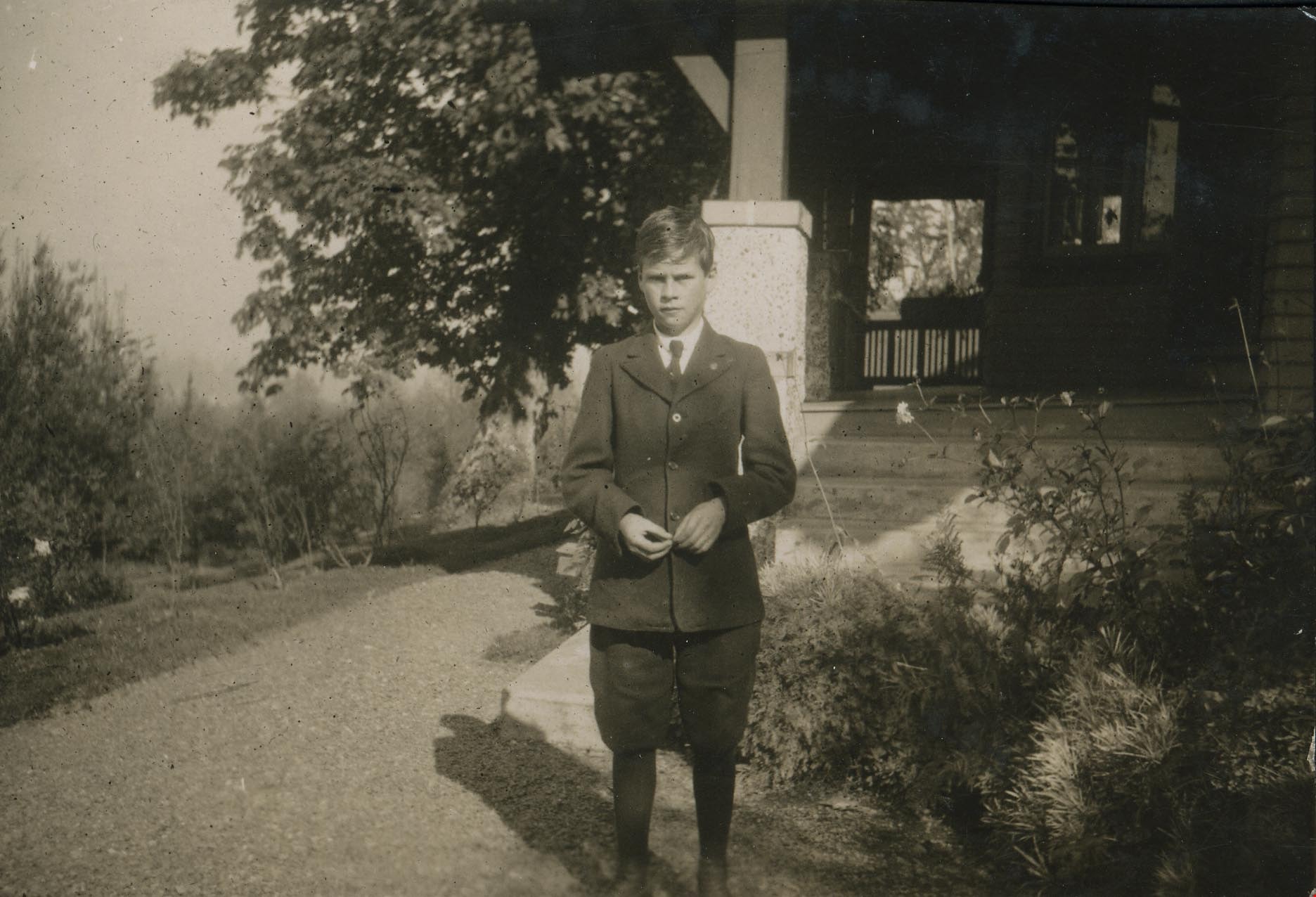
- Photograph of Kenneth Hill standing on the front step of an unidentified home (probably Bernard Hill home).
- Repository
- City of Burnaby Archives
- Date
- 1921
- Collection/Fonds
- Peers Family and Hill Family fonds
- Physical Description
- 1 photograph : B&w ; 5.5 x 10 cm on page 14 x 17.5 cm (pasted in album)
- Description Level
- Item
- Record No.
- 477-197
- Access Restriction
- No restrictions
- Reproduction Restriction
- No known restrictions
- Accession Number
- 2007-12
- Scope and Content
- Photograph of Kenneth Hill standing on the front step of an unidentified home (probably Bernard Hill home).
- Names
- Hill, Kenneth
- Media Type
- Photograph
- Notes
- Title based on contents of photograph
- Geographic Access
- Canada Way
- Street Address
- 4990 Canada Way
- Historic Neighbourhood
- Burnaby Lake (Historic Neighbourhood)
- Planning Study Area
- Douglas-Gilpin Area
Images
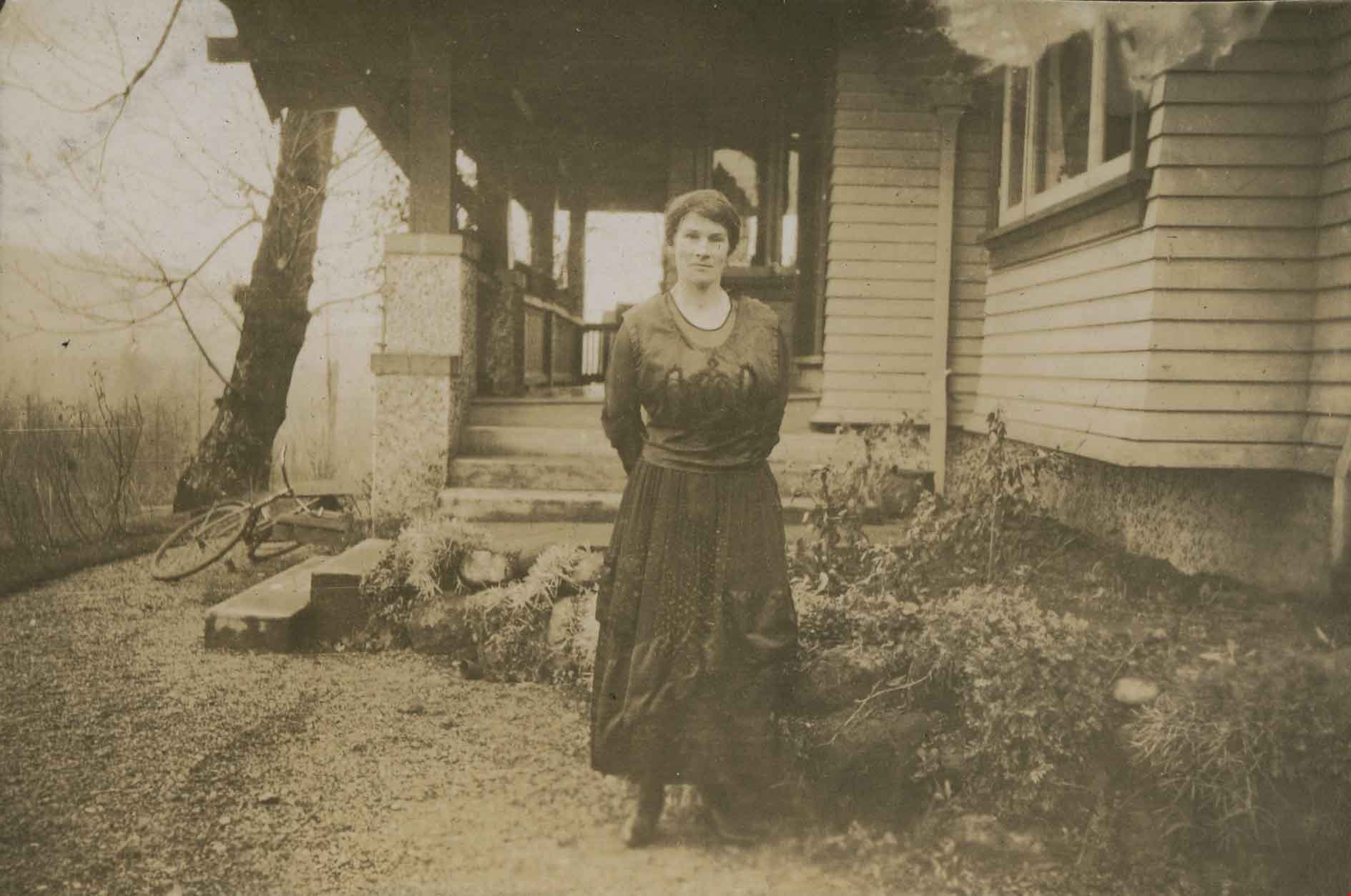
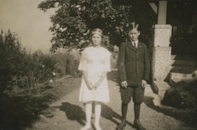
Mam Tabs in front of House of Travers
https://search.heritageburnaby.ca/link/archivedescription39140
- Repository
- City of Burnaby Archives
- Date
- 1921
- Collection/Fonds
- Peers Family and Hill Family fonds
- Description Level
- Item
- Physical Description
- 1 photograph : b&w ; 5.5 x 8 cm on page 24.5 x 32.5 cm (pasted in album)
- Scope and Content
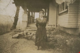
- Photograph of Alice Travers (also know as "Mam Tabs") standing outside the Travers family home on Stanley Street.
- Repository
- City of Burnaby Archives
- Date
- 1921
- Collection/Fonds
- Peers Family and Hill Family fonds
- Physical Description
- 1 photograph : b&w ; 5.5 x 8 cm on page 24.5 x 32.5 cm (pasted in album)
- Description Level
- Item
- Record No.
- 477-459
- Access Restriction
- No restrictions
- Reproduction Restriction
- No known restrictions
- Accession Number
- 2007-12
- Scope and Content
- Photograph of Alice Travers (also know as "Mam Tabs") standing outside the Travers family home on Stanley Street.
- Names
- Travers, Alice
- Media Type
- Photograph
- Notes
- Title based on caption accompanying photograph
- Geographic Access
- Stanley Street
- Street Address
- 7828 Stanley Street
- Historic Neighbourhood
- Burnaby Lake (Historic Neighbourhood)
- Planning Study Area
- Lakeview-Mayfield Area
Images

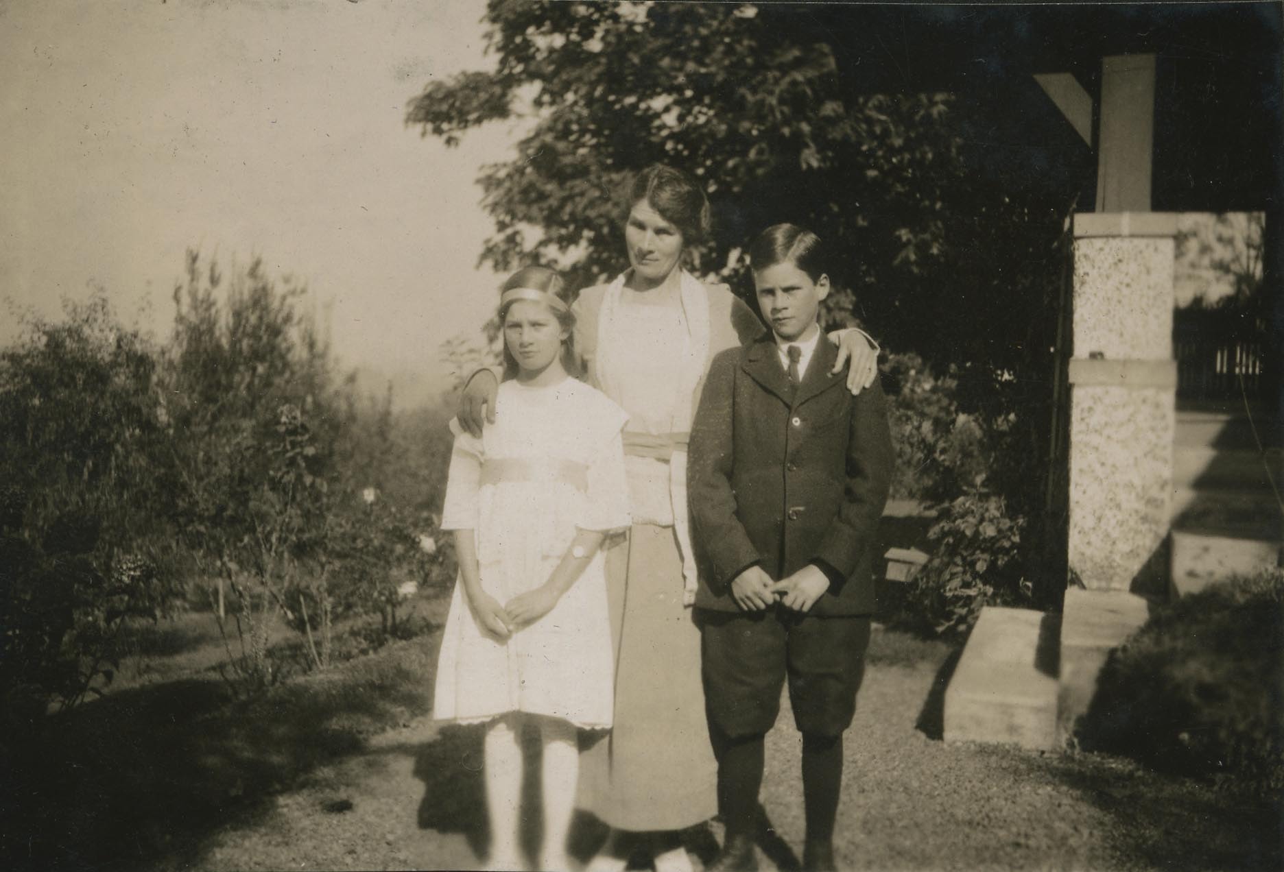
Alice Travers with her children
https://search.heritageburnaby.ca/link/archivedescription39141
- Repository
- City of Burnaby Archives
- Date
- 1921
- Collection/Fonds
- Peers Family and Hill Family fonds
- Description Level
- Item
- Physical Description
- 1 photograph : b&w ; 5 x 8.5 cm on page 24.5 x 32.5 cm (pasted in album)
- Scope and Content
- Photograph of Alice Travers with her two children. The boy is identified as Robbie and the daughter is Maude.
- Repository
- City of Burnaby Archives
- Date
- 1921
- Collection/Fonds
- Peers Family and Hill Family fonds
- Physical Description
- 1 photograph : b&w ; 5 x 8.5 cm on page 24.5 x 32.5 cm (pasted in album)
- Description Level
- Item
- Record No.
- 477-460
- Access Restriction
- No restrictions
- Reproduction Restriction
- No known restrictions
- Accession Number
- 2007-12
- Scope and Content
- Photograph of Alice Travers with her two children. The boy is identified as Robbie and the daughter is Maude.
- Media Type
- Photograph
- Notes
- Title based on caption accompanying photograph
- Geographic Access
- Stanley Street
- Street Address
- 7828 Stanley Street
- Historic Neighbourhood
- Burnaby Lake (Historic Neighbourhood)
- Planning Study Area
- Lakeview-Mayfield Area
Images
R.D. Travers
https://search.heritageburnaby.ca/link/archivedescription39142
- Repository
- City of Burnaby Archives
- Date
- 1921
- Collection/Fonds
- Peers Family and Hill Family fonds
- Description Level
- Item
- Physical Description
- 1 photograph : b&w ; 5.5 x 8 cm on page 24.5 x 32.5 cm (pasted in album)
- Scope and Content
- Photograph of R.D. Travers outside the Travers family home.
- Repository
- City of Burnaby Archives
- Date
- 1921
- Collection/Fonds
- Peers Family and Hill Family fonds
- Physical Description
- 1 photograph : b&w ; 5.5 x 8 cm on page 24.5 x 32.5 cm (pasted in album)
- Description Level
- Item
- Record No.
- 477-461
- Access Restriction
- No restrictions
- Reproduction Restriction
- No known restrictions
- Accession Number
- 2007-12
- Scope and Content
- Photograph of R.D. Travers outside the Travers family home.
- Names
- Travers, Robert
- Media Type
- Photograph
- Notes
- Title based on caption accompanying photograph
- Geographic Access
- Stanley Street
- Street Address
- 7828 Stanley Street
- Historic Neighbourhood
- Burnaby Lake (Historic Neighbourhood)
- Planning Study Area
- Lakeview-Mayfield Area
Images

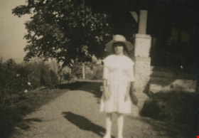
Maude Travers
https://search.heritageburnaby.ca/link/archivedescription39143
- Repository
- City of Burnaby Archives
- Date
- 1921
- Collection/Fonds
- Peers Family and Hill Family fonds
- Description Level
- Item
- Physical Description
- 1 photograph : b&w ; 5.5 x 7.8 cm on page 24.5 x 32.5 cm (pasted in album)
- Scope and Content
- Photograph of Maude Travers, the daughter of Alice Travers standing outside the Travers family home.
- Repository
- City of Burnaby Archives
- Date
- 1921
- Collection/Fonds
- Peers Family and Hill Family fonds
- Physical Description
- 1 photograph : b&w ; 5.5 x 7.8 cm on page 24.5 x 32.5 cm (pasted in album)
- Description Level
- Item
- Record No.
- 477-462
- Access Restriction
- No restrictions
- Reproduction Restriction
- No known restrictions
- Accession Number
- 2007-12
- Scope and Content
- Photograph of Maude Travers, the daughter of Alice Travers standing outside the Travers family home.
- Names
- Travers, Maude
- Media Type
- Photograph
- Notes
- Title based on caption accompanying photograph
- Geographic Access
- Stanley Street
- Street Address
- 7828 Stanley Street
- Historic Neighbourhood
- Burnaby Lake (Historic Neighbourhood)
- Planning Study Area
- Lakeview-Mayfield Area
Images

Robbie and Maude Travers
https://search.heritageburnaby.ca/link/archivedescription39144
- Repository
- City of Burnaby Archives
- Date
- 1921
- Collection/Fonds
- Peers Family and Hill Family fonds
- Description Level
- Item
- Physical Description
- 1 photograph : b&w ; 5.5 x 8 cm on page 24.5 x 32.5 cm (pasted in album)
- Scope and Content
- Photograph of the Travers children, Robbie and his sister, Maude. The photograph was taken outside the Travers home.
- Repository
- City of Burnaby Archives
- Date
- 1921
- Collection/Fonds
- Peers Family and Hill Family fonds
- Physical Description
- 1 photograph : b&w ; 5.5 x 8 cm on page 24.5 x 32.5 cm (pasted in album)
- Description Level
- Item
- Record No.
- 477-463
- Access Restriction
- No restrictions
- Reproduction Restriction
- No known restrictions
- Accession Number
- 2007-12
- Scope and Content
- Photograph of the Travers children, Robbie and his sister, Maude. The photograph was taken outside the Travers home.
- Media Type
- Photograph
- Notes
- Title based on caption accompanying photograph
- Geographic Access
- Stanley Street
- Street Address
- 7828 Stanley Street
- Historic Neighbourhood
- Burnaby Lake (Historic Neighbourhood)
- Planning Study Area
- Lakeview-Mayfield Area
Images


Robbie Travers
https://search.heritageburnaby.ca/link/archivedescription39145
- Repository
- City of Burnaby Archives
- Date
- 1921
- Collection/Fonds
- Peers Family and Hill Family fonds
- Description Level
- Item
- Physical Description
- 1 photograph : b&w ; 5.5 x 8 cm on page 24.5 x 32.5 cm (pasted in album)
- Scope and Content
- Photograph of Robbie Travers outside the Travers family home.
- Repository
- City of Burnaby Archives
- Date
- 1921
- Collection/Fonds
- Peers Family and Hill Family fonds
- Physical Description
- 1 photograph : b&w ; 5.5 x 8 cm on page 24.5 x 32.5 cm (pasted in album)
- Description Level
- Item
- Record No.
- 477-464
- Access Restriction
- No restrictions
- Reproduction Restriction
- No known restrictions
- Accession Number
- 2007-12
- Scope and Content
- Photograph of Robbie Travers outside the Travers family home.
- Names
- Travers, Robbie
- Media Type
- Photograph
- Notes
- Title based on caption accompanying photograph
- Geographic Access
- Stanley Street
- Street Address
- 7828 Stanley Street
- Historic Neighbourhood
- Burnaby Lake (Historic Neighbourhood)
- Planning Study Area
- Lakeview-Mayfield Area
Images
Skating on Deer Lake
https://search.heritageburnaby.ca/link/archivedescription39337
- Repository
- City of Burnaby Archives
- Date
- 1921
- Collection/Fonds
- Peers Family and Hill Family fonds
- Description Level
- Item
- Physical Description
- 1 photograph : sepia ; 5.5 x 8 cm on page 24.5 x 32.5 cm (pasted in album)
- Scope and Content
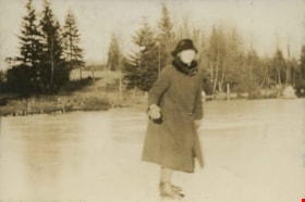
- Photograph of an unidentified girl skating on Deer Lake.
- Repository
- City of Burnaby Archives
- Date
- 1921
- Collection/Fonds
- Peers Family and Hill Family fonds
- Physical Description
- 1 photograph : sepia ; 5.5 x 8 cm on page 24.5 x 32.5 cm (pasted in album)
- Description Level
- Item
- Record No.
- 477-656
- Access Restriction
- No restrictions
- Reproduction Restriction
- No known restrictions
- Accession Number
- 2007-12
- Scope and Content
- Photograph of an unidentified girl skating on Deer Lake.
- Media Type
- Photograph
- Notes
- Title based on caption accompanying photograph
- Geographic Access
- Deer Lake
- Historic Neighbourhood
- Burnaby Lake (Historic Neighbourhood)
Images

Skating on Deer Lake
https://search.heritageburnaby.ca/link/archivedescription39338
- Repository
- City of Burnaby Archives
- Date
- 1921
- Collection/Fonds
- Peers Family and Hill Family fonds
- Description Level
- Item
- Physical Description
- 3 photographs : sepia ; 6 x 10 cm each on page 24.5 x 32.5 cm (pasted in album and joined to form one panorama)
- Scope and Content
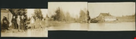
- Photograph is a panoramic picture of a group skating at Deer Lake. All are unidentified.
- Repository
- City of Burnaby Archives
- Date
- 1921
- Collection/Fonds
- Peers Family and Hill Family fonds
- Physical Description
- 3 photographs : sepia ; 6 x 10 cm each on page 24.5 x 32.5 cm (pasted in album and joined to form one panorama)
- Description Level
- Item
- Record No.
- 477-657
- Access Restriction
- No restrictions
- Reproduction Restriction
- No known restrictions
- Accession Number
- 2007-12
- Scope and Content
- Photograph is a panoramic picture of a group skating at Deer Lake. All are unidentified.
- Media Type
- Photograph
- Notes
- Title based on caption accompanying photograph
- Geographic Access
- Deer Lake
- Historic Neighbourhood
- Burnaby Lake (Historic Neighbourhood)
Images


George S. & Jessie Haddon House
https://search.heritageburnaby.ca/link/landmark508
- Repository
- Burnaby Heritage Planning
- Description
- The George and Jessie Haddon House is a symmetrical two-storey Dutch Colonial-style house with a side-gambrel roof and shed dormers. It is situated in the Burnaby Lake neighborhood in East Burnaby.
- Associated Dates
- 1922
- Formal Recognition
- Heritage Designation, Community Heritage Register
- Street View URL
- Google Maps Street View
- Repository
- Burnaby Heritage Planning
- Geographic Access
- Buckingham Avenue
- Associated Dates
- 1922
- Formal Recognition
- Heritage Designation, Community Heritage Register
- Enactment Type
- Bylaw No. 12064
- Enactment Date
- 19/06/2006
- Description
- The George and Jessie Haddon House is a symmetrical two-storey Dutch Colonial-style house with a side-gambrel roof and shed dormers. It is situated in the Burnaby Lake neighborhood in East Burnaby.
- Heritage Value
- Built in 1923, the George and Jessie Haddon House is a significant example of the romantic period revival styles that were popular during the period between the two World Wars. These traditionally styled homes reflected ongoing pride in past traditions but also recognized the modern ideals of economy and good design. At the time, houses displayed traditional and readily-identifiable historical styles as a hallmark of good taste. The use of the various Colonial Revival styles had gained new popularity during the 1920s, and this design could have originated in a residential pattern book, which were in wide circulation and used to expedite residential projects. This house displays the typical features of the Dutch Colonial style, imported from the eastern United States and relatively rare on the West Coast. The house originally featured an unusual porte-cochere with tapered supports, that indicated the growing importance of automobiles at the time. The house was built for George Samuel Haddon (1886-1971) and his wife Jessie (née Reade) Haddon, whom he married in 1915. George Haddon, who was born in British Columbia, was a prominent Vancouver figure and served as Secretary of the Vancouver General Hospital. Following Jessie's death, George Haddon was remarried to Alice Margaret Currie (1890-1951). The George and Jessie Haddon House is further valued for its connection with the continued development of the Burnaby Lake neighbourhood in the 1920s. The area was highly desirable to wealthy Vancouver and New Westminster residents because of its scenery, and easy access was provided by the British Columbia Electric Railway 'Burnaby Lake' interurban line, which opened in June 1911. The Haddon House illustrates the evolving nature of regional transportation and the growing communities made possible by increasing options for transportation. The house originally stood on a larger lot, and was relocated in 2006 to allow for subdivision and legal protection. The current owners restored the porte-cochere in 2014.
- Defining Elements
- Key elements that define the heritage character of the George and Jessie Haddon House include its: - location within the Burnaby Lake neighbourhood - residential form, scale and massing as expressed by its two-storey height and gambrel roof with shed dormers - rough-cast stucco cladding - Colonial Revival details such as the symmetrical façade and massing, and side-gambrel roof with shed dormers - additional exterior features such as an interior chimney, exposed purlins and window boxes supported on large projecting brackets - wooden front door with glazed insets - interior features including original staircase, and wooden door and window trim
- Historic Neighbourhood
- Burnaby Lake (Historic Neighbourhood)
- Planning Study Area
- Morley-Buckingham Area
- Builder
- William Dodson
- Function
- Primary Historic--Single Dwelling
- Cadastral Identifier
- P.I.D.026-745-127
- Boundaries
- The George and Jessie Haddon House is comprised of a single residential lot located at 5558 Buckingham Avenue, Burnaby.
- Area
- 1080
- Contributing Resource
- Building
- Ownership
- Private
- Documentation
- City of Burnaby Planning and Building Department, Heritage Site Files
- Street Address
- 5558 Buckingham Avenue
- Street View URL
- Google Maps Street View
Images


Bell's Drygoods Store
https://search.heritageburnaby.ca/link/landmark537
- Repository
- Burnaby Heritage Planning
- Description
- Bell’s Drygoods Store is a typical commercial false front, single storey, wood-frame building that has been relocated to the Burnaby Village Museum.
- Associated Dates
- 1922
- Formal Recognition
- Heritage Designation, Community Heritage Register
- Other Names
- Whitechurch Hardware Store
- Repository
- Burnaby Heritage Planning
- Other Names
- Whitechurch Hardware Store
- Geographic Access
- Deer Lake Avenue
- Associated Dates
- 1922
- Formal Recognition
- Heritage Designation, Community Heritage Register
- Enactment Type
- Bylaw No. 9807
- Enactment Date
- 23/11/1992
- Description
- Bell’s Drygoods Store is a typical commercial false front, single storey, wood-frame building that has been relocated to the Burnaby Village Museum.
- Heritage Value
- The value of the Bell’s Drygoods Store lies in its significance as one of the last remaining intact false front retail structures of its time to survive in Burnaby. Additionally, it remains as one of East Burnaby’s few surviving early commercial buildings and is representative of other typical commercial structures of the period. Originally located on Sixth Street in East Burnaby, in a small commercial district that served residents located along the streetcar line between New Westminster and Edmonds, its proximity to the streetcar served to draw customers into the store. This store also served as the location of the East Burnaby Post Office, one of a number of local post offices located throughout the municipality during the early twentieth century. Clifford Tuckey constructed the building in 1922, with a small lean-to structure on the back housing a kitchen and bedroom. The store was sold soon afterwards to William and Flora Bell, who then lived and worked here for a number of years. It represents a traditional relationship of the owner’s home to the store during this period, indicating the modest means of the owners and their commitment to running the business. The building was later sold to Maurice and Mildred Whitechurch, who ran it for many years as a hardware store. In 1974, the structure was relocated to its present site at the Museum. The heritage value for this structure also lies in its interpretive value within the Burnaby Village Museum. The site is an important cultural feature for the interpretation of Burnaby’s heritage to the public. Between 1993 and 1996 the building was restored to its 1925 appearance.
- Defining Elements
- The character defining features of Bell’s Drygoods Store include its: - rectangular form and simple massing - commercial false front parapet - front gable roof with cedar shingle cladding - horizontal lapped wooden siding - recessed main central entrance flanked by large storefront display windows - V-joint tongue-and-groove wood interior paneling - interior separation between commercial and residential space
- Locality
- Deer Lake Park
- Historic Neighbourhood
- Burnaby Lake (Historic Neighbourhood)
- Planning Study Area
- Morley-Buckingham Area
- Organization
- Burnaby Village Museum
- Function
- Primary Current--Museum
- Primary Historic--Shop
- Community
- Burnaby
- Cadastral Identifier
- P.I.D. No. 011-030-356 Legal Description: Parcel 1, District Lot 79 and District Lot 85, Group 1, New Westminster District, Reference Plan 77594
- Boundaries
- Burnaby Village Museum is comprised of a single municipally-owned property located at 6501 Deer Lake Avenue, Burnaby.
- Area
- 38,488.63
- Contributing Resource
- Building
- Landscape Feature
- Structure
- Ownership
- Public (local)
- Documentation
- Heritage Site Files: PC77000 20. City of Burnaby Planning and Building Department, 4949 Canada Way, Burnaby, B.C., V5G 1M2
- Street Address
- 6501 Deer Lake Avenue
Images


E.W. Bateman House 'Elworth'
https://search.heritageburnaby.ca/link/landmark538
- Repository
- Burnaby Heritage Planning
- Description
- The E.W. Bateman House is a one-and-one-half storey wood-frame residence set within in a garden landscape. The house and its adjacent garage are the only historic buildings standing on their original site within the Burnaby Village Museum property.
- Associated Dates
- 1922
- Formal Recognition
- Heritage Designation, Community Heritage Register
- Other Names
- Edwin & Mary Bateman Residence
- Street View URL
- Google Maps Street View
- Repository
- Burnaby Heritage Planning
- Other Names
- Edwin & Mary Bateman Residence
- Geographic Access
- Deer Lake Avenue
- Associated Dates
- 1922
- Formal Recognition
- Heritage Designation, Community Heritage Register
- Enactment Type
- Bylaw No. 9807
- Enactment Date
- 23/11/1992
- Description
- The E.W. Bateman House is a one-and-one-half storey wood-frame residence set within in a garden landscape. The house and its adjacent garage are the only historic buildings standing on their original site within the Burnaby Village Museum property.
- Heritage Value
- The E.W. Bateman House was constructed in the Deer Lake Crescent subdivision, that was originally promoted in 1911 as an upper class suburban neighbourhood. It represents one of the first residential developments in the City of Burnaby that required buildings to be of a specific value, thus demonstrating the desire for exclusivity among the successful businessmen who chose to settle in the area. The house and grounds illustrate the reduced scale of upper-class residential construction at a time of modest returning prosperity that followed the end of the First World War, and the social, cultural, lifestyle and leisure sensibilities of the owners in the Deer Lake Crescent subdivision: such values as social aspiration, racial exclusivity, demonstration of architectural taste, and importance of a landscaped garden. The heritage value of the E.W. Bateman House is its comprehensive representation of an upper middle-class suburban residence of the early 1920s. It was built for retired CPR executive Edwin Wettenhall Bateman (1859-1957) and his wife, Mary (Dale) Bateman (1865-1935), by contractor William Dodson in 1922. The Bateman House was designed by English-born and trained architect Enoch Evans (1862-1939) of E. Evans and Son, and is an important surviving residential design by Evans, and a typical example of the eclectic Period Revival influences that were common to domestic architecture in the post-First World War era. The symmetry of the imposing front verandah, supported by exaggerated Ionic columns, gives the relatively-modest house an image of grandeur and formality. Named after Edwin Bateman’s birthplace in Cheshire, England, ‘Elworth’ also symbolizes allegiance to England and the patriotic tenor of the time. The heritage value for this house also lies in its interpretive value within the Burnaby Village Museum. The site is an important cultural feature for the interpretation of Burnaby’s heritage to the public. The E.W. Bateman House was purchased by Burnaby in 1970 and became the focal point for the development of the Museum. Both the interior and exterior of the house have been restored and interpreted to the date of original construction, including recreated room interiors and period furnishings.
- Defining Elements
- The elements that define the heritage character of the E.W. Bateman House include its: - rectangular form and massing with central entry on long side - side gable roof with front shed dormer with cedar shingle cladding - symmetry of front facade - full open front verandah inset under the roofline, supported with Ionic columns - cedar shingle siding - multi-paned double-hung wooden-sash windows, mixture of 6-over-1 and 8-over-1 - symmetrical disposition of fenestration, with double-assembly units on the ground floor - exterior shutters - two flanking brick chimneys on the side elevations - interior room layouts and original interior features such as quality millwork and original hardware - original garage at the rear of the house
- Locality
- Deer Lake Park
- Historic Neighbourhood
- Burnaby Lake (Historic Neighbourhood)
- Planning Study Area
- Morley-Buckingham Area
- Organization
- Burnaby Village Museum
- Architect
- Enoch Evans
- E. Evans and Son
- Builder
- William Dodson
- Function
- Primary Current--Museum
- Primary Historic--Single Dwelling
- Community
- Burnaby
- Cadastral Identifier
- P.I.D. No. 011-030-356 Legal Description: Parcel 1, District Lot 79 and District Lot 85, Group 1, New Westminster District, Reference Plan 77594
- Boundaries
- Burnaby Village Museum is comprised of a single municipally-owned property located at 6501 Deer Lake Avenue, Burnaby.
- Area
- 38,488.63
- Contributing Resource
- Building
- Landscape Feature
- Structure
- Ownership
- Public (local)
- Documentation
- Heritage Site Files: PC77000 20. City of Burnaby Planning and Building Department, 4949 Canada Way, Burnaby, B.C., V5G 1M2
- Subjects
- Buildings - Residential
- Buildings - Residential - Houses
- Buildings - Heritage
- Buildings - Civic - Museums
- Street Address
- 6501 Deer Lake Avenue
- Street View URL
- Google Maps Street View
Images


Seaforth Schoolhouse
https://search.heritageburnaby.ca/link/landmark541
- Repository
- Burnaby Heritage Planning
- Description
- The Seaforth Schoolhouse is a one-storey wood-frame rectangular plan building with a projecting entry porch, located in the Burnaby Village Museum.
- Associated Dates
- 1922
- Formal Recognition
- Heritage Designation, Community Heritage Register
- Repository
- Burnaby Heritage Planning
- Geographic Access
- Deer Lake Avenue
- Associated Dates
- 1922
- Formal Recognition
- Heritage Designation, Community Heritage Register
- Enactment Type
- Bylaw No. 8148
- Enactment Date
- 03/01/1984
- Description
- The Seaforth Schoolhouse is a one-storey wood-frame rectangular plan building with a projecting entry porch, located in the Burnaby Village Museum.
- Heritage Value
- The heritage value of the Seaforth Schoolhouse lies in its representation of a one-room school once located in one of the city’s rural districts. The school was constructed due to the demand of increasing population after the First World War, in what was then known as the Lozells District, so isolated at the time that parents were concerned about the danger to their children from wild bears and cougars that roamed the area. The school was named after its sponsor, the Seaforth Chapter of the Imperial Order of Daughters of the Empire. Bowman and Cullerne, the architects for the Burnaby School Board, designed the one room schoolhouse. It was constructed by local contractor, Alphonse J. Toebaert, following the standards of British Columbia public school architecture, which specified the plan and orientation of the building. It indicates the values and the design control of school boards of the time, and the central role of the provincial government in setting educational standards. The heritage value of this school also lies in its interpretive value within the Burnaby Village Museum. The site is an important cultural feature for the interpretation of Burnaby’s heritage to the public, illustrating the changes in the local school system over time. The school was moved to Burnaby Village Museum in 1983, and was opened to the public after extensive restoration in 1987. Both the interior and exterior have been restored and interpreted to the date of original construction. The North Vancouver School Board donated most of the early desks, and the remainder of the interior artifacts are from the museum’s own collection.
- Defining Elements
- Key elements that define the heritage character of the Seaforth Schoolhouse include its: - rectangular plan - hipped roof with cedar shingle cladding - hipped-roof entry porch - typical school fenestration of the era, with a bank of double-hung 6-over-6 wooden-sash windows on one facade - cedar shingle cladding - original and authentic interior elements such as interior mouldings, blackboards and desks
- Locality
- Deer Lake Park
- Historic Neighbourhood
- Burnaby Lake (Historic Neighbourhood)
- Planning Study Area
- Morley-Buckingham Area
- Organization
- Seaforth Chapter of the Imperial Order of Daughters of the Empire
- Burnaby School Board
- Burnaby Village Museum
- Architect
- Bowman and Cullerne
- Builder
- Alphonse J. Toebaert
- Function
- Primary Historic--One-Room School
- Primary Current--Museum
- Community
- Burnaby
- Cadastral Identifier
- P.I.D. No. 011-030-356 Legal Description: Parcel 1, District Lot 79 and District Lot 85, Group 1, New Westminster District, Reference Plan 77594
- Boundaries
- Burnaby Village Museum is comprised of a single municipally-owned property located at 6501 Deer Lake Avenue, Burnaby.
- Area
- 38,488.63
- Contributing Resource
- Building
- Landscape Feature
- Structure
- Ownership
- Public (local)
- Documentation
- Heritage Site Files: PC77000 20. City of Burnaby Planning and Building Department, 4949 Canada Way, Burnaby, B.C., V5G 1M2
- Street Address
- 6501 Deer Lake Avenue
Images


![Elworth house, [between 1922 and 1929] thumbnail](/media/hpo/_Data/_BVM_Images/1986/1986_0021_0008_001.jpg?width=280)
Elworth house
https://search.heritageburnaby.ca/link/museumdescription149
- Repository
- Burnaby Village Museum
- Date
- [between 1922 and 1929]
- Collection/Fonds
- E.W. Bateman family fonds
- Description Level
- Item
- Physical Description
- 1 photograph : sepia ; 6 x 10.5 cm
- Scope and Content
- Photograph of Elworth house with landscaping and gardening finished. This is the house Edwin W. Bateman built and lived in (at the present day Burnaby Village Museum site).
- Repository
- Burnaby Village Museum
- Collection/Fonds
- E.W. Bateman family fonds
- Description Level
- Item
- Physical Description
- 1 photograph : sepia ; 6 x 10.5 cm
- Scope and Content
- Photograph of Elworth house with landscaping and gardening finished. This is the house Edwin W. Bateman built and lived in (at the present day Burnaby Village Museum site).
- Subjects
- Buildings - Residential - Houses
- Geographic Access
- Deer Lake Avenue
- Street Address
- 6501 Deer Lake Avenue
- Accession Code
- BV986.21.8
- Access Restriction
- No restrictions
- Reproduction Restriction
- No known restrictions
- Date
- [between 1922 and 1929]
- Media Type
- Photograph
- Historic Neighbourhood
- Burnaby Lake (Historic Neighbourhood)
- Planning Study Area
- Morley-Buckingham Area
- Related Material
- For another photograph of the same image from the same source, see BV004.28.7
- Scan Resolution
- 600
- Scan Date
- 2024-04-02
- Notes
- Title based on contents of photograph
- Note in pencil on verso of photograph reads: "ELWORTH HOUSE" and "# 8"
Images
![Elworth house, [between 1922 and 1929] thumbnail](/media/hpo/_Data/_BVM_Images/1986/1986_0021_0008_001.jpg)
![Construction of Elworth, [1922] thumbnail](/media/hpo/_Data/_BVM_Images/1976/1976_0037_0001_001.jpg?width=280)
Construction of Elworth
https://search.heritageburnaby.ca/link/museumdescription676
- Repository
- Burnaby Village Museum
- Date
- [1922]
- Collection/Fonds
- E.W. Bateman family fonds
- Description Level
- Item
- Physical Description
- 1 photograph : b&w ; 6.9 x 11.5 cm
- Scope and Content
- Phoptograph of the construction of Mr. and Mrs. Edwin W. and Mary Bateman's house "Elworth." The path in the garden to the front porch has already been established in the photograph, and the frames of the house are erected, with side panels being fitted for the first floor. At least three people …
- Repository
- Burnaby Village Museum
- Collection/Fonds
- E.W. Bateman family fonds
- Description Level
- Item
- Physical Description
- 1 photograph : b&w ; 6.9 x 11.5 cm
- Scope and Content
- Phoptograph of the construction of Mr. and Mrs. Edwin W. and Mary Bateman's house "Elworth." The path in the garden to the front porch has already been established in the photograph, and the frames of the house are erected, with side panels being fitted for the first floor. At least three people are sitting by the openings made for the windows. Stamped on the back of the photo: "216." The house is located at the site of what would become Burnaby Village Museum, 6501 Deer Lake Avenue.
- Geographic Access
- Deer Lake Avenue
- Street Address
- 6501 Deer Lake Avenue
- Accession Code
- HV976.37.1
- Access Restriction
- No restrictions
- Reproduction Restriction
- No known restrictions
- Date
- [1922]
- Media Type
- Photograph
- Historic Neighbourhood
- Burnaby Lake (Historic Neighbourhood)
- Planning Study Area
- Morley-Buckingham Area
- Scan Resolution
- 600
- Scan Date
- 2023-06-13
- Notes
- Title based on contents of photograph
Images
![Construction of Elworth, [1922] thumbnail](/media/hpo/_Data/_BVM_Images/1976/1976_0037_0001_001.jpg)
![Elworth, [1922] thumbnail](/media/hpo/_Data/_BVM_Images/1976/1976_0037_0002_001.jpg?width=280)
Elworth
https://search.heritageburnaby.ca/link/museumdescription677
- Repository
- Burnaby Village Museum
- Date
- [1922]
- Collection/Fonds
- E.W. Bateman family fonds
- Description Level
- Item
- Physical Description
- 1 photograph : sepia ; 8.8 x 13.5 cm
- Scope and Content
- Phoptograph of Edwin W. and Mary Bateman's house "Elworth," built as their retirement home. The house is located at the site of what would become Burnaby Village Museum, 6501 Deer Lake Avenue. Stamped on the back of the photograph: "18."
- Repository
- Burnaby Village Museum
- Collection/Fonds
- E.W. Bateman family fonds
- Description Level
- Item
- Physical Description
- 1 photograph : sepia ; 8.8 x 13.5 cm
- Material Details
- stamped upside down on verso, l.r. "18"
- Scope and Content
- Phoptograph of Edwin W. and Mary Bateman's house "Elworth," built as their retirement home. The house is located at the site of what would become Burnaby Village Museum, 6501 Deer Lake Avenue. Stamped on the back of the photograph: "18."
- Subjects
- Buildings - Residential - Houses
- Geographic Access
- Deer Lake Avenue
- Street Address
- 6501 Deer Lake Avenue
- Accession Code
- HV976.37.2
- Access Restriction
- No restrictions
- Reproduction Restriction
- No known restrictions
- Date
- [1922]
- Media Type
- Photograph
- Historic Neighbourhood
- Burnaby Lake (Historic Neighbourhood)
- Planning Study Area
- Morley-Buckingham Area
- Scan Resolution
- 600
- Scan Date
- 2023-06-13
- Notes
- Title based on contents of photograph
Images
![Elworth, [1922] thumbnail](/media/hpo/_Data/_BVM_Images/1976/1976_0037_0002_001.jpg)
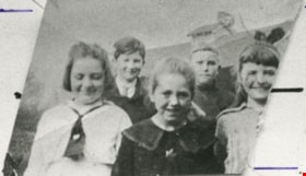
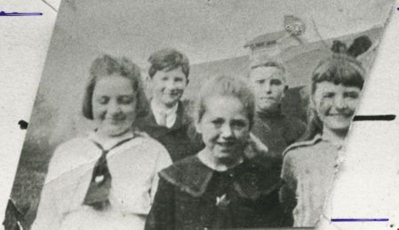
Douglas Road School class leaders
https://search.heritageburnaby.ca/link/archivedescription35157
- Repository
- City of Burnaby Archives
- Date
- 1922 (date of original), copied 1986
- Collection/Fonds
- Burnaby Historical Society fonds
- Description Level
- Item
- Physical Description
- 1 photograph : b&w ; 12.7 x 17.8 cm print
- Scope and Content
- Photograph of class leaders at Douglas Road School. Back: Billy Mathers and Teddy Norman (son of school janitor). Front: Agnes Angus, Frances Waplington and Rosalie "Rolie" Moore.
- Repository
- City of Burnaby Archives
- Date
- 1922 (date of original), copied 1986
- Collection/Fonds
- Burnaby Historical Society fonds
- Subseries
- Pioneer Tales subseries
- Physical Description
- 1 photograph : b&w ; 12.7 x 17.8 cm print
- Description Level
- Item
- Record No.
- 204-014
- Access Restriction
- No restrictions
- Reproduction Restriction
- No known restrictions
- Accession Number
- BHS1988-03
- Scope and Content
- Photograph of class leaders at Douglas Road School. Back: Billy Mathers and Teddy Norman (son of school janitor). Front: Agnes Angus, Frances Waplington and Rosalie "Rolie" Moore.
- Names
- Angus, Agnes
- Douglas Road School
- Mathers, Billy
- Pierce, Rosalie "Rolie" Moore Barrett
- Norman, Teddy
- Fleming, Frances Waplington
- Media Type
- Photograph
- Notes
- Title based on contents of photograph
- Geographic Access
- Canada Way
- Street Address
- 4861 Canada Way
- Historic Neighbourhood
- Burnaby Lake (Historic Neighbourhood)
- Planning Study Area
- Douglas-Gilpin Area
Images
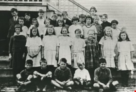
Douglas Road School Class
https://search.heritageburnaby.ca/link/archivedescription35760
- Repository
- City of Burnaby Archives
- Date
- 1922 (date of original), copied 1986
- Collection/Fonds
- Burnaby Historical Society fonds
- Description Level
- Item
- Physical Description
- 1 photograph : b&w ; 12.7 x 17.8 cm print
- Scope and Content
- Photograph of a Douglas Road School, mixed grade class. Identified: (back row, left to right) Wilbur Reid, Chuck Bowy, Herbert McConnell, George Tyre, Alistair Westcott, Monty Moore, John Waplington, and Joe Hirst. (Third row, left to right) Florence Cowan, Margaret Scott, Jean Woods, Ruby Boucher,…
- Repository
- City of Burnaby Archives
- Date
- 1922 (date of original), copied 1986
- Collection/Fonds
- Burnaby Historical Society fonds
- Subseries
- Pioneer Tales subseries
- Physical Description
- 1 photograph : b&w ; 12.7 x 17.8 cm print
- Description Level
- Item
- Record No.
- 204-618
- Access Restriction
- No restrictions
- Reproduction Restriction
- No known restrictions
- Accession Number
- BHS1988-03
- Scope and Content
- Photograph of a Douglas Road School, mixed grade class. Identified: (back row, left to right) Wilbur Reid, Chuck Bowy, Herbert McConnell, George Tyre, Alistair Westcott, Monty Moore, John Waplington, and Joe Hirst. (Third row, left to right) Florence Cowan, Margaret Scott, Jean Woods, Ruby Boucher, Vivien. Three Pontifex children, Albert Dawkins, and Eileen Mathers are also in the picture. The teacher (behind John) is Elsie Rummel (later McMurray).
- Subjects
- Occupations - Teachers
- Names
- Boucher, Ruby
- Bowy, Chuck
- Cowan, Florence
- Dawkins, Albert
- Douglas Road School
- Hirst, Joe
- Mathers, Eileen
- McConnell, Herbert
- Moore, A.G. "Al"
- Moore, Montague Hutchings "Monty"
- Reid, Wilbur
- Rummel, Miss
- Scott, Margaret
- Tyre, George
- Waplington, John
- Westcott, Alistair
- Woods, Jean
- McMurray, Elsie Rummel
- Media Type
- Photograph
- Notes
- Title based on contents of photograph
- Street Address
- 4861 Canada Way
- Historic Neighbourhood
- Burnaby Lake (Historic Neighbourhood)
- Planning Study Area
- Douglas-Gilpin Area
Images

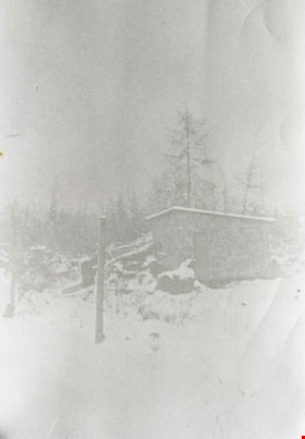
Boberg family home
https://search.heritageburnaby.ca/link/archivedescription35771
- Repository
- City of Burnaby Archives
- Date
- 1922 (date of original), copied 1986
- Collection/Fonds
- Burnaby Historical Society fonds
- Description Level
- Item
- Physical Description
- 1 photograph : b&w ; 12.7 x 17.8 cm print
- Scope and Content
- Photograph of the first Boberg family home after a heavy snowfall, on Douglas Road in the Still Creek lowlands where the creek flows into Burnaby Lake. The Bobergs moved here in 1920.
- Repository
- City of Burnaby Archives
- Date
- 1922 (date of original), copied 1986
- Collection/Fonds
- Burnaby Historical Society fonds
- Subseries
- Pioneer Tales subseries
- Physical Description
- 1 photograph : b&w ; 12.7 x 17.8 cm print
- Description Level
- Item
- Record No.
- 204-629
- Access Restriction
- No restrictions
- Reproduction Restriction
- No known restrictions
- Accession Number
- BHS1988-03
- Scope and Content
- Photograph of the first Boberg family home after a heavy snowfall, on Douglas Road in the Still Creek lowlands where the creek flows into Burnaby Lake. The Bobergs moved here in 1920.
- Media Type
- Photograph
- Notes
- Title based on contents of photograph
- Historic Neighbourhood
- Burnaby Lake (Historic Neighbourhood)
- Planning Study Area
- Ardingley-Sprott Area
Images

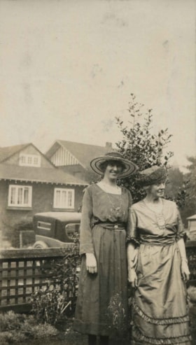
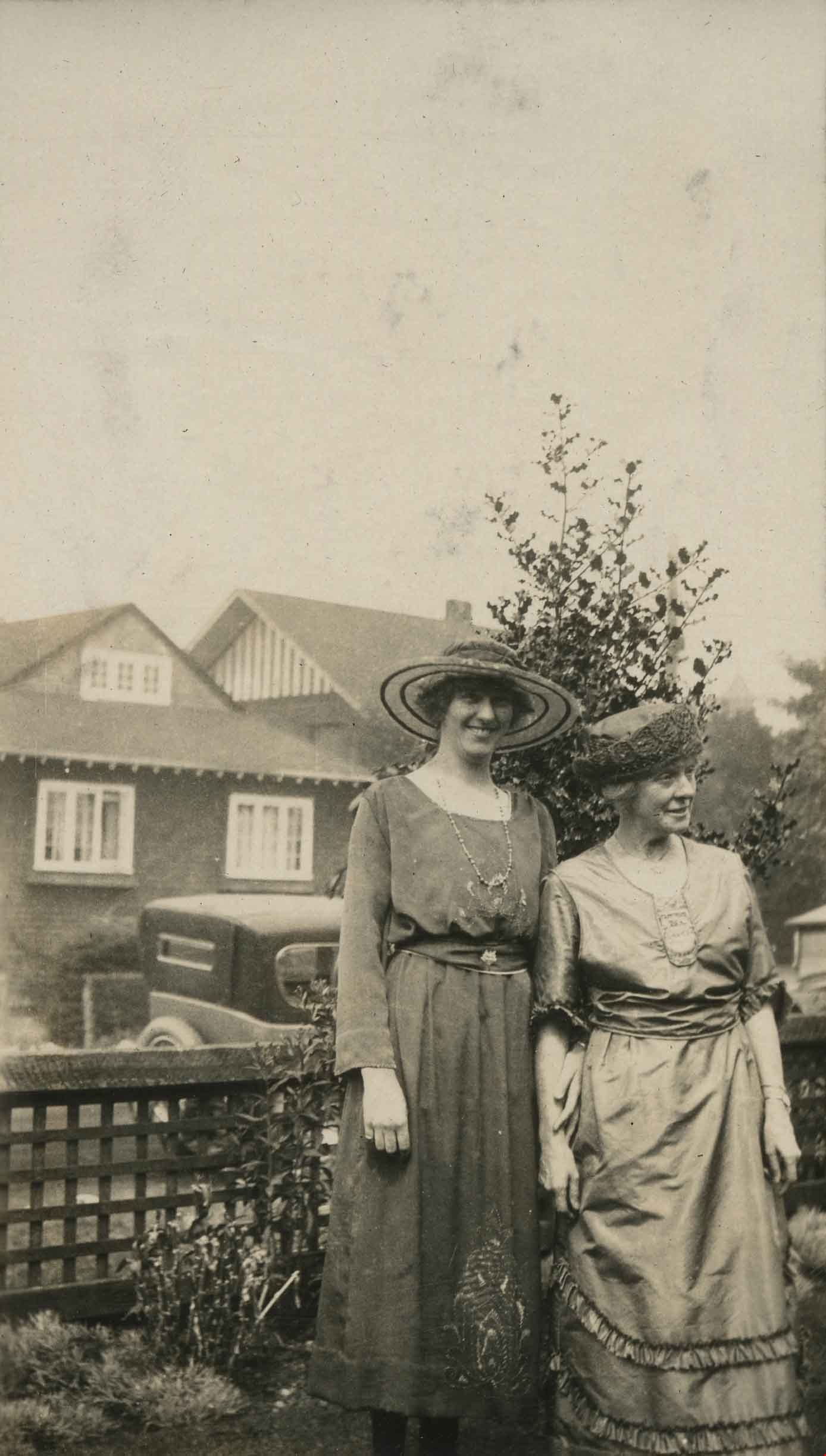
The bride and her mother
https://search.heritageburnaby.ca/link/archivedescription39281
- Repository
- City of Burnaby Archives
- Date
- August 7, 1922
- Collection/Fonds
- Peers Family and Hill Family fonds
- Description Level
- Item
- Physical Description
- 1 photograph : b&w ; 6 x 10.5 cm on page 24.5 x 32.5 cm (pasted in album)
- Scope and Content
- Photograph of Florence Hart (left) and her mother, Alice Hart (right) on Florence's wedding day. Florence was the daughter of Frederick J. Hart and she married Harold Godwin. The picture was taken on the grounds of the Hart House.
- Repository
- City of Burnaby Archives
- Date
- August 7, 1922
- Collection/Fonds
- Peers Family and Hill Family fonds
- Physical Description
- 1 photograph : b&w ; 6 x 10.5 cm on page 24.5 x 32.5 cm (pasted in album)
- Description Level
- Item
- Record No.
- 477-600
- Access Restriction
- No restrictions
- Reproduction Restriction
- No known restrictions
- Accession Number
- 2007-12
- Scope and Content
- Photograph of Florence Hart (left) and her mother, Alice Hart (right) on Florence's wedding day. Florence was the daughter of Frederick J. Hart and she married Harold Godwin. The picture was taken on the grounds of the Hart House.
- Subjects
- Ceremonies - Weddings
- Media Type
- Photograph
- Notes
- Title based on caption accompanying photograph
- Geographic Access
- Deer Lake Avenue
- Street Address
- 6664 Deer Lake Avenue
- Historic Neighbourhood
- Burnaby Lake (Historic Neighbourhood)
- Planning Study Area
- Morley-Buckingham Area
Images