Narrow Results By

Ardingley-Sprott Neighbourhood
https://search.heritageburnaby.ca/link/landmark797
- Repository
- Burnaby Heritage Planning
- Associated Dates
- 1955-2008
- Heritage Value
- The Ardingley-Sprott Neighbourhood is primarily non-residential and developed in the 1970s west of the Burnaby Lake park area. It grew to include a large recreational component in the form of the Burnaby Lake Sports Complex and playing fields.
- Historic Neighbourhood
- Burnaby Lake (Historic Neighbourhood)
- Planning Study Area
- Ardingley-Sprott Area
Images


Big Bend Neighbourhood
https://search.heritageburnaby.ca/link/landmark840
- Repository
- Burnaby Heritage Planning
- Associated Dates
- 1955-2008
- Heritage Value
- The Big Bend Neighbourhood in Burnaby maintained its status as an important agricultural area in the City in the years following 1955 and it also solidified its role as a prime industrial and commercial district. In 1972, the Big Bend Development Plan was adopted by Council and soon thereafter, approximately 620 acres of land were incorporated into the Agricultural Land Reserve. These lands have been set aside for agricultural and limited recreation purposes. By the 2000s, 160 acres of land were considered highly productive agricultural areas, and over 400 acres of land had been secured as parkland, including the Fraser Foreshore Park. The area also developed large commercial and industrial districts including those at Marine Way/Boundary, the Glenlyon Estates, Riverfront Business Park, Burnaby Business Park, and Glenwood Industrial Estates.
- Historic Neighbourhood
- Fraser Arm (Historic Neighbourhood)
- Planning Study Area
- Big Bend Area
Images


Brentwood Neighbourhood
https://search.heritageburnaby.ca/link/landmark780
- Repository
- Burnaby Heritage Planning
- Associated Dates
- 1955-2008
- Heritage Value
- Between 1955 and 2001, the Brentwood Neighbourhood developed into one of Burnaby's four official Town Centres. The Brentwood Town Centre serves the north-west sector of the Municipality, providing facilities such as commercial developments - of which the Brentwood Mall is the most significant. Under Burnaby's Residential Development Framework adopted by Council in 1981, the Town Centre also incorporated a full range of multi-housing types and forms in close relationship with their commercial facilities. In 1996, the City adopted the Brentwood Town Centre Development Plant to solidify the area as a focus of higher-density and higher-intensity residential and commercial opportunities, public transit and supporting leisure facilities.
- Planning Study Area
- Brentwood Area
Images

Burnaby Clef Society papers
https://search.heritageburnaby.ca/link/archivedescription57816
- Repository
- City of Burnaby Archives
- Date
- 1949-1999
- Collection/Fonds
- Burnaby Historical Society fonds
- Description Level
- File
- Physical Description
- 1 file of textual records and 4 photographs : col.
- Scope and Content
- File consists of papers pertaining to the Burnaby Clef Society, including newspaper clippings, programmes, correspondence, and the Burnaby Clef Society's constitution.
- Repository
- City of Burnaby Archives
- Date
- 1949-1999
- Collection/Fonds
- Burnaby Historical Society fonds
- Subseries
- Burnaby Clef Society subseries
- Physical Description
- 1 file of textual records and 4 photographs : col.
- Description Level
- File
- Record No.
- MSS020-009
- Accession Number
- BHS2007-04
- Scope and Content
- File consists of papers pertaining to the Burnaby Clef Society, including newspaper clippings, programmes, correspondence, and the Burnaby Clef Society's constitution.
- Media Type
- Textual Record
- Photograph
- Notes
- Title based on contents of file
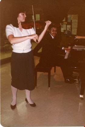
- Note in black ink on verso of photograph 142-001 reads: "Jamie Parker in '82 at Cofed. House Albert St. in Burnaby"
- Note in blue ink on verso of photograph 142-001 reads: "Violinist ______?"
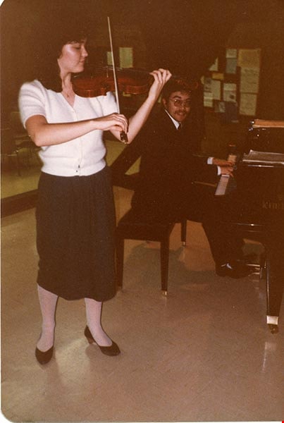
- Note in black ink on verso of photograph 142-003 reads: "Jamie Parker in recital"
Images
Burnaby Clef Society papers
https://search.heritageburnaby.ca/link/archivedescription57837
- Repository
- City of Burnaby Archives
- Date
- 1998-2000
- Collection/Fonds
- Burnaby Historical Society fonds
- Description Level
- File
- Physical Description
- 2 files of textual records and 33 photographs : col. ; 10 cm x 15 cm
- Scope and Content
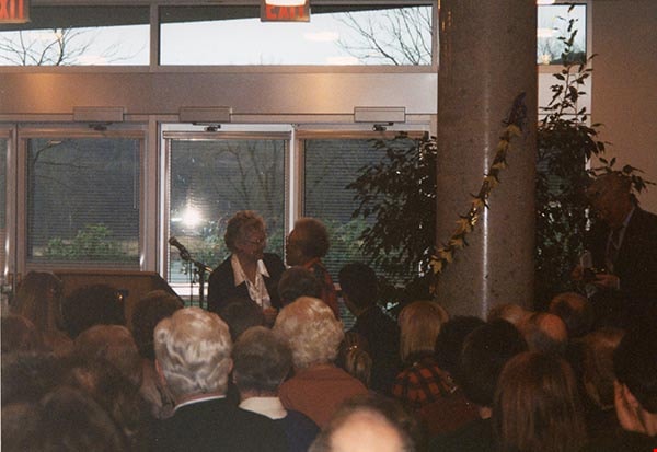
- File contains papers pertaining to the Burnaby Clef Society, including financial records, contracts, minutes, thank you cards, and other correspondence. File also contains photographs of award recipients, musicians, and concert and Christmas party attendees.
- Repository
- City of Burnaby Archives
- Date
- 1998-2000
- Collection/Fonds
- Burnaby Historical Society fonds
- Subseries
- Burnaby Clef Society subseries
- Physical Description
- 2 files of textual records and 33 photographs : col. ; 10 cm x 15 cm
- Description Level
- File
- Record No.
- MSS020-030
- Reproduction Restriction
- May be restricted by third party rights
- Accession Number
- BHS2007-04
- Scope and Content
- File contains papers pertaining to the Burnaby Clef Society, including financial records, contracts, minutes, thank you cards, and other correspondence. File also contains photographs of award recipients, musicians, and concert and Christmas party attendees.
- Media Type
- Textual Record
- Photograph
- Notes
- Title based on contents of file
- Photographs 142-003-27:142-003-33 originally housed in an enveloped labelled "Proway Printers"
Images

Burnaby Clef Society papers
https://search.heritageburnaby.ca/link/archivedescription57838
- Repository
- City of Burnaby Archives
- Date
- 1998-2000
- Collection/Fonds
- Burnaby Historical Society fonds
- Description Level
- File
- Physical Description
- 1 file of textual records and 4 photographs : col. ; 10 cm x 15 cm
- Scope and Content
- File contains papers pertaining to the Burnaby Clef Society, including financial records, contracts, scholarship recipient records and other correspondence. File also includes photographs of concert attendees and musicians.
- Repository
- City of Burnaby Archives
- Date
- 1998-2000
- Collection/Fonds
- Burnaby Historical Society fonds
- Subseries
- Burnaby Clef Society subseries
- Physical Description
- 1 file of textual records and 4 photographs : col. ; 10 cm x 15 cm
- Description Level
- File
- Record No.
- MSS020-031
- Reproduction Restriction
- May be restricted by third party rights
- Accession Number
- BHS2007-04
- Scope and Content
- File contains papers pertaining to the Burnaby Clef Society, including financial records, contracts, scholarship recipient records and other correspondence. File also includes photographs of concert attendees and musicians.
- Media Type
- Textual Record
- Photograph
- Notes
- Title based on contents of file
Images


Burnaby Clef Society papers
https://search.heritageburnaby.ca/link/archivedescription57844
- Repository
- City of Burnaby Archives
- Date
- 1996-1998
- Collection/Fonds
- Burnaby Historical Society fonds
- Description Level
- File
- Physical Description
- 1 file of textual records and 10 photographs : col. ; 10 cm x 15 cm
- Scope and Content
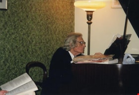
- File contains posters, programmes and correspondence pertaining to the Burnaby Clef Society. File also contains photographs of the piano students of Edward J. Parker Studio in recital on February 18, 1996.
- Repository
- City of Burnaby Archives
- Date
- 1996-1998
- Collection/Fonds
- Burnaby Historical Society fonds
- Subseries
- Burnaby Clef Society subseries
- Physical Description
- 1 file of textual records and 10 photographs : col. ; 10 cm x 15 cm
- Description Level
- File
- Record No.
- MSS020-037
- Accession Number
- BHS2007-04
- Scope and Content
- File contains posters, programmes and correspondence pertaining to the Burnaby Clef Society. File also contains photographs of the piano students of Edward J. Parker Studio in recital on February 18, 1996.
- Media Type
- Textual Record
- Photograph
- Notes
- Title based on contents of file
Images
Burnaby Clef Society press information
https://search.heritageburnaby.ca/link/archivedescription57840
- Repository
- City of Burnaby Archives
- Date
- 1992-2000
- Collection/Fonds
- Burnaby Historical Society fonds
- Description Level
- File
- Physical Description
- 1 file of textual records and 2 photographs : col. ; 10 cm x 15 cm
- Scope and Content
- File contains two folders with papers pertaining to press information pertaining to the Burnaby Clef Society, including contact information, photocopied newspaper articles and correspondence.
- Repository
- City of Burnaby Archives
- Date
- 1992-2000
- Collection/Fonds
- Burnaby Historical Society fonds
- Subseries
- Burnaby Clef Society subseries
- Physical Description
- 1 file of textual records and 2 photographs : col. ; 10 cm x 15 cm
- Description Level
- File
- Record No.
- MSS020-033
- Accession Number
- BHS2007-04
- Scope and Content
- File contains two folders with papers pertaining to press information pertaining to the Burnaby Clef Society, including contact information, photocopied newspaper articles and correspondence.
- Media Type
- Textual Record
- Photograph
- Notes
- Title based on contents of file
Images

Burnaby Clef Society promotional material
https://search.heritageburnaby.ca/link/archivedescription57841
- Repository
- City of Burnaby Archives
- Date
- 1998-1999
- Collection/Fonds
- Burnaby Historical Society fonds
- Description Level
- File
- Physical Description
- 1 file of textual records and 48 photographs : col.
- Scope and Content
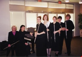
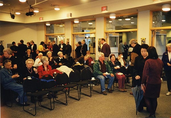
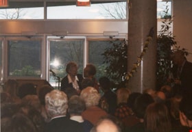
- File contains papers pertaining to the Burnaby Clef Society, including correspondence and thank you cards, newspaper articles, programmes and photographs of Clef society musicians, recitals, and receptions.
- Repository
- City of Burnaby Archives
- Date
- 1998-1999
- Collection/Fonds
- Burnaby Historical Society fonds
- Subseries
- Burnaby Clef Society subseries
- Physical Description
- 1 file of textual records and 48 photographs : col.
- Description Level
- File
- Record No.
- MSS020-034
- Accession Number
- BHS2007-04
- Scope and Content
- File contains papers pertaining to the Burnaby Clef Society, including correspondence and thank you cards, newspaper articles, programmes and photographs of Clef society musicians, recitals, and receptions.
- Media Type
- Textual Record
- Photograph
- Notes
- Title based on contents of file
- Photograph 142-006-2 by Lane Photographics Limited
Images
Burnaby Clef Society promotional material
https://search.heritageburnaby.ca/link/archivedescription57843
- Repository
- City of Burnaby Archives
- Date
- 1995-1998
- Collection/Fonds
- Burnaby Historical Society fonds
- Description Level
- File
- Physical Description
- 1 file of textual records and 49 photographs
- Scope and Content
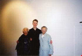
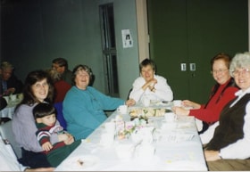
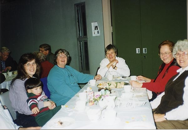
- File contains promotional materials and correspondence pertaining to the Burnaby Clef Society. File also contains photographs of the 1998 Fall Tea event, 1998 Christmas party, and various Clef musicians,
- Repository
- City of Burnaby Archives
- Date
- 1995-1998
- Collection/Fonds
- Burnaby Historical Society fonds
- Subseries
- Burnaby Clef Society subseries
- Physical Description
- 1 file of textual records and 49 photographs
- Description Level
- File
- Record No.
- MSS020-036
- Accession Number
- BHS2007-04
- Scope and Content
- File contains promotional materials and correspondence pertaining to the Burnaby Clef Society. File also contains photographs of the 1998 Fall Tea event, 1998 Christmas party, and various Clef musicians,
- Media Type
- Textual Record
- Photograph
- Notes
- Photographs 142-007-1:142-007-33 originally housed in an envelope labelled: "Fall Tea 1998"
- See poster dated Sunday November 29, 1998 within file to identify musicians in photographs 142-007-34:142-007-37
- Photographs 142-007-38:142-007-46 originally housed in an envelope labelled: "Xmas party 98"
Images

Burnaby Heights Neighbourhood
https://search.heritageburnaby.ca/link/landmark776
- Repository
- Burnaby Heritage Planning
- Associated Dates
- 1955-2008
- Heritage Value
- Up until the 1970s, this neighbourhood was known as Vancouver Heights. When a new park was created during that decade and named "Burnaby Heights Park," the name was gradually adopted by newcomers to the area. Today, you will hear residents refer to their neighbourhood as Burnaby Heights, Vancouver Heights, or just "The Heights." Throughout the 1960s and 1970s, the commercial district in this neighbourhood continued to grow and a Retail Merchants Association was formed which later became known as the Heights Merchants Association. The neighbourhood still retains a residential neighbourhood characteristic with an increasing number of apartment buildings and multi-family units being built over the past 20 years.
- Historic Neighbourhood
- Vancouver Heights (Historic Neighbourhood)
- Planning Study Area
- Burnaby Heights Area
Images


Burnaby Lake Neighbourhood
https://search.heritageburnaby.ca/link/landmark821
- Repository
- Burnaby Heritage Planning
- Associated Dates
- 1955-2008
- Heritage Value
- In 1966 Burnaby Lake was identified as a key potential regional park in the GVRD ’s Regional Park Plan for the Lower Mainland. The lake was to be developed for nature study, strolling, trail riding, canoeing, sightseeing and picnicking. It was formally recognized as a regional nature park in 1979, at which time the GVRD assumed management of the park through a lease agreement with the City of Burnaby. In 1993 Burnaby Lake was selected by the City of Burnaby to be included in Greater Vancouver ’s Green Zone, and was identified as a key component of the GVRD ’s Park and Outdoor Recreation System (PORS) for the Burrard/Peninsula/Richmond sector, which includes Burnaby, Vancouver, New Westminster, and Richmond.
- Historic Neighbourhood
- Burnaby Lake (Historic Neighbourhood)
- Planning Study Area
- Burnaby Lake Area
Images


Burnaby Mountain Neighbourhood
https://search.heritageburnaby.ca/link/landmark792
- Repository
- Burnaby Heritage Planning
- Associated Dates
- 1955-2008
- Heritage Value
- Burnaby Mountain had been dedicated as park in 1942, however the original park boundaries were reconsidered in 1952 with the development of the Trans Mountain Pipeline. Although the boundaries were adjusted to accommodate this project, significant conservation and park lands were left untouched. When, in 1962, the government of British Columbia determined the need for additional post-secondary facilities, Burnaby Mountain was chosen as the site for the new Simon Fraser University which opened in 1965. As early as 1964, the idea of establishing a townsite around the university had been discussed by Burnaby, but it was not until the mid-1990s that the idea came to fruition and by the early 2000s, a new housing development know as the UniverCity took shape on the mountain adjacent to the university.
- Historic Neighbourhood
- Barnet (Historic Neighbourhood)
- Planning Study Area
- Burnaby Mountain Area
Images


Burnaby South Secondary School and The B.C. Provincial School for the Deaf
https://search.heritageburnaby.ca/link/landmark844
- Repository
- Burnaby Heritage Planning
- Geographic Access
- Rumble Street
- Associated Dates
- 1993
- Heritage Value
- The original Burnaby South High School was replaced in 1993 and the new Burnaby South Secondary School and BC Provincial School for the Deaf was built at this location. This school was built with the latest technology and modern equipment to ensure it was fully accessible and offers integrated academic, social and recreational activities for its students.
- Historic Neighbourhood
- Alta Vista (Historic Neighbourhood)
- Planning Study Area
- Clinton-Glenwood Area
- Street Address
- 5455 Rumble Street
- Street View URL
- Google Maps Street View
Images


Cameron Neighbourhood
https://search.heritageburnaby.ca/link/landmark824
- Repository
- Burnaby Heritage Planning
- Associated Dates
- 1955-2008
- Heritage Value
- The Cameron Neighbourhood falls within the Lougheed Town Centre area - one of four Town Centres in Burnaby. The Cameron Neighbourhood - while containing significant high-density residential components - is also home to the Town Centre's office and commercial core. The Lougheed Mall is situated in this neighbourhood, which is served by the Millennium Line SkyTrain.
- Historic Neighbourhood
- Burquitlam (Historic Neighbourhood)
- Planning Study Area
- Cameron Area
Images


Capitol Hill Neighbourhood
https://search.heritageburnaby.ca/link/landmark781
- Repository
- Burnaby Heritage Planning
- Associated Dates
- 1955-2008
- Heritage Value
- The Capitol Hill Neighbourhood remained a primarily residential neighbourhood after the population boom of the 1950s and 1960s. The commercial focus remained the Hastings Street corridor, while the City of Burnaby moved to protect a conservation area on the north side of Capitol Hill and dedicated parkland throughout the 1970s and 1980s.
- Historic Neighbourhood
- Capitol Hill (Historic Neighbourhood)
- Planning Study Area
- Capitol Hill Area
Images


Cariboo-Armstrong Neighbourhood
https://search.heritageburnaby.ca/link/landmark825
- Repository
- Burnaby Heritage Planning
- Associated Dates
- 1955-2008
- Heritage Value
- The Cariboo-Armstrong Neighbourhood was mainly subdivided in the 1950s during the major building boom in Burnaby throughout the post-war years. Considered a primarily residential area, the neighbourhood has quick and convenient access to major highways and roads as well as being bordered to the north by the George Derby Conservation area.
- Historic Neighbourhood
- East Burnaby (Historic Neighbourhood)
- Planning Study Area
- Cariboo-Armstrong Area
Images


Cascade-Schou Neighbourhood
https://search.heritageburnaby.ca/link/landmark798
- Repository
- Burnaby Heritage Planning
- Associated Dates
- 1955-2008
- Heritage Value
- The Cascade-Schou neighbourhood, sometimes referred to as the Cascade Heights area, includes both the Burnaby General Hospital site, the Discovery Park facilities and is bordered on its eastern boundary by BCIT. Despite these health and science developments, the neighbourhood can still be considered to be a residential community. The housing stock includes single family homes as well as newer multi-family residences that developed throughout the 1980s and 1990s.
- Historic Neighbourhood
- Broadview (Historic Neighbourhood)
- Planning Study Area
- Cascade-Schou Area
Images


Clinton-Glenwood Neighbourhood
https://search.heritageburnaby.ca/link/landmark841
- Repository
- Burnaby Heritage Planning
- Associated Dates
- 1955-2008
- Heritage Value
- The primarily single-family subdivision and development in the Clinton-Glenwood Neighbourhood occurred during the building boom of the 1950s. Later development fell under the guidelines established in the Royal Oak Community Plan (adopted in 1999) and resulted in an increase in the number of multi-family units.
- Historic Neighbourhood
- Alta Vista (Historic Neighbourhood)
- Planning Study Area
- Clinton-Glenwood Area
Images


Dawson-Delta Neighbourhood
https://search.heritageburnaby.ca/link/landmark779
- Repository
- Burnaby Heritage Planning
- Associated Dates
- 1955-2008
- Heritage Value
- The Dawson-Delta neighbourhood in Burnaby developed into one of Burnaby's numerous industrial areas after 1955. The Eastbrook Executive Business Park opened in the 1970s and the Willingdon Green Business Centre includes buildings from the 1980s to the 2000s. Convenient access to major roads and highways fostered these developments which remain zoned for industrial uses to this day.
- Planning Study Area
- Dawson-Delta Area
Images
