Narrow Results By
Oakalla Prison Farm
https://search.heritageburnaby.ca/link/museumdescription18849
- Repository
- Burnaby Village Museum
- Date
- [2019]
- Collection/Fonds
- Burnaby Village Museum fonds
- Description Level
- Item
- Physical Description
- 1 painting (tiff)
- Scope and Content
- Item consists of a digital copy of a painting of a view of Oakalla Prison farm with Deer Lake in the background. The original painting was created by Burnaby Village Museum preparator Carly Bowman as part of an exhibit.
- Repository
- Burnaby Village Museum
- Collection/Fonds
- Burnaby Village Museum fonds
- Series
- Museum exhibits series
- Subseries
- Museum materials for exhibits subseries
- Description Level
- Item
- Physical Description
- 1 painting (tiff)
- Scope and Content
- Item consists of a digital copy of a painting of a view of Oakalla Prison farm with Deer Lake in the background. The original painting was created by Burnaby Village Museum preparator Carly Bowman as part of an exhibit.
- Creator
- Bowman, Carly
- Names
- Oakalla Prison Farm
- Accession Code
- BV019.36.1
- Date
- [2019]
- Media Type
- Graphic Material
- Notes
- Title based on contents of item
Images
BFG bag prop concept plan
https://search.heritageburnaby.ca/link/museumdescription19155
- Repository
- Burnaby Village Museum
- Date
- [2015]
- Collection/Fonds
- Hipman "Jimmy" Chow and Donna Polos fonds
- Description Level
- Item
- Physical Description
- 1 photograph : col. laser print ; 28 x 43.5 cm with annotations
- Scope and Content
- Item consists of a concept plan created by concept illustrator Brian Cunningham for a leather bag to be used as a prop in the film "The BFG". Ovelay of tape with actual measurements on surface of print for the creation of the leather bag. Concept plan was used by property master, Jimmy Chow to crea…
- Repository
- Burnaby Village Museum
- Collection/Fonds
- Hipman "Jimmy" Chow and Donna Polos fonds
- Description Level
- Item
- Physical Description
- 1 photograph : col. laser print ; 28 x 43.5 cm with annotations
- Material Details
- Green masking tape and white duct tape adhered to surface of print
- Handwritten measurements in black ink written on surface of tape
- Scope and Content
- Item consists of a concept plan created by concept illustrator Brian Cunningham for a leather bag to be used as a prop in the film "The BFG". Ovelay of tape with actual measurements on surface of print for the creation of the leather bag. Concept plan was used by property master, Jimmy Chow to create the bag as a prop. The film was directed by Steven Spielberg and released in 2016.
- Creator
- Cunningham, Brian
- Subjects
- Industries - Film
- Responsibility
- Beach, Chris
- Accession Code
- BV022.21.100
- Access Restriction
- No restrictions
- Reproduction Restriction
- May be restricted by third party rights
- Date
- [2015]
- Media Type
- Graphic Material
- Notes
- Title based on contents of item
- Bottom right corner includes identifiers reading: "? / ...BFG 3 BAG_PROP CONCEPT / ... PROP BFG BAG CONCEPT / .../ Scale / 15:00:00 [sic] / ? / C_BEACH /? / B_CUNNINGHAM / ? / NONE [sic] / ? / PRP_C05 / ..."
- Drawing identifies, Brian Cunningham as concept illustrator and Chris Beach as [designer] (Art Director)
Images
Comprehensive Development Plans - Bylaw No. 10990, Rezoning Reference # 99-28 (9100 Glenlyon Parkway)
https://search.heritageburnaby.ca/link/archivedescription84455
- Repository
- City of Burnaby Archives
- Date
- 1999
- Collection/Fonds
- City Council and Office of the City Clerk fonds
- Description Level
- File
- Physical Description
- Architectural drawing
- Repository
- City of Burnaby Archives
- Date
- 1999
- Collection/Fonds
- City Council and Office of the City Clerk fonds
- Series
- Bylaws series
- Physical Description
- Architectural drawing
- Description Level
- File
- Record No.
- 55798
- Accession Number
- 2013-28
- Media Type
- Architectural Drawing
Images
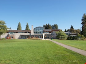
Shadbolt Centre for the Arts
https://search.heritageburnaby.ca/link/landmark820
- Repository
- Burnaby Heritage Planning
- Geographic Access
- Deer Lake Avenue
- Associated Dates
- 1995
- Heritage Value
- The Shadbolt Centre for the Arts opened in 1995. The Shadbolt Centre was named after two Burnaby residents who dedicated a lifetime of support and cultivation of the arts locally, nationally and internationally. Doris and Jack Shadbolt resided in Burnaby for over 50 years until Jack's death in November 1998. Doris Shadbolt spent her life's work bringing the artist and the audience closer together through her writing and curatorial work. Jack Shadbolt was an internationally recognized Canadian painter. He was also an author and both received many awards including the Order of Canada. In keeping with the Shadbolts' generosity the arts, Jack Shadbolt donated two of his paintings to the Centre for permanent display.
- Historic Neighbourhood
- Burnaby Lake (Historic Neighbourhood)
- Planning Study Area
- Douglas-Gilpin Area
- Street Address
- 6450 Deer Lake Avenue
- Street View URL
- Google Maps Street View
Images
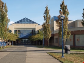
Burnaby South Secondary School and The B.C. Provincial School for the Deaf
https://search.heritageburnaby.ca/link/landmark844
- Repository
- Burnaby Heritage Planning
- Geographic Access
- Rumble Street
- Associated Dates
- 1993
- Heritage Value
- The original Burnaby South High School was replaced in 1993 and the new Burnaby South Secondary School and BC Provincial School for the Deaf was built at this location. This school was built with the latest technology and modern equipment to ensure it was fully accessible and offers integrated academic, social and recreational activities for its students.
- Historic Neighbourhood
- Alta Vista (Historic Neighbourhood)
- Planning Study Area
- Clinton-Glenwood Area
- Street Address
- 5455 Rumble Street
- Street View URL
- Google Maps Street View
Images
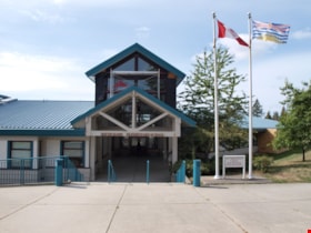
South Slope Elementary School & The B.C. Provincial School for the Deaf
https://search.heritageburnaby.ca/link/landmark843
- Repository
- Burnaby Heritage Planning
- Geographic Access
- Watling Street
- Associated Dates
- 1992
- Heritage Value
- South Slope/B.C. School for the Deaf opened in 1992 and is one of the newer elementary schools in the City. The 2009 School Growth Plan notes that South Slope/BC School for the Deaf replaced the former Jericho Hill School for the Deaf in Vancouver.
- Historic Neighbourhood
- Alta Vista (Historic Neighbourhood)
- Planning Study Area
- Sussex-Nelson Area
- Street Address
- 4446 Watling Street
- Street View URL
- Google Maps Street View
Images
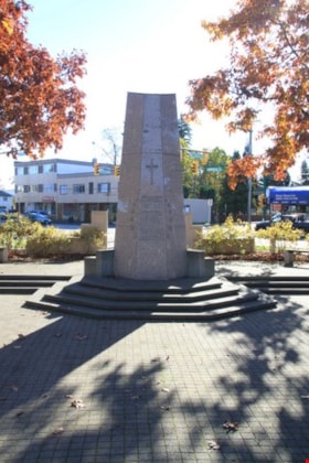
South Burnaby Cenotaph
https://search.heritageburnaby.ca/link/landmark860
- Repository
- Burnaby Heritage Planning
- Description
- The South Burnaby Cenotaph is located in Bonsor Park at the corner of Nelson Avenue and Imperial Street. The cenotaph commemorates those lost in the First World War, Second World War and the Korean War.
- Associated Dates
- 1988
- Other Names
- Bonsor Park Cenotaph
- Street View URL
- Google Maps Street View
- Repository
- Burnaby Heritage Planning
- Other Names
- Bonsor Park Cenotaph
- Geographic Access
- Nelson Avenue
- Associated Dates
- 1988
- Description
- The South Burnaby Cenotaph is located in Bonsor Park at the corner of Nelson Avenue and Imperial Street. The cenotaph commemorates those lost in the First World War, Second World War and the Korean War.
- Historic Neighbourhood
- Central Park (Historic Neighbourhood)
- Planning Study Area
- Marlborough Area
- Community
- Burnaby
- Cadastral Identifier
- P.I.D. No. 027-719-375
- Boundaries
- The property (Bonsor Park) is comprised of a single municipally-owned property located at 6749 Nelson Avenue.
- Area
- 3570.00
- Contributing Resource
- Landscape Feature
- Structure
- Ownership
- Public (local)
- Street Address
- 6749 Nelson Avenue
- Street View URL
- Google Maps Street View
Images
Landscape plan for front yard of Mawhinney house
https://search.heritageburnaby.ca/link/museumdescription15582
- Repository
- Burnaby Village Museum
- Date
- [between 1988 and 1990]
- Collection/Fonds
- Reverend Edward S. Gale fonds
- Description Level
- Item
- Physical Description
- 1 architectural drawing : pencil on parchment ; 30 x 56 cm
- Scope and Content
- Item consists of a landscape drawing identifying the layout and types of trees and bushes to be planted on the property of the Mervin Mawhinney house located at 7667 Burris Street in Burnaby while it was owned by Reverend Edward S. Gale. Grounds on the site were re-landscaped by Reverend Edward S. …
- Repository
- Burnaby Village Museum
- Collection/Fonds
- Reverend Edward S. Gale fonds
- Description Level
- Item
- Physical Description
- 1 architectural drawing : pencil on parchment ; 30 x 56 cm
- Scope and Content
- Item consists of a landscape drawing identifying the layout and types of trees and bushes to be planted on the property of the Mervin Mawhinney house located at 7667 Burris Street in Burnaby while it was owned by Reverend Edward S. Gale. Grounds on the site were re-landscaped by Reverend Edward S. Gale between 1988 and 1990..
- Geographic Access
- Burris Street
- Street Address
- 7667 Burris Street
- Accession Code
- BV018.9.48
- Access Restriction
- No restrictions
- Reproduction Restriction
- May be restricted by third party rights
- Date
- [between 1988 and 1990]
- Media Type
- Architectural Drawing
- Planning Study Area
- Morley-Buckingham Area
- Scan Resolution
- 600
- Scan Date
- May 3, 2021
- Scale
- 100
- Notes
- Title based on contents of photograph
Images
Landscape plan for front yard of Mawhinney house
https://search.heritageburnaby.ca/link/museumdescription15583
- Repository
- Burnaby Village Museum
- Date
- [between 1988 and 1990]
- Collection/Fonds
- Reverend Edward S. Gale fonds
- Description Level
- Item
- Physical Description
- 1 architectural drawing : blueline print with pencil ; 42.5 x 59.5 cm
- Scope and Content
- Item consists of an architectural landscape plan identifying the layout and types of trees and bushes to be planted in the front yard of the Mervin Mawhinney house located at 7667 Burris Street in Burnaby while it was owned by Reverend Edward S. Gale. Plantings identified include; Juniper, Rhodendr…
- Repository
- Burnaby Village Museum
- Collection/Fonds
- Reverend Edward S. Gale fonds
- Description Level
- Item
- Physical Description
- 1 architectural drawing : blueline print with pencil ; 42.5 x 59.5 cm
- Scope and Content
- Item consists of an architectural landscape plan identifying the layout and types of trees and bushes to be planted in the front yard of the Mervin Mawhinney house located at 7667 Burris Street in Burnaby while it was owned by Reverend Edward S. Gale. Plantings identified include; Juniper, Rhodendron, Azaleas, abelia, Rosh Rogos. Grounds on the site were re-landscaped by Reverend Edward S. Gale between 1988 and 1990.
- Geographic Access
- Burris Street
- Street Address
- 7667 Burris Street
- Accession Code
- BV018.9.49
- Access Restriction
- No restrictions
- Reproduction Restriction
- May be restricted by third party rights
- Date
- [between 1988 and 1990]
- Media Type
- Architectural Drawing
- Planning Study Area
- Morley-Buckingham Area
- Related Material
- See also BV018.9.30
- Scan Resolution
- 600
- Scan Date
- May 3, 2021
- Scale
- 100
- Notes
- Title based on contents of photograph
Images
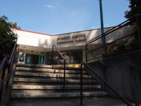
Forest Grove School
https://search.heritageburnaby.ca/link/landmark795
- Repository
- Burnaby Heritage Planning
- Geographic Access
- Forest Grove Drive
- Associated Dates
- 1986
- Heritage Value
- The Forest Grove subdivision in Burnaby was developed during the early 1980s and resulted in a rapidly growing population that required a school facility to support this "instant" community. Forest Grove Elementary was the second largest elementary school in the city when it opened and 374 pupils were recorded in its first year.
- Planning Study Area
- Lake City Area
- Street Address
- 8525 Forest Grove Drive
- Street View URL
- Google Maps Street View
Images
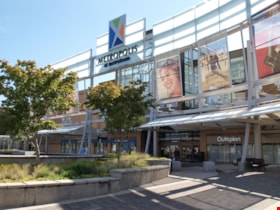
Metrotown
https://search.heritageburnaby.ca/link/landmark817
- Repository
- Burnaby Heritage Planning
- Geographic Access
- Kingsway
- Associated Dates
- 1986
- Heritage Value
- Although the idea for Metrotown was first expressed in the 1970s, the building itself opened in 1986 and was soon served by the Expo Line of the new SkyTrain system. In the ensuing twenty years, the complex developed into three distinct but adjoining malls - Metropolis at Metrotown, Metrotown Centre, and Station Square. Today, Metrotown serves as the city’s commercial and retail anchor. The mall also includes two large office towers, which by 2001 were home to the head offices for Shaw Cable and TransLink.
- Historic Neighbourhood
- Central Park (Historic Neighbourhood)
- Planning Study Area
- Maywood Area
- Street Address
- 4700 Kingsway
- Street View URL
- Google Maps Street View
Images
Burnaby Village Museum - Entrance
https://search.heritageburnaby.ca/link/museumdescription11752
- Repository
- Burnaby Village Museum
- Date
- [1985]
- Collection/Fonds
- Century Park Museum Association fonds
- Description Level
- Item
- Physical Description
- 1 drawing : b&w print hand col. (pencil crayons) on paper 46 x 58 cm ; mounted on foamcore board 71 x 58 cm
- Scope and Content
- Item consists of a presentation drawing for the proposed Burnaby Village Museum Expansion. Title at bottom of drawing "Entrance to the walkway / from the west".
- Repository
- Burnaby Village Museum
- Collection/Fonds
- Century Park Museum Association fonds
- Description Level
- Item
- Physical Description
- 1 drawing : b&w print hand col. (pencil crayons) on paper 46 x 58 cm ; mounted on foamcore board 71 x 58 cm
- Scope and Content
- Item consists of a presentation drawing for the proposed Burnaby Village Museum Expansion. Title at bottom of drawing "Entrance to the walkway / from the west".
- Names
- Burnaby Village Museum
- Accession Code
- BV019.52.88
- Access Restriction
- No restrictions
- Reproduction Restriction
- May be restricted by third party rights
- Date
- [1985]
- Media Type
- Graphic Material
- Notes
- Title based on contents of drawing
Images
Burnaby Village Museum - Inside the museum
https://search.heritageburnaby.ca/link/museumdescription11753
- Repository
- Burnaby Village Museum
- Date
- [1985]
- Collection/Fonds
- Century Park Museum Association fonds
- Description Level
- Item
- Physical Description
- 1 drawing : b&w print hand col. (pencil crayons) on paper 46 x 58 cm ; mounted on foamcore board 71 x 58 cm
- Scope and Content
- Item consists of a presentation drawing for the proposed Burnaby Village Museum Expansion. Title at bottom of drawing "Inside the museum".
- Repository
- Burnaby Village Museum
- Collection/Fonds
- Century Park Museum Association fonds
- Description Level
- Item
- Physical Description
- 1 drawing : b&w print hand col. (pencil crayons) on paper 46 x 58 cm ; mounted on foamcore board 71 x 58 cm
- Scope and Content
- Item consists of a presentation drawing for the proposed Burnaby Village Museum Expansion. Title at bottom of drawing "Inside the museum".
- Subjects
- Buildings - Civic - Museums
- Names
- Burnaby Village Museum
- Accession Code
- BV019.52.89
- Access Restriction
- No restrictions
- Reproduction Restriction
- May be restricted by third party rights
- Date
- [1985]
- Media Type
- Graphic Material
- Notes
- Title based on contents of drawing
Images
Burnaby Village Museum - Looking east towards the Adminstration complex
https://search.heritageburnaby.ca/link/museumdescription11754
- Repository
- Burnaby Village Museum
- Date
- [1985]
- Collection/Fonds
- Century Park Museum Association fonds
- Description Level
- Item
- Physical Description
- 1 drawing : b&w print hand col. (pencil crayons) on paper 46 x 58 cm ; mounted on foamcore board 71 x 58 cm
- Scope and Content
- Item consists of a presentation drawing for the proposed Burnaby Village Museum Expansion. Title at bottom of drawing "Looking east towards / the Adminstration / complex"
- Repository
- Burnaby Village Museum
- Collection/Fonds
- Century Park Museum Association fonds
- Description Level
- Item
- Physical Description
- 1 drawing : b&w print hand col. (pencil crayons) on paper 46 x 58 cm ; mounted on foamcore board 71 x 58 cm
- Scope and Content
- Item consists of a presentation drawing for the proposed Burnaby Village Museum Expansion. Title at bottom of drawing "Looking east towards / the Adminstration / complex"
- Subjects
- Buildings - Civic - Museums
- Names
- Burnaby Village Museum
- Accession Code
- BV019.52.90
- Access Restriction
- No restrictions
- Reproduction Restriction
- May be restricted by third party rights
- Date
- [1985]
- Media Type
- Graphic Material
- Notes
- Title based on contents of drawing
Images
Burnaby Village Museum - Presentation drawing
https://search.heritageburnaby.ca/link/museumdescription11755
- Repository
- Burnaby Village Museum
- Date
- [1985]
- Collection/Fonds
- Century Park Museum Association fonds
- Description Level
- Item
- Physical Description
- 1 drawing : b&w print mounted on foamcore board 48 x 75 cm
- Scope and Content
- Item consists of a presentation drawing for proposed Burnaby Village Museum Expansion. (drawing is untitled). The drawing provides an overhead view of the site.
- Repository
- Burnaby Village Museum
- Collection/Fonds
- Century Park Museum Association fonds
- Description Level
- Item
- Physical Description
- 1 drawing : b&w print mounted on foamcore board 48 x 75 cm
- Scope and Content
- Item consists of a presentation drawing for proposed Burnaby Village Museum Expansion. (drawing is untitled). The drawing provides an overhead view of the site.
- Names
- Burnaby Village Museum
- Accession Code
- BV019.52.91
- Access Restriction
- No restrictions
- Reproduction Restriction
- May be restricted by third party rights
- Date
- [1985]
- Media Type
- Architectural Drawing
- Notes
- Title based on contents of drawing
Images
Burnaby Village Museum - side street
https://search.heritageburnaby.ca/link/museumdescription17539
- Repository
- Burnaby Village Museum
- Date
- [1985]
- Collection/Fonds
- Century Park Museum Association fonds
- Description Level
- Item
- Physical Description
- 1 drawing : b&w print hand col. (pencil crayons) on paper 46 x 58 cm ; mounted on foamcore board 71 x 58 cm
- Scope and Content
- Item consists of a presentation drawing for the proposed Burnaby Village Museum Expansion. Title at bottom of drawing "Side Street". Illustration shows buildings on either side of a street with a four people walking down the centre of the road. A building on the right includes inscription on window…
- Repository
- Burnaby Village Museum
- Collection/Fonds
- Century Park Museum Association fonds
- Description Level
- Item
- Physical Description
- 1 drawing : b&w print hand col. (pencil crayons) on paper 46 x 58 cm ; mounted on foamcore board 71 x 58 cm
- Scope and Content
- Item consists of a presentation drawing for the proposed Burnaby Village Museum Expansion. Title at bottom of drawing "Side Street". Illustration shows buildings on either side of a street with a four people walking down the centre of the road. A building on the right includes inscription on windows reading "Village Hardware" and a building on the left appears to be a blacksmith shop.
- Subjects
- Buildings - Civic - Museums
- Names
- Burnaby Village Museum
- Accession Code
- BV019.52.174
- Access Restriction
- No restrictions
- Reproduction Restriction
- May be restricted by third party rights
- Date
- [1985]
- Media Type
- Architectural Drawing
- Notes
- Title based on contents of drawing
Images
Shell Oil Company
https://search.heritageburnaby.ca/link/landmark675
- Repository
- Burnaby Heritage Planning
- Geographic Access
- Kensington Avenue
- Associated Dates
- ca. 1930-1993
- Heritage Value
- After considering several sites in the Greater Vancouver area, the Shell Oil Company chose 70 acres in North Burnaby with frontage of one third of a mile on Burrard Inlet. Shell proposed to build a four-million dollar plant that would employ up to 2000 - providing some relief in the middle of Burnaby's economic crisis of the Depression years. The site became known as the Shellburn Refinery and was in operation until 1993.
- Historic Neighbourhood
- Lochdale (Historic Neighbourhood)
- Planning Study Area
- Westridge Area
Images
Riverside School
https://search.heritageburnaby.ca/link/landmark711
- Repository
- Burnaby Heritage Planning
- Geographic Access
- Marine Drive
- Associated Dates
- 1953-1983
- Heritage Value
- The south-east corner of Burnaby featured homes that were scattered in a rural setting. Previously, Riverway East and then Clinton Elementary School had served this neighbourhood, but a more central location was preferable to the School Board to limit bussing of students, so Riverside School was opened in 1953. There were 84 students registered in its first year, but by the late 1970s, enrolments across the City had declined and a number of schools, including Riverside, were closed.
- Historic Neighbourhood
- Fraser Arm (Historic Neighbourhood)
- Planning Study Area
- Big Bend Area
Images
Burnaby North High School
https://search.heritageburnaby.ca/link/landmark745
- Repository
- Burnaby Heritage Planning
- Associated Dates
- 1923-1982
- Street View URL
- Google Maps Street View
- Repository
- Burnaby Heritage Planning
- Geographic Access
- Willingdon Avenue
- Associated Dates
- 1923-1982
- Heritage Value
- Burnaby North and Burnaby South were the first high schools built in the City. Before the high school opened, Burnaby students had to travel to Vancouver if they wished to pursue education beyond an elementary level. In 1921, arrangements were made to use the basement of the Presbyterian Church for instruction of local students. By 1922 the Burnaby North High School opened at its first permanent location (4375 Pandora Street - which is now Rosser Elementary). In 1945, the Willingdon Avenue site was built and was used until a new building was constructed in 1961 on Hammarskjold Drive. From 1962, the school was used as Burnaby Heights Junior High school, but it closed in 1982 and the junior high students went to the new Burnaby North on Hammarskjold.
- Historic Neighbourhood
- Capitol Hill (Historic Neighbourhood)
- Planning Study Area
- Capitol Hill Area
- Street Address
- 250 Willingdon Avenue
- Street View URL
- Google Maps Street View
Images
Burnaby South High School
https://search.heritageburnaby.ca/link/landmark770
- Repository
- Burnaby Heritage Planning
- Associated Dates
- 1922-1988
- Street View URL
- Google Maps Street View
- Repository
- Burnaby Heritage Planning
- Geographic Access
- Southoaks Crescent
- Associated Dates
- 1922-1988
- Heritage Value
- Burnaby South and Burnaby North were Burnaby's first high schools. The first rooms of the school were built in 1922 on the same grounds as the Kingsway East Elementary School. In 1940, a two-storey building was erected and additions were made in 1963, 1967 and 1972. Kingsway East closed in 1925 and its buildings were used by the high school for Industrial Arts and Home Economics. In the early 1990s, a new "urban education centre" (Burnaby South/B.C. School for the Deaf) was opened, replacing the old Burnaby South High School.
- Historic Neighbourhood
- Edmonds (Historic Neighbourhood)
- Planning Study Area
- Kingsway-Beresford Area
- Street Address
- 6650 Southoaks Crescent
- Street View URL
- Google Maps Street View
![Oakalla Prison Farm, [2019] thumbnail](/media/hpo/_Data/_BVM_Images/2019/2019_0036_0001_001.jpg?width=280)
![BFG bag prop concept plan, [2015] thumbnail](/media/hpo/_Data/_BVM_Images/2022/2022_0021_0100_001.jpg?width=280)

![Landscape plan for front yard of Mawhinney house, [between 1988 and 1990] thumbnail](/media/hpo/_Data/_BVM_Architectural_Drawings/2018_0009_0048_001.jpg?width=280)
![Landscape plan for front yard of Mawhinney house, [between 1988 and 1990] thumbnail](/media/hpo/_Data/_BVM_Architectural_Drawings/2018_0009_0049_001.jpg?width=280)
![Burnaby Village Museum - Entrance, [1985] thumbnail](/media/hpo/_Data/_BVM_Architectural_Drawings/2019_0052_0088_001.jpg?width=280)
![Burnaby Village Museum - Inside the museum, [1985] thumbnail](/media/hpo/_Data/_BVM_Architectural_Drawings/2019_0052_0089_001.jpg?width=280)
![Burnaby Village Museum - Looking east towards the Adminstration complex, [1985] thumbnail](/media/hpo/_Data/_BVM_Architectural_Drawings/2019_0052_0090_001.jpg?width=280)
![Burnaby Village Museum - Presentation drawing, [1985] thumbnail](/media/hpo/_Data/_BVM_Architectural_Drawings/2019_0052_0091_001.jpg?width=280)
![Burnaby Village Museum - side street, [1985] thumbnail](/media/hpo/_Data/_BVM_Architectural_Drawings/2019_0052_0174_001.jpg?width=280)


