Narrow Results By
Decade
- 2020s 224
- 2010s 155
- 2000s 1822
- 1990s 2872
- 1980s 1365
- 1970s 3513
- 1960s 1354
- 1950s 1707
- 1940s 2171
- 1930s 2157
- 1920s 2494
- 1910s 2123
- 1900s
- 1890s 248
- 1880s 165
- 1870s 72
- 1860s 123
- 1850s 14
- 1840s 5
- 1830s 3
- 1820s 2
- 1810s 3
- 1800s 3
- 1790s 2
- 1780s 2
- 1770s 2
- 1760s 2
- 1750s 2
- 1740s 2
- 1730s 2
- 1720s 2
- 1710s 2
- 1700s 2
- 1690s 2
- 1680s 2
- 1670s 1
- 1660s 1
- 1650s 1
- 1640s 1
- 1630s 1
- 1620s 1
- 1610s 1
- 1600s
- 1590s 1
- 1580s 1
- 1570s 1
- 1560s 1
- 1550s 1
- 1540s 1
- 1530s 1
- 1520s 2
- 1510s 1
- 1500s 1
- 1490s 1
- 1480s 1
Subject
- Advertising Medium 3
- Advertising Medium - Signs and Signboards 2
- Agricultural Tools and Equipment 10
- Agriculture - Beekeeping 3
- Agriculture - Crops 16
- Agriculture - Farms 23
- Agriculture - Fruit and Berries 16
- Agriculture - Orchards 1
- Agriculture - Poultry 1
- Animals 1
- Animals - Bears 1
- Animals - Birds 2

John Houston Residence
https://search.heritageburnaby.ca/link/landmark610
- Repository
- Burnaby Heritage Planning
- Description
- Residential building.
- Associated Dates
- c.1908
- Street View URL
- Google Maps Street View
- Repository
- Burnaby Heritage Planning
- Geographic Access
- Burris Street
- Associated Dates
- c.1908
- Description
- Residential building.
- Heritage Value
- The original resident of this house was John Houston, listed in the 1909 City Directory as a ‘rancher’, but is known as the long-time home of barrister Wrathman Sheridan Turner (1889-1974) and his wife Gertrude Helena (née Whealhouse) Turner. Stucco now covers the original exterior siding, though the house maintains its wide, overhanging eaves with exposed rafter tails and triangular eave brackets, indicative of the influence of the newly-emerging Arts and Crafts style.
- Locality
- Burnaby Lake
- Historic Neighbourhood
- Burnaby Lake (Historic Neighbourhood)
- Planning Study Area
- Morley-Buckingham Area
- Area
- 1312.47
- Contributing Resource
- Building
- Ownership
- Private
- Street Address
- 7668 Burris Street
- Street View URL
- Google Maps Street View
Images


Barnet Neighbourhood
https://search.heritageburnaby.ca/link/landmark716
- Repository
- Burnaby Heritage Planning
- Associated Dates
- 1889-1904
- Heritage Value
- The North Pacific Lumber Company in Barnet was one of Burnaby's first industrial developments and one of the largest in the British Empire. Partners James MacLaren and Frank Ross built the mill in 1889 (activated in 1899) as a requirement for obtaining 84,000 acres of timber rights in northern BC. Due to the mill's isolation, the firm built homes for its employees with families and bunkhouses for the bachelors which separated Caucasian workers from Chinese and Sikh workers. Barnet became a distinct company town with its own general store, school, post office, community hall and telephone exchange.
- Historic Neighbourhood
- Barnet (Historic Neighbourhood)
- Planning Study Area
- Burnaby Mountain Area
Images


Central Park Neighbourhood
https://search.heritageburnaby.ca/link/landmark723
- Repository
- Burnaby Heritage Planning
- Associated Dates
- 1891-1904
- Heritage Value
- Central Park was one of the first and fastest-growing communities in Burnaby. Located along the electric tram line and the Vancouver Road (Kingsway), it was also chosen for a government settlement project referred to as the Central Park Small Holdings. The lands held by the Provincial Government were subdivided and sold around 1894 and by 1899 the settlement was large enough to warrant the construction of an Anglican Church there.
- Historic Neighbourhood
- Central Park (Historic Neighbourhood)
- Planning Study Area
- Maywood Area
Images


Vancouver Heights Neighbourhood
https://search.heritageburnaby.ca/link/landmark741
- Repository
- Burnaby Heritage Planning
- Associated Dates
- 1905-1924
- Heritage Value
- On December 13, 1912, The British Columbian Weekly described the Vancouver Heights neighbourhood as follows: "The northern portion of the municipality in the vicinity of Boundary Road has during the past three years made tremendous strides towards settlement. At that time Mr. James Herd and Mr. Peters were the only residents of the district...Soon, however, the timber was removed, streets laid out and other conveniences such as water, light and transportation provided... The school population of the district has increased so rapidly that the school has been enlarged twice this year and is at the present time inadequate. About 200 children are attending now. There are three churches in the district and one mission...At present time there are two large blocks containing six stores..."
- Historic Neighbourhood
- Vancouver Heights (Historic Neighbourhood)
- Planning Study Area
- Burnaby Heights Area
Images


Capitol Hill Neighbourhood
https://search.heritageburnaby.ca/link/landmark742
- Repository
- Burnaby Heritage Planning
- Associated Dates
- 1905-1924
- Heritage Value
- Real estate ventures became quite active in the Vancouver Heights and Capitol Hill areas of Burnaby by 1908. Brokerage firms and agents who bought large tracts, subdivided and sold them off in parcels and by 1909 had adopted the name "Capitol Hill" to describe Burnaby's newest neighbourhood. In his book, History of Burnaby and Vicinity," historian George Green explains that the term "Capitol Hill" was taken from ancient Rome where the civic centre was built upon the Capitoline Hill, one of the seven hills of the eternal city. In 1909, the Scott Brokerage Company advertised the sale of lots on Capitol Hill, calling it "one of Vancouver's swellest suburbs."
- Historic Neighbourhood
- Capitol Hill (Historic Neighbourhood)
- Planning Study Area
- Capitol Hill Area
Images


Lochdale Neighbourhood
https://search.heritageburnaby.ca/link/landmark743
- Repository
- Burnaby Heritage Planning
- Associated Dates
- 1905-1924
- Heritage Value
- "Picturesquely situated on the south-westerly slope of the highest hill on the Burrard Peninsula is a district that in many ways resembles the early pioneer settlements…its centre is at the intersection of east Hastings Street and Sperling Avenue. Only a few years ago a dense forest covered this area and the settlers were few and some distance apart. After the war working men began to enter the Lochdale woods in quest of cheap home-sites. Today there are more than 400 residents in the district who combine to make a happy contented industrious community living on the edge of a big city yet enjoying the life offered by the country...The Community Hall is the centre of all social activities. Dances, concerts and other forms of entertainment are all there...Curtis Street runs from Sperling Avenue up to the hill, locally known as Hastings Grove. From the top on a clear day there is a view for miles around." ~ From the Sunday Province, March 8, 1925.
- Historic Neighbourhood
- Lochdale (Historic Neighbourhood)
- Planning Study Area
- Lochdale Area
Images


Hastings Grove Neighbourhood
https://search.heritageburnaby.ca/link/landmark746
- Repository
- Burnaby Heritage Planning
- Associated Dates
- 1905-1924
- Heritage Value
- During the height of the real estate boom between 1909 and 1913, Vancouver developer Frederick Munson plotted the subdivision of more than 150 acres of land on Curtis Street east of Sperling Avenue, on the newly logged slopes of remote Burnaby Mountain. Burnaby opened up Curtis Street to facilitate access to Hastings Grove and Munson agreed to pay one-third of the cost but never did. He also paid only $1000.00 down on the agreed price of the land. When he failed to make further payments, the mortgage holders foreclosed and re-sold the properties. People who had bought lots from Munson lost not only the land they though they owned, but also the money they had paid for it. Hastings Grove was a disaster. The converted automobile - which served as the bus - stopped running. The few houses and most of the lots reverted to the Municipality because of non-payment of taxes and are now part of Burnaby Mountain Park. The only remaining building is the old Hastings Grove Store which still stands as an apartment building.
- Historic Neighbourhood
- Lochdale (Historic Neighbourhood)
- Planning Study Area
- Lochdale Area
Images


Barnet Neighbourhood
https://search.heritageburnaby.ca/link/landmark747
- Repository
- Burnaby Heritage Planning
- Associated Dates
- 1905-1924
- Heritage Value
- The original Barnet mill burned down in 1909 after a dramatic explosion in the boiler house. The company rebuilt a new plant, considered a model of mill construction. The company's timber was towed down the Pacific in huge rafts containing about 400,000 to 500,000 board feet. Mill capacity during a 10-hour day was 150,000 board feet with an amazing annual output of 50 million feet.
- Historic Neighbourhood
- Barnet (Historic Neighbourhood)
- Planning Study Area
- Burnaby Mountain Area
Images


Broadview Neighbourhood
https://search.heritageburnaby.ca/link/landmark750
- Repository
- Burnaby Heritage Planning
- Associated Dates
- 1905-1924
- Heritage Value
- Between 1905 and 1924, the Broadview neighbourhood in Burnaby was settled by almost 100 families who saw the advantage of living in an area that was served by two railway lines - the B.C. Electric Railway and the Great Northern Railway. Touted as being only a 20 minute car ride to the city centre, this neighbourhood expanded during the early 1920s with the promise of a new direct access road to the city being built by the Great Northern Railway company and new blocks being opened up on two government reserves adjoining it.
- Historic Neighbourhood
- Broadview (Historic Neighbourhood)
- Planning Study Area
- Cascade-Schou Area
Images


Central Park Neighbourhood
https://search.heritageburnaby.ca/link/landmark751
- Repository
- Burnaby Heritage Planning
- Associated Dates
- 1905-1924
- Heritage Value
- In 1906, Maxwell Smith, President of the Central Park Farmer's Institute gave a speech in which he commented on the growth of this district and its ideal location during the boom years after 1905. He said: "Central Park is destined to become the epicentre of a great commercial metropolis, when Vancouver and New Westminster will have both expanded and prospered until they meet and fill up the intervening distances with residences of a new city, greater than few can now imagine, even in their wildest flights of fancy...we are proud of the two cities that lie on either side of us but they are, but mere hamlets compared with the great city that is to be on this peninsula. The time is coming when there will be one vast city, one commercial metropolis, and Central Park will be the heart of it."
- Historic Neighbourhood
- Central Park (Historic Neighbourhood)
- Planning Study Area
- Maywood Area
Images


Burnaby Lake Neighbourhood
https://search.heritageburnaby.ca/link/landmark755
- Repository
- Burnaby Heritage Planning
- Associated Dates
- 1905-1924
- Heritage Value
- Along with logging and sawmills, Burnaby became known as a prime agricultural area and the Burnaby Lake Neighbourhood saw the development of many vegetable and fruit farms. Growers in the Burnaby and Deer Lake districts took their produce to the tram line on Edmonds Street and shipped it to markets in New Westminster and Vancouver on a specially designed interurban freight car that was open-sided for easy loading. The car's canvas curtains which sometimes came loose and flapped like wings in the wind led people to dub it "the flying dutchman." Most Burnaby fruit and vegetable growers depended on seasonal Chinese work forces and other local Chinese farm residents to oversee operations; these workers being recruited from New Westminsters' Asian community. Besides being good farmers, Burnaby Lake's early residents fostered a strong sense of community. Both L. Claude Hill and his brother Bernard were elected to Burnaby Municipal council and Bernard was the one who knocked on doors to find enough children to meet the qualifications for establishing a school in the district.
- Historic Neighbourhood
- Burnaby Lake (Historic Neighbourhood)
- Planning Study Area
- Morley-Buckingham Area
- Lakeview-Mayfield Area
Images


Lozells Neighbourhood
https://search.heritageburnaby.ca/link/landmark756
- Repository
- Burnaby Heritage Planning
- Associated Dates
- 1905-1924
- Heritage Value
- In 1906 C.T. Piper and Alfred Wiggs built a sawmill at the foot of what is now Piper Avenue along the north shore of Burnaby Lake. These operations and the proximity of the Great Northern Railway encourage settlers to move into this area and among them were Colonel and Mrs. James Ward. They were authorized to open a post office here and Mrs. Ward named it 'Lozells' after the Anglican parish to which she had been a member in Birmingham, England.
- Historic Neighbourhood
- Lozells (Historic Neighbourhood)
- Planning Study Area
- Government Road Area
Images


Burquitlam Neighbourhood
https://search.heritageburnaby.ca/link/landmark757
- Repository
- Burnaby Heritage Planning
- Associated Dates
- 1905-1924
- Heritage Value
- In 1921, the pamphlet "Beautiful Burnaby" was produced and it described the Burquitlam neighbourhood as such: "No part of Burnaby has more consistently laboured to advance its prosperity than Burquitlam. Enterprise and intelligence has hewn homes from the forest and developed land into highly productive gardens and poultry ranches. Burquitlam is the growing suburb to the north of the City of New Westminster. It is reached by the Sapperton carline direct from Edmonds being only a few minutes ride from New Westminster market. It is also served by the B.C.E.R. Burnaby Lake line and adjoins on the best golf links in Greater Vancouver."
- Historic Neighbourhood
- Burquitlam (Historic Neighbourhood)
- Planning Study Area
- Cameron Area
- Lyndhurst Area
Images


Edmonds Neighbourhood
https://search.heritageburnaby.ca/link/landmark758
- Repository
- Burnaby Heritage Planning
- Associated Dates
- 1905-1924
- Heritage Value
- From The British Columbian, March 19, 1912: "On the fringe of New Westminster there is…a suburban townsite in Edmonds. During the past eighteen months it has grown and prospered quite phenomenally. It is ideally situated, is in easy communication with New Westminster by two car lines. Its climate is clear and bracing, being exceptionally free from the fogs that are more or less prevalent along the river section and gulf shore...Edmonds, in fact, is one of the finest residential parts of the province. This is fast becoming known and appreciated beyond its borders. Elegant and substantial residences are being erected in various parts, and stores are being put up in convenient localities. The new municipal building is one of the finest in British Columbia for so young a municipality."
- Historic Neighbourhood
- Edmonds (Historic Neighbourhood)
- Planning Study Area
- Edmonds Area
Images


Buena Vista Neighbourhood
https://search.heritageburnaby.ca/link/landmark759
- Repository
- Burnaby Heritage Planning
- Associated Dates
- 1905-1924
- Heritage Value
- The Buena Vista neighbourhood (so named for its wonderful views) grew out of its proximity to Edmonds and New Westminster and was developed in the period 1911-1912. By the 1950s, the area had been further subdivided and in 1986, Burnaby Municipal Council adopted the Cariboo Hills Development Plan for the neighbourhood to maintain its character as a residential area of the city.
- Historic Neighbourhood
- East Burnaby (Historic Neighbourhood)
- Planning Study Area
- Cariboo-Armstrong Area
Images


Alta Vista Neighbourhood
https://search.heritageburnaby.ca/link/landmark766
- Repository
- Burnaby Heritage Planning
- Associated Dates
- 1905-1924
- Heritage Value
- Alta Vista, named for its high views of the Fraser Valley, rapidly grew during the period 1910-1912, seeing its settlement jump from about a dozen buildings in 1910 to about four hundred by the end of 1912. Home-seekers were attracted to its location just a short walk from the B.C.E.R. line at Royal Oak and Highland Park and easily accessible to both New Westminster and Vancouver.
- Historic Neighbourhood
- Alta Vista (Historic Neighbourhood)
- Planning Study Area
- Sussex-Nelson Area
Images


Fraser Arm Neighbourhood
https://search.heritageburnaby.ca/link/landmark767
- Repository
- Burnaby Heritage Planning
- Associated Dates
- 1905-1924
- Heritage Value
- Fraser Arm - so named because there the tram crossed Gilley Avenue, running down to the North Arm of the Fraser River - was served by the River Road [Marine Drive] which traversed the municipality of Burnaby, leading to both New Westminster and Vancouver. This area did not experience a real estate boom during the 1909-1913 as did many other Burnaby neighbourhoods - in fact, by 1912, only three homes had been built along Riverway as it remained a predominantly agricultural area.
- Historic Neighbourhood
- Fraser Arm (Historic Neighbourhood)
- Planning Study Area
- Big Bend Area
Images


East Burnaby Neighbourhood
https://search.heritageburnaby.ca/link/landmark773
- Repository
- Burnaby Heritage Planning
- Associated Dates
- 1905-1924
- Heritage Value
- According to the 1911 December 26 edition of The British Columbian: Optimism is the word that applies to the whole community of East Burnaby. The many improvements carried out by the council during the past two years had been the means of making East Burnaby a thriving settlement, and hence one and all are optimistic as to its future. In the clearing and building line, many fine new homes are being erected...Real estate values have advanced with the times, and a notable feature is the number of better-class houses that are being built in this locality, which proves that East Burnaby is becoming very much alive and elevated.
- Historic Neighbourhood
- East Burnaby (Historic Neighbourhood)
- Planning Study Area
- Edmonds Area
Images

![Bailey family house, [1904] thumbnail](/media/Hpo/_Data/_Archives_Images/_Unrestricted/504/508-015.jpg?width=280)
Bailey family house
https://search.heritageburnaby.ca/link/archivedescription64487
- Repository
- City of Burnaby Archives
- Date
- [1904]
- Collection/Fonds
- Burnaby Historical Society fonds
- Description Level
- Item
- Physical Description
- 1 photograph : b&w ; 11.5 x 16 cm, mounted on board 20.5 x 25.5 cm
- Scope and Content
- Photograph of five people standing in the front yard and porch of William and Mary Bailey's home at 4050 Kingsway.
- Repository
- City of Burnaby Archives
- Date
- [1904]
- Collection/Fonds
- Burnaby Historical Society fonds
- Subseries
- Bailey family subseries
- Physical Description
- 1 photograph : b&w ; 11.5 x 16 cm, mounted on board 20.5 x 25.5 cm
- Description Level
- Item
- Record No.
- 508-015
- Access Restriction
- No restrictions
- Reproduction Restriction
- No known restrictions
- Accession Number
- BHS1992-55
- Scope and Content
- Photograph of five people standing in the front yard and porch of William and Mary Bailey's home at 4050 Kingsway.
- Subjects
- Buildings - Residential - Houses
- Names
- Bailey, William
- Bailey, Mary
- Media Type
- Photograph
- Notes
- Title based on contents of photograph
- Handwritten note on verso of card mount reads: "Sept. 1925 / Passed away"
- To be scanned
- Street Address
- 4050 Kingsway
Images
![Bailey family house, [1904] thumbnail](/media/Hpo/_Data/_Archives_Images/_Unrestricted/504/508-015.jpg)

Buster Brown the busy body
https://search.heritageburnaby.ca/link/museumlibrary2702
- Repository
- Burnaby Village Museum
- Collection
- Special Collection
- Material Type
- Book
- Accession Code
- HV974.50.10
- Call Number
- 741.5 OUT
- Place of Publication
- New York
- Publisher
- The New York Herald Co.
- Publication Date
- c1908
- Physical Description
- 1 v. (multiple pagings) : col. ill. : 29 x 41 cm.
- Inscription
- "Walter Galloway Bookstore 100 _______ St. E. Vancouver, B.C." [Stamped in black ink on cover verso and title page] "George Herbert Savage" [Handwritten in pencil on title page] "George Herbert Savage 6976 Culloden St. Vancouver B.C." [Handwritten in pencil on title page verso] "From Auntie Maggie Christmas 1919" [Handwritten in pencil on title page verso]
- Library Subject (LOC)
- Comic books, strips, etc.
- United States
Images


Bayley & Ferguson's Violin Album. 100 popular & classical airs
https://search.heritageburnaby.ca/link/museumlibrary3787
- Repository
- Burnaby Village Museum
- Author
- Moffat, Alfred, 1866-1950
- Publication Date
- c1908
- Call Number
- 784 MOF
- Repository
- Burnaby Village Museum
- Collection
- Special Collection
- Material Type
- Book
- Accession Code
- BV002.67.5
- Call Number
- 784 MOF
- Author
- Moffat, Alfred, 1866-1950
- Place of Publication
- London
- Publisher
- Bayley & Ferguson
- Publication Date
- c1908
- Physical Description
- 109 p. : 31 cm.
- Inscription
- "Violin pieces" [Handwritten in pencil on outer envelope] "W.E. Spain" [Handwritten in pencil on outer envelope] "W. Spain" [Handwritten in blue crayon on title page]
- Library Subject (LOC)
- Violin and piano music
- Violin music
- Piano music
- Object History
- Donor inherited object in 1987 from the estate of her father, William Alexander Spain.
- Notes
- "arranged with pianoforte accompaniments by Alfred Moffat." -- title page
- "Including separate violin part" -- Title page
Images


A country girl : a new and original musical play
https://search.heritageburnaby.ca/link/museumlibrary4922
- Repository
- Burnaby Village Museum
- Author
- Tanner, James T.
- Edition
- New ed.
- Publication Date
- c1904
- Call Number
- 789 TAN
- Repository
- Burnaby Village Museum
- Collection
- Special Collection
- Material Type
- Book
- Accession Code
- BV997.34.9
- Call Number
- 789 TAN
- Edition
- New ed.
- Author
- Tanner, James T.
- Contributor
- Ross, Adrian, 1859-1933
- Monckton, Lionel, 1861-1924
- Rubens, Paul A. (Paul Alfred), 1875-1917
- Greenbank, Percy, 1878-1968
- Place of Publication
- London
- Publisher
- Chappell & Co., Ltd.
- Publication Date
- c1904
- Printer
- Henderson and Spalding, Marylebone Press
- Physical Description
- 212 p. : 28 cm.
- Inscription
- "E. B. Wilson" [Handwritten twice in pencil on title page]
- Library Subject (LOC)
- Musical revues, comedies, etc.
- Musical plays--Vocal scores
- Musical plays
- Music
- Subjects
- Music
- Names
- Wilson, Elsie
- Object History
- Elsie Wilson - The material in the donation is from her estate. Miss Wilson was a Burnaby resident and music teacher. The brass plaque was on her fathers home "Penrith Castle" on Blenheim St. in Burnaby
- Notes
- "By James T. Tanner. Lyrics by Adrian Ross. Music by Lionel Monckton. Additional lyrics and numbers by Paul A. Rubens. Additional lyrics by Percy Greenbank" -- Title page
- Contributor's full name and dates: Rubens, Paul A. (Paul Alfred), 1875-1917
Images

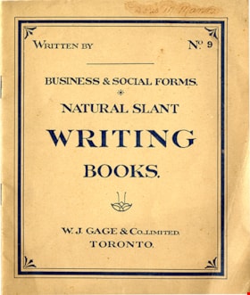
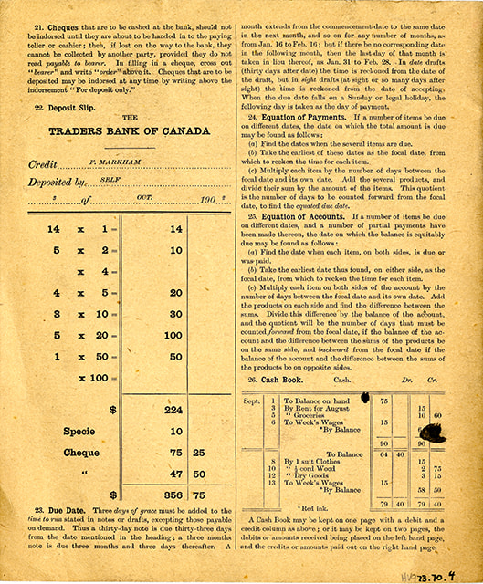
Business & social forms : natural slant writing books, no. 9
https://search.heritageburnaby.ca/link/museumlibrary6450
- Repository
- Burnaby Village Museum
- Collection
- Special Collection
- Material Type
- Book
- Accession Code
- HV973.70.4
- Call Number
- 372.634 GAG
- Place of Publication
- Toronto
- Publisher
- W. J. Gage & Co. Limited
- Publication Date
- c1902
- Physical Description
- 1 vol. ; 24 cm.
- Inscription
- "Doris M Mann" [handwritten in ink on cover]
- Library Subject (LOC)
- Penmanship
Images
![Burton family home, [1945]. Item no. 216-002 thumbnail](/media/hpo/_Data/_Archives_Images/_Unrestricted/205/216-002.jpg?width=280)
Interview with John Burton by Lynda Maeve Orr - Track 6
https://search.heritageburnaby.ca/link/oralhistory222
- Repository
- City of Burnaby Archives
- Date Range
- 1485-1814
- Length
- 0:09:45
- Summary
- This portion of the interview pertains to John Burton's explanation of the connection between printers and unions throughout history. He also tells the story of the cylinder press being smashed by handpress workmen to protect their jobs at the London Times as well as his own experiences learning on…
- Repository
- City of Burnaby Archives
- Summary
- This portion of the interview pertains to John Burton's explanation of the connection between printers and unions throughout history. He also tells the story of the cylinder press being smashed by handpress workmen to protect their jobs at the London Times as well as his own experiences learning on the Linotype.
- Date Range
- 1485-1814
- Photo Info
- Burton family home, [1945]. Item no. 216-002
- Length
- 0:09:45
- Subjects
- Printing Tools and Equipment
- Scope and Content
- Recording is of an interview with John Burton at his residence in Surrey by Lynda Mauve Orr, August 24, 1989. This interview focuses on the history of newspaper and printing presses in Canada.
- Biographical Notes
- John Burton was born in 1912 in New Westminster. He went to Second Street School, then Edmonds, then Saint Anne's Convent, and St. Louis College and Connaught before graduating from Burnaby South School in 1930. While at High School, John worked at Cowan's Music Store at 716 Columbia Street in New Westminster on Saturdays and after school. John Burton's grandfather John Foley was the founder of the Orangeville Sun newspaper in Orangeville, Ontario, established in 1861. He ran the paper until his death in 1882, when his son, John Foley Jr. took over as editor and publisher at the age of sixteen. Two of his daughters were involved in the newspaper; Margaret Foley was a regular contributor to the paper, and John Burton's mother was a typesetter. When John Burton was a teenager, he went to Orangeville to learn the trade from his uncle. Unfortunately, he was only there eighteen months when his uncle died December 21, 1932. The family was unable to hold on to the business and the paper amalgamated with the Orangeville Banner newspaper in 1933.
- Total Tracks
- 7
- Total Length
- 0:58:44
- Interviewee Name
- Burton, John
- Collection/Fonds
- Burnaby Historical Society fonds
- Subseries
- Oral history subseries
- Media Type
- Sound Recording
- Web Notes
- Interview was digitized in 2010 allowing it to be accessible on Heritage Burnaby. The digitization project was initiated by the Community Heritage Commission with support from City of Burnaby Council and the BC History Digitization Program of the Irving K. Barber Learning Centre, University of British Columbia. It was recognized by the Heritage Society of BC with an award in 2012.
Images
![Burton family home, [1945]. Item no. 216-002 thumbnail](/media/hpo/_Data/_Archives_Images/_Unrestricted/205/216-002.jpg)
Audio Tracks
Track six of interview with John Burton by Lynda Maeve Orr
Track six of interview with John Burton by Lynda Maeve Orr
https://search.heritageburnaby.ca/media/hpo/_Data/_Archives_Oral_Histories/_Unrestricted/MSS137-001-4/MSS137-001-4_Track_6.mp3
Open meeting with William Pritchard and Norman Penner July / August 1973 - Track 5
https://search.heritageburnaby.ca/link/oralhistory82
- Repository
- City of Burnaby Archives
- Date Range
- 1688-1919
- Length
- 0:08:51
- Summary
- This portion of the meeting pertains to William Pritchard's thoughts on Socialism and Revolution in their various incantations. He also discusses the political leanings of the arrested Winnipeg Strikers.
- Repository
- City of Burnaby Archives
- Summary
- This portion of the meeting pertains to William Pritchard's thoughts on Socialism and Revolution in their various incantations. He also discusses the political leanings of the arrested Winnipeg Strikers.
- Date Range
- 1688-1919
- Photo Info
- William A. Pritchard, Burnaby Reeve 1930-1932 and council member 1928-1930. Item no. 459-016
- Length
- 0:08:51
- Names
- Woodsworth, James Shaver
- Subjects
- Political Theories
- Interview Date
- July / August 1973
- Scope and Content
- Recording is of a open meeting with William Pritchard and writer Norman Penner. Norman Penner is the editor of the book "Winnipeg 1919" about the strike from the striker's perspective. William Pritchard wrote the speech that was included in the book. Audience members were invited to ask Pritchard questions. Major theme discussed is: The Winnipeg General Strike. To view "Narrow By" terms for each track expand this description and see "Notes".
- Biographical Notes
- William "Bill" Arthur Pritchard was born on April 3, 1888 in Salford, England, the son of a miner and factory worker. In May 1911, Bill moved to British Columbia and within a week of arriving became an active member of the Socialist Party of Canada. From 1914 to 1917, he served as editor of the Western Clarion – the SPC newspaper. He became such a well-known socialist figure that when he travelled to Winnipeg to participate in the General Strike in 1919, he was one of only seven people arrested and imprisoned for his participation in the event despite the fact that he was in no way directly involved in its planning nor development. In 1922, Bill and his family settled in North Burnaby in the Capitol Hill District. Almost immediately after his arrival, Bill began to advocate for change and a planned development scheme for the municipality. Pritchard ran successfully for the position of Reeve and held the post until the end of 1932. One of Reeve Pritchard’s highest priorities while in office was to attempt to provide work for as many unemployed as possible all the while trying to elicit more support from the provincial and federal governments. Bill was a strong advocate of the belief that relief work should be focused on projects that would see a comprehensive development scheme for Burnaby – including planned sewers, roads and water supply. Despite Bill's best efforts, however, Burnaby was forced into receivership and at the end of 1932, a Provincial Commission stepped in to take over the governance of the city. Reeve Pritchard, having done all he could as a champion of the unemployed, stepped down as Reeve but left behind an undeniable legacy of courage and determination. He was rewarded for his enormous contributions to the city in 1975 when he was chosen to be made a Freeman of Burnaby. William Pritchard died on October 23, 1981. Norman Penner was born in Winnipeg in 1921 to Rose and Jacob Penner and brother to Roland, Ruth and Walter. Their father Jacob was a leading member of the Communist Party and popular Winnipeg Alderman. Norman graduated from high school in 1937 but did not begin university until much later, preferring to begin his adult life from 1938 to 1941 as a full-time officer of the Winnipeg branch of the Communist Party of Canada. From 1941 to 1946 he served with the Canadian Army which included two-and-a-half years of overseas combat duty. On his return to Canada in 1947 he again returned to his duties as a full-time officer with the communist Labour-Progressive Party (formed in 1941 after the Canadian Communist Party was officially banned). After the abortive Hungarian revolution in 1956, Norman Penner resigned from the party and instead worked as a self-employed manufacturer’s sales representative until 1971. In 1964 he decided to go back to school part time and graduated with a BA from the University of Toronto in 1969. He took an MA in 1971 and a PhD in 1975 from the same institution. Penner was hired as a lecturer at York University's Glendon College in 1972 and soon became a professor, continuing to teach until 1995. He wrote extensively on the Canadian left. Penner edited and introduced "Winnipeg 1919: The Strikers' Own History of the Winnipeg General Strike" in 1973, published "The Canadian Left: A Critical Analysis" in 1977 and contributed three chapters to as well as editing "Keeping Canada Together Means Changing Our Thinking" in 1978. He published "Canadian Communism: The Stalin Years and Beyond" in 1988 and "From Protest to Power: Social Democracy in Canada 1900 to Present" in 1992 as well as numerous articles, reviews and book chapters. Norman Penner was married to Norma Lipes for sixty-seven years. The couple had four children: Steve (Mary Ellen Marus); Joyce (Herman Parsons); Gary (Marlene Kadar); and Bob (Shaena Lambert). Norman Penner died April 16, 2009 at the age of eighty-eight.
- Total Tracks
- 7
- Total Length
- 1:03:00
- Interviewee Name
- Pritchard, William A.
- Penner, Norman
- Collection/Fonds
- Burnaby Historical Society fonds
- Subseries
- Oral history subseries
- Media Type
- Sound Recording
- Web Notes
- Interview was digitized in 2010 allowing it to be accessible on Heritage Burnaby. The digitization project was initiated by the Community Heritage Commission with support from City of Burnaby Council and the BC History Digitization Program of the Irving K. Barber Learning Centre, University of British Columbia. It was recognized by the Heritage Society of BC with an award in 2012.
Images

Audio Tracks
Track five of open meeting with William Pritchard and Norman Penner
Track five of open meeting with William Pritchard and Norman Penner
https://search.heritageburnaby.ca/media/hpo/_Data/_Archives_Oral_Histories/_Unrestricted/100-13-02-2/100-13-02-2_Track_5.mp3
Recording of John Burton - Track 5
https://search.heritageburnaby.ca/link/oralhistory213
- Repository
- City of Burnaby Archives
- Date Range
- 1850-1950
- Length
- 0:09:14
- Summary
- This portion of the recording pertains to John Burton's description of the galley press and the proofing process. He also discusses job printing (now referred to as commercial printing).
- Repository
- City of Burnaby Archives
- Summary
- This portion of the recording pertains to John Burton's description of the galley press and the proofing process. He also discusses job printing (now referred to as commercial printing).
- Date Range
- 1850-1950
- Photo Info
- Burton family home, [1945]. Item no. 216-002
- Length
- 0:09:14
- Scope and Content
- Recording is of John Burton discussing the history of the weekly newspaper and of the types of printing presses that have been used in Canada, as well as exactly how their parts function. John appears to be describing printing presses that are in the room with him.
- Biographical Notes
- John Burton was born in 1912 in New Westminster. He went to Second Street School, then Edmonds, then Saint Anne's Convent, and St. Louis College and Connaught before graduating from Burnaby South School in 1930. While at High School, John worked at Cowan's Music Store at 716 Columbia Street in New Westminster on Saturdays and after school. John Burton's grandfather John Foley was the founder of the Orangeville Sun newspaper in Orangeville, Ontario, established in 1861. He ran the paper until his death in 1882, when his son, John Foley Jr. took over as editor and publisher at the age of sixteen. Two of his daughters were involved in the newspaper; Margaret Foley was a regular contributor to the paper, and John Burton's mother was a typesetter. When John Burton was a teenager, he went to Orangeville to learn the trade from his uncle. Unfortunately, he was only there eighteen months when his uncle died December 21, 1932. The family was unable to hold on to the business and the paper amalgamated with the Orangeville Banner newspaper in 1933.
- Total Tracks
- 5
- Total Length
- 0:46:18
- Interviewee Name
- Burton, John
- Collection/Fonds
- Burnaby Historical Society fonds
- Subseries
- Oral history subseries
- Media Type
- Sound Recording
- Web Notes
- Interview was digitized in 2010 allowing it to be accessible on Heritage Burnaby. The digitization project was initiated by the Community Heritage Commission with support from City of Burnaby Council and the BC History Digitization Program of the Irving K. Barber Learning Centre, University of British Columbia. It was recognized by the Heritage Society of BC with an award in 2012.
Images
Audio Tracks
Track five of recording of John Burton
Track five of recording of John Burton
https://search.heritageburnaby.ca/media/hpo/_Data/_Archives_Oral_Histories/_Unrestricted/MSS137-001-2/MSS137-001-2_Track_5.mp3![Unidentified girl, [1860-1900] thumbnail](/media/hpo/_Data/_Archives_Images/_Unrestricted/550/550-015.jpg?width=280)
Unidentified girl
https://search.heritageburnaby.ca/link/archivedescription82353
- Repository
- City of Burnaby Archives
- Date
- [1860-1900]
- Collection/Fonds
- Hill family and Vidal family fonds
- Description Level
- Item
- Physical Description
- 1 photograph : b&w ; 7 x 5 cm
- Scope and Content
- Photograph is a portrait of an unidentified girl.
- Repository
- City of Burnaby Archives
- Date
- [1860-1900]
- Collection/Fonds
- Hill family and Vidal family fonds
- Physical Description
- 1 photograph : b&w ; 7 x 5 cm
- Description Level
- Item
- Record No.
- 550-015
- Access Restriction
- No restrictions
- Reproduction Restriction
- No known restrictions
- Accession Number
- 2013-03
- Scope and Content
- Photograph is a portrait of an unidentified girl.
- Subjects
- Persons - Children
- Media Type
- Photograph
- Notes
- Title based on contents of photograph
- Note in pencil on album page reads: "Maude?"
Images
![Unidentified girl, [1860-1900] thumbnail](/media/hpo/_Data/_Archives_Images/_Unrestricted/550/550-015.jpg)
![Unidentified woman, [1860-1900] thumbnail](/media/hpo/_Data/_Archives_Images/_Unrestricted/550/550-016.jpg?width=280)
Unidentified woman
https://search.heritageburnaby.ca/link/archivedescription82354
- Repository
- City of Burnaby Archives
- Date
- [1860-1900]
- Collection/Fonds
- Hill family and Vidal family fonds
- Description Level
- Item
- Physical Description
- 1 photograph : sepia ; 10 x 6 cm
- Scope and Content
- Photograph is a portrait of an unidentified woman.
- Repository
- City of Burnaby Archives
- Date
- [1860-1900]
- Collection/Fonds
- Hill family and Vidal family fonds
- Physical Description
- 1 photograph : sepia ; 10 x 6 cm
- Description Level
- Item
- Record No.
- 550-016
- Access Restriction
- No restrictions
- Reproduction Restriction
- No known restrictions
- Accession Number
- 2013-03
- Scope and Content
- Photograph is a portrait of an unidentified woman.
- Media Type
- Photograph
- Notes
- Title based on contents of photograph
- Note in pencil on album page reads: "Unknown"
Images
![Unidentified woman, [1860-1900] thumbnail](/media/hpo/_Data/_Archives_Images/_Unrestricted/550/550-016.jpg)
![Three unidentified women, [1860-1900] thumbnail](/media/hpo/_Data/_Archives_Images/_Unrestricted/550/550-017.jpg?width=280)
Three unidentified women
https://search.heritageburnaby.ca/link/archivedescription82355
- Repository
- City of Burnaby Archives
- Date
- [1860-1900]
- Collection/Fonds
- Hill family and Vidal family fonds
- Description Level
- Item
- Physical Description
- 1 photograph : sepia ; 10.5 x 6 cm
- Scope and Content
- Photograph is a portrait of three unidentified women.
- Repository
- City of Burnaby Archives
- Date
- [1860-1900]
- Collection/Fonds
- Hill family and Vidal family fonds
- Physical Description
- 1 photograph : sepia ; 10.5 x 6 cm
- Description Level
- Item
- Record No.
- 550-017
- Access Restriction
- No restrictions
- Reproduction Restriction
- No known restrictions
- Accession Number
- 2013-03
- Scope and Content
- Photograph is a portrait of three unidentified women.
- Media Type
- Photograph
- Notes
- Title based on contents of photograph
- Note in pencil on album page reads: "Unknown"
- Photograph stamp on verso reads: "John Barron / Photographer / Sarnia, = Ont."
Images
![Three unidentified women, [1860-1900] thumbnail](/media/hpo/_Data/_Archives_Images/_Unrestricted/550/550-017.jpg)
![Two unidentified girls, [1860-1900] thumbnail](/media/hpo/_Data/_Archives_Images/_Unrestricted/550/550-018.jpg?width=280)
Two unidentified girls
https://search.heritageburnaby.ca/link/archivedescription82356
- Repository
- City of Burnaby Archives
- Date
- [1860-1900]
- Collection/Fonds
- Hill family and Vidal family fonds
- Description Level
- Item
- Physical Description
- 1 photograph : sepia ; 4 x 6 cm
- Scope and Content
- Photograph is a portrait of two unidentified girls, one perhaps being Blanche Wilkinson.
- Repository
- City of Burnaby Archives
- Date
- [1860-1900]
- Collection/Fonds
- Hill family and Vidal family fonds
- Physical Description
- 1 photograph : sepia ; 4 x 6 cm
- Description Level
- Item
- Record No.
- 550-018
- Access Restriction
- No restrictions
- Reproduction Restriction
- No known restrictions
- Accession Number
- 2013-03
- Scope and Content
- Photograph is a portrait of two unidentified girls, one perhaps being Blanche Wilkinson.
- Subjects
- Persons - Children
- Media Type
- Photograph
- Notes
- Title based on contents of photograph
- Note in pencil on album page reads: "? and Blanche W.?"
- Photograph stamp on verso reads: "Barron & Walker / Artist and Photographer / B & W"
Images
![Two unidentified girls, [1860-1900] thumbnail](/media/hpo/_Data/_Archives_Images/_Unrestricted/550/550-018.jpg)
![Unidentified man, [1860-1900] thumbnail](/media/hpo/_Data/_Archives_Images/_Unrestricted/550/550-019.jpg?width=280)
Unidentified man
https://search.heritageburnaby.ca/link/archivedescription82357
- Repository
- City of Burnaby Archives
- Date
- [1860-1900]
- Collection/Fonds
- Hill family and Vidal family fonds
- Description Level
- Item
- Physical Description
- 1 photograph : b&w ; 5 x 4.5 cm + 1 accompanying page
- Scope and Content
- Photograph is a portrait of an unidentified man.
- Repository
- City of Burnaby Archives
- Date
- [1860-1900]
- Collection/Fonds
- Hill family and Vidal family fonds
- Physical Description
- 1 photograph : b&w ; 5 x 4.5 cm + 1 accompanying page
- Description Level
- Item
- Record No.
- 550-019
- Access Restriction
- No restrictions
- Reproduction Restriction
- No known restrictions
- Accession Number
- 2013-03
- Scope and Content
- Photograph is a portrait of an unidentified man.
- Media Type
- Photograph
- Notes
- Title based on contents of photograph
- Note in pencil on album page reads: "Unknown"
Images
![Unidentified man, [1860-1900] thumbnail](/media/hpo/_Data/_Archives_Images/_Unrestricted/550/550-019.jpg)
![Maude, [1860-1900] thumbnail](/media/hpo/_Data/_Archives_Images/_Unrestricted/550/550-023.jpg?width=280)
Maude
https://search.heritageburnaby.ca/link/archivedescription82373
- Repository
- City of Burnaby Archives
- Date
- [1860-1900]
- Collection/Fonds
- Hill family and Vidal family fonds
- Description Level
- Item
- Physical Description
- 1 photograph : sepia ; 10 x 6 cm
- Scope and Content
- Photograph is a portrait of Maude.
- Repository
- City of Burnaby Archives
- Date
- [1860-1900]
- Collection/Fonds
- Hill family and Vidal family fonds
- Physical Description
- 1 photograph : sepia ; 10 x 6 cm
- Description Level
- Item
- Record No.
- 550-023
- Access Restriction
- No restrictions
- Reproduction Restriction
- No known restrictions
- Accession Number
- 2013-03
- Scope and Content
- Photograph is a portrait of Maude.
- Media Type
- Photograph
- Notes
- Title based on caption accompanying photograph
- Note in pencil on album page reads: "Maude ?"
- Note in blue ink on verso reads: "Maude"
- Photograph stamp on verso reads: "J. Foster Elliott, / Photographer, / Sarnia. / Negatives Preserved"
Images
![Maude, [1860-1900] thumbnail](/media/hpo/_Data/_Archives_Images/_Unrestricted/550/550-023.jpg)
![Guy, [1860-1900] thumbnail](/media/hpo/_Data/_Archives_Images/_Unrestricted/550/550-025.jpg?width=280)
Guy
https://search.heritageburnaby.ca/link/archivedescription82376
- Repository
- City of Burnaby Archives
- Date
- [1860-1900]
- Collection/Fonds
- Hill family and Vidal family fonds
- Description Level
- Item
- Physical Description
- 1 photograph : sepia ; 10 x 6.5 cm
- Scope and Content
- Photograph is a portrait of a boy identified as Guy.
- Repository
- City of Burnaby Archives
- Date
- [1860-1900]
- Collection/Fonds
- Hill family and Vidal family fonds
- Physical Description
- 1 photograph : sepia ; 10 x 6.5 cm
- Description Level
- Item
- Record No.
- 550-025
- Access Restriction
- No restrictions
- Reproduction Restriction
- No known restrictions
- Accession Number
- 2013-03
- Scope and Content
- Photograph is a portrait of a boy identified as Guy.
- Media Type
- Photograph
- Notes
- Title based on caption accompanying photograph
- Note in pencil on album page photograph reads: "Guy ?"
- Note in blue pen on verso reads: "Guy"
- Photograph stamp on verso reads: "J. Foster Elliot / Photographer, / Sarnia. / Negatives Preserved"
Images
![Guy, [1860-1900] thumbnail](/media/hpo/_Data/_Archives_Images/_Unrestricted/550/550-025.jpg)
![Jane Ann Rollason, [1860-1900] thumbnail](/media/hpo/_Data/_Archives_Images/_Unrestricted/550/550-118.jpg?width=280)
Jane Ann Rollason
https://search.heritageburnaby.ca/link/archivedescription82544
- Repository
- City of Burnaby Archives
- Date
- [1860-1900]
- Collection/Fonds
- Hill family and Vidal family fonds
- Description Level
- Item
- Physical Description
- 1 photograph : sepia ; 9.5 x 6 cm + 1 piece of wood
- Scope and Content
- Photograph is a portrait of a woman identified as Jane Ann Rollason.
- Repository
- City of Burnaby Archives
- Date
- [1860-1900]
- Collection/Fonds
- Hill family and Vidal family fonds
- Physical Description
- 1 photograph : sepia ; 9.5 x 6 cm + 1 piece of wood
- Description Level
- Item
- Record No.
- 550-118
- Access Restriction
- No restrictions
- Reproduction Restriction
- No known restrictions
- Accession Number
- 2013-03
- Scope and Content
- Photograph is a portrait of a woman identified as Jane Ann Rollason.
- Media Type
- Photograph
- Notes
- Title based on note accompanying photograph
- Note in pencil on album page reads: "Jane Ann Rollinson / (wife of Richard Hill) / (Grandmother of Minard Hill)
- Note in pencil on verso reads: "Jane Ann nee Rollison (Hill)"
- Photograph stamp on verso reads: "From the Photographic Studio W Sherwoood, / 23 Nook Street, Workincton, / This or ... can be enlar... in oil or water colours. / Negatives ... always be had"
- Note in blue pen on piece of wood taped to the album page reads: "Mother of K Claude Hill B R Hill / Jane Hill Nee Rolston / Grand Mother of K M Peers"
Images
![Jane Ann Rollason, [1860-1900] thumbnail](/media/hpo/_Data/_Archives_Images/_Unrestricted/550/550-118.jpg)
![Jane Ann Rollason, [1860-1900] thumbnail](/media/hpo/_Data/_Archives_Images/_Unrestricted/550/550-119.jpg?width=280)
Jane Ann Rollason
https://search.heritageburnaby.ca/link/archivedescription82545
- Repository
- City of Burnaby Archives
- Date
- [1860-1900]
- Collection/Fonds
- Hill family and Vidal family fonds
- Description Level
- Item
- Physical Description
- 1 photograph : sepia ; 9.5 x 6 cm
- Scope and Content
- Photograph is a portrait of a woman identified as Jane Ann Rollason.
- Repository
- City of Burnaby Archives
- Date
- [1860-1900]
- Collection/Fonds
- Hill family and Vidal family fonds
- Physical Description
- 1 photograph : sepia ; 9.5 x 6 cm
- Description Level
- Item
- Record No.
- 550-119
- Access Restriction
- No restrictions
- Reproduction Restriction
- No known restrictions
- Accession Number
- 2013-03
- Scope and Content
- Photograph is a portrait of a woman identified as Jane Ann Rollason.
- Media Type
- Photograph
- Notes
- Title based on note accompanying photograph
- Note in pencil on album page reads: "____ Berkeley / (Marian (Berkeley) Hill's mother)"
- Photograph stamp on recto reads: "William Heath / 24 George Street / Plymouth"
Images
![Jane Ann Rollason, [1860-1900] thumbnail](/media/hpo/_Data/_Archives_Images/_Unrestricted/550/550-119.jpg)
Interview with John Burton by Lynda Maeve Orr - Track 5
https://search.heritageburnaby.ca/link/oralhistory221
- Repository
- City of Burnaby Archives
- Date Range
- 1860-1932
- Length
- 0:08:48
- Summary
- This portion of the interview pertains to John Burton's description of the Linotype machine, as well as the history of his grandfather, John Foley, founder of the Orangeville Sun newspaper.
- Repository
- City of Burnaby Archives
- Summary
- This portion of the interview pertains to John Burton's description of the Linotype machine, as well as the history of his grandfather, John Foley, founder of the Orangeville Sun newspaper.
- Date Range
- 1860-1932
- Photo Info
- Burton family home, [1945]. Item no. 216-002
- Length
- 0:08:48
- Names
- Foley, John
- Scope and Content
- Recording is of an interview with John Burton at his residence in Surrey by Lynda Mauve Orr, August 24, 1989. This interview focuses on the history of newspaper and printing presses in Canada.
- Biographical Notes
- John Burton was born in 1912 in New Westminster. He went to Second Street School, then Edmonds, then Saint Anne's Convent, and St. Louis College and Connaught before graduating from Burnaby South School in 1930. While at High School, John worked at Cowan's Music Store at 716 Columbia Street in New Westminster on Saturdays and after school. John Burton's grandfather John Foley was the founder of the Orangeville Sun newspaper in Orangeville, Ontario, established in 1861. He ran the paper until his death in 1882, when his son, John Foley Jr. took over as editor and publisher at the age of sixteen. Two of his daughters were involved in the newspaper; Margaret Foley was a regular contributor to the paper, and John Burton's mother was a typesetter. When John Burton was a teenager, he went to Orangeville to learn the trade from his uncle. Unfortunately, he was only there eighteen months when his uncle died December 21, 1932. The family was unable to hold on to the business and the paper amalgamated with the Orangeville Banner newspaper in 1933.
- Total Tracks
- 7
- Total Length
- 0:58:44
- Interviewee Name
- Burton, John
- Collection/Fonds
- Burnaby Historical Society fonds
- Subseries
- Oral history subseries
- Media Type
- Sound Recording
- Web Notes
- Interview was digitized in 2010 allowing it to be accessible on Heritage Burnaby. The digitization project was initiated by the Community Heritage Commission with support from City of Burnaby Council and the BC History Digitization Program of the Irving K. Barber Learning Centre, University of British Columbia. It was recognized by the Heritage Society of BC with an award in 2012.
Images
Audio Tracks
Track five of interview with John Burton by Lynda Maeve Orr
Track five of interview with John Burton by Lynda Maeve Orr
https://search.heritageburnaby.ca/media/hpo/_Data/_Archives_Oral_Histories/_Unrestricted/MSS137-001-4/MSS137-001-4_Track_5.mp3![Survey and Subdivision plans in New Westminster District Group 1 – Burnaby
, [1861]-[1910] thumbnail](/media/hpo/_Data/_BVM_Cartographic_Material/1977/1977_0093_0019a_001.jpg?width=280)
Survey and Subdivision plans in New Westminster District Group 1 – Burnaby
https://search.heritageburnaby.ca/link/museumdescription6988
- Repository
- Burnaby Village Museum
- Date
- [1861]-[1910]
- Collection/Fonds
- Burnaby Village Museum Map collection
- Description Level
- File
- Physical Description
- 14 plans : 3 plans : black ink on paper hand col. + 7 plans : black ink on paper + 4 plans : graphite on paper mounted on 2 sides of cardboard 76 x 102 cm
- Scope and Content
- Item consists of a large board of four New Westminster District Gp 1 - subdivision plans mounted on one side and ten New Westminster District Gp 1 - subdivision plans mounted on the other side. Side A: 1. "Plan /of / Lots 166A, 166 and 167 /, Gr.1, N.W.D. / Showing Misconstructed Roads in Gree…
- Repository
- Burnaby Village Museum
- Collection/Fonds
- Burnaby Village Museum Map collection
- Description Level
- File
- Physical Description
- 14 plans : 3 plans : black ink on paper hand col. + 7 plans : black ink on paper + 4 plans : graphite on paper mounted on 2 sides of cardboard 76 x 102 cm
- Material Details
- Scales [between 1:2376 and 1:7920]
- Index number on edge of board reads: "19"
- Scope and Content
- Item consists of a large board of four New Westminster District Gp 1 - subdivision plans mounted on one side and ten New Westminster District Gp 1 - subdivision plans mounted on the other side. Side A: 1. "Plan /of / Lots 166A, 166 and 167 /, Gr.1, N.W.D. / Showing Misconstructed Roads in Green / 5 chs = 1 in.". (plan is drawn in black ink and hand coloured in red, green and orange ink). A section in the centre of the plan is coloured in red ink and identified as "C.S. Richmond" running from the North Arm of Fraser River to Wiggins Road and divided by "New Wiggins Rd. (as gazetted)" (coloured in orange ink) and two"Constructed Road(s)" (coloured in green ink). Plan is initialed by: "RB" [sic] (in blue pencil crayon) 2. Plan of / Subdivision of / Lot 166 / Group One / New Westminster District / Scale 4 chs = 1 in. / Map No 524". Plan is drawn in graphite and signed by "Surrig [sic] Welhams [sic] / P.L.S." Plan is initialed by: "RB" [sic] (in blue pencil crayon) 3. Plan of "Survey / of Highway / For / Burnaby Council / in / Lots 13 _14 / Group One / Scale 4 chs = 1 in." Signed by "Albert J. Hill, P.L.S." Caribou Street and Caribou Road run through the centre of the plan. Plan is stamped: "Albert J. Hill, Civil Engineer / and / Provincial Land Surveyor, / New Westminster, / B.C.". Plan is initialed by: "RB" [sic] (in blue pencil crayon) 4. A Plan of Lots 166A, 166 and 167, Group One, New Westminster District (drawn in graphite). A section in the centre of the plan is identified as "C.S. Richmond" running from the North Arm of Fraser River and divided by "New Wiggins Rd. (as gazetted)" and two "Constructed Road(s)". Plan is initialed by: "RB" [sic] (in blue pencil crayon) Side B: 1. Small plan drawn in black ink (no title) identifying lots north of the "North Arm" of the Fraser River. Lots identified include: Lot 99, Lot 98, Lot 157, Lot 158, Lot 163, Lot 162, Lot 159, Lot 163, Lot 162, Lot 165, Lot 166A, Lot 155B, Lot 155A and Lot 159. "Scale 40 chains to one inch" . Plan is initialed by: "RB" [sic] (in blue pencil crayon) (Geographic location: Burnaby) 2. Small plan drawn in black ink (no title) identifying lots north of the North Arm of the Fraser River as "Lots 155, 155A, 155B, 155C, 162, 163, 164, 165, 166A and 167". Plan is initialed by: "RB" [sic] (in blue pencil crayon) (Geographic location: Burnaby) 3. Small plan drawn in black ink (no title) which identifies "Lot 151 / Reserve/ for / Race Course"; "Reserve / 64 A / L. 152 G.1"; and other Lots: 32, 33, 34, 35, 36, 38, 39. The plan is signed "Surveyor G.Turn [sic] July / 61 / from Vol 40 R.L. notes [sic]" Plan is stamped: "Albert J. Hill, Civil Engineer / and / Provincial Land Surveyor, / New Westminster, / B.C." Plan is initialed by: "RB" [sic] (in blue pencil crayon) (Geographic location: Burnaby) 4. Small plan drawn in black in with faded red colouring on centre lot identified as "Lot 34" running north from "Vancouver Road" . Plan is stamped: "Albert J. Hill, Civil Engineer / and / Provincial Land Surveyor, / New Westminster, / B.C." Plan is initialed by: "RB" [sic] (in blue pencil crayon) (Geographic location: Burnaby) 5. Plan drawn in graphite and identified as "Lot 98, Gr.1," along with the intials "RB" [sic] (both are handwritten in blue crayon pencil on top of plan) The B.C.E.Railway is identified running through the plan along with Jubilee Road and Royal Oak Road. The plan is signed with the name "Wm. Murray" and the Plan is stamped: "Albert J. Hill, Civil Engineer / and / Provincial Land Surveyor, / New Westminster, / B.C.". (Geographic location: Burnaby) 6. Plan drawn in graphite identified as "Port Lot 13, Gr.1" along with the intials "RB" [sic] (both are handwritten in blue crayon pencil on top of plan) Plan is stamped: "Albert J. Hill, Civil Engineer / and / Provincial Land Surveyor, / New Westminster, / B.C.". (Geographic location: Burnaby) 7.Plan drawn in black ink and identified as "Lot 98 G.1" along with the intials "RB" [sic] (both are handwritten in blue crayon pencil on top of plan). A "Road Reservation" is identified running north between "Electric Tramway" and connecting with "Royal Oak Road". Plan is stamped: "Albert J. Hill, Civil Engineer / and / Provincial Land Surveyor, / New Westminster, / B.C." (Geographic location: Burnaby) 8. Plan drawn in black ink and divided into two sections, the upper plan is identified as "Portion / Lots 100 / area / 101, Gr.1" and the lower plan is identified as "Portion L. 3 G. 1" along with the intials "RB" [sic] (these identifiers are handwritten in blue crayon pencil on top of the plan). Portions of Lot 100 and Lot 101 are each divided into 6 sections and the Portion of Lot 3 plan is divided into 24 sections. The plan includes a note in black ink that reads: " Received from Wm Fromme [sic] / from Wm. Trapp / Nov. 28, 1895 / A. J. T...[sic]". (Geographic location: Burnaby) 9. Plan drawn in black ink (no title) identifying soil, buildings and geographic features in southern Burnaby. The plan is bordered by "New Westminster City" (Tenth Avenue and DL 172) to the south east and DL 173 to the south, DL 158 to the west and the B.C.E. Tramway to the north. Plan includes District Lots: 155A, 158, 159, 171, 160, 53 and 95 and identifies soil, marshland and ravines throughout. Plan identifies the following features: a "Team Road" running through Lots 158 and 159 along with "Fair Orchard Soil / Even Surface Throughout / No Ravines", "Gravel and Shingle" (bottom of Lot 158), "North Arm Road" crossing "Byrne Road" and connecting with "Power House Road" which runs north to connect with "Highland Park Station" and the B.C.E. Tramway, "Power Ho" in the northeast corner of DL 160, a "Brook" connected with a "Deep Ravine" running between DL 53, DL 95 and DL 160 along with "Good Soil" and "Fair Orchard Soil" identified nearby in DL 95. Scale is identified as "10 chs = 1 in." Plan is stamped: "Albert J. Hill, Civil Engineer / and / Provincial Land Surveyor, / New Westminster, / B.C." Plan is initialed by: "RB" [sic] (in blue pencil crayon) (Geographic location: Burnaby) 10. Plan drawn in black ink (no title) with Burnaby Lake and Deer Lake at the centre. The plan is bordered by the following District Lots identified as: 117, 118 and 68 to the west, Lots 80, 79 and 85 to the southwest, Lots 11, 13, and 1 (City of New Westminster) to the south east, the North Road boundary to the east and Lots 8, 56, 57, 59, and 136 to the North. The lower right hand corner of the plan has a small inset which reads: "Burnaby Lake" and "Page 19 R.B. Notes". Plan is initialed by: "RB" [sic] (in blue pencil crayon) (Geographic location: Burnaby)
- Creator
- Hill, Albert James
- Accession Code
- HV977.93.19
- Access Restriction
- No restrictions
- Reproduction Restriction
- No known restrictions
- Date
- [1861]-[1910]
- Media Type
- Cartographic Material
- Scan Resolution
- 300
- Scale
- 72
- Notes
- Title based on contents of file
- Scale is measured in chains. (One chain equals 792 inches)
- The term "Lot" can also refer to a "District Lot”
- Some plans are stamped: "Albert J. Hill, Civil Engineer / and / Provincial Land Surveyor, / New Westminster, / B.C." and intialed: "RB" [sic]
Images
![Survey and Subdivision plans in New Westminster District Group 1 – Burnaby
, [1861]-[1910] thumbnail](/media/hpo/_Data/_BVM_Cartographic_Material/1977/1977_0093_0019a_001.jpg)

![Survey and Subdivision plans in New Westminster District Group 1 – Burnaby, Port Moody, [1862-1908] thumbnail](/media/hpo/_Data/_BVM_Cartographic_Material/1977/1977_0093_0026a_001.jpg?width=280)
Survey and Subdivision plans in New Westminster District Group 1 – Burnaby, Port Moody
https://search.heritageburnaby.ca/link/museumdescription6995
- Repository
- Burnaby Village Museum
- Date
- [1862-1908]
- Collection/Fonds
- Burnaby Village Museum Map collection
- Description Level
- File
- Physical Description
- 9 plans : 6 plans : black ink on paper ; 57 x 36.5 cm or smaller + 1 plan : black ink and grahite on paper ; 46.5 x 49 cm + 1 plan : blueprint on paper ; 15.5 x 19.5 cm + cm + 1 plan : graphite on paper ; 25 x 17 cm ; mounted on both sides of board 76 x 102 cm
- Scope and Content
- Item consists of a large board of four New Westminster District subdivision plans mounted on one side and five New Westminster District subdivision plans mounted on the other side. Side A: 1. "Plan / of Subdivision / of a Portion / of / Lot 87 / Group One / New Westminster District / Scale 4 chs…
- Repository
- Burnaby Village Museum
- Collection/Fonds
- Burnaby Village Museum Map collection
- Description Level
- File
- Physical Description
- 9 plans : 6 plans : black ink on paper ; 57 x 36.5 cm or smaller + 1 plan : black ink and grahite on paper ; 46.5 x 49 cm + 1 plan : blueprint on paper ; 15.5 x 19.5 cm + cm + 1 plan : graphite on paper ; 25 x 17 cm ; mounted on both sides of board 76 x 102 cm
- Material Details
- Scales [between 1:792 and 1:3600]
- Index number on edge of board reads: "26"
- Scope and Content
- Item consists of a large board of four New Westminster District subdivision plans mounted on one side and five New Westminster District subdivision plans mounted on the other side. Side A: 1. "Plan / of Subdivision / of a Portion / of / Lot 87 / Group One / New Westminster District / Scale 4 chs = 1 in". Plan is stamped: "Albert J. Hill, Civil Engineer / and / Provincial Land Surveyor, / New Westminster, / B.C." and intialed by: "RB" [sic] (in blue pencil crayon). Names two of the subdivisons of District Lot 87 are identified as, "L.E. Sprott" and "John Ledger". (Geographic location: Burnaby) 2. "Plan of Subdivision / of / Portions of / Lot 136, 131 and Lots 44 and 78 Gr.1 / New Westminster District / Scale 300 ft = 1 inch". Annotation above title reads: "No. 901 / Deposited in Land Registry Office / New Westminster / Aug. 19th 1905 / Charles S. Keith D. Reg." Annotations and signatures at bottom of plan read: "I, William Nelson Draper, / W.H.R. Collister / Charles E. Perkins / E.B. Morgan / make / Surveys / correct / representation / upon / the / Land Registry Act / (sgd) W.N. Draper, P.L.S.". Plan includes a handwritten title: "Lots 136, 131, 44 & 78" and is initialed: "RB" [sic] (in blue pencil crayon) (Geographic location: Burnaby) 3. "Survey / of / a Portion / of / Lot 95, Gr.1 / Scale 1 ch = 1in." Plan is stamped: "Albert J. Hill, Civil Engineer / and / Provincial Land Surveyor, / New Westminster, / B.C." and is initialed : "RB" [sic] (in blue pencil crayon) (Geographic location: Burnaby) 4. Blueprint plan of "Lot 396. Group One." with Scale : 3 chs = 1 in. A two acre portion of District Lot 396 is filled in with red ink." Plan is signed by "Albert J. Hill / B.C.L.S." (Geographic location: Port Moody) Side B: 1. Plan titled "District Lot 92 / Burnaby / Municipality / for sale by / Mahon / McFarland & / Mahon Ltd. / Vancouver, B.C. / Scale : 4 chains to one inch". District Lot 92 is subdivided into 161 lots and identifies roads: Norwich Road, Pole Line Road, Oakland Road, Stanley Road, Burford Road, Dalhousie Road, Brantford Road, Colborne Road, Roberts Road, Vancouver & Westminster Road, B.C. Electric Railway, Gilley Stn. and Burnaby (Power House). The bottom of the plan reads: "G.S. Dawson, P.LS. Vancouver, B.C." (Geographic location: Burnaby) 2. "Plan / of Subdivision / of a Portion / of / Lot 29 / Group 1 / New Westminster District / Scale 2 chs = 1 in". Plan is stamped: "Albert J. Hill, Civil Engineer / and / Provincial Land Surveyor, / New Westminster, / B.C." and is initialed by: "RB" [sic] (in blue pencil crayon) (Geographic location: Burnaby) 3. Small handrawn plan (no title) identifying "Lot 84 / Hydes, Claim" at the centre surrounded by lots and features identified as: "Lot 85", "Lot 93", "Lot 94", "Lot 32", "Lot 82", "Lot 83", "Lot 79", "swamp" and a "Small Lake" (Burnaby Lake). Identifying marks in the right corner of the plan read: "Page 13 / Surveyed by G. Turner / May 62". Plan also includes surveyor's bearing measurements and trails to "Small Lake" (Burnaby Lake). (Geographic location: Burnaby) 4. Untitled plan showing District Lots west of North Road and north of Burnaby Lake including: Lots 2, 4, 6, 8, 15, 10, 56, 148, 57, 58, 40. and Lots 3, 5, 7 east of North Road (Coquitlam). Lots in Burnaby are identifed for timber including: "Heavily Timbered" (Lot 57), " "Some Fir and Cedar" (Lot 40), "Splendid Fir and Cedar" (Lot 143), "Heavy Fir etc" (Lots 143 and 148), " "Fine Cedar" (Lot 15), "Rough Light Timber" (Lot 56). Other features identified at the lower portion of the plan include "Burnaby Lake" and "Brunette River". (Geographic location: Burnaby) 5. Untitled plan drawn in graphite showing sections of District Lot 85 south of Burnaby Lake and north of Hazsard Road. Plan is signed: "Albert J. Hill / B.C.L.S." and dated "12/26/08". Plan is initialed by: "RB" [sic] (in blue pencil crayon) (Geographic location: Burnaby)
- Publisher
- Mahon, McFarland & Mahon Ltd
- Accession Code
- HV977.93.26
- Access Restriction
- No restrictions
- Reproduction Restriction
- No known restrictions
- Date
- [1862-1908]
- Media Type
- Cartographic Material
- Historic Neighbourhood
- Burnaby Lake (Historic Neighbourhood)
- Burquitlam (Historic Neighbourhood)
- Planning Study Area
- Burnaby Lake Area
- Scan Resolution
- 300
- Scale
- 72
- Notes
- Title based on contents of file
- Scale is measured in chains and feet. (One chain equals 792 inches)
- The term "Lot" can also refer to a "District Lot”
Images
![Survey and Subdivision plans in New Westminster District Group 1 – Burnaby, Port Moody, [1862-1908] thumbnail](/media/hpo/_Data/_BVM_Cartographic_Material/1977/1977_0093_0026a_001.jpg)


Alfred Bingham's writings - Track 1
https://search.heritageburnaby.ca/link/oralhistory251
- Repository
- City of Burnaby Archives
- Date Range
- 1865-1919
- Length
- 0:10:18
- Summary
- This portion of the recording includes Alfred Bingham's essay entitled Stump Rangers, a listing of early settlers that includes addresses and short descriptions, essays on Confederation Park, land clearing and on Burnaby's first Council meeting.
- Repository
- City of Burnaby Archives
- Summary
- This portion of the recording includes Alfred Bingham's essay entitled Stump Rangers, a listing of early settlers that includes addresses and short descriptions, essays on Confederation Park, land clearing and on Burnaby's first Council meeting.
- Date Range
- 1865-1919
- Photo Info
- Alfred Bingham, April 20, 1947. Item no. 010-066
- Length
- 0:10:18
- Scope and Content
- Recording is of Alfred Bingham's writings, as read by Alfred Bingham. Major themes discussed are: Pioneers, early days in Burnaby and the Co-op Movement. To view "Narrow By" terms for each track expand this description and see "Notes".
- Biographical Notes
- Alfred "Alf" Bingham was born in England in 1892 and moved to Canada in 1912. His first job in Canada was laying track for the Grand Trunk Pacific Railway (GTPR) from Edmonton to McBride in 1912. His second was in Vancouver at the Rat Portage Mill on False Creek, working on the Resaw machine. He quit after one week due to poor working conditions. After taking part in the 1919 Winnipeg General Strike as a delegate of the Retail and Mailorder Union (A.F.L.) on the Winnipeg Trades and Labour Council, Alfred moved to Burnaby where he and fellow Burnaby residents Aungus McLean and Percy Little worked ten hour days to build a Shingle Mill on the edge of Burnaby Lake for Simpson & Giberson. George Green, carpenter and millwright (author of “The History of Burnaby”) also helped in the construction of the mill. Alfred built his own home from lumber cut from the mill in the Lochdale area on Sherlock Street between Curtis Street and Kitchener Street. On April 10, 1920 Alfred married Mary Jane “Ada” Reynolds. Alfred and Ada often took in foster children during their marriage. Due to her nursing experience, Ada was often called upon to deliver babies in the Burnaby area. Alfred and Ada Bingham were instrumental members of the Army of the Common Good, collecting vegetables and grains from growers in the area and even producing over 125 tons of vegetables from its own gardens to feed children and youth suffering from the lack of resources during the Depression years. The army was in operation for ten years and during that time the members organised the Credit Union movement of British Columbia and drew up the Credit Union act thorough the Vancouver Co-operative Council. They also started Co-Op stores and the Co-Op Wholesale Society. Alfred was also Secretary of the Burnaby Housing committee and in 1946 he became the Secretary of the North Burnaby Labour Progressive Party (LPP). Mary Jane “Ada” (Reynolds) Bingham died on August 9, 1969. Her husband Alfred died on April 29, 1979.
- Total Tracks
- 12
- Total Length
- 1:38:06
- Interviewee Name
- Bingham, Alfred "Alf"
- Collection/Fonds
- Burnaby Historical Society fonds
- Subseries
- Oral history subseries
- Transcript Available
- MSS142-001 contains transcripts for each of the short stories
- Media Type
- Sound Recording
- Web Notes
- Interview was digitized in 2010 allowing it to be accessible on Heritage Burnaby. The digitization project was initiated by the Community Heritage Commission with support from City of Burnaby Council and the BC History Digitization Program of the Irving K. Barber Learning Centre, University of British Columbia. It was recognized by the Heritage Society of BC with an award in 2012.
Images

Audio Tracks
Track one of recording of Alfred Bingham's writings
Track one of recording of Alfred Bingham's writings
https://search.heritageburnaby.ca/media/hpo/_Data/_Archives_Oral_Histories/_Unrestricted/100-13-20-2/100-13-20-2_Track_1.mp3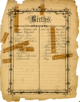
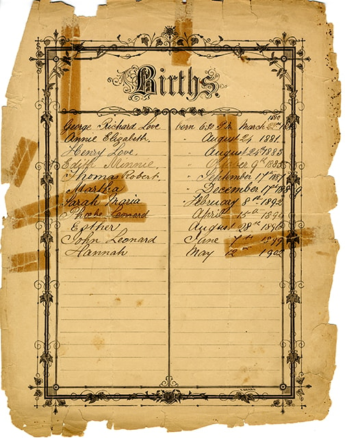
Births of Jesse and Martha Love
https://search.heritageburnaby.ca/link/museumdescription16926
- Repository
- Burnaby Village Museum
- Date
- 1879-1902
- Collection/Fonds
- Love family fonds
- Description Level
- Item
- Physical Description
- 1 p. : 24 x 30 cm
- Scope and Content
- Item consists of a births record page listing the children of Jesse and Martha Love. The page is presumed to be removed from a bible, potentially the Love family bible (BV992.26.1). The information on the obverse reads "Births / George Richard Love born 6:30 P.M March 22nd 1880 / Annie Elizabeth " …
- Repository
- Burnaby Village Museum
- Collection/Fonds
- Love family fonds
- Description Level
- Item
- Physical Description
- 1 p. : 24 x 30 cm
- Scope and Content
- Item consists of a births record page listing the children of Jesse and Martha Love. The page is presumed to be removed from a bible, potentially the Love family bible (BV992.26.1). The information on the obverse reads "Births / George Richard Love born 6:30 P.M March 22nd 1880 / Annie Elizabeth " August 24 1881 / Henry Love " August 24th 1883 / Edith Minnie " October 9th 1885 / Thomas Robert " September 17th 1887 / Martha "December 17th 1889 / Sarah Maria " February 8th 1892 / Phoebe Leonard April 15th 1894 / Esther August 28th 1896 / John Leonard June 7th 1899 / Hannah May 12th 1902". The reverse reads "Deaths" with no further notations.
- Accession Code
- BV992.26.30
- Access Restriction
- No restrictions
- Reproduction Restriction
- No known restrictions
- Date
- 1879-1902
- Media Type
- Textual Record
- Scan Resolution
- 600
- Scan Date
- 2022-06-10
- Notes
- Title based on the content of the page
Images

Love family correspondence
https://search.heritageburnaby.ca/link/museumdescription10087
- Repository
- Burnaby Village Museum
- Date
- 1880-1911
- Collection/Fonds
- Love family fonds
- Description Level
- File
- Physical Description
- 1 folder of textual records
- Scope and Content
- File consists of a series of personal letters from family members in England to Jesse and Martha Love., including; Sept 22, 1880- to Jesse and Martha Love from Jesse's mother Elizabeth Love; June 7th, 1880- to Jesse from his mother Elizabeth Love; June 9th, 1880- Letter to Jesse Love from his moth…
- Repository
- Burnaby Village Museum
- Collection/Fonds
- Love family fonds
- Description Level
- File
- Physical Description
- 1 folder of textual records
- Scope and Content
- File consists of a series of personal letters from family members in England to Jesse and Martha Love., including; Sept 22, 1880- to Jesse and Martha Love from Jesse's mother Elizabeth Love; June 7th, 1880- to Jesse from his mother Elizabeth Love; June 9th, 1880- Letter to Jesse Love from his mother Elizabeth Love; April 26, 1880 - to Jesse and Martha Love from Jesse's mother Elizabeth Love; May 21, 1881 -To Jesse Love from one of his sisters regarding his mother's death; Jan 18, 1892 - Swindon - to Jesse from his sister, informing him of his father's death; 8th Jan 1906 - to Jesse from his sister,Torie Love; 28 Oct 1910 - to Martha Love from Jesse's sister Torie Love; 27th, (month?) 1910 - to Jesse Love and one of his sisters from Jesse's sister Torie; 14th July 1911 - Letter to Jesse and Martha Love from Jesse's sister Torie; an envelope - addressed to "Mr. Jesse Love / East Burnaby, New Westminster / B.C." postmarked "Jan __ 05 / SWINDON STATION" (does not appear to relate to any of the dates of the letters) and a small evelope addressed to : "Mrs Love / Burnaby".
- History
- See extensive history of Love Family and Love farmhouse located at Burnaby Village Museum.
- Accession Code
- BV012.31.19
- Access Restriction
- No restrictions
- Reproduction Restriction
- No known restrictions
- Date
- 1880-1911
- Media Type
- Textual Record
- Scan Resolution
- 300
- Scan Date
- Feb-02-2012
- Scale
- 96
- Notes
- Title based on content of file
Images

![Family album, [between 1880 and 1900] thumbnail](/media/hpo/_Data/_Archives_Images/_Unrestricted/316/335-018-1.jpg?width=280)
Family album
https://search.heritageburnaby.ca/link/archivedescription37214
- Repository
- City of Burnaby Archives
- Date
- [between 1880 and 1900]
- Collection/Fonds
- Burnaby Historical Society fonds
- Description Level
- Item
- Physical Description
- 1 album (43 photographs : b&w ; 17 x 10 cm or smaller) ; 28 x 20 cm
- Scope and Content
- Photograph album consisting of photographs that are likely of members of the Johnson family. Photographs are primarily studio portraits of unidentified individuals, taken in various locations including: Helena, MT; Toronto; Montreal; New Westminster; Fredrikshald, Norway; and Chicago and Roseland, …
- Repository
- City of Burnaby Archives
- Date
- [between 1880 and 1900]
- Collection/Fonds
- Burnaby Historical Society fonds
- Subseries
- Andrew Johnson subseries
- Physical Description
- 1 album (43 photographs : b&w ; 17 x 10 cm or smaller) ; 28 x 20 cm
- Description Level
- Item
- Record No.
- 335-018
- Access Restriction
- No restrictions
- Reproduction Restriction
- No known restrictions
- Accession Number
- BHS1997-16
- Scope and Content
- Photograph album consisting of photographs that are likely of members of the Johnson family. Photographs are primarily studio portraits of unidentified individuals, taken in various locations including: Helena, MT; Toronto; Montreal; New Westminster; Fredrikshald, Norway; and Chicago and Roseland, IL. Photographs depict a group of maids, individuals, children alone or with their parents, and families.
- Subjects
- Documentary Artifacts - Portraits
- Media Type
- Photograph
- Notes
- Title based on contents of item
- Photographer's stamp on recto of 335-018-2 reads: "Wadds Bros / Vancouver & Nelson B.C."
- Photographer's stamp on verso of 335-018-3 reads: "J.H. Lemaitre & Co."
- Photographer's stamp on recto of 335-018-4 reads: "Gagen & Fraser / Toronto"
- Photographer's stamp on recto of 335-018-5 reads: "Perkins / Toronto"
- Photographer's stamp on recto of 335-018-6 reads: "Ahlborn / Chicago"
- Photographer's stamp on verso of 335-018-7 reads: "From the studio of J. B. Cook / ... Toronto"
- Photographer's stamp on recto of 335-018-8 reads: "Wadds Bros / Vancouver, B.C."
- Photographer's stamp on verso of 335-018-9 reads: "Eldridge Stanton / ... Toronto"
- Photographer's stamp on recto of 335-018-10 reads: "Dixon / ... Toronto"
- Photographer's stamp on recto of 335-018-11 reads: "Perkins / Toronto"
- Photographer's stamp on recto of 335-018-12 reads: "Wadds Bros / Vancouver, B.C."
- 335-018-12 is mounted on a sheet of cardboard
- Photographer's stamp on recto of 335-018-14 reads: "Perkins / Toronto"
- Photographer's stamp on verso of 335-018-15 reads: "Eldridge Stanton / ... Toronto"
- Photographer's stamp on recto of 335-018-16 reads: "J.T. Lambly, / ... Montreal"
- Photographer's stamp on recto of 335-018-17 reads: "Buchanan"
- Photographer's stamp on verso of 335-018-18 reads: "Topley" and features an elaborate design
- Photographer's stamp on verso of 335-018-19 reads: "Notman & Fraser" and "Toronto" and features an elaborate design
- Photographer's stamp on recto of 335-018-20 reads: "Farmer Brothers Photographers / Hamilton, Ont"
- Handwritten note on verso of 335-018-20 reads: "I wish you a Merry Christmas"
- Photographer's stamp on recto of 335-018-21 reads: "Perkins / Toronto"
- Photographer's stamp on recto of 335-018-22 reads: "Perkins / Toronto"
- Photographer's stamp on recto of 335-018-23 reads: "Dixon / ... Toronto"
- Photographer's stamp on recto of 335-018-24 reads: "Simpson Bros / ... Toronto"
- Caption on recto of 335-018-25 reads: "Toronto Photo Gallery"
- Photographer's stamp on recto of 335-018-26 reads: "Simpson Bros / ... Toronto"
- Photographer's stamp on recto of 335-018-28 reads: "H.R. Kiopman / Roseland, Ills."
- Photographer's stamp on recto of 335-018-29 reads: "J.G. Parks, Photo. Montreal"
- Photographer's stamp on verso of 335-018-30 reads: "J.G. Parks / ... Montreal"
- Photographer's stamp on recto of 335-018-32 reads: "S. J. Thompson, New Westminster B.C."
- Handwritten note onv erso of 335-018-32 reads: "Yours truly - J. M. McLeod" and "1/18/96"
- Photographer's stamp on verso of 335-018-33 reads: "From Burman's Photographic Rooms / ... Melbourne"
- Caption on recto of 335-018-35 reads: "Sunbeam"
- Photographer's stamp on recto of 335-018-36 reads: "Lemaitre ... Toronto"
- Photographer's stamp on verso of 335-018-37 reads: "Olaf M. Madsen / ... Fredrikshald"
- Date stamp on verso of 335-018-38 reads: "1883/4"
- Photographer's stamp on verso of 335-018-38 reads: "Spencer & Hastings / ... Victoria, B.C"
- Photographer's stamp on recto of 335-018-49 reads: "Olaf M. Madsen / Fredrikshald"
- Photographer's stamp on recto of 335-018-40 reads: "Olaf M. Madsen / Fredrikshald"
- Caption on recto of 335-018-41 reads: "Sunbeam"
- Photographer's stamp on verso of 335-018-42 reads: "Mrs. R. Maynard, / ... Victoria, B.C."
- Photographer's stamp on recto of 335-018-43 reads: "Sunbeam, Galen Block, Helena, M.T."
Images
![Family album, [between 1880 and 1900] thumbnail](/media/hpo/_Data/_Archives_Images/_Unrestricted/316/335-018-1.jpg)
![Herbert Penrose Vidal, [between 1880 and 1900] thumbnail](/media/hpo/_Data/_Archives_Images/_Unrestricted/550/550-028.jpg?width=280)
Herbert Penrose Vidal
https://search.heritageburnaby.ca/link/archivedescription82383
- Repository
- City of Burnaby Archives
- Date
- [between 1880 and 1900]
- Collection/Fonds
- Hill family and Vidal family fonds
- Description Level
- Item
- Physical Description
- 1 photograph : sepia ; 10 x 6.5 cm
- Scope and Content
- Photograph is a portrait of man identified as Herbert Penrose Vidal.
- Repository
- City of Burnaby Archives
- Date
- [between 1880 and 1900]
- Collection/Fonds
- Hill family and Vidal family fonds
- Physical Description
- 1 photograph : sepia ; 10 x 6.5 cm
- Description Level
- Item
- Record No.
- 550-028
- Access Restriction
- No restrictions
- Reproduction Restriction
- No known restrictions
- Accession Number
- 2013-03
- Scope and Content
- Photograph is a portrait of man identified as Herbert Penrose Vidal.
- Names
- Vidal, Herbert Penrose
- Media Type
- Photograph
- Notes
- Title based on caption accompanying photograph
- Note in pencil on album page reads: "Herbert Penrose Vidal / 1866-1934"
- Note in black pen on verso reads: "H P Vidal"
- Photograph stamp on verso reads: "Barron & Walker / Artists and Photographers / Sarnia / Ont"
Images
![Herbert Penrose Vidal, [between 1880 and 1900] thumbnail](/media/hpo/_Data/_Archives_Images/_Unrestricted/550/550-028.jpg)

Interview with Marianne May Bateman February 22, 1978 - Track 3
https://search.heritageburnaby.ca/link/oralhistory190
- Repository
- City of Burnaby Archives
- Date Range
- 1880-1920
- Length
- 0:08:39
- Summary
- This portion of the interview pertains to Marianne May Bateman's father Edwin Bateman's history of first coming to Canada.
- Repository
- City of Burnaby Archives
- Summary
- This portion of the interview pertains to Marianne May Bateman's father Edwin Bateman's history of first coming to Canada.
- Date Range
- 1880-1920
- Photo Info
- Photograph of Edwin Wettenhall Bateman with his four daughters; Marianne May is sitting on a chair beside her father, [1903}. Item no. BV992.29.1
- Length
- 0:08:39
- Names
- Bateman, Edwin W.
- Interviewer
- Stevens, Colin
- Interview Date
- February 22, 1978
- Scope and Content
- Recording is of an interview with Marianne May "May" Bateman conducted by Colin Stevens, February 22, 1978. Major themes discussed are: Elworth.
- Biographical Notes
- May Bateman was born in 1894 in Portage LaPrairie, Manitoba to Edwin Wettenhall Bateman and Cassie (Dale) Bateman. May's father, Edwin Bateman was born in 1859 in Sandbach, Cheshire, to James and Caroline Mary Wettenhall Bateman (their home in Sandbach was called Elworth Cottage). When he was twenty-one, E.W. Bateman immigrated to Manitoba, Canada where he met Catherine “Cassie” Dale, daughter of George and Sarah Gillon Dale. They were married in Portage La Prairie, Manitoba on November 9, 1886. Edwin and Cassie had seven children, the eldest Edna Caroline Annie (Corner) born in 1889, George, Mamie (McWilliams) born in 1892, Marianne May “May” Bateman born in 1894, Jessie (Fox Kemp), Carey, and the youngest Warren Stafford born in 1901.Cassie (Dale) Bateman died in Portage La Prairie in 1909. Edwin was transferred to Vancouver by the Canadian Pacific Railway where he married Cassie’s younger sister Mary Dale, born 1865, and moved his six children to Vancouver. The Bateman family first lived at 7th and Balsam in a large new house. It wasn’t until 1920 that they decided to move to the quieter atmosphere of the Burnaby Lake- Deer Lake area. By this time Edwin Wettenhall Bateman was a retired CPR executive. He moved his wife and daughter May to Deer Lake and commissioned 'Elworth' house, designed by English-born and trained architect Enoch Evans. The house was completed by contractor William Dodson in 1922 and located at the site of what would become Burnaby Village Museum, 6501 Deer Lake Avenue. The Batemans lived here for seventeen years before moving back to Vancouver in May of 1935. Mary Bateman died July 5, 1935. Edwin Wettenhall Bateman died on November 25, 1957 at the age of ninety-seven. Marianne May Bateman died in 1990.
- Total Tracks
- 4
- Total Length
- 0:30:44
- Interviewee Name
- Bateman, Marianne May
- Collection/Fonds
- Burnaby Historical Society fonds
- Subseries
- Oral history subseries
- Media Type
- Sound Recording
- Web Notes
- Interview was digitized in 2010 allowing it to be accessible on Heritage Burnaby. The digitization project was initiated by the Community Heritage Commission with support from City of Burnaby Council and the BC History Digitization Program of the Irving K. Barber Learning Centre, University of British Columbia. It was recognized by the Heritage Society of BC with an award in 2012.
Images

Audio Tracks
Track three of interview with May Bateman
Track three of interview with May Bateman
https://search.heritageburnaby.ca/media/hpo/_Data/_Archives_Oral_Histories/_Unrestricted/MSS137-014-1/MSS137-014-1_Track_3.mp3
Interview with Minard Hill February 9, 1978 - Track 3
https://search.heritageburnaby.ca/link/oralhistory196
- Repository
- City of Burnaby Archives
- Date Range
- 1880-1914
- Length
- 0:10:09
- Summary
- This portion of the interview pertains to Minard Gerald "Gerry" Hill's relatives in England, his father's early life as well as life on the strawberry farm in Burnaby.
- Repository
- City of Burnaby Archives
- Summary
- This portion of the interview pertains to Minard Gerald "Gerry" Hill's relatives in England, his father's early life as well as life on the strawberry farm in Burnaby.
- Date Range
- 1880-1914
- Photo Info
- Minard Gerald Hill in uniform, 1914. Item no. 477-926
- Length
- 0:10:09
- Names
- Hill, Bernard R
- Geographic Access
- Douglas Road
- Canada Way
- Historic Neighbourhood
- Burnaby Lake (Historic Neighbourhood)
- Planning Study Area
- Douglas-Gilpin Area
- Interviewer
- Stevens, Colin
- Interview Date
- February 9, 1978
- Scope and Content
- Recording is of an interview with Minard Gerald "Gerry" Hill conducted by Colin Stevens, February 9, 1978. Major themes discussed are: the Burnaby Lake Neighbourhood, Gilley Brothers Logging Company and his father, Bernard Hill.
- Biographical Notes
- Minard Gerald “Gerry” Hill was born in Burnaby on July 31, 1893 to Marian (Berkeley) and Bernard Richard Hill. He was the youngest child in the family with older siblings Frank, Claude and Winnie. Bernard R. Hill was born in Bengal, India while his father worked for the East Indian Railway. He and his older brother Claude became strawberry farmers in Burnaby despite their years of training as engineers. Between them, the Hill brothers owned all the land between Burnaby Lake and Deer Lake where Deer Creek runs, and half way around Deer Lake. Bernard built his family home at Douglas Road near Deer Lake in 1892. After the decline in the strawberry industry, Bernard worked as a surveyor for the municipality. He also served as Burnaby Councillor and School Trustee. Gerry attended Miss Harriet Woodward’s kindergarten class, and went on to Edmonds School with Miss Ellen Lister as his teacher. He later went to Central high school in New Westminster, often on horseback. Gerry served in World War I, signing his recruitment papers November 9, 1914. When he returned home, he worked felling trees, then as an apprentice surveyor and finally as a carpenter. Minard Gerald “Gerry” Hill married Charlotte Elizabeth “Elizabeth” Vidal on September 28, 1920 and single-handedly built a house for him and his wife about a thousand feet from his parents’ home. He also bought property at Yellow Point, Vancouver Island around this time. By the early 1930s Gerry had moved to Yellow Point permanently and begun work building the lodge. Elizabeth and Gerry’s child, Richard Grant McEwan Hill was born at Ladysmith hospital. Charlotte Elizabeth “Elizabeth” (Vidal) Hill died February 11, 1984 at the age of eighty-seven. Minard Gerald “Gerry” Hill died January 30, 1988 at the age of ninety-three.
- Total Tracks
- 8
- Total Length
- 1:13:56
- Interviewee Name
- Hill, Minard Gerald "Gerry"
- Interview Location
- Yellow Point, Vancouver Island
- Collection/Fonds
- Burnaby Historical Society fonds
- Subseries
- Oral history subseries
- Media Type
- Sound Recording
- Web Notes
- Interview was digitized in 2010 allowing it to be accessible on Heritage Burnaby. The digitization project was initiated by the Community Heritage Commission with support from City of Burnaby Council and the BC History Digitization Program of the Irving K. Barber Learning Centre, University of British Columbia. It was recognized by the Heritage Society of BC with an award in 2012.
Images

Audio Tracks
Track three of interview with Minard Hill
Track three of interview with Minard Hill
https://search.heritageburnaby.ca/media/hpo/_Data/_Archives_Oral_Histories/_Unrestricted/MSS137-018-1/MSS137-018-1_Track_3.mp3![Subdivision plans in New Westminster District Group 1 – Burnaby
, [1882-1910] thumbnail](/media/hpo/_Data/_BVM_Cartographic_Material/1977/1977_0093_0013a_001.jpg?width=280)
Subdivision plans in New Westminster District Group 1 – Burnaby
https://search.heritageburnaby.ca/link/museumdescription6982
- Repository
- Burnaby Village Museum
- Date
- [1882-1910]
- Collection/Fonds
- Burnaby Village Museum Map collection
- Description Level
- File
- Physical Description
- 4 plans : blueprint on paper mounted on 2 sides of cardboard 76 x 102 cm
- Scope and Content
- Item consists of a large board of two New Westminster District Gp 1 - subdivision plans mounted on one side and two New Westminster District Gp 1 - subdivision plans mounted on the other side. Side A: 1. Blueprint "Plan / of the / Subdivision / of / Lot 98 / G.1, N.W.D. / Scale 4 chs = 1 in. / …
- Repository
- Burnaby Village Museum
- Collection/Fonds
- Burnaby Village Museum Map collection
- Description Level
- File
- Physical Description
- 4 plans : blueprint on paper mounted on 2 sides of cardboard 76 x 102 cm
- Material Details
- Scales [between 1:1584 and 1:3168]
- Index number on edge of board reads: "13"
- Scope and Content
- Item consists of a large board of two New Westminster District Gp 1 - subdivision plans mounted on one side and two New Westminster District Gp 1 - subdivision plans mounted on the other side. Side A: 1. Blueprint "Plan / of the / Subdivision / of / Lot 98 / G.1, N.W.D. / Scale 4 chs = 1 in. / Map No 573" (Geographic location: Burnaby) 2. Blueprint "Plan / of Subdivision of / Lot 157 / Gr.1, New. West. Dist. / Scale 3 chs = 1 in. / Map No. 612". (Geographic location: Burnaby) Side B: 1. Blueprint "Plan / of Subdivision / of a Portion of / Lot 90 / Group One / New Westminster Dist. / Scale 2 chs = 1 in. / Map No. 555". Plan is signed by "Jno Strathern [sic]_P.L.S."n (Geographic location: Burnaby) 2. Blueprint "Subdivision of Lot 31, Group 1. / New Westminster District / As Amended by Order of Court / 1st Sept. 1882 and Numbered 847 / Scale 4 chs = 1in. / Map No 80" (Geographic location: Burnaby)
- Creator
- Stathern, John
- Accession Code
- HV977.93.13
- Access Restriction
- No restrictions
- Reproduction Restriction
- No known restrictions
- Date
- [1882-1910]
- Media Type
- Cartographic Material
- Historic Neighbourhood
- Alta Vista (Historic Neighbourhood)
- Planning Study Area
- Richmond Park Area
- Lakeview-Mayfield Area
- Scan Resolution
- 300
- Scale
- 72
- Notes
- Title based on contents of file
- Scale is measured in chains. (One chain equals 792 inches)
- The term "Lot" can also refer to a "District Lot”
Images
![Subdivision plans in New Westminster District Group 1 – Burnaby
, [1882-1910] thumbnail](/media/hpo/_Data/_BVM_Cartographic_Material/1977/1977_0093_0013a_001.jpg)

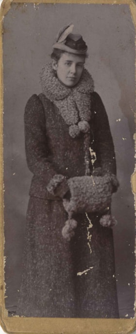
Louisa Sophia "Lou" Jones Vidal
https://search.heritageburnaby.ca/link/archivedescription82385
- Repository
- City of Burnaby Archives
- Date
- [between 1885 and 1900]
- Collection/Fonds
- Hill family and Vidal family fonds
- Description Level
- Item
- Physical Description
- 1 photograph : sepia ; 10 x 6.5 cm
- Scope and Content
- Photograph is a portrait of woman identified as Louisa Sophia "Lou" Jones Vidal.
- Repository
- City of Burnaby Archives
- Date
- [between 1885 and 1900]
- Collection/Fonds
- Hill family and Vidal family fonds
- Physical Description
- 1 photograph : sepia ; 10 x 6.5 cm
- Description Level
- Item
- Record No.
- 550-029
- Access Restriction
- No restrictions
- Reproduction Restriction
- No known restrictions
- Accession Number
- 2013-03
- Scope and Content
- Photograph is a portrait of woman identified as Louisa Sophia "Lou" Jones Vidal.
- Media Type
- Photograph
- Notes
- Title based on caption accompanying photograph
- Note in pencil on album page reads: "Louisa Sophia Jones"
- Note in pencil on verso reads: "Aunt Let? / Louisa (?)"
Images
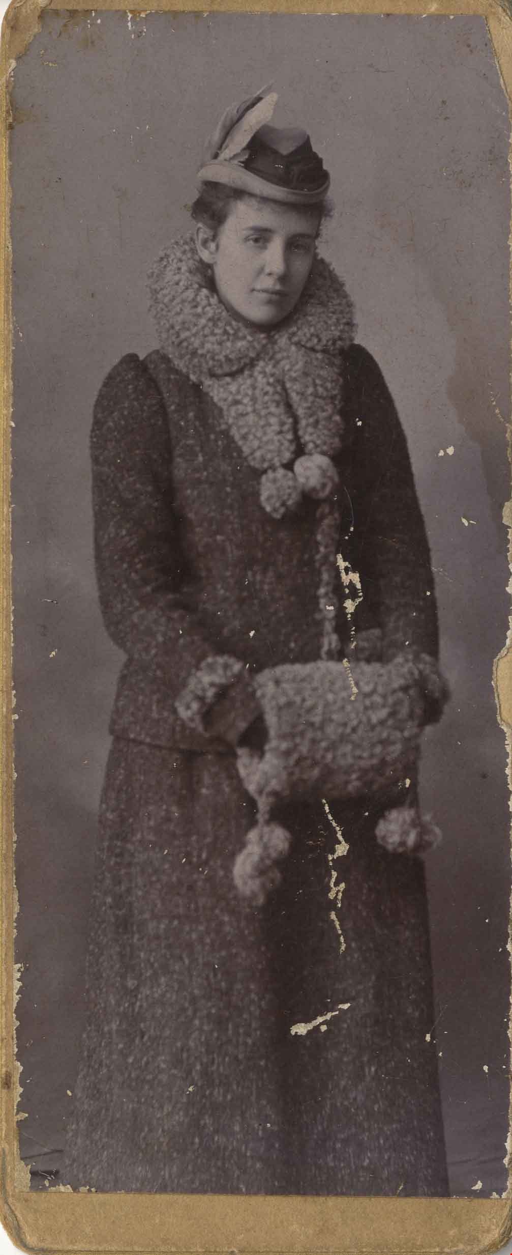
Recording of John Burton - Track 4
https://search.heritageburnaby.ca/link/oralhistory212
- Repository
- City of Burnaby Archives
- Date Range
- 1885-1959
- Length
- 0:09:56
- Summary
- This portion of the recording pertains to John Burton's description of the Linotype machine and how it functions.
- Repository
- City of Burnaby Archives
- Summary
- This portion of the recording pertains to John Burton's description of the Linotype machine and how it functions.
- Date Range
- 1885-1959
- Photo Info
- Burton family home, [1945]. Item no. 216-002
- Length
- 0:09:56
- Subjects
- Printing Tools and Equipment
- Scope and Content
- Recording is of John Burton discussing the history of the weekly newspaper and of the types of printing presses that have been used in Canada, as well as exactly how their parts function. John appears to be describing printing presses that are in the room with him.
- Biographical Notes
- John Burton was born in 1912 in New Westminster. He went to Second Street School, then Edmonds, then Saint Anne's Convent, and St. Louis College and Connaught before graduating from Burnaby South School in 1930. While at High School, John worked at Cowan's Music Store at 716 Columbia Street in New Westminster on Saturdays and after school. John Burton's grandfather John Foley was the founder of the Orangeville Sun newspaper in Orangeville, Ontario, established in 1861. He ran the paper until his death in 1882, when his son, John Foley Jr. took over as editor and publisher at the age of sixteen. Two of his daughters were involved in the newspaper; Margaret Foley was a regular contributor to the paper, and John Burton's mother was a typesetter. When John Burton was a teenager, he went to Orangeville to learn the trade from his uncle. Unfortunately, he was only there eighteen months when his uncle died December 21, 1932. The family was unable to hold on to the business and the paper amalgamated with the Orangeville Banner newspaper in 1933.
- Total Tracks
- 5
- Total Length
- 0:46:18
- Interviewee Name
- Burton, John
- Collection/Fonds
- Burnaby Historical Society fonds
- Subseries
- Oral history subseries
- Media Type
- Sound Recording
- Web Notes
- Interview was digitized in 2010 allowing it to be accessible on Heritage Burnaby. The digitization project was initiated by the Community Heritage Commission with support from City of Burnaby Council and the BC History Digitization Program of the Irving K. Barber Learning Centre, University of British Columbia. It was recognized by the Heritage Society of BC with an award in 2012.
Images
Audio Tracks
Track four of recording of John Burton
Track four of recording of John Burton
https://search.heritageburnaby.ca/media/hpo/_Data/_Archives_Oral_Histories/_Unrestricted/MSS137-001-2/MSS137-001-2_Track_4.mp3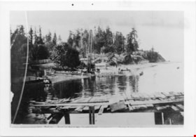
Waterfront Looking west from George Black's
https://search.heritageburnaby.ca/link/museumdescription4775
- Repository
- Burnaby Village Museum
- Date
- 1890-1915
- Collection/Fonds
- Burnaby Village Museum Photograph collection
- Description Level
- Item
- Physical Description
- 1 photograph : b&w ; 8.5 x 12.5 cm ; copy print
- Scope and Content
- Waterfront scene with land on left and water on right. Wooden dock/jetty in foreground. From left to right along the shore there are people wading, a maple tree, a slaughterhouse, a cattle yard, boating bathers, fishing. Trees and houses in background.
- Repository
- Burnaby Village Museum
- Collection/Fonds
- Burnaby Village Museum Photograph collection
- Description Level
- Item
- Physical Description
- 1 photograph : b&w ; 8.5 x 12.5 cm ; copy print
- Material Details
- "Looking west from George Black's. Wading. Maple Tree. Marine ways. Saughterhouse. Cattleyard. Boating Bathers. Fishing. […]" written in black ink on bottom front of photograph. "Columbian files 1971" written on verso in black pen. "996" stamped on back.
- Scope and Content
- Waterfront scene with land on left and water on right. Wooden dock/jetty in foreground. From left to right along the shore there are people wading, a maple tree, a slaughterhouse, a cattle yard, boating bathers, fishing. Trees and houses in background.
- History
- Part of a set of photographs from the Columbian Newspaper, which operated out of New Westminster under this name starting in 1900 until its dissolution in 1988. Photographs found in the collection of the Burnaby Village are dated 1971. George Black (1831-1896). He was born in Aberdeen Scotland, and went to California, then to the Cariboo during the gold rush. He eventually settled on Hastings Street, and was well known in the surroundings of Vancouver.
- Other Title Information
- title based on content and note on front of photograph
- Names
- Black, George
- Accession Code
- BV018.19.1
- Access Restriction
- No restrictions
- Reproduction Restriction
- May be restricted by third party rights
- Date
- 1890-1915
- Media Type
- Photograph
- Scan Resolution
- 600
- Scan Date
- 24-04-2018
Images


Two uniformed men driving wagon
https://search.heritageburnaby.ca/link/museumdescription4784
- Repository
- Burnaby Village Museum
- Date
- 1890-1920
- Collection/Fonds
- Burnaby Village Museum Photograph collection
- Description Level
- Item
- Physical Description
- 1 photograph : b&w ; 8.7 x 12.7 cm ; copy print
- Scope and Content
- Two uniformed men driving horse-drawn wagon. Picture taken from front shows three grey horses head-on in harness. Shed or garage in background. Third man in uniform standing behind wagon.
- Repository
- Burnaby Village Museum
- Collection/Fonds
- Burnaby Village Museum Photograph collection
- Description Level
- Item
- Physical Description
- 1 photograph : b&w ; 8.7 x 12.7 cm ; copy print
- Material Details
- "Columbian files 1971" written on verso in black pen.
- Scope and Content
- Two uniformed men driving horse-drawn wagon. Picture taken from front shows three grey horses head-on in harness. Shed or garage in background. Third man in uniform standing behind wagon.
- History
- Part of a set of photographs from the Columbian Newspaper, which operated out of New Westminster under this name starting in 1900 until its dissolution in 1988. Photographs found in the collection of the Burnaby Village are dated 1971.
- Other Title Information
- title based on content of photograph
- Accession Code
- BV018.19.10
- Access Restriction
- No restrictions
- Reproduction Restriction
- May be restricted by third party rights
- Date
- 1890-1920
- Media Type
- Photograph
- Scan Resolution
- 600
- Scan Date
- 24-04-2018
Images