Narrow Results By
Format
- Architectural Drawing 14
- Book 119
- Bylaws - Adopted 828
- Bylaws - Other 1
- Bylaws - Repealed 206
- Cartographic Material 34
- Council - Committee Report 1863
- Council - Manager's Report 864
- Council - Mayor/Councillor/Staff Report 3955
- Council - Public Hearing Minutes 37
- Council - Regular Council Minutes 477
- Graphic Material
Subject
- Advertising Medium - Signs and Signboards 1
- Animals - Birds 9
- Arts - Paintings 10
- Buildings - Commercial - Stores 1
- Documentary Artifacts - Newspapers 1
- Documentary Artifacts - Photographs 1
- Organizations - Societies and Clubs 1
- Performances - Concerts 1
- Personal Symbols - Certificates 1
- Persons - Royalty 1
- Transportation 1
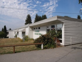
Lyndhurst Elementary School
https://search.heritageburnaby.ca/link/landmark706
- Repository
- Burnaby Heritage Planning
- Geographic Access
- Lyndhurst Street
- Associated Dates
- 1953
- Heritage Value
- The Lyndhurst Elementary School was built in 1953 to replace the previous school - the Hamilton Road School - which had served the community since 1910.
- Historic Neighbourhood
- Burquitlam (Historic Neighbourhood)
- Planning Study Area
- Lyndhurst Area
- Street Address
- 9847 Lyndhurst Street
- Street View URL
- Google Maps Street View
Images
Lyndhurst Neighbourhood
https://search.heritageburnaby.ca/link/landmark823
- Repository
- Burnaby Heritage Planning
- Associated Dates
- 1955-2008
- Heritage Value
- The Lyndhurst Neighbourhood falls within the Lougheed Town Centre area - one of four Town Centres in Burnaby. The Lyndhurst Neighbourhood accounts for a significant portion of the residential component of the Town Centre. To the east of Stoney Creek Park, lies the Sullivan Heights single family subdivision which was built in the 1950s. To the west of the park, is a higher-density residential area consisting of multi-family buildings that were developed after 1974.
- Historic Neighbourhood
- Burquitlam (Historic Neighbourhood)
- Planning Study Area
- Lyndhurst Area
Images
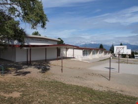
Marlborough Elementary School
https://search.heritageburnaby.ca/link/landmark695
- Repository
- Burnaby Heritage Planning
- Geographic Access
- Marlborough Avenue
- Associated Dates
- 1950
- Heritage Value
- Marlborough Elementary School was built in 1950 and was the second elementary school to be built in Burnaby after the start of the World War Two housing boom. Its design helped establish the general plans for future schools built in the city during this period - no basements, second stories or high stairways. Classrooms could easily be added, in line, as the need arose. There were additions made to Marlborough in 1952, 1961, 1967 and 1971.
- Historic Neighbourhood
- Central Park (Historic Neighbourhood)
- Planning Study Area
- Marlborough Area
- Street Address
- 6060 Marlborough Avenue
- Street View URL
- Google Maps Street View
Images
Marlborough Neighbourhood
https://search.heritageburnaby.ca/link/landmark802
- Repository
- Burnaby Heritage Planning
- Associated Dates
- 1955-2008
- Heritage Value
- The Marlborough Neighbourhood is another residential area that was witness to rapid growth and subdivision during the 1950s and 1960s, creating primarily single-family housing stock. In the 1970s and 1980s, as the commercial district around Kingsway grew, so too did higher density housing projects such as townhomes and condominiums.
- Historic Neighbourhood
- Central Park (Historic Neighbourhood)
- Planning Study Area
- Marlborough Area
Images
Maywood Neighbourhood
https://search.heritageburnaby.ca/link/landmark801
- Repository
- Burnaby Heritage Planning
- Associated Dates
- 1955-2008
- Heritage Value
- Burnaby's Maywood Neighbourhood consists of the Metrotown Town Centre - one of four Town Centres in the City. Metrotown is one of the region's most developed and fastest growing centres. It is served by the first SkyTrain line developed in the mid-1980s and anchored by B.C.'s largest shopping and entertainment complex. As an older centre that has progressively added new developments over the years, Metrotown offers a range of housing types and tenures from three-storey walk-up apartments to modern residential towers.
- Historic Neighbourhood
- Central Park (Historic Neighbourhood)
- Planning Study Area
- Maywood Area
Images
McPherson Park Junior High School
https://search.heritageburnaby.ca/link/landmark710
- Repository
- Burnaby Heritage Planning
- Associated Dates
- 1951-1993
- Street View URL
- Google Maps Street View
- Repository
- Burnaby Heritage Planning
- Geographic Access
- Rumble Street
- Associated Dates
- 1951-1993
- Heritage Value
- In 1950, the Burnaby School Inspector reported: "the recent development of a number of large housing projects and the continuing growth of new homes in settled areas are compelling the Board to consider a building program of major proportions...now under construction, including McPherson Park with 21 classrooms." Enrolment in its first year was 686 students. In the late 1980s and early 1990s, junior high schools were replaced with expanded secondary schools encompassing grades 7 through 12; as a result, McPherson Park Junior High was closed and Burnaby South Secondary School opened.
- Historic Neighbourhood
- Alta Vista (Historic Neighbourhood)
- Planning Study Area
- Clinton-Glenwood Area
- Street Address
- 5455 Rumble Street
- Street View URL
- Google Maps Street View
Morley-Buckingham Neighbourhood
https://search.heritageburnaby.ca/link/landmark829
- Repository
- Burnaby Heritage Planning
- Associated Dates
- 1955-2008
- Heritage Value
- In the 1980 "Residential Neighbourhood Environment Study," the Morley-Buckingham Neighbourhood is described as "perhaps Burnaby's most prestigious residential area. The lots are larger than most other areas of the Municipality and this, along with the new expensive housing developed over the past 10 years, has created a very desirable residential neighbourhood...The older area of Buckingham lies at the lower edge of the slope and here the homes and streets are more uniform and aged between 20 and 25 years old...to the east of Canada Way lies...a cluster townhouse development."
- Historic Neighbourhood
- Burnaby Lake (Historic Neighbourhood)
- Planning Study Area
- Morley-Buckingham Area
Images
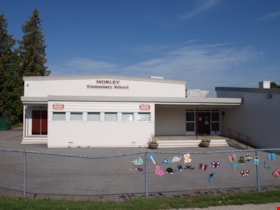
Morley Elementary School
https://search.heritageburnaby.ca/link/landmark835
- Repository
- Burnaby Heritage Planning
- Geographic Access
- Morley Street
- Associated Dates
- 1955
- Heritage Value
- In 1955 Morley Elementary School opened with 292 pupils, an indication of how quickly the residential areas around the Morley area were growing in the post-war period. Similar to other elementary schools built in Burnaby at the time, Morley was constructed on one level with classrooms in a line that could be added to as the need arose. Additions were made to the school in 1956, 1960 and 1969.
- Historic Neighbourhood
- Burnaby Lake (Historic Neighbourhood)
- Planning Study Area
- Morley-Buckingham Area
- Street Address
- 7355 Morley Street
- Street View URL
- Google Maps Street View
Images
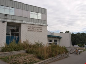
Moscrop Secondary School
https://search.heritageburnaby.ca/link/landmark813
- Repository
- Burnaby Heritage Planning
- Geographic Access
- Moscrop Street
- Associated Dates
- 1956
- Heritage Value
- By 1956, the rapidly increasing population in Burnaby necessitated the construction of many new schools, including Moscrop which opened with an enrolment of 636 students. The school was a two-storey block construction which was added to in 1965, 1971 and 1973.
- Planning Study Area
- Cascade-Schou Area
- Street Address
- 4433 Moscrop Street
- Street View URL
- Google Maps Street View
Images
North Burnaby Cenotaph
https://search.heritageburnaby.ca/link/landmark550
- Repository
- Burnaby Heritage Planning
- Description
- The North Burnaby Cenotaph is located in Confederation Park at the north end of the park on axis with the adjacent sports oval. The form of the memorial is of an obelisk atop a solid rectangular base, adorned with plaques commemorating those lost in the First World War, Second World War and the Kor…
- Associated Dates
- 1953
- Formal Recognition
- Heritage Designation, Community Heritage Register
- Repository
- Burnaby Heritage Planning
- Geographic Access
- Willingdon Avenue
- Associated Dates
- 1953
- Formal Recognition
- Heritage Designation, Community Heritage Register
- Enactment Type
- Bylaw No. 9807
- Enactment Date
- 23/11/1992
- Description
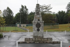
- The North Burnaby Cenotaph is located in Confederation Park at the north end of the park on axis with the adjacent sports oval. The form of the memorial is of an obelisk atop a solid rectangular base, adorned with plaques commemorating those lost in the First World War, Second World War and the Korean War.
- Heritage Value
- Built in 1953 by stonemason and First World War Veteran, Walter Holmes Morrice, the cenotaph was erected by the North Burnaby Legion Post #148 and is one of four memorials to citizens of Burnaby whose lives were lost at war. Strategically placed in an active and vibrant public park that was dedicated in 1927 and is used for sports, family outings and social gatherings, the cenotaph celebrates the freedoms that soldiers gave their lives to protect. The cenotaph is still used as a memorial site and bears witness to annual Remembrance Day ceremonies. Built of irregular granite blocks, the cenotaph is a solid structure of modest ornamentation that visually anchors the north end of the park. The site of the cenotaph and its adjacent gardens are surrounded by a simple barrier of continuous chain supported by low metal fence posts, providing a sense of solemnity and ceremony to the site.
- Defining Elements
- The character-defining elements of the North Burnaby Cenotaph include its: - axial location in the park and setting among active municipal facilities such as a school and library - strong symmetry of massing and design - obelisk form set atop a rectangular base - limited palette of materials - random coursed granite used as primary building material - bronze plaques commemorating the First and Second World Wars and the Korean War - surrounding pathways and flowerbeds
- Historic Neighbourhood
- Capitol Hill (Historic Neighbourhood)
- Planning Study Area
- Capitol Hill Area
- Organization
- North Burnaby Legion Post #148
- Builder
- Walter Holmes Morrice
- Function
- Primary Current--Park Fixture
- Primary Historic--Park Fixture
- Community
- Burnaby
- Cadastral Identifier
- P.I.D. No. 017-040-752 Legal Description: Parcel 1, District Lots 122 and 188, Group 1, New Westminster District, Plan NWP87902
- Boundaries
- The property (Confederation Park) is comprised of a single municipally-owned property located at 250 Willingdon Avenue, Burnaby.
- Area
- 184,160.00
- Contributing Resource
- Landscape Feature
- Structure
- Ownership
- Public (local)
- Documentation
- Heritage Site Files: PC77000 20. City of Burnaby Planning and Building Department, 4949 Canada Way, Burnaby, B.C., V5G 1M2
- Street Address
- 250 Willingdon Avenue
Images
Oakalla Neighbourhood
https://search.heritageburnaby.ca/link/landmark804
- Repository
- Burnaby Heritage Planning
- Associated Dates
- 1955-2008
- Heritage Value
- The phasing out and demolition of the Oakalla Prison farm allowed for the planned development of the Oakalla Neighbourhood in the 1980s. By 1991, the City of Burnaby had adopted the Oakalla Development Plan which called for the transfer of land to the Deer Lake Park reserve as well as the creation of a new residential area consisting of multi-family housing types.
- Historic Neighbourhood
- Central Park (Historic Neighbourhood)
- Planning Study Area
- Oakalla Area
Images
Parkcrest-Aubrey Neighbourhood
https://search.heritageburnaby.ca/link/landmark782
- Repository
- Burnaby Heritage Planning
- Associated Dates
- 1955-2008
- Heritage Value
- After its initial subdivision and development in the early 1950s, the Parkcrest-Audrey Neighbourhood continued to be a primarily residential area. In the 1980 Residential Neighbourhood Environment Study, the area was characterised as a stable residential neighbourhood that was served by the major collector streets Holdom, Broadway, Parker and Kensington.
- Planning Study Area
- Parkcrest-Aubrey Area
Images
Parkcrest Neighbourhood
https://search.heritageburnaby.ca/link/landmark671
- Repository
- Burnaby Heritage Planning
- Associated Dates
- 1925-1954
- Heritage Value
- On May 10, 1951, the Burnaby News-Courier reported on the new Parkcrest subdivision, saying: "Central Burnaby is the scenic locale of a successful attempt to produce modern houses economically and yet avoid the mass production effect common to other housing developments. That is one of the many highlights peculiar to the new Parkcrest development of 275 homes...By giving home purchasers a wide choice of finishes, extras and colours, hundreds of variations are possible on the six basic floor plans...Travelling time by car to Hastings and Granville from Parkcrest has been clocked at 15 minutes...Both primary and junior high schools are within walking distance. A modern shopping centre is planned for the future...Several streets are laid out in a straight but irregular manner, thus eliminating the prosaic side by side appearance block by block, as in other housing developments."
- Planning Study Area
- Parkcrest-Aubrey Area
Images
Richmond Park Neighbourhood
https://search.heritageburnaby.ca/link/landmark828
- Repository
- Burnaby Heritage Planning
- Associated Dates
- 1955-2008
- Heritage Value
- The Richmond Park Neighbourhood is part of the larger Edmonds Town Centre - one of four official Town Centres in the City. Richmond Park contains a residential subdivision that developed during the 1950s as well as a strong commercial and retail centre along Edmonds and Kingsway.
- Historic Neighbourhood
- Edmonds (Historic Neighbourhood)
- Planning Study Area
- Richmond Park Area
Images
Riverside School
https://search.heritageburnaby.ca/link/landmark711
- Repository
- Burnaby Heritage Planning
- Geographic Access
- Marine Drive
- Associated Dates
- 1953-1983
- Heritage Value
- The south-east corner of Burnaby featured homes that were scattered in a rural setting. Previously, Riverway East and then Clinton Elementary School had served this neighbourhood, but a more central location was preferable to the School Board to limit bussing of students, so Riverside School was opened in 1953. There were 84 students registered in its first year, but by the late 1970s, enrolments across the City had declined and a number of schools, including Riverside, were closed.
- Historic Neighbourhood
- Fraser Arm (Historic Neighbourhood)
- Planning Study Area
- Big Bend Area
Images
Second Street Neighbourhood
https://search.heritageburnaby.ca/link/landmark826
- Repository
- Burnaby Heritage Planning
- Associated Dates
- 1955-2008
- Heritage Value
- Second Street had its origins in the 1910-1920 era and the Second Street Elementary School was built in 1928. Substantial new housing was built in the late 1940s and 1950s and infilling occurred during the 1960s and 1970s. By the 1980s, the neighbourhood was primarily a single family area with a small number of multi-family buildings.
- Historic Neighbourhood
- East Burnaby (Historic Neighbourhood)
- Planning Study Area
- Second Street Area
Images
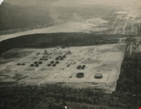
Shell Oil Company
https://search.heritageburnaby.ca/link/landmark675
- Repository
- Burnaby Heritage Planning
- Geographic Access
- Kensington Avenue
- Associated Dates
- ca. 1930-1993
- Heritage Value
- After considering several sites in the Greater Vancouver area, the Shell Oil Company chose 70 acres in North Burnaby with frontage of one third of a mile on Burrard Inlet. Shell proposed to build a four-million dollar plant that would employ up to 2000 - providing some relief in the middle of Burnaby's economic crisis of the Depression years. The site became known as the Shellburn Refinery and was in operation until 1993.
- Historic Neighbourhood
- Lochdale (Historic Neighbourhood)
- Planning Study Area
- Westridge Area
Images
Simpson-Sears
https://search.heritageburnaby.ca/link/landmark696
- Repository
- Burnaby Heritage Planning
- Geographic Access
- Kingsway
- Associated Dates
- 1954
- Heritage Value
- The Simpson-Sears store on Kingsway opened in 1954 and was the second Simpson-Sears to be located in British Columbia. The store helped to solidify the neighbourhood's growing reputation as a major commercial centre in the Lower Mainland and became a prototype for the company's large format stores across Canada.
- Historic Neighbourhood
- Central Park (Historic Neighbourhood)
- Planning Study Area
- Maywood Area
- Street Address
- 4700 Kingsway
Images
Sperling-Broadway Neighbourhood
https://search.heritageburnaby.ca/link/landmark789
- Repository
- Burnaby Heritage Planning
- Associated Dates
- 1955-2008
- Heritage Value
- By the 1970s, the Sperling-Broadway Neighbourhood was characterised as one of the Municipality's fastest growing residential areas. In 1980, it was estimated that slightly less than half of the homes were single-family residences, while the remaining development was taking the form of townhouse and high-rise apartments. The emphasis shifted back to single family housing during the construction of planned subdivisions such as the Camrose subdivision in the 1980s and the area remains primarily residential in nature. The neighbourhood is well-served by park facilities and is also home to the Burnaby Mountain Golf Course.
- Historic Neighbourhood
- Lochdale (Historic Neighbourhood)
- Planning Study Area
- Sperling-Broadway Area
Images
Stride Avenue Neighbourhood
https://search.heritageburnaby.ca/link/landmark845
- Repository
- Burnaby Heritage Planning
- Associated Dates
- 1955-2008
- Heritage Value
- The interurban link between New Westminster and Vancouver stimulated the early settlement of Stride Avenue. Infilling of the area took place in the early 1950s and the pace of development had slowed considerably by 1970. Duplexes became a popular feature in the decade between 1970 and 1980 and in the late 1980s, the neighbourhood was incorporated into the Edmonds Town Centre South plan.
- Historic Neighbourhood
- Edmonds (Historic Neighbourhood)
- Planning Study Area
- Stride Avenue Area
Images
Stride Hill Neighbourhood
https://search.heritageburnaby.ca/link/landmark846
- Repository
- Burnaby Heritage Planning
- Associated Dates
- 1955-2008
- Heritage Value
- The residential areas that are located within the Stride Hill Neighbourhood were primarily developed in the 1950s during Burnaby's post-war building boom. The area lying to the south of Byrne Creek Ravine Park was used as a municipal garbage dump until the 1960s and as a landfill site for yard waste disposal until the early 1990s at which point the area was incorporated into the Edmonds Town Centre Plan and the land was made into park and open space.
- Historic Neighbourhood
- Edmonds (Historic Neighbourhood)
- Planning Study Area
- Stride Hill Area
Images
Suncrest Neighbourhood
https://search.heritageburnaby.ca/link/landmark839
- Repository
- Burnaby Heritage Planning
- Associated Dates
- 1955-2008
- Heritage Value
- The Suncrest Neighbourhood is a small residential area south of Burnaby's Central Park. The Ocean View Burial Park takes up a large area of land in the north-east corner of this neighbourhood and the majority of the housing was built during the 1930-1960 period.
- Historic Neighbourhood
- Alta Vista (Historic Neighbourhood)
- Planning Study Area
- Suncrest Area
Images
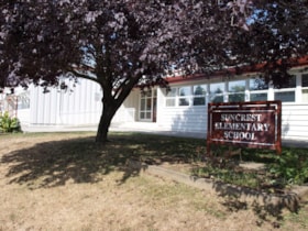
Suncrest School
https://search.heritageburnaby.ca/link/landmark694
- Repository
- Burnaby Heritage Planning
- Geographic Access
- Rumble Street
- Associated Dates
- 1953
- Heritage Value
- The new Suncrest subdivision developed in the early 1950s, resulting in 312 new homes in 1951, with an additional 100 being planned. As a result, enrolment pressure resulted in the construction of Suncrest School in 1953. Additions to the original structure were made in 1954 and a library, change rooms and staffroom were added in 1969.
- Historic Neighbourhood
- Alta Vista (Historic Neighbourhood)
- Planning Study Area
- Suncrest Area
- Street Address
- 3883 Rumble Street
- Street View URL
- Google Maps Street View
Images
Sussex Avenue School
https://search.heritageburnaby.ca/link/landmark815
- Repository
- Burnaby Heritage Planning
- Geographic Access
- Irmin Street
- Associated Dates
- 1955-1982
- Heritage Value
- Sussex Avenue school was another school built during the peak expansion years of the 1950s and early 1960s. Burnaby's population was growing at such a fast pace during that decade that 10 new schools were built, and existing schools were expanded. Sussex Avenue School opened with 304 pupils. By the 1970s, student enrolment had slowed considerably from its peak and as a result, a number of schools - including Sussex - were closed.
- Historic Neighbourhood
- Alta Vista (Historic Neighbourhood)
- Planning Study Area
- Sussex-Nelson Area
- Street Address
- 4443 Irmin Street
Images
Sussex-Nelson Neighbourhood
https://search.heritageburnaby.ca/link/landmark838
- Repository
- Burnaby Heritage Planning
- Associated Dates
- 1955-2008
- Heritage Value
- The Sussex-Nelson Neighbourhood is located just south of Metrotown and in 1980 was characterised as the most populated of all of Burnaby's Planning Study areas. The area immediately south of Metrotown was initially developed as post-war 1950s housing stock, while the sector south of Rumble was developed after the 1960s and 1970s as single-family housing.
- Historic Neighbourhood
- Alta Vista (Historic Neighbourhood)
- Planning Study Area
- Sussex-Nelson Area
Images
Trans Mountain Pipeline Company
https://search.heritageburnaby.ca/link/landmark685
- Repository
- Burnaby Heritage Planning
- Geographic Access
- Shellmont Street
- Associated Dates
- 1953
- Heritage Value
- On March 21, 1951 the Parliament of Canada granted the Trans Mountain Oil Pipe Line Company a charter. By May of the following year, the Corporation of Burnaby gave final reading to Bylaw No. 3203, which resulted in the conveyance of land in DL 142, 143 and 144 (Burnaby Mountain site) to the Trans Mountain Oil Pipe Line Company. Construction of the Burnaby Mountain tank farm was completed in October of 1953 and the site became operational as the first shipment of oil reached Trans Mountain’s Burnaby Terminal.
- Planning Study Area
- Lake City Area
- Street Address
- 8099 Shellmont Street
- Street View URL
- Google Maps Street View
Images
Twelfth Avenue Elementary School
https://search.heritageburnaby.ca/link/landmark848
- Repository
- Burnaby Heritage Planning
- Geographic Access
- 12th Avenue
- Associated Dates
- 1958
- Heritage Value
- Twelfth Avenue School was one of two schools built to relieve the overcrowding at Edmonds School resulting from the housing boom in Burnaby during the 1950s - Lakeview was the other. Built in 1958, the building was added to in 1962, 1964, 1967, 1969 and 1974.
- Historic Neighbourhood
- Edmonds (Historic Neighbourhood)
- Planning Study Area
- Edmonds Area
- Street Address
- 7622 12th Avenue
- Street View URL
- Google Maps Street View
Images
Vancouver Heights Neighbourhood
https://search.heritageburnaby.ca/link/landmark666
- Repository
- Burnaby Heritage Planning
- Associated Dates
- 1925-1954
- Heritage Value
- Vancouver Heights remained an important residential and commercial centre in Burnaby throughout the 1925-1954 period. The area had its own Board of Trade and the North Burnaby Library was created to serve the residents. In 1949, the Hastings streetcars stopped running, but the area retained its reputation as one of the best shopping districts in the city.
- Historic Neighbourhood
- Vancouver Heights (Historic Neighbourhood)
- Planning Study Area
- Burnaby Heights Area
Images
West Central Valley Neighbourhood
https://search.heritageburnaby.ca/link/landmark778
- Repository
- Burnaby Heritage Planning
- Associated Dates
- 1955-2008
- Heritage Value
- The West Central Valley Neighbourhood is home to the Bridge Business Park and is a primarily industrial neighbourhood. Similar to the adjacent Dawson-Delta Neighbourhood, West Central Valley offers businesses convenient access to major roads and highways.
- Historic Neighbourhood
- Broadview (Historic Neighbourhood)
- Planning Study Area
- West Central Valley Area
Images
Westridge Neighbourhood
https://search.heritageburnaby.ca/link/landmark680
- Repository
- Burnaby Heritage Planning
- Associated Dates
- 1925-1954
- Heritage Value
- The Westridge Neighbourhood of Burnaby was created as a new subdivision during the post-World War Two housing boom in Burnaby. Developed by the C.B. Riley Company, it was laid out in a plan contoured to the shapes of the land and was situated to allow residents easy access to main transportation routes.
- Historic Neighbourhood
- Lochdale (Historic Neighbourhood)
- Planning Study Area
- Westridge Area
Images
Westridge Neighbourhood
https://search.heritageburnaby.ca/link/landmark791
- Repository
- Burnaby Heritage Planning
- Associated Dates
- 1955-2008
- Heritage Value
- The Westridge Neighbourhood is effectively separated into two areas by Inlet Drive. To the west of the highway lies a typical 1950s subdivision of single-family homes, while to the east is a newer (1970s) subdivision featuring larger lots and some low-rise units. In the 1980 Residential Neighbourhood Environment Study, Westridge was characterised as a stable community with little need for direct Municipal involvement in growth and development.
- Historic Neighbourhood
- Lochdale (Historic Neighbourhood)
- Planning Study Area
- Westridge Area
Images
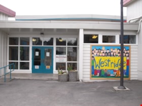
Westridge School
https://search.heritageburnaby.ca/link/landmark676
- Repository
- Burnaby Heritage Planning
- Geographic Access
- Duncan Avenue
- Associated Dates
- 1953
- Heritage Value
- The building boom in Burnaby during the first few years of the 1950s resulted in many new subdivisions being created in previously unoccupied areas of Burnaby. One such neighbourhood was the Westridge area. In 1951, the Inspector of Schools noted in a report that there were 475 new homes in Westridge with another 100 under development. As a result, enrolment pressures were particularly heavy in this area and the School Board opened the Westridge Elementary School in 1953.
- Historic Neighbourhood
- Lochdale (Historic Neighbourhood)
- Planning Study Area
- Westridge Area
- Street Address
- 510 Duncan Avenue
- Street View URL
- Google Maps Street View
Images
Willingdon Heights Neighbourhood
https://search.heritageburnaby.ca/link/landmark670
- Repository
- Burnaby Heritage Planning
- Associated Dates
- 1925-1954
- Heritage Value
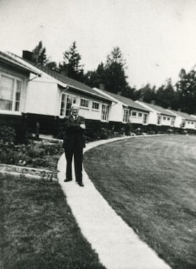
- Willingdon Heights was another new subdivision developed in Burnaby during the post-World War Two building boom. A brochure about the development published in 1948 proclaimed "the Willingdon Heights 500 home development project in Burnaby fulfills its promise to provide a self-contained community for former members of the armed services and their families...the largest single veteran housing project in Canada as far as homes for individual ownership is concerned, Willingdon Heights development was planned by the Central Mortgage and Housing Corporation...At this date the earlier built rows of homes have passable roads and the owners are improving lawns and gardens in spare time...eventually additional stores and professional services will be installed and recreational projects will add to the amenities of a community of congenial residents..."
- Planning Study Area
- Willingdon Heights Area
Images
Willingdon Heights Neighbourhood
https://search.heritageburnaby.ca/link/landmark777
- Repository
- Burnaby Heritage Planning
- Associated Dates
- 1955-2008
- Heritage Value
- The convenient location of Willingdon Heights to the Trans Canada Highway, Lougheed Highway and Hastings Street has fostered its development as a primarily residential commuter neighbourhood. Characterised in the post-World War Two period by predominantly single-family developments, the neighbourhood has retained this identity despite some higher density apartment buildings now found there.
- Planning Study Area
- Willingdon Heights Area
Images
Willingdon Heights United Church
https://search.heritageburnaby.ca/link/landmark658
- Repository
- Burnaby Heritage Planning
- Description
- Church building.
- Associated Dates
- 1951
- Street View URL
- Google Maps Street View
- Repository
- Burnaby Heritage Planning
- Geographic Access
- Parker Street
- Associated Dates
- 1951
- Description
- Church building.
- Heritage Value
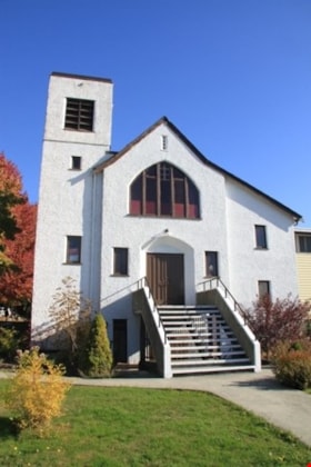
- This church was built to serve a 500-home subdivision known as Willingdon Heights–Canada’s largest single veteran’s housing project created by the Central Mortgage and Housing Corporation and constructed by the Whitsell Construction Company in 1948. The church building was designed as a simplified Gothic Revival church with a tall front tower and Gothic pointed-arch stained glass window and entrance. This church was designed by Vancouver architects Twizell & Twizell. Both Robert Twizell (1875-1964) and younger brother George Twizell (1885-1957) articled at Newcastle, England’s Hicks & Charlewood before arriving in Vancouver in late 1907 or early 1908, with George working for Robert until they established a partnership a few years later. Their firm lasted for nearly half a century and was well known for its numerous church designs.
- Locality
- Vancouver Heights
- Historic Neighbourhood
- Vancouver Heights (Historic Neighbourhood)
- Planning Study Area
- Willingdon Heights Area
- Architect
- Twizell & Twizell
- Area
- 1808.82
- Contributing Resource
- Building
- Ownership
- Private
- Street Address
- 4304 Parker Street
- Street View URL
- Google Maps Street View
Images
Windsor Neighbourhood
https://search.heritageburnaby.ca/link/landmark803
- Repository
- Burnaby Heritage Planning
- Associated Dates
- 1955-2008
- Heritage Value
- The Windsor Neighbourhood comprises a number of different districts with different characteristics. To the north, stretching to the border of the Deer Lake Park, is the primarily residential area that was developed after the building boom of the 1950s and now consists of a mix of single-family and multi-family housing. To the south, from Kingsway to the Skytrain line, an industrial area was maintained along with a significant commercial corridor along Kingsway. In recent years, the growth and development of this area has been guided by the Royal Oak Community Plan adopted by Council in 1999.
- Planning Study Area
- Windsor Area
Images
Belted kingfisher
https://search.heritageburnaby.ca/link/archivedescription82754
- Repository
- City of Burnaby Archives
- Date
- [1957]
- Collection/Fonds
- Hazel Simnett collection
- Description Level
- Item
- Physical Description
- 1 paintings : colour print ; 28 x 18.5 cm
- Scope and Content
- Painting shows a belted kingfisher.
- Repository
- City of Burnaby Archives
- Date
- [1957]
- Collection/Fonds
- Hazel Simnett collection
- Physical Description
- 1 paintings : colour print ; 28 x 18.5 cm
- Description Level
- Item
- Record No.
- 559-009
- Access Restriction
- In Archives only
- Reproduction Restriction
- No reproduction permitted
- Accession Number
- 2013-22
- Scope and Content
- Painting shows a belted kingfisher.
- Subjects
- Animals - Birds
- Arts - Paintings
- Media Type
- Graphic Material
- Creator
- Lansdowne, James Fenwick
- Notes
- Title transcribed from item
- Simnett personal papers series
Images
Blue flowers
https://search.heritageburnaby.ca/link/archivedescription63105
- Repository
- City of Burnaby Archives
- Date
- [before 1976]
- Collection/Fonds
- Burnaby Historical Society fonds
- Description Level
- Item
- Physical Description
- 1 painting : watercolour ; 38.5 x 26 cm
- Scope and Content
- Item is a watercolour painting by Leila Orman of cut blue flowers arranged in a flower pot.
- Repository
- City of Burnaby Archives
- Date
- [before 1976]
- Collection/Fonds
- Burnaby Historical Society fonds
- Subseries
- Leila Orman subseries
- Physical Description
- 1 painting : watercolour ; 38.5 x 26 cm
- Description Level
- Item
- Record No.
- MSS104-020
- Accession Number
- BHS2007-04
- Scope and Content
- Item is a watercolour painting by Leila Orman of cut blue flowers arranged in a flower pot.
- Media Type
- Graphic Material
- Notes
- Title based on contents of painting
Bullock's oriole
https://search.heritageburnaby.ca/link/archivedescription82753
- Repository
- City of Burnaby Archives
- Date
- [1957]
- Collection/Fonds
- Hazel Simnett collection
- Description Level
- Item
- Physical Description
- 1 paintings : colour print ; 28 x 18.5 cm
- Scope and Content
- Painting shows two Bullock's orioles.
- Repository
- City of Burnaby Archives
- Date
- [1957]
- Collection/Fonds
- Hazel Simnett collection
- Physical Description
- 1 paintings : colour print ; 28 x 18.5 cm
- Description Level
- Item
- Record No.
- 559-008
- Access Restriction
- In Archives only
- Reproduction Restriction
- No reproduction permitted
- Accession Number
- 2013-22
- Scope and Content
- Painting shows two Bullock's orioles.
- Subjects
- Animals - Birds
- Arts - Paintings
- Media Type
- Graphic Material
- Creator
- Lansdowne, James Fenwick
- Notes
- Title transcribed from item
- Simnett personal papers series
Images
California quail
https://search.heritageburnaby.ca/link/archivedescription82748
- Repository
- City of Burnaby Archives
- Date
- [1956]
- Collection/Fonds
- Hazel Simnett collection
- Description Level
- Item
- Physical Description
- 1 painting : colour print ; 37 x 28 cm
- Scope and Content
- Painting shows two California quail.
- Repository
- City of Burnaby Archives
- Date
- [1956]
- Collection/Fonds
- Hazel Simnett collection
- Physical Description
- 1 painting : colour print ; 37 x 28 cm
- Description Level
- Item
- Record No.
- 559-003
- Access Restriction
- In Archives only
- Reproduction Restriction
- No reproduction permitted
- Accession Number
- 2013-22
- Scope and Content
- Painting shows two California quail.
- Subjects
- Animals - Birds
- Arts - Paintings
- Media Type
- Graphic Material
- Creator
- Lansdowne, James Fenwick
- Notes
- Title transcribed from item
- Simnett personal papers series
Images
Green-winged teal
https://search.heritageburnaby.ca/link/archivedescription82749
- Repository
- City of Burnaby Archives
- Date
- [1957]
- Collection/Fonds
- Hazel Simnett collection
- Description Level
- Item
- Physical Description
- 1 painting : colour print ; 37 x 28 cm
- Scope and Content
- Painting shows two green-winged teal.
- Repository
- City of Burnaby Archives
- Date
- [1957]
- Collection/Fonds
- Hazel Simnett collection
- Physical Description
- 1 painting : colour print ; 37 x 28 cm
- Description Level
- Item
- Record No.
- 559-004
- Access Restriction
- In Archives only
- Reproduction Restriction
- No reproduction permitted
- Accession Number
- 2013-22
- Scope and Content
- Painting shows two green-winged teal.
- Subjects
- Animals - Birds
- Arts - Paintings
- Media Type
- Graphic Material
- Creator
- Lansdowne, James Fenwick
- Notes
- Title transcribed from item
- Simnett personal papers series
Images
Hazel Simnett collection
https://search.heritageburnaby.ca/link/archivedescription71379
- Repository
- City of Burnaby Archives
- Date
- [1910-1996]
- Collection/Fonds
- Hazel Simnett collection
- Description Level
- Fonds
- Physical Description
- 13 files of textual records : ill. (some col.) ; 9 paintings : colour print ; 2 photographs : b&w
- Scope and Content
- Fonds consists of City-generated records, personal records, and political records collected by Hazel Simnett.
- Repository
- City of Burnaby Archives
- Date
- [1910-1996]
- Collection/Fonds
- Hazel Simnett collection
- Physical Description
- 13 files of textual records : ill. (some col.) ; 9 paintings : colour print ; 2 photographs : b&w
- Description Level
- Fonds
- Accession Number
- 2013-22
- 2012-03
- Scope and Content
- Fonds consists of City-generated records, personal records, and political records collected by Hazel Simnett.
- History
- Hazel Simnett was born in Burnaby in 1922 to Frederick and Mary Ann Simnett and grew up looking up to her father who was very involved in labour and unions. A politically active citizen, Hazel Simnett has supported the Canadian Commonwealth Federation (CCF) and the New Democratic Party (NDP). She once ran as a New Democratic Party candidate for Burnaby City Council. Hazel attended Kingsway West Public School and Burnaby South High School in Burnaby. During the 1970s, Hazel was President of the Century Park Museum Association, which governs Burnaby Heritage Museum and published the work "Bygones of Burnaby". Hazel worked on the campaign team of Joan Sawicki from 1990 to 1991, which led Sawicki to be elected as Burnaby-Willingdon riding's MLA. Hazel volunteered her time to be a member of the Burnaby Advisory Planning Commission from 1993 to 1996. In 2006, Hazel won the Burnaby Local Hero Award for her volunteer work at the New Vista Society where she served as chair for a number of years. She also served as a member of the Burnaby Historical Society and established the Hazel Simnett Endowment with the Burnaby Public Library to bring a collection of books on Canadian history and social issues.
- Media Type
- Textual Record
- Photograph
- Graphic Material
- Creator
- Simnett, Hazel
- Notes
- Title based on contents of fonds
- MSS167
Hipman "Jimmy" Chow and Donna Polos fonds
https://search.heritageburnaby.ca/link/museumdescription19150
- Repository
- Burnaby Village Museum
- Date
- 1950-2022
- Collection/Fonds
- Hipman "Jimmy" Chow and Donna Polos fonds
- Description Level
- Fonds
- Physical Description
- 3 sound recordings (wav) + 1 sound recording (mp3) + 65 photographs + 26 photographs (jpg) + 1 portfolio (15 col. photographs + 12 col. laser prints) + 1 col. laser print + 6 business cards + 1 identification card + 1 booklet
- Scope and Content
- Fonds consists of an oral history interview with Jimmy Chow and his wife, Donna Polos; photographs of Jimmy Chow and his family soon after they immigrated to Canada in the 1950s as well as a sampling of photographs and records documenting Jimmy Chow's career in the film industry. Fonds is arranged…
- Repository
- Burnaby Village Museum
- Collection/Fonds
- Hipman "Jimmy" Chow and Donna Polos fonds
- Description Level
- Fonds
- Physical Description
- 3 sound recordings (wav) + 1 sound recording (mp3) + 65 photographs + 26 photographs (jpg) + 1 portfolio (15 col. photographs + 12 col. laser prints) + 1 col. laser print + 6 business cards + 1 identification card + 1 booklet
- Scope and Content
- Fonds consists of an oral history interview with Jimmy Chow and his wife, Donna Polos; photographs of Jimmy Chow and his family soon after they immigrated to Canada in the 1950s as well as a sampling of photographs and records documenting Jimmy Chow's career in the film industry. Fonds is arranged into series: 1) Jimmy Chow and Donna Polos interviews series 2) Jimmy Chow family photographs series 3) Property master photographs series 4) Property master records series
- History
- Hipman "Jimmy" Chow was born in Lin Pong Lee, Hoiping, China in 1948. In 1950, Jimmy Chow and his mother, Gim Gee Chow (1913-1991) fled China to escape the Communist Revolution and to be reunited with his father, Robin Chung Dip Chow (1906-1990) who’d immigrated to Canada many years earlier. Jimmy’s elder sister Shao-Lin Chow stayed behind in China. Jimmy’s father, Robin Chung Dip Chow immigrated to Canada in 1921 at 14 years of age and was forced to pay the Chinese head tax of $500. In 1950, Jimmy and his mother first fled to Hong Kong before immigrating to Canada and arriving in Vancouver. Jimmy Chow’s birth name is Hipman Chow but when he arrived in Canada, his father indicated that he needed an English name and he was given the name “Jimmy” but retained his birth name “Hipman Chow”. Over the years, Jimmy has also used the name “James H. Chow” and is often credited by this name in the film industry. For the first four years after immigrating, Jimmy and his parents lived in Manitoba, Saskatchewan and Quebec where his father had work in hotels and restaurants. While living in Asquith, Saskatchewan Jimmy attended school and began to learn English. In 1954, Jimmy and his parents returned to Vancouver, first living in the area of Strathcona before settling in the neighbourhood of Mount Pleasant where they purchased a house located on 15th Avenue east of Main Street. While living in Mount Pleasant, Jimmy attended both elementary and high school. While attending high school, Jimmy began working at the local grocery store where he worked for many years living at home and saving his money. In 1970 while attending Vancouver City College, Jimmy met his future wife Donna Polos. Two years later, they moved in together, married in 1981 and started a family. Jimmy and Donna first lived in North Burnaby before purchasing a house on Victory Street in Burnaby where they raised their three children. Growing up in a traditional Chinese Canadian family, Jimmy was always one who went against the grain. Although his father wanted him to get a business degree, Jimmy had aspirations for a different career path. Through the referral of a friend, he entered the film industry in 1973 working for CBC Vancouver. While working at the CBC, Jimmy gained valuable experience working on the set of the television series The Beachcombers, which launched his career in the film industry. Over a 45 year career, Jimmy worked on over 50 blockbuster movies, historical period films, science fiction films and fantasy films, where he honed in on his expertise as a set decorator, art director and property master. He built an international reputation through working with production companies, prop makers and antique sellers across the globe. As a property master in the film industry, Jimmy Chow has been responsible for designing, managing, and sourcing props for films such as: The BFG, Warcraft: The Beginning, X-Men 2, Fantastic Four, Watchman, Tron: Legacy, Little Women, Seven Years in Tibet, Shanghai Noon, The Shipping News, Fantastic Four: Rise of the Silver Surfer, The Changeling, Man of Steel (Superman), Snow Falling on Cedars, Legends of the Fall, And the Sea Will Tell, Once a Thief and many more. With Jimmy's many years of professional experience in the film industry, he has been a union member of IATSE (International Alliance of Theatrical Stage Employees, Moving Picture Technicians...) from July 1979, a member of the Academy of Motion Picture Arts and Science from 2018 and has worked as a guest lecturer in film production at Capilano University and Langara University. He was also a key contributor to the Burnaby Village Museum’s 2014 temporary exhibition Burnaby Makes Movies. Donna Polos was born in Vancouver in 1949 to parents Mayme "May" Helen Tillikana Polos (1931-1977) and Donald James Polos (1926-2017). Donna’s maternal grandparents, Elvi Tienhara and Toiva Tillikana immigrated to Canada from Helsinki, Finland. Donna’s paternal grandmother, Pauline Chimiki Polos emigrated from Ukraine to Argentina and then to Winnipeg. Donna’s paternal grandfather, James "Jimmy" Kostopolus emigrated as an orphan from Sparta Greece at the age of 12 years. In 1908, he first immigrated to the United States where he was denied entry so immigrated to Canada, entering through Halifax at Pier 17. When immigrating, James changed his last name to "Polos". Jimmy Polos arrived in Halifax with only five dollars in his pocket. He lived in Halifax for many years before making his way to Vancouver where he established three restaurants and raised his family. James was the proprietor of three restaurants in Burnaby including; the Home Apple Pie Café (1941-1944) located on East Hastings near Princess Avenue; Jimmy’s Café (1945-1955) located on East Hastings near Hawks Avenue and another restaurant located near 10th Avenue and Alma Street. Donna grew up with her family in Vancouver, first living in the downtown eastside before moving to a home near Joyce Station. Donna attended elementary school and high school while growing up in the neighbourhood of Joyce Station. Donna moved out of her family home at 21 years of age and lived with roommates before moving in with Jimmy Chow in 1972. Donna attended Vancouver City College and the University of British Columbia where she obtained her teaching degree in 1974. Donna first taught at Gilmore Elementary School before being hired to teach at Clinton Elementary School where she taught for nine years. While raising their three children, Donna worked part time teaching in schools in Burnaby. In 1991, after a near death experience, Donna became interested in fine art and took drawing and watercolour painting classes. This experience led her to experimenting with different painting techniques on paper and fabric. In 2008, Donna retired from teaching but continued her art career often working as an Artist in Residence at various schools and exhibiting her work. While living in Burnaby Donna has been politically active with a particular passion for heritage, housing and preserving the natural environment. Donna was instrumental in advocating and petitioning for the establishment of a tree bylaw in Burnaby which was eventually adopted by the City.
- Creator
- Chow, Hipman "Jimmy"
- Polos, Donna
- Accession Code
- BV022.21
- BV023.11
- Date
- 1950-2022
- Media Type
- Sound Recording
- Photograph
- Textual Record
- Graphic Material
- Notes
- Title based on contents of fonds
- Hipman "Jimmy" Chow's name in Cantonese is Chow Hipman and in Mandarin is Zhou Xiamin.
Macgillivray's warbler
https://search.heritageburnaby.ca/link/archivedescription82751
- Repository
- City of Burnaby Archives
- Date
- [1955]
- Collection/Fonds
- Hazel Simnett collection
- Description Level
- Item
- Physical Description
- 1 painting : colour print ; 37 x 28 cm
- Scope and Content
- Painting shows two Macgillvray's warblers.
- Repository
- City of Burnaby Archives
- Date
- [1955]
- Collection/Fonds
- Hazel Simnett collection
- Physical Description
- 1 painting : colour print ; 37 x 28 cm
- Description Level
- Item
- Record No.
- 559-006
- Access Restriction
- In Archives only
- Reproduction Restriction
- No reproduction permitted
- Accession Number
- 2013-22
- Scope and Content
- Painting shows two Macgillvray's warblers.
- Subjects
- Animals - Birds
- Arts - Paintings
- Media Type
- Graphic Material
- Creator
- Lansdowne, James Fenwick
- Notes
- Title transcribed from item
- Simnett personal papers series
Images
Mourning dove
https://search.heritageburnaby.ca/link/archivedescription82755
- Repository
- City of Burnaby Archives
- Date
- [1957]
- Collection/Fonds
- Hazel Simnett collection
- Description Level
- Item
- Physical Description
- 1 paintings : colour print ; 28 x 18.5 cm
- Scope and Content
- Painting shows a mourning dove.
- Repository
- City of Burnaby Archives
- Date
- [1957]
- Collection/Fonds
- Hazel Simnett collection
- Physical Description
- 1 paintings : colour print ; 28 x 18.5 cm
- Description Level
- Item
- Record No.
- 559-010
- Access Restriction
- In Archives only
- Reproduction Restriction
- No reproduction permitted
- Accession Number
- 2013-22
- Scope and Content
- Painting shows a mourning dove.
- Subjects
- Animals - Birds
- Arts - Paintings
- Media Type
- Graphic Material
- Creator
- Lansdowne, James Fenwick
- Notes
- Title transcribed from item
- Simnett personal papers series
Images
Personal material
https://search.heritageburnaby.ca/link/archivedescription82732
- Repository
- City of Burnaby Archives
- Date
- [1910-1978]
- Collection/Fonds
- Hazel Simnett collection
- Description Level
- File
- Physical Description
- 9 paintings : colour print, 2 photographs : b&w, and 1 folder of textual records
- Scope and Content
- File consists of application for a driver's license, Kingsway Driving School report card, driver's examination receipt and a letter addressed to Hazel Simnett from the Victorian Order of Nurses for Canada. Also included is an immigration inspection card of Fred Simnett aboard the S.S. Lake Champlai…
- Repository
- City of Burnaby Archives
- Date
- [1910-1978]
- Collection/Fonds
- Hazel Simnett collection
- Physical Description
- 9 paintings : colour print, 2 photographs : b&w, and 1 folder of textual records
- Description Level
- File
- Record No.
- MSS167-008
- Accession Number
- 2013-22
- Scope and Content
- File consists of application for a driver's license, Kingsway Driving School report card, driver's examination receipt and a letter addressed to Hazel Simnett from the Victorian Order of Nurses for Canada. Also included is an immigration inspection card of Fred Simnett aboard the S.S. Lake Champlain from Liverpool and a letter from the Office of the Mayor addressed to Mary Ann Simnett for her ninetieth birthday. Also included is a photograph (see item 559-001). Also included are newsclippings regarding Robert Burnaby and the "Bygones of Burnaby" book, a programme of the Robert Burnaby Commemorative Dinner, a photocopy of "The Argus" (Burnaby South High School's newspaper) from 1938, a programme from Madys Pridmore Brown's Variety Programme, "The Buzzer" Volume 40 Issue 16 advertising Vancouver street cars, New Vista Society certificate addressed to Hazel Simnett, an envelope of Fenwick Lansdowne bird prints from 1957 and a print of the Royal Family found in a cardboard envelope postmarked 1972.
- Subjects
- Arts - Paintings
- Documentary Artifacts - Newspapers
- Documentary Artifacts - Photographs
- Performances - Concerts
- Organizations - Societies and Clubs
- Personal Symbols - Certificates
- Transportation
- Persons - Royalty
- Media Type
- Textual Record
- Photograph
- Graphic Material
- Notes
- Title based on note accompanying file on folder ; The Argue was stapled together
- Simnett personal papers series
- Historic Neighbourhood
- Alta-Vista (Historic Neighbourhood)
- Planning Study Area
- Clinton-Glenwood Area
Red-winged blackbird
https://search.heritageburnaby.ca/link/archivedescription82752
- Repository
- City of Burnaby Archives
- Date
- [1957]
- Collection/Fonds
- Hazel Simnett collection
- Description Level
- Item
- Physical Description
- 1 painting : colour print ; 28 x 18.5 cm
- Scope and Content
- Painting shows two red-winged blackbirds.
- Repository
- City of Burnaby Archives
- Date
- [1957]
- Collection/Fonds
- Hazel Simnett collection
- Physical Description
- 1 painting : colour print ; 28 x 18.5 cm
- Description Level
- Item
- Record No.
- 559-007
- Access Restriction
- In Archives only
- Reproduction Restriction
- No reproduction permitted
- Accession Number
- 2013-22
- Scope and Content
- Painting shows two red-winged blackbirds.
- Subjects
- Animals - Birds
- Arts - Paintings
- Media Type
- Graphic Material
- Creator
- Lansdowne, James Fenwick
- Notes
- Title transcribed from item
- Simnett personal papers series
Images
Simnett personal papers series
https://search.heritageburnaby.ca/link/archivedescription82730
- Repository
- City of Burnaby Archives
- Date
- [1910-1978]
- Collection/Fonds
- Hazel Simnett collection
- Description Level
- Series
- Physical Description
- 9 paintings : colour print, 3 files of textual records: ill. (some col.), and 2 photographs : b&w
- Scope and Content
- Series consists of three files: (1). Roll of Honour records; (2). Personal material; and (3). Graduation records.
- Repository
- City of Burnaby Archives
- Date
- [1910-1978]
- Collection/Fonds
- Hazel Simnett collection
- Physical Description
- 9 paintings : colour print, 3 files of textual records: ill. (some col.), and 2 photographs : b&w
- Description Level
- Series
- Accession Number
- 2013-22
- Scope and Content
- Series consists of three files: (1). Roll of Honour records; (2). Personal material; and (3). Graduation records.
- Names
- Simnett, Hazel
- Media Type
- Textual Record
- Photograph
- Graphic Material
- Notes
- Title based on contents of series
- Simnett personal papers series
Sparrow hawk
https://search.heritageburnaby.ca/link/archivedescription82756
- Repository
- City of Burnaby Archives
- Date
- [1957]
- Collection/Fonds
- Hazel Simnett collection
- Description Level
- Item
- Physical Description
- 1 paintings : colour print ; 28 x 18.5 cm
- Scope and Content
- Painting shows a sparrow hawk.
- Repository
- City of Burnaby Archives
- Date
- [1957]
- Collection/Fonds
- Hazel Simnett collection
- Physical Description
- 1 paintings : colour print ; 28 x 18.5 cm
- Description Level
- Item
- Record No.
- 559-011
- Access Restriction
- In Archives only
- Reproduction Restriction
- No reproduction permitted
- Accession Number
- 2013-22
- Scope and Content
- Painting shows a sparrow hawk.
- Subjects
- Animals - Birds
- Arts - Paintings
- Media Type
- Graphic Material
- Creator
- Lansdowne, James Fenwick
- Notes
- Title transcribed from item
- Simnett personal papers series
Images
Waplington and Fleming families album series
https://search.heritageburnaby.ca/link/museumdescription18958
- Repository
- Burnaby Village Museum
- Date
- [1900-2004]
- Collection/Fonds
- Waplington family fonds
- Description Level
- Series
- Physical Description
- 1 album (88 photographs, textual records, graphic material)
- Scope and Content
- Series consists of an album about the Waplington and Fleming families. The album contains photographs, family documents, stories, poems, biographies and genealogy about family members.
- Repository
- Burnaby Village Museum
- Collection/Fonds
- Waplington family fonds
- Description Level
- Series
- Physical Description
- 1 album (88 photographs, textual records, graphic material)
- Scope and Content
- Series consists of an album about the Waplington and Fleming families. The album contains photographs, family documents, stories, poems, biographies and genealogy about family members.
- Date
- [1900-2004]
- Media Type
- Photograph
- Textual Record
- Graphic Material
- Notes
- Title based on contents of series

















![Belted kingfisher, [1957] thumbnail](/media/hpo/_Data/_Archives_Images/_Unrestricted/559/559-009.jpg?width=280)
![Bullock's oriole, [1957] thumbnail](/media/hpo/_Data/_Archives_Images/_Unrestricted/559/559-008.jpg?width=280)
![California quail, [1956] thumbnail](/media/hpo/_Data/_Archives_Images/_Unrestricted/559/559-003.jpg?width=280)
![Green-winged teal, [1957] thumbnail](/media/hpo/_Data/_Archives_Images/_Unrestricted/559/559-004.jpg?width=280)
![Macgillivray's warbler, [1955] thumbnail](/media/hpo/_Data/_Archives_Images/_Unrestricted/559/559-006.jpg?width=280)
![Mourning dove, [1957] thumbnail](/media/hpo/_Data/_Archives_Images/_Unrestricted/559/559-010.jpg?width=280)
![Red-winged blackbird, [1957] thumbnail](/media/hpo/_Data/_Archives_Images/_Unrestricted/559/559-007.jpg?width=280)
![Sparrow hawk, [1957] thumbnail](/media/hpo/_Data/_Archives_Images/_Unrestricted/559/559-011.jpg?width=280)