Narrow Results By
Creator
- Burnett, Geoffrey K. 1
- Burnett & McGugan, Engineers and Surveyors 7
- Church of England 1
- Draper, William Nelson 1
- Garden, Hermon and Burwell 2
- Garden, Hermon & Burwell 1
- Gauvreau, Narcisse B. 1
- Government of British Columbia - Department of Mines and Resources 1
- Government of Canada - Department of Mines - Geological Survey Branch 1
- Greenbank, Percy, 1878-1968 1
- Hill, Albert James 17
- Mahon, McFarland & Mahon 1

A country girl : a new and original musical play
https://search.heritageburnaby.ca/link/museumlibrary4922
- Repository
- Burnaby Village Museum
- Author
- Tanner, James T.
- Edition
- New ed.
- Publication Date
- c1904
- Call Number
- 789 TAN
- Repository
- Burnaby Village Museum
- Collection
- Special Collection
- Material Type
- Book
- Accession Code
- BV997.34.9
- Call Number
- 789 TAN
- Edition
- New ed.
- Author
- Tanner, James T.
- Contributor
- Ross, Adrian, 1859-1933
- Monckton, Lionel, 1861-1924
- Rubens, Paul A. (Paul Alfred), 1875-1917
- Greenbank, Percy, 1878-1968
- Place of Publication
- London
- Publisher
- Chappell & Co., Ltd.
- Publication Date
- c1904
- Printer
- Henderson and Spalding, Marylebone Press
- Physical Description
- 212 p. : 28 cm.
- Inscription
- "E. B. Wilson" [Handwritten twice in pencil on title page]
- Library Subject (LOC)
- Musical revues, comedies, etc.
- Musical plays--Vocal scores
- Musical plays
- Music
- Subjects
- Music
- Names
- Wilson, Elsie
- Object History
- Elsie Wilson - The material in the donation is from her estate. Miss Wilson was a Burnaby resident and music teacher. The brass plaque was on her fathers home "Penrith Castle" on Blenheim St. in Burnaby
- Notes
- "By James T. Tanner. Lyrics by Adrian Ross. Music by Lionel Monckton. Additional lyrics and numbers by Paul A. Rubens. Additional lyrics by Percy Greenbank" -- Title page
- Contributor's full name and dates: Rubens, Paul A. (Paul Alfred), 1875-1917
Images

![All Saints Church, [ca.1910] thumbnail](/media/hpo/_Data/_BVM_Cartographic_Material/2003/2003_0083_0046_001.jpg?width=280)
All Saints Church
https://search.heritageburnaby.ca/link/museumdescription11924
- Repository
- Burnaby Village Museum
- Date
- [ca.1910]
- Collection/Fonds
- Ronald G. Scobbie collection
- Description Level
- Item
- Physical Description
- 1 plan : black ink and watercol. on paper ; 30.45 x 30.5 cm
- Scope and Content
- Item consists of building insurance plan of "All Saints Church / Lot "A" BK 29 DL 98 GP1 N.W.D.". Watling Street is idenfied to the north of the church building and Royal Oak Avenue to the west.
- Repository
- Burnaby Village Museum
- Collection/Fonds
- Ronald G. Scobbie collection
- Description Level
- Item
- Physical Description
- 1 plan : black ink and watercol. on paper ; 30.45 x 30.5 cm
- Material Details
- Scale 1 inch = 20 feet
- Scope and Content
- Item consists of building insurance plan of "All Saints Church / Lot "A" BK 29 DL 98 GP1 N.W.D.". Watling Street is idenfied to the north of the church building and Royal Oak Avenue to the west.
- Subjects
- Buildings - Religious - Churches
- Accession Code
- BV003.83.46
- Access Restriction
- No restrictions
- Reproduction Restriction
- No known restrictions
- Date
- [ca.1910]
- Media Type
- Cartographic Material
- Scan Resolution
- 600
- Scan Date
- 15-Jan-2021
- Scale
- 100
- Notes
- Transcribed title
- Note in pencil on verso reads: ""All Saints Church / Lot "A" BK 29 DL 98 / Scale 1 inch = 20 feet"
- Note in balck in on verso reads: "3704"
Images
![All Saints Church, [ca.1910] thumbnail](/media/hpo/_Data/_BVM_Cartographic_Material/2003/2003_0083_0046_001.jpg)
![Anglican Church, [ca.1910] thumbnail](/media/hpo/_Data/_BVM_Cartographic_Material/2003/2003_0083_0043_001.jpg?width=280)
Anglican Church
https://search.heritageburnaby.ca/link/museumdescription11921
- Repository
- Burnaby Village Museum
- Date
- [ca.1910]
- Collection/Fonds
- Ronald G. Scobbie collection
- Description Level
- Item
- Physical Description
- 1 plan : black ink and watercol. on paper ; 30.45 x 30.5 cm
- Scope and Content
- Item consists of building insurance plan of "Anglican Church / Lot 2 BK 37 DL69, GP.1, N.W.D. (15th Ave. (Dominion) is identified to the north of Lots 1, 2 and 3).
- Repository
- Burnaby Village Museum
- Collection/Fonds
- Ronald G. Scobbie collection
- Description Level
- Item
- Physical Description
- 1 plan : black ink and watercol. on paper ; 30.45 x 30.5 cm
- Material Details
- Scale 1 inch = 20 feet
- Scope and Content
- Item consists of building insurance plan of "Anglican Church / Lot 2 BK 37 DL69, GP.1, N.W.D. (15th Ave. (Dominion) is identified to the north of Lots 1, 2 and 3).
- Subjects
- Buildings - Religious - Churches
- Accession Code
- BV003.83.43
- Access Restriction
- No restrictions
- Reproduction Restriction
- No known restrictions
- Date
- [ca.1910]
- Media Type
- Cartographic Material
- Scan Resolution
- 600
- Scan Date
- 15-Jan-2021
- Scale
- 100
- Notes
- Transcribed title
- Note in pencil on verso reads: "Anglican Church / Lot 2 Bk 37 DL69 / 1"=20' "
- Note in balck in on verso reads: "3704"
Images
![Anglican Church, [ca.1910] thumbnail](/media/hpo/_Data/_BVM_Cartographic_Material/2003/2003_0083_0043_001.jpg)
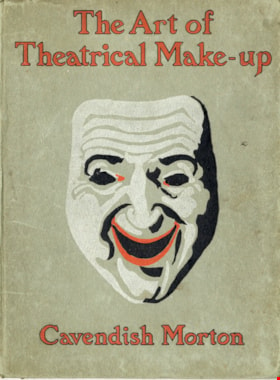
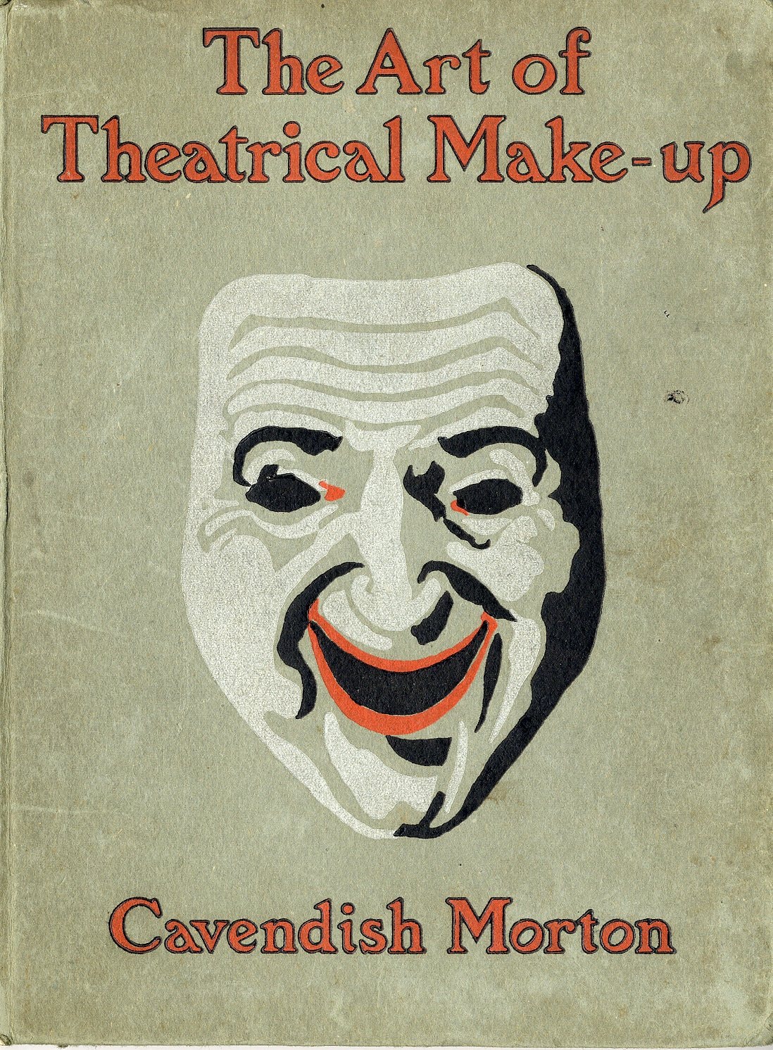
The art of theatrical make-up
https://search.heritageburnaby.ca/link/museumlibrary419
- Repository
- Burnaby Village Museum
- Author
- Morton, Cavendish, 1911-
- Publication Date
- 1909
- Call Number
- 792.02 CAV
- Repository
- Burnaby Village Museum
- Collection
- Special Collection
- Material Type
- Book
- Accession Code
- BV988.44.195
- Call Number
- 792.02 CAV
- Author
- Morton, Cavendish, 1911-
- Place of Publication
- London
- Publisher
- Adam and Charles Black
- Publication Date
- 1909
- Printer
- Ballantyne
- Physical Description
- 137 p. : ill. ; 25 cm.
- Inscription
- Front endpaper: "C.J Caunt" [written in pencil] Back endpaper: "mnh" [written in pencil] "200" [written in pencil] "G.S. Forsyth & Co Vancouver, B.C." [stamped in purple ink]
- Library Subject (LOC)
- Theatrical makeup
- Notes
- "Illustrated with thirty-two reproductions from photographs of the author by himself" -- t.p.
Images
Authorized by the Education Ministry For Lower Division Primary School Use, Volume 10 New Chinese Language Textbook
https://search.heritageburnaby.ca/link/museumlibrary616
- Repository
- Burnaby Village Museum
- Collection
- Special Collection
- Material Type
- Book
- Accession Code
- BV985.360.10
- Author
- Shang Wu Yin Shu Guan
- Place of Publication
- Shanghai
- Publisher
- Commercial Press, Limited
- Publication Date
- 1906
- Physical Description
- 61 p. : ill (some col.), ports, maps ; 22 cm
- Subjects
- Persons - Chinese Canadians
- Object History
- Some books in this accession are marked: "Mr. Chan Y. Leong, 111 Pender St. E., Vancouver B.C., Canada, North America, Western H."
- Sam Kee & Company merchants is the business located at 111 Pender St. E. Vancouver - originally owned by Chan Toy (many alternative names including Chang Toy) which was later run by Chang Yat Leong - presumably the same person as Chan Y. Leong.
- Notes
- Chinese language book
- On double leaves, East Asian binding
Images


Bayley & Ferguson's Violin Album. 100 popular & classical airs
https://search.heritageburnaby.ca/link/museumlibrary3787
- Repository
- Burnaby Village Museum
- Author
- Moffat, Alfred, 1866-1950
- Publication Date
- c1908
- Call Number
- 784 MOF
- Repository
- Burnaby Village Museum
- Collection
- Special Collection
- Material Type
- Book
- Accession Code
- BV002.67.5
- Call Number
- 784 MOF
- Author
- Moffat, Alfred, 1866-1950
- Place of Publication
- London
- Publisher
- Bayley & Ferguson
- Publication Date
- c1908
- Physical Description
- 109 p. : 31 cm.
- Inscription
- "Violin pieces" [Handwritten in pencil on outer envelope] "W.E. Spain" [Handwritten in pencil on outer envelope] "W. Spain" [Handwritten in blue crayon on title page]
- Library Subject (LOC)
- Violin and piano music
- Violin music
- Piano music
- Object History
- Donor inherited object in 1987 from the estate of her father, William Alexander Spain.
- Notes
- "arranged with pianoforte accompaniments by Alfred Moffat." -- title page
- "Including separate violin part" -- Title page
Images

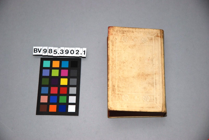
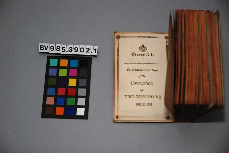
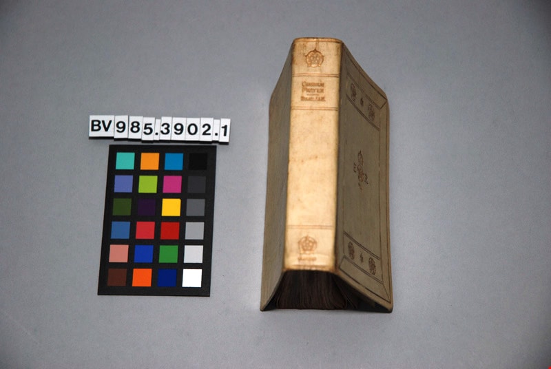
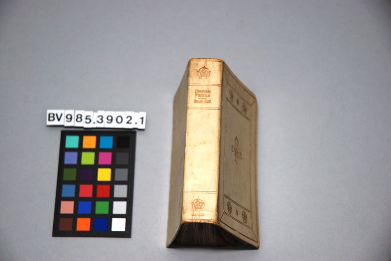
The book of common prayer, and administration of the sacraments, and other rites and ceremonies of the church, according to the use of the Church of England : together with the Psalter or Psalms of David, pointed as they are to be sung or said in churches ; and the form and manner of making, ordaining, and consecrating of bishops, priests, and deacons
https://search.heritageburnaby.ca/link/museumlibrary4865
- Repository
- Burnaby Village Museum
- Author
- Church of England
- Publication Date
- 1902
- Call Number
- 264.03 CHU
- Repository
- Burnaby Village Museum
- Collection
- Special Collection
- Material Type
- Book
- Accession Code
- BV985.3902.1
- Call Number
- 264.03 CHU
- Author
- Church of England
- Place of Publication
- London
- Publisher
- Henry Frowde
- Publication Date
- 1902
- Printer
- Oxford University Press
- Physical Description
- 1 vol. ; 12 cm.
- Inscription
- "THE BOOK OF Common Prayer" "E R" "VII" front centre "COMMON PRAYER" "HYMNS A&M", "OXFORD"; "Presented to [blank] In Commemoration of the Coronation of KING EDWARD VII" "JUNE 26, 1902"; page, "The Royal Commemoration Prayer Book" "Oxford 1902" "FEAR GOD, HONOUR THE KING"; "HORACE HART PRINTER TO THE UNIVERSITY"; 197pp; illustrated
- Library Subject (LOC)
- Church of England--Liturgy--Texts
- Church of England--Prayers and devotions
- Prayer books
Images

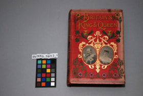
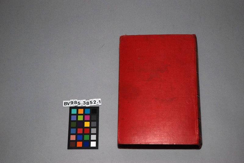
Britain's King and Queen : the story of their lives , with sixty-eight illustrations
https://search.heritageburnaby.ca/link/museumlibrary5110
- Repository
- Burnaby Village Museum
- Author
- Paul, Thomas
- Edition
- New enl. ed.
- Publication Date
- 1902
- Call Number
- 923.1361 PAU
- Repository
- Burnaby Village Museum
- Collection
- Special Collection
- Material Type
- Book
- Accession Code
- BV985.3852.1
- Call Number
- 923.1361 PAU
- Edition
- New enl. ed.
- Author
- Paul, Thomas
- Place of Publication
- London
- Publisher
- John F. Shaw And Co.
- Publication Date
- 1902
- Physical Description
- xii, 387 p. : ill. ; 21 cm.
- Inscription
- "BRITAIN'S KING & QUEEN" "J.F. SHAW & CO." 388pp; sepia floral endpapers, pencil scribbles; several pages of advertising at the end for other books.
- Library Subject (LOC)
- Great Britain--Kings and rulers
Images


![Broadview Presbyterian Church, [ca.1910] thumbnail](/media/hpo/_Data/_BVM_Cartographic_Material/2003/2003_0083_0049_001.jpg?width=280)
Broadview Presbyterian Church
https://search.heritageburnaby.ca/link/museumdescription11927
- Repository
- Burnaby Village Museum
- Date
- [ca.1910]
- Collection/Fonds
- Ronald G. Scobbie collection
- Description Level
- Item
- Physical Description
- 1 plan : black ink and watercol. on paper ; 30.45 x 30.5 cm
- Scope and Content
- Item consists of building insurance plan of "Broadview Presbyterian Church / Lot 6, BK 31, DL 69 / GP1 N.W.D." . Fourteenth Avenue (Manor) is identified to the north and Douglas Ave. to the east.
- Repository
- Burnaby Village Museum
- Collection/Fonds
- Ronald G. Scobbie collection
- Description Level
- Item
- Physical Description
- 1 plan : black ink and watercol. on paper ; 30.45 x 30.5 cm
- Material Details
- Scale 1 inch = 20 feet
- Scope and Content
- Item consists of building insurance plan of "Broadview Presbyterian Church / Lot 6, BK 31, DL 69 / GP1 N.W.D." . Fourteenth Avenue (Manor) is identified to the north and Douglas Ave. to the east.
- Subjects
- Buildings - Religious - Churches
- Accession Code
- BV003.83.49
- Access Restriction
- No restrictions
- Reproduction Restriction
- No known restrictions
- Date
- [ca.1910]
- Media Type
- Cartographic Material
- Scan Resolution
- 600
- Scan Date
- 15-Jan-2021
- Scale
- 100
- Notes
- Transcribed title
- Note in pencil on verso reads: "Broadview Presbyterian Church / Lot 6, BK 31, DL 69 / 1" = 20' "
- Note in balck in on verso reads: "3704"
Images
![Broadview Presbyterian Church, [ca.1910] thumbnail](/media/hpo/_Data/_BVM_Cartographic_Material/2003/2003_0083_0049_001.jpg)
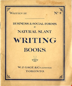
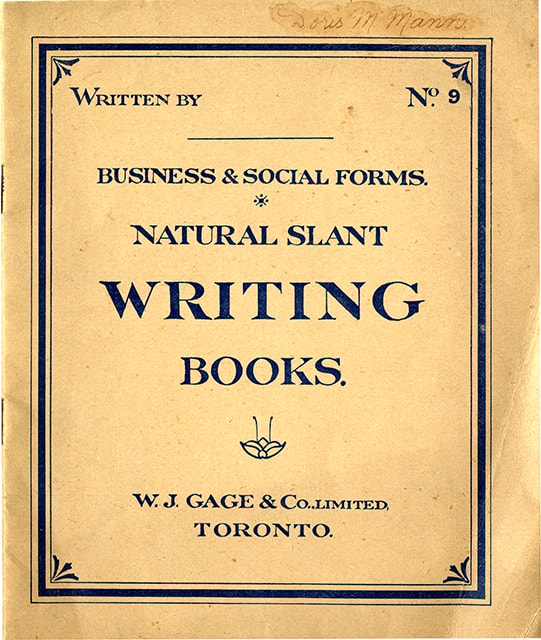
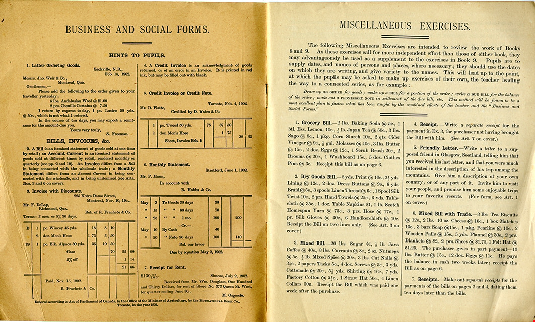
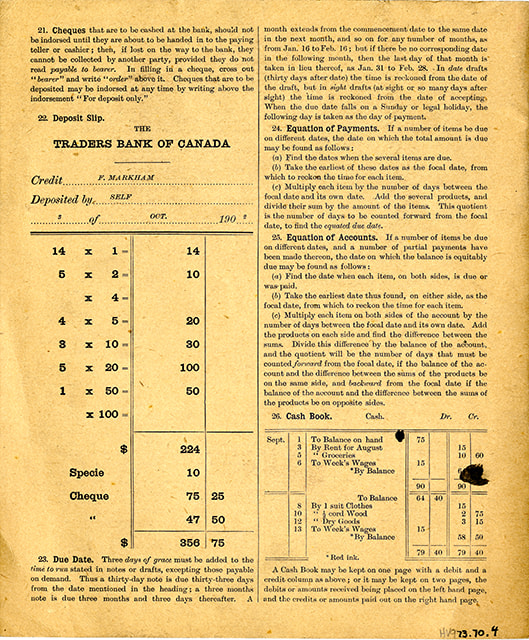
Business & social forms : natural slant writing books, no. 9
https://search.heritageburnaby.ca/link/museumlibrary6450
- Repository
- Burnaby Village Museum
- Collection
- Special Collection
- Material Type
- Book
- Accession Code
- HV973.70.4
- Call Number
- 372.634 GAG
- Place of Publication
- Toronto
- Publisher
- W. J. Gage & Co. Limited
- Publication Date
- c1902
- Physical Description
- 1 vol. ; 24 cm.
- Inscription
- "Doris M Mann" [handwritten in ink on cover]
- Library Subject (LOC)
- Penmanship
Images

Buster Brown the busy body
https://search.heritageburnaby.ca/link/museumlibrary2702
- Repository
- Burnaby Village Museum
- Collection
- Special Collection
- Material Type
- Book
- Accession Code
- HV974.50.10
- Call Number
- 741.5 OUT
- Place of Publication
- New York
- Publisher
- The New York Herald Co.
- Publication Date
- c1908
- Physical Description
- 1 v. (multiple pagings) : col. ill. : 29 x 41 cm.
- Inscription
- "Walter Galloway Bookstore 100 _______ St. E. Vancouver, B.C." [Stamped in black ink on cover verso and title page] "George Herbert Savage" [Handwritten in pencil on title page] "George Herbert Savage 6976 Culloden St. Vancouver B.C." [Handwritten in pencil on title page verso] "From Auntie Maggie Christmas 1919" [Handwritten in pencil on title page verso]
- Library Subject (LOC)
- Comic books, strips, etc.
- United States
Images


Complete instructor for the violin
https://search.heritageburnaby.ca/link/museumlibrary3788
- Repository
- Burnaby Village Museum
- Author
- Tours, Berthold, 1838-1897
- Publication Date
- 1900
- Call Number
- 787 TOU
- Repository
- Burnaby Village Museum
- Collection
- Special Collection
- Material Type
- Book
- Accession Code
- BV002.67.6
- Call Number
- 787 TOU
- Author
- Tours, Berthold, 1838-1897
- Place of Publication
- Philadelphia
- Publisher
- Theodore Presser Co.
- Publication Date
- 1900
- Printer
- Wm. H. Keyser & Co.
- Physical Description
- 96 p. : 31 cm.
- Inscription
- "William Spain" [Handwritten in black pencil crayon on front cover] "W. Spain" [Handwritten in blue pencil crayon on blank page before title page]
- Library Subject (LOC)
- Violin--Instruction and study
- Violin music
- Music--Instruction and study
- Object History
- Donor inherited object in 1987 from the estate of her father, William Alexander Spain.
Images

![Dundonald United Church, [ca.1910] thumbnail](/media/hpo/_Data/_BVM_Cartographic_Material/2003/2003_0083_0052_001.jpg?width=280)
Dundonald United Church
https://search.heritageburnaby.ca/link/museumdescription11930
- Repository
- Burnaby Village Museum
- Date
- [ca.1910]
- Collection/Fonds
- Ronald G. Scobbie collection
- Description Level
- Item
- Physical Description
- 1 plan : black ink and watercol. on paper ; 30.45 x 30.5 cm
- Scope and Content
- Item consists of a building insurance plan of "Dundonald United Church / Lots 9, 10 BK 28 DL 159 GP 1 / N.W.D.". Clinton Street is identified to the north of Lots nine and ten.
- Repository
- Burnaby Village Museum
- Collection/Fonds
- Ronald G. Scobbie collection
- Description Level
- Item
- Physical Description
- 1 plan : black ink and watercol. on paper ; 30.45 x 30.5 cm
- Material Details
- Scale 1 inch = 20 feet
- Scope and Content
- Item consists of a building insurance plan of "Dundonald United Church / Lots 9, 10 BK 28 DL 159 GP 1 / N.W.D.". Clinton Street is identified to the north of Lots nine and ten.
- Subjects
- Buildings - Religious - Churches
- Names
- Dundonald United Church
- Accession Code
- BV003.83.52
- Access Restriction
- No restrictions
- Reproduction Restriction
- No known restrictions
- Date
- [ca.1910]
- Media Type
- Cartographic Material
- Scan Resolution
- 600
- Scan Date
- 15-Jan-2021
- Scale
- 100
- Notes
- Transcribed title
- Note in pencil on verso reads: "_ _Church / Lots 9 & 10 BK 28 DL 159 / 1" = 20' "
- Note in black ink on verso reads: "3704"
Images
![Dundonald United Church, [ca.1910] thumbnail](/media/hpo/_Data/_BVM_Cartographic_Material/2003/2003_0083_0052_001.jpg)
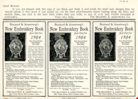
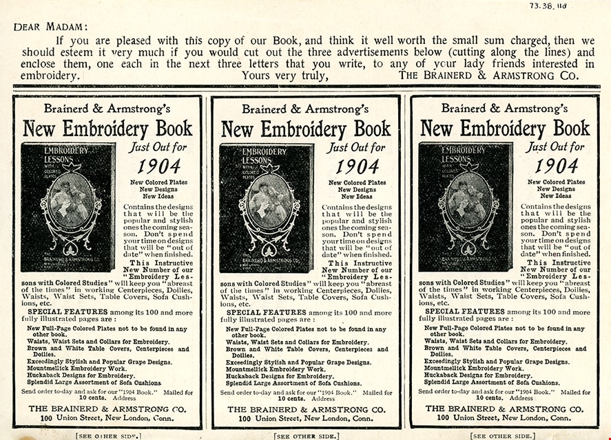
Embroidery lessons with colored studies, 1903 : latest and most complete book on the subject of silk embroidery and popular fancy work
https://search.heritageburnaby.ca/link/museumlibrary2813
- Repository
- Burnaby Village Museum
- Collection
- Special Collection
- Material Type
- Book
- Accession Code
- HV973.38.11
- Call Number
- 746.4 BRA
- Place of Publication
- New London, Conn.
- Publisher
- The Brainerd & Armstrong Co.
- Publication Date
- 1902
- Physical Description
- 109 p., [8] leaves of plates : ill. (some col.) ; 20 cm.
- Library Subject (LOC)
- Embroidery
Images
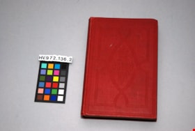
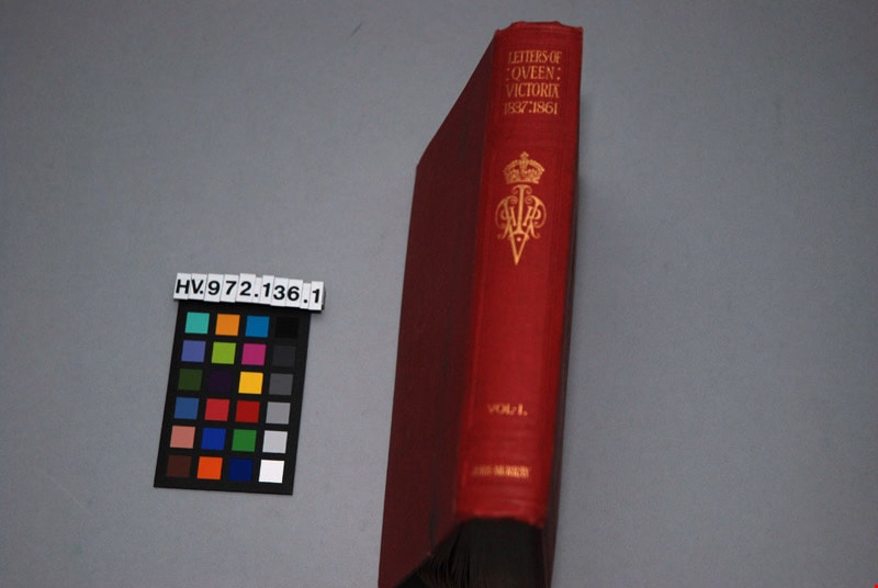
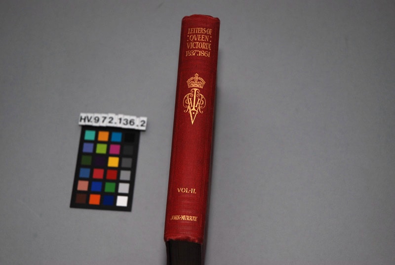
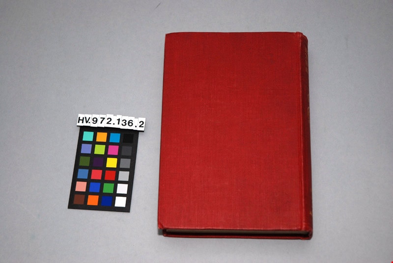
The letters of Queen Victoria : a selection from her Makesty's correspondence between the years 1837 and 1861, published by the authority of His Majesty the King, vol. ii, 1844-1853
https://search.heritageburnaby.ca/link/museumlibrary4908
- Repository
- Burnaby Village Museum
- Author
- Murray, John, 1808-1892
- Publication Date
- 1902
- Call Number
- 942.08 MUR
- Repository
- Burnaby Village Museum
- Collection
- Special Collection
- Material Type
- Book
- Accession Code
- HV972.136.2
- Call Number
- 942.08 MUR
- Author
- Murray, John, 1808-1892
- Place of Publication
- London
- Publisher
- John Murray
- Publication Date
- 1902
- Physical Description
- xi, 472 p. : ill. ; 20 cm.
- Inscription
- "Mrs. J. A. Elliott" [handwritten in black ink on front endpapers]
- Library Subject (LOC)
- Victoria, Queen of Great Britain,--1819-1901
- Great Britain--History--Victoria, 1837-1901
- Great Britain--Politics and government--1837-1901
- Subjects
- Persons - Royalty
- Souvenirs
- Souvenirs - Royalty
- Documentary Artifacts
- Documentary Artifacts - Books
Images


![Map with subdivision of lots on Cumberland Road, [190-] thumbnail](/media/hpo/_Data/_BVM_Cartographic_Material/1992/1992_0026_0026_001.jpg?width=280)
Map with subdivision of lots on Cumberland Road
https://search.heritageburnaby.ca/link/museumdescription18806
- Repository
- Burnaby Village Museum
- Date
- [190-]
- Collection/Fonds
- Love family fonds
- Description Level
- Item
- Physical Description
- 1 map : hand drawn in graphite on paper ; 27.5 x 21 cm
- Scope and Content
- Item consists of a hand drawn map with subdivision lots labeled A,B,C,D,E,F along Cumberland Road.
- Repository
- Burnaby Village Museum
- Collection/Fonds
- Love family fonds
- Description Level
- Item
- Physical Description
- 1 map : hand drawn in graphite on paper ; 27.5 x 21 cm
- Scope and Content
- Item consists of a hand drawn map with subdivision lots labeled A,B,C,D,E,F along Cumberland Road.
- Accession Code
- BV992.26.26
- Access Restriction
- No restrictions
- Reproduction Restriction
- No known restrictions
- Date
- [190-]
- Media Type
- Cartographic Material
- Scan Resolution
- 600
- Scan Date
- 2022-06-10
- Notes
- Title based on contents of item
- Map, drawn by hand in pencil on brown paper; rectangle divided into lots A, B, C, D, E, F; all lots same size except B which is like a road or easement; "Cumberland Road" is written along one long side of block, "Parts Conveyed" written through lots; dimensions given; smaller drawing in corner of page with total dimensions of block, "1.", and note with arrow to block, "Registered sk of Mr. [sic] Loves see Map 813 Bd. 135"
Images
![Map with subdivision of lots on Cumberland Road, [190-] thumbnail](/media/hpo/_Data/_BVM_Cartographic_Material/1992/1992_0026_0026_001.jpg)
![Municipality of Burnaby, [ca. 1909] thumbnail](/media/hpo/_Data/_BVM_Cartographic_Material/1976/1976_0158_0006_002%20WEB.jpg?width=280)
Municipality of Burnaby
https://search.heritageburnaby.ca/link/museumdescription13095
- Repository
- Burnaby Village Museum
- Date
- [ca. 1909]
- Collection/Fonds
- Burnaby Village Museum Map collection
- Description Level
- Item
- Physical Description
- 1 map : b&w lithographic print on linen, b&w ; 40 x 43.5 cm
- Scope and Content
- Map of the Municipality of Burnaby issued by Mahon, McFarland and Mahon (Real Estate, Insurance and Loans, Vancouver B.C.). A handrawn red line runs south of Burnaby Lake and between North Road and Boundary Road.
- Repository
- Burnaby Village Museum
- Collection/Fonds
- Burnaby Village Museum Map collection
- Description Level
- Item
- Physical Description
- 1 map : b&w lithographic print on linen, b&w ; 40 x 43.5 cm
- Scope and Content
- Map of the Municipality of Burnaby issued by Mahon, McFarland and Mahon (Real Estate, Insurance and Loans, Vancouver B.C.). A handrawn red line runs south of Burnaby Lake and between North Road and Boundary Road.
- Creator
- Mahon, McFarland & Mahon
- Publisher
- The Angel Engraving Co.
- Accession Code
- HV976.158.6
- Access Restriction
- No restrictions
- Reproduction Restriction
- No known restrictions
- Date
- [ca. 1909]
- Media Type
- Cartographic Material
- Scan Resolution
- 420
- Scan Date
- Dec. 22, 2020
- Scale
- 100
- Notes
- Title based on content of map
- Title on map reads: "Map / of The / Municipality / of / BURNABY / ISSUED BY / Mahon, McFarland & Mahon"
- Map contains the initals "F.R.G." [sic]
- Circular insignia in left corner reads: "THE ANGEL ENGRAVING CO."
Zoomable Images
![Municipality of Burnaby, [ca. 1909] thumbnail](/media/hpo/_Data/_BVM_Cartographic_Material/1976/1976_0158_0006_001_seadragon/1976_0158_0006_001.jpg?w=280)
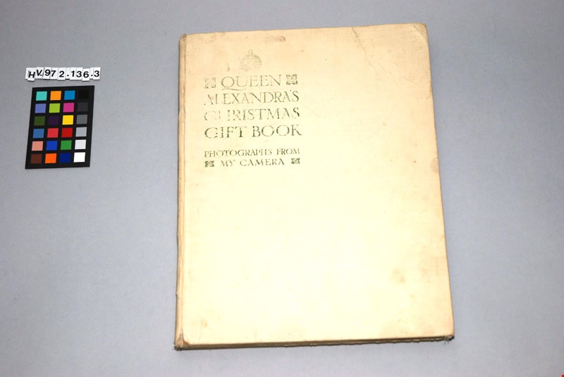
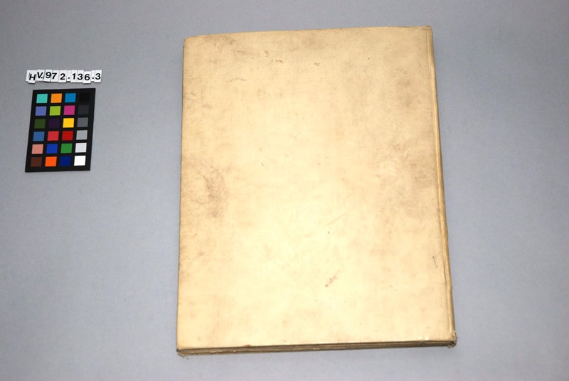
Queen Alexandra's Christmas gift book : photographs from my camera, to be sold for charity
https://search.heritageburnaby.ca/link/museumlibrary4909
- Repository
- Burnaby Village Museum
- Collection
- Special Collection
- Material Type
- Book
- Accession Code
- HV972.136.3
- Call Number
- 929.7201 DAI
- Place of Publication
- London
- Publisher
- Daily Telegraph
- Publication Date
- 1908
- Physical Description
- 1 vol. : ill. ; 29 cm.
- Inscription
- "QUEEN ALEXANDRA'S CHRISTMAS GIFT BOOK / PHOTOGRAPHS FROM MY CAMERA", printed in green on cover of book in upper left corner "To be Sold for Charity" / "THE DAILY TELEGRAPH", printed in frontispiece
- Library Subject (LOC)
- Great Britain--Kings and rulers--Collectibles
- Denmark--Kings and rulers--Collectibles
- Subjects
- Persons - Royalty
- Souvenirs
- Souvenirs - Royalty
- Documentary Artifacts
- Documentary Artifacts - Books
- Object History
- This book was published as a charitable fund raiser. It features photographs, taken by Queen Alexandra, of the Royal homes and family. The book was published by the Daily Telegraph, London, 1908.
Images

Sketch map of the Province of British Columbia showing mining divisions
https://search.heritageburnaby.ca/link/museumdescription18946
- Repository
- Burnaby Village Museum
- Date
- 1907
- Collection/Fonds
- Burnaby Village Museum Map collection
- Description Level
- Item
- Physical Description
- 1 map : col. lithographic print on paper ; 52 x 59 cm
- Scope and Content
- Item consists of a map titled "Sketch map of the Province of / British Columbia / Showing Mining Divisions"; "Department of Mines, / Victoria, 1907". Map includes wagon roads and trails and geographic disticts.
- Repository
- Burnaby Village Museum
- Collection/Fonds
- Burnaby Village Museum Map collection
- Description Level
- Item
- Physical Description
- 1 map : col. lithographic print on paper ; 52 x 59 cm
- Material Details
- Scale not determinable
- Scope and Content
- Item consists of a map titled "Sketch map of the Province of / British Columbia / Showing Mining Divisions"; "Department of Mines, / Victoria, 1907". Map includes wagon roads and trails and geographic disticts.
- Accession Code
- HV977.37.172
- Access Restriction
- No restrictions
- Reproduction Restriction
- No known restrictions
- Date
- 1907
- Media Type
- Cartographic Material
- Scan Resolution
- 600
- Scan Date
- 2023-08-17
- Notes
- Title based on contents of map
- Stamp on verso of map reads: "Compliments of Vancouver Tourist Bureau"
Zoomable Images

![St. Albans the Martyr, [ca.1910] thumbnail](/media/hpo/_Data/_BVM_Cartographic_Material/2003/2003_0083_0048_001.jpg?width=280)
St. Albans the Martyr
https://search.heritageburnaby.ca/link/museumdescription11926
- Repository
- Burnaby Village Museum
- Date
- [ca.1910]
- Collection/Fonds
- Ronald G. Scobbie collection
- Description Level
- Item
- Physical Description
- 1 plan : black ink and watercol. on paper ; 30.45 x 30.5 cm
- Scope and Content
- Item consists of building insurance plan of "St. Albans the Martyr / Lots 45 & 46 North Part DL 28 / GP1 N.W.D." Edmonds Street is to the north, Douglas Road to the west and 19th Avenue to the south.
- Repository
- Burnaby Village Museum
- Collection/Fonds
- Ronald G. Scobbie collection
- Description Level
- Item
- Physical Description
- 1 plan : black ink and watercol. on paper ; 30.45 x 30.5 cm
- Material Details
- Scale 1 inch = 40 feet
- Scope and Content
- Item consists of building insurance plan of "St. Albans the Martyr / Lots 45 & 46 North Part DL 28 / GP1 N.W.D." Edmonds Street is to the north, Douglas Road to the west and 19th Avenue to the south.
- Subjects
- Buildings - Religious - Churches
- Accession Code
- BV003.83.48
- Access Restriction
- No restrictions
- Reproduction Restriction
- No known restrictions
- Date
- [ca.1910]
- Media Type
- Cartographic Material
- Scan Resolution
- 600
- Scan Date
- 15-Jan-2021
- Scale
- 100
- Notes
- Transcribed title
- Note in pencil on verso reads: "St. Albans the Martyr / Lots 45 & 46 North Part DL 28 / 1" = 40' "
- Note in balck in on verso reads: "3704"
Images
![St. Albans the Martyr, [ca.1910] thumbnail](/media/hpo/_Data/_BVM_Cartographic_Material/2003/2003_0083_0048_001.jpg)
![St. Helen's Church, [ca.1910] thumbnail](/media/hpo/_Data/_BVM_Cartographic_Material/2003/2003_0083_0051_001.jpg?width=280)
St. Helen's Church
https://search.heritageburnaby.ca/link/museumdescription11929
- Repository
- Burnaby Village Museum
- Date
- [ca.1910]
- Collection/Fonds
- Ronald G. Scobbie collection
- Description Level
- Item
- Physical Description
- 1 plan : black ink and watercol. on paper ; 30.45 x 30.5 cm
- Scope and Content
- Item consists of building insurance plan of "St. Helen's Church / Lots 11 & 12 BK 7 DL 186 / GP1 N.W.D." . Ingleton Ave is identified to the east and Pandora St. to the south.
- Repository
- Burnaby Village Museum
- Collection/Fonds
- Ronald G. Scobbie collection
- Description Level
- Item
- Physical Description
- 1 plan : black ink and watercol. on paper ; 30.45 x 30.5 cm
- Material Details
- Scale 1 inch = 20 feet
- Scope and Content
- Item consists of building insurance plan of "St. Helen's Church / Lots 11 & 12 BK 7 DL 186 / GP1 N.W.D." . Ingleton Ave is identified to the east and Pandora St. to the south.
- Subjects
- Buildings - Religious - Churches
- Accession Code
- BV003.83.51
- Access Restriction
- No restrictions
- Reproduction Restriction
- No known restrictions
- Date
- [ca.1910]
- Media Type
- Cartographic Material
- Scan Resolution
- 600
- Scan Date
- 15-Jan-2021
- Scale
- 100
- Notes
- Transcribed title
- Note in pencil on verso reads: ""St. Helen's Church / Lots 11 & 12 BK 7 DL 186 / 1" = 20' "
- Note in balck in on verso reads: "3704"
Images
![St. Helen's Church, [ca.1910] thumbnail](/media/hpo/_Data/_BVM_Cartographic_Material/2003/2003_0083_0051_001.jpg)
![St. John the Divine, [ca.1910] thumbnail](/media/hpo/_Data/_BVM_Cartographic_Material/2003/2003_0083_0044_001.jpg?width=280)
St. John the Divine
https://search.heritageburnaby.ca/link/museumdescription11922
- Repository
- Burnaby Village Museum
- Date
- [ca.1910]
- Collection/Fonds
- Ronald G. Scobbie collection
- Description Level
- Item
- Physical Description
- 1 plan : black ink and watercol. on paper ; 30.45 x 30.5 cm
- Scope and Content
- Item consists of building insurance plan of "St. John the Divine / Lot "A" BK. 49 DL 35 GP1 N.W.D.". Kingsway is identified to the south of building.
- Repository
- Burnaby Village Museum
- Collection/Fonds
- Ronald G. Scobbie collection
- Description Level
- Item
- Physical Description
- 1 plan : black ink and watercol. on paper ; 30.45 x 30.5 cm
- Material Details
- Scale 1 inch = 20 feet
- Scope and Content
- Item consists of building insurance plan of "St. John the Divine / Lot "A" BK. 49 DL 35 GP1 N.W.D.". Kingsway is identified to the south of building.
- Subjects
- Buildings - Religious - Churches
- Accession Code
- BV003.83.44
- Access Restriction
- No restrictions
- Reproduction Restriction
- No known restrictions
- Date
- [ca.1910]
- Media Type
- Cartographic Material
- Scan Resolution
- 600
- Scan Date
- 15-Jan-2021
- Scale
- 100
- Notes
- Transcribed title
- Note in pencil on verso reads: "St. John the Divine / Lot "A" BK. 49 DL 35 / 1"=20' "
- Note in balck in on verso reads: "3704"
Images
![St. John the Divine, [ca.1910] thumbnail](/media/hpo/_Data/_BVM_Cartographic_Material/2003/2003_0083_0044_001.jpg)
![Subdivision plans in New Westminster District Group 1 – Burnaby
, [1900-1910] thumbnail](/media/hpo/_Data/_BVM_Cartographic_Material/1977/1977_0093_0009a_001.jpg?width=280)
Subdivision plans in New Westminster District Group 1 – Burnaby
https://search.heritageburnaby.ca/link/museumdescription6978
- Repository
- Burnaby Village Museum
- Date
- [1900-1910]
- Collection/Fonds
- Burnaby Village Museum Map collection
- Description Level
- File
- Physical Description
- 4 plans : blueprint ink on paper mounted on 2 sides of cardboard 76 x 102 cm
- Scope and Content
- Item consists of a large board with two New Westminster District Gp 1 - subdivision plans mounted on one side and two New Westminster District Gp 1 - subdivision plans mounted on the other side. Side A: 1. Blueprint "Plan/ of Subdivisions / of portions / of / Lot 91, / Group 1 / New Westminster …
- Repository
- Burnaby Village Museum
- Collection/Fonds
- Burnaby Village Museum Map collection
- Description Level
- File
- Physical Description
- 4 plans : blueprint ink on paper mounted on 2 sides of cardboard 76 x 102 cm
- Material Details
- Scales [between 1:792 and 1:2376]
- Index number on edge of board reads: "9"
- Scope and Content
- Item consists of a large board with two New Westminster District Gp 1 - subdivision plans mounted on one side and two New Westminster District Gp 1 - subdivision plans mounted on the other side. Side A: 1. Blueprint "Plan/ of Subdivisions / of portions / of / Lot 91, / Group 1 / New Westminster Dist. / Scale 3 chs = 1 in / Map Nos 535 & 506". (Geographic location: Burnaby) 2. Blueprint "Plan / of / Subdivision of a Portion / of / Lot 28 / Group One / New Westminster Dist. / Scale 1 chs = 1 in / Map No 274". Lots are identified as "I / II / III / VI / V / IV ". The plan is bordered by First Avenue, Suburban Lands and Cemetery at the bottom, 13th Street at the top, Douglas Road to the west and 4th Street to the east. The plan is signed by "W. Thibaudeau". (Geographic location: Burnaby) Side B: 1. Blueprint "Plan / of the Subdivision of a Portion / of / Lot 29 / Group One / New Westminster District / Scale 1ch = 1 in / Map No 291 _ Subdivision 'L'". (Geographic location: Burnaby) 2. Blueprint " Plan of Subdivision / of / Lot 27 / Group One / New Westminster Dist. / Scale 3 chs = 1 in. / Map No. 697". (Geographic location: Burnaby)
- Accession Code
- HV977.93.9
- Access Restriction
- No restrictions
- Reproduction Restriction
- No known restrictions
- Date
- [1900-1910]
- Media Type
- Cartographic Material
- Scan Resolution
- 300
- Scale
- 72
- Notes
- Title based on contents of file
- Scale is measured in chains. (One chain equals 792 inches)
- The term "Lot" can also refer to a "District Lot”
Images
![Subdivision plans in New Westminster District Group 1 – Burnaby
, [1900-1910] thumbnail](/media/hpo/_Data/_BVM_Cartographic_Material/1977/1977_0093_0009a_001.jpg)

![Subdivision plans in New Westminster District Group 1 – Burnaby
, [1900-1910] thumbnail](/media/hpo/_Data/_BVM_Cartographic_Material/1977/1977_0093_0010a_001.jpg?width=280)
Subdivision plans in New Westminster District Group 1 – Burnaby
https://search.heritageburnaby.ca/link/museumdescription6979
- Repository
- Burnaby Village Museum
- Date
- [1900-1910]
- Collection/Fonds
- Burnaby Village Museum Map collection
- Description Level
- File
- Physical Description
- 4 plans : blueprint ink on paper mounted on 2 sides of cardboard 76 x 102 cm
- Scope and Content
- Item consists of a large board with two New Westminster District Gp 1 - subdivision plans mounted on one side and two New Westminster District Gp 1- subdivision plans mounted on the other side. Side A: 1. Blueprint "Plan / of Subdivision / of / Lot 15 / Group One / New Westminster District/ Sca…
- Repository
- Burnaby Village Museum
- Collection/Fonds
- Burnaby Village Museum Map collection
- Description Level
- File
- Physical Description
- 4 plans : blueprint ink on paper mounted on 2 sides of cardboard 76 x 102 cm
- Material Details
- Scales [between 1:2376 and 1:3168]
- Index number on edge of board reads: "10"
- Scope and Content
- Item consists of a large board with two New Westminster District Gp 1 - subdivision plans mounted on one side and two New Westminster District Gp 1- subdivision plans mounted on the other side. Side A: 1. Blueprint "Plan / of Subdivision / of / Lot 15 / Group One / New Westminster District/ Scale 4 chs = 1 in. / Map No 209". Subdivision plan is bordered by North Road (Lot 9) Lot 8, Lot 148 and Lot 100. (Geographic location: Burnaby) 2. Blueprint "Plan / of Subdivision / of / Lot 88 / Group 1 / Scale 4 chs = 1 in. / Map No 760". Plan is bordered by Burnaby Lake, Cumberland Street, Lot 11, Lot 25 and Lot 89. (Geographic location: Burnaby) Side B: 1. Blueprint "Plan / of the Subdivision / of / Lot "G" / in the Subdivision / of / Lot 96, Gr.1 / Scale 4 chs = 1 in. / Map No 756". Plan includes inset "Map No. 699" which includes Lots D, G, E, F, C, A and B of DL 96. Plan is bordered by False Creek Road, Westminster & Vancouver Tramway. (Geographic location: Burnaby) 2. Blueprint "Plan / of Subdivision / of South Portion / of / Lot 94, Group 1 / New Westminster District / Scale 3 chs = 1 in. / Map Nos 4402 & 720". (Geographic location: Burnaby)
- Accession Code
- HV977.93.10
- Access Restriction
- No restrictions
- Reproduction Restriction
- No known restrictions
- Date
- [1900-1910]
- Media Type
- Cartographic Material
- Scan Resolution
- 300
- Scale
- 72
- Notes
- Scale is measured in chains. (One chain equals 792 inches)
- The term "Lot" can also refer to a "District Lot”
Images
![Subdivision plans in New Westminster District Group 1 – Burnaby
, [1900-1910] thumbnail](/media/hpo/_Data/_BVM_Cartographic_Material/1977/1977_0093_0010a_001.jpg)

![Subdivision plans in New Westminster District Group 1 – Burnaby, [1905-1910] thumbnail](/media/hpo/_Data/_BVM_Cartographic_Material/1977/1977_0093_0011a_001.jpg?width=280)
Subdivision plans in New Westminster District Group 1 – Burnaby
https://search.heritageburnaby.ca/link/museumdescription6980
- Repository
- Burnaby Village Museum
- Date
- [1905-1910]
- Collection/Fonds
- Burnaby Village Museum Map collection
- Description Level
- File
- Physical Description
- 4 plans : blueprint ink on paper mounted on 2 sides of cardboard 76 x 102 cm
- Scope and Content
- Item consists of a large board of two New Westminster District Gp 1 - subdivision plans mounted on one side and two New Westminster District subdivision plans mounted on the other side. Side A: 1.Blueprint "Plan / of Subdivision / of a Portion / of / Lot 90 / Group One / New Westmisnter Distric…
- Repository
- Burnaby Village Museum
- Collection/Fonds
- Burnaby Village Museum Map collection
- Description Level
- File
- Physical Description
- 4 plans : blueprint ink on paper mounted on 2 sides of cardboard 76 x 102 cm
- Material Details
- Scales [between 1:1200 and 1:3960]
- Index number on edge of board reads: "11"
- Scope and Content
- Item consists of a large board of two New Westminster District Gp 1 - subdivision plans mounted on one side and two New Westminster District subdivision plans mounted on the other side. Side A: 1.Blueprint "Plan / of Subdivision / of a Portion / of / Lot 90 / Group One / New Westmisnter District / Scale 200 ft = 1 in. / Map No 642". (Geographic location: Burnaby) 2. Blueprint "Plan / of Subdivision / of / North Portion / of / Lot 28 / Group One / New Westminster District / Scale 100' = 1 in. / Map No 632". Geographic location: Burnaby) Side B: 1. Blueprint "Plan / of Subdivision of Lot 153 / Group 1 / New Westminster Dist. / Scale 5 chs = 1 in. / Map No. 783". Handwritten annotation in red reads: "NOTE. THIS INCLUDEDS PART / OF LOT 151. & 152". Geographic location: Burnaby) 2. Blueprint "Plan / of Subdivision of Lot 82, Group 1 / New Westminster Dist. / Scale 2 chs = 1 in. / Map No 201". Geographic location: Burnaby)
- Accession Code
- HV977.93.11
- Access Restriction
- No restrictions
- Reproduction Restriction
- No known restrictions
- Date
- [1905-1910]
- Media Type
- Cartographic Material
- Scan Resolution
- 300
- Scale
- 72
- Notes
- Title based on contents of file
- Scale is measured in chains and feet. (One chain equals 792 inches)
- The term "Lot" can also refer to a "District Lot”
Images
![Subdivision plans in New Westminster District Group 1 – Burnaby, [1905-1910] thumbnail](/media/hpo/_Data/_BVM_Cartographic_Material/1977/1977_0093_0011a_001.jpg)

![Subdivision plans in New Westminster District Group 1 – Burnaby
, [1900-1910] thumbnail](/media/hpo/_Data/_BVM_Cartographic_Material/1977/1977_0093_0012a_001.jpg?width=280)
Subdivision plans in New Westminster District Group 1 – Burnaby
https://search.heritageburnaby.ca/link/museumdescription6981
- Repository
- Burnaby Village Museum
- Date
- [1900-1910]
- Collection/Fonds
- Burnaby Village Museum Map collection
- Description Level
- File
- Physical Description
- 4 plans : blueprint ink on paper mounted on 2 sides of cardboard 76 x 102 cm
- Scope and Content
- Item consists of a large board of two New Westminster District Gp 1 - subdivision plans mounted on one side and two New Westminster District Gp 1 -subdivision plans mounted on the other side. Side A: 1. Blueprint "Plan / shewing [sic] / Subdivision of / Lot 162 / Group One / New Westmisnter Dis…
- Repository
- Burnaby Village Museum
- Collection/Fonds
- Burnaby Village Museum Map collection
- Description Level
- File
- Physical Description
- 4 plans : blueprint ink on paper mounted on 2 sides of cardboard 76 x 102 cm
- Material Details
- Scales [1:2376] and [1:3168]
- Index number on edge of board reads: "12"
- Scope and Content
- Item consists of a large board of two New Westminster District Gp 1 - subdivision plans mounted on one side and two New Westminster District Gp 1 -subdivision plans mounted on the other side. Side A: 1. Blueprint "Plan / shewing [sic] / Subdivision of / Lot 162 / Group One / New Westmisnter Dist. / Scale 4 chs = 1 in. / Map No 450". Plan is signed by "Sidney Williams / Provincial Land Surveyor" (Geographic location: Burnaby) 2. Blueprint "Plan of / Subdivision of / Block 166A / Grroup One, / Westminster District / Scale 4 chs = 1 in. / Map No 524". Plan is signed by "Sidney Williams / Provincial Land Surveyor" (Geographic location: Burnaby) Side B: 1. Blueprint "Plan / of / Subdivision of Lot 77, Group 1 / New Westminster Dist. / Scale = 4 chs = 1 in. / Map No 238" Plan is signed by "Gardue [sic] Hermon [sic] / District [sic] Land Surveyor" (Geographic location: Burnaby) 2. Blueprint " Plan / of Subdivision / of part / of / Lot 95 / Group One / New Westminster Dist. / Sclae 3 chs = 1 in. / Map No 556". (Geographic location: Burnaby)
- Creator
- Williams, Sidney
- Accession Code
- HV977.93.12
- Access Restriction
- No restrictions
- Reproduction Restriction
- No known restrictions
- Date
- [1900-1910]
- Media Type
- Cartographic Material
- Scan Resolution
- 300
- Scale
- 72
- Notes
- Title based on contents of file
- Scale is measured in chains. (One chain equals 792 inches)
- The term "Lot" can also refer to a "District Lot”
Images
![Subdivision plans in New Westminster District Group 1 – Burnaby
, [1900-1910] thumbnail](/media/hpo/_Data/_BVM_Cartographic_Material/1977/1977_0093_0012a_001.jpg)

![Subdivision plans in New Westminster District Group 1 – Burnaby
, [1882-1910] thumbnail](/media/hpo/_Data/_BVM_Cartographic_Material/1977/1977_0093_0013a_001.jpg?width=280)
Subdivision plans in New Westminster District Group 1 – Burnaby
https://search.heritageburnaby.ca/link/museumdescription6982
- Repository
- Burnaby Village Museum
- Date
- [1882-1910]
- Collection/Fonds
- Burnaby Village Museum Map collection
- Description Level
- File
- Physical Description
- 4 plans : blueprint on paper mounted on 2 sides of cardboard 76 x 102 cm
- Scope and Content
- Item consists of a large board of two New Westminster District Gp 1 - subdivision plans mounted on one side and two New Westminster District Gp 1 - subdivision plans mounted on the other side. Side A: 1. Blueprint "Plan / of the / Subdivision / of / Lot 98 / G.1, N.W.D. / Scale 4 chs = 1 in. / …
- Repository
- Burnaby Village Museum
- Collection/Fonds
- Burnaby Village Museum Map collection
- Description Level
- File
- Physical Description
- 4 plans : blueprint on paper mounted on 2 sides of cardboard 76 x 102 cm
- Material Details
- Scales [between 1:1584 and 1:3168]
- Index number on edge of board reads: "13"
- Scope and Content
- Item consists of a large board of two New Westminster District Gp 1 - subdivision plans mounted on one side and two New Westminster District Gp 1 - subdivision plans mounted on the other side. Side A: 1. Blueprint "Plan / of the / Subdivision / of / Lot 98 / G.1, N.W.D. / Scale 4 chs = 1 in. / Map No 573" (Geographic location: Burnaby) 2. Blueprint "Plan / of Subdivision of / Lot 157 / Gr.1, New. West. Dist. / Scale 3 chs = 1 in. / Map No. 612". (Geographic location: Burnaby) Side B: 1. Blueprint "Plan / of Subdivision / of a Portion of / Lot 90 / Group One / New Westminster Dist. / Scale 2 chs = 1 in. / Map No. 555". Plan is signed by "Jno Strathern [sic]_P.L.S."n (Geographic location: Burnaby) 2. Blueprint "Subdivision of Lot 31, Group 1. / New Westminster District / As Amended by Order of Court / 1st Sept. 1882 and Numbered 847 / Scale 4 chs = 1in. / Map No 80" (Geographic location: Burnaby)
- Creator
- Stathern, John
- Accession Code
- HV977.93.13
- Access Restriction
- No restrictions
- Reproduction Restriction
- No known restrictions
- Date
- [1882-1910]
- Media Type
- Cartographic Material
- Historic Neighbourhood
- Alta Vista (Historic Neighbourhood)
- Planning Study Area
- Richmond Park Area
- Lakeview-Mayfield Area
- Scan Resolution
- 300
- Scale
- 72
- Notes
- Title based on contents of file
- Scale is measured in chains. (One chain equals 792 inches)
- The term "Lot" can also refer to a "District Lot”
Images
![Subdivision plans in New Westminster District Group 1 – Burnaby
, [1882-1910] thumbnail](/media/hpo/_Data/_BVM_Cartographic_Material/1977/1977_0093_0013a_001.jpg)

![Subdivision plans in New Westminster District Group 1 – Burnaby
, [1890-1910] thumbnail](/media/hpo/_Data/_BVM_Cartographic_Material/1977/1977_0093_0014a_001.jpg?width=280)
Subdivision plans in New Westminster District Group 1 – Burnaby
https://search.heritageburnaby.ca/link/museumdescription6983
- Repository
- Burnaby Village Museum
- Date
- [1890-1910]
- Collection/Fonds
- Burnaby Village Museum Map collection
- Description Level
- File
- Physical Description
- 4 plans : blueprint ink on paper mounted on 2 sides of cardboard 76 x 102 cm
- Scope and Content
- Item consists of a large board of two New Westminster District Gp 1 - subdivision plans mounted on one side and two New Westminster District Gp 1 - subdivision plans mounted on the other side. Side A: 1. Blueprint "Plan of / Subdivision of Lot No. 69 / Group One / New Westminster District / Pro…
- Repository
- Burnaby Village Museum
- Collection/Fonds
- Burnaby Village Museum Map collection
- Description Level
- File
- Physical Description
- 4 plans : blueprint ink on paper mounted on 2 sides of cardboard 76 x 102 cm
- Material Details
- Scales [between 1:1584 and 1:3168]
- Index number on edge of board reads: "14"
- Scope and Content
- Item consists of a large board of two New Westminster District Gp 1 - subdivision plans mounted on one side and two New Westminster District Gp 1 - subdivision plans mounted on the other side. Side A: 1. Blueprint "Plan of / Subdivision of Lot No. 69 / Group One / New Westminster District / Property of Ernest Buse, Esq. / Scale 3 chs = 1 in. / Map No 290". Plan is signed by "Garden, Hermon and Burwell, Dom. Land Surveyor" (Geographic location: Burnaby) 2. Blueprint "Plan / of Subdivision / of Lots 1-19, 36-53 and 69-75 inclusive / in the Subdivision / of / Lot 30 / Group One / New Westminster District / Scale 2 chs = 1 in. Map No 631". Plan is signed by "Jno [sic] Strathern [sic] P.L.S." Names and Lot numbers are handwritten in red pencil in sections along Douglas Road and read: "20 - F / 21 - Fitherstruhaul [sic] / 22 - J.S. Craig / 23 - McGill & Dill / 24 / 25 / 26 / 27 / 28 - School / 29 - School / 30 - D. McDownall / 31 - W.J. Troloow [sic] / 32 - N.C. Nelson / 33 - _[sic] McGill / 34 - T.S.[sic] Craig / 35" (Geographic location: Burnaby) Side B: 1.Blueprint "Plan / of Subdivision / of Centre Portion / of Lot 28 / Group One / New Westminster District / Scale 200' = 1" / Map No 627". Plan is signed by "Jno Strathern / P.L.S." (Geographic location: Burnaby) 2. Blueprint "Plan / of Subdivision / of N.1/2 Lot 100 and S.1/2 Lot 101, / Group One / New Westminster District, BC / Scale 4 chs = 1 in." (Geographic location: Burnaby)
- Names
- Strathern, John
- Accession Code
- HV977.93.14
- Access Restriction
- No restrictions
- Reproduction Restriction
- No known restrictions
- Date
- [1890-1910]
- Media Type
- Cartographic Material
- Historic Neighbourhood
- Broadview (Historic Neighbourhood)
- East Burnaby (Historic Neighbourhood)
- Planning Study Area
- Cascade-Schou Area
- West Central Valley Area
- Second Street Area
- Lake City Area
- Scan Resolution
- 300
- Scale
- 72
- Notes
- Title based on contents of file
- Scale is measured in chains and feet. (One chain equals 792 inches)
- The term "Lot" can also refer to a "District Lot”
Images
![Subdivision plans in New Westminster District Group 1 – Burnaby
, [1890-1910] thumbnail](/media/hpo/_Data/_BVM_Cartographic_Material/1977/1977_0093_0014a_001.jpg)

![Subdivision plans in New Westminster District Group 1 – Burnaby
, [1891-1910] thumbnail](/media/hpo/_Data/_BVM_Cartographic_Material/1977/1977_0093_0015a_001.jpg?width=280)
Subdivision plans in New Westminster District Group 1 – Burnaby
https://search.heritageburnaby.ca/link/museumdescription6984
- Repository
- Burnaby Village Museum
- Date
- [1891-1910]
- Collection/Fonds
- Burnaby Village Museum Map collection
- Description Level
- File
- Physical Description
- 4 plans : blueprint ink on paper mounted on 2 sides of cardboard 76 x 102 cm
- Scope and Content
- Item consists of a large board of two New Westminster District Gp 1 - subdivision plans mounted on one side and two New Westminster District Gp 1 - subdivision plans mounted on the other side. Side A: 1. Blueprint "Plan / of Subdivision / of / Lot 29 / Group One / New Westminster District / Scal…
- Repository
- Burnaby Village Museum
- Collection/Fonds
- Burnaby Village Museum Map collection
- Description Level
- File
- Physical Description
- 4 plans : blueprint ink on paper mounted on 2 sides of cardboard 76 x 102 cm
- Material Details
- Scales [between 1:600 and 1:7920]
- Index number on edge of board reads: "15"
- Scope and Content
- Item consists of a large board of two New Westminster District Gp 1 - subdivision plans mounted on one side and two New Westminster District Gp 1 - subdivision plans mounted on the other side. Side A: 1. Blueprint "Plan / of Subdivision / of / Lot 29 / Group One / New Westminster District / Scale 4 chs = 1 in. / Map No 564, Depostd '91". "Reichenbach", dep. Aug. 1891. (Geographic location: Burnaby) 2. Blueprint "Plan / of Subdivision / of / Lot 93 / Group One / New Westminster District / Scale 4 chs = 1 in. / Map No 284". (Geographic location: Burnaby) Side B: 1. Blueprint "Plan / of Subdivision / of a Portion / of / [Lot A of ] Lot 29 / Group One / New Westminster District / Scale 50 ' = 1"" Plan is bordered by Douglas Road to the east, False Creek Trail to the south and Lot 30 to the north. (Geographic location: Burnaby) 2. Blueprint "Plan / of Central Park / and Vicinity / Scale 10 chs = 1 in." (Geographic location: Burnaby)
- Accession Code
- HV977.93.15
- Access Restriction
- No restrictions
- Reproduction Restriction
- No known restrictions
- Date
- [1891-1910]
- Media Type
- Cartographic Material
- Historic Neighbourhood
- Edmonds (Historic Neighbourhood)
- Planning Study Area
- Edmonds Area
- Scan Resolution
- 300
- Scale
- 72
- Notes
- Title based on contents of file
- Scale is measured in chains and feet. (One chain equals 792 inches)
- The term "Lot" can also refer to a "District Lot”
Images
![Subdivision plans in New Westminster District Group 1 – Burnaby
, [1891-1910] thumbnail](/media/hpo/_Data/_BVM_Cartographic_Material/1977/1977_0093_0015a_001.jpg)

![Subdivision plans in New Westminster District Group 1 – Burnaby
, [1893-1910] thumbnail](/media/hpo/_Data/_BVM_Cartographic_Material/1977/1977_0093_0016a_001.jpg?width=280)
Subdivision plans in New Westminster District Group 1 – Burnaby
https://search.heritageburnaby.ca/link/museumdescription6985
- Repository
- Burnaby Village Museum
- Date
- [1893-1910]
- Collection/Fonds
- Burnaby Village Museum Map collection
- Description Level
- File
- Physical Description
- 4 plans : blueprint ink on paper mounted on 2 sides of cardboard 76 x 102 cm
- Scope and Content
- Item consists of a large board of two New Westminster District Gp 1 - subdivision plans mounted on one side and two New Westminster District Gp 1 - subdivision plans mounted on the other side. Side A: 1. Blueprint "Plan / of Subdivision / of / Lot 6 / Group One / New Westminster District / Scale…
- Repository
- Burnaby Village Museum
- Collection/Fonds
- Burnaby Village Museum Map collection
- Description Level
- File
- Physical Description
- 4 plans : blueprint ink on paper mounted on 2 sides of cardboard 76 x 102 cm
- Material Details
- Scales [between 1:1584 and 1:3960]
- Index number on edge of board reads: "16"
- Scope and Content
- Item consists of a large board of two New Westminster District Gp 1 - subdivision plans mounted on one side and two New Westminster District Gp 1 - subdivision plans mounted on the other side. Side A: 1. Blueprint "Plan / of Subdivision / of / Lot 6 / Group One / New Westminster District / Scale 5 chs = 1 in. / Map No 748" (Geographic location: Burnaby) 2. Blueprint "Plan / of Subdivision / of a Portion / of / Lot 29 / Group One / New Westminster Dist. / Scale 2 chs = 1 in. / Map No." Name identified in Block H is "Reichenbach" (Geographic location: Burnaby) Side B: 1. Blueprint "Plan / of Subdivision / of North 1/2 of Lot 80 / Group One / New Westminster District / Scale 3 chs = 1 in. / Map No 719" Plan is signed by: "Garden, Hermon & Burwell P.L.S. / Vancouver Jan. 23rd, 1893" (Geographic location: Burnaby) 2. Blueprint "Plan / of Subdivision / of Lot 79, Gr.1 / New Westminster Dist. / Scale 4 chas = 1 in. / Map No 536" Plan is signed by "Garden Hermon & Burwell / Provincial Land Surveyors". (Geographic location: Burnaby)
- Creator
- Garden, Hermon and Burwell
- Accession Code
- HV977.93.16
- Access Restriction
- No restrictions
- Reproduction Restriction
- No known restrictions
- Date
- [1893-1910]
- Media Type
- Cartographic Material
- Historic Neighbourhood
- Edmonds (Historic Neighbourhood)
- Burnaby Lake (Historic Neighbourhood)
- Planning Study Area
- Douglas-Gilpin Area
- Edmonds Area
- Cameron Area
- Scan Resolution
- 300
- Scale
- 72
- Notes
- Title based on contents of file
- Scale is measured in chains. (One chain equals 792 inches)
- The term "Lot" can also refer to a "District Lot”
Images
![Subdivision plans in New Westminster District Group 1 – Burnaby
, [1893-1910] thumbnail](/media/hpo/_Data/_BVM_Cartographic_Material/1977/1977_0093_0016a_001.jpg)


Subdivision plans in New Westminster District Group 1 – Burnaby, Vancouver and map - Canada Department of Mines
https://search.heritageburnaby.ca/link/museumdescription6994
- Repository
- Burnaby Village Museum
- Date
- 1890-1909
- Collection/Fonds
- Burnaby Village Museum Map collection
- Description Level
- File
- Physical Description
- 1 plan : graphite on paper + 2 plans : black ink on paper + 1 map : col. on paper mounted on 2 sides of cardboard 76 x 102 cm
- Scope and Content
- Item consists of a large board with one New Westminster District subdivision plan mounted on one side and two New Westminster District subdivision plans and one colour map mounted on the other side. Side A: 1. "Plan / of Subdivision of / Blocks 2, 3, 4, 5, 6 / Lot 77 / Group 1 / New Westminster D…
- Repository
- Burnaby Village Museum
- Collection/Fonds
- Burnaby Village Museum Map collection
- Description Level
- File
- Physical Description
- 1 plan : graphite on paper + 2 plans : black ink on paper + 1 map : col. on paper mounted on 2 sides of cardboard 76 x 102 cm
- Material Details
- Scales 1:720 and 1:1200 and 1:.00001578
- Scope and Content
- Item consists of a large board with one New Westminster District subdivision plan mounted on one side and two New Westminster District subdivision plans and one colour map mounted on the other side. Side A: 1. "Plan / of Subdivision of / Blocks 2, 3, 4, 5, 6 / Lot 77 / Group 1 / New Westminster District / BC. / Scale 100 feet = 1 inch", "Deposited 8th day / of April 1890 / Mowileg [sic] / Dist. Regt". Plan is drawn in graphite with annotations: "AB_Parts_lettered_are_lots_in / the_different_subdivisions" / "Owners: / James E. Hall / P.S.Cabilan [sic] by his attorney Joseph Hall / Joseph Hall / Eliza J. Shannon / John Harrison"; "This plan is correct and is prepared under the / provisions of the Land Registry Act" ; signed by: "Gordon Herman & Burwell / Dominion & Provincial Land Surveryors / Vancouver March 19th/90" . Plan is initialed by: "RB" [sic] (in blue pencil crayon) and measures: 99.5 x 65 cm (Geographic location: Burnaby) Side B: 1. Map titled "Canada / Department of Mines / Geological Survey Branch" / "Hon.W Templeton, Minister / A.P. Low, Deputy Minister / R.W. Brock, Acting Director", Vol. XXXI, Plate I / Compiled under the direction of / James White, F.R.G.S. Geographer /Dep. of Interior". Note above map reads: "To illustrate Mr. James Barrowman's report as Delegate at the Excursion - meeting of the Canadian Mining Institute", "The instiitution of Mining Engineers / Transactions 1908 - 1909", "The Mining Institute of Scotland / Transactions 1908-1909". Map identifies minerals and includes a Legend and Scale: 100 miles = 1 inch 2. "Plan / of Subdivision of / Lot 4 / of Subdivision of / Lot 87. Gr. 1 / New Westminster District / Scale 60' = 1in." Plan is initialed by: "RB" [sic] along with a note "also Board / 48" (in blue pencil crayon) (Geographic location: Burnaby) 3. Plan of "Lot 335 / G. 1" west of Boundary Road and north of River Road - Vancouver. (Geographic location: Vancouver)
- Publisher
- The Mining Institute of Scotland
- Geographic Access
- Vancouver
- Accession Code
- HV977.93.25
- Access Restriction
- No restrictions
- Reproduction Restriction
- No known restrictions
- Date
- 1890-1909
- Media Type
- Cartographic Material
- Scan Resolution
- 300
- Scale
- 72
- Notes
- Title based on contents of file
- Scale is measured in feet and miles.
- The term "Lot" often refers to "District Lot"
Images


![Survey and Subdivision plans in New Westminster District Group 1 - Burnaby
, [1906-1910] thumbnail](/media/hpo/_Data/_BVM_Cartographic_Material/1977/1977_0093_0001a_001.jpg?width=280)
Survey and Subdivision plans in New Westminster District Group 1 - Burnaby
https://search.heritageburnaby.ca/link/museumdescription6970
- Repository
- Burnaby Village Museum
- Date
- [1906-1910]
- Collection/Fonds
- Burnaby Village Museum Map collection
- Description Level
- File
- Physical Description
- 7 plans : blueprint ink on paper + 2 plans : black ink on paper mounted on 2 sides of cardboard 76 cm x 102 cm
- Scope and Content
- Item consists of a large board of six New Westminster District Gp 1 subdivision plans mounted on one side and three New Westminster District Gp 1 subdivision plans mounted on the other side with scales ranging from one chain equals one inch to four chains equals one inch. Side A: 1. Blueprint "Pl…
- Repository
- Burnaby Village Museum
- Collection/Fonds
- Burnaby Village Museum Map collection
- Description Level
- File
- Physical Description
- 7 plans : blueprint ink on paper + 2 plans : black ink on paper mounted on 2 sides of cardboard 76 cm x 102 cm
- Material Details
- Scales [1:792] and [1:3168]
- Index number on edge of board reads: "1"
- Scope and Content
- Item consists of a large board of six New Westminster District Gp 1 subdivision plans mounted on one side and three New Westminster District Gp 1 subdivision plans mounted on the other side with scales ranging from one chain equals one inch to four chains equals one inch. Side A: 1. Blueprint "Plan / of Subdivision / of a portion / of / Lot 13, GR.1 / New Westminster District". Plan is bordered by Cumberland Street, Tenth Ave., Cariboo Street, Armstrong Street, "See Bd.145", Map No891 (Geographic location: Burnaby) 2."Plan / of Subdivision / of a portion / of / Lot 13, GR.1 / New Westminster District". Plan is bordered by Cumberland Street, Tenth Ave., Cariboo St. and Armstrong St. Pencilled annotations on plan read: "for Subdivisions see Board 145"; "Subdivided by H. Neville Smith". (Geographic location: Burnaby) 3. Blueprint "Plan / of Subdivision / of a part / of / Lot 155 / Group 1 / New Westminster District". Plan is bordered by North Arm of Fraser, Wiggins Rd. and Lot 173. Plan created by "NB Gauvreau" (Geographic location: Burnaby) Side B: 1. Blueprint plan which reads: "Albert J. Hill / P.L.S." at top with handwritten annotation: "Lot 85". The plan is bordered by Hastings Rd. and Burnaby Lake with names on lots identified as:"Laura Troop; Jas. Anderson and A. de W. Haszard". (Geographic location: Burnaby) 2. Blueprint plan which reads: "Albert J. Hill / P.L.S" at top with handwritten annotation: "Lot 85". The plan is bordered by Hastings Rd. and Burnaby Lake with names on lots identified as:"Laura Troop; A. de W. Haszard". (Geographic location: Burnaby) 3.Plan of "Survey of Road / for / Burnaby Council". "Albert J. Hill, M.A. Civil Engineer". Plan identifies "Centre Line Lot 10 / Present Road" at the centre and is bordered by Gunn Rd. at the top and Brunette River at the bottom. (Geographic location: Burnaby) 4.Blueprint "Plan / of Subdivision / Lot 97 Group 1/ N.W.D." Plan is bordered by Lots 93, 94 and 96 and Webster Road. Vancouver and New Westminster Road crosses the upper right corner of the plan and the New Westminster Vancouver Tramway runs through from Power House Rd. to Webster Road. Lower right corner identifies "W.N. Draper, P.LotS." (Geographic location: Burnaby) 5. Blueprint "Plan / of / The Subdivision of / Portion of / Lot 85, GP.1 / New Westminster District" Plan is bordered by Lots 79 / Byrne Drive; Burnaby Lake/ Esplanade and Lot 87. Plan is identified with "Albert J. Hill / B.C.LotS. / 19/6/09" (Geographic location: Burnaby) 6. Blueprint "Plan / of Subdivision/ of / Lot 155B, Group One / New Westminster District". Plan is bordered by Lots 155A, 155C, 162 / Byrne Road, 166A / Wiggins Road with Spruce Street running through the middle and Westminster- Eburne Ry. Right of Way running diagonally. Plan is identified with "Albert J. Hill (Geographic location: Burnaby)
- Accession Code
- HV977.93.1
- Access Restriction
- No restrictions
- Reproduction Restriction
- No known restrictions
- Date
- [1906-1910]
- Media Type
- Cartographic Material
- Scan Resolution
- 300
- Scan Date
- 2019-07-16
- Scale
- 72
- Notes
- Title based on contents of file
- Stamp on plans reads: "ALBERT J. HILL M.A. / CIVIL ENGINEER / and / PROVINCIAL LAND SURVEYOR / NEW WESTMINSTER / BC"
- Scale is measured in chains. (One chain equals 792 inches)
Images
![Survey and Subdivision plans in New Westminster District Group 1 - Burnaby
, [1906-1910] thumbnail](/media/hpo/_Data/_BVM_Cartographic_Material/1977/1977_0093_0001a_001.jpg)


Survey and Subdivision plans in New Westminster District Group 1 – Burnaby
https://search.heritageburnaby.ca/link/museumdescription6971
- Repository
- Burnaby Village Museum
- Date
- 1904-1908
- Collection/Fonds
- Burnaby Village Museum Map collection
- Description Level
- File
- Physical Description
- 7 plans : blueprint ink on paper mounted on 2 sides of cardboard 76 cm x 101.5 cm
- Scope and Content
- Item consists of a large board of four New Westminster District Gp 1 -subdivision plans mounted on one side and three New Westminster District Gp 1 - subdivision plans mounted on the other side. Side A: 1. Blueprint "Plan / of Subdivision of / Lot 28A / in Subdivision of / Lot 97, Group 1 / Ne…
- Repository
- Burnaby Village Museum
- Collection/Fonds
- Burnaby Village Museum Map collection
- Description Level
- File
- Physical Description
- 7 plans : blueprint ink on paper mounted on 2 sides of cardboard 76 cm x 101.5 cm
- Material Details
- Scales [between1:120 and 1:3960]
- Index number on edge of board reads: "3"
- Scope and Content
- Item consists of a large board of four New Westminster District Gp 1 -subdivision plans mounted on one side and three New Westminster District Gp 1 - subdivision plans mounted on the other side. Side A: 1. Blueprint "Plan / of Subdivision of / Lot 28A / in Subdivision of / Lot 97, Group 1 / New Westminster District". The B.C.E.R. is identified running through the subdivision of XXVIIIA (Lot 28A). Plan is dated "Sept. 21st, 08" (Geographic location: Burnaby) 2. Blueprint "Measurements / of Discharge / in Ditches / Lots 155A, G.One" / "Scale, Twentieths. / 17/12/04" (Geographic location: Burnaby) 3. Blueprint "Plan / of Subdivision / of a portion of / Lot 95 / Group One / New Westminster District" B.C. Electric Railway runs through the top of the plan. The plan is dated May 23, 1906. (Geographic location: Burnaby) 4. Blueprint " Profile / on Water Surface / in / Holland Road Ditch / Woollard's Ditch / Dec. 3rd 1904 / Scales Hor. 200'=1" / Vert. 10'=1"" (Geographic location: Burnaby) Side B: 1. Blueprint " "Sunnyside Park" / plan of Subdivision / of / the East Half / of / Lot 39, GR.One, / New Westminster District / Scale 100'=1" (Geographic location: Burnaby) 2. Blueprint " "Sunnyside Park"/ plan of Subdivi..n / of / Lot 39, Gr.1. / New Westminster District" Index in upper left corner of plan shows location of Lot 39 in relation to Central Park and surrounding Lots. (Geographic location: Burnaby) 3. Blueprint "Plan / of Subdivision / of / Lot 163 and 165 / Group One / New Westminster District / Scale 5 chs=1 in." Streets within subdivision plan are identified as; North Arm Road, Ingram Street, Blair Street, Kennedy Street, Murray Street, Wiggins Road, Byrne Road, South Road along with North Arm Fraser River and B.C. Electric Railway. (Geographic location: Burnaby)
- Geographic Access
- Central Park
- Accession Code
- HV977.93.3
- Access Restriction
- No restrictions
- Reproduction Restriction
- No known restrictions
- Date
- 1904-1908
- Media Type
- Cartographic Material
- Historic Neighbourhood
- Central Park (Historic Neighbourhood)
- Scan Resolution
- 300
- Scale
- 72
- Notes
- Title based on contents of file
- Scale is measured in chains and feet. (One chain equals 792 inches)
- The term "Lot" can also refer to a "District Lot”
Images


![Survey and Subdivision plans in New Westminster District Group 1 – Burnaby
, [1909] thumbnail](/media/hpo/_Data/_BVM_Cartographic_Material/1977/1977_0093_0002a_001.jpg?width=280)
Survey and Subdivision plans in New Westminster District Group 1 – Burnaby
https://search.heritageburnaby.ca/link/museumdescription6972
- Repository
- Burnaby Village Museum
- Date
- [1909]
- Collection/Fonds
- Burnaby Village Museum Map collection
- Description Level
- File
- Physical Description
- 6 Plans : blueprint ink on paper + 1 black ink on paper mounted on 2 sides of cardboard 76 cm x 102 cm
- Scope and Content
- Item consists of a large board of three New Westminster District Gp 1 - subdivision plans mounted on one side and three New Westminster District Gp 1 - subdivision plans mounted on the other side with scales ranging from one chain equals one inch to four chains equals one inch. Side A: 1. Bluepri…
- Repository
- Burnaby Village Museum
- Collection/Fonds
- Burnaby Village Museum Map collection
- Description Level
- File
- Physical Description
- 6 Plans : blueprint ink on paper + 1 black ink on paper mounted on 2 sides of cardboard 76 cm x 102 cm
- Material Details
- Scales [1:792] and [1:3168]
- Index number on edge of board reads: "2"
- Scope and Content
- Item consists of a large board of three New Westminster District Gp 1 - subdivision plans mounted on one side and three New Westminster District Gp 1 - subdivision plans mounted on the other side with scales ranging from one chain equals one inch to four chains equals one inch. Side A: 1. Blueprint "Plan, / of Subdivision / of / Blocks 61, 62 and 2 / Lot 30 / Group 1 /N.W.Dist." Plan includes Fulton Street, Edmonds Street and Vancouver Road at the bottom. (Geographic location: Burnaby) 2. Blueprint "Location / for Burnaby Council / of / The West Boundary of Lots 161 & 175 / Group One". Plan includes River Road, North Arm Road, Boundary Rd. Diversion and the North Arm of the Fraser at the bottom. (Geographic location: Burnaby) 3. Blueprint "Survey / of Highway / for / Burnaby Council / Lots 13 & 14 / Group One". Plan includes Armstrong Street, Caribou [sic] Street, Caribou [sic] Road and Brunette River with Lower Dam and Upper Dam. (Geographic location: Burnaby) Side B: 1. Blueprint "Plan of Subdivision / of Lots 1, 2 and 5 / in the Subdivision of / Lot 87, Gr.1 / Also of 20 1/2 acre part / in the North-West portion of / said Lot 87, Gr.1 / New Westminster District". Plan is bordered by Lot 86 / Hastings Road, Esplanade / Burnaby Lake with Nursery Road running east west. Plan is identified as "Albert J. Hill / B.C.LotS. / 25/06/09" (Geographic location: Burnaby) 2. Blueprint "Plan / of / Subdivision of / Portion of / Lot 85, Gp.1, / New Westminster District" Plan is bordered by Douglas Road and Poleline Road and Esplanade / Burnaby Lake with Byrne Drive running through. Plan is identified as "Albert J. Hill / B.C.LotS. / 11/6/09" (Geographic location: Burnaby) 3. "Plan / of Resubdivision / of / Block VIII / In the Subdivision / of Lot 27 / Group 1 / New Westminster District" Annotation in red ink reads: "Original Subdivision Shown in Red". Plan includes an index at the top and is bordered by Block VII / Second Street, Block V. / Third Avenue, Block XI / Fourth Avenue / Block IX / First Street. (Geographic location: Burnaby)
- Creator
- Hill, Albert James
- Accession Code
- HV977.93.2
- Access Restriction
- No restrictions
- Reproduction Restriction
- No known restrictions
- Date
- [1909]
- Media Type
- Cartographic Material
- Scan Resolution
- 300
- Scale
- 72
- Notes
- Title based on contents of file
- Scale is measured in chains. (One chain equals 792 inches)
- The term "Lot" can also refer to a "District Lot”
Images
![Survey and Subdivision plans in New Westminster District Group 1 – Burnaby
, [1909] thumbnail](/media/hpo/_Data/_BVM_Cartographic_Material/1977/1977_0093_0002a_001.jpg)

![Survey and Subdivision plans in New Westminster District Group 1 – Burnaby
, [1908] thumbnail](/media/hpo/_Data/_BVM_Cartographic_Material/1977/1977_0093_0004a_001.jpg?width=280)
Survey and Subdivision plans in New Westminster District Group 1 – Burnaby
https://search.heritageburnaby.ca/link/museumdescription6973
- Repository
- Burnaby Village Museum
- Date
- [1908]
- Collection/Fonds
- Burnaby Village Museum Map collection
- Description Level
- File
- Physical Description
- 10 plans : blueprint ink on paper mounted on 2 sides of cardboard ; 76 cm x 102 cm
- Scope and Content
- Item consists of a large board of four New Westminster District Gp 1 - subdivision plans mounted on one side and six New Westminster District Gp 1 - subdivision plans mounted on the other side. Side A: 1. Blueprint "Plan / of - ReSubdivision / of / Lots 1-18 inclusive / Blocks 20 and 21 / in Sub…
- Repository
- Burnaby Village Museum
- Collection/Fonds
- Burnaby Village Museum Map collection
- Description Level
- File
- Physical Description
- 10 plans : blueprint ink on paper mounted on 2 sides of cardboard ; 76 cm x 102 cm
- Material Details
- Scales [between 1:792 and 1:4752]
- Index number on edge of board reads: "4"
- Scope and Content
- Item consists of a large board of four New Westminster District Gp 1 - subdivision plans mounted on one side and six New Westminster District Gp 1 - subdivision plans mounted on the other side. Side A: 1. Blueprint "Plan / of - ReSubdivision / of / Lots 1-18 inclusive / Blocks 20 and 21 / in Subdivision / of / Lot 53 -Gr.1 / New Westminster District" / "Subdivision Lot Numbers - Shown in Red". Plan is bordered by First Street / Jorgenson's Line / Fourth Avenue and Second Street with Fifith Avenue running through the centre. There is an index in the upper right corner of the plan. Planned is signed by "Peter Byrne" and "William R. Phillips" and dated July 28, 1908. (Geographic location: Burnaby) 2. Blueprint "Plan / of Subdivision / of / Lot 159 / and a Portion of Lot 158 / Group One / New Westminster District". Plan is bordered by Lots 96 and 97; South Wilson Street; North Arm Road and Lot 160 / Power House Road (Lot 155 A). B.C.E.R. Gilley Station is identified in the upper right corner of the plan. (Geographic location: Burnaby) 3. Blueprint plan identified as "Subdvs 10, L 88 and Lot 25, G. 1" Plan identifies Cumberland Street running from top to the bottom and a Ravine running alongside with the Jensen house, stable and barn. (Geographic location: Burnaby) 4. Blueprint Plan of "Lot 153. G. 1 /New Westminster District". Plan identifies the "New Westminster & Vancouver Tramway" and the "New Westminster and Vancouver Road" running through the plan of Lot 53. (Geographic location: Burnaby) Side B: 1. Blueprint plan of "Profile on Proposed North Rd. Diversion". 2. Blueprint plan (no title) showing wood lots north of Burnaby Lake and Brunette River and west of North Road. Various lots are identified as "Heavily Timbered" (Lot 57); "Splendid Fir and Cedar / Heavy Fir etc. / Fine Cedar" (Lots 143, 148); "Rough Light Timber," (Lot 56); "Some Fir and Cedar" (Lot 40). (Geographic location: Burnaby) 3. Blueprint "Plan / of Subdivision / of a Portion / of Lot 87, Gr.1 / New Westminster District". Plan is bordered by Burnaby Lake at the top and Hastings Road / Lot 86 at the bottom and Lot 90 to the east. "Albert J. Hill B.C.LotS." Annotation in ink reads: " J.A. Brownlee, B.C.L.S. / Subdivision / Map 1494 / Bd. 248". Plan is signed by "Peter Byrne, Reeve" (Geographic location: Burnaby) 4. Blueprint plan of Subdivisions along either side of Douglas Road including Lots 117; 119; 74; 80; 79 and 77. (Geographic location: Burnaby) 5. Blueprint "Plan / of / Subdivision of / Lot 27 / in Subdivision / of / Lot 30 / Group One / New Westminster District" Plan is bordered by Lot 26, Lot 28 and Hastings Rd. Lot 27 runs north of Edmonds Street. , "Albert J. Hill, B.C.LotS." (Geographic location: Burnaby) 6. Blueprint plan identified as a "Cultivated Orchard" including the names "W. Grace" and "G. Mead" located north of the North Arm Fraser River and west of "Twentieth Street_ City Boundary". Handwritten annotation in coloured pencil reads: "Portion of Lot 172" (Geographic location: Burnaby)
- Subjects
- Geographic Features - Forests
- Geographic Access
- Cumberland Street
- North Road
- Hastings Street
- Douglas Road
- Accession Code
- HV977.93.4
- Access Restriction
- No restrictions
- Reproduction Restriction
- No known restrictions
- Date
- [1908]
- Media Type
- Cartographic Material
- Historic Neighbourhood
- Burnaby Lake (Historic Neighbourhood)
- Fraser Arm (Historic Neighbourhood)
- Planning Study Area
- Douglas-Gilpin Area
- Burnaby Lake Area
- Scan Resolution
- 300
- Scale
- 72
- Notes
- Title based on contents of file
- Scale is measured in chains. (One chain equals 792 inches)
- The term "Lot" can also refer to a "District Lot”-
Images
![Survey and Subdivision plans in New Westminster District Group 1 – Burnaby
, [1908] thumbnail](/media/hpo/_Data/_BVM_Cartographic_Material/1977/1977_0093_0004a_001.jpg)

![Survey and Subdivision plans in New Westminster District Group 1 – Burnaby
, [1909] thumbnail](/media/hpo/_Data/_BVM_Cartographic_Material/1977/1977_0093_0005a_001.jpg?width=280)
Survey and Subdivision plans in New Westminster District Group 1 – Burnaby
https://search.heritageburnaby.ca/link/museumdescription6974
- Repository
- Burnaby Village Museum
- Date
- [1909]
- Collection/Fonds
- Burnaby Village Museum Map collection
- Description Level
- File
- Physical Description
- 5 plans : blueprint ink on paper + 1 plan : black ink on paper mounted on 2 sides of cardboard ; 76 cm x 102 cm
- Scope and Content
- Item consists of a large board of three New Westminster District Gp 1 - subdivision plans mounted on one side and three New Westminster District Gp 1 - subdivision plans mounted on the other side. Side A: 1. Blueprint "Plan / of Subdivision of / Lot 1 and the West Half of Lot 2 / in the Subdivis…
- Repository
- Burnaby Village Museum
- Collection/Fonds
- Burnaby Village Museum Map collection
- Description Level
- File
- Physical Description
- 5 plans : blueprint ink on paper + 1 plan : black ink on paper mounted on 2 sides of cardboard ; 76 cm x 102 cm
- Material Details
- Scales [between 1:1584 and 1:3960]
- Index number on edge of board reads: "5"
- Scope and Content
- Item consists of a large board of three New Westminster District Gp 1 - subdivision plans mounted on one side and three New Westminster District Gp 1 - subdivision plans mounted on the other side. Side A: 1. Blueprint "Plan / of Subdivision of / Lot 1 and the West Half of Lot 2 / in the Subdivision of / Lot 136, 131, 44 and 78 Gr.1 / District of New Westminster , B.C." . Plan is bordered by Johnston Road, Pole Line Road, V.W.& Y. Railway and Lot 43. (Geographic location: Burnaby) 2. Blueprint "Plan / of Subdivision / of a portion / of / Lot 13, Gr.1 / New Westminster District". Plan is bordered by north east of Cariboo Street and Armstrong Street with Lillooet Street bisecting through the middle. (Geographic location: Burnaby) 3. Blueprint "Plan / of Subdivision / of / Lots 2 and 4 / Group One / New Westminster District." Plan is bordered west of North Road, north of Lot 1 and south of Lot 6. (Geographic location: Burnaby) Side B: 1. Blueprint plan of "Diversion of Gunn Road / in / Lots 10 & 4 / Group One." Plan idenfies V.W.& Y. Railway alongside proposed diversion of Gunn Road. (Geographic location: Burnaby) 2. Blueprint "Survey and Subdivision / of / Lot 12 and a portion of Lot 13 / Group One / New Westminster District." Plan ids bordered by Gunn Rd. to the north, and Cariboo Road / Lot s 10 and 14 to the east and Lot 1 to the west with V.W.& Y. Rwy and Brunette River running through diagonally. (Geographic location: Burnaby) 3. Blueprint "Plan of Subdivision / of / Lot 97, Group 1 / New Westminster District." Plan is bordered by Webster Road, Power House Road, Lot 94 and Lot 93 to the north with Jenn's Rd. running north through the centre and Vancouver & New Westminster Rd. and New Westminster Vancouver Tramway running east-west. Handwritten annotation in pencil over top of plan reads: "Cancelled" (Geographic location: Burnaby)
- Accession Code
- HV977.93.5
- Access Restriction
- No restrictions
- Reproduction Restriction
- No known restrictions
- Date
- [1909]
- Media Type
- Cartographic Material
- Scan Resolution
- 300
- Scale
- 72
- Notes
- Title based on contents of file
- Scale is measured in chains. (One chain equals 792 inches)
- The term "Lot" can also refer to a "District Lot”
Images
![Survey and Subdivision plans in New Westminster District Group 1 – Burnaby
, [1909] thumbnail](/media/hpo/_Data/_BVM_Cartographic_Material/1977/1977_0093_0005a_001.jpg)

![Survey and Subdivision plans in New Westminster District Group 1 – Burnaby
, [1906-1908] thumbnail](/media/hpo/_Data/_BVM_Cartographic_Material/1977/1977_0093_0008a_001.jpg?width=280)
Survey and Subdivision plans in New Westminster District Group 1 – Burnaby
https://search.heritageburnaby.ca/link/museumdescription6977
- Repository
- Burnaby Village Museum
- Date
- [1906-1908]
- Collection/Fonds
- Burnaby Village Museum Map collection
- Description Level
- File
- Physical Description
- 5 plans : blueprint ink on paper + 1 plan : pencil on paper mounted on 2 sides of cardboard 76 x 102 cm
- Scope and Content
- Item consists of a large board of three New Westminster District Gp 1 - plans mounted on one side and two New Westminster District Gp 1 - subdivision plans mounted on the other side. Side A: 1. Blueprint "Plan / of / Lot 155A Group 1 / Showing / Water Courses and General Topography, etc. / Scale…
- Repository
- Burnaby Village Museum
- Collection/Fonds
- Burnaby Village Museum Map collection
- Description Level
- File
- Physical Description
- 5 plans : blueprint ink on paper + 1 plan : pencil on paper mounted on 2 sides of cardboard 76 x 102 cm
- Material Details
- Scales [between 1:396 and 1:3168]
- Index number on edge of board reads: "8"
- Scope and Content
- Item consists of a large board of three New Westminster District Gp 1 - plans mounted on one side and two New Westminster District Gp 1 - subdivision plans mounted on the other side. Side A: 1. Blueprint "Plan / of / Lot 155A Group 1 / Showing / Water Courses and General Topography, etc. / Scale 200' = 1 / 171, G. 1 " Plans identifies Woodland, North Arm Road, Chinese Gardens, Woollard's Ditch and Woollard's Brook. (Geographic location: Burnaby) 2. Blueprint plan (no title) with handwritten annotation at the top "Lot 13. G.1" Streets on the plan are identified as Armstrong Street, Cariboo Road and Lillooet Street with the subdivided area lying above District Lot 1. (Geographic location: Burnaby) 3. Blueprint plan (no title) of subdivision of a portion of Lot 85. Subdivision is bordered by Deer Lake, Pole Line Road, Lot 85, Lot 86, Lot 92, Lot 93 and Lot 84. Plan is signed by "H.Neville Smith / C.E., B.C.L.S." "New Westminster / November 1906". (Geographic location: Burnaby) 4. Plan drawn in pencil "Lot 85, Gr.1 / Scale 2 in = 1 ch / Albert E. Hill / 6/5/08". Plan identifies Pole (Line Rd.) and Hastings Road. (Geographic location: Burnaby) Side B: 1. Blueprint "Subdivision of / Certain portion / of / Lot 28, Gr.1 /Sc. 100 ' = 1"" Plan identifies: Westminster & Vancouver Tramway Co.s Property, Block A, Douglas Street, May Street, Mary Street, Fourth Avenue, Fifth Avenue, Sixth Avenue, Seventh Avenue, Eighth Avenue, Ninth Avenue, Tenth Avenue, Eleventh Avenue and Westminster & Vancouver Tramway. (Geographic location: Burnaby) 2. Blueprint "Plan, Shewing Subdivision / DL 171 & Part of DL 160 / N.W.D.". Top of Plan includes an identifier: "REC. Map 992 / BD. 174". Plan is signed by G.E. Jorgenson B.C.L.S. Vancouver, B.C. May 14, 1907 and by Peter Byrne, Reeve. (Geographic location: Burnaby)
- Creator
- Smith, H. Neville
- Accession Code
- HV977.93.8
- Access Restriction
- No restrictions
- Reproduction Restriction
- No known restrictions
- Date
- [1906-1908]
- Media Type
- Cartographic Material
- Scan Resolution
- 300
- Scale
- 72
- Notes
- Title based on contents of file
- Scale is measured in chains and feet. (One chain equals 792 inches)
- Photograph only shows 1. Plan, L. 155A Gr.1
- The term "Lot" can also refer to a "District Lot"
Images
![Survey and Subdivision plans in New Westminster District Group 1 – Burnaby
, [1906-1908] thumbnail](/media/hpo/_Data/_BVM_Cartographic_Material/1977/1977_0093_0008a_001.jpg)

![Survey and Subdivision plans in New Westminster District Group 1 – Burnaby
, [1900-1910] thumbnail](/media/hpo/_Data/_BVM_Cartographic_Material/1977/1977_0093_0018a_001.jpg?width=280)
Survey and Subdivision plans in New Westminster District Group 1 – Burnaby
https://search.heritageburnaby.ca/link/museumdescription6987
- Repository
- Burnaby Village Museum
- Date
- [1900-1910]
- Collection/Fonds
- Burnaby Village Museum Map collection
- Description Level
- File
- Physical Description
- 9 plans : 1 plan : blueprint ink on paper + 6 plans : black ink on paper + 2 plans : graphite on paper mounted on 2 sides of cardboard 76 x 102 cm
- Scope and Content
- Item consists of a large board of five New Westminster District Gp 1 - subdivision plans mounted on one side and four New Westminster District Gp 1 - subdivision plans mounted on the other side. Side A: 1. "Plan / of Subdivision of / a Portion / of / Lot 13, Gr.1 / New Westminster District / Scal…
- Repository
- Burnaby Village Museum
- Collection/Fonds
- Burnaby Village Museum Map collection
- Description Level
- File
- Physical Description
- 9 plans : 1 plan : blueprint ink on paper + 6 plans : black ink on paper + 2 plans : graphite on paper mounted on 2 sides of cardboard 76 x 102 cm
- Material Details
- Scales [between 1:1200 and 1:7920]
- Index number on edge of board reads: "18"
- Scope and Content
- Item consists of a large board of five New Westminster District Gp 1 - subdivision plans mounted on one side and four New Westminster District Gp 1 - subdivision plans mounted on the other side. Side A: 1. "Plan / of Subdivision of / a Portion / of / Lot 13, Gr.1 / New Westminster District / Scale - 2 chs = 1 in." Plan is bordered by Armstrong Street and Cariboo Street with Lillooet Street running through the centre. (Geographic location: Burnaby) 2. Plan of "Lot 98, Gr.1" (handwritten in blue pencil). Plan identifies lots running south of "Vancouver Road (later became Kingsway in 1912) and Royal Oak Road running north - south. Plan is stamped with: "Albert J. Hill, Civil Engineer". (Geographic location: Burnaby) 3. Plan of "Lot 85, Gr.1" (handwritten in blue pencil). "Scale 10 chs = 1 in. / Albert J. Hill / B.C.L.S." Plan is bordered by Deer Lake and Lot 84, Hastings Road, Haszard Road and idenfities Pole Line Road running through the centre. (Geographic location: Burnaby) 4. "Plan / of / Subdivision Lot 'G' / in the Subdivision of / Lot 96, Gr.1 / New Westminster District / Scale 100 ' = 1 in." The subdivision plan is bordered by False Creek Road and Westminster & Vancouver Tramway. 5. Plan (drawn in pencil) "Mr. Madill, Mar. 29/09" of "Lot 90 , G.1" / "Scale 200 ' = 1 " / Albert J. Hill, B.C.L.S." Plan is bordered by Lot 87 and Lot 91 and Hastings Road. (Geographic location: Burnaby) Side B: 1. Plan of "Extension / of the Gunn Rd. / Through / Lots 40, 42, 43 and 44, / Group One / Scale 300' = 1"" . Plan is stamped with: "Albert J. Hill, Civil Engineer / and / Provincial Land Surveyor, / New Westminster, / B.C." Road is identified running from Bainbridge Road and Vancouver Westminster Railway through Lot 44 to Lot 10. (Geographic location: Burnaby) 2. Blueprint Plan of "Lot 98, G.1" (handwritten in blue pencil) The plan identifies the Westminster & Vancouver Tramway Line, and is bordered by Lot 158 and Lot 99. Plan is stamped with: "Albert J. Hill, Civil Engineer / and / Provincial Land Surveyor, / New Westminster, / B.C." (Geographic location: Burnaby) 3. Plan, graphite on paper titled: "Lot 28, Gr.1," (handwritten in blue pencil) and titled "Cliff's Survey" with "Scale 2 chs = 1 in." Plan is bordered by Tramway, Sixth Street and Fourth Street. "Plan is stamped with: "Albert J. Hill, Civil Engineer / and / Provincial Land Surveyor, / New Westminster, / B.C." (Geographic location: Burnaby) 4. "Plan / of Subdivision / of / Subdivision Block XIII, / Lot 27, / Group One / New Westminster Dist." Scale 2 chs = 1 in. " Plan is bordered by Second Street to the east and Fourth Street to the west. Plan is stamped: "Albert J. Hill, Civil Engineer / and / Provincial Land Surveyor, / New Westminster, / B.C." (Geographic location: Burnaby)
- Creator
- Hill, Albert James
- Accession Code
- HV977.93.18
- Access Restriction
- No restrictions
- Reproduction Restriction
- No known restrictions
- Date
- [1900-1910]
- Media Type
- Cartographic Material
- Scan Resolution
- 300
- Scale
- 72
- Notes
- Title based on contents of file
- Scale is measured in chains and feet. (One chain equals 792 inches)
- The term "Lot" can also refer to a "District Lot”
Images
![Survey and Subdivision plans in New Westminster District Group 1 – Burnaby
, [1900-1910] thumbnail](/media/hpo/_Data/_BVM_Cartographic_Material/1977/1977_0093_0018a_001.jpg)

![Survey and Subdivision plans in New Westminster District Group 1 – Burnaby
, [1861]-[1910] thumbnail](/media/hpo/_Data/_BVM_Cartographic_Material/1977/1977_0093_0019a_001.jpg?width=280)
Survey and Subdivision plans in New Westminster District Group 1 – Burnaby
https://search.heritageburnaby.ca/link/museumdescription6988
- Repository
- Burnaby Village Museum
- Date
- [1861]-[1910]
- Collection/Fonds
- Burnaby Village Museum Map collection
- Description Level
- File
- Physical Description
- 14 plans : 3 plans : black ink on paper hand col. + 7 plans : black ink on paper + 4 plans : graphite on paper mounted on 2 sides of cardboard 76 x 102 cm
- Scope and Content
- Item consists of a large board of four New Westminster District Gp 1 - subdivision plans mounted on one side and ten New Westminster District Gp 1 - subdivision plans mounted on the other side. Side A: 1. "Plan /of / Lots 166A, 166 and 167 /, Gr.1, N.W.D. / Showing Misconstructed Roads in Gree…
- Repository
- Burnaby Village Museum
- Collection/Fonds
- Burnaby Village Museum Map collection
- Description Level
- File
- Physical Description
- 14 plans : 3 plans : black ink on paper hand col. + 7 plans : black ink on paper + 4 plans : graphite on paper mounted on 2 sides of cardboard 76 x 102 cm
- Material Details
- Scales [between 1:2376 and 1:7920]
- Index number on edge of board reads: "19"
- Scope and Content
- Item consists of a large board of four New Westminster District Gp 1 - subdivision plans mounted on one side and ten New Westminster District Gp 1 - subdivision plans mounted on the other side. Side A: 1. "Plan /of / Lots 166A, 166 and 167 /, Gr.1, N.W.D. / Showing Misconstructed Roads in Green / 5 chs = 1 in.". (plan is drawn in black ink and hand coloured in red, green and orange ink). A section in the centre of the plan is coloured in red ink and identified as "C.S. Richmond" running from the North Arm of Fraser River to Wiggins Road and divided by "New Wiggins Rd. (as gazetted)" (coloured in orange ink) and two"Constructed Road(s)" (coloured in green ink). Plan is initialed by: "RB" [sic] (in blue pencil crayon) 2. Plan of / Subdivision of / Lot 166 / Group One / New Westminster District / Scale 4 chs = 1 in. / Map No 524". Plan is drawn in graphite and signed by "Surrig [sic] Welhams [sic] / P.L.S." Plan is initialed by: "RB" [sic] (in blue pencil crayon) 3. Plan of "Survey / of Highway / For / Burnaby Council / in / Lots 13 _14 / Group One / Scale 4 chs = 1 in." Signed by "Albert J. Hill, P.L.S." Caribou Street and Caribou Road run through the centre of the plan. Plan is stamped: "Albert J. Hill, Civil Engineer / and / Provincial Land Surveyor, / New Westminster, / B.C.". Plan is initialed by: "RB" [sic] (in blue pencil crayon) 4. A Plan of Lots 166A, 166 and 167, Group One, New Westminster District (drawn in graphite). A section in the centre of the plan is identified as "C.S. Richmond" running from the North Arm of Fraser River and divided by "New Wiggins Rd. (as gazetted)" and two "Constructed Road(s)". Plan is initialed by: "RB" [sic] (in blue pencil crayon) Side B: 1. Small plan drawn in black ink (no title) identifying lots north of the "North Arm" of the Fraser River. Lots identified include: Lot 99, Lot 98, Lot 157, Lot 158, Lot 163, Lot 162, Lot 159, Lot 163, Lot 162, Lot 165, Lot 166A, Lot 155B, Lot 155A and Lot 159. "Scale 40 chains to one inch" . Plan is initialed by: "RB" [sic] (in blue pencil crayon) (Geographic location: Burnaby) 2. Small plan drawn in black ink (no title) identifying lots north of the North Arm of the Fraser River as "Lots 155, 155A, 155B, 155C, 162, 163, 164, 165, 166A and 167". Plan is initialed by: "RB" [sic] (in blue pencil crayon) (Geographic location: Burnaby) 3. Small plan drawn in black ink (no title) which identifies "Lot 151 / Reserve/ for / Race Course"; "Reserve / 64 A / L. 152 G.1"; and other Lots: 32, 33, 34, 35, 36, 38, 39. The plan is signed "Surveyor G.Turn [sic] July / 61 / from Vol 40 R.L. notes [sic]" Plan is stamped: "Albert J. Hill, Civil Engineer / and / Provincial Land Surveyor, / New Westminster, / B.C." Plan is initialed by: "RB" [sic] (in blue pencil crayon) (Geographic location: Burnaby) 4. Small plan drawn in black in with faded red colouring on centre lot identified as "Lot 34" running north from "Vancouver Road" . Plan is stamped: "Albert J. Hill, Civil Engineer / and / Provincial Land Surveyor, / New Westminster, / B.C." Plan is initialed by: "RB" [sic] (in blue pencil crayon) (Geographic location: Burnaby) 5. Plan drawn in graphite and identified as "Lot 98, Gr.1," along with the intials "RB" [sic] (both are handwritten in blue crayon pencil on top of plan) The B.C.E.Railway is identified running through the plan along with Jubilee Road and Royal Oak Road. The plan is signed with the name "Wm. Murray" and the Plan is stamped: "Albert J. Hill, Civil Engineer / and / Provincial Land Surveyor, / New Westminster, / B.C.". (Geographic location: Burnaby) 6. Plan drawn in graphite identified as "Port Lot 13, Gr.1" along with the intials "RB" [sic] (both are handwritten in blue crayon pencil on top of plan) Plan is stamped: "Albert J. Hill, Civil Engineer / and / Provincial Land Surveyor, / New Westminster, / B.C.". (Geographic location: Burnaby) 7.Plan drawn in black ink and identified as "Lot 98 G.1" along with the intials "RB" [sic] (both are handwritten in blue crayon pencil on top of plan). A "Road Reservation" is identified running north between "Electric Tramway" and connecting with "Royal Oak Road". Plan is stamped: "Albert J. Hill, Civil Engineer / and / Provincial Land Surveyor, / New Westminster, / B.C." (Geographic location: Burnaby) 8. Plan drawn in black ink and divided into two sections, the upper plan is identified as "Portion / Lots 100 / area / 101, Gr.1" and the lower plan is identified as "Portion L. 3 G. 1" along with the intials "RB" [sic] (these identifiers are handwritten in blue crayon pencil on top of the plan). Portions of Lot 100 and Lot 101 are each divided into 6 sections and the Portion of Lot 3 plan is divided into 24 sections. The plan includes a note in black ink that reads: " Received from Wm Fromme [sic] / from Wm. Trapp / Nov. 28, 1895 / A. J. T...[sic]". (Geographic location: Burnaby) 9. Plan drawn in black ink (no title) identifying soil, buildings and geographic features in southern Burnaby. The plan is bordered by "New Westminster City" (Tenth Avenue and DL 172) to the south east and DL 173 to the south, DL 158 to the west and the B.C.E. Tramway to the north. Plan includes District Lots: 155A, 158, 159, 171, 160, 53 and 95 and identifies soil, marshland and ravines throughout. Plan identifies the following features: a "Team Road" running through Lots 158 and 159 along with "Fair Orchard Soil / Even Surface Throughout / No Ravines", "Gravel and Shingle" (bottom of Lot 158), "North Arm Road" crossing "Byrne Road" and connecting with "Power House Road" which runs north to connect with "Highland Park Station" and the B.C.E. Tramway, "Power Ho" in the northeast corner of DL 160, a "Brook" connected with a "Deep Ravine" running between DL 53, DL 95 and DL 160 along with "Good Soil" and "Fair Orchard Soil" identified nearby in DL 95. Scale is identified as "10 chs = 1 in." Plan is stamped: "Albert J. Hill, Civil Engineer / and / Provincial Land Surveyor, / New Westminster, / B.C." Plan is initialed by: "RB" [sic] (in blue pencil crayon) (Geographic location: Burnaby) 10. Plan drawn in black ink (no title) with Burnaby Lake and Deer Lake at the centre. The plan is bordered by the following District Lots identified as: 117, 118 and 68 to the west, Lots 80, 79 and 85 to the southwest, Lots 11, 13, and 1 (City of New Westminster) to the south east, the North Road boundary to the east and Lots 8, 56, 57, 59, and 136 to the North. The lower right hand corner of the plan has a small inset which reads: "Burnaby Lake" and "Page 19 R.B. Notes". Plan is initialed by: "RB" [sic] (in blue pencil crayon) (Geographic location: Burnaby)
- Creator
- Hill, Albert James
- Accession Code
- HV977.93.19
- Access Restriction
- No restrictions
- Reproduction Restriction
- No known restrictions
- Date
- [1861]-[1910]
- Media Type
- Cartographic Material
- Scan Resolution
- 300
- Scale
- 72
- Notes
- Title based on contents of file
- Scale is measured in chains. (One chain equals 792 inches)
- The term "Lot" can also refer to a "District Lot”
- Some plans are stamped: "Albert J. Hill, Civil Engineer / and / Provincial Land Surveyor, / New Westminster, / B.C." and intialed: "RB" [sic]
Images
![Survey and Subdivision plans in New Westminster District Group 1 – Burnaby
, [1861]-[1910] thumbnail](/media/hpo/_Data/_BVM_Cartographic_Material/1977/1977_0093_0019a_001.jpg)

![Survey and Subdivision plans in New Westminster District Group 1 – Burnaby
, [1892-1908] thumbnail](/media/hpo/_Data/_BVM_Cartographic_Material/1977/1977_0093_0020a_001.jpg?width=280)
Survey and Subdivision plans in New Westminster District Group 1 – Burnaby
https://search.heritageburnaby.ca/link/museumdescription6989
- Repository
- Burnaby Village Museum
- Date
- [1892-1908]
- Collection/Fonds
- Burnaby Village Museum Map collection
- Description Level
- File
- Physical Description
- 12 plans : 6 plans : black ink on paper + 6 plans : graphite on paper mounted on 2 sides of cardboard 76 x 102 cm
- Scope and Content
- Item consists of a large board of six New Westminster District Gp 1 - subdivision plans mounted on one side and three New Westminster District Gp 1 - subdivision plans mounted on the other side. Side A: 1. Plan drawn in graphite with markings "Plan 535" "Scale 3 chs = 1 in." Plan appears to ext…
- Repository
- Burnaby Village Museum
- Collection/Fonds
- Burnaby Village Museum Map collection
- Description Level
- File
- Physical Description
- 12 plans : 6 plans : black ink on paper + 6 plans : graphite on paper mounted on 2 sides of cardboard 76 x 102 cm
- Material Details
- Scales [between 1:240 and 1:7920]
- Index number on edge of board reads: "20"
- Scope and Content
- Item consists of a large board of six New Westminster District Gp 1 - subdivision plans mounted on one side and three New Westminster District Gp 1 - subdivision plans mounted on the other side. Side A: 1. Plan drawn in graphite with markings "Plan 535" "Scale 3 chs = 1 in." Plan appears to extend onto another piece of paper with a title "Lo [sic] 506" ans "Scale 2 chs = 1 in." Plan is stamped: "Albert J. Hill, Civil Engineer / and / Provincial Land Surveyor, / New Westminster, / B.C." (Geographic location: Burnaby) 2. Plan of "Douglas Road" (written at top in blue pencil) and "Plan 642 / Reg. Apr. 8 1892 / ....Lots / 3 & 4 Bl. I...[sic]" (written in graphite). Road runs through Lots 29, 28, 30, 90 and 91. Note in red ink at bottom of plan reads: "Sketch plans as sent to Council / Aug. 28_1893 / ..." Plan is stamped: "Albert J. Hill, Civil Engineer / and / Provincial Land Surveyor, / New Westminster, / B.C." (Geographic location: Burnaby) 3. Plan drawn in graphite identified with markings "L.9 in / L. 88" "Scale 3 chs = 1 in. / Albert J. Hill / B.C.L.S. / 11/3/08" (Geographic location: Burnaby) 4. Plan in black ink identified as "No.2" / Lot 101 & 100 / Gr.1" / Lot 3 Gr. 1" (handwritten in blue pencil) with "Scale : 2 Inches = 1 Mile". Plan is stamped: "Albert J. Hill, Civil Engineer / and / Provincial Land Surveyor, / New Westminster, / B.C." (Geographic location: Burnaby) 5. Plan in black ink identified as "Sub. L. 28 and 29 of / Lot 35, G - 1" (handwritten in blue pencil) "Scale 100' = 1 in." (Geographic location: Burnaby) 6. Plan drawn in graphite with markings "Lot 165 Gr.1" (handwritten in blue pencil) "Scale 10 chs = 1 in. / Albert J. Hill / B.C.L.S." (Geographic location: Burnaby) 7. "Plan / of Subdivision / of / Subdivision of Lot 10 [sic] / of Lot 53 / Group One / New Westminster Dist. / Scale 1 chs = 1 inc." (drawn and written in graphite) Plan is stamped: "Albert J. Hill, Civil Engineer / and / Provincial Land Surveyor, / New Westminster, / B.C." (Geographic location: Burnaby) Side B: 1. "Plan / of Subdivision / of / Lots 10 and 11, / in the Subdivision / of / Lot 156 Gr.1 / New Westminster District / Scale 100' = 1 "" (drawn and written in graphite) (Geographic location: Burnaby) 2. "Plan / of Subdivision / of a Portion / of / Lot 95 / Group One / New Westminster District / Scale 3 chs = 1 in." (drawn in graphite and black ink) Plan is stamped: "Albert J. Hill, Civil Engineer / and / Provincial Land Surveyor, / New Westminster, / B.C." (Geographic location: Burnaby) 3. Plan drawn in graphite and identified as "Lot 98, Gr.1" (handwritten in blue pencil). Plan identifies a "Road Reservation", "Royal Oak Road" and "Electric Tramway" and "Lot 94" to the north of "Lot 98" (Geographic location: Burnaby) 4. Plan drawn in graphite and identified as "Lot 25, Gr.1" (handwritten in blue pencil) Lot 25 is identified as "Love" "Scale 7 chs = 1 in. / Albert J. Hill B.C.L.S." Plan is dated "24/7/07" Plan is stamped: "Albert J. Hill, Civil Engineer / and / Provincial Land Surveyor, / New Westminster, / B.C." (Geographic location: Burnaby) 5. Profile plan in black ink with marking "Douglas Road" and intials "RGS" [sic] (handwritten in blue pencil) "City Boundary / Hastings Road / Scale Hor 200' = 1" / Vert 20' = 1"" Plan is also marked in red pencil and reads: "Please / See other side". Plan is stamped: "Albert J. Hill, Civil Engineer / and / Provincial Land Surveyor, / New Westminster, / B.C." (Geographic location: Burnaby) 6. Plan of "Profile / on Tramway Track / New Vancouver Road / Scales Hor 200 ft = 1 inch / Vert 20 ft = 1 inch" (Geographic location: Burnaby)
- Creator
- Hill, Albert James
- Accession Code
- HV977.93.20
- Access Restriction
- No restrictions
- Reproduction Restriction
- No known restrictions
- Date
- [1892-1908]
- Media Type
- Cartographic Material
- Scan Resolution
- 300
- Scale
- 72
- Notes
- Title based on contents of file
- Scale is measured in chains and feet. (One chain equals 792 inches)
- The term "Lot" can also refer to a "District Lot”
Images
![Survey and Subdivision plans in New Westminster District Group 1 – Burnaby
, [1892-1908] thumbnail](/media/hpo/_Data/_BVM_Cartographic_Material/1977/1977_0093_0020a_001.jpg)

![Survey and Subdivision plans in New Westminster District Group 1 – Burnaby
, [1905-1912] thumbnail](/media/hpo/_Data/_BVM_Cartographic_Material/1977/1977_0093_0021a_001.jpg?width=280)
Survey and Subdivision plans in New Westminster District Group 1 – Burnaby
https://search.heritageburnaby.ca/link/museumdescription6990
- Repository
- Burnaby Village Museum
- Date
- [1905-1912]
- Collection/Fonds
- Burnaby Village Museum Map collection
- Description Level
- File
- Physical Description
- 10 plans : 2 blueprint on paper + 7 black ink on paper + 1 graphite on paper mounted on cardboard 76 x 102 cm
- Scope and Content
- Item consists of a large board of five New Westminster District subdivision plans mounted on one side and five New Westminster District subdivision plans mounted on the other side. Side A: 1. "Survey / of / a Portion / of / Lot 95 Gr.1 / Scale : 1 ch = 1 in". Plan shows Lot 9, Lot 10 and Lot 11 o…
- Repository
- Burnaby Village Museum
- Collection/Fonds
- Burnaby Village Museum Map collection
- Description Level
- File
- Physical Description
- 10 plans : 2 blueprint on paper + 7 black ink on paper + 1 graphite on paper mounted on cardboard 76 x 102 cm
- Material Details
- Scales [between 1:792 and 1:3960]
- Index number on edge of board reads: "21"
- Scope and Content
- Item consists of a large board of five New Westminster District subdivision plans mounted on one side and five New Westminster District subdivision plans mounted on the other side. Side A: 1. "Survey / of / a Portion / of / Lot 95 Gr.1 / Scale : 1 ch = 1 in". Plan shows Lot 9, Lot 10 and Lot 11 of District Lot 95, northeast of Vancouver Road and B.C.E. Tramway. Plan is initialed by: "RB" [sic] (in blue pencil crayon) (Geographic location: Burnaby) 2. Plan of "Lot 12, 13, 2, Gr.1" (handwritten in blue crayon) with Note: "Figures shown in / Red are from Reg. / Plan No 898" and "Scale 4 chains to 1 inch" (written in graphite). Plan identifies the Brunette River running through Lot 12, Lot 13 and Lot 1 and is bordered by North Road to the east and Cariboo Road to the south west. Plan is initialed by: "RB" [sic] (in blue pencil crayon) and stamped: "Albert J. Hill, Civil Engineer / and / Provincial Land Surveyor, / New Westminster, / B.C." (Geographic location: Burnaby) 3. Subdivision plan of a "Portion / of / Lot 29 Gr.1" The plan shows Lots two through fourteen North of Vancouver Road. Name on plan reads: "Reichenbach" and "Scale 2 chs = 1 in" . Plan is initialed by: "RB" [sic] (in blue pencil crayon) nd stamped: "Albert J. Hill, Civil Engineer / and / Provincial Land Surveyor, / New Westminster, / B.C." (Geographic location: Burnaby) 4. Plan of "SUBDvn 10, L88 / "Sc. 1 ch = 1 in / Albert J. Hill / P.L.S.". Plan shows Lot 88 and Lot 25 running along a ravine and Cumberland Street and identifies the "Jensen" house as well as a "stable" and "barn". Plan is initialed by: "RB" [sic] (in blue pencil crayon) and stamped: "Albert J. Hill, Civil Engineer / and / Provincial Land Surveyor, / New Westminster, / B.C." Note handwritten in pencil reads: "Cancelled / See other Side". See also plan 3B. (Geographic location: Burnaby) 5. "Survey / of / Roberts Road / and / Power House Road / Scale 200' = 1" ". Survey for roads identifies North Arm Road, Byrne Road, Woollard, Lot 155A, Lot 160, Lot 159, Lot 96 and Lot 97. Plan is initialed by: "RB" [sic] (in blue pencil crayon) and stamped: "Albert J. Hill, Civil Engineer / and / Provincial Land Surveyor, / New Westminster, / B.C." (Geographic location: Burnaby) Side B: 1. Plan of "Lot 29, G. 1" "McDonald's Lot / Vancouver Road". Plan shows the subdivision of District Lot 29 with the name "S McDonald" marked on one lot next to another identified as "Carter Smith". Lots within survey plan are all north of Vancouver Road and west of Wise Road. Plan is initialed by: "RB" [sic] (in blue pencil crayon) (Geographic location: Burnaby) 2. Plan of "Location / for Burnaby Council / of / the West Boundary of Lots 161 & 175 / Group One" Plan is initialed by: "RB" [sic] (in blue pencil crayon) and stamped: "Albert J. Hill, Civil Engineer / and / Provincial Land Surveyor, / New Westminster, / B.C." (Geographic location: Burnaby) 3. Blueprint plan of "SUBDvn 10, L88 / "Sc. 1 ch = 1 in / Albert J. Hill / P.L.S.". Subdivision plan shows Lot 88 and Lot 25 running along a ravine and Cumberland Street and identifies the "Jensen" house as well as a "stable" and "barn". Plan is initialed by: "RB" [sic] with note "Previous map on / other side hereof" (in blue pencil crayon). See also plan 4A. (Geographic location: Burnaby) 4. Plan titled: "Western Addition / Plan of Subdivision / of / Lots 159_160 / and Part of / Lot 158 / Group One / New Westminster District / Scale : 5 chs = 1 in / to The City of / New Westminster." Plan is initialed by: "RB" [sic] (in blue pencil crayon) (Geographic location: Burnaby) 5. Plan "of Resubdivision/ of Lot 11 / in the Subdivision / of Lots D, C, & G / Lot 96 / Group One / New Westminster District / Scale 2 ch = 1 in" Plan is initialed by: "RB" [sic] (in blue pencil crayon) (Geographic location: Burnaby)
- Creator
- Hill, Albert James
- Accession Code
- HV977.93.21
- Access Restriction
- No restrictions
- Reproduction Restriction
- No known restrictions
- Date
- [1905-1912]
- Media Type
- Cartographic Material
- Scan Resolution
- 300
- Scale
- 72
- Notes
- Title based on contents of file
- Scale is measured in chains and feet. (One chain equals 792 inches)
- The term "Lot" can also refer to a "District Lot”
Images
![Survey and Subdivision plans in New Westminster District Group 1 – Burnaby
, [1905-1912] thumbnail](/media/hpo/_Data/_BVM_Cartographic_Material/1977/1977_0093_0021a_001.jpg)

![Survey and Subdivision plans in New Westminster District Group 1 – Burnaby, [1905-1917] thumbnail](/media/hpo/_Data/_BVM_Cartographic_Material/1977/1977_0093_0022a_001.jpg?width=280)
Survey and Subdivision plans in New Westminster District Group 1 – Burnaby
https://search.heritageburnaby.ca/link/museumdescription6991
- Repository
- Burnaby Village Museum
- Date
- [1905-1917]
- Collection/Fonds
- Burnaby Village Museum Map collection
- Description Level
- File
- Physical Description
- 12 plans : 6 black ink on paper + 2 black & col. ink on paper + 4 graphite on paper
- Scope and Content
- Item consists of a large board of six New Westminster District subdivision plans mounted on one side and six New Westminster District subdivision plans mounted on the other side. Side A: 1. Plan drawn in graphite with markings in black ink "Surveyed for Mr. W. Wilson / Paterson Stat. B.C.E.R." . …
- Repository
- Burnaby Village Museum
- Collection/Fonds
- Burnaby Village Museum Map collection
- Description Level
- File
- Physical Description
- 12 plans : 6 black ink on paper + 2 black & col. ink on paper + 4 graphite on paper
- Material Details
- Scales [between 1:360 and 1:3168]
- Index number on edge of board reads: "22"
- Scope and Content
- Item consists of a large board of six New Westminster District subdivision plans mounted on one side and six New Westminster District subdivision plans mounted on the other side. Side A: 1. Plan drawn in graphite with markings in black ink "Surveyed for Mr. W. Wilson / Paterson Stat. B.C.E.R." . Plan includes subdivision of lots situated between B.C.E. Railway and Vancouver Road (Kingsway). (Geographic location: Burnaby) 2. Subdivision plan (no title) drawn in black ink with annotations in graphite. Plan covers District Lots 2, 4 and 6, west of North Road. Plan is stamped: "Albert J. Hill, Civil Engineer / and / Provincial Land Surveyor, / New Westminster, / B.C. (Geographic location: Burnaby) 3. Plan of "Portion of Municipality" with intials "RB" [sic] (handwritten in blue crayon). Plan covers the area north east of the City of New Westminster including District Lots 11, 13, 14, 12, 1 and 2. Plan is stamped: "Albert J. Hill, Civil Engineer / and / Provincial Land Surveyor, / New Westminster, / B.C. (Geographic location: Burnaby) 4."Plan / of Subdivision of / N.W.1/4 Lot 175 / Group 1 New West. Dist. / B.C. / Scale 4 chs = 1 in. " Plan is stamped: "Albert J. Hill, Civil Engineer / and / Provincial Land Surveyor, / New Westminster, / B.C. and initialed : "RB" [sic] (in blue pencil crayon) (Geographic location: Burnaby) 5. "Subdivision / of a Portion of / Lot 15 Group 1 / New Westminster Dist. / Scale 4 chs = 1 in". Plan provides numbered sudivisions - Lots 1 to 15 of District Lot 15 in red ink. (Geographic location: Burnaby) 6. Plan of "Central Park & / Vicinity" Plan includes subdivisions of District Lot 153 east of Central Park District Lot 151 and subdivision of District Lot 36 and 49 west of Boundary Road (Vancouver). Plan is stamped: "Albert J. Hill, Civil Engineer / and / Provincial Land Surveyor, / New Westminster, / B.C. and initialed : "RB" [sic] (in blue pencil crayon). (Geographic location: Burnaby) Side B: 1. Subdivision plan (no title) drawn in black ink. Plan identifies lots between Vancouver Road (Yale Road is crossed out and replaced with Vancouver Road) and B.C.E. Railway. "Scale 2 chs = 1 in" (Geographic location: Burnaby) 2. Plan of "Subdivision Lot 1 / Lot 69 Gr. 1 / Scale 30' = 1 " " Plan identifies Boundary Road, Still Creek and a Road Allowance between District Lot 118 and District Lot 69. Plan was "Surveyed for Burnaby Mun. Council / March 11th 1908 / G.K.B." (Geographic location: Burnaby) 3. Plan drawn in black ink (no title) showing a subdivision in Lot 25 with names "Newcomb", "Debeck" and "Armstrong" along with roads identified as Third Street, Cumberland Street, Armstrong Street and Cariboo [sic] Street and including Lots 27, 11 and 13.Plan is stamped: "Albert J. Hill, Civil Engineer / and / Provincial Land Surveyor, / New Westminster, / B.C. and initialed : "RB" [sic] (in blue pencil crayon). (Geographic location: Burnaby) 4. Handrawn subdivision plan in graphite titled: "Lot 13, Gr.1" with intials "RB" [sic] (handwritten in blue crayon). Plan is bordered by Armstrong Street (Lot 11, G.1), Cumberland St. (Lot 25, G.1) and Tenth Avenue (City Boundary). The plan is singed by "Albert J. Hill / P.L.S." and one of the subdivided lots is identified with the name: "W. Karrymann". (Geographic location: Burnaby) 5. Handrawn sketch in graphite titled: "Lot 88, Gr.1" with intials "RB" [sic] (handwritten in blue crayon). Plan appears to be a draft of a subdivision plan of a portion of District Lot 88 along Cumberland Road. The plan is signed: "16/7/17 _W.F. Draper [sic] / B.C.L.S." (Geographic location: Burnaby) 6. "Plan / of Subdivision / of Blocks 61, 62 and 2 / Lot 30 / Group 1 / N.W. Dist. / Scale 1ch = 1 in". Plan is intialed by: "PB" with a note: "Also see board 2 / for duplicate" (handwritten in blue crayon). (Geographic location: Burnaby)
- Creator
- Hill, Albert James
- Geographic Access
- Boundary Road
- Kingsway
- Cumberland Street
- Accession Code
- HV977.93.22
- Access Restriction
- No restrictions
- Reproduction Restriction
- No known restrictions
- Date
- [1905-1917]
- Media Type
- Cartographic Material
- Historic Neighbourhood
- Central Park (Historic Neighbourhood)
- Scan Resolution
- 300
- Scale
- 100
- Notes
- Title based on contents of file
- Scale is measured in chains and feet. (One chain equals 792 inches)
- The term "Lot" can also refer to a "District Lot”
- Some plans are stamped: "Albert J. Hill, Civil Engineer / and / Provincial Land Surveyor, / New Westminster, / B.C." and intialed: "RB" [sic]
Images
![Survey and Subdivision plans in New Westminster District Group 1 – Burnaby, [1905-1917] thumbnail](/media/hpo/_Data/_BVM_Cartographic_Material/1977/1977_0093_0022a_001.jpg)

![Survey and Subdivision plans in New Westminster District Group 1 – Burnaby, [1905-1909] thumbnail](/media/hpo/_Data/_BVM_Cartographic_Material/1977/1977_0093_0024a_001.jpg?width=280)
Survey and Subdivision plans in New Westminster District Group 1 – Burnaby
https://search.heritageburnaby.ca/link/museumdescription6993
- Repository
- Burnaby Village Museum
- Date
- [1905-1909]
- Collection/Fonds
- Burnaby Village Museum Map collection
- Description Level
- File
- Physical Description
- 11 plans : 8 plans : black ink on paper + 2 plans : graphite on paper + 1 plan : graphite and ink on paper mounted on 2 sides of cardboard 76 x 102 cm
- Scope and Content
- Item consists of a large board of seven New Westminster District subdivision plans mounted on one side and four New Westminster District subdivision plans mounted on the other side. Side A: 1. Small subdivision plan of "Lot 2, Gr.1" drawn in black ink with annotation "Now Lot 1 of Subd of Lot 2 /…
- Repository
- Burnaby Village Museum
- Collection/Fonds
- Burnaby Village Museum Map collection
- Description Level
- File
- Physical Description
- 11 plans : 8 plans : black ink on paper + 2 plans : graphite on paper + 1 plan : graphite and ink on paper mounted on 2 sides of cardboard 76 x 102 cm
- Material Details
- Scales [between 1:1200 and 1:3600]
- Index number on edge of board reads: "24"
- Scope and Content
- Item consists of a large board of seven New Westminster District subdivision plans mounted on one side and four New Westminster District subdivision plans mounted on the other side. Side A: 1. Small subdivision plan of "Lot 2, Gr.1" drawn in black ink with annotation "Now Lot 1 of Subd of Lot 2 / see Bd. 5". Plan is initialed by: "RB" [sic] (in blue pencil crayon) with "Scale 3 ch = 1 in" and signed by "Albert J. Hill / P.L.S." (in graphite). (Geographic location: Burnaby) 2. Plan of "Lot 43, G.1" north of Burnaby Lake and surrounded by Lot 59, Lot 44, Lot 42. Lot 43 identifies physical features including: " roads / beaver dam / cranberry bog / roads / large brook / cutting / spruce / cedar / vine paper and alder / cedar / light spruce". Lot 59 identifies physical features: "heavy timber / alder and cedar etc" (Geographic location: Burnaby) 3. "Plan / Shewing Subdivision of part of / Lot 156 G.1 / Burnaby / N.W.D. / BC / Scale 300 ft = 1 inch" Annotation at top of plan reads: "#1030_Deposited / in the Land Registry Office / at New Westminster BC / 24th February 1908 / C.S. Keith Dist Reg I / RB". Plan is signed by "Peter Byrne / Reeve" and "H.G. Youdall [sic] _ BCLS" (Geographic location: Burnaby) 4. "Plan / of / Subdivision of Part / Lot 25, Group 1, N.W.D. / Burnaby Municipality / Scale: 3 chains = 1 inch" (drawn in graphite). Plan is initialed by: "RB" [sic] (in blue pencil crayon) and signed by "H.N. Smith" and "1024 / Deposited 25th / Jan. 1908 / Keith" (graphite) (Geographic location: Burnaby) 5. Handrawn plan in graphite is identified as "Lots 89 & 90 Gr.1" and intialed "RB" [sic] (in blue pencil crayon) (Geographic location: Burnaby) 7. Plan of "Lot 95 Gr. 1". Plan includes a portion of District Lot 95 near the intersection of centre line of B.C.E.R. and B.C.E.Ry - Vancouver Road. Plan is stamped: "Albert J. Hill, Civil Engineer / and / Provincial Land Surveyor, / New Westminster, / B.C." and initialed by "RB" [sic] (in blue pencil crayon) (Geographic location: Burnaby) 6. "Plan of Subdivision / of Sub Lot XI, Block 11 / DL 25, Gr.1 / (Burnaby) / N.W.D. / Scale 100 feet = 1 inch". Plan is dated "May 13, 1909" and signed by "W.R. Williams / Owner _ H.M. Smith" . Plan is initialed by: "RB" [sic] (in blue pencil crayon) (Geographic location: Burnaby) Side B: 1. "Plan / of Subdivision / of / Block "F" / in the Subdivision / of / Lot 29, Group 1. / New Westminster District / Scale 2chs = 1in" . Plan is stamped: "Albert J. Hill, Civil Engineer / and / Provincial Land Surveyor, / New Westminster, / B.C.". Plan is initialed by: "RB" [sic] (in blue pencil crayon) (Geographic location: Burnaby) 2. Plan of "Portion Lot B Gr.1". Plan includes annotations in graphite reading: "See Board 52-8 & 56-53" / "Sketch / see orig. plan". Plan is stamped: "Albert J. Hill, Civil Engineer / and / Provincial Land Surveyor, / New Westminster, / B.C." and is initialed by: "RB" [sic] (in blue pencil crayon) 3. Untitled plan drawn in black ink showing the "Brunette River", the "V.W. & Y.RY" and "Gunn Road _Diversion" running through Lot 13, Lot 2 - H.Gunn, Lot 4 - A.Lewis, Lot 10 - Geo. Love and W. Leonard and Lot 40. Plan is stamped: "Albert J. Hill, Civil Engineer / and / Provincial Land Surveyor, / New Westminster, / B.C." and initialed by "RB" [sic] (in blue pencil crayon) (Geographic location: Burnaby) 4."Plan / of / a Portion of the Foreshore / of / The North Arm of the Fraser River / Fronting / A Portion of Lot 166 Gr.1 / N.W. Dist. B.C. / Scale 100' = 1 " / Soundings taken from Map of D.P.W. Surveys". Plan is initialed by: "RB" [sic] (in blue pencil crayon) and includes annotations in red ink reading: "Office Copy" / "Plotted / Dec. 9th 1908 / G.K.B." (Geographic location: Burnaby)
- Creator
- Hill, Albert James
- Smith, H. Neville
- Accession Code
- HV977.93.24
- Access Restriction
- No restrictions
- Reproduction Restriction
- No known restrictions
- Date
- [1905-1909]
- Media Type
- Cartographic Material
- Historic Neighbourhood
- Burnaby Lake (Historic Neighbourhood)
- Fraser Arm (Historic Neighbourhood)
- Planning Study Area
- Burnaby Lake Area
- Scan Resolution
- 300
- Scale
- 72
- Notes
- Title based on contents of file
- Scale is measured in chains and feet. (One chain equals 792 inches)
- The term "Lot" can also refer to a "District Lot"
Images
![Survey and Subdivision plans in New Westminster District Group 1 – Burnaby, [1905-1909] thumbnail](/media/hpo/_Data/_BVM_Cartographic_Material/1977/1977_0093_0024a_001.jpg)

![Survey and Subdivision plans in New Westminster District Group 1 – Burnaby, Port Moody, [1862-1908] thumbnail](/media/hpo/_Data/_BVM_Cartographic_Material/1977/1977_0093_0026a_001.jpg?width=280)
Survey and Subdivision plans in New Westminster District Group 1 – Burnaby, Port Moody
https://search.heritageburnaby.ca/link/museumdescription6995
- Repository
- Burnaby Village Museum
- Date
- [1862-1908]
- Collection/Fonds
- Burnaby Village Museum Map collection
- Description Level
- File
- Physical Description
- 9 plans : 6 plans : black ink on paper ; 57 x 36.5 cm or smaller + 1 plan : black ink and grahite on paper ; 46.5 x 49 cm + 1 plan : blueprint on paper ; 15.5 x 19.5 cm + cm + 1 plan : graphite on paper ; 25 x 17 cm ; mounted on both sides of board 76 x 102 cm
- Scope and Content
- Item consists of a large board of four New Westminster District subdivision plans mounted on one side and five New Westminster District subdivision plans mounted on the other side. Side A: 1. "Plan / of Subdivision / of a Portion / of / Lot 87 / Group One / New Westminster District / Scale 4 chs…
- Repository
- Burnaby Village Museum
- Collection/Fonds
- Burnaby Village Museum Map collection
- Description Level
- File
- Physical Description
- 9 plans : 6 plans : black ink on paper ; 57 x 36.5 cm or smaller + 1 plan : black ink and grahite on paper ; 46.5 x 49 cm + 1 plan : blueprint on paper ; 15.5 x 19.5 cm + cm + 1 plan : graphite on paper ; 25 x 17 cm ; mounted on both sides of board 76 x 102 cm
- Material Details
- Scales [between 1:792 and 1:3600]
- Index number on edge of board reads: "26"
- Scope and Content
- Item consists of a large board of four New Westminster District subdivision plans mounted on one side and five New Westminster District subdivision plans mounted on the other side. Side A: 1. "Plan / of Subdivision / of a Portion / of / Lot 87 / Group One / New Westminster District / Scale 4 chs = 1 in". Plan is stamped: "Albert J. Hill, Civil Engineer / and / Provincial Land Surveyor, / New Westminster, / B.C." and intialed by: "RB" [sic] (in blue pencil crayon). Names two of the subdivisons of District Lot 87 are identified as, "L.E. Sprott" and "John Ledger". (Geographic location: Burnaby) 2. "Plan of Subdivision / of / Portions of / Lot 136, 131 and Lots 44 and 78 Gr.1 / New Westminster District / Scale 300 ft = 1 inch". Annotation above title reads: "No. 901 / Deposited in Land Registry Office / New Westminster / Aug. 19th 1905 / Charles S. Keith D. Reg." Annotations and signatures at bottom of plan read: "I, William Nelson Draper, / W.H.R. Collister / Charles E. Perkins / E.B. Morgan / make / Surveys / correct / representation / upon / the / Land Registry Act / (sgd) W.N. Draper, P.L.S.". Plan includes a handwritten title: "Lots 136, 131, 44 & 78" and is initialed: "RB" [sic] (in blue pencil crayon) (Geographic location: Burnaby) 3. "Survey / of / a Portion / of / Lot 95, Gr.1 / Scale 1 ch = 1in." Plan is stamped: "Albert J. Hill, Civil Engineer / and / Provincial Land Surveyor, / New Westminster, / B.C." and is initialed : "RB" [sic] (in blue pencil crayon) (Geographic location: Burnaby) 4. Blueprint plan of "Lot 396. Group One." with Scale : 3 chs = 1 in. A two acre portion of District Lot 396 is filled in with red ink." Plan is signed by "Albert J. Hill / B.C.L.S." (Geographic location: Port Moody) Side B: 1. Plan titled "District Lot 92 / Burnaby / Municipality / for sale by / Mahon / McFarland & / Mahon Ltd. / Vancouver, B.C. / Scale : 4 chains to one inch". District Lot 92 is subdivided into 161 lots and identifies roads: Norwich Road, Pole Line Road, Oakland Road, Stanley Road, Burford Road, Dalhousie Road, Brantford Road, Colborne Road, Roberts Road, Vancouver & Westminster Road, B.C. Electric Railway, Gilley Stn. and Burnaby (Power House). The bottom of the plan reads: "G.S. Dawson, P.LS. Vancouver, B.C." (Geographic location: Burnaby) 2. "Plan / of Subdivision / of a Portion / of / Lot 29 / Group 1 / New Westminster District / Scale 2 chs = 1 in". Plan is stamped: "Albert J. Hill, Civil Engineer / and / Provincial Land Surveyor, / New Westminster, / B.C." and is initialed by: "RB" [sic] (in blue pencil crayon) (Geographic location: Burnaby) 3. Small handrawn plan (no title) identifying "Lot 84 / Hydes, Claim" at the centre surrounded by lots and features identified as: "Lot 85", "Lot 93", "Lot 94", "Lot 32", "Lot 82", "Lot 83", "Lot 79", "swamp" and a "Small Lake" (Burnaby Lake). Identifying marks in the right corner of the plan read: "Page 13 / Surveyed by G. Turner / May 62". Plan also includes surveyor's bearing measurements and trails to "Small Lake" (Burnaby Lake). (Geographic location: Burnaby) 4. Untitled plan showing District Lots west of North Road and north of Burnaby Lake including: Lots 2, 4, 6, 8, 15, 10, 56, 148, 57, 58, 40. and Lots 3, 5, 7 east of North Road (Coquitlam). Lots in Burnaby are identifed for timber including: "Heavily Timbered" (Lot 57), " "Some Fir and Cedar" (Lot 40), "Splendid Fir and Cedar" (Lot 143), "Heavy Fir etc" (Lots 143 and 148), " "Fine Cedar" (Lot 15), "Rough Light Timber" (Lot 56). Other features identified at the lower portion of the plan include "Burnaby Lake" and "Brunette River". (Geographic location: Burnaby) 5. Untitled plan drawn in graphite showing sections of District Lot 85 south of Burnaby Lake and north of Hazsard Road. Plan is signed: "Albert J. Hill / B.C.L.S." and dated "12/26/08". Plan is initialed by: "RB" [sic] (in blue pencil crayon) (Geographic location: Burnaby)
- Publisher
- Mahon, McFarland & Mahon Ltd
- Accession Code
- HV977.93.26
- Access Restriction
- No restrictions
- Reproduction Restriction
- No known restrictions
- Date
- [1862-1908]
- Media Type
- Cartographic Material
- Historic Neighbourhood
- Burnaby Lake (Historic Neighbourhood)
- Burquitlam (Historic Neighbourhood)
- Planning Study Area
- Burnaby Lake Area
- Scan Resolution
- 300
- Scale
- 72
- Notes
- Title based on contents of file
- Scale is measured in chains and feet. (One chain equals 792 inches)
- The term "Lot" can also refer to a "District Lot”
Images
![Survey and Subdivision plans in New Westminster District Group 1 – Burnaby, Port Moody, [1862-1908] thumbnail](/media/hpo/_Data/_BVM_Cartographic_Material/1977/1977_0093_0026a_001.jpg)


![Survey and Subdivision plans in New Westminster District Group 1 & Group 2 - Burnaby, Port Moody, Coquitlam, Mission and Map of Port Simpson Harbour, [190-] thumbnail](/media/hpo/_Data/_BVM_Cartographic_Material/1977/1977_0093_0111_001.jpg?width=280)
Survey and Subdivision plans in New Westminster District Group 1 & Group 2 - Burnaby, Port Moody, Coquitlam, Mission and Map of Port Simpson Harbour
https://search.heritageburnaby.ca/link/museumdescription7080
- Repository
- Burnaby Village Museum
- Date
- [190-]
- Collection/Fonds
- Burnaby Village Museum Map collection
- Description Level
- File
- Physical Description
- 9 plans : 3 plans : blueprint ink on paper + 4 plans : black ink and graphite on linen + 2 plans : graphite on paper mounted on 2 sides of cardboard 76 x 102 cm
- Scope and Content
- File consists of a large board with five plans in New Westminster District, Group 1 mounted on one side and three plans in New Westminster District, Group 1 and a map of Port Simpson Harbour mounted on the other side. Side A: 1. Plan: blueprint on paper ; 30 x 20 cm. Title reads: "Plan of / Subdi…
- Repository
- Burnaby Village Museum
- Collection/Fonds
- Burnaby Village Museum Map collection
- Description Level
- File
- Physical Description
- 9 plans : 3 plans : blueprint ink on paper + 4 plans : black ink and graphite on linen + 2 plans : graphite on paper mounted on 2 sides of cardboard 76 x 102 cm
- Material Details
- Scales vary (One chain equals 792 inches)
- Indexed number on tape on edge of board reads "111"
- Scope and Content
- File consists of a large board with five plans in New Westminster District, Group 1 mounted on one side and three plans in New Westminster District, Group 1 and a map of Port Simpson Harbour mounted on the other side. Side A: 1. Plan: blueprint on paper ; 30 x 20 cm. Title reads: "Plan of / Subdivision of Part of D.L.172.GR.I.N.W.D." Scale: 200 feet = 1inch. dated, Feb.22, 1908, signed by land surveyor "Noel Humphreys" (Geographic location: District Lot 172, Burnaby) 2. Plan : graphite and blue crayon on paper ; 21.5 x 22 cm. Title in blue crayon reads: "N.E.1/4 & NW 1/4 Sec.25 / Tp 18". Scale: 10 chains=1 inch (Geographic location: Mission) 3. Plan : graphite on paper ; 31.5 x 16 cm. Title in blue crayon reads: "Lot 350_ Gr.1" with initials "RB". Scale : 3 chains = 1 inch. (Geographic location: Port Moody) 4. Plan ; graphite on linen ; 40 x 54 cm. Title in blue crayon reads: "Lot 190_Gr.1" with initials "RB". Plan covers area in Lot 190 including streets identified as; McInness Street, First Street, Second Street, Third Street, Fourth Street running through District Lot. (Geographic location: Port Moody) 5. Plan: blueprint on paper ; 50.5 x 57.5 cm. Title reads: "Plan of / T.F. Sinclair's Quarry Site. / SituateOnPittRiver.Sec.122T.P.40. / East of Coast Mer." Scale: 5 chains = 1inch. dated June 30 1908 [sic] Plan covers site of T.F. Sinclair's quarry in Section 22 of Township 40 on the shore of Pitt River. (Geographic location: Coquitlam ) Side B: 1. Map : blueprint on paper ; 50 x 38 cm. Scale: 40 chains - 1 inch. Title reads: "Map of Land on / Port Simpson Harbor". Scale : 40 chains = 1 inch Map covers subdivided land on the North Coast of British Columbia on the Tsimpsean Pennisula bordered by water identified as "Work Channel" to the west, "Port Simpson Harbour" to the east and land identified as "Indian Reserve" [Lax Kw'alaams] to the south. Names of property owners are identified in subdivided sections and area of land along the shore of "Work Channel" is identified as "Goverment Reserve". Blueprint includes inset "Key Map" with location of Port Simpson Harbour and Tsimpean Pennisula on the North Coast of British Columbia. 2. Plan : graphite on linen ; 24.5 x 46 cm. Title reads: "Portion of Lot 470 / Group 1" Scale : 2 chains = 1 inch. Plan covers a subdivided portion of District Lot 470, New Westminster District, Group 1 with streets identified as; "Pleasant Street", "Metta Street" and "Clarence Street". (Geographic location: Port Moody) 3. Plan : black ink on linen ; 40 x 30.5 cm. Title reads: "Plan / of / A Portion of the Foreshore / of / Lot 201 GR.2 / N.W.D. / Showing / Mill-Site". Scale : 100 feet = 1 inch. Plan is stamped in red ink: "Albert J. Hill, M.A., / Civil Engineer / And / Provincial Land Surveyor, / New Westminster, / B.C.". Survey notes in black ink read: "Surveyed Oct 9th 1908 for Messrs. / Roe & Abernathy and plan (duplicate / of this one) sent Oct. 8th / G.K. Burnett". (Geographic location : Port Moody) 4. Plan : black and red ink on line ; 63 x 29.5 cm. Title reads: "Port Moody / Butchard's Property". Scale : 200 feet = 1 inch. Plan covers subdivided lot into 16 parcels numbered I to XVI along the north shore of Burrard Inlet in Port Moody. Streets are identified as; George Street, Bruce Street, Norval Street, Nora Street, Elm Street, Pine Street, Orr Street and Orchard Street. Roads are identified as; West Road and East Road. (Geographic location : Port Moody)
- Creator
- Hill, Albert James
- Accession Code
- HV977.93.111
- Access Restriction
- No restrictions
- Reproduction Restriction
- No known restrictions
- Date
- [190-]
- Media Type
- Cartographic Material
- Scan Resolution
- 600
- Scan Date
- 2023-06-26
- Notes
- Title based on contents of file
Zoomable Images
![Survey and Subdivision plans in New Westminster District Group 1 & Group 2 - Burnaby, Port Moody, Coquitlam, Mission and Map of Port Simpson Harbour, [190-] thumbnail](/media/hpo/_Data/_BVM_Cartographic_Material/1977/1977_0093_0111_003_seadragon/1977_0093_0111_003.jpg?w=280)
Survey and Subdivision plans in New Westminster District Group 1 & Group 2 - Burnaby, Port Moody, Coquitlam, Mission and Map of Port Simpson Harbour, [190-]
Zoom into Image
![Survey and Subdivision plans in New Westminster District Group 1 & Group 2 - Maple Ridge, Surrey, ʷməθkʷəy̓əm (Musqueam), [190-] thumbnail](/media/hpo/_Data/_BVM_Cartographic_Material/1977/1977_0093_0082_001.jpg?width=280)
Survey and Subdivision plans in New Westminster District Group 1 & Group 2 - Maple Ridge, Surrey, ʷməθkʷəy̓əm (Musqueam)
https://search.heritageburnaby.ca/link/museumdescription7051
- Repository
- Burnaby Village Museum
- Date
- [190-]
- Collection/Fonds
- Burnaby Village Museum Map collection
- Description Level
- File
- Physical Description
- 10 plans : graphite and ink on paper and linen; various sizes mounted on 2 sides of cardboard 76 x 102 cm
- Scope and Content
- File consists of a large board with five plans in New Westminster District (Group 1 & Group 2) mounted on one side and five plans in New Westminster District (Group 2) mounted on the other side. Side A: 1.Plan : black ink on paper ; 48.5 x 33 cm. Title reads: "Plan of / The Subdivision of / The /…
- Repository
- Burnaby Village Museum
- Collection/Fonds
- Burnaby Village Museum Map collection
- Description Level
- File
- Physical Description
- 10 plans : graphite and ink on paper and linen; various sizes mounted on 2 sides of cardboard 76 x 102 cm
- Material Details
- Scales vary (One chain equals 792 inches)
- Indexed number on tape on edge of board reads "82"
- Scope and Content
- File consists of a large board with five plans in New Westminster District (Group 1 & Group 2) mounted on one side and five plans in New Westminster District (Group 2) mounted on the other side. Side A: 1.Plan : black ink on paper ; 48.5 x 33 cm. Title reads: "Plan of / The Subdivision of / The / S.E. 1/4 of S.W.1/4 / Sec.35, TP. 2 / N.W.DIST." Scale 200 feet = 1 inch Stamp in red ink on plan reads: "Albert J. Hill, M.A., / Civil Engineer / And / Provincial Land Surveyor, / New Westminster, / B.C." Annotation in blue crayon reads "RB_also Board 81" (Geographic location: Surrey) 2. Plan : black ink on linen ; 40 x 32 cm. Title reads: "Subdivision / of / N.W. 1/4 of Section 19, Group 2 (crossed out to read "Township 2) / New Westminster District , B.C." Sudivision includes lots in Section 19 to the east of Mud Bay Road. Stamp in red ink on plan reads: "Albert J. Hill, M.A., / Civil Engineer / And / Provincial Land Surveyor, / New Westminster, / B.C." Scale: 5 Chains = 1 Inch (Geographic location: Surrey) 3. Plan : graphite on paper ; 37.5 x 21.5 cm. Title reads:"Portion of Lot 51, Group 2, New Westminster District". Scale: 500 feet = 1 inch. (Geographic location: Surrey) 4. Plan : graphite on paper ; 24 x 17 cm. Title reads: "Lot 401, G1" Includes area identified as "Brickyard" Scale: 3 chains = 1 inch. Annotation in blue crayon reads: "Lot 401 GR. 1_RB" (Geographic location: Maple Ridge) 5. Plan : ink on paper ; 58.5 x 36.5 cm. Title reads: "Sketch plan / of / Cloverdale and Vicinity / from Nicomekl River / to McLellan Road". Plan identifies lot owners and land marks as; Robinson, Cloverdale Hotel and station, I.B. Fisher, D.W. McKenzie, A. Milton, T. Shannon, Johnson, O. Gummitt, F. Shannon, Murphy, D. McKenzie, J. Armstrong, W. Bell, R. Ludlow, J. Appel. Includes directional and natural flow of water in ditches and collecting basin. Annotation in blue pencil reads: "Sec. 5 Twp". (Geographic locaiton: Surrey) Side B: 1. Plan : black ink on linen ; 24 x 33 cm. Title reads: "Prop Outfall from River Road" (in blue crayon with initials RB). Plan refers to the proposed outfall of water from River Road to Fraser River and running through Lots 1, 2, B & A. Plan includes route of the proposed bridge approach on the south shore of the Fraser River. (Geographic location: Surrey) 2. Plan : black ink on linen ; 22.5 x 22.5 cm. Title reads: "Plan / of Proposed Outfall / from / River Road / to / Fraser River" Annotation in blue crayon reads: "Prop outfall from River Rd." and is initialed "RB". Scale: 132 feet = 1 inch. (Geographic location: Surrey) 3. Plan : black ink on paper ; 45 x 56 cm. Title reads: "Plan of South Half Sec.18, TP1 / Surrey Municipality". Plan includes subdivision of lots in Section 18, Township 1, bordered by Semiamu Bay [sic] (Semiahmoo Bay) to the west. (Geographic location: Surrey) 4. Plan : black ink on paper ; 45 x 30 cm. Title reads: "Plan of the / Subdivision of the / S.E. 1/4 Sec. 2, TP.7. / N.W.D." Subdivided lots north of the International Boundary are identified with names: "Rodgers, Fish & Hayward and Reid" Scale 5 chains = 1 inch. Stamp in blue ink reads: "I, ALBERT J. HILL / a British Columbia Land Surveyor, certify..." Signed by "Albert J. HIll. B.C.L.S." (Geographic location: Surrey) 5. Plan : black ink on linen ; 22.5 x 22.5 cm. Title reads: "ʷməθkʷəy̓əm (Musqueam) Ind. Res" (in blue crayon). Plan refers to an area of land on the south shore of the Fraser River in District Lot 1, identified as "ʷməθkʷəy̓əm (Musqueam) Indian Reserve" in Group 2, New Westminster District. Scale: I inch = 4 chains (Geographic location: Surrey)
- Creator
- Hill, Albert James
- Names
- ʷməθkʷəy̓əm (Musqueam)
- Accession Code
- HV977.93.82
- Access Restriction
- No restrictions
- Reproduction Restriction
- No known restrictions
- Date
- [190-]
- Media Type
- Cartographic Material
- Scan Resolution
- 600
- Scan Date
- 2023-06-26
- Notes
- Title based on contents of file
Zoomable Images
![Survey and Subdivision plans in New Westminster District Group 1 & Group 2 - Maple Ridge, Surrey, ʷməθkʷəy̓əm (Musqueam), [190-] thumbnail](/media/hpo/_Data/_BVM_Cartographic_Material/1977/1977_0093_0082_003_seadragon/1977_0093_0082_003.jpg?w=280)
Survey and Subdivision plans in New Westminster District Group 1 & Group 2 - Maple Ridge, Surrey, ʷməθkʷəy̓əm (Musqueam), [190-]
Zoom into Image
![Survey and Subdivision plans in New Westminster District Group 1 & Group 2 - Port Moody, Surrey
, [1898-1910] thumbnail](/media/hpo/_Data/_BVM_Cartographic_Material/1977/1977_0093_0073_001.jpg?width=280)
Survey and Subdivision plans in New Westminster District Group 1 & Group 2 - Port Moody, Surrey
https://search.heritageburnaby.ca/link/museumdescription7042
- Repository
- Burnaby Village Museum
- Date
- [1898-1910]
- Collection/Fonds
- Burnaby Village Museum Map collection
- Description Level
- File
- Physical Description
- 10 plans : graphite and ink on paper and linen; various sizes mounted on 2 sides of cardboard 76 x 102 cm
- Scope and Content
- File consists of a large board with four plans in New Westminster District mounted on one side and six plans mounted on the other side. Side A: 1. Plan : black ink and graphite on paper ; 46.5 x 37.5 cm. Title reads: "Bon Accord Hatchery / Sec 6 B5N R1W". Signed by Albert J. Hill P.L.S. August 1…
- Repository
- Burnaby Village Museum
- Collection/Fonds
- Burnaby Village Museum Map collection
- Description Level
- File
- Physical Description
- 10 plans : graphite and ink on paper and linen; various sizes mounted on 2 sides of cardboard 76 x 102 cm
- Material Details
- Scales vary (One chain equals 792 inches)
- Indexed number on tape on edge of board reads "73"
- Scope and Content
- File consists of a large board with four plans in New Westminster District mounted on one side and six plans mounted on the other side. Side A: 1. Plan : black ink and graphite on paper ; 46.5 x 37.5 cm. Title reads: "Bon Accord Hatchery / Sec 6 B5N R1W". Signed by Albert J. Hill P.L.S. August 12, 1903. Plan covers land identified as Section 6, Section 7, Located along the south shore of the Fraser River in Port Mann (Geographic location: Surrey). 2. Plan : black ink and graphite on paper ; 36 x 31 cm. Title reads: "Survey of Portions of Sec. 20 B5N R2W". Plan is stamped in red ink: "Albert J. Hill, Civil Engineer". Scale 4 chains = 1 inch. 3. Plan : black ink on linen ; 14 x 23 cm. Title reads:"Port Moody". Plan covers sections in Lot 191 (District Lot 191) bordered by Burrard Inlet to the west and Lot 235 and Lot 233 to the south. Streets identified include Water Street, Beauregard Street, Yonge Street, Clinton Street and Oxford Street. 4. Plan: graphite and ink on paper ; 43.5 x 64.5 cm. Title reads: "Sketch Plan Approved by Council [sic] / _[sic]1898". (No identifying geographic landmarks provided) Side B: 1. Plan : graphite on paper ; 53.5 x 31 cm. Title reads: "Plan of Lot 13, Gr. II, N.W. Dist". Sketch plan covers area along the Fraser River in District Lot 13, New Westminster District, Group 2. District Lot 13 is bordered by District Lot 14 (to the west) and Lot 12 (to the east). Natural geographic features within District Lot 13 are noted as "dense brush and fallen timber / sallal / rough spruce and cedar / swamp / fine alder / sallal / fine alder bottom land / fine brook". Scale: 3 chains = 1 inch (Geographic location: Surrey) 2. Plan : black ink on paper ; 50.5 x 34.5 cm. Title reads: "Indian Reserve / Opposite / New Westminster". Plan covers area on the south shore of the Fraser River in New Westminster District Group 2 in an area known as Brownsville. Lots are identified as District Lots 1, 2, 3, 4, 18, 17 and 8 and Sections A and B. Two areas of land are noted as "Indian Reserve"; one 6.3 acre parcel and one 104.25 acre parcel, both within District Lot 1. Note on plan reads: "N.B. this plan shows reserves and adjacent properties as they are on the ground". (Geographic location: Surrey) 3. Plan : black and col. ink on paper ; 19.5 x 31.5 cm. Title reads: "Bon Accord Road". Plan shows elevation. "Average section 10 feet = 1 inch". Plan is stamped in red ink: "Albert J. Hill, Civil Engineer and Provincial Land Surveyor, New Westminster, B.C." (Geographic location: Surrey) 4. Plan : black and col. ink on linen ; 16.5 x 25.5 cm. (no formal title) Plan covers area of Section 35, south of Yale Wagon Road and east of Quible Road. Plan is signed by "Albert J. Hill / B.C.L.S." (Geographic location: Surrey) 5. Plan: black and col. ink on linen ; 22.5 x 22.5 cm. (no formal title) Plan covers area between Yale Road and Townline Road in Surrey. Scale: 4 chains = 1 inch. Plan is signed by Albert J. Hill B.C.L.S. [190-] (Geographic location: Surrey) 6. Plan : graphite on paper ; 24 x 54 cm. (no formal title) Plan covers sectioned areas along Bon Accord Road. Sections are identified as " Sec. 8 / T.F. Patterson"; "Sec. 9 / Russell"; "Elliott_Burnett_Crean / Sec. 16"; "Dom. Govt. / Sec. 17". (Geographic location: Surrey, beneath the Port Mann bridge)
- Names
- ʷməθkʷəy̓əm (Musqueam)
- Accession Code
- HV977.93.73
- Access Restriction
- No restrictions
- Reproduction Restriction
- No known restrictions
- Date
- [1898-1910]
- Media Type
- Cartographic Material
- Scan Resolution
- 600
- Scan Date
- 2023-06-26
- Notes
- Title based on contents of file
- Note re plan 2B: The sight of Brownsville was also the former site of the Qayqayt First Nation and one of the main summer villages of the Kwantlen and ʷməθkʷəy̓əm (Musqueam) peoples
Zoomable Images
![Survey and Subdivision plans in New Westminster District Group 1 & Group 2 - Port Moody, Surrey
, [1898-1910] thumbnail](/media/hpo/_Data/_BVM_Cartographic_Material/1977/1977_0093_0073_003_seadragon/1977_0093_0073_003.jpg?w=280)
Survey and Subdivision plans in New Westminster District Group 1 & Group 2 - Port Moody, Surrey , [1898-1910]
Zoom into Image
![Survey and Subdivision plans in New Westminster District Group 2 - Surrey and Map of Surrey Municipality, [190-] thumbnail](/media/hpo/_Data/_BVM_Cartographic_Material/1977/1977_0093_0094_003.jpg?width=280)
Survey and Subdivision plans in New Westminster District Group 2 - Surrey and Map of Surrey Municipality
https://search.heritageburnaby.ca/link/museumdescription7063
- Repository
- Burnaby Village Museum
- Date
- [190-]
- Collection/Fonds
- Burnaby Village Museum Map collection
- Description Level
- File
- Physical Description
- 5 plans : blueprints on paper ; various sizes mounted on 2 sides of cardboard 76 x 102 cm
- Scope and Content
- File consists of a large board with two plans in New Westminster District (Group 2) mounted on one side and three plans in New Westminster District (Group 2) mounted on the other side. Side A: 1. Plan : blueprint on paper ; 75.5 x 64.5 cm. Title reads: "South Westminster / Plan/ of Subdivision of…
- Repository
- Burnaby Village Museum
- Collection/Fonds
- Burnaby Village Museum Map collection
- Description Level
- File
- Physical Description
- 5 plans : blueprints on paper ; various sizes mounted on 2 sides of cardboard 76 x 102 cm
- Material Details
- Scales vary (One chain equals 792 inches)
- Indexed number on tape on edge of board reads 94"
- Scope and Content
- File consists of a large board with two plans in New Westminster District (Group 2) mounted on one side and three plans in New Westminster District (Group 2) mounted on the other side. Side A: 1. Plan : blueprint on paper ; 75.5 x 64.5 cm. Title reads: "South Westminster / Plan/ of Subdivision of / Lot 440, G2, E1/2Sec36, NE1/4Sec25, N1/2ofSE1/4Sec25, T4.NW1/4S31,T2.". Subdivision plan covers subdivided property in Lot 440 and Section 36, Section 25 in New Westminster, Group 2, Township 4 (Delta) and Section 31 in Township 2 (Surrey). Includes inset map noting property in "South Westminster". Map is bordered by Burrard Inlet to the north and Mud Bay to the south. (Geographic locations: North Delta and Surrey) 2. Plan : blueprint on paper ; 22.5 x 59.5 cm. Title reads: "Plan / Shewing part of / Section 10 Block 5 North R.I.W. / New Westminster District / Lying North of B.C.S.Railway". Scale: 2 chains = 1 inch. Signed by A.S. Colton, District Land Surveyor. March 1, 1900. Plan covers property in Section 10, Block 5 North in New Westminster District, Group 2, along the south shore of the Fraser River with the Great Northern Railway running through. (Geographic location: Surrey) Side B: 1. Map : blueprint on paper ; 69 x 53 cm. Title reads: "Map / of / Surrey Municipality". Scale: 5 chains = 1 inch. Creator and surveyor of map is identified as "Albert J. Hill, M.A., Civil Engineer / And / Provincial Land Surveyor, / New Westminster, / B.C.". Map identifies property divisions including lots with names of property owners, Sections, Townships, Wards, waterways, major roads, railways and the Semiahmoo Indian Reserve on the shore of "Semiahmoo Bay" and an indian reserve (I.R.) located in Lot 1 along the south shore of the Fraser River. 2. Plan : blueprint on paper ; 21 x 40.5 cm. Title reads: "Plan / of / Sudivision of / Section 32, / Block 5 North Range 1 West, / District of New Westminster, B.C.". Scale: 4 chains = 1 inch. Sudivision plan is signed by Albert J. Hill, B.C. Land Surveyor. Plan covers Section 32, subdivided into 28 parcels. Section 32 is bordered by Section 29 (north), Section 33, Johnston Road (east), Section 34, Township 2, Town Line Road (south) and Section 31 (west). (Geographic location: Surrey) 3. Plan : blueprint on paper ; 49.5 x 37 cm. Title reads: "Traverse of the Waterline / in front of / Lots 3 and 4 Group 2 / N.W.D. / with G.N. Railway Rt of Way". Scale: 100 feet = 1 inch. Annotation on board below plan reads: "also see Boards 87 & 93 & 110". Location south of the Fraser River with old wharf identified and Great Northern Railway running east to west along the river. (Geographic location: Surrey)
- Names
- Great Northern Railway
- Accession Code
- HV977.93.94
- Access Restriction
- No restrictions
- Reproduction Restriction
- No known restrictions
- Date
- [190-]
- Media Type
- Cartographic Material
- Scan Resolution
- 600
- Scan Date
- 2023-06-26
- Notes
- Title based on contents of file
Zoomable Images
![Survey and Subdivision plans in New Westminster District Group 2 - Surrey and Map of Surrey Municipality, [190-] thumbnail](/media/hpo/_Data/_BVM_Cartographic_Material/1977/1977_0093_0094_003_seadragon/1977_0093_0094_003.jpg?w=280)
Survey and Subdivision plans in New Westminster District Group 2 - Surrey and Map of Surrey Municipality, [190-]
Zoom into Image
![Survey and Subdivision plans in New Westminster District Group 2 - Surrey, Delta
, [1898-1910] thumbnail](/media/hpo/_Data/_BVM_Cartographic_Material/1977/1977_0093_0078_001.jpg?width=280)
Survey and Subdivision plans in New Westminster District Group 2 - Surrey, Delta
https://search.heritageburnaby.ca/link/museumdescription7047
- Repository
- Burnaby Village Museum
- Date
- [1898-1910]
- Collection/Fonds
- Burnaby Village Museum Map collection
- Description Level
- File
- Physical Description
- 10 plans : graphite and ink on paper and linen; various sizes mounted on 2 sides of cardboard 76 x 102 cm
- Scope and Content
- File consists of a large board with four plans in New Westminster District mounted on one side and six plans mounted on the other side. Side A: 1. Plan : black ink on paper with colour (no formal title). Plan covers area in New Westminster District, Group 2 situated along the south shore of the …
- Repository
- Burnaby Village Museum
- Collection/Fonds
- Burnaby Village Museum Map collection
- Description Level
- File
- Physical Description
- 10 plans : graphite and ink on paper and linen; various sizes mounted on 2 sides of cardboard 76 x 102 cm
- Material Details
- Scales vary
- Indexed number on tape on edge of board reads "78"
- Scope and Content
- File consists of a large board with four plans in New Westminster District mounted on one side and six plans mounted on the other side. Side A: 1. Plan : black ink on paper with colour (no formal title). Plan covers area in New Westminster District, Group 2 situated along the south shore of the Fraser River identified as "Indian Reserve / Turner 1868" situated in District Lot 1 between District Lot 2 identified as "Mohun's Line" and "Herring's Line" bordered by lots B and A. Includes note "see plan of subdivision of Lots 3 & 4 Gr. 2". (Geographic location: Surrey) 2. Plan : graphite on paper ; Title reads: "B5N R2W, Sec.26_Sec. 28 / Sec. 35_Sec.36". Plan covers a 60 acre parcel in Sec. 35 with Yale wagon road to the south. Scale: 6 chains = 1 inch (Geographic location: Surrey) 3. Plan : black ink on paper ; Title reads: "Survey for Proposed Highway in Indian Reserve Surrey". Plan covers area of land to the northwest of Lot 2 along the shore of the Fraser River and identfies route of proposed highway, proposed tramway as well at the Great Northern Railway and bridge. Scale: 2 chains = 1 inch 4. Plan : black ink on red lined graphing paper ; Title reads: "Sketch Plan Showing Section of Great Northern R. of W. at Point of Crossing of Proposed Ditch". Plan covers area of Lot 2 in New Westminster District, Group 2. (Surrey) Scale: 1 inch = 5 feet. (Geographic location: Surrey) Side B: 1. Plan : black ink on paper ; Title reads: "Plan of Subdivision of a Portion of Section 13, TP2, Surrey Municipality, New Westminster District, B.C.". Plan covers land bordered by Coast Meridian Road (to the east), Bose Road (to the south) and Pike Road (to the west). Surveyed for D.S. Bayners, Nov. 24, 1908. Scale: 5 chains= 1 inch 2. Plan : black ink on linen with colour ; Title reads: "Traverse of the Waterline in front of Lots 3 and 4, Group 2, New Westminster District with G.N. Railway Right of Way". Plan covers area along the southern shore of the Fraser River with a road crossing the Great Northern Railway and leading to a wharf. Scale: 100 feet = 1 inch (Geographic location: Surrey) 3. Plan : black ink on paper ; Title reads: "Survey of the South Boundary of Sec. 12, Township 2, New Westminster District". Plan covers area south of Bose Road and west of Coast Meridean Road and north of McClellen Road. Scale: 400 feet = 1 inch. Sec.12 (Geographic location: Surrey) 4. Plan : graphite on paper ; Title reads: "Plan of Subdivisioin of a part of S.E. 1/4 of Sec. 7, TP 8". Plan covers area of Section 7 in New Westminster District, Group 2, Township 8. Streets are identified running through lot including, Langley Ave., Robinson Ave, Melrose Ave., Hawthorne Ave., Broadway, Bond Ave., Mable Ave., Breene Ave. and McLelland Ave. and Clover Valley Road. Scale: 200 feet = 1 inch. Note in black ink reads: See Bd. 166 for blue print. (Geographic location: Surrey) 5. Plan : graphite on linen ; Title reads: "Sec.20, B5N R2W". Plan covers area north of Yale Road and is subdivided into parts identified as A, B, C, D, E, and unknown. (Geographic location: Surrey) 6. Plan : black ink and graphite on paper ; (no formal title) Plan covers lots surveyed along Ladner Road identified as A, B and Lots 13, 12 and 11. [Geographic location: Delta]
- Accession Code
- HV977.93.78
- Access Restriction
- No restrictions
- Reproduction Restriction
- No known restrictions
- Date
- [1898-1910]
- Media Type
- Cartographic Material
- Scan Resolution
- 600
- Scan Date
- 2023-06-26
- Notes
- Title based on contents of file
- Note re plans 1A & 3A: The sight of Brownsville was also the former site of the Qayqayt First Nation and one of the main summer villages of the Kwantlen and ʷməθkʷəy̓əm (Musqueam) peoples
- Scale is measured in chains and feet. (One chain equals 792 inches)
Zoomable Images
![Survey and Subdivision plans in New Westminster District Group 2 - Surrey, Delta
, [1898-1910] thumbnail](/media/hpo/_Data/_BVM_Cartographic_Material/1977/1977_0093_0078_003_seadragon/1977_0093_0078_003.jpg?w=280)
Survey and Subdivision plans in New Westminster District Group 2 - Surrey, Delta , [1898-1910]
Zoom into Image
![Survey and Subdivision plans in New Westminster District Group 2 - Surrey, ʷməθkʷəy̓əm (Musqueam) Indian Reserve, [190-] thumbnail](/media/hpo/_Data/_BVM_Cartographic_Material/1977/1977_0093_0086_001.jpg?width=280)
Survey and Subdivision plans in New Westminster District Group 2 - Surrey, ʷməθkʷəy̓əm (Musqueam) Indian Reserve
https://search.heritageburnaby.ca/link/museumdescription7055
- Repository
- Burnaby Village Museum
- Date
- [190-]
- Collection/Fonds
- Burnaby Village Museum Map collection
- Description Level
- File
- Physical Description
- 12 plans : graphite and ink on paper and linen; various sizes mounted on 2 sides of cardboard 76 x 102 cm
- Scope and Content
- File consists of a large board with twelve plans (six plans mounted on each side). All plans are located in New Westminster District, Group 2, covering geographic areas within Surrey. Side A: 1. Plan : black ink on paper ; 20.5 x 57.5 cm. Title reads: "Extension of Tram Line / Hospital to Distill…
- Repository
- Burnaby Village Museum
- Collection/Fonds
- Burnaby Village Museum Map collection
- Description Level
- File
- Physical Description
- 12 plans : graphite and ink on paper and linen; various sizes mounted on 2 sides of cardboard 76 x 102 cm
- Scope and Content
- File consists of a large board with twelve plans (six plans mounted on each side). All plans are located in New Westminster District, Group 2, covering geographic areas within Surrey. Side A: 1. Plan : black ink on paper ; 20.5 x 57.5 cm. Title reads: "Extension of Tram Line / Hospital to Distillery St." Scales: Hor: 100 feet = 1 inch; Vert: 20 feet = 1 inch. tram line, hospital to distillery street; 2. Plan : black ink on linen ; 55 x 46.5 cm. (no title). Plan covers New Westminster District, Group 2, Lots 1,2, 3,4, A and B and the ʷməθkʷəy̓əm (Musqueam) Indian Reserve (1868).along the south shore of the Fraser River opposite City of New Westminster. Portion of land is highlighted in blue along the west border of the "ʷməθkʷəy̓əm (Musqueam) Indian Reserve" and between Lot 2 and Lot 1 and survey lines identified as "Mohun's Line" and Hill's Line. Stamp in red ink on plan reads: "Albert J. HIll, M.A. / Civil Engineer / and Provincial Land Surveyor / New Westminster / B.C." (Geographic location: Surrey also formerly known as Brownsville) 3. Plan : black ink on paper ; 34.5 x 23 cm. Title reads: "Lot 51, Gr.2" (in blue crayon). Plan covers area in New Westminster, Group 2, District Lot 51, north of Mud Bay with the Victoria Terminal Railway and Great Northern Railway lines identified. (Geographic location: Surrey) 4. Plan : graphite on paper ; 16.5 x 18 cm. Title reads: "Sec.20, B5N R2W" (underlined in blue crayon). Sketch plan covers and area in New Westmninster District, Group 2. Plan includes initials "RB" in blue crayon. Scale: 5 chains = 1 inch (Geographic location: Surrey) 5. Plan : graphite on paper with annotations in black ink ; 17 x 21 cm. Title reads: "N.W.1/4 Sec.12 TP2" (in blue crayon). Plan covers an area in New Westminster District Group 2 in Section 12, south of Bose Road. Identifying land marks include names: "Bose", "Smith" and "Church Land" Scale: 8 chains = 1 inch (Geographic location: Surrey) 6. Plan : graphite on paper ; 38 x 26.5 cm. (no title) Sketch plan covers areas in Lot 1 and Lot 2 with land identified as "Dominion Government". (could be survey for ʷməθkʷəy̓əm (Musqueam) Indian Reserve) (Geographic location: Surrey also formerly known as Brownsville) Side B: 1. Plan: black ink on paper ; 53.5 x 38 cm. Title reads:"Plan of Subdivision / of / Section 27, / Block 5 North, Range 2 West / New Westminster District". Scale: 4 chains = 1 inch. Includes area subdivided into 18 lots, south of Hjorth Road (104th Avenue) and west of Quible Road with Yale Road running through. Note in blue crayon reads: See also Bd.93) (Geographic location: Surrey) 2. Plan : black ink on paper ; 35 x 28 cm. Title reads: "Plan / of / Block A - L387A / Surrey". Scale: 2 chains = 1 inch. Annotaion in blue crayon reads: "Blk A / Lot 387a_Gr. 2". Plan covers New Westminster District Group 2, Block A, Lot 387 A, south of Parsons Slough and east of Latimer Road (192nd Street). Stamp in red ink on plan reads: "Albert J. HIll, M.A. / Civil Engineer / and Provincial Land Surveyor / New Westminster / B.C." (Geographic location: Surrey) 3. Plan : black ink on linen ; 50 x 42 cm. Title reads: Plan / of part of / Campbell River / running through / the South portion / of N.E. 1/4, Section 8, / Tp. 7, East of Coast Meridian / also / Showing location / of Shingle Mill and Dam". Scale: 100 feet = 1 inch. Plan covers the area in New Westminster District, Township 7, Section 8 with Hall's Prairie Road (184th Street) running through and intersecting with Campbell River. Vegetation, buildings, bridge, shingle mill are identified. (Geographic location: Surrey) 5. Plan : black ink on linen ; 21.5 x 16.5 cm. Title reads: "Sec.32, B5N R2W". Scale: 10 chains = 1 inch. Signed by "Albert J. Hill / B.C.L.S. / Dec. 23, 1908". Note on survey reads: "No actual survey / 40 ac. surveyed". (Geographic location: Surrey) 6. Plan : graphite on paper ; 22 x 15.5 cm. Title reads: "Position 'A5' Subjects / by _McKenzie" [Geographic location: Surrey]
- Creator
- Hill, Albert James
- Names
- ʷməθkʷəy̓əm (Musqueam)
- Accession Code
- HV977.93.86
- Access Restriction
- No restrictions
- Reproduction Restriction
- No known restrictions
- Date
- [190-]
- Media Type
- Cartographic Material
- Scan Resolution
- 600
- Scan Date
- 2023-06-26
- Notes
- Title based on contents of file
- Numeric stamp on edge of board reads: "86"
Zoomable Images
![Survey and Subdivision plans in New Westminster District Group 2 - Surrey, ʷməθkʷəy̓əm (Musqueam) Indian Reserve, [190-] thumbnail](/media/hpo/_Data/_BVM_Cartographic_Material/1977/1977_0093_0086_003_seadragon/1977_0093_0086_003.jpg?w=280)
Survey and Subdivision plans in New Westminster District Group 2 - Surrey, ʷməθkʷəy̓əm (Musqueam) Indian Reserve, [190-]
Zoom into Image