Narrow Results By
Subject
- Advertising Medium - Signs and Signboards 1
- Agriculture - Farms 1
- Buildings - Commercial - Grocery Stores 1
- Buildings - Commercial - Stores 1
- Buildings - Schools 6
- Events - Anniversaries 1
- Events - Festivals 1
- Officials - Aldermen and Councillors 1
- Officials - Mayors and Reeves 1
- Pandemics - COVID-19 1
- Persons - Chinese Canadians 1
- Persons - Students 1

100 Years of Gilmore School
https://search.heritageburnaby.ca/link/museumdescription4488
- Repository
- Burnaby Village Museum
- Date
- 2017
- Collection/Fonds
- 100 Years of Gilmore School video collection
- Description Level
- Item
- Physical Description
- 1 video recording (mp4) (34 min., 23 sec.) : digital, 29 fps, col., sd., stereo
- Scope and Content
- "100 Years of Gilmore School". Filmed by Yunuen Perez Vertti and made by the Heights Neighbourhood Association. The film includes interviews with former students and highlights their experiences through the Great Depression, the Second World War and the 1960s.
- Repository
- Burnaby Village Museum
- Collection/Fonds
- 100 Years of Gilmore School video collection
- Description Level
- Item
- Physical Description
- 1 video recording (mp4) (34 min., 23 sec.) : digital, 29 fps, col., sd., stereo
- Scope and Content
- "100 Years of Gilmore School". Filmed by Yunuen Perez Vertti and made by the Heights Neighbourhood Association. The film includes interviews with former students and highlights their experiences through the Great Depression, the Second World War and the 1960s.
- History
- Yunuen Perez Vertti is a filmmaker and digital media artist originally from Mexico City. She has produced films for many public, private and non-profit organizations.
- Creator
- Perez Vertti, Yunuen
- Names
- Gilmore Avenue School
- Responsibility
- Heights Neighbourhood Association
- Geographic Access
- Gilmore Avenue
- Street Address
- 50 Gilmore Avenue
- Accession Code
- BV018.13.1
- Access Restriction
- Restricted access
- Reproduction Restriction
- May be restricted by third party rights
- Date
- 2017
- Media Type
- Moving Images
- Historic Neighbourhood
- Vancouver Heights (Historic Neighbourhood)
- Planning Study Area
- Burnaby Heights Area
- Notes
- Transcribed title
- Reproductions are restricted by copyright holder
Images

Video
100 Years of Gilmore School, 2017
100 Years of Gilmore School, 2017
https://search.heritageburnaby.ca/media/hpo/_Data/_BVM_Moving_Images/2018_0013_0001_001.mp4
Agnes & Elizabeth Michie Residence
https://search.heritageburnaby.ca/link/landmark554
- Repository
- Burnaby Heritage Planning
- Description
- Residential building.
- Associated Dates
- c.1935
- Street View URL
- Google Maps Street View
- Repository
- Burnaby Heritage Planning
- Geographic Access
- Yale Street
- Associated Dates
- c.1935
- Description
- Residential building.
- Heritage Value
- This interwar bungalow is beautifully preserved and retains many original features. Symmetrical in design, with two steeply-pitched front gables that flank a central arched gable over the front entrance, it also retains its narrow arched windows and projecting purlins in the front gables. Narrow sidelights flank the front door. The matching front elevation windows are typical of the period, with double-hung sash flanking a plate glass “picture window” with a curved transom; the upper panes are cross-leaded. This house was built by Agnes Michie and Elizabeth D. Michie.
- Locality
- Vancouver Heights
- Historic Neighbourhood
- Vancouver Heights (Historic Neighbourhood)
- Planning Study Area
- Burnaby Heights Area
- Ownership
- Private
- Street Address
- 3894 Yale Street
- Street View URL
- Google Maps Street View
Images


Angus & Mabel MacDonald Residence
https://search.heritageburnaby.ca/link/landmark558
- Repository
- Burnaby Heritage Planning
- Description
- Residential building.
- Associated Dates
- 1913
- Other Names
- The Pillars
- Street View URL
- Google Maps Street View
- Repository
- Burnaby Heritage Planning
- Other Names
- The Pillars
- Geographic Access
- Dundas Street
- Associated Dates
- 1913
- Description
- Residential building.
- Heritage Value
- With its two monumental, double height columns terminating in elaborate Ionic capitals, this Neoclassical Revival style house is aptly named The Pillars. Other Neoclassical embellishments include a Palladian pediment window, pilasters with Ionic capitals applied to the front corners of the house and lathe-turned porch columns. Though it has been re-clad with a later covering of asbestos shingles over the original siding, it otherwise retains a high degree of exterior integrity with most of its double-hung windows and decorative elements still in place. This home was constructed for Angus John MacDonald (née Cummins, 1878-1955), Vice-President of A. Linton & Company Ltd., and his wife Mabel Jessie MacDonald (1884-1971). Linton & Company was a shipbuilding firm; MacDonald retired in 1942 after thirty years in the industry. A photograph of this grand house was often featured in the promotional material for the Vancouver Heights subdivision by realtors and titled “A typical Vancouver Heights home.”
- Locality
- Vancouver Heights
- Historic Neighbourhood
- Vancouver Heights (Historic Neighbourhood)
- Planning Study Area
- Burnaby Heights Area
- Area
- 566.71
- Contributing Resource
- Building
- Ownership
- Private
- Street Address
- 3815 Dundas Street
- Street View URL
- Google Maps Street View
Images


Angus & Margaret MacDonald House
https://search.heritageburnaby.ca/link/landmark495
- Repository
- Burnaby Heritage Planning
- Description
- Set on a large corner lot at North Esmond Avenue and Oxford Street, the Angus & Margaret MacDonald House is a prominent, two and one-half storey Queen Anne Revival-style residence. The high hipped roof has open projecting gables. The house is a landmark within the Vancouver Heights neighbourhood of…
- Associated Dates
- 1909
- Formal Recognition
- Heritage Designation, Community Heritage Register
- Street View URL
- Google Maps Street View
- Repository
- Burnaby Heritage Planning
- Geographic Access
- Oxford Street
- Associated Dates
- 1909
- Formal Recognition
- Heritage Designation, Community Heritage Register
- Enactment Type
- Bylaw No. 12174
- Enactment Date
- 11/12/2006
- Description
- Set on a large corner lot at North Esmond Avenue and Oxford Street, the Angus & Margaret MacDonald House is a prominent, two and one-half storey Queen Anne Revival-style residence. The high hipped roof has open projecting gables. The house is a landmark within the Vancouver Heights neighbourhood of North Burnaby, on a high point of land overlooking Burrard Inlet and the North Shore Mountains.
- Heritage Value
- The MacDonald House is valued as one of Burnaby’s most elaborate examples of the Queen Anne Revival style. The house retains many of its original features, including a prominent front corner turret wrapped by a clamshell verandah. The eclectic and transitional nature of Edwardian-era architecture is demonstrated by the late persistence of these Queen Anne Revival details, combined with the use of newly-popular classical revival elements such as Ionic columns. The interior retains a number of original architectural elements, and the early garage at the rear originally housed Angus MacDonald’s Cadillac, one of the first known automobiles owned by a Burnaby resident. Constructed in 1909, this house was built for Angus MacDonald (1857-1943) and his wife, Margaret Isabella Thompson MacDonald (1862-1939). Angus MacDonald, an electrical contractor, relocated from Nova Scotia to Vancouver in 1891 and served on Vancouver Council from 1904-08. The MacDonald family moved to Burnaby upon his retirement from the B.C. Electric Railway Company, and he then served the North Burnaby Ward as a councillor from 1911-1916 and again in 1921. MacDonald Street in Burnaby was named in his honour. The MacDonald House has additional significance as one of the surviving landmark residences, built between 1909 and 1914, during the first development of Vancouver Heights. In 1909, C.J. Peter and his employer, G.F. and J. Galt Limited, initiated the development of this North Burnaby neighbourhood, promoting it as one of the most picturesque districts in the region and an alternative to the CPR’s prestigious Shaughnessy Heights development in Vancouver. Buyers were obligated to build houses worth $3,500 at a time when the average house price was $1,000. Reputed to be the second house built in the subdivision, this house cost $7,000 to build.
- Defining Elements
- Key elements that define the heritage character of the MacDonald House include its: - prominent corner location in the Vancouver Heights neighbourhood, with views to Burrard Inlet and the North Shore Mountains - residential form, scale and massing as exemplified by its two and one-half storey height, full basement, compound plan, and high hipped roof with gabled projections at the front and side - wood-frame construction including wooden lapped siding, trim and mouldings - rubble-stone granite foundation - Queen Anne Revival details such as scroll-cut modillions, octagonal corner turret, wraparound, clamshell verandah with classical columns, and projecting square and semi-octagonal bays - external red-brick chimney with corbelled top - original windows including double-hung, 1-over-1 wooden sash windows in single and double assembly, and arched-top casement windows in the gable peaks - original interior features such as the main staircase, a panelled dining room with a fireplace and built-in cabinets, a living room with a parquet floor, and a rear den with an oak mantle and tiled hearth - associated early wood-frame garage at the rear of the property - landscape features such as mature coniferous and deciduous trees surrounding the property
- Historic Neighbourhood
- Vancouver Heights (Historic Neighbourhood)
- Planning Study Area
- Burnaby Heights Area
- Organization
- British Columbia Mills Timber and Trading Company
- Function
- Primary Historic--Single Dwelling
- Primary Current--Single Dwelling
- Community
- Vancouver Heights
- Cadastral Identifier
- P.I.D.011-999-462
- Boundaries
- The MacDonald House is comprised of a single residential lot located at 3814 Oxford Street, Burnaby.
- Area
- 566.71
- Contributing Resource
- Building
- Ownership
- Private
- Documentation
- City of Burnaby Planning and Building Department, Heritage Site Files
- Street Address
- 3814 Oxford Street
- Street View URL
- Google Maps Street View
Images


Bishop Block
https://search.heritageburnaby.ca/link/landmark562
- Repository
- Burnaby Heritage Planning
- Description
- Commercial building.
- Associated Dates
- 1935
- Street View URL
- Google Maps Street View
- Repository
- Burnaby Heritage Planning
- Geographic Access
- Hastings Street
- Associated Dates
- 1935
- Description
- Commercial building.
- Heritage Value
- This one-storey commercial block retains its original division into three retail units. An eclectic Spanish Colonial Revival character is imparted by the use of visor roofs, covered in metal pantiles, that extend over the recessed entries. The stepped parapets are more reminiscent of the Art Deco style. Each of the three retail spaces retains their plate glass display windows. This commercial block was owned in 1939 by Mary J. Bishop of Vancouver.
- Locality
- Vancouver Heights
- Historic Neighbourhood
- Vancouver Heights (Historic Neighbourhood)
- Planning Study Area
- Willingdon Heights Area
- Ownership
- Private
- Street Address
- 3736 Hastings Street
- Street View URL
- Google Maps Street View
Images


Burnaby Heights Neighbourhood
https://search.heritageburnaby.ca/link/landmark776
- Repository
- Burnaby Heritage Planning
- Associated Dates
- 1955-2008
- Heritage Value
- Up until the 1970s, this neighbourhood was known as Vancouver Heights. When a new park was created during that decade and named "Burnaby Heights Park," the name was gradually adopted by newcomers to the area. Today, you will hear residents refer to their neighbourhood as Burnaby Heights, Vancouver Heights, or just "The Heights." Throughout the 1960s and 1970s, the commercial district in this neighbourhood continued to grow and a Retail Merchants Association was formed which later became known as the Heights Merchants Association. The neighbourhood still retains a residential neighbourhood characteristic with an increasing number of apartment buildings and multi-family units being built over the past 20 years.
- Historic Neighbourhood
- Vancouver Heights (Historic Neighbourhood)
- Planning Study Area
- Burnaby Heights Area
Images


Burrard Inlet
https://search.heritageburnaby.ca/link/landmark717
- Repository
- Burnaby Heritage Planning
- Repository
- Burnaby Heritage Planning
- Heritage Value
- According to Tsleil'wautuh Chief Len George, as many as 10,000 band members once lived along both sides of the Burrard Inlet, but disease took its toll in the 1400s and Europeans brought smallpox in the 1800s. In 1792, Captain George Vancouver charted this inlet of the Pacific Ocean.
- Historic Neighbourhood
- Vancouver Heights (Historic Neighbourhood)
- Capitol Hill (Historic Neighbourhood)
- Barnet (Historic Neighbourhood)
- Planning Study Area
- Burnaby Heights Area
- Capitol Hill Area
- Westridge Area
Images


Colonial Finance Company House
https://search.heritageburnaby.ca/link/landmark568
- Repository
- Burnaby Heritage Planning
- Description
- Residential building.
- Associated Dates
- c.1912
- Street View URL
- Google Maps Street View
- Repository
- Burnaby Heritage Planning
- Geographic Access
- Cambridge Street
- Associated Dates
- c.1912
- Description
- Residential building.
- Heritage Value
- 3890 Cambridge Street and 3896 Cambridge Street are nearly identical twins. These modestly-sized pattern book residences each feature a side gabled roof with a central dormer and a central entrance, as well as interesting Craftsman-style detailing such as the bracketed verandah columns, triangular eave brackets and exposed rafter tails. Though the original exterior siding has been covered by a later stucco cladding, the house maintains its original double-hung windows with elaborate multi-paned upper sashes. Built as a revenue property, it was owned by the Colonial Finance Company in 1915.
- Locality
- Vancouver Heights
- Historic Neighbourhood
- Vancouver Heights (Historic Neighbourhood)
- Planning Study Area
- Burnaby Heights Area
- Ownership
- Private
- Street Address
- 3890 Cambridge Street
- Street View URL
- Google Maps Street View
Images


Colonial Finance Company House
https://search.heritageburnaby.ca/link/landmark569
- Repository
- Burnaby Heritage Planning
- Description
- Residential building.
- Associated Dates
- c.1912
- Street View URL
- Google Maps Street View
- Repository
- Burnaby Heritage Planning
- Geographic Access
- Cambridge Street
- Associated Dates
- c.1912
- Description
- Residential building.
- Heritage Value
- 3890 Cambridge Street and 3896 Cambridge Street are nearly identical twins. These modestly-sized pattern book residences each feature a side gabled roof with a central dormer and a central entrance, and an open front verandah. Both houses have later coverings over their original siding; 3890 Cambridge was stuccoed, and this house received more recent vinyl siding, indicating the periodic pressure on homeowners to “upgrade” through the use of new, applied products. Built as a revenue property by the Colonial Finance Company, this house was owned by David Caldwell, the manager of the Caldwell & Carson real estate company in 1915.
- Locality
- Vancouver Heights
- Historic Neighbourhood
- Vancouver Heights (Historic Neighbourhood)
- Planning Study Area
- Burnaby Heights Area
- Street Address
- 3896 Cambridge Street
- Street View URL
- Google Maps Street View
Images


Crabtown
https://search.heritageburnaby.ca/link/landmark674
- Repository
- Burnaby Heritage Planning
- Associated Dates
- 1912-1957
- Heritage Value
- North Burnaby's waterfront was the location of a unique squatter's community known as Crabtown. Although its origins are obscure, it is believed that the first shacks were built before 1912. When the depression of 1913-1917 began, the shacks became permanent homes for impoverished workers. During the Great Depression of the 1930s, the community grew larger. Crabtown was not a slum, but a neighbourhood - the community even rallied together to build a water supply system and trails up the steep bluff with steps and banisters so children could go to school safely. In 1957, the National Harbours Board decided that Crabtown was encroaching on Federal property and evicted all 130 residents. Within a few months, residents were relocated and 114 homes were levelled.
- Historic Neighbourhood
- Vancouver Heights (Historic Neighbourhood)
- Planning Study Area
- Burnaby Heights Area
Images


David Graybill Residence
https://search.heritageburnaby.ca/link/landmark571
- Repository
- Burnaby Heritage Planning
- Description
- Residential building.
- Associated Dates
- 1913
- Street View URL
- Google Maps Street View
- Repository
- Burnaby Heritage Planning
- Geographic Access
- Eton Street
- Associated Dates
- 1913
- Description
- Residential building.
- Heritage Value
- Built by David Graybill in 1913, this house is a unique example of a two-storey Arts and Crafts house. The visor roofs, which shield the upper storey windows, and the second storey balcony, which was incorporated into the ground floor verandah roof, add to the house’s character and remain its most notable decorative features. Other defining features are the wide, overhanging eaves with triangular eave brackets. Though the wooden siding has been covered with asbestos shingles–an easily-reversible alteration–the house remains in highly original condition.
- Locality
- Vancouver Heights
- Historic Neighbourhood
- Vancouver Heights (Historic Neighbourhood)
- Planning Study Area
- Burnaby Heights Area
- Ownership
- Private
- Street Address
- 3757 Eton Street
- Street View URL
- Google Maps Street View
Images


Dr. James Farish House
https://search.heritageburnaby.ca/link/landmark574
- Repository
- Burnaby Heritage Planning
- Description
- Residential building.
- Associated Dates
- 1912
- Street View URL
- Google Maps Street View
- Repository
- Burnaby Heritage Planning
- Geographic Access
- Cambridge Street
- Associated Dates
- 1912
- Description
- Residential building.
- Heritage Value
- This house was constructed as an investment rental property by Nova Scotia-born Dr. James Collins Farish (1866-1952). Farish was a Vancouver physician and surgeon and an eye, ear, nose & throat specialist; he retired in 1941 after fifty years of practice. In 1903, he married his first wife, Annie Gower Revely (died 1922). His second wife, Ella Jean Morrison (1887-1953) was originally from Winslow, Quebec. With its hipped roof and gabled projections, this house displays the typical elements of the Edwardian era domestic architecture. Features such as exposed rafter tails, paired square porch columns and bracketed bay windows display the emerging influence of the Arts and Crafts style. The ground floor windows are excellent examples of the multiple assemblies of casement, fixed and transom windows favoured during the era. A recent restoration project has extensively altered the original appearance and character of this impressive home.
- Locality
- Vancouver Heights
- Historic Neighbourhood
- Vancouver Heights (Historic Neighbourhood)
- Planning Study Area
- Burnaby Heights Area
- Area
- 566.71
- Contributing Resource
- Building
- Ownership
- Private
- Street Address
- 3774 Cambridge Street
- Street View URL
- Google Maps Street View
Images


Eating your way through Burnaby: A look at Chinese Canadian history through food
https://search.heritageburnaby.ca/link/museumdescription14762
- Repository
- Burnaby Village Museum
- Date
- 27 Oct. 2020
- Collection/Fonds
- Burnaby Village Museum fonds
- Description Level
- Item
- Physical Description
- 1 video recording (mp4) (61 min., 56 sec.) : digital, col., sd., stereo ; 29 fps
- Scope and Content
- Item consists of a video recording of a live Zoom webinar hosted by Kate Petrusa, Burnaby Village Museum assistant curator. The webinar is titled "Eating your way through Burnaby: A look at Chinese Canadian history through food" and is presented by Denise Fong, Planning Assistant for the City of Bu…
- Repository
- Burnaby Village Museum
- Collection/Fonds
- Burnaby Village Museum fonds
- Description Level
- Item
- Physical Description
- 1 video recording (mp4) (61 min., 56 sec.) : digital, col., sd., stereo ; 29 fps
- Material Details
- Presenter: Denise Fong
- Host: Kate Petrusa
- Date of Presentation: October 27 7:00 pm - 8:00 pm
- Total Number of tracks: 1
- Total Length of all tracks:61 min., 56 sec.
- Recording Device: Zoom video communication platform
- Scope and Content
- Item consists of a video recording of a live Zoom webinar hosted by Kate Petrusa, Burnaby Village Museum assistant curator. The webinar is titled "Eating your way through Burnaby: A look at Chinese Canadian history through food" and is presented by Denise Fong, Planning Assistant for the City of Burnaby. The zoom webinar is the seventh in a collection of seven "Burnaby Neighbourhood Speaker series" webinars that were presented and made available to the public between September 29 and October 27, 2020. The live webinar and recording was also made available on the Burnaby Village Museum's facebook page. In this webinar, Denise Fong talks about how Chinese Canadians have played a key role in supplying food to Burnaby’s community through their participation in the local market gardening, green grocer, and restaurant industries. The presentation is supported with historical maps, photographs, documents, census records and stories from recent research on the 1960s-1970s period in Burnaby’s Big Bend and Capitol Hill neighborhoods. In her presentation, Denise also talks about the history of Chinese Immigration in Canada including the political circumstances and legal barriers that Chinese migrants faced in the late nineteenth to early twentieth century. Denise highlights specific Chinese Canadian family farms in Burnaby including; the Jung family farm located on 5460 Douglas Road operated by Jung Chong and his wife Jung Gee Shee; "Hop On Farms" located on Marine Drive, operated by Chan Kow Hong, Sui Ha Hong and family; the Tong Yip Farm located on Byrne Road operated by D.T. "George" Yip and his wife, Yip Chow Won Tai. Denise also highlights her recent research regarding Chinese Canadian corner stores and green grocers in Burnaby including; The Lee Kee grocery store located at 3824 East Hastings Street, owned and operated by Yow Lee Ko and his wife Say Jan Chan; the Burnaby Market located at 3942 East Hastings Street, owned and operated by Chin Yin Wong; the Quon Bros. located at 3702 East Hastings Street.; Y. Hoy Produce Co. located at 4092 East Hastings Street operated by Hoy Yen; Louie's Food Basket located at 5886 South East Marine Drive operated by Hoy Bew Louie, his wife Poy Yee and later by thier son Bing Louie and Tommy's Market located in Burnaby's Edmonds neighbourhood, operated by Tommy Chu. Denise also provides a detailed history of Tommy Chu and family who owned and operated Tommy's Market. Denise tells of how in the early 1970s, Chinese grocers in the lower mainland came together and formed the Lower Mainland Independent Grocers Association and Lower Mainland Grocers Co-Op. The organization was formed to protect the rights and promote businesses of independent grocers. In closing, Denise explains how her research of Chinese Canadian history in Burnaby continues and by the end of the project, the information will be made accessible in the form of a publication.
- Creator
- Burnaby Village Museum
- Subjects
- Persons - Chinese Canadians
- Social Issues - Discrimination
- Agriculture - Farms
- Social Issues - Racism
- Buildings - Commercial - Grocery Stores
- Names
- Fong, Denise
- Jung, Chung Chong
- Tommy's Produce
- Lee Kee Grocery
- Louie's Food Basket
- Louie, Hoy Bew
- Jung, Gee Shee
- Hong, Chan Kow
- Hong, Sui Ha
- Yip, D.T. "George"
- Yip, Chow Won Tai
- Ko, Yow Lee
- Ko, Chan Say Jan
- Burnaby Market
- Wong, Chin Yin
- Quon Bros.
- Y. Hoy Produce Co.
- Yen, Hoy
- Louie, Poy Yee
- Louie, Bing
- Chu, Tommy
- Chu, Sharon
- Chu, Calvin
- Responsibility
- Petrusa, Kate
- Geographic Access
- Hastings Street
- Accession Code
- BV020.29.7
- Access Restriction
- No restrictions
- Reproduction Restriction
- No known restrictions
- Date
- 27 Oct. 2020
- Media Type
- Moving Images
- Historic Neighbourhood
- Fraser Arm (Historic Neighbourhood)
- Vancouver Heights (Historic Neighbourhood)
- Planning Study Area
- Big Bend Area
- Burnaby Heights Area
- Notes
- Title based on contents of video recording
- Video recording was edited for publication on Heritage Burnaby. Original mp4 video recording (BV020.29.7.1) is 72 min., 14 sec.
Images

Video
Eating your way through Burnaby: A look at Chinese Canadian history through food, 27 Oct. 2020
Eating your way through Burnaby: A look at Chinese Canadian history through food, 27 Oct. 2020
https://search.heritageburnaby.ca/media/hpo/_Data/_BVM_Moving_Images/2020_0029_0007_002.mp4
Ernest & Katherine Hermon Residence
https://search.heritageburnaby.ca/link/landmark577
- Repository
- Burnaby Heritage Planning
- Description
- Residential building.
- Associated Dates
- 1911
- Street View URL
- Google Maps Street View
- Repository
- Burnaby Heritage Planning
- Geographic Access
- Yale Street
- Associated Dates
- 1911
- Description
- Residential building.
- Heritage Value
- Mr. Ernest Bolton Hermon, of the prominent engineering firm Hermon & Burwell, built this residence, and he and his wife, Katherine, lived here until 1935. The British Columbian described this home as “…a splendid mansion …which cost in the neighbourhood of $15,000.” Hermon was born into a Dutch family in Ontario in 1863, and moved to British Columbia in 1886. This is one of only three examples of the work of Samuel Maclure in Burnaby and is an outstanding example of his firm’s typical British Arts and Crafts style designs. Samuel Maclure (1860-1929) was known for his British Arts and Crafts style with meticulous attention paid to functional and beautiful interiors that utilized native wood combined with luxurious imported fittings. He was a leading exponent of the Art and Crafts design movement, and established a sophisticated local variation of residential architecture. Maclure’s Vancouver office, in association with his partner Cecil Croker Fox (1879-1916), received some sixty residential commissions between 1909-1915 as a result of the booming local economy and subsequent development of new residential districts. This partnership lasted until when Fox was killed overseas in active service during the First World War.The house has received some alterations, including stucco and brick being added to the lower floor, but it has retained its original form and massing including its symmetrical design, hipped roof and second floor half timbering.
- Locality
- Vancouver Heights
- Historic Neighbourhood
- Vancouver Heights (Historic Neighbourhood)
- Planning Study Area
- Burnaby Heights Area
- Architect
- Maclure & Fox
- Area
- 1133.42
- Contributing Resource
- Building
- Ownership
- Private
- Street Address
- 3870 Yale Street
- Street View URL
- Google Maps Street View
Images


Film of Barrie McKenzie discussing Gilmore Avenue School
https://search.heritageburnaby.ca/link/museumdescription5121
- Repository
- Burnaby Village Museum
- Date
- January 17, 2017
- Collection/Fonds
- 100 Years of Gilmore School video collection
- Description Level
- Item
- Physical Description
- 1 video recording (mp4) (2 min., 2 sec.) : digital, 23 fps, col., sd., stereo
- Scope and Content
- Video recording of an anecdote shared by Barrie McKenzie, pertaining to Gilmore Avenue School in Burnaby. Barrie attended the school in the 1940s and 1950s. He describes the “punishment paddle” as made by and used on students in the woodworking shop.
- Repository
- Burnaby Village Museum
- Collection/Fonds
- 100 Years of Gilmore School video collection
- Description Level
- Item
- Physical Description
- 1 video recording (mp4) (2 min., 2 sec.) : digital, 23 fps, col., sd., stereo
- Material Details
- Film recorded at the McGill Library on January 17, 2017 as part of an event to screen "100 Years of Gilmore School" by filmmaker Yunuen Perez Vertti.
- Scope and Content
- Video recording of an anecdote shared by Barrie McKenzie, pertaining to Gilmore Avenue School in Burnaby. Barrie attended the school in the 1940s and 1950s. He describes the “punishment paddle” as made by and used on students in the woodworking shop.
- Creator
- Perez Vertti, Yunuen
- Subjects
- Buildings - Schools
- Accession Code
- BV017.48.1
- Access Restriction
- No restrictions
- Reproduction Restriction
- No known restrictions
- Date
- January 17, 2017
- Media Type
- Moving Images
- Historic Neighbourhood
- Vancouver Heights (Historic Neighbourhood)
- Planning Study Area
- Burnaby Heights Area
- Notes
- Title based on contents of film
Images
Video
Film of Barrie McKenzie discussing Gilmore Avenue School, January 17, 2017
Film of Barrie McKenzie discussing Gilmore Avenue School, January 17, 2017
https://search.heritageburnaby.ca/media/hpo/_Data/_BVM_Moving_Images/2017_0048_0001_001.mp4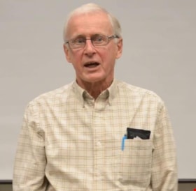
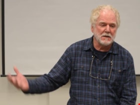
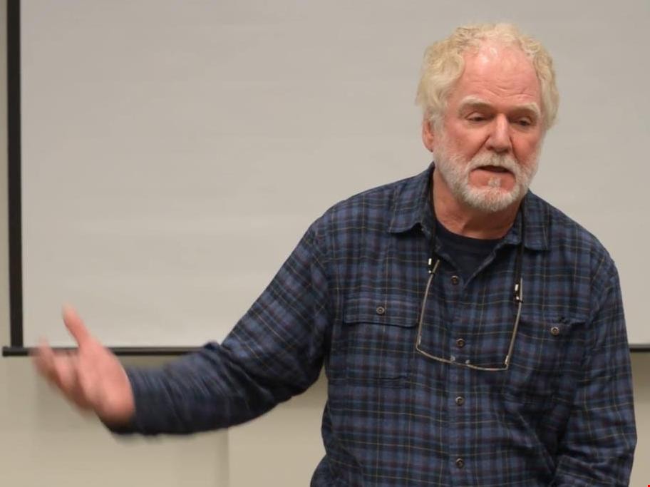
Film of Bruce McRae discussing Gilmore Avenue School
https://search.heritageburnaby.ca/link/museumdescription5118
- Repository
- Burnaby Village Museum
- Date
- January 17, 2017
- Collection/Fonds
- 100 Years of Gilmore School video collection
- Description Level
- Item
- Physical Description
- 1 video recording (mp4) (3 min., 15 sec.) : digital, 23 fps, col., sd., stereo
- Scope and Content
- Recording is of anecdotes shared by Bruce McRae pertaining to Gilmore Avenue School in Burnaby. Bruce recalls that he didn’t attend Gilmore Avenue School, but his mother, Sheila McRae, worked there as an assistant. He describes her work and her enjoyment of it. Bruce also notes that the school had …
- Repository
- Burnaby Village Museum
- Collection/Fonds
- 100 Years of Gilmore School video collection
- Description Level
- Item
- Physical Description
- 1 video recording (mp4) (3 min., 15 sec.) : digital, 23 fps, col., sd., stereo
- Material Details
- Film recorded at the McGill Library on January 17, 2017 as part of an event to screen "100 Years of Gilmore School" by filmmaker Yunuen Perez Vertti.
- Scope and Content
- Recording is of anecdotes shared by Bruce McRae pertaining to Gilmore Avenue School in Burnaby. Bruce recalls that he didn’t attend Gilmore Avenue School, but his mother, Sheila McRae, worked there as an assistant. He describes her work and her enjoyment of it. Bruce also notes that the school had an air raid siren mounted on its roof which sounded terrifying to him when it was tested periodically during the 1950s Cold War era.
- Creator
- Perez Vertti, Yunuen
- Geographic Access
- Gilmore Avenue
- Street Address
- 50 Gilmore Avenue
- Accession Code
- BV017.48.4
- Access Restriction
- No restrictions
- Reproduction Restriction
- No known restrictions
- Date
- January 17, 2017
- Media Type
- Moving Images
- Historic Neighbourhood
- Vancouver Heights (Historic Neighbourhood)
- Planning Study Area
- Burnaby Heights Area
- Notes
- Title based on contents of film
Images
Video
Film of Bruce McRae discussing Gilmore Avenue School, January 17, 2017
Film of Bruce McRae discussing Gilmore Avenue School, January 17, 2017
https://search.heritageburnaby.ca/media/hpo/_Data/_BVM_Moving_Images/2017_0048_0004_001.mp4
Film of Dave Linton discussing Gilmore Avenue School
https://search.heritageburnaby.ca/link/museumdescription5117
- Repository
- Burnaby Village Museum
- Date
- January 17, 2017
- Collection/Fonds
- 100 Years of Gilmore School video collection
- Description Level
- Item
- Physical Description
- 1 video recording (mp4) (51 sec.) : digital, 23 fps, col., sd., stereo
- Scope and Content
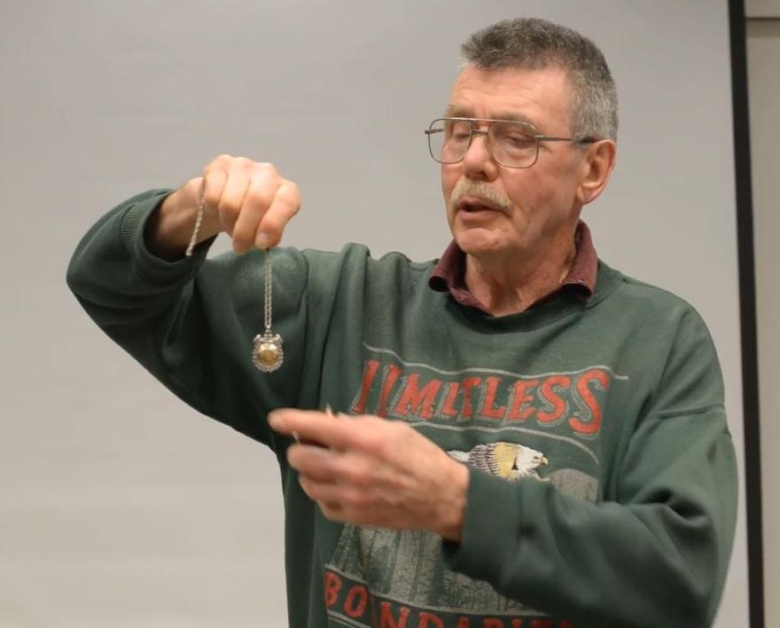
- Recording is an anecdote shared by Dave Linton pertaining to Gilmore Avenue School in Burnaby. Dave displays a medallion which was awarded to his mother by the Burnaby School Board for perfect attendance between the years 1921-1929. Dave attended Gilmore Avenue School, but it is unclear which schoo…
- Repository
- Burnaby Village Museum
- Collection/Fonds
- 100 Years of Gilmore School video collection
- Description Level
- Item
- Physical Description
- 1 video recording (mp4) (51 sec.) : digital, 23 fps, col., sd., stereo
- Material Details
- Film recorded at the McGill Library on January 17, 2017 as part of an event to screen "100 Years of Gilmore School" by filmmaker Yunuen Perez Vertti.
- Scope and Content
- Recording is an anecdote shared by Dave Linton pertaining to Gilmore Avenue School in Burnaby. Dave displays a medallion which was awarded to his mother by the Burnaby School Board for perfect attendance between the years 1921-1929. Dave attended Gilmore Avenue School, but it is unclear which school his mother attended. Asked her name, he replies “Stark”.
- Creator
- Perez Vertti, Yunuen
- Subjects
- Buildings - Schools
- Accession Code
- BV017.48.2
- Access Restriction
- No restrictions
- Reproduction Restriction
- No known restrictions
- Date
- January 17, 2017
- Media Type
- Moving Images
- Historic Neighbourhood
- Vancouver Heights (Historic Neighbourhood)
- Planning Study Area
- Burnaby Heights Area
- Notes
- Title based on contents of film
Images
Video
Film of Dave Linton discussing Gilmore Avenue School, January 17, 2017
Film of Dave Linton discussing Gilmore Avenue School, January 17, 2017
https://search.heritageburnaby.ca/media/hpo/_Data/_BVM_Moving_Images/2017_0048_0002_001.mp4
Film of Marcello Agosti discussing Gilmore Avenue School
https://search.heritageburnaby.ca/link/museumdescription5119
- Repository
- Burnaby Village Museum
- Date
- January 17, 2017
- Collection/Fonds
- 100 Years of Gilmore School video collection
- Description Level
- Item
- Physical Description
- 1 video recording (mp4) (2 min., 3 sec.) : digital, 23 fps, col., sd., stereo
- Scope and Content
- Recording is of an anecdote shared by Marcello Agosti pertaining to Gilmore Avenue School in Burnaby. Marcello was a Grade 2 student at the school at the time of the recording. He describes the music class, noting that it has changed greatly since he was in Kindergarten. Marcello talks about the ro…
- Repository
- Burnaby Village Museum
- Collection/Fonds
- 100 Years of Gilmore School video collection
- Description Level
- Item
- Physical Description
- 1 video recording (mp4) (2 min., 3 sec.) : digital, 23 fps, col., sd., stereo
- Material Details
- Film recorded at the McGill Library on January 17, 2017 as part of an event to screen "100 Years of Gilmore School" by filmmaker Yunuen Perez Vertti.
- Scope and Content
- Recording is of an anecdote shared by Marcello Agosti pertaining to Gilmore Avenue School in Burnaby. Marcello was a Grade 2 student at the school at the time of the recording. He describes the music class, noting that it has changed greatly since he was in Kindergarten. Marcello talks about the room, the equipment and resources, the students’ activities, and praises his music teacher.
- Creator
- Perez Vertti, Yunuen
- Subjects
- Buildings - Schools
- Geographic Access
- Gilmore Avenue
- Street Address
- 50 Gilmore Avenue
- Accession Code
- BV017.48.5
- Access Restriction
- No restrictions
- Reproduction Restriction
- May be restricted by third party rights
- Date
- January 17, 2017
- Media Type
- Moving Images
- Historic Neighbourhood
- Vancouver Heights (Historic Neighbourhood)
- Planning Study Area
- Burnaby Heights Area
- Notes
- Title based on contents of film
Images

Video
Film of Marcello Agosti discussing Gilmore Avenue School, January 17, 2017
Film of Marcello Agosti discussing Gilmore Avenue School, January 17, 2017
https://search.heritageburnaby.ca/media/hpo/_Data/_BVM_Moving_Images/2017_0048_0005_001.mp4
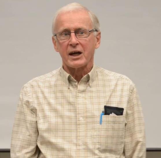
Film of Pat Sexsmith discussing Gilmore Avenue School
https://search.heritageburnaby.ca/link/museumdescription5116
- Repository
- Burnaby Village Museum
- Date
- January 17, 2017
- Collection/Fonds
- 100 Years of Gilmore School video collection
- Description Level
- Item
- Physical Description
- 1 video recording (mp4) (2 min., 30 sec.) : digital, 23 fps, col., sd., stereo
- Scope and Content
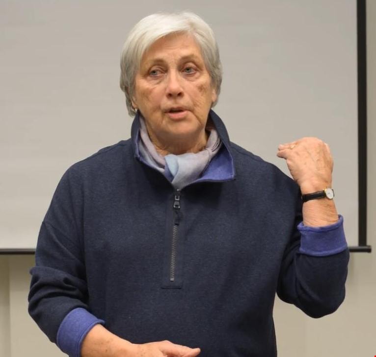
- Recording is of anecdotes shared by Pat Sexsmith pertaining to Gilmore Avenue School in Burnaby. Pat attended the school in the 1940s and 1950s. She describes recreational activities at the school during a time when resources were few, and recalls the commitment of time made by the school’s teacher…
- Repository
- Burnaby Village Museum
- Collection/Fonds
- 100 Years of Gilmore School video collection
- Description Level
- Item
- Physical Description
- 1 video recording (mp4) (2 min., 30 sec.) : digital, 23 fps, col., sd., stereo
- Material Details
- Film recorded at the McGill Library on January 17, 2017 as part of an event to screen "100 Years of Gilmore School" by filmmaker Yunuen Perez Vertti.
- Scope and Content
- Recording is of anecdotes shared by Pat Sexsmith pertaining to Gilmore Avenue School in Burnaby. Pat attended the school in the 1940s and 1950s. She describes recreational activities at the school during a time when resources were few, and recalls the commitment of time made by the school’s teachers to extracurricular activities for the students.
- Creator
- Perez Vertti, Yunuen
- Subjects
- Buildings - Schools
- Geographic Access
- Gilmore Avenue
- Street Address
- 50 Gilmore Avenue
- Accession Code
- BV017.48.3
- Access Restriction
- No restrictions
- Reproduction Restriction
- No known restrictions
- Date
- January 17, 2017
- Media Type
- Moving Images
- Historic Neighbourhood
- Vancouver Heights (Historic Neighbourhood)
- Planning Study Area
- Burnaby Heights Area
- Notes
- Title based on contents of film
Images
Video
Film of Pat Sexsmith discussing Gilmore Avenue School, January 17, 2017
Film of Pat Sexsmith discussing Gilmore Avenue School, January 17, 2017
https://search.heritageburnaby.ca/media/hpo/_Data/_BVM_Moving_Images/2017_0048_0003_001.mp4
Frank Walsh Residence
https://search.heritageburnaby.ca/link/landmark581
- Repository
- Burnaby Heritage Planning
- Description
- Residential building.
- Associated Dates
- 1948
- Street View URL
- Google Maps Street View
- Repository
- Burnaby Heritage Planning
- Geographic Access
- Boundary Road
- Associated Dates
- 1948
- Description
- Residential building.
- Heritage Value
- This Streamline Moderne house is a rare example of this style in Burnaby and remains in excellent condition. Reflecting the influence of technology, industrial design and aerodynamic styling, the house has smooth rounded surfaces, rounded corners, a flat roof and prominent projecting eaves. It was built for prominent North Burnaby businessman Frank Wallace Walsh (1907-1963), who was a mechanic, and his wife Rena.
- Locality
- Vancouver Heights
- Historic Neighbourhood
- Vancouver Heights (Historic Neighbourhood)
- Planning Study Area
- Burnaby Heights Area
- Area
- 566.71
- Contributing Resource
- Building
- Ownership
- Private
- Street Address
- 270 Boundary Road
- Street View URL
- Google Maps Street View
Images

