Narrow Results By
Person / Organization
- Alpha Secondary School 1
- Burnaby Central Secondary School 1
- Cascade Heights Elementary School 1
- Cliff's Can Factory 1
- Coutts, Mel 1
- Coutts, Stewart "Stu" 1
- Gilmore Avenue School 1
- Gooden, Tom 1
- James Brookes Woodworking Limited 1
- Moscrop Secondary School 1
- Schou Street School 1
- Western Canadian Can Factory 1
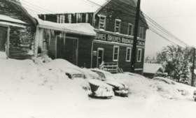
Woodworking Plant
https://search.heritageburnaby.ca/link/archivedescription35247
- Repository
- City of Burnaby Archives
- Date
- 1954 (date of original), copied 1986
- Collection/Fonds
- Burnaby Historical Society fonds
- Description Level
- Item
- Physical Description
- 1 photograph : b&w ; 12.7 x 17.8 cm print
- Scope and Content
- Photograph of James Brookes Woodworking Plant, located at 7730 6th Street, taken from 6th Avenue after a heavy snowfall. The plant was built originally as Cliff's Can Factory, and also served as Western Canadian Can Factory.
- Repository
- City of Burnaby Archives
- Date
- 1954 (date of original), copied 1986
- Collection/Fonds
- Burnaby Historical Society fonds
- Subseries
- Pioneer Tales subseries
- Physical Description
- 1 photograph : b&w ; 12.7 x 17.8 cm print
- Description Level
- Item
- Record No.
- 204-104
- Access Restriction
- No restrictions
- Reproduction Restriction
- Reproduce for fair dealing purposes only
- Accession Number
- BHS1988-03
- Scope and Content
- Photograph of James Brookes Woodworking Plant, located at 7730 6th Street, taken from 6th Avenue after a heavy snowfall. The plant was built originally as Cliff's Can Factory, and also served as Western Canadian Can Factory.
- Media Type
- Photograph
- Notes
- Title based on contents of photograph
- Geographic Access
- 6th Street
- Street Address
- 7730 6th Street
- Historic Neighbourhood
- East Burnaby (Historic Neighbourhood)
- Planning Study Area
- Second Street Area
Images
Interview with Janet White May 10, 2005 - Track 1
https://search.heritageburnaby.ca/link/museumdescription4370
- Repository
- Burnaby Village Museum
- Date
- [195-] (interview content), interviewed May 10, 2005
- Collection/Fonds
- Burnaby Village Museum fonds
- Description Level
- Item
- Physical Description
- 1 sound recording (mp3) (0:03:12 min)
- Scope and Content
- Track 1: This portion of the recording pertains to Janet White’s school years and the activities and sports she participated in, formally and informally. She lived near 6th and Edmonds St., and then in the Cascades area, by Nithsdale St., and attended Schou Elementary. She attended many schools as …
- Repository
- Burnaby Village Museum
- Collection/Fonds
- Burnaby Village Museum fonds
- Series
- Museum Oral Histories series
- Subseries
- Growing Up in Burnaby subseries
- Description Level
- Item
- Physical Description
- 1 sound recording (mp3) (0:03:12 min)
- Material Details
- Interviewer: Tom Gooden Interviewee: Janet White Date of interview: May 10, 2005 Total Number of Tracks: 8 Total length of all Tracks: 0:31:34
- Scope and Content
- Track 1: This portion of the recording pertains to Janet White’s school years and the activities and sports she participated in, formally and informally. She lived near 6th and Edmonds St., and then in the Cascades area, by Nithsdale St., and attended Schou Elementary. She attended many schools as soon as they were built, attending Gilmore Avenue, then Cascade Heights, Alpha Junior High, Moscrop Secondary, and finally Burnaby Central Secondary. Play was unstructured, with the Cascades bush and the tunnel parallel to and going under Smith Avenue being favourite places to play.
- History
- Recording of an interview with Janet White recording by Tom Gooden on May 10 2005. This recording was completed for an exhibit, Growing Up in Burnaby, for the Burnaby Village Museum. Major themes discussed are growing up in Burnaby in the 1950s.
- Creator
- Burnaby Village Museum
- Names
- Gooden, Tom
- White, Janet
- Schou Street School
- Gilmore Avenue School
- Cascade Heights Elementary School
- Alpha Secondary School
- Moscrop Secondary School
- Burnaby Central Secondary School
- Geographic Access
- 6th Street
- Edmonds Street
- Accession Code
- BV017.45.1
- Access Restriction
- No restrictions
- Reproduction Restriction
- May be restricted by third party rights
- Date
- [195-] (interview content), interviewed May 10, 2005
- Media Type
- Sound Recording
- Planning Study Area
- Cascade-Schou Area
Audio Tracks
Interview with Janet White May 10, 2005 - Track 1, [195-] (interview content), interviewed May 10, 2005
Interview with Janet White May 10, 2005 - Track 1, [195-] (interview content), interviewed May 10, 2005
https://search.heritageburnaby.ca/media/hpo/_Data/_BVM_Sound_Recordings/Oral_Histories/2017_0045_0001_001.mp3335 16th Avenue
https://search.heritageburnaby.ca/link/archivedescription37842
- Repository
- City of Burnaby Archives
- Date
- [between 1950 and 1954] (date of original), copied 1991
- Collection/Fonds
- Burnaby Historical Society fonds
- Description Level
- Item
- Physical Description
- 1 photograph : b&w ; 2.6 x 4.6 cm print on contact sheet 20.6 x 26.7 cm
- Scope and Content
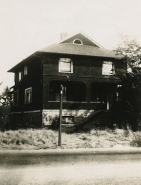
- Photograph of 335 16th Avenue (later renumbered 8029 16th Avenue), the home of Mel and Lois Coutts from 1948 to 1955.
- Repository
- City of Burnaby Archives
- Date
- [between 1950 and 1954] (date of original), copied 1991
- Collection/Fonds
- Burnaby Historical Society fonds
- Subseries
- Burnaby Image Bank subseries
- Physical Description
- 1 photograph : b&w ; 2.6 x 4.6 cm print on contact sheet 20.6 x 26.7 cm
- Description Level
- Item
- Record No.
- 370-430
- Access Restriction
- No restrictions
- Reproduction Restriction
- No restrictions
- Accession Number
- BHS1999-03
- Scope and Content
- Photograph of 335 16th Avenue (later renumbered 8029 16th Avenue), the home of Mel and Lois Coutts from 1948 to 1955.
- Subjects
- Buildings - Residential - Houses
- Media Type
- Photograph
- Notes
- Title based on contents of photograph
- 1 b&w copy negative accompanying
- Negative has a pink cast
- Geographic Access
- 16th Avenue
- Street Address
- 8029 16th Avenue
- Historic Neighbourhood
- East Burnaby (Historic Neighbourhood)
- Planning Study Area
- Second Street Area
Images
Mel Coutts and Stewart Coutts
https://search.heritageburnaby.ca/link/archivedescription37843
- Repository
- City of Burnaby Archives
- Date
- [1950] (date of original), copied 1991
- Collection/Fonds
- Burnaby Historical Society fonds
- Description Level
- Item
- Physical Description
- 1 photograph : b&w ; 2.6 x 4.6 cm print on contact sheet 20.6 x 26.7 cm
- Scope and Content
- Photograph of Mel Coutts with his son, Stewart, in front of their home at 335 16th Avenue (later renumbered 8029 16th Avenue).
- Repository
- City of Burnaby Archives
- Date
- [1950] (date of original), copied 1991
- Collection/Fonds
- Burnaby Historical Society fonds
- Subseries
- Burnaby Image Bank subseries
- Physical Description
- 1 photograph : b&w ; 2.6 x 4.6 cm print on contact sheet 20.6 x 26.7 cm
- Description Level
- Item
- Record No.
- 370-431
- Access Restriction
- No restrictions
- Reproduction Restriction
- No restrictions
- Accession Number
- BHS1999-03
- Scope and Content
- Photograph of Mel Coutts with his son, Stewart, in front of their home at 335 16th Avenue (later renumbered 8029 16th Avenue).
- Subjects
- Clothing - Uniforms
- Media Type
- Photograph
- Notes
- Title based on contents of photograph
- 1 b&w copy negative accompanying
- Negative has a pink cast
- Geographic Access
- 16th Avenue
- Street Address
- 8029 16th Avenue
- Historic Neighbourhood
- East Burnaby (Historic Neighbourhood)
- Planning Study Area
- Second Street Area
Images
Coldicutt House
https://search.heritageburnaby.ca/link/archivedescription34549
- Repository
- City of Burnaby Archives
- Date
- 1914
- Collection/Fonds
- Burnaby Historical Society fonds
- Description Level
- Item
- Physical Description
- 1 photograph : b&w ; 16.0 x 21.1 cm mounted on 25.1 x 30.1 cm cardboard
- Scope and Content
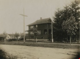
- Photograph of the exterior of the Coldicutt House at 7510 6th Street.
- Repository
- City of Burnaby Archives
- Date
- 1914
- Collection/Fonds
- Burnaby Historical Society fonds
- Subseries
- Photographs subseries
- Physical Description
- 1 photograph : b&w ; 16.0 x 21.1 cm mounted on 25.1 x 30.1 cm cardboard
- Description Level
- Item
- Record No.
- 044-009
- Access Restriction
- No restrictions
- Reproduction Restriction
- No known restrictions
- Accession Number
- BHS2007-04
- Scope and Content
- Photograph of the exterior of the Coldicutt House at 7510 6th Street.
- Media Type
- Photograph
- Notes
- Title based on contents of photograph
- Geographic Access
- 6th Street
- Street Address
- 7510 6th Street
- Historic Neighbourhood
- East Burnaby (Historic Neighbourhood)
- Planning Study Area
- Second Street Area
Images
Kingsway at 16th Avenue
https://search.heritageburnaby.ca/link/museumdescription3093
- Repository
- Burnaby Village Museum
- Date
- 1913
- Collection/Fonds
- Burnaby Village Museum Photograph collection
- Description Level
- Item
- Physical Description
- 1 photograph : b&w glass negative ; 15.8 x 21.1 cm
- Scope and Content
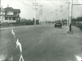
- Photograph of Kingsway looking northwest from 16th Avenue. On the lefthand side of the road, driving to New Westminster is a car with three men in suits and bowler hats. The car license plate reads, "BC/ 2720/ 1913." Following the car is a horse pulling a wagon. Further north, a small street car…
- Repository
- Burnaby Village Museum
- Collection/Fonds
- Burnaby Village Museum Photograph collection
- Description Level
- Item
- Physical Description
- 1 photograph : b&w glass negative ; 15.8 x 21.1 cm
- Scope and Content
- Photograph of Kingsway looking northwest from 16th Avenue. On the lefthand side of the road, driving to New Westminster is a car with three men in suits and bowler hats. The car license plate reads, "BC/ 2720/ 1913." Following the car is a horse pulling a wagon. Further north, a small street car can be seen, probably moving southward. According to the 1988 catalogue record, the two houses on the left are separated by Hubert Avenue. The larger house on the left is the home of of Mr. and Mrs. John McNiven, now demolished. The smaller house in the distance, being constructed, is the Britton family home. On the right in the distance, the roof and twin chimneys of the 1890s Stride home can be seen, which later became the Sylvan Court Apartment Building.
- Subjects
- Geographic Features - Roads
- Geographic Access
- Kingsway
- 16th Avenue
- Accession Code
- HV972.11.7
- Access Restriction
- No restrictions
- Reproduction Restriction
- No known restrictions
- Date
- 1913
- Media Type
- Photograph
- Historic Neighbourhood
- Edmonds (Historic Neighbourhood)
- Planning Study Area
- Edmonds Area
- Stride Avenue Area
- Scan Resolution
- 300
- Scan Date
- 14/8/2006
- Scale
- 100
- Notes
- Title based on contents of photograph
- 1 b&w contact print accompanying negative
Images
Thomas & Margaret Coldicutt Residence
https://search.heritageburnaby.ca/link/landmark647
- Repository
- Burnaby Heritage Planning
- Description
- Residential building.
- Associated Dates
- 1911
- Street View URL
- Google Maps Street View
- Repository
- Burnaby Heritage Planning
- Geographic Access
- 6th Street
- Associated Dates
- 1911
- Description
- Residential building.
- Heritage Value
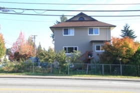
- This house was built by Thomas Davis Coldicutt (1879-1970) and Margaret Jane Coldicutt, pre-eminent local citizens. Thomas Coldicutt was born in Birmingham and arrived in Canada in 1900, finding success in the steamboat industry. In 1902, he married Margaret Jane Styler who had been born in Redditch, Worcester, England, and in 1908 they settled in East Burnaby–some of the first pioneers to the area–and established a fruit farm. Thomas had a successful real estate, insurance and brokerage business, and was elected as a councillor for East Burnaby in 1909. He was also active in civic, political and social circles in Burnaby and became president of the Burnaby Board of Trade. "East Burnaby is booming and the signs of prosperity that may be seen on every hand. Most of these are substantial dwellings, such as effect a permanent improvement to the countryside. Among those whose homes have been completed, or on the point of completion may be mentioned. Councillor Coldicutt, who has built himself a habitation on Second Avenue at a cost of $4,000. (The British Columbian, 1911). In 1913, Coldicutt sold his original farm described as “the show place of Burnaby” to the Burnaby School Board for the development of Second Street School and this house was moved from Second Street and Sixteenth Avenue to this site. It has been extensively altered, but retains its original form, scale and massing.
- Locality
- East Burnaby
- Historic Neighbourhood
- East Burnaby (Historic Neighbourhood)
- Planning Study Area
- Edmonds Area
- Area
- 557.42
- Contributing Resource
- Building
- Ownership
- Private
- Street Address
- 7510 6th Street
- Street View URL
- Google Maps Street View
![335 16th Avenue, [between 1950 and 1954] (date of original), copied 1991 thumbnail](/media/hpo/_Data/_Archives_Images/_Unrestricted/370/370-430.jpg?width=280)
![Mel Coutts and Stewart Coutts, [1950] (date of original), copied 1991 thumbnail](/media/hpo/_Data/_Archives_Images/_Unrestricted/370/370-431.jpg?width=280)

