Narrow Results By
Format
- Architectural Drawing 8
- Book 484
- Bylaws - Adopted 470
- Bylaws - Other 5
- Bylaws - Repealed 35
- Cartographic Material
- Council - 7
- Council - Committee Report 663
- Council - Information Report 15
- Council - Manager's Report 846
- Council - Mayor/Councillor/Staff Report 2179
- Council - Public Hearing Minutes 27
Creator
- Armstrong, Sophie 1
- Bancroft, Rose 1
- Burnett, David H. 1
- Burnett, Geoffrey K. 1
- Burnett & McGugan, Engineers and Surveyors 7
- Chow, Hipman "Jimmy" 1
- Draper, William Nelson 1
- Forsyth, Mary 1
- Garden, Hermon and Burwell 2
- Garden, Hermon & Burwell 1
- Gauvreau, Narcisse B. 1
- Government of British Columbia - Department of Mines and Resources 1
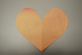
Paper heart by Sophie Armstrong
https://search.heritageburnaby.ca/link/museumdescription14749
- Repository
- Burnaby Village Museum
- Date
- March 2020
- Collection/Fonds
- Burnaby Village Museum COVID-19 collection
- Description Level
- Item
- Physical Description
- 1 drawing : wax crayon on pink construction paper ; 20 x 23.5 cm
- Scope and Content
- Item consists of a heart that has been cut out of pink coloured construction paper. One side of the heart has contains a child's drawing with markings in purple crayon while the other side is blank. The side with the markings is faded from exposure due to sunlight after being hung in a window.
- Repository
- Burnaby Village Museum
- Collection/Fonds
- Burnaby Village Museum COVID-19 collection
- Description Level
- Item
- Physical Description
- 1 drawing : wax crayon on pink construction paper ; 20 x 23.5 cm
- Scope and Content
- Item consists of a heart that has been cut out of pink coloured construction paper. One side of the heart has contains a child's drawing with markings in purple crayon while the other side is blank. The side with the markings is faded from exposure due to sunlight after being hung in a window.
- History
- This was a heart the Armstrong family made in the last week of March when things were starting to get very scary and they wanted to share their message of love and support to the world. The heart was decorated on one side by Sophie (age 1), Kimberly's youngest daughter (of two). The heart remained on the window until mid July 2020.
- Creator
- Armstrong, Sophie
- Subjects
- Arts - Drawings
- Crafts
- Pandemics - COVID-19
- Responsibility
- Paneloc Marketing Limited
- Accession Code
- BV020.24.1
- Access Restriction
- No restrictions
- Reproduction Restriction
- No known restrictions
- Date
- March 2020
- Media Type
- Graphic Material
- Notes
- Title based on contents of item
Images


Museum exhibits series
https://search.heritageburnaby.ca/link/museumdescription16037
- Repository
- Burnaby Village Museum
- Date
- 1990-2021
- Collection/Fonds
- Burnaby Village Museum fonds
- Description Level
- Series
- Physical Description
- 1 digital illustration (pdf) + 1 painting (tiff) + 9 sound recordings (mp3) + 2 video recordings (mp4) + 6.5 cm of textual records
- Scope and Content
- Series consists of photographs, graphic materials and other records pertaining to Burnaby Village Museum temporary and permanent exhibits. A selection of temporary exihibits are described by title and year. Series have been arranged by exhibit title into the following subseries: 1) Burnaby's Best …
- Repository
- Burnaby Village Museum
- Collection/Fonds
- Burnaby Village Museum fonds
- Series
- Museum exhibits series
- Description Level
- Series
- Physical Description
- 1 digital illustration (pdf) + 1 painting (tiff) + 9 sound recordings (mp3) + 2 video recordings (mp4) + 6.5 cm of textual records
- Scope and Content
- Series consists of photographs, graphic materials and other records pertaining to Burnaby Village Museum temporary and permanent exhibits. A selection of temporary exihibits are described by title and year. Series have been arranged by exhibit title into the following subseries: 1) Burnaby's Best Baby contest subseries 2) Across the Pacific subseries 3) Agents of Change subseries 4) Museum materials for exhibits subseries
- Names
- Burnaby Village Museum
- Accession Code
- BV020.5
- BV019.36.1
- BV019.61.1
- BV020.42
- BV021.14
- Date
- 1990-2021
- Arrangement
- Series are arranged by subseries by exhibit title and year.
- Notes
- Title based on contents of series
- Further accruals expected
Property master records series
https://search.heritageburnaby.ca/link/museumdescription19153
- Repository
- Burnaby Village Museum
- Date
- [1973-2022]
- Collection/Fonds
- Hipman "Jimmy" Chow and Donna Polos fonds
- Description Level
- Series
- Physical Description
- 1 portfolio : (15 photographs + 12 col. laser prints) + 1 col. laser print + 6 business cards + 1 identification card + 1 booklet
- Scope and Content
- Series consists of a small selection of prop concept design plans and prototypes for films that Jimmy Chow worked on as property master along with a collection of Jimmy Chow's identification cards and business cards while working in the film industry. Prop concept designs and prototypes include; …
- Repository
- Burnaby Village Museum
- Collection/Fonds
- Hipman "Jimmy" Chow and Donna Polos fonds
- Description Level
- Series
- Physical Description
- 1 portfolio : (15 photographs + 12 col. laser prints) + 1 col. laser print + 6 business cards + 1 identification card + 1 booklet
- Scope and Content
- Series consists of a small selection of prop concept design plans and prototypes for films that Jimmy Chow worked on as property master along with a collection of Jimmy Chow's identification cards and business cards while working in the film industry. Prop concept designs and prototypes include; "X2: X-Men United" and "The BFG".
- Accession Code
- BV022.21
- Date
- [1973-2022]
- Media Type
- Photograph
- Textual Record
- Graphic Material
- Notes
- Title based on contents of series
Hipman "Jimmy" Chow and Donna Polos fonds
https://search.heritageburnaby.ca/link/museumdescription19150
- Repository
- Burnaby Village Museum
- Date
- 1950-2022
- Collection/Fonds
- Hipman "Jimmy" Chow and Donna Polos fonds
- Description Level
- Fonds
- Physical Description
- 3 sound recordings (wav) + 1 sound recording (mp3) + 65 photographs + 26 photographs (jpg) + 1 portfolio (15 col. photographs + 12 col. laser prints) + 1 col. laser print + 6 business cards + 1 identification card + 1 booklet
- Scope and Content
- Fonds consists of an oral history interview with Jimmy Chow and his wife, Donna Polos; photographs of Jimmy Chow and his family soon after they immigrated to Canada in the 1950s as well as a sampling of photographs and records documenting Jimmy Chow's career in the film industry. Fonds is arranged…
- Repository
- Burnaby Village Museum
- Collection/Fonds
- Hipman "Jimmy" Chow and Donna Polos fonds
- Description Level
- Fonds
- Physical Description
- 3 sound recordings (wav) + 1 sound recording (mp3) + 65 photographs + 26 photographs (jpg) + 1 portfolio (15 col. photographs + 12 col. laser prints) + 1 col. laser print + 6 business cards + 1 identification card + 1 booklet
- Scope and Content
- Fonds consists of an oral history interview with Jimmy Chow and his wife, Donna Polos; photographs of Jimmy Chow and his family soon after they immigrated to Canada in the 1950s as well as a sampling of photographs and records documenting Jimmy Chow's career in the film industry. Fonds is arranged into series: 1) Jimmy Chow and Donna Polos interviews series 2) Jimmy Chow family photographs series 3) Property master photographs series 4) Property master records series
- History
- Hipman "Jimmy" Chow was born in Lin Pong Lee, Hoiping, China in 1948. In 1950, Jimmy Chow and his mother, Gim Gee Chow (1913-1991) fled China to escape the Communist Revolution and to be reunited with his father, Robin Chung Dip Chow (1906-1990) who’d immigrated to Canada many years earlier. Jimmy’s elder sister Shao-Lin Chow stayed behind in China. Jimmy’s father, Robin Chung Dip Chow immigrated to Canada in 1921 at 14 years of age and was forced to pay the Chinese head tax of $500. In 1950, Jimmy and his mother first fled to Hong Kong before immigrating to Canada and arriving in Vancouver. Jimmy Chow’s birth name is Hipman Chow but when he arrived in Canada, his father indicated that he needed an English name and he was given the name “Jimmy” but retained his birth name “Hipman Chow”. Over the years, Jimmy has also used the name “James H. Chow” and is often credited by this name in the film industry. For the first four years after immigrating, Jimmy and his parents lived in Manitoba, Saskatchewan and Quebec where his father had work in hotels and restaurants. While living in Asquith, Saskatchewan Jimmy attended school and began to learn English. In 1954, Jimmy and his parents returned to Vancouver, first living in the area of Strathcona before settling in the neighbourhood of Mount Pleasant where they purchased a house located on 15th Avenue east of Main Street. While living in Mount Pleasant, Jimmy attended both elementary and high school. While attending high school, Jimmy began working at the local grocery store where he worked for many years living at home and saving his money. In 1970 while attending Vancouver City College, Jimmy met his future wife Donna Polos. Two years later, they moved in together, married in 1981 and started a family. Jimmy and Donna first lived in North Burnaby before purchasing a house on Victory Street in Burnaby where they raised their three children. Growing up in a traditional Chinese Canadian family, Jimmy was always one who went against the grain. Although his father wanted him to get a business degree, Jimmy had aspirations for a different career path. Through the referral of a friend, he entered the film industry in 1973 working for CBC Vancouver. While working at the CBC, Jimmy gained valuable experience working on the set of the television series The Beachcombers, which launched his career in the film industry. Over a 45 year career, Jimmy worked on over 50 blockbuster movies, historical period films, science fiction films and fantasy films, where he honed in on his expertise as a set decorator, art director and property master. He built an international reputation through working with production companies, prop makers and antique sellers across the globe. As a property master in the film industry, Jimmy Chow has been responsible for designing, managing, and sourcing props for films such as: The BFG, Warcraft: The Beginning, X-Men 2, Fantastic Four, Watchman, Tron: Legacy, Little Women, Seven Years in Tibet, Shanghai Noon, The Shipping News, Fantastic Four: Rise of the Silver Surfer, The Changeling, Man of Steel (Superman), Snow Falling on Cedars, Legends of the Fall, And the Sea Will Tell, Once a Thief and many more. With Jimmy's many years of professional experience in the film industry, he has been a union member of IATSE (International Alliance of Theatrical Stage Employees, Moving Picture Technicians...) from July 1979, a member of the Academy of Motion Picture Arts and Science from 2018 and has worked as a guest lecturer in film production at Capilano University and Langara University. He was also a key contributor to the Burnaby Village Museum’s 2014 temporary exhibition Burnaby Makes Movies. Donna Polos was born in Vancouver in 1949 to parents Mayme "May" Helen Tillikana Polos (1931-1977) and Donald James Polos (1926-2017). Donna’s maternal grandparents, Elvi Tienhara and Toiva Tillikana immigrated to Canada from Helsinki, Finland. Donna’s paternal grandmother, Pauline Chimiki Polos emigrated from Ukraine to Argentina and then to Winnipeg. Donna’s paternal grandfather, James "Jimmy" Kostopolus emigrated as an orphan from Sparta Greece at the age of 12 years. In 1908, he first immigrated to the United States where he was denied entry so immigrated to Canada, entering through Halifax at Pier 17. When immigrating, James changed his last name to "Polos". Jimmy Polos arrived in Halifax with only five dollars in his pocket. He lived in Halifax for many years before making his way to Vancouver where he established three restaurants and raised his family. James was the proprietor of three restaurants in Burnaby including; the Home Apple Pie Café (1941-1944) located on East Hastings near Princess Avenue; Jimmy’s Café (1945-1955) located on East Hastings near Hawks Avenue and another restaurant located near 10th Avenue and Alma Street. Donna grew up with her family in Vancouver, first living in the downtown eastside before moving to a home near Joyce Station. Donna attended elementary school and high school while growing up in the neighbourhood of Joyce Station. Donna moved out of her family home at 21 years of age and lived with roommates before moving in with Jimmy Chow in 1972. Donna attended Vancouver City College and the University of British Columbia where she obtained her teaching degree in 1974. Donna first taught at Gilmore Elementary School before being hired to teach at Clinton Elementary School where she taught for nine years. While raising their three children, Donna worked part time teaching in schools in Burnaby. In 1991, after a near death experience, Donna became interested in fine art and took drawing and watercolour painting classes. This experience led her to experimenting with different painting techniques on paper and fabric. In 2008, Donna retired from teaching but continued her art career often working as an Artist in Residence at various schools and exhibiting her work. While living in Burnaby Donna has been politically active with a particular passion for heritage, housing and preserving the natural environment. Donna was instrumental in advocating and petitioning for the establishment of a tree bylaw in Burnaby which was eventually adopted by the City.
- Creator
- Chow, Hipman "Jimmy"
- Polos, Donna
- Accession Code
- BV022.21
- BV023.11
- Date
- 1950-2022
- Media Type
- Sound Recording
- Photograph
- Textual Record
- Graphic Material
- Notes
- Title based on contents of fonds
- Hipman "Jimmy" Chow's name in Cantonese is Chow Hipman and in Mandarin is Zhou Xiamin.
![Survey and Subdivision plans in New Westminster District Group 1 – Burnaby
, [1909] thumbnail](/media/hpo/_Data/_BVM_Cartographic_Material/1977/1977_0093_0002a_001.jpg?width=280)
Survey and Subdivision plans in New Westminster District Group 1 – Burnaby
https://search.heritageburnaby.ca/link/museumdescription6972
- Repository
- Burnaby Village Museum
- Date
- [1909]
- Collection/Fonds
- Burnaby Village Museum Map collection
- Description Level
- File
- Physical Description
- 6 Plans : blueprint ink on paper + 1 black ink on paper mounted on 2 sides of cardboard 76 cm x 102 cm
- Scope and Content
- Item consists of a large board of three New Westminster District Gp 1 - subdivision plans mounted on one side and three New Westminster District Gp 1 - subdivision plans mounted on the other side with scales ranging from one chain equals one inch to four chains equals one inch. Side A: 1. Bluepri…
- Repository
- Burnaby Village Museum
- Collection/Fonds
- Burnaby Village Museum Map collection
- Description Level
- File
- Physical Description
- 6 Plans : blueprint ink on paper + 1 black ink on paper mounted on 2 sides of cardboard 76 cm x 102 cm
- Material Details
- Scales [1:792] and [1:3168]
- Index number on edge of board reads: "2"
- Scope and Content
- Item consists of a large board of three New Westminster District Gp 1 - subdivision plans mounted on one side and three New Westminster District Gp 1 - subdivision plans mounted on the other side with scales ranging from one chain equals one inch to four chains equals one inch. Side A: 1. Blueprint "Plan, / of Subdivision / of / Blocks 61, 62 and 2 / Lot 30 / Group 1 /N.W.Dist." Plan includes Fulton Street, Edmonds Street and Vancouver Road at the bottom. (Geographic location: Burnaby) 2. Blueprint "Location / for Burnaby Council / of / The West Boundary of Lots 161 & 175 / Group One". Plan includes River Road, North Arm Road, Boundary Rd. Diversion and the North Arm of the Fraser at the bottom. (Geographic location: Burnaby) 3. Blueprint "Survey / of Highway / for / Burnaby Council / Lots 13 & 14 / Group One". Plan includes Armstrong Street, Caribou [sic] Street, Caribou [sic] Road and Brunette River with Lower Dam and Upper Dam. (Geographic location: Burnaby) Side B: 1. Blueprint "Plan of Subdivision / of Lots 1, 2 and 5 / in the Subdivision of / Lot 87, Gr.1 / Also of 20 1/2 acre part / in the North-West portion of / said Lot 87, Gr.1 / New Westminster District". Plan is bordered by Lot 86 / Hastings Road, Esplanade / Burnaby Lake with Nursery Road running east west. Plan is identified as "Albert J. Hill / B.C.LotS. / 25/06/09" (Geographic location: Burnaby) 2. Blueprint "Plan / of / Subdivision of / Portion of / Lot 85, Gp.1, / New Westminster District" Plan is bordered by Douglas Road and Poleline Road and Esplanade / Burnaby Lake with Byrne Drive running through. Plan is identified as "Albert J. Hill / B.C.LotS. / 11/6/09" (Geographic location: Burnaby) 3. "Plan / of Resubdivision / of / Block VIII / In the Subdivision / of Lot 27 / Group 1 / New Westminster District" Annotation in red ink reads: "Original Subdivision Shown in Red". Plan includes an index at the top and is bordered by Block VII / Second Street, Block V. / Third Avenue, Block XI / Fourth Avenue / Block IX / First Street. (Geographic location: Burnaby)
- Creator
- Hill, Albert James
- Accession Code
- HV977.93.2
- Access Restriction
- No restrictions
- Reproduction Restriction
- No known restrictions
- Date
- [1909]
- Media Type
- Cartographic Material
- Scan Resolution
- 300
- Scale
- 72
- Notes
- Title based on contents of file
- Scale is measured in chains. (One chain equals 792 inches)
- The term "Lot" can also refer to a "District Lot”
Images
![Survey and Subdivision plans in New Westminster District Group 1 – Burnaby
, [1909] thumbnail](/media/hpo/_Data/_BVM_Cartographic_Material/1977/1977_0093_0002a_001.jpg)

![Survey and Subdivision plans in New Westminster District Group 1 – Burnaby
, [1909] thumbnail](/media/hpo/_Data/_BVM_Cartographic_Material/1977/1977_0093_0005a_001.jpg?width=280)
Survey and Subdivision plans in New Westminster District Group 1 – Burnaby
https://search.heritageburnaby.ca/link/museumdescription6974
- Repository
- Burnaby Village Museum
- Date
- [1909]
- Collection/Fonds
- Burnaby Village Museum Map collection
- Description Level
- File
- Physical Description
- 5 plans : blueprint ink on paper + 1 plan : black ink on paper mounted on 2 sides of cardboard ; 76 cm x 102 cm
- Scope and Content
- Item consists of a large board of three New Westminster District Gp 1 - subdivision plans mounted on one side and three New Westminster District Gp 1 - subdivision plans mounted on the other side. Side A: 1. Blueprint "Plan / of Subdivision of / Lot 1 and the West Half of Lot 2 / in the Subdivis…
- Repository
- Burnaby Village Museum
- Collection/Fonds
- Burnaby Village Museum Map collection
- Description Level
- File
- Physical Description
- 5 plans : blueprint ink on paper + 1 plan : black ink on paper mounted on 2 sides of cardboard ; 76 cm x 102 cm
- Material Details
- Scales [between 1:1584 and 1:3960]
- Index number on edge of board reads: "5"
- Scope and Content
- Item consists of a large board of three New Westminster District Gp 1 - subdivision plans mounted on one side and three New Westminster District Gp 1 - subdivision plans mounted on the other side. Side A: 1. Blueprint "Plan / of Subdivision of / Lot 1 and the West Half of Lot 2 / in the Subdivision of / Lot 136, 131, 44 and 78 Gr.1 / District of New Westminster , B.C." . Plan is bordered by Johnston Road, Pole Line Road, V.W.& Y. Railway and Lot 43. (Geographic location: Burnaby) 2. Blueprint "Plan / of Subdivision / of a portion / of / Lot 13, Gr.1 / New Westminster District". Plan is bordered by north east of Cariboo Street and Armstrong Street with Lillooet Street bisecting through the middle. (Geographic location: Burnaby) 3. Blueprint "Plan / of Subdivision / of / Lots 2 and 4 / Group One / New Westminster District." Plan is bordered west of North Road, north of Lot 1 and south of Lot 6. (Geographic location: Burnaby) Side B: 1. Blueprint plan of "Diversion of Gunn Road / in / Lots 10 & 4 / Group One." Plan idenfies V.W.& Y. Railway alongside proposed diversion of Gunn Road. (Geographic location: Burnaby) 2. Blueprint "Survey and Subdivision / of / Lot 12 and a portion of Lot 13 / Group One / New Westminster District." Plan ids bordered by Gunn Rd. to the north, and Cariboo Road / Lot s 10 and 14 to the east and Lot 1 to the west with V.W.& Y. Rwy and Brunette River running through diagonally. (Geographic location: Burnaby) 3. Blueprint "Plan of Subdivision / of / Lot 97, Group 1 / New Westminster District." Plan is bordered by Webster Road, Power House Road, Lot 94 and Lot 93 to the north with Jenn's Rd. running north through the centre and Vancouver & New Westminster Rd. and New Westminster Vancouver Tramway running east-west. Handwritten annotation in pencil over top of plan reads: "Cancelled" (Geographic location: Burnaby)
- Accession Code
- HV977.93.5
- Access Restriction
- No restrictions
- Reproduction Restriction
- No known restrictions
- Date
- [1909]
- Media Type
- Cartographic Material
- Scan Resolution
- 300
- Scale
- 72
- Notes
- Title based on contents of file
- Scale is measured in chains. (One chain equals 792 inches)
- The term "Lot" can also refer to a "District Lot”
Images
![Survey and Subdivision plans in New Westminster District Group 1 – Burnaby
, [1909] thumbnail](/media/hpo/_Data/_BVM_Cartographic_Material/1977/1977_0093_0005a_001.jpg)

![Municipality of Burnaby, [ca. 1909] thumbnail](/media/hpo/_Data/_BVM_Cartographic_Material/1976/1976_0158_0006_002%20WEB.jpg?width=280)
Municipality of Burnaby
https://search.heritageburnaby.ca/link/museumdescription13095
- Repository
- Burnaby Village Museum
- Date
- [ca. 1909]
- Collection/Fonds
- Burnaby Village Museum Map collection
- Description Level
- Item
- Physical Description
- 1 map : b&w lithographic print on linen, b&w ; 40 x 43.5 cm
- Scope and Content
- Map of the Municipality of Burnaby issued by Mahon, McFarland and Mahon (Real Estate, Insurance and Loans, Vancouver B.C.). A handrawn red line runs south of Burnaby Lake and between North Road and Boundary Road.
- Repository
- Burnaby Village Museum
- Collection/Fonds
- Burnaby Village Museum Map collection
- Description Level
- Item
- Physical Description
- 1 map : b&w lithographic print on linen, b&w ; 40 x 43.5 cm
- Scope and Content
- Map of the Municipality of Burnaby issued by Mahon, McFarland and Mahon (Real Estate, Insurance and Loans, Vancouver B.C.). A handrawn red line runs south of Burnaby Lake and between North Road and Boundary Road.
- Creator
- Mahon, McFarland & Mahon
- Publisher
- The Angel Engraving Co.
- Accession Code
- HV976.158.6
- Access Restriction
- No restrictions
- Reproduction Restriction
- No known restrictions
- Date
- [ca. 1909]
- Media Type
- Cartographic Material
- Scan Resolution
- 420
- Scan Date
- Dec. 22, 2020
- Scale
- 100
- Notes
- Title based on content of map
- Title on map reads: "Map / of The / Municipality / of / BURNABY / ISSUED BY / Mahon, McFarland & Mahon"
- Map contains the initals "F.R.G." [sic]
- Circular insignia in left corner reads: "THE ANGEL ENGRAVING CO."
Zoomable Images
![Municipality of Burnaby, [ca. 1909] thumbnail](/media/hpo/_Data/_BVM_Cartographic_Material/1976/1976_0158_0006_001_seadragon/1976_0158_0006_001.jpg?w=280)
Western Canada Power Company
https://search.heritageburnaby.ca/link/archivedescription395
- Repository
- City of Burnaby Archives
- Date
- 1909-1930
- Collection/Fonds
- City Council and Office of the City Clerk fonds
- Description Level
- File
- Physical Description
- 5 folders textual records and cartographic material
- Scope and Content
- File contains draft bylaws, draft contracts and correspondence related to the operation of the Western Canada Power Company. As well, file contains declarations, news clippings, correspondence, ballots, and tally sheets that resulted from the voting held regarding the Western Canada Power Co. Byla…
- Repository
- City of Burnaby Archives
- Date
- 1909-1930
- Collection/Fonds
- City Council and Office of the City Clerk fonds
- Physical Description
- 5 folders textual records and cartographic material
- Description Level
- File
- Record No.
- 2091
- Accession Number
- 2001-02
- Scope and Content
- File contains draft bylaws, draft contracts and correspondence related to the operation of the Western Canada Power Company. As well, file contains declarations, news clippings, correspondence, ballots, and tally sheets that resulted from the voting held regarding the Western Canada Power Co. Bylaw. Also included are agreements, correspondence and bylaw no. 114. The 1922 agreement includes a blueprint. As well, file contains a white linen plan of DL 15 and blueprint plans of standard power pole and transmission towers on Broadway and Cariboo Roads, 1916.
- Media Type
- Textual Record
- Cartographic Material
- Notes
- For related records see also file 6-1-5-2. A map of the Municipality of Burnaby by Archibald Moir and Co. : M9-B-2-11; blueprint of Burnaby Municipality : M9-B-2-15
Board of Railway Commissioners
https://search.heritageburnaby.ca/link/archivedescription396
- Repository
- City of Burnaby Archives
- Date
- 1909-1912
- Collection/Fonds
- City Council and Office of the City Clerk fonds
- Description Level
- File
- Physical Description
- Textual record, cartographic material, and architectural drawings
- Scope and Content
- File contains correspondence and reports related to the activities of the Board of Railway Commissioners such as the movement of stations, culvert work, and the maintenance of crossings. File also includes white linen plan and blueprint plans (4) of culverts at Cariboo Road and V.W. and Y.Rlwy Jun…
- Repository
- City of Burnaby Archives
- Date
- 1909-1912
- Collection/Fonds
- City Council and Office of the City Clerk fonds
- Physical Description
- Textual record, cartographic material, and architectural drawings
- Description Level
- File
- Record No.
- 2096
- Accession Number
- 2001-02
- Scope and Content
- File contains correspondence and reports related to the activities of the Board of Railway Commissioners such as the movement of stations, culvert work, and the maintenance of crossings. File also includes white linen plan and blueprint plans (4) of culverts at Cariboo Road and V.W. and Y.Rlwy Junction, 1911.
- Notes
- Plans/maps are located in file and have not been moved to map case.
Street lighting
https://search.heritageburnaby.ca/link/archivedescription436
- Repository
- City of Burnaby Archives
- Date
- 1909-1922
- Collection/Fonds
- City Council and Office of the City Clerk fonds
- Description Level
- File
- Physical Description
- 4 folders textual records and cartographic material
- Scope and Content
- File contains agreements, statements, correspondence and reports pertaining to the installation and maintenance of street lights.
- Repository
- City of Burnaby Archives
- Date
- 1909-1922
- Collection/Fonds
- City Council and Office of the City Clerk fonds
- Physical Description
- 4 folders textual records and cartographic material
- Description Level
- File
- Record No.
- 2138
- Accession Number
- 2001-02
- Scope and Content
- File contains agreements, statements, correspondence and reports pertaining to the installation and maintenance of street lights.
- Media Type
- Textual Record
- Cartographic Material
- Notes
- A map of Burnaby with proposed street lamps marked (1912?) : M9-B-2-12
Crossing - B.C. Electric Railway Co.
https://search.heritageburnaby.ca/link/archivedescription657
- Repository
- City of Burnaby Archives
- Date
- 1909-1913
- Collection/Fonds
- City Council and Office of the City Clerk fonds
- Description Level
- File
- Physical Description
- Textual record and cartographic material
- Scope and Content
- File contains correspondence and reports pertaining to crossings on B.C. Electric Railway lines at Cariboo, Hastings, Boundary, Gilley, Jubilee, McKay, and Patterson.
- Repository
- City of Burnaby Archives
- Date
- 1909-1913
- Collection/Fonds
- City Council and Office of the City Clerk fonds
- Physical Description
- Textual record and cartographic material
- Description Level
- File
- Record No.
- 2382
- Accession Number
- 2001-02
- Scope and Content
- File contains correspondence and reports pertaining to crossings on B.C. Electric Railway lines at Cariboo, Hastings, Boundary, Gilley, Jubilee, McKay, and Patterson.
- Media Type
- Textual Record
- Cartographic Material
- Notes
- Vancouver and Lulu Island Railway Westminster and Eburne Byrne Road Crossing at Station 355 : M9-A-6-5; Trapp Road Crossing at Station 425 : M9-A-6-6
Petition (Lefurgey) - Cancellation of plans, map 1521
https://search.heritageburnaby.ca/link/archivedescription727
- Repository
- City of Burnaby Archives
- Date
- [ between 1909 - 1912 ]
- Collection/Fonds
- City Council and Office of the City Clerk fonds
- Description Level
- File
- Physical Description
- Textual record and cartographic material
- Scope and Content
- File contains correspondence and Council minutes regarding the petition made by Alfred Lefurgey to have Map No. 1521 cancelled. File also includes the petition made by Lefurgey to the County Court of Westminster and two oversized blueprint plans for DL 10 (1909) and for the NE portion of DL 10 (19…
- Repository
- City of Burnaby Archives
- Date
- [ between 1909 - 1912 ]
- Collection/Fonds
- City Council and Office of the City Clerk fonds
- Physical Description
- Textual record and cartographic material
- Description Level
- File
- Record No.
- 2454
- Accession Number
- 2001-02
- Scope and Content
- File contains correspondence and Council minutes regarding the petition made by Alfred Lefurgey to have Map No. 1521 cancelled. File also includes the petition made by Lefurgey to the County Court of Westminster and two oversized blueprint plans for DL 10 (1909) and for the NE portion of DL 10 (1911).
- Media Type
- Textual Record
- Cartographic Material
- Notes
- 2 plans of subdivision of NE Portion of DL 10, group 1, NWD : M9-A-8-14; M9-A-8-15
Boundary Plan - Location for Burnaby Council of the West Boundary of Lots 161 and 175 Group One
https://search.heritageburnaby.ca/link/archivedescription8042
- Repository
- City of Burnaby Archives
- Date
- [1909]
- Collection/Fonds
- City Council and Office of the City Clerk fonds
- Description Level
- Item
- Physical Description
- Cartographic material
- Scope and Content
- Item consists of one plan on waxed linen with colour ink noting the western boundary of District Lots 161 and 175.
- Repository
- City of Burnaby Archives
- Date
- [1909]
- Collection/Fonds
- City Council and Office of the City Clerk fonds
- Physical Description
- Cartographic material
- Description Level
- Item
- Record No.
- 10997
- Accession Number
- 2001-02
- Scope and Content
- Item consists of one plan on waxed linen with colour ink noting the western boundary of District Lots 161 and 175.
- Media Type
- Cartographic Material
- Notes
- Located in map case.
Way Sang Yuen Wat Kee & Co.
https://search.heritageburnaby.ca/link/museumdescription4648
- Repository
- Burnaby Village Museum
- Date
- 1908-1975
- Collection/Fonds
- Way Sang Yuen Wat Kee & Co. fonds
- Description Level
- Fonds
- Physical Description
- 3 folders of textual records + 180 photographs + ephemera + 1 map + 1 architectural drawing
- Scope and Content
- Fonds consists of records acquired from the Chinese Herbalist shop “Way Sang Yuen Wat Kee & Co” operating in Victoria from 1905 until 1968. Textual records include a few pieces of correspondence, receipts and ephemera addressed to "Way Sang Yuen Wat Kee & Co.", Lim You and Lim Yau (Yew Long Lum) wh…
- Repository
- Burnaby Village Museum
- Collection/Fonds
- Way Sang Yuen Wat Kee & Co. fonds
- Description Level
- Fonds
- Physical Description
- 3 folders of textual records + 180 photographs + ephemera + 1 map + 1 architectural drawing
- Scope and Content
- Fonds consists of records acquired from the Chinese Herbalist shop “Way Sang Yuen Wat Kee & Co” operating in Victoria from 1905 until 1968. Textual records include a few pieces of correspondence, receipts and ephemera addressed to "Way Sang Yuen Wat Kee & Co.", Lim You and Lim Yau (Yew Long Lum) while the shop was in operation at 1620 Government Street in the 1940s. Some of the records are written in English while a portion are written in Cantonese and haven't been translated. Most of the photographs document the content of the original shop at the time of aquistion in 1975. Some photographs of unidentified people may be related to the owner or proprietor of the shop. A collection of other photographs document various Chinese Canadian organizations that were in operation in Victoria. Records are arranged into the following series: 1) Way Sang Yuen Wat Kee & Co. photographs series 2) Way Sang Yuen Wat Kee & Co. documents series
- History
- The Chinese Herbalist shop "Way Sang Yuen Wat Kee & Co" operated in Victoria, BC from about 1905 until [1968]. The meaning of "Way Sang Yuen Wat Kee & Co" can be translated as "Collection, Life, Source, Alive, Shop" although many interpretations can be taken since each Chinese character can have several meanings. Contents of the shop were purchased by the Burnaby Village Museum in 1975 and reassembled as a permanent display in the Burnaby Village Museum. The shop’s original owner was Ng Chee Fong who opened the shop ca.1905. In 1921, Ng returned to Hong Kong and sold the business to Lam Yuen and Wong Ying who were from Vancouver. Lam Yuen and Wong Ying employed Lum Chuck Yue to operate the shop. Lum Chuck Yue had formerly operated a small herbal counter in a Chinese apothecary store on the south side of Fisgard Street, Victoria. In 1924 Lam Yuen and Wong Ying purchased Wah Sun & Co. from Lee S. Yew and Way Sang Yuen Wat Kee & Co. moved into the Wah Sun premises at 1620 Government Street in the Lee Block . The furnishings and fixtures of both stores were combined, with the more elaborate fixtures from WSYWK remaining as part of the public part of the shop and the plainer fixtures of Wah Sun moved into the workroom and basement. In the 1930s Lum Chuck Yue took over the business and became the proprietor. In about 1934, Tan Yi Tang purchased the business and the shop reopened as Way Sang Yuen Wat Kee & Co. following renovations with Lum Yew Jong as the shop's proprietor. Lum Yew Jong continued to operate the shop until his death in 1967 at the age of 68 years. Following Lum’s death, the property and contents of the shop were purchased by Mr. J. Watson Marles, a local owner operator of an antique store at 1714 Government Street. The shop and contents went through a few more private owners including Rodney Pain before it was purchased by the Heritage Village Museum in 1975 with funds made available by the Vancouver Foundation and the Province of British Columbia. Contents of the original shop were reasembled in a reconstructed building as a permanent display on site at the Burnaby Village Museum.
- Creator
- Way Sang Yuen Wat Kee & Company
- Accession Code
- HV975.5
- BV985.5331
- BV017.7
- Access Restriction
- Restricted access
- Reproduction Restriction
- May be restricted by third party rights
- Date
- 1908-1975
- Related Material
- See also Artifacts under Accessions HV975.5; BV985.5331 and BV017.7
- Notes
- Title based on contents of fonds
![Survey and Subdivision plans in New Westminster District Group 1 – Burnaby
, [1908] thumbnail](/media/hpo/_Data/_BVM_Cartographic_Material/1977/1977_0093_0004a_001.jpg?width=280)
Survey and Subdivision plans in New Westminster District Group 1 – Burnaby
https://search.heritageburnaby.ca/link/museumdescription6973
- Repository
- Burnaby Village Museum
- Date
- [1908]
- Collection/Fonds
- Burnaby Village Museum Map collection
- Description Level
- File
- Physical Description
- 10 plans : blueprint ink on paper mounted on 2 sides of cardboard ; 76 cm x 102 cm
- Scope and Content
- Item consists of a large board of four New Westminster District Gp 1 - subdivision plans mounted on one side and six New Westminster District Gp 1 - subdivision plans mounted on the other side. Side A: 1. Blueprint "Plan / of - ReSubdivision / of / Lots 1-18 inclusive / Blocks 20 and 21 / in Sub…
- Repository
- Burnaby Village Museum
- Collection/Fonds
- Burnaby Village Museum Map collection
- Description Level
- File
- Physical Description
- 10 plans : blueprint ink on paper mounted on 2 sides of cardboard ; 76 cm x 102 cm
- Material Details
- Scales [between 1:792 and 1:4752]
- Index number on edge of board reads: "4"
- Scope and Content
- Item consists of a large board of four New Westminster District Gp 1 - subdivision plans mounted on one side and six New Westminster District Gp 1 - subdivision plans mounted on the other side. Side A: 1. Blueprint "Plan / of - ReSubdivision / of / Lots 1-18 inclusive / Blocks 20 and 21 / in Subdivision / of / Lot 53 -Gr.1 / New Westminster District" / "Subdivision Lot Numbers - Shown in Red". Plan is bordered by First Street / Jorgenson's Line / Fourth Avenue and Second Street with Fifith Avenue running through the centre. There is an index in the upper right corner of the plan. Planned is signed by "Peter Byrne" and "William R. Phillips" and dated July 28, 1908. (Geographic location: Burnaby) 2. Blueprint "Plan / of Subdivision / of / Lot 159 / and a Portion of Lot 158 / Group One / New Westminster District". Plan is bordered by Lots 96 and 97; South Wilson Street; North Arm Road and Lot 160 / Power House Road (Lot 155 A). B.C.E.R. Gilley Station is identified in the upper right corner of the plan. (Geographic location: Burnaby) 3. Blueprint plan identified as "Subdvs 10, L 88 and Lot 25, G. 1" Plan identifies Cumberland Street running from top to the bottom and a Ravine running alongside with the Jensen house, stable and barn. (Geographic location: Burnaby) 4. Blueprint Plan of "Lot 153. G. 1 /New Westminster District". Plan identifies the "New Westminster & Vancouver Tramway" and the "New Westminster and Vancouver Road" running through the plan of Lot 53. (Geographic location: Burnaby) Side B: 1. Blueprint plan of "Profile on Proposed North Rd. Diversion". 2. Blueprint plan (no title) showing wood lots north of Burnaby Lake and Brunette River and west of North Road. Various lots are identified as "Heavily Timbered" (Lot 57); "Splendid Fir and Cedar / Heavy Fir etc. / Fine Cedar" (Lots 143, 148); "Rough Light Timber," (Lot 56); "Some Fir and Cedar" (Lot 40). (Geographic location: Burnaby) 3. Blueprint "Plan / of Subdivision / of a Portion / of Lot 87, Gr.1 / New Westminster District". Plan is bordered by Burnaby Lake at the top and Hastings Road / Lot 86 at the bottom and Lot 90 to the east. "Albert J. Hill B.C.LotS." Annotation in ink reads: " J.A. Brownlee, B.C.L.S. / Subdivision / Map 1494 / Bd. 248". Plan is signed by "Peter Byrne, Reeve" (Geographic location: Burnaby) 4. Blueprint plan of Subdivisions along either side of Douglas Road including Lots 117; 119; 74; 80; 79 and 77. (Geographic location: Burnaby) 5. Blueprint "Plan / of / Subdivision of / Lot 27 / in Subdivision / of / Lot 30 / Group One / New Westminster District" Plan is bordered by Lot 26, Lot 28 and Hastings Rd. Lot 27 runs north of Edmonds Street. , "Albert J. Hill, B.C.LotS." (Geographic location: Burnaby) 6. Blueprint plan identified as a "Cultivated Orchard" including the names "W. Grace" and "G. Mead" located north of the North Arm Fraser River and west of "Twentieth Street_ City Boundary". Handwritten annotation in coloured pencil reads: "Portion of Lot 172" (Geographic location: Burnaby)
- Subjects
- Geographic Features - Forests
- Geographic Access
- Cumberland Street
- North Road
- Hastings Street
- Douglas Road
- Accession Code
- HV977.93.4
- Access Restriction
- No restrictions
- Reproduction Restriction
- No known restrictions
- Date
- [1908]
- Media Type
- Cartographic Material
- Historic Neighbourhood
- Burnaby Lake (Historic Neighbourhood)
- Fraser Arm (Historic Neighbourhood)
- Planning Study Area
- Douglas-Gilpin Area
- Burnaby Lake Area
- Scan Resolution
- 300
- Scale
- 72
- Notes
- Title based on contents of file
- Scale is measured in chains. (One chain equals 792 inches)
- The term "Lot" can also refer to a "District Lot”-
Images
![Survey and Subdivision plans in New Westminster District Group 1 – Burnaby
, [1908] thumbnail](/media/hpo/_Data/_BVM_Cartographic_Material/1977/1977_0093_0004a_001.jpg)

Way Sang Yuen Wat Kee & Co. documents series
https://search.heritageburnaby.ca/link/museumdescription19022
- Repository
- Burnaby Village Museum
- Date
- 1910-1970
- Collection/Fonds
- Way Sang Yuen Wat Kee & Co. fonds
- Description Level
- Series
- Physical Description
- textual records + 1 map + 1 architectural drawing
- Scope and Content
- Series consists of small collection of business records and newspapers that were part of the contents of the Way Sang Yuen Wat Kee & Co. at 1620 Government Street, Victoria in 1975.
- Repository
- Burnaby Village Museum
- Collection/Fonds
- Way Sang Yuen Wat Kee & Co. fonds
- Description Level
- Series
- Physical Description
- textual records + 1 map + 1 architectural drawing
- Scope and Content
- Series consists of small collection of business records and newspapers that were part of the contents of the Way Sang Yuen Wat Kee & Co. at 1620 Government Street, Victoria in 1975.
- Accession Code
- HV975.5
- BV985.5331
- BV017.7
- Date
- 1910-1970
- Related Material
- See also Artifacts under Accessions HV975.5; BV985.5331 and BV017.7
- Notes
- Title based on contents of series
Hastings Road
https://search.heritageburnaby.ca/link/archivedescription458
- Repository
- City of Burnaby Archives
- Date
- 1908-1909
- Collection/Fonds
- City Council and Office of the City Clerk fonds
- Description Level
- File
- Physical Description
- Textual record and cartographic material
- Scope and Content
- File consists of correspondence and reports arising from a survey of Hastings Road and two maps associated with the correspondence. One map is of Hastings Road through Westminster District and the the other is a tracing of Douglas Road from original notes of the Royal Engineers.
- Repository
- City of Burnaby Archives
- Date
- 1908-1909
- Collection/Fonds
- City Council and Office of the City Clerk fonds
- Physical Description
- Textual record and cartographic material
- Description Level
- File
- Record No.
- 2163
- Accession Number
- 2001-02
- Scope and Content
- File consists of correspondence and reports arising from a survey of Hastings Road and two maps associated with the correspondence. One map is of Hastings Road through Westminster District and the the other is a tracing of Douglas Road from original notes of the Royal Engineers.
- Media Type
- Textual Record
- Cartographic Material
- Notes
- A map of Hastings Road through N. West (1909) : M9-B-1-1; "Tracing of original notes from Royal Engineers of Douglas Road" : M9-B-1-2
Ditches and water courses
https://search.heritageburnaby.ca/link/archivedescription662
- Repository
- City of Burnaby Archives
- Date
- 1908
- Collection/Fonds
- City Council and Office of the City Clerk fonds
- Description Level
- File
- Physical Description
- Textual record and cartographic material
- Scope and Content
- File contains reports, correspondence, declarations and appeals related to the construction of ditches and water courses as well as the application to construct ditches made by Ida I. Dow, William Buckoll, and O. Goodacre. File also includes white linen plan of "Proposed Ditch in lot 153, G1, NWD…
- Repository
- City of Burnaby Archives
- Date
- 1908
- Collection/Fonds
- City Council and Office of the City Clerk fonds
- Physical Description
- Textual record and cartographic material
- Description Level
- File
- Record No.
- 2387
- Accession Number
- 2001-02
- Scope and Content
- File contains reports, correspondence, declarations and appeals related to the construction of ditches and water courses as well as the application to construct ditches made by Ida I. Dow, William Buckoll, and O. Goodacre. File also includes white linen plan of "Proposed Ditch in lot 153, G1, NWD" located at M9-B-3-20.
- Media Type
- Textual Record
- Cartographic Material
- Notes
- A map of Proposed Ditch in Lot 153 : M9-B-3-20
Ditches and water courses (Sprott)
https://search.heritageburnaby.ca/link/archivedescription668
- Repository
- City of Burnaby Archives
- Date
- 1908
- Collection/Fonds
- City Council and Office of the City Clerk fonds
- Description Level
- File
- Physical Description
- Textual records, cartographic material and architectural material
- Scope and Content
- File contains correspondence, certificates signed by the District Engineer attesting to the fact that ditches were constructed according to the Ditches and Waterworks Act, as well as notices to residents that ditches were to be built along their property. File also includes 2 blueprint plans and 1…
- Repository
- City of Burnaby Archives
- Date
- 1908
- Collection/Fonds
- City Council and Office of the City Clerk fonds
- Physical Description
- Textual records, cartographic material and architectural material
- Description Level
- File
- Record No.
- 2393
- Accession Number
- 2001-02
- Scope and Content
- File contains correspondence, certificates signed by the District Engineer attesting to the fact that ditches were constructed according to the Ditches and Waterworks Act, as well as notices to residents that ditches were to be built along their property. File also includes 2 blueprint plans and 1 linen map of DL 79.
- Notes
- Plans/maps are located in file and have not been moved to map case.
Plan Shewing [sic] Position of New Wagon Road through DL's 214 and 213
https://search.heritageburnaby.ca/link/archivedescription8037
- Repository
- City of Burnaby Archives
- Date
- 1908
- Collection/Fonds
- City Council and Office of the City Clerk fonds
- Description Level
- Item
- Physical Description
- 1 map
- Scope and Content
- White linen plan showing DL's 212, 213, 214, and 215 with Burrard Inlet to the north and the proposed road done in red.
- Repository
- City of Burnaby Archives
- Date
- 1908
- Collection/Fonds
- City Council and Office of the City Clerk fonds
- Physical Description
- 1 map
- Description Level
- Item
- Record No.
- 10992
- Accession Number
- 2001-02
- Scope and Content
- White linen plan showing DL's 212, 213, 214, and 215 with Burrard Inlet to the north and the proposed road done in red.
- Media Type
- Cartographic Material
- Notes
- Located in map case.