Narrow Results By
Subject
- Aerial Photographs 1
- Agriculture - Farms 3
- Animals - Deer 2
- Animals - Dogs 2
- Armament - Firearms 1
- Buildings - Agricultural 1
- Buildings - Heritage 1
- Buildings - Public - Detention Facilities 1
- Buildings - Recreational 1
- Buildings - Religious - Churches 1
- Buildings - Residential 2
- Buildings - Residential - Houses 3
Person / Organization
- Borstal School 1
- British Columbia Hydro and Power Authority 1
- Burnaby Historical Society 2
- Canadian National Railway 1
- Chan, Steven 1
- Chow, Josephine 1
- Glenwood Elementary School 1
- Home of the Friendless 1
- Hong, Gay Tim 1
- Hop On Farms 2
- Marine Drive Game Farm 1
- McPherson Park Junior Secondary School 1

Fraser Arm Neighbourhood
https://search.heritageburnaby.ca/link/landmark708
- Repository
- Burnaby Heritage Planning
- Associated Dates
- 1925-1954
- Heritage Value
- By the late 1920s, the Fraser Arm Neighbourhood in Burnaby was developing into an industrial and manufacturing district. In 1931, the Canadian National Railway built a bridge over the Fraser River from Burnaby to Lulu Island and advertised that over 30 industries were currently operating along the North Fraser. Along with industries, this district remained an important agricultural area for the Lower Mainland. Chinese market gardens continued to develop and thrive and in 1926, the Vancouver Sun estimated that that Chinese farms in the Lower Fraser Valley then supplied 90 per cent of all green vegetables consumed in the Vancouver market area.
- Historic Neighbourhood
- Fraser Arm (Historic Neighbourhood)
- Planning Study Area
- Big Bend Area
Images


Riverside School
https://search.heritageburnaby.ca/link/landmark711
- Repository
- Burnaby Heritage Planning
- Geographic Access
- Marine Drive
- Associated Dates
- 1953-1983
- Heritage Value
- The south-east corner of Burnaby featured homes that were scattered in a rural setting. Previously, Riverway East and then Clinton Elementary School had served this neighbourhood, but a more central location was preferable to the School Board to limit bussing of students, so Riverside School was opened in 1953. There were 84 students registered in its first year, but by the late 1970s, enrolments across the City had declined and a number of schools, including Riverside, were closed.
- Historic Neighbourhood
- Fraser Arm (Historic Neighbourhood)
- Planning Study Area
- Big Bend Area
Images


Big Bend Neighbourhood
https://search.heritageburnaby.ca/link/landmark840
- Repository
- Burnaby Heritage Planning
- Associated Dates
- 1955-2008
- Heritage Value
- The Big Bend Neighbourhood in Burnaby maintained its status as an important agricultural area in the City in the years following 1955 and it also solidified its role as a prime industrial and commercial district. In 1972, the Big Bend Development Plan was adopted by Council and soon thereafter, approximately 620 acres of land were incorporated into the Agricultural Land Reserve. These lands have been set aside for agricultural and limited recreation purposes. By the 2000s, 160 acres of land were considered highly productive agricultural areas, and over 400 acres of land had been secured as parkland, including the Fraser Foreshore Park. The area also developed large commercial and industrial districts including those at Marine Way/Boundary, the Glenlyon Estates, Riverfront Business Park, Burnaby Business Park, and Glenwood Industrial Estates.
- Historic Neighbourhood
- Fraser Arm (Historic Neighbourhood)
- Planning Study Area
- Big Bend Area
Images


Duncan & Margaret McGregor Estate 'Glen-Lyon' New Haven Barn
https://search.heritageburnaby.ca/link/landmark852
- Repository
- Burnaby Heritage Planning
- Description
- Designed in a vernacular architectural style, the New Haven Barn is a large gambrel-roofed barn located on the Edwardian era McGregor Estate 'Glen-Lyon,' overlooking the rich farmland of the Fraser River floodplain and near a ravine and forested area adjacent to Marine Drive in South Burnaby.
- Associated Dates
- 1939
- Formal Recognition
- Heritage Designation, Community Heritage Register
- Other Names
- Home of the Friendless, New Haven Borstal Home for Boys and Youthful Offenders, New Haven Correction Centre
- Street View URL
- Google Maps Street View
- Repository
- Burnaby Heritage Planning
- Other Names
- Home of the Friendless, New Haven Borstal Home for Boys and Youthful Offenders, New Haven Correction Centre
- Geographic Access
- Marine Drive
- Associated Dates
- 1939
- Formal Recognition
- Heritage Designation, Community Heritage Register
- Enactment Type
- Bylaw No. 12183
- Enactment Date
- 11/12/2006
- Description
- Designed in a vernacular architectural style, the New Haven Barn is a large gambrel-roofed barn located on the Edwardian era McGregor Estate 'Glen-Lyon,' overlooking the rich farmland of the Fraser River floodplain and near a ravine and forested area adjacent to Marine Drive in South Burnaby.
- Heritage Value
- The site is historically significant for its association with early social welfare and correctional reform. The estate was sold in 1926 to an inter-denominational religious organization called the Home of the Friendless, which used it as their B.C. headquarters. The organization was charged with several cases of abuse and neglect in 1937, after which a Royal Commission was formed that led to new legislation to regulate and license all private welfare institutions. 'Glen-Lyon' was sold to the provincial government, and was dedicated in 1939 by the Lt.-Gov. E.W. Hamber for use as the New Haven Borstal Home for Boys and Youthful Offenders (later renamed the New Haven Correction Centre). The Borstal movement originated in England in the late nineteenth century, as an alternative to sending young offenders and runaways to prisons by providing reformatories that focused on discipline and vocational skill. This site’s role as the first North American institution devoted to the Borstal School philosophy was historic, and influenced corrections programs across Canada. The New Haven Barn is a significant feature from its development in 1939 as the Borstal School, designed by Chief Provincial Architect Henry Whittaker of the Department of Public Works, and is the only remaining structure of its kind in Burnaby.
- Defining Elements
- Key elements that define the heritage character of the New Haven Barn include its: - gambrel-roofed barn with roof vent with finial, sliding hay loft and access doors, small multi-pane windows, and lapped wooden siding
- Historic Neighbourhood
- Fraser Arm (Historic Neighbourhood)
- Planning Study Area
- Big Bend Area
- Architect
- Henry Whittaker
- Function
- Primary Historic--Estate
- Community
- Burnaby
- Cadastral Identifier
- 003-004-661
- Boundaries
- 'Glen-Lyon' is comprised of a single residential lot located at 4250 Marine Drive, Burnaby.
- Area
- 230873.18
- Contributing Resource
- Building
- Ownership
- Private
- Names
- Whittaker, George
- New Haven Borstal Home for Boys and Youthful Offenders
- New Haven Correction Centre
- Borstal School
- Street Address
- 4250 Marine Drive
- Street View URL
- Google Maps Street View
Images


![Fraser River, [1930] thumbnail](/media/hpo/_Data/_Archives_Images/_Unrestricted/126/160-001.jpg?width=280)
Fraser River
https://search.heritageburnaby.ca/link/archivedescription34922
- Repository
- City of Burnaby Archives
- Date
- [1930]
- Collection/Fonds
- Burnaby Historical Society fonds
- Description Level
- Item
- Physical Description
- 1 photograph : b&w ; 28.3 x 18.6 cm
- Scope and Content
- Photograph of squatters' shacks and fishing boats on the shore of the Fraser River at the foot of Byrne Road. The photograph was taken from a boat on the north arm of the Fraser River.
- Repository
- City of Burnaby Archives
- Date
- [1930]
- Collection/Fonds
- Burnaby Historical Society fonds
- Subseries
- Bernard Bellinger subseries
- Physical Description
- 1 photograph : b&w ; 28.3 x 18.6 cm
- Description Level
- Item
- Record No.
- 160-001
- Access Restriction
- No restrictions
- Reproduction Restriction
- No known restrictions
- Accession Number
- BHS1986-10
- Scope and Content
- Photograph of squatters' shacks and fishing boats on the shore of the Fraser River at the foot of Byrne Road. The photograph was taken from a boat on the north arm of the Fraser River.
- Media Type
- Photograph
- Notes
- Title based on contents of photograph
- Geographic Access
- Byrne Road
- Historic Neighbourhood
- Fraser Arm (Historic Neighbourhood)
- Planning Study Area
- Big Bend Area
Images
![Fraser River, [1930] thumbnail](/media/hpo/_Data/_Archives_Images/_Unrestricted/126/160-001.jpg)
![Fraser River, [1930] (date of original), copied 1986 thumbnail](/media/hpo/_Data/_Archives_Images/_Unrestricted/126/160-002.jpg?width=280)
Fraser River
https://search.heritageburnaby.ca/link/archivedescription34923
- Repository
- City of Burnaby Archives
- Date
- [1930] (date of original), copied 1986
- Collection/Fonds
- Burnaby Historical Society fonds
- Description Level
- Item
- Physical Description
- 1 photograph : b&w ; 8.5 x 5.5 cm print
- Scope and Content
- Photograph of squatters' shacks on the shore of the Fraser River at the foot of Byrne Road.
- Repository
- City of Burnaby Archives
- Date
- [1930] (date of original), copied 1986
- Collection/Fonds
- Burnaby Historical Society fonds
- Subseries
- Bernard Bellinger subseries
- Physical Description
- 1 photograph : b&w ; 8.5 x 5.5 cm print
- Description Level
- Item
- Record No.
- 160-002
- Access Restriction
- No restrictions
- Reproduction Restriction
- No known restrictions
- Accession Number
- BHS1986-10
- Scope and Content
- Photograph of squatters' shacks on the shore of the Fraser River at the foot of Byrne Road.
- Media Type
- Photograph
- Notes
- Title based on contents of photograph
- Geographic Access
- Byrne Road
- Historic Neighbourhood
- Fraser Arm (Historic Neighbourhood)
- Planning Study Area
- Big Bend Area
Images
![Fraser River, [1930] (date of original), copied 1986 thumbnail](/media/hpo/_Data/_Archives_Images/_Unrestricted/126/160-002.jpg)
![Women and Model T Ford, [1938] (date of original), copied 1986 thumbnail](/media/hpo/_Data/_Archives_Images/_Unrestricted/126/162-005.jpg?width=280)
Women and Model T Ford
https://search.heritageburnaby.ca/link/archivedescription34936
- Repository
- City of Burnaby Archives
- Date
- [1938] (date of original), copied 1986
- Collection/Fonds
- Burnaby Historical Society fonds
- Description Level
- Item
- Physical Description
- 1 photograph : b&w ; 8.8 x 12.5 cm print
- Scope and Content
- Photograph of three women posing on a Model T Ford on Marine Drive at Gilley Avenue.
- Repository
- City of Burnaby Archives
- Date
- [1938] (date of original), copied 1986
- Collection/Fonds
- Burnaby Historical Society fonds
- Subseries
- Photographs subseries
- Physical Description
- 1 photograph : b&w ; 8.8 x 12.5 cm print
- Description Level
- Item
- Record No.
- 162-005
- Access Restriction
- No restrictions
- Reproduction Restriction
- No known restrictions
- Accession Number
- BHS1986-13
- Scope and Content
- Photograph of three women posing on a Model T Ford on Marine Drive at Gilley Avenue.
- Subjects
- Transportation - Automobiles
- Media Type
- Photograph
- Notes
- Title based on contents of photograph
- Geographic Access
- Marine Drive
- Gilley Avenue
- Historic Neighbourhood
- Fraser Arm (Historic Neighbourhood)
- Planning Study Area
- Big Bend Area
Images
![Women and Model T Ford, [1938] (date of original), copied 1986 thumbnail](/media/hpo/_Data/_Archives_Images/_Unrestricted/126/162-005.jpg)

Marine Drive Game Farm
https://search.heritageburnaby.ca/link/archivedescription35158
- Repository
- City of Burnaby Archives
- Date
- 1930 (date of original), copied 1986
- Collection/Fonds
- Burnaby Historical Society fonds
- Description Level
- Item
- Physical Description
- 1 photograph : b&w ; 12.7 x 17.8 cm print
- Scope and Content
- Photograph of the Marine Drive Game Farm, founded and owned by William "Bill" Greenslade's father, William Greenslade, Sr. It was located at 3295 Marine Drive (later renumbered 5421 Marine Drive).
- Repository
- City of Burnaby Archives
- Date
- 1930 (date of original), copied 1986
- Collection/Fonds
- Burnaby Historical Society fonds
- Subseries
- Pioneer Tales subseries
- Physical Description
- 1 photograph : b&w ; 12.7 x 17.8 cm print
- Description Level
- Item
- Record No.
- 204-015
- Access Restriction
- No restrictions
- Reproduction Restriction
- No known restrictions
- Accession Number
- BHS1988-03
- Scope and Content
- Photograph of the Marine Drive Game Farm, founded and owned by William "Bill" Greenslade's father, William Greenslade, Sr. It was located at 3295 Marine Drive (later renumbered 5421 Marine Drive).
- Names
- Marine Drive Game Farm
- Media Type
- Photograph
- Notes
- Title based on contents of photograph
- Geographic Access
- Marine Drive
- Street Address
- 5421 Marine Drive
- Historic Neighbourhood
- Fraser Arm (Historic Neighbourhood)
- Planning Study Area
- Clinton-Glenwood Area
Images

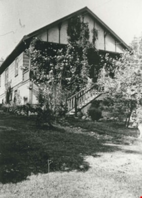
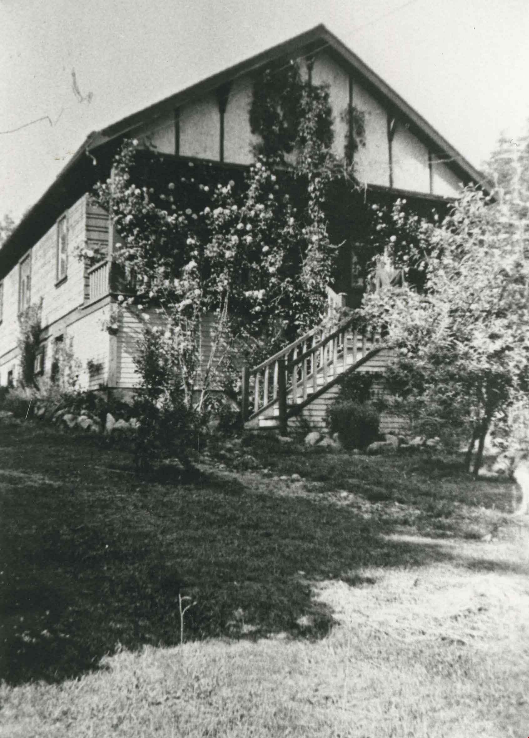
Rorison family home
https://search.heritageburnaby.ca/link/archivedescription35379
- Repository
- City of Burnaby Archives
- Date
- 1930 (date of original), copied 1986
- Collection/Fonds
- Burnaby Historical Society fonds
- Description Level
- Item
- Physical Description
- 1 photograph : b&w ; 12.7 x 17.8 cm print
- Scope and Content
- Photograph of the William Rorison family home at 3907 River Road (later becoming 4593 Marine Drive at Strathern Avenue) in the South Slope area. William Rorison built this house next to another for his mother-in-law. The Rorison family consisted of William Rorison, his wife Alma Rorison (nee Cropl…
- Repository
- City of Burnaby Archives
- Date
- 1930 (date of original), copied 1986
- Collection/Fonds
- Burnaby Historical Society fonds
- Subseries
- Pioneer Tales subseries
- Physical Description
- 1 photograph : b&w ; 12.7 x 17.8 cm print
- Description Level
- Item
- Record No.
- 204-236
- Access Restriction
- No restrictions
- Reproduction Restriction
- No known restrictions
- Accession Number
- BHS1988-03
- Scope and Content
- Photograph of the William Rorison family home at 3907 River Road (later becoming 4593 Marine Drive at Strathern Avenue) in the South Slope area. William Rorison built this house next to another for his mother-in-law. The Rorison family consisted of William Rorison, his wife Alma Rorison (nee Cropley) and their children: Kay (later Kay North), Evelyn, Bill, Hugh, and John.
- Subjects
- Buildings - Residential - Houses
- Media Type
- Photograph
- Notes
- Title based on contents of photograph
- Geographic Access
- Marine Drive
- Street Address
- 4593 Marine Drive
- Historic Neighbourhood
- Fraser Arm (Historic Neighbourhood)
- Planning Study Area
- Sussex-Nelson Area
Images
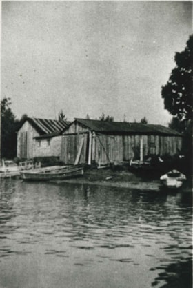
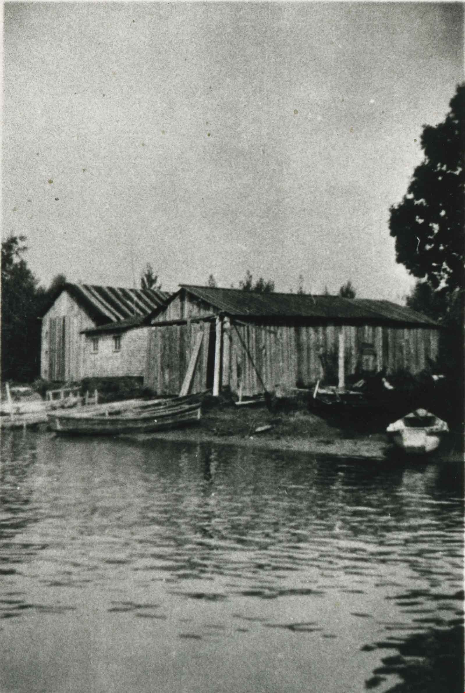
Boat sheds
https://search.heritageburnaby.ca/link/archivedescription35662
- Repository
- City of Burnaby Archives
- Date
- 1930 (date of original), copied 1986
- Collection/Fonds
- Burnaby Historical Society fonds
- Description Level
- Item
- Physical Description
- 1 photograph : b&w ; 12.7 x 17.8 cm print
- Scope and Content
- Photograph of Burnaby salmon fleet boat sheds, between the foot of Sussex (if it continued to the water) and the foot of Byrne along the north arm of the Fraser River. JS 6554 is Joe Stacey's 30-foot gillnetter.
- Repository
- City of Burnaby Archives
- Date
- 1930 (date of original), copied 1986
- Collection/Fonds
- Burnaby Historical Society fonds
- Subseries
- Pioneer Tales subseries
- Physical Description
- 1 photograph : b&w ; 12.7 x 17.8 cm print
- Description Level
- Item
- Record No.
- 204-520
- Access Restriction
- No restrictions
- Reproduction Restriction
- No known restrictions
- Accession Number
- BHS1988-03
- Scope and Content
- Photograph of Burnaby salmon fleet boat sheds, between the foot of Sussex (if it continued to the water) and the foot of Byrne along the north arm of the Fraser River. JS 6554 is Joe Stacey's 30-foot gillnetter.
- Media Type
- Photograph
- Notes
- Title based on contents of photograph
- Geographic Access
- Burnaby Fraser Foreshore Park
- Historic Neighbourhood
- Fraser Arm (Historic Neighbourhood)
- Planning Study Area
- Big Bend Area
Images
![Riverway West Baptist Mission, [between 1930 and 1958] thumbnail](/media/hpo/_Data/_Archives_Images/_Unrestricted/251/269-010.jpg?width=280)
Riverway West Baptist Mission
https://search.heritageburnaby.ca/link/archivedescription36425
- Repository
- City of Burnaby Archives
- Date
- [between 1930 and 1958]
- Collection/Fonds
- Burnaby Historical Society fonds
- Description Level
- Item
- Physical Description
- 1 photograph : b&w copy negative ; 35 mm
- Scope and Content
- Photograph of a large group standing on the steps at the front entrance to the Riverway West Baptist Mission. A sign on the right advertises Sunday School and the times for morning worship.
- Repository
- City of Burnaby Archives
- Date
- [between 1930 and 1958]
- Collection/Fonds
- Burnaby Historical Society fonds
- Subseries
- Kay North subseries
- Physical Description
- 1 photograph : b&w copy negative ; 35 mm
- Description Level
- Item
- Record No.
- 269-010
- Access Restriction
- No restrictions
- Reproduction Restriction
- Reproduce for fair dealing purposes only
- Accession Number
- BHS1991-38
- Scope and Content
- Photograph of a large group standing on the steps at the front entrance to the Riverway West Baptist Mission. A sign on the right advertises Sunday School and the times for morning worship.
- Media Type
- Photograph
- Notes
- Title based on contents of photograph
- Geographic Access
- Marine Drive
- Patterson Avenue
- Historic Neighbourhood
- Fraser Arm (Historic Neighbourhood)
- Planning Study Area
- Big Bend Area
Images
![Riverway West Baptist Mission, [between 1930 and 1958] thumbnail](/media/hpo/_Data/_Archives_Images/_Unrestricted/251/269-010.jpg)
![Hunters and deer, [193-] (date of original), copied 1992 thumbnail](/media/hpo/_Data/_Archives_Images/_Unrestricted/315/315-303.jpg?width=280)
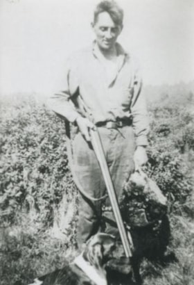
Hunters and deer
https://search.heritageburnaby.ca/link/archivedescription36845
- Repository
- City of Burnaby Archives
- Date
- [193-] (date of original), copied 1992
- Collection/Fonds
- Burnaby Historical Society fonds
- Description Level
- Item
- Physical Description
- 1 photograph : b&w ; 8.7 x 12.7 cm print
- Scope and Content
- Photograph of two hunters with two deer that have been killed.
- Repository
- City of Burnaby Archives
- Date
- [193-] (date of original), copied 1992
- Collection/Fonds
- Burnaby Historical Society fonds
- Subseries
- Burnaby Centennial Anthology subseries
- Physical Description
- 1 photograph : b&w ; 8.7 x 12.7 cm print
- Description Level
- Item
- Record No.
- 315-303
- Access Restriction
- No restrictions
- Reproduction Restriction
- No known restrictions
- Accession Number
- BHS1994-04
- Scope and Content
- Photograph of two hunters with two deer that have been killed.
- Media Type
- Photograph
- Notes
- Title based on contents of photograph
- Historic Neighbourhood
- Fraser Arm (Historic Neighbourhood)
- Planning Study Area
- Big Bend Area
Images
![Hunters and deer, [193-] (date of original), copied 1992 thumbnail](/media/hpo/_Data/_Archives_Images/_Unrestricted/315/315-303.jpg)
Arnold Rypdal
https://search.heritageburnaby.ca/link/archivedescription36846
- Repository
- City of Burnaby Archives
- Date
- 1930 (date of original), copied 1992
- Collection/Fonds
- Burnaby Historical Society fonds
- Description Level
- Item
- Physical Description
- 1 photograph : b&w ; 8.7 x 12.6 cm print
- Scope and Content
- Photograph of Arnold Rypdal his dog, Molly, with some type of game.
- Repository
- City of Burnaby Archives
- Date
- 1930 (date of original), copied 1992
- Collection/Fonds
- Burnaby Historical Society fonds
- Subseries
- Burnaby Centennial Anthology subseries
- Physical Description
- 1 photograph : b&w ; 8.7 x 12.6 cm print
- Description Level
- Item
- Record No.
- 315-304
- Access Restriction
- No restrictions
- Reproduction Restriction
- No known restrictions
- Accession Number
- BHS1994-04
- Scope and Content
- Photograph of Arnold Rypdal his dog, Molly, with some type of game.
- Names
- Rypdal, Arnold
- Media Type
- Photograph
- Notes
- Title based on contents of photograph
- Historic Neighbourhood
- Fraser Arm (Historic Neighbourhood)
- Planning Study Area
- Big Bend Area
Images

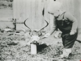
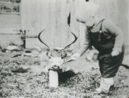
Norma Rypdal
https://search.heritageburnaby.ca/link/archivedescription36847
- Repository
- City of Burnaby Archives
- Date
- 1930 (date of original), copied 1992
- Collection/Fonds
- Burnaby Historical Society fonds
- Description Level
- Item
- Physical Description
- 1 photograph : b&w ; 8.7 x 11.4 cm print
- Scope and Content
- Photograph of Norma Rypdal, at two years old, with a deer shot on the flats near her home.
- Repository
- City of Burnaby Archives
- Date
- 1930 (date of original), copied 1992
- Collection/Fonds
- Burnaby Historical Society fonds
- Subseries
- Burnaby Centennial Anthology subseries
- Physical Description
- 1 photograph : b&w ; 8.7 x 11.4 cm print
- Description Level
- Item
- Record No.
- 315-305
- Access Restriction
- No restrictions
- Reproduction Restriction
- No known restrictions
- Accession Number
- BHS1994-04
- Scope and Content
- Photograph of Norma Rypdal, at two years old, with a deer shot on the flats near her home.
- Names
- Perry, Norma Rypdal
- Media Type
- Photograph
- Notes
- Title based on contents of photograph
- Historic Neighbourhood
- Fraser Arm (Historic Neighbourhood)
- Planning Study Area
- Big Bend Area
Images

Silvanovicz family
https://search.heritageburnaby.ca/link/archivedescription36850
- Repository
- City of Burnaby Archives
- Date
- 1934
- Collection/Fonds
- Burnaby Historical Society fonds
- Description Level
- Item
- Physical Description
- 1 photograph : b&w ; 9 x 13 cm print
- Scope and Content
- Photograph of the first Silvanovicz family home at 2109 Willard Street (old street numbering system). Members of the Sivanovicz family are in front, left to right: Helen (daughter), Mary (mother), and Alex (son).
- Repository
- City of Burnaby Archives
- Date
- 1934
- Collection/Fonds
- Burnaby Historical Society fonds
- Subseries
- Burnaby Centennial Anthology subseries
- Physical Description
- 1 photograph : b&w ; 9 x 13 cm print
- Description Level
- Item
- Record No.
- 315-308
- Access Restriction
- No restrictions
- Reproduction Restriction
- No known restrictions
- Accession Number
- BHS1994-04
- Scope and Content
- Photograph of the first Silvanovicz family home at 2109 Willard Street (old street numbering system). Members of the Sivanovicz family are in front, left to right: Helen (daughter), Mary (mother), and Alex (son).
- Media Type
- Photograph
- Notes
- Title based on contents of photograph
- Geographic Access
- Willard Street
- 12th Avenue
- 10th Avenue
- Historic Neighbourhood
- Fraser Arm (Historic Neighbourhood)
- Planning Study Area
- Big Bend Area
Images

![Canadian National Railway Bridge, [between 1930 and 1934] (date of original), copied 1991 thumbnail](/media/hpo/_Data/_Archives_Images/_Unrestricted/370/370-059.jpg?width=280)
Canadian National Railway Bridge
https://search.heritageburnaby.ca/link/archivedescription37471
- Repository
- City of Burnaby Archives
- Date
- [between 1930 and 1934] (date of original), copied 1991
- Collection/Fonds
- Burnaby Historical Society fonds
- Description Level
- Item
- Physical Description
- 1 photograph : b&w ; 2.7 x 4.1 cm print on contact sheet 20.2 x 25.3 cm
- Scope and Content
- Photograph of the Canadian National Railway (CNR) Bridge over the Fraser River open to allow ships through. No boats are visible.
- Repository
- City of Burnaby Archives
- Date
- [between 1930 and 1934] (date of original), copied 1991
- Collection/Fonds
- Burnaby Historical Society fonds
- Subseries
- Burnaby Image Bank subseries
- Physical Description
- 1 photograph : b&w ; 2.7 x 4.1 cm print on contact sheet 20.2 x 25.3 cm
- Description Level
- Item
- Record No.
- 370-059
- Access Restriction
- No restrictions
- Reproduction Restriction
- No known restrictions
- Accession Number
- BHS1999-03
- Scope and Content
- Photograph of the Canadian National Railway (CNR) Bridge over the Fraser River open to allow ships through. No boats are visible.
- Media Type
- Photograph
- Photographer
- Bellinger, Bernard
- Notes
- Title based on contents of photograph
- 1 b&w copy negative accompanying
- Historic Neighbourhood
- Fraser Arm (Historic Neighbourhood)
- Planning Study Area
- Big Bend Area
Images
![Canadian National Railway Bridge, [between 1930 and 1934] (date of original), copied 1991 thumbnail](/media/hpo/_Data/_Archives_Images/_Unrestricted/370/370-059.jpg)
Rorison family
https://search.heritageburnaby.ca/link/archivedescription87857
- Repository
- City of Burnaby Archives
- Date
- Between 1926 and 1940 (date of originals), copied [1990]
- Collection/Fonds
- Mary Forsyth fonds
- Description Level
- File
- Physical Description
- 6 photographs : b&w copy prints ; 10 x 15 cm
- Scope and Content
- Photographs of the Cropley and Rorison families near their home located at 3907 River Road (now Marine Drive) in Burnaby. The property was purchased by Matilda Cropley in 1913. Matilda married Alfred Cropley and may have lived on the property. Matilda and Alfred's daughter, Alma married William Ror…
- Repository
- City of Burnaby Archives
- Date
- Between 1926 and 1940 (date of originals), copied [1990]
- Collection/Fonds
- Mary Forsyth fonds
- Physical Description
- 6 photographs : b&w copy prints ; 10 x 15 cm
- Description Level
- File
- Record No.
- 572-001
- Access Restriction
- In Archives only
- Reproduction Restriction
- No reproduction permitted
- Accession Number
- 2014-27
- Scope and Content
- Photographs of the Cropley and Rorison families near their home located at 3907 River Road (now Marine Drive) in Burnaby. The property was purchased by Matilda Cropley in 1913. Matilda married Alfred Cropley and may have lived on the property. Matilda and Alfred's daughter, Alma married William Rorison and built their home on part of the land owned by Matilda. Alma and William had four children, Bill (William Jr.), Hugh and twin girls Kay (Kathleen) and Evelyn.
- Names
- Rorison, Marguerite
- Media Type
- Photograph
- Notes
- Title based on contents of photograph
- Date of originals noted on verso of copy print
- Captions on verso describe the photographs and identify individuals
- Historic Neighbourhood
- Fraser Arm (Historic Neighbourhood)
- Planning Study Area
- Big Bend Area
Riverway East and Riverway West Schools
https://search.heritageburnaby.ca/link/archivedescription87921
- Repository
- City of Burnaby Archives
- Date
- 1926-1967 (date of originals), copied [1990]
- Collection/Fonds
- Mary Forsyth fonds
- Description Level
- File
- Physical Description
- 24 photographs : b&w copy prints + 25 photographs : b&w negatives ; 35 mm
- Scope and Content
- Photographs of Dundonald, Riverway East, Glenwood and Riverway West schools and negatives.
- Repository
- City of Burnaby Archives
- Date
- 1926-1967 (date of originals), copied [1990]
- Collection/Fonds
- Mary Forsyth fonds
- Physical Description
- 24 photographs : b&w copy prints + 25 photographs : b&w negatives ; 35 mm
- Description Level
- File
- Record No.
- 572-002
- Access Restriction
- In Archives only
- Reproduction Restriction
- No reproduction permitted
- Accession Number
- 2014-27
- Scope and Content
- Photographs of Dundonald, Riverway East, Glenwood and Riverway West schools and negatives.
- Subjects
- Buildings - Schools
- Names
- Riverway East School
- Media Type
- Photograph
- Notes
- Title based on contents of photograph
- Most of the photographs are copy prints taken from the Riverway West PTA scrapbook MSS068-001 (Bay 64 - Shelf 6)
- Many of the photographs contain annotations on verso
- Note in pencil on verso of photograph 572-002-1 reads: "Riverway East"
- Note in pencil on verso of photograph 572-002-2 reads: "school site for/ 1) Dundonald with shed/ 2) Riverway East 1905/ 3) Glenwood"
- Note in blue pen on verso of photograph 572-002-38 reads:"back row/ Miss Kidd, Donald Kin, William Waldner, Sammy Gilbert, Lucy Checkowsky, Geraldine McIntyre, Beatrice MacGowen, Jean Banon, Dorren McClure, Sady Mann, Sonny McClure, 2 Normal Students/2nd row/Eva Eng, Florence MacGowen, Evelyn Rorison, Kay Rorison, Nelie Wilson, Jessie Gilbert, Margaret Corothers, Audrey Banon, Betty Mann, Jean MacMullin/3rd row/ Hughie Rorison, Engine Banoff, David Downs, Donald McIntyre, Fred Chambers, George Eng, Anthony Checkowsky, Jimmy Wintson, Art McClure, Leonard Geall, Jack Rorison, Peter Smith, Gum Eng."
- Historic Neighbourhood
- Fraser Arm (Historic Neighbourhood)
- Planning Study Area
- Big Bend Area
Marine Way
https://search.heritageburnaby.ca/link/archivedescription93716
- Repository
- City of Burnaby Archives
- Date
- 1987
- Collection/Fonds
- Grover, Elliott & Co. Ltd. fonds
- Description Level
- File
- Physical Description
- 24 photographs : col. negatives ; 35 mm
- Scope and Content
- Photographs of an undeveloped property along Marine Way. Property is located adjacent to railway tracks and a creek.
- Repository
- City of Burnaby Archives
- Date
- 1987
- Collection/Fonds
- Grover, Elliott & Co. Ltd. fonds
- Physical Description
- 24 photographs : col. negatives ; 35 mm
- Description Level
- File
- Record No.
- 622-005
- Access Restriction
- No restrictions
- Reproduction Restriction
- No restrictions
- Accession Number
- 2017-39
- Scope and Content
- Photographs of an undeveloped property along Marine Way. Property is located adjacent to railway tracks and a creek.
- Media Type
- Photograph
- Notes
- Transcribed title
- Title transcribed from original print envelope
- File no. 87-297-B
- Geographic Access
- Marine Way
- Historic Neighbourhood
- Fraser Arm (Historic Neighbourhood)
- Planning Study Area
- Big Bend Area
8855 Northbrook Court
https://search.heritageburnaby.ca/link/archivedescription93735
- Repository
- City of Burnaby Archives
- Date
- 1989
- Collection/Fonds
- Grover, Elliott & Co. Ltd. fonds
- Description Level
- File
- Physical Description
- 21 photographs : col. negatives ; 35 mm
- Scope and Content
- Photographs of an undeveloped property loacated at 8855 Northbrook Court. Construction equipment is visible in the distance.
- Repository
- City of Burnaby Archives
- Date
- 1989
- Collection/Fonds
- Grover, Elliott & Co. Ltd. fonds
- Physical Description
- 21 photographs : col. negatives ; 35 mm
- Description Level
- File
- Record No.
- 622-020
- Access Restriction
- No restrictions
- Reproduction Restriction
- No restrictions
- Accession Number
- 2017-39
- Scope and Content
- Photographs of an undeveloped property loacated at 8855 Northbrook Court. Construction equipment is visible in the distance.
- Media Type
- Photograph
- Notes
- Transcribed title
- Title transcribed from original print envelope
- File no. 89-037-B
- Geographic Access
- Northbrook Court
- Street Address
- 8855 Northbrook Court
- Historic Neighbourhood
- Fraser Arm (Historic Neighbourhood)
- Planning Study Area
- Big Bend Area