Narrow Results By
Subject
- Agriculture 1
- Agriculture - Farms 2
- Arts 1
- Buildings - Commercial - Grocery Stores 1
- Buildings - Commercial - Restaurants 3
- Buildings - Commercial - Service Stations 1
- Buildings - Industrial - Saw Mills 1
- Buildings - Religious - Monasteries 1
- Buildings - Religious - Mosques 1
- Buildings - Schools 10
- Businesses 1
- Businesses - Real Estate Agencies 1
Creator
- Bekins Moving and Storage Company Limited 1
- Binks, James 5
- British Columbia Underwriters' Association 2
- Burnaby Village Museum 17
- Burnett and McGugan B.C. Land Surveyors, New Westminster 5
- Burnett, Geoffrey K. 1
- Burnett & McGugan, Engineers and Surveyors 5
- City Map and White Print Co. 1
- Damer, Eric 5
- Dominion Map and Blueprint Co. 1
- Fleming, Frances "Fanny" Waplington 2
- Fong, Denise 2

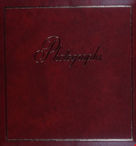
Family and political photograph album
https://search.heritageburnaby.ca/link/museumdescription3654
- Repository
- Burnaby Village Museum
- Date
- 1914-1977
- Collection/Fonds
- Harold Edward Winch collection
- Description Level
- Item
- Physical Description
- 1 album (ca. 85 photographs)
- Scope and Content
- Item is a photograph album containing ca. 85 photographs, including both personal and work-related subjects such as the Winch family and homes, and Winch's political work and travels. Also included are some textual records relating to Winch's political work.
- Repository
- Burnaby Village Museum
- Collection/Fonds
- Harold Edward Winch collection
- Description Level
- Item
- Physical Description
- 1 album (ca. 85 photographs)
- Scope and Content
- Item is a photograph album containing ca. 85 photographs, including both personal and work-related subjects such as the Winch family and homes, and Winch's political work and travels. Also included are some textual records relating to Winch's political work.
- Names
- Winch, Harold Edward
- Winch, Linda Marian Hendy
- Winch, Grace
- Winch, Eileen
- Winch, Ernest "Ernie"
- Winch, Eric
- Co-operative Commonwealth Federation "CCF"
- New Democratic Party
- Douglas, Tommy
- MacInnis, Grace
- Accession Code
- BV013.12.11
- Date
- 1914-1977
- Media Type
- Photograph
- Textual Record
- Notes
- Title based on contents of photograph
- A selection of photographs from scrapbook have been described at item level (BV013.12.36 to BV015.35.117)
Images

Documents
![Political photograph album, [193-], 1970-1977 thumbnail](/media/hpo/_Data/_BVM_Images/2013/2013_0012_0012_001.jpg?width=280)
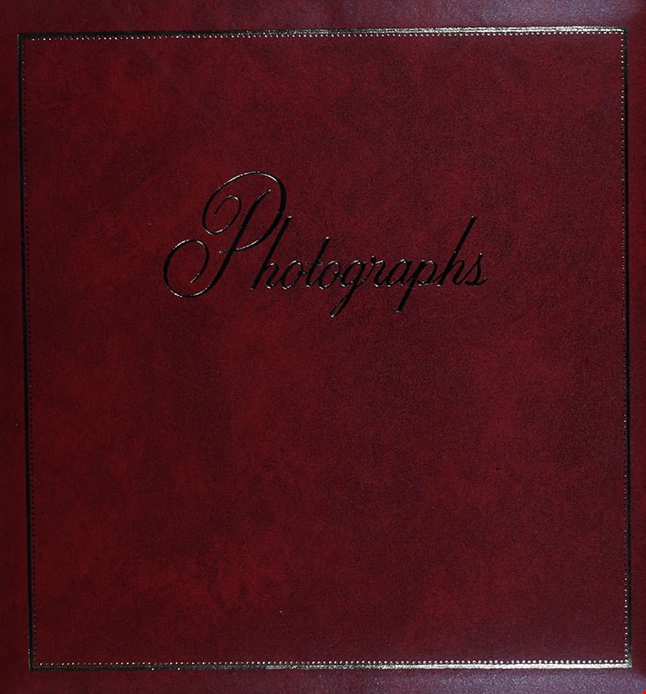
Political photograph album
https://search.heritageburnaby.ca/link/museumdescription3655
- Repository
- Burnaby Village Museum
- Date
- [193-], 1970-1977
- Collection/Fonds
- Harold Edward Winch collection
- Description Level
- Item
- Physical Description
- 1 album (ca. 100 photographs)
- Scope and Content
- Item is a photograph album containing ca. 100 photographs, including primarily work-related subjects such as Winch's political work and travels.
- Repository
- Burnaby Village Museum
- Collection/Fonds
- Harold Edward Winch collection
- Description Level
- Item
- Physical Description
- 1 album (ca. 100 photographs)
- Scope and Content
- Item is a photograph album containing ca. 100 photographs, including primarily work-related subjects such as Winch's political work and travels.
- Names
- Winch, Harold Edward
- MacInnis, Grace
- Winch, Ernest "Ernie"
- Co-operative Commonwealth Federation "CCF"
- New Democratic Party
- Accession Code
- BV013.12.12
- Date
- [193-], 1970-1977
- Media Type
- Photograph
- Textual Record
- Notes
- Title based on contents of photograph
Images
![Political photograph album, [193-], 1970-1977 thumbnail](/media/hpo/_Data/_BVM_Images/2013/2013_0012_0012_001.jpg)
Documents
Family photograph album
https://search.heritageburnaby.ca/link/museumdescription3656
- Repository
- Burnaby Village Museum
- Date
- 1972-1979
- Collection/Fonds
- Harold Edward Winch collection
- Description Level
- Item
- Physical Description
- 1 album (ca. 60 photographs)
- Scope and Content
- Item is a photograph album containing ca. 60 photographs, including primarily personal subjects such as family vacations and events, as well as a few photographs relating to Winch's political travels.
- Repository
- Burnaby Village Museum
- Collection/Fonds
- Harold Edward Winch collection
- Description Level
- Item
- Physical Description
- 1 album (ca. 60 photographs)
- Scope and Content
- Item is a photograph album containing ca. 60 photographs, including primarily personal subjects such as family vacations and events, as well as a few photographs relating to Winch's political travels.
- Names
- Winch, Harold Edward
- Accession Code
- BV013.12.13
- Date
- 1972-1979
- Media Type
- Photograph
- Textual Record
- Notes
- Title based on contents of item
Images
Documents
Personal and political photograph album
https://search.heritageburnaby.ca/link/museumdescription3657
- Repository
- Burnaby Village Museum
- Date
- 1972-1986
- Collection/Fonds
- Harold Edward Winch collection
- Description Level
- Item
- Physical Description
- 1 album (ca. 100 photographs)
- Scope and Content
- Item is a photograph album containing ca. 100 photographs and ephemera, including both personal and work-related subjects such as cards from Harold and Jessie Winch's wedding, family vacations, newspaper clippings, and records relating to Winch's political career.
- Repository
- Burnaby Village Museum
- Collection/Fonds
- Harold Edward Winch collection
- Description Level
- Item
- Physical Description
- 1 album (ca. 100 photographs)
- Scope and Content
- Item is a photograph album containing ca. 100 photographs and ephemera, including both personal and work-related subjects such as cards from Harold and Jessie Winch's wedding, family vacations, newspaper clippings, and records relating to Winch's political career.
- Subjects
- Government - Federal Government
- Accession Code
- BV013.12.14
- Date
- 1972-1986
- Media Type
- Photograph
- Textual Record
- Notes
- Title based on contents of photograph album
Images

Documents
Personal photograph album
https://search.heritageburnaby.ca/link/museumdescription3658
- Repository
- Burnaby Village Museum
- Date
- 1983-1987
- Collection/Fonds
- Harold Edward Winch collection
- Description Level
- Item
- Physical Description
- 1 album (ca. 100 photographs)
- Scope and Content
- Item is a photograph album containing ca. 100 photographs relating to a family vacation to Tahiti, Cook Islands, New Zealand, Australia, and Fiji.
- Repository
- Burnaby Village Museum
- Collection/Fonds
- Harold Edward Winch collection
- Description Level
- Item
- Physical Description
- 1 album (ca. 100 photographs)
- Scope and Content
- Item is a photograph album containing ca. 100 photographs relating to a family vacation to Tahiti, Cook Islands, New Zealand, Australia, and Fiji.
- Accession Code
- BV013.12.15
- Date
- 1983-1987
- Media Type
- Photograph
- Textual Record
- Notes
- Title based on contents of photograph
Images

Documents
Gift album from Israeli government
https://search.heritageburnaby.ca/link/museumdescription3661
- Repository
- Burnaby Village Museum
- Date
- 1959
- Collection/Fonds
- Harold Edward Winch collection
- Description Level
- Item
- Physical Description
- 1 album (180 photographs)
- Scope and Content
- Item is a photograph album received from the Israeli government by Harold as a member of a Canadian Parliamentary delegation visiting Israel in 1959, containing ca. 180 photographs, newspaper clippings, stamps, brochures, and other ephemera relating to Israel and the delegates' visit. The album is …
- Repository
- Burnaby Village Museum
- Collection/Fonds
- Harold Edward Winch collection
- Description Level
- Item
- Physical Description
- 1 album (180 photographs)
- Scope and Content
- Item is a photograph album received from the Israeli government by Harold as a member of a Canadian Parliamentary delegation visiting Israel in 1959, containing ca. 180 photographs, newspaper clippings, stamps, brochures, and other ephemera relating to Israel and the delegates' visit. The album is signed by the Speaker of the Knesset (the Israeli legislature).
- Subjects
- Government - Federal Government
- Names
- Winch, Harold Edward
- Accession Code
- BV013.12.18
- Access Restriction
- No restrictions
- Reproduction Restriction
- May be restricted by third party rights
- Date
- 1959
- Media Type
- Photograph
- Textual Record
- Notes
- Title based on contents of item
Documents
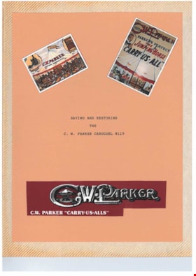
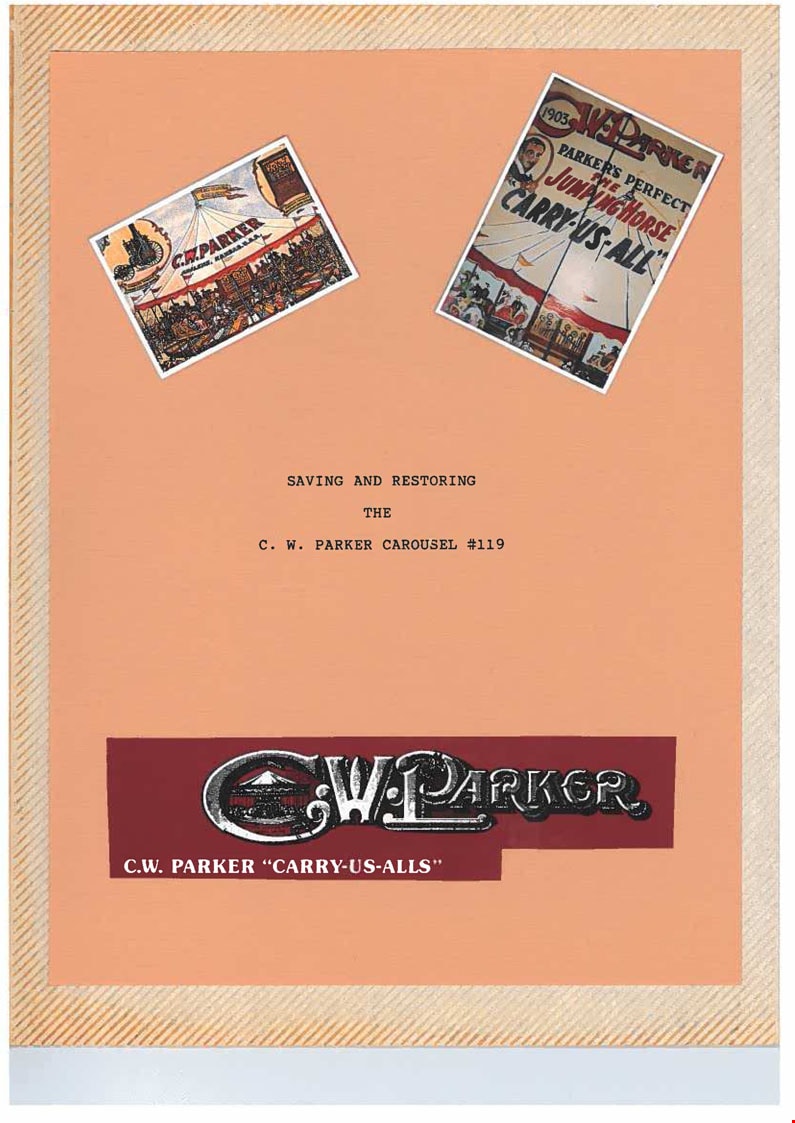
Parker Carousel Volume I
https://search.heritageburnaby.ca/link/museumdescription4555
- Repository
- Burnaby Village Museum
- Date
- 1989-2004
- Collection/Fonds
- Keith Jamieson fonds
- Description Level
- Item
- Physical Description
- 1 album (4 photographs + textual records + ephemera)
- Scope and Content
- Item consists of one of three scrapbooks titled, "Parker Carousel Volume 1- Saving and Restoring the C.W. Parker Carousel no. 119". The scrapbook contains newspaper clippings, correspondence, newsletters and original photographs documenting "The Friends of the Carousel" fundraising endeavours as we…
- Repository
- Burnaby Village Museum
- Collection/Fonds
- Keith Jamieson fonds
- Description Level
- Item
- Physical Description
- 1 album (4 photographs + textual records + ephemera)
- Scope and Content
- Item consists of one of three scrapbooks titled, "Parker Carousel Volume 1- Saving and Restoring the C.W. Parker Carousel no. 119". The scrapbook contains newspaper clippings, correspondence, newsletters and original photographs documenting "The Friends of the Carousel" fundraising endeavours as well as the restoration and installation of the C.W. Parker carouselno. 119. The carousel was rescued from the PNE and re-installed at the Burnaby Village Museum.
- Subjects
- Recreational Devices - Carousels
- Names
- Lower Mainland Association of the Friends of the Vancouver Carousel
- Jamieson, Keith
- Jamieson, Pat
- Pacific National Exhibition (PNE)
- C.W. Parker no. 119 Carousel
- Accession Code
- BV015.41.1
- Date
- 1989-2004
- Media Type
- Photograph
- Textual Record
- Arrangement
- Scrapbooks were arranged by Keith and Pat Jamieson before donation.
- Notes
- Title based on contents of item
Images
Documents
![Parker Carousel Volume II, [1989-1993] thumbnail](/media/hpo/_Data/_BVM_Images/2015/2015_0041_0002_001.jpg?width=280)
Parker Carousel Volume II
https://search.heritageburnaby.ca/link/museumdescription4556
- Repository
- Burnaby Village Museum
- Date
- [1989-1993]
- Collection/Fonds
- Keith Jamieson fonds
- Description Level
- Item
- Physical Description
- 1 album (169 photographs + textual records + ephemera)
- Scope and Content
- Item consists of one of three scrapbooks and is titled, "Parker Carousel Volume II- Product Endorsements, Advertisements, Etc". The scrapbook includes a wide array of photographs documenting "The Friends of the Carousel" fundraising endeavours as well as a detailed account of the transport, restor…
- Repository
- Burnaby Village Museum
- Collection/Fonds
- Keith Jamieson fonds
- Description Level
- Item
- Physical Description
- 1 album (169 photographs + textual records + ephemera)
- Scope and Content
- Item consists of one of three scrapbooks and is titled, "Parker Carousel Volume II- Product Endorsements, Advertisements, Etc". The scrapbook includes a wide array of photographs documenting "The Friends of the Carousel" fundraising endeavours as well as a detailed account of the transport, restoration, installation and ground breaking ceremony of the carousel prior to it's opening at the Burnaby Village Museum.
- Subjects
- Recreational Devices - Carousels
- Names
- Lower Mainland Association of the Friends of the Vancouver Carousel
- Jamieson, Keith
- Jamieson, Pat
- C.W. Parker no. 119 Carousel
- Accession Code
- BV015.41.2
- Date
- [1989-1993]
- Media Type
- Photograph
- Textual Record
- Arrangement
- Scrapbooks were arranged by Keith and Pat Jamieson before donation.
- Notes
- Transcribed title
Images
![Parker Carousel Volume II, [1989-1993] thumbnail](/media/hpo/_Data/_BVM_Images/2015/2015_0041_0002_001.jpg)
Documents
![Parker Carousel Volume III, [1989-1993] thumbnail](/media/hpo/_Data/_BVM_Images/2015/2015_0041_0003_001.jpg?width=280)
Parker Carousel Volume III
https://search.heritageburnaby.ca/link/museumdescription4557
- Repository
- Burnaby Village Museum
- Date
- [1989-1993]
- Collection/Fonds
- Keith Jamieson fonds
- Description Level
- Item
- Physical Description
- 1 scrapbook (172 photographs)
- Scope and Content
- Item consists of one of three scrapbooks and is titled, "Parker Carousel Volume III- The Story in Photographs Continues". The scrapbook is a photograph album providing a detailed account regarding the restoration (before and after) and reassembly of the Parker no. 119 carousel.
- Repository
- Burnaby Village Museum
- Collection/Fonds
- Keith Jamieson fonds
- Description Level
- Item
- Physical Description
- 1 scrapbook (172 photographs)
- Scope and Content
- Item consists of one of three scrapbooks and is titled, "Parker Carousel Volume III- The Story in Photographs Continues". The scrapbook is a photograph album providing a detailed account regarding the restoration (before and after) and reassembly of the Parker no. 119 carousel.
- Subjects
- Recreational Devices - Carousels
- Names
- Lower Mainland Association of the Friends of the Vancouver Carousel
- Jamieson, Keith
- Jamieson, Pat
- C.W. Parker no. 119 Carousel
- Accession Code
- BV015.41.3
- Reproduction Restriction
- May be restricted by third party rights
- Date
- [1989-1993]
- Media Type
- Photograph
- Textual Record
- Arrangement
- Scrapbooks were arranged by Keith and Pat Jamieson before donation.
- Notes
- Title based on contents of item
Images
![Parker Carousel Volume III, [1989-1993] thumbnail](/media/hpo/_Data/_BVM_Images/2015/2015_0041_0003_001.jpg)
Documents
![The Way it was, [1988] thumbnail](/media/hpo/_Data/_BVM_Textual_Records/2016/2016_0046_0050_002.jpg?width=280)
The Way it was
https://search.heritageburnaby.ca/link/museumdescription4616
- Repository
- Burnaby Village Museum
- Date
- [1988]
- Collection/Fonds
- Waplington family fonds
- Description Level
- Item
- Physical Description
- Textual record : 65 p. + illustrations
- Scope and Content
- Item consists of an unpublished manuscript handwritten and drawn by Frances L. Flemming (nee Waplington), titled "The Way it Was - a very personal account of my childhood 1913-1925" ,"The true and painful history of the Waplington family on which the story of "Lizzie Lau / Wallingford" is based."
- Repository
- Burnaby Village Museum
- Collection/Fonds
- Waplington family fonds
- Description Level
- Item
- Physical Description
- Textual record : 65 p. + illustrations
- Scope and Content
- Item consists of an unpublished manuscript handwritten and drawn by Frances L. Flemming (nee Waplington), titled "The Way it Was - a very personal account of my childhood 1913-1925" ,"The true and painful history of the Waplington family on which the story of "Lizzie Lau / Wallingford" is based."
- Other Title Information
- title continued..."a very personal account of my childhood / 1913-1925"
- Accession Code
- BV016.46.50
- Access Restriction
- Restricted access
- Reproduction Restriction
- Reproductions subject to FIPPA
- Date
- [1988]
- Media Type
- Textual Record
- Related Material
- See also Pioneer Tales pages 337-340
- Notes
- Transcribed title
- An excerpt (pages 52-59) of this manuscript regarding Frances Fleming Waplington's childhood memories of growing up in Burnaby has been made available as a pdf. Contact Burnaby Village Museum to view the Manuscript in it's entirety.
Images
![The Way it was, [1988] thumbnail](/media/hpo/_Data/_BVM_Textual_Records/2016/2016_0046_0050_002.jpg)
Documents
![In and Out of a Cedar Shake Shack, [ca. 2000] thumbnail](/media/hpo/_Data/_BVM_Textual_Records/2016/2016_0046_0051_002.jpg?width=280)
In and Out of a Cedar Shake Shack
https://search.heritageburnaby.ca/link/museumdescription4617
- Repository
- Burnaby Village Museum
- Date
- [ca. 2000]
- Collection/Fonds
- Waplington family fonds
- Description Level
- Item
- Physical Description
- 1 manuscript : 200 pages
- Scope and Content
- Item consists of a copy of an unpublished manuscript titled "In and Out of a Cedar Shake Shack The life of a little girl from World War I to Canada's Diamond Jubilee" written by Frances L. Fleming (nee Waplington).
- Repository
- Burnaby Village Museum
- Collection/Fonds
- Waplington family fonds
- Description Level
- Item
- Physical Description
- 1 manuscript : 200 pages
- Scope and Content
- Item consists of a copy of an unpublished manuscript titled "In and Out of a Cedar Shake Shack The life of a little girl from World War I to Canada's Diamond Jubilee" written by Frances L. Fleming (nee Waplington).
- Other Title Information
- Title continues:... The life of a little girl from World War I to Canada's Diamond Jubilee
- Accession Code
- BV016.46.51
- Access Restriction
- Restricted access
- Reproduction Restriction
- Reproductions subject to FIPPA
- Date
- [ca. 2000]
- Media Type
- Textual Record
- Notes
- Transcribed title
- Experts from this manuscript (pages 113-126) “Christmas Time” and “The Fire Brigade”. have been made available as a pdf. Contact Burnaby Village Museum to view the Manuscript in it's entirety.
Images
![In and Out of a Cedar Shake Shack, [ca. 2000] thumbnail](/media/hpo/_Data/_BVM_Textual_Records/2016/2016_0046_0051_002.jpg)
Documents
![Bird's eye view of New Westminster, Burnaby and Vancouver, [ca. 1911] thumbnail](/media/hpo/_Data/_BVM_Cartographic_Material/1983/1983_0012_0001_002%20Web.jpg?width=280)
Bird's eye view of New Westminster, Burnaby and Vancouver
https://search.heritageburnaby.ca/link/museumdescription8199
- Repository
- Burnaby Village Museum
- Date
- [ca. 1911]
- Collection/Fonds
- Burnaby Village Museum Map collection
- Description Level
- Item
- Physical Description
- 1 map : hand painted ; 65.5 x 99 cm
- Scope and Content
- An untitled monochromatic grayscale map of a developer's bird's eye view looking north west from Burnaby Mountain. View includes Burnaby, New Westminster, Vancouver with the North shore in the distance. Burnaby neighbourhood subdivisions of "Burnaby Heights" and "Buena Vista" are featured near the…
- Repository
- Burnaby Village Museum
- Collection/Fonds
- Burnaby Village Museum Map collection
- Description Level
- Item
- Physical Description
- 1 map : hand painted ; 65.5 x 99 cm
- Scope and Content
- An untitled monochromatic grayscale map of a developer's bird's eye view looking north west from Burnaby Mountain. View includes Burnaby, New Westminster, Vancouver with the North shore in the distance. Burnaby neighbourhood subdivisions of "Burnaby Heights" and "Buena Vista" are featured near the centre of the map. These neighbourhood subdivisions were marketed by Real Estate Agents Liebly & Blumer in 1911. Roads, buildings, factories, railways and bridges are identified on the map.
- Subjects
- Businesses - Real Estate Agencies
- Responsibility
- Leibly & Blumer Realty Co. Incorporated
- Accession Code
- HV983.12.1
- Access Restriction
- No restrictions
- Reproduction Restriction
- No known restrictions
- Date
- [ca. 1911]
- Media Type
- Cartographic Material
- Historic Neighbourhood
- East Burnaby (Historic Neighbourhood)
- Vancouver Heights (Historic Neighbourhood)
- Planning Study Area
- Cariboo-Armstrong Area
- Burnaby Heights Area
- Scan Resolution
- 300
- Scan Date
- December 2020
- Scale
- 100
- Notes
- Title based on contents of map
- Note in pencil on verso of photograph reads: "Make tint block of Buena Vista / Blocks only as shown in lots"
Zoomable Images
![Bird's eye view of New Westminster, Burnaby and Vancouver, [ca. 1911] thumbnail](/media/hpo/_Data/_BVM_Cartographic_Material/1983/1983_0012_0001_001_seadragon/1983_0012_0001_001.jpg?w=280)

Map of Municipality of Burnaby
https://search.heritageburnaby.ca/link/museumdescription8200
- Repository
- Burnaby Village Museum
- Date
- 1921
- Collection/Fonds
- Burnaby Village Museum Map collection
- Description Level
- Item
- Physical Description
- 1 map : lithographic print, b&w ; 83 x 56 cm
- Scope and Content
- Item consists of a map of the Municipality of Burnaby compiled and published by Dominion Blueprint & Map Company.
- Repository
- Burnaby Village Museum
- Collection/Fonds
- Burnaby Village Museum Map collection
- Description Level
- Item
- Physical Description
- 1 map : lithographic print, b&w ; 83 x 56 cm
- Material Details
- Scale : 1:24,000 inches
- Scope and Content
- Item consists of a map of the Municipality of Burnaby compiled and published by Dominion Blueprint & Map Company.
- Creator
- Dominion Map and Blueprint Co.
- Publisher
- Blue Printers, Map Publishers and Draughtsmen
- Accession Code
- HV976.11.1
- Access Restriction
- No restrictions
- Reproduction Restriction
- No known restrictions
- Date
- 1921
- Media Type
- Cartographic Material
- Scan Resolution
- 340
- Scan Date
- 22 Dec. 2020
- Scale
- 100
- Notes
- Title based on contents of map
- Cardstock map cover reads: "Map / of the / Municipality of / Burnaby / Published by / Dominion Map & Blue Print Co. / Arts and Crafts Bldg /576 Seymour St., Vancouver, B.C. / Blue Printers, Map Publishers and Draughtsmen / Phone Sey 4670 / Price, 50 c."
- Title on map reads: "Burnaby / Municipality."
Zoomable Images

![Indexed map of Greater Vancouver, [193-] thumbnail](/media/hpo/_Data/_BVM_Cartographic_Material/1976/1976_0026_0001_001.jpg?width=280)
Indexed map of Greater Vancouver
https://search.heritageburnaby.ca/link/museumdescription8201
- Repository
- Burnaby Village Museum
- Date
- [193-]
- Collection/Fonds
- Burnaby Village Museum Map collection
- Description Level
- Item
- Physical Description
- 1 map + 1 p. textual records : b&w lithographic print on 1 sheet ; 46 x 41 cm folded to 23 x 10 cm
- Scope and Content
- Item consists of a promotional brochure for Bekins Moving and Storage, with an indexed map of Greater Vancouver showing distances from the Bekins building located at Pender Street and Beatty Street on one side, and text and images advertising the company's services and facilities on the other side.…
- Repository
- Burnaby Village Museum
- Collection/Fonds
- Burnaby Village Museum Map collection
- Description Level
- Item
- Physical Description
- 1 map + 1 p. textual records : b&w lithographic print on 1 sheet ; 46 x 41 cm folded to 23 x 10 cm
- Material Details
- Scale not defined
- Printing on two sides of sheet
- Folded into eight sections
- Scope and Content
- Item consists of a promotional brochure for Bekins Moving and Storage, with an indexed map of Greater Vancouver showing distances from the Bekins building located at Pender Street and Beatty Street on one side, and text and images advertising the company's services and facilities on the other side. Cover of folded map reads "Indexed Map of Greater Vancouver / The Great Northwest for Opportunity / Compliments of / Bekins Moving and / Storage Co.".
- Responsibility
- Bekins Moving and Storage Company Limited
- Accession Code
- HV976.26.1
- Access Restriction
- No restrictions
- Reproduction Restriction
- No known restrictions
- Date
- [193-]
- Media Type
- Cartographic Material
- Textual Record
- Scan Resolution
- 600
- Scan Date
- 2023-08-17
- Notes
- Title based on contents of map
Zoomable Images
![Indexed map of Greater Vancouver, [193-] thumbnail](/media/hpo/_Data/_BVM_Cartographic_Material/1976/1976_0026_0001_001_seadragon/1976_0026_0001_001.jpg?w=280)
![Indexed guide map of the City of Vancouver and suburbs, [1920] thumbnail](/media/hpo/_Data/_BVM_Cartographic_Material/1975/1975_0061_0013_001.jpg?width=280)
Indexed guide map of the City of Vancouver and suburbs
https://search.heritageburnaby.ca/link/museumdescription8678
- Repository
- Burnaby Village Museum
- Date
- [1920]
- Collection/Fonds
- Burnaby Village Museum Map collection
- Description Level
- Item
- Physical Description
- 1 map + textual record : col. lithographic print on paper ; 51.5 x 71 cm folded to 21 x 10 cm
- Scope and Content
- Item consists of a fold out map entitled "Indexed Guide Map of Vancouver and Suburbs" with index. Map includes concentric circles raditating out from Vancouver City Hall on corner of Hastings Street and Main Street; electric railways are indicated by heavy red lines in centres of streets. Includes …
- Repository
- Burnaby Village Museum
- Collection/Fonds
- Burnaby Village Museum Map collection
- Description Level
- Item
- Physical Description
- 1 map + textual record : col. lithographic print on paper ; 51.5 x 71 cm folded to 21 x 10 cm
- Material Details
- Scale [1:47520]
- Index on 4 pages within cardstock cover with advertisements on verso
- Scope and Content
- Item consists of a fold out map entitled "Indexed Guide Map of Vancouver and Suburbs" with index. Map includes concentric circles raditating out from Vancouver City Hall on corner of Hastings Street and Main Street; electric railways are indicated by heavy red lines in centres of streets. Includes old and new street names. Index includes a District Lot Index and Street Index.
- Publisher
- Vancouver Map and Blue Print Company
- Accession Code
- HV975.61.13
- Access Restriction
- No restrictions
- Reproduction Restriction
- No known restrictions
- Date
- [1920]
- Media Type
- Cartographic Material
- Textual Record
- Publisher Series
- 6th edition revised June 1920
- Scan Resolution
- 600
- Scan Date
- 2023-11-10
- Notes
- Title based on contents of map
- Cover of booklet reads: "INDEXED / Guide Map / of the CITY of / VANCOUVER / and / SUBURBS / Compiled and Published by / The Vancouver Map & Blue Print Co. / ...."INTERNATIONAL / BOOK SHOP / Cor. Columbia and Hastings Sts._Vancouver, B.C.".
Documents
Zoomable Images
![Indexed guide map of the City of Vancouver and suburbs, [1920] thumbnail](/media/hpo/_Data/_BVM_Cartographic_Material/1975/1975_0061_0013_002_seadragon/1975_0061_0013_002.jpg?w=280)

Map of South Western Part of British Columbia
https://search.heritageburnaby.ca/link/museumdescription8688
- Repository
- Burnaby Village Museum
- Date
- 1897
- Collection/Fonds
- Burnaby Village Museum Map collection
- Description Level
- Item
- Physical Description
- 1 map : col. ink on paper ; 68 x 88 cm
- Scope and Content
- Item consists of a "MAP OF THE SOUTH-WESTERN PART OF BRITISH COLUMBIA”. Map identifies geographic land districts of New Westminster District; Coast District; Lillooet District; Yale District, Kamloops Division, Yale Division and districts on Vancouver Island. Map also includes the northern portions…
- Repository
- Burnaby Village Museum
- Collection/Fonds
- Burnaby Village Museum Map collection
- Description Level
- Item
- Physical Description
- 1 map : col. ink on paper ; 68 x 88 cm
- Material Details
- Scale [1:633600]
- Scope and Content
- Item consists of a "MAP OF THE SOUTH-WESTERN PART OF BRITISH COLUMBIA”. Map identifies geographic land districts of New Westminster District; Coast District; Lillooet District; Yale District, Kamloops Division, Yale Division and districts on Vancouver Island. Map also includes the northern portions of the State of Washington below the 49th parallel.
- Publisher
- The Colonist Litho Victoria B.C.
- Responsibility
- Martin, George Bohun
- Accession Code
- BV993.12.12
- Access Restriction
- No restrictions
- Reproduction Restriction
- No known restrictions
- Date
- 1897
- Media Type
- Cartographic Material
- Scan Resolution
- 600
- Scan Date
- 2023-08-17
- Notes
- Transcribed title
- Scale equals 1 inch to 10 miles
- "Compiled and drawn by direction of the Honouable G.B. Martin, Chief Commissioner of Lands and Works, Victoria, B.C."
- Signed by Surveyor General "Tom Kains"
Zoomable Images


Indexed guide map of the city of Vancouver and Suburbs
https://search.heritageburnaby.ca/link/museumdescription8694
- Repository
- Burnaby Village Museum
- Date
- 1914
- Collection/Fonds
- Burnaby Village Museum Map collection
- Description Level
- Item
- Physical Description
- 1 map + textual record : col. lithographic print on paper ; 55 x 78 cm on sheet 58.5 x 82 cm folded to 20 x 10 cm
- Scope and Content
- Item consists of a map "Indexed Guide Map of the City of Vancouver and Suburbs compiled and published by The Vancouver Map and Blueprint Co. Ltd. Map shows district lots, blocks and boundaries between City of Vancouver, Point Grey, South Vancouver, Burnaby, New Westminster and parts of Richmond, No…
- Repository
- Burnaby Village Museum
- Collection/Fonds
- Burnaby Village Museum Map collection
- Description Level
- Item
- Physical Description
- 1 map + textual record : col. lithographic print on paper ; 55 x 78 cm on sheet 58.5 x 82 cm folded to 20 x 10 cm
- Material Details
- Scale not defined
- Map is folded into booklet form
- Scope and Content
- Item consists of a map "Indexed Guide Map of the City of Vancouver and Suburbs compiled and published by The Vancouver Map and Blueprint Co. Ltd. Map shows district lots, blocks and boundaries between City of Vancouver, Point Grey, South Vancouver, Burnaby, New Westminster and parts of Richmond, North Vancouver and West Vancouver. Concentric cirlces indicate the distance in miles from the intersection of Main Street and Hastings Street, Vancouver in intervals of 1/2 mile. Map is folded into booklet form and includes a four page index with cardstock cover. Index page 1 is titled "Hotels"; page 2 is titled "District Lot Index"; pages 3-8 "Street Index".
- Publisher
- Vancouver Map and Blueprint Company Limited
- Edition
- 5th Edition revised to June 1914
- Geographic Access
- Vancouver
- Accession Code
- HV983.9.18
- Date
- 1914
- Media Type
- Cartographic Material
- Scan Resolution
- 600
- Scan Date
- 2023-08-17
- Notes
- Transcribed title from map and cover
- Sticker adhered to front cover of index of two lions "Service / "WE GIVE IT" / WESTERN SPECIALTY / LIMITED/ STATIONERS AND PRINTERS / VANCOUVER - B.C."
Documents
Zoomable Images

![Highways map of British Columbia, Alberta and adjacent states, [1930] thumbnail](/media/hpo/_Data/_BVM_Cartographic_Material/1977/1977_0037_0187_001.jpg?width=280)
Highways map of British Columbia, Alberta and adjacent states
https://search.heritageburnaby.ca/link/museumdescription9668
- Repository
- Burnaby Village Museum
- Date
- [1930]
- Collection/Fonds
- Burnaby Village Museum Map collection
- Description Level
- Item
- Physical Description
- 1 map : col. lithographic print ; both sides ; 89.5 x 58 cm, folded to 11.5 x 20 cm
- Scope and Content
- Double sided road map published by Imperial Oil, Ltd. and featuring the main travelled highway routes of British Columbia, Alberta and the Northwestern-most states of the United States of America. The map is a colour lithograph. The main map is green, with the highways highlighted in red. The litho…
- Repository
- Burnaby Village Museum
- Collection/Fonds
- Burnaby Village Museum Map collection
- Description Level
- Item
- Physical Description
- 1 map : col. lithographic print ; both sides ; 89.5 x 58 cm, folded to 11.5 x 20 cm
- Material Details
- Scale 1 inch = 20 miles
- A.R. THOMSON / CHIEF CARTOGRAPHER
- Scope and Content
- Double sided road map published by Imperial Oil, Ltd. and featuring the main travelled highway routes of British Columbia, Alberta and the Northwestern-most states of the United States of America. The map is a colour lithograph. The main map is green, with the highways highlighted in red. The lithograph was created in Canada by Rolph Clark Stone Ltd in Toronto. The opposite side of the map features inset maps of the following: the Trans-Canada Highway, the highway between Prince Rupert and Prince George, the highway through the Canadian Rockies, and the highway through the Peace River District. Small city plan maps of highways through major cities, as well as advertisements for Imperial Oil products, are also found on the opposite side of the main map. This map is one of four produced by Imperial Oil that covered the most populated areas of Canada from coast to coast and paralleled Imperial Oil's distribution service.
- Creator
- Thomson, A.R.
- Publisher
- Imperial Oil Limited
- Accession Code
- HV977.37.187
- Access Restriction
- No restrictions
- Reproduction Restriction
- No known restrictions
- Date
- [1930]
- Media Type
- Cartographic Material
- Scan Resolution
- 600
- Scan Date
- 2023-11-10
- Notes
- Title based on content of map
Zoomable Images
![Highways map of British Columbia, Alberta and adjacent states, [1930] thumbnail](/media/hpo/_Data/_BVM_Cartographic_Material/1977/1977_0037_0187_003_seadragon/1977_0037_0187_003.jpg?w=280)

![Plan of Subdivision of Blocks 1,2.3,6,21 and 23 of District Lot 211, [between 1911 and 1912] thumbnail](/media/hpo/_Data/_BVM_Cartographic_Material/1984/1984_0057_0004_002%20Web.jpg?width=280)
Plan of Subdivision of Blocks 1,2.3,6,21 and 23 of District Lot 211
https://search.heritageburnaby.ca/link/museumdescription11111
- Repository
- Burnaby Village Museum
- Date
- [between 1911 and 1912]
- Collection/Fonds
- Ronald G. Scobbie collection
- Description Level
- Item
- Physical Description
- 1 plan : ink on waxed linen ; 60 x 52.5 cm
- Scope and Content
- Item consists of a "Plan of Subdivision of Blocks 1,2.3,6,21 and 23 / of District Lot 211. Group 1 N.W.D. / Burnaby Municipality"
- Repository
- Burnaby Village Museum
- Collection/Fonds
- Ronald G. Scobbie collection
- Description Level
- Item
- Physical Description
- 1 plan : ink on waxed linen ; 60 x 52.5 cm
- Material Details
- Scale [1:1200]
- Scope and Content
- Item consists of a "Plan of Subdivision of Blocks 1,2.3,6,21 and 23 / of District Lot 211. Group 1 N.W.D. / Burnaby Municipality"
- Creator
- Hill & Burnett
- Accession Code
- HV984.57.4
- Access Restriction
- No restrictions
- Reproduction Restriction
- No known restrictions
- Date
- [between 1911 and 1912]
- Media Type
- Cartographic Material
- Planning Study Area
- Burnaby Mountain Area
- Scan Resolution
- 400
- Scan Date
- Dec. 22, 2020
- Scale
- 100
- Notes
- Transcribed title
- Scale is measured "100 feet to one inch"
- Credit on plan reads: "Hill & Burnett_BC_Land Surveyors_Civil Engineers_New Westminster_B.C."
Zoomable Images
![Plan of Subdivision of Blocks 1,2.3,6,21 and 23 of District Lot 211, [between 1911 and 1912] thumbnail](/media/hpo/_Data/_BVM_Cartographic_Material/1984/1984_0057_0004_001_seadragon/1984_0057_0004_001.jpg?w=280)
Plan of Subdivision of Blocks 1,2.3,6,21 and 23 of District Lot 211, [between 1911 and 1912]
Zoom into Image
Kingsway East School
https://search.heritageburnaby.ca/link/museumdescription11121
- Repository
- Burnaby Village Museum
- Date
- April 27, 1915
- Collection/Fonds
- Ronald G. Scobbie collection
- Description Level
- Item
- Physical Description
- 1 survey plan : blueprint on paper ; 56 x 54 cm
- Scope and Content
- Survey plan of "Kingsway East School Site" "Burnaby Municipality" / "Lot 10, of the Subdivision of Lot "D" of... Lot 96, Group 1, New Westminster District"
- Repository
- Burnaby Village Museum
- Collection/Fonds
- Ronald G. Scobbie collection
- Description Level
- Item
- Physical Description
- 1 survey plan : blueprint on paper ; 56 x 54 cm
- Material Details
- Scale: 40 feet = 1 inch
- Scope and Content
- Survey plan of "Kingsway East School Site" "Burnaby Municipality" / "Lot 10, of the Subdivision of Lot "D" of... Lot 96, Group 1, New Westminster District"
- Subjects
- Buildings - Schools
- Names
- Kingsway East School
- Geographic Access
- Kingsway
- Mission Avenue
- Street Address
- 6650 Southoaks Crescent
- Accession Code
- BV003.83.1
- Access Restriction
- No restrictions
- Reproduction Restriction
- No known restrictions
- Date
- April 27, 1915
- Media Type
- Cartographic Material
- Historic Neighbourhood
- Edmonds (Historic Neighbourhood)
- Planning Study Area
- Kingsway-Beresford Area
- Scan Resolution
- 440
- Scan Date
- 22-Dec-2020
- Scale
- 100
- Notes
- Title based on contents of plan
- handwritten on back, "1753"
- signed "Geoffrey Burnett"; notarized, signature illegible
- "Oath of I, Geoffrey K. Burnett...did personally superintend the survey..." "Survey was completed on the 27th day of April 1915.
