Narrow Results By
Subject
- Accidents 1
- Accidents - Train Accidents 1
- Advertising Medium 1
- Advertising Medium - Signs and Signboards 8
- Agricultural Tools and Equipment 1
- Agricultural Tools and Equipment - Gardening Equipment 3
- Agricultural Tools and Equipment - Plows 3
- Agriculture
- Agriculture - Crops 6
- Agriculture - Farms
- Agriculture - Fruit and Berries 7
- Agriculture - Orchards 2
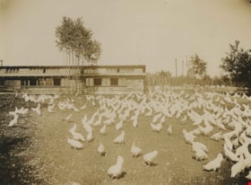
George Edmonds' poultry ranch
https://search.heritageburnaby.ca/link/archivedescription34550
- Repository
- City of Burnaby Archives
- Date
- 1914
- Collection/Fonds
- Burnaby Historical Society fonds
- Description Level
- Item
- Physical Description
- 1 photograph : b&w ; 16.1 x 21.3 cm mounted on 25.2 x 30.2 cm cardboard
- Scope and Content
- Photograph of George Edmonds poultry ranch with a number of chickens in a yard in front of a henhouse.
- Repository
- City of Burnaby Archives
- Date
- 1914
- Collection/Fonds
- Burnaby Historical Society fonds
- Subseries
- Photographs subseries
- Physical Description
- 1 photograph : b&w ; 16.1 x 21.3 cm mounted on 25.2 x 30.2 cm cardboard
- Description Level
- Item
- Record No.
- 044-010
- Access Restriction
- No restrictions
- Reproduction Restriction
- No known restrictions
- Accession Number
- BHS2007-04
- Scope and Content
- Photograph of George Edmonds poultry ranch with a number of chickens in a yard in front of a henhouse.
- Subjects
- Agriculture - Farms
- Animals - Poultry
- Media Type
- Photograph
- Notes
- Title based on contents of photograph
Images
Cassidy Family on their Dairy Farm
https://search.heritageburnaby.ca/link/archivedescription35217
- Repository
- City of Burnaby Archives
- Date
- [1912] (date of original), copied 1986
- Collection/Fonds
- Burnaby Historical Society fonds
- Description Level
- Item
- Physical Description
- 1 photograph : b&w ; 12.7 x 20.3 cm print
- Scope and Content
- Photograph of the Cassidy family. Willie Cassidy (back), Mary Cassidy (left) and Mrs. Katherine Cassidy (foreground) are tending the dairy herd on the Cassidy farm at Darwin and Moscrop Streets. John Cassidy delivered milk.
- Repository
- City of Burnaby Archives
- Date
- [1912] (date of original), copied 1986
- Collection/Fonds
- Burnaby Historical Society fonds
- Subseries
- Pioneer Tales subseries
- Physical Description
- 1 photograph : b&w ; 12.7 x 20.3 cm print
- Description Level
- Item
- Record No.
- 204-074
- Access Restriction
- No restrictions
- Reproduction Restriction
- No known restrictions
- Accession Number
- BHS1988-03
- Scope and Content
- Photograph of the Cassidy family. Willie Cassidy (back), Mary Cassidy (left) and Mrs. Katherine Cassidy (foreground) are tending the dairy herd on the Cassidy farm at Darwin and Moscrop Streets. John Cassidy delivered milk.
- Subjects
- Animals - Cows
- Agriculture - Farms
- Media Type
- Photograph
- Notes
- Title based on contents of photograph
- Geographic Access
- Darwin Avenue
- Moscrop Street
- Historic Neighbourhood
- Central Park (Historic Neighbourhood)
- Planning Study Area
- Garden Village Area
Images
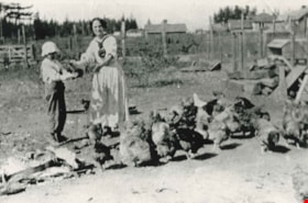
Gillmore Poultry Farm
https://search.heritageburnaby.ca/link/archivedescription35388
- Repository
- City of Burnaby Archives
- Date
- 1911 (date of original), copied 1986
- Collection/Fonds
- Burnaby Historical Society fonds
- Description Level
- Item
- Physical Description
- 1 photograph : b&w ; 12.7 x 17.8 cm print
- Scope and Content
- Photograph of (left to right) Jack Gillmore and his mother, Jean Gillmore, feeding some of the 2,000 chickens on Red Feather Poultry Ranch on Keefer Road (later becoming 6350 McKay Avenue). The ranch was founded by Charles Reginald Gillmore. Charles R. Gillmore was married to Jean Leslie Mills an…
- Repository
- City of Burnaby Archives
- Date
- 1911 (date of original), copied 1986
- Collection/Fonds
- Burnaby Historical Society fonds
- Subseries
- Pioneer Tales subseries
- Physical Description
- 1 photograph : b&w ; 12.7 x 17.8 cm print
- Description Level
- Item
- Record No.
- 204-245
- Access Restriction
- No restrictions
- Reproduction Restriction
- No known restrictions
- Accession Number
- BHS1988-03
- Scope and Content
- Photograph of (left to right) Jack Gillmore and his mother, Jean Gillmore, feeding some of the 2,000 chickens on Red Feather Poultry Ranch on Keefer Road (later becoming 6350 McKay Avenue). The ranch was founded by Charles Reginald Gillmore. Charles R. Gillmore was married to Jean Leslie Mills and was a principal in Gillmore, Mills & Co. of 170 Water Street in Vancouver.
- Subjects
- Animals - Poultry
- Agriculture - Farms
- Media Type
- Photograph
- Notes
- Title based on contents of photograph
- Geographic Access
- McKay Avenue
- Street Address
- 6350 McKay Avenue
- Historic Neighbourhood
- Central Park (Historic Neighbourhood)
- Planning Study Area
- Maywood Area
Images
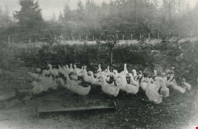
Gillmore Poultry Farm
https://search.heritageburnaby.ca/link/archivedescription35389
- Repository
- City of Burnaby Archives
- Date
- 1911 (date of original), copied 1986
- Collection/Fonds
- Burnaby Historical Society fonds
- Description Level
- Item
- Physical Description
- 1 photograph : b&w ; 12.7 x 17.8 cm print
- Scope and Content
- Photograph of ducks on the Red Feather Poultry Ranch located on Keefer Road (later becoming 6350 McKay Avenue). The long ranch house is faintly discernable in the background. The farm was operated by Charles R. Gillmore.
- Repository
- City of Burnaby Archives
- Date
- 1911 (date of original), copied 1986
- Collection/Fonds
- Burnaby Historical Society fonds
- Subseries
- Pioneer Tales subseries
- Physical Description
- 1 photograph : b&w ; 12.7 x 17.8 cm print
- Description Level
- Item
- Record No.
- 204-246
- Access Restriction
- No restrictions
- Reproduction Restriction
- No known restrictions
- Accession Number
- BHS1988-03
- Scope and Content
- Photograph of ducks on the Red Feather Poultry Ranch located on Keefer Road (later becoming 6350 McKay Avenue). The long ranch house is faintly discernable in the background. The farm was operated by Charles R. Gillmore.
- Subjects
- Animals - Poultry
- Agriculture - Farms
- Media Type
- Photograph
- Notes
- Title based on contents of photograph
- Geographic Access
- McKay Avenue
- Street Address
- 6350 McKay Avenue
- Historic Neighbourhood
- Central Park (Historic Neighbourhood)
- Planning Study Area
- Maywood Area
Images
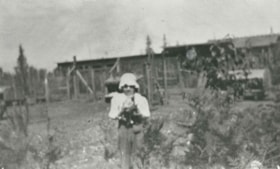
Jack Gillmore
https://search.heritageburnaby.ca/link/archivedescription35392
- Repository
- City of Burnaby Archives
- Date
- 1910 (date of original), copied 1986
- Collection/Fonds
- Burnaby Historical Society fonds
- Description Level
- Item
- Physical Description
- 1 photograph : b&w ; 12.7 x 17.8 cm print
- Scope and Content
- Photograph of Jack Gillmore holding a bantam. The long ranch home and chicken pens can be seen. Jack was the son of Charles R. Gillmore who operated the Red Feather Poultry Ranch on Keefer Road (later becoming 6350 McKay Avenue).
- Repository
- City of Burnaby Archives
- Date
- 1910 (date of original), copied 1986
- Collection/Fonds
- Burnaby Historical Society fonds
- Subseries
- Pioneer Tales subseries
- Physical Description
- 1 photograph : b&w ; 12.7 x 17.8 cm print
- Description Level
- Item
- Record No.
- 204-249
- Access Restriction
- No restrictions
- Reproduction Restriction
- No known restrictions
- Accession Number
- BHS1988-03
- Scope and Content
- Photograph of Jack Gillmore holding a bantam. The long ranch home and chicken pens can be seen. Jack was the son of Charles R. Gillmore who operated the Red Feather Poultry Ranch on Keefer Road (later becoming 6350 McKay Avenue).
- Subjects
- Animals - Poultry
- Agriculture - Farms
- Media Type
- Photograph
- Notes
- Title based on contents of photograph
- Geographic Access
- McKay Avenue
- Street Address
- 6350 McKay Avenue
- Historic Neighbourhood
- Central Park (Historic Neighbourhood)
- Planning Study Area
- Maywood Area
Images
Fernhurst Game Farm
https://search.heritageburnaby.ca/link/archivedescription35393
- Repository
- City of Burnaby Archives
- Date
- 1918 (date of original), copied 1986
- Collection/Fonds
- Burnaby Historical Society fonds
- Description Level
- Item
- Physical Description
- 1 photograph : b&w ; 12.7 x 17.8 cm print
- Scope and Content
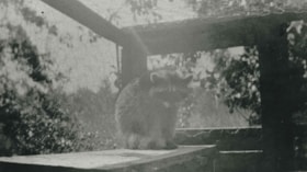
- Photograph of a raccoon at the Fernhurst Game Farm, founded by Charles R. Gillmore near Imperial Street and Dow Avenue. This later became the site of Maywood Elementary School at 4567 Imperial Street.
- Repository
- City of Burnaby Archives
- Date
- 1918 (date of original), copied 1986
- Collection/Fonds
- Burnaby Historical Society fonds
- Subseries
- Pioneer Tales subseries
- Physical Description
- 1 photograph : b&w ; 12.7 x 17.8 cm print
- Description Level
- Item
- Record No.
- 204-250
- Access Restriction
- No restrictions
- Reproduction Restriction
- No known restrictions
- Accession Number
- BHS1988-03
- Scope and Content
- Photograph of a raccoon at the Fernhurst Game Farm, founded by Charles R. Gillmore near Imperial Street and Dow Avenue. This later became the site of Maywood Elementary School at 4567 Imperial Street.
- Subjects
- Animals
- Agriculture - Farms
- Names
- Fernhurst Game Farm
- Media Type
- Photograph
- Notes
- Title based on contents of photograph
- Geographic Access
- Imperial Street
- Street Address
- 4567 Imperial Street
- Historic Neighbourhood
- Central Park (Historic Neighbourhood)
- Planning Study Area
- Maywood Area
Images
Thrussell farm and barn
https://search.heritageburnaby.ca/link/archivedescription36477
- Repository
- City of Burnaby Archives
- Date
- [1914]
- Collection/Fonds
- Burnaby Historical Society fonds
- Description Level
- Item
- Physical Description
- 1 photograph : b&w ; 8.5 x 12.5 cm print
- Scope and Content
- Photograph of the Thrussell family farm, including the front gate and barn on Marine Drive, at Nelson Avenue.
- Repository
- City of Burnaby Archives
- Date
- [1914]
- Collection/Fonds
- Burnaby Historical Society fonds
- Subseries
- Thrussell family subseries
- Physical Description
- 1 photograph : b&w ; 8.5 x 12.5 cm print
- Description Level
- Item
- Record No.
- 275-009
- Access Restriction
- No restrictions
- Reproduction Restriction
- No known restrictions
- Accession Number
- BHS1992-05
- Scope and Content
- Photograph of the Thrussell family farm, including the front gate and barn on Marine Drive, at Nelson Avenue.
- Names
- North Arm Dairy
- Media Type
- Photograph
- Notes
- Title based on contents of photograph
- Geographic Access
- Marine Drive
- Nelson Avenue
- Historic Neighbourhood
- Fraser Arm (Historic Neighbourhood)
- Planning Study Area
- Big Bend Area
Images
McKenzie family home
https://search.heritageburnaby.ca/link/archivedescription37034
- Repository
- City of Burnaby Archives
- Date
- 1912 (date of original), copied 1992
- Collection/Fonds
- Burnaby Historical Society fonds
- Description Level
- Item
- Physical Description
- 1 photograph : b&w ; 7.6 x 12.6 cm print
- Scope and Content
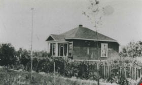
- Photograph of the McKenzie family home and farm on Laurier Street (now Halligan Street).
- Repository
- City of Burnaby Archives
- Date
- 1912 (date of original), copied 1992
- Collection/Fonds
- Burnaby Historical Society fonds
- Subseries
- Burnaby Centennial Anthology subseries
- Physical Description
- 1 photograph : b&w ; 7.6 x 12.6 cm print
- Description Level
- Item
- Record No.
- 315-497
- Access Restriction
- No restrictions
- Reproduction Restriction
- No known restrictions
- Accession Number
- BHS1994-04
- Scope and Content
- Photograph of the McKenzie family home and farm on Laurier Street (now Halligan Street).
- Media Type
- Photograph
- Notes
- Title based on contents of photograph
- Geographic Access
- Halligan Street
- Historic Neighbourhood
- Edmonds (Historic Neighbourhood)
- Planning Study Area
- Morley-Buckingham Area
Images
McKenzie family home and farm
https://search.heritageburnaby.ca/link/archivedescription37035
- Repository
- City of Burnaby Archives
- Date
- 1912 (date of original), copied 1992
- Collection/Fonds
- Burnaby Historical Society fonds
- Description Level
- Item
- Physical Description
- 1 photograph : b&w ; 8.6 x 12.7 cm print
- Scope and Content
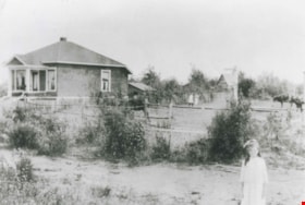
- Photograph of the McKenzie family home and farm on Laurier Street (now Halligan Street). Cows can be seen in the background and a girl in the foreground.
- Repository
- City of Burnaby Archives
- Date
- 1912 (date of original), copied 1992
- Collection/Fonds
- Burnaby Historical Society fonds
- Subseries
- Burnaby Centennial Anthology subseries
- Physical Description
- 1 photograph : b&w ; 8.6 x 12.7 cm print
- Description Level
- Item
- Record No.
- 315-498
- Access Restriction
- No restrictions
- Reproduction Restriction
- No known restrictions
- Accession Number
- BHS1994-04
- Scope and Content
- Photograph of the McKenzie family home and farm on Laurier Street (now Halligan Street). Cows can be seen in the background and a girl in the foreground.
- Media Type
- Photograph
- Notes
- Title based on contents of photograph
- Geographic Access
- Halligan Street
- Historic Neighbourhood
- Edmonds (Historic Neighbourhood)
- Planning Study Area
- Morley-Buckingham Area
Images
McKenzie family home
https://search.heritageburnaby.ca/link/archivedescription37039
- Repository
- City of Burnaby Archives
- Date
- 1912 (date of original), copied 1992
- Collection/Fonds
- Burnaby Historical Society fonds
- Description Level
- Item
- Physical Description
- 1 photograph : b&w ; 8.1 x 12.1 cm print
- Scope and Content
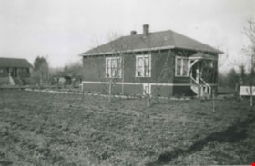
- Photograph of the McKenzie family home and farm on Laurier Street (now Halligan Street) with added rooms at the back and a strawberry patch in front.
- Repository
- City of Burnaby Archives
- Date
- 1912 (date of original), copied 1992
- Collection/Fonds
- Burnaby Historical Society fonds
- Subseries
- Burnaby Centennial Anthology subseries
- Physical Description
- 1 photograph : b&w ; 8.1 x 12.1 cm print
- Description Level
- Item
- Record No.
- 315-502
- Access Restriction
- No restrictions
- Reproduction Restriction
- No known restrictions
- Accession Number
- BHS1994-04
- Scope and Content
- Photograph of the McKenzie family home and farm on Laurier Street (now Halligan Street) with added rooms at the back and a strawberry patch in front.
- Media Type
- Photograph
- Notes
- Title based on contents of photograph
- Geographic Access
- Halligan Street
- Historic Neighbourhood
- Edmonds (Historic Neighbourhood)
- Planning Study Area
- Morley-Buckingham Area
Images
Fraser Arm District
https://search.heritageburnaby.ca/link/archivedescription37139
- Repository
- City of Burnaby Archives
- Date
- [between 1911 and 1919]
- Collection/Fonds
- Burnaby Historical Society fonds
- Description Level
- Item
- Physical Description
- 1 photograph : b&w ; 8 x 12.5 cm print
- Scope and Content
- Photograph of the Fraser Arm District, taken from Marine Drive.
- Repository
- City of Burnaby Archives
- Date
- [between 1911 and 1919]
- Collection/Fonds
- Burnaby Historical Society fonds
- Subseries
- Disney family subseries
- Physical Description
- 1 photograph : b&w ; 8 x 12.5 cm print
- Description Level
- Item
- Record No.
- 325-011
- Access Restriction
- No restrictions
- Reproduction Restriction
- No known restrictions
- Accession Number
- BHS1996-04
- Scope and Content
- Photograph of the Fraser Arm District, taken from Marine Drive.
- Media Type
- Photograph
- Photographer
- Disney, John Harold "Jack"
- Notes
- Title based on contents of photograph
- Historic Neighbourhood
- Fraser Arm (Historic Neighbourhood)
- Planning Study Area
- Big Bend Area
Images
Nicholson Farm
https://search.heritageburnaby.ca/link/archivedescription38255
- Repository
- City of Burnaby Archives
- Date
- 1910
- Collection/Fonds
- Burnaby Historical Society fonds
- Description Level
- Item
- Physical Description
- 1 photograph : b&w ; 10.2 x 15.2 cm
- Scope and Content
- Photograph of the home and barns at the farm of E.W. Nicholson and Elsie Nicholson.
- Repository
- City of Burnaby Archives
- Date
- 1910
- Collection/Fonds
- Burnaby Historical Society fonds
- Subseries
- Margaret McCallum subseries
- Physical Description
- 1 photograph : b&w ; 10.2 x 15.2 cm
- Description Level
- Item
- Record No.
- 375-017
- Access Restriction
- No restrictions
- Reproduction Restriction
- No known restrictions
- Accession Number
- BHS1986-42
- Scope and Content
- Photograph of the home and barns at the farm of E.W. Nicholson and Elsie Nicholson.
- Media Type
- Photograph
- Notes
- Title based on contents of photograph
- A note on the back of the photograph reads: "Home of E.W. Nicholson 1900-1951 and Elsie Nicholson 1934-1951. Boundary Road and Great Northern Railway. Property sold to Link-Belt Co. in 1951."
- Geographic Access
- Boundary Road
- Street Address
- 2550 Boundary Road
- Historic Neighbourhood
- Broadview (Historic Neighbourhood)
- Planning Study Area
- West Central Valley Area
Images
The Spinney
https://search.heritageburnaby.ca/link/archivedescription39333
- Repository
- City of Burnaby Archives
- Date
- [1915]
- Collection/Fonds
- Peers Family and Hill Family fonds
- Description Level
- Item
- Physical Description
- 1 photograph : b&w ; 6 x 10.2 cm on page 24.5 x 32.5 cm (pasted in album)
- Scope and Content
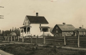
- Photograph looking north towards the Pole Line Road (Sperling Avenue) from the farm of Claude Hill. The photograph has been captioned "The Spinney."
- Repository
- City of Burnaby Archives
- Date
- [1915]
- Collection/Fonds
- Peers Family and Hill Family fonds
- Physical Description
- 1 photograph : b&w ; 6 x 10.2 cm on page 24.5 x 32.5 cm (pasted in album)
- Description Level
- Item
- Record No.
- 477-652
- Access Restriction
- No restrictions
- Reproduction Restriction
- No known restrictions
- Accession Number
- 2007-12
- Scope and Content
- Photograph looking north towards the Pole Line Road (Sperling Avenue) from the farm of Claude Hill. The photograph has been captioned "The Spinney."
- Subjects
- Agriculture - Farms
- Media Type
- Photograph
- Notes
- Title based on caption accompanying photograph
- Geographic Access
- Sperling Avenue
- Historic Neighbourhood
- Burnaby Lake (Historic Neighbourhood)
- Planning Study Area
- Morley-Buckingham Area
Images
Hill farm
https://search.heritageburnaby.ca/link/archivedescription39334
- Repository
- City of Burnaby Archives
- Date
- [1915]
- Collection/Fonds
- Peers Family and Hill Family fonds
- Description Level
- Item
- Physical Description
- 2 photographs : b&w ; 5 x 10.5 cm on page 24.5 x 32.5 cm (pasted in album and joined to form one panorama)
- Scope and Content
- Photograph of the Hill family farm near Deer Lake. The panorama shows the buildings and fields and off to the right can be seen the Pole Line Road (Sperling Avenue).
- Repository
- City of Burnaby Archives
- Date
- [1915]
- Collection/Fonds
- Peers Family and Hill Family fonds
- Physical Description
- 2 photographs : b&w ; 5 x 10.5 cm on page 24.5 x 32.5 cm (pasted in album and joined to form one panorama)
- Description Level
- Item
- Record No.
- 477-653
- Access Restriction
- No restrictions
- Reproduction Restriction
- No known restrictions
- Accession Number
- 2007-12
- Scope and Content
- Photograph of the Hill family farm near Deer Lake. The panorama shows the buildings and fields and off to the right can be seen the Pole Line Road (Sperling Avenue).
- Media Type
- Photograph
- Notes
- Title based on contents of photograph
- Geographic Access
- Sperling Avenue
- Historic Neighbourhood
- Burnaby Lake (Historic Neighbourhood)
- Planning Study Area
- Morley-Buckingham Area
Images
Claude Hill
https://search.heritageburnaby.ca/link/archivedescription39336
- Repository
- City of Burnaby Archives
- Date
- [1915]
- Collection/Fonds
- Peers Family and Hill Family fonds
- Description Level
- Item
- Physical Description
- 1 photograph : b&w ; 5.9 x 10.4 cm on page 24.5 x 32.5 cm (pasted in album)
- Scope and Content
- Photograph of Claude Hill in his fields, standing next to a row of bushes and fence posts.
- Repository
- City of Burnaby Archives
- Date
- [1915]
- Collection/Fonds
- Peers Family and Hill Family fonds
- Physical Description
- 1 photograph : b&w ; 5.9 x 10.4 cm on page 24.5 x 32.5 cm (pasted in album)
- Description Level
- Item
- Record No.
- 477-655
- Access Restriction
- No restrictions
- Reproduction Restriction
- No known restrictions
- Accession Number
- 2007-12
- Scope and Content
- Photograph of Claude Hill in his fields, standing next to a row of bushes and fence posts.
- Subjects
- Agriculture - Farms
- Media Type
- Photograph
- Notes
- Title based on contents of photograph
- Historic Neighbourhood
- Burnaby Lake (Historic Neighbourhood)
- Planning Study Area
- Morley-Buckingham Area
Images
Interview with Maureen Olofson by Kathy Bossort October 14, 2015 - Track 1
https://search.heritageburnaby.ca/link/oralhistory569
- Repository
- City of Burnaby Archives
- Date Range
- 1906-1950
- Length
- 0:09:08
- Summary
- This portion of the interview is about Maureen Olofson’s parents immigration to Saskatchewan, her mother Kerstin in 1912 and father Axel in 1928, Maureen’s birth on a trip to Sweden in 1938, and her family’s move to Burnaby in 1942 and the start of their mink ranch, the GAK Fur Farm, near Curtis Av…
- Repository
- City of Burnaby Archives
- Summary
- This portion of the interview is about Maureen Olofson’s parents immigration to Saskatchewan, her mother Kerstin in 1912 and father Axel in 1928, Maureen’s birth on a trip to Sweden in 1938, and her family’s move to Burnaby in 1942 and the start of their mink ranch, the GAK Fur Farm, near Curtis Avenue in the old Hastings Grove subdivision on Burnaby Mountain.
- Date Range
- 1906-1950
- Length
- 0:09:08
- Subjects
- Agriculture
- Geographic Access
- Burnaby Mountain Conservation Area
- Historic Neighbourhood
- Lochdale (Historic Neighbourhood)
- Planning Study Area
- Westridge Area
- Interviewer
- Bossort, Kathy
- Interview Date
- October 14, 2015
- Scope and Content
- Recording is of an interview with Maureen Olofson conducted by Kathy Bossort. Maureen Olofson was one of 23 participants interviewed as part of the Community Heritage Commission’s Burnaby Mountain Oral History Project. The interview is mainly about Maureen Olofson’s memories of growing up on her parent’s Burnaby Mountain mink ranch between 1942 and 1950 and about the operation of the farm. She also talks about her parents’ history, her teaching career, and her thoughts about the beauty and value of Burnaby Mountain’s natural area.
- Biographical Notes
- Maureen Olofson was born 1938 in Glote, Harjedalen, Sweden, to Axel (1906-1998) and Kerstin Margareta (1906-1980). Axel and Kerstin Olofson, who had separately immigrated to Canada in 1928 and 1913 respectively, married in Canada and then returned to Sweden where Maureen was born. They moved to Burnaby in 1942 with their daughters Maureen and Anita Lea, and bought land and a mink ranch on Burnaby Mountain with their partners Gus Skofteby and Karin Ericksson (Kerstin’s sister). The GAK Fur Farm, located in the old Hastings Grove subdivision on 4th Avenue near Curtis Street, was one of the largest mink ranches in BC, an award winning operation with over 1200 mink animals. In 1950 the partners sold the land and the Olofson family moved to rented homes on Sperling Avenue. In 1952 Axel sold the last of his minks and opened a sporting goods store on Hastings Street. In 1954 the family moved to North Vancouver where Axel Olofson reestablished his sports business. Maureen attended Sperling Avenue School from Gr. 1 to Gr. 8 and Burnaby North High School to Gr. 11, completing school in North Vancouver, before going to UBC where she trained as a teacher. She returned to Burnaby in 1977 to teach, retiring in 1997. She is a volunteer with the Swedish Canadian Rest Home Association and the Dania Homes Society. Maureen continues to enjoy activities on Burnaby Mountain and works toward preserving the natural beauty of the mountain.
- Total Tracks
- 8
- Total Length
- 1:19:04
- Interviewee Name
- Olofson, B. Maureen
- Interview Location
- Maureen Olofson's home in Burnaby
- Interviewer Bio
- Kathy Bossort is a retired archivist living in Ladner, BC. She worked at the Delta Museum and Archives after graduating from SLAIS (UBC) in 2001 with Masters degrees in library science and archival studies. Kathy grew up in Calgary, Alberta, and, prior to this career change, she lived in the West Kootenays, earning her living as a cook for BC tourist lodges and work camps. She continues to be interested in oral histories as a way to fill the gaps in the written record and bring richer meaning to history.
- Collection/Fonds
- Community Heritage Commission Special Projects fonds
- Media Type
- Sound Recording
Audio Tracks
Track one of interview with Maureen Olofson
Track one of interview with Maureen Olofson
https://search.heritageburnaby.ca/media/hpo/_Data/_Archives_Oral_Histories/_Unrestricted/MSS196-004/MSS196-004_Track_1.mp3Fraser Valley Nurseries
https://search.heritageburnaby.ca/link/museumdescription575
- Repository
- Burnaby Village Museum
- Date
- [191-?] (date of original), copied 1977
- Collection/Fonds
- Burnaby Village Museum Photograph collection
- Description Level
- Item
- Physical Description
- 1 photograph : b&w ; 20.32 x 25.4 cm
- Scope and Content
- Photograph of the grounds of the Fraser Valley Nurseries. The grounds are fenced with wire and wooden posts.There is a large sign on the left of the photograph that reads "The Fraser Valley Nurseries, Ltd." There are a few barns or sheds on the nursery grounds. Behind the nursery can be seen a la…
- Repository
- Burnaby Village Museum
- Collection/Fonds
- Burnaby Village Museum Photograph collection
- Description Level
- Item
- Physical Description
- 1 photograph : b&w ; 20.32 x 25.4 cm
- Scope and Content
- Photograph of the grounds of the Fraser Valley Nurseries. The grounds are fenced with wire and wooden posts.There is a large sign on the left of the photograph that reads "The Fraser Valley Nurseries, Ltd." There are a few barns or sheds on the nursery grounds. Behind the nursery can be seen a large body of water, most likely Burnaby Lake. The accession register and the inscription on the photograph identify the location as just off Douglas Road (now Canada Way). The annotation on the back of the photograph reads: "Located off Canada Way."
- Subjects
- Agriculture - Farms
- Names
- Fraser Valley Nurseries
- Geographic Access
- Douglas Road
- Canada Way
- Nursery Street
- Burnaby Lake
- Accession Code
- HV977.99.17
- Access Restriction
- No restrictions
- Reproduction Restriction
- May be restricted by third party rights
- Date
- [191-?] (date of original), copied 1977
- Media Type
- Photograph
- Historic Neighbourhood
- Burnaby Lake (Historic Neighbourhood)
- Planning Study Area
- Lakeview-Mayfield Area
- Related Material
- For the right side of the two part panorama of the nurseries, see HV977.99.19
- Scan Resolution
- 600
- Scan Date
- 2023-07-11
- Notes
- Title based on contents of photograph
Images
Fraser Valley Nurseries
https://search.heritageburnaby.ca/link/museumdescription577
- Repository
- Burnaby Village Museum
- Date
- [191-?] (date of original), copied 1977
- Collection/Fonds
- Burnaby Village Museum Photograph collection
- Description Level
- Item
- Physical Description
- 1 photograph : b&w ; 20.2 x 25.2 cm print
- Scope and Content
- Photograph of the grounds of the Fraser Valley Nurseries. The grounds are fenced with wire and wooden posts. There are a few barns or sheds on the nursery grounds. Behind the nursery can be seen a large body of water, most likely Burnaby Lake. The accession register identifies the location as j…
- Repository
- Burnaby Village Museum
- Collection/Fonds
- Burnaby Village Museum Photograph collection
- Description Level
- Item
- Physical Description
- 1 photograph : b&w ; 20.2 x 25.2 cm print
- Scope and Content
- Photograph of the grounds of the Fraser Valley Nurseries. The grounds are fenced with wire and wooden posts. There are a few barns or sheds on the nursery grounds. Behind the nursery can be seen a large body of water, most likely Burnaby Lake. The accession register identifies the location as just off Douglas Road (now Canada Way). An annotation on the back of the photo reads: "View Fraser Valley Nurseries."
- Subjects
- Agriculture - Farms
- Names
- Fraser Valley Nurseries
- Geographic Access
- Douglas Road
- Canada Way
- Nursery Street
- Burnaby Lake
- Accession Code
- HV977.99.19
- Access Restriction
- No restrictions
- Reproduction Restriction
- May be restricted by third party rights
- Date
- [191-?] (date of original), copied 1977
- Media Type
- Photograph
- Historic Neighbourhood
- Burnaby Lake (Historic Neighbourhood)
- Planning Study Area
- Lakeview-Mayfield Area
- Related Material
- For the left side of the two part panorama of the nurseries, see HV977.99.17
- Scan Resolution
- 600
- Scan Date
- 2023-07-11
- Notes
- Title based on contents of photograph
Images
Deer Lake Drive
https://search.heritageburnaby.ca/link/museumdescription1085
- Repository
- Burnaby Village Museum
- Date
- [1918]
- Collection/Fonds
- Burnaby Village Museum Photograph collection
- Description Level
- Item
- Physical Description
- 1 photograph : b&w ; 12.9 x 32.9 cm
- Scope and Content
- Photograph is a panorama of Deer Lake Drive, including the Ceperley mansion and the surrounding grounds of the home to the left of the picture. The photograph, taken from the water tower, with Burnaby Lake in the background. In the midground, following the horizon line, power poles can be seen. Far…
- Repository
- Burnaby Village Museum
- Collection/Fonds
- Burnaby Village Museum Photograph collection
- Description Level
- Item
- Physical Description
- 1 photograph : b&w ; 12.9 x 32.9 cm
- Scope and Content
- Photograph is a panorama of Deer Lake Drive, including the Ceperley mansion and the surrounding grounds of the home to the left of the picture. The photograph, taken from the water tower, with Burnaby Lake in the background. In the midground, following the horizon line, power poles can be seen. Farm lands are visible leading down to the homes of the Andersons. An annotation on the back of the photo in pencil reads, "Deer Lake Dr." and an annotation in blue pen reads, "1918."
- Geographic Access
- Deer Lake Drive
- Deer Lake Avenue
- Street Address
- 6344 Deer Lake Avenue
- Accession Code
- HV972.51.12
- Access Restriction
- No restrictions
- Reproduction Restriction
- No known restrictions
- Date
- [1918]
- Media Type
- Photograph
- Historic Neighbourhood
- Burnaby Lake (Historic Neighbourhood)
- Planning Study Area
- Douglas-Gilpin Area
- Scan Resolution
- 600
- Scan Date
- 2023-04-04
Images
At MacMillan's Chicken Farm
https://search.heritageburnaby.ca/link/museumdescription1443
- Repository
- Burnaby Village Museum
- Date
- [1915]
- Collection/Fonds
- Burnaby Village Museum Photograph collection
- Description Level
- Item
- Physical Description
- 1 photograph : b&w
- Scope and Content
- Photograph of an unidentified man sitting on grass and feeding baby chicks from his hand. There is an inverted wooden box behind the chicks that has the name "EDWARDSBURG STARCH" printed on the side. In the background are a chicken wire fence, two barrels, and a shed. The inscription on the photogr…
- Repository
- Burnaby Village Museum
- Collection/Fonds
- Burnaby Village Museum Photograph collection
- Description Level
- Item
- Physical Description
- 1 photograph : b&w
- Material Details
- inscribed in black ink, verso, t. "At MacMillan's/ Chicken Farm"
- Scope and Content
- Photograph of an unidentified man sitting on grass and feeding baby chicks from his hand. There is an inverted wooden box behind the chicks that has the name "EDWARDSBURG STARCH" printed on the side. In the background are a chicken wire fence, two barrels, and a shed. The inscription on the photograph identifies the location as "MacMillan's Chicken Farm". Further location or information about the farm is not known.
- Subjects
- Animals - Poultry
- Agriculture - Farms
- Accession Code
- BV985.5818.1
- Access Restriction
- No restrictions
- Reproduction Restriction
- No known restrictions
- Date
- [1915]
- Media Type
- Photograph
- Scan Resolution
- 600
- Scan Date
- 2024-02-27
![Cassidy Family on their Dairy Farm, [1912] (date of original), copied 1986 thumbnail](/media/hpo/_Data/_Archives_Images/_Unrestricted/204/204-074.jpg?width=280)
![Thrussell farm and barn, [1914] thumbnail](/media/hpo/_Data/_Archives_Images/_Unrestricted/251/275-009.jpg?width=280)
![Fraser Arm District, [between 1911 and 1919] thumbnail](/media/hpo/_Data/_Archives_Images/_Unrestricted/316/325-011.jpg?width=280)
![The Spinney, [1915] thumbnail](/media/hpo/_Data/_Archives_Images/_Unrestricted/477/477-652.jpg?width=280)
![Hill farm, [1915] thumbnail](/media/hpo/_Data/_Archives_Images/_Unrestricted/477/477-653.jpg?width=280)
![Claude Hill, [1915] thumbnail](/media/hpo/_Data/_Archives_Images/_Unrestricted/477/477-655.jpg?width=280)
![Fraser Valley Nurseries, [191-?] (date of original), copied 1977 thumbnail](/media/hpo/_Data/_BVM_Images/1977/1977_0099_0017_001.jpg?width=280)
![Fraser Valley Nurseries, [191-?] (date of original), copied 1977 thumbnail](/media/hpo/_Data/_BVM_Images/1977/1977_0099_0019_001.jpg?width=280)
![Deer Lake Drive, [1918] thumbnail](/media/hpo/_Data/_BVM_Images/1972/1972_0051_0012_001.jpg?width=280)
![At MacMillan's Chicken Farm, [1915] thumbnail](/media/hpo/_Data/_BVM_Images/1985/1985_5818_0001_001.jpg?width=280)