Narrow Results By
Format
- Architectural Drawing 18
- Book 268
- Bylaws - Adopted 1449
- Bylaws - Other 2
- Bylaws - Repealed 256
- Cartographic Material 57
- Council - Committee Report 2811
- Council - Manager's Report 864
- Council - Mayor/Councillor/Staff Report 6605
- Council - Public Hearing Minutes 37
- Council - Regular Council Minutes 1054
- Graphic Material 20
Decade
- 2020s 2390
- 2010s 6268
- 2000s 9732
- 1990s 13499
- 1980s 12569
- 1970s 18316
- 1960s 12805
- 1950s
- 1940s 7324
- 1930s
- 1920s 12054
- 1910s 8836
- 1900s 4205
- 1890s 1863
- 1880s 301
- 1870s 128
- 1860s 179
- 1850s 45
- 1840s 24
- 1830s 14
- 1820s 11
- 1810s 8
- 1800s 11
- 1790s 6
- 1780s
- 1770s 5
- 1760s 5
- 1750s 5
- 1740s 5
- 1730s 5
- 1720s 5
- 1710s 7
- 1700s 6
- 1690s 5
- 1680s 6
- 1670s 4
- 1660s 4
- 1650s 4
- 1640s 4
- 1630s 4
- 1620s 4
- 1610s 4
- 1600s 4
- 1590s 1
- 1580s 1
- 1570s 1
- 1560s 1
- 1550s 1
- 1540s 1
- 1530s 1
- 1520s 2
- 1510s 1
- 1500s 1
- 1490s 1
- 1480s 1
Subject
- Accidents 6
- Accidents - Automobile Accidents 8
- Accidents - Train Accidents 8
- Adornment - Jewelry 2
- Advertising Medium 3
- Advertising Medium - Signs and Signboards 30
- Aerial Photographs 20
- Agricultural Tools and Equipment 5
- Agricultural Tools and Equipment - Gardening Equipment 3
- Agricultural Tools and Equipment - Plows 1
- Agriculture 14
- Agriculture - Crops 5
Edmonds Street Neighbourhood
https://search.heritageburnaby.ca/link/landmark827
- Repository
- Burnaby Heritage Planning
- Associated Dates
- 1955-2008
- Heritage Value
- The Edmonds Street Neighbourhood is part of the larger Edmonds Town Centre - one of four Town Centres in Burnaby. This neighbourhood is considered to be primarily residential, but a strong local commercial component developed along Edmonds and Kingsway.
- Historic Neighbourhood
- Edmonds (Historic Neighbourhood)
- Planning Study Area
- Edmonds Area
Images
Richmond Park Neighbourhood
https://search.heritageburnaby.ca/link/landmark828
- Repository
- Burnaby Heritage Planning
- Associated Dates
- 1955-2008
- Heritage Value
- The Richmond Park Neighbourhood is part of the larger Edmonds Town Centre - one of four official Town Centres in the City. Richmond Park contains a residential subdivision that developed during the 1950s as well as a strong commercial and retail centre along Edmonds and Kingsway.
- Historic Neighbourhood
- Edmonds (Historic Neighbourhood)
- Planning Study Area
- Richmond Park Area
Images
Morley-Buckingham Neighbourhood
https://search.heritageburnaby.ca/link/landmark829
- Repository
- Burnaby Heritage Planning
- Associated Dates
- 1955-2008
- Heritage Value
- In the 1980 "Residential Neighbourhood Environment Study," the Morley-Buckingham Neighbourhood is described as "perhaps Burnaby's most prestigious residential area. The lots are larger than most other areas of the Municipality and this, along with the new expensive housing developed over the past 10 years, has created a very desirable residential neighbourhood...The older area of Buckingham lies at the lower edge of the slope and here the homes and streets are more uniform and aged between 20 and 25 years old...to the east of Canada Way lies...a cluster townhouse development."
- Historic Neighbourhood
- Burnaby Lake (Historic Neighbourhood)
- Planning Study Area
- Morley-Buckingham Area
Images
Lakeview-Mayfield Neighbourhood
https://search.heritageburnaby.ca/link/landmark830
- Repository
- Burnaby Heritage Planning
- Associated Dates
- 1955-2008
- Heritage Value
- Like many other areas of the City, the Lakeview-Mayfield Neighbourhood was subdivided during the 1950s post-war building boom. Pockets of newer homes were built in the 1970s, and the neighbourhood retained its character as a primarily residential area. The neighbourhood is bordered to the east by Robert Burnaby Park.
- Planning Study Area
- Lakeview-Mayfield Area
Images
Sussex-Nelson Neighbourhood
https://search.heritageburnaby.ca/link/landmark838
- Repository
- Burnaby Heritage Planning
- Associated Dates
- 1955-2008
- Heritage Value
- The Sussex-Nelson Neighbourhood is located just south of Metrotown and in 1980 was characterised as the most populated of all of Burnaby's Planning Study areas. The area immediately south of Metrotown was initially developed as post-war 1950s housing stock, while the sector south of Rumble was developed after the 1960s and 1970s as single-family housing.
- Historic Neighbourhood
- Alta Vista (Historic Neighbourhood)
- Planning Study Area
- Sussex-Nelson Area
Images
Suncrest Neighbourhood
https://search.heritageburnaby.ca/link/landmark839
- Repository
- Burnaby Heritage Planning
- Associated Dates
- 1955-2008
- Heritage Value
- The Suncrest Neighbourhood is a small residential area south of Burnaby's Central Park. The Ocean View Burial Park takes up a large area of land in the north-east corner of this neighbourhood and the majority of the housing was built during the 1930-1960 period.
- Historic Neighbourhood
- Alta Vista (Historic Neighbourhood)
- Planning Study Area
- Suncrest Area
Images
Big Bend Neighbourhood
https://search.heritageburnaby.ca/link/landmark840
- Repository
- Burnaby Heritage Planning
- Associated Dates
- 1955-2008
- Heritage Value
- The Big Bend Neighbourhood in Burnaby maintained its status as an important agricultural area in the City in the years following 1955 and it also solidified its role as a prime industrial and commercial district. In 1972, the Big Bend Development Plan was adopted by Council and soon thereafter, approximately 620 acres of land were incorporated into the Agricultural Land Reserve. These lands have been set aside for agricultural and limited recreation purposes. By the 2000s, 160 acres of land were considered highly productive agricultural areas, and over 400 acres of land had been secured as parkland, including the Fraser Foreshore Park. The area also developed large commercial and industrial districts including those at Marine Way/Boundary, the Glenlyon Estates, Riverfront Business Park, Burnaby Business Park, and Glenwood Industrial Estates.
- Historic Neighbourhood
- Fraser Arm (Historic Neighbourhood)
- Planning Study Area
- Big Bend Area
Images
Clinton-Glenwood Neighbourhood
https://search.heritageburnaby.ca/link/landmark841
- Repository
- Burnaby Heritage Planning
- Associated Dates
- 1955-2008
- Heritage Value
- The primarily single-family subdivision and development in the Clinton-Glenwood Neighbourhood occurred during the building boom of the 1950s. Later development fell under the guidelines established in the Royal Oak Community Plan (adopted in 1999) and resulted in an increase in the number of multi-family units.
- Historic Neighbourhood
- Alta Vista (Historic Neighbourhood)
- Planning Study Area
- Clinton-Glenwood Area
Images
Stride Avenue Neighbourhood
https://search.heritageburnaby.ca/link/landmark845
- Repository
- Burnaby Heritage Planning
- Associated Dates
- 1955-2008
- Heritage Value
- The interurban link between New Westminster and Vancouver stimulated the early settlement of Stride Avenue. Infilling of the area took place in the early 1950s and the pace of development had slowed considerably by 1970. Duplexes became a popular feature in the decade between 1970 and 1980 and in the late 1980s, the neighbourhood was incorporated into the Edmonds Town Centre South plan.
- Historic Neighbourhood
- Edmonds (Historic Neighbourhood)
- Planning Study Area
- Stride Avenue Area
Images
Stride Hill Neighbourhood
https://search.heritageburnaby.ca/link/landmark846
- Repository
- Burnaby Heritage Planning
- Associated Dates
- 1955-2008
- Heritage Value
- The residential areas that are located within the Stride Hill Neighbourhood were primarily developed in the 1950s during Burnaby's post-war building boom. The area lying to the south of Byrne Creek Ravine Park was used as a municipal garbage dump until the 1960s and as a landfill site for yard waste disposal until the early 1990s at which point the area was incorporated into the Edmonds Town Centre Plan and the land was made into park and open space.
- Historic Neighbourhood
- Edmonds (Historic Neighbourhood)
- Planning Study Area
- Stride Hill Area
Images
Brothers Earl and Norman Wild
https://search.heritageburnaby.ca/link/archivedescription80586
- Repository
- City of Burnaby Archives
- Date
- [1925] - 1990
- Collection/Fonds
- Murray family fonds
- Description Level
- Item
- Physical Description
- 1 photograph : b&w ; 7 x 7 cm
- Scope and Content
- Photograph of brothers Earl and Norman Wild in Idaho, in the United States of America (USA). Norman is holding an unidentified toddler on one arm, and has his other arm around his brother.
- Repository
- City of Burnaby Archives
- Date
- [1925] - 1990
- Collection/Fonds
- Murray family fonds
- Physical Description
- 1 photograph : b&w ; 7 x 7 cm
- Description Level
- Item
- Record No.
- 548-003
- Access Restriction
- No restrictions
- Reproduction Restriction
- No restrictions
- Accession Number
- 2012-31
- Scope and Content
- Photograph of brothers Earl and Norman Wild in Idaho, in the United States of America (USA). Norman is holding an unidentified toddler on one arm, and has his other arm around his brother.
- Names
- Wild, Norman
- Wild, Earl
- Media Type
- Photograph
- Notes
- Title based on contents of photograph
- Note in blue ink on verso of photograph reads: "Norman's brother Earl + Norman. Idaho USA"
Images
City of Burnaby Archives photograph collection
https://search.heritageburnaby.ca/link/archivedescription93710
- Repository
- City of Burnaby Archives
- Date
- [1920]-[1979]
- Collection/Fonds
- City of Burnaby Archives photograph collection
- Description Level
- Fonds
- Physical Description
- 43 photographs (39 tiffs ; 2 jpegs ; 3 col. prints, 9 x 9 cm) and 3 p. of textual records
- Scope and Content
- Collection consists of photographs that were selected for preservation because of their relevance to documenting the heritage and development of the City of Burnaby. The items in this collection depict Burnaby citizens, locations, businesses, residences, geography, and events throughout the history…
- Repository
- City of Burnaby Archives
- Date
- [1920]-[1979]
- Collection/Fonds
- City of Burnaby Archives photograph collection
- Physical Description
- 43 photographs (39 tiffs ; 2 jpegs ; 3 col. prints, 9 x 9 cm) and 3 p. of textual records
- Description Level
- Fonds
- Access Restriction
- No restrictions
- Reproduction Restriction
- May be restricted by third party rights
- Accession Number
- 2010-01
- 2013-31
- 2016-24
- 2021-10
- Scope and Content
- Collection consists of photographs that were selected for preservation because of their relevance to documenting the heritage and development of the City of Burnaby. The items in this collection depict Burnaby citizens, locations, businesses, residences, geography, and events throughout the history of the City of Burnaby. The items in this collection are acquisitions of discrete items or small sets of items that do not form a discrete fonds or collection.
- History
- Burnaby’s first municipal archive officially opened on November 10, 2001, and is located in the McGill Branch Public Library at 4595 Albert Street. The City Archives functions as a branch of the Office of the City Clerk and operates as the official repository of Burnaby’s municipal records, containing records dating back to Burnaby’s incorporation in 1892. In 2007, the City of Burnaby Archives expanded its collection mandate to include private as well as public records. Types of records held at the Archives include City Records (Council minutes and reports, bylaws, departmental records and photographs) and records from private individuals and community organizations (correspondence, reports, minutes, photographs, moving images and sound recordings). The Archives storage area is equipped with the sophisticated environmental controls necessary to preserve Burnaby’s unique archival material into the future. The mandate of the City of Burnaby Archives is to identify, acquire, preserve and make accessible archival material in the form of civic and private records documenting the history of the City of Burnaby.
- Media Type
- Textual Record
- Photograph
- Creator
- City of Burnaby Archives
- Notes
- Title based on contents of collection.
Columbian Newspaper subseries
https://search.heritageburnaby.ca/link/archivedescription97177
- Repository
- City of Burnaby Archives
- Date
- [1865]-1983
- Collection/Fonds
- Burnaby Historical Society fonds
- Description Level
- Subseries
- Physical Description
- Photographs
- Scope and Content
- Subseries consists of photographs from the Columbian Newspaper collected by the Burnaby Historical Society.
- Repository
- City of Burnaby Archives
- Date
- [1865]-1983
- Collection/Fonds
- Burnaby Historical Society fonds
- Subseries
- Columbian Newspaper subseries
- Physical Description
- Photographs
- Description Level
- Subseries
- Accession Number
- BHS1989-19
- Scope and Content
- Subseries consists of photographs from the Columbian Newspaper collected by the Burnaby Historical Society.
- Media Type
- Photograph
- Creator
- The Columbian
- Notes
- Title based on contents of subseries
- PC 222
- History/Bio adapted from New Westminster Archives
Disney Family collection
https://search.heritageburnaby.ca/link/archivedescription97178
- Repository
- City of Burnaby Archives
- Date
- [1914-1963]
- Collection/Fonds
- Disney Family collection
- Description Level
- Fonds
- Physical Description
- 6 architectural drawings : pencil and ink on paper ; 52 cm x 77 cm and smaller + 1 p. of textual records (40 cm. x 31 cm.) + 1 plan : col. ; 55 cm x 75 cm folded to 28 cm x 10 cm + 1 map : diazo print ; 39 cm x 28 cm.
- Scope and Content
- Fonds consists of maps and plans created and collected by Jack Disney.
- Repository
- City of Burnaby Archives
- Date
- [1914-1963]
- Collection/Fonds
- Disney Family collection
- Physical Description
- 6 architectural drawings : pencil and ink on paper ; 52 cm x 77 cm and smaller + 1 p. of textual records (40 cm. x 31 cm.) + 1 plan : col. ; 55 cm x 75 cm folded to 28 cm x 10 cm + 1 map : diazo print ; 39 cm x 28 cm.
- Description Level
- Fonds
- Access Restriction
- No restrictions
- Reproduction Restriction
- May be restricted by third party rights
- Accession Number
- 2016-03
- Scope and Content
- Fonds consists of maps and plans created and collected by Jack Disney.
- History
- John Howard "Jack" Disney served as Burnaby Surveyor from 1911 to 1919.
- Media Type
- Photograph
- Notes
- Title based on contents of collection
- MSS199
Jermyn family subseries
https://search.heritageburnaby.ca/link/archivedescription64492
- Repository
- City of Burnaby Archives
- Date
- [194-]-1953
- Collection/Fonds
- Burnaby Historical Society fonds
- Description Level
- Subseries
- Physical Description
- Textual records and 1 photograph
- Scope and Content
- Subseries consists of records pertaining to the Jermyn family mushroom farm at 4840 Ardingly Avenue. Records include insurance papers, cancelled cheques, bank receipts, tax demands, Horticultural Circulars, and a photograph.
- Repository
- City of Burnaby Archives
- Date
- [194-]-1953
- Collection/Fonds
- Burnaby Historical Society fonds
- Subseries
- Jermyn family subseries
- Physical Description
- Textual records and 1 photograph
- Description Level
- Subseries
- Accession Number
- BHS1992-54
- Scope and Content
- Subseries consists of records pertaining to the Jermyn family mushroom farm at 4840 Ardingly Avenue. Records include insurance papers, cancelled cheques, bank receipts, tax demands, Horticultural Circulars, and a photograph.
- History
- Chester Stephen Jermyn was born February of 1908. His wife Mary Magdalene was born May of 1909. Chester and Mary had three sons: Wayne S., born August 1938, Morris J., born February 1942, and Ralph J. Jermyn born October 1947. The family lived together at 4840 Ardingly Avenue in Burnaby and ran a mushroom farm on their property.
- Media Type
- Photograph
- Textual Record
- Creator
- Jermyn family
- Notes
- MSS116 and PC509
- Title based on contents of subseries
Interview with W.H. O'Brien July / August 1975 - Track 8
https://search.heritageburnaby.ca/link/oralhistory25
- Repository
- City of Burnaby Archives
- Date Range
- [1932]-1936
- Length
- 0:11:12
- Summary
- This portion of the interview pertains to W.H. "Harry" O'Brien's involvement with the formation of the Army of the Common Good Credit Union (now the South Burnaby Credit Union).
- Repository
- City of Burnaby Archives
- Summary
- This portion of the interview pertains to W.H. "Harry" O'Brien's involvement with the formation of the Army of the Common Good Credit Union (now the South Burnaby Credit Union).
- Date Range
- [1932]-1936
- Photo Info
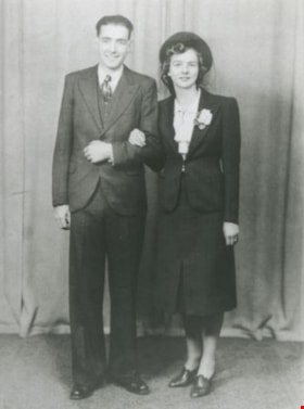
- Harry and Gertrude (Sutherland) O'Brien on their wedding day, October 12, 1940. Item no. 315-005
- Length
- 0:11:12
- Subjects
- Organizations
- Interviewer
- Bradbury, Dr. Bettina
- Interview Date
- July / August 1975
- Scope and Content
- Recording is a taped interview with W.H. "Harry" O'Brien by SFU (Simon Fraser University) graduate student Bettina Bradbury. Major themes discussed are: the Army of the Common Good, the Union of the Unemployed and the Common Good Credit Union (now the South Burnaby Credit Union). To view "Narrow By" terms for each track expand this description and see "Notes".
- Biographical Notes
- W.H. “Harry” O’Brien was born in the coal mining town of Nanaimo, British Columbia on October 20, 1914. He came to Burnaby with his parents and five siblings in 1927. Harry’s mother, a school teacher, wanted her children to live closer to school in order to obtain a better education, so the O’Brien family settled at Inman Avenue, Burnaby. Harry's mother, Mary Anne Crossan, was Gilmore Avenue School's first teacher. Harry left school in June of 1929. Harry’s father worked as the caretaker at Central Park around this time and Harry helped him to clear brush, plant trees and enforce the land clearing and wood cutting permit regulations held by men who were on script. Although too young to vote by just over a week, Harry O'Brien worked as a scrutineer for the Co-operative Commonwealth Federation (CCF) during the 1935 Federal Election. On October 12, 1940 Harry O'Brien married Gertrude Sutherland at St. John the Divine in Burnaby. The Sutherland family came to Burnaby from Winnipeg in 1933 and settled at Nelson Avenue. Harry began his involvement with the Unemployment Organization in Burnaby by participating in an organised protest against the municipality for homeowner evictions brought on by unpaid taxes. The South Burnaby Union of the Unemployed organised in order to protest rules around receiving Relief. Harry became involved, eventually becoming one of the spearheads of the organization, taking over as secretary by 1936. Harry was an original member of the Army of the Common Good, helping to produce over one hundred and twenty-five tons of vegetables from its own gardens to feed Burnaby citizens suffering from the lack of resources during the Depression years. The members of the Army of the Common Good who cut wood for consumption or worked in the gardens were given credit for their work through LU (Labour Units) which they could then use to buy groceries and that at the Army's Cooperative stores, one of which was at McKay Avenue, where Harry began working as Manager of Groceries in 1937. The Credit Union movement of British Columbia was also organized by Harry O'Brien and his fellow Army of the Common Good members. W.H. "Harry" O'Brien died July 1, 1992.
- Total Tracks
- 9
- Total Length
- 1:17:56
- Interviewee Name
- O'Brien, Harry
- Interviewer Bio
- Bettina Bradbury teaches history and women's studies at York University. She is the author of Wife to Widow. Lives, Laws and Politics in Nineteenth-century Montreal. (Vancouver: University of British Columbia Press, June 2011), 520p; Working Families. Age, Gender and Daily Survival in Industrializing Montreal. (Toronto: Canadian Social History Series, McClelland and Stewart, 1993); (Republished Toronto: Oxford University Press, 1996) (3rd edition, Toronto: University of Toronto Press, 2007). These interviews were undertaken after she completed her MA at Simon Fraser University in 1975 with the support of an LIP grant.
- Collection/Fonds
- Burnaby Historical Society fonds
- Subseries
- Oral history subseries
- Transcript Available
- None
- Media Type
- Sound Recording
- Web Notes
- Interview was digitized in 2010 allowing it to be accessible on Heritage Burnaby. The digitization project was initiated by the Community Heritage Commission with support from City of Burnaby Council and the BC History Digitization Program of the Irving K. Barber Learning Centre, University of British Columbia. It was recognized by the Heritage Society of BC with an award in 2012.
Images
Audio Tracks
Track eight of interview with W.H.
Track eight of interview with W.H.
https://search.heritageburnaby.ca/media/hpo/_Data/_Archives_Oral_Histories/_Unrestricted/100-13-25/100-13-25_Track_8.mp3Cherry-Burrell general catalog : complete equipment and supplies for handling milk and its products : catalog no. 1939.
https://search.heritageburnaby.ca/link/museumlibrary2262
- Repository
- Burnaby Village Museum
- Collection
- Special Collection
- Material Type
- Book
- Accession Code
- HV977.29.49
- Call Number
- 637 CHE
- Place of Publication
- Toronto, Ont.
- Publisher
- Cherry-Burrell Corp.
- Publication Date
- c1939
- Physical Description
- 324 p. : ill. : 28 cm.
- Inscription
- "Mr Gould" [Handwritten in red crayon on title page] "Dary Supply Co Ltd" [Handwritten in orange crayon on title page] "Dairy Supplies ________ Complete ____ to the Dairy ____ ______ 1158 Romeo _____ Vancouver B.C." [Stamped in black ink on front cover]
- Library Subject (LOC)
- Commercial catalogs
- Dairying
- Catalogs
- Subjects
- Agriculture
- Agriculture - Dairy
- Notes
- Includes index.
Pertinent portraits
https://search.heritageburnaby.ca/link/museumlibrary718
- Repository
- Burnaby Village Museum
- Author
- Mather, Barry, 1909-1982
- Publication Date
- [c1934]
- Call Number
- 324.271 MAT
- Repository
- Burnaby Village Museum
- Collection
- Reference Collection
- Material Type
- Book
- Call Number
- 324.271 MAT
- Author
- Mather, Barry, 1909-1982
- Contributor
- Wilson, Fraser
- Place of Publication
- Vancouver
- Publisher
- Boag Foundation
- Publication Date
- [c1934]
- Physical Description
- 59 p. : ill. ; 18 cm.
- Library Subject (LOC)
- Co-operative Commonwealth Federation
- Politicians--Canada
- Biography
Pacific coastal liners
https://search.heritageburnaby.ca/link/museumlibrary790
- Repository
- Burnaby Village Museum
- Author
- Newell, Gordon R.
- Williamson, Joe
- Edition
- Autographed ed.
- Publication Date
- c1959
- Call Number
- 387.5 NEW
- Repository
- Burnaby Village Museum
- Collection
- Reference Collection
- Material Type
- Book
- Call Number
- 387.5 NEW
- Edition
- Autographed ed.
- Author
- Newell, Gordon R.
- Williamson, Joe
- Place of Publication
- Seattle
- Publisher
- Superior Pub. Co.
- Publication Date
- c1959
- Physical Description
- 192 p. : ill. ; 28 cm.
- Inscription
- "Property of John Thomson / 7231 E. Broadway / Vancouver BC", handwritten in ink on inside of front cover.
- Library Subject (LOC)
- Steamboats
- Coastwise shipping--Pacific Coast (North America)
- Passenger ships--Pacific Coast (North America)
- Notes
- Includes index.
Fill 'er up! : the story of fifty years of motoring
https://search.heritageburnaby.ca/link/museumlibrary797
- Repository
- Burnaby Village Museum
- Collection
- Reference Collection
- Material Type
- Book
- Call Number
- 388.4 PAR
- Place of Publication
- New York
- Publisher
- McGraw-Hill
- Publication Date
- c1952
- Physical Description
- x, 235 p. : ill. ; 24 cm.
- Inscription
- "Sheridan and Ernest Street / 3049 Walter Ave, / South Burnaby, B.C. / from / Uncle Will Pound / Christmas 1954", handwritten in ink on inside of front cover.
- Library Subject (LOC)
- Automobiles--History
- Automobile driving
- Notes
- Includes index.


![Brothers Earl and Norman Wild, [1925] - 1990 thumbnail](/media/hpo/_Data/_Archives_Images/_Unrestricted/540/548-003.jpg?width=280)
