Narrow Results By
Subject
- Adornment 83
- Adornment - Jewelry 4
- Adornment - Lapel Pins 83
- Advertising Medium 92
- Advertising Medium - Business Cards 17
- Advertising Medium - Flyer 34
- Advertising Medium - Poster 2
- Advertising Medium - Signs and Signboards 38
- Agricultural Tools and Equipment 5
- Agricultural Tools and Equipment - Cultivators 1
- Agricultural Tools and Equipment - Gardening Equipment 2
- Agriculture 3
Creator
- Albert F. Arnold 1
- Albert F. Arnold McCarter & Nairne 1
- Alphonse J. Toebaert 1
- Bernard R. Hill 1
- Bowman and Cullerne 2
- Bowman & Cullerne 5
- British Columbia Hydro and Power Authority 1
- Burnaby Monumental Works 1
- Burnaby Parks and Recreation Commission 1
- Burnaby Village Museum 9
- Buzza, Joy 4
- Cecil Croker Fox 1
Person / Organization
- A & H Plastering and Stucco 1
- Aikenhead, May 7
- Air Raid Precautions (A.R.P.) 30
- Allen, James Charles 1
- Alpha Secondary School 4
- Army, Navy and Air Force Veterans in Canada, Pompier Unit #314 1
- Bailey, Joan 8
- Barnet Lumber Company 2
- Bateman, Catherine "Cassie" Dale 1
- Bateman, Edwin W. 5
- Bateman Family 9
- Bateman, Mary Dale 2
Album page
https://search.heritageburnaby.ca/link/museumartifact90677
- Repository
- Burnaby Village Museum
- Accession Code
- BV005.54.741
- Description
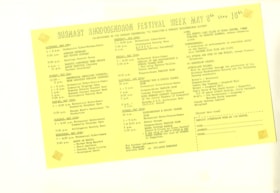
- Album page with schedule of events for "Burnaby Rhododendron Festival Week May 8 thru 16th"; mimeographed copy on yellow cartridge paper.
- Object History
- Album page 213 from Don Copan album/scrapbook for Burnaby Centennial '71 celebrations
- Don Copan was an active member of the Burnaby Centennial ’71 Committee and later became the founding President of the Century Park Museum Association. While a member of the Burnaby Centennial ’71 Committee, Don created a scrapbook album of photographs and ephemera documenting the Burnaby Centennial ’71 Committee’s involvement in celebrating British Columbia’s Centenary of Confederation between January and December 1971 including Burnaby’s Commemorative Project – Heritage Village (Burnaby Village Museum).
- Reference
- Photographs from the Don Copan scrapbook/album are described as part of the Donald Copan collection - Copan Album series
- Category
- 08. Communication Artifacts
- Classification
- Documentary Artifacts - - Other Documents
- Object Term
- Schedule
Images

Album page
https://search.heritageburnaby.ca/link/museumartifact90701
- Repository
- Burnaby Village Museum
- Accession Code
- BV005.54.743
- Description
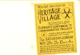
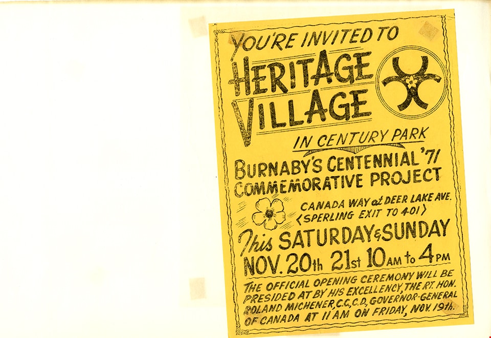
- Album page with attached notice; yellow cartridge paper with mimeographed text which reads: "You're invited to Heritage Village in Century Park / Burnaby's Centennial '71 Project / .../ This Saturday & Sunday / Nov. 20th 21st 10 AM to 4 PM / The Official Opening Ceremony will be / presided by his excellency, the Rt. Hon. Roland Michener, C.C.C.D., Governor-General / of Canada at 11 AM on Friday, Nov. 19th."
- Object History
- Album page 215 from Don Copan album/scrapbook for Burnaby Centennial '71 celebrations
- Don Copan was an active member of the Burnaby Centennial ’71 Committee and later became the founding President of the Century Park Museum Association. While a member of the Burnaby Centennial ’71 Committee, Don created a scrapbook album of photographs and ephemera documenting the Burnaby Centennial ’71 Committee’s involvement in celebrating British Columbia’s Centenary of Confederation between January and December 1971 including Burnaby’s Commemorative Project – Heritage Village (Burnaby Village Museum).
- Reference
- Photographs from the Don Copan scrapbook/album are described as part of the Donald Copan collection - Copan Album series
- Category
- 08. Communication Artifacts
- Classification
- Advertising Media
- Object Term
- Poster
Images
Album page
https://search.heritageburnaby.ca/link/museumartifact90706
- Repository
- Burnaby Village Museum
- Accession Code
- BV005.54.745
- Description
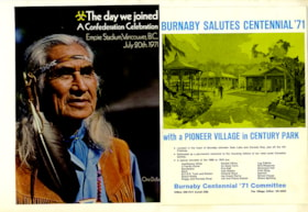
- Album page with two advertisement pages; col.; glossy; (may be from a program); page on the left includes a photograph of Chief Dan George with text reading: "The day we joined / A Confederation Celebration / Empire Stadium Vancouver, B.C. / July 20th. 1971"; page on the right reads: "Burnaby Salutes Centennial '71 / with Pioneer Village in Century Park / ... Burnaby Centennial '71 Committee"; recto. of eage page includes a printed advertisement
- Object History
- Album page 217 from Don Copan album/scrapbook for Burnaby Centennial '71 celebrations
- Don Copan was an active member of the Burnaby Centennial ’71 Committee and later became the founding President of the Century Park Museum Association. While a member of the Burnaby Centennial ’71 Committee, Don created a scrapbook album of photographs and ephemera documenting the Burnaby Centennial ’71 Committee’s involvement in celebrating British Columbia’s Centenary of Confederation between January and December 1971 including Burnaby’s Commemorative Project – Heritage Village (Burnaby Village Museum).
- Reference
- Photographs from the Don Copan scrapbook/album are described as part of the Donald Copan collection - Copan Album series
- Category
- 08. Communication Artifacts
- Classification
- Advertising Media
- Object Term
- Advertisement
Images

Documents
Album page
https://search.heritageburnaby.ca/link/museumartifact90709
- Repository
- Burnaby Village Museum
- Accession Code
- BV005.54.746
- Description
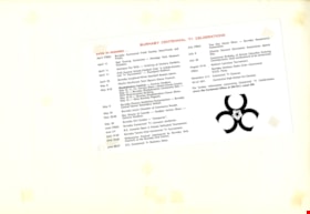
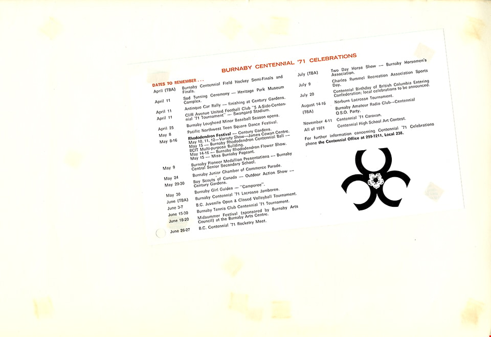
- Album page with flyer; "Burnaby Centennial '71 Celebrations: Dates to remember..."; lists centennial celebration events between April and November 1971.
- Object History
- Album page 218 from Don Copan album/scrapbook for Burnaby Centennial '71 celebrations
- Don Copan was an active member of the Burnaby Centennial ’71 Committee and later became the founding President of the Century Park Museum Association. While a member of the Burnaby Centennial ’71 Committee, Don created a scrapbook album of photographs and ephemera documenting the Burnaby Centennial ’71 Committee’s involvement in celebrating British Columbia’s Centenary of Confederation between January and December 1971 including Burnaby’s Commemorative Project – Heritage Village (Burnaby Village Museum).
- Reference
- Photographs from the Don Copan scrapbook/album are described as part of the Donald Copan collection - Copan Album series
- Category
- 08. Communication Artifacts
- Classification
- Documentary Artifacts - - Other Documents
- Object Term
- Pamphlet
- Subjects
- Celebrations - Centennials
Images
Album page
https://search.heritageburnaby.ca/link/museumartifact90711
- Repository
- Burnaby Village Museum
- Accession Code
- BV005.54.747
- Description
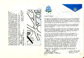
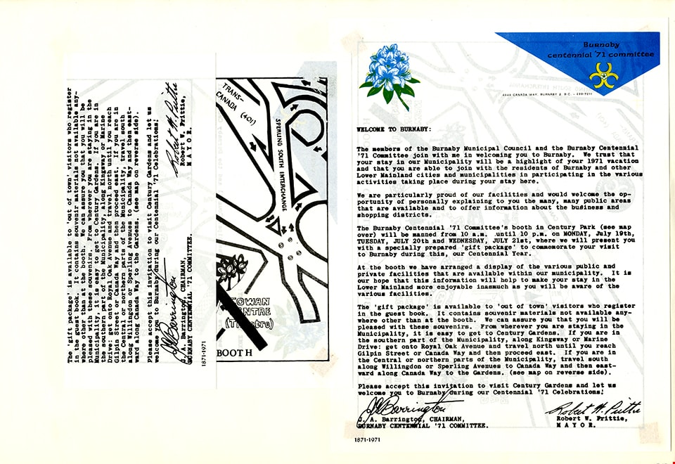
- Album page with two copies of doubled sided form letter from Burnaby Centennial '71 Committee; one side includes colour letterhead and heading "Welcome to Burnaby", signed by J.A. Barrington, Burnaby Centennial '71 Committee chairman; other side includes a map with title at bottom "Burnaby's salute to B.C. booth". Two copies are attached, to show both sides.
- Object History
- Album page 219 from Don Copan album/scrapbook for Burnaby Centennial '71 celebrations
- Don Copan was an active member of the Burnaby Centennial ’71 Committee and later became the founding President of the Century Park Museum Association. While a member of the Burnaby Centennial ’71 Committee, Don created a scrapbook album of photographs and ephemera documenting the Burnaby Centennial ’71 Committee’s involvement in celebrating British Columbia’s Centenary of Confederation between January and December 1971 including Burnaby’s Commemorative Project – Heritage Village (Burnaby Village Museum).
- Reference
- Photographs from the Don Copan scrapbook/album are described as part of the Donald Copan collection - Copan Album series
- Category
- 08. Communication Artifacts
- Classification
- Documentary Artifacts - - Other Documents
- Object Term
- Correspondence
- Subjects
- Celebrations - Centennials
Images
Album page
https://search.heritageburnaby.ca/link/museumartifact90714
- Repository
- Burnaby Village Museum
- Accession Code
- BV005.54.748
- Description
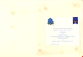
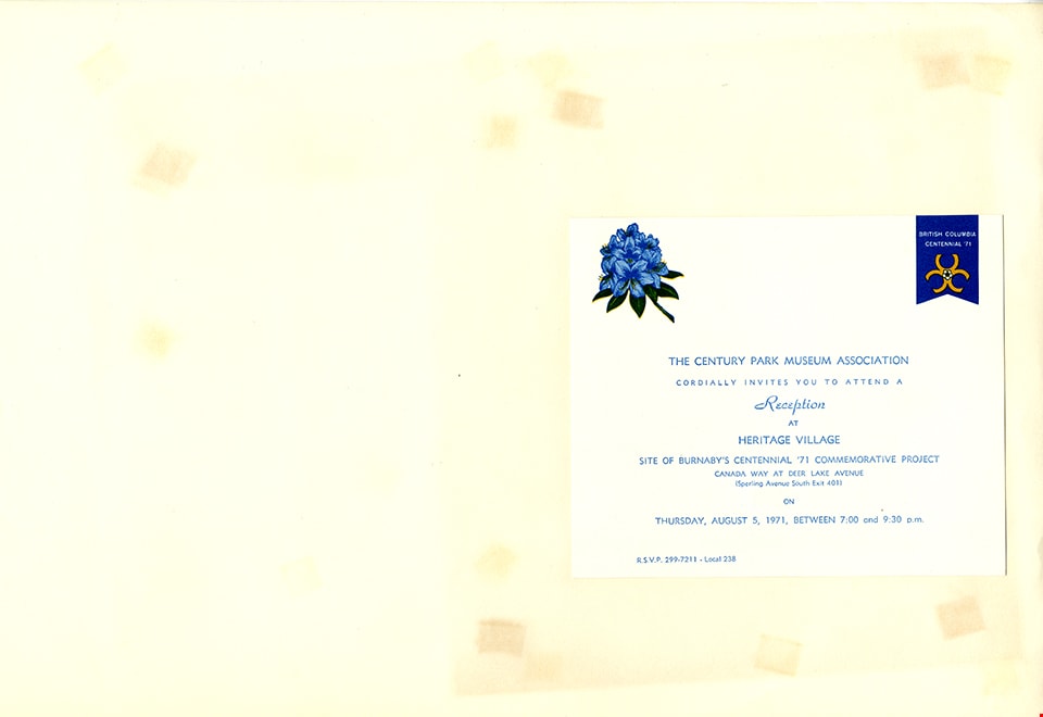
- Album page with invitation; cardstock; Burnaby Centennial '71 Committee logo and blue rhododendron flower; invitation reads: "The Century Park Museum Association / Cordially invites you to attend a / Reception / at / Heritage Village / Site of Burnaby's Centennial '71 Commemorative Project / ... Thursday, August 5, 1971, Between 7:00 and 9:30 p.m."
- Object History
- Album page 220 from Don Copan album/scrapbook for Burnaby Centennial '71 celebrations
- Don Copan was an active member of the Burnaby Centennial ’71 Committee and later became the founding President of the Century Park Museum Association. While a member of the Burnaby Centennial ’71 Committee, Don created a scrapbook album of photographs and ephemera documenting the Burnaby Centennial ’71 Committee’s involvement in celebrating British Columbia’s Centenary of Confederation between January and December 1971 including Burnaby’s Commemorative Project – Heritage Village (Burnaby Village Museum).
- Reference
- Photographs from the Don Copan scrapbook/album are described as part of the Donald Copan collection - Copan Album series
- Category
- 08. Communication Artifacts
- Classification
- Documentary Artifacts - - Other Documents
- Object Term
- Request
- Subjects
- Celebrations - Centennials
Images
Album page
https://search.heritageburnaby.ca/link/museumartifact90743
- Repository
- Burnaby Village Museum
- Accession Code
- BV005.54.755
- Description
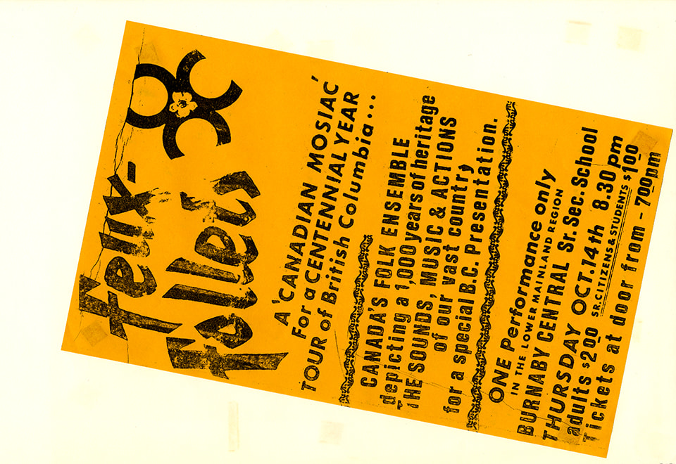
- Album page with poster for "Feux-follets" performance, October 14, 1971; gold coloured cartridge paper with black ink
- Object History
- Album page 227 from Don Copan album/scrapbook for Burnaby Centennial '71 celebrations
- Don Copan was an active member of the Burnaby Centennial ’71 Committee and later became the founding President of the Century Park Museum Association. While a member of the Burnaby Centennial ’71 Committee, Don created a scrapbook album of photographs and ephemera documenting the Burnaby Centennial ’71 Committee’s involvement in celebrating British Columbia’s Centenary of Confederation between January and December 1971 including Burnaby’s Commemorative Project – Heritage Village (Burnaby Village Museum).
- Reference
- Photographs from the Don Copan scrapbook/album are described as part of the Donald Copan collection - Copan Album series
- Category
- 08. Communication Artifacts
- Classification
- Advertising Media
- Object Term
- Poster
Images
Album page
https://search.heritageburnaby.ca/link/museumartifact90747
- Repository
- Burnaby Village Museum
- Accession Code
- BV005.54.757
- Description
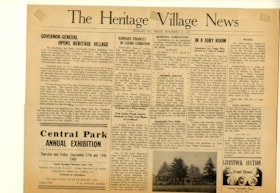
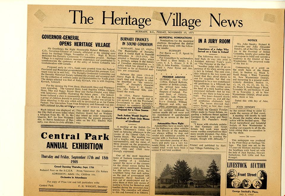
- Album page with souvenir newspaper; single page; one sided; "The Heritage Village News", Friday, November 19, 1971
- Object History
- Album page 229 from Don Copan album/scrapbook for Burnaby Centennial '71 celebrations
- Don Copan was an active member of the Burnaby Centennial ’71 Committee and later became the founding President of the Century Park Museum Association. While a member of the Burnaby Centennial ’71 Committee, Don created a scrapbook album of photographs and ephemera documenting the Burnaby Centennial ’71 Committee’s involvement in celebrating British Columbia’s Centenary of Confederation between January and December 1971 including Burnaby’s Commemorative Project – Heritage Village (Burnaby Village Museum).
- Reference
- Photographs from the Don Copan scrapbook/album are described as part of the Donald Copan collection - Copan Album series
- Category
- 08. Communication Artifacts
- Classification
- Documentary Artifacts - - Other Documents
- Object Term
- Serial
Images
Album page
https://search.heritageburnaby.ca/link/museumartifact90797
- Repository
- Burnaby Village Museum
- Accession Code
- BV005.54.770
- Description
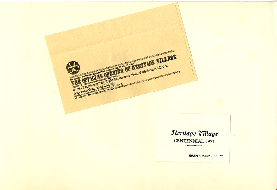
- Album page with invitation and card; Invitation with black text on yellow cartridge paper reads "The Burnaby Centennial '71 Committee Cordially invites you to attend / The Official Opening of Heritage Village / (Burnaby's Centennial '71 Commemorative Project) / by his Excellency The Right Honourable Roland Michener, C.C., C.D. / Governor General of Canada..."; card; black text on glossy cardstock reads "Heritage Village / Centennial 1971 / Burnaby, B.C."
- Object History
- Album page 241 from Don Copan album/scrapbook for Burnaby Centennial '71 celebrations
- Don Copan was an active member of the Burnaby Centennial ’71 Committee and later became the founding President of the Century Park Museum Association. While a member of the Burnaby Centennial ’71 Committee, Don created a scrapbook album of photographs and ephemera documenting the Burnaby Centennial ’71 Committee’s involvement in celebrating British Columbia’s Centenary of Confederation between January and December 1971 including Burnaby’s Commemorative Project – Heritage Village (Burnaby Village Museum).
- Reference
- Photographs from the Don Copan scrapbook/album are described as part of the Donald Copan collection - Copan Album series
- Category
- 08. Communication Artifacts
- Classification
- Documentary Artifacts - - Other Documents
- Object Term
- Card, Advertising
- Request
Images

alcohol burner
https://search.heritageburnaby.ca/link/museumartifact2528
- Repository
- Burnaby Village Museum
- Accession Code
- HV971.157.35
- Description
- Clear glass alcohol burner or spirit lamp, with glass lid/snuffer and wick. Lid has some brown burn discolouration. No contents. Label on bottom "W. BOOTE / & SONS LTD. / E 06283".
- Classification
- Chemical T&E
- Marks/Labels
- Label on bottom of burner reads: "W. BOOTE / & SONS LTD. / E 06283"
- Measurements
- Approx. H: 10 cm (with lid) x W: 9 cm ( widest part of burner)
Images

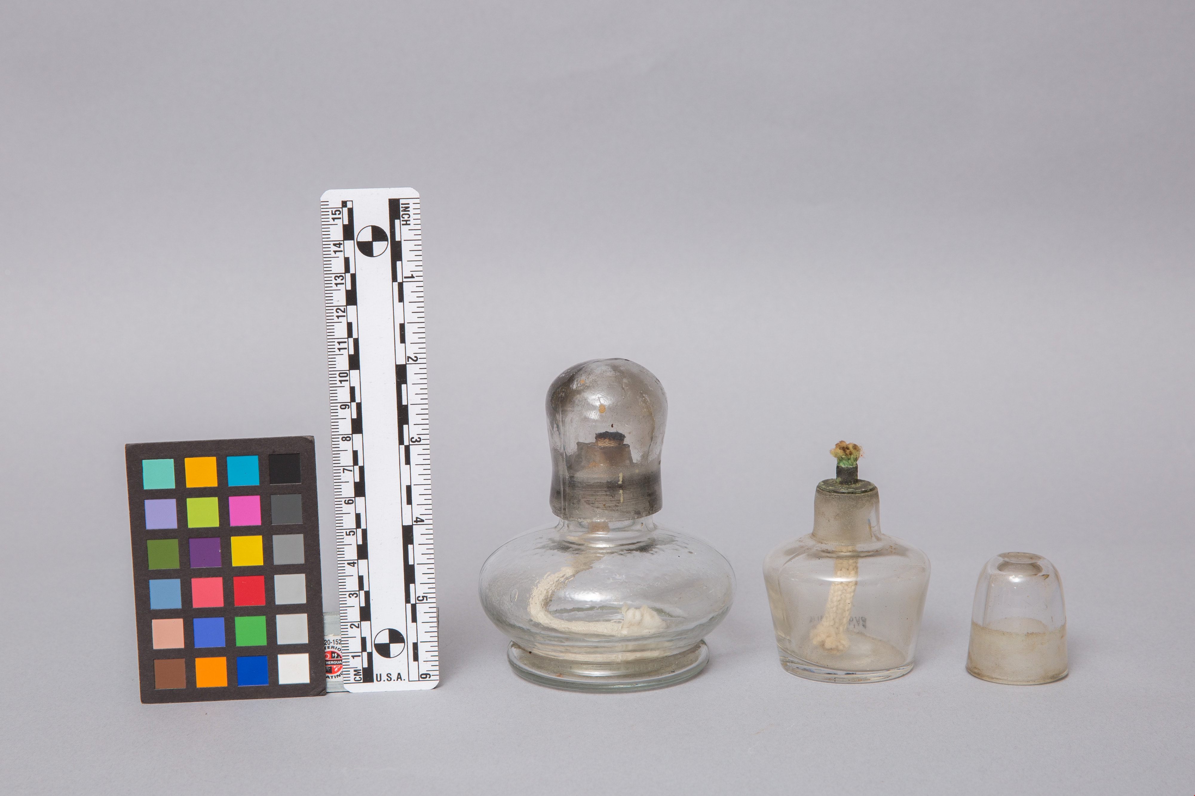
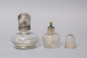
alcohol burner
https://search.heritageburnaby.ca/link/museumartifact8884
- Repository
- Burnaby Village Museum
- Accession Code
- BV985.1331.1
- Description
- Clear glass alcohol burner or spirit lamp, with glass lid/snuffer and wick. Metal wick support has some green discolouration. No contents.
- Reference
- https://www.mccrone.com/mm/how-to-makemodify-and-use-an-alcohol-lamp/
- Classification
- Chemical T&E
- Marks/Labels
- No label or visible markings
- Measurements
- approx: Dia.: 2.5 cm x H: 7 cm
Images


Alfred & Ruth MacLeod Cottage
https://search.heritageburnaby.ca/link/landmark503
- Repository
- Burnaby Heritage Planning
- Description
- Located atop a hill on the southern shore of picturesque Deer Lake, the Alfred and Ruth MacLeod Cottage is a one and one-half storey, wood-frame, rustic Arts and Crafts-style bungalow. The cottage is well-maintained, but has been altered through the enclosure of much of its original wraparound vera…
- Associated Dates
- 1913
- Repository
- Burnaby Heritage Planning
- Geographic Access
- Deer Lake Drive
- Associated Dates
- 1913
- Description
- Located atop a hill on the southern shore of picturesque Deer Lake, the Alfred and Ruth MacLeod Cottage is a one and one-half storey, wood-frame, rustic Arts and Crafts-style bungalow. The cottage is well-maintained, but has been altered through the enclosure of much of its original wraparound verandah. Its sits on the brow of a steep slope, with panoramic views north to Deer Lake.
- Heritage Value
- The Alfred and Ruth MacLeod Cottage is valued as a significant example of the early development of summer estates in Burnaby, specifically in the Deer Lake neighbourhood, that attracted residents from the burgeoning cities of New Westminster and Vancouver. Access to the area was facilitated by the construction of the Burnaby Lake Interurban tramline, which opened in June 1911. This modest, rustic cottage illustrates the desire for a simple country lifestyle and retreat into nature of those who settled on the south shore of Deer Lake. While the grand mansions on the north shore of Deer Lake are set in formally landscaped gardens, the informality of this cottage demonstrates reverence for its natural, wooded surroundings, oriented towards views of Deer Lake. The Alfred and Ruth MacLeod Cottage is important for its connection with prominent New Westminster insurance and real estate broker, Alfred W. MacLeod, and his wife, Ruth. The MacLeods had recently constructed a large city home, and built this cottage as a summer residence in 1913. In 2005, the Alfred and Ruth MacLeod Cottage was purchased by the City of Burnaby and today constitutes part of the Deer Lake Park Heritage Precinct, which is Burnaby's most significant collection of historic sites.
- Defining Elements
- Key elements that define the heritage character of the Alfred and Ruth MacLeod Cottage include its: - secluded setting on the brow of a steep hill on the southern shore of Deer Lake, with expansive views of Deer Lake to the north - residential form, scale and massing as expressed by its one and one-half storey rectangular plan, side-gabled roof, hipped roof over original verandah and two shed dormers - associated landscape features such as mature coniferous and deciduous trees surrounding the property
- Historic Neighbourhood
- Burnaby Lake (Historic Neighbourhood)
- Planning Study Area
- Morley-Buckingham Area
- Function
- Primary Historic--Single Dwelling
- Primary Current--Single Dwelling
- Cadastral Identifier
- P.I.D.000-708-038
- Boundaries
- The Alfred and Ruth MacLeod Cottage is comprised of a single residential lot located at 6466 Deer Lake Drive, Burnaby.
- Area
- 13354.63
- Contributing Resource
- Building
- Ownership
- Public (local)
- Documentation
- City of Burnaby Planning and Building Department, Heritage Site Files
- Street Address
- 6466 Deer Lake Drive
Images


Alfred & Sarah Chrisp Residence
https://search.heritageburnaby.ca/link/landmark556
- Repository
- Burnaby Heritage Planning
- Description
- Rsidential building.
- Associated Dates
- 1913
- Street View URL
- Google Maps Street View
- Repository
- Burnaby Heritage Planning
- Geographic Access
- 11th Avenue
- Associated Dates
- 1913
- Description
- Rsidential building.
- Heritage Value
- This high-quality Craftsman bungalow was built for Alfred John Chrisp (1882-1944) and his wife Sarah Hannah Chrisp (née Hindmarch, 1883-1954). Starting in 1908, Alfred worked as an accountant for the CPR in New Westminster, and he and Sarah were married there in 1910. This house features a front gabled roof and gabled front porch, and is notable for its elaborate stained glass windows in the front door glazing, sidelights and the narrow transom over the front elevation window. Maintaining a very high degree of original integrity, the bungalow features lapped siding at the foundation level, a shingle clad main floor, a combination of casement and double-hung windows and square tapered porch columns.
- Locality
- East Burnaby
- Historic Neighbourhood
- East Burnaby (Historic Neighbourhood)
- Planning Study Area
- Edmonds Area
- Street Address
- 7349 11th Avenue
- Street View URL
- Google Maps Street View
Images


Aliceville
https://search.heritageburnaby.ca/link/landmark721
- Repository
- Burnaby Heritage Planning
- Associated Dates
- 1886
- Heritage Value
- Shortly after the townsite of Port Moody was surveyed in the early 1880s, a resort community developed on the border of Burnaby and Port Moody that would come to be called Aliceville. Located near the north end of North Road, in 1886 the Canadian Pacific Railway established a flag station there and the settlement was named after Alice May Webster who, with her sister Mrs. Jenns, operated the Aliceville Hotel.
- Historic Neighbourhood
- Barnet (Historic Neighbourhood)
- Planning Study Area
- Burnaby Mountain Area
Images


Alpha Secondary School
https://search.heritageburnaby.ca/link/landmark678
- Repository
- Burnaby Heritage Planning
- Geographic Access
- Parker Street
- Associated Dates
- 1950
- Heritage Value
- The unexpected period of growth in Burnaby during the first few years of the 1950s resulted in many overcrowded schools. As a result, the School Board decided it required a Junior High to alleviate enrolment issues at Gilmore Avenue Elementary-Junior school. Alpha opened in 1950 with 423 students. The new school had 12 rooms but added more in 1953. There were fires at the school in 1956 and 1964, resulting in the rebuilding of seven classrooms, library and administrative offices. There were additions made in 1968 and 1969 and in 1976 a gymnasium was built.
- Planning Study Area
- Brentwood Area
- Street Address
- 4600 Parker Street
- Street View URL
- Google Maps Street View
Images


Alta Vista Baptist Church
https://search.heritageburnaby.ca/link/landmark557
- Repository
- Burnaby Heritage Planning
- Description
- Church building.
- Associated Dates
- 1936
- Other Names
- Royal Oak Community Church
- Street View URL
- Google Maps Street View
- Repository
- Burnaby Heritage Planning
- Other Names
- Royal Oak Community Church
- Geographic Access
- Royal Oak Avenue
- Associated Dates
- 1936
- Description
- Church building.
- Heritage Value
- This Baptist congregation originally held services in a tent at the corner of McGregor Avenue and Portland but they soon were able to build a small church. A membership drive by Pastor Arthur James Bowbrick (1875-1961) was so successful that the congregation was able build this fine structure, prominently located at the corner of Victory Street. Although it has been altered with later additions and stucco over the original siding, the original windows and the rooftop belfry remain.
- Locality
- Alta Vista
- Historic Neighbourhood
- Alta Vista (Historic Neighbourhood)
- Planning Study Area
- Sussex-Nelson Area
- Ownership
- Private
- Street Address
- 7175 Royal Oak Avenue
- Street View URL
- Google Maps Street View
Images


Alta Vista Neighbourhood
https://search.heritageburnaby.ca/link/landmark707
- Repository
- Burnaby Heritage Planning
- Associated Dates
- 1925-1954
- Heritage Value
- As with many areas of Burnaby during this period, the years after World War Two marked a rapid growth in residential development in the Alta-Vista Neighbourhood. Subdivisions like Sussex and Suncrest were built and new schools and amenities were constructed to meet the demands of increased population.
- Historic Neighbourhood
- Alta Vista (Historic Neighbourhood)
- Planning Study Area
- Sussex-Nelson Area
Images


Alta Vista Neighbourhood
https://search.heritageburnaby.ca/link/landmark766
- Repository
- Burnaby Heritage Planning
- Associated Dates
- 1905-1924
- Heritage Value
- Alta Vista, named for its high views of the Fraser Valley, rapidly grew during the period 1910-1912, seeing its settlement jump from about a dozen buildings in 1910 to about four hundred by the end of 1912. Home-seekers were attracted to its location just a short walk from the B.C.E.R. line at Royal Oak and Highland Park and easily accessible to both New Westminster and Vancouver.
- Historic Neighbourhood
- Alta Vista (Historic Neighbourhood)
- Planning Study Area
- Sussex-Nelson Area
Images

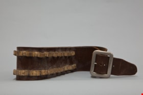
ammunition belt.
https://search.heritageburnaby.ca/link/museumartifact82369
- Repository
- Burnaby Village Museum
- Accession Code
- BV012.14.96
- Description
- brown leather belt, holds 20 bullets, metal buckle, measures 7.3 cm h. x 104 cm. l. x 4 mm. w.
- Object History
- Used by John Yanko for hunting. Hunting for deer and moose was a regular way of stocking a freezer in the garage with game for use by the family. Annie D. Basiuk (later Yanko) was born on February 25, 1902 in Sheho, Saskatchewan (formerly Sheho, North West Territories). Daniel "Dan" Yanko was born in Kobilnicha, Ukraine in 1887 and immigrated to Canada in May or June of 1905. Daniel Yanko married Annie D. Basiuk and had thirteen children together. Their son, John Ivan Yanko was born on the family farm, near Kelliher, Saskatchewan, on June 27, 1923. In grade six, John was pulled out of school to help support the family. Eugenia “Jenny” Haresomovych (later Carman) was born August 8, 1904 in Galecia, Austria. She came to Canada in 1928, when her parents sent her to live with the Austrian consular in Halifax. A year later, she was in The Pas with Albert Edward Carman, with whom she would have three children. Their daughter, Leida Doria "Lillian Doris" Carman was born in The Pas, Manitoba March 24, 1929. Eugenia “Jenny” (Haresomovych) Carman later re-married Joseph Nagy who was born in Hungary in October 3, 1900. Jenny, Joseph and the children moved to Nelson, British Columbia, where Joseph worked for the Canadian Pacific Railway. At the age of twenty, John Yanko met his future wife Lillian Doris Carman while visiting relatives in Burnaby. Lillian received a rail pass because of her dad’s employment with the CPR and at fourteen had gone to visit her Godmother in Burnaby. John Ivan Yanko and Leida Doria "Lillian Doris" Carman were married October 16, 1948 in Nelson, British Columbia and moved into the basement of John’s sister’s house on Union Street. Lillian began working at the downtown Woodward’s store as a cashier in 1948. In 1950, the young couple bought property at 7385 (later renumbered 7391) Broadway in Burnaby and began constructing a house as they could afford it. Knowing she’d be let go if she was pregnant, when Lillian was expecting her first child, Jenny sewed her several versions of the same outfit; they all used the same material, but each was a little bit larger than the last to accommodate her expanding girth. Rhonda, born in 1953 and Charmaine, born in 1955, grew up in the Broadway home. They attended school at Sperling Elementary, and later at Burnaby North high school. Lillian left her job to be a stay-at-home mom when Rhonda was born, but that changed in 1963 when John and Charmaine were in a car accident that left John temporarily unable to work. Joseph Nagy died April 20, 1962; his wife Eugenia “Jenny” (Haresomovych) (Carman) Nagy passed away August 14, 1985. Daniel "Dan" Yanko died in 1976; his wife Annie D. (Basiuk) Yanko died in 1997. John Yanko later returned to work, establishing his own tile setting business and working until age eighty-two. John and Lillian lived out the rest of their married lives on the Broadway property. John Ivan Yanko passed away in 2010; his wife Leida Doria "Lillian Doris" Carman (Carman) Yanko passed away in 2011.
- Names
- Yanko, John Ivan
- Yanko Family
Images


Andy Johnson House
https://search.heritageburnaby.ca/link/landmark515
- Repository
- Burnaby Heritage Planning
- Description
- The Andy Johnson House is a large, one and one-half storey plus above-ground basement wood-frame mansion on a rubble-stone granite foundation with a red terra cotta pantile roof and an octagonal corner turret. The building stands in a prominent location on a corner lot on Kingsway, one of Burnaby’s…
- Associated Dates
- 1912
- Formal Recognition
- Community Heritage Register
- Other Names
- Andrew M. & Margaret Johnson House 'Glenedward'
- Street View URL
- Google Maps Street View
- Repository
- Burnaby Heritage Planning
- Other Names
- Andrew M. & Margaret Johnson House 'Glenedward'
- Geographic Access
- Kingsway
- Associated Dates
- 1912
- Formal Recognition
- Community Heritage Register
- Enactment Type
- Council Resolution
- Enactment Date
- 26/05/2003
- Description
- The Andy Johnson House is a large, one and one-half storey plus above-ground basement wood-frame mansion on a rubble-stone granite foundation with a red terra cotta pantile roof and an octagonal corner turret. The building stands in a prominent location on a corner lot on Kingsway, one of Burnaby’s main transportation and commercial corridors, and stands adjacent to the Burlington Square Development.
- Heritage Value
- The Andy Johnson House 'Glenedward' is a valued representation of a prominent upper middle-class family dwelling from the pre-First World War era. Andrew M. Johnson (1861-1934), an early Vancouver pioneer, and his wife Margaret built this house in 1912, in an imposing style favoured by the newly wealthy of the prewar boom period. Born in Norway, Andrew Johnson arrived in Vancouver just months after the Great Fire of 1886 and went into partnership with J. (Ollie) Atkins in a transportation company that became the Mainland Transfer Company, eventually the largest of its kind in Vancouver. Johnson also operated Burnaby's historic Royal Oak Hotel, once located on the opposite corner from his estate. Additionally, the Andy Johnson House is significant for the high-quality design and construction of both the house and its landscaped setting. Designed in the British Arts and Crafts style, the house exhibits a rare degree of opulence in building materials, including imported terra cotta roof tiles, oak and walnut interior millwork, and stained glass manufactured by the Royal City Glass Company. The rubble-stone foundations and perimeter walls were obtained from two massive granite glacial erratic boulders found on the property. The house has been relocated closer to the corner, but the encircling stone walls, the gate posts and gates manufactured by the Westminster Iron Works and some of the original plantings have been retained. A grouping of three giant Sequoias, other mature deciduous trees and massings of shrubbery indicate the type of landscape setting considered appropriate for an estate house in the early years of the twentieth century.
- Defining Elements
- Key elements that define the heritage character of the Andy Johnson House include its: - corner location on Kingsway at Royal Oak Avenue - residential form, scale and massing as expressed by the one and one-half storey height, above-ground basement, octagonal corner turret and rectangular plan - British Arts and Crafts details such as the use of natural indigenous materials, half-timbering in the gables and dormers, picturesque roofline, cedar shingle siding, extended eaves, native granite rubble-stone foundation with red-coloured mortar, and granite piers and chimneys - additional exterior features such as the central front entrance, elaborate wrap-around verandah, porte-cochere and balcony at second storey lighted with original cast iron electric lanterns - red terra cotta pantile roof cladding - fenestration, such as double-hung 1-over-1 wooden-sash windows with stained glass and leaded lights in the upper sash - original interior features such as fireplaces, wainscoting finished with oak and walnut millwork, and three-quarter sawn oak flooring - associated landscape features including three giant Sequoias. granite walls, granite gate posts and wrought iron gates
- Historic Neighbourhood
- Central Park (Historic Neighbourhood)
- Planning Study Area
- Marlborough Area
- Builder
- J.C. Allen
- Function
- Primary Historic--Single Dwelling
- Primary Current--Eating or Drinking Establishment
- Community
- Burnaby
- Cadastral Identifier
- 003-004-538
- Boundaries
- The Andy Johnson House is comprised of a single residential lot located at 5152 Kingsway, Burnaby
- Area
- 1424.21
- Contributing Resource
- Building
- Ownership
- Private
- Street Address
- 5152 Kingsway
- Street View URL
- Google Maps Street View
Images


Angus & Mabel MacDonald Residence
https://search.heritageburnaby.ca/link/landmark558
- Repository
- Burnaby Heritage Planning
- Description
- Residential building.
- Associated Dates
- 1913
- Other Names
- The Pillars
- Street View URL
- Google Maps Street View
- Repository
- Burnaby Heritage Planning
- Other Names
- The Pillars
- Geographic Access
- Dundas Street
- Associated Dates
- 1913
- Description
- Residential building.
- Heritage Value
- With its two monumental, double height columns terminating in elaborate Ionic capitals, this Neoclassical Revival style house is aptly named The Pillars. Other Neoclassical embellishments include a Palladian pediment window, pilasters with Ionic capitals applied to the front corners of the house and lathe-turned porch columns. Though it has been re-clad with a later covering of asbestos shingles over the original siding, it otherwise retains a high degree of exterior integrity with most of its double-hung windows and decorative elements still in place. This home was constructed for Angus John MacDonald (née Cummins, 1878-1955), Vice-President of A. Linton & Company Ltd., and his wife Mabel Jessie MacDonald (1884-1971). Linton & Company was a shipbuilding firm; MacDonald retired in 1942 after thirty years in the industry. A photograph of this grand house was often featured in the promotional material for the Vancouver Heights subdivision by realtors and titled “A typical Vancouver Heights home.”
- Locality
- Vancouver Heights
- Historic Neighbourhood
- Vancouver Heights (Historic Neighbourhood)
- Planning Study Area
- Burnaby Heights Area
- Area
- 566.71
- Contributing Resource
- Building
- Ownership
- Private
- Street Address
- 3815 Dundas Street
- Street View URL
- Google Maps Street View
Images


Angus & Margaret MacDonald House
https://search.heritageburnaby.ca/link/landmark495
- Repository
- Burnaby Heritage Planning
- Description
- Set on a large corner lot at North Esmond Avenue and Oxford Street, the Angus & Margaret MacDonald House is a prominent, two and one-half storey Queen Anne Revival-style residence. The high hipped roof has open projecting gables. The house is a landmark within the Vancouver Heights neighbourhood of…
- Associated Dates
- 1909
- Formal Recognition
- Heritage Designation, Community Heritage Register
- Street View URL
- Google Maps Street View
- Repository
- Burnaby Heritage Planning
- Geographic Access
- Oxford Street
- Associated Dates
- 1909
- Formal Recognition
- Heritage Designation, Community Heritage Register
- Enactment Type
- Bylaw No. 12174
- Enactment Date
- 11/12/2006
- Description
- Set on a large corner lot at North Esmond Avenue and Oxford Street, the Angus & Margaret MacDonald House is a prominent, two and one-half storey Queen Anne Revival-style residence. The high hipped roof has open projecting gables. The house is a landmark within the Vancouver Heights neighbourhood of North Burnaby, on a high point of land overlooking Burrard Inlet and the North Shore Mountains.
- Heritage Value
- The MacDonald House is valued as one of Burnaby’s most elaborate examples of the Queen Anne Revival style. The house retains many of its original features, including a prominent front corner turret wrapped by a clamshell verandah. The eclectic and transitional nature of Edwardian-era architecture is demonstrated by the late persistence of these Queen Anne Revival details, combined with the use of newly-popular classical revival elements such as Ionic columns. The interior retains a number of original architectural elements, and the early garage at the rear originally housed Angus MacDonald’s Cadillac, one of the first known automobiles owned by a Burnaby resident. Constructed in 1909, this house was built for Angus MacDonald (1857-1943) and his wife, Margaret Isabella Thompson MacDonald (1862-1939). Angus MacDonald, an electrical contractor, relocated from Nova Scotia to Vancouver in 1891 and served on Vancouver Council from 1904-08. The MacDonald family moved to Burnaby upon his retirement from the B.C. Electric Railway Company, and he then served the North Burnaby Ward as a councillor from 1911-1916 and again in 1921. MacDonald Street in Burnaby was named in his honour. The MacDonald House has additional significance as one of the surviving landmark residences, built between 1909 and 1914, during the first development of Vancouver Heights. In 1909, C.J. Peter and his employer, G.F. and J. Galt Limited, initiated the development of this North Burnaby neighbourhood, promoting it as one of the most picturesque districts in the region and an alternative to the CPR’s prestigious Shaughnessy Heights development in Vancouver. Buyers were obligated to build houses worth $3,500 at a time when the average house price was $1,000. Reputed to be the second house built in the subdivision, this house cost $7,000 to build.
- Defining Elements
- Key elements that define the heritage character of the MacDonald House include its: - prominent corner location in the Vancouver Heights neighbourhood, with views to Burrard Inlet and the North Shore Mountains - residential form, scale and massing as exemplified by its two and one-half storey height, full basement, compound plan, and high hipped roof with gabled projections at the front and side - wood-frame construction including wooden lapped siding, trim and mouldings - rubble-stone granite foundation - Queen Anne Revival details such as scroll-cut modillions, octagonal corner turret, wraparound, clamshell verandah with classical columns, and projecting square and semi-octagonal bays - external red-brick chimney with corbelled top - original windows including double-hung, 1-over-1 wooden sash windows in single and double assembly, and arched-top casement windows in the gable peaks - original interior features such as the main staircase, a panelled dining room with a fireplace and built-in cabinets, a living room with a parquet floor, and a rear den with an oak mantle and tiled hearth - associated early wood-frame garage at the rear of the property - landscape features such as mature coniferous and deciduous trees surrounding the property
- Historic Neighbourhood
- Vancouver Heights (Historic Neighbourhood)
- Planning Study Area
- Burnaby Heights Area
- Organization
- British Columbia Mills Timber and Trading Company
- Function
- Primary Historic--Single Dwelling
- Primary Current--Single Dwelling
- Community
- Vancouver Heights
- Cadastral Identifier
- P.I.D.011-999-462
- Boundaries
- The MacDonald House is comprised of a single residential lot located at 3814 Oxford Street, Burnaby.
- Area
- 566.71
- Contributing Resource
- Building
- Ownership
- Private
- Documentation
- City of Burnaby Planning and Building Department, Heritage Site Files
- Street Address
- 3814 Oxford Street
- Street View URL
- Google Maps Street View
Images


Annie Barrett-Lennard Residence
https://search.heritageburnaby.ca/link/landmark559
- Repository
- Burnaby Heritage Planning
- Description
- Residential building.
- Associated Dates
- c.1935
- Street View URL
- Google Maps Street View
- Repository
- Burnaby Heritage Planning
- Geographic Access
- Parker Street
- Associated Dates
- c.1935
- Description
- Residential building.
- Heritage Value
- Built for Annie Barrett-Lennard, this British Arts and Crafts residence has retained many of its original features, such as its stucco and half-timbering exterior with a cat’s slide roof over the front entrance. The steeply-pitched gables, asymmetrical half-massing, leaded windows and pegged joinery are all references to traditional British antecedents.
- Locality
- Capitol Hill
- Historic Neighbourhood
- Capitol Hill (Historic Neighbourhood)
- Planning Study Area
- Parkcrest-Aubrey Area
- Area
- 1227.44
- Contributing Resource
- Building
- Ownership
- Private
- Street Address
- 5450 Parker Street
- Street View URL
- Google Maps Street View
Images

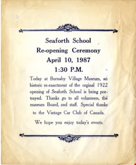
announcement
https://search.heritageburnaby.ca/link/museumartifact91052
- Repository
- Burnaby Village Museum
- Accession Code
- BV020.5.1776
- Description
- Announcement; blue ink on white cartridge paper; text reads: "Seaforth School / Re-opening Ceremony / April 10, 1987 / 1:30 P.M. / Today at Burnaby Village Museum, an / historic re-enactment of the original 1922 / opening of Seaforth School is being por- / trayed. Thanks go to all volunteers, the / museum Board, and staff. / Special thanks / to the Vintage Car Club of Canada. / We hope you enjoy today's events."; decorativer border art at top and bottom of text.
- Object History
- Item was found in Burnaby Village Museum printshop along with other Heritage Village / Burnaby Village Museum ephemera created between 1971 and 1990
- Category
- 08. Communication Artifacts
- Classification
- Documentary Artifacts - - Other Documents
- Object Term
- Serial
- Country Made
- Canada
- Province Made
- British Columbia
- Publication Date
- 1987
- Subjects
- Documentary Artifacts
- Names
- Burnaby Village Museum
Images

announcement card and envelope
https://search.heritageburnaby.ca/link/museumartifact41381
- Repository
- Burnaby Village Museum
- Accession Code
- BV001.1.168
- Description
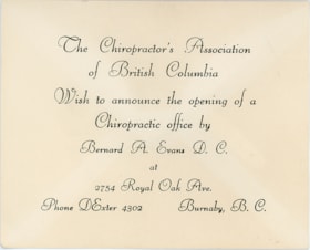
- Announcement card, with envelope; card is white with black print, "The Chiropractor's Association of British Columbia" "Wish to announce the opening of a Chiropractic Office by" "Bernard A. Evans D.C." "at" "2754 Royal Oak Ave." "Phone Dexter 4302" "Burnaby, B.C."; no date; envelope is buff paper, soiled, darkened at edges; front has smudges, flap is open, gum unused, small piece torn out at left; centre under flap has been pulled, glue is loosened, paper creased
Images

apothecary case
https://search.heritageburnaby.ca/link/museumartifact91630
- Repository
- Burnaby Village Museum
- Accession Code
- BV022.21.104
- Description
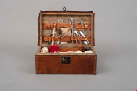
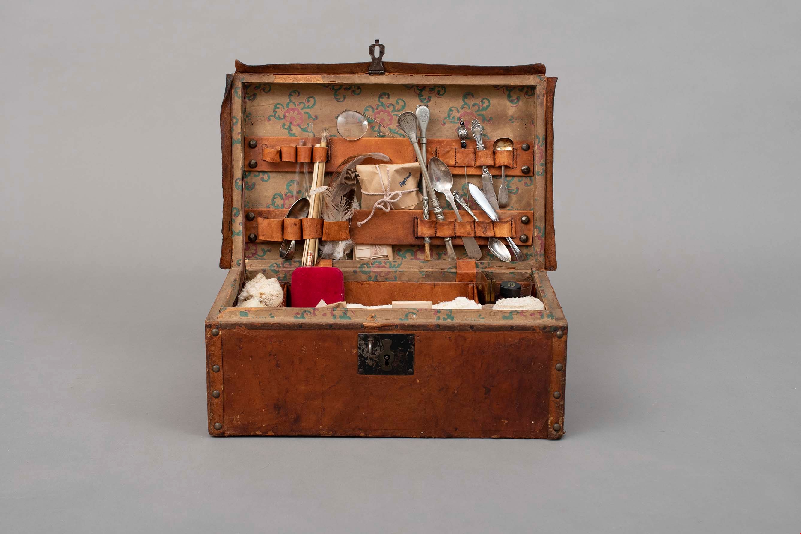
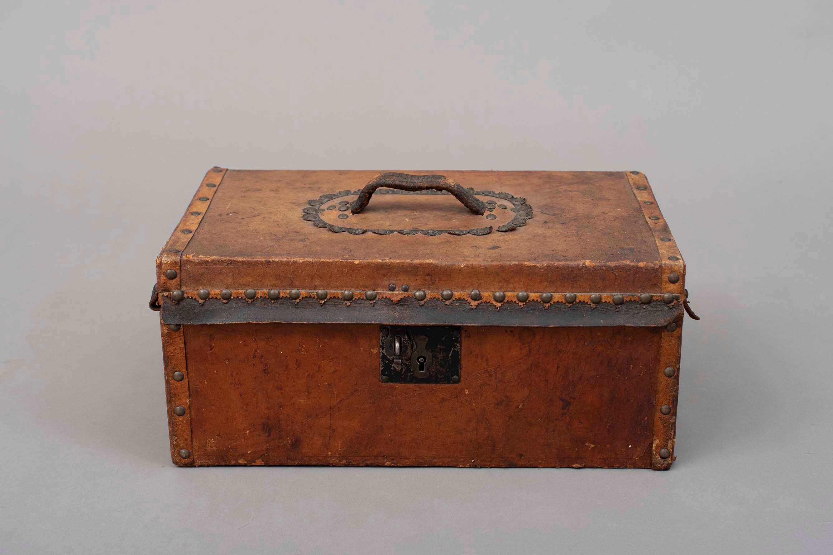
- Wood case covered in leather filled with various items including spoons, feathers, gauze, and paper packets.
- The case was assembled to act as an apothecary case for a movie.
- Object History
- This apothecary case was a prop used in the 1994 film "Little Women"
- For more information about the donor, see Hipman "Jimmy" Chow and Donna Polos fonds
- Category
- 02. Furnishings
- Classification
- Furniture - - Storage & Display Furniture
- Object Term
- Chest
- Subjects
- Persons - Chinese Canadians
- Names
- Chow, Hipman "Jimmy"
Images
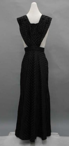
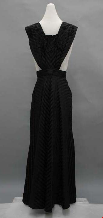
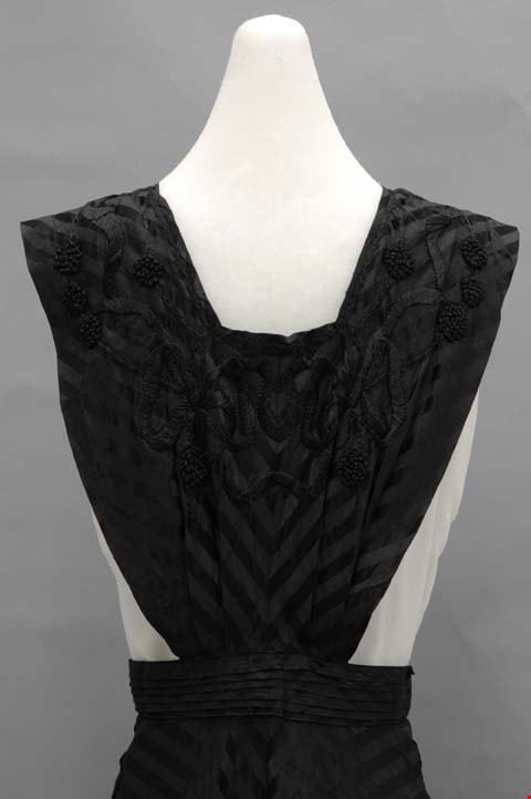
apron
https://search.heritageburnaby.ca/link/museumartifact6509
- Repository
- Burnaby Village Museum
- Accession Code
- BV985.73.1
- Description
- Pinafore, black with woven-in stripe; black embroidery on chest; skirt is sewn up the back and does up at waist with hooks and eyes; possibly a jumper dress.
- Subjects
- Clothing
- Clothing - Costumes
Images


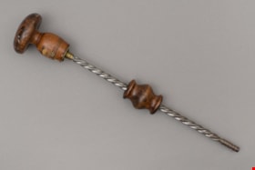
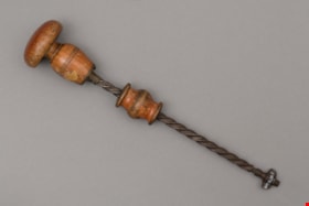
archimedean drill
https://search.heritageburnaby.ca/link/museumartifact31210
- Repository
- Burnaby Village Museum
- Accession Code
- HV972.35.21
- Description
- archimedean drill, two-part wooden handle; handle end piece has flattened knob; upper part of handle moves along metal shaft; blunt piece of metal on end of shaft, with notch at one side; many paint splatters.
- Object History
- The tools included in this donation belonged to Samuel Robins. Samuel and his wife Sarah Ann Robins moved to Burnaby in 1918. Samuel was a stonemason who worked on many projects in the Lower Mainland, including constructing houses in Shaughnessy and he also worked in the Vancouver City Hall.
Images

archimedean drill
https://search.heritageburnaby.ca/link/museumartifact31214
- Repository
- Burnaby Village Museum
- Accession Code
- HV972.35.25
- Description
- archimedean drill; two-part wooden handle; end part of handle is flattened knob; upper part moved up and down spiral metal shaft; screw threads on end, and nut; surface of wood is worn.
- Object History
- The tools included in this donation belonged to Samuel Robins. Samuel and his wife Sarah Ann Robins moved to Burnaby in 1918. Samuel was a stonemason who worked on many projects in the Lower Mainland, including constructing houses in Shaughnessy and
- he also worked in the Vancouver City Hall.
Images


Ardingley-Sprott Neighbourhood
https://search.heritageburnaby.ca/link/landmark797
- Repository
- Burnaby Heritage Planning
- Associated Dates
- 1955-2008
- Heritage Value
- The Ardingley-Sprott Neighbourhood is primarily non-residential and developed in the 1970s west of the Burnaby Lake park area. It grew to include a large recreational component in the form of the Burnaby Lake Sports Complex and playing fields.
- Historic Neighbourhood
- Burnaby Lake (Historic Neighbourhood)
- Planning Study Area
- Ardingley-Sprott Area
Images

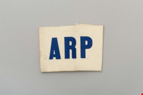
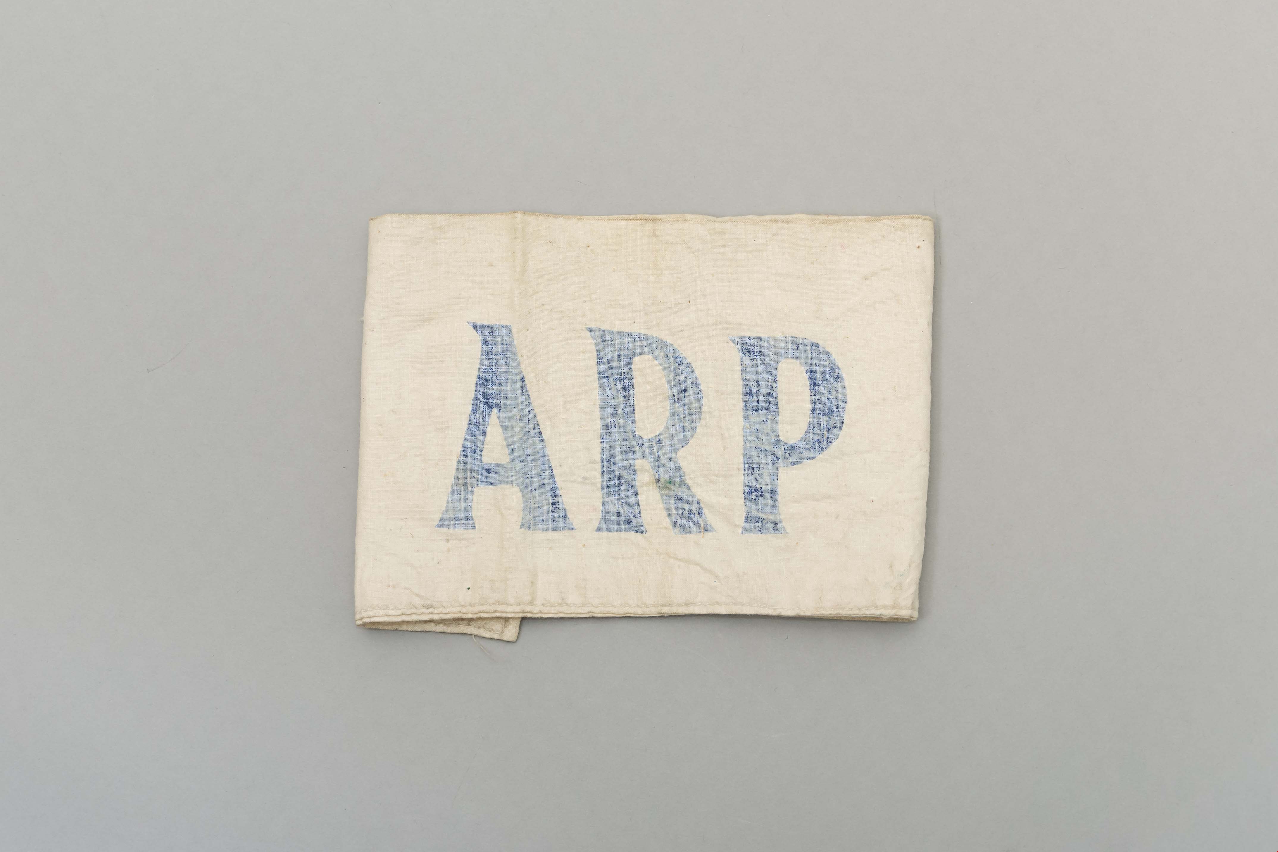
armband
https://search.heritageburnaby.ca/link/museumartifact4311
- Repository
- Burnaby Village Museum
- Accession Code
- BV988.47.7
- Description
- Canvas arm band, A.R.P. ARP = Air Raid Precautions, a WWII civil defence group.
- Category
- 08. Communication Artifacts
- Classification
- Adornment - - Body Adornments
- Object Term
- Armband
- Subjects
- Emergency Measures - Civil Defence
Images

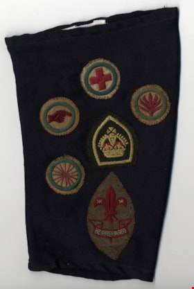
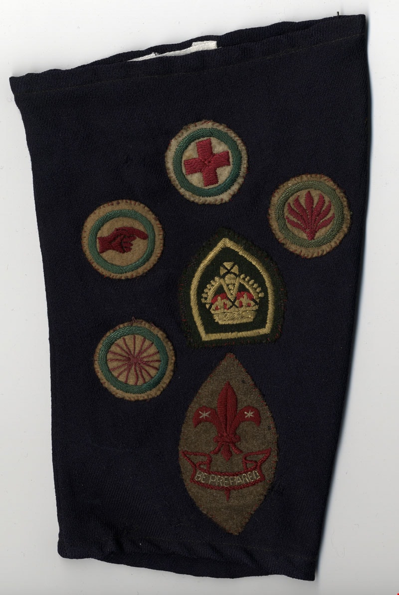
armband
https://search.heritageburnaby.ca/link/museumartifact35017
- Repository
- Burnaby Village Museum
- Accession Code
- BV993.17.79
- Description
- Armband; navy blue, green, red, yellow; six badges, clockwise from top: cross, leaf, Scout logo, squiggly lines, hand, centre: crown
- Object History
- Sea Scouts
- Marks/Labels
- "BE PREPARED", stitched, white in banner on badge on bottom
- Names
- Boy Scouts of Canada
Images

armband
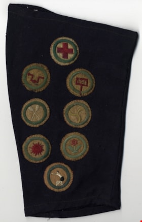
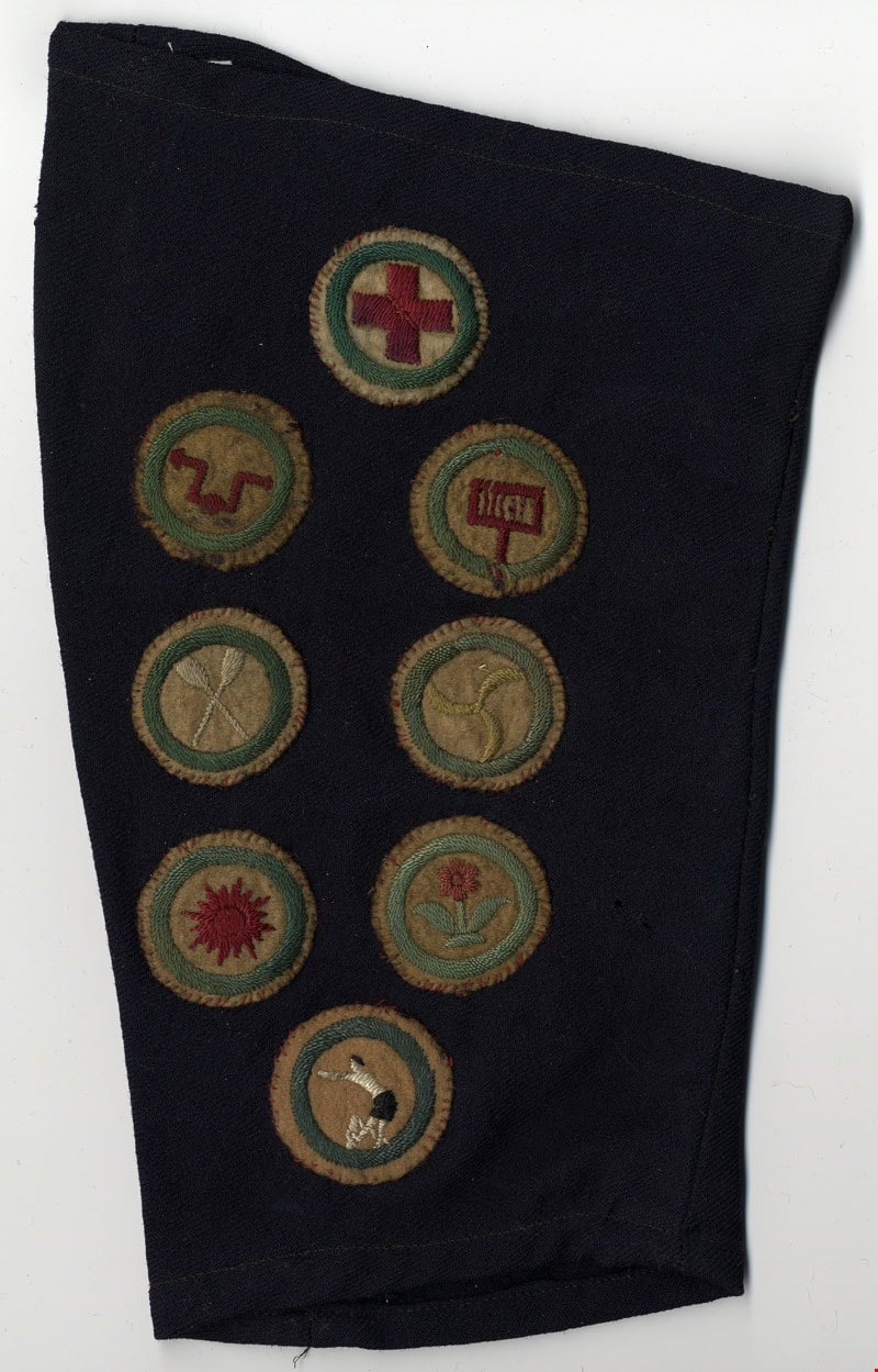
https://search.heritageburnaby.ca/link/museumartifact35018
- Repository
- Burnaby Village Museum
- Accession Code
- BV993.17.80
- Description
- Armband; navy blue, green, red, yellow; eight badges, clockwise from top: cross, sign, three pronged motif, flower, man, sun, two oars, bent arrow.
Images
armband
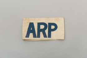
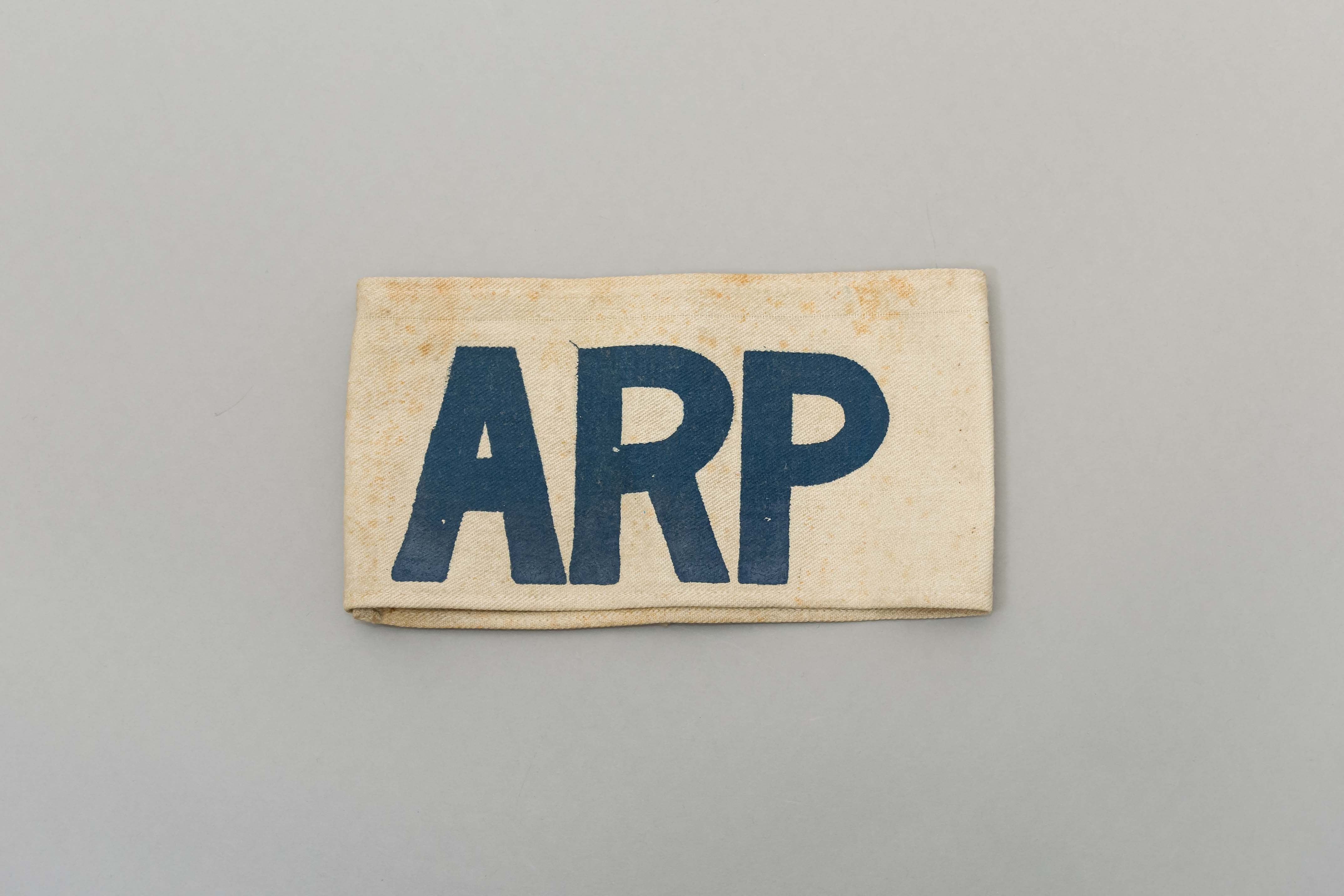
https://search.heritageburnaby.ca/link/museumartifact39844
- Repository
- Burnaby Village Museum
- Accession Code
- BV999.17.19
- Description
- Armband. White canvas with "ARP" stamped in blue. ARP = Air Raid Precautions. WWII Civilian defence group.
- Object History
- The ARP armband belonged to Harry Cutress who was a volunteer with the Burnaby Air Raid Precautions. The Burnaby ARP wore armbands such as these.
- Reference
- See City of Burnaby Archives photograph 028-001 "Burnaby Air Raid Patrol"
- Category
- 03. Personal Artifacts
- Classification
- Clothing - - Clothing Accessories
- Object Term
- Insignia
- Marks/Labels
- "ARP" stamped in blue.
- Historic Neighbourhood
- Alta Vista (Historic Neighbourhood)
- Planning Study Area
- Clinton-Glenwood Area
Images
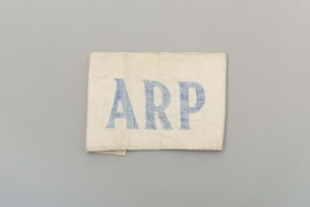
armband
https://search.heritageburnaby.ca/link/museumartifact45360
- Repository
- Burnaby Village Museum
- Accession Code
- BV003.15.1
- Description
- Armband, white cloth; "ARP"; joined by two pieces of elastic; blue lettering is faded
- Category
- 08. Communication Artifacts
- Classification
- Adornment - - Body Adornments
- Object Term
- Armband
- Subjects
- Emergency Measures - Civil Defence
Images
armband
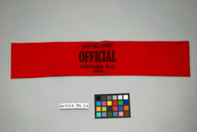
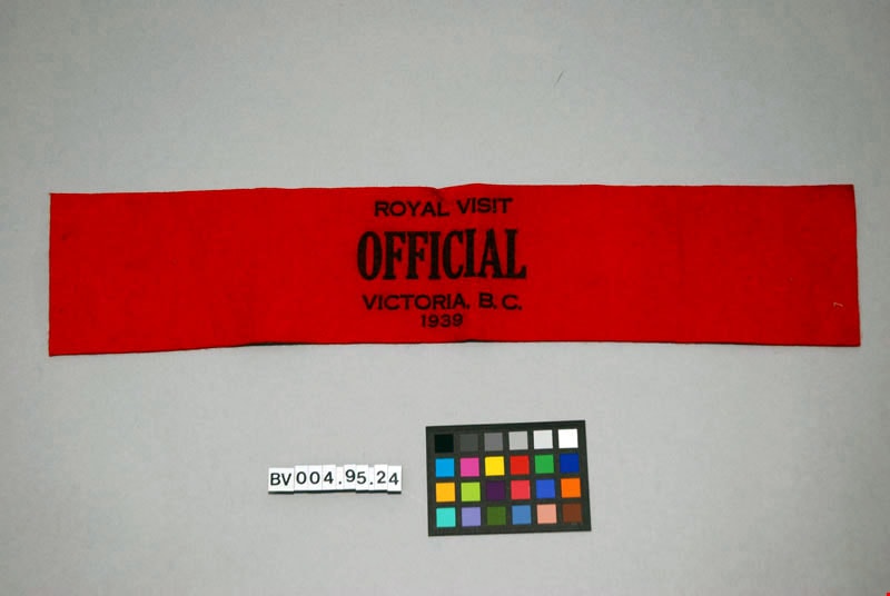
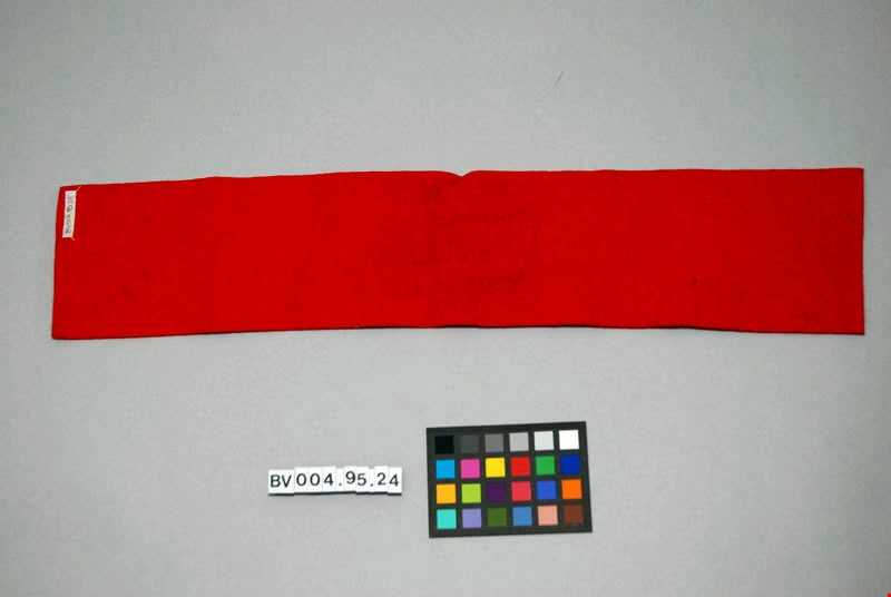
https://search.heritageburnaby.ca/link/museumartifact47615
- Repository
- Burnaby Village Museum
- Accession Code
- BV004.95.24
- Description
- Armband, felt, red. Stamped "Royal Visit Official Victoria, B.C .1939" in black.
- Object History
- 1939 was the first tour of Canada by a reigning monarch. King George VI and his consort, Queen Elizabeth, travelled across the country from coast-to-coast.
- Marks/Labels
- "Royal Visit, Official, Victoria, B.C., 1939" stamped in black on the red felt.
- Colour
- Red
Images

armband
https://search.heritageburnaby.ca/link/museumartifact87424
- Repository
- Burnaby Village Museum
- Accession Code
- BV015.35.44
- Description
- armband, Guides and Rangers; blue felt armband with a gold trefoil with "CGG" on it above a banner with text in gold reading "NATIONAL SERVICE”.
- Reference
- http://www.girlguides.ca/WEB/Documents/ON/Girl%20Program%20Resources/Pins%20and%20Badges%20Other.pdf
- Category
- 03. Personal Artifacts
- Classification
- Clothing - - Clothing Accessories
- Personal Symbols
- Subjects
- Organizations - Girls' Societies and Clubs
- Personal Symbols
- Clothing - Accessory
- Clothing - Uniforms
- Names
- Girl Guides of Canada
Images
armband
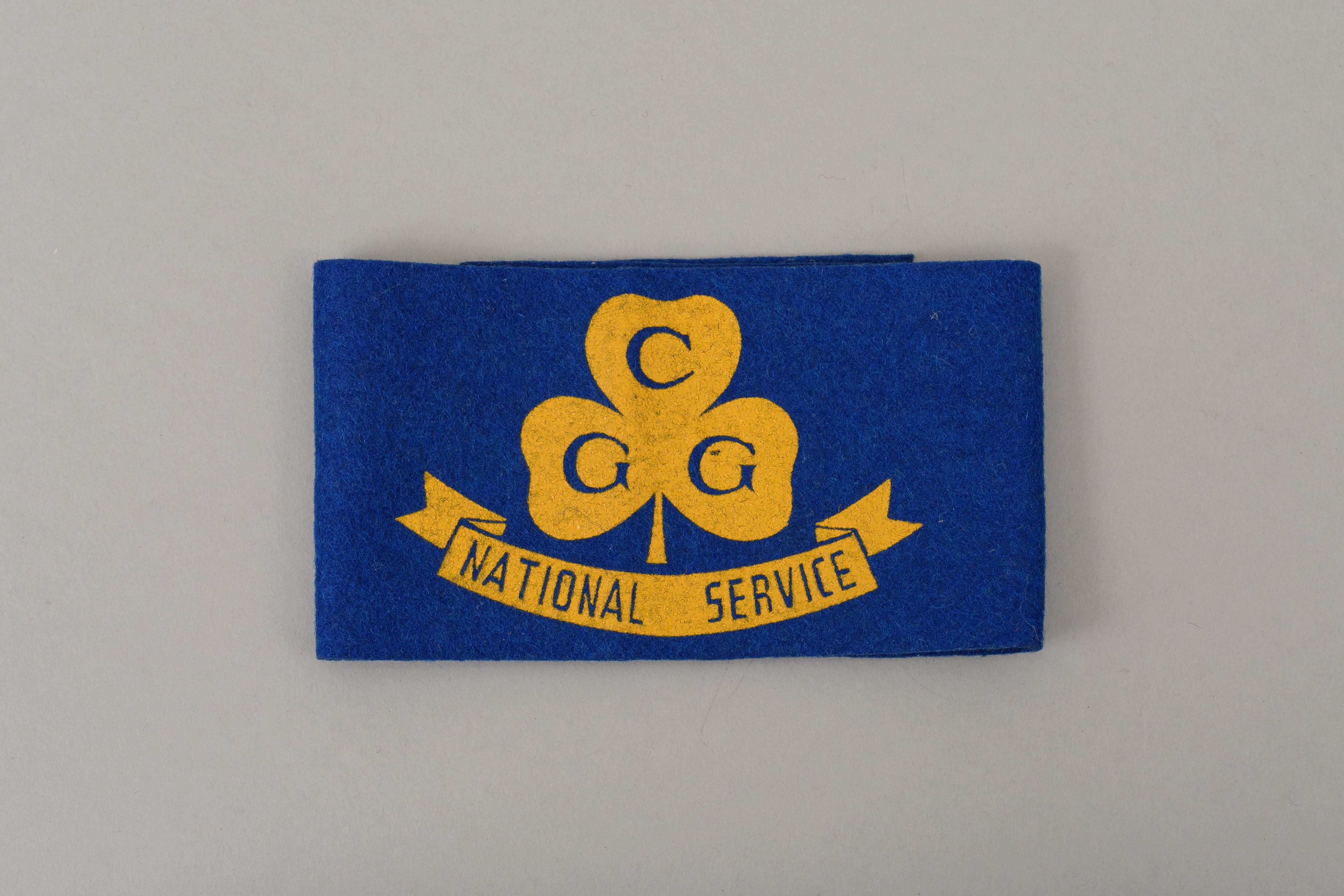
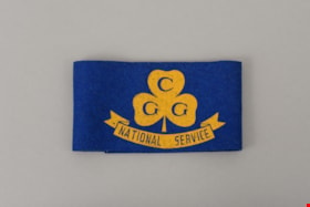
https://search.heritageburnaby.ca/link/museumartifact87425
- Repository
- Burnaby Village Museum
- Accession Code
- BV015.35.45
- Description
- armband, Guides and Rangers; blue felt armband with a gold trefoil with "CGG" on it above a banner with text in gold reading "NATIONAL SERVICE”.
- Reference
- http://www.girlguides.ca/WEB/Documents/ON/Girl%20Program%20Resources/Pins%20and%20Badges%20Other.pdf
- Category
- 03. Personal Artifacts
- Classification
- Clothing - - Clothing Accessories
- Personal Symbols
- Subjects
- Organizations - Girls' Societies and Clubs
- Personal Symbols
- Clothing - Accessory
- Clothing - Uniforms
- Names
- Girl Guides of Canada
Images

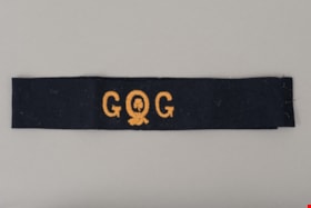
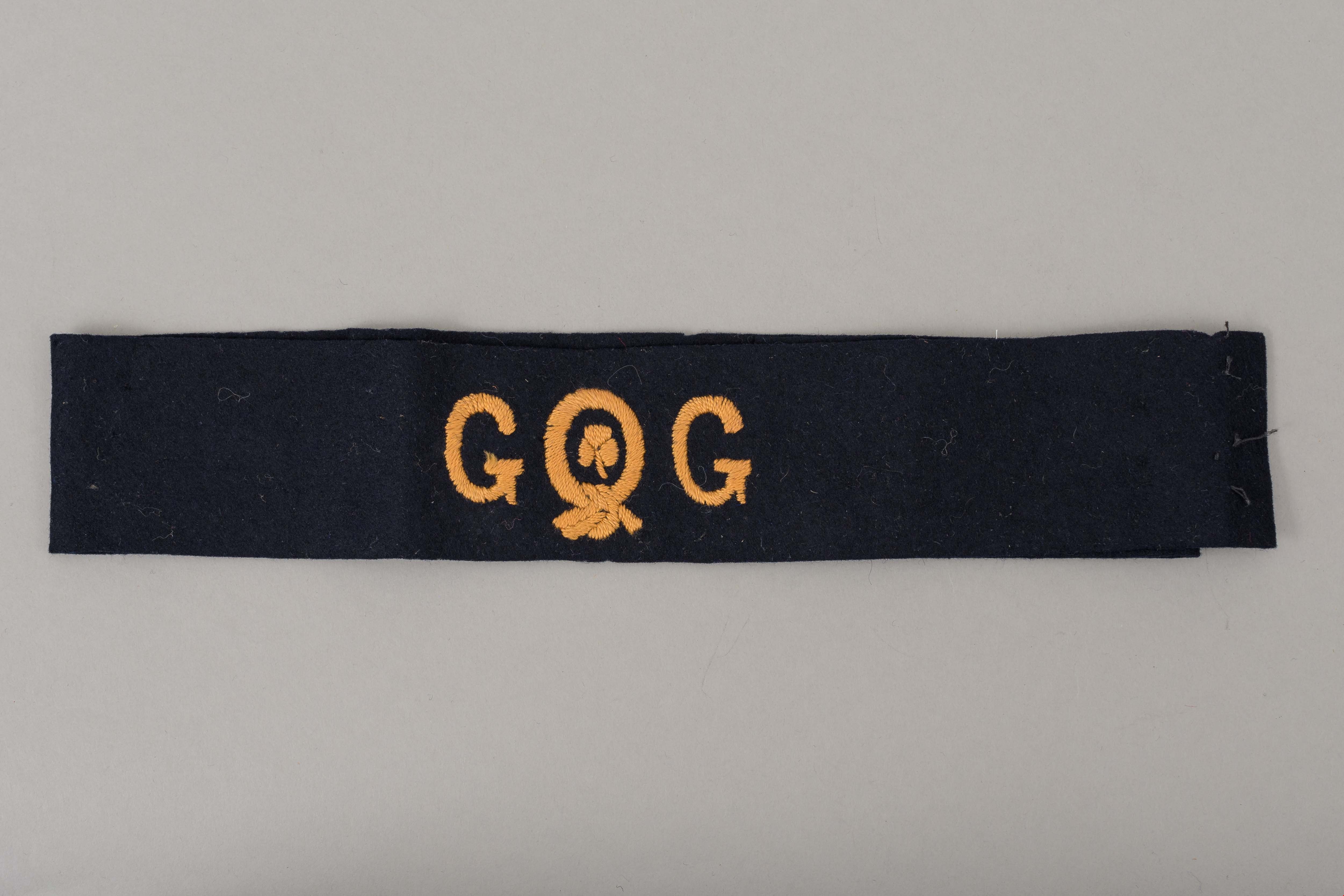
armband
https://search.heritageburnaby.ca/link/museumartifact87426
- Repository
- Burnaby Village Museum
- Accession Code
- BV015.35.46
- Description
- armband, Girl Guides; black felt armband with a gold trefoil with "G" "G" on either side of a gold ribbon of courage with a reef knot at bottom and a trefoil in the center.
- Reference
- http://www.girlguides.ca/WEB/Documents/ON/Girl%20Program%20Resources/Pins%20and%20Badges%20Other.pdf
- Category
- 03. Personal Artifacts
- Classification
- Clothing - - Clothing Accessories
- Personal Symbols
- Subjects
- Organizations - Girls' Societies and Clubs
- Personal Symbols
- Clothing - Accessory
- Clothing - Uniforms
- Names
- Girl Guides of Canada
Images

Armstrong Elementary School
https://search.heritageburnaby.ca/link/landmark762
- Repository
- Burnaby Heritage Planning
- Geographic Access
- Armstrong Avenue
- Associated Dates
- 1911
- Heritage Value
- The site for the Armstrong Avenue school was cleared in 1911. In 1955 the original structure was replaced by a new building and additions were constructed in 1962, 1964, 1967 and 1969. Armstrong Avenue was named after J.C. Armstrong, an early property owner of Burnaby who was involved in the effort to make Burnaby a municipality in 1892.
- Historic Neighbourhood
- East Burnaby (Historic Neighbourhood)
- Planning Study Area
- Cariboo-Armstrong Area
- Street Address
- 8757 Armstrong Avenue
- Street View URL
- Google Maps Street View
Images


Arrow Neon Sign
https://search.heritageburnaby.ca/link/landmark861
- Repository
- Burnaby Heritage Planning
- Description
- Commercial building.
- Associated Dates
- 1961
- Other Names
- Lost in the 50's Drive-in
- Street View URL
- Google Maps Street View
- Repository
- Burnaby Heritage Planning
- Other Names
- Lost in the 50's Drive-in
- Geographic Access
- Edmonds Street
- Associated Dates
- 1961
- Description
- Commercial building.
- Heritage Value
- The Arrow Neon Sign was built in 1961 by the Neonette Sign Company of New Westminster when this property was opened as the Tomahawk Drive-in Restaurant. The restaurant was later known as Lindy's Burger and in 1990, the business was renamed Lost in the 50's Drive-in. It stands 20-foot tall and is composed of a large double-sided hollow steel panel serpentine arrow mounted on a pole supporting a lexan sign panel measuring approximately 8 feet wide by 4 feet tall. The sign was designed with three illuminated features: a round lamp at the top of the pole, a double-sided rectangular fluorescent sign panel box, and two double-sided rows of orange neon arrows that follow the large serpentine arrow. The Arrow Neon Sign remains as a rare surviving example of neon sign art in the city and is the only historic neon sign in South Burnaby. The sign has gained prominence over the years as it has been associated with this small iconic drive-in which has also been utilized as a set for film production. Additionally, the drive-in has played a prominent role in the Edmonds community as a popular setting for recent "Show and Shine" participants to park their classic cars.
- Locality
- Edmonds
- Historic Neighbourhood
- East Burnaby (Historic Neighbourhood)
- Planning Study Area
- Lakeview-Mayfield Area
- Builder
- Neonette Sign Company
- Community
- Burnaby
- Contributing Resource
- Structure
- Ownership
- Public (local)
- Street Address
- 7741 Edmonds Street
- Street View URL
- Google Maps Street View
Images


Arthur Long Residence
https://search.heritageburnaby.ca/link/landmark560
- Repository
- Burnaby Heritage Planning
- Description
- Residential building.
- Associated Dates
- 1912
- Street View URL
- Google Maps Street View
- Repository
- Burnaby Heritage Planning
- Geographic Access
- Stanley Street
- Associated Dates
- 1912
- Description
- Residential building.
- Heritage Value
- Arthur Long, of the Water Rights Office of Victoria, purchased this land from neighbour Henry Ramsay, and built this beautiful Arts and Crafts styled home. The house appears to have many similarities to the neighbouring Ramsay House, which was designed by Vancouver architect R. Mackay Fripp. The house has retained its original complex gabled roof, triangular eave brackets and horizontal siding.
- Locality
- Burnaby Lake
- Historic Neighbourhood
- Burnaby Lake (Historic Neighbourhood)
- Planning Study Area
- Lakeview-Mayfield Area
- Ownership
- Private
- Street Address
- 7828 Stanley Street
- Street View URL
- Google Maps Street View
Images


artist proof
https://search.heritageburnaby.ca/link/museumartifact90264
- Repository
- Burnaby Village Museum
- Accession Code
- BV020.4.14
- Description
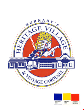
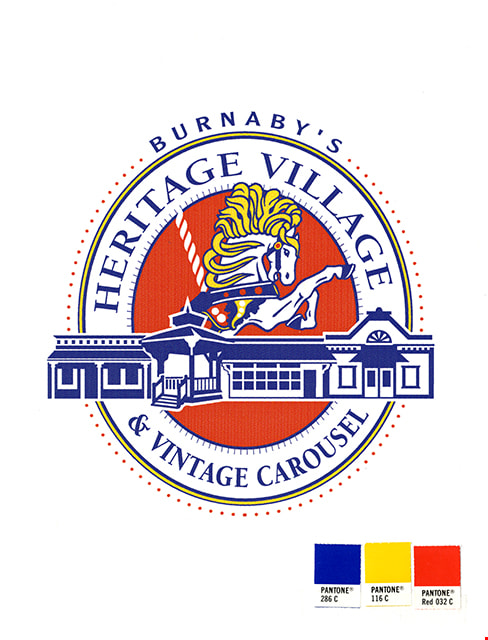
- artist proof; marketing material; thick, white board with logo of Heritage Village printed on it; sheet of heavy-weight grey paper secured at top of board with masking tape and folded down over image on board to protect it; oval logo in blue, yellow, and red ink; illustrations of selected Village buildings and Parker Carousel Horse No. 1; text in blue reads: "BURNABY'S / HERITAGE VILLAGE / & VINTAGE CAROUSEL"; colour sample squares adhered to board beneath logo: PANTONE 286 C (blue), PANTONE 116 C (yellow), and PANTONE Red 032 C (red).
- Object History
- Item was created as promotional material for Burnaby Village Museum and came from the Marketing Office.
- Category
- 08. Communication Artifacts
- Classification
- Documentary Artifacts - - Other Documents
- Object Term
- Draft
- Colour
- White
- Blue
- Red
- Yellow
- Measurements
- L: 27.2 cm W: 21.0 cm
- Country Made
- Canada
- Subjects
- Documentary Artifacts
- Names
- Burnaby Village Museum
Images
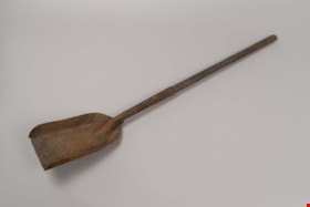
ash shovel
https://search.heritageburnaby.ca/link/museumartifact24617
- Repository
- Burnaby Village Museum
- Accession Code
- HV975.5.1113
- Description
- Stove shovel; wooden handle
- Object History
- Contents of Chinese Herbalist Store "Way Sang Yuen Wat Kee & Co.", Victoria B.C.
Images


ash shovel
https://search.heritageburnaby.ca/link/museumartifact24618
- Repository
- Burnaby Village Museum
- Accession Code
- HV975.5.1114
- Description
- Stove shovel; no handle
- Object History
- Contents of Chinese Herbalist Store "Way Sang Yuen Wat Kee & Co.", Victoria B.C.
Images
atomizer bulb set with box
https://search.heritageburnaby.ca/link/museumartifact20898
- Repository
- Burnaby Village Museum
- Accession Code
- HV976.14.49
- Description
- Black rubber atomizer bulb with rectangular maroon-coloured cardboard box. Box has flap closures at both ends with identical commercial paper labels indicating contents as: "De Vilbiss / No. 1 / [graphic of product] / THE DeVILBISS MFG. CO., LIMITED / WINDSOR, ONTARIO / Bulb Set". One of the lid labels has "LM/50" written in pencil on the left-hand side.
- Classification
- Chemical T&E
- Marks/Labels
- Lids on both ends have identical commercial paper label indicating contents as "De Vilbiss / No. 1 / [graphic of product] / THE DeVILBISS MFG. CO., LIMITED / WINDSOR, ONTARIO / Bulb Set". One of the lid labels has "LM/50" written in pencil on the left-hand side.
- Measurements
- Atomizer; bulb only: 7.5 cm length x 4.5 cm diameter Total Atomizer length, including hose 16.5 cm Box: 5 cm width x 16.5 cm length
- Country Made
- Canada
- Province Made
- British Columbia
- Site/City Made
- Windsor

Aubrey Elementary School
https://search.heritageburnaby.ca/link/landmark785
- Repository
- Burnaby Heritage Planning
- Geographic Access
- Stratford Avenue
- Associated Dates
- 1959
- Heritage Value
- Aubrey Avenue School was built in 1959 to help alleviate the increased enrolment at other North Burnaby schools due to the development of new subdivisions such as Brentwood, Capitol Hill and Westridge. Additions to the original structure were made in 1962, 1963, 1964, 1967 and 1972.
- Planning Study Area
- Parkcrest-Aubrey Area
- Street Address
- 1075 Stratford Avenue
- Street View URL
- Google Maps Street View
Images

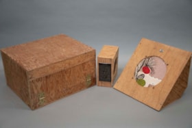
audio amplification set
https://search.heritageburnaby.ca/link/museumartifact91427
- Repository
- Burnaby Village Museum
- Accession Code
- BV021.22.1
- Description
- A large box containing a audio-amp, a wooden triangular prism with a decorative round speaker, and six smaller rectangular boxes. All are made of a light wood, and have different functions.
- Object History
- This audio-amplifier set was used by Mr. Edward A. Fountain, who was appointed as Civil Defense Coordinator on May 5th, 1952. He also built the wooden boxes which contain each part of the set. The Burnaby Civil Defense Department was established in order to disseminate information guiding the public on how to react in response to the impending threat of nuclear war and Russian bombers. In the early 1950’s, this education centered primarily on evacuation, as members of the public were expected to prepare and essentially fend for themselves in the event of a nuclear attack. These pieces of audio technology are believed to have been used at Civil Defense rallies in Burnaby, which Edward Fountain would have been involved in as the department director. According to Burnaby City Council meeting records, music and defense operation demonstrations were commonplace at such rallies, and are examples of what this set was used for.
- Classification
- Telecommunication T&E - - Telecommunication Devices
- Object Term
- Radio
- Colour
- Brown
- Country Made
- Canada
- Province Made
- British Columbia
- Site/City Made
- Burnaby
- Subjects
- Communication Artifacts
- Names
- Fountain, Edward
- Geographic Access
- Burnaby Lake
- Planning Study Area
- Windsor Area
Images
autograph book
https://search.heritageburnaby.ca/link/museumartifact7129
- Repository
- Burnaby Village Museum
- Accession Code
- BV985.407.6
- Description
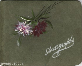
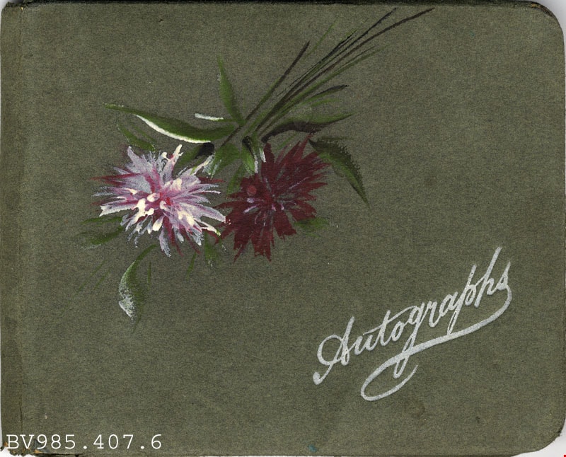
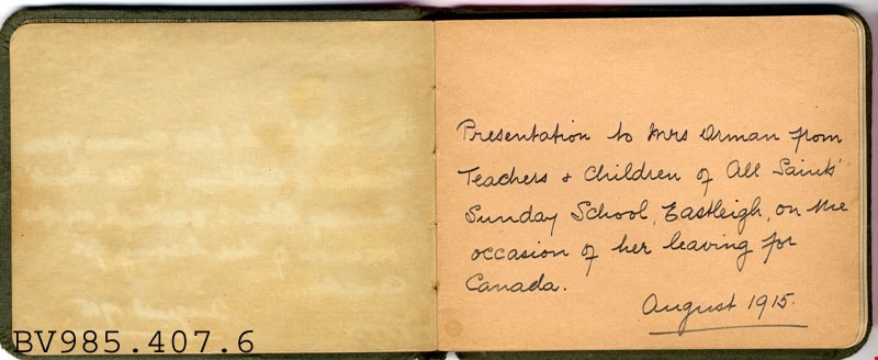
- Autograph Book - Booklet -- [1915]. Autograph book produced by Rose & Co at 44 Above Bar, Southhampton. The book was a gift to Mrs. Orman from the Teachers and Children of All Saints Sunday School, Eastleigh, Southhampton, upon her departure to Canada. The first four pages lists all the teachers and children's names. The front cover of the book is green with two painted purple flowers and "Autographs" embossed in white on the bottom right.
- Object History
- This accession appears to be connected to the Orman family. Ada Leila Orman was born June 2, 1901 in Eastleigh, Hampshire, England. According to the 1915 Census, the Orman family came to Canada in 1911 and settled in Calgary. Father Willoughby Henry Orman is listed there as working as a C.P.R. foreman, while mother Daisy Marie (Harklett) Orman worked at home. Older sister Daisy Hilda (Targett) Orman, worked as a stenographer. At five years old Leila began a long fight with a crippling type of rheumatoid arthritis. By the time she was thirteen, she experienced completely ankylosed joints. Her family travelled all over hoping to find a cure, but to no avail. While living in Calgary, Leila developed an interest in painting, knitting, and composing her own poems. She began writing news articles for the Calgary Daily Herald in the 1930s, and her first sonnet published was in that paper on August 28, 1934. She had a strong interest in the arts, often writing about music and the visual arts. While living in Calgary, she became a member of the Business and Professional Women’s Club as well as a member of the Canadian Author’s Association. Three members of the family moved to B.C. when Willoughby retired, ca. 1938. In the 1940 BC Directory, the family are listed as living at 407 Campbell Street, Burnaby. Willoughby died in Burnaby in 1945. Daisy Marie died in 1955 after living 15 years in Burnaby. Her address at the time of her death is listed as 407 Rosewood Avenue, Burnaby. Leila was living with her at that time. Older sister Daisy Hilda married Edgar Harold Targett in 1922. They moved to B.C. from Alberta some years after the other three members of the family (ca. 1962). Daisy Hilda died in 1972. Her address at the time of her death was 7969 Rosewood Avenue, Burnaby. Leila wrote on a typewriter with two sticks to type out the letters. She was an avid reader and was able to turn the pages with a special stick with elastic bands wound around the ends. Canadian novelist Maida Parlow French became her lifelong friend and encouraged her to write her own autobiography - unfortunately it was never finished. Leila wrote “The Giving Heart” in October of 1948. By 1952, she was writing a column for the British Columbia Saturday Magazine entitled “Across the Board” with the intention of inspiring other “incapacitated folk” to live up to their full potential, “If [she] could reach a few people, and encourage them to reach up and out, [she] should feel the effort well worthwhile.” A member of the St. Alban’s Prayer Healing Fellowship group, Leila wrote the “Christian Manifesto for World Peace” in 1963. The Prayer Group met twice monthly at one of the members’ homes and undertook to pray daily for the sick and for world peace. After Leila’s mother died in 1955, Leila’s friend Jeanie Brown kept house for her and was her constant companion. Jeanie Brown and Leila lived together for over thirteen years until an accident sent Leila to hospital and later to nursing home where she died on February 16, 1976.
Images
autograph book
https://search.heritageburnaby.ca/link/museumartifact18282
- Repository
- Burnaby Village Museum
- Accession Code
- HV978.57.26
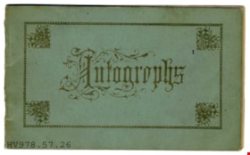
- Description
- Autographs - Booklet -- [1915]. Small blue book for autographs that belonged to Norah Byrne. There are signatures dating from 1915 to 1932.
- Object History
- From the estate of Norah Byrne, daughter of Peter Byrne and Priscilla Amelia Rowling Rowling. She married William Napoleon Descoteau on May 28th 1924 in New Westminster. William worked as a steam engineer on the railroad.
Images
