Narrow Results By
Format
- Architectural Drawing 14
- Book 119
- Bylaws - Adopted 828
- Bylaws - Other 1
- Bylaws - Repealed 206
- Cartographic Material 34
- Council - Committee Report 1863
- Council - Manager's Report 864
- Council - Mayor/Councillor/Staff Report 3955
- Council - Public Hearing Minutes 37
- Council - Regular Council Minutes 477
- Graphic Material 15
Decade
- 2020s 2376
- 2010s 6261
- 2000s 9727
- 1990s 13489
- 1980s 12563
- 1970s 18309
- 1960s 12797
- 1950s
- 1940s 7154
- 1930s 7853
- 1920s 11900
- 1910s 8561
- 1900s 4174
- 1890s 1860
- 1880s 298
- 1870s 125
- 1860s 176
- 1850s 45
- 1840s 24
- 1830s 14
- 1820s 11
- 1810s 8
- 1800s 11
- 1790s 6
- 1780s 5
- 1770s 5
- 1760s 5
- 1750s 5
- 1740s 5
- 1730s 5
- 1720s 5
- 1710s 7
- 1700s 6
- 1690s 5
- 1680s 6
- 1670s 4
- 1660s 4
- 1650s 4
- 1640s 4
- 1630s 4
- 1620s 4
- 1610s 4
- 1600s 4
- 1590s 1
- 1580s 1
- 1570s 1
- 1560s 1
- 1550s 1
- 1540s 1
- 1530s 1
- 1520s 2
- 1510s 1
- 1500s 1
- 1490s 1
- 1480s 1
Subject
- Accidents - Automobile Accidents 2
- Adornment - Jewelry 2
- Advertising Medium 2
- Advertising Medium - Signs and Signboards 12
- Aerial Photographs 18
- Agricultural Tools and Equipment 3
- Agriculture 5
- Agriculture - Crops 2
- Agriculture - Farms 37
- Agriculture - Fruit and Berries 4
- Agriculture - Poultry 1
- Animals 1
Burnaby Winter Club
https://search.heritageburnaby.ca/link/landmark816
- Repository
- Burnaby Heritage Planning
- Geographic Access
- Canada Way
- Associated Dates
- 1956
- Heritage Value
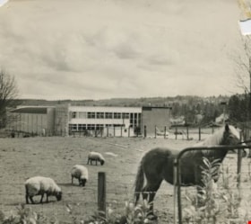
- Skating on Deer Lake and Burnaby Lake was the inspiration to form the Burnaby Winter Club in the 1950s. In 1958, the volunteer group opened an indoor ice facility, still operating today at 4990 Canada Way. Originally, the facility boasted 8 sheets of curling ice, that were used to capacity by the more than 500 family and individual members in the heyday of the Club. The Winter Club was a social centre: in addition to curling, it was a popular place for banquets and dances, and a place for families to spend time together. In the 1960s, the eight sheets of curling ice were reduced to five, to make room for a sheet of hockey ice for the members’ children. Volunteer coaches were committed to excellence, and the Club produced many professional hockey players. By 1964, the Club’s first future NHL player was playing: Pee Wee player Jack McIlhargey.
- Historic Neighbourhood
- Burnaby Lake (Historic Neighbourhood)
- Planning Study Area
- Douglas-Gilpin Area
- Street Address
- 4990 Canada Way
- Street View URL
- Google Maps Street View
Images
Burquitlam Neighbourhood
https://search.heritageburnaby.ca/link/landmark703
- Repository
- Burnaby Heritage Planning
- Associated Dates
- 1925-1954
- Heritage Value
- By the 1950s, the Burquitlam Neighbourhood was becoming a residential and commercial centre for the northeast section of Burnaby. The Sullivan Heights area was developed as a single-family residential area with the Lyndhurst School opening in 1954. The completion of the Lougheed Highway in 1953 encouraged more commercial and retail development and fostered the growth of the neighbourhood throughout this period.
- Historic Neighbourhood
- Burquitlam (Historic Neighbourhood)
- Planning Study Area
- Lyndhurst Area
Images
Cameron Neighbourhood
https://search.heritageburnaby.ca/link/landmark824
- Repository
- Burnaby Heritage Planning
- Associated Dates
- 1955-2008
- Heritage Value
- The Cameron Neighbourhood falls within the Lougheed Town Centre area - one of four Town Centres in Burnaby. The Cameron Neighbourhood - while containing significant high-density residential components - is also home to the Town Centre's office and commercial core. The Lougheed Mall is situated in this neighbourhood, which is served by the Millennium Line SkyTrain.
- Historic Neighbourhood
- Burquitlam (Historic Neighbourhood)
- Planning Study Area
- Cameron Area
Images
Capitol Hill Neighbourhood
https://search.heritageburnaby.ca/link/landmark667
- Repository
- Burnaby Heritage Planning
- Associated Dates
- 1925-1954
- Heritage Value
- Although the Hastings street-car extension to Ellesmere opened in 1913 and there had been much speculation in the area during the real estate boom of 1909-1913, development in Capitol Hill did not really take off until after World War One when workers in Vancouver started to look to Burnaby for affordable but centrally-located neighbourhoods in which to build their homes. The 1913 one-room school had to be replaced in 1923 and in 1948, members of the community came together to build a new Community Hall.
- Historic Neighbourhood
- Capitol Hill (Historic Neighbourhood)
- Planning Study Area
- Capitol Hill Area
Images
Capitol Hill Neighbourhood
https://search.heritageburnaby.ca/link/landmark781
- Repository
- Burnaby Heritage Planning
- Associated Dates
- 1955-2008
- Heritage Value
- The Capitol Hill Neighbourhood remained a primarily residential neighbourhood after the population boom of the 1950s and 1960s. The commercial focus remained the Hastings Street corridor, while the City of Burnaby moved to protect a conservation area on the north side of Capitol Hill and dedicated parkland throughout the 1970s and 1980s.
- Historic Neighbourhood
- Capitol Hill (Historic Neighbourhood)
- Planning Study Area
- Capitol Hill Area
Images
Cariboo-Armstrong Neighbourhood
https://search.heritageburnaby.ca/link/landmark825
- Repository
- Burnaby Heritage Planning
- Associated Dates
- 1955-2008
- Heritage Value
- The Cariboo-Armstrong Neighbourhood was mainly subdivided in the 1950s during the major building boom in Burnaby throughout the post-war years. Considered a primarily residential area, the neighbourhood has quick and convenient access to major highways and roads as well as being bordered to the north by the George Derby Conservation area.
- Historic Neighbourhood
- East Burnaby (Historic Neighbourhood)
- Planning Study Area
- Cariboo-Armstrong Area
Images
Cascade Heights School
https://search.heritageburnaby.ca/link/landmark691
- Repository
- Burnaby Heritage Planning
- Geographic Access
- Smith Avenue
- Associated Dates
- 1953
- Heritage Value
- Among the first new elementary schools to be built during the post-World War Two housing boom in Burnaby, Cascade Heights opened in 1953. Additions to the school were made in 1954, 1963 and 1969.
- Planning Study Area
- Cascade-Schou Area
- Street Address
- 4343 Smith Avenue
- Street View URL
- Google Maps Street View
Images
Cascade-Schou Neighbourhood
https://search.heritageburnaby.ca/link/landmark798
- Repository
- Burnaby Heritage Planning
- Associated Dates
- 1955-2008
- Heritage Value
- The Cascade-Schou neighbourhood, sometimes referred to as the Cascade Heights area, includes both the Burnaby General Hospital site, the Discovery Park facilities and is bordered on its eastern boundary by BCIT. Despite these health and science developments, the neighbourhood can still be considered to be a residential community. The housing stock includes single family homes as well as newer multi-family residences that developed throughout the 1980s and 1990s.
- Historic Neighbourhood
- Broadview (Historic Neighbourhood)
- Planning Study Area
- Cascade-Schou Area
Images
Central Park Neighbourhood
https://search.heritageburnaby.ca/link/landmark688
- Repository
- Burnaby Heritage Planning
- Associated Dates
- 1925-1954
- Heritage Value
- Although still largely a rural area during the 1920s, subdivisions began appearing in the Central Park neighbourhood at this time. Development was slowed by the Great Depression of the 1930s but the influx of commercial buildings and new housing initiatives in the post-war boom led to a period of rapid growth especially in the Garden Village subdivision which was undertaken in 1953 with the plan to build 500 modern homes in the 140-acre site. Despite the closure of the interurban line in 1953, the neighbourhood remained an active commercial and residential centre.
- Historic Neighbourhood
- Central Park (Historic Neighbourhood)
- Planning Study Area
- Maywood Area
Images
Clinton-Glenwood Neighbourhood
https://search.heritageburnaby.ca/link/landmark841
- Repository
- Burnaby Heritage Planning
- Associated Dates
- 1955-2008
- Heritage Value
- The primarily single-family subdivision and development in the Clinton-Glenwood Neighbourhood occurred during the building boom of the 1950s. Later development fell under the guidelines established in the Royal Oak Community Plan (adopted in 1999) and resulted in an increase in the number of multi-family units.
- Historic Neighbourhood
- Alta Vista (Historic Neighbourhood)
- Planning Study Area
- Clinton-Glenwood Area
Images
Crabtown
https://search.heritageburnaby.ca/link/landmark674
- Repository
- Burnaby Heritage Planning
- Associated Dates
- 1912-1957
- Heritage Value
- North Burnaby's waterfront was the location of a unique squatter's community known as Crabtown. Although its origins are obscure, it is believed that the first shacks were built before 1912. When the depression of 1913-1917 began, the shacks became permanent homes for impoverished workers. During the Great Depression of the 1930s, the community grew larger. Crabtown was not a slum, but a neighbourhood - the community even rallied together to build a water supply system and trails up the steep bluff with steps and banisters so children could go to school safely. In 1957, the National Harbours Board decided that Crabtown was encroaching on Federal property and evicted all 130 residents. Within a few months, residents were relocated and 114 homes were levelled.
- Historic Neighbourhood
- Vancouver Heights (Historic Neighbourhood)
- Planning Study Area
- Burnaby Heights Area
Images
Dawson-Delta Neighbourhood
https://search.heritageburnaby.ca/link/landmark779
- Repository
- Burnaby Heritage Planning
- Associated Dates
- 1955-2008
- Heritage Value
- The Dawson-Delta neighbourhood in Burnaby developed into one of Burnaby's numerous industrial areas after 1955. The Eastbrook Executive Business Park opened in the 1970s and the Willingdon Green Business Centre includes buildings from the 1980s to the 2000s. Convenient access to major roads and highways fostered these developments which remain zoned for industrial uses to this day.
- Planning Study Area
- Dawson-Delta Area
Images
Douglas-Gilpin Neighbourhood
https://search.heritageburnaby.ca/link/landmark799
- Repository
- Burnaby Heritage Planning
- Associated Dates
- 1955-2008
- Heritage Value
- The Douglas-Gilpin Neighbourhood developed into a diverse area incorporating residential, business, educational and park districts in the period after 1955. The BCIT site was built in the early 1960s, shortly after the Burnaby Municipal Hall was located on Canada Way near Deer Lake in 1956. The construction of the Municipal Hall at this location fostered the creation of an administrative and business centre adjacent to the park, while the northern and central areas of the neighbourhood retained their primarily residential character.
- Historic Neighbourhood
- Burnaby Lake (Historic Neighbourhood)
- Planning Study Area
- Douglas-Gilpin Area
Images
East Burnaby Neighbourhood
https://search.heritageburnaby.ca/link/landmark712
- Repository
- Burnaby Heritage Planning
- Associated Dates
- 1925-1954
- Heritage Value
- After a lull in construction during the World War I period, East Burnaby Neighbourhood's growth resumed during the 1920s when many homes and businesses were constructed. The post-World War Two period also saw rapid construction and the creation of new housing developments in response to a population boom. The neighbourhood remained a primarily single-family residential area.
- Historic Neighbourhood
- Edmonds (Historic Neighbourhood)
- Planning Study Area
- Stride Avenue Area
Images
Edmonds Neighbourhood
https://search.heritageburnaby.ca/link/landmark704
- Repository
- Burnaby Heritage Planning
- Associated Dates
- 1925-1954
- Heritage Value
- The historic growth of Edmonds as a neighbourhood was based on its strategic location on the early interurban line between Vancouver and New Westminster. Even by 1980 when a survey of the residential neighbourhoods was conducted, a full 25% of homes in the area predated 1930. The 1950s was a period of strong housing development, with both single-family and multi-family units being constructed. Although Burnaby's City Hall was moved from Kingsway and Edmonds in the early 1950s, Edmonds remained an important centre in the community.
- Historic Neighbourhood
- Edmonds (Historic Neighbourhood)
- Planning Study Area
- Stride Avenue Area
Images
Edmonds Street Neighbourhood
https://search.heritageburnaby.ca/link/landmark827
- Repository
- Burnaby Heritage Planning
- Associated Dates
- 1955-2008
- Heritage Value
- The Edmonds Street Neighbourhood is part of the larger Edmonds Town Centre - one of four Town Centres in Burnaby. This neighbourhood is considered to be primarily residential, but a strong local commercial component developed along Edmonds and Kingsway.
- Historic Neighbourhood
- Edmonds (Historic Neighbourhood)
- Planning Study Area
- Edmonds Area
Images
Fraser Arm Neighbourhood
https://search.heritageburnaby.ca/link/landmark708
- Repository
- Burnaby Heritage Planning
- Associated Dates
- 1925-1954
- Heritage Value
- By the late 1920s, the Fraser Arm Neighbourhood in Burnaby was developing into an industrial and manufacturing district. In 1931, the Canadian National Railway built a bridge over the Fraser River from Burnaby to Lulu Island and advertised that over 30 industries were currently operating along the North Fraser. Along with industries, this district remained an important agricultural area for the Lower Mainland. Chinese market gardens continued to develop and thrive and in 1926, the Vancouver Sun estimated that that Chinese farms in the Lower Fraser Valley then supplied 90 per cent of all green vegetables consumed in the Vancouver market area.
- Historic Neighbourhood
- Fraser Arm (Historic Neighbourhood)
- Planning Study Area
- Big Bend Area
Images
Garden Village Neighbourhood
https://search.heritageburnaby.ca/link/landmark800
- Repository
- Burnaby Heritage Planning
- Associated Dates
- 1955-2008
- Heritage Value
- Bounded by Moscrop Street to the north, Kingsway and Grange to the south, Willingdon to the east and Boundary Road to the west, the Garden Village Neighbourhood is characterised as a primarily residential area that is well-served due to its proximity to commercial, park and business centres. The north-east corner of the neighbourhood is a typical 1950s subdivision of mostly single family homes located on an irregular street pattern, while the remaining areas saw some transition to multi-family housing types throughout the 1970s and up to the current time.
- Historic Neighbourhood
- Central Park (Historic Neighbourhood)
- Planning Study Area
- Garden Village Area
Images
Glenwood School
https://search.heritageburnaby.ca/link/landmark842
- Repository
- Burnaby Heritage Planning
- Geographic Access
- Marine Drive
- Associated Dates
- 1956
- Heritage Value
- Glenwood Elementary School was built in 1956 to replace Riverway East School. Additions to the school were made in 1966 and 1969. Decreasing enrolment led to the school closure by 1980, but it was re-opened 1994.
- Historic Neighbourhood
- Fraser Arm (Historic Neighbourhood)
- Planning Study Area
- Clinton-Glenwood Area
- Street Address
- 5787 Marine Drive
- Street View URL
- Google Maps Street View
Images
Government Road Neighbourhood
https://search.heritageburnaby.ca/link/landmark822
- Repository
- Burnaby Heritage Planning
- Associated Dates
- 1955-2008
- Heritage Value
- After the building boom of the 1950s, the Government Road Neighbourhood became characterised as a stable, single-family residential area. In addition to the residential component, the neighbourhood also has a significant industrial sector, along the north side of Burnaby Lake, and a commercial zone to the north along the Lougheed Highway.
- Historic Neighbourhood
- Lozells (Historic Neighbourhood)
- Planning Study Area
- Government Road Area


