Narrow Results By
Subject
- Advertising Medium - Signs and Signboards 2
- Building Components 1
- Buildings - Agricultural 4
- Buildings - Agricultural - Greenhouses 2
- Buildings - Agricultural - Stables 1
- Buildings - Civic 1
- Buildings - Civic - Community Centres 1
- Buildings - Civic - Museums 1
- Buildings - Commercial - Restaurants 1
- Buildings - Commercial - Stores 1
- Buildings - Heritage 14
- Buildings - Public - Detention Facilities 2
Person / Organization
- Allen, James Charles 1
- Army, Navy and Air Force Veterans in Canada, Pompier Unit #314 1
- Barnet Lumber Company 2
- Bateman, Edwin W. 1
- Bateman, Mary Dale 1
- Bell, Flora 1
- Bell, William 1
- Borstal School 2
- Bowman & Cullerne 1
- Bowman, Joseph Henry 1
- British Columbia Electric Railway 3
- British Columbia Electric Railway Company 1
Richard & Alice Dunn Residence
https://search.heritageburnaby.ca/link/landmark552
- Repository
- Burnaby Heritage Planning
- Description
- Residential building.
- Associated Dates
- 1939
- Street View URL
- Google Maps Street View
- Repository
- Burnaby Heritage Planning
- Geographic Access
- Jubilee Avenue
- Associated Dates
- 1939
- Description
- Residential building.
- Heritage Value
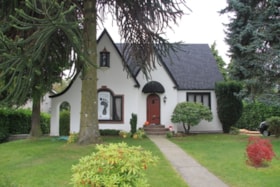
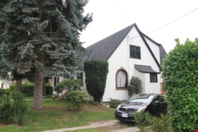
- This house was built for Richard Dunn, a police sergeant with the B.C. Police force and his wife Alice. This house is a notable example of a Storybook Cottage, dating from just prior to the outbreak of the Second World War. Modest houses of the era often assumed a cottage appearance that provided a romantic ideal of traditional domesticity. With its smooth, planar stucco, severely-clipped roof edges, round-arched door and windows, side arch with a catslide roof, cross-leaded glass and brick detailing, this house is an excellent example of this picturesque housing trend. Located on a corner lot, the house was sited at an angle. The large Chilean Pine, or monkey-puzzle tree, entrance is a remarkable specimen.
- Locality
- Alta Vista
- Historic Neighbourhood
- Alta Vista (Historic Neighbourhood)
- Planning Study Area
- Sussex-Nelson Area
- Ownership
- Private
- Street Address
- 7207 Jubilee Avenue
- Street View URL
- Google Maps Street View
Images
Richmond Park Neighbourhood
https://search.heritageburnaby.ca/link/landmark828
- Repository
- Burnaby Heritage Planning
- Associated Dates
- 1955-2008
- Heritage Value
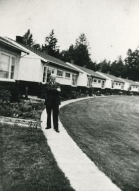
- The Richmond Park Neighbourhood is part of the larger Edmonds Town Centre - one of four official Town Centres in the City. Richmond Park contains a residential subdivision that developed during the 1950s as well as a strong commercial and retail centre along Edmonds and Kingsway.
- Historic Neighbourhood
- Edmonds (Historic Neighbourhood)
- Planning Study Area
- Richmond Park Area
Images
Riverside School
https://search.heritageburnaby.ca/link/landmark711
- Repository
- Burnaby Heritage Planning
- Geographic Access
- Marine Drive
- Associated Dates
- 1953-1983
- Heritage Value
- The south-east corner of Burnaby featured homes that were scattered in a rural setting. Previously, Riverway East and then Clinton Elementary School had served this neighbourhood, but a more central location was preferable to the School Board to limit bussing of students, so Riverside School was opened in 1953. There were 84 students registered in its first year, but by the late 1970s, enrolments across the City had declined and a number of schools, including Riverside, were closed.
- Historic Neighbourhood
- Fraser Arm (Historic Neighbourhood)
- Planning Study Area
- Big Bend Area
Images
Riverway East School (aka Dundonald School)
https://search.heritageburnaby.ca/link/landmark769
- Repository
- Burnaby Heritage Planning
- Geographic Access
- Marine Drive
- Associated Dates
- 1905
- Heritage Value
- Burnaby's fourth school was originally called Dundonald school and was opened in 1905. The building cost $600.00 to erect and was built on a small clearing of land in the middle of what was described as a dense forest. The attendance in the first year consisted of 13 children from three families: the Byrne, Woolard and Thrussell families. The school was later renamed Riverway East School and was replaced in 1953 by Glenwood Elementary School.
- Historic Neighbourhood
- Fraser Arm (Historic Neighbourhood)
- Planning Study Area
- Big Bend Area
- Street Address
- 5787 Marine Drive
- Street View URL
- Google Maps Street View
Images
Riverway West School
https://search.heritageburnaby.ca/link/landmark768
- Repository
- Burnaby Heritage Planning
- Geographic Access
- Marine Drive
- Associated Dates
- 1922
- Heritage Value
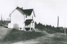
- Riverway West School was built on a slope just north of Riverway Road (Marine Drive). From 1922 until 1952, the school operated as a one-teacher school. In 1962, the original building was replaced with a larger structure but declining school enrolments in Burnaby during the 1970s brought about Riverway's closure in the early 1980s.
- Historic Neighbourhood
- Fraser Arm (Historic Neighbourhood)
- Planning Study Area
- Big Bend Area
- Street Address
- 4340 Marine Drive
- Street View URL
- Google Maps Street View
Images
R.M. Edgar House
https://search.heritageburnaby.ca/link/landmark543
- Repository
- Burnaby Heritage Planning
- Description
- The R.M. Edgar House is a particularly large wood-frame Craftsman-inspired bungalow on the south shore of Deer Lake, built as a family estate home. It has a symmetrical front elevation, a deep wrap-around verandah, and a pyramidal roof with massive dormers on each face. Set on a large lot and isola…
- Associated Dates
- 1912
- Formal Recognition
- Heritage Designation, Community Heritage Register
- Other Names
- Robert McBeth & Maude Edgar Residence
- Repository
- Burnaby Heritage Planning
- Other Names
- Robert McBeth & Maude Edgar Residence
- Geographic Access
- Deer Lake Drive
- Associated Dates
- 1912
- Formal Recognition
- Heritage Designation, Community Heritage Register
- Enactment Type
- Bylaw No. 9807
- Enactment Date
- 23/11/1992
- Description
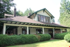
- The R.M. Edgar House is a particularly large wood-frame Craftsman-inspired bungalow on the south shore of Deer Lake, built as a family estate home. It has a symmetrical front elevation, a deep wrap-around verandah, and a pyramidal roof with massive dormers on each face. Set on a large lot and isolated from its neighbours, the house is surrounded by a manicured naturalistic landscape.
- Heritage Value
- The R.M. Edgar House represents an alternative reading of the aesthetic and lifestyle values of those who settled on these lakeside estates in the early twentieth century. By comparison with the grand mansions, set in formally landscaped gardens, on the north shore of Deer Lake, the R.M. Edgar House demonstrates a reverence for the natural, wooded environs, and a deliberate orientation near a stream running through the property. The house is important for its connection with Robert McBeth Edgar, not only a successful and wealthy businessman (partner in the real estate firm Hampton and Edgar) but also an active supporter of the Liberal party, Dominion Returning Officer for Vancouver, and Burnaby Councillor for six years; his contribution to Burnaby and British Columbia was far-reaching and significant. The house illustrates the desire for a simpler lifestyle and retreat into nature of those who settled on the south shore of Deer Lake and also this community's attraction for those of an artistic temperament. Maude Edgar was a poet and broadcaster; and the Edgar's daughter - Ann, known as 'Bebe' - was an accomplished sculptress. This was the first house built on the south shore of Deer Lake.
- Defining Elements
- Key elements that define the heritage character of the R.M. Edgar House include its: - overall bungalow massing and its location facing Deer Lake and backing onto a wilderness of Douglas Fir and moss-covered rocks, with a stream running through the site - remnants of the original landscaping such as the box hedge, rockeries and granite retaining walls - the surrounding naturalistic landscape augmented by ornamental cedars, maples, and rhododendrons - square floor plan with a deep enclosed verandah under a prominent broad hipped roof - symmetrical gable dormers - internal brick chimneys, including one at the centre peak of the roof - Craftsman-influenced exterior with such characteristics as: woodwork brackets on the square verandah pillars; deep overhanging roof eaves; and exposed rafter tails - multiple-assembly 12-paned casement wooden-sash windows in the dormers with 6-paned transoms - rustic Arts and Crafts interior with such items as Douglas fir paneling and large granite fireplace in the Drawing Room
- Locality
- Deer Lake Park
- Historic Neighbourhood
- Burnaby Lake (Historic Neighbourhood)
- Planning Study Area
- Morley-Buckingham Area
- Function
- Primary Current--Single Dwelling
- Primary Historic--Estate
- Community
- Burnaby
- Cadastral Identifier
- P.I.D. No. 001-178-024 and P.I.D. No. 001-178-016 Legal Description: Parcel 'D' (Explanatory Plan 4272) District Lot 85, Group 1, New Westminster District and Parcel 'W' (Explanatory Plan 255) District Lot 85, Group 1, New Westminster District
- Boundaries
- The R.M. Edgar House is comprised of a single municipally-owned property located at 6450 Deer Lake Drive, Burnaby.
- Area
- 11,661.30
- Contributing Resource
- Building
- Landscape Feature
- Ownership
- Public (local)
- Documentation
- Heritage Site Files: PC77000 20. City of Burnaby Planning and Building Department, 4949 Canada Way, Burnaby, B.C., V5G 1M2
- Street Address
- 6450 Deer Lake Drive
Images
Robert & Mary B. McLennan House
https://search.heritageburnaby.ca/link/landmark634
- Repository
- Burnaby Heritage Planning
- Description
- Residential building.
- Associated Dates
- 1911
- Street View URL
- Google Maps Street View
- Repository
- Burnaby Heritage Planning
- Geographic Access
- Yale Street
- Associated Dates
- 1911
- Description
- Residential building.
- Heritage Value
- Robert McLennan was the vice-president of the prominent Vancouver hardware firm of McLennan, McFeely & Company, popularly known as Mc.& Mc. Born in Pictou, Nova Scotia in 1861, Robert McLennan entered the hardware business at age fifteen. The West was an irresistible lure, and after he moved to Victoria in 1884, he took on a friend, Edward J. McFeely, as a business partner. Their business was a success and they soon opened a branch in the rapidly-developing new city of Vancouver. In 1898, Robert went to Dawson, where he opened a branch operation and served as mayor for one year in 1903. He returned to Vancouver in 1904, and as the business expanded, E.G. Prior was taken on as partner. In addition to his business pursuits, the public-spirited McLennan served on many boards and committees. In 1887, Robert returned to Nova Scotia where he married Bessie Archibald McKenzie. They had nine children, one of whom was born in Dawson. Robert died in 1927, and Bessie died in 1941. This grand residence was one of the first to be built in the Vancouver Heights subdivision, and its spectacular location retains panoramic views of Burrard Inlet and the North Shore. This house was undoubtedly designed by a local architect as it is an excellent example of the British Arts and Crafts style, with a shingled exterior, half-timbered gables and prominent brick chimneys. Although the west verandah has been enclosed and the windows altered, the house has been well maintained. Although owned by the McLennans, it may have been an investment property, as they lived for many years at a Vancouver address. In 1926, the house was sold to Vancouver Medical Health Officer, F.T. Underhill.
- Locality
- Vancouver Heights
- Historic Neighbourhood
- Vancouver Heights (Historic Neighbourhood)
- Planning Study Area
- Burnaby Heights Area
- Area
- 576.00
- Contributing Resource
- Building
- Ownership
- Private
- Street Address
- 3789 Yale Street
- Street View URL
- Google Maps Street View
Images
Rosalie (Moore) Barrett Residence
https://search.heritageburnaby.ca/link/landmark498
- Repository
- Burnaby Heritage Planning
- Description
- The Rosalie (Moore) Barrett Residence is a one-storey ranch-style bungalow with a cross-gabled roofline, located on Sperling Avenue. It is located within the Deer Lake Park Heritage Precinct, and is adjacent to a related house, the Ethel Moore Residence, built the previous year.
- Associated Dates
- 1942
- Street View URL
- Google Maps Street View
- Repository
- Burnaby Heritage Planning
- Geographic Access
- Sperling Avenue
- Associated Dates
- 1942
- Description
- The Rosalie (Moore) Barrett Residence is a one-storey ranch-style bungalow with a cross-gabled roofline, located on Sperling Avenue. It is located within the Deer Lake Park Heritage Precinct, and is adjacent to a related house, the Ethel Moore Residence, built the previous year.
- Heritage Value
- This house is significant for its connection with first owner, Rosalie Barrett, the daughter of Ethel Hutchings Moore, who lived in the adjacent house at 5145 Sperling Avenue. A spacious modernist bungalow, it was constructed in 1942, and was designed by Rosalie Moore herself. Moore intended to build several houses on this property, but further development was curtailed due to wartime restrictions on domestic construction. The Rosalie (Moore) Barrett Residence is a testament to Deer Lake's continued popularity as a residential neighbourhood in the 1940s. Although Burnaby was serviced by a number of transportation links at the time, the increasing availability of automobiles provided improved access to outlying suburbs. Rising real estate prices in Vancouver and New Westminster attracted residents to this neighbourhood because of its relative affordability, central location and beautiful scenery.
- Defining Elements
- Key elements that define the heritage character of the Rosalie (Moore) Barrett Residence include its: - location within the Deer Lake Park Heritage Precinct - residential form, scale and massing as expressed by its one-storey height, rambling linear plan and cross-gabled roof - wood-frame construction with stucco siding and waney-edged boards in the gable peaks - red brick on the front façade and rough-cut granite at the base of the house - Modernist design as exemplified by the asymmetrical, linear plan with low pitched roof - internal granite chimney - original windows, including wooden-sash casement windows in double and triple-assembly with four-part, horizontal leading - original front door with glass block sidelights - associated landscape features such as granite gateposts, foundation plantings and mature coniferous trees
- Historic Neighbourhood
- Burnaby Lake (Historic Neighbourhood)
- Planning Study Area
- Morley-Buckingham Area
- Function
- Primary Historic--Single Dwelling
- Primary Current--Single Dwelling
- Community
- Deer Lake
- Cadastral Identifier
- P.I.D.006-082-696
- Boundaries
- The Rosalie (Moore) Barrett Residence is comprised of a single residential lot located at 5155 Sperling Avenue, Burnaby.
- Area
- 11291.44
- Contributing Resource
- Building
- Ownership
- Public (local)
- Documentation
- City of Burnaby Planning and Building Department, Heritage Site Files
- Street Address
- 5155 Sperling Avenue
- Street View URL
- Google Maps Street View
Images
Rosser Elementary School
https://search.heritageburnaby.ca/link/landmark636
- Repository
- Burnaby Heritage Planning
- Description
- School building.
- Associated Dates
- 1923
- Other Names
- NORTH BURNABY HIGH SCHOOL
- Street View URL
- Google Maps Street View
- Repository
- Burnaby Heritage Planning
- Other Names
- NORTH BURNABY HIGH SCHOOL
- Geographic Access
- Pandora Street
- Associated Dates
- 1923
- Description
- School building.
- Heritage Value
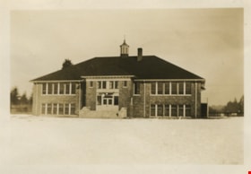
- Originally built as North Burnaby High School, this eight-room school became Rosser Avenue School in 1945. It has been altered with replacement windows, the application of stucco over the original siding and an addition, but has retained its historical form, including a hipped roof with half-timbered gables and a domed roof ventilator. The Rosser Elementary School was designed by the architectural firm of Bowman & Cullerne, who specialized in school design. The firm’s projects include Seaforth School (1922, now relocated to Burnaby Village Museum), Windsor Street School (1923), and Nelson Avenue School (1927).
- Locality
- Vancouver Heights
- Historic Neighbourhood
- Vancouver Heights (Historic Neighbourhood)
- Planning Study Area
- Burnaby Heights Area
- Architect
- Bowman and Cullerne
- Area
- 10579.94
- Contributing Resource
- Building
- Street Address
- 4375 Pandora Street
- Street View URL
- Google Maps Street View
Images
Royal Oak Hotel
https://search.heritageburnaby.ca/link/landmark726
- Repository
- Burnaby Heritage Planning
- Geographic Access
- Kingsway
- Associated Dates
- 1891
- Heritage Value
- One of the most notorious landmarks in Burnaby was the Royal Oak Hotel, constructed around 1891 at the present-day northeast corner of Kingsway and Royal Oak. Levis Morrison built the hotel, then sold out to Charles Cridland, whose poor hotel reputation prompted Burnaby council to hire its second police constable. The hotel continued to operate until 1973 when it was demolished to build a Safeway store.
- Historic Neighbourhood
- Central Park (Historic Neighbourhood)
- Planning Study Area
- Marlborough Area
- Street View URL
- Google Maps Street View
Images
Roy & Catherine Cummins House
https://search.heritageburnaby.ca/link/landmark506
- Repository
- Burnaby Heritage Planning
- Description
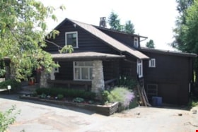
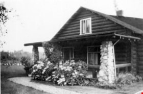
- Located on Rumble Street in the Alta Vista neighbourhood, the Roy and Catherine Cummins House is a one and one-half storey, front-gabled rustic Arts and Crafts house, distinguished by the use of log construction and fieldstone verandah columns.
- Associated Dates
- 1912
- Formal Recognition
- Heritage Designation, Community Heritage Register
- Street View URL
- Google Maps Street View
- Repository
- Burnaby Heritage Planning
- Geographic Access
- Rumble Street
- Associated Dates
- 1912
- Formal Recognition
- Heritage Designation, Community Heritage Register
- Enactment Type
- By-law No. 11959
- Enactment Date
- 17/10/2005
- Description
- Located on Rumble Street in the Alta Vista neighbourhood, the Roy and Catherine Cummins House is a one and one-half storey, front-gabled rustic Arts and Crafts house, distinguished by the use of log construction and fieldstone verandah columns.
- Heritage Value
- The Roy and Catherine Cummins House is valued for its association with the early settlement of Burnaby. Its construction is linked to the opening of the Burnaby Lake Interurban line, which ran through the central part of Burnaby, providing access between Vancouver and New Westminster. The accessibility of the area, combined with spectacular views of the Fraser River, made Alta Vista a desirable Edwardian era middle-class neighbourhood. The house was built in 1912 for Roy Franklin Cummins and his wife, Catherine Emma Cummins (née Cook), shortly after their marriage. Roy Cummins was a lineman with the B.C. Electric Railway Company, an economic driving force in Burnaby. The Roy and Catherine Cummins House is a unique and sophisticated local example of a rustic Arts and Crafts structure. Roy Cummins constructed the house from logs cleared for the construction of Rumble Street; the house is also unique for its use of local fieldstone for its verandah columns and chimney. Reminiscent of park lodge architecture, it exemplifies the semi-wild nature of the area as it was being opened for subdivision. It is also an indication of how far Burnaby was removed from the more urban lifestyles and attitudes of Vancouver and New Westminster.
- Defining Elements
- Key elements that define the heritage character of the Roy and Catherine Cummins House include its: - location on a steeply sloping site in the Alta Vista neighbourhood of Burnaby - residential form, scale and massing as expressed by its one and one-half storey height plus full basement, front-gabled roof and shed dormer, full open front verandah and partial rear verandah - peeled log construction including notched corner posts, log verandah roof framing and log balustrades - masonry elements including fieldstone verandah columns and internal chimney, and board-formed concrete foundations with fieldstone aggregate - rustic Arts and Crafts features such as the use of natural materials, tapered columns, front door with sidelights and exposed eave purlins - original windows, including wooden sash casement windows in multiple assembly with continuous transoms - interior features including fir-panelled walls, wooden mouldings and fieldstone fireplace - associated landscape features including terraced stone walls
- Historic Neighbourhood
- Alta Vista (Historic Neighbourhood)
- Planning Study Area
- Sussex-Nelson Area
- Function
- Primary Historic--Single Dwelling
- Primary Current--Single Dwelling
- Community
- Alta Vista
- Cadastral Identifier
- P.I.D.026-635-534
- Boundaries
- The Roy and Catherine Cummins House is comprised of a single residential lot located at 4156 Rumble Street, Burnaby.
- Area
- 718
- Contributing Resource
- Building
- Ownership
- Private
- Documentation
- City of Burnaby Planning and Building Department, Heritage Site Files
- Street Address
- 4156 Rumble Street
- Street View URL
- Google Maps Street View
Images
Russian Submarines at Barnet
https://search.heritageburnaby.ca/link/landmark748
- Repository
- Burnaby Heritage Planning
- Associated Dates
- 1915-1917
- Heritage Value
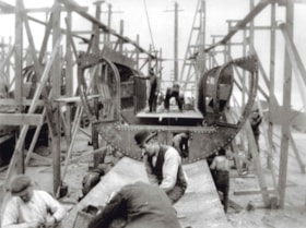
- This site was a top secret site where 460 men worked on the assembly of five submarines for the Russian Navy during World War I. The Seattle contractor was forbidden from doing the work in the US because of American neutrality regulations and he set up the secret plant here without the knowledge of the Canadian Government.
- Historic Neighbourhood
- Barnet (Historic Neighbourhood)
- Planning Study Area
- Burnaby Mountain Area
Images
Schou Street School
https://search.heritageburnaby.ca/link/landmark637
- Repository
- Burnaby Heritage Planning
- Description
- School building.
- Associated Dates
- 1914
- Street View URL
- Google Maps Street View
- Repository
- Burnaby Heritage Planning
- Geographic Access
- Norfolk Street
- Associated Dates
- 1914
- Description
- School building.
- Heritage Value
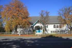
- This school was built to replace tents and temporary buildings that had previously been used for the local children of the Broadview neighbourhood. The site was donated to the School Board in 1911 by the real estate firm of Leibly & Blumer in anticipation of increased settlement in the district. The school was named after the street, which had been named after Nicolai Schou, Burnaby’s second Reeve. Originally designed in the Arts and Crafts style, the character of the school was altered in 1964 when its original siding was covered in stucco and the windows were replaced, but has retained its original form and massing, including its front gabled entrance with recessed doorway and twinned square columns. Of special note is the name of the school above the front entry.This school was designed by Joseph H. Bowman (1864-1943), a specialist in school buildings, who was retained as the school board architect for South Vancouver and Burnaby. One of his first designs for Burnaby was a utilitarian two-storey school that could be built with two classrooms and later expanded to eight rooms as the district’s school population grew; five schools from this design were built in 1908, and then four others in modified versions between 1910-16, including this school.
- Locality
- Broadview
- Historic Neighbourhood
- Broadview (Historic Neighbourhood)
- Planning Study Area
- Cascade-Schou Area
- Architect
- Joseph H. Bowman
- Area
- 7660.46
- Contributing Resource
- Building
- Street Address
- 4054 Norfolk Street
- Street View URL
- Google Maps Street View
Images
Seaforth Schoolhouse
https://search.heritageburnaby.ca/link/landmark541
- Repository
- Burnaby Heritage Planning
- Description
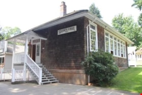
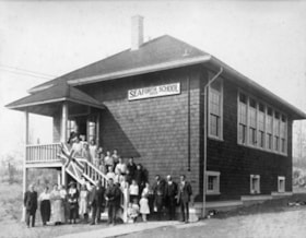
- The Seaforth Schoolhouse is a one-storey wood-frame rectangular plan building with a projecting entry porch, located in the Burnaby Village Museum.
- Associated Dates
- 1922
- Formal Recognition
- Heritage Designation, Community Heritage Register
- Repository
- Burnaby Heritage Planning
- Geographic Access
- Deer Lake Avenue
- Associated Dates
- 1922
- Formal Recognition
- Heritage Designation, Community Heritage Register
- Enactment Type
- Bylaw No. 8148
- Enactment Date
- 03/01/1984
- Description
- The Seaforth Schoolhouse is a one-storey wood-frame rectangular plan building with a projecting entry porch, located in the Burnaby Village Museum.
- Heritage Value
- The heritage value of the Seaforth Schoolhouse lies in its representation of a one-room school once located in one of the city’s rural districts. The school was constructed due to the demand of increasing population after the First World War, in what was then known as the Lozells District, so isolated at the time that parents were concerned about the danger to their children from wild bears and cougars that roamed the area. The school was named after its sponsor, the Seaforth Chapter of the Imperial Order of Daughters of the Empire. Bowman and Cullerne, the architects for the Burnaby School Board, designed the one room schoolhouse. It was constructed by local contractor, Alphonse J. Toebaert, following the standards of British Columbia public school architecture, which specified the plan and orientation of the building. It indicates the values and the design control of school boards of the time, and the central role of the provincial government in setting educational standards. The heritage value of this school also lies in its interpretive value within the Burnaby Village Museum. The site is an important cultural feature for the interpretation of Burnaby’s heritage to the public, illustrating the changes in the local school system over time. The school was moved to Burnaby Village Museum in 1983, and was opened to the public after extensive restoration in 1987. Both the interior and exterior have been restored and interpreted to the date of original construction. The North Vancouver School Board donated most of the early desks, and the remainder of the interior artifacts are from the museum’s own collection.
- Defining Elements
- Key elements that define the heritage character of the Seaforth Schoolhouse include its: - rectangular plan - hipped roof with cedar shingle cladding - hipped-roof entry porch - typical school fenestration of the era, with a bank of double-hung 6-over-6 wooden-sash windows on one facade - cedar shingle cladding - original and authentic interior elements such as interior mouldings, blackboards and desks
- Locality
- Deer Lake Park
- Historic Neighbourhood
- Burnaby Lake (Historic Neighbourhood)
- Planning Study Area
- Morley-Buckingham Area
- Organization
- Seaforth Chapter of the Imperial Order of Daughters of the Empire
- Burnaby School Board
- Burnaby Village Museum
- Architect
- Bowman and Cullerne
- Builder
- Alphonse J. Toebaert
- Function
- Primary Historic--One-Room School
- Primary Current--Museum
- Community
- Burnaby
- Cadastral Identifier
- P.I.D. No. 011-030-356 Legal Description: Parcel 1, District Lot 79 and District Lot 85, Group 1, New Westminster District, Reference Plan 77594
- Boundaries
- Burnaby Village Museum is comprised of a single municipally-owned property located at 6501 Deer Lake Avenue, Burnaby.
- Area
- 38,488.63
- Contributing Resource
- Building
- Landscape Feature
- Structure
- Ownership
- Public (local)
- Documentation
- Heritage Site Files: PC77000 20. City of Burnaby Planning and Building Department, 4949 Canada Way, Burnaby, B.C., V5G 1M2
- Street Address
- 6501 Deer Lake Avenue
Images
Second Street Neighbourhood
https://search.heritageburnaby.ca/link/landmark826
- Repository
- Burnaby Heritage Planning
- Associated Dates
- 1955-2008
- Heritage Value
- Second Street had its origins in the 1910-1920 era and the Second Street Elementary School was built in 1928. Substantial new housing was built in the late 1940s and 1950s and infilling occurred during the 1960s and 1970s. By the 1980s, the neighbourhood was primarily a single family area with a small number of multi-family buildings.
- Historic Neighbourhood
- East Burnaby (Historic Neighbourhood)
- Planning Study Area
- Second Street Area
Images
Second Street School
https://search.heritageburnaby.ca/link/landmark638
- Repository
- Burnaby Heritage Planning
- Description
- School building.
- Associated Dates
- 1928
- Street View URL
- Google Maps Street View
- Repository
- Burnaby Heritage Planning
- Geographic Access
- 2nd Street
- Associated Dates
- 1928
- Description
- School building.
- Heritage Value
- The Second Street School was originally established at this location as a two-room schoolhouse in 1913 to relieve the overcrowding of Edmonds School during the pre-First World War building boom. The old school was converted into an auditorium when this handsome school building was constructed in 1928. The new school, built by local contractors Ward-Leverington Ltd., included four classrooms, a library, a room for the principal, and a room for the teachers. The original brick façade has been retained although it has been painted; other intact original features include the bellcast octagonal roof ventilator and the protruding front entrance. The Burnaby School Board architect at this time was the talented firm of McCarter & Nairne, who also designed the Douglas Road School. John Y. McCarter (1886-1981) and George Nairne (1884-1953) formed their partnership in 1921 after serving overseas during the First World War. The partners began designing houses and small apartment buildings, and larger commissions soon followed, including Vancouver’s first skyscraper, the Marine Building (1928-30).
- Locality
- East Burnaby
- Historic Neighbourhood
- East Burnaby (Historic Neighbourhood)
- Planning Study Area
- Second Street Area
- Architect
- McCarter & Nairne
- Area
- 15777.66
- Contributing Resource
- Building
- Street Address
- 7502 2nd Street
- Street View URL
- Google Maps Street View
Images
Shadbolt Centre for the Arts
https://search.heritageburnaby.ca/link/landmark820
- Repository
- Burnaby Heritage Planning
- Geographic Access
- Deer Lake Avenue
- Associated Dates
- 1995
- Heritage Value
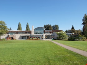
- The Shadbolt Centre for the Arts opened in 1995. The Shadbolt Centre was named after two Burnaby residents who dedicated a lifetime of support and cultivation of the arts locally, nationally and internationally. Doris and Jack Shadbolt resided in Burnaby for over 50 years until Jack's death in November 1998. Doris Shadbolt spent her life's work bringing the artist and the audience closer together through her writing and curatorial work. Jack Shadbolt was an internationally recognized Canadian painter. He was also an author and both received many awards including the Order of Canada. In keeping with the Shadbolts' generosity the arts, Jack Shadbolt donated two of his paintings to the Centre for permanent display.
- Historic Neighbourhood
- Burnaby Lake (Historic Neighbourhood)
- Planning Study Area
- Douglas-Gilpin Area
- Street Address
- 6450 Deer Lake Avenue
- Street View URL
- Google Maps Street View
Images
Shell Oil Company
https://search.heritageburnaby.ca/link/landmark675
- Repository
- Burnaby Heritage Planning
- Geographic Access
- Kensington Avenue
- Associated Dates
- ca. 1930-1993
- Heritage Value
- After considering several sites in the Greater Vancouver area, the Shell Oil Company chose 70 acres in North Burnaby with frontage of one third of a mile on Burrard Inlet. Shell proposed to build a four-million dollar plant that would employ up to 2000 - providing some relief in the middle of Burnaby's economic crisis of the Depression years. The site became known as the Shellburn Refinery and was in operation until 1993.
- Historic Neighbourhood
- Lochdale (Historic Neighbourhood)
- Planning Study Area
- Westridge Area
Images
Simon Fraser University
https://search.heritageburnaby.ca/link/landmark639
- Repository
- Burnaby Heritage Planning
- Description
- The planning, design concept, design coordination, site development and landscaping for the original part of the campus were all under the control of Erickson/Massey. The complex was conceived as one building, with future growth occurring at the periphery. Tall buildings would have been out of scal…
- Associated Dates
- 1965
- Street View URL
- Google Maps Street View
- Repository
- Burnaby Heritage Planning
- Geographic Access
- University Drive
- Associated Dates
- 1965
- Description
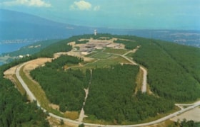
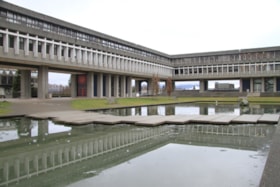
- The planning, design concept, design coordination, site development and landscaping for the original part of the campus were all under the control of Erickson/Massey. The complex was conceived as one building, with future growth occurring at the periphery. Tall buildings would have been out of scale with the massive mountaintop ridge, so a series of horizontal terraced structures were designed that hugged the ridge and dissolve into the landscape. Following the linear peak of the mountain, the scheme organized various parts of the campus along an east/west line. The concept of a central academic quadrangle was conceived within the tradition of Oxford and Cambridge, and to enhance the sense of contemplative quiet, it was designed as a perfect square raised on massive pilotis, allowing stunning views through a landscaped courtyard. The connecting link was a gigantic space frame-developed in conjunction with Jeffrey Lindsay, a one-time associate of Buckminster Fuller-that provided shelter and a gathering-place for the students. Other architects who had placed among the top five in the competition were retained to design the individual components of the original plan: the Academic Quadrangle by Zoltan S. Kiss; the Theatre, Gymnasium & Swimming Pool by Duncan McNab & Associates; the Science Complex by Rhone & Iredale; and the Library by Robert F. Harrison.
- Heritage Value
- Following the end of the Second World War, there was unprecedented growth throughout the Lower Mainland. Many returning veterans had settled on the coast, and the loosening of wartime restrictions led to the creation of many new suburban developments throughout the region. The growing population strained existing facilities, and there was a recognition that new educational facilities had to be constructed to meet these growing demands. For many years, the only university in the province was the University of British Columbia. In the 1960s, new universities were planned for both Victoria and Burnaby to serve the wave of baby boomers just then going through high school. The dramatic site chosen for the Burnaby university was the top of Burnaby Mountain, with expansive views over mountain ranges and water. An architectural competition was held for a campus of 7,000 students that could eventually be expanded to 18,000. Of the many submissions, the judges reached unanimity on the winner, an outstanding scheme submitted by the firm of Erickson/Massey. The judges went even further, and recommended that every effort be made to ensure that the winning design be built as submitted. The new Chancellor, Gordon Shrum, agreed. The realization of this scheme won extensive recognition for the work of Arthur Erickson and Geoffrey Massey, and launched Erickson’s international career. In Erickson’s words: "Unlike any previous university, Simon Fraser is a direct translation into architecture of the expanding fields of knowledge that defy traditional boundaries, of the vital role of the university as both challenger and conservor of human culture, and of the university community as one in constant intellectual, spiritual and social interchange." The new school opened for classes in September 1965, nicknamed the “instant university,” and quickly gained a radical reputation. The startling futuristic architecture and open layout suited the explosive nature of the mid-1960s, when political and social traditions of all types were being questioned and student protests were common. Many of SFU’s programs were considered experimental, even controversial, and unrest and conflict on the campus continued for a number of years. Since this auspicious beginning 40 years ago, SFU has grown to house 25,000 students on three campuses. The core of the original campus, recognized world-wide as a profound work of architecture, remains essentially intact today.
- Locality
- Burnaby Mountain
- Historic Neighbourhood
- Barnet (Historic Neighbourhood)
- Planning Study Area
- Burnaby Mountain Area
- Architect
- Erickson/Massey
- Area
- 1360000.00
- Contributing Resource
- Building
- Ownership
- Private
- Street Address
- 8888 University Drive
- Street View URL
- Google Maps Street View
Images
Simpson-Sears
https://search.heritageburnaby.ca/link/landmark696
- Repository
- Burnaby Heritage Planning
- Geographic Access
- Kingsway
- Associated Dates
- 1954
- Heritage Value
- The Simpson-Sears store on Kingsway opened in 1954 and was the second Simpson-Sears to be located in British Columbia. The store helped to solidify the neighbourhood's growing reputation as a major commercial centre in the Lower Mainland and became a prototype for the company's large format stores across Canada.
- Historic Neighbourhood
- Central Park (Historic Neighbourhood)
- Planning Study Area
- Maywood Area
- Street Address
- 4700 Kingsway
