![Shull Lumber and Shingle Company, [194-] thumbnail](/media/hpo/_Data/_Archives_Images/_Unrestricted/001/090-002.jpg?width=280)
Shull Lumber and Shingle Company
https://search.heritageburnaby.ca/link/archivedescription34675
- Repository
- City of Burnaby Archives
- Date
- [194-]
- Collection/Fonds
- Burnaby Historical Society fonds
- Description Level
- Item
- Physical Description
- 1 photograph : b&w ; 20.1 x 24.4 cm
- Scope and Content
- Photograph of the Shull Lumber and Shingle Company at the foot of Boundary Road. A log slip can be seen on the left and there are logs in the river.
- Repository
- City of Burnaby Archives
- Date
- [194-]
- Collection/Fonds
- Burnaby Historical Society fonds
- Subseries
- Photographs subseries
- Physical Description
- 1 photograph : b&w ; 20.1 x 24.4 cm
- Description Level
- Item
- Record No.
- 090-002
- Access Restriction
- No restrictions
- Reproduction Restriction
- Reproduce for fair dealing purposes only
- Accession Number
- BHS2007-04
- Scope and Content
- Photograph of the Shull Lumber and Shingle Company at the foot of Boundary Road. A log slip can be seen on the left and there are logs in the river.
- Subjects
- Industries - Forestry
- Maunfactured Products - Logs
- Woodworking Tools and Equipment - Logging Machinery
- Industries - Logging/lumber
- Media Type
- Photograph
- Photographer
- Steffens-Colmer Limited
- Notes
- Title based on contents of photograph
- Embossed at front lower right of photograph, "Steffens-Colmer Photo"
- Stamped and annotated on back of photograph, "Steffens-Colmer Ltd. / 560 Granville Street / Vancouver, B.C. / No. 52832-8"
- Geographic Access
- Boundary Road
- Historic Neighbourhood
- Fraser Arm (Historic Neighbourhood)
- Planning Study Area
- Big Bend Area
Images
![Shull Lumber and Shingle Company, [194-] thumbnail](/media/hpo/_Data/_Archives_Images/_Unrestricted/001/090-002.jpg)
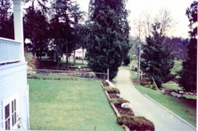
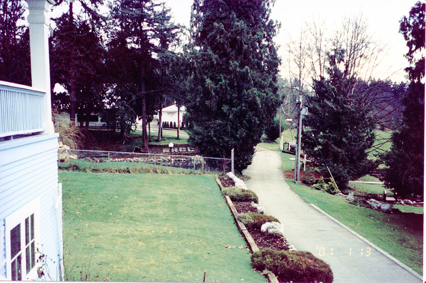
Sidewalk and grounds of New Haven
https://search.heritageburnaby.ca/link/museumdescription13543
- Repository
- Burnaby Village Museum
- Date
- Jan. 2001
- Collection/Fonds
- Burnaby Village Museum Photograph collection
- Description Level
- Item
- Physical Description
- 1 photograph : col. ; 5.3 x 10 cm
- Scope and Content
- Photograph of sidewalk, buildings and grounds of New Haven Correctional Centre. Photograph is taken looking from the main building.
- Repository
- Burnaby Village Museum
- Collection/Fonds
- Burnaby Village Museum Photograph collection
- Description Level
- Item
- Physical Description
- 1 photograph : col. ; 5.3 x 10 cm
- Scope and Content
- Photograph of sidewalk, buildings and grounds of New Haven Correctional Centre. Photograph is taken looking from the main building.
- History
- In 1937 New Haven Correctional Centre was established as the British Columbia Training School on the southeast side of Marine Drive in Burnaby (4250 Marine Drive). Sections of Sussex and Patterson Avenues bordered the estate. Originally, the facility housed nineteen inmates with two staff and was one of the first initiatives in Canada to segregate young adult inmates into a separate institution apart from adults. This was part of the Borstal system that started in England whereby young male offenders between the ages of sixteen and twenty one were trained to earn an honest living. Alterations and additions to the estate took place between December 1937 and October 1939 so that more inmates could be accomodated. Five new cottages were built that could hold up to forty people. Except for the plastering and lighting, all work on the new cottages was done by the inmates. On October 29, 1939, the Lieutenant-Governor Eric Hamber formally opened the New Haven Borstal School. World War II interrupted full development of the intstitution and it was closed in 1941 when the inmates were were conscripted into the army. Between 1941 and 1947 the Deaf and Blind Institute were housed at New Haven. In 1947, the New Haven Borstal School returned to the estate. New additions were added to old buildings and new additional buildings were erected on the site over the years including a warden's house on the east grounds and a barn and gymnasium. In the 1970s an equipment shed was added along with another dormitory and a variety of small sheds and storage buildings. The correctional centre officially closed in March 2001.
- Subjects
- Public Services - Correctional
- Geographic Access
- Marine Drive
- Street Address
- 4250 Marine Drive
- Accession Code
- BV020.5.886
- Access Restriction
- No restrictions
- Reproduction Restriction
- No known restrictions
- Date
- Jan. 2001
- Media Type
- Photograph
- Historic Neighbourhood
- Fraser Arm (Historic Neighbourhood)
- Planning Study Area
- Suncrest Area
- Scan Resolution
- 600
- Scan Date
- 25-Aug-2020
- Scale
- 100
- Notes
- Title based on contents of photograph
- Photograph processing stamp on front of photograph reads: "'01_1_13"
- Historical information based on notes from Mary Forsyth's research notes "New Haven" MSS185-018
Images
![Sidney Roofing and Paper Company, [1960] thumbnail](/media/Hpo/_Data/_Archives_Images/_Unrestricted/001/091-001.jpg?width=280)
Sidney Roofing and Paper Company
https://search.heritageburnaby.ca/link/archivedescription34676
- Repository
- City of Burnaby Archives
- Date
- [1960]
- Collection/Fonds
- Burnaby Historical Society fonds
- Description Level
- Item
- Physical Description
- 1 photograph : b&w ; 20.2 x 25.7 cm mounted on cardboard
- Scope and Content
- Aerial photograph of Sidney Roofing and Paper Company located in South Burnaby.
- Repository
- City of Burnaby Archives
- Date
- [1960]
- Collection/Fonds
- Burnaby Historical Society fonds
- Subseries
- Photographs subseries
- Physical Description
- 1 photograph : b&w ; 20.2 x 25.7 cm mounted on cardboard
- Description Level
- Item
- Record No.
- 091-001
- Access Restriction
- No restrictions
- Reproduction Restriction
- Reproduce for fair dealing purposes only
- Accession Number
- BHS2007-04
- Scope and Content
- Aerial photograph of Sidney Roofing and Paper Company located in South Burnaby.
- Subjects
- Aerial Photographs
- Buildings - Industrial
- Media Type
- Photograph
- Photographer
- Graphic Industries Limited
- Notes
- Title based on contents of photograph
- Bottom of photo has the "Sidney Products" logo and reads, "Sidney Roofing & Paper Co. Ltd."
- Printed on back of cardboard "GIL: Graphic Industries Ltd. / Vancouver's Largest Commercial Photographers / 1201 Melville St., Vancouver 1, B.C. / Phone MUtual 1-4174 File No: 4601 3"
- Annotation on back of photograph reads, "[illegible of Sid R. in Burnaby looking N/W / June 5 '58"
- Historic Neighbourhood
- Fraser Arm (Historic Neighbourhood)
- Planning Study Area
- Big Bend Area
Images
![Sidney Roofing and Paper Company, [1960] thumbnail](/media/Hpo/_Data/_Archives_Images/_Unrestricted/001/091-001.jpg)

Sidney Roofing and Paper Company
https://search.heritageburnaby.ca/link/archivedescription34677
- Repository
- City of Burnaby Archives
- Date
- November 1957
- Collection/Fonds
- Burnaby Historical Society fonds
- Description Level
- Item
- Physical Description
- 1 photograph : b&w ; 20.2 x 25.5 cm, mounted on cardboard
- Scope and Content
- Photograph of a man standing on the dock at Sidney Roofing and Paper Company, located in South Burnaby.
- Repository
- City of Burnaby Archives
- Date
- November 1957
- Collection/Fonds
- Burnaby Historical Society fonds
- Subseries
- Photographs subseries
- Physical Description
- 1 photograph : b&w ; 20.2 x 25.5 cm, mounted on cardboard
- Description Level
- Item
- Record No.
- 091-002
- Access Restriction
- No restrictions
- Reproduction Restriction
- Reproduce for fair dealing purposes only
- Accession Number
- BHS2007-04
- Scope and Content
- Photograph of a man standing on the dock at Sidney Roofing and Paper Company, located in South Burnaby.
- Media Type
- Photograph
- Photographer
- Graphic Industries Limited
- Notes
- Title based on contents of photograph
- Bottom of photo has the "Sidney Products" logo and reads, "Sidney Roofing & Paper Co. Ltd."
- Printed on back of cardboard "GIL: Graphic Industries Ltd. / Vancouver's Largest Commercial Photographers / 1201 Melville St., Vancouver 1, B.C. / Phone MUtual 1-4174 File No: 4263 2"
- Annotation on back "Nov '57"
- Historic Neighbourhood
- Fraser Arm (Historic Neighbourhood)
- Planning Study Area
- Big Bend Area
Images

![Sidney Roofing and Paper Company, [1960] thumbnail](/media/Hpo/_Data/_Archives_Images/_Unrestricted/001/091-003.jpg?width=280)
Sidney Roofing and Paper Company
https://search.heritageburnaby.ca/link/archivedescription34678
- Repository
- City of Burnaby Archives
- Date
- [1960]
- Collection/Fonds
- Burnaby Historical Society fonds
- Description Level
- Item
- Physical Description
- 1 photograph : b&w ; 20.2 x 25.5 cm
- Scope and Content
- Photograph of construction and construction workers at Sidney Roofing and Paper Company, South Burnaby.
- Repository
- City of Burnaby Archives
- Date
- [1960]
- Collection/Fonds
- Burnaby Historical Society fonds
- Subseries
- Photographs subseries
- Physical Description
- 1 photograph : b&w ; 20.2 x 25.5 cm
- Description Level
- Item
- Record No.
- 091-003
- Access Restriction
- No restrictions
- Reproduction Restriction
- Reproduce for fair dealing purposes only
- Accession Number
- BHS2007-04
- Scope and Content
- Photograph of construction and construction workers at Sidney Roofing and Paper Company, South Burnaby.
- Media Type
- Photograph
- Photographer
- Graphic Industries Limited
- Notes
- Title based on contents of photograph
- Bottom of photo has the "Sidney Products" logo and reads, "Sidney Roofing & Paper Co. Ltd."
- Stamped on back of photograph: "Photo by: Graphic Industries Ltd. / File No. 3205-1 / Vancouver, Canada / PAcific 4174"
- Historic Neighbourhood
- Fraser Arm (Historic Neighbourhood)
- Planning Study Area
- Big Bend Area
Images
![Sidney Roofing and Paper Company, [1960] thumbnail](/media/Hpo/_Data/_Archives_Images/_Unrestricted/001/091-003.jpg)
![Sidney Roofing and Paper Company, [1960] thumbnail](/media/Hpo/_Data/_Archives_Images/_Unrestricted/001/091-004.jpg?width=280)
Sidney Roofing and Paper Company
https://search.heritageburnaby.ca/link/archivedescription34679
- Repository
- City of Burnaby Archives
- Date
- [1960]
- Collection/Fonds
- Burnaby Historical Society fonds
- Description Level
- Item
- Physical Description
- 1 photograph : b&w ; 20.5 x 25.3 cm
- Scope and Content
- Aerial photograph of Sidney Roofing and Paper Company, South Burnaby.
- Repository
- City of Burnaby Archives
- Date
- [1960]
- Collection/Fonds
- Burnaby Historical Society fonds
- Subseries
- Photographs subseries
- Physical Description
- 1 photograph : b&w ; 20.5 x 25.3 cm
- Description Level
- Item
- Record No.
- 091-004
- Access Restriction
- No restrictions
- Reproduction Restriction
- Reproduce for fair dealing purposes only
- Accession Number
- BHS2007-04
- Scope and Content
- Aerial photograph of Sidney Roofing and Paper Company, South Burnaby.
- Media Type
- Photograph
- Photographer
- Graphic Industries Limited
- Notes
- Title based on contents of photograph
- Bottom of photo has the "Sidney Products" logo and reads, "Sidney Roofing & Paper Co. Ltd."
- Stamped on back of photograph: "Photo by: Graphic Industries Ltd. / File No. 3921-2 / Vancouver, Canada / PAcific 4174"
- Historic Neighbourhood
- Fraser Arm (Historic Neighbourhood)
- Planning Study Area
- Big Bend Area
Images
![Sidney Roofing and Paper Company, [1960] thumbnail](/media/Hpo/_Data/_Archives_Images/_Unrestricted/001/091-004.jpg)

Silvanovicz family
https://search.heritageburnaby.ca/link/archivedescription36850
- Repository
- City of Burnaby Archives
- Date
- 1934
- Collection/Fonds
- Burnaby Historical Society fonds
- Description Level
- Item
- Physical Description
- 1 photograph : b&w ; 9 x 13 cm print
- Scope and Content
- Photograph of the first Silvanovicz family home at 2109 Willard Street (old street numbering system). Members of the Sivanovicz family are in front, left to right: Helen (daughter), Mary (mother), and Alex (son).
- Repository
- City of Burnaby Archives
- Date
- 1934
- Collection/Fonds
- Burnaby Historical Society fonds
- Subseries
- Burnaby Centennial Anthology subseries
- Physical Description
- 1 photograph : b&w ; 9 x 13 cm print
- Description Level
- Item
- Record No.
- 315-308
- Access Restriction
- No restrictions
- Reproduction Restriction
- No known restrictions
- Accession Number
- BHS1994-04
- Scope and Content
- Photograph of the first Silvanovicz family home at 2109 Willard Street (old street numbering system). Members of the Sivanovicz family are in front, left to right: Helen (daughter), Mary (mother), and Alex (son).
- Media Type
- Photograph
- Notes
- Title based on contents of photograph
- Geographic Access
- Willard Street
- 12th Avenue
- 10th Avenue
- Historic Neighbourhood
- Fraser Arm (Historic Neighbourhood)
- Planning Study Area
- Big Bend Area
Images


South Burnaby
https://search.heritageburnaby.ca/link/archivedescription79981
- Repository
- City of Burnaby Archives
- Date
- September 10, 1976
- Collection/Fonds
- Burnaby Public Library Contemporary Visual Archive Project
- Description Level
- Item
- Physical Description
- 1 photograph : b&w ; 11 x 16 cm mounted on cardboard
- Scope and Content
- Photograph shows a view of southern Burnaby looking northeast toward the railroad tracks and Marine Drive from the southern tip of Burnaby.
- Repository
- City of Burnaby Archives
- Date
- September 10, 1976
- Collection/Fonds
- Burnaby Public Library Contemporary Visual Archive Project
- Physical Description
- 1 photograph : b&w ; 11 x 16 cm mounted on cardboard
- Description Level
- Item
- Record No.
- 556-537
- Access Restriction
- No restrictions
- Reproduction Restriction
- Reproduce for fair dealing purposes only
- Accession Number
- 2013-13
- Scope and Content
- Photograph shows a view of southern Burnaby looking northeast toward the railroad tracks and Marine Drive from the southern tip of Burnaby.
- Subjects
- Aerial Photographs
- Media Type
- Photograph
- Photographer
- Ross, Martha
- Notes
- Scope note taken directly from BPL photograph description.
- 1 b&w copy negative : 10 x 12.5 cm accompanying
- Historic Neighbourhood
- Fraser Arm (Historic Neighbourhood)
- Planning Study Area
- Big Bend Area
Images

![Sui Ha Hong ploughing fields at Hop-On Farm, [between 1975 and 1979] (date of original), copied 2017 thumbnail](/media/hpo/_Data/_BVM_Images/2017/2017_0036_0010_001.jpg?width=280)
Sui Ha Hong ploughing fields at Hop-On Farm
https://search.heritageburnaby.ca/link/museumdescription4259
- Repository
- Burnaby Village Museum
- Date
- [between 1975 and 1979] (date of original), copied 2017
- Collection/Fonds
- Burnaby Village Museum Photograph collection
- Description Level
- Item
- Physical Description
- 1 photograph : colour : copy scan
- Scope and Content
- Photograph of Sui Ha Hong on a red tractor, ploughing fields at Hop-On Farm. Sui Ha is wearing a hat and apron. Farmland and trees evident in background.
- Repository
- Burnaby Village Museum
- Collection/Fonds
- Burnaby Village Museum Photograph collection
- Description Level
- Item
- Physical Description
- 1 photograph : colour : copy scan
- Scope and Content
- Photograph of Sui Ha Hong on a red tractor, ploughing fields at Hop-On Farm. Sui Ha is wearing a hat and apron. Farmland and trees evident in background.
- History
- Josephine Hong was born to Sui Ha Hong and Chan Kow Hong. The Hong Family had seven children, oldest to youngest: Pauline, Josephine, Catherine, Norine, Gary, Darlene, and Marlene. The family runs Hop-On Farm on Marine Drive in Burnaby. Many Hong family members worked on the farm including Josephine Hong's grandfather, Gay Tim Hong, and uncles. Her great-grandfather was Sui Wing Hong
- Subjects
- Persons - Chinese Canadians
- Names
- Hop On Farms
- Hong, Sui Ha
- Geographic Access
- Byrne Road
- Accession Code
- BV017.36.10
- Access Restriction
- No restrictions
- Reproduction Restriction
- May be restricted by third party rights
- Date
- [between 1975 and 1979] (date of original), copied 2017
- Media Type
- Photograph
- Historic Neighbourhood
- Fraser Arm (Historic Neighbourhood)
- Related Material
- See Oral History Interview-BV020.6.1
- Scan Resolution
- 800
- Scan Date
- 12/3/2017
- Scale
- 100
- Notes
- Title based on contents of photograph.
Images
![Sui Ha Hong ploughing fields at Hop-On Farm, [between 1975 and 1979] (date of original), copied 2017 thumbnail](/media/hpo/_Data/_BVM_Images/2017/2017_0036_0010_001.jpg)
![Sui Ha Hong seeding fields at Hop-On Farm, [between 1975 and 1979] (date of original), copied 2017 thumbnail](/media/hpo/_Data/_BVM_Images/2017/2017_0036_0014_001.jpg?width=280)
Sui Ha Hong seeding fields at Hop-On Farm
https://search.heritageburnaby.ca/link/museumdescription4263
- Repository
- Burnaby Village Museum
- Date
- [between 1975 and 1979] (date of original), copied 2017
- Collection/Fonds
- Burnaby Village Museum Photograph collection
- Description Level
- Item
- Physical Description
- 1 photograph : colour : copy scan
- Scope and Content
- Photograph of Sui Ha Hong holding plow, seeding fields at Hop-On Farm. Wooden crates, a building and a man in background. Sui Ha Hong is wearing an apron and farm boots.
- Repository
- Burnaby Village Museum
- Collection/Fonds
- Burnaby Village Museum Photograph collection
- Description Level
- Item
- Physical Description
- 1 photograph : colour : copy scan
- Scope and Content
- Photograph of Sui Ha Hong holding plow, seeding fields at Hop-On Farm. Wooden crates, a building and a man in background. Sui Ha Hong is wearing an apron and farm boots.
- History
- Josephine Hong was born to Sui Ha Hong and Chan Kow Hong. The Hong Family had seven children, oldest to youngest: Pauline, Josephine, Catherine, Norine, Gary, Darlene, and Marlene. The family runs Hop-On Farm on Marine Drive in Burnaby. Many Hong family members worked on the farm including Josephine Hong's grandfather, Gay Tim Hong, and uncles. Her great-grandfather was Sui Wing Hong
- Subjects
- Persons - Chinese Canadians
- Names
- Hop On Farms
- Hong, Sui Ha
- Geographic Access
- Byrne Road
- Accession Code
- BV017.36.14
- Access Restriction
- No restrictions
- Reproduction Restriction
- May be restricted by third party rights
- Date
- [between 1975 and 1979] (date of original), copied 2017
- Media Type
- Photograph
- Historic Neighbourhood
- Fraser Arm (Historic Neighbourhood)
- Related Material
- See Oral History Interview-BV020.6.1
- Scan Resolution
- 800
- Scan Date
- 12/3/2017
- Scale
- 100
- Notes
- Title based on contents of photograph.
Images
![Sui Ha Hong seeding fields at Hop-On Farm, [between 1975 and 1979] (date of original), copied 2017 thumbnail](/media/hpo/_Data/_BVM_Images/2017/2017_0036_0014_001.jpg)
![Sunday School children, [193-] thumbnail](/media/hpo/_Data/_Archives_Images/_Unrestricted/251/269-015.jpg?width=280)
Sunday School children
https://search.heritageburnaby.ca/link/archivedescription53963
- Repository
- City of Burnaby Archives
- Date
- [193-]
- Collection/Fonds
- Burnaby Historical Society fonds
- Description Level
- Item
- Physical Description
- 1 photograph : b&w copy negative ; 35 mm
- Scope and Content
- Photograph of the Riverway Mission Sunday School bus parked outside of the Riverway Mission. The Sunday School children are all standing out in front of the truck, in the front yard.
- Repository
- City of Burnaby Archives
- Date
- [193-]
- Collection/Fonds
- Burnaby Historical Society fonds
- Subseries
- Kay North subseries
- Physical Description
- 1 photograph : b&w copy negative ; 35 mm
- Description Level
- Item
- Record No.
- 269-015
- Access Restriction
- No restrictions
- Reproduction Restriction
- No known restrictions
- Accession Number
- BHS1991-38
- Scope and Content
- Photograph of the Riverway Mission Sunday School bus parked outside of the Riverway Mission. The Sunday School children are all standing out in front of the truck, in the front yard.
- Subjects
- Buildings - Religious - Churches
- Media Type
- Photograph
- Notes
- Title based on contents of photograph
- Geographic Access
- Marine Drive
- Patterson Avenue
- Historic Neighbourhood
- Fraser Arm (Historic Neighbourhood)
- Planning Study Area
- Big Bend Area
Images
![Sunday School children, [193-] thumbnail](/media/hpo/_Data/_Archives_Images/_Unrestricted/251/269-015.jpg)
![Survey and Subdivision plans in New Westminster District Group 1 – Burnaby
, [1908] thumbnail](/media/hpo/_Data/_BVM_Cartographic_Material/1977/1977_0093_0004a_001.jpg?width=280)
Survey and Subdivision plans in New Westminster District Group 1 – Burnaby
https://search.heritageburnaby.ca/link/museumdescription6973
- Repository
- Burnaby Village Museum
- Date
- [1908]
- Collection/Fonds
- Burnaby Village Museum Map collection
- Description Level
- File
- Physical Description
- 10 plans : blueprint ink on paper mounted on 2 sides of cardboard ; 76 cm x 102 cm
- Scope and Content
- Item consists of a large board of four New Westminster District Gp 1 - subdivision plans mounted on one side and six New Westminster District Gp 1 - subdivision plans mounted on the other side. Side A: 1. Blueprint "Plan / of - ReSubdivision / of / Lots 1-18 inclusive / Blocks 20 and 21 / in Sub…
- Repository
- Burnaby Village Museum
- Collection/Fonds
- Burnaby Village Museum Map collection
- Description Level
- File
- Physical Description
- 10 plans : blueprint ink on paper mounted on 2 sides of cardboard ; 76 cm x 102 cm
- Material Details
- Scales [between 1:792 and 1:4752]
- Index number on edge of board reads: "4"
- Scope and Content
- Item consists of a large board of four New Westminster District Gp 1 - subdivision plans mounted on one side and six New Westminster District Gp 1 - subdivision plans mounted on the other side. Side A: 1. Blueprint "Plan / of - ReSubdivision / of / Lots 1-18 inclusive / Blocks 20 and 21 / in Subdivision / of / Lot 53 -Gr.1 / New Westminster District" / "Subdivision Lot Numbers - Shown in Red". Plan is bordered by First Street / Jorgenson's Line / Fourth Avenue and Second Street with Fifith Avenue running through the centre. There is an index in the upper right corner of the plan. Planned is signed by "Peter Byrne" and "William R. Phillips" and dated July 28, 1908. (Geographic location: Burnaby) 2. Blueprint "Plan / of Subdivision / of / Lot 159 / and a Portion of Lot 158 / Group One / New Westminster District". Plan is bordered by Lots 96 and 97; South Wilson Street; North Arm Road and Lot 160 / Power House Road (Lot 155 A). B.C.E.R. Gilley Station is identified in the upper right corner of the plan. (Geographic location: Burnaby) 3. Blueprint plan identified as "Subdvs 10, L 88 and Lot 25, G. 1" Plan identifies Cumberland Street running from top to the bottom and a Ravine running alongside with the Jensen house, stable and barn. (Geographic location: Burnaby) 4. Blueprint Plan of "Lot 153. G. 1 /New Westminster District". Plan identifies the "New Westminster & Vancouver Tramway" and the "New Westminster and Vancouver Road" running through the plan of Lot 53. (Geographic location: Burnaby) Side B: 1. Blueprint plan of "Profile on Proposed North Rd. Diversion". 2. Blueprint plan (no title) showing wood lots north of Burnaby Lake and Brunette River and west of North Road. Various lots are identified as "Heavily Timbered" (Lot 57); "Splendid Fir and Cedar / Heavy Fir etc. / Fine Cedar" (Lots 143, 148); "Rough Light Timber," (Lot 56); "Some Fir and Cedar" (Lot 40). (Geographic location: Burnaby) 3. Blueprint "Plan / of Subdivision / of a Portion / of Lot 87, Gr.1 / New Westminster District". Plan is bordered by Burnaby Lake at the top and Hastings Road / Lot 86 at the bottom and Lot 90 to the east. "Albert J. Hill B.C.LotS." Annotation in ink reads: " J.A. Brownlee, B.C.L.S. / Subdivision / Map 1494 / Bd. 248". Plan is signed by "Peter Byrne, Reeve" (Geographic location: Burnaby) 4. Blueprint plan of Subdivisions along either side of Douglas Road including Lots 117; 119; 74; 80; 79 and 77. (Geographic location: Burnaby) 5. Blueprint "Plan / of / Subdivision of / Lot 27 / in Subdivision / of / Lot 30 / Group One / New Westminster District" Plan is bordered by Lot 26, Lot 28 and Hastings Rd. Lot 27 runs north of Edmonds Street. , "Albert J. Hill, B.C.LotS." (Geographic location: Burnaby) 6. Blueprint plan identified as a "Cultivated Orchard" including the names "W. Grace" and "G. Mead" located north of the North Arm Fraser River and west of "Twentieth Street_ City Boundary". Handwritten annotation in coloured pencil reads: "Portion of Lot 172" (Geographic location: Burnaby)
- Subjects
- Geographic Features - Forests
- Geographic Access
- Cumberland Street
- North Road
- Hastings Street
- Douglas Road
- Accession Code
- HV977.93.4
- Access Restriction
- No restrictions
- Reproduction Restriction
- No known restrictions
- Date
- [1908]
- Media Type
- Cartographic Material
- Historic Neighbourhood
- Burnaby Lake (Historic Neighbourhood)
- Fraser Arm (Historic Neighbourhood)
- Planning Study Area
- Douglas-Gilpin Area
- Burnaby Lake Area
- Scan Resolution
- 300
- Scale
- 72
- Notes
- Title based on contents of file
- Scale is measured in chains. (One chain equals 792 inches)
- The term "Lot" can also refer to a "District Lot”-
Images
![Survey and Subdivision plans in New Westminster District Group 1 – Burnaby
, [1908] thumbnail](/media/hpo/_Data/_BVM_Cartographic_Material/1977/1977_0093_0004a_001.jpg)

![Survey and Subdivision plans in New Westminster District Group 1 – Burnaby, [1905-1909] thumbnail](/media/hpo/_Data/_BVM_Cartographic_Material/1977/1977_0093_0024a_001.jpg?width=280)
Survey and Subdivision plans in New Westminster District Group 1 – Burnaby
https://search.heritageburnaby.ca/link/museumdescription6993
- Repository
- Burnaby Village Museum
- Date
- [1905-1909]
- Collection/Fonds
- Burnaby Village Museum Map collection
- Description Level
- File
- Physical Description
- 11 plans : 8 plans : black ink on paper + 2 plans : graphite on paper + 1 plan : graphite and ink on paper mounted on 2 sides of cardboard 76 x 102 cm
- Scope and Content
- Item consists of a large board of seven New Westminster District subdivision plans mounted on one side and four New Westminster District subdivision plans mounted on the other side. Side A: 1. Small subdivision plan of "Lot 2, Gr.1" drawn in black ink with annotation "Now Lot 1 of Subd of Lot 2 /…
- Repository
- Burnaby Village Museum
- Collection/Fonds
- Burnaby Village Museum Map collection
- Description Level
- File
- Physical Description
- 11 plans : 8 plans : black ink on paper + 2 plans : graphite on paper + 1 plan : graphite and ink on paper mounted on 2 sides of cardboard 76 x 102 cm
- Material Details
- Scales [between 1:1200 and 1:3600]
- Index number on edge of board reads: "24"
- Scope and Content
- Item consists of a large board of seven New Westminster District subdivision plans mounted on one side and four New Westminster District subdivision plans mounted on the other side. Side A: 1. Small subdivision plan of "Lot 2, Gr.1" drawn in black ink with annotation "Now Lot 1 of Subd of Lot 2 / see Bd. 5". Plan is initialed by: "RB" [sic] (in blue pencil crayon) with "Scale 3 ch = 1 in" and signed by "Albert J. Hill / P.L.S." (in graphite). (Geographic location: Burnaby) 2. Plan of "Lot 43, G.1" north of Burnaby Lake and surrounded by Lot 59, Lot 44, Lot 42. Lot 43 identifies physical features including: " roads / beaver dam / cranberry bog / roads / large brook / cutting / spruce / cedar / vine paper and alder / cedar / light spruce". Lot 59 identifies physical features: "heavy timber / alder and cedar etc" (Geographic location: Burnaby) 3. "Plan / Shewing Subdivision of part of / Lot 156 G.1 / Burnaby / N.W.D. / BC / Scale 300 ft = 1 inch" Annotation at top of plan reads: "#1030_Deposited / in the Land Registry Office / at New Westminster BC / 24th February 1908 / C.S. Keith Dist Reg I / RB". Plan is signed by "Peter Byrne / Reeve" and "H.G. Youdall [sic] _ BCLS" (Geographic location: Burnaby) 4. "Plan / of / Subdivision of Part / Lot 25, Group 1, N.W.D. / Burnaby Municipality / Scale: 3 chains = 1 inch" (drawn in graphite). Plan is initialed by: "RB" [sic] (in blue pencil crayon) and signed by "H.N. Smith" and "1024 / Deposited 25th / Jan. 1908 / Keith" (graphite) (Geographic location: Burnaby) 5. Handrawn plan in graphite is identified as "Lots 89 & 90 Gr.1" and intialed "RB" [sic] (in blue pencil crayon) (Geographic location: Burnaby) 7. Plan of "Lot 95 Gr. 1". Plan includes a portion of District Lot 95 near the intersection of centre line of B.C.E.R. and B.C.E.Ry - Vancouver Road. Plan is stamped: "Albert J. Hill, Civil Engineer / and / Provincial Land Surveyor, / New Westminster, / B.C." and initialed by "RB" [sic] (in blue pencil crayon) (Geographic location: Burnaby) 6. "Plan of Subdivision / of Sub Lot XI, Block 11 / DL 25, Gr.1 / (Burnaby) / N.W.D. / Scale 100 feet = 1 inch". Plan is dated "May 13, 1909" and signed by "W.R. Williams / Owner _ H.M. Smith" . Plan is initialed by: "RB" [sic] (in blue pencil crayon) (Geographic location: Burnaby) Side B: 1. "Plan / of Subdivision / of / Block "F" / in the Subdivision / of / Lot 29, Group 1. / New Westminster District / Scale 2chs = 1in" . Plan is stamped: "Albert J. Hill, Civil Engineer / and / Provincial Land Surveyor, / New Westminster, / B.C.". Plan is initialed by: "RB" [sic] (in blue pencil crayon) (Geographic location: Burnaby) 2. Plan of "Portion Lot B Gr.1". Plan includes annotations in graphite reading: "See Board 52-8 & 56-53" / "Sketch / see orig. plan". Plan is stamped: "Albert J. Hill, Civil Engineer / and / Provincial Land Surveyor, / New Westminster, / B.C." and is initialed by: "RB" [sic] (in blue pencil crayon) 3. Untitled plan drawn in black ink showing the "Brunette River", the "V.W. & Y.RY" and "Gunn Road _Diversion" running through Lot 13, Lot 2 - H.Gunn, Lot 4 - A.Lewis, Lot 10 - Geo. Love and W. Leonard and Lot 40. Plan is stamped: "Albert J. Hill, Civil Engineer / and / Provincial Land Surveyor, / New Westminster, / B.C." and initialed by "RB" [sic] (in blue pencil crayon) (Geographic location: Burnaby) 4."Plan / of / a Portion of the Foreshore / of / The North Arm of the Fraser River / Fronting / A Portion of Lot 166 Gr.1 / N.W. Dist. B.C. / Scale 100' = 1 " / Soundings taken from Map of D.P.W. Surveys". Plan is initialed by: "RB" [sic] (in blue pencil crayon) and includes annotations in red ink reading: "Office Copy" / "Plotted / Dec. 9th 1908 / G.K.B." (Geographic location: Burnaby)
- Creator
- Hill, Albert James
- Smith, H. Neville
- Accession Code
- HV977.93.24
- Access Restriction
- No restrictions
- Reproduction Restriction
- No known restrictions
- Date
- [1905-1909]
- Media Type
- Cartographic Material
- Historic Neighbourhood
- Burnaby Lake (Historic Neighbourhood)
- Fraser Arm (Historic Neighbourhood)
- Planning Study Area
- Burnaby Lake Area
- Scan Resolution
- 300
- Scale
- 72
- Notes
- Title based on contents of file
- Scale is measured in chains and feet. (One chain equals 792 inches)
- The term "Lot" can also refer to a "District Lot"
Images
![Survey and Subdivision plans in New Westminster District Group 1 – Burnaby, [1905-1909] thumbnail](/media/hpo/_Data/_BVM_Cartographic_Material/1977/1977_0093_0024a_001.jpg)

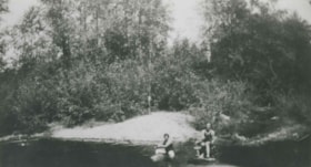
Swimming in the Fraser River
https://search.heritageburnaby.ca/link/archivedescription37075
- Repository
- City of Burnaby Archives
- Date
- 1920 (date of original), copied 1992
- Collection/Fonds
- Burnaby Historical Society fonds
- Description Level
- Item
- Physical Description
- 1 photograph : b&w ; 6.6 x 12.2 cm print
- Scope and Content
- Photograph of two people swimming in the Fraser River.
- Repository
- City of Burnaby Archives
- Date
- 1920 (date of original), copied 1992
- Collection/Fonds
- Burnaby Historical Society fonds
- Subseries
- Burnaby Centennial Anthology subseries
- Physical Description
- 1 photograph : b&w ; 6.6 x 12.2 cm print
- Description Level
- Item
- Record No.
- 315-538
- Access Restriction
- No restrictions
- Reproduction Restriction
- No known restrictions
- Accession Number
- BHS1994-04
- Scope and Content
- Photograph of two people swimming in the Fraser River.
- Media Type
- Photograph
- Notes
- Title based on contents of photograph
- Historic Neighbourhood
- Fraser Arm (Historic Neighbourhood)
- Planning Study Area
- Big Bend Area
Images

![Switching engines at BC Hydro, Trap Yard, New Westminster, [1985] thumbnail](/media/hpo/_Data/_BVM_Images/2012/2012_0018_0001_001.jpg?width=280)
Switching engines at BC Hydro, Trap Yard, New Westminster
https://search.heritageburnaby.ca/link/museumdescription2878
- Repository
- Burnaby Village Museum
- Date
- [1985]
- Collection/Fonds
- Burnaby Village Museum Photograph collection
- Description Level
- Item
- Physical Description
- 1 photograph : col. ; 20 x 20 cm
- Scope and Content
- Photograph of BC Hydro, Trap Yard, New Westminster. There appears to be six yellow Hydro switching engines on tracks in front of engine maintanence building.
- Repository
- Burnaby Village Museum
- Collection/Fonds
- Burnaby Village Museum Photograph collection
- Description Level
- Item
- Physical Description
- 1 photograph : col. ; 20 x 20 cm
- Scope and Content
- Photograph of BC Hydro, Trap Yard, New Westminster. There appears to be six yellow Hydro switching engines on tracks in front of engine maintanence building.
- Subjects
- Transportation - Locomotives
- Accession Code
- BV012.18.1
- Access Restriction
- No restrictions
- Reproduction Restriction
- No known restrictions
- Date
- [1985]
- Media Type
- Photograph
- Historic Neighbourhood
- Fraser Arm (Historic Neighbourhood)
- Planning Study Area
- Big Bend Area
- Scan Resolution
- 300
- Scan Date
- 13-Mar-2018
- Photographer
- Carson, Dwight W.
- Notes
- Title based on contents of photograph
Images
![Switching engines at BC Hydro, Trap Yard, New Westminster, [1985] thumbnail](/media/hpo/_Data/_BVM_Images/2012/2012_0018_0001_001.jpg)
![Team of horses at logging site, [1890] thumbnail](/media/hpo/_Data/_BVM_Images/1977/197701400001.jpg?width=280)
Team of horses at logging site
https://search.heritageburnaby.ca/link/museumdescription636
- Repository
- Burnaby Village Museum
- Date
- [1890]
- Collection/Fonds
- Burnaby Village Museum Photograph collection
- Description Level
- Item
- Physical Description
- 1 photograph : sepia ; 27 x 36 cm, mounted on card 27 x 36 cm
- Scope and Content
- Photograph of a team of ten equine animals reined together in pairs at a logging site at Gilley Avenue. The pair in front looks to be a mule and a draft horse while all other pairs appear to be draft horses.
- Repository
- Burnaby Village Museum
- Collection/Fonds
- Burnaby Village Museum Photograph collection
- Description Level
- Item
- Physical Description
- 1 photograph : sepia ; 27 x 36 cm, mounted on card 27 x 36 cm
- Scope and Content
- Photograph of a team of ten equine animals reined together in pairs at a logging site at Gilley Avenue. The pair in front looks to be a mule and a draft horse while all other pairs appear to be draft horses.
- Geographic Access
- Gilley Avenue
- Accession Code
- HV977.140.1
- Access Restriction
- No restrictions
- Date
- [1890]
- Media Type
- Photograph
- Historic Neighbourhood
- Fraser Arm (Historic Neighbourhood)
- Scan Resolution
- 600
- Scan Date
- 1/8/2010
- Scale
- 100
- Notes
- Title based on contents of photograph
Images
![Team of horses at logging site, [1890] thumbnail](/media/hpo/_Data/_BVM_Images/1977/197701400001.jpg)
![Team of oxen, [1888] thumbnail](/media/hpo/_Data/_BVM_Images/1977/197701400003.jpg?width=280)
Team of oxen
https://search.heritageburnaby.ca/link/museumdescription638
- Repository
- Burnaby Village Museum
- Date
- [1888]
- Collection/Fonds
- Burnaby Village Museum Photograph collection
- Description Level
- Item
- Physical Description
- 1 photograph : sepia ; 19 x 23cm, mounted on card 30 x 35 cm
- Scope and Content
- Photograph of a team of four oxen and their handler working near Kingsway on Gilley Avenue. A second lumberjack is resting on a log as the team moves past.
- Repository
- Burnaby Village Museum
- Collection/Fonds
- Burnaby Village Museum Photograph collection
- Description Level
- Item
- Physical Description
- 1 photograph : sepia ; 19 x 23cm, mounted on card 30 x 35 cm
- Scope and Content
- Photograph of a team of four oxen and their handler working near Kingsway on Gilley Avenue. A second lumberjack is resting on a log as the team moves past.
- Geographic Access
- Gilley Avenue
- Accession Code
- HV977.140.3
- Access Restriction
- No restrictions
- Date
- [1888]
- Media Type
- Photograph
- Historic Neighbourhood
- Fraser Arm (Historic Neighbourhood)
- Scan Resolution
- 600
- Scan Date
- 1/15/2010
- Scale
- 100
- Notes
- Title based on contents of photograph
- Note in pencil on verso of photograph reads: "Near Kingsway on Gilley Ave. about 1888"
Images
![Team of oxen, [1888] thumbnail](/media/hpo/_Data/_BVM_Images/1977/197701400003.jpg)
![Teresa Chan at Mandeville Gardens, [2001] thumbnail](/media/hpo/_Data/_Archives_Images/_Unrestricted/535/535-2714.jpg?width=280)
Teresa Chan at Mandeville Gardens
https://search.heritageburnaby.ca/link/archivedescription97323
- Repository
- City of Burnaby Archives
- Date
- [2001]
- Collection/Fonds
- Burnaby NewsLeader photograph collection
- Description Level
- Item
- Physical Description
- 1 photograph (tiff) : col.
- Scope and Content
- Photograph of Teresa Chan smelling a rose at the "Revelry of Roses" display at Mandeville Gardens.
- Repository
- City of Burnaby Archives
- Date
- [2001]
- Collection/Fonds
- Burnaby NewsLeader photograph collection
- Physical Description
- 1 photograph (tiff) : col.
- Description Level
- Item
- Record No.
- 535-2714
- Access Restriction
- No restrictions
- Reproduction Restriction
- No restrictions
- Accession Number
- 2018-12
- Scope and Content
- Photograph of Teresa Chan smelling a rose at the "Revelry of Roses" display at Mandeville Gardens.
- Subjects
- Plants - Flowers
- Gardens
- Media Type
- Photograph
- Photographer
- Bartel, Mario
- Notes
- Title based on caption
- Collected by editorial for use in an August 2001 issue of the Burnaby NewsLeader
- Caption from metadata: "Teresa Chan stops to smell the "April" roses at the "Revelry of Roses" display of cut blossoms at Mandeville Gardens."
- Geographic Access
- Marine Drive
- Historic Neighbourhood
- Fraser Arm (Historic Neighbourhood)
- Planning Study Area
- Big Bend Area
Images
![Teresa Chan at Mandeville Gardens, [2001] thumbnail](/media/hpo/_Data/_Archives_Images/_Unrestricted/535/535-2714.jpg)
![Thrussell barn construction, [1920] thumbnail](/media/hpo/_Data/_Archives_Images/_Unrestricted/251/275-011.jpg?width=280)
Thrussell barn construction
https://search.heritageburnaby.ca/link/archivedescription36479
- Repository
- City of Burnaby Archives
- Date
- [1920]
- Collection/Fonds
- Burnaby Historical Society fonds
- Description Level
- Item
- Physical Description
- 1 photograph : b&w ; 8.5 x 12.5 cm print
- Scope and Content
- Photograph of the construction of the new barn at the Thrussell farm.
- Repository
- City of Burnaby Archives
- Date
- [1920]
- Collection/Fonds
- Burnaby Historical Society fonds
- Subseries
- Thrussell family subseries
- Physical Description
- 1 photograph : b&w ; 8.5 x 12.5 cm print
- Description Level
- Item
- Record No.
- 275-011
- Access Restriction
- No restrictions
- Reproduction Restriction
- No known restrictions
- Accession Number
- BHS1992-05
- Scope and Content
- Photograph of the construction of the new barn at the Thrussell farm.
- Media Type
- Photograph
- Notes
- Title based on contents of photograph
- Geographic Access
- Marine Drive
- Nelson Avenue
- Historic Neighbourhood
- Fraser Arm (Historic Neighbourhood)
- Planning Study Area
- Big Bend Area
Images
![Thrussell barn construction, [1920] thumbnail](/media/hpo/_Data/_Archives_Images/_Unrestricted/251/275-011.jpg)
![Thrussell family, [1920] thumbnail](/media/hpo/_Data/_Archives_Images/_Unrestricted/251/275-012.jpg?width=280)
Thrussell family
https://search.heritageburnaby.ca/link/archivedescription36480
- Repository
- City of Burnaby Archives
- Date
- [1920]
- Collection/Fonds
- Burnaby Historical Society fonds
- Description Level
- Item
- Physical Description
- 1 photograph : b&w ; 8.5 x 12.5 cm print
- Scope and Content
- Photograph of four generations of the Thrussell family in the yard. Mary Anne Thrussell Phillips Welsh is standing, wearing a white top, Mr. Fenwick is sitting with Lawerne Phillips on his lap, and Harriett Fenwick Thrussell is standing, wearing a dark shirt and a long necklace.
- Repository
- City of Burnaby Archives
- Date
- [1920]
- Collection/Fonds
- Burnaby Historical Society fonds
- Subseries
- Thrussell family subseries
- Physical Description
- 1 photograph : b&w ; 8.5 x 12.5 cm print
- Description Level
- Item
- Record No.
- 275-012
- Access Restriction
- No restrictions
- Reproduction Restriction
- No known restrictions
- Accession Number
- BHS1992-05
- Scope and Content
- Photograph of four generations of the Thrussell family in the yard. Mary Anne Thrussell Phillips Welsh is standing, wearing a white top, Mr. Fenwick is sitting with Lawerne Phillips on his lap, and Harriett Fenwick Thrussell is standing, wearing a dark shirt and a long necklace.
- Media Type
- Photograph
- Notes
- Title based on contents of photograph
- Geographic Access
- Marine Drive
- Nelson Avenue
- Historic Neighbourhood
- Fraser Arm (Historic Neighbourhood)
- Planning Study Area
- Big Bend Area
Images
![Thrussell family, [1920] thumbnail](/media/hpo/_Data/_Archives_Images/_Unrestricted/251/275-012.jpg)