Narrow Results By
Format
- Architectural Drawing 504
- Book 344
- Bylaws - Adopted 3103
- Bylaws - Other 1
- Bylaws - Repealed 144
- Cartographic Material 14
- Council - Committee Report 2519
- Council - Manager's Report 11132
- Council - Mayor/Councillor/Staff Report 517
- Council - Public Hearing Minutes 245
- Council - Regular Council Minutes 824
- Graphic Material 18
Decade
- 2020s 2390
- 2010s 6268
- 2000s 9732
- 1990s
- 1980s
- 1970s 18316
- 1960s 12805
- 1950s 11104
- 1940s 7324
- 1930s 7949
- 1920s 12054
- 1910s 8836
- 1900s 4205
- 1890s 1863
- 1880s 301
- 1870s 128
- 1860s 179
- 1850s 45
- 1840s 24
- 1830s 14
- 1820s 11
- 1810s 8
- 1800s 11
- 1790s 6
- 1780s 5
- 1770s 5
- 1760s 5
- 1750s 5
- 1740s 5
- 1730s 5
- 1720s 5
- 1710s 7
- 1700s 6
- 1690s 5
- 1680s 6
- 1670s 4
- 1660s 4
- 1650s 4
- 1640s 4
- 1630s 4
- 1620s 4
- 1610s 4
- 1600s 4
- 1590s 1
- 1580s 1
- 1570s 1
- 1560s 1
- 1550s
- 1540s 1
- 1530s 1
- 1520s 2
- 1510s 1
- 1500s 1
- 1490s 1
- 1480s 1
Subject
- Accidents 3
- Accidents - Automobile Accidents 14
- Advertising Medium 1
- Advertising Medium - Signs and Signboards 14
- Aerial Photographs 2
- Agricultural Tools and Equipment - Gardening Equipment 1
- Agriculture 11
- Agriculture - Crops 5
- Agriculture - Farms 9
- Agriculture - Fruit and Berries 2
- Animals 32
- Animals - Bears 4
Creator
- Ackerknecht, Erwin H. (Erwin Heinz), 1906-1988 1
- Adams, Beth 1
- Adams, Beverley 1
- Adams, John, 1926-1998 1
- Adams, John D. (John Duncan), 1879- 1
- Adams, Peter 1
- Adler, Michael H. 1
- Affleck, George Allan, 1964- 1
- Alberta. Alberta Culture 1
- Alexander, Edward P. (Edward Porter), 1907-2003 1
- Alter, Ian 1
- Amazon Drygoods 1
Sussex-Nelson Neighbourhood
https://search.heritageburnaby.ca/link/landmark838
- Repository
- Burnaby Heritage Planning
- Associated Dates
- 1955-2008
- Heritage Value
- The Sussex-Nelson Neighbourhood is located just south of Metrotown and in 1980 was characterised as the most populated of all of Burnaby's Planning Study areas. The area immediately south of Metrotown was initially developed as post-war 1950s housing stock, while the sector south of Rumble was developed after the 1960s and 1970s as single-family housing.
- Historic Neighbourhood
- Alta Vista (Historic Neighbourhood)
- Planning Study Area
- Sussex-Nelson Area
Images
Suncrest Neighbourhood
https://search.heritageburnaby.ca/link/landmark839
- Repository
- Burnaby Heritage Planning
- Associated Dates
- 1955-2008
- Heritage Value
- The Suncrest Neighbourhood is a small residential area south of Burnaby's Central Park. The Ocean View Burial Park takes up a large area of land in the north-east corner of this neighbourhood and the majority of the housing was built during the 1930-1960 period.
- Historic Neighbourhood
- Alta Vista (Historic Neighbourhood)
- Planning Study Area
- Suncrest Area
Images
Big Bend Neighbourhood
https://search.heritageburnaby.ca/link/landmark840
- Repository
- Burnaby Heritage Planning
- Associated Dates
- 1955-2008
- Heritage Value
- The Big Bend Neighbourhood in Burnaby maintained its status as an important agricultural area in the City in the years following 1955 and it also solidified its role as a prime industrial and commercial district. In 1972, the Big Bend Development Plan was adopted by Council and soon thereafter, approximately 620 acres of land were incorporated into the Agricultural Land Reserve. These lands have been set aside for agricultural and limited recreation purposes. By the 2000s, 160 acres of land were considered highly productive agricultural areas, and over 400 acres of land had been secured as parkland, including the Fraser Foreshore Park. The area also developed large commercial and industrial districts including those at Marine Way/Boundary, the Glenlyon Estates, Riverfront Business Park, Burnaby Business Park, and Glenwood Industrial Estates.
- Historic Neighbourhood
- Fraser Arm (Historic Neighbourhood)
- Planning Study Area
- Big Bend Area
Images
Clinton-Glenwood Neighbourhood
https://search.heritageburnaby.ca/link/landmark841
- Repository
- Burnaby Heritage Planning
- Associated Dates
- 1955-2008
- Heritage Value
- The primarily single-family subdivision and development in the Clinton-Glenwood Neighbourhood occurred during the building boom of the 1950s. Later development fell under the guidelines established in the Royal Oak Community Plan (adopted in 1999) and resulted in an increase in the number of multi-family units.
- Historic Neighbourhood
- Alta Vista (Historic Neighbourhood)
- Planning Study Area
- Clinton-Glenwood Area
Images
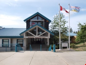
South Slope Elementary School & The B.C. Provincial School for the Deaf
https://search.heritageburnaby.ca/link/landmark843
- Repository
- Burnaby Heritage Planning
- Geographic Access
- Watling Street
- Associated Dates
- 1992
- Heritage Value
- South Slope/B.C. School for the Deaf opened in 1992 and is one of the newer elementary schools in the City. The 2009 School Growth Plan notes that South Slope/BC School for the Deaf replaced the former Jericho Hill School for the Deaf in Vancouver.
- Historic Neighbourhood
- Alta Vista (Historic Neighbourhood)
- Planning Study Area
- Sussex-Nelson Area
- Street Address
- 4446 Watling Street
- Street View URL
- Google Maps Street View
Images
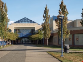
Burnaby South Secondary School and The B.C. Provincial School for the Deaf
https://search.heritageburnaby.ca/link/landmark844
- Repository
- Burnaby Heritage Planning
- Geographic Access
- Rumble Street
- Associated Dates
- 1993
- Heritage Value
- The original Burnaby South High School was replaced in 1993 and the new Burnaby South Secondary School and BC Provincial School for the Deaf was built at this location. This school was built with the latest technology and modern equipment to ensure it was fully accessible and offers integrated academic, social and recreational activities for its students.
- Historic Neighbourhood
- Alta Vista (Historic Neighbourhood)
- Planning Study Area
- Clinton-Glenwood Area
- Street Address
- 5455 Rumble Street
- Street View URL
- Google Maps Street View
Images
Stride Avenue Neighbourhood
https://search.heritageburnaby.ca/link/landmark845
- Repository
- Burnaby Heritage Planning
- Associated Dates
- 1955-2008
- Heritage Value
- The interurban link between New Westminster and Vancouver stimulated the early settlement of Stride Avenue. Infilling of the area took place in the early 1950s and the pace of development had slowed considerably by 1970. Duplexes became a popular feature in the decade between 1970 and 1980 and in the late 1980s, the neighbourhood was incorporated into the Edmonds Town Centre South plan.
- Historic Neighbourhood
- Edmonds (Historic Neighbourhood)
- Planning Study Area
- Stride Avenue Area
Images
Stride Hill Neighbourhood
https://search.heritageburnaby.ca/link/landmark846
- Repository
- Burnaby Heritage Planning
- Associated Dates
- 1955-2008
- Heritage Value
- The residential areas that are located within the Stride Hill Neighbourhood were primarily developed in the 1950s during Burnaby's post-war building boom. The area lying to the south of Byrne Creek Ravine Park was used as a municipal garbage dump until the 1960s and as a landfill site for yard waste disposal until the early 1990s at which point the area was incorporated into the Edmonds Town Centre Plan and the land was made into park and open space.
- Historic Neighbourhood
- Edmonds (Historic Neighbourhood)
- Planning Study Area
- Stride Hill Area
Images
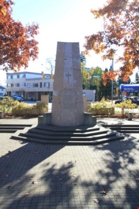
South Burnaby Cenotaph
https://search.heritageburnaby.ca/link/landmark860
- Repository
- Burnaby Heritage Planning
- Description
- The South Burnaby Cenotaph is located in Bonsor Park at the corner of Nelson Avenue and Imperial Street. The cenotaph commemorates those lost in the First World War, Second World War and the Korean War.
- Associated Dates
- 1988
- Other Names
- Bonsor Park Cenotaph
- Street View URL
- Google Maps Street View
- Repository
- Burnaby Heritage Planning
- Other Names
- Bonsor Park Cenotaph
- Geographic Access
- Nelson Avenue
- Associated Dates
- 1988
- Description
- The South Burnaby Cenotaph is located in Bonsor Park at the corner of Nelson Avenue and Imperial Street. The cenotaph commemorates those lost in the First World War, Second World War and the Korean War.
- Historic Neighbourhood
- Central Park (Historic Neighbourhood)
- Planning Study Area
- Marlborough Area
- Community
- Burnaby
- Cadastral Identifier
- P.I.D. No. 027-719-375
- Boundaries
- The property (Bonsor Park) is comprised of a single municipally-owned property located at 6749 Nelson Avenue.
- Area
- 3570.00
- Contributing Resource
- Landscape Feature
- Structure
- Ownership
- Public (local)
- Street Address
- 6749 Nelson Avenue
- Street View URL
- Google Maps Street View
Images
Letter from City of Port Moody re: Air Emission Permit for BC Hydro Burrard Thermal Plant
https://search.heritageburnaby.ca/link/councilreport15829
- Repository
- City of Burnaby Archives
- Report ID
- 10301
- Meeting Date
- 6-Jan-1986
- Format
- Council - Manager's Report
- Manager's Report No.
- 1
- Item No.
- 9
- Collection/Fonds
- City Council and Office of the City Clerk fonds
- Repository
- City of Burnaby Archives
- Report ID
- 10301
- Meeting Date
- 6-Jan-1986
- Format
- Council - Manager's Report
- Manager's Report No.
- 1
- Item No.
- 9
- Collection/Fonds
- City Council and Office of the City Clerk fonds
Documents
Endorsement of decisions taken by Council "In Camera" 1985 November 25
https://search.heritageburnaby.ca/link/councilreport15830
- Repository
- City of Burnaby Archives
- Report ID
- 10303
- Meeting Date
- 6-Jan-1986
- Format
- Council - Manager's Report
- Manager's Report No.
- 1
- Item No.
- 11
- Collection/Fonds
- City Council and Office of the City Clerk fonds
- Repository
- City of Burnaby Archives
- Report ID
- 10303
- Meeting Date
- 6-Jan-1986
- Format
- Council - Manager's Report
- Manager's Report No.
- 1
- Item No.
- 11
- Collection/Fonds
- City Council and Office of the City Clerk fonds
Documents
Proposed Bylaw to Remove Illegal Portable Signs
https://search.heritageburnaby.ca/link/councilreport15831
- Repository
- City of Burnaby Archives
- Report ID
- 10305
- Meeting Date
- 6-Jan-1986
- Format
- Council - Manager's Report
- Manager's Report No.
- 1
- Item No.
- 13
- Collection/Fonds
- City Council and Office of the City Clerk fonds
- Repository
- City of Burnaby Archives
- Report ID
- 10305
- Meeting Date
- 6-Jan-1986
- Format
- Council - Manager's Report
- Manager's Report No.
- 1
- Item No.
- 13
- Collection/Fonds
- City Council and Office of the City Clerk fonds
Documents
Delegation Appearing Before Council at its regular Meeting 1985 December 09, Spokesman Mr. Brian Prentice re: Public Transit System Design
https://search.heritageburnaby.ca/link/councilreport15832
- Repository
- City of Burnaby Archives
- Report ID
- 10306
- Meeting Date
- 6-Jan-1986
- Format
- Council - Manager's Report
- Manager's Report No.
- 1
- Item No.
- 14
- Collection/Fonds
- City Council and Office of the City Clerk fonds
- Repository
- City of Burnaby Archives
- Report ID
- 10306
- Meeting Date
- 6-Jan-1986
- Format
- Council - Manager's Report
- Manager's Report No.
- 1
- Item No.
- 14
- Collection/Fonds
- City Council and Office of the City Clerk fonds
Documents
Letter which appeared on the Agenda for the 1985 December 09 Meeting of Council re: Log Booming Operations in Burrard Inlet North of Cliff Avenue
https://search.heritageburnaby.ca/link/councilreport15833
- Repository
- City of Burnaby Archives
- Report ID
- 10307
- Meeting Date
- 6-Jan-1986
- Format
- Council - Manager's Report
- Manager's Report No.
- 1
- Item No.
- 15
- Collection/Fonds
- City Council and Office of the City Clerk fonds
- Repository
- City of Burnaby Archives
- Report ID
- 10307
- Meeting Date
- 6-Jan-1986
- Format
- Council - Manager's Report
- Manager's Report No.
- 1
- Item No.
- 15
- Collection/Fonds
- City Council and Office of the City Clerk fonds
Documents
Rezoning Reference # 82/85 - 7148 18th Avenue
https://search.heritageburnaby.ca/link/councilreport15834
- Repository
- City of Burnaby Archives
- Report ID
- 10298
- Meeting Date
- 6-Jan-1986
- Format
- Council - Manager's Report
- Manager's Report No.
- 1
- Item No.
- 6
- Collection/Fonds
- City Council and Office of the City Clerk fonds
- Repository
- City of Burnaby Archives
- Report ID
- 10298
- Meeting Date
- 6-Jan-1986
- Format
- Council - Manager's Report
- Manager's Report No.
- 1
- Item No.
- 6
- Collection/Fonds
- City Council and Office of the City Clerk fonds
Documents
Municipal Appreciation Dinner
https://search.heritageburnaby.ca/link/councilreport15835
- Repository
- City of Burnaby Archives
- Report ID
- 10290
- Meeting Date
- 6-Jan-1986
- Format
- Council - Mayor/Councillor/Staff Report
- Collection/Fonds
- City Council and Office of the City Clerk fonds
- Repository
- City of Burnaby Archives
- Report ID
- 10290
- Meeting Date
- 6-Jan-1986
- Format
- Council - Mayor/Councillor/Staff Report
- Collection/Fonds
- City Council and Office of the City Clerk fonds
Documents
Proposed Text Amendment, Burnaby Zoning Bylaw: Service Commercial District (C4) Retail Furniture Sales Establishments
https://search.heritageburnaby.ca/link/councilreport15836
- Repository
- City of Burnaby Archives
- Report ID
- 10208
- Meeting Date
- 16-Dec-1985
- Format
- Council - Manager's Report
- Manager's Report No.
- 78
- Item No.
- 20
- Collection/Fonds
- City Council and Office of the City Clerk fonds
- Repository
- City of Burnaby Archives
- Report ID
- 10208
- Meeting Date
- 16-Dec-1985
- Format
- Council - Manager's Report
- Manager's Report No.
- 78
- Item No.
- 20
- Collection/Fonds
- City Council and Office of the City Clerk fonds
Documents
Letter from Mr. Terry Gilbert re: Project No. 85-022, 1985 Local Improvement Program
https://search.heritageburnaby.ca/link/councilreport15837
- Repository
- City of Burnaby Archives
- Report ID
- 10197
- Meeting Date
- 16-Dec-1985
- Format
- Council - Manager's Report
- Manager's Report No.
- 78
- Item No.
- 9
- Collection/Fonds
- City Council and Office of the City Clerk fonds
- Repository
- City of Burnaby Archives
- Report ID
- 10197
- Meeting Date
- 16-Dec-1985
- Format
- Council - Manager's Report
- Manager's Report No.
- 78
- Item No.
- 9
- Collection/Fonds
- City Council and Office of the City Clerk fonds
Documents
Possible Future Construction of Still Creek Avenue Arterial Road Between Gilmore Avenue and Willingdon Avenue
https://search.heritageburnaby.ca/link/councilreport15838
- Repository
- City of Burnaby Archives
- Report ID
- 10199
- Meeting Date
- 16-Dec-1985
- Format
- Council - Manager's Report
- Manager's Report No.
- 78
- Item No.
- 11
- Collection/Fonds
- City Council and Office of the City Clerk fonds
- Repository
- City of Burnaby Archives
- Report ID
- 10199
- Meeting Date
- 16-Dec-1985
- Format
- Council - Manager's Report
- Manager's Report No.
- 78
- Item No.
- 11
- Collection/Fonds
- City Council and Office of the City Clerk fonds
Documents
Development of Trail Links in the Vicinity of Chevron Canada Limited, Demolition of Municipally Owned Houses 4400 Block Eton Street
https://search.heritageburnaby.ca/link/councilreport15839
- Repository
- City of Burnaby Archives
- Report ID
- 10200
- Meeting Date
- 16-Dec-1985
- Format
- Council - Manager's Report
- Manager's Report No.
- 78
- Item No.
- 12
- Collection/Fonds
- City Council and Office of the City Clerk fonds
- Repository
- City of Burnaby Archives
- Report ID
- 10200
- Meeting Date
- 16-Dec-1985
- Format
- Council - Manager's Report
- Manager's Report No.
- 78
- Item No.
- 12
- Collection/Fonds
- City Council and Office of the City Clerk fonds


