More like 'Interview with Ron Burton by Kathy Bossort November 16, 2015 - Track 3'
Narrow Results By
Subject
- Agriculture - Farms 2
- Animals - Deer 1
- Animals - Dogs 2
- Animals - Horses 1
- Animals - Oxen 1
- Buildings - Commercial 1
- Buildings - Commercial - Grocery Stores 1
- Buildings - Commercial - Train Stations 1
- Buildings - Industrial - Mills 2
- Buildings - Recreational - Bandstands 1
- Buildings - Recreational - Community Halls 1
- Buildings - Religious - Churches 1
Person / Organization
- Babey, Beverley 1
- Barnet Mill 2
- Bingham, Alfred "Alf" 1
- Bird, Gloriana "Birdie" 3
- Bossort, Kathy 2
- British Columbia Electric Railway Company 1
- Brownlee, James Harrison 1
- Burnaby Central Secondary School 1
- Burnaby Mountain Centennial Park 2
- Burnaby Mountain Centennial Rose Garden 1
- Burnaby Mountain Conservation Area 2
- Canada Way Food Market 1
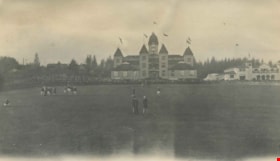
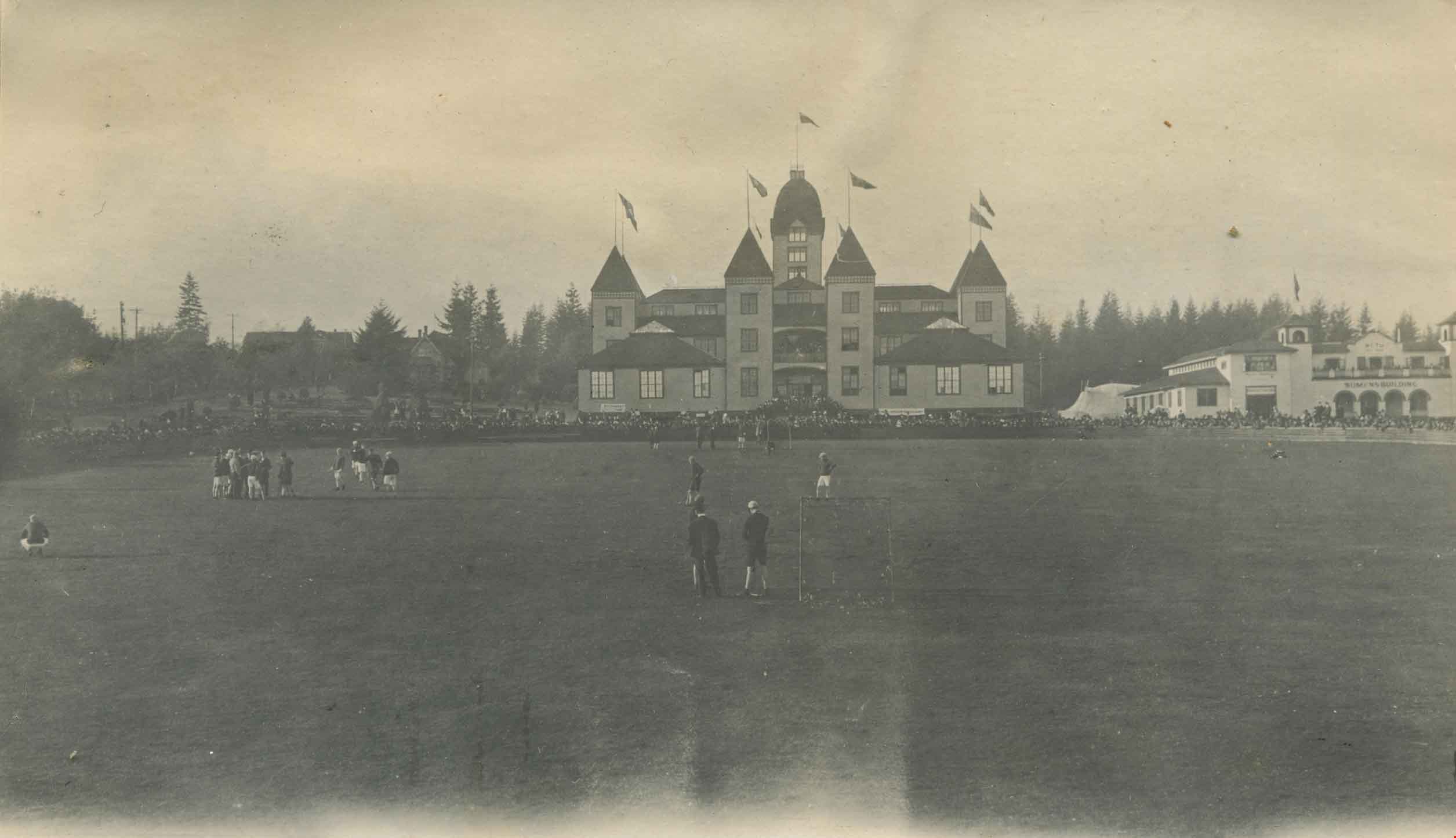
New Westminster Exhibition grounds
https://search.heritageburnaby.ca/link/archivedescription39565
- Repository
- City of Burnaby Archives
- Date
- 1909
- Collection/Fonds
- Peers Family and Hill Family fonds
- Description Level
- Item
- Physical Description
- 1 photograph : b&w ; 6.4 x 10.7 cm on page 21.5 x 28 cm (pasted in album)
- Scope and Content
- Photograph of a team playing grass hockey at the New Westminster Exhibition grounds.
- Repository
- City of Burnaby Archives
- Date
- 1909
- Collection/Fonds
- Peers Family and Hill Family fonds
- Physical Description
- 1 photograph : b&w ; 6.4 x 10.7 cm on page 21.5 x 28 cm (pasted in album)
- Description Level
- Item
- Record No.
- 477-884
- Access Restriction
- No restrictions
- Reproduction Restriction
- No known restrictions
- Accession Number
- 2007-12
- Scope and Content
- Photograph of a team playing grass hockey at the New Westminster Exhibition grounds.
- Media Type
- Photograph
- Notes
- Title based on caption accompanying photograph
Images
![Stanley Park, Vancouver, [1909] thumbnail](/media/hpo/_Data/_BVM_Images/1972/1972_0050_0016_001.jpg?width=280)
Stanley Park, Vancouver
https://search.heritageburnaby.ca/link/museumdescription1077
- Repository
- Burnaby Village Museum
- Date
- [1909]
- Collection/Fonds
- Burnaby Village Museum Photograph collection
- Description Level
- Item
- Physical Description
- 1 photograph : b&w ; 6.1 x 10.2 cm
- Scope and Content
- Photograph of Stanley Park, Vancouver. Women and children are walking along a path. A group of men is gathered by a tree on a lawn on the right side of the photograph. There is a sign directing people to a pavillion posted on that same tree. An annotation on the back of the photograph reads, "Sta…
- Repository
- Burnaby Village Museum
- Collection/Fonds
- Burnaby Village Museum Photograph collection
- Description Level
- Item
- Physical Description
- 1 photograph : b&w ; 6.1 x 10.2 cm
- Scope and Content
- Photograph of Stanley Park, Vancouver. Women and children are walking along a path. A group of men is gathered by a tree on a lawn on the right side of the photograph. There is a sign directing people to a pavillion posted on that same tree. An annotation on the back of the photograph reads, "Stanley Park / 1909."
- Subjects
- Geographic Features - Parks
- Geographic Access
- Vancouver
- Accession Code
- HV972.50.16
- Access Restriction
- No restrictions
- Reproduction Restriction
- No known restrictions
- Date
- [1909]
- Media Type
- Photograph
- Scan Resolution
- 600
- Scan Date
- 2023-04-04
- Photographer
- Dean, H.M.
- Notes
- Title based on caption of photograph
Images
![Stanley Park, Vancouver, [1909] thumbnail](/media/hpo/_Data/_BVM_Images/1972/1972_0050_0016_001.jpg)

Linden Avenue
https://search.heritageburnaby.ca/link/archivedescription35000
- Repository
- City of Burnaby Archives
- Date
- 1908 (date of original), copied 1986
- Collection/Fonds
- Burnaby Historical Society fonds
- Description Level
- Item
- Physical Description
- 1 photograph : b&w ; 8.8 x 12.5 cm print
- Scope and Content
- Photograph of trees and stumps on Linden Avenue, Edmonds District. The caption at the bottom right of the photograph reads, "Linden Ave. / Edmonds 1908."
- Repository
- City of Burnaby Archives
- Date
- 1908 (date of original), copied 1986
- Collection/Fonds
- Burnaby Historical Society fonds
- Subseries
- Patterson family subseries
- Physical Description
- 1 photograph : b&w ; 8.8 x 12.5 cm print
- Description Level
- Item
- Record No.
- 171-021
- Access Restriction
- No restrictions
- Reproduction Restriction
- No known restrictions
- Accession Number
- BHS1986-20
- Scope and Content
- Photograph of trees and stumps on Linden Avenue, Edmonds District. The caption at the bottom right of the photograph reads, "Linden Ave. / Edmonds 1908."
- Media Type
- Photograph
- Geographic Access
- Linden Avenue
- Historic Neighbourhood
- Edmonds (Historic Neighbourhood)
- Planning Study Area
- Richmond Park Area
Images

![Kingsway at Central Park, [1908] (date of original) thumbnail](/media/hpo/_Data/_Archives_Images/_Unrestricted/251/293-001.jpg?width=280)
Kingsway at Central Park
https://search.heritageburnaby.ca/link/archivedescription36540
- Repository
- City of Burnaby Archives
- Date
- [1908] (date of original)
- Collection/Fonds
- Burnaby Historical Society fonds
- Description Level
- Item
- Physical Description
- 1 photograph : b&w ; 10 x 11.5 cm print
- Scope and Content
- Photograph of men driving horse-drawn carriages down Kingsway, east of Boundary Road. The Central Park Presbyterian Church is visible on the left, with Central Park on the right.
- Repository
- City of Burnaby Archives
- Date
- [1908] (date of original)
- Collection/Fonds
- Burnaby Historical Society fonds
- Subseries
- John DeForest subseries
- Physical Description
- 1 photograph : b&w ; 10 x 11.5 cm print
- Description Level
- Item
- Record No.
- 293-001
- Access Restriction
- No restrictions
- Reproduction Restriction
- No known restrictions
- Accession Number
- BHS1992-30
- Scope and Content
- Photograph of men driving horse-drawn carriages down Kingsway, east of Boundary Road. The Central Park Presbyterian Church is visible on the left, with Central Park on the right.
- Media Type
- Photograph
- Notes
- Title based on contents of photograph
- Geographic Access
- Central Park
- Kingsway
- Historic Neighbourhood
- Central Park (Historic Neighbourhood)
- Planning Study Area
- Maywood Area
Images
![Kingsway at Central Park, [1908] (date of original) thumbnail](/media/hpo/_Data/_Archives_Images/_Unrestricted/251/293-001.jpg)

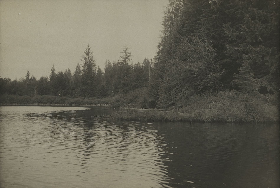
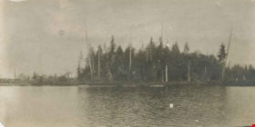
Deer Lake, Burnaby BC
https://search.heritageburnaby.ca/link/archivedescription38513
- Repository
- City of Burnaby Archives
- Date
- 1908
- Collection/Fonds
- Burnaby Historical Society fonds
- Description Level
- Item
- Physical Description
- 1 photograph : b&w postcard ; 9 x 14 cm
- Scope and Content
- Photographic postcard of Deer Lake. Stamped on the front of the card is the name of the photographer, W.T. Cooksley and the picture has been captioned "Deer Lake, Burnaby BC." The card bears a postmark dated 1908 at New Westminster.
- Repository
- City of Burnaby Archives
- Date
- 1908
- Collection/Fonds
- Burnaby Historical Society fonds
- Subseries
- Photographs subseries
- Physical Description
- 1 photograph : b&w postcard ; 9 x 14 cm
- Description Level
- Item
- Record No.
- 449-008
- Access Restriction
- No restrictions
- Reproduction Restriction
- No known restrictions
- Accession Number
- BHS2007-04
- Scope and Content
- Photographic postcard of Deer Lake. Stamped on the front of the card is the name of the photographer, W.T. Cooksley and the picture has been captioned "Deer Lake, Burnaby BC." The card bears a postmark dated 1908 at New Westminster.
- Media Type
- Photograph
- Photographer
- Cooksley, William Thomas
- Geographic Access
- Deer Lake
- Historic Neighbourhood
- Burnaby Lake (Historic Neighbourhood)
- Planning Study Area
- Morley-Buckingham Area
Images

![O.G. Naud house, [1908] (date of original), copied 1986 thumbnail](/media/hpo/_Data/_Archives_Images/_Unrestricted/126/172-002-003.jpg?width=280)
O.G. Naud house
https://search.heritageburnaby.ca/link/archivedescription39832
- Repository
- City of Burnaby Archives
- Date
- [1908] (date of original), copied 1986
- Collection/Fonds
- Burnaby Historical Society fonds
- Description Level
- Item
- Physical Description
- 1 photograph : b&w ; 8.8 x 12.5 cm print
- Scope and Content
- Photograph is the right side of a three-part panorama (photos 172-002a to 172-002c) showing the land beside the house of Onezime G. Naud at 4737 Victory Road (later renamed Victory Street). A number of adults and children are seen standing in a field.
- Repository
- City of Burnaby Archives
- Date
- [1908] (date of original), copied 1986
- Collection/Fonds
- Burnaby Historical Society fonds
- Subseries
- O.G. Naud subseries
- Physical Description
- 1 photograph : b&w ; 8.8 x 12.5 cm print
- Description Level
- Item
- Record No.
- 172-002-3
- Access Restriction
- No restrictions
- Reproduction Restriction
- No known restrictions
- Accession Number
- BHS1986-21
- Scope and Content
- Photograph is the right side of a three-part panorama (photos 172-002a to 172-002c) showing the land beside the house of Onezime G. Naud at 4737 Victory Road (later renamed Victory Street). A number of adults and children are seen standing in a field.
- Media Type
- Photograph
- Notes
- Title based on contents of photograph
- b&w ; 5.5 x 24.5 cm photocopy of entire panorama accompanying in accession file
- Geographic Access
- Victory Street
- Street Address
- 4737 Victory Street
- Historic Neighbourhood
- Alta-Vista (Historic Neighbourhood)
- Planning Study Area
- Sussex-Nelson Area
Images
![O.G. Naud house, [1908] (date of original), copied 1986 thumbnail](/media/hpo/_Data/_Archives_Images/_Unrestricted/126/172-002-003.jpg)
![Children in the woods, [1908] thumbnail](/media/hpo/_Data/_BVM_Images/1976/1976_0139_0003_001.jpg?width=280)
Children in the woods
https://search.heritageburnaby.ca/link/museumdescription752
- Repository
- Burnaby Village Museum
- Date
- [1908]
- Collection/Fonds
- Burnaby Village Museum Photograph collection
- Description Level
- Item
- Physical Description
- 1 photograph : b&w ; 12.5 x 17.5 cm print
- Scope and Content
- Photograph of a group of four children in the woods. The woods are thick with ferns, lichens and mosses. Two boys and two girls standing in a line. They each carrying a hat in their hand, except for one girl who is wearing hers. An annotation on the back of the photograph reads: "In the woods. …
- Repository
- Burnaby Village Museum
- Collection/Fonds
- Burnaby Village Museum Photograph collection
- Description Level
- Item
- Physical Description
- 1 photograph : b&w ; 12.5 x 17.5 cm print
- Scope and Content
- Photograph of a group of four children in the woods. The woods are thick with ferns, lichens and mosses. Two boys and two girls standing in a line. They each carrying a hat in their hand, except for one girl who is wearing hers. An annotation on the back of the photograph reads: "In the woods. S. side Deer Lake / Arthur Morrow, Kingsley Hart, Florence Hart, and KM [Katherine Maude "Kitty"] Hill. App. 1908."
- Subjects
- Geographic Features - Forests
- Geographic Access
- Deer Lake
- Accession Code
- HV976.139.3
- Access Restriction
- No restrictions
- Reproduction Restriction
- No known restrictions
- Date
- [1908]
- Media Type
- Photograph
- Historic Neighbourhood
- Burnaby Lake (Historic Neighbourhood)
- Planning Study Area
- Oakalla Area
- Scan Resolution
- 600
- Scan Date
- 2023-06-27
- Photographer
- Cooksley, William Thomas
- Notes
- Title based on contents of photograph
- 1 b&w copy print accompanying
Images
![Children in the woods, [1908] thumbnail](/media/hpo/_Data/_BVM_Images/1976/1976_0139_0003_001.jpg)
![Deer Lake Burnaby BC, [1908] (date of original), copied 1976 thumbnail](/media/hpo/_Data/_BVM_Images/1976/1976_0139_0004_001.jpg?width=280)
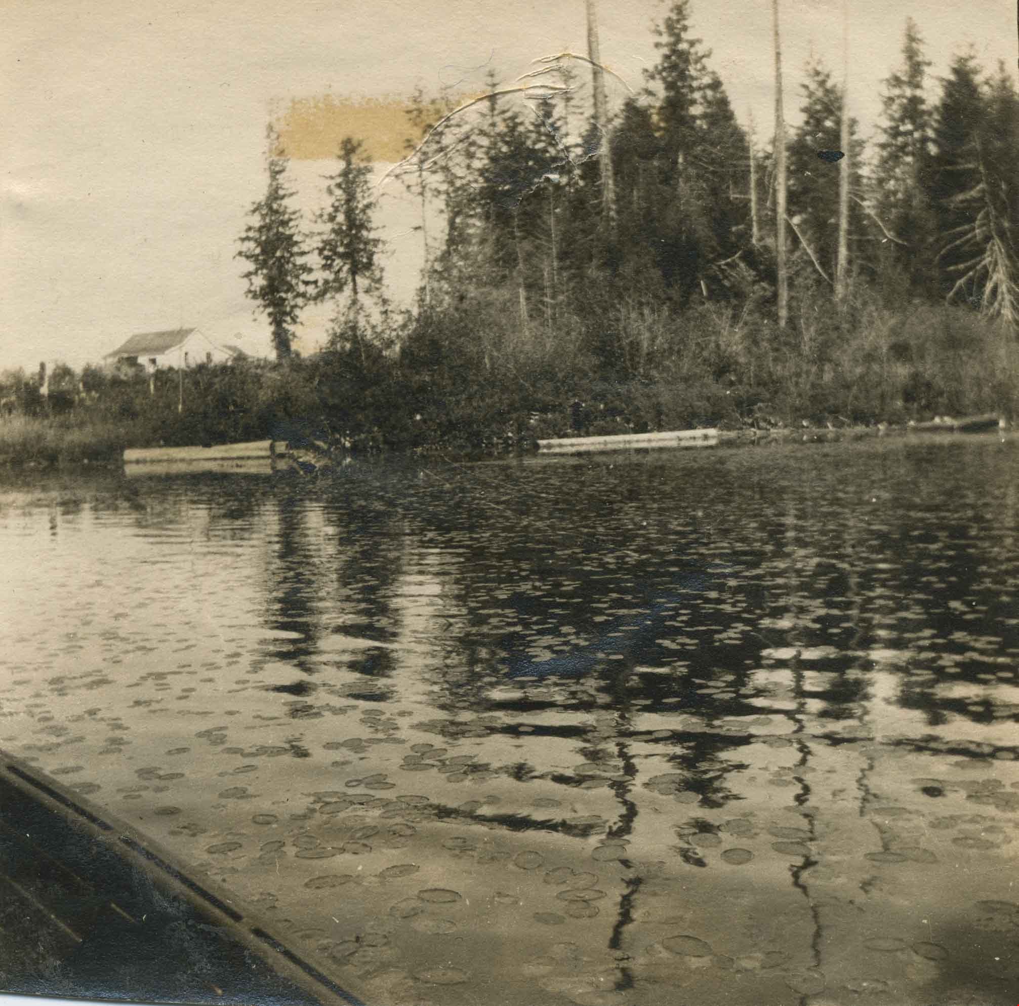
Deer Lake Burnaby BC
https://search.heritageburnaby.ca/link/museumdescription753
- Repository
- Burnaby Village Museum
- Date
- [1908] (date of original), copied 1976
- Collection/Fonds
- Burnaby Village Museum Photograph collection
- Description Level
- Item
- Physical Description
- 1 photograph : b&w ; 12.3 x 17.6 cm, mounted on cardboard 22.7 x 27.3 cm
- Scope and Content
- Photograph of Deer Lake and the shoreline. An annotation on the front lower left of the original photograph reads, "Deer Lake, Burnaby, B.C." An annotation on the back of the card reads "Deer Lake as it was in 1908."
- Repository
- Burnaby Village Museum
- Collection/Fonds
- Burnaby Village Museum Photograph collection
- Description Level
- Item
- Physical Description
- 1 photograph : b&w ; 12.3 x 17.6 cm, mounted on cardboard 22.7 x 27.3 cm
- Scope and Content
- Photograph of Deer Lake and the shoreline. An annotation on the front lower left of the original photograph reads, "Deer Lake, Burnaby, B.C." An annotation on the back of the card reads "Deer Lake as it was in 1908."
- Geographic Access
- Deer Lake
- Accession Code
- HV976.139.4
- Access Restriction
- No restrictions
- Reproduction Restriction
- No known restrictions
- Date
- [1908] (date of original), copied 1976
- Media Type
- Photograph
- Historic Neighbourhood
- Burnaby Lake (Historic Neighbourhood)
- Planning Study Area
- Oakalla Area
- Scan Resolution
- 600
- Scan Date
- 2023-06-27
- Notes
- 1 b&w copy print accompanying
Images
![Deer Lake Burnaby BC, [1908] (date of original), copied 1976 thumbnail](/media/hpo/_Data/_BVM_Images/1976/1976_0139_0004_001.jpg)
![Looking down north Poleline Hill, [1908] thumbnail](/media/hpo/_Data/_BVM_Images/1976/1976_0139_0047_001.jpg?width=280)
Looking down north Poleline Hill
https://search.heritageburnaby.ca/link/museumdescription796
- Repository
- Burnaby Village Museum
- Date
- [1908]
- Collection/Fonds
- Burnaby Village Museum Photograph collection
- Description Level
- Item
- Physical Description
- 1 photograph : b&w ; 20.32 x 25.4 cm print
- Scope and Content
- Photograph looking north along the Pole Line Road (later Sperling Avenue). To the far left is Deer Lake and at the top right is Burnaby Lake. The smoke and debris from land clearing is a result of logging operations being carried out by the Doran Brothers logging company, the Deer Lake Mill Company…
- Repository
- Burnaby Village Museum
- Collection/Fonds
- Burnaby Village Museum Photograph collection
- Description Level
- Item
- Physical Description
- 1 photograph : b&w ; 20.32 x 25.4 cm print
- Material Details
- inscribed in pencil, verso, l.l. "Looking down north Poleline Hill (now Sperling) Deer Lake at left. "
- Scope and Content
- Photograph looking north along the Pole Line Road (later Sperling Avenue). To the far left is Deer Lake and at the top right is Burnaby Lake. The smoke and debris from land clearing is a result of logging operations being carried out by the Doran Brothers logging company, the Deer Lake Mill Company. Above Deer Lake, Douglas Road is visible with Claude Hill's Brookfield property (later 6501 Deer Lake Avenue) on the south side of the road and Bernard Hill's home on the north side (later 4990 Canada Way). Just northeast of Brookfield is the George Every-Clayton farm (amongst the trees) on what would later become the Henry and Grace Ceperley estate grounds known as Fairacres. The house in the centre of the picture is the Walker house (later 5255 Sperling Avenue). Mountains can be seen to the north.
- Subjects
- Land Clearing
- Geographic Features - Roads
- Industries - Forestry
- Industries - Logging/lumber
- Geographic Access
- Sperling Avenue
- Deer Lake
- Douglas Road
- Canada Way
- Accession Code
- HV976.139.47
- Access Restriction
- No restrictions
- Reproduction Restriction
- No known restrictions
- Date
- [1908]
- Media Type
- Photograph
- Historic Neighbourhood
- Burnaby Lake (Historic Neighbourhood)
- Planning Study Area
- Morley-Buckingham Area
- Scan Resolution
- 600
- Scan Date
- 2023-06-27
- Notes
- Title based on contents of photograph
Images
![Looking down north Poleline Hill, [1908] thumbnail](/media/hpo/_Data/_BVM_Images/1976/1976_0139_0047_001.jpg)
![Granville Street looking south from Rogers building, [between 1908 and 1911] thumbnail](/media/hpo/_Data/_BVM_Images/1972/1972_0050_0002_002.jpg?width=280)
Granville Street looking south from Rogers building
https://search.heritageburnaby.ca/link/museumdescription1063
- Repository
- Burnaby Village Museum
- Date
- [between 1908 and 1911]
- Collection/Fonds
- Burnaby Village Museum Photograph collection
- Description Level
- Item
- Physical Description
- 1 photograph : b&w ; 6.1 x 10.7 cm mounted on paper 13.5 x 18.3 cm
- Scope and Content
- Photograph of Granville Street in Vancouver, looking south from the Roger's Building. The two tall buildings to the sides are under construction, and steam is blowing out from building chimneys. Busy street activities can be seen below with two trams running along the tracks.Inscribed on the scrapb…
- Repository
- Burnaby Village Museum
- Collection/Fonds
- Burnaby Village Museum Photograph collection
- Description Level
- Item
- Physical Description
- 1 photograph : b&w ; 6.1 x 10.7 cm mounted on paper 13.5 x 18.3 cm
- Scope and Content
- Photograph of Granville Street in Vancouver, looking south from the Roger's Building. The two tall buildings to the sides are under construction, and steam is blowing out from building chimneys. Busy street activities can be seen below with two trams running along the tracks.Inscribed on the scrapbook paper in white ink: "Granville Street / Looking South / From Rogers Building / Vancouver B.C."
- Geographic Access
- Vancouver
- Accession Code
- HV972.50.2
- Access Restriction
- No restrictions
- Reproduction Restriction
- No known restrictions
- Date
- [between 1908 and 1911]
- Media Type
- Photograph
- Scan Resolution
- 600
- Scan Date
- 2023-03-28
- Photographer
- Dean, H.M.
- Notes
- Title based on caption of photograph
Images
![Granville Street looking south from Rogers building, [between 1908 and 1911] thumbnail](/media/hpo/_Data/_BVM_Images/1972/1972_0050_0002_002.jpg)
![Canadian Pacific Railway Depot, [between 1908 and 1911] thumbnail](/media/hpo/_Data/_BVM_Images/1972/1972_0050_0005_002.jpg?width=280)
Canadian Pacific Railway Depot
https://search.heritageburnaby.ca/link/museumdescription1066
- Repository
- Burnaby Village Museum
- Date
- [between 1908 and 1911]
- Collection/Fonds
- Burnaby Village Museum Photograph collection
- Description Level
- Item
- Physical Description
- 1 photograph : sepia ; 8.0 x 10.2 cm, mounted on paper 13.5 x 12.2 cm
- Scope and Content
- Photograph of (in the foreground, centre) the Canadian Pacific Railway depot, Vancouver with Burrard Inlet in the background. The north shore can be seen faintly across the water. An annotation reads, "C.P.R. Depot and Burrard Inlet / From Rogers Bldg."
- Repository
- Burnaby Village Museum
- Collection/Fonds
- Burnaby Village Museum Photograph collection
- Description Level
- Item
- Physical Description
- 1 photograph : sepia ; 8.0 x 10.2 cm, mounted on paper 13.5 x 12.2 cm
- Scope and Content
- Photograph of (in the foreground, centre) the Canadian Pacific Railway depot, Vancouver with Burrard Inlet in the background. The north shore can be seen faintly across the water. An annotation reads, "C.P.R. Depot and Burrard Inlet / From Rogers Bldg."
- Accession Code
- HV972.50.5
- Access Restriction
- No restrictions
- Reproduction Restriction
- No known restrictions
- Date
- [between 1908 and 1911]
- Media Type
- Photograph
- Scan Resolution
- 600
- Scan Date
- 2023-03-28
- Photographer
- Dean, H.M.
- Notes
- Title based on contents of photograph
Images
![Canadian Pacific Railway Depot, [between 1908 and 1911] thumbnail](/media/hpo/_Data/_BVM_Images/1972/1972_0050_0005_002.jpg)
![Time exposure of Vancouver's city lights, [between 1908 and 1911] thumbnail](/media/hpo/_Data/_BVM_Images/1972/1972_0050_0009_001.jpg?width=280)
Time exposure of Vancouver's city lights
https://search.heritageburnaby.ca/link/museumdescription1070
- Repository
- Burnaby Village Museum
- Date
- [between 1908 and 1911]
- Collection/Fonds
- Burnaby Village Museum Photograph collection
- Description Level
- Item
- Physical Description
- 1 photograph : b&w ; 7.3 x 9.8 cm
- Scope and Content
- Photograph of Vancouver's city lights taken from Grouse Mountain at night. There are silhouettes of trees in the foreground and rows of lights in the midground. An annotation on the back of the photograph reads, "City Lights? Time exposure taken from Grouse Mt. of lights of Vancouver. 1910. Box C…
- Repository
- Burnaby Village Museum
- Collection/Fonds
- Burnaby Village Museum Photograph collection
- Description Level
- Item
- Physical Description
- 1 photograph : b&w ; 7.3 x 9.8 cm
- Scope and Content
- Photograph of Vancouver's city lights taken from Grouse Mountain at night. There are silhouettes of trees in the foreground and rows of lights in the midground. An annotation on the back of the photograph reads, "City Lights? Time exposure taken from Grouse Mt. of lights of Vancouver. 1910. Box Camera with shutter held open with a string was used." Inscribed in pencil in a different hand reads, "Photo by H.M. Dean."
- Subjects
- Geographic Features - Cities
- Geographic Access
- Vancouver
- Accession Code
- HV972.50.9
- Access Restriction
- No restrictions
- Reproduction Restriction
- No known restrictions
- Date
- [between 1908 and 1911]
- Media Type
- Photograph
- Scan Resolution
- 600
- Scan Date
- 2023-04-04
- Photographer
- Dean, H.M.
- Notes
- Title based on contents of photograph
Images
![Time exposure of Vancouver's city lights, [between 1908 and 1911] thumbnail](/media/hpo/_Data/_BVM_Images/1972/1972_0050_0009_001.jpg)
![Bandsand in Stanley Park, Vancouver, BC, [between 1908 and 1911] thumbnail](/media/hpo/_Data/_BVM_Images/1972/1972_0050_0010_001.jpg?width=280)
Bandsand in Stanley Park, Vancouver, BC
https://search.heritageburnaby.ca/link/museumdescription1071
- Repository
- Burnaby Village Museum
- Date
- [between 1908 and 1911]
- Collection/Fonds
- Burnaby Village Museum Photograph collection
- Description Level
- Item
- Physical Description
- 1 photograph : sepia ; 7.3 x 9.9 cm
- Scope and Content
- Photograph of people walking towards the bandstand in Stanley Park, Vancouver. In 1934, the Malkin Bowl was erected at the site where the banstand used to be. An annotation on the back of the photograph reads, "Band stand in Stanley Park where Malkin Bowl now stands."
- Repository
- Burnaby Village Museum
- Collection/Fonds
- Burnaby Village Museum Photograph collection
- Description Level
- Item
- Physical Description
- 1 photograph : sepia ; 7.3 x 9.9 cm
- Scope and Content
- Photograph of people walking towards the bandstand in Stanley Park, Vancouver. In 1934, the Malkin Bowl was erected at the site where the banstand used to be. An annotation on the back of the photograph reads, "Band stand in Stanley Park where Malkin Bowl now stands."
- Geographic Access
- Vancouver
- Accession Code
- HV972.50.10
- Access Restriction
- No restrictions
- Reproduction Restriction
- No known restrictions
- Date
- [between 1908 and 1911]
- Media Type
- Photograph
- Scan Resolution
- 600
- Scan Date
- 2023-04-04
- Photographer
- Dean, H.M.
- Notes
- Title based on contents of photograph
Images
![Bandsand in Stanley Park, Vancouver, BC, [between 1908 and 1911] thumbnail](/media/hpo/_Data/_BVM_Images/1972/1972_0050_0010_001.jpg)
![Horseshoe Bay, [between 1908 and 1911] thumbnail](/media/hpo/_Data/_BVM_Images/1972/1972_0050_0012_001.jpg?width=280)
Horseshoe Bay
https://search.heritageburnaby.ca/link/museumdescription1073
- Repository
- Burnaby Village Museum
- Date
- [between 1908 and 1911]
- Collection/Fonds
- Burnaby Village Museum Photograph collection
- Description Level
- Item
- Physical Description
- 1 photograph : sepia ; 7.4 x 9.9 cm mounted on paper 13.6 x 18.3 cm
- Scope and Content
- Photograph of Horeshoe Bay. People are walking on the beach, swimming, and boating.
- Repository
- Burnaby Village Museum
- Collection/Fonds
- Burnaby Village Museum Photograph collection
- Description Level
- Item
- Physical Description
- 1 photograph : sepia ; 7.4 x 9.9 cm mounted on paper 13.6 x 18.3 cm
- Scope and Content
- Photograph of Horeshoe Bay. People are walking on the beach, swimming, and boating.
- Accession Code
- HV972.50.12
- Access Restriction
- No restrictions
- Reproduction Restriction
- No known restrictions
- Date
- [between 1908 and 1911]
- Media Type
- Photograph
- Scan Resolution
- 600
- Scan Date
- 2023-04-04
- Photographer
- Dean, H.M.
- Notes
- Title based on contents of photograph
Images
![Horseshoe Bay, [between 1908 and 1911] thumbnail](/media/hpo/_Data/_BVM_Images/1972/1972_0050_0012_001.jpg)
![Horseshoe Bay, [between 1908 and 1911] thumbnail](/media/hpo/_Data/_BVM_Images/1972/1972_0050_0013_001.jpg?width=280)
Horseshoe Bay
https://search.heritageburnaby.ca/link/museumdescription1074
- Repository
- Burnaby Village Museum
- Date
- [between 1908 and 1911]
- Collection/Fonds
- Burnaby Village Museum Photograph collection
- Description Level
- Item
- Physical Description
- 1 photograph : b&w ; 7.5 x 9.8 cm mounted on paper 13.6 x 18.3 cm
- Scope and Content
- Photograph of Horeshoe Bay. People are walking on the beach, swimming, and boating.
- Repository
- Burnaby Village Museum
- Collection/Fonds
- Burnaby Village Museum Photograph collection
- Description Level
- Item
- Physical Description
- 1 photograph : b&w ; 7.5 x 9.8 cm mounted on paper 13.6 x 18.3 cm
- Scope and Content
- Photograph of Horeshoe Bay. People are walking on the beach, swimming, and boating.
- Accession Code
- HV972.50.13
- Access Restriction
- No restrictions
- Reproduction Restriction
- No known restrictions
- Date
- [between 1908 and 1911]
- Media Type
- Photograph
- Scan Resolution
- 600
- Scan Date
- 2023-04-04
- Photographer
- Dean, H.M.
- Notes
- Title based on contents of photograph
Images
![Horseshoe Bay, [between 1908 and 1911] thumbnail](/media/hpo/_Data/_BVM_Images/1972/1972_0050_0013_001.jpg)
![Boats docked at a bay, [between 1908 and 1911] thumbnail](/media/hpo/_Data/_BVM_Images/1972/1972_0050_0014_001.jpg?width=280)
Boats docked at a bay
https://search.heritageburnaby.ca/link/museumdescription1075
- Repository
- Burnaby Village Museum
- Date
- [between 1908 and 1911]
- Collection/Fonds
- Burnaby Village Museum Photograph collection
- Description Level
- Item
- Physical Description
- 1 photograph : b&w ; 7.4 x 9.9 cm mounted on paper 13.6 x 18.3 cm
- Scope and Content
- Photograph of three boats docked at a pier at an unidentified bay.
- Repository
- Burnaby Village Museum
- Collection/Fonds
- Burnaby Village Museum Photograph collection
- Description Level
- Item
- Physical Description
- 1 photograph : b&w ; 7.4 x 9.9 cm mounted on paper 13.6 x 18.3 cm
- Scope and Content
- Photograph of three boats docked at a pier at an unidentified bay.
- Accession Code
- HV972.50.14
- Access Restriction
- No restrictions
- Reproduction Restriction
- No known restrictions
- Date
- [between 1908 and 1911]
- Media Type
- Photograph
- Scan Resolution
- 600
- Scan Date
- 2023-04-04
- Photographer
- Dean, H.M.
- Notes
- Title based on contents of photograph
Images
![Boats docked at a bay, [between 1908 and 1911] thumbnail](/media/hpo/_Data/_BVM_Images/1972/1972_0050_0014_001.jpg)
![Old Lumberman's Arch, [between 1908 and 1911] thumbnail](/media/hpo/_Data/_BVM_Images/1972/1972_0050_0018_001.jpg?width=280)
Old Lumberman's Arch
https://search.heritageburnaby.ca/link/museumdescription1079
- Repository
- Burnaby Village Museum
- Date
- [between 1908 and 1911]
- Collection/Fonds
- Burnaby Village Museum Photograph collection
- Description Level
- Item
- Physical Description
- 1 photograph : b&w ; 5.9 x 10.2 cm
- Scope and Content
- Photograph of the old Lumberman's Arch by the beachside in Stanley Park, Vancouver. There are people gathered by the arch and standing and sitting on logs strewn on the beach.
- Repository
- Burnaby Village Museum
- Collection/Fonds
- Burnaby Village Museum Photograph collection
- Description Level
- Item
- Physical Description
- 1 photograph : b&w ; 5.9 x 10.2 cm
- Scope and Content
- Photograph of the old Lumberman's Arch by the beachside in Stanley Park, Vancouver. There are people gathered by the arch and standing and sitting on logs strewn on the beach.
- Geographic Access
- Vancouver
- Accession Code
- HV972.50.18
- Access Restriction
- No restrictions
- Reproduction Restriction
- No known restrictions
- Date
- [between 1908 and 1911]
- Media Type
- Photograph
- Scan Resolution
- 600
- Scan Date
- 2023-04-04
- Photographer
- Dean, H.M.
- Notes
- Title based on contents of photograph
Images
![Old Lumberman's Arch, [between 1908 and 1911] thumbnail](/media/hpo/_Data/_BVM_Images/1972/1972_0050_0018_001.jpg)
![Survey and Subdivision plans in New Westminster District Group 1 – Burnaby
, [1908] thumbnail](/media/hpo/_Data/_BVM_Cartographic_Material/1977/1977_0093_0004a_001.jpg?width=280)
Survey and Subdivision plans in New Westminster District Group 1 – Burnaby
https://search.heritageburnaby.ca/link/museumdescription6973
- Repository
- Burnaby Village Museum
- Date
- [1908]
- Collection/Fonds
- Burnaby Village Museum Map collection
- Description Level
- File
- Physical Description
- 10 plans : blueprint ink on paper mounted on 2 sides of cardboard ; 76 cm x 102 cm
- Scope and Content
- Item consists of a large board of four New Westminster District Gp 1 - subdivision plans mounted on one side and six New Westminster District Gp 1 - subdivision plans mounted on the other side. Side A: 1. Blueprint "Plan / of - ReSubdivision / of / Lots 1-18 inclusive / Blocks 20 and 21 / in Sub…
- Repository
- Burnaby Village Museum
- Collection/Fonds
- Burnaby Village Museum Map collection
- Description Level
- File
- Physical Description
- 10 plans : blueprint ink on paper mounted on 2 sides of cardboard ; 76 cm x 102 cm
- Material Details
- Scales [between 1:792 and 1:4752]
- Index number on edge of board reads: "4"
- Scope and Content
- Item consists of a large board of four New Westminster District Gp 1 - subdivision plans mounted on one side and six New Westminster District Gp 1 - subdivision plans mounted on the other side. Side A: 1. Blueprint "Plan / of - ReSubdivision / of / Lots 1-18 inclusive / Blocks 20 and 21 / in Subdivision / of / Lot 53 -Gr.1 / New Westminster District" / "Subdivision Lot Numbers - Shown in Red". Plan is bordered by First Street / Jorgenson's Line / Fourth Avenue and Second Street with Fifith Avenue running through the centre. There is an index in the upper right corner of the plan. Planned is signed by "Peter Byrne" and "William R. Phillips" and dated July 28, 1908. (Geographic location: Burnaby) 2. Blueprint "Plan / of Subdivision / of / Lot 159 / and a Portion of Lot 158 / Group One / New Westminster District". Plan is bordered by Lots 96 and 97; South Wilson Street; North Arm Road and Lot 160 / Power House Road (Lot 155 A). B.C.E.R. Gilley Station is identified in the upper right corner of the plan. (Geographic location: Burnaby) 3. Blueprint plan identified as "Subdvs 10, L 88 and Lot 25, G. 1" Plan identifies Cumberland Street running from top to the bottom and a Ravine running alongside with the Jensen house, stable and barn. (Geographic location: Burnaby) 4. Blueprint Plan of "Lot 153. G. 1 /New Westminster District". Plan identifies the "New Westminster & Vancouver Tramway" and the "New Westminster and Vancouver Road" running through the plan of Lot 53. (Geographic location: Burnaby) Side B: 1. Blueprint plan of "Profile on Proposed North Rd. Diversion". 2. Blueprint plan (no title) showing wood lots north of Burnaby Lake and Brunette River and west of North Road. Various lots are identified as "Heavily Timbered" (Lot 57); "Splendid Fir and Cedar / Heavy Fir etc. / Fine Cedar" (Lots 143, 148); "Rough Light Timber," (Lot 56); "Some Fir and Cedar" (Lot 40). (Geographic location: Burnaby) 3. Blueprint "Plan / of Subdivision / of a Portion / of Lot 87, Gr.1 / New Westminster District". Plan is bordered by Burnaby Lake at the top and Hastings Road / Lot 86 at the bottom and Lot 90 to the east. "Albert J. Hill B.C.LotS." Annotation in ink reads: " J.A. Brownlee, B.C.L.S. / Subdivision / Map 1494 / Bd. 248". Plan is signed by "Peter Byrne, Reeve" (Geographic location: Burnaby) 4. Blueprint plan of Subdivisions along either side of Douglas Road including Lots 117; 119; 74; 80; 79 and 77. (Geographic location: Burnaby) 5. Blueprint "Plan / of / Subdivision of / Lot 27 / in Subdivision / of / Lot 30 / Group One / New Westminster District" Plan is bordered by Lot 26, Lot 28 and Hastings Rd. Lot 27 runs north of Edmonds Street. , "Albert J. Hill, B.C.LotS." (Geographic location: Burnaby) 6. Blueprint plan identified as a "Cultivated Orchard" including the names "W. Grace" and "G. Mead" located north of the North Arm Fraser River and west of "Twentieth Street_ City Boundary". Handwritten annotation in coloured pencil reads: "Portion of Lot 172" (Geographic location: Burnaby)
- Subjects
- Geographic Features - Forests
- Geographic Access
- Cumberland Street
- North Road
- Hastings Street
- Douglas Road
- Accession Code
- HV977.93.4
- Access Restriction
- No restrictions
- Reproduction Restriction
- No known restrictions
- Date
- [1908]
- Media Type
- Cartographic Material
- Historic Neighbourhood
- Burnaby Lake (Historic Neighbourhood)
- Fraser Arm (Historic Neighbourhood)
- Planning Study Area
- Douglas-Gilpin Area
- Burnaby Lake Area
- Scan Resolution
- 300
- Scale
- 72
- Notes
- Title based on contents of file
- Scale is measured in chains. (One chain equals 792 inches)
- The term "Lot" can also refer to a "District Lot”-
Images
![Survey and Subdivision plans in New Westminster District Group 1 – Burnaby
, [1908] thumbnail](/media/hpo/_Data/_BVM_Cartographic_Material/1977/1977_0093_0004a_001.jpg)


Deer Lake
https://search.heritageburnaby.ca/link/archivedescription34054
- Repository
- City of Burnaby Archives
- Date
- 1907
- Collection/Fonds
- Burnaby Historical Society fonds
- Description Level
- Item
- Physical Description
- 1 photograph : b&w ; 8.6 x 8.7 cm
- Scope and Content
- Photograph of the northeast shore of Deer Lake.
- Repository
- City of Burnaby Archives
- Date
- 1907
- Collection/Fonds
- Burnaby Historical Society fonds
- Subseries
- Photographs subseries
- Physical Description
- 1 photograph : b&w ; 8.6 x 8.7 cm
- Description Level
- Item
- Record No.
- 002-002
- Access Restriction
- No restrictions
- Reproduction Restriction
- No known restrictions
- Accession Number
- BHS2007-04
- Scope and Content
- Photograph of the northeast shore of Deer Lake.
- Media Type
- Photograph
- Notes
- Title based on contents of photograph
- Geographic Access
- Deer Lake
- Deer Lake Avenue
- Historic Neighbourhood
- Burnaby Lake (Historic Neighbourhood)
- Planning Study Area
- Morley-Buckingham Area
Images
Deer Lake
https://search.heritageburnaby.ca/link/archivedescription34055
- Repository
- City of Burnaby Archives
- Date
- 1907
- Collection/Fonds
- Burnaby Historical Society fonds
- Description Level
- Item
- Physical Description
- 1 photograph : b&w ; 4.4 x 8.7 cm
- Scope and Content
- Photograph of the northeast shore of Deer Lake.
- Repository
- City of Burnaby Archives
- Date
- 1907
- Collection/Fonds
- Burnaby Historical Society fonds
- Subseries
- Photographs subseries
- Physical Description
- 1 photograph : b&w ; 4.4 x 8.7 cm
- Description Level
- Item
- Record No.
- 002-003
- Access Restriction
- No restrictions
- Reproduction Restriction
- No known restrictions
- Accession Number
- BHS2007-04
- Scope and Content
- Photograph of the northeast shore of Deer Lake.
- Media Type
- Photograph
- Notes
- Photograph has been cropped
- Geographic Access
- Deer Lake
- Deer Lake Avenue
- Historic Neighbourhood
- Burnaby Lake (Historic Neighbourhood)
- Planning Study Area
- Morley-Buckingham Area
Images
