More like 'Interview with Tony and Hazel Padula by Eric Damer November 27, 2012 - Track 2'
Narrow Results By
Decade
- 2020s 129
- 2010s 120
- 2000s 663
- 1990s 661
- 1980s 522
- 1970s 1170
- 1960s 377
- 1950s 543
- 1940s 601
- 1930s 603
- 1920s 656
- 1910s 655
- 1900s 277
- 1890s 36
- 1880s 70
- 1870s 5
- 1860s 3
- 1850s 1
- 1840s 1
- 1830s 1
- 1820s 1
- 1810s 1
- 1800s 1
- 1790s 1
- 1780s 1
- 1770s 1
- 1760s 1
- 1750s 1
- 1740s 1
- 1730s 1
- 1720s 1
- 1710s 1
- 1700s 1
- 1690s 1
- 1680s 1
- 1670s 1
- 1660s 1
- 1650s 1
- 1640s 1
- 1630s 1
- 1620s 1
- 1610s 1
- 1600s 1
Subject
- Accidents 1
- Accidents - Automobile Accidents 2
- Adornment 1
- Advertising Medium 4
- Advertising Medium - Signs and Signboards 127
- Aerial Photographs 59
- Agricultural Tools and Equipment 2
- Agricultural Tools and Equipment - Gardening Equipment 4
- Agricultural Tools and Equipment - Plows 5
- Agriculture 7
- Agriculture - Crops 2
- Agriculture - Dairy 1
Interview with Vi Townley May 24, 1978 - Track 1
https://search.heritageburnaby.ca/link/oralhistory192
- Repository
- City of Burnaby Archives
- Date Range
- 1913-1935
- Length
- 0:06:23
- Summary
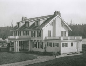
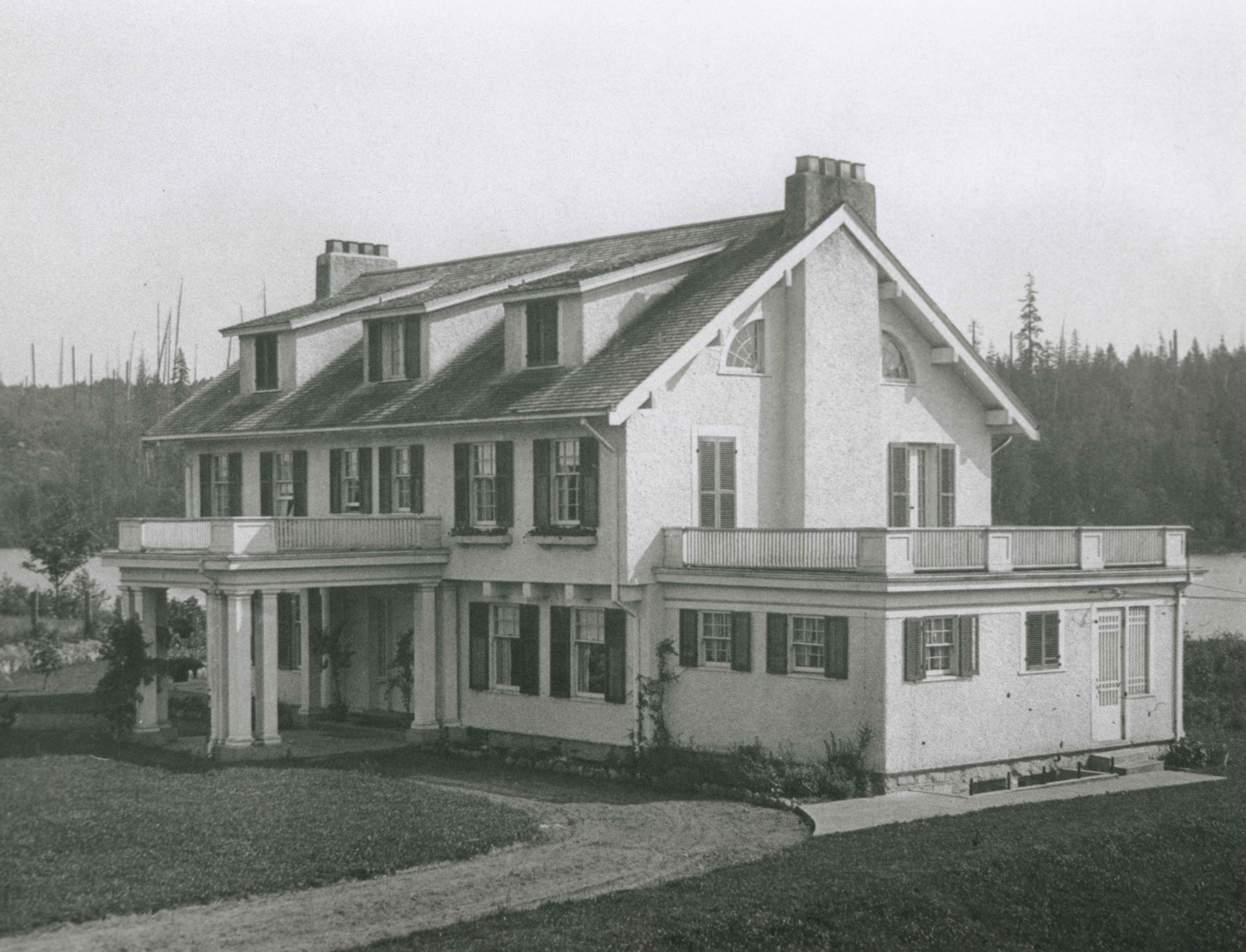
- This portion of the interview pertains to Vi Townley's description of the Townley mansion, Deerholme.
- Repository
- City of Burnaby Archives
- Summary
- This portion of the interview pertains to Vi Townley's description of the Townley mansion, Deerholme.
- Date Range
- 1913-1935
- Photo Info
- Townley mansion known as Deerholme, 1913. Item no. 454-001
- Length
- 0:06:23
- Subjects
- Buildings - Residences - Houses
- Geographic Access
- Price Street
- Historic Neighbourhood
- Burnaby Lake (Historic Neighbourhood)
- Planning Study Area
- Douglas-Gilpin Area
- Interview Date
- May 24, 1978
- Scope and Content
- Recording is of an interview with Vi Townley, May 24, 1978. Major themes discussed are: Deerholme.
- Biographical Notes
- Vi Townley was the daughter-in-law of Colonel Thomas O. Townley and Frances Townley, the owners of Deerholme.
- Total Tracks
- 2
- Total Length
- 0:10:49
- Interviewee Name
- Townley, Vi
- Collection/Fonds
- Burnaby Historical Society fonds
- Subseries
- Oral history subseries
- Media Type
- Sound Recording
- Web Notes
- Interview was digitized in 2010 allowing it to be accessible on Heritage Burnaby. The digitization project was initiated by the Community Heritage Commission with support from City of Burnaby Council and the BC History Digitization Program of the Irving K. Barber Learning Centre, University of British Columbia. It was recognized by the Heritage Society of BC with an award in 2012.
Images
Audio Tracks
Track one of interview with Vi Townley
Track one of interview with Vi Townley
https://search.heritageburnaby.ca/media/hpo/_Data/_Archives_Oral_Histories/_Unrestricted/MSS137-014-2/MSS137-014-2_Track_1.mp3![Burnaby Alderman, Bill (William) Lewarne, [1973]. Item no. 231-012 thumbnail](/media/hpo/_Data/_Archives_Images/_Unrestricted/205/231-012.jpg?width=280)
Interview with William A. Lewarne by Rod Fowler March 14, 1990 - Track 4
https://search.heritageburnaby.ca/link/oralhistory444
- Repository
- City of Burnaby Archives
- Date Range
- 1930-1945
- Length
- 00:02:27
- Summary
- This portion of the interview is about Bill Lewarne’s memory of burning sawdust to heat the family home and the “fog” [smog] created by burning wood and wood waste in homes and in sawmill bee hive burners
- Repository
- City of Burnaby Archives
- Summary
- This portion of the interview is about Bill Lewarne’s memory of burning sawdust to heat the family home and the “fog” [smog] created by burning wood and wood waste in homes and in sawmill bee hive burners
- Date Range
- 1930-1945
- Photo Info
- Burnaby Alderman, Bill (William) Lewarne, [1973]. Item no. 231-012
- Length
- 00:02:27
- Interviewer
- Fowler, Rod
- Interview Date
- March 14, 1990
- Scope and Content
- Recording is of an interview with former Mayor William “Bill” Lewarne, conducted by Rod Fowler. Bill Lewarne was one of eleven participants interviewed as part of the SFU/Burnaby Centennial Committee's oral history series titled, "Voices of Burnaby". The interview is mainly about Bill Lewarne’s business and political careers, and memories of growing up in South Burnaby in the 1930s. Bill Lewarne talks about his parent’s origins, his family and community struggles during the Depression, the interurban, his education, war service, and joining his father's business. He describes the start, operation and expansion of the family ice cream business, and how business life compared to political life. The interview explores the role of politics in community affairs, his political activities, the history of the BVA, and his involvement in various community organizations. To view “Narrow By” terms for each track, expand this description and see “Notes”.
- Biographical Notes
- William Alfred “Bill” Lewarne was born in Burnaby in 1926 to Ethel Cecilia Leer (1899- ) and Alfred Lewarne (1893-1962). The family, Ethel, Alfred and their three children Patricia, Beverley and William, moved to a house on Nelson Avenue in Alta Vista in 1931. Ethel still lived in the family home in 1990. Bill Lewarne attended Nelson Avenue School and South Burnaby High School (1932-1944). His father Alfred worked at Colony Farms as a dairy inspector and then for the Port of Vancouver Dairy before being laid off early in the Depression. The family struggled until in 1936 Alfred started his own ice cream business. After graduation Bill was in the army for two years, taking a refrigeration course under the veteran’s training benefit, before joining his father’s business. Three generations of the family operated the successful company, expanding from wholesale, retail and distribution of ice cream products into refrigerated warehouses and the wholesale ice business, until the business was sold to its competitor Dairyland in 1989. Bill Lewarne entered politics in 1965, first with the Nonpartisan Association (NPA) and then as a founder of the Burnaby Citizens Association (BCA). He served as an alderman on Burnaby Council 1973-1975 and 1977-1981 and as Mayor 1981-1987. In 1979 he ran for provincial office for the Social Credit Party against Rosemary Brown but lost. Bill Lewarne married June Lawrence and they had three children Robert, Leslie and Janice. He was active in many organizations: Burnaby/Willingdon Liberal Association, Seton Villa, Irish Fusileers of Canada, Lions Club, Rotary Club, Burnaby Association for Community Inclusion, and the Burnaby Hospital Foundation, and continued to be active on the Board of the BCA. Bill Lewarne died in 1995.
- Total Tracks
- 14
- Total Length
- 1:34:40
- Interviewee Name
- Lewarne, William A. "Bill"
- Interviewer Bio
- Rod Fowler returned to university as a mature student in the 1980s after working about twenty years in the field of economics and business computerization in England, Europe and Western Canada. He graduated with a BA from SFU in both History and Sociology in 1987, his MA degree in Geography in 1989, and his PhD in Cultural Geography at SFU. He taught courses in Geography, Sociology, History and Canadian Studies at several Lower Mainland colleges, before becoming a full time member of the Geography Department at Kwantlen University College.
- Collection/Fonds
- SFU/Burnaby Centennial Committee fonds
- Transcript Available
- Transcript available
- Media Type
- Sound Recording
- Web Notes
- Interviews were digitized in 2015 allowing them to be accessible on Heritage Burnaby. The digitization project was initiated by the Community Heritage Commission with support from City of Burnaby Council.
Images
![Burnaby Alderman, Bill (William) Lewarne, [1973]. Item no. 231-012 thumbnail](/media/hpo/_Data/_Archives_Images/_Unrestricted/205/231-012.jpg)
Audio Tracks
Track four of interview with Bill Lewarne
Track four of interview with Bill Lewarne
https://search.heritageburnaby.ca/media/hpo/_Data/_Archives_Oral_Histories/_Unrestricted/MSS187-019/MSS187-019_Track_4.mp3
Speech given by Florence Hart Godwin May 28, 1973 - Track 2
https://search.heritageburnaby.ca/link/oralhistory278
- Repository
- City of Burnaby Archives
- Date Range
- 1911-1917
- Length
- 0:08:09
- Summary
- This portion of the recording pertains to Florence (Hart) Godwin's memories of the house that her father built at Sperling Avenue and Douglas Road (it sounds as if Florence is pulling out an architectural drawing of her house). She also mentions the Townley, Mathers and Ceperley houses.
- Repository
- City of Burnaby Archives
- Summary
- This portion of the recording pertains to Florence (Hart) Godwin's memories of the house that her father built at Sperling Avenue and Douglas Road (it sounds as if Florence is pulling out an architectural drawing of her house). She also mentions the Townley, Mathers and Ceperley houses.
- Date Range
- 1911-1917
- Photo Info
- Arthur Morrow, Kingsley Hart, Florence Hart (later Godwin), and Katherine Maude "Kitty" Hill (later Peers) in the woods at the south side of Deer Lake photographed by W.T. Cooksley [1908]. Item no. HV976.139.3
- Length
- 0:08:09
- Subjects
- Buildings - Residences - Houses
- Geographic Access
- Sperling Avenue
- Douglas Road
- Historic Neighbourhood
- Burnaby Lake (Historic Neighbourhood)
- Planning Study Area
- Douglas-Gilpin Area
- Interviewer
- Burnaby Arts Council
- Interview Date
- May 28, 1973
- Scope and Content
- Recording is of a speech given by Florence Hart Godwin at a Burnaby Arts Council meeting held May 28, 1973. Major themes discussed are: pioneer families and early residences in the Burnaby Lake District.
- Biographical Notes
- Florence Hart was born in 1898 in New Westminster. Florence first saw Burnaby in April of 1905 on a trip made by horse and buggy from the family home in New Westminster where her father worked as a real estate agent. By 1911, he had built a permanent home for his family in Burnaby, building what is now known as the Hart house and is currently owned by the municipality. Frederick John “Fred” Hart married Alice Chapman in Yale BC on August 13, 1895. They had four children together; Kingsley Chapman born May 27, 1897, Florence Elizabeth born October 23, 1898, and ten years later, Edwyna and Jack. They followed their family nurse, Miss Maude Woodward to Burnaby and purchased thirteen acres of land at Deer Lake to build a summer cottage. Mrs Hill and the children spent the summer months there while Frederick continued working in New Westminster, joining his family on the weekends. Florence Hart attended Douglas Road School before boarding at Crofton House in Vancouver. Kingsley Hart had enlisted in the army on March 23, 1915 when he was only seventeen years old. He was killed in action on September 26, 1916. The Hart family then moved to Kerrisdale, Vancouver. Florence worked at the Carnegie Library. On August 7, 1922 Florence Hart married Harold “Hal” Godwin and moved back to Edmonds in Burnaby where they remained for their entire married lives. In 1929, Florence and Harold’s daughter, Elizabeth Godwin was born. Alice (Chapman) Hart died May 24, 1935 at the age of sixty-eight. Frederick John Hart died August 29, 1945 at the age of seventy-seven. Florence Hart Godwin was named Good Citizen of Burnaby in 1971 and received a life membership to the IODE (Imperial Order Daughters of the Empire) for her long tenure. Both Florence and her husband Harold were awarded life memberships from the VON (Victorian Order of Nurses) for more than half a century of service. Harold Ward Godwin died December 12, 1962 at the age of sixty-six.
- Total Tracks
- 5
- Total Length
- 0:33:50
- Interviewee Name
- Godwin, Florence Hart
- Collection/Fonds
- Burnaby Historical Society fonds
- Subseries
- Oral history subseries
- Transcript Available
- None
- Media Type
- Sound Recording
- Web Notes
- Interview was digitized in 2010 allowing it to be accessible on Heritage Burnaby. The digitization project was initiated by the Community Heritage Commission with support from City of Burnaby Council and the BC History Digitization Program of the Irving K. Barber Learning Centre, University of British Columbia. It was recognized by the Heritage Society of BC with an award in 2012.
Images

Audio Tracks
Track two of speech given by Florence Hart Godwin
Track two of speech given by Florence Hart Godwin
https://search.heritageburnaby.ca/media/hpo/_Data/_Archives_Oral_Histories/_Unrestricted/MSS137-005-1/MSS137-005-1_Track_2.mp3![4042 Yale Street, [1961 or 1962] (date of original), copied 1991 thumbnail](/media/hpo/_Data/_Archives_Images/_Unrestricted/370/370-214.jpg?width=280)
4042 Yale Street
https://search.heritageburnaby.ca/link/archivedescription37626
- Repository
- City of Burnaby Archives
- Date
- [1961 or 1962] (date of original), copied 1991
- Collection/Fonds
- Burnaby Historical Society fonds
- Description Level
- Item
- Physical Description
- 1 photograph : b&w ; 3.9 x 3.9 cm print on contact sheet 20.2 x 25.3 cm
- Scope and Content
- Photograph from above 4042 Yale Street looking northeast. Burrard Inlet and the northshore mountains are visible in the background. The photograph was taken during the winter of 1961 to 1962, and there is snow.
- Repository
- City of Burnaby Archives
- Date
- [1961 or 1962] (date of original), copied 1991
- Collection/Fonds
- Burnaby Historical Society fonds
- Subseries
- Burnaby Image Bank subseries
- Physical Description
- 1 photograph : b&w ; 3.9 x 3.9 cm print on contact sheet 20.2 x 25.3 cm
- Description Level
- Item
- Record No.
- 370-214
- Access Restriction
- No restrictions
- Reproduction Restriction
- No restrictions
- Accession Number
- BHS1999-03
- Scope and Content
- Photograph from above 4042 Yale Street looking northeast. Burrard Inlet and the northshore mountains are visible in the background. The photograph was taken during the winter of 1961 to 1962, and there is snow.
- Subjects
- Buildings - Residential - Houses
- Geographic Features - Inlets
- Geographic Features - Mountains
- Media Type
- Photograph
- Notes
- Title based on contents of photograph
- 1 b&w copy negative accompanying
- Geographic Access
- Yale Street
- Street Address
- 4042 Yale Street
- Historic Neighbourhood
- Vancouver Heights (Historic Neighbourhood)
- Planning Study Area
- Burnaby Heights Area
Images
![4042 Yale Street, [1961 or 1962] (date of original), copied 1991 thumbnail](/media/hpo/_Data/_Archives_Images/_Unrestricted/370/370-214.jpg)
6088 Cassie Avenue
https://search.heritageburnaby.ca/link/archivedescription93717
- Repository
- City of Burnaby Archives
- Date
- 1987
- Collection/Fonds
- Grover, Elliott & Co. Ltd. fonds
- Description Level
- File
- Physical Description
- 14 photographs : col. negatives ; 35 mm + 5 photographs : col. ; 10 cm x 15 cm
- Scope and Content
- Photographs of the private residence and garden located at 6088 Cassie Avenue - an address that no longer exists.
- Repository
- City of Burnaby Archives
- Date
- 1987
- Collection/Fonds
- Grover, Elliott & Co. Ltd. fonds
- Physical Description
- 14 photographs : col. negatives ; 35 mm + 5 photographs : col. ; 10 cm x 15 cm
- Description Level
- File
- Record No.
- 622-006
- Access Restriction
- No restrictions
- Reproduction Restriction
- No restrictions
- Accession Number
- 2017-39
- Scope and Content
- Photographs of the private residence and garden located at 6088 Cassie Avenue - an address that no longer exists.
- Media Type
- Photograph
- Notes
- Transcribed title
- Title transcribed from original print envelope
- File no. 87-300-B
- Geographic Access
- Cassie Avenue
- Historic Neighbourhood
- Central Park (Historic Neighbourhood)
- Planning Study Area
- Maywood Area
9886 and 9940 Broadway
https://search.heritageburnaby.ca/link/archivedescription94331
- Repository
- City of Burnaby Archives
- Date
- March 1995
- Collection/Fonds
- Grover, Elliott & Co. Ltd. fonds
- Description Level
- File
- Physical Description
- 70 photographs : col. negatives ; 35 mm
- Scope and Content
- Photographs of Broadway, various residential houses and towers, and undeveloped properties at unidentified locations.
- Repository
- City of Burnaby Archives
- Date
- March 1995
- Collection/Fonds
- Grover, Elliott & Co. Ltd. fonds
- Physical Description
- 70 photographs : col. negatives ; 35 mm
- Description Level
- File
- Record No.
- 622-116
- Access Restriction
- No restrictions
- Reproduction Restriction
- No restrictions
- Accession Number
- 2017-39
- Scope and Content
- Photographs of Broadway, various residential houses and towers, and undeveloped properties at unidentified locations.
- Media Type
- Photograph
- Notes
- Transcribed title
- Title transcribed from envelope photographs were originally housed in
- File no. 95-069-B
- Photographer identified as "K.H."
- Geographic Access
- Broadway
- Street Address
- 9886 Broadway
- 9940 Broadway
- Historic Neighbourhood
- Burquitlam (Historic Neighbourhood)
- Planning Study Area
- Lyndhurst Area
![Burrard Inlet in winter, [192-] thumbnail](/media/hpo/_Data/_BVM_Images/2007/2007_0045_0017_001.jpg?width=280)
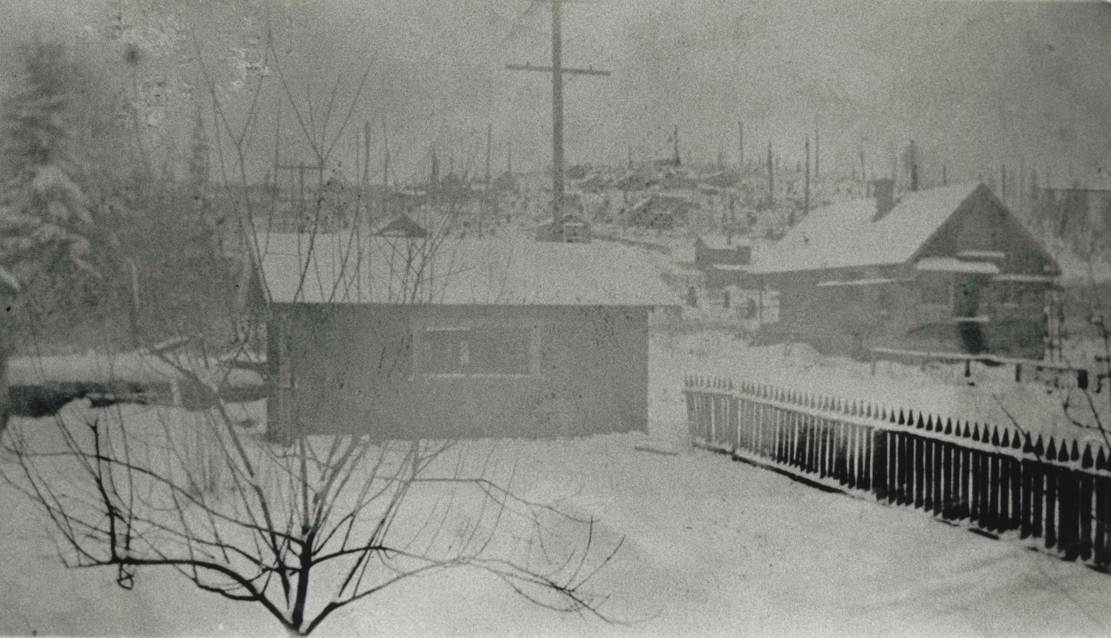
Burrard Inlet in winter
https://search.heritageburnaby.ca/link/museumdescription3902
- Repository
- Burnaby Village Museum
- Date
- [192-]
- Collection/Fonds
- Burnaby Village Museum Photograph collection
- Description Level
- Item
- Physical Description
- 1 photograph : b&w ; 26.5 x 16 cm
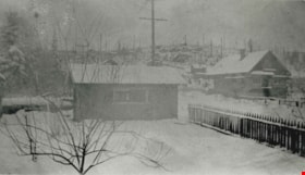
- Scope and Content
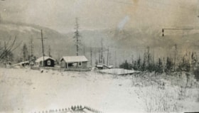
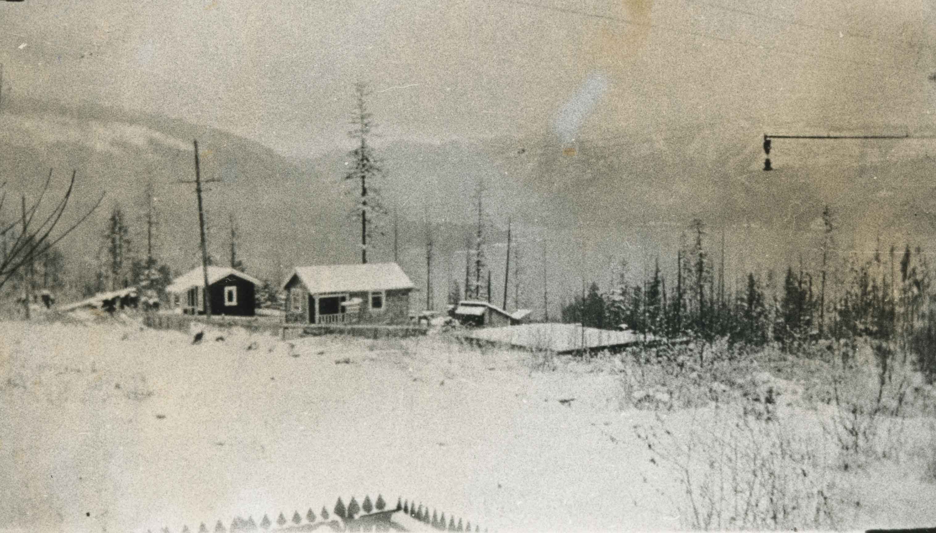
- Photograph of a Vancouver Heights streetscape in winter. There is snow on the ground. One of the houses across the street has what appears to be a radio mast in the front yard. The photograph is taken looking Northeast toward the Burrard Inlet with Mount Seymour in the background.
- Repository
- Burnaby Village Museum
- Collection/Fonds
- Burnaby Village Museum Photograph collection
- Description Level
- Item
- Physical Description
- 1 photograph : b&w ; 26.5 x 16 cm
- Material Details
- "Burrard Inlet - winter" written in ink on back of photo. "37" written in pencil on back of photo.
- Scope and Content
- Photograph of a Vancouver Heights streetscape in winter. There is snow on the ground. One of the houses across the street has what appears to be a radio mast in the front yard. The photograph is taken looking Northeast toward the Burrard Inlet with Mount Seymour in the background.
- History
- George Vincent Martin was born in 1892 in England. He married Matilda Florence Reed in 1916. He purchased a property in North Burnaby in the 1920s on Trinity Street. There was a main house and a "shack" on the property split up onto two lots.
- Subjects
- Natural Phenomena - Snow
- Geographic Features - Mountains
- Geographic Features - Inlets
- Buildings - Residential - Houses
- Accession Code
- BV007.45.17
- Access Restriction
- No restrictions
- Reproduction Restriction
- No known restrictions
- Date
- [192-]
- Media Type
- Photograph
- Scan Resolution
- 300
- Scan Date
- 29-Nov-2018
- Scale
- 96
- Notes
- Title based on content of the photograph
Images
![Burrard Inlet in winter, [192-] thumbnail](/media/hpo/_Data/_BVM_Images/2007/2007_0045_0017_001.jpg)
Edmonds St + 18th Ave (SW of 16th Street)
https://search.heritageburnaby.ca/link/archivedescription93727
- Repository
- City of Burnaby Archives
- Date
- March 1989
- Collection/Fonds
- Grover, Elliott & Co. Ltd. fonds
- Description Level
- File
- Physical Description
- 14 photographs : col. negatives ; 35 mm
- Scope and Content
- Photographs of the intersections at Edmonds Street and 18th Avenue and Edmonds Street and 16th Avenue and an unidentified residential lane.
- Repository
- City of Burnaby Archives
- Date
- March 1989
- Collection/Fonds
- Grover, Elliott & Co. Ltd. fonds
- Physical Description
- 14 photographs : col. negatives ; 35 mm
- Description Level
- File
- Record No.
- 622-015
- Access Restriction
- No restrictions
- Reproduction Restriction
- No restrictions
- Accession Number
- 2017-39
- Scope and Content
- Photographs of the intersections at Edmonds Street and 18th Avenue and Edmonds Street and 16th Avenue and an unidentified residential lane.
- Media Type
- Photograph
- Notes
- Transcribed title
- Title transcribed from original print envelope
- Photographs 622-015-001 : 622-015-002 depict Edmonds Street and 16th Avenue, facing south
- Photographs 622-015-003 : 622-015-004 depict the view southwest along Edmonds Street
- Photographs 622-015-006 : 622-015-008 depict the view southeast along 16th Street
- Photographs 622-015-009 : 622-015-011 depict the view southwest along 18th Avenue
- Locations were identified using notes on verso of accompanying prints
- Geographic Access
- 18th Avenue
- Edmonds Street
- 16th Avenue
- Historic Neighbourhood
- Edmonds (Historic Neighbourhood)
- Planning Study Area
- Stride Avenue Area

From 4042 Yale Street
https://search.heritageburnaby.ca/link/archivedescription37628
- Repository
- City of Burnaby Archives
- Date
- 1952 (date of original), copied 1991
- Collection/Fonds
- Burnaby Historical Society fonds
- Description Level
- Item
- Physical Description
- 1 photograph : b&w ; 2.9 x 4.8 cm print on contact sheet 20.2 x 25.3 cm
- Scope and Content
- Photograph taken looking north from 4042 Yale Street. Burrard Inlet and the northshore mountains are visible in the background, and there is snow.
- Repository
- City of Burnaby Archives
- Date
- 1952 (date of original), copied 1991
- Collection/Fonds
- Burnaby Historical Society fonds
- Subseries
- Burnaby Image Bank subseries
- Physical Description
- 1 photograph : b&w ; 2.9 x 4.8 cm print on contact sheet 20.2 x 25.3 cm
- Description Level
- Item
- Record No.
- 370-216
- Access Restriction
- No restrictions
- Reproduction Restriction
- No restrictions
- Accession Number
- BHS1999-03
- Scope and Content
- Photograph taken looking north from 4042 Yale Street. Burrard Inlet and the northshore mountains are visible in the background, and there is snow.
- Subjects
- Buildings - Residential - Houses
- Geographic Features - Inlets
- Geographic Features - Mountains
- Media Type
- Photograph
- Notes
- Title based on contents of photograph
- 1 b&w copy negative accompanying
- Geographic Access
- Yale Street
- Street Address
- 4042 Yale Street
- Historic Neighbourhood
- Vancouver Heights (Historic Neighbourhood)
- Planning Study Area
- Burnaby Heights Area
Images

![Roads and sidewalks, [192-] (date of original), copied 1986 thumbnail](/media/hpo/_Data/_Archives_Images/_Unrestricted/204/204-037.jpg?width=280)
Roads and sidewalks
https://search.heritageburnaby.ca/link/archivedescription35180
- Repository
- City of Burnaby Archives
- Date
- [192-] (date of original), copied 1986
- Collection/Fonds
- Burnaby Historical Society fonds
- Description Level
- Item
- Physical Description
- 1 photograph : b&w ; 12.7 x 17.8 cm print
- Scope and Content
- Photograph of dirt roads and sidewalks in Burnaby in the 1920s. George Pearson supervised cement sidewalk building throughout Burnaby during the Great Depression. St. Helen's Roman Catholic Church may be in the background.
- Repository
- City of Burnaby Archives
- Date
- [192-] (date of original), copied 1986
- Collection/Fonds
- Burnaby Historical Society fonds
- Subseries
- Pioneer Tales subseries
- Physical Description
- 1 photograph : b&w ; 12.7 x 17.8 cm print
- Description Level
- Item
- Record No.
- 204-037
- Access Restriction
- No restrictions
- Reproduction Restriction
- No known restrictions
- Accession Number
- BHS1988-03
- Scope and Content
- Photograph of dirt roads and sidewalks in Burnaby in the 1920s. George Pearson supervised cement sidewalk building throughout Burnaby during the Great Depression. St. Helen's Roman Catholic Church may be in the background.
- Subjects
- Geographic Features - Sidewalks
- Geographic Features - Roads
- Buildings - Residential - Houses
- Media Type
- Photograph
- Notes
- Title based on contents of photograph
Images
![Roads and sidewalks, [192-] (date of original), copied 1986 thumbnail](/media/hpo/_Data/_Archives_Images/_Unrestricted/204/204-037.jpg)
![Second Narrows, [192-] thumbnail](/media/hpo/_Data/_BVM_Images/2007/2007_0045_0018_001.jpg?width=280)
Second Narrows
https://search.heritageburnaby.ca/link/museumdescription3903
- Repository
- Burnaby Village Museum
- Date
- [192-]
- Collection/Fonds
- Burnaby Village Museum Photograph collection
- Description Level
- Item
- Physical Description
- 1 stereograph card : b&w ; 17.5 x 9 cm
- Scope and Content
- Stereograph card images of a street in Vancouver Heights. The photograph is taken looking Northeast toward the Burrard Inlet. Mount Seymour is shrouded in cloud in the background.
- Repository
- Burnaby Village Museum
- Collection/Fonds
- Burnaby Village Museum Photograph collection
- Description Level
- Item
- Physical Description
- 1 stereograph card : b&w ; 17.5 x 9 cm
- Material Details
- Hand-written text in red ink on the front of the stereograph card reads: "2nd Narrows".
- Scope and Content
- Stereograph card images of a street in Vancouver Heights. The photograph is taken looking Northeast toward the Burrard Inlet. Mount Seymour is shrouded in cloud in the background.
- History
- George Vincent Martin was born in 1892 in England. He married Matilda Florence Reed in 1916. He purchased a property in North Burnaby in the 1920s on Trinity Street. There was a main house and a "shack" on the property split up onto two lots.
- Subjects
- Geographic Features - Mountains
- Geographic Features - Inlets
- Buildings - Residential - Houses
- Accession Code
- BV007.45.18
- Access Restriction
- No restrictions
- Reproduction Restriction
- No known restrictions
- Date
- [192-]
- Media Type
- Photograph
- Scan Resolution
- 300
- Scan Date
- 29-Nov-2018
- Scale
- 96
- Notes
- Title based on notation below the photograph
Images
![Second Narrows, [192-] thumbnail](/media/hpo/_Data/_BVM_Images/2007/2007_0045_0018_001.jpg)
![Barnet Village, [1915] (date of original), copied 1986 thumbnail](/media/hpo/_Data/_Archives_Images/_Unrestricted/204/204-295.jpg?width=280)
Barnet Village
https://search.heritageburnaby.ca/link/archivedescription35437
- Repository
- City of Burnaby Archives
- Date
- [1915] (date of original), copied 1986
- Collection/Fonds
- Burnaby Historical Society fonds
- Description Level
- Item
- Physical Description
- 1 photograph : b&w ; 12.7 x 17.8 cm print
- Scope and Content
- Photograph of workers' houses in Barnet Village. Some 700 people were employed by the North Pacific Lumber Co. mill at its peak. The roof of the Canadian Pacific Railway station is visible.
- Repository
- City of Burnaby Archives
- Date
- [1915] (date of original), copied 1986
- Collection/Fonds
- Burnaby Historical Society fonds
- Subseries
- Pioneer Tales subseries
- Physical Description
- 1 photograph : b&w ; 12.7 x 17.8 cm print
- Description Level
- Item
- Record No.
- 204-295
- Access Restriction
- No restrictions
- Reproduction Restriction
- No restrictions
- Accession Number
- BHS1988-03
- Scope and Content
- Photograph of workers' houses in Barnet Village. Some 700 people were employed by the North Pacific Lumber Co. mill at its peak. The roof of the Canadian Pacific Railway station is visible.
- Subjects
- Geographic Features - Neighbourhoods
- Media Type
- Photograph
- Photographer
- Eaton, Dr. Carl
- Notes
- Title based on contents of photograph
- Geographic Access
- Barnet Road
- Street Address
- 8181 Barnet Road
- Historic Neighbourhood
- Barnet (Historic Neighbourhood)
- Planning Study Area
- Burnaby Mountain Area
Images
![Barnet Village, [1915] (date of original), copied 1986 thumbnail](/media/hpo/_Data/_Archives_Images/_Unrestricted/204/204-295.jpg)
Benson Neighbourhood
https://search.heritageburnaby.ca/link/archivedescription35582
- Repository
- City of Burnaby Archives
- Date
- 1929 (date of original), copied 1986
- Collection/Fonds
- Burnaby Historical Society fonds
- Description Level
- Item
- Physical Description
- 1 photograph : b&w ; 12.7 x 17.8 cm print
- Scope and Content
- Photograph of the neighbourhood as seen from the Benson front porch at 3 Fell Avenue North. Note the trees and bush.
- Repository
- City of Burnaby Archives
- Date
- 1929 (date of original), copied 1986
- Collection/Fonds
- Burnaby Historical Society fonds
- Subseries
- Pioneer Tales subseries
- Physical Description
- 1 photograph : b&w ; 12.7 x 17.8 cm print
- Description Level
- Item
- Record No.
- 204-440
- Access Restriction
- No restrictions
- Reproduction Restriction
- No known restrictions
- Accession Number
- BHS1988-03
- Scope and Content
- Photograph of the neighbourhood as seen from the Benson front porch at 3 Fell Avenue North. Note the trees and bush.
- Subjects
- Geographic Features - Neighbourhoods
- Media Type
- Photograph
- Notes
- Title based on contents of photograph
- Geographic Access
- Fell Avenue
- Historic Neighbourhood
- Capitol Hill (Historic Neighbourhood)
- Planning Study Area
- Capitol Hill Area
Images
![Burnaby Heights Merchants Association daffodils, [2002] thumbnail](/media/hpo/_Data/_Archives_Images/_Unrestricted/535/535-2313.jpg?width=280)
Burnaby Heights Merchants Association daffodils
https://search.heritageburnaby.ca/link/archivedescription96708
- Repository
- City of Burnaby Archives
- Date
- [2002]
- Collection/Fonds
- Burnaby NewsLeader photograph collection
- Description Level
- Item
- Physical Description
- 1 photograph (tiff) : col.
- Scope and Content
- Photograph of Monique Koningstein, the program coordinator of the Burnaby Heights Merchants Association, holding a bouquet of daffodils and standing on Hastings Street. Some businesses, including the Dollar Mart, and neighbourhood flags for "The Heights" on the streetlights are visible in the backg…
- Repository
- City of Burnaby Archives
- Date
- [2002]
- Collection/Fonds
- Burnaby NewsLeader photograph collection
- Physical Description
- 1 photograph (tiff) : col.
- Description Level
- Item
- Record No.
- 535-2313
- Access Restriction
- No restrictions
- Reproduction Restriction
- No restrictions
- Accession Number
- 2018-12
- Scope and Content
- Photograph of Monique Koningstein, the program coordinator of the Burnaby Heights Merchants Association, holding a bouquet of daffodils and standing on Hastings Street. Some businesses, including the Dollar Mart, and neighbourhood flags for "The Heights" on the streetlights are visible in the background.
- Media Type
- Photograph
- Photographer
- Bartel, Mario
- Notes
- Title based on caption
- Collected by editorial for use in a March 2002 issue of the Burnaby NewsLeader
- Caption from metadata: "Monique Koningstein, the program co-ordinator of the Burnaby Heights Merchants Association, enjoys a burst of Spring. Merchants in the Heights shopping district handed out daffodils to their customers on Saturday as a way to celebrate the season and to support the Cancer Foundation."
- Geographic Access
- Hastings Street
- Historic Neighbourhood
- Vancouver Heights (Historic Neighbourhood)
- Planning Study Area
- Burnaby Heights Area
Images
![Burnaby Heights Merchants Association daffodils, [2002] thumbnail](/media/hpo/_Data/_Archives_Images/_Unrestricted/535/535-2313.jpg)
![Burnaby Heights Merchants Association executives, [2001] thumbnail](/media/hpo/_Data/_Archives_Images/_Unrestricted/535/535-2941.jpg?width=280)
Burnaby Heights Merchants Association executives
https://search.heritageburnaby.ca/link/archivedescription97645
- Repository
- City of Burnaby Archives
- Date
- [2001]
- Collection/Fonds
- Burnaby NewsLeader photograph collection
- Description Level
- Item
- Physical Description
- 1 photograph (tiff) : col.
- Scope and Content
- Photograph of Bob Coghlan, president of the Burnaby Heights Merchants Association, and Joe Dobson, the executive director, posing in front of a mural in the Burnaby Heights neighbourhood.
- Repository
- City of Burnaby Archives
- Date
- [2001]
- Collection/Fonds
- Burnaby NewsLeader photograph collection
- Physical Description
- 1 photograph (tiff) : col.
- Description Level
- Item
- Record No.
- 535-2941
- Access Restriction
- No restrictions
- Reproduction Restriction
- No restrictions
- Accession Number
- 2018-12
- Scope and Content
- Photograph of Bob Coghlan, president of the Burnaby Heights Merchants Association, and Joe Dobson, the executive director, posing in front of a mural in the Burnaby Heights neighbourhood.
- Media Type
- Photograph
- Photographer
- Bartel, Mario
- Notes
- Title based on caption
- Collected by editorial for use in a November 2001 issue of the Burnaby NewsLeader
- Caption from metadata: "Bob Coghlan, the President of the Burnaby Heights Merchants' Association, and Joe Dobson, the Executive-Director, work to keep the Associaton involved with the community's non-profit and social service groups. The Association was recently honored with a Community Spirit Award at the Burnaby Business Excellence Awards."
- Historic Neighbourhood
- Vancouver Heights (Historic Neighbourhood)
- Planning Study Area
- Burnaby Heights Area
Images
![Burnaby Heights Merchants Association executives, [2001] thumbnail](/media/hpo/_Data/_Archives_Images/_Unrestricted/535/535-2941.jpg)
Burnaby neighbourhood
https://search.heritageburnaby.ca/link/archivedescription35955
- Repository
- City of Burnaby Archives
- Date
- December 1987
- Collection/Fonds
- Burnaby Historical Society fonds
- Description Level
- Item
- Physical Description
- 1 photograph : sepia ; 10 x 15 cm print
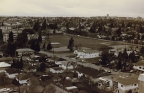
- Scope and Content
- Photograph of a neighbourhood in Burnaby, taken from the New Vista Tower, looking west.
- Repository
- City of Burnaby Archives
- Date
- December 1987
- Collection/Fonds
- Burnaby Historical Society fonds
- Subseries
- Edmonds School subseries
- Physical Description
- 1 photograph : sepia ; 10 x 15 cm print
- Description Level
- Item
- Record No.
- 207-004
- Access Restriction
- No restrictions
- Reproduction Restriction
- Reproduce for fair dealing purposes only
- Accession Number
- BHS1988-07
- Scope and Content
- Photograph of a neighbourhood in Burnaby, taken from the New Vista Tower, looking west.
- Subjects
- Geographic Features - Neighbourhoods
- Media Type
- Photograph
- Notes
- Title based on contents of photograph
- Historic Neighbourhood
- Edmonds (Historic Neighbourhood)
- Planning Study Area
- Edmonds Area
Images

Burnaby neighbourhood
https://search.heritageburnaby.ca/link/archivedescription35956
- Repository
- City of Burnaby Archives
- Date
- December 1987
- Collection/Fonds
- Burnaby Historical Society fonds
- Description Level
- Item
- Physical Description
- 1 photograph : sepia ; 10 x 15 cm
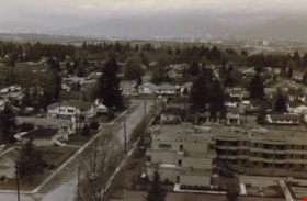
- Scope and Content
- Photograph of houses and apartment buildings in a Burnaby neighbourhood, taken from the New Vista Tower, looking north-west.
- Repository
- City of Burnaby Archives
- Date
- December 1987
- Collection/Fonds
- Burnaby Historical Society fonds
- Subseries
- Edmonds School subseries
- Physical Description
- 1 photograph : sepia ; 10 x 15 cm
- Description Level
- Item
- Record No.
- 207-005
- Access Restriction
- No restrictions
- Reproduction Restriction
- Reproduce for fair dealing purposes only
- Accession Number
- BHS1988-07
- Scope and Content
- Photograph of houses and apartment buildings in a Burnaby neighbourhood, taken from the New Vista Tower, looking north-west.
- Subjects
- Geographic Features - Neighbourhoods
- Media Type
- Photograph
- Notes
- Title based on contents of photograph
- Historic Neighbourhood
- Edmonds (Historic Neighbourhood)
- Planning Study Area
- Edmonds Area
Images
Capitol Hill neighborhood
https://search.heritageburnaby.ca/link/archivedescription35792
- Repository
- City of Burnaby Archives
- Date
- 1923 (date of original), copied 1986
- Collection/Fonds
- Burnaby Historical Society fonds
- Description Level
- Item
- Physical Description
- 1 photograph : b&w ; 12.7 x 17.8 cm print
- Scope and Content
- Photograph of the Capitol Hill neighborhood taken from Bob Benson's home, 5 Fell Avenue and Dundas Street, looking towards the top of Capitol Hill.
- Repository
- City of Burnaby Archives
- Date
- 1923 (date of original), copied 1986
- Collection/Fonds
- Burnaby Historical Society fonds
- Subseries
- Pioneer Tales subseries
- Physical Description
- 1 photograph : b&w ; 12.7 x 17.8 cm print
- Description Level
- Item
- Record No.
- 204-650
- Access Restriction
- No restrictions
- Reproduction Restriction
- No known restrictions
- Accession Number
- BHS1988-03
- Scope and Content
- Photograph of the Capitol Hill neighborhood taken from Bob Benson's home, 5 Fell Avenue and Dundas Street, looking towards the top of Capitol Hill.
- Media Type
- Photograph
- Notes
- Title based on contents of photograph
- Geographic Access
- Fell Avenue
- Street Address
- 5 Fell Avenue
- Historic Neighbourhood
- Capitol Hill (Historic Neighbourhood)
- Planning Study Area
- Capitol Hill Area
Images
![Carol and Valerie Shantz with Ida Cary, [1955] (date of original), copied 1991 thumbnail](/media/hpo/_Data/_Archives_Images/_Unrestricted/370/370-167.jpg?width=280)
Carol and Valerie Shantz with Ida Cary
https://search.heritageburnaby.ca/link/archivedescription37579
- Repository
- City of Burnaby Archives
- Date
- [1955] (date of original), copied 1991
- Collection/Fonds
- Burnaby Historical Society fonds
- Description Level
- Item
- Physical Description
- 1 photograph : b&w ; 4.4 x 3.0 cm print on contact sheet 20.2 x 25.3 cm
- Scope and Content
- Photograph of Carol and Valerie Shantz, age 5 and 1, with their grandmother, Ida Cary, at the intersection of Madison Avenue and Albert Street.
- Repository
- City of Burnaby Archives
- Date
- [1955] (date of original), copied 1991
- Collection/Fonds
- Burnaby Historical Society fonds
- Subseries
- Burnaby Image Bank subseries
- Physical Description
- 1 photograph : b&w ; 4.4 x 3.0 cm print on contact sheet 20.2 x 25.3 cm
- Description Level
- Item
- Record No.
- 370-167
- Access Restriction
- No restrictions
- Reproduction Restriction
- No restrictions
- Accession Number
- BHS1999-03
- Scope and Content
- Photograph of Carol and Valerie Shantz, age 5 and 1, with their grandmother, Ida Cary, at the intersection of Madison Avenue and Albert Street.
- Subjects
- Geographic Features - Neighbourhoods
- Media Type
- Photograph
- Notes
- Title based on contents of photograph
- 1 b&w copy negative accompanying
- Geographic Access
- Madison Avenue
- Albert Street
- Historic Neighbourhood
- Vancouver Heights (Historic Neighbourhood)
- Planning Study Area
- Burnaby Heights Area
Images
![Carol and Valerie Shantz with Ida Cary, [1955] (date of original), copied 1991 thumbnail](/media/hpo/_Data/_Archives_Images/_Unrestricted/370/370-167.jpg)
![City of Mainz, Germany, [1880] thumbnail](/media/hpo/_Data/_Archives_Images/_Unrestricted/477/477-798.jpg?width=280)
City of Mainz, Germany
https://search.heritageburnaby.ca/link/archivedescription39479
- Repository
- City of Burnaby Archives
- Date
- [1880]
- Collection/Fonds
- Peers Family and Hill Family fonds
- Description Level
- Item
- Physical Description
- 1 photograph : b&w ; 10 x 15 cm on page 21.5 x 28 cm (pasted in album)
- Scope and Content
- Photograph of the City of Mainz in Germany. This item was in a scrapbook kept by Claude Hill who was originally from England but ultimately settled in the Burnaby Lake area.
- Repository
- City of Burnaby Archives
- Date
- [1880]
- Collection/Fonds
- Peers Family and Hill Family fonds
- Physical Description
- 1 photograph : b&w ; 10 x 15 cm on page 21.5 x 28 cm (pasted in album)
- Description Level
- Item
- Record No.
- 477-798
- Access Restriction
- No restrictions
- Reproduction Restriction
- No known restrictions
- Accession Number
- 2007-12
- Scope and Content
- Photograph of the City of Mainz in Germany. This item was in a scrapbook kept by Claude Hill who was originally from England but ultimately settled in the Burnaby Lake area.
- Media Type
- Photograph
- Notes
- Title based on contents of photograph
Images
![City of Mainz, Germany, [1880] thumbnail](/media/hpo/_Data/_Archives_Images/_Unrestricted/477/477-798.jpg)