More like 'Interview with Robert Lowe by Eric Damer November 5, 2012 - Track 2'
Narrow Results By
Subject
- Academic Disciplines 1
- Accidents 5
- Accidents - Automobile Accidents 6
- Accidents - Train Accidents 2
- Advertising Medium 2
- Advertising Medium - Signs and Signboards 12
- Agricultural Tools and Equipment 13
- Agricultural Tools and Equipment - Gardening Equipment 2
- Agricultural Tools and Equipment - Plows 9
- Agriculture 9
- Agriculture - Crops 27
- Agriculture - Farms 115
Interview with Robert Lowe by Eric Damer November 5, 2012 - Track 3
https://search.heritageburnaby.ca/link/oralhistory355
- Repository
- City of Burnaby Archives
- Date Range
- 1939-1972
- Length
- 0:10:04
- Summary
- This portion of the recording pertains to Robert "Bob" Lowe's memories of growing up in Burnaby. He discusses transportation in Burnaby, including the first cars in his family. Bob talks about recreational activities available to Burnaby residents in the late nineteen-thirties and early nineteen-fo…
- Repository
- City of Burnaby Archives
- Summary
- This portion of the recording pertains to Robert "Bob" Lowe's memories of growing up in Burnaby. He discusses transportation in Burnaby, including the first cars in his family. Bob talks about recreational activities available to Burnaby residents in the late nineteen-thirties and early nineteen-forties, as well as changes that he has seen from his time growing up to the time of raising his own children.
- Date Range
- 1939-1972
- Photo Info
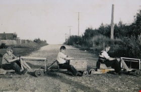
- Robert "Bob" Lowe (at center) and friends riding soap box race cars, [1939]. Item no. 549-041.
- Length
- 0:10:04
- Interviewer
- Damer, Eric
- Interview Date
- November 5, 2012
- Scope and Content
- Recording is an interview with Robert "Bob" Lowe conducted by Burnaby Village Museum employee Eric Damer, November 5, 2012. Major theme discussed: the rise of the automobile and its effect on development in Burnaby.
- Biographical Notes
- Robert "Bob" Lowe has lived his entire life in Burnaby. During his childhood, Bob’s family lived at several addresses near Royal Oak and what is now Canada Way. He attended Douglas Road Elementary and South Burnaby High Schools. After graduating, Bob worked for a few years before enrolling in Normal School for a teaching certificate. He began teaching in Vancouver, married in 1952, and started a family. The Lowes moved to Government Road in 1961 and began a hobby farm, while Bob upgraded his formal education and became an administrator in the new college system.
- Total Tracks
- 4
- Total Length
- 0:36:54
- Interviewee Name
- Lowe, Robert "Bob"
- Interview Location
- Interviewee's residence
- Interviewer Bio
- Eric Damer is a lifelong British Columbian born in Victoria, raised in Kamloops, and currently residing in Burnaby. After studying philosophy at the University of Victoria, he became interested in the educational forces that had shaped his own life. He completed master’s and doctoral degrees in educational studies at the University of British Columbia with a particular interest in the history of adult and higher education in the province. In 2012, Eric worked for the City of Burnaby as a field researcher and writer, conducting interviews for the City Archives and Museum Oral History Program.
- Collection/Fonds
- Community Heritage Commission Special Projects fonds
- Transcript Available
- None
- Media Type
- Sound Recording
Images
Audio Tracks
Track three of recording of interview with Bob Lowe
Track three of recording of interview with Bob Lowe
https://search.heritageburnaby.ca/media/hpo/_Data/_Archives_Oral_Histories/_Unrestricted/MSS171-016/MSS171-016_Track_3.mp3Trailers on the Stiglish property
https://search.heritageburnaby.ca/link/archivedescription77193
- Repository
- City of Burnaby Archives
- Date
- [196-] (date of original), digitally copied 2013
- Collection/Fonds
- Stiglish family fonds
- Description Level
- Item
- Physical Description
- 1 photograph : b&w copy-print ; 9 x 9 cm
- Scope and Content
- Photograph of the overflow of Jehovah Witness convention goers staying on the Stiglish property because the four acre trailer park, in Coquitlam, British Columbia that Jack Stiglish owned, was full.
- Repository
- City of Burnaby Archives
- Date
- [196-] (date of original), digitally copied 2013
- Collection/Fonds
- Stiglish family fonds
- Physical Description
- 1 photograph : b&w copy-print ; 9 x 9 cm
- Description Level
- Item
- Record No.
- 552-007
- Access Restriction
- No restrictions
- Reproduction Restriction
- Reproduce for fair dealing purposes only
- Accession Number
- 2013-07
- Scope and Content
- Photograph of the overflow of Jehovah Witness convention goers staying on the Stiglish property because the four acre trailer park, in Coquitlam, British Columbia that Jack Stiglish owned, was full.
- Names
- Stiglish, F.J. "Jack"
- Media Type
- Photograph
- Notes
- Title based on contents of photograph
- Note in blue ink on verso of photograph reads: "father owned four acre Trailer Court in Coquitlam / Jehovah Witness convention overflow from trailer park"
- Original spelling of surname was "Stiglich"
- Geographic Access
- Keswick Avenue
- Street Address
- 3782 Keswick Avenue
- Historic Neighbourhood
- Burquitlam (Historic Neighbourhood)
- Planning Study Area
- Cameron Area
Images
Elsie Nicholson
https://search.heritageburnaby.ca/link/archivedescription38241
- Repository
- City of Burnaby Archives
- Date
- [1921]
- Collection/Fonds
- Burnaby Historical Society fonds
- Description Level
- Item
- Physical Description
- 1 photograph : b&w ; 8 x 12.2 cm
- Scope and Content
- Photograph of Elsie Nicholson standing next to the horse named "Holly" at the Nicholson farm in the area of Boundary Road and the C.N.R. rail line. The barns and farm outbuildings can be seen in the background.
- Repository
- City of Burnaby Archives
- Date
- [1921]
- Collection/Fonds
- Burnaby Historical Society fonds
- Subseries
- Margaret McCallum subseries
- Physical Description
- 1 photograph : b&w ; 8 x 12.2 cm
- Description Level
- Item
- Record No.
- 375-002
- Access Restriction
- No restrictions
- Reproduction Restriction
- No known restrictions
- Accession Number
- BHS1986-42
- Scope and Content
- Photograph of Elsie Nicholson standing next to the horse named "Holly" at the Nicholson farm in the area of Boundary Road and the C.N.R. rail line. The barns and farm outbuildings can be seen in the background.
- Subjects
- Agriculture - Farms
- Occupations - Farmers
- Agriculture - Crops
- Transportation - Horses
- Animals - Dogs
- Transportation - Wagons
- Names
- Nicholson, Elsie
- Media Type
- Photograph
- Notes
- Title based on contents of photograph
- Geographic Access
- Boundary Road
- Street Address
- 2550 Boundary Road
- Historic Neighbourhood
- Broadview (Historic Neighbourhood)
- Planning Study Area
- West Central Valley Area
Images
E.W. Nicholson at his farm
https://search.heritageburnaby.ca/link/archivedescription38240
- Repository
- City of Burnaby Archives
- Date
- [1921]
- Collection/Fonds
- Burnaby Historical Society fonds
- Description Level
- Item
- Physical Description
- 1 photograph : b&w ; 8 x 12.5 cm
- Scope and Content
- Photograph of E.W. Nicholson, haying on his farm at Boundary Road and the Canadian National Railway tracks with his horse "Holly."
- Repository
- City of Burnaby Archives
- Date
- [1921]
- Collection/Fonds
- Burnaby Historical Society fonds
- Subseries
- Margaret McCallum subseries
- Physical Description
- 1 photograph : b&w ; 8 x 12.5 cm
- Description Level
- Item
- Record No.
- 375-001
- Access Restriction
- No restrictions
- Reproduction Restriction
- No known restrictions
- Accession Number
- BHS1986-42
- Scope and Content
- Photograph of E.W. Nicholson, haying on his farm at Boundary Road and the Canadian National Railway tracks with his horse "Holly."
- Subjects
- Agriculture - Farms
- Occupations - Farmers
- Agriculture - Crops
- Transportation - Horses
- Animals - Dogs
- Transportation - Wagons
- Names
- Nicholson, E.W.
- Media Type
- Photograph
- Notes
- Title based on contents of photograph
- Geographic Access
- Boundary Road
- Street Address
- 2550 Boundary Road
- Historic Neighbourhood
- Broadview (Historic Neighbourhood)
- Planning Study Area
- West Central Valley Area
Images
Farm workers
https://search.heritageburnaby.ca/link/archivedescription38856
- Repository
- City of Burnaby Archives
- Date
- [1905]
- Collection/Fonds
- Peers Family and Hill Family fonds
- Description Level
- Item
- Physical Description
- 1 photograph : b&w ; 6 x 10.5 cm on page 14 x 17.5 cm (pasted in album)
- Scope and Content
- Photograph of workers in the field picking crops on the farm belonging to F.J. Hart. The property was on the corner of Douglas Road (later Canada Way) and Sperling Avenue although the Hart House was located at 6664 Deer Lake Avenue.
- Repository
- City of Burnaby Archives
- Date
- [1905]
- Collection/Fonds
- Peers Family and Hill Family fonds
- Physical Description
- 1 photograph : b&w ; 6 x 10.5 cm on page 14 x 17.5 cm (pasted in album)
- Description Level
- Item
- Record No.
- 477-175
- Access Restriction
- No restrictions
- Reproduction Restriction
- No known restrictions
- Accession Number
- 2007-12
- Scope and Content
- Photograph of workers in the field picking crops on the farm belonging to F.J. Hart. The property was on the corner of Douglas Road (later Canada Way) and Sperling Avenue although the Hart House was located at 6664 Deer Lake Avenue.
- Subjects
- Agriculture - Crops
- Occupations - Agricultural Labourers
- Agriculture - Farms
- Agriculture - Fruit and Berries
- Media Type
- Photograph
- Notes
- Title based on contents of photograph
- Geographic Access
- Douglas Road
- Sperling Avenue
- Canada Way
- Deer Lake Avenue
- Historic Neighbourhood
- Burnaby Lake (Historic Neighbourhood)
- Planning Study Area
- Morley-Buckingham Area
Images
Money's Mushrooms parade float
https://search.heritageburnaby.ca/link/archivedescription77189
- Repository
- City of Burnaby Archives
- Date
- [1957] (date of original), digitally copied 2013
- Collection/Fonds
- Stiglish family fonds
- Description Level
- Item
- Physical Description
- 1 photograph : b&w copy-print ; 9 x 9 cm
- Scope and Content
- Photograph of the Money's Mushrooms parade float that FJ "Jack" Stiglish created for the Pacific National Exhibition (PNE) parade. Helen Stiglish is believed to have created the mushroom drawings for the float.
- Repository
- City of Burnaby Archives
- Date
- [1957] (date of original), digitally copied 2013
- Collection/Fonds
- Stiglish family fonds
- Physical Description
- 1 photograph : b&w copy-print ; 9 x 9 cm
- Description Level
- Item
- Record No.
- 552-003
- Access Restriction
- No restrictions
- Reproduction Restriction
- Reproduce for fair dealing purposes only
- Accession Number
- 2013-07
- Scope and Content
- Photograph of the Money's Mushrooms parade float that FJ "Jack" Stiglish created for the Pacific National Exhibition (PNE) parade. Helen Stiglish is believed to have created the mushroom drawings for the float.
- Media Type
- Photograph
- Notes
- Title based on contents of photograph
- Note in blue ink on verso of photograph reads: "Father created the float for the PNE parade with mother's help. My mother probably drew the mushrooms as she was very artistic. There was also a booth at the PNE that / about 1957 / float on an old red Studebaker"
- Original spelling of surname was "Stiglich"
- Geographic Access
- Keswick Avenue
- Street Address
- 3782 Keswick Avenue
- Historic Neighbourhood
- Burquitlam (Historic Neighbourhood)
- Planning Study Area
- Cameron Area
Images
Ploughing at Nicholson farm
https://search.heritageburnaby.ca/link/archivedescription38261
- Repository
- City of Burnaby Archives
- Date
- 1931
- Collection/Fonds
- Burnaby Historical Society fonds
- Description Level
- Item
- Physical Description
- 1 photograph : b&w ; 10.5 x 15.4 cm
- Scope and Content
- Photograph of four farmers and a team of horses ploughing a field and the E.W. Nicholson farm in the Broadview district. In the background, to the right, can be seen the Dominion Bridge Co. building (at 3880 Henning Drive).
- Repository
- City of Burnaby Archives
- Date
- 1931
- Collection/Fonds
- Burnaby Historical Society fonds
- Subseries
- Margaret McCallum subseries
- Physical Description
- 1 photograph : b&w ; 10.5 x 15.4 cm
- Description Level
- Item
- Record No.
- 375-023
- Access Restriction
- No restrictions
- Reproduction Restriction
- No known restrictions
- Accession Number
- BHS1986-42
- Scope and Content
- Photograph of four farmers and a team of horses ploughing a field and the E.W. Nicholson farm in the Broadview district. In the background, to the right, can be seen the Dominion Bridge Co. building (at 3880 Henning Drive).
- Subjects
- Agriculture - Farms
- Occupations - Farmers
- Transportation - Horses
- Agricultural Tools and Equipment - Plows
- Media Type
- Photograph
- Notes
- Title based on caption
- A note on the back of the photograph reads: "Ploughing on farm of Mr. E.W. Nicholson - Boundary Road and Great Northern Rlwy. John McCallum in foreground. Dominion Bridge Co. in background.)
- Geographic Access
- Boundary Road
- Henning Drive
- Street Address
- 2550 Boundary Road
- 3880 Henning Drive
- Historic Neighbourhood
- Broadview (Historic Neighbourhood)
- Planning Study Area
- West Central Valley Area
Images
William Brenchley farm
https://search.heritageburnaby.ca/link/archivedescription34864
- Repository
- City of Burnaby Archives
- Date
- [between 1890 and 1895] (date of original), copied 1985
- Collection/Fonds
- Burnaby Historical Society fonds
- Description Level
- Item
- Physical Description
- 1 photograph : b&w ; 8.8 x 12.5 cm print
- Scope and Content
- Photograph of a farm hand and horse team inside a large stump, taken on William Brenchley's farm. The farm was located at the northeast corner of Kingsway and 10th Avenue.
- Repository
- City of Burnaby Archives
- Date
- [between 1890 and 1895] (date of original), copied 1985
- Collection/Fonds
- Burnaby Historical Society fonds
- Subseries
- W.E. Brenchley subseries
- Physical Description
- 1 photograph : b&w ; 8.8 x 12.5 cm print
- Description Level
- Item
- Record No.
- 146-002
- Access Restriction
- No restrictions
- Reproduction Restriction
- No known restrictions
- Accession Number
- BHS1985-16
- Scope and Content
- Photograph of a farm hand and horse team inside a large stump, taken on William Brenchley's farm. The farm was located at the northeast corner of Kingsway and 10th Avenue.
- Media Type
- Photograph
- Photographer
- Thompson, S.J.
- Notes
- Title based on contents of photograph
- Geographic Access
- 10th Avenue
- Kingsway
- Historic Neighbourhood
- Edmonds (Historic Neighbourhood)
- Planning Study Area
- Edmonds Area
Images
C.F. Sprott's house
https://search.heritageburnaby.ca/link/archivedescription34498
- Repository
- City of Burnaby Archives
- Date
- 1908
- Collection/Fonds
- Burnaby Historical Society fonds
- Description Level
- Item
- Physical Description
- 1 photograph : sepia ; 12.8 x 17.7 cm mounted on cardboard 14.8 x 19.7 cm
- Scope and Content
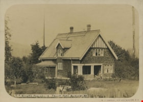
- Photograph of C.F. Sprott's House at Douglas Road and Norland Avenue. A unidentified man is standing on the porch steps.
- Repository
- City of Burnaby Archives
- Date
- 1908
- Collection/Fonds
- Burnaby Historical Society fonds
- Subseries
- Photographs subseries
- Physical Description
- 1 photograph : sepia ; 12.8 x 17.7 cm mounted on cardboard 14.8 x 19.7 cm
- Description Level
- Item
- Record No.
- 022-001
- Access Restriction
- No restrictions
- Reproduction Restriction
- No known restrictions
- Accession Number
- BHS2007-04
- Scope and Content
- Photograph of C.F. Sprott's House at Douglas Road and Norland Avenue. A unidentified man is standing on the porch steps.
- Media Type
- Photograph
- Photographer
- Cooksley, William Thomas
- Notes
- Title based on contents of photograph
- Annotation at bottom of photograph reads, "C.F. Sprott's Residence, Fruit Farm, Burnaby B.C."
- Annotation underneath photograph reads, "W.T. Cooksley, New Westminster, B.C."
- Geographic Access
- Douglas Road
- Norland Avenue
- Historic Neighbourhood
- Burnaby Lake (Historic Neighbourhood)
- Planning Study Area
- Ardingley-Sprott Area
Images
Chinese Market Gardens
https://search.heritageburnaby.ca/link/archivedescription70542
- Repository
- City of Burnaby Archives
- Date
- 1949
- Collection/Fonds
- Gail Yip fonds
- Description Level
- Item
- Physical Description
- 1 photograph (jpeg) : b&w
- Scope and Content
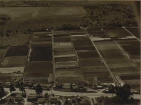
- Photograph is an aerial view looking south over the Chinese Market Gardens along Marine Drive. The farm on the south side of Marine Drive, second from the east, is 4930 Marine Drive.
- Repository
- City of Burnaby Archives
- Date
- 1949
- Collection/Fonds
- Gail Yip fonds
- Physical Description
- 1 photograph (jpeg) : b&w
- Description Level
- Item
- Record No.
- 529-001
- Access Restriction
- No restrictions
- Reproduction Restriction
- Reproduce for fair dealing purposes only
- Accession Number
- 2012-04
- Scope and Content
- Photograph is an aerial view looking south over the Chinese Market Gardens along Marine Drive. The farm on the south side of Marine Drive, second from the east, is 4930 Marine Drive.
- Subjects
- Agriculture - Crops
- Agriculture - Farms
- Names
- Chinese Market Gardens
- Media Type
- Photograph
- Geographic Access
- Marine Drive
- Street Address
- 4930 Marine Drive
- Historic Neighbourhood
- Fraser Arm (Historic Neighbourhood)
- Planning Study Area
- Big Bend Area
Images
Cram family fruit stand
https://search.heritageburnaby.ca/link/archivedescription35703
- Repository
- City of Burnaby Archives
- Date
- 1920 (date of original), copied 1986
- Collection/Fonds
- Burnaby Historical Society fonds
- Description Level
- Item
- Physical Description
- 1 photograph : b&w ; 12.7 x 17.8 cm print
- Scope and Content
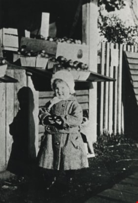
- Photograph of the Cram roadside fruit stand on Kingsway with Mary Cram in front. The Cram family sold fruit, produce, honey, and cottage cheese from their farm at Kingsway and what is now 6515 Denbigh Avenue. The stand was located directly in front of the Cram-Tidball family home.
- Repository
- City of Burnaby Archives
- Date
- 1920 (date of original), copied 1986
- Collection/Fonds
- Burnaby Historical Society fonds
- Subseries
- Pioneer Tales subseries
- Physical Description
- 1 photograph : b&w ; 12.7 x 17.8 cm print
- Description Level
- Item
- Record No.
- 204-561
- Access Restriction
- No restrictions
- Reproduction Restriction
- No known restrictions
- Accession Number
- BHS1988-03
- Scope and Content
- Photograph of the Cram roadside fruit stand on Kingsway with Mary Cram in front. The Cram family sold fruit, produce, honey, and cottage cheese from their farm at Kingsway and what is now 6515 Denbigh Avenue. The stand was located directly in front of the Cram-Tidball family home.
- Names
- Vogt, Mary Cram
- Media Type
- Photograph
- Notes
- Title based on contents of photograph
- Geographic Access
- Denbigh Avenue
- Street Address
- 6515 Denbigh Avenue
- Historic Neighbourhood
- Central Park (Historic Neighbourhood)
- Planning Study Area
- Windsor Area
Images
Development on Big Bend agricultural land
https://search.heritageburnaby.ca/link/archivedescription95885
- Repository
- City of Burnaby Archives
- Date
- [2000]
- Collection/Fonds
- Burnaby NewsLeader photograph collection
- Description Level
- File
- Physical Description
- 2 photographs (tiff) : col.
- Scope and Content
- File contains photographs of Burnaby citizens concerned about industrial and big box retail development in the Big Bend area. One photograph shows Shawn Wade leaning against a fence next to a sign that reads "Western Garden Soil Mushroom Manure Bark Mulch." The other photograph shows Ed Leong holdi…
- Repository
- City of Burnaby Archives
- Date
- [2000]
- Collection/Fonds
- Burnaby NewsLeader photograph collection
- Physical Description
- 2 photographs (tiff) : col.
- Description Level
- File
- Record No.
- 535-1685
- Access Restriction
- No restrictions
- Reproduction Restriction
- No restrictions
- Accession Number
- 2018-12
- Scope and Content
- File contains photographs of Burnaby citizens concerned about industrial and big box retail development in the Big Bend area. One photograph shows Shawn Wade leaning against a fence next to a sign that reads "Western Garden Soil Mushroom Manure Bark Mulch." The other photograph shows Ed Leong holding soil in the fields at Leong's Nursery.
- Media Type
- Photograph
- Photographer
- Bartel, Mario
- Notes
- Title based on caption
- Collected by editorial for use in a November 2000 issue of the Burnaby NewsLeader
- Caption from metadata for 535-1685-1: "Shawn Wade is concerned the City of Burnaby's plans to allow big box retail development in the Big Bend area along Marine Way would threaten the unique agricultural flavor of the area, including nurseries, and the allotment gardens."
- Caption from metadata for 535-1685-2: "Ed Leong, who's run Leong's Nursery since the 1960s, says industrial development in the Big Bend area has already destroyed his ability to grow crops like Chinese vegetables, green onions, lettuce and carrots, as water gets trapped in the already boggy soil by surrounding landfill."
- Historic Neighbourhood
- Fraser Arm (Historic Neighbourhood)
- Planning Study Area
- Big Bend Area
Images
Jesse Love's Fruit Farm, Burnaby, BC
https://search.heritageburnaby.ca/link/archivedescription34501
- Repository
- City of Burnaby Archives
- Date
- [1900]
- Collection/Fonds
- Burnaby Historical Society fonds
- Description Level
- Item
- Physical Description
- 1 photograph : sepia ; 12.8 x 17.8 cm mounted on cardboard 14.7 x 19.8 cm
- Scope and Content
- Photograph of members of the Love family kneeling in a strawberry field. Left to right: Jesse Love (father), Leonard, Phoebe, Martha, Minnie, Martha Love (mother), and Sarah. The small building at the extreme left of the picture was George Love's (oldest of the Love's children) first sash and doo…
- Repository
- City of Burnaby Archives
- Date
- [1900]
- Collection/Fonds
- Burnaby Historical Society fonds
- Subseries
- Photographs subseries
- Physical Description
- 1 photograph : sepia ; 12.8 x 17.8 cm mounted on cardboard 14.7 x 19.8 cm
- Description Level
- Item
- Record No.
- 022-004
- Access Restriction
- No restrictions
- Reproduction Restriction
- No known restrictions
- Accession Number
- BHS2007-04
- Scope and Content
- Photograph of members of the Love family kneeling in a strawberry field. Left to right: Jesse Love (father), Leonard, Phoebe, Martha, Minnie, Martha Love (mother), and Sarah. The small building at the extreme left of the picture was George Love's (oldest of the Love's children) first sash and door outlet. He later built Love's Sash and Door Factory on the south side of Edmonds Street just west of 6th Street. The original farm was located in East Burnaby, on Cumberland Road. In 1988, this house was moved to the site of the Burnaby Village Museum at Deer Lake Avenue.
- Names
- Love, Jesse, 1849-1928
- Love, Leonard
- Brandrith, Martha Dorothy “Dot” Love
- Love, Martha Leonard, 1858-1920
- McKenzie, Edith Minnie Love
- Feedham, Phoebe Leonard Love
- Parker, Sarah Maria Love
- Media Type
- Photograph
- Photographer
- Cooksley, William Thomas
- Notes
- Annotation bottom of the photograph reads, "Jesse Love's Fruit Farm, Burnaby, BC"
- Geographic Access
- Cumberland Street
- Street Address
- 6501 Deer Lake Avenue
- Historic Neighbourhood
- East Burnaby (Historic Neighbourhood)
- Planning Study Area
- Cariboo-Armstrong Area
Images
Nicholson Farm
https://search.heritageburnaby.ca/link/archivedescription38258
- Repository
- City of Burnaby Archives
- Date
- 1933
- Collection/Fonds
- Burnaby Historical Society fonds
- Description Level
- Item
- Physical Description
- 1 photograph : b&w ; 10.5 x 15.5 cm
- Scope and Content
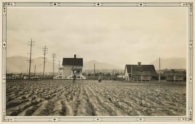
- Photograph looking over a field toward a house and barn identified as E.W. Nicholson's Broadway Jersey Ranch.
- Repository
- City of Burnaby Archives
- Date
- 1933
- Collection/Fonds
- Burnaby Historical Society fonds
- Subseries
- Margaret McCallum subseries
- Physical Description
- 1 photograph : b&w ; 10.5 x 15.5 cm
- Description Level
- Item
- Record No.
- 375-020
- Access Restriction
- No restrictions
- Reproduction Restriction
- No known restrictions
- Accession Number
- BHS1986-42
- Scope and Content
- Photograph looking over a field toward a house and barn identified as E.W. Nicholson's Broadway Jersey Ranch.
- Subjects
- Agriculture - Farms
- Buildings - Agricultural - Barns
- Agriculture - Crops
- Buildings - Residential - Houses
- Media Type
- Photograph
- Notes
- Title based on caption
- A note on the back of the photograph reads: "Our farm home - Broadway Jersey Ranch 1993. 3704 Boundary Road at G.N.Ry Crossing Burnaby BC. Property occupied and owned by E.W. Nicholson from May 23, 1900 to Sept. 29, 1951. Property sold to Link-Belt Co. in 1951."
- Geographic Access
- Boundary Road
- Street Address
- 2550 Boundary Road
- Historic Neighbourhood
- Broadview (Historic Neighbourhood)
- Planning Study Area
- West Central Valley Area
Images
Price Strawberry farm
https://search.heritageburnaby.ca/link/archivedescription35946
- Repository
- City of Burnaby Archives
- Date
- 1920 (date of original), copied 1986
- Collection/Fonds
- Burnaby Historical Society fonds
- Description Level
- Item
- Physical Description
- 1 photograph : b&w ; 7.6 x 12.7 cm print
- Scope and Content
- Photograph of the Price Strawberry farm at 5220 Royal Oak Avenue. Oakalla Prison Farm can be seen in the background.
- Repository
- City of Burnaby Archives
- Date
- 1920 (date of original), copied 1986
- Collection/Fonds
- Burnaby Historical Society fonds
- Subseries
- Pioneer Tales subseries
- Physical Description
- 1 photograph : b&w ; 7.6 x 12.7 cm print
- Description Level
- Item
- Record No.
- 204-806
- Access Restriction
- No restrictions
- Reproduction Restriction
- No known restrictions
- Accession Number
- BHS1988-03
- Scope and Content
- Photograph of the Price Strawberry farm at 5220 Royal Oak Avenue. Oakalla Prison Farm can be seen in the background.
- Names
- Oakalla Prison Farm
- Media Type
- Photograph
- Notes
- Title based on contents of photograph
- Geographic Access
- Oakmount Crescent
- Street Address
- 5220 Oakmount Crescent
- Historic Neighbourhood
- Burnaby Lake (Historic Neighbourhood)
- Planning Study Area
- Oakalla Area
Images
Shawn Wade in Big Bend
https://search.heritageburnaby.ca/link/archivedescription97571
- Repository
- City of Burnaby Archives
- Date
- [2002]
- Collection/Fonds
- Burnaby NewsLeader photograph collection
- Description Level
- Item
- Physical Description
- 1 photograph (tiff) : col.
- Scope and Content
- Photograph of Shawn Wade standing on the shoulder of a road in the Big Bend area. A farm and forested area are visible in the background.
- Repository
- City of Burnaby Archives
- Date
- [2002]
- Collection/Fonds
- Burnaby NewsLeader photograph collection
- Physical Description
- 1 photograph (tiff) : col.
- Description Level
- Item
- Record No.
- 535-2910
- Access Restriction
- No restrictions
- Reproduction Restriction
- No restrictions
- Accession Number
- 2018-12
- Scope and Content
- Photograph of Shawn Wade standing on the shoulder of a road in the Big Bend area. A farm and forested area are visible in the background.
- Media Type
- Photograph
- Photographer
- Bartel, Mario
- Notes
- Title based on caption
- Collected by editorial for use in a January 2002 issue of the Burnaby NewsLeader
- Caption from metadata: "Shawn Wade fears the unique rural character of Burnaby's Big Bend area will die if Burnaby council approves a plan for commercial development."
- Historic Neighbourhood
- Fraser Arm (Historic Neighbourhood)
- Planning Study Area
- Big Bend Area
Images
Towards Nicholson Farm
https://search.heritageburnaby.ca/link/archivedescription38256
- Repository
- City of Burnaby Archives
- Date
- 1933
- Collection/Fonds
- Burnaby Historical Society fonds
- Description Level
- Item
- Physical Description
- 1 photograph : b&w ; 7 x 11.5 cm
- Scope and Content
- Photograph looking over a field towards a house and barn in the background. The farm has been identified as that belonging to E.W. Nicholson of the Broadview district.
- Repository
- City of Burnaby Archives
- Date
- 1933
- Collection/Fonds
- Burnaby Historical Society fonds
- Subseries
- Margaret McCallum subseries
- Physical Description
- 1 photograph : b&w ; 7 x 11.5 cm
- Description Level
- Item
- Record No.
- 375-018
- Access Restriction
- No restrictions
- Reproduction Restriction
- No known restrictions
- Accession Number
- BHS1986-42
- Scope and Content
- Photograph looking over a field towards a house and barn in the background. The farm has been identified as that belonging to E.W. Nicholson of the Broadview district.
- Subjects
- Agriculture - Farms
- Buildings - Agricultural - Barns
- Agriculture - Crops
- Buildings - Residential - Houses
- Media Type
- Photograph
- Notes
- Title based on caption.
- A note on the back of the photograph reads: "Haying time on farm of E.W. Nicholson."
- Geographic Access
- Boundary Road
- Street Address
- 2550 Boundary Road
- Historic Neighbourhood
- Broadview (Historic Neighbourhood)
- Planning Study Area
- West Central Valley Area
Images
W.H. Lewis farm
https://search.heritageburnaby.ca/link/archivedescription34499
- Repository
- City of Burnaby Archives
- Date
- [1900]
- Collection/Fonds
- Burnaby Historical Society fonds
- Description Level
- Item
- Physical Description
- 1 photograph : sepia ; 12.6 x 17.7 cm mounted on cardboard 14.2 x 19.3 cm
- Scope and Content
- Photograph of W.H. Lewis' fruit farm with a man, three women and five children kneeling in a strawberry field. "Pioneer Tales" identifies them as William Lewis (foreground), three of his children, and hired help. A house can be seen in the background. The Lewis house was located on 4th Street.
- Repository
- City of Burnaby Archives
- Date
- [1900]
- Collection/Fonds
- Burnaby Historical Society fonds
- Subseries
- Photographs subseries
- Physical Description
- 1 photograph : sepia ; 12.6 x 17.7 cm mounted on cardboard 14.2 x 19.3 cm
- Description Level
- Item
- Record No.
- 022-002
- Access Restriction
- No restrictions
- Reproduction Restriction
- No known restrictions
- Accession Number
- BHS2007-04
- Scope and Content
- Photograph of W.H. Lewis' fruit farm with a man, three women and five children kneeling in a strawberry field. "Pioneer Tales" identifies them as William Lewis (foreground), three of his children, and hired help. A house can be seen in the background. The Lewis house was located on 4th Street.
- Media Type
- Photograph
- Photographer
- Cooksley, William Thomas
- Notes
- Title based on contents of photograph
- Annotation at bottom of photograph reads, "W.H. Lewis' Fruit Farm, Burnaby, B.C."
- Geographic Access
- 4th Street
- 18th Avenue
- Historic Neighbourhood
- East Burnaby (Historic Neighbourhood)
- Planning Study Area
- Second Street Area
Images
Abandonded farm house
https://search.heritageburnaby.ca/link/archivedescription36511
- Repository
- City of Burnaby Archives
- Date
- 1950
- Collection/Fonds
- Burnaby Historical Society fonds
- Description Level
- Item
- Physical Description
- 1 photograph : b&w ; 8.5 x 14 cm
- Scope and Content
- Photograph of an abandoned farm house on Government Road.
- Repository
- City of Burnaby Archives
- Date
- 1950
- Collection/Fonds
- Burnaby Historical Society fonds
- Subseries
- Photographs subseries
- Physical Description
- 1 photograph : b&w ; 8.5 x 14 cm
- Description Level
- Item
- Record No.
- 288-002
- Access Restriction
- No restrictions
- Reproduction Restriction
- Reproduce for fair dealing purposes only
- Accession Number
- BHS1992-23
- Scope and Content
- Photograph of an abandoned farm house on Government Road.
- Media Type
- Photograph
- Notes
- Title based on contents of photograph
- Photograph is a modern contact print of an original negative that was loaned to the Archives
- Geographic Access
- Government Road
- Historic Neighbourhood
- Lochdale (Historic Neighbourhood)
- Planning Study Area
- Government Road Area
Images
Barn at 6861 Kitchener Street
https://search.heritageburnaby.ca/link/archivedescription78995
- Repository
- City of Burnaby Archives
- Date
- October 4, 1976
- Collection/Fonds
- Burnaby Public Library Contemporary Visual Archive Project
- Description Level
- Item
- Physical Description
- 1 photograph : b&w ; 11 x 16 cm mounted on cardboard
- Scope and Content
- Photograph shows a barn and lot with a horse grazing at 6861 Kitchener Street near Cliff Avenue.
- Repository
- City of Burnaby Archives
- Date
- October 4, 1976
- Collection/Fonds
- Burnaby Public Library Contemporary Visual Archive Project
- Physical Description
- 1 photograph : b&w ; 11 x 16 cm mounted on cardboard
- Description Level
- Item
- Record No.
- 556-079
- Access Restriction
- No restrictions
- Reproduction Restriction
- Reproduce for fair dealing purposes only
- Accession Number
- 2013-13
- Scope and Content
- Photograph shows a barn and lot with a horse grazing at 6861 Kitchener Street near Cliff Avenue.
- Media Type
- Photograph
- Photographer
- Born, A. J.
- Notes
- Scope note taken directly from BPL photograph description.
- 1 b&w copy negative : 10 x 12.5 cm accompanying
- Geographic Access
- Kitchener Street
- Street Address
- 6861 Kitchener Street
- Historic Neighbourhood
- Lochdale (Historic Neighbourhood)
- Planning Study Area
- Lochdale Area
![Trailers on the Stiglish property, [196-] (date of original), digitally copied 2013 thumbnail](/media/hpo/_Data/_Archives_Images/_Unrestricted/550/552-007.jpg?width=280)
![Elsie Nicholson, [1921] thumbnail](/media/hpo/_Data/_Archives_Images/_Unrestricted/371/375-002.jpg?width=280)
![E.W. Nicholson at his farm, [1921] thumbnail](/media/hpo/_Data/_Archives_Images/_Unrestricted/371/375-001.jpg?width=280)
![Farm workers, [1905] thumbnail](/media/hpo/_Data/_Archives_Images/_Unrestricted/477/477-175.jpg?width=280)
![Money's Mushrooms parade float, [1957] (date of original), digitally copied 2013 thumbnail](/media/hpo/_Data/_Archives_Images/_Unrestricted/550/552-003.jpg?width=280)

![William Brenchley farm, [between 1890 and 1895] (date of original), copied 1985 thumbnail](/media/hpo/_Data/_Archives_Images/_Unrestricted/126/146-002.jpg?width=280)
![Development on Big Bend agricultural land, [2000] thumbnail](/media/hpo/_Data/_Archives_Images/_Unrestricted/535/535-1685-2.jpg?width=280)
![Jesse Love's Fruit Farm, Burnaby, BC, [1900] thumbnail](/media/hpo/_Data/_Archives_Images/_Unrestricted/001/022-004.jpg?width=280)
![Shawn Wade in Big Bend, [2002] thumbnail](/media/hpo/_Data/_Archives_Images/_Unrestricted/535/535-2910.jpg?width=280)
![W.H. Lewis farm, [1900] thumbnail](/media/hpo/_Data/_Archives_Images/_Unrestricted/001/022-002.jpg?width=280)
