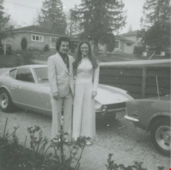
More like '5990 Irmin Street'
Narrow Results By
Subject
- Accidents 5
- Accidents - Automobile Accidents 10
- Accidents - Train Accidents 9
- Advertising Medium 5
- Advertising Medium - Signs and Signboards 106
- Aerial Photographs 27
- Agricultural Tools and Equipment 5
- Agricultural Tools and Equipment - Gardening Equipment 2
- Agricultural Tools and Equipment - Plows 9
- Agriculture 2
- Agriculture - Crops 10
- Agriculture - Farms 58

Venables Street
https://search.heritageburnaby.ca/link/archivedescription52845
- Repository
- City of Burnaby Archives
- Date
- 1981
- Collection/Fonds
- Harold H. Johnston fonds
- Description Level
- Item
- Physical Description
- 1 photograph (jpeg) : b&w
- Scope and Content
- Photograph of a woman standing next to two children on a tricycle on Venables Street. A man is on the far right standing next to a parked car. Three of the people in the photograph are identified by first name only as Sharron, Andrea and Frank. The photograph was most likely taken near the Johnston…
- Repository
- City of Burnaby Archives
- Date
- 1981
- Collection/Fonds
- Harold H. Johnston fonds
- Physical Description
- 1 photograph (jpeg) : b&w
- Description Level
- Item
- Record No.
- 483-102
- Access Restriction
- No restrictions
- Reproduction Restriction
- No reproduction permitted
- Accession Number
- 2008-08
- Scope and Content
- Photograph of a woman standing next to two children on a tricycle on Venables Street. A man is on the far right standing next to a parked car. Three of the people in the photograph are identified by first name only as Sharron, Andrea and Frank. The photograph was most likely taken near the Johnston family home at 4447 Venables Street.
- Subjects
- Transportation - Automobiles
- Transportation - Bicycles
- Buildings - Residential - Houses
- Geographic Features - Roads
- Media Type
- Photograph
- Photographer
- Johnston, Harold H.
- Notes
- Title based on contents of photograph
- Geographic Access
- Venables Street
- Historic Neighbourhood
- Vancouver Heights (Historic Neighbourhood)
- Planning Study Area
- Willingdon Heights Area
Images

![3830 Hazel Street, [ca. 1945] (date of original), copied 1991 thumbnail](/media/hpo/_Data/_Archives_Images/_Unrestricted/370/370-747.jpg?width=280)
3830 Hazel Street
https://search.heritageburnaby.ca/link/archivedescription38160
- Repository
- City of Burnaby Archives
- Date
- [ca. 1945] (date of original), copied 1991
- Collection/Fonds
- Burnaby Historical Society fonds
- Description Level
- Item
- Physical Description
- 1 photograph : b&w ; 3.0 x 5.4 cm print on contact sheet 20.1 x 26.3 cm
- Scope and Content
- Photograph of the view from 3830 Hazel Street (later renumbered 4662 Hazel Street) in the snow. Spud Murphy's car, a Desoto, can be seen in the street and the George family's house is in the background.
- Repository
- City of Burnaby Archives
- Date
- [ca. 1945] (date of original), copied 1991
- Collection/Fonds
- Burnaby Historical Society fonds
- Subseries
- Burnaby Image Bank subseries
- Physical Description
- 1 photograph : b&w ; 3.0 x 5.4 cm print on contact sheet 20.1 x 26.3 cm
- Description Level
- Item
- Record No.
- 370-747
- Access Restriction
- No restrictions
- Reproduction Restriction
- No known restrictions
- Accession Number
- BHS1999-03
- Scope and Content
- Photograph of the view from 3830 Hazel Street (later renumbered 4662 Hazel Street) in the snow. Spud Murphy's car, a Desoto, can be seen in the street and the George family's house is in the background.
- Media Type
- Photograph
- Notes
- Title based on contents of photograph
- 1 b&w copy negative accompanying
- Negative has a pink cast
- Geographic Access
- Hazel Street
- Street Address
- 4662 Hazel Street
- Historic Neighbourhood
- Central Park (Historic Neighbourhood)
- Planning Study Area
- Marlborough Area
Images
![3830 Hazel Street, [ca. 1945] (date of original), copied 1991 thumbnail](/media/hpo/_Data/_Archives_Images/_Unrestricted/370/370-747.jpg)
![4674 Southlawn Drive, [ca. 1954] (date of original), copied 1991 thumbnail](/media/hpo/_Data/_Archives_Images/_Unrestricted/370/370-462.jpg?width=280)
4674 Southlawn Drive
https://search.heritageburnaby.ca/link/archivedescription37874
- Repository
- City of Burnaby Archives
- Date
- [ca. 1954] (date of original), copied 1991
- Collection/Fonds
- Burnaby Historical Society fonds
- Description Level
- Item
- Physical Description
- 1 photograph : b&w ; 2.5 x 3.7 cm print on contact sheet 20.1 x 26.7 cm
- Scope and Content
- Photograph of the view from 4674 Southlawn Drive, facing north. A car and houses across the street can be seen. Capitol Hill is visible in the distance.
- Repository
- City of Burnaby Archives
- Date
- [ca. 1954] (date of original), copied 1991
- Collection/Fonds
- Burnaby Historical Society fonds
- Subseries
- Burnaby Image Bank subseries
- Physical Description
- 1 photograph : b&w ; 2.5 x 3.7 cm print on contact sheet 20.1 x 26.7 cm
- Description Level
- Item
- Record No.
- 370-462
- Access Restriction
- No restrictions
- Reproduction Restriction
- No restrictions
- Accession Number
- BHS1999-03
- Scope and Content
- Photograph of the view from 4674 Southlawn Drive, facing north. A car and houses across the street can be seen. Capitol Hill is visible in the distance.
- Media Type
- Photograph
- Notes
- Title based on contents of photograph
- 1 b&w copy negative accompanying
- Negative has a pink cast
- Geographic Access
- Southlawn Drive
- Planning Study Area
- Brentwood Area
Images
![4674 Southlawn Drive, [ca. 1954] (date of original), copied 1991 thumbnail](/media/hpo/_Data/_Archives_Images/_Unrestricted/370/370-462.jpg)
5507 to 5555 Inman Ave
https://search.heritageburnaby.ca/link/archivedescription93747
- Repository
- City of Burnaby Archives
- Date
- 1989
- Collection/Fonds
- Grover, Elliott & Co. Ltd. fonds
- Description Level
- File
- Physical Description
- 19 photographs : col. negatives ; 35 mm
- Scope and Content
- Photographs of the properties located at 5507 to 5555 Inman Avenue - addresses that no longer exist. Buildings on the properties are single-storey houses.
- Repository
- City of Burnaby Archives
- Date
- 1989
- Collection/Fonds
- Grover, Elliott & Co. Ltd. fonds
- Physical Description
- 19 photographs : col. negatives ; 35 mm
- Description Level
- File
- Record No.
- 622-032
- Access Restriction
- No restrictions
- Reproduction Restriction
- No restrictions
- Accession Number
- 2017-39
- Scope and Content
- Photographs of the properties located at 5507 to 5555 Inman Avenue - addresses that no longer exist. Buildings on the properties are single-storey houses.
- Media Type
- Photograph
- Notes
- Transcribed title
- Title transcribed from print envelope photographs were originally housed in
- File no. 89-519-B
- Geographic Access
- Inman Avenue
- Historic Neighbourhood
- Central Park (Historic Neighbourhood)
- Planning Study Area
- Garden Village Area
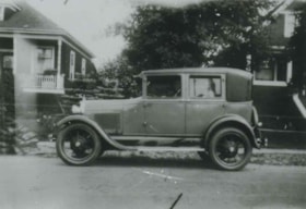
![Andrew Johnson house and family, [1913] thumbnail](/media/hpo/_Data/_Archives_Images/_Unrestricted/316/335-001.jpg?width=280)
Andrew Johnson house and family
https://search.heritageburnaby.ca/link/archivedescription37198
- Repository
- City of Burnaby Archives
- Date
- [1913]
- Collection/Fonds
- Burnaby Historical Society fonds
- Description Level
- Item
- Physical Description
- 1 photograph : sepia ; 11.5 x 16.5 cm, mounted on board 21.5 x 27 cm
- Scope and Content
- Photograph of Andrew M. Johnson, his wife Margaret and their child Andrew Sloane Johnson holding on to their dog, in a chauffeured car, parked in front of their house.
- Repository
- City of Burnaby Archives
- Date
- [1913]
- Collection/Fonds
- Burnaby Historical Society fonds
- Subseries
- Andrew Johnson subseries
- Physical Description
- 1 photograph : sepia ; 11.5 x 16.5 cm, mounted on board 21.5 x 27 cm
- Description Level
- Item
- Record No.
- 335-001
- Access Restriction
- No restrictions
- Reproduction Restriction
- No known restrictions
- Accession Number
- BHS1997-16
- Scope and Content
- Photograph of Andrew M. Johnson, his wife Margaret and their child Andrew Sloane Johnson holding on to their dog, in a chauffeured car, parked in front of their house.
- Media Type
- Photograph
- Notes
- Title based on contents of photograph
- 1 b&w copy negative accompanying
- Geographic Access
- Kingsway
- Street Address
- 5152 Kingsway
- Historic Neighbourhood
- Central Park (Historic Neighbourhood)
- Planning Study Area
- Marlborough Area
Images
![Andrew Johnson house and family, [1913] thumbnail](/media/hpo/_Data/_Archives_Images/_Unrestricted/316/335-001.jpg)
![Annie Ellis-King and Car, [ca. 1950] (date of original), copied 1991 thumbnail](/media/hpo/_Data/_Archives_Images/_Unrestricted/370/370-352.jpg?width=280)
Annie Ellis-King and Car
https://search.heritageburnaby.ca/link/archivedescription37764
- Repository
- City of Burnaby Archives
- Date
- [ca. 1950] (date of original), copied 1991
- Collection/Fonds
- Burnaby Historical Society fonds
- Description Level
- Item
- Physical Description
- 1 photograph : b&w ; 2.9 x 4.5 cm print on contact sheet 20.5 x 26.4 cm
- Scope and Content
- Photograph of Annie King-Ellis, posing with a car at the front of 6113 Silver Avenue, the Ellis family home.
- Repository
- City of Burnaby Archives
- Date
- [ca. 1950] (date of original), copied 1991
- Collection/Fonds
- Burnaby Historical Society fonds
- Subseries
- Burnaby Image Bank subseries
- Physical Description
- 1 photograph : b&w ; 2.9 x 4.5 cm print on contact sheet 20.5 x 26.4 cm
- Description Level
- Item
- Record No.
- 370-352
- Access Restriction
- No restrictions
- Reproduction Restriction
- No restrictions
- Accession Number
- BHS1999-03
- Scope and Content
- Photograph of Annie King-Ellis, posing with a car at the front of 6113 Silver Avenue, the Ellis family home.
- Names
- Ellis, Annie King
- Media Type
- Photograph
- Notes
- Title based on contents of photograph
- 1 b&w copy negative accompanying
- Negative has a pink cast
- Geographic Access
- Silver Avenue
- Street Address
- 6113 Silver Avenue
- Historic Neighbourhood
- Central Park (Historic Neighbourhood)
- Planning Study Area
- Maywood Area
Images
![Annie Ellis-King and Car, [ca. 1950] (date of original), copied 1991 thumbnail](/media/hpo/_Data/_Archives_Images/_Unrestricted/370/370-352.jpg)
![Back of 6926 Nelson Avenue, [between 1945 and 1949] (date of original), copied 1991 thumbnail](/media/hpo/_Data/_Archives_Images/_Unrestricted/370/370-351.jpg?width=280)
Back of 6926 Nelson Avenue
https://search.heritageburnaby.ca/link/archivedescription37763
- Repository
- City of Burnaby Archives
- Date
- [between 1945 and 1949] (date of original), copied 1991
- Collection/Fonds
- Burnaby Historical Society fonds
- Description Level
- Item
- Physical Description
- 1 photograph : b&w ; 2.9 x 5.2 cm print on contact sheet 20.5 x 26.4 cm
- Scope and Content
- Photograph of the backyard of 6926 Nelson Avenue, the Ellis family home, showing a car and an unidentified woman in the yard.
- Repository
- City of Burnaby Archives
- Date
- [between 1945 and 1949] (date of original), copied 1991
- Collection/Fonds
- Burnaby Historical Society fonds
- Subseries
- Burnaby Image Bank subseries
- Physical Description
- 1 photograph : b&w ; 2.9 x 5.2 cm print on contact sheet 20.5 x 26.4 cm
- Description Level
- Item
- Record No.
- 370-351
- Access Restriction
- No restrictions
- Reproduction Restriction
- No known restrictions
- Accession Number
- BHS1999-03
- Scope and Content
- Photograph of the backyard of 6926 Nelson Avenue, the Ellis family home, showing a car and an unidentified woman in the yard.
- Media Type
- Photograph
- Notes
- Title based on contents of photograph
- 1 b&w copy negative accompanying
- Negative has a pink cast
- Geographic Access
- Nelson Avenue
- Street Address
- 6926 Nelson Avenue
- Historic Neighbourhood
- Central Park (Historic Neighbourhood)
- Planning Study Area
- Sussex-Nelson Area
Images
![Back of 6926 Nelson Avenue, [between 1945 and 1949] (date of original), copied 1991 thumbnail](/media/hpo/_Data/_Archives_Images/_Unrestricted/370/370-351.jpg)

Beach Drive, Victoria
https://search.heritageburnaby.ca/link/archivedescription38710
- Repository
- City of Burnaby Archives
- Date
- 1946
- Collection/Fonds
- Peers Family and Hill Family fonds
- Description Level
- Item
- Physical Description
- 1 photograph : sepia ; 6 x 10.3 cm
- Scope and Content
- Photograph of a car parked in front of Beach Drive, Victoria. A note on the back of the photograph indicates the car is "1937 Willis Car."
- Repository
- City of Burnaby Archives
- Date
- 1946
- Collection/Fonds
- Peers Family and Hill Family fonds
- Physical Description
- 1 photograph : sepia ; 6 x 10.3 cm
- Description Level
- Item
- Record No.
- 477-029
- Access Restriction
- No restrictions
- Reproduction Restriction
- No known restrictions
- Accession Number
- 2007-12
- Scope and Content
- Photograph of a car parked in front of Beach Drive, Victoria. A note on the back of the photograph indicates the car is "1937 Willis Car."
- Media Type
- Photograph
- Notes
- Title based on contents of photograph
Images
![Butler family home, [196-] thumbnail](/media/hpo/_Data/_Archives_Images/_Unrestricted/204/204-210.jpg?width=280)
Butler family home
https://search.heritageburnaby.ca/link/archivedescription35353
- Repository
- City of Burnaby Archives
- Date
- [196-]
- Collection/Fonds
- Burnaby Historical Society fonds
- Description Level
- Item
- Physical Description
- 1 photograph : b&w ; 12.7 x 17.8 cm print
- Scope and Content
- Photograph of the second Butler family home at 7790 Buller Avenue, South Burnaby. Edwin Butler is standing by a valiant that is parked out front. The first Butler home in Burnaby was at 278 14th Avenue, East Burnaby.
- Repository
- City of Burnaby Archives
- Date
- [196-]
- Collection/Fonds
- Burnaby Historical Society fonds
- Subseries
- Pioneer Tales subseries
- Physical Description
- 1 photograph : b&w ; 12.7 x 17.8 cm print
- Description Level
- Item
- Record No.
- 204-210
- Access Restriction
- No restrictions
- Reproduction Restriction
- Reproduce for fair dealing purposes only
- Accession Number
- BHS1988-03
- Scope and Content
- Photograph of the second Butler family home at 7790 Buller Avenue, South Burnaby. Edwin Butler is standing by a valiant that is parked out front. The first Butler home in Burnaby was at 278 14th Avenue, East Burnaby.
- Names
- Butler, Edwin
- Media Type
- Photograph
- Notes
- Title based on contents of photograph
- Geographic Access
- Buller Avenue
- Street Address
- 7790 Buller Avenue
- Historic Neighbourhood
- Alta-Vista (Historic Neighbourhood)
- Planning Study Area
- Clinton-Glenwood Area
Images
![Butler family home, [196-] thumbnail](/media/hpo/_Data/_Archives_Images/_Unrestricted/204/204-210.jpg)
![Car in Front of 510 North Boundary Road, [1930] (date of original), copied ca. 2000 thumbnail](/media/Hpo/_Data/_Archives_Images/_Unrestricted/371/407-011.jpg?width=280)
Car in Front of 510 North Boundary Road
https://search.heritageburnaby.ca/link/archivedescription38336
- Repository
- City of Burnaby Archives
- Date
- [1930] (date of original), copied ca. 2000
- Collection/Fonds
- Burnaby Historical Society fonds
- Description Level
- Item
- Physical Description
- 1 photograph : b&w ; 8.8 x 12.7 cm print
- Scope and Content
- Photograph of a man and a woman sitting in a car in front of 510 North Boundary Road - both are unidentified.
- Repository
- City of Burnaby Archives
- Date
- [1930] (date of original), copied ca. 2000
- Collection/Fonds
- Burnaby Historical Society fonds
- Subseries
- Photographs subseries
- Physical Description
- 1 photograph : b&w ; 8.8 x 12.7 cm print
- Description Level
- Item
- Record No.
- 407-011
- Access Restriction
- No restrictions
- Reproduction Restriction
- No known restrictions
- Accession Number
- BHS2007-04
- Scope and Content
- Photograph of a man and a woman sitting in a car in front of 510 North Boundary Road - both are unidentified.
- Media Type
- Photograph
- Notes
- Title based on contents of photograph.
Images
![Car in Front of 510 North Boundary Road, [1930] (date of original), copied ca. 2000 thumbnail](/media/Hpo/_Data/_Archives_Images/_Unrestricted/371/407-011.jpg)
![Car in front of Loynes Family Home, [ca. 1973] (date of original), copied 1991 thumbnail](/media/hpo/_Data/_Archives_Images/_Unrestricted/370/370-260.jpg?width=280)
Car in front of Loynes Family Home
https://search.heritageburnaby.ca/link/archivedescription37672
- Repository
- City of Burnaby Archives
- Date
- [ca. 1973] (date of original), copied 1991
- Collection/Fonds
- Burnaby Historical Society fonds
- Description Level
- Item
- Physical Description
- 1 photograph : b&w ; 3.9 x 3.9 cm print on contact sheet 20.2 x 25.3 cm
- Scope and Content
- Photograph of the Loynes family home at 1855 18th Avenue (later renumbered as the 7000 block of 18th Avenue), with a car parked in front. The photo was taken from across the street.
- Repository
- City of Burnaby Archives
- Date
- [ca. 1973] (date of original), copied 1991
- Collection/Fonds
- Burnaby Historical Society fonds
- Subseries
- Burnaby Image Bank subseries
- Physical Description
- 1 photograph : b&w ; 3.9 x 3.9 cm print on contact sheet 20.2 x 25.3 cm
- Description Level
- Item
- Record No.
- 370-260
- Access Restriction
- No restrictions
- Reproduction Restriction
- No restrictions
- Accession Number
- BHS1999-03
- Scope and Content
- Photograph of the Loynes family home at 1855 18th Avenue (later renumbered as the 7000 block of 18th Avenue), with a car parked in front. The photo was taken from across the street.
- Media Type
- Photograph
- Notes
- Title based on contents of photograph
- 1 b&w copy negative accompanying
- Copied from col. photograph
- Negative has a pink cast
- Geographic Access
- 18th Avenue
- Historic Neighbourhood
- Edmonds (Historic Neighbourhood)
- Planning Study Area
- Stride Avenue Area
Images
![Car in front of Loynes Family Home, [ca. 1973] (date of original), copied 1991 thumbnail](/media/hpo/_Data/_Archives_Images/_Unrestricted/370/370-260.jpg)
![Ceperley touring car, [1912] thumbnail](/media/hpo/_Data/_Archives_Images/_Unrestricted/205/241-003.jpg?width=280)
Ceperley touring car
https://search.heritageburnaby.ca/link/archivedescription36225
- Repository
- City of Burnaby Archives
- Date
- [1912]
- Collection/Fonds
- Burnaby Historical Society fonds
- Description Level
- Item
- Physical Description
- 1 photograph : b&w copy negative ; 5 x 8 cm
- Scope and Content
- Photograph of the Ceperley touring car parked in driveway at the Fairacres' Mansion.
- Repository
- City of Burnaby Archives
- Date
- [1912]
- Collection/Fonds
- Burnaby Historical Society fonds
- Subseries
- Burnaby Art Gallery subseries
- Physical Description
- 1 photograph : b&w copy negative ; 5 x 8 cm
- Description Level
- Item
- Record No.
- 241-003
- Access Restriction
- No restrictions
- Reproduction Restriction
- No known restrictions
- Accession Number
- BHS1990-05
- Scope and Content
- Photograph of the Ceperley touring car parked in driveway at the Fairacres' Mansion.
- Media Type
- Photograph
- Notes
- Title based on contents of photograph 1 b&w copy print accompanying
- Geographic Access
- Deer Lake Avenue
- Street Address
- 6344 Deer Lake Avenue
- Historic Neighbourhood
- Burnaby Lake (Historic Neighbourhood)
- Planning Study Area
- Douglas-Gilpin Area
Images
![Ceperley touring car, [1912] thumbnail](/media/hpo/_Data/_Archives_Images/_Unrestricted/205/241-003.jpg)

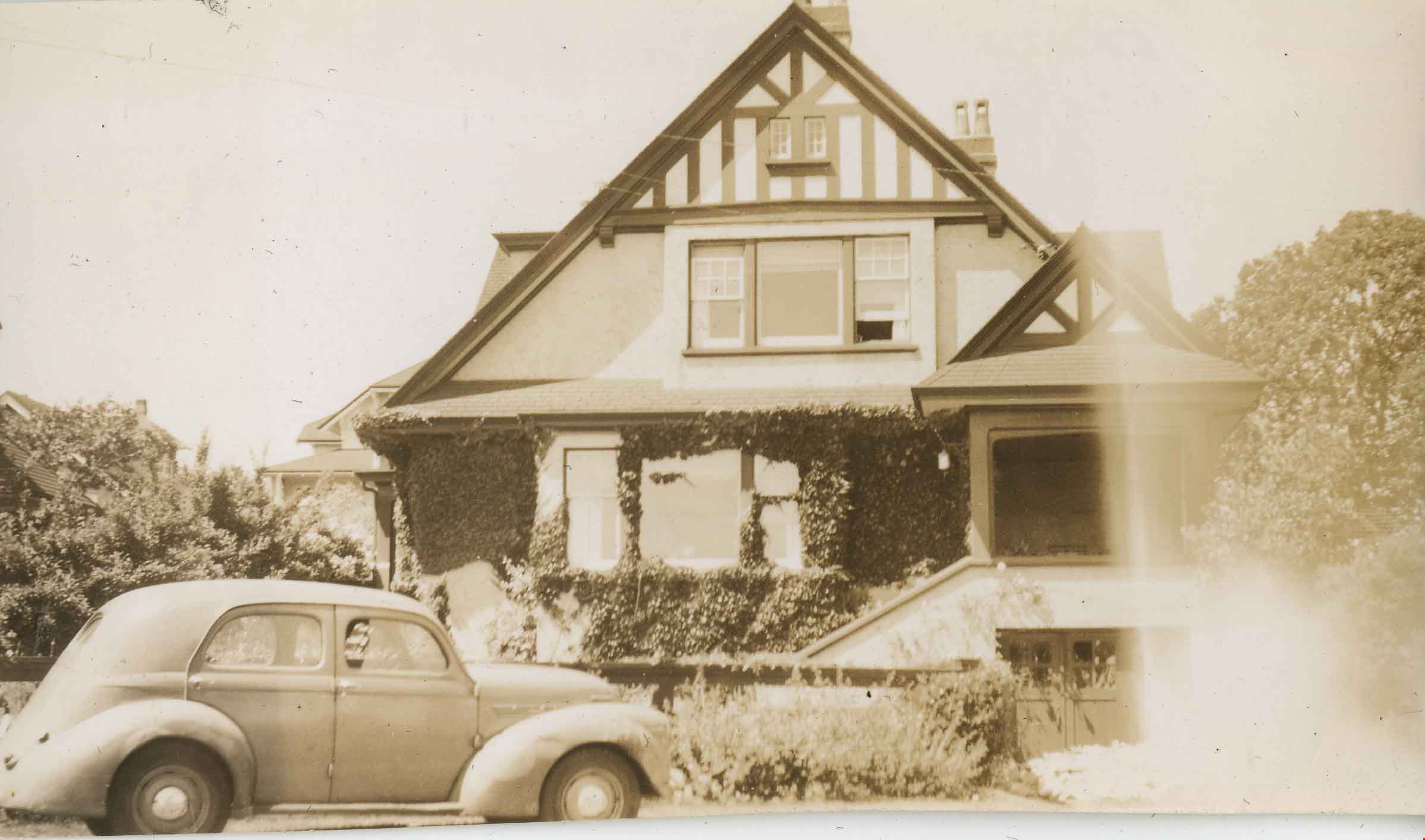
Davies Family Home
https://search.heritageburnaby.ca/link/archivedescription37055
- Repository
- City of Burnaby Archives
- Date
- 1950 (date of original), copied 1992
- Collection/Fonds
- Burnaby Historical Society fonds
- Description Level
- Item
- Physical Description
- 1 photograph : b&w ; 8.5 x 12.3 cm print
- Scope and Content
- Photograph of the Davies' home at 224 Boundary Road. A 1950 Studebaker car is parked in front.
- Repository
- City of Burnaby Archives
- Date
- 1950 (date of original), copied 1992
- Collection/Fonds
- Burnaby Historical Society fonds
- Subseries
- Burnaby Centennial Anthology subseries
- Physical Description
- 1 photograph : b&w ; 8.5 x 12.3 cm print
- Description Level
- Item
- Record No.
- 315-518
- Access Restriction
- No restrictions
- Reproduction Restriction
- Reproduce for fair dealing purposes only
- Accession Number
- BHS1994-04
- Scope and Content
- Photograph of the Davies' home at 224 Boundary Road. A 1950 Studebaker car is parked in front.
- Media Type
- Photograph
- Notes
- Title based on contents of photograph
- Geographic Access
- Boundary Road
- Street Address
- 224 Boundary Road North
- Historic Neighbourhood
- Vancouver Heights (Historic Neighbourhood)
- Planning Study Area
- Burnaby Heights Area
Images

![Dorothy and Doug Cary, [1939] (date of original), copied 1991 thumbnail](/media/hpo/_Data/_Archives_Images/_Unrestricted/370/370-199.jpg?width=280)
Dorothy and Doug Cary
https://search.heritageburnaby.ca/link/archivedescription37611
- Repository
- City of Burnaby Archives
- Date
- [1939] (date of original), copied 1991
- Collection/Fonds
- Burnaby Historical Society fonds
- Description Level
- Item
- Physical Description
- 1 photograph : b&w ; 3.1 x 4.5 cm print on contact sheet 20.2 x 25.3 cm
- Scope and Content
- Photograph of Dorothy and Doug Cary standing beside a 1933 Ford Coupe at the side of 311 Madison Avenue.
- Repository
- City of Burnaby Archives
- Date
- [1939] (date of original), copied 1991
- Collection/Fonds
- Burnaby Historical Society fonds
- Subseries
- Burnaby Image Bank subseries
- Physical Description
- 1 photograph : b&w ; 3.1 x 4.5 cm print on contact sheet 20.2 x 25.3 cm
- Description Level
- Item
- Record No.
- 370-199
- Access Restriction
- No restrictions
- Reproduction Restriction
- No known restrictions
- Accession Number
- BHS1999-03
- Scope and Content
- Photograph of Dorothy and Doug Cary standing beside a 1933 Ford Coupe at the side of 311 Madison Avenue.
- Media Type
- Photograph
- Notes
- Title based on contents of photograph
- 1 b&w copy negative accompanying
- Geographic Access
- Madison Avenue
- Street Address
- 311 Madison Avenue
- Historic Neighbourhood
- Vancouver Heights (Historic Neighbourhood)
- Planning Study Area
- Burnaby Heights Area
Images
![Dorothy and Doug Cary, [1939] (date of original), copied 1991 thumbnail](/media/hpo/_Data/_Archives_Images/_Unrestricted/370/370-199.jpg)
![Lane Between Albert Street and Hastings Street, [196-] thumbnail](/media/hpo/_Data/_Archives_Images/_Unrestricted/316/366-026.jpg?width=280)
Lane Between Albert Street and Hastings Street
https://search.heritageburnaby.ca/link/archivedescription37397
- Repository
- City of Burnaby Archives
- Date
- [196-]
- Collection/Fonds
- Burnaby Historical Society fonds
- Description Level
- Item
- Physical Description
- 1 photograph : b&w negative
- Scope and Content
- Photograph shows three cars parked in the lane at 3900 Albert Street, between Albert and Hastings Street, looking north.
- Repository
- City of Burnaby Archives
- Date
- [196-]
- Collection/Fonds
- Burnaby Historical Society fonds
- Subseries
- Municipal record subseries
- Physical Description
- 1 photograph : b&w negative
- Description Level
- Item
- Record No.
- 366-026
- Access Restriction
- No restrictions
- Reproduction Restriction
- Reproduce for fair dealing purposes only
- Accession Number
- BHS1998-12
- Scope and Content
- Photograph shows three cars parked in the lane at 3900 Albert Street, between Albert and Hastings Street, looking north.
- Media Type
- Photograph
- Notes
- Title based on contents of photograph
- Geographic Access
- Albert Street
- Street Address
- 3900 Albert Street
- Historic Neighbourhood
- Vancouver Heights (Historic Neighbourhood)
- Planning Study Area
- Burnaby Heights Area
Images
![Lane Between Albert Street and Hastings Street, [196-] thumbnail](/media/hpo/_Data/_Archives_Images/_Unrestricted/316/366-026.jpg)

Looking east along Dominion street to corner of Douglas Road and Dominion Street
https://search.heritageburnaby.ca/link/archivedescription91875
- Repository
- City of Burnaby Archives
- Date
- 1991
- Collection/Fonds
- Small family fonds
- Description Level
- Item
- Physical Description
- 1 photograph : col. copy print ; 10 cm x 15 cm
- Scope and Content
- Photograph of houses along Dominion Street, looking east with a tall hemlock, fir, and oak tree in the background. These houses were built after the Roberts' house was moved from 5538 Dominion Street to 5496 Dominion Street in 1982. The trees are the only three remaining from the original landsca…
- Repository
- City of Burnaby Archives
- Date
- 1991
- Collection/Fonds
- Small family fonds
- Physical Description
- 1 photograph : col. copy print ; 10 cm x 15 cm
- Description Level
- Item
- Record No.
- 620-056
- Access Restriction
- No restrictions
- Reproduction Restriction
- No reproduction permitted
- Accession Number
- 2017-01
- Scope and Content
- Photograph of houses along Dominion Street, looking east with a tall hemlock, fir, and oak tree in the background. These houses were built after the Roberts' house was moved from 5538 Dominion Street to 5496 Dominion Street in 1982. The trees are the only three remaining from the original landscaping of the Roberts' property in the late 1920s. The photograph was taken from the north side of the street, opposite 5496 Dominion Street.
- Media Type
- Photograph
- Notes
- Transcribed title
- Title transcribed from donor's notes
- Note in blue ink on verso of photograph reads: "P.18"
- Note in blue ink on verso of photograph reads: "Dominion St Summer 1991"
- The oak tree is the same tree as in photographs 620-007, 620-014, 620-015, and 620-016
- Geographic Access
- Dominion Street
- Street Address
- 5538 Dominion Street
- Historic Neighbourhood
- Burnaby Lake (Historic Neighbourhood)
- Planning Study Area
- Ardingley-Sprott Area
Images
![Looking north from 5486 Dominion Street, [1969] thumbnail](/media/hpo/_Data/_Archives_Images/_Unrestricted/600/620-031.jpg?width=280)
Looking north from 5486 Dominion Street
https://search.heritageburnaby.ca/link/archivedescription91850
- Repository
- City of Burnaby Archives
- Date
- [1969]
- Collection/Fonds
- Small family fonds
- Description Level
- Item
- Physical Description
- 1 photograph : b&w ; 9 cm x 12 cm
- Scope and Content
- Photograph of the McLeans' house at 5493 Dominion Street with a Volkswagon Beetle parked on the street in front. The Brocklebanks's backyard at 3071 Douglas Road is visible on the right. The photograph was taken from 5486 Dominion Street, looking north.
- Repository
- City of Burnaby Archives
- Date
- [1969]
- Collection/Fonds
- Small family fonds
- Physical Description
- 1 photograph : b&w ; 9 cm x 12 cm
- Description Level
- Item
- Record No.
- 620-031
- Access Restriction
- No restrictions
- Reproduction Restriction
- No reproduction permitted
- Accession Number
- 2017-01
- Scope and Content
- Photograph of the McLeans' house at 5493 Dominion Street with a Volkswagon Beetle parked on the street in front. The Brocklebanks's backyard at 3071 Douglas Road is visible on the right. The photograph was taken from 5486 Dominion Street, looking north.
- Media Type
- Photograph
- Notes
- Transcribed title
- Title transcribed from donor's notes
- Note in blue ink on verso of photograph reads: "P.31"
- Note in blue ink on verso of photograph reads: "(McLean's) / 5493 Domion [sic] St (left) (3071 Douglas Rd / Brocklebanks back yard / (right)"
- Note in blue ink of verso of photograph reads: "?-11-69 probably ?"
- 5493 Dominion Street was previously numbered 3107 Dominion Street and was later subdivided into two lots: 5491 and 5495 Dominion Street.
- Photograph 620-032 was taken from the same vantage point
- Street Address
- 3071 Douglas Road
- 5493 Dominion Street
- Historic Neighbourhood
- Burnaby Lake (Historic Neighbourhood)
- Planning Study Area
- Ardingley-Sprott Area
Images
![Looking north from 5486 Dominion Street, [1969] thumbnail](/media/hpo/_Data/_Archives_Images/_Unrestricted/600/620-031.jpg)

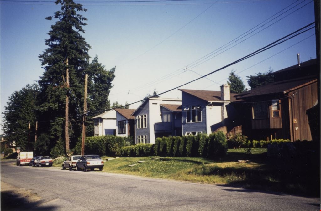
Looking west along Dominion Street from across the street from 5496 Dominion Street
https://search.heritageburnaby.ca/link/archivedescription91874
- Repository
- City of Burnaby Archives
- Date
- July 2016
- Collection/Fonds
- Small family fonds
- Description Level
- Item
- Physical Description
- 1 photograph : col. copy print ; 10 cm x 15 cm
- Scope and Content
- Photograph of the houses along the south side of Dominion Street with cars parked along the curb. In 2009 sidewalks were installed and the street was repaved under a neighbourhood local improvement request to the City. The photograph was taken from the north side of the street, opposite 5496 Dom…
- Repository
- City of Burnaby Archives
- Date
- July 2016
- Collection/Fonds
- Small family fonds
- Physical Description
- 1 photograph : col. copy print ; 10 cm x 15 cm
- Description Level
- Item
- Record No.
- 620-055
- Access Restriction
- No restrictions
- Reproduction Restriction
- No reproduction permitted
- Accession Number
- 2017-01
- Scope and Content
- Photograph of the houses along the south side of Dominion Street with cars parked along the curb. In 2009 sidewalks were installed and the street was repaved under a neighbourhood local improvement request to the City. The photograph was taken from the north side of the street, opposite 5496 Dominion Street, looking west.
- Media Type
- Photograph
- Notes
- Transcribed title
- Title transcribed from donor's notes
- Note in blue ink on verso of photograph reads: "P.17"
- Note in blue ink on verso of photograph reads: "Dominion St. infilled with houses on 33' lots / Photo July 2016"
- Geographic Access
- Dominion Street
- Historic Neighbourhood
- Burnaby Lake (Historic Neighbourhood)
- Planning Study Area
- Ardingley-Sprott Area
Images

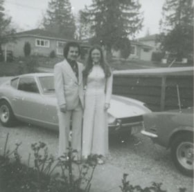
Mike Loynes and Linda
https://search.heritageburnaby.ca/link/archivedescription37673
- Repository
- City of Burnaby Archives
- Date
- 1973 (date of original), copied 1991
- Collection/Fonds
- Burnaby Historical Society fonds
- Description Level
- Item
- Physical Description
- 1 photograph : b&w ; 3.9 x 3.9 cm print on contact sheet 20.2 x 25.3 cm
- Scope and Content
- Photograph of Mike Loynes and his future wife, Linda, standing beside a car in the driveway of 1855 18th Avenue (old numbering) before attending a wedding.
- Repository
- City of Burnaby Archives
- Date
- 1973 (date of original), copied 1991
- Collection/Fonds
- Burnaby Historical Society fonds
- Subseries
- Burnaby Image Bank subseries
- Physical Description
- 1 photograph : b&w ; 3.9 x 3.9 cm print on contact sheet 20.2 x 25.3 cm
- Description Level
- Item
- Record No.
- 370-261
- Access Restriction
- No restrictions
- Reproduction Restriction
- No restrictions
- Accession Number
- BHS1999-03
- Scope and Content
- Photograph of Mike Loynes and his future wife, Linda, standing beside a car in the driveway of 1855 18th Avenue (old numbering) before attending a wedding.
- Media Type
- Photograph
- Notes
- Title based on contents of photograph
- 1 b&w copy negative accompanying
- Copied from col. photograph
- Negative has a pink cast
- Geographic Access
- 18th Avenue
- Historic Neighbourhood
- Edmonds (Historic Neighbourhood)
- Planning Study Area
- Stride Avenue Area
Images
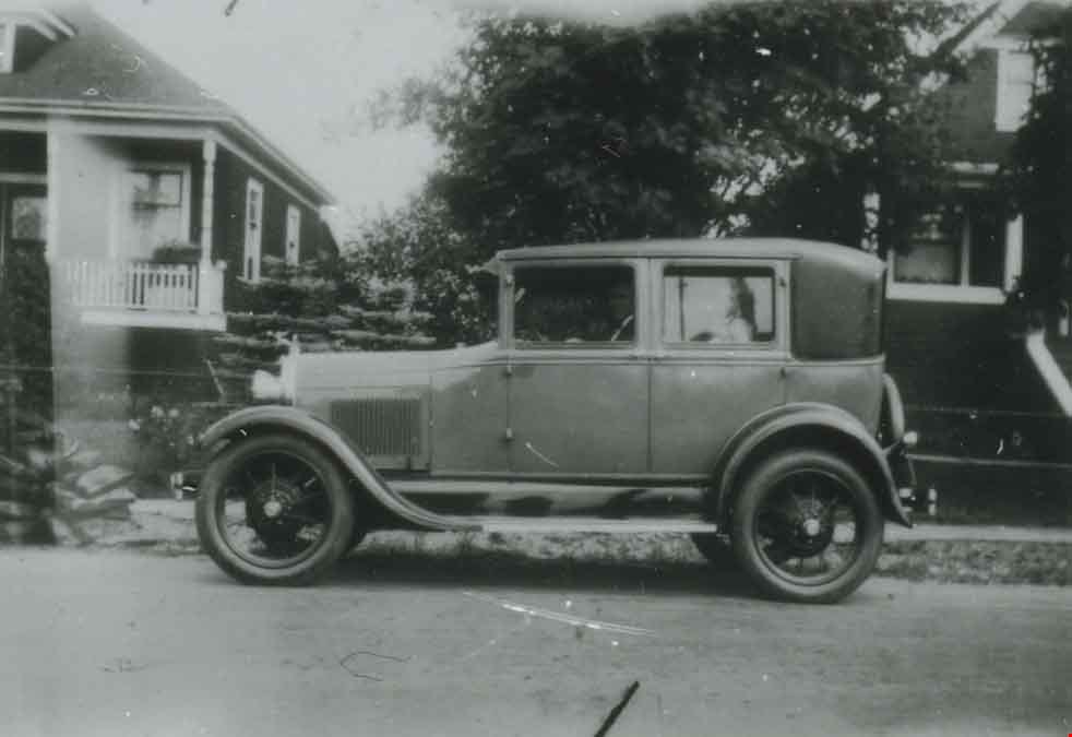
Model A Ford at 2890 McKay Avenue
https://search.heritageburnaby.ca/link/archivedescription37650
- Repository
- City of Burnaby Archives
- Date
- 1929 (date of original), copied 1991
- Collection/Fonds
- Burnaby Historical Society fonds
- Description Level
- Item
- Physical Description
- 1 photograph : b&w ; 2.9 x 4.2 cm print on contact sheet 20.2 x 25.3 cm
- Scope and Content
- Photograph of a Model A Ford parked in front of 2890 McKay Avenue (later renumbered 6149 McKay Avenue). Angus Matheson is at the wheel.
- Repository
- City of Burnaby Archives
- Date
- 1929 (date of original), copied 1991
- Collection/Fonds
- Burnaby Historical Society fonds
- Subseries
- Burnaby Image Bank subseries
- Physical Description
- 1 photograph : b&w ; 2.9 x 4.2 cm print on contact sheet 20.2 x 25.3 cm
- Description Level
- Item
- Record No.
- 370-238
- Access Restriction
- No restrictions
- Reproduction Restriction
- No known restrictions
- Accession Number
- BHS1999-03
- Scope and Content
- Photograph of a Model A Ford parked in front of 2890 McKay Avenue (later renumbered 6149 McKay Avenue). Angus Matheson is at the wheel.
- Names
- Matheson, Angus
- Media Type
- Photograph
- Notes
- Title based on contents of photograph
- 1 b&w copy negative accompanying
- Negative has a pink cast
- Geographic Access
- McKay Avenue
- Street Address
- 6149 McKay Avenue
- Historic Neighbourhood
- Central Park (Historic Neighbourhood)
- Planning Study Area
- Maywood Area
Images