More like '3710 1st Ave'
Narrow Results By
Decade
- 2020s 60
- 2010s 28
- 2000s 43
- 1990s 139
- 1980s 177
- 1970s 410
- 1960s 90
- 1950s 149
- 1940s 136
- 1930s 213
- 1920s 135
- 1910s 150
- 1900s 92
- 1890s 11
- 1880s 2
- 1870s 1
- 1860s 1
- 1850s 1
- 1840s 1
- 1830s 1
- 1820s 1
- 1810s 1
- 1800s 1
- 1790s 1
- 1780s 1
- 1770s 1
- 1760s 1
- 1750s 1
- 1740s 1
- 1730s 1
- 1720s 1
- 1710s 1
- 1700s 1
- 1690s 1
- 1680s 1
- 1670s 1
- 1660s 1
- 1650s 1
- 1640s 1
- 1630s 1
- 1620s 1
- 1610s 1
- 1600s 1
Creator
- Aero Surveys Limited 1
- Associated Factory Mutual Fire Insurance Cos 1
- Battersby, Frank 10
- Beatty Bros Limited 1
- Binks, James 3
- Blake, Frederick "Fred" 2
- Bobic, Janice 1
- Bodnar, Diana, 1950- 1
- Brown, Conway 1
- Brown, William Thomas 1
- Burnaby Village Museum 30
- Burnett and McGugan B.C. Land Surveyors, New Westminster 5
![Granville Street, Vancouver, [1910] thumbnail](/media/hpo/_Data/_BVM_Images/1972/1972_0050_0008_001.jpg?width=280)
Granville Street, Vancouver
https://search.heritageburnaby.ca/link/museumdescription1069
- Repository
- Burnaby Village Museum
- Date
- [1910]
- Collection/Fonds
- Burnaby Village Museum Photograph collection
- Description Level
- Item
- Physical Description
- 1 photograph : b&w ; 7.4 x 9.8 cm
- Scope and Content
- Photograph of Granville Street, looking north. Signs for "Fletchers Pianos" and the "Colonial Theatre" can be seen. The north shore is faintly visible across Burrard Inlet.
- Repository
- Burnaby Village Museum
- Collection/Fonds
- Burnaby Village Museum Photograph collection
- Description Level
- Item
- Physical Description
- 1 photograph : b&w ; 7.4 x 9.8 cm
- Scope and Content
- Photograph of Granville Street, looking north. Signs for "Fletchers Pianos" and the "Colonial Theatre" can be seen. The north shore is faintly visible across Burrard Inlet.
- Subjects
- Advertising Medium - Signs and Signboards
- Buildings - Commercial
- Geographic Features - Roads
- Geographic Access
- Vancouver
- Accession Code
- HV972.50.8
- Access Restriction
- No restrictions
- Reproduction Restriction
- No known restrictions
- Date
- [1910]
- Media Type
- Photograph
- Scan Resolution
- 600
- Scan Date
- 2023-04-04
- Photographer
- Dean, H.M.
- Notes
- Title based on contents of photograph
- An annotation on the back of the photograph reads, "Granville St. - 1910."
Images
![Granville Street, Vancouver, [1910] thumbnail](/media/hpo/_Data/_BVM_Images/1972/1972_0050_0008_001.jpg)
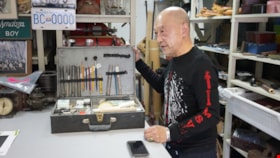
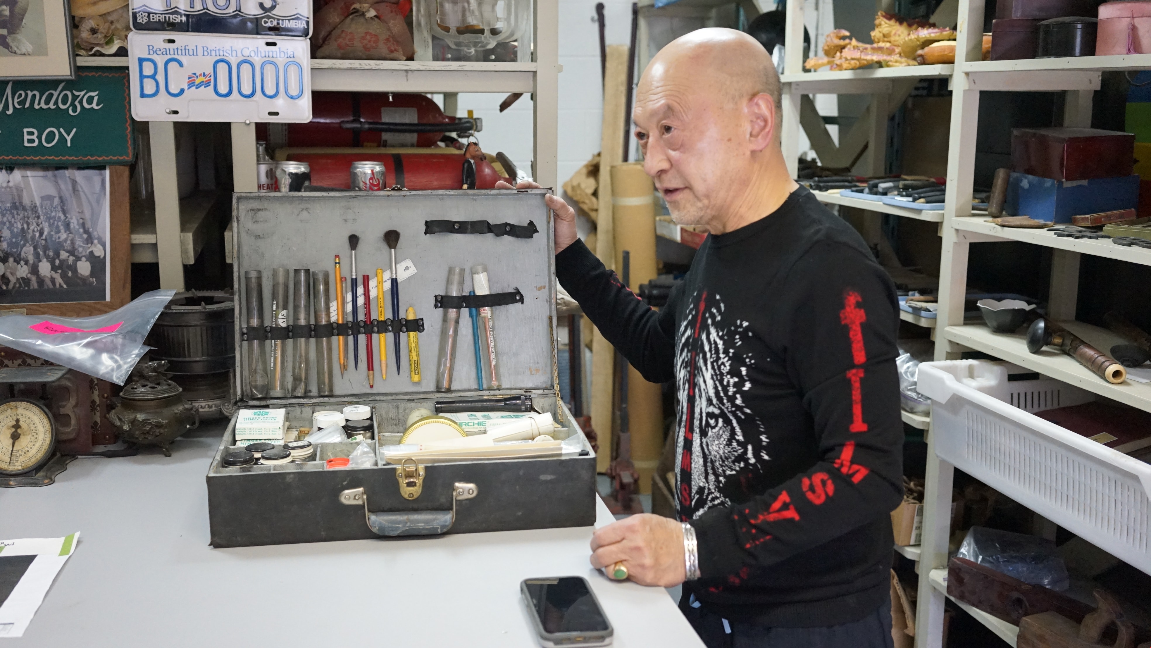
Oral history interview with Hipman "Jimmy" Chow and Donna Polos
https://search.heritageburnaby.ca/link/museumdescription19146
- Repository
- Burnaby Village Museum
- Date
- 29 Jun. 2022
- Collection/Fonds
- Hipman "Jimmy" Chow and Donna Polos fonds
- Description Level
- Item
- Physical Description
- 3 sound recordings (wav) (02:06:53 min) + 1 sound recording (mp3) (02:06:53 min)
- Scope and Content
- Item consists of an audio recording of an oral history interview with Jimmy Chow and Donna Polos conducted by Denise Fong with assistance from Burnaby Village Museum Assistant Curator, Kate Petrusa. During the interview, Jimmy Chow and Donna Polos discuss; their ancestral background, childhood, pla…
- Repository
- Burnaby Village Museum
- Collection/Fonds
- Hipman "Jimmy" Chow and Donna Polos fonds
- Description Level
- Item
- Physical Description
- 3 sound recordings (wav) (02:06:53 min) + 1 sound recording (mp3) (02:06:53 min)
- Material Details
- Interviewer: Denise Fong Co Interviewer and technical support: Kate Petrusa Interviewees: Hipman "Jimmy" Chow and Donna Polos Location of Interview: Home of Jimmy Chow and Donna Polos on Victory Street, Burnaby Date of interview: June 29, 2022 Total Number of Tracks: 3 Total length of all Tracks: 02:06:53 min Digital master recordings (wav) were recorded onto 3 separate audio tracks, edited and merged together and converted to mp3 for access on Heritage Burnaby
- Scope and Content
- Item consists of an audio recording of an oral history interview with Jimmy Chow and Donna Polos conducted by Denise Fong with assistance from Burnaby Village Museum Assistant Curator, Kate Petrusa. During the interview, Jimmy Chow and Donna Polos discuss; their ancestral background, childhood, places of residence, education, career history, how they met, Jimmy's experience working in the film industry, their home in Burnaby and their neighbourhood, their political activism in Burnaby, Robin Chung Dip's work in Vancouver’s' Chinatown, the gambling scene in Vancouver prior to legalized forms of gambling and their memories of supper clubs in Vancouver. 00:00 - 5:57 Opening introductions where Jimmy Chow and Donna Polos provide information on their full names, their birth places and their ancestral background. Jimmy clarifies that his birth name is Hipman Chow but that he was given the English name “Jimmy” by his father when he came to Canada. Jimmy shares that he was born in 1948, in the Village of Lin Pong Lee, Hoiping, China and immigrated to British Columbia with his mother, Gim Gee Chow in 1950 to escape the Communist Regime and to join his father who had already immigrated to Canada. Jimmy imparts that many Chinese immigrated to British Columbia in search of a better life, referring to it as “Gold Mountain” and that even though they faced extreme racial discrimination that many stayed since they felt that it was better than returning. Donna Polos shares ancestral information on both her maternal and paternal sides of the family. Donna’s mother’s family came from Helsinki, Finland. Donna’s paternal grandmother emigrated from Ukraine to Argentina and then to Winnipeg. Donna’s paternal grandfather, James Kostopolus (renamed Polos) emigrated as a 12 year old orphan from Sparta, Greece to the United States but was denied entry so ended up going to Halifax and eventually made his way to Vancouver. Once in Vancouver, he became a restaurant proprietor and over the years, he owned and operated three restaurants in Vancouver, including; “Jimmy’s Café” (next door the Astoria Hotel); “Home Apple Pie Café” (Princess Avenue & Hastings Street) and a restaurant that was located on Alma Street. 05:58 - 13:28 Jimmy recollects in further detail, the many places that his family lived over the years. Jimmy’s father Robin Chung Dip Chow immigrated to Vancouver at the age of 14 years and worked and lived in Victoria and Vancouver. In 1950, Jimmy and his mother fled China, first to Hong Kong and then to Vancouver to join his father. Soon after arriving in Vancouver, for the next four years, he and his parents lived in Manitoba, Saskatchewan and Quebec City where his father, Robin had work in restaurants and hotels. Jimmy attended school while the family lived in these different places and began to learn English. After four years, the family returned to Vancouver, first living in areas of Chinatown and Strathcona before settling in the neighbourhood of Mount Pleasant. Jimmy shares his memories of growing up in Strathcona and the Mount Pleasant neighbourhood, schools that he attended and the friendships that he made. Jimmy recollects details about the old Bethlehem Lutheran Church that he attended and describes the demands of the education required to become a Lutheran minister. 13:29 - 15:47 Jimmy tells of how his father, Robin Chung Dip Chow had to pay the Chinese Head Tax of $500 when he arrived in Vancouver at 14 years of age (1921) and how his father had to work hard pay off the head tax over the years. Denise Fong and Jimmy Chow, talk about the origin of a photograph portrait of Jimmy Chow that was taken around 1954 and speculate whether it might have been taken by well known portrait photographer, Yucho Chow. 15:48 - 19:33 Donna Polos recollects the many locations that her family lived while she was growing up in Vancouver. First residing at various locations in the downtown east side of Vancouver before moving to a home near Joyce Station where she lived until 21 years old. After 21 years of age, Donna moved in with roommates in Vancouver before moving in with Jimmy in North Burnaby in 1972. In 1976 Donna and Jimmy purchased their home on Victory Street. Both Donna and Jimmy talk about their careers after high school. Jimmy talks about how he worked at the Supervalu grocery store near his house. Jimmy planned to use his savings from his job to travel but instead he used his savings for a down payment on a house with Donna. Donna imparts that after obtaining her teaching degree she began working in Burnaby schools, eventually teaching at Burnaby South. 19:34 - 32:08 Both Jimmy and Donna share their educational background and experiences growing up. Jimmy first attended Florence Nightingale elementary in Strathcona, then Mount Pleasant Elementary and later high school at 24th Avenue and Main Street. Donna lists the schools that she attended including; elementary school in Strathcona, Carlton Elementary School at Kingsway and Joyce, Windermere High School, Vancouver City College (Langara) and the University of British Columbia. Donna and Jimmy reflect on public transportation that was available during the time they were growing up. Donna recollects her childhood growing up in the neighbourhood of Joyce Station, the freedom that she experienced playing outside in nature and what inspired her to become a teacher. Jimmy reflects on some of his mentors and about his first experience seeing movies as a young child at a cinema in Asquith, Saskatchewan. Donna communicates her own experiences of sexism throughout her high school, college and university education (1968-1972). 32:09 - 36:18 Donna talks about her career history and some of her major turning points. Donna recollects starting out as a Chemistry lab assistant, marking math papers before working as a teacher on call and eventually being hired as a teacher at Clinton Elementary School where she taught for nine years. Donna shares a memory of her first experience working as a teacher on call at Gilmore Elementary School and the fire that occurred there. After starting a family (Jimmy and Donna had three children) Donna worked part time teaching while Jimmy worked full time in film. Donna, shares that in 1991, after a near death experience, she became interested in fine art and took drawing and watercolour painting classes. With this experience, Donna experimented with different painting techniques on paper and fabric. Donna tells of how she retired from teaching in 2008 but continued to participate in the schools as an Artist in Residence. 36:19 - 58:18 Jimmy talks about his work and career history. He shares memories of his experiences as a young boy delivering newspapers, working at a local pharmacy, stocking shelves at the local supermarket, and his experience working with troubled youth and of how he thought that he might like to become a social worker. Jimmy tells of how he was uncertain of what to do until he got a job with the CBC in 1973 which eventually launched his career as a property master in the film industry, becoming a member of IATSE and a voting member of the Academy of Motion Pictures. Jimmy describes in detail what it means to be a property master and the work that is entailed in the film industry. 58:19 - 1:07:45 Donna Polos describes her art practice and her connection to Burnaby. Donna recollects how she first started working with textiles and fabrics from a young age and how this later inspired her to develop her own watercolour techniques of painting on paper, canvas and fabrics. Donna describes how she first got started by taking art classes in Burnaby and now has over 31 years of experience working in watercolour. Donna has worked as an Artist in Residence in Burnaby schools, been a member of the Burnaby Arts Council, had her first show in 1997 and has been involved in many art projects over the years. Donna describes the style of her work, first starting with more figurative work, social commentary and still life and that now most of her work is landscape based. Donna coveys that as a political activist in Burnaby, she was an active participant in the development of a tree bylaw, has petitioned to protect renters from demo-evictions and the impacts of future development on the local environment. 1:07:46 - 1:07:59 Background discussion between Denise Fong and Kate Petrusa re interviews. 1:08:00 - 1:26:36 Jimmy provides information on his connection to the local film industry and the changes that have occurred over the years. Jimmy describes the first studios on the North Shore and the eventual establishment of Bridge Studios on Boundary Road. Jimmy shares that in 1988, he and some of his colleagues in the film industry put a proposal together to buy the Bridge Studios but it didn't go through. Since the Bridge Studios and other film studios have been established in Burnaby and Vancouver, the industry has grown exponentially. Jimmy became the 54th member of the local IATSE union. Jimmy describes some of his experiences working on various productions including "Seven Years in Tibet", provides a description of what a film studio is, how it is used and the differences between working in the film industry in the United States and British Columbia. 1:26:37 - 1:32:46 Jimmy and Donna recollect how they first met, buying a house in Burnaby, getting married and starting a family. The two share memories of their wedding in White Rock and Jimmy talks about the Chinese hair cutting ceremony in recognition of their first born child that took place in Chinatown in Vancouver. Jimmy tells of how his parents had hopes of him marrying a Chinese woman and his mother began introducing him to a few young Chinese women from the time he was 16 years old. Jimmy mentions that his parents rarely used Western Medicine and relied on Traditional Chinese Medicine. Donna and Jimmy talk about Jimmy's parents, when they died and how happy his parents were to have grandchildren. 1:32:47 - 1:40:13 Jimmy and Donna talk about their house on Victory Street which they purchased in 1976. They share information on the history of the house, how it was built in 1939 by Norm Clark, how they fell in love with the design of the house and the neighbourhood. 1:40:14 - 1:58:31 Jimmy and Donna share information on their family life in Burnaby, their neighbourhood and favourite places in Burnaby. Donna lists the schools that their three children attended including; Nelson Avenue School, Burnaby South High School and Burnaby Central High School. Both Donna and Jimmy convey that all of their children played soccer and the benefits that the sport provided them. Donna and Jimmy talk about how the neighbourhood has changed over the years, the benefits of where they live, their fondness for built heritage and the many parks and trees in Burnaby. 1:58:32 - 2:02:50 Jimmy begins to share information on his father, Robin Chung Dip Chow's employment history. Jimmy recalls that his father, Robin worked in a variety of jobs over the years and as a young child, Jimmy was uncertain of what his father's job was but thought that he worked in accounting. He mentions that his father stopped working at 45 years of age due to a problem with his Achilles tendon. Jimmy describes his father as an intellectual who worked at gambling houses in Vancouver's Chinatown where people played mah-jong and fan-tan. Jimmy recollects that these were large clubs with lots of employees. His father never gambled but he was good with money so he worked on the management side. Jimmy mentions that while working in the film industry, his father took him and some of his film colleagues into some of the gambling houses in Chinatown to assist them with a production that they were working on. 2:02:51 - 2:06:58 Donna shares her own family history regarding gambling. She mentions that her uncle worked as a high end "bookie" in Vancouver and how in 1968, her uncle was arrested but got let go with just a small fine. Jimmy describes what gambling was like in those days with various sweepstakes, not under the jurisdiction of the government like it is today. Both Donna and Jimmy recollect the popularity of supper clubs their memories of Vie's Chicken and Steak House that was located in Hogan's Alley. Jimmy laments the destruction of Hogan's Alley and the other proposals that were brought forward that would change Chinatown and Strathcona.
- History
- Interviewees biography: Hipman "Jimmy" Chow was born in Lin Pong Lee, Hoiping, China in 1948. In 1950, Jimmy Chow immigrated to Vancouver from China with his mother, Gim Gee Chow to join his father, Robin Chung Dip Chow who'd immigrated to Canada at 14 years of age in 1921. For the first four years after immigrating, Jimmy and his parents lived in Manitoba, Saskatchewan and Quebec before returning to Vancouver around 1954. Jimmy and his family then lived and worked in Vancouver eventually settling in the neighbourhood of Mount Pleasant. In the early 1970s, Jimmy met his future wife Donna Polos and they married in 1981. Donna Polos was born in 1949 to Donald James Polos and Mayme "May" Helen Tilikana Polos and grew up in Vancouver. Between the age of 5 and 21 years, Donna lived in the neighbourhood of Joyce Station. In 1976, Jimmy and Donna purchased and moved into a house on Victory Street in Burnaby where they still live today. While living on Victory Street, they've raised their three children. Donna received her teaching degree and taught in elementary schools for many years. In 1991, after a near death experience, Donna developed an interest in drawing and painting and began experimenting with water colour painting on fabric. Donna has since exhibited her work widely, participated as an Artist in Residence in Burnaby schools and is a member of the Federation of Canadian Artists. Jimmy entered the film industry in 1973, gaining experience and recognition as a property master and has worked on many films over a 45 year career. Interviewer biography: Denise Fong is a historical researcher at Burnaby Village Museum. She has degrees in Anthropology (BA) and Archaeology (MA), and is completing her doctoral degree at UBC in Interdisciplinary Studies. Her primary research interests are in Chinese Canadian history and critical heritage studies. She is the co-curator of BVM’s “Across the Pacific” exhibition, and the Museum of Vancouver’s “A Seat at the Table – Chinese Immigration and British Columbia”.
- Creator
- Burnaby Village Museum
- Subjects
- Buildings - Commercial - Restaurants
- Buildings - Residential
- Buildings - Residential - Houses
- Education
- Geographic Features - Parks
- Geographic Features - Neighbourhoods
- Government - Local Government
- Industries - Film
- Migration
- Occupations
- Occupations - Artists
- Occupations - Grocers
- Occupations - Entrepreneurs
- Occupations - Teachers
- Persons - Chinese Canadians
- Social Issues - Racism
- Sports - Soccer
- Names
- Bridge Studios
- Chow, Gim Gee Dang
- Chow, Hipman "Jimmy"
- Chow, Robin Chung Dip
- Polos, Donna
- Polos, James "Jimmy", 1898-1962
- Polos, Donald James
- Polos, Mayme "May" Helen Tilikana
- Geographic Access
- Victory Street
- Accession Code
- BV022.21.1
- Date
- 29 Jun. 2022
- Media Type
- Sound Recording
- Notes
- Title based on contents of recording
- Hipman "Jimmy" Chow's name in Cantonese is Chow Hipman and in Mandarin is Zhou Xiamin.
Images
Audio Tracks
Oral history interview with Hipman
Oral history interview with Hipman
https://search.heritageburnaby.ca/media/hpo/_Data/_BVM_Sound_Recordings/Oral_Histories/2022_0021_0001_004.mp3![Andrew Johnson house and surrounding property, [1913] thumbnail](/media/hpo/_Data/_BVM_Images/1994/1994_0015_0003_002.jpg?width=280)
Andrew Johnson house and surrounding property
https://search.heritageburnaby.ca/link/museumdescription1189
- Repository
- Burnaby Village Museum
- Date
- [1913]
- Collection/Fonds
- Burnaby Village Museum Photograph collection
- Description Level
- Item
- Physical Description
- 1 photograph : b&w panorama ; 13.5 x 34.5 cm mounted on mattboard 20 x 38 cm
- Scope and Content
- Photograph of the Andrew M. Johnson house "Glenedward" and surrounding property at Kingsway and Royal Oak Avenue. Andrew Johnson built the house around 1911, then occupied the residence until his death in 1934. His wife sold the property in 1943, after which, the place operated as a funeral home un…
- Repository
- Burnaby Village Museum
- Collection/Fonds
- Burnaby Village Museum Photograph collection
- Description Level
- Item
- Physical Description
- 1 photograph : b&w panorama ; 13.5 x 34.5 cm mounted on mattboard 20 x 38 cm
- Material Details
- Panorama was created by printing two negatives and joining them together
- Scope and Content
- Photograph of the Andrew M. Johnson house "Glenedward" and surrounding property at Kingsway and Royal Oak Avenue. Andrew Johnson built the house around 1911, then occupied the residence until his death in 1934. His wife sold the property in 1943, after which, the place operated as a funeral home until 1980 or 1981. The building was then purchased by Wales McLelland development company, then went through a series of restaurant owners' hands.
- Geographic Access
- Kingsway
- Royal Oak Avenue
- Street Address
- 5152 Kingsway
- Accession Code
- BV994.15.3
- Access Restriction
- No restrictions
- Reproduction Restriction
- No known restrictions
- Date
- [1913]
- Media Type
- Photograph
- Historic Neighbourhood
- Central Park (Historic Neighbourhood)
- Planning Study Area
- Marlborough Area
- Scan Resolution
- 600
- Scan Date
- 2024-04-23
- Notes
- Title based on contents of photograph
Images
![Andrew Johnson house and surrounding property, [1913] thumbnail](/media/hpo/_Data/_BVM_Images/1994/1994_0015_0003_002.jpg)
![Banff, Alberta, [1944] thumbnail](/media/hpo/_Data/_BVM_Images/2000/200500300033.jpg?width=280)
Banff, Alberta
https://search.heritageburnaby.ca/link/museumdescription3411
- Repository
- Burnaby Village Museum
- Date
- [1944]
- Collection/Fonds
- Burnaby Village Museum Photograph collection
- Description Level
- Item
- Physical Description
- 1 photograph : b&w ; 10 x 6 cm
- Scope and Content
- Photograph of Mount Lougheed, taken looking north, from the main street in Banff.
- Repository
- Burnaby Village Museum
- Collection/Fonds
- Burnaby Village Museum Photograph collection
- Description Level
- Item
- Physical Description
- 1 photograph : b&w ; 10 x 6 cm
- Scope and Content
- Photograph of Mount Lougheed, taken looking north, from the main street in Banff.
- Accession Code
- BV005.30.33
- Access Restriction
- No restrictions
- Date
- [1944]
- Media Type
- Photograph
- Scan Date
- 1/19/2010
- Photographer
- Battersby, Frank
- Notes
- Title based on contents of photograph
Images
![Banff, Alberta, [1944] thumbnail](/media/hpo/_Data/_BVM_Images/2000/200500300033.jpg)
![Men riding bicycles, [1914] thumbnail](/media/hpo/_Data/_BVM_Images/1971/197200110015.jpg?width=280)
Men riding bicycles
https://search.heritageburnaby.ca/link/museumdescription3101
- Repository
- Burnaby Village Museum
- Date
- [1914]
- Collection/Fonds
- Burnaby Village Museum Photograph collection
- Description Level
- Item
- Physical Description
- 1 photograph : b&w glass negative ; 16.4 x 21.3 cm
- Scope and Content
- Photograph of a paved road lined with electric poles on both sides and a wood plank sidewalk on one side of the road. There are two men in suits and bowler hats riding bicycles and another man in suit and bowler hat standing on the sidewalk. The sun is casting long shadows from the left side of the…
- Repository
- Burnaby Village Museum
- Collection/Fonds
- Burnaby Village Museum Photograph collection
- Description Level
- Item
- Physical Description
- 1 photograph : b&w glass negative ; 16.4 x 21.3 cm
- Scope and Content
- Photograph of a paved road lined with electric poles on both sides and a wood plank sidewalk on one side of the road. There are two men in suits and bowler hats riding bicycles and another man in suit and bowler hat standing on the sidewalk. The sun is casting long shadows from the left side of the photograph. An earlier catalogue record from 1988 conjectures that the photograph may be of Kingsway in Burnaby, possibly near Gilley looking east towards Griffiths Avenue. The record also dates the negative, ca. 1914.
- Geographic Access
- Kingsway
- Griffiths Avenue
- Accession Code
- HV972.11.15
- Access Restriction
- No restrictions
- Reproduction Restriction
- No known restrictions
- Date
- [1914]
- Media Type
- Photograph
- Historic Neighbourhood
- Edmonds (Historic Neighbourhood)
- Planning Study Area
- Kingsway-Beresford Area
- Scan Resolution
- 300
- Scan Date
- 14/8/2006
- Scale
- 100
- Notes
- Title based on contents of photograph
- 1 b&w contact print accompanying negative
Images
![Men riding bicycles, [1914] thumbnail](/media/hpo/_Data/_BVM_Images/1971/197200110015.jpg)
![Mountainside plank road, [190-] thumbnail](/media/hpo/_Data/_BVM_Images/1977/197900500189.jpg?width=280)
Mountainside plank road
https://search.heritageburnaby.ca/link/museumdescription446
- Repository
- Burnaby Village Museum
- Date
- [190-]
- Collection/Fonds
- Hugh H. Stewart fonds
- Description Level
- Item
- Physical Description
- 1 photograph : sepia ; 15.3 x 11.0 cm mounted on cardboard 24.5 x 17.8 cm
- Scope and Content
- Photograph of an automobile parked on the side of a plank road by a mountain rising steeply to the right of the image. An unidentified man is seen leaning on the fence at the side of the plank road.
- Repository
- Burnaby Village Museum
- Collection/Fonds
- Hugh H. Stewart fonds
- Description Level
- Item
- Physical Description
- 1 photograph : sepia ; 15.3 x 11.0 cm mounted on cardboard 24.5 x 17.8 cm
- Scope and Content
- Photograph of an automobile parked on the side of a plank road by a mountain rising steeply to the right of the image. An unidentified man is seen leaning on the fence at the side of the plank road.
- Accession Code
- HV979.50.189
- Access Restriction
- No restrictions
- Reproduction Restriction
- No known restrictions
- Date
- [190-]
- Media Type
- Photograph
- Scan Resolution
- 600
- Scan Date
- 2023-09-12
- Notes
- Title based on contents of photograph
Images
![Mountainside plank road, [190-] thumbnail](/media/hpo/_Data/_BVM_Images/1977/197900500189.jpg)
![Deer Lake Drive, [1918] thumbnail](/media/hpo/_Data/_BVM_Images/1972/1972_0051_0012_001.jpg?width=280)
Deer Lake Drive
https://search.heritageburnaby.ca/link/museumdescription1085
- Repository
- Burnaby Village Museum
- Date
- [1918]
- Collection/Fonds
- Burnaby Village Museum Photograph collection
- Description Level
- Item
- Physical Description
- 1 photograph : b&w ; 12.9 x 32.9 cm
- Scope and Content
- Photograph is a panorama of Deer Lake Drive, including the Ceperley mansion and the surrounding grounds of the home to the left of the picture. The photograph, taken from the water tower, with Burnaby Lake in the background. In the midground, following the horizon line, power poles can be seen. Far…
- Repository
- Burnaby Village Museum
- Collection/Fonds
- Burnaby Village Museum Photograph collection
- Description Level
- Item
- Physical Description
- 1 photograph : b&w ; 12.9 x 32.9 cm
- Scope and Content
- Photograph is a panorama of Deer Lake Drive, including the Ceperley mansion and the surrounding grounds of the home to the left of the picture. The photograph, taken from the water tower, with Burnaby Lake in the background. In the midground, following the horizon line, power poles can be seen. Farm lands are visible leading down to the homes of the Andersons. An annotation on the back of the photo in pencil reads, "Deer Lake Dr." and an annotation in blue pen reads, "1918."
- Geographic Access
- Deer Lake Drive
- Deer Lake Avenue
- Street Address
- 6344 Deer Lake Avenue
- Accession Code
- HV972.51.12
- Access Restriction
- No restrictions
- Reproduction Restriction
- No known restrictions
- Date
- [1918]
- Media Type
- Photograph
- Historic Neighbourhood
- Burnaby Lake (Historic Neighbourhood)
- Planning Study Area
- Douglas-Gilpin Area
- Scan Resolution
- 600
- Scan Date
- 2023-04-04
Images
![Deer Lake Drive, [1918] thumbnail](/media/hpo/_Data/_BVM_Images/1972/1972_0051_0012_001.jpg)

Neville Street by Royal Oak
https://search.heritageburnaby.ca/link/museumdescription3031
- Repository
- Burnaby Village Museum
- Date
- 1912
- Collection/Fonds
- Burnaby Village Museum Photograph collection
- Description Level
- Item
- Physical Description
- 1 photograph : sepia postcard ; 8.8 x 13.9 cm
- Scope and Content
- Photographic postcard of Neville Street just off Royal Oak Avenue. The street is a dirt road lined with residential buildings on one side and eletric power poles on the other side. The Holdsworth house is seen being constructed on the left. There is scaffolding on the side of the building and a cle…
- Repository
- Burnaby Village Museum
- Collection/Fonds
- Burnaby Village Museum Photograph collection
- Description Level
- Item
- Physical Description
- 1 photograph : sepia postcard ; 8.8 x 13.9 cm
- Scope and Content
- Photographic postcard of Neville Street just off Royal Oak Avenue. The street is a dirt road lined with residential buildings on one side and eletric power poles on the other side. The Holdsworth house is seen being constructed on the left. There is scaffolding on the side of the building and a cleared lot beside the house. here are variant spellings of "Holdsworth" used in the notes in the accession file. They are "Houldsworth" and "Hallsworth." The 1937 British Columbia directory lists a Fred Houldsworth at 3345 Neville Street, Burnaby. The address was later renumbered 5249 Neville Street. An annotation on the back of the postcard reads: "Nevil [sic] Street - 1912 - Just off Royal Oak."
- Subjects
- Buildings - Residential - Houses
- Documentary Artifacts - Postcards
- Geographic Features - Roads
- Geographic Access
- Neville Street
- Royal Oak Avenue
- Accession Code
- HV980.12.3
- Access Restriction
- No restrictions
- Reproduction Restriction
- May be restricted by third party rights
- Date
- 1912
- Media Type
- Photograph
- Historic Neighbourhood
- Alta-Vista (Historic Neighbourhood)
- Planning Study Area
- Clinton-Glenwood Area
- Scan Resolution
- 600
- Scan Date
- 2023-09-12
- Notes
- Title based on contents of photograph
Images

![Banff, Alberta, [1944] thumbnail](/media/hpo/_Data/_BVM_Images/2000/200500300012.jpg?width=280)
Banff, Alberta
https://search.heritageburnaby.ca/link/museumdescription3390
- Repository
- Burnaby Village Museum
- Date
- [1944]
- Collection/Fonds
- Burnaby Village Museum Photograph collection
- Description Level
- Item
- Physical Description
- 1 photograph : b&w ; 10 x 6 cm
- Scope and Content
- Photograph of the bus station and surrounding area at Banff, Alberta. Mount Lougheed is visible in the background.
- Repository
- Burnaby Village Museum
- Collection/Fonds
- Burnaby Village Museum Photograph collection
- Description Level
- Item
- Physical Description
- 1 photograph : b&w ; 10 x 6 cm
- Scope and Content
- Photograph of the bus station and surrounding area at Banff, Alberta. Mount Lougheed is visible in the background.
- Accession Code
- BV005.30.12
- Access Restriction
- No restrictions
- Date
- [1944]
- Media Type
- Photograph
- Scan Date
- 1/19/2010
- Photographer
- Battersby, Frank
- Notes
- Title based on contents of photograph
Images
![Banff, Alberta, [1944] thumbnail](/media/hpo/_Data/_BVM_Images/2000/200500300012.jpg)
![Canadian Pacific Railway Depot, [between 1908 and 1911] thumbnail](/media/hpo/_Data/_BVM_Images/1972/1972_0050_0005_002.jpg?width=280)
Canadian Pacific Railway Depot
https://search.heritageburnaby.ca/link/museumdescription1066
- Repository
- Burnaby Village Museum
- Date
- [between 1908 and 1911]
- Collection/Fonds
- Burnaby Village Museum Photograph collection
- Description Level
- Item
- Physical Description
- 1 photograph : sepia ; 8.0 x 10.2 cm, mounted on paper 13.5 x 12.2 cm
- Scope and Content
- Photograph of (in the foreground, centre) the Canadian Pacific Railway depot, Vancouver with Burrard Inlet in the background. The north shore can be seen faintly across the water. An annotation reads, "C.P.R. Depot and Burrard Inlet / From Rogers Bldg."
- Repository
- Burnaby Village Museum
- Collection/Fonds
- Burnaby Village Museum Photograph collection
- Description Level
- Item
- Physical Description
- 1 photograph : sepia ; 8.0 x 10.2 cm, mounted on paper 13.5 x 12.2 cm
- Scope and Content
- Photograph of (in the foreground, centre) the Canadian Pacific Railway depot, Vancouver with Burrard Inlet in the background. The north shore can be seen faintly across the water. An annotation reads, "C.P.R. Depot and Burrard Inlet / From Rogers Bldg."
- Accession Code
- HV972.50.5
- Access Restriction
- No restrictions
- Reproduction Restriction
- No known restrictions
- Date
- [between 1908 and 1911]
- Media Type
- Photograph
- Scan Resolution
- 600
- Scan Date
- 2023-03-28
- Photographer
- Dean, H.M.
- Notes
- Title based on contents of photograph
Images
![Canadian Pacific Railway Depot, [between 1908 and 1911] thumbnail](/media/hpo/_Data/_BVM_Images/1972/1972_0050_0005_002.jpg)
![Common Good Co-op Store, [1938] thumbnail](/media/hpo/_Data/_BVM_Images/1976/1976_0046_0001_001.jpg?width=280)
Common Good Co-op Store
https://search.heritageburnaby.ca/link/museumdescription735
- Repository
- Burnaby Village Museum
- Date
- [1938]
- Collection/Fonds
- Burnaby Village Museum Photograph collection
- Description Level
- Item
- Physical Description
- 1 photograph : sepia ; 6.8 x 11.2 cm
- Scope and Content
- Photograph of a man in an apron standing in front of a co-op store bearing the sign "C.G. Co-operative Association", otherwise known as the Army of the Common Good. Window displays include the goods he carries and advertising signs for Coca-Cola and Orange Crush are put up below the windows. In fro…
- Repository
- Burnaby Village Museum
- Collection/Fonds
- Burnaby Village Museum Photograph collection
- Description Level
- Item
- Physical Description
- 1 photograph : sepia ; 6.8 x 11.2 cm
- Material Details
- Inscribed in pencil, recto, b. "Co op store Douglas R." and in blue ink, verso, t. "Coop Store Douglas Road/ C.G. Co-op 1939", b. "Mr Love Mayor of/ store/ no 2", in blue ball point pen, l.l. "Main Store was at McKay station/ this is No 1 Branch store" stamped on verso, c. "VANCOUVER/ DRUG CO. LTD/ SEP 12 1938/ Nu-Gloss"
- Scope and Content
- Photograph of a man in an apron standing in front of a co-op store bearing the sign "C.G. Co-operative Association", otherwise known as the Army of the Common Good. Window displays include the goods he carries and advertising signs for Coca-Cola and Orange Crush are put up below the windows. In front of the store is wood plank sidewalk.
- Geographic Access
- Douglas Road
- Accession Code
- HV976.46.1
- Access Restriction
- No restrictions
- Reproduction Restriction
- No known restrictions
- Date
- [1938]
- Media Type
- Photograph
- Scan Resolution
- 600
- Scan Date
- 2023-06-20
- Notes
- Title based on caption of photograph
Images
![Common Good Co-op Store, [1938] thumbnail](/media/hpo/_Data/_BVM_Images/1976/1976_0046_0001_001.jpg)
![Granville Street looking south from Rogers building, [between 1908 and 1911] thumbnail](/media/hpo/_Data/_BVM_Images/1972/1972_0050_0002_002.jpg?width=280)
Granville Street looking south from Rogers building
https://search.heritageburnaby.ca/link/museumdescription1063
- Repository
- Burnaby Village Museum
- Date
- [between 1908 and 1911]
- Collection/Fonds
- Burnaby Village Museum Photograph collection
- Description Level
- Item
- Physical Description
- 1 photograph : b&w ; 6.1 x 10.7 cm mounted on paper 13.5 x 18.3 cm
- Scope and Content
- Photograph of Granville Street in Vancouver, looking south from the Roger's Building. The two tall buildings to the sides are under construction, and steam is blowing out from building chimneys. Busy street activities can be seen below with two trams running along the tracks.Inscribed on the scrapb…
- Repository
- Burnaby Village Museum
- Collection/Fonds
- Burnaby Village Museum Photograph collection
- Description Level
- Item
- Physical Description
- 1 photograph : b&w ; 6.1 x 10.7 cm mounted on paper 13.5 x 18.3 cm
- Scope and Content
- Photograph of Granville Street in Vancouver, looking south from the Roger's Building. The two tall buildings to the sides are under construction, and steam is blowing out from building chimneys. Busy street activities can be seen below with two trams running along the tracks.Inscribed on the scrapbook paper in white ink: "Granville Street / Looking South / From Rogers Building / Vancouver B.C."
- Geographic Access
- Vancouver
- Accession Code
- HV972.50.2
- Access Restriction
- No restrictions
- Reproduction Restriction
- No known restrictions
- Date
- [between 1908 and 1911]
- Media Type
- Photograph
- Scan Resolution
- 600
- Scan Date
- 2023-03-28
- Photographer
- Dean, H.M.
- Notes
- Title based on caption of photograph
Images
![Granville Street looking south from Rogers building, [between 1908 and 1911] thumbnail](/media/hpo/_Data/_BVM_Images/1972/1972_0050_0002_002.jpg)
![Granville Street, Vancouver, [1911] thumbnail](/media/hpo/_Data/_BVM_Images/1972/1972_0050_0006_001.jpg?width=280)
Granville Street, Vancouver
https://search.heritageburnaby.ca/link/museumdescription1067
- Repository
- Burnaby Village Museum
- Date
- [1911]
- Collection/Fonds
- Burnaby Village Museum Photograph collection
- Description Level
- Item
- Physical Description
- 1 photograph : b&w ; 8.0 x 10.2 cm
- Scope and Content
- Photograph of Granville Street, looking south. The two tall buildings to the sides are under construction. Busy street activities can be seen below with two trams running along the tracks. The old Vancouver Hotel is in view and the old courthouse (later the Vancouver Art Gallery) is in view faint…
- Repository
- Burnaby Village Museum
- Collection/Fonds
- Burnaby Village Museum Photograph collection
- Description Level
- Item
- Physical Description
- 1 photograph : b&w ; 8.0 x 10.2 cm
- Scope and Content
- Photograph of Granville Street, looking south. The two tall buildings to the sides are under construction. Busy street activities can be seen below with two trams running along the tracks. The old Vancouver Hotel is in view and the old courthouse (later the Vancouver Art Gallery) is in view faintly to the right of the photograph. An annoation on the back of the photograph reads, ""Granville St. - with OLD [underlined] / Vancouver Hotel across / from the Birks Building/ 1911/ (Court House in back of Van Hotel)."
- Geographic Access
- Vancouver
- Accession Code
- HV972.50.6
- Access Restriction
- No restrictions
- Reproduction Restriction
- No known restrictions
- Date
- [1911]
- Media Type
- Photograph
- Scan Resolution
- 600
- Scan Date
- 2023-04-04
- Photographer
- Dean, H.M.
- Notes
- Title based on contents of photograph
Images
![Granville Street, Vancouver, [1911] thumbnail](/media/hpo/_Data/_BVM_Images/1972/1972_0050_0006_001.jpg)
![Barnet Road and North Avenue, [1914] thumbnail](/media/hpo/_Data/_BVM_Images/1971/197200110019.jpg?width=280)
Barnet Road and North Avenue
https://search.heritageburnaby.ca/link/museumdescription3105
- Repository
- Burnaby Village Museum
- Date
- [1914]
- Collection/Fonds
- Burnaby Village Museum Photograph collection
- Description Level
- Item
- Physical Description
- 1 photograph : b&w glass negative ; 16.0 x 20.9 cm
- Scope and Content
- Photograph of Barnet Road, a dirt road at the time of the photograph, from North Road. There is a sign post in the foreground to the left that indicates the crossing is "NORTH AVE" and "BARNET RD". On the sign post a provincial notice is tacked on. There are electric posts along one side of Barnet …
- Repository
- Burnaby Village Museum
- Collection/Fonds
- Burnaby Village Museum Photograph collection
- Description Level
- Item
- Physical Description
- 1 photograph : b&w glass negative ; 16.0 x 20.9 cm
- Scope and Content
- Photograph of Barnet Road, a dirt road at the time of the photograph, from North Road. There is a sign post in the foreground to the left that indicates the crossing is "NORTH AVE" and "BARNET RD". On the sign post a provincial notice is tacked on. There are electric posts along one side of Barnet Road, and further down the road is an unidentified man riding a motorcycle or a bicycle. According to an earlier catalogue record from 1988, the view is looking East, and the mountain rising in the background is Burnaby Mountain. The record also dates the negative ca. 1914
- Subjects
- Geographic Features - Roads
- Geographic Access
- Barnet Road
- North Road
- Accession Code
- HV972.11.19
- Access Restriction
- No restrictions
- Reproduction Restriction
- No known restrictions
- Date
- [1914]
- Media Type
- Photograph
- Planning Study Area
- Burnaby Mountain Area
- Scan Resolution
- 300
- Scan Date
- 14/8/2006
- Scale
- 100
- Notes
- Title based on contents of photograph
- 1 b&w contact print accompanying negative
Images
![Barnet Road and North Avenue, [1914] thumbnail](/media/hpo/_Data/_BVM_Images/1971/197200110019.jpg)
![Brunette Bridge, looking south, [1914] thumbnail](/media/hpo/_Data/_BVM_Images/1971/197200110021.jpg?width=280)
Brunette Bridge, looking south
https://search.heritageburnaby.ca/link/museumdescription3107
- Repository
- Burnaby Village Museum
- Date
- [1914]
- Collection/Fonds
- Burnaby Village Museum Photograph collection
- Description Level
- Item
- Physical Description
- 1 photograph : b&w glass negative ; 16.4 x 21.3 cm
- Scope and Content
- Photograph of North Road and the Brunette Bridge, looking south into New Westminster from Burnaby. By the northern end of the bridge, there is a pit being dug with shovels. A few houses can be seen on the southwest side of the bridge. The house furthest away is identified as the William Holmes hou…
- Repository
- Burnaby Village Museum
- Collection/Fonds
- Burnaby Village Museum Photograph collection
- Description Level
- Item
- Physical Description
- 1 photograph : b&w glass negative ; 16.4 x 21.3 cm
- Scope and Content
- Photograph of North Road and the Brunette Bridge, looking south into New Westminster from Burnaby. By the northern end of the bridge, there is a pit being dug with shovels. A few houses can be seen on the southwest side of the bridge. The house furthest away is identified as the William Holmes house (Burnaby's first settler to pre-empt property in Burnaby). All of the land on the right side of the road was purchased by William H. Holmes in 1860 (District Lot 1, Group 1, New Westminster District). A car is parked on the side of the road south of the bridge. The shorter ash tree south of the bridge is identified as the famous "Holmes Ash Tree" (also known as the "Moody tree").
- Accession Code
- HV972.11.21
- Access Restriction
- No restrictions
- Reproduction Restriction
- No known restrictions
- Date
- [1914]
- Media Type
- Photograph
- Planning Study Area
- Cariboo-Armstrong Area
- Related Material
- See also: William Holmes fonds
- Scan Resolution
- 300
- Scan Date
- 14/8/2006
- Scale
- 100
- Notes
- Title based on contents of photograph
- 1 b&w contact print accompanying negative
- Inscribed on the negative, lower left of the print: "Brunette Bridge / Looking South."
Images
![Brunette Bridge, looking south, [1914] thumbnail](/media/hpo/_Data/_BVM_Images/1971/197200110021.jpg)
![Copy of Official British Columbia Road Maps, [193-] thumbnail](/media/hpo/_Data/_BVM_Cartographic_Material/1972/1972_0179_0001_001.jpg?width=280)
Copy of Official British Columbia Road Maps
https://search.heritageburnaby.ca/link/museumdescription18945
- Repository
- Burnaby Village Museum
- Date
- [193-]
- Collection/Fonds
- Burnaby Village Museum Map collection
- Physical Description
- 1 map : lithographic print on sheet ; 43 x 56 cm folded to 22 x 11 cm
- Scope and Content
- Item consists of Road maps of British Columbia presented by Union Oil Company of Canada Limited. Includes seventeen maps printed on both sides of sheet. One side of sheet includes ten separate road maps titled "Cariboo"; "Chilcotin Plateau"; "150 Mile House to Prince George"; "Prince George - Burns…
- Repository
- Burnaby Village Museum
- Collection/Fonds
- Burnaby Village Museum Map collection
- Physical Description
- 1 map : lithographic print on sheet ; 43 x 56 cm folded to 22 x 11 cm
- Material Details
- Scale not defined
- Scope and Content
- Item consists of Road maps of British Columbia presented by Union Oil Company of Canada Limited. Includes seventeen maps printed on both sides of sheet. One side of sheet includes ten separate road maps titled "Cariboo"; "Chilcotin Plateau"; "150 Mile House to Prince George"; "Prince George - Burns Lake"; "Burns Lake - Hazelton"; "Similkameen - Nicola"; "Salmon Arm to Revelstoke"; "Ashcroft to Salmon Arm / Kamloops to Vernon"; "Okanagan Valley"; "Boundary District". Other side of sheet includes seven road maps titled "Vancouver Island"; "Vancouver to Yale"' "Fraser Canyon Section Cariboo Road"; "Lytton to 150 Mile House"; "Arrow and Kootenay Lakes"; "The Kootenays"; "Columbia Valley". When folded, cover of maps reads "COPY OF / OFFICIAL / BRITISH COLUMBIA / ROAD-MAPS" / Presented by / UNION OIL / COMPANY / of Canada Ltd."; verso of cover includes advertisement for Union Motor oil "MOTORITE"; inside cover includes advertisement for Union Gasoline with title reading "See Canada's Evergreen Playground".
- Responsibility
- Union Oil Company of Canada Limited
- Accession Code
- HV972.179.1
- Access Restriction
- No restrictions
- Reproduction Restriction
- No known restrictions
- Date
- [193-]
- Media Type
- Cartographic Material
- Scan Resolution
- 600
- Scan Date
- 2023-08-17
- Notes
- Title based on contents of map
Images
![Copy of Official British Columbia Road Maps, [193-] thumbnail](/media/hpo/_Data/_BVM_Cartographic_Material/1972/1972_0179_0001_001.jpg)

![Country Street, [190-?] thumbnail](/media/hpo/_Data/_BVM_Images/1984/1984_0051_0055_001.jpg?width=280)
Country Street
https://search.heritageburnaby.ca/link/museumdescription271
- Repository
- Burnaby Village Museum
- Date
- [190-?]
- Collection/Fonds
- Burnaby Village Museum Photograph collection
- Description Level
- Item
- Physical Description
- 1 photograph : b&w ; 8.2 x 13.8 cm
- Scope and Content
- Photograph of an unidentified country road. It is a dirt road sloping upwards to a village of houses and a church with a steeple and there is an ox walking along the road.
- Repository
- Burnaby Village Museum
- Collection/Fonds
- Burnaby Village Museum Photograph collection
- Description Level
- Item
- Physical Description
- 1 photograph : b&w ; 8.2 x 13.8 cm
- Scope and Content
- Photograph of an unidentified country road. It is a dirt road sloping upwards to a village of houses and a church with a steeple and there is an ox walking along the road.
- Accession Code
- HV984.51.55
- Access Restriction
- No restrictions
- Reproduction Restriction
- No known restrictions
- Date
- [190-?]
- Media Type
- Photograph
- Scan Resolution
- 600
- Scan Date
- 2023-10-31
- Notes
- Title based on contents of photograph
Images
![Country Street, [190-?] thumbnail](/media/hpo/_Data/_BVM_Images/1984/1984_0051_0055_001.jpg)
![Douglas Road, [1897] (date of original), copied 1978 thumbnail](/media/hpo/_Data/_BVM_Images/1978/1978_0001_0001_001.jpg?width=280)
Douglas Road
https://search.heritageburnaby.ca/link/museumdescription447
- Repository
- Burnaby Village Museum
- Date
- [1897] (date of original), copied 1978
- Collection/Fonds
- Burnaby Village Museum Photograph collection
- Description Level
- Item
- Physical Description
- 1 photograph : b&w ; 20.2 x 25.2 cm print
- Scope and Content
- Photograph of Douglas Road (later renamed in part Canada Way), near Stanley Street. To the right is the Sprott family property, where a few wooden buildings are visible in the cleared area. Charles Sprott, head of the Sprott family, was an important Burnaby politician who was continuously elected t…
- Repository
- Burnaby Village Museum
- Collection/Fonds
- Burnaby Village Museum Photograph collection
- Description Level
- Item
- Physical Description
- 1 photograph : b&w ; 20.2 x 25.2 cm print
- Scope and Content
- Photograph of Douglas Road (later renamed in part Canada Way), near Stanley Street. To the right is the Sprott family property, where a few wooden buildings are visible in the cleared area. Charles Sprott, head of the Sprott family, was an important Burnaby politician who was continuously elected to serve in the municiality as councillor from 1895 to 1903 and as Reeve from 1904 to 1905.
- Subjects
- Geographic Features - Roads
- Land Clearing
- Geographic Access
- Douglas Road
- Canada Way
- Stanley Street
- Accession Code
- HV978.1.1
- Access Restriction
- No restrictions
- Reproduction Restriction
- No known restrictions
- Date
- [1897] (date of original), copied 1978
- Media Type
- Photograph
- Historic Neighbourhood
- Burnaby Lake (Historic Neighbourhood)
- Planning Study Area
- Lakeview-Mayfield Area
- Scan Resolution
- 600
- Scan Date
- 2023-07-25
- Notes
- Title based on contents of photograph
Images
![Douglas Road, [1897] (date of original), copied 1978 thumbnail](/media/hpo/_Data/_BVM_Images/1978/1978_0001_0001_001.jpg)
![Great Northern Railway crossing, [1914] thumbnail](/media/hpo/_Data/_BVM_Images/1971/197200110009.jpg?width=280)
Great Northern Railway crossing
https://search.heritageburnaby.ca/link/museumdescription3095
- Repository
- Burnaby Village Museum
- Date
- [1914]
- Collection/Fonds
- Burnaby Village Museum Photograph collection
- Description Level
- Item
- Physical Description
- 1 photograph : b&w glass negative ; 20.2 x 15.8 cm
- Scope and Content
- Photograph of the Great Northern Railway crossing meeting a road that appears to have run parellel to the railway on a bluff. On the left side of the photograph is a small hut beside a sign that reads, "Railway Crossing." Two unidentified men are standing outside of the hut. An earlier catalogue re…
- Repository
- Burnaby Village Museum
- Collection/Fonds
- Burnaby Village Museum Photograph collection
- Description Level
- Item
- Physical Description
- 1 photograph : b&w glass negative ; 20.2 x 15.8 cm
- Material Details
- Inscribed on negative, and printed backwards on contact print, l.r. "G.N.RAILWAY......../SHEWI [rest of the word illegible] INTERSECTION). CROSSING.../ [illegible word] ROAD. LOOKING NORTH"
- Scope and Content
- Photograph of the Great Northern Railway crossing meeting a road that appears to have run parellel to the railway on a bluff. On the left side of the photograph is a small hut beside a sign that reads, "Railway Crossing." Two unidentified men are standing outside of the hut. An earlier catalogue record from 1988 notes that the crossing street is North Road, and the photograph was taken looking northwest into Burnaby. Inscribed on negative, lower right: "G.N. Railway /Shewi [rest of the word illegible] Intersection) Crossing / [illegible word] Road. Looking North."
- Names
- Great Northern Railway
- Geographic Access
- North Road
- Accession Code
- HV972.11.9
- Access Restriction
- No restrictions
- Reproduction Restriction
- No known restrictions
- Date
- [1914]
- Media Type
- Photograph
- Planning Study Area
- Cariboo-Armstrong Area
- Scan Resolution
- 300
- Scan Date
- 14/8/2006
- Scale
- 100
- Notes
- Title based on contents of photograph
- 1 b&w contact print accompanying negative
Images
![Great Northern Railway crossing, [1914] thumbnail](/media/hpo/_Data/_BVM_Images/1971/197200110009.jpg)
![Highway through Siskiyou Mountains, [1936] (date of original), copied 1996 thumbnail](/media/hpo/_Data/_BVM_Images/2022/2022_0002_0036_001.jpg?width=280)
Highway through Siskiyou Mountains
https://search.heritageburnaby.ca/link/museumdescription18106
- Repository
- Burnaby Village Museum
- Date
- [1936] (date of original), copied 1996
- Collection/Fonds
- Burnaby Village Museum fonds
- Description Level
- Item
- Physical Description
- 1 photograph : b&w negative ; 35 mm
- Scope and Content
- Photograph of the Pacific highway through the Siskiyou Mountains, Oregon. Photograph was taken while Dora and Jimmy Robertson traveled to the United States to assist in bringing the C.W. Parker no. 119 carousel to Happyland in Vancouver after it was purchased.
- Repository
- Burnaby Village Museum
- Collection/Fonds
- Burnaby Village Museum fonds
- Subseries
- Carousel photographs subseries
- Description Level
- Item
- Physical Description
- 1 photograph : b&w negative ; 35 mm
- Scope and Content
- Photograph of the Pacific highway through the Siskiyou Mountains, Oregon. Photograph was taken while Dora and Jimmy Robertson traveled to the United States to assist in bringing the C.W. Parker no. 119 carousel to Happyland in Vancouver after it was purchased.
- Subjects
- Geographic Features - Roads
- Accession Code
- BV022.2.36
- Access Restriction
- No restrictions
- Reproduction Restriction
- No known restrictions
- Date
- [1936] (date of original), copied 1996
- Media Type
- Photograph
- Scan Resolution
- 2400
- Scan Date
- 2021-08-17
- Notes
- Title based on contents of photograph
- Photograph from Roll P96-3, negative #9
- Photograph copied from Robertson family album
Images
![Highway through Siskiyou Mountains, [1936] (date of original), copied 1996 thumbnail](/media/hpo/_Data/_BVM_Images/2022/2022_0002_0036_001.jpg)