More like 'Cascades Drive-In Theatre'
Narrow Results By
Decade
- 2020s 96
- 2010s 43
- 2000s 482
- 1990s 406
- 1980s 407
- 1970s 983
- 1960s 322
- 1950s 475
- 1940s 423
- 1930s 355
- 1920s 379
- 1910s 452
- 1900s 175
- 1890s 23
- 1880s 57
- 1870s 3
- 1860s 1
- 1850s 1
- 1840s 1
- 1830s 1
- 1820s 1
- 1810s 1
- 1800s 1
- 1790s 1
- 1780s 1
- 1770s 1
- 1760s 1
- 1750s 1
- 1740s 1
- 1730s 1
- 1720s 1
- 1710s 1
- 1700s 1
- 1690s 1
- 1680s 1
- 1670s 1
- 1660s 1
- 1650s 1
- 1640s 1
- 1630s 1
- 1620s 1
- 1610s 1
- 1600s 1
Subject
- Accidents - Automobile Accidents 1
- Adornment 1
- Advertising Medium 4
- Advertising Medium - Signs and Signboards 96
- Aerial Photographs 131
- Agricultural Tools and Equipment - Plows 3
- Agriculture 4
- Agriculture - Crops 5
- Agriculture - Dairy 1
- Agriculture - Farms 58
- Agriculture - Fruit and Berries 10
- Agriculture - Poultry 4
postcard; advertisement
https://search.heritageburnaby.ca/link/museumartifact44816
- Repository
- Burnaby Village Museum
- Accession Code
- BV002.48.8
- Description
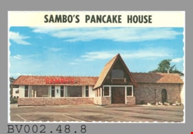
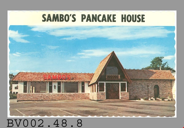
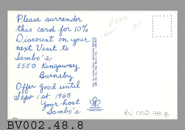
- Postcard, colour photo of single-storey building, brick and plaster, with projecting two-storey entrance, balcony over door, empty parking lot in foreground; red "SAMBO'S" on roof at left; blue sky with clouds; white border at top with black "SAMBO'S PANCAKE HOUSE"; scalloped edges; on reverse in blue up centre, "Pub. by Living Colour Advertising Agencies, 809 21st St., New West'r, B.C. - 526-6612; at bottom, maple leaf logo, "Made in Canada" "DEXTER COLOR, CANADA LTD." "CORNWALL, ONTARIO"; at left is preprinted handwritten message "Please surrender this card for 10% Discount on your next Visit to Sambo's 5550 Kingsway Burnaby Offer good until Sept 1st 1968 Your host Sambo's"; pencilled "READ" with arrow at top; pencilled "9-"; dotted outline of rectangle at upper right; glossy; unused
- Classification
- Written Communication T&E - - Writing Media
- Object Term
- Postcard
- Country Made
- Canada
- Province Made
- Ontario
- Site/City Made
- Cornwall
- Title
- Sambo's Pancake House
- Publication Date
- 1968.
- Subjects
- Documentary Artifacts
- Documentary Artifacts - Postcards
- Documentary Artifacts - Photographs
- Buildings
- Buildings - Commercial
- Buildings - Commercial - Restaurants
Images
postcard; advertisement
https://search.heritageburnaby.ca/link/museumartifact44817
- Repository
- Burnaby Village Museum
- Accession Code
- BV002.48.9
- Description
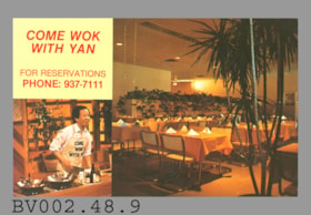
- Postcard: colour photos; horizontal; two; larger photo, at right, shows restaurant interior with palm trees; smaller photo at lower left of Stephen Yan wearing "COME WOK WITH YAN" apron; at upper left of card on yellow ground is red "COME WOK WITH YAN" "FOR RESERVATIONS PHONE: 937-7111"; on reverse in black at left is "9948 LOUGHEED HWY. BURNABY, B.C. CANADA V3J 1N3" "PHOTO BY COQUITLAM PHOTO", black line below, then simple map showing location of "YAN'S"; black line border at right [Yan owned two restaurants in the Vancouver area and his hit show, "Wok With Yan" was on the air from 1980-1995]; card appears to be c.1985; unused
- Classification
- Written Communication T&E - - Writing Media
- Object Term
- Postcard
- Title
- Come Wok With Yan
- Subjects
- Documentary Artifacts
- Documentary Artifacts - Postcards
- Documentary Artifacts - Photographs
- Buildings
- Buildings - Commercial
- Buildings - Commercial - Restaurants
Images


postcard; advertisement
https://search.heritageburnaby.ca/link/museumartifact44822
- Repository
- Burnaby Village Museum
- Accession Code
- BV002.50.1
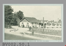
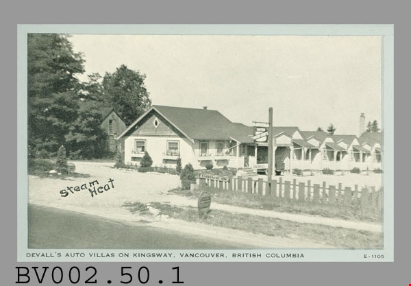
- Description
- Postcard: black and white photo; horizontal; silver border; shows row of single-storey bungalows, sign "UNITED AUTO COURTS", "VACANCIES"; wooden fence, sign "DRIVE IN"; smaller round sign "MAIN ENTRANCE"? at edge of road; black "Steam Heat" hand-printed over image on gravel? driveway; in bottom border in black, "DEVALL'S AUTO VILLAS ON KINGSWAY, VANCOUVER, BRITISH COLUMBIA"; at bottom right, "E-1105"; on reverse in black, "Post Card"; at left, "CLEAR VIEW"; double line across card, at right, "PLACE STAMP HERE"; below lines at left "FOR CORRESPONDENCE"; up centre, "MFD. BY WAYNE PAPER BOX & PRTG. CORP,, FORT WAYNE, IND."; lightly soiled, creased, worn corners; c. 194-?; unused
- Classification
- Written Communication T&E - - Writing Media
- Object Term
- Postcard
- Colour
- Black
- White
- Country Made
- United States of America
- Province Made
- Indiana
- Site/City Made
- Fort Wayne
- Title
- DeVall's Auto Villas E-1105
- Subjects
- Documentary Artifacts
- Documentary Artifacts - Postcards
- Documentary Artifacts - Photographs
- Buildings
- Buildings - Commercial
- Buildings - Commercial - Hotels and Motels
Images
postcard; advertisement
https://search.heritageburnaby.ca/link/museumartifact44823
- Repository
- Burnaby Village Museum
- Accession Code
- BV002.50.2
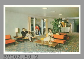
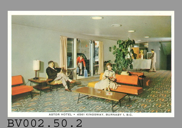
- Description
- Postcard: colour photo; horizontal; hotel lobby; white border with black print at bottom "ASTOR HOTEL. 3985 KINGSWAY, VANCOUVER, B.C."; lobby has c. 1950s furnishings, people seated and standing; image is blurred; on reverse in black, "LOBBY" "Actual photograph of the comfortable lobby of the Astor Hotel", aboriginal animal logo, "POST CARD"; line down centre; at left, "CORRESPONDENCE", at right, "ADDRESS"; outline of rectangle at upper right with "Stamp Here"; soiled; surface tears from adhesive? contact; "4.00"? erased at upper left; some wear on corners; unused
- Classification
- Written Communication T&E - - Writing Media
- Object Term
- Postcard
- Title
- Astor Hotel . 3985 Kingsway, Vancouver, B.C.
- Subjects
- Documentary Artifacts
- Documentary Artifacts - Postcards
- Documentary Artifacts - Photographs
- Buildings
- Buildings - Commercial
- Buildings - Commercial - Hotels and Motels
Images
postcard; advertisement
https://search.heritageburnaby.ca/link/museumartifact44824
- Repository
- Burnaby Village Museum
- Accession Code
- BV002.50.3
- Description
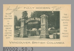
- Postcard, black and white photo of entrance to "CENTRAL PARK AUTO CAMP", sign between two stone pillars; black line border; horizontal; printed on buff card, plain border all around, wider at sides; black print at top "FULLY MODERN"; below photo, "VANCOUVER, BRITISH COLUMBIA"; at left, "RIGHT ON THE HIGHWAY" "15 MINUTES DRIVE TO THE CENTRE OP THE CITY"; at right, "THE FINEST NATURAL AUTO CAMP ON THE PACIFIC COAST"; pencilled at upper left, "Knight", at right,"Taft"; on reverse, black "POST CARD" at top centre, dotted outline of rectangle at upper right; darkened around edges; black marks; print transferred from something else at top, reversed "--ODER"; unused; card really does have "OP" instead of "OF"
- Classification
- Written Communication T&E - - Writing Media
- Object Term
- Postcard
- Colour
- Black
- White
- Title
- Central Park Auto Camp
- Subjects
- Documentary Artifacts
- Documentary Artifacts - Postcards
- Documentary Artifacts - Photographs
- Buildings
- Buildings - Commercial
- Buildings - Commercial - Hotels and Motels
- Names
- Central Park Auto Camp
Images


Children's theatrical performance at the Oak Theatre
https://search.heritageburnaby.ca/link/archivedescription85469
- Repository
- City of Burnaby Archives
- Date
- 1939
- Collection/Fonds
- Digney Family fonds
- Description Level
- Item
- Physical Description
- 1 film clip (1 min., 36 sec.) : digital, b&w ; si.
- Scope and Content
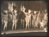
- Item is a digitized copy of a black and white film segment of an unidentified theatrical production at the Oak Theatre with children as the performers. Children appear in costume with some dressed as mice or rats and cats dancing and performing on the stage while others are dressed as townsfolk. Th…
- Repository
- City of Burnaby Archives
- Date
- 1939
- Collection/Fonds
- Digney Family fonds
- Physical Description
- 1 film clip (1 min., 36 sec.) : digital, b&w ; si.
- Description Level
- Item
- Record No.
- 562-002-5
- Access Restriction
- No restrictions
- Reproduction Restriction
- May be restricted by third party rights
- Accession Number
- 2012-15
- Scope and Content
- Item is a digitized copy of a black and white film segment of an unidentified theatrical production at the Oak Theatre with children as the performers. Children appear in costume with some dressed as mice or rats and cats dancing and performing on the stage while others are dressed as townsfolk. The play closely resembles the folk tale 'The Pied Piper of Hamelin' (also known as The Pan Piper, the Rat Catcher of Hamelin).
- Names
- Oak Theatre
- Media Type
- Moving Images
- Photographer
- Digney, Andy
- Creator
- Digney, Andy
- Notes
- Title based on contents of film
- Film clip originates from digitized version of original 16 mm film footage (item 562-002). This segment was part of digitized portion titled 'Royal Visit'
- Storage location refers to location of DVD containing this clip. See 562-002 notes for more information. Additional copies of video file stored in Permanent drive accession folder.
- Geographic Access
- Kingsway
- Central Park
- Historic Neighbourhood
- Central Park (Historic Neighbourhood)
- Planning Study Area
- Sussex-Nelson Area
Images
Video
Children's theatrical performance at the Oak Theatre, 1939
Children's theatrical performance at the Oak Theatre, 1939
https://search.heritageburnaby.ca/media/hpo/_Data/_Archives_Moving_Images/_Unrestricted/562-002-5.m4v![Lion dancer at Dolphin Theatre mural, [2001] thumbnail](/media/hpo/_Data/_Archives_Images/_Unrestricted/535/535-2971.jpg?width=280)
Lion dancer at Dolphin Theatre mural
https://search.heritageburnaby.ca/link/archivedescription97696
- Repository
- City of Burnaby Archives
- Date
- [2001]
- Collection/Fonds
- Burnaby NewsLeader photograph collection
- Description Level
- Item
- Physical Description
- 1 photograph (tiff) : col.
- Scope and Content
- Photograph of a lion dancer in front of the mural, depicting volunteers and painted by volunteers, on the side of the Dolphin Theatre in North Burnaby.
- Repository
- City of Burnaby Archives
- Date
- [2001]
- Collection/Fonds
- Burnaby NewsLeader photograph collection
- Physical Description
- 1 photograph (tiff) : col.
- Description Level
- Item
- Record No.
- 535-2971
- Access Restriction
- No restrictions
- Reproduction Restriction
- No restrictions
- Accession Number
- 2018-12
- Scope and Content
- Photograph of a lion dancer in front of the mural, depicting volunteers and painted by volunteers, on the side of the Dolphin Theatre in North Burnaby.
- Media Type
- Photograph
- Photographer
- Bartel, Mario
- Notes
- Title based on caption
- Collected by editorial for use in a December 2001 issue of the Burnaby NewsLeader
- Caption from metadata: "A Chinese Lion Dancer blesses the mural on the side of the Dolphin Theatre in North Burnaby. The mural salutes Burnaby volunteers by depicting actual volunteers and was itself painted by 100 volunteers."
- Geographic Access
- Hastings Street
- Street Address
- 4555 Hastings Street
- Historic Neighbourhood
- Capitol Hill (Historic Neighbourhood)
- Planning Study Area
- Capitol Hill Area
Images
![Lion dancer at Dolphin Theatre mural, [2001] thumbnail](/media/hpo/_Data/_Archives_Images/_Unrestricted/535/535-2971.jpg)
![Oak Theatre, [between 1937 and 1936] thumbnail](/media/Hpo/_Data/_Archives_Moving_Images/_Unrestricted/562-002-1.jpg?width=280)
Oak Theatre
https://search.heritageburnaby.ca/link/archivedescription85202
- Repository
- City of Burnaby Archives
- Date
- [between 1937 and 1936]
- Collection/Fonds
- Digney Family fonds
- Description Level
- Item
- Physical Description
- 1 film clip (9 min., 26 sec.) : digital, col., si.
- Scope and Content
- Item is a digitized copy of a silent colour film segment with footage of the construction of the Oak Theatre in 1936, the opening of the theatre held on August 4, 1937, the theatre with snow in the winter and the Digney family home and neighborhood . Andy Digney moved with his family from Manitoba …
- Repository
- City of Burnaby Archives
- Date
- [between 1937 and 1936]
- Collection/Fonds
- Digney Family fonds
- Physical Description
- 1 film clip (9 min., 26 sec.) : digital, col., si.
- Description Level
- Item
- Record No.
- 562-002-1
- Access Restriction
- No restrictions
- Reproduction Restriction
- May be restricted by third party rights
- Accession Number
- 2012-15
- Scope and Content
- Item is a digitized copy of a silent colour film segment with footage of the construction of the Oak Theatre in 1936, the opening of the theatre held on August 4, 1937, the theatre with snow in the winter and the Digney family home and neighborhood . Andy Digney moved with his family from Manitoba to Burnaby in 1936 and purchased 2 acres of land where he settled with his family and built the Oak Theatre which was located at 5000 Kingsway (Marlborough & Kingsway). The theatre was located on a 2 acre parcel of land and had a 350 seat capacity and offered valet parking. Construction crews with men and horses can be seen laying the foundation and erecting the walls of the theatre and crowds of people and cars are seen arriving outside the theatre on opening day.
- Subjects
- Events - Openings
- Buildings - Commercial - Theatres
- Recreational Activities - Theatre
- Animals - Horses
- Names
- Oak Theatre
- Digney, Andy
- Media Type
- Moving Images
- Photographer
- Digney, Andy
- Creator
- Digney, Andy
- Notes
- Title based on contents of film
- Film clip originates from digitized version of original 16 mm film footage (item 562-002). This segment was part of digitized portion titled 'Oak Theatre'
- Historic Neighbourhood
- Central Park (Historic Neighbourhood)
- Planning Study Area
- Sussex-Nelson Area
Images
![Oak Theatre, [between 1937 and 1936] thumbnail](/media/Hpo/_Data/_Archives_Moving_Images/_Unrestricted/562-002-1.jpg)
Video
Oak Theatre, [between 1937 and 1936]
Oak Theatre, [between 1937 and 1936]
https://search.heritageburnaby.ca/media/hpo/_Data/_Archives_Moving_Images/_Unrestricted/562-002-1.m4v
Oak Theatre
https://search.heritageburnaby.ca/link/archivedescription37463
- Repository
- City of Burnaby Archives
- Date
- 1937 (date of original), copied 1991
- Collection/Fonds
- Burnaby Historical Society fonds
- Description Level
- Item
- Physical Description
- 1 photograph : b&w ; 4.6 x 3.3 cm print on contact sheet 20.2 x 25.3 cm
- Scope and Content
- Photograph of the Oak Theatre at 3506 Kingsway at night. This was the first commercial use of neon lighting in Burnaby. This photograph may have been taken opening night, August 4, 1937.
- Repository
- City of Burnaby Archives
- Date
- 1937 (date of original), copied 1991
- Collection/Fonds
- Burnaby Historical Society fonds
- Subseries
- Burnaby Image Bank subseries
- Physical Description
- 1 photograph : b&w ; 4.6 x 3.3 cm print on contact sheet 20.2 x 25.3 cm
- Description Level
- Item
- Record No.
- 370-051
- Access Restriction
- No restrictions
- Reproduction Restriction
- No known restrictions
- Accession Number
- BHS1999-03
- Scope and Content
- Photograph of the Oak Theatre at 3506 Kingsway at night. This was the first commercial use of neon lighting in Burnaby. This photograph may have been taken opening night, August 4, 1937.
- Names
- Oak Theatre
- Media Type
- Photograph
- Photographer
- Bellinger, Bernard
- Notes
- Title based on contents of photograph
- 1 b&w copy negative accompanying
- Geographic Access
- Kingsway
- Historic Neighbourhood
- Central Park (Historic Neighbourhood)
- Planning Study Area
- Marlborough Area
Images

Royal Visit
https://search.heritageburnaby.ca/link/archivedescription85203
- Repository
- City of Burnaby Archives
- Date
- 1939
- Collection/Fonds
- Digney Family fonds
- Description Level
- Item
- Physical Description
- 1 film clip (1 min., 52 sec.) : digital, col., si.
- Scope and Content
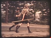
- Item is a digitized copy of a silent colour film segment with footage of the Royal Visit from King George VI and Queen consort, Elizabeth. Boy Scouts and members of the community can be seen preparing for a roadside view of the motorcade and Mr. Digney can be seen pacing in his gardens at the Oak T…
- Repository
- City of Burnaby Archives
- Date
- 1939
- Collection/Fonds
- Digney Family fonds
- Physical Description
- 1 film clip (1 min., 52 sec.) : digital, col., si.
- Description Level
- Item
- Record No.
- 562-002-2
- Access Restriction
- No restrictions
- Reproduction Restriction
- No known restrictions
- Accession Number
- 2012-15
- Scope and Content
- Item is a digitized copy of a silent colour film segment with footage of the Royal Visit from King George VI and Queen consort, Elizabeth. Boy Scouts and members of the community can be seen preparing for a roadside view of the motorcade and Mr. Digney can be seen pacing in his gardens at the Oak Theatre. As the royal couple (King George VI and Queen Elizabeth) drive by the crowd on Kingsway, they can be seen in a automobile identified as a McLaughlin model 45 Extra Special series, with Queen Elizabeth holding a white umbrella. RCMP officers are seen on a motorcycle with a side car, while dignitaries and officials in automobiles accompany the royal couple as the crowd waves red flags and looks on as the cars drive off.
- Subjects
- Events - May Day
- Events - Royal Visits
- Buildings - Commercial - Theatres
- Recreational Activities - Theatre
- Names
- Oak Theatre
- Digney, Andy
- Elizabeth, Queen, consort of George VI, King of Great Britain, 1900-2002
- George VI, King of Great Britain, 1895-1952
- Media Type
- Moving Images
- Photographer
- Digney, Andy
- Creator
- Digney, Andy
- Notes
- Title based on contents of film
- Film clip originates from digitized version of original 16 mm film footage (item 562-002). This segment was part of digitized portion titled 'Royal Visit'
- Geographic Access
- Kingsway
- Central Park
- Historic Neighbourhood
- Central Park (Historic Neighbourhood)
- Planning Study Area
- Sussex-Nelson Area
Images

Video
Royal Visit, 1939

postcard; advertisement
https://search.heritageburnaby.ca/link/museumartifact44813
- Repository
- Burnaby Village Museum
- Accession Code
- BV002.48.5
- Description
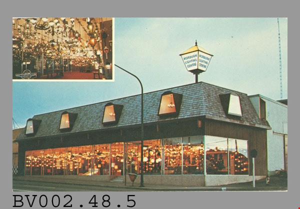
- Postcard: colour photo; horizontal; building, showroom for lighting, large windows, lights are on; sloping shingled roof with dormer display windows, large lantern sign on corner, "NORBURN LIGHTING CENTRE"; inset photo at upper left is interior photo of showroom; on reverse, in blue at upper left, "Norburn Lighting Centre" with logo of lantern and "4600 E. HASTINGS ST., BURNABY, 299-0666"; up centre of card, "LITHOGRAPHED BY LAWSON GRAPHICS PACIFIC LIMITED, VANCOUVER, CANADA"; maple leaf at top, "MADE IN CANADA"; at bottom, "Traveltime PRODUCT" "C-2943"; at upper right, "POST CARD" "ADDRESS"; rectangle with "USE CANADIAN POSTAGE"; brownish stain, black marks; creases; wear at corners; unused
- Classification
- Written Communication T&E - - Writing Media
- Object Term
- Postcard
- Country Made
- Canada
- Province Made
- British Columbia
- Site/City Made
- Vancouver
- Title
- Norburn Lighting Centre C-2943
- Subjects
- Documentary Artifacts
- Documentary Artifacts - Postcards
- Documentary Artifacts - Photographs
- Buildings
- Buildings - Commercial
Images
![Aerial of Metro Vancouver, [1995] thumbnail](/media/Hpo/_Data/_Archives_Images/_Unrestricted/629/629-001.jpg?width=280)
Aerial of Metro Vancouver
https://search.heritageburnaby.ca/link/archivedescription97764
- Repository
- City of Burnaby Archives
- Date
- [1995]
- Collection/Fonds
- Burnaby Mountain Preservation Society fonds
- Description Level
- Item
- Physical Description
- 1 photograph : col. slide ; 35 mm
- Scope and Content
- Aerial photograph of Metro Vancouver.
- Repository
- City of Burnaby Archives
- Date
- [1995]
- Collection/Fonds
- Burnaby Mountain Preservation Society fonds
- Physical Description
- 1 photograph : col. slide ; 35 mm
- Description Level
- Item
- Record No.
- 629-001
- Access Restriction
- No restrictions
- Reproduction Restriction
- Reproduce for fair dealing purposes only
- Accession Number
- 2006-13
- Scope and Content
- Aerial photograph of Metro Vancouver.
- Subjects
- Aerial Photographs
- Media Type
- Photograph
Images
![Aerial of Metro Vancouver, [1995] thumbnail](/media/Hpo/_Data/_Archives_Images/_Unrestricted/629/629-001.jpg)
Aerial photograph of Burnaby
https://search.heritageburnaby.ca/link/archivedescription84891
- Repository
- City of Burnaby Archives
- Date
- 1963
- Collection/Fonds
- Allan Amundsen collection
- Description Level
- Item
- Physical Description
- 1 photograph : b&w ; 22.5 x 22.5 cm
- Scope and Content
- Aerial photograph of Burnaby north of Lougheed Highway.
- Repository
- City of Burnaby Archives
- Date
- 1963
- Collection/Fonds
- Allan Amundsen collection
- Physical Description
- 1 photograph : b&w ; 22.5 x 22.5 cm
- Description Level
- Item
- Record No.
- 561-012
- Access Restriction
- In Archives only
- Reproduction Restriction
- No reproduction permitted
- Accession Number
- 2014-08
- Scope and Content
- Aerial photograph of Burnaby north of Lougheed Highway.
- Media Type
- Photograph
- Photographer
- Province of British Columbia
- Notes
- Title based on contents of photograph
- This photo is indentified as BC5061:117 and connects with B.C. air photograph BC5061:118 to the east
- Historic Neighbourhood
- Burnaby Lake (Historic Neighbourhood)
- Planning Study Area
- Parkcrest-Aubrey Area
- Ardingley-Sprott Area
Aerial photograph of Burnaby
https://search.heritageburnaby.ca/link/archivedescription84892
- Repository
- City of Burnaby Archives
- Date
- 1963
- Collection/Fonds
- Allan Amundsen collection
- Description Level
- Item
- Physical Description
- 1 photograph : b&w ; 22.5 x 22.5 cm
- Scope and Content
- Aerial photograph of Burnaby north of Lougheed Highway.
- Repository
- City of Burnaby Archives
- Date
- 1963
- Collection/Fonds
- Allan Amundsen collection
- Physical Description
- 1 photograph : b&w ; 22.5 x 22.5 cm
- Description Level
- Item
- Record No.
- 561-013
- Access Restriction
- In Archives only
- Reproduction Restriction
- No reproduction permitted
- Accession Number
- 2014-08
- Scope and Content
- Aerial photograph of Burnaby north of Lougheed Highway.
- Subjects
- Aerial Photographs
- Media Type
- Photograph
- Photographer
- Province of British Columbia
- Notes
- Title based on contents of photograph
- This photo is indentified as BC5061:118 and connects with B.C. air photograph BC5061:117 to the west and BC5061:119 to the east
- Historic Neighbourhood
- Burnaby Lake (Historic Neighbourhood)
- Lozells (Historic Neighbourhood)
- Planning Study Area
- Parkcrest-Aubrey Area
- Ardingley-Sprott Area
- Sperling-Broadway Area
- Government Road Area
Aerial photograph of Burnaby
https://search.heritageburnaby.ca/link/archivedescription84893
- Repository
- City of Burnaby Archives
- Date
- 1963
- Collection/Fonds
- Allan Amundsen collection
- Description Level
- Item
- Physical Description
- 1 photograph : b&w ; 22.5 x 22.5 cm
- Scope and Content
- Aerial photograph of Burnaby north of Lougheed Highway and west of Sperling Avenue.
- Repository
- City of Burnaby Archives
- Date
- 1963
- Collection/Fonds
- Allan Amundsen collection
- Physical Description
- 1 photograph : b&w ; 22.5 x 22.5 cm
- Description Level
- Item
- Record No.
- 561-014
- Access Restriction
- In Archives only
- Reproduction Restriction
- No reproduction permitted
- Accession Number
- 2014-08
- Scope and Content
- Aerial photograph of Burnaby north of Lougheed Highway and west of Sperling Avenue.
- Subjects
- Aerial Photographs
- Media Type
- Photograph
- Photographer
- Province of British Columbia
- Notes
- Title based on contents of photograph
- This photo is indentified as BC5061:119 and connects with B.C. air photograph BC5061:118 to the west and BC5061:120 to the east
- Geographic Access
- Burnaby Mountain Conservation Area
- Historic Neighbourhood
- Lozells (Historic Neighbourhood)
- Planning Study Area
- Sperling-Broadway Area
- Lake City Area
- Government Road Area
Aerial photograph of Burnaby
https://search.heritageburnaby.ca/link/archivedescription84894
- Repository
- City of Burnaby Archives
- Date
- 1963
- Collection/Fonds
- Allan Amundsen collection
- Description Level
- Item
- Physical Description
- 1 photograph : b&w ; 22.5 x 22.5 cm
- Scope and Content
- Aerial photograph of Burnaby north of Broadway and west of Sperling Avenue.
- Repository
- City of Burnaby Archives
- Date
- 1963
- Collection/Fonds
- Allan Amundsen collection
- Physical Description
- 1 photograph : b&w ; 22.5 x 22.5 cm
- Description Level
- Item
- Record No.
- 561-015
- Access Restriction
- In Archives only
- Reproduction Restriction
- No reproduction permitted
- Accession Number
- 2014-08
- Scope and Content
- Aerial photograph of Burnaby north of Broadway and west of Sperling Avenue.
- Subjects
- Aerial Photographs
- Media Type
- Photograph
- Photographer
- Province of British Columbia
- Notes
- Title based on contents of photograph
- This photo is indentified as BC5061:120 and connects with B.C. air photograph BC5061:119 to the west and BC5061:121 to the east
- Geographic Access
- Burnaby Mountain Conservation Area
- Historic Neighbourhood
- Lozells (Historic Neighbourhood)
- Planning Study Area
- Sperling-Broadway Area
- Lake City Area
- Government Road Area
- Burnaby Mountain Area
Aerial photograph of Burnaby
https://search.heritageburnaby.ca/link/archivedescription84896
- Repository
- City of Burnaby Archives
- Date
- 1963
- Collection/Fonds
- Allan Amundsen collection
- Description Level
- Item
- Physical Description
- 1 photograph : b&w ; 22.5 x 22.5 cm
- Scope and Content
- Aerial photograph of Burnaby north of Broadway and west of Sperling Avenue.
- Repository
- City of Burnaby Archives
- Date
- 1963
- Collection/Fonds
- Allan Amundsen collection
- Physical Description
- 1 photograph : b&w ; 22.5 x 22.5 cm
- Description Level
- Item
- Record No.
- 561-016
- Access Restriction
- In Archives only
- Reproduction Restriction
- No reproduction permitted
- Accession Number
- 2014-08
- Scope and Content
- Aerial photograph of Burnaby north of Broadway and west of Sperling Avenue.
- Subjects
- Aerial Photographs
- Media Type
- Photograph
- Photographer
- Province of British Columbia
- Notes
- Title based on contents of photograph
- This photo is indentified as BC5061:121 and connects with B.C. air photograph BC5061:120 to the west and BC5061:122 to the east
- Geographic Access
- Burnaby Mountain Conservation Area
- Historic Neighbourhood
- Lozells (Historic Neighbourhood)
- Planning Study Area
- Sperling-Broadway Area
- Lake City Area
- Government Road Area
- Burnaby Mountain Area
Aerial photograph of Burnaby
https://search.heritageburnaby.ca/link/archivedescription84903
- Repository
- City of Burnaby Archives
- Date
- 1963
- Collection/Fonds
- Allan Amundsen collection
- Description Level
- Item
- Physical Description
- 1 photograph : b&w ; 22.5 x 22.5 cm
- Scope and Content
- Aerial photograph of Burnaby with the Trans Canada Highway running through and the Forest Lawn Cemetery to the south.
- Repository
- City of Burnaby Archives
- Date
- 1963
- Collection/Fonds
- Allan Amundsen collection
- Physical Description
- 1 photograph : b&w ; 22.5 x 22.5 cm
- Description Level
- Item
- Record No.
- 561-024
- Access Restriction
- In Archives only
- Reproduction Restriction
- No reproduction permitted
- Accession Number
- 2014-08
- Scope and Content
- Aerial photograph of Burnaby with the Trans Canada Highway running through and the Forest Lawn Cemetery to the south.
- Subjects
- Aerial Photographs
- Media Type
- Photograph
- Photographer
- Province of British Columbia
- Notes
- Title based on contents of photograph
- This photo is indentified as BC5062:27 and connects with B.C. air photograph BC5061:26 to the east
- Historic Neighbourhood
- Burnaby Lake (Historic Neighbourhood)
- Planning Study Area
- Douglas-Gilpin Area
- Ardingley-Sprott Area
- Dawson-Delta Area
Aerial photograph of Burnaby
https://search.heritageburnaby.ca/link/archivedescription84907
- Repository
- City of Burnaby Archives
- Date
- 1963
- Collection/Fonds
- Allan Amundsen collection
- Description Level
- Item
- Physical Description
- 1 photograph : b&w ; 22.5 x 22.5 cm
- Scope and Content
- Aerial photograph of Burnaby with the Trans Canada Highway running from through and Burnaby Lake in the south east corner.
- Repository
- City of Burnaby Archives
- Date
- 1963
- Collection/Fonds
- Allan Amundsen collection
- Physical Description
- 1 photograph : b&w ; 22.5 x 22.5 cm
- Description Level
- Item
- Record No.
- 561-025
- Access Restriction
- In Archives only
- Reproduction Restriction
- No reproduction permitted
- Accession Number
- 2014-08
- Scope and Content
- Aerial photograph of Burnaby with the Trans Canada Highway running from through and Burnaby Lake in the south east corner.
- Subjects
- Aerial Photographs
- Media Type
- Photograph
- Photographer
- Province of British Columbia
- Notes
- Title based on contents of photograph
- This photo is indentified as BC5062:26 and connects with B.C. air photograph BC5062:27 to the west and B.C. air photograph BC5062:25 to the east
- Historic Neighbourhood
- Burnaby Lake (Historic Neighbourhood)
- Planning Study Area
- Douglas-Gilpin Area
- Ardingley-Sprott Area
- Burnaby Lake Area
Aerial photograph of Burnaby
https://search.heritageburnaby.ca/link/archivedescription84911
- Repository
- City of Burnaby Archives
- Date
- 1963
- Collection/Fonds
- Allan Amundsen collection
- Description Level
- Item
- Physical Description
- 1 photograph : b&w ; 22.5 x 22.5 cm
- Scope and Content
- Aerial photograph of Burnaby with Lougheed Highway running west to east through the middle of the photograph and the Trans Canada Highway in the lower left segment.
- Repository
- City of Burnaby Archives
- Date
- 1963
- Collection/Fonds
- Allan Amundsen collection
- Physical Description
- 1 photograph : b&w ; 22.5 x 22.5 cm
- Description Level
- Item
- Record No.
- 561-029
- Access Restriction
- In Archives only
- Reproduction Restriction
- No reproduction permitted
- Accession Number
- 2014-08
- Scope and Content
- Aerial photograph of Burnaby with Lougheed Highway running west to east through the middle of the photograph and the Trans Canada Highway in the lower left segment.
- Subjects
- Aerial Photographs
- Media Type
- Photograph
- Photographer
- Province of British Columbia
- Notes
- Title based on contents of photograph
- This photo is indentified as BC5062:22 and connects with B.C. air photograph BC5062:23 to the west and B.C. air photograph BC5062:21
- Historic Neighbourhood
- Lozells (Historic Neighbourhood)
- Burquitlam (Historic Neighbourhood)
- Planning Study Area
- Lake City Area
- Government Road Area
- Burnaby Lake Area
- Lyndhurst Area
- Cariboo-Armstrong Area