More like 'May Day dancers at Central Park'

Central Park Entrance Gate
https://search.heritageburnaby.ca/link/landmark544
- Repository
- Burnaby Heritage Planning
- Description
- The Central Park Entrance Gate is the ceremonial entrance to Burnaby’s historic Central Park from Kingsway, and consists of two massive stone pillars, approximately 7.5 metres high and 1.8 metres square, adjacent gate posts and a low flanking stone wall that curves into the park to the east.
- Associated Dates
- 1913
- Formal Recognition
- Heritage Designation, Community Heritage Register
- Street View URL
- Google Maps Street View
- Repository
- Burnaby Heritage Planning
- Geographic Access
- Imperial Street
- Associated Dates
- 1913
- Formal Recognition
- Heritage Designation, Community Heritage Register
- Enactment Type
- Bylaw No. 9807
- Enactment Date
- 23/11/1992
- Description
- The Central Park Entrance Gate is the ceremonial entrance to Burnaby’s historic Central Park from Kingsway, and consists of two massive stone pillars, approximately 7.5 metres high and 1.8 metres square, adjacent gate posts and a low flanking stone wall that curves into the park to the east.
- Heritage Value
- The Central Park Entrance Gate is significant as a ceremonial entry to a major park, for its connection with the early history of the British Columbia Electric Railway (BCER) and as an important design by an accomplished British Columbian architect. When the original interurban line between Vancouver and New Westminster was constructed in 1891, one of the first stations was located where the tramway crossed the Vancouver-Westminster Road (now Kingsway) within the newly-created Central Park. The interurban line ran through the park on a diagonal right-of-way (the current SkyTrain line, opened in 1986, follows this original alignment). In 1912 an agreement was reached between the successor interurban company, the BCER, and the Central Park Provincial Park Board, to deed additional land for an expanded right-of-way through the Park in exchange for improvements that included the construction of an ornamental stone wall and gate with an iron arch, with an illuminated 'Central Park' sign, adjacent to the interurban station on Kingsway. This was an early and rare example of an electric sign used for a public recreation facility. The Gate is also significant as a surviving early design by Robert Lyon (1879-1963), an Edinburgh-born and trained immigrant who was one of the most accomplished of British Columbia's early architects. After he moved to Vancouver, he was employed by the BCER from 1911 until 1918, and worked on a broad range of projects including some of the grandest and most innovative local industrial structures of the time. The arch was built by the Westminster Ironworks Company, one of the leading firms of its kind in Western Canada, operated by John Reid of New Westminster. The Gate was completed in 1914; in 1968 the decorative ironwork was removed due to corrosion and placed in storage.
- Defining Elements
- Key elements that define the heritage character of the Central Park Entrance Gate include its: - two subtly tapered massive stone pillars, which rise in stages from a larger base to a shaft with random coursed multi-coloured granite with roughly formed grey granite quoins, to a top formed of finely finished grey granite blocks with a coved and bracketed cap - adjacent gate posts with monolithic pyramidal granite caps - low flanking stone wall that curves into the park to the east, constructed of random coursed multi-coloured granite with a river rock triangular cap
- Historic Neighbourhood
- Central Park (Historic Neighbourhood)
- Planning Study Area
- Maywood Area
- Architect
- Robert Lyon
- Builder
- John Reid
- Westminster Iron Works Co.
- Function
- Primary Current--Park Fixture
- Primary Historic--Park Fixture
- Community
- Burnaby
- Cadastral Identifier
- P.I.D. No. 017-767-172 Legal Description: Block B of Lot 2 Except Firstly: Part on Plan 8669 and Secondly: Part on Plan LMP4689 District Lot 151, Group 1, New Westminster District, Plan 3443
- Boundaries
- The property (Central Park) is a municipally-owned park that lies at the western edge of Burnaby, between 49th Avenue to the south, Kingsway to the north, Boundary Road to the west and Patterson Avenue to the east.
- Area
- 853,403.82
- Contributing Resource
- Structure
- Landscape Feature
- Ownership
- Public (local)
- Names
- Lyon, Robert
- Reid, John
- Westminster Iron Works Company
- British Columbia Electric Railway Company
- Central Park Provincial Park Board
- Subjects
- Structures - Fences
- Street Address
- 3883 Imperial Street
- Street View URL
- Google Maps Street View
Images


H.T. Ceperley Estate 'Fairacres' Estate Gate
https://search.heritageburnaby.ca/link/landmark863
- Repository
- Burnaby Heritage Planning
- Description
- The 'Fairacres Estate Gate' marks the location of one of the original driveway entrances to the estate.
- Associated Dates
- 1911
- Formal Recognition
- Heritage Designation, Community Heritage Register
- Street View URL
- Google Maps Street View
- Repository
- Burnaby Heritage Planning
- Geographic Access
- Deer Lake Avenue
- Associated Dates
- 1911
- Formal Recognition
- Heritage Designation, Community Heritage Register
- Enactment Type
- Bylaw No. 140665
- Enactment Date
- 23/11/1992
- Description
- The 'Fairacres Estate Gate' marks the location of one of the original driveway entrances to the estate.
- Heritage Value
- Fairacres was designed as a country estate with a working farm that included over 10 acres of productive berry and vegetable fields, with a large kitchen garden, a root house to store food, and greenhouses heated by steam. The agricultural potential ofthe Deer Lake area made it one of the first parts of the municipality to attract settlement. Construction of the Fairacres Estate represented a shift toward wealthy country estates over more modest farms, and the Ceperleys employed a large staff to manage the estate's agricultural production. Agricultural use of the estate continued when a Catholic order of Benedictine monks purchased the estate as part of the Priory of St. Joseph and the Seminary of Christ the King, and continued to farm the land until 1953. The overall architectural intention of the estate's architect was to reflect the ideals of the Arts & Crafts movement to showcase craftsmanship, and to incorporate high quality materials, including many local materials, such as wood and stone from the site. On the mansion exterior, the rustic style is seen in the use of natural materials such as cedar shingles and siding, cobblestone foundations and chimneys and the half-timbering in gable ends. The estate's remaining gate pillar features the same rustic field and cobblestones used on the mansion. The original estate driveway had two entrances constructed in 1910, each marked by a pair of entry gate pillars which supported iron gates. The main entrance gate pillars which marked the lower driveway and the east pillar of the upper entrance were demolished many years ago and the iron gates removed. A single gate pillar remains marking the upper driveway, adjacent to the Garage and Stables. This gate pillar is a significant site feature and incorporates cobble stone and a carved sandstone capstone.
- Defining Elements
- Key elements that define the heritage character of the ‘Fairacres Estate Gate' include: - setting in relation to the estate boundary and estate buildings - Cobble stone and sandstone construction, which represents a typical Arts and Crafts use of local materials, and matches the extensive use of cobblestone as chimneys and foundations on the Fairacres mansion, as well as the use of sandstone on the mansion's exterior.
- Locality
- Deer Lake Park
- Historic Neighbourhood
- Burnaby Lake (Historic Neighbourhood)
- Planning Study Area
- Douglas-Gilpin Area
- Function
- Primary Historic--Estate
- Community
- Burnaby
- Cadastral Identifier
- P.I.D. No. 004-493-311 Legal Description: Block 3 Except: Part subdivided by Plan 26865, District Lot 79, Group 1, New Westminster District, Plan 536
- Boundaries
- ‘Fairacres’ is comprised of a single municipally-owned property located at 6344 Deer Lake Avenue, Burnaby.
- Area
- 17,065.00
- Contributing Resource
- Landscape Feature
- Ownership
- Public (local)
- Other Collection
- Burnaby Historical Society, Community Archives: Ceperley Photograph Album
- Documentation
- Heritage Site Files: PC77000 20. City of Burnaby Planning and Building Department, 4949 Canada Way, Burnaby, B.C., V5G 1M2
- Subjects
- Structures - Fences
- Street Address
- 6344 Deer Lake Avenue
- Street View URL
- Google Maps Street View
Images

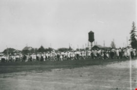
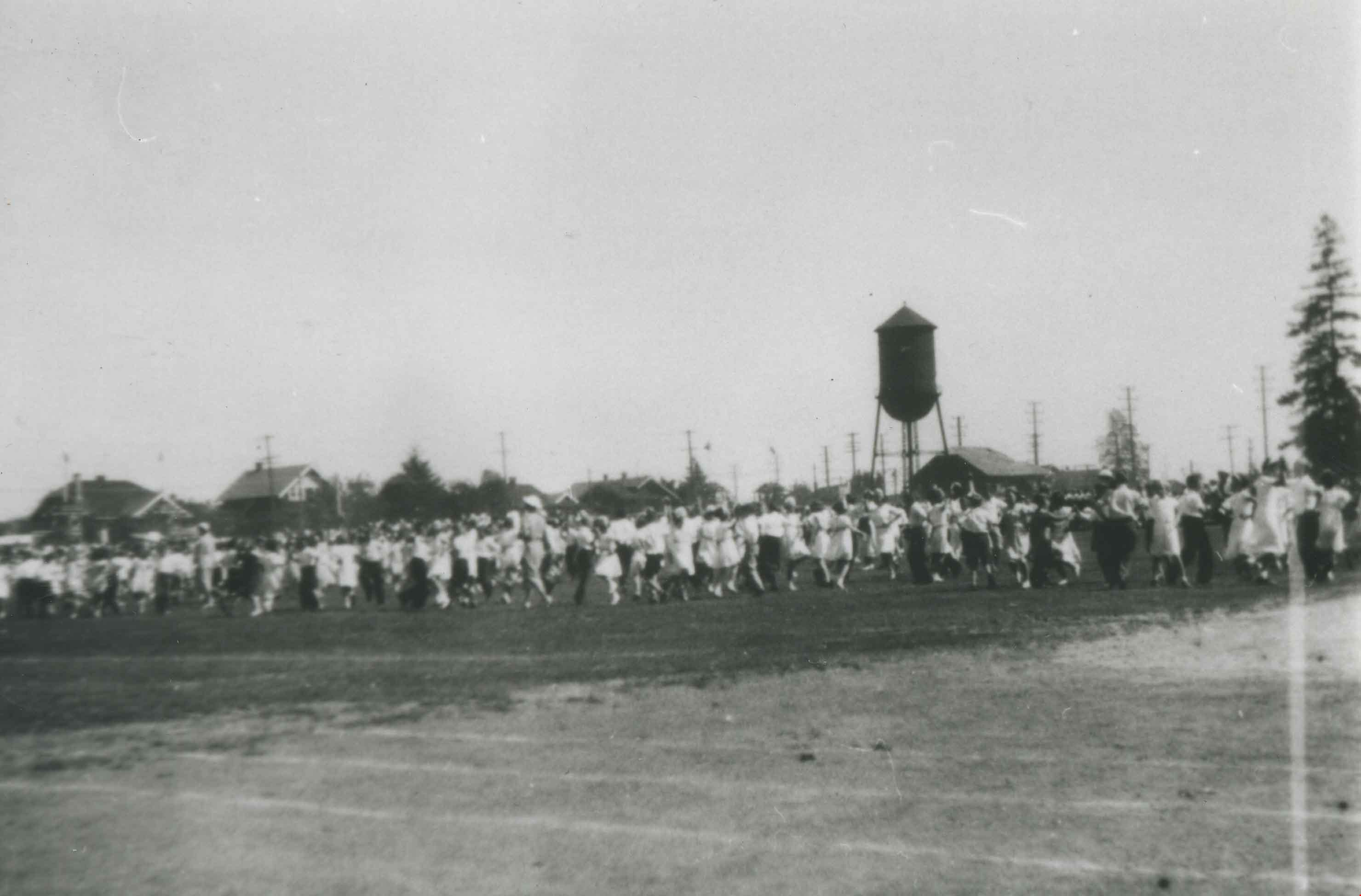
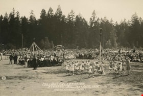
May Day
https://search.heritageburnaby.ca/link/archivedescription36677
- Repository
- City of Burnaby Archives
- Date
- 1930 (date of original), copied 1992
- Collection/Fonds
- Burnaby Historical Society fonds
- Description Level
- Item
- Physical Description
- 1 photograph : b&w ; 8.8 x 12.5 cm print
- Scope and Content
- Photograph of Burnaby May Day being held in Central Park. A water tower can be seen in the background.
- Repository
- City of Burnaby Archives
- Date
- 1930 (date of original), copied 1992
- Collection/Fonds
- Burnaby Historical Society fonds
- Subseries
- Burnaby Centennial Anthology subseries
- Physical Description
- 1 photograph : b&w ; 8.8 x 12.5 cm print
- Description Level
- Item
- Record No.
- 315-032
- Access Restriction
- No restrictions
- Reproduction Restriction
- No known restrictions
- Accession Number
- BHS1994-04
- Scope and Content
- Photograph of Burnaby May Day being held in Central Park. A water tower can be seen in the background.
- Media Type
- Photograph
- Notes
- Title based on contents of photograph
- Geographic Access
- Central Park
- Imperial Street
- Street Address
- 3883 Imperial Street
- Historic Neighbourhood
- Central Park (Historic Neighbourhood)
- Planning Study Area
- Maywood Area
Images
![Bruce and Alice Patterson with friends, [191-?] (date of original), copied 1977 thumbnail](/media/hpo/_Data/_BVM_Images/1977/1977_0099_0003_001.jpg?width=280)
Bruce and Alice Patterson with friends
https://search.heritageburnaby.ca/link/museumdescription561
- Repository
- Burnaby Village Museum
- Date
- [191-?] (date of original), copied 1977
- Collection/Fonds
- Burnaby Village Museum Photograph collection
- Description Level
- Item
- Physical Description
- 1 photograph : b&w ; 20.3 x 25.2 cm print
- Scope and Content
- Photograph of eighteen people, mostly young women in sailor collared midi suits. There is also an older couple standing to the right, a young man in uniform, and another man in a suit. Seated in the front row, second to the left is Bruce Patterson, with his sister Alice seated on his left. Also vis…
- Repository
- Burnaby Village Museum
- Collection/Fonds
- Burnaby Village Museum Photograph collection
- Description Level
- Item
- Physical Description
- 1 photograph : b&w ; 20.3 x 25.2 cm print
- Scope and Content
- Photograph of eighteen people, mostly young women in sailor collared midi suits. There is also an older couple standing to the right, a young man in uniform, and another man in a suit. Seated in the front row, second to the left is Bruce Patterson, with his sister Alice seated on his left. Also visible is a dog and a railway track on the right of the photograph, and a water tower in the upper right corner of the photograph. An annotation on the back of the photograph reads: "Bruce Paterson [sic] seated 2nd from left front / Sister Alice to his left."
- Accession Code
- HV977.99.3
- Access Restriction
- No restrictions
- Reproduction Restriction
- May be restricted by third party rights
- Date
- [191-?] (date of original), copied 1977
- Media Type
- Photograph
- Scan Resolution
- 600
- Scan Date
- 2023-07-18
- Notes
- Title based on contents of photograph
Images
![Bruce and Alice Patterson with friends, [191-?] (date of original), copied 1977 thumbnail](/media/hpo/_Data/_BVM_Images/1977/1977_0099_0003_001.jpg)
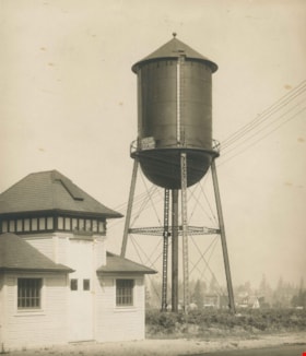
Capitol Hill water tower
https://search.heritageburnaby.ca/link/archivedescription35801
- Repository
- City of Burnaby Archives
- Date
- 1927 (date of original), copied 1986
- Collection/Fonds
- Burnaby Historical Society fonds
- Description Level
- Item
- Physical Description
- 1 photograph : b&w ; 12.7 x 17.8 cm print
- Scope and Content
- Photograph of the water tower on Capitol Hill. This iron one was built ca. 1927 to replace a smaller, wooden one. This picture was taken from front yard of the Henderson family home at 103 Grosvenor Avenue. The address of the water tower is 5440 Cambridge Street.
- Repository
- City of Burnaby Archives
- Date
- 1927 (date of original), copied 1986
- Collection/Fonds
- Burnaby Historical Society fonds
- Subseries
- Pioneer Tales subseries
- Physical Description
- 1 photograph : b&w ; 12.7 x 17.8 cm print
- Description Level
- Item
- Record No.
- 204-659
- Access Restriction
- No restrictions
- Reproduction Restriction
- No known restrictions
- Accession Number
- BHS1988-03
- Scope and Content
- Photograph of the water tower on Capitol Hill. This iron one was built ca. 1927 to replace a smaller, wooden one. This picture was taken from front yard of the Henderson family home at 103 Grosvenor Avenue. The address of the water tower is 5440 Cambridge Street.
- Media Type
- Photograph
- Notes
- Title based on contents of photograph
- Geographic Access
- Cambridge Street
- Street Address
- 5440 Cambridge Street
- Historic Neighbourhood
- Capitol Hill (Historic Neighbourhood)
- Planning Study Area
- Capitol Hill Area
Images


Continental Can Company
https://search.heritageburnaby.ca/link/archivedescription93708
- Repository
- City of Burnaby Archives
- Date
- February 24, 1978
- Collection/Fonds
- Burnaby Public Library Contemporary Visual Archive Project
- Description Level
- Item
- Physical Description
- 1 photograph : b&w ; 12.5 x 17.5 cm
- Scope and Content
- Photograph of the exterior of Continental Can Company factory, located on Winston Street by Burnaby Lake. The photograph is taken from across Winston Street, facing south, and the railway tracks are visible in front of the manufacturing plant. The Continental Can water tower stands in the backgroun…
- Repository
- City of Burnaby Archives
- Date
- February 24, 1978
- Collection/Fonds
- Burnaby Public Library Contemporary Visual Archive Project
- Physical Description
- 1 photograph : b&w ; 12.5 x 17.5 cm
- Description Level
- Item
- Record No.
- 556-665
- Access Restriction
- No restrictions
- Reproduction Restriction
- Reproduce for fair dealing purposes only
- Accession Number
- 2017-57
- Scope and Content
- Photograph of the exterior of Continental Can Company factory, located on Winston Street by Burnaby Lake. The photograph is taken from across Winston Street, facing south, and the railway tracks are visible in front of the manufacturing plant. The Continental Can water tower stands in the background, and there are signs on the side of the road for a "spindle sale" and Braemar Gardens.
- Names
- Continental Can Co.
- Media Type
- Photograph
- Photographer
- Surridge, Jack
- Notes
- Title taken from project information form
- Accompanied by a project information form and 1 photograph (b&w negative ; 9.5 x 12.5 cm)
- BPL no. 113
- Geographic Access
- Winston Street
- Burnaby Lake
- Historic Neighbourhood
- Lozells (Historic Neighbourhood)
- Planning Study Area
- Government Road Area
Images

![Kingsway at Salisbury Avenue, [1914] thumbnail](/media/hpo/_Data/_BVM_Images/1971/197200110005.jpg?width=280)
Kingsway at Salisbury Avenue
https://search.heritageburnaby.ca/link/museumdescription3091
- Repository
- Burnaby Village Museum
- Date
- [1914]
- Collection/Fonds
- Burnaby Village Museum Photograph collection
- Description Level
- Item
- Physical Description
- 1 photograph : b&w glass negative ; 16.0 x 20.9 cm
- Scope and Content
- Photograph of Kingsway looking west from Salisbury Avenue in Burnaby. At one corner of the four-way intersection is a road sign labelling the roads "Kingsway" and "Salisbury Ave," beside which hangs a "For Sale" sign from "Wolf Merton & Son" for a house at "119 Pender St. W. Vancouver." Across fro…
- Repository
- Burnaby Village Museum
- Collection/Fonds
- Burnaby Village Museum Photograph collection
- Description Level
- Item
- Physical Description
- 1 photograph : b&w glass negative ; 16.0 x 20.9 cm
- Scope and Content
- Photograph of Kingsway looking west from Salisbury Avenue in Burnaby. At one corner of the four-way intersection is a road sign labelling the roads "Kingsway" and "Salisbury Ave," beside which hangs a "For Sale" sign from "Wolf Merton & Son" for a house at "119 Pender St. W. Vancouver." Across from these signs stands a man in a suit beside one of the electric poles that lines Kingsway. Further behind him is a water tower that an earlier catalogue record from 1988 identifies as a Municipal Water Tower. Also, the record dates the negative ca. 1914.
- Subjects
- Geographic Features - Roads
- Structures - Water Tanks and Towers
- Public Services - Utilities
- Geographic Access
- Kingsway
- Salisbury Avenue
- Accession Code
- HV972.11.5
- Access Restriction
- No restrictions
- Reproduction Restriction
- No known restrictions
- Date
- [1914]
- Media Type
- Photograph
- Historic Neighbourhood
- Edmonds (Historic Neighbourhood)
- Planning Study Area
- Stride Avenue Area
- Richmond Park Area
- Scan Resolution
- 300
- Scan Date
- 14/8/2006
- Scale
- 100
- Notes
- Title based on contents of photograph
- 1 b&w contact print accompanying negative
Images
![Kingsway at Salisbury Avenue, [1914] thumbnail](/media/hpo/_Data/_BVM_Images/1971/197200110005.jpg)

Warehouses - Burnaby Lake
https://search.heritageburnaby.ca/link/archivedescription93627
- Repository
- City of Burnaby Archives
- Date
- October 22, 1977
- Collection/Fonds
- Burnaby Public Library Contemporary Visual Archive Project
- Description Level
- Item
- Physical Description
- 1 photograph : b&w ; 12.5 x 17.5 cm
- Scope and Content
- Photograph of commercial and industrial buildings by Burnaby Lake on Winston Street. The photograph is taken from a high point, facing south. The photograph shows the Furniture Fair warehouse and parking lot in the foreground and the Continental Can Company plant and its water tower are in the back…
- Repository
- City of Burnaby Archives
- Date
- October 22, 1977
- Collection/Fonds
- Burnaby Public Library Contemporary Visual Archive Project
- Physical Description
- 1 photograph : b&w ; 12.5 x 17.5 cm
- Description Level
- Item
- Record No.
- 556-584
- Access Restriction
- No restrictions
- Reproduction Restriction
- Reproduce for fair dealing purposes only
- Accession Number
- 2017-57
- Scope and Content
- Photograph of commercial and industrial buildings by Burnaby Lake on Winston Street. The photograph is taken from a high point, facing south. The photograph shows the Furniture Fair warehouse and parking lot in the foreground and the Continental Can Company plant and its water tower are in the background.
- Subjects
- Buildings - Commercial - Stores
- Buildings - Industrial - Factories
- Structures - Water Tanks and Towers
- Names
- Continental Can Co.
- Media Type
- Photograph
- Photographer
- Surridge, Jack
- Notes
- Title taken from project information form
- Accompanied by a project information form and 1 photograph (b&w negative ; 9.5 x 12.5 cm)
- BPL no. 33
- Geographic Access
- Winston Street
- Burnaby Lake
- Historic Neighbourhood
- Lozells (Historic Neighbourhood)
- Planning Study Area
- Government Road Area
Images

Water tank and pump house
https://search.heritageburnaby.ca/link/archivedescription34557
- Repository
- City of Burnaby Archives
- Date
- February 14, 1920
- Collection/Fonds
- Burnaby Historical Society fonds
- Description Level
- Item
- Physical Description
- 1 photograph : b&w ; 27.7 x 22.7 cm
- Scope and Content
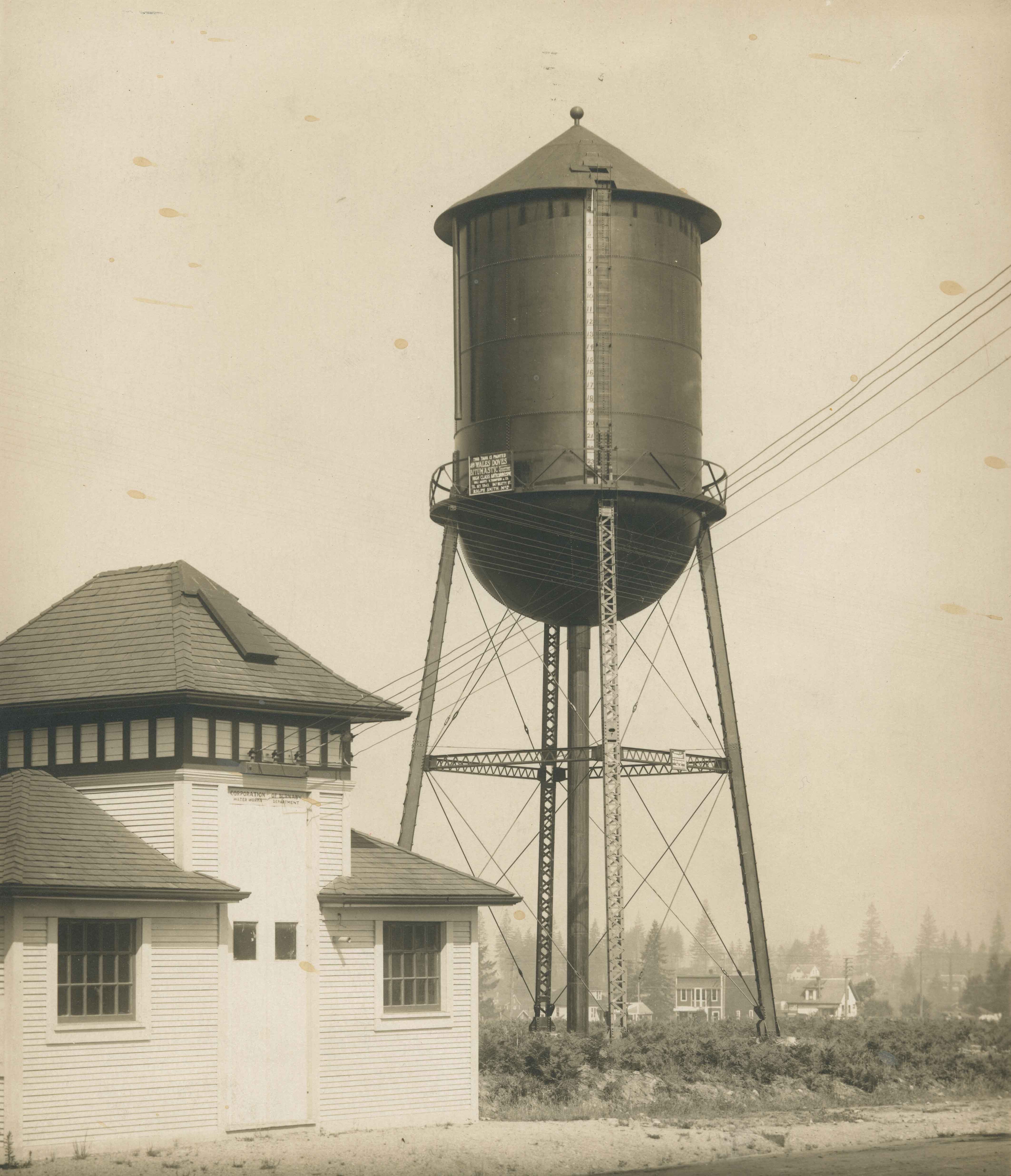
- Photograph of the water tank and pump house at Central Park. A sign on the pump house reads, "Corporation of Burnaby / Water Works Department." A sign on the water tank reads, "This tank is painted with Wales Doves Bitumastic Solution / High Class Anti-Corrosive / Sales agents R. Thompson and Co. …
- Repository
- City of Burnaby Archives
- Date
- February 14, 1920
- Collection/Fonds
- Burnaby Historical Society fonds
- Subseries
- Photographs subseries
- Physical Description
- 1 photograph : b&w ; 27.7 x 22.7 cm
- Description Level
- Item
- Record No.
- 047-002
- Access Restriction
- No restrictions
- Reproduction Restriction
- No known restrictions
- Accession Number
- BHS2007-04
- Scope and Content
- Photograph of the water tank and pump house at Central Park. A sign on the pump house reads, "Corporation of Burnaby / Water Works Department." A sign on the water tank reads, "This tank is painted with Wales Doves Bitumastic Solution / High Class Anti-Corrosive / Sales agents R. Thompson and Co. / Tel. Sey. 5343, 847 Beatty St. / Ralph Smith Mgr." In the background, the Central Park Theatre is visible.
- Media Type
- Photograph
- Notes
- Title based on contents of photograph
- Stamp on back of photograph reads, "Feb. 14, 1920 / [illegible] Steel Co. Ltd."
- Geographic Access
- Central Park
- Imperial Street
- Street Address
- 3883 Imperial Street
- Historic Neighbourhood
- Central Park (Historic Neighbourhood)
- Planning Study Area
- Maywood Area
Images
Water tank on Edmonds Street School site
https://search.heritageburnaby.ca/link/archivedescription34556
- Repository
- City of Burnaby Archives
- Date
- 1920
- Collection/Fonds
- Burnaby Historical Society fonds
- Description Level
- Item
- Physical Description
- 1 photograph : b&w ; 27.7 x 22.7 cm
- Scope and Content
- Photograph of the water tank at the Edmonds Street school site. An accompanying typed caption reads, "Water Tank East Burnaby School House. British Columbia. 25 x 50 Ft. / Painted with Wailes Doves' "Bitumastic" Solution. Sole Agents: N. Thomspon & Co. Ltd., 847 Beatty St., Vancouver, B.C."
- Repository
- City of Burnaby Archives
- Date
- 1920
- Collection/Fonds
- Burnaby Historical Society fonds
- Subseries
- Photographs subseries
- Physical Description
- 1 photograph : b&w ; 27.7 x 22.7 cm
- Description Level
- Item
- Record No.
- 047-001
- Access Restriction
- No restrictions
- Reproduction Restriction
- No known restrictions
- Accession Number
- BHS2007-04
- Scope and Content
- Photograph of the water tank at the Edmonds Street school site. An accompanying typed caption reads, "Water Tank East Burnaby School House. British Columbia. 25 x 50 Ft. / Painted with Wailes Doves' "Bitumastic" Solution. Sole Agents: N. Thomspon & Co. Ltd., 847 Beatty St., Vancouver, B.C."
- Media Type
- Photograph
- Notes
- Title based on contents of photograph
- Geographic Access
- Edmonds Street
- Street Address
- 7641 Edmonds Street
- Historic Neighbourhood
- Edmonds (Historic Neighbourhood)
- Planning Study Area
- Edmonds Area
Images

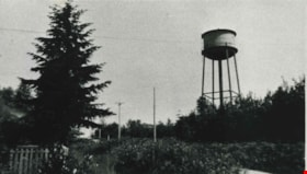
![Water tower, [194-?] thumbnail](/media/hpo/_Data/_Archives_Images/_Unrestricted/315/315-421.jpg?width=280)
Water tower
https://search.heritageburnaby.ca/link/archivedescription36963
- Repository
- City of Burnaby Archives
- Date
- [194-?]
- Collection/Fonds
- Burnaby Historical Society fonds
- Description Level
- Item
- Physical Description
- 1 photograph : b&w ; 8.7 x 12.6 cm print
- Scope and Content
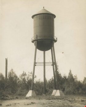
- Photograph of a water tower with graffiti on it.
- Repository
- City of Burnaby Archives
- Date
- [194-?]
- Collection/Fonds
- Burnaby Historical Society fonds
- Subseries
- Burnaby Centennial Anthology subseries
- Physical Description
- 1 photograph : b&w ; 8.7 x 12.6 cm print
- Description Level
- Item
- Record No.
- 315-421
- Access Restriction
- No restrictions
- Reproduction Restriction
- Reproduce for fair dealing purposes only
- Accession Number
- BHS1994-04
- Scope and Content
- Photograph of a water tower with graffiti on it.
- Subjects
- Structures - Water Tanks and Towers
- Media Type
- Photograph
- Notes
- Title based on contents of photograph
Images
![Water tower, [194-?] thumbnail](/media/hpo/_Data/_Archives_Images/_Unrestricted/315/315-421.jpg)
Water tower being dismantled
https://search.heritageburnaby.ca/link/archivedescription36964
- Repository
- City of Burnaby Archives
- Date
- 1948 (date of original), copied 1992
- Collection/Fonds
- Burnaby Historical Society fonds
- Description Level
- Item
- Physical Description
- 1 photograph : b&w ; 8.8 x 12.7 cm print
- Scope and Content
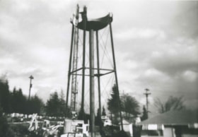
- Photograph of a water tower being dismantled on the east side of Royal Oak Avenue and Kingsway.
- Repository
- City of Burnaby Archives
- Date
- 1948 (date of original), copied 1992
- Collection/Fonds
- Burnaby Historical Society fonds
- Subseries
- Burnaby Centennial Anthology subseries
- Physical Description
- 1 photograph : b&w ; 8.8 x 12.7 cm print
- Description Level
- Item
- Record No.
- 315-422
- Access Restriction
- No restrictions
- Reproduction Restriction
- No known restrictions
- Accession Number
- BHS1994-04
- Scope and Content
- Photograph of a water tower being dismantled on the east side of Royal Oak Avenue and Kingsway.
- Subjects
- Structures - Water Tanks and Towers
- Media Type
- Photograph
- Notes
- Title based on contents of photograph
- Geographic Access
- Royal Oak Avenue
- Kingsway
- Historic Neighbourhood
- Central Park (Historic Neighbourhood)
- Planning Study Area
- Windsor Area
Images
Water tower being dismantled
https://search.heritageburnaby.ca/link/archivedescription36965
- Repository
- City of Burnaby Archives
- Date
- 1948 (date of original), copied 1992
- Collection/Fonds
- Burnaby Historical Society fonds
- Description Level
- Item
- Physical Description
- 1 photograph : b&w ; 8.8 x 12.7 cm print
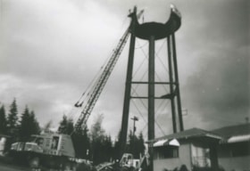
- Scope and Content
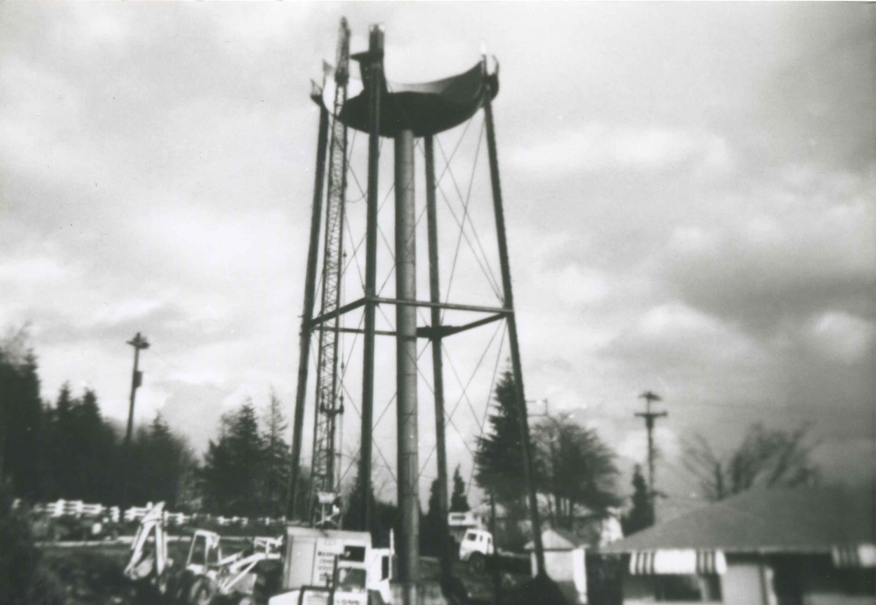
- Photograph of a water tower being dismantled by crane on the east side of Royal Oak Avenue and Kingsway.
- Repository
- City of Burnaby Archives
- Date
- 1948 (date of original), copied 1992
- Collection/Fonds
- Burnaby Historical Society fonds
- Subseries
- Burnaby Centennial Anthology subseries
- Physical Description
- 1 photograph : b&w ; 8.8 x 12.7 cm print
- Description Level
- Item
- Record No.
- 315-423
- Access Restriction
- No restrictions
- Reproduction Restriction
- No known restrictions
- Accession Number
- BHS1994-04
- Scope and Content
- Photograph of a water tower being dismantled by crane on the east side of Royal Oak Avenue and Kingsway.
- Subjects
- Structures - Water Tanks and Towers
- Media Type
- Photograph
- Notes
- Title based on contents of photograph
- Geographic Access
- Royal Oak Avenue
- Kingsway
- Historic Neighbourhood
- Central Park (Historic Neighbourhood)
- Planning Study Area
- Windsor Area
Images

Water tower being dismantled
https://search.heritageburnaby.ca/link/archivedescription36966
- Repository
- City of Burnaby Archives
- Date
- 1948 (date of original), copied 1992
- Collection/Fonds
- Burnaby Historical Society fonds
- Description Level
- Item
- Physical Description
- 1 photograph : b&w ; 8.6 x 10.3 cm print
- Scope and Content
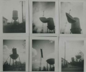
- Photograph of a series of six photographs of a water tower being dismantled on the east side of Royal Oak Avenue and Kingsway.
- Repository
- City of Burnaby Archives
- Date
- 1948 (date of original), copied 1992
- Collection/Fonds
- Burnaby Historical Society fonds
- Subseries
- Burnaby Centennial Anthology subseries
- Physical Description
- 1 photograph : b&w ; 8.6 x 10.3 cm print
- Description Level
- Item
- Record No.
- 315-424
- Access Restriction
- No restrictions
- Reproduction Restriction
- No known restrictions
- Accession Number
- BHS1994-04
- Scope and Content
- Photograph of a series of six photographs of a water tower being dismantled on the east side of Royal Oak Avenue and Kingsway.
- Subjects
- Structures - Water Tanks and Towers
- Media Type
- Photograph
- Notes
- Title based on contents of photograph
- Geographic Access
- Royal Oak Avenue
- Kingsway
- Historic Neighbourhood
- Central Park (Historic Neighbourhood)
- Planning Study Area
- Windsor Area
Images

First May Day
https://search.heritageburnaby.ca/link/archivedescription35293
- Repository
- City of Burnaby Archives
- Date
- 1925 (date of original), copied 1986
- Collection/Fonds
- Burnaby Historical Society fonds
- Description Level
- Item
- Physical Description
- 1 photograph : b&w ; 12.7 x 17.8 cm print
- Scope and Content
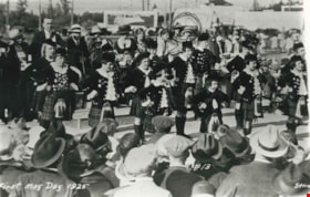
- Photograph of the first Burnaby May Day in 1925. Margaret Urquhart (Peggy) and her mother Lillias Urquhart (circled) were spectators.
- Repository
- City of Burnaby Archives
- Date
- 1925 (date of original), copied 1986
- Collection/Fonds
- Burnaby Historical Society fonds
- Subseries
- Pioneer Tales subseries
- Physical Description
- 1 photograph : b&w ; 12.7 x 17.8 cm print
- Description Level
- Item
- Record No.
- 204-150
- Access Restriction
- No restrictions
- Reproduction Restriction
- No known restrictions
- Accession Number
- BHS1988-03
- Scope and Content
- Photograph of the first Burnaby May Day in 1925. Margaret Urquhart (Peggy) and her mother Lillias Urquhart (circled) were spectators.
- Names
- Urquhart, Lillias
- Media Type
- Photograph
- Photographer
- Stride, Charles Edgar
- Notes
- Title based on caption on photograph
- Parallel Name Authority: "Stride Studios"
- Geographic Access
- Central Park
- Historic Neighbourhood
- Central Park (Historic Neighbourhood)
- Planning Study Area
- Maywood Area
Images

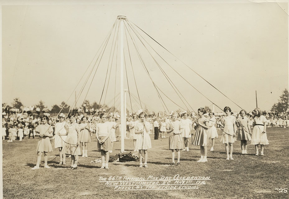
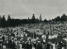
The 66th May Day Celebration
https://search.heritageburnaby.ca/link/museumdescription827
- Repository
- Burnaby Village Museum
- Date
- May 1, 1936
- Collection/Fonds
- Burnaby Village Museum Photograph collection
- Description Level
- Item
- Physical Description
- 1 photograph : sepia ; 12.2 x 17.3 cm
- Scope and Content
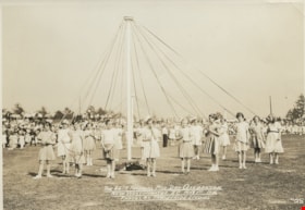
- Photograph of a group of girls each holding a ribbon from the Maypole in her hands, getting ready for the Maypole dance at the May Day Celebration in New Westminster in 1936. Most of the girls are wearing white dresses, some are in a skirt and blouse, and most wear strap shoes. There is a crowd o…
- Repository
- Burnaby Village Museum
- Collection/Fonds
- Burnaby Village Museum Photograph collection
- Description Level
- Item
- Physical Description
- 1 photograph : sepia ; 12.2 x 17.3 cm
- Scope and Content
- Photograph of a group of girls each holding a ribbon from the Maypole in her hands, getting ready for the Maypole dance at the May Day Celebration in New Westminster in 1936. Most of the girls are wearing white dresses, some are in a skirt and blouse, and most wear strap shoes. There is a crowd of people gathered behind them to watch the dance. Inscribed in the negative and printed on the photograph, bottom front: "The 66th May Day Celebration / New Westminster, B.C., May 1st, 1936 / Photos by the Stride Studios / #28."
- Geographic Access
- New Westminster
- Accession Code
- HV976.143.7
- Access Restriction
- No restrictions
- Reproduction Restriction
- No known restrictions
- Date
- May 1, 1936
- Media Type
- Photograph
- Scan Resolution
- 600
- Scan Date
- 2023-06-27
- Photographer
- Stride, Charles Edgar
- Notes
- The photographs in the accession HV976.143 are thought to be by the Stride studio, as the donor indicated in her letter that the Stride family were personal friends of her great-aunt and her husband, who resided in Edmonds. She wrote that she received a picture of the New Westminster or Burnaby May Day celebrations each year.
Images
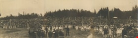
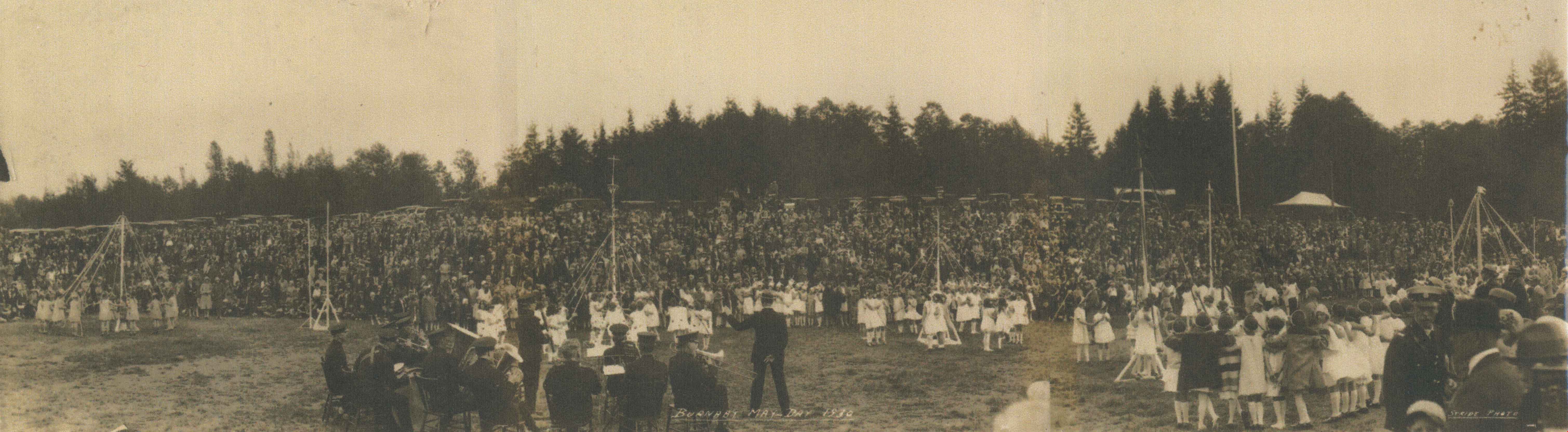
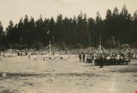
Burnaby May Day
https://search.heritageburnaby.ca/link/archivedescription34273
- Repository
- City of Burnaby Archives
- Date
- May 1930
- Collection/Fonds
- Burnaby Historical Society fonds
- Description Level
- Item
- Physical Description
- 1 photograph : b&w ; 26.5 x 96 cm
- Scope and Content
- Photograph of Burnaby May Day celebrations at Burnaby Park with a band in the foreground and children maypole dancing with a crowd watching. Parked cars and trees can be seen in the background.
- Repository
- City of Burnaby Archives
- Date
- May 1930
- Collection/Fonds
- Burnaby Historical Society fonds
- Subseries
- George Jeffery subseries
- Physical Description
- 1 photograph : b&w ; 26.5 x 96 cm
- Material Details
- Photograph consists of three photos taped together, stored folded at joints
- Description Level
- Item
- Record No.
- 013-017
- Access Restriction
- No restrictions
- Reproduction Restriction
- No known restrictions
- Accession Number
- BHS2007-04
- Scope and Content
- Photograph of Burnaby May Day celebrations at Burnaby Park with a band in the foreground and children maypole dancing with a crowd watching. Parked cars and trees can be seen in the background.
- Media Type
- Photograph
- Photographer
- Stride, Charles Edgar
- Notes
- Title based on caption of photograph
- Annotation at bottom of photograph reads, "Burnaby May Day 1930 / Stride Photo"
- Stamp on back of photograph reads, "Enlarged by The Stride Studios / 657 Columbia Street, New Westminster, BC / We do picture framing"
- Geographic Access
- Robert Burnaby Park
- Wedgewood Street
- Street Address
- 8155 Wedgewood Street
- Historic Neighbourhood
- Burnaby Lake (Historic Neighbourhood)
- Planning Study Area
- Lakeview-Mayfield Area
Images
Burnaby May Day
https://search.heritageburnaby.ca/link/archivedescription35140
- Repository
- City of Burnaby Archives
- Date
- May 26, 1934
- Collection/Fonds
- Burnaby Historical Society fonds
- Description Level
- Item
- Physical Description
- 1 photograph : b&w ; 12.1 x 17.4 cm print
- Scope and Content
- Photograph of Burnaby May Day activities at Central Park. Children are dancing around three Maypoles on a field. A crowd is watching, and a band is seated beside the Maypole on the right side of the photograph.
- Repository
- City of Burnaby Archives
- Date
- May 26, 1934
- Collection/Fonds
- Burnaby Historical Society fonds
- Subseries
- Anderson family subseries
- Physical Description
- 1 photograph : b&w ; 12.1 x 17.4 cm print
- Description Level
- Item
- Record No.
- 203-001
- Access Restriction
- No restrictions
- Reproduction Restriction
- No known restrictions
- Accession Number
- BHS1988-01
- Scope and Content
- Photograph of Burnaby May Day activities at Central Park. Children are dancing around three Maypoles on a field. A crowd is watching, and a band is seated beside the Maypole on the right side of the photograph.
- Media Type
- Photograph
- Photographer
- Stride, Charles Edgar
- Notes
- Title based on contents of photograph
- An "8" is printed at the left side of the photo
- Geographic Access
- Central Park
- Imperial Street
- Street Address
- 3883 Imperial Street
- Historic Neighbourhood
- Central Park (Historic Neighbourhood)
- Planning Study Area
- Maywood Area
Images

Burnaby May Day
https://search.heritageburnaby.ca/link/archivedescription35141
- Repository
- City of Burnaby Archives
- Date
- May 26, 1934
- Collection/Fonds
- Burnaby Historical Society fonds
- Description Level
- Item
- Physical Description
- 1 photograph : b&w ; 12.2 x 17.4 cm
- Scope and Content
- Photograph of Burnaby May Day celebrations in Central Park. There are two Maypoles visible with children around them. A crowd is watching, and a band is seated beside the Maypole at the left side of the photograph. The girls at the right Maypole are standing and looking at the top of the Maypole …
- Repository
- City of Burnaby Archives
- Date
- May 26, 1934
- Collection/Fonds
- Burnaby Historical Society fonds
- Subseries
- Anderson family subseries
- Physical Description
- 1 photograph : b&w ; 12.2 x 17.4 cm
- Description Level
- Item
- Record No.
- 203-002
- Access Restriction
- No restrictions
- Reproduction Restriction
- No known restrictions
- Accession Number
- BHS1988-01
- Scope and Content
- Photograph of Burnaby May Day celebrations in Central Park. There are two Maypoles visible with children around them. A crowd is watching, and a band is seated beside the Maypole at the left side of the photograph. The girls at the right Maypole are standing and looking at the top of the Maypole where their ribbons may be tangled.
- Media Type
- Photograph
- Photographer
- Stride, Charles Edgar
- Notes
- Title based on contents of photograph
- An annotation at the bottom of the photo reads; "May Day Celebrations / Burnaby, B.C., May 26th, 1934 / Stride Studio Photo."
- A "10" is printed at the left side of the photograph
- Geographic Access
- Central Park
- Imperial Street
- Street Address
- 3883 Imperial Street
- Historic Neighbourhood
- Central Park (Historic Neighbourhood)
- Planning Study Area
- Maywood Area
Images

Burnaby May Day
https://search.heritageburnaby.ca/link/archivedescription35558
- Repository
- City of Burnaby Archives
- Date
- 1928 (date of original), copied 1986
- Collection/Fonds
- Burnaby Historical Society fonds
- Description Level
- Item
- Physical Description
- 1 photograph : b&w ; 12.7 x 17.8 cm print
- Scope and Content
- Photograph of Burnaby May Day in Robert Burnaby Park. In the maypole dance is Mary Cram, then in Grade 1 at Kingsway West School. Ruth Bearn was crowned the first May Queen.
- Repository
- City of Burnaby Archives
- Date
- 1928 (date of original), copied 1986
- Collection/Fonds
- Burnaby Historical Society fonds
- Subseries
- Pioneer Tales subseries
- Physical Description
- 1 photograph : b&w ; 12.7 x 17.8 cm print
- Description Level
- Item
- Record No.
- 204-416
- Access Restriction
- No restrictions
- Reproduction Restriction
- No known restrictions
- Accession Number
- BHS1988-03
- Scope and Content
- Photograph of Burnaby May Day in Robert Burnaby Park. In the maypole dance is Mary Cram, then in Grade 1 at Kingsway West School. Ruth Bearn was crowned the first May Queen.
- Media Type
- Photograph
- Notes
- Title based on contents of photograph
- Geographic Access
- Robert Burnaby Park
- Wedgewood Street
- Street Address
- 8155 Wedgewood Street
- Historic Neighbourhood
- Burnaby Lake (Historic Neighbourhood)
- Planning Study Area
- Lakeview-Mayfield Area
Images
