More like 'Central Park'
Narrow Results By
Subject
- Academic Disciplines 1
- Accidents 9
- Accidents - Automobile Accidents 11
- Accidents - Train Accidents 9
- Adornment 9
- Adornment - Lapel Pins 11
- Advertising Medium 104
- Advertising Medium - Business Cards 17
- Advertising Medium - Flyer 38
- Advertising Medium - Poster 18
- Advertising Medium - Signs and Signboards 261
- Aerial Photographs 36

Arrow Neon Sign
https://search.heritageburnaby.ca/link/landmark861
- Repository
- Burnaby Heritage Planning
- Description
- Commercial building.
- Associated Dates
- 1961
- Other Names
- Lost in the 50's Drive-in
- Street View URL
- Google Maps Street View
- Repository
- Burnaby Heritage Planning
- Other Names
- Lost in the 50's Drive-in
- Geographic Access
- Edmonds Street
- Associated Dates
- 1961
- Description
- Commercial building.
- Heritage Value
- The Arrow Neon Sign was built in 1961 by the Neonette Sign Company of New Westminster when this property was opened as the Tomahawk Drive-in Restaurant. The restaurant was later known as Lindy's Burger and in 1990, the business was renamed Lost in the 50's Drive-in. It stands 20-foot tall and is composed of a large double-sided hollow steel panel serpentine arrow mounted on a pole supporting a lexan sign panel measuring approximately 8 feet wide by 4 feet tall. The sign was designed with three illuminated features: a round lamp at the top of the pole, a double-sided rectangular fluorescent sign panel box, and two double-sided rows of orange neon arrows that follow the large serpentine arrow. The Arrow Neon Sign remains as a rare surviving example of neon sign art in the city and is the only historic neon sign in South Burnaby. The sign has gained prominence over the years as it has been associated with this small iconic drive-in which has also been utilized as a set for film production. Additionally, the drive-in has played a prominent role in the Edmonds community as a popular setting for recent "Show and Shine" participants to park their classic cars.
- Locality
- Edmonds
- Historic Neighbourhood
- East Burnaby (Historic Neighbourhood)
- Planning Study Area
- Lakeview-Mayfield Area
- Builder
- Neonette Sign Company
- Community
- Burnaby
- Contributing Resource
- Structure
- Ownership
- Public (local)
- Street Address
- 7741 Edmonds Street
- Street View URL
- Google Maps Street View
Images


Helen 'The Swinging Girl' Neon Sign
https://search.heritageburnaby.ca/link/landmark591
- Repository
- Burnaby Heritage Planning
- Description
- Commercial building.
- Associated Dates
- 1956
- Formal Recognition
- Heritage Designation, Community Heritage Register
- Other Names
- Helen's Childrens Wear Sign
- Street View URL
- Google Maps Street View
- Repository
- Burnaby Heritage Planning
- Other Names
- Helen's Childrens Wear Sign
- Geographic Access
- Hastings Street
- Associated Dates
- 1956
- Formal Recognition
- Heritage Designation, Community Heritage Register
- Enactment Type
- Bylaw No. 12771
- Enactment Date
- 19/04/2010
- Description
- Commercial building.
- Heritage Value
- While the building here is of some importance as the former North Burnaby municipal office, its primary importance is its delightful neon sign that has become a North Burnaby landmark. Helen Arnold opened Helen’s Childrens Wear shop in the building next door to the old Municipal offices in 1948. In 1955, when North Burnaby moved out, she moved into the vacated building. As part of the renovations, Helen enlisted the assistance of her good friend Jimmy Wallace, owner of Vancouver’s Wallace Neon Company, to create a new sign for her expanded business. One of the company’s designers, Reeve Lehman, created the swinging neon girl that was installed in 1956. Designed in two parts, one section of the sign is cloud shaped and reads ‘Helen’s’ while the other section is a moving representation of a little girl on a swing. The sign is nine feet six inches high and nine feet wide, and the lower section is animated with an internal motor and gears. It immediately became a landmark on Hastings Street, and recently the sign’s design fame has spread far and wide as one of the best surviving examples of kinetic neon art in North America.
- Locality
- Vancouver Heights
- Historic Neighbourhood
- Vancouver Heights (Historic Neighbourhood)
- Planning Study Area
- Willingdon Heights Area
- Community
- Burnaby
- Names
- Helen's Childrens Wear
- Street Address
- 4142 Hastings Street
- Street View URL
- Google Maps Street View
Images


Central Park Entrance Gate
https://search.heritageburnaby.ca/link/landmark544
- Repository
- Burnaby Heritage Planning
- Description
- The Central Park Entrance Gate is the ceremonial entrance to Burnaby’s historic Central Park from Kingsway, and consists of two massive stone pillars, approximately 7.5 metres high and 1.8 metres square, adjacent gate posts and a low flanking stone wall that curves into the park to the east.
- Associated Dates
- 1913
- Formal Recognition
- Heritage Designation, Community Heritage Register
- Street View URL
- Google Maps Street View
- Repository
- Burnaby Heritage Planning
- Geographic Access
- Imperial Street
- Associated Dates
- 1913
- Formal Recognition
- Heritage Designation, Community Heritage Register
- Enactment Type
- Bylaw No. 9807
- Enactment Date
- 23/11/1992
- Description
- The Central Park Entrance Gate is the ceremonial entrance to Burnaby’s historic Central Park from Kingsway, and consists of two massive stone pillars, approximately 7.5 metres high and 1.8 metres square, adjacent gate posts and a low flanking stone wall that curves into the park to the east.
- Heritage Value
- The Central Park Entrance Gate is significant as a ceremonial entry to a major park, for its connection with the early history of the British Columbia Electric Railway (BCER) and as an important design by an accomplished British Columbian architect. When the original interurban line between Vancouver and New Westminster was constructed in 1891, one of the first stations was located where the tramway crossed the Vancouver-Westminster Road (now Kingsway) within the newly-created Central Park. The interurban line ran through the park on a diagonal right-of-way (the current SkyTrain line, opened in 1986, follows this original alignment). In 1912 an agreement was reached between the successor interurban company, the BCER, and the Central Park Provincial Park Board, to deed additional land for an expanded right-of-way through the Park in exchange for improvements that included the construction of an ornamental stone wall and gate with an iron arch, with an illuminated 'Central Park' sign, adjacent to the interurban station on Kingsway. This was an early and rare example of an electric sign used for a public recreation facility. The Gate is also significant as a surviving early design by Robert Lyon (1879-1963), an Edinburgh-born and trained immigrant who was one of the most accomplished of British Columbia's early architects. After he moved to Vancouver, he was employed by the BCER from 1911 until 1918, and worked on a broad range of projects including some of the grandest and most innovative local industrial structures of the time. The arch was built by the Westminster Ironworks Company, one of the leading firms of its kind in Western Canada, operated by John Reid of New Westminster. The Gate was completed in 1914; in 1968 the decorative ironwork was removed due to corrosion and placed in storage.
- Defining Elements
- Key elements that define the heritage character of the Central Park Entrance Gate include its: - two subtly tapered massive stone pillars, which rise in stages from a larger base to a shaft with random coursed multi-coloured granite with roughly formed grey granite quoins, to a top formed of finely finished grey granite blocks with a coved and bracketed cap - adjacent gate posts with monolithic pyramidal granite caps - low flanking stone wall that curves into the park to the east, constructed of random coursed multi-coloured granite with a river rock triangular cap
- Historic Neighbourhood
- Central Park (Historic Neighbourhood)
- Planning Study Area
- Maywood Area
- Architect
- Robert Lyon
- Builder
- John Reid
- Westminster Iron Works Co.
- Function
- Primary Current--Park Fixture
- Primary Historic--Park Fixture
- Community
- Burnaby
- Cadastral Identifier
- P.I.D. No. 017-767-172 Legal Description: Block B of Lot 2 Except Firstly: Part on Plan 8669 and Secondly: Part on Plan LMP4689 District Lot 151, Group 1, New Westminster District, Plan 3443
- Boundaries
- The property (Central Park) is a municipally-owned park that lies at the western edge of Burnaby, between 49th Avenue to the south, Kingsway to the north, Boundary Road to the west and Patterson Avenue to the east.
- Area
- 853,403.82
- Contributing Resource
- Structure
- Landscape Feature
- Ownership
- Public (local)
- Names
- Lyon, Robert
- Reid, John
- Westminster Iron Works Company
- British Columbia Electric Railway Company
- Central Park Provincial Park Board
- Subjects
- Structures - Fences
- Street Address
- 3883 Imperial Street
- Street View URL
- Google Maps Street View
Images


H.T. Ceperley Estate 'Fairacres' Estate Gate
https://search.heritageburnaby.ca/link/landmark863
- Repository
- Burnaby Heritage Planning
- Description
- The 'Fairacres Estate Gate' marks the location of one of the original driveway entrances to the estate.
- Associated Dates
- 1911
- Formal Recognition
- Heritage Designation, Community Heritage Register
- Street View URL
- Google Maps Street View
- Repository
- Burnaby Heritage Planning
- Geographic Access
- Deer Lake Avenue
- Associated Dates
- 1911
- Formal Recognition
- Heritage Designation, Community Heritage Register
- Enactment Type
- Bylaw No. 140665
- Enactment Date
- 23/11/1992
- Description
- The 'Fairacres Estate Gate' marks the location of one of the original driveway entrances to the estate.
- Heritage Value
- Fairacres was designed as a country estate with a working farm that included over 10 acres of productive berry and vegetable fields, with a large kitchen garden, a root house to store food, and greenhouses heated by steam. The agricultural potential ofthe Deer Lake area made it one of the first parts of the municipality to attract settlement. Construction of the Fairacres Estate represented a shift toward wealthy country estates over more modest farms, and the Ceperleys employed a large staff to manage the estate's agricultural production. Agricultural use of the estate continued when a Catholic order of Benedictine monks purchased the estate as part of the Priory of St. Joseph and the Seminary of Christ the King, and continued to farm the land until 1953. The overall architectural intention of the estate's architect was to reflect the ideals of the Arts & Crafts movement to showcase craftsmanship, and to incorporate high quality materials, including many local materials, such as wood and stone from the site. On the mansion exterior, the rustic style is seen in the use of natural materials such as cedar shingles and siding, cobblestone foundations and chimneys and the half-timbering in gable ends. The estate's remaining gate pillar features the same rustic field and cobblestones used on the mansion. The original estate driveway had two entrances constructed in 1910, each marked by a pair of entry gate pillars which supported iron gates. The main entrance gate pillars which marked the lower driveway and the east pillar of the upper entrance were demolished many years ago and the iron gates removed. A single gate pillar remains marking the upper driveway, adjacent to the Garage and Stables. This gate pillar is a significant site feature and incorporates cobble stone and a carved sandstone capstone.
- Defining Elements
- Key elements that define the heritage character of the ‘Fairacres Estate Gate' include: - setting in relation to the estate boundary and estate buildings - Cobble stone and sandstone construction, which represents a typical Arts and Crafts use of local materials, and matches the extensive use of cobblestone as chimneys and foundations on the Fairacres mansion, as well as the use of sandstone on the mansion's exterior.
- Locality
- Deer Lake Park
- Historic Neighbourhood
- Burnaby Lake (Historic Neighbourhood)
- Planning Study Area
- Douglas-Gilpin Area
- Function
- Primary Historic--Estate
- Community
- Burnaby
- Cadastral Identifier
- P.I.D. No. 004-493-311 Legal Description: Block 3 Except: Part subdivided by Plan 26865, District Lot 79, Group 1, New Westminster District, Plan 536
- Boundaries
- ‘Fairacres’ is comprised of a single municipally-owned property located at 6344 Deer Lake Avenue, Burnaby.
- Area
- 17,065.00
- Contributing Resource
- Landscape Feature
- Ownership
- Public (local)
- Other Collection
- Burnaby Historical Society, Community Archives: Ceperley Photograph Album
- Documentation
- Heritage Site Files: PC77000 20. City of Burnaby Planning and Building Department, 4949 Canada Way, Burnaby, B.C., V5G 1M2
- Subjects
- Structures - Fences
- Street Address
- 6344 Deer Lake Avenue
- Street View URL
- Google Maps Street View
Images


Central Park testing station
https://search.heritageburnaby.ca/link/archivedescription95101
- Repository
- City of Burnaby Archives
- Date
- May 9, 2020
- Collection/Fonds
- Burnaby Photographic Society fonds
- Description Level
- Item
- Physical Description
- 1 photograph (tiff)
- Scope and Content
- Photograph of the COVID-19 testing station located in the Central Park parking lot off Boundary Road. A sign in the foreground reads "Covid-19 Care Site by Referral Only / Walk in Access". In the background, the white tents of the testing station are visible.
- Repository
- City of Burnaby Archives
- Date
- May 9, 2020
- Collection/Fonds
- Burnaby Photographic Society fonds
- Physical Description
- 1 photograph (tiff)
- Description Level
- Item
- Record No.
- 623-019
- Access Restriction
- No restrictions
- Reproduction Restriction
- No restrictions
- Accession Number
- 2020-10
- Scope and Content
- Photograph of the COVID-19 testing station located in the Central Park parking lot off Boundary Road. A sign in the foreground reads "Covid-19 Care Site by Referral Only / Walk in Access". In the background, the white tents of the testing station are visible.
- Subjects
- Geographic Features - Parks
- Geographic Features - Automobile Parking Lots
- Advertising Medium - Signs and Signboards
- Structures - Tents
- Media Type
- Photograph
- Photographer
- Damer, Eric
- Notes
- Transcribed title
- Geographic Access
- Boundary Road
- Central Park
- Historic Neighbourhood
- Central Park (Historic Neighbourhood)
- Planning Study Area
- Maywood Area
Images

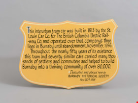
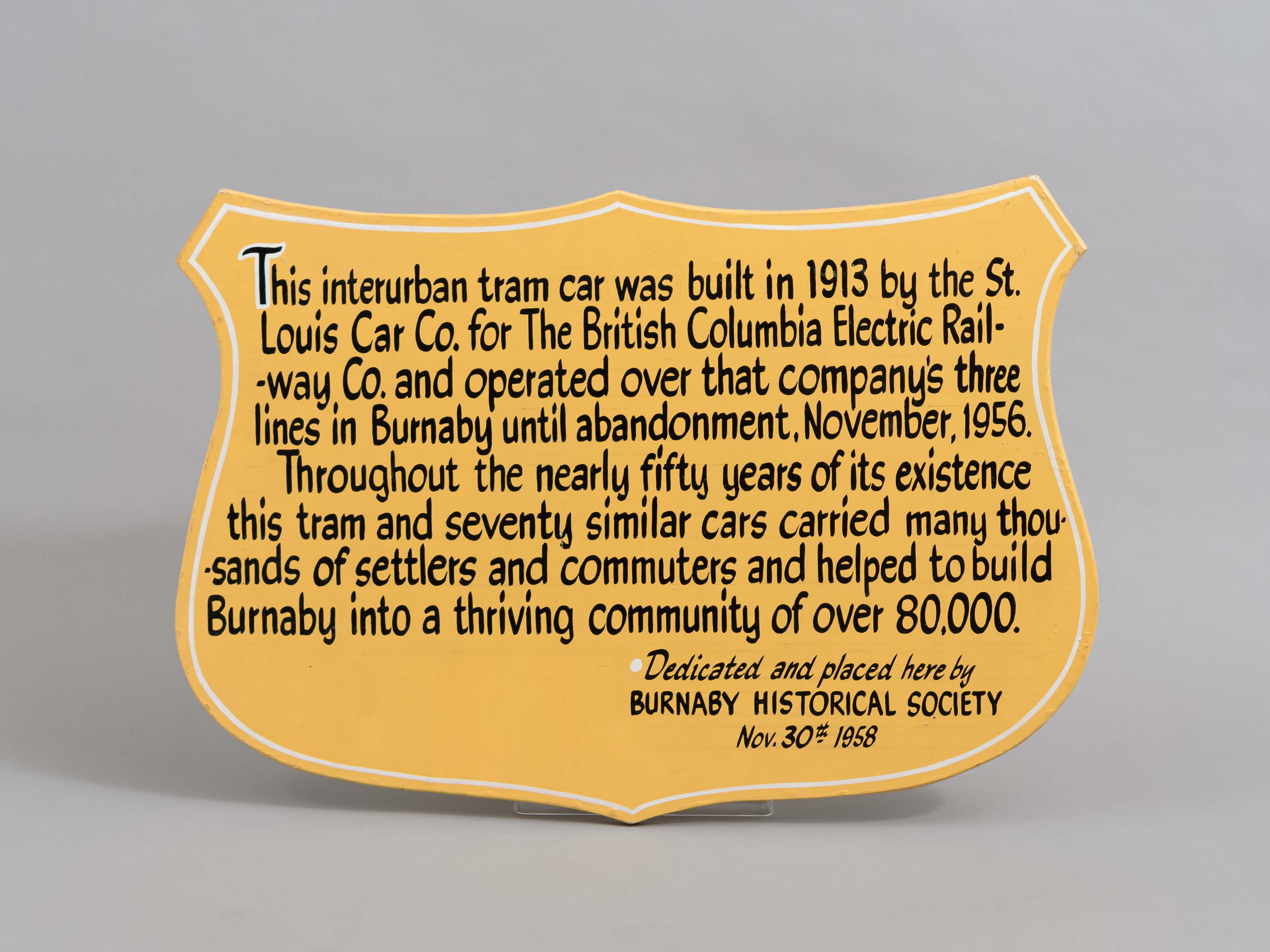
plaque
https://search.heritageburnaby.ca/link/museumartifact36450
- Repository
- Burnaby Village Museum
- Accession Code
- BV994.38.1
- Description
- Plaque. Badge shaped, made of ply-wooden, the background is painted yellow/tan and the lettering is black.
- Object History
- The plaque commemorates the history of the British Columbia Electric Railway in Burnaby, and the preservation of tram #1223 by the Burnaby Historical Society in 1958. Interurban tram No. 1223 has been restored by the joint efforts of the Friends of 1223 and Burnaby Village Museum. In March 2007 the tram was officially returned to Burnaby Village Museum and is currently on display, in a replica of a Tram Car Barn, at the Museum.
- Fraser Wilson hand lettered the sign.
- Marks/Labels
- "This Interurban Tram Car was built in 1913 by the St. Louis Car Co. for the British Columbia Electric Railway Co. and operated over that company's three lines in Burnaby until abandonment, November 1956. Throughout the nearly fifty years of its existence this tram and seventy similar cars carried many thousands of settlers and commuters and helped to build Burnaby into a thriving community of over 80,000"; "Dedicated and placed here by Burnaby Historical Society. Nov. 30th 1958", hand lettered.
- Subjects
- Transportation
- Transportation - Public Transit
- Transportation - Electric Railroads
- Advertising Medium
- Advertising Medium - Signs and Signboards
Images
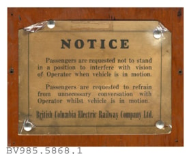
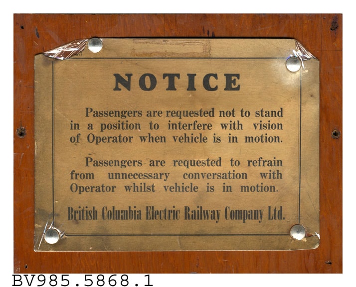
plaque
https://search.heritageburnaby.ca/link/museumartifact40427
- Repository
- Burnaby Village Museum
- Accession Code
- BV985.5868.1
- Description
- Notice - Plaque. Wood backed plaque with cardboard notice from the British Columbia Electric Railway Company advising passengers to stand in a position that does not interfere with the Operator's vision while the vehicle was in motion. The notice also requests that the passengers refrain from unnecessary conversation with the Operator while the vehicle is in motion. The notice is attached to the wood with four tacks. The wood backing is 23.5cm x 18.5cm and the cardboard is 20cm x 15cm.
- Subjects
- Advertising Medium
- Advertising Medium - Signs and Signboards
- Transportation
- Transportation - Electric Railroads
- Transportation - Public Transit
Images
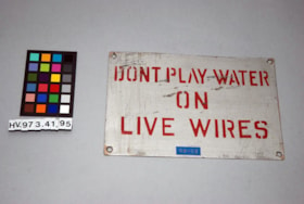
Sign
https://search.heritageburnaby.ca/link/museumartifact29019
- Repository
- Burnaby Village Museum
- Accession Code
- HV973.41.95
- Description
- Rectangular metallic, magnetic silver painted with "DONT PLAY WATER ON LIVE WIRES" painted in red. A blue sticker with "KS-K5" glued on the bottom. Four mounting holes in the corners. Length: 19.3 cm Width: 12.7 cm Thickness: 1 mm
- Object History
- key system S.F. California.
- Marks/Labels
- "DONT PLAY WATER" "ON" "LIVE WIRES"; Blue sticker "KS-KS";
- Subjects
- Transportation
- Transportation - Public Transit
- Transportation - Electric Railroads
- Advertising Medium
- Advertising Medium - Signs and Signboards
Images

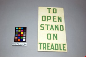
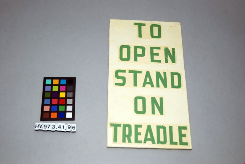
Sign
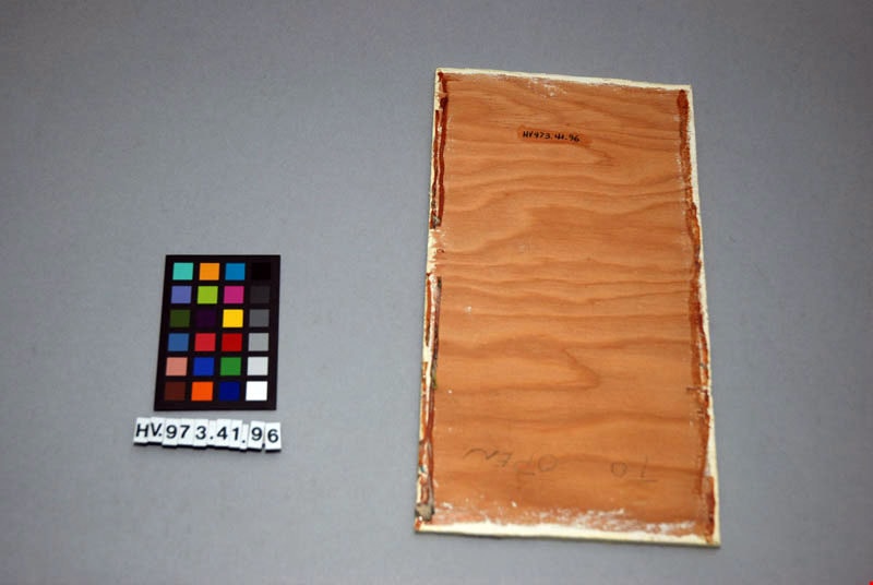
https://search.heritageburnaby.ca/link/museumartifact29020
- Repository
- Burnaby Village Museum
- Accession Code
- HV973.41.96
- Description
- A rectangular wooden sign painted cream with green lettering "TO OPEN STAND ON TREADLE". Length: 25.5 cm Width: 14 cm Thickness: 6 mm
- Object History
- For the British Columbia Electric Railway.
- Marks/Labels
- on front green lettering "TO" "OPEN" "STAND" "ON" "TREADLE" on cream background. On plain wooden back in pencil "To Open"
- Subjects
- Transportation
- Transportation - Public Transit
- Transportation - Electric Railroads
- Advertising Medium
- Advertising Medium - Signs and Signboards
Images
Sign
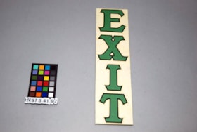
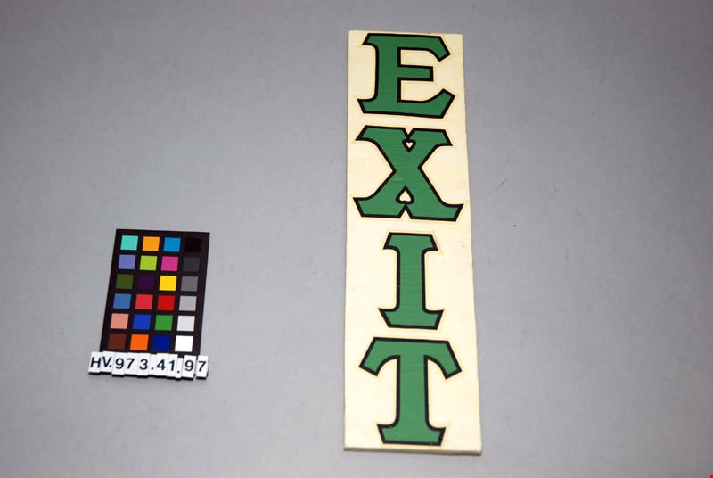
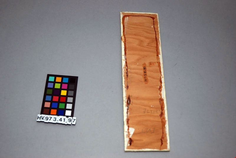
https://search.heritageburnaby.ca/link/museumartifact29021
- Repository
- Burnaby Village Museum
- Accession Code
- HV973.41.97
- Description
- A rectangular wooden sign painted cream with green lettering "EXIT" (vertically). Length: 28.7 cm Width: 7.7 cm Thickness: 6 mm
- Object History
- For the British Columbia Electric Railway.
- Marks/Labels
- "EXIT", printed in light green, edged in black. On plain wooden back, in pencil "No1 SQUARE" "EXIT" "WHITE".
- Subjects
- Transportation
- Transportation - Public Transit
- Transportation - Electric Railroads
- Advertising Medium
- Advertising Medium - Signs and Signboards
Images
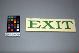
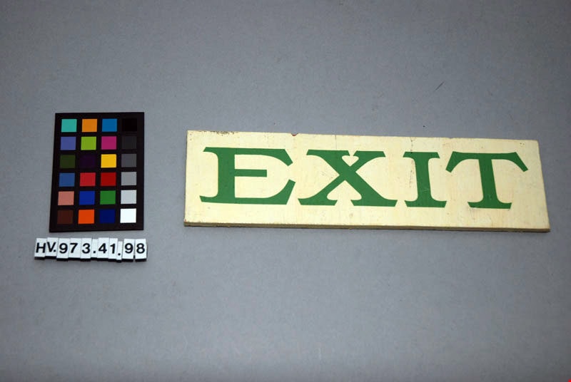
Sign
https://search.heritageburnaby.ca/link/museumartifact29022
- Repository
- Burnaby Village Museum
- Accession Code
- HV973.41.98
- Description
- A rectangular wooden sign painted cream with green lettering "EXIT". Length: 22.9 cm Width: 6.3 cm Thickness: 6 mm
- Object History
- For the British Columbia Electric Railway.
- Marks/Labels
- Green lettering "EXIT" (horizontally) on cream back ground. On back, on plain wood, in pencil "EXIT".
- Subjects
- Transportation
- Transportation - Public Transit
- Transportation - Electric Railroads
- Advertising Medium
- Advertising Medium - Signs and Signboards
Images


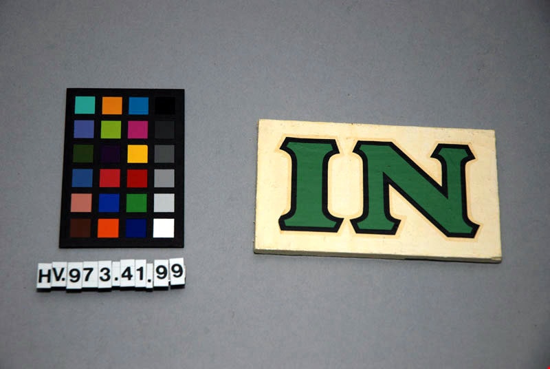
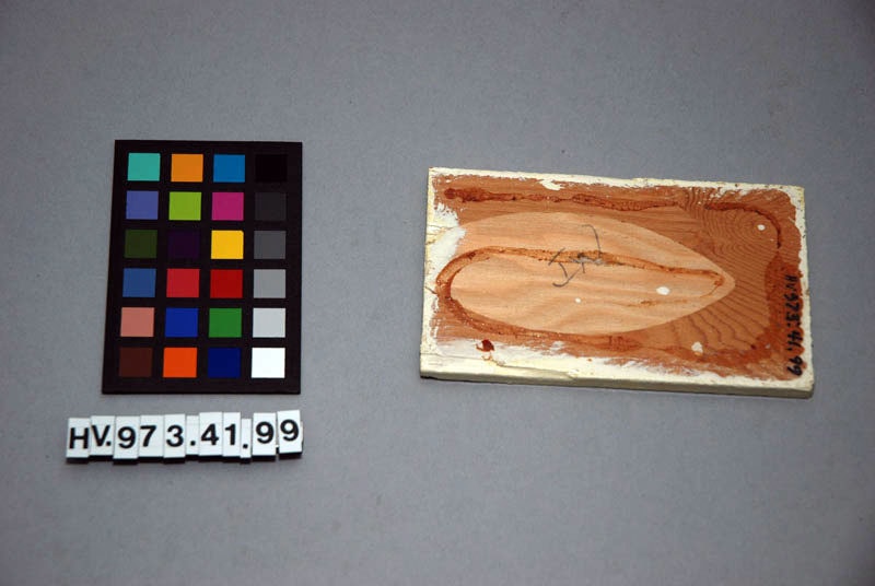
Sign
https://search.heritageburnaby.ca/link/museumartifact29023
- Repository
- Burnaby Village Museum
- Accession Code
- HV973.41.99
- Description
- A rectangular wooden sign painted cream with green lettering "IN". Length: 11.4 cm Width: 6.7 cm Thickness: 6 mm.
- Object History
- For the British Columbia Electric Railway.
- Marks/Labels
- Green lettering, with black borders, "IN", on cream back ground. On back, on plain wood, in pencil, "IN".
- Subjects
- Transportation
- Transportation - Public Transit
- Transportation - Electric Railroads
- Advertising Medium
- Advertising Medium - Signs and Signboards
Images
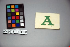
Sign
https://search.heritageburnaby.ca/link/museumartifact29024
- Repository
- Burnaby Village Museum
- Accession Code
- HV973.41.100
- Description
- A rectangular wooden sign painted cream with green lettering "A". Length: 7.6 cm Width: 5.2 cm Thickness: 6 mm
- Object History
- For the British Columbia Electric Railway.
- Marks/Labels
- Green lettering "A" on cream back ground. On back, on plain wood, in pencil "A".
- Subjects
- Transportation
- Transportation - Public Transit
- Transportation - Electric Railroads
- Advertising Medium
- Advertising Medium - Signs and Signboards
Images


Sign
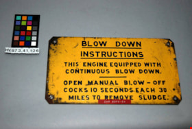
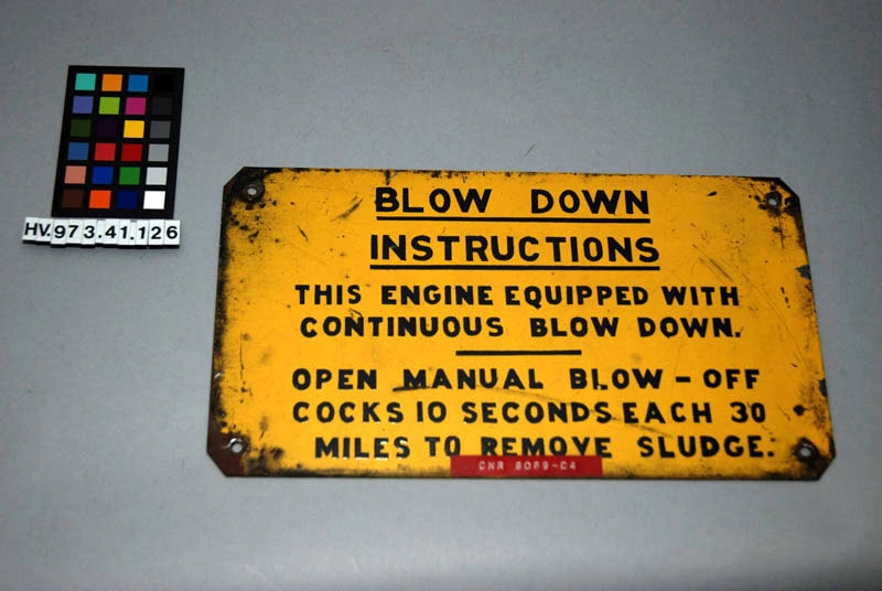
https://search.heritageburnaby.ca/link/museumartifact29050
- Repository
- Burnaby Village Museum
- Accession Code
- HV973.41.126
- Description
- Metallic, magnetic rectangular shaped. Painted yellow with black lettering beginning with "BLOW DOWN INSTRUCTIONS" for a locomotive. Four mounting holes located at each corner. A red plastic sticker "CNR 6069-C4" is glued at the bottom. Hand printed in pencil on the back is "6069 Stratford Ont. Dec 24, 1961". Length: 28.2 cm Width: 15.2 cm Thickness: 1 mm
- Marks/Labels
- "BLOW DOWN" (underlined) / INSTRUCTIONS" (underlined), on front in black lettering. "THIS ENGINE EQUIPPED WITH / CONTINUOUS BLOW DOWN. / OPEN MANUAL BLOW-OFF / COCKS 10 SECONDS EACH 30 / MILES TO REMOVE SLUDGE.", on front in black lettering. "CNR 6069-C4" on front red sticker "6069" "STRATFORD ONT," "DEC 24, 1961", on back, in pencil.
- Subjects
- Transportation
- Transportation - Public Transit
- Transportation - Electric Railroads
- Advertising Medium
- Advertising Medium - Signs and Signboards
Images

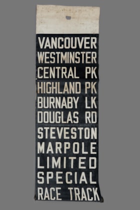
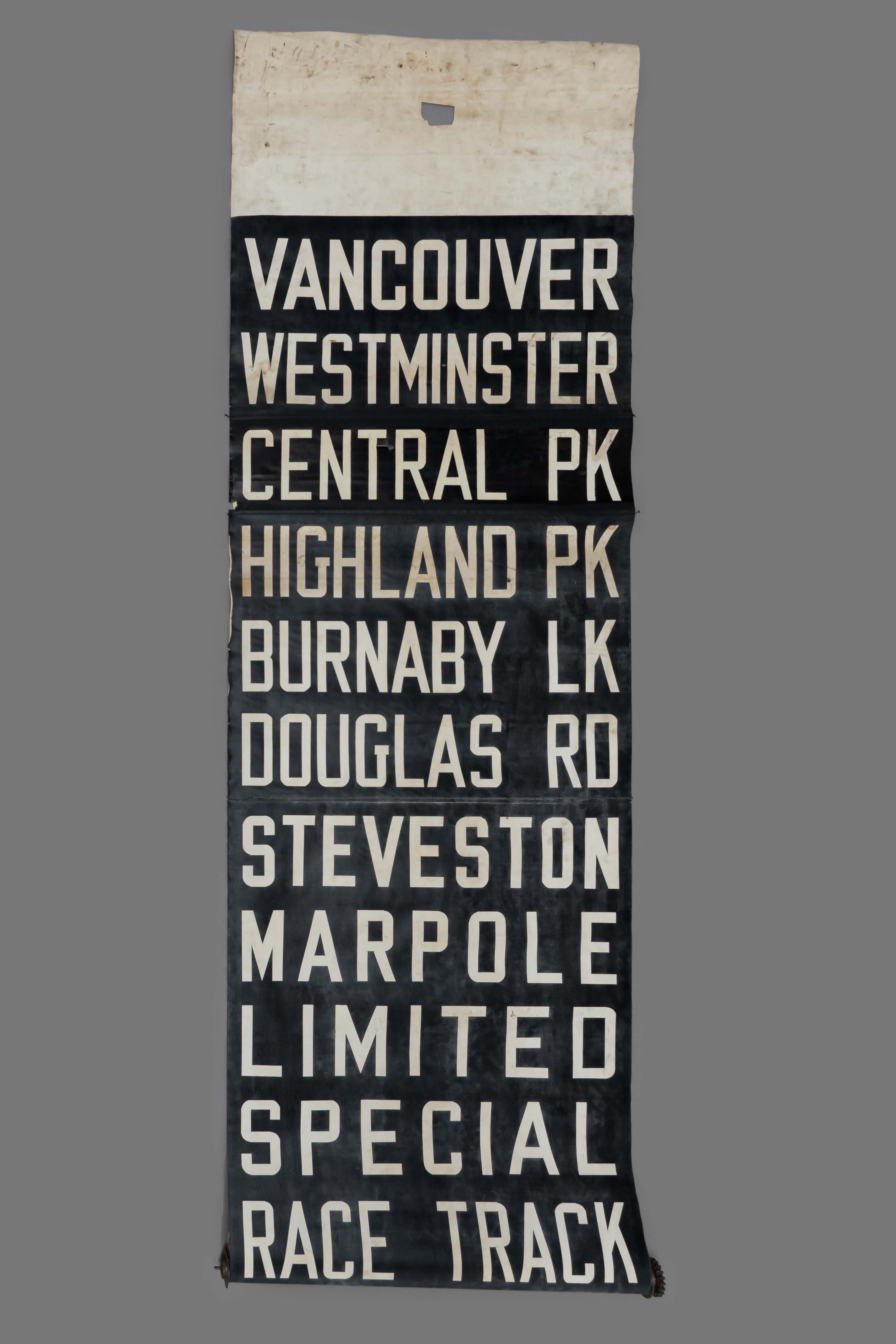
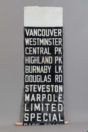
tram destination roller
https://search.heritageburnaby.ca/link/museumartifact25717
- Repository
- Burnaby Village Museum
- Accession Code
- HV975.73.3
- Description
- Stiff fabric scroll, rolled up and attached to a metal roll that would be placed into a holder. Black back ground and white capital letters for destinations: "VANCOUVER / WESTMINSTER / CENTRAL PK / HIGHLAND PK / BURNABY LK / DOUGLAS RD / STEVESTON / MARPOLE / LIMITED / SPECIAL / RACE TRACK / HORNE PAYNE / CARRALL ST / PARK AVE / CAR BARNS".
- Object History
- This was a destination roller for British Columbia Electric Railway tram, Burnaby Lake line. It was used by drivers to change the name of their destination.
- Classification
- Land Transportation T&E
- Object Term
- Sign
- Marks/Labels
- "CAR BARNS / CARRALL ST / PARK AVE / HORNE PAYNE / RACE TRACK / SPECIAL / LIMITED / MARPOLE / STEVESTON / DOUGLAS RD / BURNABY LK / HIGHLAND PK / CENTRAL PK / WESTMINSTER / VANCOUVER ". printed in white on black background. The back of the scroll has shortened versions of the destinations in black lettering on a white background.
- Subjects
- Transportation
- Transportation - Public Transit
- Transportation - Electric Railroads
- Advertising Medium
- Advertising Medium - Signs and Signboards
Images
tram destination roller
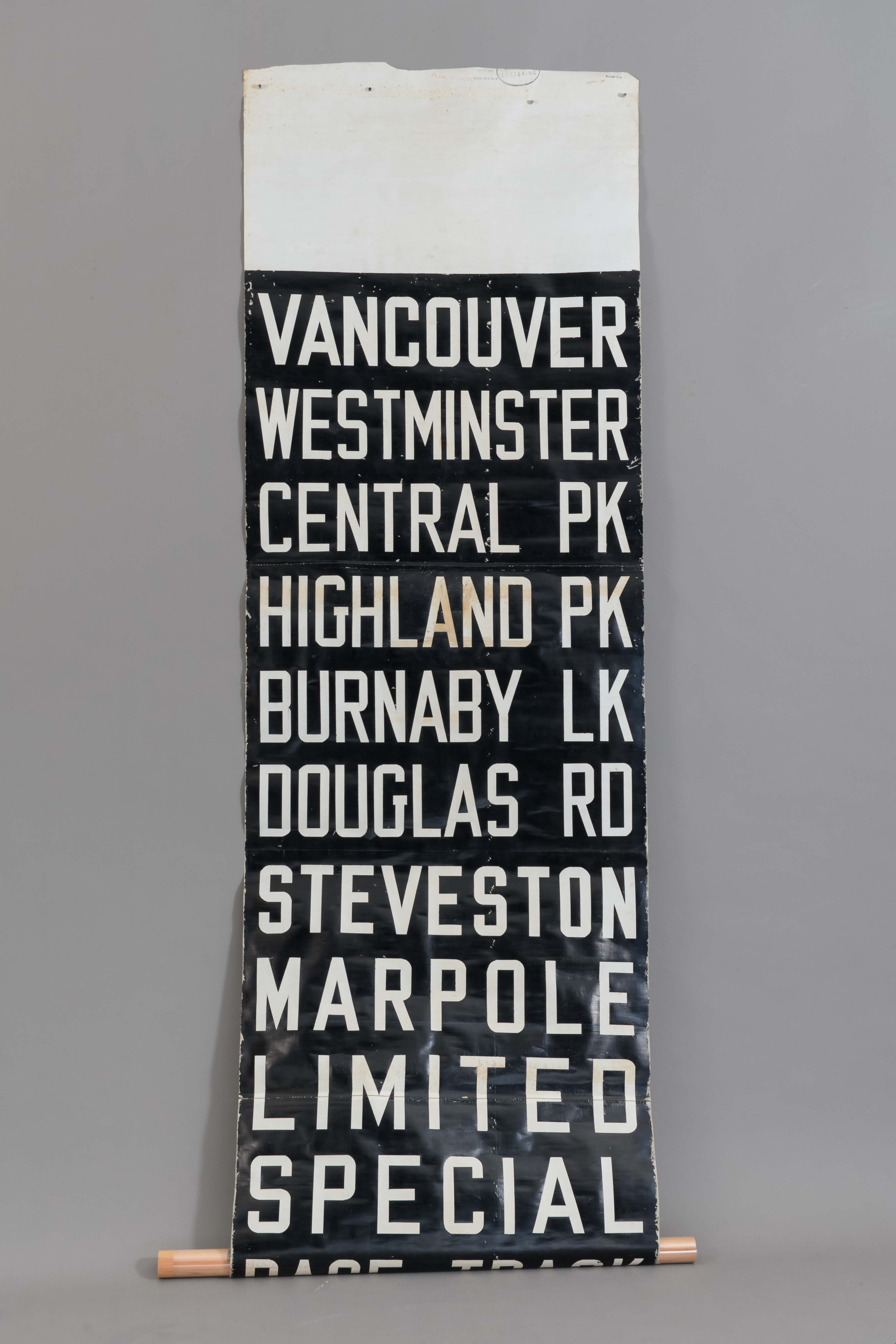
https://search.heritageburnaby.ca/link/museumartifact48327
- Repository
- Burnaby Village Museum
- Accession Code
- BV005.17.6
- Description
- Fabric sign. For British Columbia Electric Railway. Destinations are in white lettering on black background. VANCOUVER WESTMINSTER CENTRAL PARK HIGHLAND PK BURNABY LAKE DOUGLAS RD STEVESTON MARPOLE LIMITED SPECIAL RACE TRACK There are handwritten abbreviations on reverse; printed on treated cotton fabric.
- Marks/Labels
- Vancouver / Westminster / Central Pk / Highland Pk / Burnaby Lk / Douglas Rd / Steveston / Marpole / Limited / Special / Race Track MAR 27 1950 / MADE IN U.S.A. / LETTERING ORDER No. 16936
- Country Made
- Canada
- Province Made
- British Columbia
- Site/City Made
- Vancouver
- Subjects
- Transportation
- Transportation - Public Transit
- Transportation - Electric Railroads
- Advertising Medium
- Advertising Medium - Signs and Signboards
Images
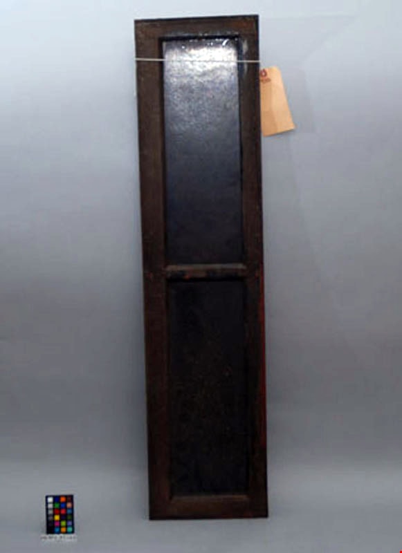
Window
https://search.heritageburnaby.ca/link/museumartifact29025
- Repository
- Burnaby Village Museum
- Accession Code
- HV973.41.101
- Description
- Wooden frame around two rectangular shaped windows with a wooden separation bar. The frame and windows are both dark (brown/black). The wooden frame appears to be composed of mahogony. The windows are composed of a glass-like material yet do not appear to be ordinary glass. One side of the windows has a scallop shell pattern and the other side is plain. Two holes are drilled through the edges of the frame at the midpoint. Length: 114 cm Width: 25 cm Thickness: 2.1 cm
- Object History
- British Columbia Electric Railway transom window.
- Marks/Labels
- Small blue sticker "BCER - B52".
- Subjects
- Transportation
- Transportation - Public Transit
- Transportation - Electric Railroads
- Advertising Medium
- Advertising Medium - Signs and Signboards
Images

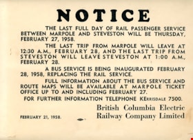
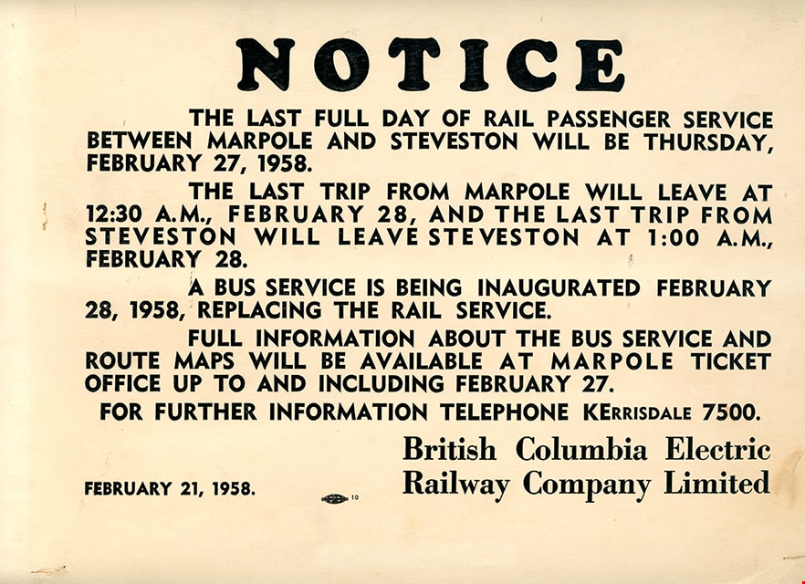
Notice
https://search.heritageburnaby.ca/link/museumartifact29081
- Repository
- Burnaby Village Museum
- Accession Code
- HV973.41.157
- Description
- A light weight 31.8 cm x 24 cm cardboard sign printed with "NOTICE" at the top. The BCER sign indicates the last day of service on February 28, 1958 between Marpole and Steveston using BCER interurbans which will be replaced with bus service. The sign is dated February 21, 1958.
- Country Made
- Canada
- Province Made
- British Columbia
- Publication Date
- 1958
- Subjects
- Advertising Medium
- Advertising Medium - Signs and Signboards
- Transportation
- Transportation - Electric Railroads
Images

Burnaby's COVID-19 drive thru testing site
https://search.heritageburnaby.ca/link/museumdescription15374
- Repository
- Burnaby Village Museum
- Date
- 5 Apr. 2020
- Collection/Fonds
- Burnaby Village Museum COVID-19 collection
- Description Level
- Item
- Physical Description
- 1 photograph (jpg)
- Scope and Content
- Photograph of the COVID-19 drive thru testing site in Central Park parking lot in Burnaby. Orange traffic posts and wayfinding signs are set up in the parking lot.
- Repository
- Burnaby Village Museum
- Collection/Fonds
- Burnaby Village Museum COVID-19 collection
- Description Level
- Item
- Physical Description
- 1 photograph (jpg)
- Scope and Content
- Photograph of the COVID-19 drive thru testing site in Central Park parking lot in Burnaby. Orange traffic posts and wayfinding signs are set up in the parking lot.
- Subjects
- Advertising Medium - Signs and Signboards
- Geographic Features - Parks
- Public Services - Health Services
- Pandemics - COVID-19
- Geographic Access
- Central Park
- Imperial Street
- Accession Code
- BV021.2.39
- Access Restriction
- No restrictions
- Reproduction Restriction
- May be restricted by third party rights
- Date
- 5 Apr. 2020
- Media Type
- Photograph
- Historic Neighbourhood
- Central Park (Historic Neighbourhood)
- Planning Study Area
- Maywood Area
- Notes
- Title based on contents of photograph
Images


Burnaby's COVID-19 drive thru testing site
https://search.heritageburnaby.ca/link/museumdescription15375
- Repository
- Burnaby Village Museum
- Date
- 5 Apr. 2020
- Collection/Fonds
- Burnaby Village Museum COVID-19 collection
- Description Level
- Item
- Physical Description
- 1 photograph (jpg)
- Scope and Content
- Photograph of the COVID-19 drive thru testing site in Central Park parking lot in Burnaby. Orange traffic posts, wayfinding signs and white tents are set up in the parking lot.
- Repository
- Burnaby Village Museum
- Collection/Fonds
- Burnaby Village Museum COVID-19 collection
- Description Level
- Item
- Physical Description
- 1 photograph (jpg)
- Scope and Content
- Photograph of the COVID-19 drive thru testing site in Central Park parking lot in Burnaby. Orange traffic posts, wayfinding signs and white tents are set up in the parking lot.
- Subjects
- Advertising Medium - Signs and Signboards
- Geographic Features - Parks
- Public Services - Health Services
- Pandemics - COVID-19
- Geographic Access
- Central Park
- Imperial Street
- Accession Code
- BV021.2.40
- Access Restriction
- No restrictions
- Reproduction Restriction
- May be restricted by third party rights
- Date
- 5 Apr. 2020
- Media Type
- Photograph
- Historic Neighbourhood
- Central Park (Historic Neighbourhood)
- Planning Study Area
- Maywood Area
- Notes
- Title based on contents of photograph
Images
