Narrow Results By
Subject
- Accidents 2
- Accidents - Automobile Accidents 1
- Accidents - Train Accidents 1
- Adornment 7
- Adornment - Lapel Pins 8
- Advertising Medium 25
- Advertising Medium - Business Cards 9
- Advertising Medium - Flyer 1
- Advertising Medium - Signs and Signboards 38
- Aerial Photographs 21
- Agricultural Tools and Equipment 1
- Agriculture 6
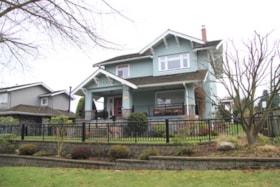
François & Cezarie Comeau Residence
https://search.heritageburnaby.ca/link/landmark580
- Repository
- Burnaby Heritage Planning
- Description
- Residential building.
- Associated Dates
- c.1925
- Street View URL
- Google Maps Street View
- Repository
- Burnaby Heritage Planning
- Geographic Access
- Esmond Avenue
- Associated Dates
- c.1925
- Description
- Residential building.
- Heritage Value
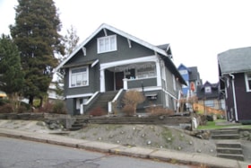
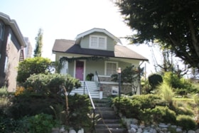
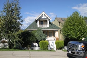
- This home was built for Francois Xavier “Frank” Comeau (1863-1943), a blacksmith who moved from Quebec to Vancouver in about 1890, and his wife Cezarie Marie (née Fortin, 1860-1950), also from Quebec, whom he married in 1903. Featuring a front gabled roof with decorative triangular eave brackets, this comfortable Craftsman bungalow displays other characteristics typical of the style such as lapped siding at the foundation, a shingle-clad main floor, casement windows and stained glass transoms on the front elevation. The most notable feature of the plan is the inset verandah with subtle segmental-arched openings and tapered square columns.
- Locality
- Vancouver Heights
- Historic Neighbourhood
- Vancouver Heights (Historic Neighbourhood)
- Planning Study Area
- Burnaby Heights Area
- Area
- 566.71
- Contributing Resource
- Building
- Ownership
- Private
- Street Address
- 306 Esmond Avenue
- Street View URL
- Google Maps Street View
Images
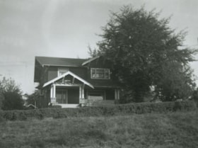
George & Rose Nuttall Residence
https://search.heritageburnaby.ca/link/landmark585
- Repository
- Burnaby Heritage Planning
- Description
- Residential building.
- Associated Dates
- 1921
- Other Names
- HILLCREST
- Street View URL
- Google Maps Street View
- Repository
- Burnaby Heritage Planning
- Other Names
- HILLCREST
- Geographic Access
- McGill Street
- Associated Dates
- 1921
- Description
- Residential building.
- Heritage Value
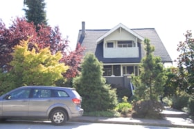
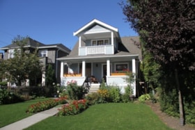
- This house was built for local plumber contractor George Nuttall (1883-1970) and his wife Rose Ann Nuttall (née Clagg, 1881-1955). George continued to live in the house after Rose’s death, until his own death in 1970. Although typical of the Craftsman style and form with its side-gabled roof, triangular eave brackets and front gabled dormer, this house has a number of special details, such as its beautiful art glass transom windows. The front verandah supports are massive stucco columns that contain stained glass lanterns with the house name, Hillcrest, and address.
- Locality
- Vancouver Heights
- Historic Neighbourhood
- Vancouver Heights (Historic Neighbourhood)
- Planning Study Area
- Burnaby Heights Area
- Area
- 566.71
- Contributing Resource
- Building
- Ownership
- Private
- Street Address
- 3756 McGill Street
- Street View URL
- Google Maps Street View
Images
Gilmore Community School
https://search.heritageburnaby.ca/link/landmark587
- Repository
- Burnaby Heritage Planning
- Description
- School building.
- Associated Dates
- 1915
- Other Names
- Gilmore Avenue School
- Street View URL
- Google Maps Street View
- Repository
- Burnaby Heritage Planning
- Other Names
- Gilmore Avenue School
- Geographic Access
- Gilmore Avenue
- Associated Dates
- 1915
- Description
- School building.
- Heritage Value
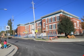
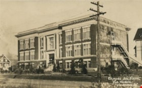
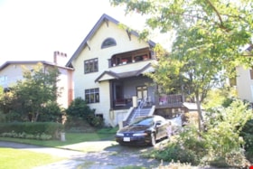
- This Classical Revival school was originally designed as a two-storey four-room brick building in 1915, with a two-storey four-room addition in 1922 and an auditorium in 1929. It was built to replace a wooden schoolhouse that had been built on the site in 1912. The original section was designed by Joseph Bowman (1864-1943), a specialist in school buildings who was the school board architect for South Vancouver and Burnaby, with the additions designed after the formation of his partnership with Harold Cullerne in 1919. One of Bowman’s first designs for Burnaby was a utilitarian two-storey school that could be built with two classrooms and later expanded to eight rooms as the district’s school population grew; five schools from this design were built in 1908, and then four others in modified versions between 1910-16, including this school. This school was named after provincial politician Hugh Gilmour, but the spelling of the name was inadvertently changed by a civic clerk. The classrooms retain their thick wood doors, cloakrooms and rounded walls. The first addition was built by the contracting firm of Patterson, Cope & Thomson. Original features include the dentilled cornice that encircles the entire building and its red brick façade. The school was the first brick school in Burnaby and is the only school of this era left in Burnaby.
- Locality
- Vancouver Heights
- Historic Neighbourhood
- Vancouver Heights (Historic Neighbourhood)
- Planning Study Area
- Burnaby Heights Area
- Architect
- Bowman & Cullerne
- Area
- 7601.86
- Contributing Resource
- Building
- Street Address
- 50 Gilmore Avenue
- Street View URL
- Google Maps Street View
Images
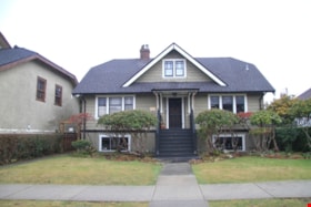
Harrison & Beatrice Morrison Residence
https://search.heritageburnaby.ca/link/landmark589
- Repository
- Burnaby Heritage Planning
- Description
- Residential building.
- Associated Dates
- 1911
- Street View URL
- Google Maps Street View
- Repository
- Burnaby Heritage Planning
- Geographic Access
- Dundas Street
- Associated Dates
- 1911
- Description
- Residential building.
- Heritage Value
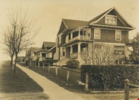
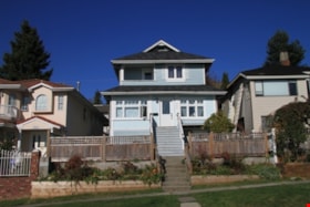
- In 1911, the Vancouver Daily Province reported that “Mr. Harrison D. Morrison is building a twelve-room house of two stories and an attic, with stone basement, on Dundas Street, at a cost of about $4,500.” Harrison Donald Morrison (1864-1944) was a life-long contractor who lived in Burnaby with his wife Beatrice Amanda (née Smith, 1875-1954), until his death in 1944. This Edwardian-era house displays many holdover elements of the Queen Anne Revival style, particularly the elaboration of wall surfaces. In this example, the use of bay and cutaway bay windows, and integral first and second storey verandahs–now removed or altered–add visual interest. The distinct dual pitch of the roof is also a transitional characteristic, used in the late days of the Queen Anne Revival style. A later coat of stucco now covers the original ground floor siding.
- Locality
- Vancouver Heights
- Historic Neighbourhood
- Vancouver Heights (Historic Neighbourhood)
- Planning Study Area
- Burnaby Heights Area
- Area
- 566.71
- Contributing Resource
- Building
- Ownership
- Private
- Street Address
- 3738 Dundas Street
- Street View URL
- Google Maps Street View
Images
Hastings Barnet Road
https://search.heritageburnaby.ca/link/landmark715
- Repository
- Burnaby Heritage Planning
- Associated Dates
- 1903
- Heritage Value
- Prior to 1900, Hastings Street in Vancouver (named after Rear Admiral George Fowler Hastings, commander of Her Majesty's Pacific Coast Squadron) only extended eastward as far as Renfrew Street. By 1903, however, with operations at the Barnet Mill expanding, a direct route into Vancouver was deemed necessary and the Provincial Government ordered that Hastings be extended to connect with the rough trail known as the Barnet Road.
- Historic Neighbourhood
- Vancouver Heights (Historic Neighbourhood)
- Planning Study Area
- Burnaby Heights Area
Images
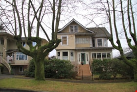
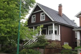
H.D. Morrison House
https://search.heritageburnaby.ca/link/landmark521
- Repository
- Burnaby Heritage Planning
- Description
- The H.D. Morrison House is a tall, two and one-half storey plus basement wood-frame Edwardian era residence, with an eclectic combination of Arts and Crafts stylistic elements. It is now located adjacent to a large multi-family residential building in the Vancouver Heights neighbourhood of North Bu…
- Associated Dates
- 1912
- Formal Recognition
- Heritage Designation, Community Heritage Register
- Other Names
- Harrison D. Morrison House
- Street View URL
- Google Maps Street View
- Repository
- Burnaby Heritage Planning
- Other Names
- Harrison D. Morrison House
- Geographic Access
- Albert Street
- Associated Dates
- 1912
- Formal Recognition
- Heritage Designation, Community Heritage Register
- Enactment Type
- Bylaw No. 10626
- Enactment Date
- 22/09/1997
- Description
- The H.D. Morrison House is a tall, two and one-half storey plus basement wood-frame Edwardian era residence, with an eclectic combination of Arts and Crafts stylistic elements. It is now located adjacent to a large multi-family residential building in the Vancouver Heights neighbourhood of North Burnaby.
- Heritage Value
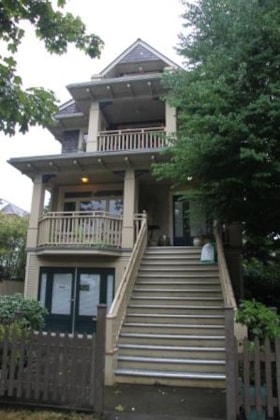
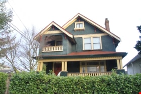
- The H.D. Morrison House is valued for its association with the initial speculative development phase of the Vancouver Heights neighbourhood, initiated during the Edwardian era as a high-class residential subdivision. Building contractor Harrison D. Morrison built this house as a rental property in 1912, at the height of the land speculation boom prior to the First World War. Buyers in the neighbourhood were obligated by the developer, G.F. and J. Galt Limited, to build houses worth a minimum of $3,500 at a time when the average house price was $1,000. Additionally, the H.D. Morrison House is a typical example of builders' houses of the time period, distinguished by the unique stacked balconies on the front facade. It was one of the surviving landmark residences built between 1909 and 1914 during the first development boom in Vancouver Heights.
- Defining Elements
- Key elements that define the heritage character of the H.D. Morrison House include its: - location on a south-facing slope in the Vancouver Heights neighbourhood of North Burnaby - residential form, scale and massing as exemplified by its symmetrical two and one-half storey plus basement height, front gabled roof and rectangular plan - vernacular Arts and Crafts style elements such as the exposed roof beams and rafter tails, decorative scalloped shingles in the front gable and decorative brackets - main floor full open front verandah on the front facade with two stacked balconies above, all detailed with square columns, scroll-cut brackets and overhanging roof eaves - bowed balustrade on main floor verandah - boxed eaves with scroll-cut brackets - recessed top floor gable treatment - cladding, including lapped wooden siding at the main floor and cedar shingles on the second floor and in the gable ends, with decorative diamond-cut shingles in the front gable end - front entry door with incised design, dentil detail and rectangular glass inset, with glassed sidelights - irregular fenestration: double-hung 1-over-1 wooden-sash windows; and three part casement window on main floor front facade, with diamond-shaped leaded lights in double transom above - corbelled red brick internal chimney
- Historic Neighbourhood
- Vancouver Heights (Historic Neighbourhood)
- Planning Study Area
- Burnaby Heights Area
- Function
- Primary Historic--Single Dwelling
- Primary Current--Multiple Dwelling
- Community
- Burnaby
- Cadastral Identifier
- 003-318-371
- Boundaries
- The H.D. Morrison House is comprised of a single residential lot located at 3765 Albert Street, Burnaby.
- Area
- 2263
- Contributing Resource
- Building
- Ownership
- Private
- Street Address
- 3765 Albert Street
- Street View URL
- Google Maps Street View
Images
Helen 'The Swinging Girl' Neon Sign
https://search.heritageburnaby.ca/link/landmark591
- Repository
- Burnaby Heritage Planning
- Description
- Commercial building.
- Associated Dates
- 1956
- Formal Recognition
- Heritage Designation, Community Heritage Register
- Other Names
- Helen's Childrens Wear Sign
- Street View URL
- Google Maps Street View
- Repository
- Burnaby Heritage Planning
- Other Names
- Helen's Childrens Wear Sign
- Geographic Access
- Hastings Street
- Associated Dates
- 1956
- Formal Recognition
- Heritage Designation, Community Heritage Register
- Enactment Type
- Bylaw No. 12771
- Enactment Date
- 19/04/2010
- Description
- Commercial building.
- Heritage Value
- While the building here is of some importance as the former North Burnaby municipal office, its primary importance is its delightful neon sign that has become a North Burnaby landmark. Helen Arnold opened Helen’s Childrens Wear shop in the building next door to the old Municipal offices in 1948. In 1955, when North Burnaby moved out, she moved into the vacated building. As part of the renovations, Helen enlisted the assistance of her good friend Jimmy Wallace, owner of Vancouver’s Wallace Neon Company, to create a new sign for her expanded business. One of the company’s designers, Reeve Lehman, created the swinging neon girl that was installed in 1956. Designed in two parts, one section of the sign is cloud shaped and reads ‘Helen’s’ while the other section is a moving representation of a little girl on a swing. The sign is nine feet six inches high and nine feet wide, and the lower section is animated with an internal motor and gears. It immediately became a landmark on Hastings Street, and recently the sign’s design fame has spread far and wide as one of the best surviving examples of kinetic neon art in North America.
- Locality
- Vancouver Heights
- Historic Neighbourhood
- Vancouver Heights (Historic Neighbourhood)
- Planning Study Area
- Willingdon Heights Area
- Community
- Burnaby
- Names
- Helen's Childrens Wear
- Street Address
- 4142 Hastings Street
- Street View URL
- Google Maps Street View
Images
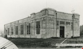
Horne-Payne Receiving Station
https://search.heritageburnaby.ca/link/landmark594
- Repository
- Burnaby Heritage Planning
- Description
- Industrial building.
- Associated Dates
- 1913
- Street View URL
- Google Maps Street View
- Repository
- Burnaby Heritage Planning
- Geographic Access
- 2nd Avenue
- Associated Dates
- 1913
- Description
- Industrial building.
- Heritage Value
- Constructed as an electrical grid substation by the B.C. Electric Railway Company, the Horne-Payne substation was part of the expansion of this utility company to central Burnaby that occurred as a result of the opening of the Burnaby Lake Interurban line in 1911. The Receiving Station is intended to rearrange the company’s system of distributing power over the whole of the Burrard Peninsula. Power will come to the transformers there and be converted and distributed to the various substations in Vancouver, New Westminster and the suburbs...Work has already been started at the foundation for the new plant. (Vancouver Daily Province, April 29, 1913) When constructed the substation was situated within a forest clearing in a largely undeveloped section of northwest Burnaby. The area now surrounding the substation is heavily developed for semi-industrial purposes. This steel-frame and poured concrete structure was designed to be utilitarian, but with decorative detailing. The south-facing front of the structure features massed corners detailed with decorative relief panels at the roofline. Additionally, this well-balanced building displayed symmetrical fenestration with blind, and tall multi-paned steel-sash windows, some crowned with keystones. A tower added to the east side of the building’s front is the most substantial change made to the appearance of the Horne-Payne substation. This industrial structure was designed by prominent British Columbian architect, Robert Lyon (1879-1963). Born in Edinburgh, Lyon apprenticed and worked as an architect in Scotland until 1908 before moving to New York in 1909. In 1911, he began his career in Vancouver as an “architectural engineer,” with the B.C. Electric Company that lasted until 1918. After a short tenure in the lumber industry, Lyon returned to architecture, this time with his own firm in Penticton. Active in municipal politics, he was instrumental in the incorporation of Penticton as a city, and became its first mayor from 1948-1949. Lyon retired from architecture in 1958 and died in 1963. Lyon also designed the Central Park Gate in Burnaby.
- Locality
- Vancouver Heights
- Historic Neighbourhood
- Vancouver Heights (Historic Neighbourhood)
- Planning Study Area
- West Central Valley Area
- Architect
- Robert Lyon
- Area
- 47400.00
- Contributing Resource
- Building
- Ownership
- Private
- Street Address
- 3700 2nd Street
- Street View URL
- Google Maps Street View
Images
Isak & Lilly Gronning Residence
https://search.heritageburnaby.ca/link/landmark598
- Repository
- Burnaby Heritage Planning
- Description
- Residential building.
- Associated Dates
- c.1938
- Street View URL
- Google Maps Street View
- Repository
- Burnaby Heritage Planning
- Geographic Access
- Eton Street
- Associated Dates
- c.1938
- Description
- Residential building.
- Heritage Value
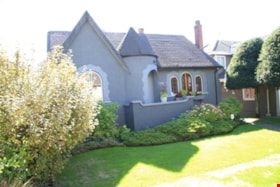
- This house was built for Isac Hartvig Peterson “Harry” Gronning (1880-1955), a Norwegian-born butcher, and his wife Lilly Geneva (née Hatton, 1889-1978). The Gronnings married in Vancouver in 1913, and lived in this home until at least Harry’s death in 1955. Designed to simulate a Norman-style cottage, the most distinctive feature of this eclectic bungalow is its round entry tower with a conical roof. Other distinctive features include its rolled roof edges that simulate a thatched roof, and its rounded arch windows surrounded with imitation voussoirs. It retains its original wooden-sash windows with leaded panes.
- Locality
- Vancouver Heights
- Historic Neighbourhood
- Vancouver Heights (Historic Neighbourhood)
- Planning Study Area
- Burnaby Heights Area
- Area
- 566.71
- Contributing Resource
- Building
- Ownership
- Private
- Street Address
- 3766 Eton Street
- Street View URL
- Google Maps Street View
Images
James & Catherine Newton Residence
https://search.heritageburnaby.ca/link/landmark602
- Repository
- Burnaby Heritage Planning
- Description
- Residential building.
- Associated Dates
- 1930
- Street View URL
- Google Maps Street View
- Repository
- Burnaby Heritage Planning
- Geographic Access
- Yale Street
- Associated Dates
- 1930
- Description
- Residential building.
- Heritage Value
- Typical of the Craftsman style, this bungalow has retained its original side jerkin-headed roof, jerkin-headed dormer, twin-course shingle siding and tapered columns on the open front verandah. The panelled and glazed front door, and the multi-paned windows are original. It was built for James Newton (1887-1954), an inspector for the Workman’s Compensation Board, for $3,500 in 1930. James and his wife, Catherine (née McKechnie), lived here until his death in 1954.
- Locality
- Vancouver Heights
- Historic Neighbourhood
- Vancouver Heights (Historic Neighbourhood)
- Planning Study Area
- Burnaby Heights Area
- Area
- 566.71
- Contributing Resource
- Building
- Ownership
- Private
- Street Address
- 3724 Yale Street
- Street View URL
- Google Maps Street View
Images
James & Harriet Atkey Residence
https://search.heritageburnaby.ca/link/landmark603
- Repository
- Burnaby Heritage Planning
- Description
- Residential building.
- Associated Dates
- 1913
- Street View URL
- Google Maps Street View
- Repository
- Burnaby Heritage Planning
- Geographic Access
- MacDonald Avenue North
- Associated Dates
- 1913
- Description
- Residential building.
- Heritage Value
- This Arts and Crafts residence has retained many of its original features, such as its full open front verandah with twinned square columns, shingle siding, and triangular eave brackets. Typical of the era, the front door has glazed insets and the living room window assembly has opening casements and transoms above. The second floor sleeping porch has retained its original arched openings. It has been restored and is in very good condition. It was built by C.A. Curseaden of Kerrisdale and sold to James William Atkey (1868-1956), a general store merchant, and his wife Harriet Ellen (née Bugg, 1868-1944) in 1915.
- Locality
- Vancouver Heights
- Historic Neighbourhood
- Vancouver Heights (Historic Neighbourhood)
- Planning Study Area
- Burnaby Heights Area
- Area
- 371.61
- Contributing Resource
- Building
- Ownership
- Private
- Street Address
- 20 Macdonald Avenue North
- Street View URL
- Google Maps Street View
Images
James & Mary Herd Residence
https://search.heritageburnaby.ca/link/landmark604
- Repository
- Burnaby Heritage Planning
- Description
- Residential building.
- Associated Dates
- 1910
- Other Names
- STRATHMORE
- Street View URL
- Google Maps Street View
- Repository
- Burnaby Heritage Planning
- Other Names
- STRATHMORE
- Geographic Access
- Boundary Road North
- Associated Dates
- 1910
- Description
- Residential building.
- Heritage Value
- Designed for James Herd (1863-1940) and his wife, Mary Jane Barrie Herd (née Fenton, 1870-1956), this house was described “as a fine new home valued at… $7,000” by The British Columbian in 1912. Named after Mrs. Herd’s birthplace in the Strathmore Valley, Scotland, this was one of the first homes to be built in the Vancouver Heights subdivision. A full width verandah takes advantage of remarkable views of downtown Vancouver and Burrard Inlet. Though the architecture of the house has been altered by the addition of stucco cladding and the replacement of the original windows, it remains an excellent example of the Craftsman style, with the triangular eave brackets, granite clad verandah piers, square support columns and varied roofline with broad eaves that are characteristic of the style. It was the long-time residence of Joseph Wellington Kelly (1876-1962), a stationary engineer, and his wife Margaret Ann Kelly (née Allan, 1880-1968), who were married in Vancouver in 1901. Their son, Allan C. Kelly (died 2001) was an architect, who worked for the architectural firm Townley & Matheson from 1928 until the 1970s. Among many other projects undertaken for the firm, Allan Kelly was the project architect for Vancouver City Hall.
- Locality
- Vancouver Heights
- Historic Neighbourhood
- Vancouver Heights (Historic Neighbourhood)
- Planning Study Area
- Burnaby Heights Area
- Area
- 708.39
- Contributing Resource
- Building
- Ownership
- Private
- Street Address
- 510 Boundary Road North
- Street View URL
- Google Maps Street View
Images
John & Jessie MacLean Residence
https://search.heritageburnaby.ca/link/landmark608
- Repository
- Burnaby Heritage Planning
- Description
- Residential building.
- Associated Dates
- c.1926
- Street View URL
- Google Maps Street View
- Repository
- Burnaby Heritage Planning
- Geographic Access
- Pandora Street
- Associated Dates
- c.1926
- Description
- Residential building.
- Heritage Value
- This cottage illustrates the traditionalism of the interwar years, when domestic ideals were expressed through modest homes displaying period revival influences. Reflecting the influence of the British Arts and Crafts movement, it features a symmetrical plan, a side jerkin-headed roof, a gabled front dormer and twin-coursed shingle siding, and retains its original wooden-sash windows with unusual multi-paned upper sash. It was built for John R. and Jessie MacLean. The house was recently restored by the owners.
- Locality
- Vancouver Heights
- Historic Neighbourhood
- Vancouver Heights (Historic Neighbourhood)
- Planning Study Area
- Burnaby Heights Area
- Area
- 566.71
- Contributing Resource
- Building
- Ownership
- Private
- Street Address
- 3827 Pandora Street
- Street View URL
- Google Maps Street View
Images
John & Roseanna Clark House
https://search.heritageburnaby.ca/link/landmark567
- Repository
- Burnaby Heritage Planning
- Description
- Residential building.
- Associated Dates
- 1912
- Formal Recognition
- Heritage Designation, Community Heritage Register
- Street View URL
- Google Maps Street View
- Repository
- Burnaby Heritage Planning
- Geographic Access
- Dundas Street
- Associated Dates
- 1912
- Formal Recognition
- Heritage Designation, Community Heritage Register
- Enactment Type
- Bylaw No. 12640
- Enactment Date
- 22/06/2009
- Description
- Residential building.
- Heritage Value
- While simple in form, this sophisticated Edwardian-era house is finely detailed and maintains a high degree of its original integrity. The symmetrical home’s most distinct characteristic is its full width inset verandah with octagonal columns supporting second floor projection. This was the home of John William Clark (1886-1947), an English-born carpenter who retired in 1926, and his wife Roseanna Clark (1860-1933).
- Locality
- Vancouver Heights
- Historic Neighbourhood
- Vancouver Heights (Historic Neighbourhood)
- Planning Study Area
- Burnaby Heights Area
- Community
- Burnaby
- Contributing Resource
- Building
- Ownership
- Private
- Street Address
- 4115 Dundas Street
- Street View URL
- Google Maps Street View
Images
Johnson & Berg House
https://search.heritageburnaby.ca/link/landmark611
- Repository
- Burnaby Heritage Planning
- Description
- Residential building.
- Associated Dates
- 1913
- Street View URL
- Google Maps Street View
- Repository
- Burnaby Heritage Planning
- Geographic Access
- Eton Street
- Associated Dates
- 1913
- Description
- Residential building.
- Heritage Value
- This Edwardian-era bungalow displays an impressive mix of details added to a modest suburban form. A hipped roof was rarely used in conjunction with the Craftsman style. Here, the tapered verandah piers, attic balcony columns and gable screen reference the Craftsman style, while the overall symmetrical form and roofline are more typical Edwardian features. It appears to have been built as a revenue property by business partners and local builders, Herman Johnson and Ole Berg in 1913 and rented by them as late as 1939.
- Locality
- Vancouver Heights
- Historic Neighbourhood
- Vancouver Heights (Historic Neighbourhood)
- Planning Study Area
- Burnaby Heights Area
- Area
- 374.03
- Contributing Resource
- Building
- Ownership
- Private
- Street Address
- 4247 Eton Street
- Street View URL
- Google Maps Street View
Images
Joseph & Anne Gartlan Residence
https://search.heritageburnaby.ca/link/landmark612
- Repository
- Burnaby Heritage Planning
- Description
- Residential building.
- Associated Dates
- c.1913
- Street View URL
- Google Maps Street View
- Repository
- Burnaby Heritage Planning
- Geographic Access
- Oxford Street
- Associated Dates
- c.1913
- Description
- Residential building.
- Heritage Value
- This house was owned by Joseph Paul Gartlan (1877-1967), a steam shovel engineer for the B.C. Electric Company from 1906 to 1943, and his wife, Annie Claudia Gartlan (née Wood, 1891-1933). Joseph was a long-time resident of the house, remaining until his death in 1967. Typical of the Edwardian era, this bungalow has a side gabled roof with a large front gable over the balcony, an open front verandah with square tapered columns, and a mix of narrow lapped wooden siding, square shingles and diamond shingles in the gable peak.
- Locality
- Vancouver Heights
- Historic Neighbourhood
- Vancouver Heights (Historic Neighbourhood)
- Planning Study Area
- Burnaby Heights Area
- Area
- 374.03
- Contributing Resource
- Building
- Ownership
- Private
- Street Address
- 4111 Oxford Street
- Street View URL
- Google Maps Street View
Images
J.R. & Frances Dawson Residence
https://search.heritageburnaby.ca/link/landmark599
- Repository
- Burnaby Heritage Planning
- Description
- Residential building.
- Associated Dates
- c.1912
- Street View URL
- Google Maps Street View
- Repository
- Burnaby Heritage Planning
- Geographic Access
- Cambridge Street
- Associated Dates
- c.1912
- Description
- Residential building.
- Heritage Value
- This beautifully-detailed house displays a highly sophisticated mix of fashionable Arts and Crafts elements. The asymmetrical design has stacked inset verandahs on one side, with the ground floor verandah wrapping around the side of the house. The second floor verandah has an arched opening, supported by short versions of the ground floor columns and accessed by French doors with geometric patterned, multi-paned glazing. A semi-circular lunette window lights the attic, and banked windows with leaded transoms are used on the front façade. Decorative details include triangular eave brackets and square verandah columns with distinctive bracketted capitals. The house has survived in original condition except for a later asbestos siding that was applied over the original shingle siding, and the enclosure of the side verandah. The home was owned by J.R. Dawson and Frances Abigail Dawson (née Thompson, 1853-1938) from 1915 until Frances’ death in 1938.
- Locality
- Vancouver Heights
- Historic Neighbourhood
- Vancouver Heights (Historic Neighbourhood)
- Planning Study Area
- Burnaby Heights Area
- Area
- 566.71
- Contributing Resource
- Building
- Ownership
- Private
- Street Address
- 3746 Cambridge Street
- Street View URL
- Google Maps Street View
Images
J.S. & Mina Reid Residence
https://search.heritageburnaby.ca/link/landmark600
- Repository
- Burnaby Heritage Planning
- Description
- Residential building.
- Associated Dates
- c.1913
- Street View URL
- Google Maps Street View
- Repository
- Burnaby Heritage Planning
- Geographic Access
- Frances Street
- Associated Dates
- c.1913
- Description
- Residential building.
- Heritage Value
- The gable-on-hipped roofline is this house’s most unique feature. The home is a typical plan of the Foursquare type with the addition of an inset second-storey verandah. The full open front verandah has square columns and closed balustrades. A coloured glass transom was used above the living room window assembly. By 1915, the house was owned by J.S. and Mina Reid (1874-1969).
- Locality
- Vancouver Heights
- Historic Neighbourhood
- Vancouver Heights (Historic Neighbourhood)
- Planning Study Area
- Burnaby Heights Area
- Area
- 377.10
- Contributing Resource
- Building
- Ownership
- Private
- Street Address
- 3851 Frances Street
- Street View URL
- Google Maps Street View
Images
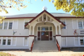
Kitchener Elementary School
https://search.heritageburnaby.ca/link/landmark614
- Repository
- Burnaby Heritage Planning
- Description
- School building.
- Associated Dates
- 1925
- Street View URL
- Google Maps Street View
- Repository
- Burnaby Heritage Planning
- Geographic Access
- Gilmore Avenue
- Associated Dates
- 1925
- Description
- School building.
- Heritage Value
- This landmark school was designed by the architectural firm of Bowman & Cullerne, specialists in the design of educational facilities. After Harold Cullerne (1890-1976) returned from service during the First World War, he joined J.H. Bowman (1864-1943) in a partnership that lasted from 1919 to 1934. The firm’s projects include the Seaforth School (1922, now relocated to Burnaby Village Museum), Burnaby North High School (1923), and the Nelson Avenue School (1927). This was originally designed as a two-storey, four-room building in 1925, with two-storey four-room wings added two years later. The building has been altered with the addition of stucco cladding over the original siding and replacement windows, but has retained its original form and massing, as well as its domed roof ventilator.
- Locality
- Vancouver Heights
- Historic Neighbourhood
- Vancouver Heights (Historic Neighbourhood)
- Planning Study Area
- Willingdon Heights Area
- Architect
- Bowman & Cullerne
- Area
- 20478.11
- Contributing Resource
- Building
- Street Address
- 1351 Gilmore Avenue
- Street View URL
- Google Maps Street View
Images
Lewis & Millicent Physick Residence
https://search.heritageburnaby.ca/link/landmark616
- Repository
- Burnaby Heritage Planning
- Description
- Residential building.
- Associated Dates
- 1939
- Street View URL
- Google Maps Street View
- Repository
- Burnaby Heritage Planning
- Geographic Access
- Boundary Road North
- Associated Dates
- 1939
- Description
- Residential building.
- Heritage Value
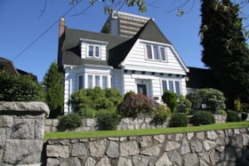
- This modest residence was built for Lewis Baker Physick (1905-1971), a freight dispatcher for B.C. Motor Transport Company who later worked for B.C. Hydro, and Millicent Physick (née Edwards, 1894-1971), a hairdresser, who lived here until their respective deaths. Situated on a terraced lot with stone-clad retaining walls, this home was influenced by the British Arts and Crafts style, which remained popular throughout the 1930s. Such stylistic influence can be seen in the second floor overhang, which is supported by false beams, leaded casement windows and steeply pitched roof and front gable. The roofline is enhanced by a jerkin-headed roof on the front gable. Apart from the addition of a later south elevation extension, the house remains in excellent original condition. Located on an elevated site, this residence has an unobstructed view of downtown Vancouver and Burrard Inlet.
- Locality
- Vancouver Heights
- Historic Neighbourhood
- Vancouver Heights (Historic Neighbourhood)
- Planning Study Area
- Burnaby Heights Area
- Area
- 566.71
- Contributing Resource
- Building
- Ownership
- Private
- Street Address
- 420 Boundary Road North
- Street View URL
- Google Maps Street View
