Narrow Results By
Subject
- Animals - Birds 1
- Buildings - Heritage 1
- Buildings - Industrial - Mills 1
- Buildings - Industrial - Saw Mills 1
- Buildings - Residential 1
- Buildings - Schools - Universities and Colleges 1
- Construction 1
- Construction Tools and Equipment 1
- Documentary Artifacts - Architectural Drawings 2
- Geographic Features - Beaches 1
- Geographic Features - Forests 1
- Geographic Features - Inlets 1

Barnet Marine Park
https://search.heritageburnaby.ca/link/archivedescription91581
- Repository
- City of Burnaby Archives
- Date
- August 9, 1996
- Collection/Fonds
- Doreen Lawson fonds
- Description Level
- File
- Physical Description
- 18 photographs : col. slides ; 35 mm
- Scope and Content
- File consists of photographs of Barnet Marine Park, including Barnet Beach pilings, overpass and people preparing kayaks on the shore.
- Repository
- City of Burnaby Archives
- Date
- August 9, 1996
- Collection/Fonds
- Doreen Lawson fonds
- Physical Description
- 18 photographs : col. slides ; 35 mm
- Description Level
- File
- Record No.
- 605-014
- Access Restriction
- No restrictions
- Reproduction Restriction
- No restrictions
- Accession Number
- 2003-30
- Scope and Content
- File consists of photographs of Barnet Marine Park, including Barnet Beach pilings, overpass and people preparing kayaks on the shore.
- Names
- Lawson, Doreen A.
- Media Type
- Photograph
- Photographer
- Lawson, Doreen A.
- Notes
- Title based on contents of photographs
- Note in black in on recto of slide frames of photographs 605-014-1 : 605-014-7, 605-014-9 : 605-014-11, and 605-014-13 reads: "Barnet Beach Pilings"
- Note in black ink on recto of slide frames of photographs 605-014-8 and 605-014-12 reads: "Barnet Beach Kayaks"
- Note in black ink on recto of slide frames of photographs 605-014-14 : 605-014-18 reads: "Barnet Beach Overpass"
- Geographic Access
- Barnet Marine Park
- Historic Neighbourhood
- Barnet (Historic Neighbourhood)
- Planning Study Area
- Burnaby Mountain Area
Images

![Local construction, [1999] thumbnail](/media/hpo/_Data/_Archives_Images/_Unrestricted/535/535-3205-1.jpg?width=280)
Local construction
https://search.heritageburnaby.ca/link/archivedescription98126
- Repository
- City of Burnaby Archives
- Date
- [1999]
- Collection/Fonds
- Burnaby NewsLeader photograph collection
- Description Level
- File
- Physical Description
- 2 photographs (tiff) : col.
- Scope and Content
- File contains photographs of two unidentified people observing evidence of construction. One photograph depicts a person looking at a crack in a floor tile while holding a land survey map, and the other depicts an individual looking at a piece of construction equipment on the other side of a chain …
- Repository
- City of Burnaby Archives
- Date
- [1999]
- Collection/Fonds
- Burnaby NewsLeader photograph collection
- Physical Description
- 2 photographs (tiff) : col.
- Description Level
- File
- Record No.
- 535-3205
- Access Restriction
- No restrictions
- Reproduction Restriction
- No restrictions
- Accession Number
- 2018-12
- Scope and Content
- File contains photographs of two unidentified people observing evidence of construction. One photograph depicts a person looking at a crack in a floor tile while holding a land survey map, and the other depicts an individual looking at a piece of construction equipment on the other side of a chain link fence.
- Media Type
- Photograph
- Notes
- Title based on contents of file
- Collected by editorial for use in a June 1999 issue of the Burnaby NewsLeader
Images
![Local construction, [1999] thumbnail](/media/hpo/_Data/_Archives_Images/_Unrestricted/535/535-3205-1.jpg)
![Harry Pride and Barnet townsite, [2004] thumbnail](/media/hpo/_Data/_Archives_Images/_Unrestricted/535/535-2056-1.jpg?width=280)
Harry Pride and Barnet townsite
https://search.heritageburnaby.ca/link/archivedescription96386
- Repository
- City of Burnaby Archives
- Date
- [2004]
- Collection/Fonds
- Burnaby NewsLeader photograph collection
- Description Level
- File
- Physical Description
- 3 photographs (tiff) : col.
- Scope and Content
- File contains photographs of Harry Pride at work on researching his book about Burnaby's Barnet townsite. Photographs depict Pride with Beatrice Woolsey-McMillan, a former resident of the community, on the shore of the Burrard Inlet, and Pride viewing historical photographs and one of the remaining…
- Repository
- City of Burnaby Archives
- Date
- [2004]
- Collection/Fonds
- Burnaby NewsLeader photograph collection
- Physical Description
- 3 photographs (tiff) : col.
- Description Level
- File
- Record No.
- 535-2056
- Access Restriction
- No restrictions
- Reproduction Restriction
- No restrictions
- Accession Number
- 2018-12
- Scope and Content
- File contains photographs of Harry Pride at work on researching his book about Burnaby's Barnet townsite. Photographs depict Pride with Beatrice Woolsey-McMillan, a former resident of the community, on the shore of the Burrard Inlet, and Pride viewing historical photographs and one of the remaining structures from the Barnet sawmill.
- Subjects
- Geographic Features - Inlets
- Buildings - Industrial - Saw Mills
- Buildings - Industrial - Mills
- Media Type
- Photograph
- Photographer
- Bartel, Mario
- Notes
- Title based on caption
- Collected by editorial for use in a March 2004 issue of the Burnaby NewsLeader
- Caption from metadata for 535-2056-1: "Harry Pride, who is working on a book about Burnaby's Barnet townsite, reminisces with Beatrice Woolsey-McMillan, who lived in the mill community along the Burrard Inlet from 1925-46."
- Caption from metadata for 535-2056-2: "Harry Pride sorts through some of the historical photos he's collected for a book he's working on about Burnaby's Barnet townsite, along the Burrard Inlet."
- Caption from metadata for 535-2056-3: "Harry Pride, who's working on a book about Burnaby's Barnet townsite, checks out one of the remaining structures from the sawmill that once bustled along the Burrard Inlet."
- Geographic Access
- Barnet Village
- Burrard Inlet
- Barnet Marine Park
- Historic Neighbourhood
- Barnet (Historic Neighbourhood)
- Planning Study Area
- Burnaby Mountain Area
Images
![Harry Pride and Barnet townsite, [2004] thumbnail](/media/hpo/_Data/_Archives_Images/_Unrestricted/535/535-2056-1.jpg)
B.C. Electric Railway Franchise - Agreement
https://search.heritageburnaby.ca/link/archivedescription382
- Repository
- City of Burnaby Archives
- Date
- 1909-1913
- Collection/Fonds
- City Council and Office of the City Clerk fonds
- Description Level
- File
- Physical Description
- Textual records and architectural drawings
- Scope and Content
- File contains records relating to agreements made between the Corporation of the District of Burnaby and the B.C. Electric Railway Co., for rail line extensions. File also includes a blueprint plan of station structures for Vancouver Fraser Valley and Southern Railway Co. and a newspaper clipping.
- Repository
- City of Burnaby Archives
- Date
- 1909-1913
- Collection/Fonds
- City Council and Office of the City Clerk fonds
- Physical Description
- Textual records and architectural drawings
- Description Level
- File
- Record No.
- 2075
- Accession Number
- 2001-02
- Scope and Content
- File contains records relating to agreements made between the Corporation of the District of Burnaby and the B.C. Electric Railway Co., for rail line extensions. File also includes a blueprint plan of station structures for Vancouver Fraser Valley and Southern Railway Co. and a newspaper clipping.
- Media Type
- Textual Record
- Architectural Drawing
- Notes
- Plans/maps are located in file and have not been moved to map case. File includes original newspaper clipping.
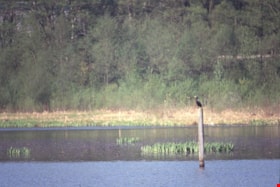
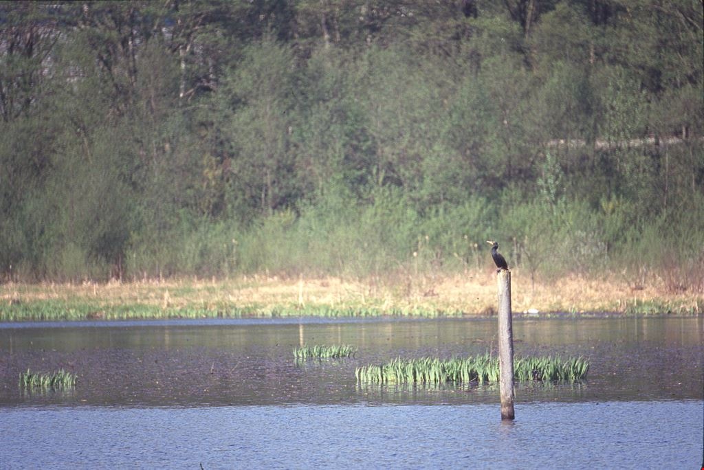
Cormorants
https://search.heritageburnaby.ca/link/archivedescription91686
- Repository
- City of Burnaby Archives
- Date
- 1982-1991
- Collection/Fonds
- Doreen Lawson fonds
- Description Level
- File
- Physical Description
- 4 photographs : col. slides ; 35 mm
- Scope and Content
- File consists of photographs of cormorants. In three of the photographs cormorants are perched on wooded structures on Burnaby Lake; in the forth a cormorant is depicted taking flight from the water. The cormorants are medium-to-large sized birds with dark feathers and long, thin yellow bills.
- Repository
- City of Burnaby Archives
- Date
- 1982-1991
- Collection/Fonds
- Doreen Lawson fonds
- Physical Description
- 4 photographs : col. slides ; 35 mm
- Description Level
- File
- Record No.
- 618-004
- Access Restriction
- No restrictions
- Reproduction Restriction
- No restrictions
- Accession Number
- 2015-15
- Scope and Content
- File consists of photographs of cormorants. In three of the photographs cormorants are perched on wooded structures on Burnaby Lake; in the forth a cormorant is depicted taking flight from the water. The cormorants are medium-to-large sized birds with dark feathers and long, thin yellow bills.
- Media Type
- Photograph
- Photographer
- Lawson, Doreen A.
- Notes
- Transcribed title
- Title transcribed from note on slide sheet photographs were originally housed in
- Historic Neighbourhood
- Burnaby Lake (Historic Neighbourhood)
- Planning Study Area
- Burnaby Lake Area
Images
Disappearing Burnaby collection
https://search.heritageburnaby.ca/link/archivedescription98597
- Repository
- City of Burnaby Archives
- Date
- 2021-2022
- Collection/Fonds
- Disappearing Burnaby collection
- Description Level
- Fonds
- Physical Description
- 33 photographs (jpeg) : b&w and col.
- Scope and Content
- Collection consists of photographs taken by Nakita Cheung for her "Disappearing Burnaby" project, in which she photographs buildings and structures that she finds aesthetically and historically interesting before they are lost to time and/or development in the changing urban landscape of Burnaby. F…
- Repository
- City of Burnaby Archives
- Date
- 2021-2022
- Collection/Fonds
- Disappearing Burnaby collection
- Physical Description
- 33 photographs (jpeg) : b&w and col.
- Description Level
- Fonds
- Access Restriction
- No restrictions
- Reproduction Restriction
- May be restricted by third party rights
- Accession Number
- 2022-14
- Scope and Content
- Collection consists of photographs taken by Nakita Cheung for her "Disappearing Burnaby" project, in which she photographs buildings and structures that she finds aesthetically and historically interesting before they are lost to time and/or development in the changing urban landscape of Burnaby. For this collection, Cheung selected 33 photographs that she felt represented Burnaby in a time of transition. These photographs document single-family homes, low-rise apartment buildings, commercial buildings, signage, and street scenes, often at night and in the rain.
- History
- Nakita Cheung is an amateur photographer located in Burnaby, B.C., near Metrotown. She was born on July 3, 1994, and grew up in Burnaby. In her "Disappearing Burnaby" project, which is also published on her blog "Disappearing Burnaby" (https://disappearingburnaby.wordpress.com), Cheung is creating a "photo journal of Burnaby’s disappearing low-rise apartments, bungalows, and buildings."
- Media Type
- Photograph
- Creator
- Cheung, Nakita
![Fire on Godwin Avenue, [2000] thumbnail](/media/hpo/_Data/_Archives_Images/_Unrestricted/535/535-1661-1.jpg?width=280)
Fire on Godwin Avenue
https://search.heritageburnaby.ca/link/archivedescription95861
- Repository
- City of Burnaby Archives
- Date
- [2000]
- Collection/Fonds
- Burnaby NewsLeader photograph collection
- Description Level
- File
- Physical Description
- 2 photographs (tiff) : col.
- Scope and Content
- File contains photographs of the aftermath of a suspected arson file on Godwin Avenue. Photographs show fire investigator Doug Hahn looking through the window of a burned car with a burned structure in the background, and another fire fighter walking away from the structure that was taped off.
- Repository
- City of Burnaby Archives
- Date
- [2000]
- Collection/Fonds
- Burnaby NewsLeader photograph collection
- Physical Description
- 2 photographs (tiff) : col.
- Description Level
- File
- Record No.
- 535-1661
- Access Restriction
- No restrictions
- Reproduction Restriction
- No restrictions
- Accession Number
- 2018-12
- Scope and Content
- File contains photographs of the aftermath of a suspected arson file on Godwin Avenue. Photographs show fire investigator Doug Hahn looking through the window of a burned car with a burned structure in the background, and another fire fighter walking away from the structure that was taped off.
- Names
- Burnaby Fire Department
- Media Type
- Photograph
- Photographer
- Bartel, Mario
- Notes
- Title based on caption
- Collected by editorial for use in a November 2000 issue of the Burnaby NewsLeader
- Caption from metadata for 535-1661-1: "Burnaby fire investigator Doug Hahn inspects a burned out car and garage on Godwin St., the fourth in a series of arsons set in the area early Sunday morning."
- Caption from metadata for 535-1661-2: "RCMP arson investigators remove evidence from a garage fire on Godwin St., the fourth in a series of suspected arson fires set in the area early Sunday morning."
- Geographic Access
- Godwin Avenue
- Historic Neighbourhood
- Burnaby Lake (Historic Neighbourhood)
- Planning Study Area
- Burnaby Lake Area
Images
![Fire on Godwin Avenue, [2000] thumbnail](/media/hpo/_Data/_Archives_Images/_Unrestricted/535/535-1661-1.jpg)
Planning Department fonds
https://search.heritageburnaby.ca/link/archivedescription102
- Repository
- City of Burnaby Archives
- Date
- 1940-2016
- Collection/Fonds
- Planning Department fonds
- Description Level
- Fonds
- Physical Description
- 80 m of textual records and other material
- Scope and Content
- Fonds consists of those records created during the regular conduct of business by the Planning Department and its predecessor agencies according to their mandate of providing professional and technical advice to Council on the current and future uses of City land and resources.
- Repository
- City of Burnaby Archives
- Date
- 1940-2016
- Collection/Fonds
- Planning Department fonds
- Physical Description
- 80 m of textual records and other material
- Description Level
- Fonds
- File Class
- 71000 10 (add. 2020)
- 71000 20 (add. 2020)
- 71000 30 (add. 2020)
- 71000 40 (add. 2020)
- Access Restriction
- Subject to FOIPPA
- Reproduction Restriction
- Reproductions subject to FOIPPA.
- Scope and Content
- Fonds consists of those records created during the regular conduct of business by the Planning Department and its predecessor agencies according to their mandate of providing professional and technical advice to Council on the current and future uses of City land and resources.
- History
- The City of Burnaby Planning Department was established on October 9, 1956, when the City Council unanimously carried the motion to create a distinct department to deal with planning issues within the City and appointed Mr. William John Blakely as its head. This decision followed a report and recommendation made by the City’s Chief Administrative Officer which indicated that the role of the Planning Engineer and his staff had quickly expanded to become a separate division within the Engineering Department and that they were functioning as an independent unit in all but name. The proposed separation of the Engineering and Planning departments had been in the works since the early part of 1956 when staff changes and restructuring within the Engineering Department’s Planning Division illustrated the undermanned condition of the Planning Engineer’s office. As a result, Council asked the Chief Administrative Officer to undertake a study examining the feasibility of creating a distinct Planning Department. This report was delivered to Council on July 3, 1956, but was laid over until a Committee of the Council had the opportunity to study the functions of the Planning department to determine the necessity of the proposal. The Committee’s findings were in line with the initial report and the Planning Department was established with a staff of nine (the head Planning Engineer, an Administrative Planner, three Research Planning Assistants, a Draughtsman, a Subdivision Control Clerk, a department Clerk and a Clerk Stenographer). This new department was to offer advice and carry out the work intensive in matters such as zoning and rezoning applications, subdivision control, traffic and transportation planning, and general City planning schemes. Prior to the creation of the Planning Department, a number of bodies within the City had been responsible for fulfilling the functions carried out by this new unit. In the earliest years of the City, the members of Council were responsible for matters of planning and were assisted in their job by the City’s Engineer or any number of hired consultants (e.g. surveyors, cartographers). By 1906, however, the provincial laws surrounding the subdivision process had changed, and local governments were charged with the task of approving all private subdivision plans in their respective Municipalities. In Burnaby, the City Council passed a bylaw decreeing that all subdivision plans were to be submitted to Council for review and the City Engineer was responsible for ensuring compliance with the law. After the first Town Planning Bylaw in 1924 which restricted the type and size of construction that could occur in certain City areas, the Engineering and Building departments were to work together to oversee the enforcement of the Bylaw and the development of City plans. The scope and competence required to carry out this work grew as Burnaby’s population expanded, and in 1930 Council passed the Town Planning Commission Bylaw (No. 1028) that saw the creation of a permanent body – the Town Planning Commission – which was to serve as an advisory body to help direct the planning activities in the City while the actual work continued to be carried out by the Engineering Department. This body was comprised of the Reeve, the Chairman of the School Board, the Chairman of the Park Committee (later, the Board of Parks Commissioners), and six appointed citizens who served three-year terms. Council referred all matters of subdivisions, transportation planning, and rezoning to this Commission, which was later supported in its work by several other special or standing committees such as the Subdivision Committee, the Apartment Committee, the Transportation Committee or the Town Planning Board of Appeal. By 1953, it had become apparent that the advisory committees that were dedicated to these planning issues needed a permanent staff to carry out the work intensive, so a restructuring of the Engineering department resulted in a permanent Planning Engineer’s office being created. The Town Planning Commission continued in its advisory capacity even after the determination came in 1956 to create a separate Planning Department. When Bylaw No. 4473 was passed in 1963, the Town Planning Commission was disbanded in favour of a new Advisory Planning Commission that would turn over all routine matters such as subdivision and rezoning applications to the Planning Department but would offer advice and community input into the more complex planning schemes within the City and act as an intermediary in cases where Council and Planning staff were in disagreement. A new Advisory Planning Commission Bylaw (No. 7600) was adopted in 1980 which allowed for even greater community participation in the planning process. The Planning Department was initially responsible to report directly to Council, but in 1957, the administrative structure of Municipal staff changed with the introduction of the Burnaby Municipal Manager Bylaw (No. 3859) and from that point on, the head of the Planning Department held a direct reporting relationship to the Municipal Manager, who in turn was responsible for reporting the activities of the Department to the City Council. Over the years, the internal structure and the scope of responsibilities of the Department have changed during periods of staff reorganizations. Under the larger umbrella of the Planning and Building Department, Planning has come to be comprised of two divisions: the Current Planning Division and the Long Range Planning Division. The functions of the Current Planning Division include rezoning, subdivision, development plan areas, preliminary plan approvals, urban design, heritage planning, and urban trails and bicycle routes. The Long Range Planning Division is responsible for environmental planning concerns, transportation planning, housing, neighbourhood area planning, social planning and planning information services. In 2022, the Planning and Building Department was reorganized to better align functions with delivery of services. The Climate Action and Engery Division moved from Corporate Services to the Planning and Building Department, while Indigenous Relations and Facilities Management moved to Corporate Services and Lands and Facilities, respectively. The position of Director of Planning and Building was changed to General Manager, Planning and Development. The following individuals have served as Planning Engineer and/or Director of the Planning Department and/or General Manager, Planning and Development for the City of Burnaby: William John Blakely 1954-1956 (as Planning Engineer) 1956-1963 (as Head of the Department) Anthony P. Parr 1964-1993 Don G. Stenson 1993-2001 Jack S. Belhouse 2001-2006 Basil Luksun 2006-2012 Lou Pelletier 2012-2019 Edward Kozak 2019-present
- Formats
- Microforms exist for some records. See series descriptions.
- Media Type
- Textual Record
- Photograph
- Moving Images
- Creator
- City of Burnaby
- Notes
- Title based on contents of fonds
1966 Census of Canada - Households and Families - Dwellings by Structural Type and Tenure
https://search.heritageburnaby.ca/link/archivedescription32068
- Repository
- City of Burnaby Archives
- Date
- 1968
- Collection/Fonds
- Planning Department fonds
- Description Level
- File
- Physical Description
- Textual record
- Repository
- City of Burnaby Archives
- Date
- 1968
- Collection/Fonds
- Planning Department fonds
- Physical Description
- Textual record
- Description Level
- File
- Record No.
- 35082
- Accession Number
- 2006-16
- Media Type
- Textual Record
1971 Census of Canada - Profile Studies - The Age-Sex Structure of Canada's Populaltion
https://search.heritageburnaby.ca/link/archivedescription32136
- Repository
- City of Burnaby Archives
- Date
- 1976
- Collection/Fonds
- Planning Department fonds
- Description Level
- File
- Physical Description
- Textual record
- Repository
- City of Burnaby Archives
- Date
- 1976
- Collection/Fonds
- Planning Department fonds
- Physical Description
- Textual record
- Description Level
- File
- Record No.
- 35150
- Accession Number
- 2006-16
- Media Type
- Textual Record
1971 Census of Canada - Profile Studies - The Industrial Structure of Canada's Labour Force
https://search.heritageburnaby.ca/link/archivedescription32173
- Repository
- City of Burnaby Archives
- Date
- 1978
- Collection/Fonds
- Planning Department fonds
- Description Level
- File
- Physical Description
- Textual record
- Repository
- City of Burnaby Archives
- Date
- 1978
- Collection/Fonds
- Planning Department fonds
- Physical Description
- Textual record
- Description Level
- File
- Record No.
- 35187
- Accession Number
- 2006-16
- Media Type
- Textual Record
7837 CA Way Burnaby
https://search.heritageburnaby.ca/link/archivedescription93813
- Repository
- City of Burnaby Archives
- Date
- November 1992
- Collection/Fonds
- Grover, Elliott & Co. Ltd. fonds
- Description Level
- File
- Physical Description
- 48 photographs : col. negatives ; 35 mm + 5 photographs : col. ; 10 cm x 15 cm
- Scope and Content
- Photographs of the residential buildings located at 7837 Canada Way. Buildings include a two-storey blue-shingled house, single-storey addition, and a guest house. File also contains photographs of the Capilano suspension bridge and Capilano Suspension Bridge Park in North Vancouver.
- Repository
- City of Burnaby Archives
- Date
- November 1992
- Collection/Fonds
- Grover, Elliott & Co. Ltd. fonds
- Physical Description
- 48 photographs : col. negatives ; 35 mm + 5 photographs : col. ; 10 cm x 15 cm
- Description Level
- File
- Record No.
- 622-061
- Access Restriction
- No restrictions
- Reproduction Restriction
- No restrictions
- Accession Number
- 2017-39
- Scope and Content
- Photographs of the residential buildings located at 7837 Canada Way. Buildings include a two-storey blue-shingled house, single-storey addition, and a guest house. File also contains photographs of the Capilano suspension bridge and Capilano Suspension Bridge Park in North Vancouver.
- Media Type
- Photograph
- Notes
- Transcribed title
- Title transcribed from envelope photographs were originally housed in
- File no. 92-437-B
- Sticky note adhered to 622-061-9 print reads: "7 / View of the building looking northeast across the site".
- Sticky note adhered to 622-061-13 print reads: "6 / View of the original house and the single storey addition looking north west across the property".
- Sticky note adhered to 622-061-17 print reads: "8 / View northeast across the property from the southeast corner".
- Sticky note adhered to 622-061-21 print reads: "9 / View west from the property along the lane at the south side".
- Sticky note adhered to 622-061-26 reads: "3 / The original house now part of the guest home and the view south along the east property line".
- Sticky note adhered to 622-061-27 reads: "4 / View west along Canada Way [illegible] the subject".
- Sticky note adhered to 622-061-28 reads: "5 / The most recent addition - the single storey L shaped structure at the west end of the guesthouse".
- Sticky note adhere to 622-061-29 reads: "5A / The original house"."
- Photographer identified as "D.E."
- Geographic Access
- Canada Way
- Street Address
- 7837 Canada Way
- Planning Study Area
- Lake City Area

BCIT "Fawlty Towers" event
https://search.heritageburnaby.ca/link/archivedescription95722
- Repository
- City of Burnaby Archives
- Date
- [2001]
- Collection/Fonds
- Burnaby NewsLeader photograph collection
- Description Level
- File
- Physical Description
- 2 photographs (tiff) : col.
- Scope and Content
- File contains photographs of students participating in BCIT's annual "Fawlty Towers" competition. Photographs depict students taping index cards together to form towers inside of a gymnasium.
- Repository
- City of Burnaby Archives
- Date
- [2001]
- Collection/Fonds
- Burnaby NewsLeader photograph collection
- Physical Description
- 2 photographs (tiff) : col.
- Description Level
- File
- Record No.
- 535-1580
- Access Restriction
- No restrictions
- Reproduction Restriction
- No restrictions
- Accession Number
- 2018-12
- Scope and Content
- File contains photographs of students participating in BCIT's annual "Fawlty Towers" competition. Photographs depict students taping index cards together to form towers inside of a gymnasium.
- Media Type
- Photograph
- Photographer
- Bartel, Mario
- Notes
- Title based on caption
- Collected by editorial for use in a January 2001 issue of the Burnaby NewsLeader
- Caption from metadata for 535-1580-1: "Davy Chang, a management systems student at BCIT, works on his team's entry in the school's annual "Fawlty Towers" competition. Teams of students were given 90 minutes to see who could design and build the tallest structure, using only cardboard index cards and masking tape."
- Caption from metadata for 535-1580-2: "Forestry students Jocelyn Waldbrook and Kara Epp assemble the walls of what will become their team's tower at BCIT's annual Fawlty Towers competition. Teams of students were given 90 minutes to design and build the tallest tower, using only cardboard index cards and masking tape."
- Geographic Access
- Willingdon Avenue
- Street Address
- 3700 Willingdon Avenue
- Planning Study Area
- Douglas-Gilpin Area
Images

Burnaby Arts Council - Committee Structure
https://search.heritageburnaby.ca/link/archivedescription56388
- Repository
- City of Burnaby Archives
- Date
- 1989
- Collection/Fonds
- Burnaby Historical Society fonds
- Description Level
- File
- Physical Description
- Textual record
- Repository
- City of Burnaby Archives
- Date
- 1989
- Collection/Fonds
- Burnaby Historical Society fonds
- Subseries
- Burnaby Arts Council subseries
- Physical Description
- Textual record
- Description Level
- File
- Record No.
- 39816
- Accession Number
- BHS1998-06
- Media Type
- Textual Record
Burnaby Centennial '71 Committee collection
https://search.heritageburnaby.ca/link/museumdescription12986
- Repository
- Burnaby Village Museum
- Date
- 1970-1971
- Collection/Fonds
- Burnaby Centennial '71 Committee collection
- Description Level
- Fonds
- Physical Description
- 57 architectural drawings + approx. 45 cm of textual records + 94 photographs + 1 video recording (mp4) + 1 film reel
- Scope and Content
- Collection consists of records documenting the planning and development of the Burnaby Centennial '71 Committee's commemorative project, Heritage Village (Burnaby Village Museum) prior to it's opening in November 1971. These records were created and/or accumulated by various members of the Burnaby…
- Repository
- Burnaby Village Museum
- Collection/Fonds
- Burnaby Centennial '71 Committee collection
- Description Level
- Fonds
- Physical Description
- 57 architectural drawings + approx. 45 cm of textual records + 94 photographs + 1 video recording (mp4) + 1 film reel
- Scope and Content
- Collection consists of records documenting the planning and development of the Burnaby Centennial '71 Committee's commemorative project, Heritage Village (Burnaby Village Museum) prior to it's opening in November 1971. These records were created and/or accumulated by various members of the Burnaby ’71 Centennial Committee sub-committee, Heritage Village staff and the Century Park Museum Association.
- History
- The Burnaby Centennial '71 Committee was formed in accordance with the British Columbia Centennial '71 Act and was directed by the Provincial Centennial '71 Committee. In April 1970, a representative group of Burnaby citizens were appointed to the committee. Members of the committee included: Ex-Officio Mayor Robert W. Prittie; Chairman, James A. Barrrington; Vice Chairman, Gordon H. Skene; Secretary-Treasurer, Charles B. Brown; Alderman, John D. Drummond; Mrs. Joan Johnston; Mrs. Martin Dunsmuir; Miss Rose Bancroft; Msgr. J.E. Brown; Messrs. Elmer Buckingham; A.B. "Sandy" Stewart; Vic Stusiak; Fraser Wilson; Don Copan and Richard Smith. The purpose of the committee was to ensure that all Burnaby citizens as individuals, family groups or members of community organizations had an opportunity to participate and contribute to celebrations marking the 100th Anniversary of the entry of British Columbia into Confederation and further to make written suggestions of a permanent Centennial project of lasting value and significance to the community. Programs and special events sponsored by the committee included; Flag raising ceremony on January 1, 1971, New Year's Day Ceremony, parades, plays (including "Barkerville '71"), musical events, Burnaby pioneer award presentations, a horse show, lacrosse jamboree, minor baseball, volleyball, tennis, football, soccer, judo and field hockey tournaments, a swim meet, an antique car rally, Easter egg hunt, Rocketry meet, Boy Scouts outdoor action show, Girl Guides "camporee", Midsummer Festival at Burnaby Arts Centre, Rhododendrun Festival at Century Gardens, Variety show, Centennial Ball, Burnaby Rhodendrun Flower show, a Miss Burnaby Pageant, Sports Day, Burnaby Amateur Radio Club party, Centennial '71 Caravan, Centennial High School Art Contest, Sod Turning Ceremony at Heritage park Museum and opening of Heritage Village Museum in November. A sub-committee of the Centennial Committee was responsible for the development of a City of Burnaby permanent commemorative project which became Heritage Village. Sandy Stewart was the sub-committee chair who worked with Richie Smith and Vic Stusiak to develop the concept for an open- air museum reflective of a tram stop community. Architect Rudy Kovacs was hired to come up with a design for the project. Official sod-turning of Heritage Village took place on April 11, 1971. Mayor Bob Prittie officially turned the sod in front of the Elworth house before a crowd of 500. In the spring of 1971, a Heritage Village Director and Curator were hired to oversee the development of the project and acquire artifacts. Salaries were paid through the Parks Commission. The sub-committee continued to assist in overseeing the project to completion. Vic Stusiak set up an administrative structure to govern the new museum. The building of the museum was contracted by Ballarin Bros. Construction at a cost of $121,000 and work began in mid July. Trevi Construction Co. was contracted to do the finished carpentry on the project. The Century Park Museum Association was formed to govern Heritage Village with directors elected on October 26, 1971. Heritage Village officially opened on November 19, 1971 with Mayor Bob Prittie and Governor General Roland Michener in attendance. On January 27, 1972 the committee turned over the Heritage Village Project to the Corporation of the District of Burnaby. After this, the committee was dissolved and all remaining funds were transferred to the Century Park Museum Association which took over the governance of Heritage Village, later known as Burnaby Village Museum.
- Creator
- Burnaby Centennial '71 Committee
- Accession Code
- BV985.6018
- BV000.18
- BV019.52
- BV020.5
- BV022.9
- Date
- 1970-1971
- Related Material
- Century Park Museum Association fonds
- Donald Copan collection
- Burnaby Village Museum fonds
- Arrangement
- Records were accumulated and donated by various donors over time. They were arranged and described by subject and format as discrete items originating from this committee.
- Notes
- Title based on content of collection
- Some records within this collection have restricted access - contact Burnaby Village Museum for further information
- Further accruals are expected
Burnaby Fine Arts Council - Purpose, Objectives and Structure
https://search.heritageburnaby.ca/link/archivedescription55203
- Repository
- City of Burnaby Archives
- Date
- 1967-1969
- Collection/Fonds
- Burnaby Historical Society fonds
- Description Level
- File
- Physical Description
- Textual record
- Repository
- City of Burnaby Archives
- Date
- 1967-1969
- Collection/Fonds
- Burnaby Historical Society fonds
- Subseries
- Burnaby Arts Council subseries
- Physical Description
- Textual record
- Description Level
- File
- Record No.
- 39371
- Accession Number
- BHS1998-06
- Media Type
- Textual Record
Farmhouse restoration photographs - Book 1
https://search.heritageburnaby.ca/link/museumdescription9874
- Repository
- Burnaby Village Museum
- Date
- 1997-1998
- Collection/Fonds
- Burnaby Village Museum fonds
- Description Level
- File
- Physical Description
- Approx. 197 photographs : col. negatives ; 35 mm
- Scope and Content
- File consists of a collection of photographs which were taken between 1997 and 1998 by Researcher/Registrar, Lisa Langlet to document the restoration process along with the curating of artifacts and furnishings to be included in the farmhouse exhibit.The photographs are arranged by Year / Roll num…
- Repository
- Burnaby Village Museum
- Collection/Fonds
- Burnaby Village Museum fonds
- Series
- Jesse Love farmhouse series
- Description Level
- File
- Physical Description
- Approx. 197 photographs : col. negatives ; 35 mm
- Scope and Content
- File consists of a collection of photographs which were taken between 1997 and 1998 by Researcher/Registrar, Lisa Langlet to document the restoration process along with the curating of artifacts and furnishings to be included in the farmhouse exhibit.The photographs are arranged by Year / Roll number / Photograph number. Book 1 includes photographs documenting: Items of furniture and artifacts from the Love family, Burnaby Village Museum and Mathers house to be considered for furnishing the Love family farmhouse; items purchased and considered for purchase from various collectors and suppliers of antiques; items donated for interior of house including a kitchen sink and water tank; original fixtures, mouldings, doors, walls, paint treatments (paint history), damages to structure and sufaces within the house; before and after restoration of furnishings; new paint treatments to kitchen; construction of sidewalks and a wheelchair ramp outside of the house; garden in late fall; installation of new kitchen stove and other artifacts, furnishings and fixtures within kitchen; opening day with Gordon Love and family as the first visitors to the house (only kitchen is open); exterior veiws of the grounds around the house and interior areas due to flooding in mid December 1997; restoration views of the parlour, dining room and downstairs bedroom including old wallpaper, tongue and groove walls with layers of paint, baseboards and original layers of flooring; the garden expansion in Spring 1998; tin ceilings in parlour and front hall and a photograph of Mrs.Richard Whiting, her daughter Betty, son in law and grandaughter.
- Subjects
- Buildings - Heritage
- Names
- Burnaby Village Museum
- Accession Code
- BV018.41.83
- Access Restriction
- No restrictions
- Reproduction Restriction
- May be restricted by third party rights
- Date
- 1997-1998
- Media Type
- Photograph
- Photographer
- Wolf, Jim
- Notes
- Title based on content of file
- 176 col. prints accompanying
- A selection of photographs within this collection have been scanned and described at item level. See BV018.41.695 to BV018.41.785
Heritage Park - Contract 2
https://search.heritageburnaby.ca/link/museumdescription11677
- Repository
- Burnaby Village Museum
- Date
- June 17, 1971
- Collection/Fonds
- Burnaby Centennial '71 Committee collection
- Description Level
- File
- Physical Description
- 3 architectural drawings : blackline prints ; 58 x 90 cm
- Scope and Content
- File consists of architectural drawings of "Heritage Park / for the Burnaby Centennial Committee / Contract No. 2 / Job no. 71-006" including Sheet A-1 / Site Plan"; Sheet "A-2 / Floor Plan of buildings 1,G, H & Q"; Sheet A-6 / Structural / Details".
- Repository
- Burnaby Village Museum
- Collection/Fonds
- Burnaby Centennial '71 Committee collection
- Description Level
- File
- Physical Description
- 3 architectural drawings : blackline prints ; 58 x 90 cm
- Material Details
- Scales differ
- Scope and Content
- File consists of architectural drawings of "Heritage Park / for the Burnaby Centennial Committee / Contract No. 2 / Job no. 71-006" including Sheet A-1 / Site Plan"; Sheet "A-2 / Floor Plan of buildings 1,G, H & Q"; Sheet A-6 / Structural / Details".
- Names
- Burnaby Village Museum
- Accession Code
- BV019.52.13
- Access Restriction
- Subject to FIPPA
- Reproduction Restriction
- Reproductions subject to FIPPA
- Date
- June 17, 1971
- Media Type
- Architectural Drawing
- Notes
- Transcribed Title; Stamp on plans read: "Received July 5, 1971"; Approved Corp of Burnaby July 26, 1971; Drawings appear to be 'As-builts or contractors copies since they have various notes and annotations

Heritage Park - Contract 2 - original site plan and buildings
https://search.heritageburnaby.ca/link/museumdescription11678
- Repository
- Burnaby Village Museum
- Date
- June 1971
- Collection/Fonds
- Burnaby Centennial '71 Committee collection
- Description Level
- File
- Physical Description
- 6 architectural drawings : blackline prints ; 61 x 92 cm
- Scope and Content
- File consists of architectural drawings of Heritage Park covering Contracts number one, two and three. Plans are titled: "Heritage Park / for the Burnaby Centennial Committee / Contract 2 / Job no. 71-006", drawings "A-1 / Site Plan"; "A-2 / Floor Plan / of Buildings / I.G.H. & Q / Contract No. 2";…
- Repository
- Burnaby Village Museum
- Collection/Fonds
- Burnaby Centennial '71 Committee collection
- Description Level
- File
- Physical Description
- 6 architectural drawings : blackline prints ; 61 x 92 cm
- Material Details
- Scales differ
- Scope and Content
- File consists of architectural drawings of Heritage Park covering Contracts number one, two and three. Plans are titled: "Heritage Park / for the Burnaby Centennial Committee / Contract 2 / Job no. 71-006", drawings "A-1 / Site Plan"; "A-2 / Floor Plan / of Buildings / I.G.H. & Q / Contract No. 2"; "A-3 / Elevations / Contract No. 2"; "A-4 / Elevation, / Section & / Details / Contract No. 2"; "A-5 / Building / Sections / Contract No. 2" ; "Structural / Details / Contract No. 2". Site plan includes proposed buildings within Heritage Village identified as: Building A (Admission Gate and entrance); Building B (Baker house); Buildng C (Baker house garage); Building D (Bandstand); Building E (Gas Station); Buildng F (Fire Hall); Building G (East side of Hill Street including Print Shop, Bicycle Shop, General Store, Buggy Shop); Building H (West side of Hill Street including Ice Cream Parlour, Kitchen, Bank, Dentist, Apothecary, Service); Building I (East side of Hill Street including Harness Shop and Blacksmith shop); Building J (Future Exhibits); Building K (Municipal Hall); Building L (Service & Adminstration); Building M (Sawmill); Building N (Shake Splitting and Saw Shop); Building O (Log Cabin); Building P (Shelter next to Farm Yard); Building Q (Tram and Tram Station);
- Names
- Burnaby Village Museum
- Accession Code
- BV019.52.14
- Access Restriction
- Subject to FIPPA
- Reproduction Restriction
- Reproductions subject to FIPPA
- Date
- June 1971
- Media Type
- Architectural Drawing
- Scan Resolution
- 600
- Scan Date
- 2023-03-27
- Notes
- Transcribed Title
- Tag taped to the A-6 reads: "6501 Deer Lake Avenue / Heritage Village 1971" and on verso of tag "Heritage Park / (Deer Lake & Can. Way)"
- Title on verso of plan reads: "MISC._DWGS.--ORGINAL_SITE_PLAN_+_BUILDINGS / "HERITAGE_PARK"--CENTENNIAL_COMMITTEE_JUNE_1971"
Images


Urban Structure Policy Catalogue Book 1 / Burnaby Planning Department
https://search.heritageburnaby.ca/link/archivedescription58476
- Repository
- City of Burnaby Archives
- Date
- [1972]
- Collection/Fonds
- Planning Department fonds
- Description Level
- File
- Physical Description
- 1 folder textual records
- Repository
- City of Burnaby Archives
- Date
- [1972]
- Collection/Fonds
- Planning Department fonds
- Physical Description
- 1 folder textual records
- Description Level
- File
- Record No.
- 40118
- Accession Number
- 2009-08
- Media Type
- Textual Record