Narrow Results By
Subject
- Buildings - Civic - Museums 2
- Buildings - Commercial 1
- Buildings - Commercial - Grocery Stores 1
- Buildings - Commercial - Hardware Stores 1
- Buildings - Industrial - Factories 1
- Buildings - Recreational - Bowling Alleys 1
- Buildings - Religious - Churches 12
- Buildings - Schools 16
- Businesses - Real Estate Agencies 1
- Celebrations - Birthdays 1
- Documentary Artifacts - Maps 2
- Events - Parades 3
Creator
- Associated Factory Mutual Fire Insurance Cos 1
- Bekins Moving and Storage Company Limited 1
- British Columbia Underwriters' Association 6
- Bureau of Post War Rehabilitation and Reconstruction Regional Planning Division 1
- Burnaby Village Museum 6
- Burnaby Village Museum - City of Burnaby 1
- Burnett and McGugan B.C. Land Surveyors, New Westminster 5
- Burnett, David H. 1
- Burnett, Geoffrey K. 4
- Burnett & McGugan, Engineers and Surveyors 23
- Canadian Broadcasting Corporation 3
- Chenatte, Jeff 1

RCAF Flying Log Book and navigation maps
https://search.heritageburnaby.ca/link/museumdescription20321
- Repository
- Burnaby Village Museum
- Date
- 1943-1945
- Collection/Fonds
- Joseph H.C. Corsbie fonds
- Description Level
- File
- Physical Description
- 1 book (hardcover) + 1 map : b&w lithograph on paper with annotations in col. ink ; 34.5 x 40.5 cm + 7 maps : b&w lithograph on paper with annotations in col. ink ; 41.5 x 33.5 cm
- Scope and Content
- File consists of a "Royal Canadian Air Force Flying Log Book for Aircrew other than Pilot" assigned to J.H. Corsbie along with eight aircraft navigation maps for flying at night titled; "Newcastle to Prague" and "Hull to Venice" with navigational markings created by Joseph H. Corsbie. Entries in lo…
- Repository
- Burnaby Village Museum
- Collection/Fonds
- Joseph H.C. Corsbie fonds
- Description Level
- File
- Physical Description
- 1 book (hardcover) + 1 map : b&w lithograph on paper with annotations in col. ink ; 34.5 x 40.5 cm + 7 maps : b&w lithograph on paper with annotations in col. ink ; 41.5 x 33.5 cm
- Material Details
- Scale : 1:2,890,000 (approx.)
- Scope and Content
- File consists of a "Royal Canadian Air Force Flying Log Book for Aircrew other than Pilot" assigned to J.H. Corsbie along with eight aircraft navigation maps for flying at night titled; "Newcastle to Prague" and "Hull to Venice" with navigational markings created by Joseph H. Corsbie. Entries in log book provide detailed records of Corsbie's training and flights undertaken on RCAF service aircraft between March 1943 and July 1945 along with units which Corsbie served as observer or air gunner and the aircraft in which he's flown (1943-1944).
- Other Title Information
- Full title of book "Royal Canadian Air Force Flying Log Book for aircrew other than Pilot"
- Responsibility
- Royal Canadian Air Force
- Accession Code
- BV020.31.44
- Access Restriction
- No restrictions
- Reproduction Restriction
- No known restrictions
- Date
- 1943-1945
- Media Type
- Textual Record
- Cartographic Material
- Scan Resolution
- 600
- Scan Date
- 19-09-2023
- Notes
- Title based on contents of file
- 7 maps titled "Hull to Venice / Heights in Feet" include identifier below bottom border reading: "O.R.1373 / Spot-Height Corrections, 1944"_"Compiled and drawn at H.Q./G.S.G.S.-1943"
- 1 map titled "Newcastle to Prague / Heights in Feet" include identifier below bottom border reading: "O.R.1373 / Spot-Height Corrections, 1944"_" H.Q./G.S.G.S.-1943"
Images

Documents
![Survey and Subdivision plans in New Westminster District Group 1 – Burnaby, [1905-1909] thumbnail](/media/hpo/_Data/_BVM_Cartographic_Material/1977/1977_0093_0024a_001.jpg?width=280)
Survey and Subdivision plans in New Westminster District Group 1 – Burnaby
https://search.heritageburnaby.ca/link/museumdescription6993
- Repository
- Burnaby Village Museum
- Date
- [1905-1909]
- Collection/Fonds
- Burnaby Village Museum Map collection
- Description Level
- File
- Physical Description
- 11 plans : 8 plans : black ink on paper + 2 plans : graphite on paper + 1 plan : graphite and ink on paper mounted on 2 sides of cardboard 76 x 102 cm
- Scope and Content
- Item consists of a large board of seven New Westminster District subdivision plans mounted on one side and four New Westminster District subdivision plans mounted on the other side. Side A: 1. Small subdivision plan of "Lot 2, Gr.1" drawn in black ink with annotation "Now Lot 1 of Subd of Lot 2 /…
- Repository
- Burnaby Village Museum
- Collection/Fonds
- Burnaby Village Museum Map collection
- Description Level
- File
- Physical Description
- 11 plans : 8 plans : black ink on paper + 2 plans : graphite on paper + 1 plan : graphite and ink on paper mounted on 2 sides of cardboard 76 x 102 cm
- Material Details
- Scales [between 1:1200 and 1:3600]
- Index number on edge of board reads: "24"
- Scope and Content
- Item consists of a large board of seven New Westminster District subdivision plans mounted on one side and four New Westminster District subdivision plans mounted on the other side. Side A: 1. Small subdivision plan of "Lot 2, Gr.1" drawn in black ink with annotation "Now Lot 1 of Subd of Lot 2 / see Bd. 5". Plan is initialed by: "RB" [sic] (in blue pencil crayon) with "Scale 3 ch = 1 in" and signed by "Albert J. Hill / P.L.S." (in graphite). (Geographic location: Burnaby) 2. Plan of "Lot 43, G.1" north of Burnaby Lake and surrounded by Lot 59, Lot 44, Lot 42. Lot 43 identifies physical features including: " roads / beaver dam / cranberry bog / roads / large brook / cutting / spruce / cedar / vine paper and alder / cedar / light spruce". Lot 59 identifies physical features: "heavy timber / alder and cedar etc" (Geographic location: Burnaby) 3. "Plan / Shewing Subdivision of part of / Lot 156 G.1 / Burnaby / N.W.D. / BC / Scale 300 ft = 1 inch" Annotation at top of plan reads: "#1030_Deposited / in the Land Registry Office / at New Westminster BC / 24th February 1908 / C.S. Keith Dist Reg I / RB". Plan is signed by "Peter Byrne / Reeve" and "H.G. Youdall [sic] _ BCLS" (Geographic location: Burnaby) 4. "Plan / of / Subdivision of Part / Lot 25, Group 1, N.W.D. / Burnaby Municipality / Scale: 3 chains = 1 inch" (drawn in graphite). Plan is initialed by: "RB" [sic] (in blue pencil crayon) and signed by "H.N. Smith" and "1024 / Deposited 25th / Jan. 1908 / Keith" (graphite) (Geographic location: Burnaby) 5. Handrawn plan in graphite is identified as "Lots 89 & 90 Gr.1" and intialed "RB" [sic] (in blue pencil crayon) (Geographic location: Burnaby) 7. Plan of "Lot 95 Gr. 1". Plan includes a portion of District Lot 95 near the intersection of centre line of B.C.E.R. and B.C.E.Ry - Vancouver Road. Plan is stamped: "Albert J. Hill, Civil Engineer / and / Provincial Land Surveyor, / New Westminster, / B.C." and initialed by "RB" [sic] (in blue pencil crayon) (Geographic location: Burnaby) 6. "Plan of Subdivision / of Sub Lot XI, Block 11 / DL 25, Gr.1 / (Burnaby) / N.W.D. / Scale 100 feet = 1 inch". Plan is dated "May 13, 1909" and signed by "W.R. Williams / Owner _ H.M. Smith" . Plan is initialed by: "RB" [sic] (in blue pencil crayon) (Geographic location: Burnaby) Side B: 1. "Plan / of Subdivision / of / Block "F" / in the Subdivision / of / Lot 29, Group 1. / New Westminster District / Scale 2chs = 1in" . Plan is stamped: "Albert J. Hill, Civil Engineer / and / Provincial Land Surveyor, / New Westminster, / B.C.". Plan is initialed by: "RB" [sic] (in blue pencil crayon) (Geographic location: Burnaby) 2. Plan of "Portion Lot B Gr.1". Plan includes annotations in graphite reading: "See Board 52-8 & 56-53" / "Sketch / see orig. plan". Plan is stamped: "Albert J. Hill, Civil Engineer / and / Provincial Land Surveyor, / New Westminster, / B.C." and is initialed by: "RB" [sic] (in blue pencil crayon) 3. Untitled plan drawn in black ink showing the "Brunette River", the "V.W. & Y.RY" and "Gunn Road _Diversion" running through Lot 13, Lot 2 - H.Gunn, Lot 4 - A.Lewis, Lot 10 - Geo. Love and W. Leonard and Lot 40. Plan is stamped: "Albert J. Hill, Civil Engineer / and / Provincial Land Surveyor, / New Westminster, / B.C." and initialed by "RB" [sic] (in blue pencil crayon) (Geographic location: Burnaby) 4."Plan / of / a Portion of the Foreshore / of / The North Arm of the Fraser River / Fronting / A Portion of Lot 166 Gr.1 / N.W. Dist. B.C. / Scale 100' = 1 " / Soundings taken from Map of D.P.W. Surveys". Plan is initialed by: "RB" [sic] (in blue pencil crayon) and includes annotations in red ink reading: "Office Copy" / "Plotted / Dec. 9th 1908 / G.K.B." (Geographic location: Burnaby)
- Creator
- Hill, Albert James
- Smith, H. Neville
- Accession Code
- HV977.93.24
- Access Restriction
- No restrictions
- Reproduction Restriction
- No known restrictions
- Date
- [1905-1909]
- Media Type
- Cartographic Material
- Historic Neighbourhood
- Burnaby Lake (Historic Neighbourhood)
- Fraser Arm (Historic Neighbourhood)
- Planning Study Area
- Burnaby Lake Area
- Scan Resolution
- 300
- Scale
- 72
- Notes
- Title based on contents of file
- Scale is measured in chains and feet. (One chain equals 792 inches)
- The term "Lot" can also refer to a "District Lot"
Images
![Survey and Subdivision plans in New Westminster District Group 1 – Burnaby, [1905-1909] thumbnail](/media/hpo/_Data/_BVM_Cartographic_Material/1977/1977_0093_0024a_001.jpg)

![Copy of Official British Columbia Road Maps, [193-] thumbnail](/media/hpo/_Data/_BVM_Cartographic_Material/1972/1972_0179_0001_001.jpg?width=280)
Copy of Official British Columbia Road Maps
https://search.heritageburnaby.ca/link/museumdescription18945
- Repository
- Burnaby Village Museum
- Date
- [193-]
- Collection/Fonds
- Burnaby Village Museum Map collection
- Physical Description
- 1 map : lithographic print on sheet ; 43 x 56 cm folded to 22 x 11 cm
- Scope and Content
- Item consists of Road maps of British Columbia presented by Union Oil Company of Canada Limited. Includes seventeen maps printed on both sides of sheet. One side of sheet includes ten separate road maps titled "Cariboo"; "Chilcotin Plateau"; "150 Mile House to Prince George"; "Prince George - Burns…
- Repository
- Burnaby Village Museum
- Collection/Fonds
- Burnaby Village Museum Map collection
- Physical Description
- 1 map : lithographic print on sheet ; 43 x 56 cm folded to 22 x 11 cm
- Material Details
- Scale not defined
- Scope and Content
- Item consists of Road maps of British Columbia presented by Union Oil Company of Canada Limited. Includes seventeen maps printed on both sides of sheet. One side of sheet includes ten separate road maps titled "Cariboo"; "Chilcotin Plateau"; "150 Mile House to Prince George"; "Prince George - Burns Lake"; "Burns Lake - Hazelton"; "Similkameen - Nicola"; "Salmon Arm to Revelstoke"; "Ashcroft to Salmon Arm / Kamloops to Vernon"; "Okanagan Valley"; "Boundary District". Other side of sheet includes seven road maps titled "Vancouver Island"; "Vancouver to Yale"' "Fraser Canyon Section Cariboo Road"; "Lytton to 150 Mile House"; "Arrow and Kootenay Lakes"; "The Kootenays"; "Columbia Valley". When folded, cover of maps reads "COPY OF / OFFICIAL / BRITISH COLUMBIA / ROAD-MAPS" / Presented by / UNION OIL / COMPANY / of Canada Ltd."; verso of cover includes advertisement for Union Motor oil "MOTORITE"; inside cover includes advertisement for Union Gasoline with title reading "See Canada's Evergreen Playground".
- Responsibility
- Union Oil Company of Canada Limited
- Accession Code
- HV972.179.1
- Access Restriction
- No restrictions
- Reproduction Restriction
- No known restrictions
- Date
- [193-]
- Media Type
- Cartographic Material
- Scan Resolution
- 600
- Scan Date
- 2023-08-17
- Notes
- Title based on contents of map
Images
![Copy of Official British Columbia Road Maps, [193-] thumbnail](/media/hpo/_Data/_BVM_Cartographic_Material/1972/1972_0179_0001_001.jpg)


Fire insurance key plan - Greater Vancouver - Volume XIX - Municipality of Burnaby
https://search.heritageburnaby.ca/link/museumdescription17799
- Repository
- Burnaby Village Museum
- Date
- 1927
- Collection/Fonds
- Burnaby Village Museum Map collection
- Description Level
- Item
- Physical Description
- 1 plan on 1 sheet : col. lithographic print ; 64 x 54 cm
- Scope and Content
- Item consists of a one page fire insurance key plan titled "Greater Vancouver / Volume XIX / Municipality / of Burnaby / Key Plan" surveyed May 1927. Key plan from compilation, "Insurance Plans of Greater Vancouver Plan No. 11, Volumes 15 to 19 Burnaby".
- Repository
- Burnaby Village Museum
- Collection/Fonds
- Burnaby Village Museum Map collection
- Description Level
- Item
- Physical Description
- 1 plan on 1 sheet : col. lithographic print ; 64 x 54 cm
- Material Details
- Scale [1:6000]
- Scope and Content
- Item consists of a one page fire insurance key plan titled "Greater Vancouver / Volume XIX / Municipality / of Burnaby / Key Plan" surveyed May 1927. Key plan from compilation, "Insurance Plans of Greater Vancouver Plan No. 11, Volumes 15 to 19 Burnaby".
- Publisher
- Plan Department of Fire Branch of British Columbia Underwriters' Association
- Accession Code
- BV987.1.70
- Access Restriction
- No restrictions
- Reproduction Restriction
- May be restricted by third party rights
- Date
- 1927
- Media Type
- Cartographic Material
- Historic Neighbourhood
- Fraser Arm (Historic Neighbourhood)
- Planning Study Area
- Big Bend Area
- Scan Resolution
- 400
- Scan Date
- 2021-11-17
- Notes
- Title based on contents of item
- Scale 500 feet = 1 inch
- These plans were removed from a bound book with labels on cover page reading: "Plan No. 90 / THIS INSURANCE PLAN / of / Vancouver VOLUME "8" / IN THE PROPERTY OF THE / British Columbia Insurance Underwriter's Association / Vancouver B.C. / AND IS LOANED / MELVILLE F. THOMSON CO. .../ Date May 26th, 1934"; / "Plan No. 74 / THIS INSURANCE PLAN / OF / VANCOUVER VOLUME "9"" / Plan No. 11 / THIS INSURANCE PLAN / OF / BURNABY VOLUMES 15-19" / "THIS PLAN IS THE PROPERTY OF / THE / BRITISH LAW INSURANCE COMPANY / LIMITED"
- Does not include the corresponding key plan page or associated plans numbered 1901 to 1914
- Contact Burnaby Village Museum to view associated fire insurance plans
Zoomable Images

Fire insurance key plan - Greater Vancouver - Volume XIX - Municipality of Burnaby, 1927
Zoom into Image
Fire insurance key plan - Greater Vancouver - Volume XVI - Municipality of Burnaby
https://search.heritageburnaby.ca/link/museumdescription17796
- Repository
- Burnaby Village Museum
- Date
- 1927
- Collection/Fonds
- Burnaby Village Museum Map collection
- Description Level
- Item
- Physical Description
- 2 plans on 2 sheets: col. lithographic print ; 64 x 54 cm
- Scope and Content
- Item consists of a two page fire insurance key plan titled "Greater Vancouver / Volume XVI / Municipality / of Burnaby / Key Plan" surveyed May 1927. Volume XVI includes a two page Key Plan (C and D). .
- Repository
- Burnaby Village Museum
- Collection/Fonds
- Burnaby Village Museum Map collection
- Description Level
- Item
- Physical Description
- 2 plans on 2 sheets: col. lithographic print ; 64 x 54 cm
- Scope and Content
- Item consists of a two page fire insurance key plan titled "Greater Vancouver / Volume XVI / Municipality / of Burnaby / Key Plan" surveyed May 1927. Volume XVI includes a two page Key Plan (C and D). .
- Publisher
- Plan Department of Fire Branch of British Columbia Underwriters Association
- Accession Code
- BV987.1.70
- Access Restriction
- No restrictions
- Reproduction Restriction
- May be restricted by third party rights
- Date
- 1927
- Media Type
- Cartographic Material
- Scan Resolution
- 400
- Scan Date
- 11/17/2021
- Notes
- Title based on contents of item
- Item "GREATER VANCOUVER / VOLUME XVI / MUNICIPALITY OF / BURNABY / KEY PLAN" does not include associated numbered plans (1601 to 1651)
- These plans were removed from a bound book with labels on cover page reading: "Plan No. 90 / THIS INSURANCE PLAN / of / Vancouver VOLUME "8" / IN THE PROPERTY OF THE / British Columbia Insurance Underwriter's Association / Vancouver B.C. / AND IS LOANED / MELVILLE F. THOMSON CO. .../ Date May 26th, 1934"; / "Plan No. 74 / THIS INSURANCE PLAN / OF / VANCOUVER VOLUME "9"" / Plan No. 11 / THIS INSURANCE PLAN / OF / BURNABY VOLUMES 15-19" / "THIS PLAN IS THE PROPERTY OF / THE / BRITISH LAW INSURANCE COMPANY / LIMITED"
Zoomable Images

Fire insurance key plan - Greater Vancouver - Volume XVI - Municipality of Burnaby, 1927
Zoom into Image
Fire insurance plans - Greater Vancouver - Volume XVIII - Municipality of Burnaby
https://search.heritageburnaby.ca/link/museumdescription17798
- Repository
- Burnaby Village Museum
- Date
- 1927-1950
- Collection/Fonds
- Burnaby Village Museum Map collection
- Description Level
- Item
- Physical Description
- 22 plans on 12 sheets : col. lithographic print ; 64 x 54 cm
- Scope and Content
- Item consists of fire insurance plans titled "Greater Vancouver / Volume XVIII / Municipality / of Burnaby" surveyed May 1927, revised in October 1940 and September 1950. Includes a two page key plan (G and H) and twenty associated plans numbered; 1801; 1802; 1803; 1804; 1805; 1806; 1807; 1808; 18…
- Repository
- Burnaby Village Museum
- Collection/Fonds
- Burnaby Village Museum Map collection
- Description Level
- Item
- Physical Description
- 22 plans on 12 sheets : col. lithographic print ; 64 x 54 cm
- Material Details
- Scales between [1:600] and [1:6000]
- Scope and Content
- Item consists of fire insurance plans titled "Greater Vancouver / Volume XVIII / Municipality / of Burnaby" surveyed May 1927, revised in October 1940 and September 1950. Includes a two page key plan (G and H) and twenty associated plans numbered; 1801; 1802; 1803; 1804; 1805; 1806; 1807; 1808; 1809; 1810; 1811; 1812; 1813; 1814; 1815; 1819; 1820; 1821; 1822 and 1832.
- Publisher
- Plan Department of Fire Branch of British Columbia Underwriters' Association
- Accession Code
- BV987.1.70
- Access Restriction
- No restrictions
- Reproduction Restriction
- May be restricted by third party rights
- Date
- 1927-1950
- Media Type
- Cartographic Material
- Scan Resolution
- 400
- Scan Date
- 11/17/2021
- Notes
- Title based on contents of item
- Scale 1 inch = 50 feet
- These plans were removed from a bound book with labels on cover page reading: "Plan No. 90 / THIS INSURANCE PLAN / of / Vancouver VOLUME "8" / IN THE PROPERTY OF THE / British Columbia Insurance Underwriter's Association / Vancouver B.C. / AND IS LOANED / MELVILLE F. THOMSON CO. .../ Date May 26th, 1934"; / "Plan No. 74 / THIS INSURANCE PLAN / OF / VANCOUVER VOLUME "9"" / Plan No. 11 / THIS INSURANCE PLAN / OF / BURNABY VOLUMES 15-19" / "THIS PLAN IS THE PROPERTY OF / THE / BRITISH LAW INSURANCE COMPANY / LIMITED"
- Contact Burnaby Village Museum to view associated fire insurance plans
Fire insurance plans - Greater Vancouver - Volume XVII - Municipality of Burnaby
https://search.heritageburnaby.ca/link/museumdescription17797
- Repository
- Burnaby Village Museum
- Date
- 1927-1950
- Collection/Fonds
- Burnaby Village Museum Map collection
- Description Level
- Item
- Physical Description
- 4 plans on 4 sheets : col. lithographic prints
- Scope and Content
- Item consists of fire insurance plans titled "Greater Vancouver / Volume XVII / Municipality / of Burnaby" surveyed May 1927, revised in October 1940 and September 1950. Includes a two page key plan (E and F) and two associated plans numbered 1729 and 1738 (located within District Lot 35).
- Repository
- Burnaby Village Museum
- Collection/Fonds
- Burnaby Village Museum Map collection
- Description Level
- Item
- Physical Description
- 4 plans on 4 sheets : col. lithographic prints
- Scope and Content
- Item consists of fire insurance plans titled "Greater Vancouver / Volume XVII / Municipality / of Burnaby" surveyed May 1927, revised in October 1940 and September 1950. Includes a two page key plan (E and F) and two associated plans numbered 1729 and 1738 (located within District Lot 35).
- Publisher
- Plan Department of Fire Branch of British Columbia Underwriters' Association
- Accession Code
- BV987.1.70
- Access Restriction
- No restrictions
- Reproduction Restriction
- May be restricted by third party rights
- Date
- 1927-1950
- Media Type
- Cartographic Material
- Historic Neighbourhood
- Central Park (Historic Neighbourhood)
- Planning Study Area
- Garden Village Area
- Scan Resolution
- 400
- Scan Date
- 2021-11-17
- Notes
- Title based on contents of item
- These plans were removed from a bound book with labels on cover page reading: "Plan No. 90 / THIS INSURANCE PLAN / of / Vancouver VOLUME "8" / IN THE PROPERTY OF THE / British Columbia Insurance Underwriter's Association / Vancouver B.C. / AND IS LOANED / MELVILLE F. THOMSON CO. .../ Date May 26th, 1934"; / "Plan No. 74 / THIS INSURANCE PLAN / OF / VANCOUVER VOLUME "9"" / Plan No. 11 / THIS INSURANCE PLAN / OF / BURNABY VOLUMES 15-19" / "THIS PLAN IS THE PROPERTY OF / THE / BRITISH LAW INSURANCE COMPANY / LIMITED"
- Contact Burnaby Village Museum to view associated fire insurance plans XVIII
Fire insurance plans - Greater Vancouver - Volume XV - Municipality of Burnaby
https://search.heritageburnaby.ca/link/museumdescription17795
- Repository
- Burnaby Village Museum
- Date
- 1927-1940
- Collection/Fonds
- Burnaby Village Museum Map collection
- Description Level
- Item
- Physical Description
- 11 plans on 8 sheets : col. lithographic print ; 64 x 54 cm
- Scope and Content
- Item consists of fire insurance plans titled "Greater Vancouver / Volume XV / Municipality / of Burnaby" surveyed May 1927 and revised October 1940. Volume XV includes a two page Key Plan (A and B) identifying associated plan numbers and district lots and nine numbered fire insurance plans identifi…
- Repository
- Burnaby Village Museum
- Collection/Fonds
- Burnaby Village Museum Map collection
- Description Level
- Item
- Physical Description
- 11 plans on 8 sheets : col. lithographic print ; 64 x 54 cm
- Material Details
- Scales between [1:600] and [1:6000]
- Scope and Content
- Item consists of fire insurance plans titled "Greater Vancouver / Volume XV / Municipality / of Burnaby" surveyed May 1927 and revised October 1940. Volume XV includes a two page Key Plan (A and B) identifying associated plan numbers and district lots and nine numbered fire insurance plans identified as; 1507; 1508 ; 1517; 1518; 1519; 1520;1521; 1531and 1532.
- Publisher
- Plan Department of Fire Branch of British Columbia Underwriters' Association
- Accession Code
- BV987.1.70
- Access Restriction
- No restrictions
- Reproduction Restriction
- May be restricted by third party rights
- Date
- 1927-1940
- Media Type
- Cartographic Material
- Historic Neighbourhood
- Vancouver Heights (Historic Neighbourhood)
- Planning Study Area
- Burnaby Heights Area
- Willingdon Heights Area
- Scan Resolution
- 400
- Notes
- Title based on contents of item
- These plans are contained within a bound book with labels on cover page reading: "Plan No. 90 / THIS INSURANCE PLAN / of / Vancouver VOLUME "8" / IN THE PROPERTY OF THE / British Columbia Insurance Underwriter's Association / Vancouver B.C. / AND IS LOANED / MELVILLE F. THOMSON CO. .../ Date May 26th, 1934"; / "Plan No. 74 / THIS INSURANCE PLAN / OF / VANCOUVER VOLUME "9"" / Plan No. 11 / THIS INSURANCE PLAN / OF / BURNABY VOLUMES 15-19" / "THIS PLAN IS THE PROPERTY OF / THE / BRITISH LAW INSURANCE COMPANY / LIMITED"
- Fire insurance plans cover various district lots in Burnaby including: District Lot 116,121, 186 and 187.
- Sticker adhered to Key Plan B reads: "
- Contact Burnaby Village Museum to view fire insurance plans that are part of Volume XV

McLean family activities
https://search.heritageburnaby.ca/link/archivedescription85426
- Repository
- City of Burnaby Archives
- Date
- 1963
- Collection/Fonds
- George H.F. McLean fonds
- Description Level
- Item
- Physical Description
- 1 digital file ( 4 min., 30 sec ) : digital , col., si.
- Scope and Content
- Item consists of one silent colour film and opens with Sharon McLean's birthday party with family and friends gathered around and continues with some boys playing guitars and McLean family members looking on. The film then switches to views on a golf course with people playing a round of golf, foll…
- Repository
- City of Burnaby Archives
- Date
- 1963
- Collection/Fonds
- George H.F. McLean fonds
- Physical Description
- 1 digital file ( 4 min., 30 sec ) : digital , col., si.
- Description Level
- Item
- Record No.
- 567-001-11
- Access Restriction
- No restrictions
- Reproduction Restriction
- May be restricted by third party rights
- Accession Number
- 2014-03
- Scope and Content
- Item consists of one silent colour film and opens with Sharon McLean's birthday party with family and friends gathered around and continues with some boys playing guitars and McLean family members looking on. The film then switches to views on a golf course with people playing a round of golf, followed by a large group of people playing a game of egg toss outdoors, family on a beach, children reading in sleeping bags, Brad McLean's birthday and birthday cake and young Teresa McLean walking under a table in the family kitchen. The film ends with the McLean family swimming at an outdoor swimming pool.
- Subjects
- Persons - Children
- Recreational Activities - Golf
- Sports - Swimming
- Musical Instruments - Guitars
- Celebrations - Birthdays
- Media Type
- Moving Images
- Photographer
- McLean, George H.F.
- Notes
- Title based on content of film
- Films originated in an 8mm format and were digitized by George McLean before being donated to the CBA
- Street Address
- 4378 Halley Avenue
- Historic Neighbourhood
- Broadview (Historic Neighbourhood)
- Planning Study Area
- Cascade-Schou Area
Images

Video
McLean family activities, 1963
McLean family activities, 1963
https://search.heritageburnaby.ca/media/hpo/_Data/_Archives_Moving_Images/_Unrestricted/567-001-11.m4v
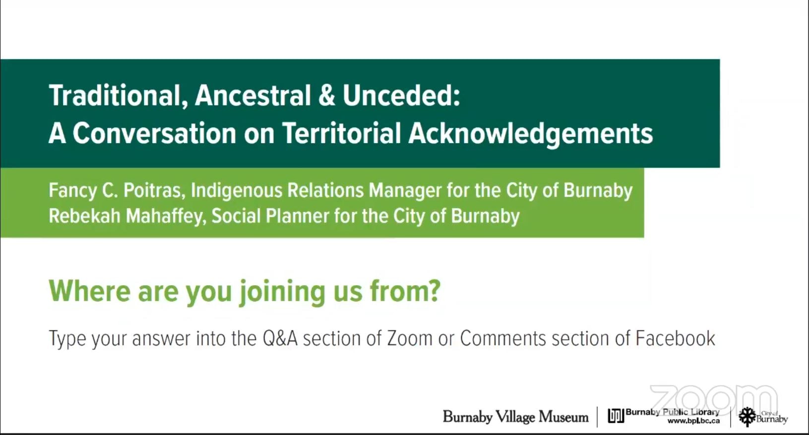
Traditional, Ancestral & Unceded: A Conversation on Territorial Acknowledgements
https://search.heritageburnaby.ca/link/museumdescription15664
- Repository
- Burnaby Village Museum
- Date
- 29 Apr. 2021
- Collection/Fonds
- Burnaby Village Museum fonds
- Description Level
- Item
- Physical Description
- 1 video recording (mp4) (87 min., 17 sec.) : digital, col., sd., stereo ; 29 fps
- Scope and Content
- Item consists of a video recording of a live Zoom webinar hosted by Burnaby Village Museum curator, Jane Lemke. The webinar is titled "Traditional, Ancestral & Unceded: A Conversation on Territorial Acknowledgements" and is presented by Fancy Poitras, Indigenous Relations Manager for the City of Bu…
- Repository
- Burnaby Village Museum
- Collection/Fonds
- Burnaby Village Museum fonds
- Description Level
- Item
- Physical Description
- 1 video recording (mp4) (87 min., 17 sec.) : digital, col., sd., stereo ; 29 fps
- Material Details
- Presenters: Fancy Poitras and Rebekah Mahaffey
- Host: Jane Lemke
- Date of Presentation: Thursday, April 29, 7:00 pm - 8:30 pm
- Total Number of tracks: 1
- Total Length of all tracks: 87 min., 17 sec.
- Recording Device: Zoom video communication platform
- Recording Note: Film was edited from it's original recorded version (95 min., 34 sec.) to edited version (87 min., 17 sec.) for public viewing on Heritage Burnaby. This live recording experienced technical difficulties with the viewer window during the first few minutes of the presentation. This is resolved at 15:36.
- Scope and Content
- Item consists of a video recording of a live Zoom webinar hosted by Burnaby Village Museum curator, Jane Lemke. The webinar is titled "Traditional, Ancestral & Unceded: A Conversation on Territorial Acknowledgements" and is presented by Fancy Poitras, Indigenous Relations Manager for the City of Burnaby and Rebekah Mahaffey, Social Planner for the City of Burnaby. The Zoom webinar is the second in a series of six "Neighbourhood Speaker series" webinars exploring a range of topics shared by Indigenous speakers and knowledge keepers that were presented and made available to the public between April 27 and May 12, 2021. The live webinar was also made available on the Burnaby Village Museum's facebook page. Community members were invited to participate by bringing questions during the interactive online sessions. The webinar opens with host, Jane Lemke providing a Land Acknowlegement "The land on which Burnaby now sits is the ancestral and unceded homelands of the hən̓q̓əmin̓əm and Sḵwx̱wú7mesh speaking peoples". Jane explains that providing a land acknowledgement is part of the City of Burnaby's official policy and that the land is on the shared territory of many Nations including the sq̓əc̓iy̓aɁɬ təməxʷ (Katzie), Kway-quit-lum, Kwantlen, ʷməθkʷəy̓əm (Musqueam), Sḵwx̱wú7mesh, and Tsleil-Waututh Nations. Understanding the definitions of language groups, Nations, shared territory and many of the importance words form a basis of the subject matter for this webinar. Fancy Poitras and Rebekah Mahaffey enter a discussion exploring this topic while posing thought provoking questions to each other. As Burnaby's Indigenous Relations Manager, Fancy Poitras conveys her own experiences and knowledge while providing historical references and recommendations for further educational resources around territorial land acknowledgment. Following their discussion, Fancy and Rebekah take questions from the audience that are moderated by the host, Jane Lemke.
- History
- Fancy Poitras was hired as the City of Burnaby's first Indigenous Relations Manager in 2021. Prior to her role, she worked for the First Nations Health Authority for more than five years, first as a Senior Policy Analyst, then as the Manager and Acting Director of Strategic Policy; throughout her time with FNHA, she worked on an extensive portfolio of health and wellness, and service design and delivery issues, including primary care, cancer, seniors and elders. Fancy has a Master’s degree in Public Policy and a Post-Baccalaureate Diploma in Social Policy Issues from Simon Fraser University, and a Bachelor of Arts in Political Science from University of Alberta. Fancy is a member of Mikisew Cree First Nation, Treaty 8 territory, and she grew up primarily in the Northwest Territories. Rebekah Mahaffey (she, her, hers) is a Social Policy Planner at the City of Burnaby. She is a settler on these lands, and is of mixed French-Scottish-Irish ancestry. She grew up in Indonesia, Libya and England and has called the west coast home for almost 15 years. Rebekah has degrees in International Development, Art History and Urban Planning. In her work she focuses on inter-culturalism, access and inclusion, anti-racism, and working with Burnaby’s 2SLGBTQQIA community. When not at work, she enjoys hiking, reading, and listening to podcasts. She lives in Vancouver with her young child.
- Creator
- Burnaby Village Museum
- Subjects
- Indigenous peoples - British Columbia
- Indigenous peoples - Canada - Government relations
- Indigenous peoples - British Columbia - Languages
- Indigenous peoples - Canada - , Treatment of
- Responsibility
- Lemke, Jane
- Accession Code
- BV021.17.2
- Access Restriction
- No restrictions
- Reproduction Restriction
- No known restrictions
- Date
- 29 Apr. 2021
- Media Type
- Moving Images
- Notes
- Title based on contents of video recording The following links wereshared at the end of the presentation:
- My Conversations with Canadians by Lee Maracle: https://bookhugpress.ca/shop/ebooks/essays-ebooks/conversations-with-canadians-by-lee-maracle/
- 21 Things You May Not Know About the Indian Act by Bob Joseph: https://www.ictinc.ca/books/21-things-you-may-not-know-about-the-indian-act
- CBC documentary series 8th Fire: https://www.cbc.ca/firsthand/blog/8th-fire-wabs-walk-through-history ‘Whose Land’ App: https://apps.apple.com/ca/app/whose-land/id1350310353
- “Unreserved” Podcast, Episode: January 20, 2019, ‘Hayden King’: https://www.cbc.ca/radio/unreserved/redrawing-the-lines-1.4973363/i-regret-it-hayden-king-on-writing-ryerson-university-s-territorial-acknowledgement-1.4973371
- Guidelines for Indigenous Territory Acknowledgement http://www.burnaby.ca/Assets/Burnaby+Interagency/Guidelines+for+Indigenous+Territory+Acknowledgement.pdf
- United Nations Declaration on the Rights of Indigenous Peoples: https://www.un.org/development/desa/indigenouspeoples/declaration-on-the-rights-of-indigenous-peoples.html
- Truth and Reconciliation Commission Calls to Action: http://trc.ca/assets/pdf/Calls_to_Action_English2.pdf
- Missing and Murdered Indigenous Women and Girls Calls for Justice: https://www.mmiwg-ffada.ca/wp-content/uploads/2019/06/Calls_for_Justice.pdf
Images
Video
Traditional, Ancestral & Unceded: A Conversation on Territorial Acknowledgements, 29 Apr. 2021
Traditional, Ancestral & Unceded: A Conversation on Territorial Acknowledgements, 29 Apr. 2021
https://search.heritageburnaby.ca/media/hpo/_Data/_BVM_Moving_Images/2021_0017_0002_002.mp4![Survey and Subdivision plans in New Westminster District Group 1 & Group 2 - Maple Ridge, Surrey, ʷməθkʷəy̓əm (Musqueam), [190-] thumbnail](/media/hpo/_Data/_BVM_Cartographic_Material/1977/1977_0093_0082_001.jpg?width=280)
Survey and Subdivision plans in New Westminster District Group 1 & Group 2 - Maple Ridge, Surrey, ʷməθkʷəy̓əm (Musqueam)
https://search.heritageburnaby.ca/link/museumdescription7051
- Repository
- Burnaby Village Museum
- Date
- [190-]
- Collection/Fonds
- Burnaby Village Museum Map collection
- Description Level
- File
- Physical Description
- 10 plans : graphite and ink on paper and linen; various sizes mounted on 2 sides of cardboard 76 x 102 cm
- Scope and Content
- File consists of a large board with five plans in New Westminster District (Group 1 & Group 2) mounted on one side and five plans in New Westminster District (Group 2) mounted on the other side. Side A: 1.Plan : black ink on paper ; 48.5 x 33 cm. Title reads: "Plan of / The Subdivision of / The /…
- Repository
- Burnaby Village Museum
- Collection/Fonds
- Burnaby Village Museum Map collection
- Description Level
- File
- Physical Description
- 10 plans : graphite and ink on paper and linen; various sizes mounted on 2 sides of cardboard 76 x 102 cm
- Material Details
- Scales vary (One chain equals 792 inches)
- Indexed number on tape on edge of board reads "82"
- Scope and Content
- File consists of a large board with five plans in New Westminster District (Group 1 & Group 2) mounted on one side and five plans in New Westminster District (Group 2) mounted on the other side. Side A: 1.Plan : black ink on paper ; 48.5 x 33 cm. Title reads: "Plan of / The Subdivision of / The / S.E. 1/4 of S.W.1/4 / Sec.35, TP. 2 / N.W.DIST." Scale 200 feet = 1 inch Stamp in red ink on plan reads: "Albert J. Hill, M.A., / Civil Engineer / And / Provincial Land Surveyor, / New Westminster, / B.C." Annotation in blue crayon reads "RB_also Board 81" (Geographic location: Surrey) 2. Plan : black ink on linen ; 40 x 32 cm. Title reads: "Subdivision / of / N.W. 1/4 of Section 19, Group 2 (crossed out to read "Township 2) / New Westminster District , B.C." Sudivision includes lots in Section 19 to the east of Mud Bay Road. Stamp in red ink on plan reads: "Albert J. Hill, M.A., / Civil Engineer / And / Provincial Land Surveyor, / New Westminster, / B.C." Scale: 5 Chains = 1 Inch (Geographic location: Surrey) 3. Plan : graphite on paper ; 37.5 x 21.5 cm. Title reads:"Portion of Lot 51, Group 2, New Westminster District". Scale: 500 feet = 1 inch. (Geographic location: Surrey) 4. Plan : graphite on paper ; 24 x 17 cm. Title reads: "Lot 401, G1" Includes area identified as "Brickyard" Scale: 3 chains = 1 inch. Annotation in blue crayon reads: "Lot 401 GR. 1_RB" (Geographic location: Maple Ridge) 5. Plan : ink on paper ; 58.5 x 36.5 cm. Title reads: "Sketch plan / of / Cloverdale and Vicinity / from Nicomekl River / to McLellan Road". Plan identifies lot owners and land marks as; Robinson, Cloverdale Hotel and station, I.B. Fisher, D.W. McKenzie, A. Milton, T. Shannon, Johnson, O. Gummitt, F. Shannon, Murphy, D. McKenzie, J. Armstrong, W. Bell, R. Ludlow, J. Appel. Includes directional and natural flow of water in ditches and collecting basin. Annotation in blue pencil reads: "Sec. 5 Twp". (Geographic locaiton: Surrey) Side B: 1. Plan : black ink on linen ; 24 x 33 cm. Title reads: "Prop Outfall from River Road" (in blue crayon with initials RB). Plan refers to the proposed outfall of water from River Road to Fraser River and running through Lots 1, 2, B & A. Plan includes route of the proposed bridge approach on the south shore of the Fraser River. (Geographic location: Surrey) 2. Plan : black ink on linen ; 22.5 x 22.5 cm. Title reads: "Plan / of Proposed Outfall / from / River Road / to / Fraser River" Annotation in blue crayon reads: "Prop outfall from River Rd." and is initialed "RB". Scale: 132 feet = 1 inch. (Geographic location: Surrey) 3. Plan : black ink on paper ; 45 x 56 cm. Title reads: "Plan of South Half Sec.18, TP1 / Surrey Municipality". Plan includes subdivision of lots in Section 18, Township 1, bordered by Semiamu Bay [sic] (Semiahmoo Bay) to the west. (Geographic location: Surrey) 4. Plan : black ink on paper ; 45 x 30 cm. Title reads: "Plan of the / Subdivision of the / S.E. 1/4 Sec. 2, TP.7. / N.W.D." Subdivided lots north of the International Boundary are identified with names: "Rodgers, Fish & Hayward and Reid" Scale 5 chains = 1 inch. Stamp in blue ink reads: "I, ALBERT J. HILL / a British Columbia Land Surveyor, certify..." Signed by "Albert J. HIll. B.C.L.S." (Geographic location: Surrey) 5. Plan : black ink on linen ; 22.5 x 22.5 cm. Title reads: "ʷməθkʷəy̓əm (Musqueam) Ind. Res" (in blue crayon). Plan refers to an area of land on the south shore of the Fraser River in District Lot 1, identified as "ʷməθkʷəy̓əm (Musqueam) Indian Reserve" in Group 2, New Westminster District. Scale: I inch = 4 chains (Geographic location: Surrey)
- Creator
- Hill, Albert James
- Names
- ʷməθkʷəy̓əm (Musqueam)
- Accession Code
- HV977.93.82
- Access Restriction
- No restrictions
- Reproduction Restriction
- No known restrictions
- Date
- [190-]
- Media Type
- Cartographic Material
- Scan Resolution
- 600
- Scan Date
- 2023-06-26
- Notes
- Title based on contents of file
Zoomable Images
![Survey and Subdivision plans in New Westminster District Group 1 & Group 2 - Maple Ridge, Surrey, ʷməθkʷəy̓əm (Musqueam), [190-] thumbnail](/media/hpo/_Data/_BVM_Cartographic_Material/1977/1977_0093_0082_003_seadragon/1977_0093_0082_003.jpg?w=280)
Survey and Subdivision plans in New Westminster District Group 1 & Group 2 - Maple Ridge, Surrey, ʷməθkʷəy̓əm (Musqueam), [190-]
Zoom into Image
![Survey and Subdivision plans in New Westminster District, Group 2 - Surrey, ʷməθkʷəy̓əm (Musqueam) Indian Reserve, [190-] thumbnail](/media/hpo/_Data/_BVM_Cartographic_Material/1977/1977_0093_0099_003.jpg?width=280)
Survey and Subdivision plans in New Westminster District, Group 2 - Surrey, ʷməθkʷəy̓əm (Musqueam) Indian Reserve
https://search.heritageburnaby.ca/link/museumdescription7068
- Repository
- Burnaby Village Museum
- Date
- [190-]
- Collection/Fonds
- Burnaby Village Museum Map collection
- Description Level
- File
- Physical Description
- 11 plans : graphite and ink on paper and linen + blueprint ; various sizes mounted on 2 sides of cardboard 76 x 102 cm
- Scope and Content
- File consists of a large board with eleven plans in New Westminster District (Group 2) mounted on one side and five plans in New Westminster District (Group 2) mounted on the other side. Side A: 1. Plan : black ink on linen ; 19.5 x 32 cm. Title reads: "Yale Road / Sec.9 & 10 / B5N R2W" (in blue …
- Repository
- Burnaby Village Museum
- Collection/Fonds
- Burnaby Village Museum Map collection
- Description Level
- File
- Physical Description
- 11 plans : graphite and ink on paper and linen + blueprint ; various sizes mounted on 2 sides of cardboard 76 x 102 cm
- Material Details
- Scales vary (One chain equals 792 inches)
- Indexed number on tape on edge of board reads "99"
- Scope and Content
- File consists of a large board with eleven plans in New Westminster District (Group 2) mounted on one side and five plans in New Westminster District (Group 2) mounted on the other side. Side A: 1. Plan : black ink on linen ; 19.5 x 32 cm. Title reads: "Yale Road / Sec.9 & 10 / B5N R2W" (in blue crayon). Scale: 400 chains = 1 inch. Initals in blue crayon: "RB". Survey plan of Yale Road running through Sections 9 and 10 in New Westminster District, Group 2. (Geographic location: Surrey) 2. Plan : blueprint on paper ; 35.5 x 77.5 cm. Title reads: "Victoria Terminal Railway & Ferry Co. / Plan showing / Proposed Change of Wagon Road through White Rock, B.C" Scale: 400 feet = 1 inch. "H.C. Brice / Engineer in charge / New Westminster, B.C.". February 1906. Signed by "Walter Wilkie B.C.L.S.". Annotation in blue crayon reads: "Sub. of Parts of Sec. 10 & 11 / Tp. 1". Semiahmoo Indian Reserve, Washington Ave., Feb. 1906; 2. Yale Road, Sec.9, 10, B5N R2W, River Rd.; (Geographic location: White Rock) 3. Plan : graphite on paper ; 34 x 94 cm. Title reads: "Tp 7 / NW District" (in graphite) and "Campbell River / in Twp. 7" (in blue crayon). TP7, New Westminster District, Campbell R. in TP4, Coast Meridian, Bamford; (Geographic location: Surrey) Side B: 1. Plan : black ink and col. ink on paper ; 28 x 38.5 cm. Title reads: "G.N.R. / South approach to Wests bridge" (in blue crayon). Scale: 2 chains = 1 inch. Signed by Albert J. Hill, B.C.L.S. Plan covers land in Lot 2, Group 2 and ʷməθkʷəy̓əm (Musqueam) Indian Reserve with approach to bridge running through. (Geographic location: Surrey) 2. Plan : black ink and col. ink on paper ; 26.5 x 44.5 cm. Title reads: "Plan / of / River Frontage / across / Lot 1 BI.N.R.2W. and Lot 6, B.I.N.R.I.W. / N.W.D." Scale: 6 chains = 1 inch. Stamp in red ink reads: "Albert J. Hill, M.A., / Civil Engineer / and / Provincial Land Surveyor, / New Westminster, / B.C." (Geographic location: Surrey) 3. Plan : graphite and ink on paper ; 27 x 44.5 cm. (no formal title) Plan covers area between Yale Road, (north), Quible Road (west) and Townline Road (south). Scale: 4 chains = 1 inch. Signed by Albert J. Hill, B.C.L.S. Annotations in blue crayon read: "also Board 83 / Cancelled" (Geographic location: Surrey) 4. Plan : graphite on paper ; 35.5 x 21.5 cm. Title reads: "Sec 33 B.5N. R2W / see finished drawing Board 125". Initials in blue crayon "RB". Plan certifified by B.C. Provincial Land Surveyor in blue ink "Albert J. Hill". 5. Plan : black ink and col. ink on linen ; 15.5 x 22 cm. Title reads: " Lot 167 Gr. 2" (blue crayon). Scale: 200 feet = 1 inch. Signed by Albert J. Hill, Provincial Land Surveyor. Survey of aarea north of Cloverdale & Guichon Railway with area identified as "Gravel Pit". "Cancelled" in upper left corner of plan. (Geographic location: Surrey) 6. Plan : graphite on paper ; 27 x 27.5 cm. Title reads: "South Half / of / S.W.1/4 Sec.31 TP7 / N.W.D.". Scale: 5 chains = 1 inch. Other title at top of plan reads; "Edward Parr [sic] / Cloverdale". Covers area east of Coast Meridian Road in Section 36. (Geographic location: Surrey) 7. Plan : graphite on paper ; 20.5 x 16 cm. Title reads: "Survey of [sic] Sec. 16, Tp 1[sic] / ..." Other title in blue crayon reads: "N.E. 1/4 Sec. 16 / Twp. 1". (Geographic location: Surrey) 8. Plan : graphite on paper. ; 26.5 x 35 cm. (title is illegible) Plan covers are in New Westminster District, Group 2 along the south shore of the Fraser River. (Geographic location: Surrey)
- Creator
- Hill, Albert James
- Accession Code
- HV977.93.99
- Access Restriction
- No restrictions
- Reproduction Restriction
- No known restrictions
- Date
- [190-]
- Media Type
- Cartographic Material
- Scan Resolution
- 600
- Scan Date
- 2023-06-26
- Notes
- Title based on contents of file
Zoomable Images
![Survey and Subdivision plans in New Westminster District, Group 2 - Surrey, ʷməθkʷəy̓əm (Musqueam) Indian Reserve, [190-] thumbnail](/media/hpo/_Data/_BVM_Cartographic_Material/1977/1977_0093_0099_003_seadragon/1977_0093_0099_003.jpg?w=280)
Survey and Subdivision plans in New Westminster District, Group 2 - Surrey, ʷməθkʷəy̓əm (Musqueam) Indian Reserve, [190-]
Zoom into Image
![Survey and Subdivision plans in New Westminster District Group 2 - Surrey, ʷməθkʷəy̓əm (Musqueam) Indian Reserve, [190-] thumbnail](/media/hpo/_Data/_BVM_Cartographic_Material/1977/1977_0093_0086_001.jpg?width=280)
Survey and Subdivision plans in New Westminster District Group 2 - Surrey, ʷməθkʷəy̓əm (Musqueam) Indian Reserve
https://search.heritageburnaby.ca/link/museumdescription7055
- Repository
- Burnaby Village Museum
- Date
- [190-]
- Collection/Fonds
- Burnaby Village Museum Map collection
- Description Level
- File
- Physical Description
- 12 plans : graphite and ink on paper and linen; various sizes mounted on 2 sides of cardboard 76 x 102 cm
- Scope and Content
- File consists of a large board with twelve plans (six plans mounted on each side). All plans are located in New Westminster District, Group 2, covering geographic areas within Surrey. Side A: 1. Plan : black ink on paper ; 20.5 x 57.5 cm. Title reads: "Extension of Tram Line / Hospital to Distill…
- Repository
- Burnaby Village Museum
- Collection/Fonds
- Burnaby Village Museum Map collection
- Description Level
- File
- Physical Description
- 12 plans : graphite and ink on paper and linen; various sizes mounted on 2 sides of cardboard 76 x 102 cm
- Scope and Content
- File consists of a large board with twelve plans (six plans mounted on each side). All plans are located in New Westminster District, Group 2, covering geographic areas within Surrey. Side A: 1. Plan : black ink on paper ; 20.5 x 57.5 cm. Title reads: "Extension of Tram Line / Hospital to Distillery St." Scales: Hor: 100 feet = 1 inch; Vert: 20 feet = 1 inch. tram line, hospital to distillery street; 2. Plan : black ink on linen ; 55 x 46.5 cm. (no title). Plan covers New Westminster District, Group 2, Lots 1,2, 3,4, A and B and the ʷməθkʷəy̓əm (Musqueam) Indian Reserve (1868).along the south shore of the Fraser River opposite City of New Westminster. Portion of land is highlighted in blue along the west border of the "ʷməθkʷəy̓əm (Musqueam) Indian Reserve" and between Lot 2 and Lot 1 and survey lines identified as "Mohun's Line" and Hill's Line. Stamp in red ink on plan reads: "Albert J. HIll, M.A. / Civil Engineer / and Provincial Land Surveyor / New Westminster / B.C." (Geographic location: Surrey also formerly known as Brownsville) 3. Plan : black ink on paper ; 34.5 x 23 cm. Title reads: "Lot 51, Gr.2" (in blue crayon). Plan covers area in New Westminster, Group 2, District Lot 51, north of Mud Bay with the Victoria Terminal Railway and Great Northern Railway lines identified. (Geographic location: Surrey) 4. Plan : graphite on paper ; 16.5 x 18 cm. Title reads: "Sec.20, B5N R2W" (underlined in blue crayon). Sketch plan covers and area in New Westmninster District, Group 2. Plan includes initials "RB" in blue crayon. Scale: 5 chains = 1 inch (Geographic location: Surrey) 5. Plan : graphite on paper with annotations in black ink ; 17 x 21 cm. Title reads: "N.W.1/4 Sec.12 TP2" (in blue crayon). Plan covers an area in New Westminster District Group 2 in Section 12, south of Bose Road. Identifying land marks include names: "Bose", "Smith" and "Church Land" Scale: 8 chains = 1 inch (Geographic location: Surrey) 6. Plan : graphite on paper ; 38 x 26.5 cm. (no title) Sketch plan covers areas in Lot 1 and Lot 2 with land identified as "Dominion Government". (could be survey for ʷməθkʷəy̓əm (Musqueam) Indian Reserve) (Geographic location: Surrey also formerly known as Brownsville) Side B: 1. Plan: black ink on paper ; 53.5 x 38 cm. Title reads:"Plan of Subdivision / of / Section 27, / Block 5 North, Range 2 West / New Westminster District". Scale: 4 chains = 1 inch. Includes area subdivided into 18 lots, south of Hjorth Road (104th Avenue) and west of Quible Road with Yale Road running through. Note in blue crayon reads: See also Bd.93) (Geographic location: Surrey) 2. Plan : black ink on paper ; 35 x 28 cm. Title reads: "Plan / of / Block A - L387A / Surrey". Scale: 2 chains = 1 inch. Annotaion in blue crayon reads: "Blk A / Lot 387a_Gr. 2". Plan covers New Westminster District Group 2, Block A, Lot 387 A, south of Parsons Slough and east of Latimer Road (192nd Street). Stamp in red ink on plan reads: "Albert J. HIll, M.A. / Civil Engineer / and Provincial Land Surveyor / New Westminster / B.C." (Geographic location: Surrey) 3. Plan : black ink on linen ; 50 x 42 cm. Title reads: Plan / of part of / Campbell River / running through / the South portion / of N.E. 1/4, Section 8, / Tp. 7, East of Coast Meridian / also / Showing location / of Shingle Mill and Dam". Scale: 100 feet = 1 inch. Plan covers the area in New Westminster District, Township 7, Section 8 with Hall's Prairie Road (184th Street) running through and intersecting with Campbell River. Vegetation, buildings, bridge, shingle mill are identified. (Geographic location: Surrey) 5. Plan : black ink on linen ; 21.5 x 16.5 cm. Title reads: "Sec.32, B5N R2W". Scale: 10 chains = 1 inch. Signed by "Albert J. Hill / B.C.L.S. / Dec. 23, 1908". Note on survey reads: "No actual survey / 40 ac. surveyed". (Geographic location: Surrey) 6. Plan : graphite on paper ; 22 x 15.5 cm. Title reads: "Position 'A5' Subjects / by _McKenzie" [Geographic location: Surrey]
- Creator
- Hill, Albert James
- Names
- ʷməθkʷəy̓əm (Musqueam)
- Accession Code
- HV977.93.86
- Access Restriction
- No restrictions
- Reproduction Restriction
- No known restrictions
- Date
- [190-]
- Media Type
- Cartographic Material
- Scan Resolution
- 600
- Scan Date
- 2023-06-26
- Notes
- Title based on contents of file
- Numeric stamp on edge of board reads: "86"
Zoomable Images
![Survey and Subdivision plans in New Westminster District Group 2 - Surrey, ʷməθkʷəy̓əm (Musqueam) Indian Reserve, [190-] thumbnail](/media/hpo/_Data/_BVM_Cartographic_Material/1977/1977_0093_0086_003_seadragon/1977_0093_0086_003.jpg?w=280)
Survey and Subdivision plans in New Westminster District Group 2 - Surrey, ʷməθkʷəy̓əm (Musqueam) Indian Reserve, [190-]
Zoom into Image
![Survey and Subdivision plans in New Westminster District Group 2 - Surrey, ʷməθkʷəy̓əm (Musqueam) Indian Reserve, [190-] thumbnail](/media/hpo/_Data/_BVM_Cartographic_Material/1977/1977_0093_0093_003.jpg?width=280)
Survey and Subdivision plans in New Westminster District Group 2 - Surrey, ʷməθkʷəy̓əm (Musqueam) Indian Reserve
https://search.heritageburnaby.ca/link/museumdescription7062
- Repository
- Burnaby Village Museum
- Date
- [190-]
- Collection/Fonds
- Burnaby Village Museum Map collection
- Description Level
- File
- Physical Description
- 10 plans : blueprints on paper ; various sizes mounted on 2 sides of cardboard 76 x 102 cm
- Scope and Content
- File consists of a large board with ten plans (5 plans mounted on each side). All plans are located in New Westminster District, Group 2, covering geographic areas within Surrey. Side A: 1. Plan : blueprint on paper ; 57 x 33 cm. Title reads: "Plan / of the Subdivision of / Block 23 / in / Sec. 3…
- Repository
- Burnaby Village Museum
- Collection/Fonds
- Burnaby Village Museum Map collection
- Description Level
- File
- Physical Description
- 10 plans : blueprints on paper ; various sizes mounted on 2 sides of cardboard 76 x 102 cm
- Material Details
- Scales vary (One chain equals 792 inches)
- Indexed number on tape on edge of board reads "93"
- Scope and Content
- File consists of a large board with ten plans (5 plans mounted on each side). All plans are located in New Westminster District, Group 2, covering geographic areas within Surrey. Side A: 1. Plan : blueprint on paper ; 57 x 33 cm. Title reads: "Plan / of the Subdivision of / Block 23 / in / Sec. 31 B5N R2W / N.W. Dist." Located in New Westminster District Group 2. Scale; 40 feet = 1 inch. Signed by Albert J. Hill, Provincial Land Surveyor. Subdivision plan covers land in Block 23 of Section 31 (New Westminster District, Group 2) south of Albert Street, north of Surrey Street and west of Fourth Avenue. (Geographic location: Surrey) 2. Plan : blueprint on paper ; 38.5 59.5 cm. Title reads: "Plan / of ʷməθkʷəy̓əm (Musqueam) Indian Reserve / And / Right-of-Way / for / Bridge Approach". Scale: 100 feet = 1 inch. Signed by Albert J. Hill, Provincial Land Surveyor, June 28, 1902. Plan covers the location of the ʷməθkʷəy̓əm (Musqueam) Indian Reserve in New Westminster District, Group 2, Lot 1 on the south shore of the Fraser River situated between lots owned by Herring (Lot B) and F. Clarke. Plan includes locations of buildings on F. Clarke's property and also includes the location of Roman Catholic Church located on ʷməθkʷəy̓əm (Musqueam) Indian Reserve. (Geographic location: Surrey) 3. Plan : blueprint on paper ; 26 x 35.5 cm. Title reads: "Section 35_B.5N._R.2W". Plan covers areas of land in Section 35 bordered by Section 36 and Section 26 in New Westminster District Group 2 (plan appears to be reversed with Section 26 to the north and Section 35 to the south). Yale Wagon Road is identified running through Section 35. 4. Plan : blueprint on paper ; 21 x 37.5 cm. Title reads: "Traverse of the Water Line / in front of / Lots 3 and 4 Group 2 / N.W.D. / with G.N. Railway Rt. of Way". Scale: 100 feet = 1 inch. Signed by Albert J. Hill, B.C. Land Surveyor. Plan covers the location of the water line with the Great Northern Railway Right of Way within New Westminster District, Group 2, Lots 3 and 4 on the south shore of the Fraser River. (Geographic location: Surrey) 5. Plan : blueprint on paper ; 75 x 52.5 cm. Title reads: "Plan / of Block 7 and 8 / of the / 5 W.1/4 Sec.6, TWP. 7 / N.W.D.". Scale: 1/12 chains = 1 inch. Annotation in red crayon reads "see Boards 85 & 207".Signed by Albert J. Hill, B.C. Land Surveyor. The plan is bordered by "O'Connell Street" to the north, "Columbia Avenue" to the west, "Westland Row" to the east and the International Boundary to the south. (Geographic location: Surrey) Side B: 1. Plan : blueprint on paper ; 60 x 39.5 cm. Title reads: "Plan / of Subdivision 'B' / of Section 20 / B5N R2W / New Westminster Distr." Scale: 2 chains = 1 inch. Signed by Albert J. Hill, B.C. Land Surveyor. Plan covers subdivision "B" in Section 20, New Westminster District, Group 2. (Geographic location: Surrey) 2. Plan : blueprint on paper ; 42 x 29.5 cm. Title reads: "Section 32, / Township 8, / New Westminster District". Scale 10 chains = 1 inch. Lot owners are identified as; Childs, Thompson, Gordon and Layfield bordered by Clover Valley Road to the west and Hall's Prairie Road to the east and Township Line Road and Lot 121 and Lot 99 to the north. Note in blue crayon reads: "also Board 80" (Geographic location: Surrey) 3. Plan : blueprint on paper ; 18 x 21 cm. Title reads: "N.E.1/4 Sec.21 / TP1". Ceritified by Albert J. Hill, B.C. Land Surveyor. Includes property identified as "Mr. Feedham". (Geographic location: Surrey) 4. Plan : blueprint on paper ; 27 x 19 cm. Title in blue crayon reads: "Sec 25 B5N. R3W / also see Board 91". Scale: 4 chaines = 1 inch. Signed by Albert J. Hill, B.C. Land Surveyor. Survey area includes land north of the intersection of Ladner Road and Scott Road. (Geographic location: Surrey) 5. Plan : blueprint on paper ; 53 x 34 cm. Title reads: "Plan of Subdivision / of / Section 27, / Block 5 North, Range 2 West, / New Westminster District". Scale: 4 chains - 1 inch. Signed by Albert J. Hill, Provincial Land Surveyor, [August 13, 1900]. Property in Section 27 bordered by Hjorth Road to the north, Quible Road to the east and Yale Road to the south. (Geographic location: Surrey)
- Creator
- Hill, Albert James
- Names
- ʷməθkʷəy̓əm (Musqueam)
- Accession Code
- HV977.93.93
- Access Restriction
- No restrictions
- Reproduction Restriction
- No known restrictions
- Date
- [190-]
- Media Type
- Cartographic Material
- Scan Resolution
- 600
- Scan Date
- 2023-06-26
- Notes
- Title based on contents of file
Zoomable Images
![Survey and Subdivision plans in New Westminster District Group 2 - Surrey, ʷməθkʷəy̓əm (Musqueam) Indian Reserve, [190-] thumbnail](/media/hpo/_Data/_BVM_Cartographic_Material/1977/1977_0093_0093_003_seadragon/1977_0093_0093_003.jpg?w=280)
Survey and Subdivision plans in New Westminster District Group 2 - Surrey, ʷməθkʷəy̓əm (Musqueam) Indian Reserve, [190-]
Zoom into Image
![Survey and Subdivision plans in New Westminster District Group 1 & Group 2 - Burnaby, Port Moody, Coquitlam, Mission and Map of Port Simpson Harbour, [190-] thumbnail](/media/hpo/_Data/_BVM_Cartographic_Material/1977/1977_0093_0111_001.jpg?width=280)
Survey and Subdivision plans in New Westminster District Group 1 & Group 2 - Burnaby, Port Moody, Coquitlam, Mission and Map of Port Simpson Harbour
https://search.heritageburnaby.ca/link/museumdescription7080
- Repository
- Burnaby Village Museum
- Date
- [190-]
- Collection/Fonds
- Burnaby Village Museum Map collection
- Description Level
- File
- Physical Description
- 9 plans : 3 plans : blueprint ink on paper + 4 plans : black ink and graphite on linen + 2 plans : graphite on paper mounted on 2 sides of cardboard 76 x 102 cm
- Scope and Content
- File consists of a large board with five plans in New Westminster District, Group 1 mounted on one side and three plans in New Westminster District, Group 1 and a map of Port Simpson Harbour mounted on the other side. Side A: 1. Plan: blueprint on paper ; 30 x 20 cm. Title reads: "Plan of / Subdi…
- Repository
- Burnaby Village Museum
- Collection/Fonds
- Burnaby Village Museum Map collection
- Description Level
- File
- Physical Description
- 9 plans : 3 plans : blueprint ink on paper + 4 plans : black ink and graphite on linen + 2 plans : graphite on paper mounted on 2 sides of cardboard 76 x 102 cm
- Material Details
- Scales vary (One chain equals 792 inches)
- Indexed number on tape on edge of board reads "111"
- Scope and Content
- File consists of a large board with five plans in New Westminster District, Group 1 mounted on one side and three plans in New Westminster District, Group 1 and a map of Port Simpson Harbour mounted on the other side. Side A: 1. Plan: blueprint on paper ; 30 x 20 cm. Title reads: "Plan of / Subdivision of Part of D.L.172.GR.I.N.W.D." Scale: 200 feet = 1inch. dated, Feb.22, 1908, signed by land surveyor "Noel Humphreys" (Geographic location: District Lot 172, Burnaby) 2. Plan : graphite and blue crayon on paper ; 21.5 x 22 cm. Title in blue crayon reads: "N.E.1/4 & NW 1/4 Sec.25 / Tp 18". Scale: 10 chains=1 inch (Geographic location: Mission) 3. Plan : graphite on paper ; 31.5 x 16 cm. Title in blue crayon reads: "Lot 350_ Gr.1" with initials "RB". Scale : 3 chains = 1 inch. (Geographic location: Port Moody) 4. Plan ; graphite on linen ; 40 x 54 cm. Title in blue crayon reads: "Lot 190_Gr.1" with initials "RB". Plan covers area in Lot 190 including streets identified as; McInness Street, First Street, Second Street, Third Street, Fourth Street running through District Lot. (Geographic location: Port Moody) 5. Plan: blueprint on paper ; 50.5 x 57.5 cm. Title reads: "Plan of / T.F. Sinclair's Quarry Site. / SituateOnPittRiver.Sec.122T.P.40. / East of Coast Mer." Scale: 5 chains = 1inch. dated June 30 1908 [sic] Plan covers site of T.F. Sinclair's quarry in Section 22 of Township 40 on the shore of Pitt River. (Geographic location: Coquitlam ) Side B: 1. Map : blueprint on paper ; 50 x 38 cm. Scale: 40 chains - 1 inch. Title reads: "Map of Land on / Port Simpson Harbor". Scale : 40 chains = 1 inch Map covers subdivided land on the North Coast of British Columbia on the Tsimpsean Pennisula bordered by water identified as "Work Channel" to the west, "Port Simpson Harbour" to the east and land identified as "Indian Reserve" [Lax Kw'alaams] to the south. Names of property owners are identified in subdivided sections and area of land along the shore of "Work Channel" is identified as "Goverment Reserve". Blueprint includes inset "Key Map" with location of Port Simpson Harbour and Tsimpean Pennisula on the North Coast of British Columbia. 2. Plan : graphite on linen ; 24.5 x 46 cm. Title reads: "Portion of Lot 470 / Group 1" Scale : 2 chains = 1 inch. Plan covers a subdivided portion of District Lot 470, New Westminster District, Group 1 with streets identified as; "Pleasant Street", "Metta Street" and "Clarence Street". (Geographic location: Port Moody) 3. Plan : black ink on linen ; 40 x 30.5 cm. Title reads: "Plan / of / A Portion of the Foreshore / of / Lot 201 GR.2 / N.W.D. / Showing / Mill-Site". Scale : 100 feet = 1 inch. Plan is stamped in red ink: "Albert J. Hill, M.A., / Civil Engineer / And / Provincial Land Surveyor, / New Westminster, / B.C.". Survey notes in black ink read: "Surveyed Oct 9th 1908 for Messrs. / Roe & Abernathy and plan (duplicate / of this one) sent Oct. 8th / G.K. Burnett". (Geographic location : Port Moody) 4. Plan : black and red ink on line ; 63 x 29.5 cm. Title reads: "Port Moody / Butchard's Property". Scale : 200 feet = 1 inch. Plan covers subdivided lot into 16 parcels numbered I to XVI along the north shore of Burrard Inlet in Port Moody. Streets are identified as; George Street, Bruce Street, Norval Street, Nora Street, Elm Street, Pine Street, Orr Street and Orchard Street. Roads are identified as; West Road and East Road. (Geographic location : Port Moody)
- Creator
- Hill, Albert James
- Accession Code
- HV977.93.111
- Access Restriction
- No restrictions
- Reproduction Restriction
- No known restrictions
- Date
- [190-]
- Media Type
- Cartographic Material
- Scan Resolution
- 600
- Scan Date
- 2023-06-26
- Notes
- Title based on contents of file
Zoomable Images
![Survey and Subdivision plans in New Westminster District Group 1 & Group 2 - Burnaby, Port Moody, Coquitlam, Mission and Map of Port Simpson Harbour, [190-] thumbnail](/media/hpo/_Data/_BVM_Cartographic_Material/1977/1977_0093_0111_003_seadragon/1977_0093_0111_003.jpg?w=280)
Survey and Subdivision plans in New Westminster District Group 1 & Group 2 - Burnaby, Port Moody, Coquitlam, Mission and Map of Port Simpson Harbour, [190-]
Zoom into Image
![Survey plans in New Westminster District Group 1 - Maple Ridge, Pitt Meadows, [190-] thumbnail](/media/hpo/_Data/_BVM_Cartographic_Material/1977/1977_0093_0105_001.jpg?width=280)
Survey plans in New Westminster District Group 1 - Maple Ridge, Pitt Meadows
https://search.heritageburnaby.ca/link/museumdescription7074
- Repository
- Burnaby Village Museum
- Date
- [190-]
- Collection/Fonds
- Burnaby Village Museum Map collection
- Description Level
- File
- Physical Description
- 6 plans : graphite and ink on paper and linen; various sizes mounted on 2 sides of cardboard 76 x 102 cm
- Scope and Content
- File consists of a large board with three plans mounted on one side and two on the other side. All plans are located in New Westminster District, Group 2, covering geographic areas within Maple Ridge and Pitt Meadows. Side A: 1. Plan : black ink on linen ; 34 x 86 cm. Title reads: "Survey / of / …
- Repository
- Burnaby Village Museum
- Collection/Fonds
- Burnaby Village Museum Map collection
- Description Level
- File
- Physical Description
- 6 plans : graphite and ink on paper and linen; various sizes mounted on 2 sides of cardboard 76 x 102 cm
- Material Details
- Scales vary (One chain equals 792 inches)
- Indexed number on tape on edge of board reads "105"
- Scope and Content
- File consists of a large board with three plans mounted on one side and two on the other side. All plans are located in New Westminster District, Group 2, covering geographic areas within Maple Ridge and Pitt Meadows. Side A: 1. Plan : black ink on linen ; 34 x 86 cm. Title reads: "Survey / of / Dyke and Waterfront / Sec's 9, 10, 11, 13 & 14 / B5N R1E". Scale: 400 feet = 1 inch. Stamp in red ink on plan reads: "Albert J. Hill, M.A., / Civil Engineer / And / Provincial Land Surveyor, / New Westminster, / B.C." (Geographic location: Pitt Meadows) 2. 2 plans : black ink and graphite on paper ; 34.5 x 51 cm. Titles read: "Survey / For Highway / in / Section 4, Township 15, / New Westminster District. / For Maple Ridge Council." and "Survey / for Highway / in / Section 5, Tp. 15, / New Westminster Dist. / For Maple Ridge Council." Survey plan in Section 5, Township 15, covers SW quarter of Sec. 5, Tp. 15 with "Indian Reserve" (Whonnock Indian Reserve No. 1 - Kwantlen First Nation) identified. Stamp in red ink on plan reads: "Albert J. Hill, M.A., / Civil Engineer / And / Provincial Land Surveyor, / New Westminster, / B.C." Scales vary per drawing: 4 chains = 1 inch and 2 chains = 1 inch. (Geographic location: Maple Ridge) 3. Plan, black ink and graphite on paper ; 41 x 34 cm. Title reads: "Plan / of Subdivision / of / Fractional S.E. Quarter / of Sec. 6, TP. 15 / New Westminster District". Scale: 4 chains = 1 inch tamp in red ink on plan reads: "Albert J. Hill, M.A., / Civil Engineer / And / Provincial Land Surveyor, / New Westminster, / B.C." . Annotation in blue crayon reads: "also Board 122. (Geographic location: Maple Ridge) Side B: 1. Plan : black ink and col. red ink on linen ; 25.5 x 16 cm. Title reads: "Plan of Survey in Lot 398 Gr. 1 / For Lougheed & Abernathy". Scale: 3 chains = 1 inch. Plan is signed by "G.K. Burnett" September 25, 1907. (Geographic location: Maple Ridge) 2. Plan : graphite on paper with annotations in blue ; 91 x 67 cm. Title on survey plan reads: "Lot 441, 439, 438, 440, Gr. 1 / Showing bank of Stave River" (in blue crayon). Survey plan includes lot numbers and identifies "Indian Reserve" (Whonnock Indian Reserve No. 1 - Kwantlen First Nation) (Geographic location: Maple Ridge)
- Accession Code
- HV977.93.105
- Access Restriction
- No restrictions
- Reproduction Restriction
- No known restrictions
- Date
- [190-]
- Media Type
- Cartographic Material
- Scan Resolution
- 600
- Scan Date
- 2023-06-26
- Notes
- Title based on contents of file
Zoomable Images
![Survey plans in New Westminster District Group 1 - Maple Ridge, Pitt Meadows, [190-] thumbnail](/media/hpo/_Data/_BVM_Cartographic_Material/1977/1977_0093_0105_003_seadragon/1977_0093_0105_003.jpg?w=280)
Survey plans in New Westminster District Group 1 - Maple Ridge, Pitt Meadows, [190-]
Zoom into Image
![Survey and Subdivision plans in New Westminster District Group 2 - Surrey, Delta
, [1898-1910] thumbnail](/media/hpo/_Data/_BVM_Cartographic_Material/1977/1977_0093_0078_001.jpg?width=280)
Survey and Subdivision plans in New Westminster District Group 2 - Surrey, Delta
https://search.heritageburnaby.ca/link/museumdescription7047
- Repository
- Burnaby Village Museum
- Date
- [1898-1910]
- Collection/Fonds
- Burnaby Village Museum Map collection
- Description Level
- File
- Physical Description
- 10 plans : graphite and ink on paper and linen; various sizes mounted on 2 sides of cardboard 76 x 102 cm
- Scope and Content
- File consists of a large board with four plans in New Westminster District mounted on one side and six plans mounted on the other side. Side A: 1. Plan : black ink on paper with colour (no formal title). Plan covers area in New Westminster District, Group 2 situated along the south shore of the …
- Repository
- Burnaby Village Museum
- Collection/Fonds
- Burnaby Village Museum Map collection
- Description Level
- File
- Physical Description
- 10 plans : graphite and ink on paper and linen; various sizes mounted on 2 sides of cardboard 76 x 102 cm
- Material Details
- Scales vary
- Indexed number on tape on edge of board reads "78"
- Scope and Content
- File consists of a large board with four plans in New Westminster District mounted on one side and six plans mounted on the other side. Side A: 1. Plan : black ink on paper with colour (no formal title). Plan covers area in New Westminster District, Group 2 situated along the south shore of the Fraser River identified as "Indian Reserve / Turner 1868" situated in District Lot 1 between District Lot 2 identified as "Mohun's Line" and "Herring's Line" bordered by lots B and A. Includes note "see plan of subdivision of Lots 3 & 4 Gr. 2". (Geographic location: Surrey) 2. Plan : graphite on paper ; Title reads: "B5N R2W, Sec.26_Sec. 28 / Sec. 35_Sec.36". Plan covers a 60 acre parcel in Sec. 35 with Yale wagon road to the south. Scale: 6 chains = 1 inch (Geographic location: Surrey) 3. Plan : black ink on paper ; Title reads: "Survey for Proposed Highway in Indian Reserve Surrey". Plan covers area of land to the northwest of Lot 2 along the shore of the Fraser River and identfies route of proposed highway, proposed tramway as well at the Great Northern Railway and bridge. Scale: 2 chains = 1 inch 4. Plan : black ink on red lined graphing paper ; Title reads: "Sketch Plan Showing Section of Great Northern R. of W. at Point of Crossing of Proposed Ditch". Plan covers area of Lot 2 in New Westminster District, Group 2. (Surrey) Scale: 1 inch = 5 feet. (Geographic location: Surrey) Side B: 1. Plan : black ink on paper ; Title reads: "Plan of Subdivision of a Portion of Section 13, TP2, Surrey Municipality, New Westminster District, B.C.". Plan covers land bordered by Coast Meridian Road (to the east), Bose Road (to the south) and Pike Road (to the west). Surveyed for D.S. Bayners, Nov. 24, 1908. Scale: 5 chains= 1 inch 2. Plan : black ink on linen with colour ; Title reads: "Traverse of the Waterline in front of Lots 3 and 4, Group 2, New Westminster District with G.N. Railway Right of Way". Plan covers area along the southern shore of the Fraser River with a road crossing the Great Northern Railway and leading to a wharf. Scale: 100 feet = 1 inch (Geographic location: Surrey) 3. Plan : black ink on paper ; Title reads: "Survey of the South Boundary of Sec. 12, Township 2, New Westminster District". Plan covers area south of Bose Road and west of Coast Meridean Road and north of McClellen Road. Scale: 400 feet = 1 inch. Sec.12 (Geographic location: Surrey) 4. Plan : graphite on paper ; Title reads: "Plan of Subdivisioin of a part of S.E. 1/4 of Sec. 7, TP 8". Plan covers area of Section 7 in New Westminster District, Group 2, Township 8. Streets are identified running through lot including, Langley Ave., Robinson Ave, Melrose Ave., Hawthorne Ave., Broadway, Bond Ave., Mable Ave., Breene Ave. and McLelland Ave. and Clover Valley Road. Scale: 200 feet = 1 inch. Note in black ink reads: See Bd. 166 for blue print. (Geographic location: Surrey) 5. Plan : graphite on linen ; Title reads: "Sec.20, B5N R2W". Plan covers area north of Yale Road and is subdivided into parts identified as A, B, C, D, E, and unknown. (Geographic location: Surrey) 6. Plan : black ink and graphite on paper ; (no formal title) Plan covers lots surveyed along Ladner Road identified as A, B and Lots 13, 12 and 11. [Geographic location: Delta]
- Accession Code
- HV977.93.78
- Access Restriction
- No restrictions
- Reproduction Restriction
- No known restrictions
- Date
- [1898-1910]
- Media Type
- Cartographic Material
- Scan Resolution
- 600
- Scan Date
- 2023-06-26
- Notes
- Title based on contents of file
- Note re plans 1A & 3A: The sight of Brownsville was also the former site of the Qayqayt First Nation and one of the main summer villages of the Kwantlen and ʷməθkʷəy̓əm (Musqueam) peoples
- Scale is measured in chains and feet. (One chain equals 792 inches)
Zoomable Images
![Survey and Subdivision plans in New Westminster District Group 2 - Surrey, Delta
, [1898-1910] thumbnail](/media/hpo/_Data/_BVM_Cartographic_Material/1977/1977_0093_0078_003_seadragon/1977_0093_0078_003.jpg?w=280)
Survey and Subdivision plans in New Westminster District Group 2 - Surrey, Delta , [1898-1910]
Zoom into Image
B.C. Transit Centennial: Chilliwack and Fraser Valley Way Points
https://search.heritageburnaby.ca/link/museumdescription10100
- Repository
- Burnaby Village Museum
- Date
- 1990
- Collection/Fonds
- Burnaby Village Museum Film and Video collection
- Description Level
- Item
- Physical Description
- 1 videocassette (2 hr., 3 min., 4 sec.) : VHS, 29 fps, col., sd., stereo
- Scope and Content
- Historical film excerpts of B.C. Electric Lower Mainland trams on their various routes as well as an excursion train shot by Ken Hodgson in 1948/1949 and in 1950. Film footage is part of the B.C. Transit Centennial and includes a voice over commentary by Frank Horne and Vic Sharman. Frank and Vic w…
- Repository
- Burnaby Village Museum
- Collection/Fonds
- Burnaby Village Museum Film and Video collection
- Description Level
- Item
- Physical Description
- 1 videocassette (2 hr., 3 min., 4 sec.) : VHS, 29 fps, col., sd., stereo
- Material Details
- VHS video tape in slip case "1950 / BCE Rail Archives / Burn. Lake / Central Park / Oak-Marpole / Skagit / Tourist Ride Chilliwack" hand written on label.
- "Railway Pictures Inc." "Chilliwack and Fraser Valley Way Points"- Directed and Produced by Ken Hodgson
- Opening title card on film excerpt reads: "GASTOWN POST & TRANSFER / B.C. TRANSIT CENTENNIAL / "BURNABY LAKE" / COLOURIST: Al / ASSISTANT"
- Scope and Content
- Historical film excerpts of B.C. Electric Lower Mainland trams on their various routes as well as an excursion train shot by Ken Hodgson in 1948/1949 and in 1950. Film footage is part of the B.C. Transit Centennial and includes a voice over commentary by Frank Horne and Vic Sharman. Frank and Vic worked as motormen on the BC Electric Railway. The trams are shown travelling through Vancouver, Burnaby, New Westminster, Surrey, North Delta, Langley, Abbotsford, and Chilliwack. The excursion train was filmed in Washington State, U.S.A. The narrators give commentary, describing the routes, landmarks of the past and present, the various kinds of trams and buses seen, drivers’ protocols, and historical information. Summary: 0:00 – 16:18: Title card reads "Gastown Post & Transfer" "BC Transit / Transit Centennial" "Burnaby Lake". Footage of a Burnaby Lake Line tram from the Carrall Street depot in Vancouver to the Sapperton terminus, New Westminster. 16:18 – 30:20: Title card reads "Gastown Post & Transfer" "BC Transit / Transit Centennial" "Central Park". Footage of a Central Park Line tram from the New Westminster depot to the Carrall Street depot. 30:20 - 40:53: Title card reads "Gastown Post & Transfer" "BC Transit / Transit Centennial" "Oak St. Line". Footage of an Oak St. Line tram from Victory Square to the Marpole terminus. 40:53 – 49:41:Title card reads "Gastown Post & Transfer" "BC Transit / Transit Centennial" "Fairview Belt Line 1". Although the title card reads “Fairview Belt Line 1”, this is an observation car from the intersection of Cambie and Hastings Streets to the Dunbar terminus and back to Victory Square by way of Granville Street. 49:41 – 57:34: Title card reads "Gastown Post & Transfer" "Skagit River Railway". Footage of Skagit River Railway, Washington, U.S.A., from Newhalem to the Diablo Dam powerhouse and lift, then to the boat which crossed the lake to Ross Dam 57:34 – 1:12:54: the title card reads “Observation Car Trip” but this is a Fairview Belt Line tram on the outer line run, from Broadway and Main on a complete loop through downtown. 1:12:54 – 1:15:49: Title reads: "Railway Pictures Inc." "Chilliwack and Fraser Valley Way Points" with voice over by Frank Horne and Vic Sharman, directed and produced by Ken Hodgson. Opens with Vic Sharman, his wife and family at Liverpool Old Station (Scott Road) preparing for the last trip on the Chilliwack Line October, 1950. The last Fraser Valley Line tram from Vancouver meets the last tram from Chilliwack in Langley for the last-day-of-service ceremony, October 1, 1950 1:15:49 – 1:56:10: Footage of a Fraser Valley line tram from the Carrall Street depot, leaving in sections which meet at the New Westminster depot and continue on together to Chilliwack Depot, then return to New Westminster. 1:56:10 – 2:03:04: Footage of decommissioning of the system: removal of the tram power lines, scrapping and burning of tram cars at the Kitsilano yard.
- History
- Film footage shot in 1948 -1949 and 1950 and voice-over recorded in 1990. The end-of-service ceremony film is dated October 1, 1950.
- Creator
- Hodgson, Kenneth A. "Ken"
- Publisher
- Railway Pictures Incorporated
- Accession Code
- BV012.37.12
- Access Restriction
- No restrictions
- Reproduction Restriction
- May be restricted by third party rights
- Date
- 1990
- Media Type
- Moving Images
- Related Material
- See also BV020.5.1060
- Notes
- Title based on contents of film
- Other organizations participated in the filming of the footage: B.C. Transit and Gastown Post & Transfer.
- Film is narrated by Frank Horn and Vic Sharman
- VHS is a copy created from original excerpts
Images
Video
B.C. Transit Centennial: Chilliwack and Fraser Valley Way Points, 1990
B.C. Transit Centennial: Chilliwack and Fraser Valley Way Points, 1990
https://search.heritageburnaby.ca/media/hpo/_Data/_BVM_Moving_Images/2012_0037_0012_001.mp4![Survey and Subdivision plans in New Westminster District Group 1 & Group 2 - Port Moody, Surrey
, [1898-1910] thumbnail](/media/hpo/_Data/_BVM_Cartographic_Material/1977/1977_0093_0073_001.jpg?width=280)
Survey and Subdivision plans in New Westminster District Group 1 & Group 2 - Port Moody, Surrey
https://search.heritageburnaby.ca/link/museumdescription7042
- Repository
- Burnaby Village Museum
- Date
- [1898-1910]
- Collection/Fonds
- Burnaby Village Museum Map collection
- Description Level
- File
- Physical Description
- 10 plans : graphite and ink on paper and linen; various sizes mounted on 2 sides of cardboard 76 x 102 cm
- Scope and Content
- File consists of a large board with four plans in New Westminster District mounted on one side and six plans mounted on the other side. Side A: 1. Plan : black ink and graphite on paper ; 46.5 x 37.5 cm. Title reads: "Bon Accord Hatchery / Sec 6 B5N R1W". Signed by Albert J. Hill P.L.S. August 1…
- Repository
- Burnaby Village Museum
- Collection/Fonds
- Burnaby Village Museum Map collection
- Description Level
- File
- Physical Description
- 10 plans : graphite and ink on paper and linen; various sizes mounted on 2 sides of cardboard 76 x 102 cm
- Material Details
- Scales vary (One chain equals 792 inches)
- Indexed number on tape on edge of board reads "73"
- Scope and Content
- File consists of a large board with four plans in New Westminster District mounted on one side and six plans mounted on the other side. Side A: 1. Plan : black ink and graphite on paper ; 46.5 x 37.5 cm. Title reads: "Bon Accord Hatchery / Sec 6 B5N R1W". Signed by Albert J. Hill P.L.S. August 12, 1903. Plan covers land identified as Section 6, Section 7, Located along the south shore of the Fraser River in Port Mann (Geographic location: Surrey). 2. Plan : black ink and graphite on paper ; 36 x 31 cm. Title reads: "Survey of Portions of Sec. 20 B5N R2W". Plan is stamped in red ink: "Albert J. Hill, Civil Engineer". Scale 4 chains = 1 inch. 3. Plan : black ink on linen ; 14 x 23 cm. Title reads:"Port Moody". Plan covers sections in Lot 191 (District Lot 191) bordered by Burrard Inlet to the west and Lot 235 and Lot 233 to the south. Streets identified include Water Street, Beauregard Street, Yonge Street, Clinton Street and Oxford Street. 4. Plan: graphite and ink on paper ; 43.5 x 64.5 cm. Title reads: "Sketch Plan Approved by Council [sic] / _[sic]1898". (No identifying geographic landmarks provided) Side B: 1. Plan : graphite on paper ; 53.5 x 31 cm. Title reads: "Plan of Lot 13, Gr. II, N.W. Dist". Sketch plan covers area along the Fraser River in District Lot 13, New Westminster District, Group 2. District Lot 13 is bordered by District Lot 14 (to the west) and Lot 12 (to the east). Natural geographic features within District Lot 13 are noted as "dense brush and fallen timber / sallal / rough spruce and cedar / swamp / fine alder / sallal / fine alder bottom land / fine brook". Scale: 3 chains = 1 inch (Geographic location: Surrey) 2. Plan : black ink on paper ; 50.5 x 34.5 cm. Title reads: "Indian Reserve / Opposite / New Westminster". Plan covers area on the south shore of the Fraser River in New Westminster District Group 2 in an area known as Brownsville. Lots are identified as District Lots 1, 2, 3, 4, 18, 17 and 8 and Sections A and B. Two areas of land are noted as "Indian Reserve"; one 6.3 acre parcel and one 104.25 acre parcel, both within District Lot 1. Note on plan reads: "N.B. this plan shows reserves and adjacent properties as they are on the ground". (Geographic location: Surrey) 3. Plan : black and col. ink on paper ; 19.5 x 31.5 cm. Title reads: "Bon Accord Road". Plan shows elevation. "Average section 10 feet = 1 inch". Plan is stamped in red ink: "Albert J. Hill, Civil Engineer and Provincial Land Surveyor, New Westminster, B.C." (Geographic location: Surrey) 4. Plan : black and col. ink on linen ; 16.5 x 25.5 cm. (no formal title) Plan covers area of Section 35, south of Yale Wagon Road and east of Quible Road. Plan is signed by "Albert J. Hill / B.C.L.S." (Geographic location: Surrey) 5. Plan: black and col. ink on linen ; 22.5 x 22.5 cm. (no formal title) Plan covers area between Yale Road and Townline Road in Surrey. Scale: 4 chains = 1 inch. Plan is signed by Albert J. Hill B.C.L.S. [190-] (Geographic location: Surrey) 6. Plan : graphite on paper ; 24 x 54 cm. (no formal title) Plan covers sectioned areas along Bon Accord Road. Sections are identified as " Sec. 8 / T.F. Patterson"; "Sec. 9 / Russell"; "Elliott_Burnett_Crean / Sec. 16"; "Dom. Govt. / Sec. 17". (Geographic location: Surrey, beneath the Port Mann bridge)
- Names
- ʷməθkʷəy̓əm (Musqueam)
- Accession Code
- HV977.93.73
- Access Restriction
- No restrictions
- Reproduction Restriction
- No known restrictions
- Date
- [1898-1910]
- Media Type
- Cartographic Material
- Scan Resolution
- 600
- Scan Date
- 2023-06-26
- Notes
- Title based on contents of file
- Note re plan 2B: The sight of Brownsville was also the former site of the Qayqayt First Nation and one of the main summer villages of the Kwantlen and ʷməθkʷəy̓əm (Musqueam) peoples
Zoomable Images
![Survey and Subdivision plans in New Westminster District Group 1 & Group 2 - Port Moody, Surrey
, [1898-1910] thumbnail](/media/hpo/_Data/_BVM_Cartographic_Material/1977/1977_0093_0073_003_seadragon/1977_0093_0073_003.jpg?w=280)
Survey and Subdivision plans in New Westminster District Group 1 & Group 2 - Port Moody, Surrey , [1898-1910]
Zoom into Image
![Survey and Subdivision plans in New Westminster District Group 1 and Group 2 – Vancouver, ʷməθkʷəy̓əm (Musqueam) Indian Reserve, Burnaby, Surrey
, [1910-1911] thumbnail](/media/hpo/_Data/_BVM_Cartographic_Material/1977/1977_0093_0017_001.jpg?width=280)
Survey and Subdivision plans in New Westminster District Group 1 and Group 2 – Vancouver, ʷməθkʷəy̓əm (Musqueam) Indian Reserve, Burnaby, Surrey
https://search.heritageburnaby.ca/link/museumdescription6986
- Repository
- Burnaby Village Museum
- Date
- [1910-1911]
- Collection/Fonds
- Burnaby Village Museum Map collection
- Description Level
- File
- Physical Description
- 9 plans : 4 plans : blueprint ink on paper + 4 plans : black ink on paper + 1 plan : graphite on paper mounted on 2 sides of cardboard 76 x 102 cm
- Scope and Content
- File consists of a large board of three survey plans in New Westminster District Group 1 mounted on one side and six survey and subdivision plans of District Lot 85, New Westminster District Group 1 mounted on the other side. Side A: 1. Plan : blueprint on paper ; 30.5 x 80 cm. Title reads: "Fras…
- Repository
- Burnaby Village Museum
- Collection/Fonds
- Burnaby Village Museum Map collection
- Description Level
- File
- Physical Description
- 9 plans : 4 plans : blueprint ink on paper + 4 plans : black ink on paper + 1 plan : graphite on paper mounted on 2 sides of cardboard 76 x 102 cm
- Material Details
- Scales vary (One chain equals 792 inches)
- Indexed number on tape on edge of board reads "17"
- Scope and Content
- File consists of a large board of three survey plans in New Westminster District Group 1 mounted on one side and six survey and subdivision plans of District Lot 85, New Westminster District Group 1 mounted on the other side. Side A: 1. Plan : blueprint on paper ; 30.5 x 80 cm. Title reads: "Fraser River Bridge / Plan of South Approach". Plan covers area of land north of the Fraser River and Great Northern Railway with approach for a bridge running through the "ʷməθkʷəy̓əm (Musqueam) Indian Reserve" (ʷməθkʷəy̓əm (Musqueam) First Nation) and lots marked as Dominion Government and the east half of Lot 2 identified as "C. F. Brown" "Plan 851". Plan is identified as "Plan 851 / traced / Mar. 17, 1911". (Geographic location in Vancouver) Scale: 100 feet = 1 inch, Signed by Albert J. Hill / P.L.S." 2. Plan : blueprint on paper ; 36.5 x 35 cm (no title). Includes three plans of lots on the east and west sides of North Road. Note on bottom of blueprint reads: "I.E.B. McKay Surveyor General - hereby certify / that this is a correct tracing from the field / notes of the Royal Engineers on file in the / Lands Department / E.B. McKay (signature) / Surveyor General / Victoria B.C. April 11th 1911" . Plan in top left titled "Page 11 / Vol. 1. / R.E. Notes" covers District Lots east of North Road including Lot 5, Lot 7, Lot 41, Lot 9 and Lot 107 in Coquitlam. Plan in top right corner titled "Page 17 / Vol. 1. / R.E. Notes" covers District Lots east of North Road including Lot 104, Lot 54, Lot 105, Lot 55, Lot 106, Lot 9 and Lot 107 in Coquitlam and Port Moody. Plan in lower left corner titled "Page 15 / Vol. 1 / R.E. Notes" covers District Lots west of North Road including Lot 147, Lot 148, Lot 100, Lot 15 in Burnaby. 3. Plan : blue print on paper ; 29.5 x 41.5 cm. (no formal title). Plan of the North 1/2 of Section 18. Plan covers area in the "North 1/2 of Sec.18 B.5 N RGE 1 W" and "Sec. 18 B.5 N. RGE 1 W" bordered by Section 7, Section 13, Section 17 and Section 19. Bon Accord Road runs through Sec. 18. The plan is signed by surveryor "I.H. Neville Smith... C.E.B.C.L.S. / Mar. 26th 1910" and signed by "Ludwig Pillath". (Geographic location: Surrey) Side B: 1. Plan : blueprint on paper ; 43.5 x 49.5 cm. Title reads: "Plan / of Subdivision / of a Portion / of / Lot 85 / Group One / New Westminster District. Plan covers portion of land east of Deer Lake and Pole Line Road (Sperling Avenue) and south of Hastings Road in District Lot 85 in Burnaby with section 4 and a portion of section 2 coloured in red. Plan is signed by "Albert J. Hill, B.C.L.S." Plan is initialed by: "RB" [sic] (in blue pencil crayon) Scale: 4 chains = 1 inch 2. Plaln : black black ink on linen ; 39 x 37 cm. Title reads: "L.C. Hill's Property, / Burnaby". Plan covers a triangular portion of land east of Pole Line Road (Sperling Avenue) and south of Hastings Road in District Lot 85 in Burnaby. Plan is intitaled by "RB" [sic] (in blue pencil crayon). Scale: 3 chains = 1 mile 3. Plan : graphite on paper ; 23 x 17 cm. Title reads: "Portion of Lot 85 / Gr.1". Plan covers portion of land north east of Deer Lake and west of Pole Line Road (now Sperling Avenue) in District Lot 85 in Burnaby. Plan is stamped in red ink: "Albert J. Hill, Civil Engineer". Plan is initialed by: "RB" [sic] (in blue pencil crayon). Scale: 1 chain = 1 inch 4. Plan : black ink on linen ; 16 x 19 cm. Title reads: "Lot 85". Plan covers the intersection of Pole Line Road (Sperling Avenue) and Hastings Road at the north west section of District Lot 79 and District Lot 85 in Burnaby. Plan is stamped: "A.J. Hill, Civil Engineer" with identitifed in blue pencil crayon. 5. Plan : black ink on paper ; 28.5 x 37 cm. (no formal title) Plan covers an area of land, west of Pole Line Road (Sperling Avenue) and south of Deer Lake in District Lot 85 in Burnaby. Plan is initialed by: "RB" [sic] (in blue pencil crayon) 6. Plan : black ink on paper ; 21 x 34 cm (no formal title). Plan covers an area of land, west of Pole Line Road (Sperling Avenue) and south of Deer Lake in District Lot 85 in Burnaby. Plan is initialed by: "RB" [sic] (in blue pencil crayon)
- Accession Code
- HV977.93.17
- Access Restriction
- No restrictions
- Reproduction Restriction
- No known restrictions
- Date
- [1910-1911]
- Media Type
- Cartographic Material
- Historic Neighbourhood
- Burnaby Lake (Historic Neighbourhood)
- Burquitlam (Historic Neighbourhood)
- Planning Study Area
- Morley-Buckingham Area
- Douglas-Gilpin Area
- Scan Resolution
- 600
- Scan Date
- 2023-06-26
- Notes
- Title based on contents of file
- Scale is measured in chains and feet. (One chain equals 792 inches).
- The term "Lot" also refers to a "District Lot”
- Some plans are stamped: "Albert J. Hill, Civil Engineer / and / Provincial Land Surveyor, / New Westminster, / B.C." and intialed: "RB" [sic]
Zoomable Images
![Survey and Subdivision plans in New Westminster District Group 1 and Group 2 – Vancouver, ʷməθkʷəy̓əm (Musqueam) Indian Reserve, Burnaby, Surrey
, [1910-1911] thumbnail](/media/hpo/_Data/_BVM_Cartographic_Material/1977/1977_0093_0017_003_seadragon/1977_0093_0017_003.jpg?w=280)
Survey and Subdivision plans in New Westminster District Group 1 and Group 2 – Vancouver, ʷməθkʷəy̓əm (Musqueam) Indian Reserve, Burnaby, Surrey , [1910-1911]
Zoom into Image