Narrow Results By
Decade
- 2020s 20
- 2010s 45
- 2000s 55
- 1990s 62
- 1980s 109
- 1970s 148
- 1960s
- 1950s 47
- 1940s
- 1930s 90
- 1920s 127
- 1910s 47
- 1900s 13
- 1890s 17
- 1880s 12
- 1870s 3
- 1860s 2
- 1850s 2
- 1840s 1
- 1830s 1
- 1820s 1
- 1810s 1
- 1800s 1
- 1790s 1
- 1780s 1
- 1770s 1
- 1760s 1
- 1750s 1
- 1740s 1
- 1730s 1
- 1720s 1
- 1710s 1
- 1700s 1
- 1690s 1
- 1680s 1
- 1670s 1
- 1660s 1
- 1650s 1
- 1640s 1
- 1630s 1
- 1620s 1
- 1610s 1
- 1600s 1
Person / Organization
- Boy Scouts of Canada 5
- British Columbia Organization to Fight Racism 1
- Burnaby Arts Centre 3
- Burnaby Arts Council 2
- Burnaby Mountain Centennial Rose Garden 1
- Burnaby Mountain Conservation Area 1
- Burnaby Mountain Preservation Society 1
- Burnaby South High School 2
- Burnaby Writers' Club 3
- Canadian Farmworkers Union 1
- Canadian Institute of Mining and Metallurgy 1
- Canadian Tamil Congress (CTC) 1
East Burnaby Neighbourhood
https://search.heritageburnaby.ca/link/landmark712
- Repository
- Burnaby Heritage Planning
- Associated Dates
- 1925-1954
- Heritage Value
- After a lull in construction during the World War I period, East Burnaby Neighbourhood's growth resumed during the 1920s when many homes and businesses were constructed. The post-World War Two period also saw rapid construction and the creation of new housing developments in response to a population boom. The neighbourhood remained a primarily single-family residential area.
- Historic Neighbourhood
- Edmonds (Historic Neighbourhood)
- Planning Study Area
- Stride Avenue Area
Images
Alta Vista Neighbourhood
https://search.heritageburnaby.ca/link/landmark707
- Repository
- Burnaby Heritage Planning
- Associated Dates
- 1925-1954
- Heritage Value
- As with many areas of Burnaby during this period, the years after World War Two marked a rapid growth in residential development in the Alta-Vista Neighbourhood. Subdivisions like Sussex and Suncrest were built and new schools and amenities were constructed to meet the demands of increased population.
- Historic Neighbourhood
- Alta Vista (Historic Neighbourhood)
- Planning Study Area
- Sussex-Nelson Area
Images
Brantford Elementary School
https://search.heritageburnaby.ca/link/landmark809
- Repository
- Burnaby Heritage Planning
- Geographic Access
- Brantford Avenue
- Associated Dates
- 1965
- Heritage Value
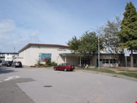
- As housing developments extended north from Kingsway, pupil enrolments grew at Windsor and at Morley Schools so Brantford was built equidistant from the two to help ease enrolment problems. Brantford Elementary school opened in 1965 and was similar in structure to other schools built in Burnaby during this period - no basements, no second stories and no high stairways. Classrooms were built in a line and could easily be added to as enrolments increased. Brantford had room additions in 1969.
- Historic Neighbourhood
- Edmonds (Historic Neighbourhood)
- Planning Study Area
- Kingsway-Beresford Area
- Street Address
- 6512 Brantford Avenue
- Street View URL
- Google Maps Street View
Images
Burquitlam Neighbourhood
https://search.heritageburnaby.ca/link/landmark703
- Repository
- Burnaby Heritage Planning
- Associated Dates
- 1925-1954
- Heritage Value
- By the 1950s, the Burquitlam Neighbourhood was becoming a residential and commercial centre for the northeast section of Burnaby. The Sullivan Heights area was developed as a single-family residential area with the Lyndhurst School opening in 1954. The completion of the Lougheed Highway in 1953 encouraged more commercial and retail development and fostered the growth of the neighbourhood throughout this period.
- Historic Neighbourhood
- Burquitlam (Historic Neighbourhood)
- Planning Study Area
- Lyndhurst Area
Images
Central Park Neighbourhood
https://search.heritageburnaby.ca/link/landmark688
- Repository
- Burnaby Heritage Planning
- Associated Dates
- 1925-1954
- Heritage Value
- Although still largely a rural area during the 1920s, subdivisions began appearing in the Central Park neighbourhood at this time. Development was slowed by the Great Depression of the 1930s but the influx of commercial buildings and new housing initiatives in the post-war boom led to a period of rapid growth especially in the Garden Village subdivision which was undertaken in 1953 with the plan to build 500 modern homes in the 140-acre site. Despite the closure of the interurban line in 1953, the neighbourhood remained an active commercial and residential centre.
- Historic Neighbourhood
- Central Park (Historic Neighbourhood)
- Planning Study Area
- Maywood Area
Images
Confederation Park Elementary School
https://search.heritageburnaby.ca/link/landmark786
- Repository
- Burnaby Heritage Planning
- Geographic Access
- Pandora Street
- Associated Dates
- 1965
- Heritage Value
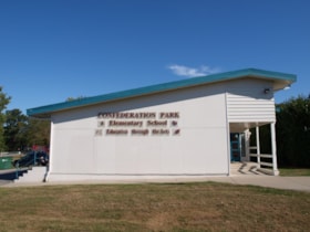
- Confederation Park school was built in 1965 to alleviate increased enrolments in Rosser Avenue and Capitol Hill schools. All elementary schools built in Burnaby in the post-war period share similar features and Confederation Park is no exception. Built low to the ground with no basement, no second stories and no high stairways, the structures could be easily added to as needed as the classrooms were built in a line.
- Historic Neighbourhood
- Capitol Hill (Historic Neighbourhood)
- Planning Study Area
- Capitol Hill Area
- Street Address
- 4715 Pandora Street
- Street View URL
- Google Maps Street View
Images
Douglas-Gilpin Neighbourhood
https://search.heritageburnaby.ca/link/landmark799
- Repository
- Burnaby Heritage Planning
- Associated Dates
- 1955-2008
- Heritage Value
- The Douglas-Gilpin Neighbourhood developed into a diverse area incorporating residential, business, educational and park districts in the period after 1955. The BCIT site was built in the early 1960s, shortly after the Burnaby Municipal Hall was located on Canada Way near Deer Lake in 1956. The construction of the Municipal Hall at this location fostered the creation of an administrative and business centre adjacent to the park, while the northern and central areas of the neighbourhood retained their primarily residential character.
- Historic Neighbourhood
- Burnaby Lake (Historic Neighbourhood)
- Planning Study Area
- Douglas-Gilpin Area
Images
Edmonds Neighbourhood
https://search.heritageburnaby.ca/link/landmark704
- Repository
- Burnaby Heritage Planning
- Associated Dates
- 1925-1954
- Heritage Value
- The historic growth of Edmonds as a neighbourhood was based on its strategic location on the early interurban line between Vancouver and New Westminster. Even by 1980 when a survey of the residential neighbourhoods was conducted, a full 25% of homes in the area predated 1930. The 1950s was a period of strong housing development, with both single-family and multi-family units being constructed. Although Burnaby's City Hall was moved from Kingsway and Edmonds in the early 1950s, Edmonds remained an important centre in the community.
- Historic Neighbourhood
- Edmonds (Historic Neighbourhood)
- Planning Study Area
- Stride Avenue Area
Images
Lozells Neighbourhood
https://search.heritageburnaby.ca/link/landmark701
- Repository
- Burnaby Heritage Planning
- Associated Dates
- 1925-1954
- Heritage Value
- Like a lot of residential neighbourhoods in Burnaby during the post-War boom, the Lozells area during the 1925-1954 period was one of new construction and subdivisions. Although more homes were being built, the neighbourhood still retained a somewhat rural characteristic well into the 1950s.
- Historic Neighbourhood
- Lozells (Historic Neighbourhood)
- Planning Study Area
- Government Road Area
Images
Maywood Elementary School
https://search.heritageburnaby.ca/link/landmark812
- Repository
- Burnaby Heritage Planning
- Geographic Access
- Imperial Street
- Associated Dates
- 1962
- Heritage Value
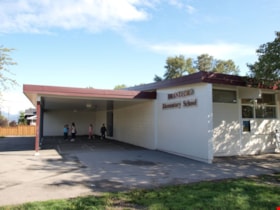
- Located between Nelson and Suncrest Schools, Maywood Elementary School was built in 1962 and helped eased the increasing enrolments at these other schools. Like other schools of this period, Maywood was built on one level with no basement and no high stairs. The classrooms were built in a line which could be easily added to as required. Additions to the original structure were completed in 1964, 1966, 1967, 1971, 1972. Fires at the school in 1979 and 1989 caused extensive damage and required partial reconstruction of the building.
- Historic Neighbourhood
- Central Park (Historic Neighbourhood)
- Planning Study Area
- Maywood Area
- Street Address
- 4567 Imperial Street
- Street View URL
- Google Maps Street View
Images
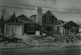
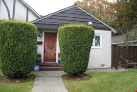
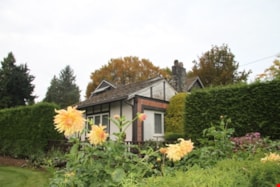
Montague & Marcia Moore Residence
https://search.heritageburnaby.ca/link/landmark499
- Repository
- Burnaby Heritage Planning
- Description
- The Montague and Marcia Moore Residence, situated on Sperling Avenue, is a one and one-half storey wood-frame house with Tudor Revival elements such as half-timbering and diamond-leaded windows. The landscaping includes a large hedge at the front of the property. It is located on a lakefront site w…
- Associated Dates
- 1943
- Street View URL
- Google Maps Street View
- Repository
- Burnaby Heritage Planning
- Geographic Access
- Sperling Avenue
- Associated Dates
- 1943
- Description
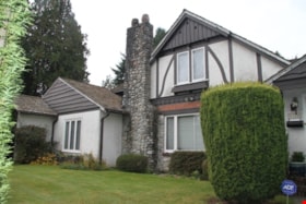
- The Montague and Marcia Moore Residence, situated on Sperling Avenue, is a one and one-half storey wood-frame house with Tudor Revival elements such as half-timbering and diamond-leaded windows. The landscaping includes a large hedge at the front of the property. It is located on a lakefront site within the scenic Deer Lake Park Heritage Precinct.
- Heritage Value
- Located within the historic Deer Lake Park neighbourhood, the Montague and Marcia Moore Residence is valued as an example of the late persistence of the historicist influence on domestic architecture, at a time when it was still considered the height of good taste for a house to be designed in a recognizable period revival style. This is reflected in the rustic Tudor Revival elements such as half-timbering, waney-edged boards in the gables, brick nogging, diamond-leaded windows, and bird houses in the main gable. The cobblestone chimney, the major focal point of the house, was constructed from river stones that were transported from Lynn Canyon. Meticulously retained in its original condition, this was the last home to be constructed by the Moore family before the Second World War construction supply rationing took effect. It was built by Danish contractor, Hans Jorgensen Hau (1878-1944), who had a flair for the construction of homes with a rustic character, and shares a number of design features with Hau’s own house at 5070 Canada Way.
- Defining Elements
- Key elements that define the heritage character of the Montague and Marcia Moore Residence include its: - location on a lakefront site, within the Deer Lake Park Heritage Precinct - residential form, scale and massing as expressed by its one and one-half storey height, rectangular plan and front gabled roof - wood-frame construction - Tudor Revival elements such as stucco and wood half-timbering, diamond-leaded casement windows, scroll-cut brackets, brick nogging on the front façade, bird houses in the main front gable, waney-edged boards at gable peaks, plank front door with strap hinges and a prominent external cobblestone chimney - associated landscape features such as a granite wall, and mature coniferous and deciduous trees
- Historic Neighbourhood
- Burnaby Lake (Historic Neighbourhood)
- Planning Study Area
- Morley-Buckingham Area
- Organization
- Canadian Institute of Mining and Metallurgy
- Builder
- Hans Jorgensen Hau
- Function
- Primary Historic--Single Dwelling
- Primary Current--Single Dwelling
- Community
- Deer Lake
- Cadastral Identifier
- P.I.D.006-082-696
- Boundaries
- The Montague and Marcia Moore Residence is comprised of a single residential lot located at 5165 Sperling Avenue, Burnaby.
- Area
- 4104
- Contributing Resource
- Building
- Ownership
- Public (local)
- Documentation
- City of Burnaby Planning and Building Department, Heritage Site Files
- Street Address
- 5165 Sperling Avenue
- Street View URL
- Google Maps Street View
Images
Suncrest Neighbourhood
https://search.heritageburnaby.ca/link/landmark839
- Repository
- Burnaby Heritage Planning
- Associated Dates
- 1955-2008
- Heritage Value
- The Suncrest Neighbourhood is a small residential area south of Burnaby's Central Park. The Ocean View Burial Park takes up a large area of land in the north-east corner of this neighbourhood and the majority of the housing was built during the 1930-1960 period.
- Historic Neighbourhood
- Alta Vista (Historic Neighbourhood)
- Planning Study Area
- Suncrest Area
Images
Vancouver Heights Neighbourhood
https://search.heritageburnaby.ca/link/landmark666
- Repository
- Burnaby Heritage Planning
- Associated Dates
- 1925-1954
- Heritage Value
- Vancouver Heights remained an important residential and commercial centre in Burnaby throughout the 1925-1954 period. The area had its own Board of Trade and the North Burnaby Library was created to serve the residents. In 1949, the Hastings streetcars stopped running, but the area retained its reputation as one of the best shopping districts in the city.
- Historic Neighbourhood
- Vancouver Heights (Historic Neighbourhood)
- Planning Study Area
- Burnaby Heights Area
Images
Willingdon Heights Neighbourhood
https://search.heritageburnaby.ca/link/landmark777
- Repository
- Burnaby Heritage Planning
- Associated Dates
- 1955-2008
- Heritage Value
- The convenient location of Willingdon Heights to the Trans Canada Highway, Lougheed Highway and Hastings Street has fostered its development as a primarily residential commuter neighbourhood. Characterised in the post-World War Two period by predominantly single-family developments, the neighbourhood has retained this identity despite some higher density apartment buildings now found there.
- Planning Study Area
- Willingdon Heights Area
Images
The brownie, vol. 6, no. 15
https://search.heritageburnaby.ca/link/museumlibrary6846
- Repository
- Burnaby Village Museum
- Author
- Girl Guides Association
- Publication Date
- 1967
- Call Number
- 369.4 GIR no.15
- Repository
- Burnaby Village Museum
- Collection
- Special Collection
- Material Type
- Textual Record
- Accession Code
- BV015.35.39
- Call Number
- 369.4 GIR no.15
- Author
- Girl Guides Association
- Place of Publication
- London
- Publisher
- Girl Guides Association
- Publication Date
- 1967
- Printer
- Riverside Press
- Physical Description
- 23 p. : ill. ; 22 cm.
- Inscription
- "40th Brownie" "L. Jung" [handwritten in blue ink on cover]
- Library Subject (LOC)
- Girls--Societies and clubs
- Periodicals
- Names
- Girl Guides Association
The brownie, vol. 6, no. 21
https://search.heritageburnaby.ca/link/museumlibrary6847
- Repository
- Burnaby Village Museum
- Collection
- Special Collection
- Material Type
- Textual Record
- Accession Code
- BV015.35.40
- Call Number
- 369.4 GIR no. 21
- Place of Publication
- London
- Publisher
- Girl Guides Association
- Publication Date
- 1967
- Printer
- Riverside Press
- Physical Description
- 24 p. : ill. ; 22 cm.
- Inscription
- "40th Brownie" "L. Jung" [handwritten in blue ink on cover]
- Library Subject (LOC)
- Girls--Societies and clubs
- Periodicals
- Names
- Girl Guides Association
Butter-fat, vol. 45, no. 5, Dec. 1967 - Jan. 1968
https://search.heritageburnaby.ca/link/museumlibrary936
- Repository
- Burnaby Village Museum
- Collection
- Reference Collection
- Material Type
- Textual Record
- Call Number
- 637 FRA
- Place of Publication
- Burnaby, B.C.
- Publisher
- Fraser Valley Milk Producers' Association
- Publication Date
- 1967
- Physical Description
- 66 p. : ill. ; 30 cm.
- Inscription
- "BURNABY VILLAGE MUSEUM / copy 1", handwritten in ink on title page.
- Library Subject (LOC)
- Dairying
- Periodicals
- Subjects
- Agriculture
- Agriculture - Dairy
The Canada year book 1946
https://search.heritageburnaby.ca/link/museumlibrary3888
- Repository
- Burnaby Village Museum
- Collection
- Special Collection
- Material Type
- Book
- Accession Code
- BV005.53.14
- Call Number
- 317.1 CAN 1946
- Place of Publication
- Ottawa
- Publisher
- Dominion Bureau of Statistics, Department of Trade and Commerce
- Publication Date
- 1946
- Printer
- King's Printer and Controller of Stationery
- Physical Description
- xxvii, 1224 p. : col. maps ; 232 cm.
- Inscription
- Canada Year Book / 1946 / Dominion Bureau of Statistics / Department of Trade and Commerce
- Library Subject (LOC)
- Canada--Statistics--Historical texts
- Canada--Statistics
- Canada
- Periodicals
- Notes
- "The official statistical annual of the resources, history, institutions, and social and economic conditions of the Dominion" --T.p.
Canadian boy : the Boy Scout magazine for all boys, vol. 2, no. 8
https://search.heritageburnaby.ca/link/museumlibrary6370
- Repository
- Burnaby Village Museum
- Collection
- Special Collection
- Material Type
- Book
- Accession Code
- BV014.17.45
- Call Number
- 369.43 BRO
- Contributor
- Brown, Norman
- Place of Publication
- Ottawa, Ont.
- Publisher
- Boy Scouts of Canada
- Publication Date
- 1965
- Series
- Canadian boy magazine
- Physical Description
- 34 p. : ill. ; 29 cm.
- Inscription
- "01793 Paul Adam 5590 Monarch Burnaby B C" [typewritten address label on front cover]
- Library Subject (LOC)
- Juvenile literature
- Scouting (youth activity)
- Boys--Canada
- Boys--Societies and clubs
- Periodicals
- Names
- Boy Scouts of Canada
- Notes
- "Norman Brown, editor" -- t.p.
Canadian boy : the Boy Scout magazine for all boys, vol. 2, no. 9
https://search.heritageburnaby.ca/link/museumlibrary6373
- Repository
- Burnaby Village Museum
- Collection
- Special Collection
- Material Type
- Book
- Accession Code
- BV014.17.46
- Call Number
- 369.43 BRO
- Contributor
- Brown, Norman
- Place of Publication
- Ottawa, Ont.
- Publisher
- Boy Scouts of Canada
- Publication Date
- 1965
- Series
- Canadian boy magazine
- Physical Description
- 34 p. : ill. ; 29 cm.
- Inscription
- "01793 Paul Adam 5590 Monarch Burnaby B C" [typewritten address label on front cover]
- Library Subject (LOC)
- Juvenile literature
- Scouting (youth activity)
- Boys--Canada
- Boys--Societies and clubs
- Periodicals
- Names
- Boy Scouts of Canada
- Notes
- "Norman Brown, editor" -- t.p.


