Narrow Results By
Creator
- Alger, Horatio, Jr., 1832-1899 1
- Andersen, Earl, 1966- 1
- Askey, Jim 1
- Aylward, W. J. (William James), 1875-1956 1
- Barker, Ronald 1
- Benson, Don, 1933- 1
- Blackmore, R. D., (Richard Doddridge), 1825-1900 1
- Black, Newton Henry, 1874-1961 1
- Buckley, Arabella B. (Arabella Burton), 1840-1929 1
- Burnaby Community Heritage Commission 1
- Burnaby, Robert, 1828-1878 1
- Burnaby Village Museum 2
Person / Organization
- Armstrong Avenue School 1
- Barnet School 1
- British Columbia Electric Railway Company 2
- British Columbia Telephone Company 1
- Brownlee, James Harrison 1
- Burnaby Fire Department 1
- Burnaby Village Museum 1
- Burnett, Geoffrey K. 2
- Byrne, Mary 1
- Canadian Pacific Railway Company 1
- Coe, Eric 1
- Descoteau, Norah Irene Byrne 2
![Bird's eye view of New Westminster, Burnaby and Vancouver, [ca. 1911] thumbnail](/media/hpo/_Data/_BVM_Cartographic_Material/1983/1983_0012_0001_002%20Web.jpg?width=280)
Bird's eye view of New Westminster, Burnaby and Vancouver
https://search.heritageburnaby.ca/link/museumdescription8199
- Repository
- Burnaby Village Museum
- Date
- [ca. 1911]
- Collection/Fonds
- Burnaby Village Museum Map collection
- Description Level
- Item
- Physical Description
- 1 map : hand painted ; 65.5 x 99 cm
- Scope and Content
- An untitled monochromatic grayscale map of a developer's bird's eye view looking north west from Burnaby Mountain. View includes Burnaby, New Westminster, Vancouver with the North shore in the distance. Burnaby neighbourhood subdivisions of "Burnaby Heights" and "Buena Vista" are featured near the…
- Repository
- Burnaby Village Museum
- Collection/Fonds
- Burnaby Village Museum Map collection
- Description Level
- Item
- Physical Description
- 1 map : hand painted ; 65.5 x 99 cm
- Scope and Content
- An untitled monochromatic grayscale map of a developer's bird's eye view looking north west from Burnaby Mountain. View includes Burnaby, New Westminster, Vancouver with the North shore in the distance. Burnaby neighbourhood subdivisions of "Burnaby Heights" and "Buena Vista" are featured near the centre of the map. These neighbourhood subdivisions were marketed by Real Estate Agents Liebly & Blumer in 1911. Roads, buildings, factories, railways and bridges are identified on the map.
- Subjects
- Businesses - Real Estate Agencies
- Responsibility
- Leibly & Blumer Realty Co. Incorporated
- Accession Code
- HV983.12.1
- Access Restriction
- No restrictions
- Reproduction Restriction
- No known restrictions
- Date
- [ca. 1911]
- Media Type
- Cartographic Material
- Historic Neighbourhood
- East Burnaby (Historic Neighbourhood)
- Vancouver Heights (Historic Neighbourhood)
- Planning Study Area
- Cariboo-Armstrong Area
- Burnaby Heights Area
- Scan Resolution
- 300
- Scan Date
- December 2020
- Scale
- 100
- Notes
- Title based on contents of map
- Note in pencil on verso of photograph reads: "Make tint block of Buena Vista / Blocks only as shown in lots"
Zoomable Images
![Bird's eye view of New Westminster, Burnaby and Vancouver, [ca. 1911] thumbnail](/media/hpo/_Data/_BVM_Cartographic_Material/1983/1983_0012_0001_001_seadragon/1983_0012_0001_001.jpg?w=280)
The court house of New Westminster
https://search.heritageburnaby.ca/link/museumlibrary1119
- Repository
- Burnaby Village Museum
- Author
- Chambers, L. B.
- Publication Date
- 1980
- Call Number
- 971.113 CHA
- Repository
- Burnaby Village Museum
- Collection
- Reference Collection
- Material Type
- Book
- Call Number
- 971.113 CHA
- Author
- Chambers, L. B.
- Place of Publication
- New Westminster
- Publisher
- The Herritage Preservation Foundation of New Westminster
- Publication Date
- 1980
- Printer
- D.W. Friesen & Sons
- Physical Description
- 77 p. : ill.
- Library Subject (LOC)
- Courthouse (New Westminster, B.C.)--History
- New Westminster (B.C.)--Historic Houses, Etc
- Court-houses--British Columbia--New Westminster
Early days in New Westminster
https://search.heritageburnaby.ca/link/museumlibrary1120
- Repository
- Burnaby Village Museum
- Collection
- Reference Collection
- Material Type
- Book
- Call Number
- 971.1 EAR
- Place of Publication
- New Westminister
- Publisher
- New Westminister Public Library
- Physical Description
- [16] p. :ill.
- Library Subject (LOC)
- New Westminster (B.C.)--History--Bibliography
- Notes
- "This booklet is a guide to the books, directories, newspapers, periodicals, maps and photographs in the New Westminster Public Library's Local History Collection."
Map of New Westminster District
https://search.heritageburnaby.ca/link/archivedescription24491
- Repository
- City of Burnaby Archives
- Date
- 1913
- Collection/Fonds
- City Council and Office of the City Clerk fonds
- Description Level
- Item
- Physical Description
- Cartographic material
- Scope and Content
- Item consists of one canvas map entitled "1913 District of New Westminster" and depicting the area bordered on the east by Hope, west to the Georgia Strait, north to North Vancouver and south to the United States border.
- Repository
- City of Burnaby Archives
- Date
- 1913
- Collection/Fonds
- City Council and Office of the City Clerk fonds
- Physical Description
- Cartographic material
- Description Level
- Item
- Record No.
- 27497
- Access Restriction
- Open access
- Accession Number
- 2006-09
- Scope and Content
- Item consists of one canvas map entitled "1913 District of New Westminster" and depicting the area bordered on the east by Hope, west to the Georgia Strait, north to North Vancouver and south to the United States border.
- Media Type
- Cartographic Material
New Westminster, the early years, 1858-1898
https://search.heritageburnaby.ca/link/museumlibrary1102
- Repository
- Burnaby Village Museum
- Author
- Woodland, Alan
- Publication Date
- 1973
- Call Number
- 971.04 WOO COPY 1
- Repository
- Burnaby Village Museum
- Collection
- Reference Collection
- Material Type
- Book
- Call Number
- 971.04 WOO COPY 1
- Author
- Woodland, Alan
- Place of Publication
- New Westminster, B.C.
- Publisher
- Nunaga Pub. Co.
- Publication Date
- 1973
- Physical Description
- 72 p. : ill. ; 28 cm.
- Inscription
- "SCHOOL DISTRICT #41 (BURNABY) / DISTRICT RESOURCE CENTRE", printed on sticker affixed to title page.
- Library Subject (LOC)
- New Westminster (B.C.)--History
- New Westminster (B.C.)--Pictorial works
- Notes
- 2 copies held: copy 1.

Part of the New Westminster District shewing the Proposed New Municipality of Burnaby
https://search.heritageburnaby.ca/link/museumdescription17544
- Repository
- Burnaby Village Museum
- Date
- 1891 (date of original)
- Collection/Fonds
- Burnaby Village Museum Map collection
- Description Level
- Item
- Physical Description
- 1 map : blueline print with col. ; 59 x 96 cm
- Scope and Content
- Item consists of a map titled "Part of the New Westminster District shewing the Proposed New Municipality of Burnaby". The map shows boundaries of a proposed new municipality of Burnaby including all land outside of the "old" City of Vancouver between Burrard Inlet and the Fraser River and west of …
- Repository
- Burnaby Village Museum
- Collection/Fonds
- Burnaby Village Museum Map collection
- Description Level
- Item
- Physical Description
- 1 map : blueline print with col. ; 59 x 96 cm
- Material Details
- Scale approx. [1:31,680]
- Scope and Content
- Item consists of a map titled "Part of the New Westminster District shewing the Proposed New Municipality of Burnaby". The map shows boundaries of a proposed new municipality of Burnaby including all land outside of the "old" City of Vancouver between Burrard Inlet and the Fraser River and west of North Road. Map also shows the boundaries of the District Lots. Signed by Garden, Hermon and Burwell Provincial Land Surveyors, Vancouver, June 5, 1891. Blueline print is hand-coloured highlighting Burnaby.
- Creator
- Garden, Hermon and Burwell
- Accession Code
- BV994.29.1
- Access Restriction
- No restrictions
- Reproduction Restriction
- No known restrictions
- Date
- 1891 (date of original)
- Media Type
- Cartographic Material
- Scan Resolution
- 300
- Scan Date
- 2022-05-10
- Notes
- Transcribed title
Images

Portion of New Westminster District with Adjacent Islands and Part of Vancouver Island
https://search.heritageburnaby.ca/link/museumdescription8690
- Repository
- Burnaby Village Museum
- Date
- 1910
- Collection/Fonds
- Burnaby Village Museum Map collection
- Description Level
- Item
- Physical Description
- 1 map : col. ink on canvas ; 68 x 90 cm on canvas 70 x 95 cm
- Scope and Content
- "Map of Portion of New Westminster District with Adjacent Islands and Part of Vancouver Island / Drawn at the Lands and Works Department. Victoria, B.C."
- Repository
- Burnaby Village Museum
- Collection/Fonds
- Burnaby Village Museum Map collection
- Description Level
- Item
- Physical Description
- 1 map : col. ink on canvas ; 68 x 90 cm on canvas 70 x 95 cm
- Material Details
- Scale 1/4 inch = 80 chains
- Scope and Content
- "Map of Portion of New Westminster District with Adjacent Islands and Part of Vancouver Island / Drawn at the Lands and Works Department. Victoria, B.C."
- Geographic Access
- Vancouver
- Accession Code
- BV994.11.9
- Access Restriction
- No restrictions
- Reproduction Restriction
- No known restrictions
- Date
- 1910
- Media Type
- Cartographic Material
- Notes
- Title based on contents of map
- Cleaned by conservator Dec 2009
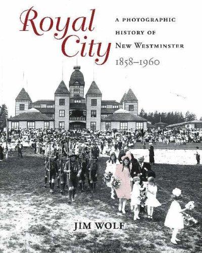
Royal city : a photographic history of New Westminster, 1858 - 1960
https://search.heritageburnaby.ca/link/museumlibrary1386
- Repository
- Burnaby Village Museum
- Author
- Wolf, Jim
- Edition
- 1st ed.
- Publication Date
- c2005
- Call Number
- 971.133 WOL
- Repository
- Burnaby Village Museum
- Collection
- Reference Collection
- Material Type
- Book
- ISBN
- 1894384849
- 1894384970
- Call Number
- 971.133 WOL
- Edition
- 1st ed.
- Author
- Wolf, Jim
- Place of Publication
- Surrey, BC
- Publisher
- Heritage House
- Publication Date
- c2005
- Physical Description
- 191 p. : ill.
- Library Subject (LOC)
- New Westminster (B.C.)--Pictorial works
- New Westminster (B.C.)--History
- Photographers--British Columbia--New Westminster
- Biography
- Geographic Access
- New Westminster
- Notes
- Includes biographical references and index.

Royal metal : the people, times and trains of New Westminster bridge
https://search.heritageburnaby.ca/link/museumlibrary6501
- Repository
- Burnaby Village Museum
- Author
- Sanford, Barrie, 1948-
- Publication Date
- c2004
- Call Number
- 971.133 SAN
- Repository
- Burnaby Village Museum
- Collection
- Reference Collection
- Material Type
- Book
- ISBN
- 0973560207
- Call Number
- 971.133 SAN
- Author
- Sanford, Barrie, 1948-
- Place of Publication
- Vancouver, B.C.
- Publisher
- National Railway Historical Society, British Columbia Chapter
- Publication Date
- c2004
- Printer
- Friesen Corporation
- Physical Description
- viii, 246 p. : ill., maps ; 29 cm.
- Geographic Access
- New Westminster
- Notes
- Includes bibliographical references and index.
![Subdivision plans in New Westminster District Group 1 – Burnaby
, [1900-1910] thumbnail](/media/hpo/_Data/_BVM_Cartographic_Material/1977/1977_0093_0009a_001.jpg?width=280)
Subdivision plans in New Westminster District Group 1 – Burnaby
https://search.heritageburnaby.ca/link/museumdescription6978
- Repository
- Burnaby Village Museum
- Date
- [1900-1910]
- Collection/Fonds
- Burnaby Village Museum Map collection
- Description Level
- File
- Physical Description
- 4 plans : blueprint ink on paper mounted on 2 sides of cardboard 76 x 102 cm
- Scope and Content
- Item consists of a large board with two New Westminster District Gp 1 - subdivision plans mounted on one side and two New Westminster District Gp 1 - subdivision plans mounted on the other side. Side A: 1. Blueprint "Plan/ of Subdivisions / of portions / of / Lot 91, / Group 1 / New Westminster …
- Repository
- Burnaby Village Museum
- Collection/Fonds
- Burnaby Village Museum Map collection
- Description Level
- File
- Physical Description
- 4 plans : blueprint ink on paper mounted on 2 sides of cardboard 76 x 102 cm
- Material Details
- Scales [between 1:792 and 1:2376]
- Index number on edge of board reads: "9"
- Scope and Content
- Item consists of a large board with two New Westminster District Gp 1 - subdivision plans mounted on one side and two New Westminster District Gp 1 - subdivision plans mounted on the other side. Side A: 1. Blueprint "Plan/ of Subdivisions / of portions / of / Lot 91, / Group 1 / New Westminster Dist. / Scale 3 chs = 1 in / Map Nos 535 & 506". (Geographic location: Burnaby) 2. Blueprint "Plan / of / Subdivision of a Portion / of / Lot 28 / Group One / New Westminster Dist. / Scale 1 chs = 1 in / Map No 274". Lots are identified as "I / II / III / VI / V / IV ". The plan is bordered by First Avenue, Suburban Lands and Cemetery at the bottom, 13th Street at the top, Douglas Road to the west and 4th Street to the east. The plan is signed by "W. Thibaudeau". (Geographic location: Burnaby) Side B: 1. Blueprint "Plan / of the Subdivision of a Portion / of / Lot 29 / Group One / New Westminster District / Scale 1ch = 1 in / Map No 291 _ Subdivision 'L'". (Geographic location: Burnaby) 2. Blueprint " Plan of Subdivision / of / Lot 27 / Group One / New Westminster Dist. / Scale 3 chs = 1 in. / Map No. 697". (Geographic location: Burnaby)
- Accession Code
- HV977.93.9
- Access Restriction
- No restrictions
- Reproduction Restriction
- No known restrictions
- Date
- [1900-1910]
- Media Type
- Cartographic Material
- Scan Resolution
- 300
- Scale
- 72
- Notes
- Title based on contents of file
- Scale is measured in chains. (One chain equals 792 inches)
- The term "Lot" can also refer to a "District Lot”
Images
![Subdivision plans in New Westminster District Group 1 – Burnaby
, [1900-1910] thumbnail](/media/hpo/_Data/_BVM_Cartographic_Material/1977/1977_0093_0009a_001.jpg)

![Subdivision plans in New Westminster District Group 1 – Burnaby
, [1900-1910] thumbnail](/media/hpo/_Data/_BVM_Cartographic_Material/1977/1977_0093_0010a_001.jpg?width=280)
Subdivision plans in New Westminster District Group 1 – Burnaby
https://search.heritageburnaby.ca/link/museumdescription6979
- Repository
- Burnaby Village Museum
- Date
- [1900-1910]
- Collection/Fonds
- Burnaby Village Museum Map collection
- Description Level
- File
- Physical Description
- 4 plans : blueprint ink on paper mounted on 2 sides of cardboard 76 x 102 cm
- Scope and Content
- Item consists of a large board with two New Westminster District Gp 1 - subdivision plans mounted on one side and two New Westminster District Gp 1- subdivision plans mounted on the other side. Side A: 1. Blueprint "Plan / of Subdivision / of / Lot 15 / Group One / New Westminster District/ Sca…
- Repository
- Burnaby Village Museum
- Collection/Fonds
- Burnaby Village Museum Map collection
- Description Level
- File
- Physical Description
- 4 plans : blueprint ink on paper mounted on 2 sides of cardboard 76 x 102 cm
- Material Details
- Scales [between 1:2376 and 1:3168]
- Index number on edge of board reads: "10"
- Scope and Content
- Item consists of a large board with two New Westminster District Gp 1 - subdivision plans mounted on one side and two New Westminster District Gp 1- subdivision plans mounted on the other side. Side A: 1. Blueprint "Plan / of Subdivision / of / Lot 15 / Group One / New Westminster District/ Scale 4 chs = 1 in. / Map No 209". Subdivision plan is bordered by North Road (Lot 9) Lot 8, Lot 148 and Lot 100. (Geographic location: Burnaby) 2. Blueprint "Plan / of Subdivision / of / Lot 88 / Group 1 / Scale 4 chs = 1 in. / Map No 760". Plan is bordered by Burnaby Lake, Cumberland Street, Lot 11, Lot 25 and Lot 89. (Geographic location: Burnaby) Side B: 1. Blueprint "Plan / of the Subdivision / of / Lot "G" / in the Subdivision / of / Lot 96, Gr.1 / Scale 4 chs = 1 in. / Map No 756". Plan includes inset "Map No. 699" which includes Lots D, G, E, F, C, A and B of DL 96. Plan is bordered by False Creek Road, Westminster & Vancouver Tramway. (Geographic location: Burnaby) 2. Blueprint "Plan / of Subdivision / of South Portion / of / Lot 94, Group 1 / New Westminster District / Scale 3 chs = 1 in. / Map Nos 4402 & 720". (Geographic location: Burnaby)
- Accession Code
- HV977.93.10
- Access Restriction
- No restrictions
- Reproduction Restriction
- No known restrictions
- Date
- [1900-1910]
- Media Type
- Cartographic Material
- Scan Resolution
- 300
- Scale
- 72
- Notes
- Scale is measured in chains. (One chain equals 792 inches)
- The term "Lot" can also refer to a "District Lot”
Images
![Subdivision plans in New Westminster District Group 1 – Burnaby
, [1900-1910] thumbnail](/media/hpo/_Data/_BVM_Cartographic_Material/1977/1977_0093_0010a_001.jpg)

![Subdivision plans in New Westminster District Group 1 – Burnaby, [1905-1910] thumbnail](/media/hpo/_Data/_BVM_Cartographic_Material/1977/1977_0093_0011a_001.jpg?width=280)
Subdivision plans in New Westminster District Group 1 – Burnaby
https://search.heritageburnaby.ca/link/museumdescription6980
- Repository
- Burnaby Village Museum
- Date
- [1905-1910]
- Collection/Fonds
- Burnaby Village Museum Map collection
- Description Level
- File
- Physical Description
- 4 plans : blueprint ink on paper mounted on 2 sides of cardboard 76 x 102 cm
- Scope and Content
- Item consists of a large board of two New Westminster District Gp 1 - subdivision plans mounted on one side and two New Westminster District subdivision plans mounted on the other side. Side A: 1.Blueprint "Plan / of Subdivision / of a Portion / of / Lot 90 / Group One / New Westmisnter Distric…
- Repository
- Burnaby Village Museum
- Collection/Fonds
- Burnaby Village Museum Map collection
- Description Level
- File
- Physical Description
- 4 plans : blueprint ink on paper mounted on 2 sides of cardboard 76 x 102 cm
- Material Details
- Scales [between 1:1200 and 1:3960]
- Index number on edge of board reads: "11"
- Scope and Content
- Item consists of a large board of two New Westminster District Gp 1 - subdivision plans mounted on one side and two New Westminster District subdivision plans mounted on the other side. Side A: 1.Blueprint "Plan / of Subdivision / of a Portion / of / Lot 90 / Group One / New Westmisnter District / Scale 200 ft = 1 in. / Map No 642". (Geographic location: Burnaby) 2. Blueprint "Plan / of Subdivision / of / North Portion / of / Lot 28 / Group One / New Westminster District / Scale 100' = 1 in. / Map No 632". Geographic location: Burnaby) Side B: 1. Blueprint "Plan / of Subdivision of Lot 153 / Group 1 / New Westminster Dist. / Scale 5 chs = 1 in. / Map No. 783". Handwritten annotation in red reads: "NOTE. THIS INCLUDEDS PART / OF LOT 151. & 152". Geographic location: Burnaby) 2. Blueprint "Plan / of Subdivision of Lot 82, Group 1 / New Westminster Dist. / Scale 2 chs = 1 in. / Map No 201". Geographic location: Burnaby)
- Accession Code
- HV977.93.11
- Access Restriction
- No restrictions
- Reproduction Restriction
- No known restrictions
- Date
- [1905-1910]
- Media Type
- Cartographic Material
- Scan Resolution
- 300
- Scale
- 72
- Notes
- Title based on contents of file
- Scale is measured in chains and feet. (One chain equals 792 inches)
- The term "Lot" can also refer to a "District Lot”
Images
![Subdivision plans in New Westminster District Group 1 – Burnaby, [1905-1910] thumbnail](/media/hpo/_Data/_BVM_Cartographic_Material/1977/1977_0093_0011a_001.jpg)

![Subdivision plans in New Westminster District Group 1 – Burnaby
, [1900-1910] thumbnail](/media/hpo/_Data/_BVM_Cartographic_Material/1977/1977_0093_0012a_001.jpg?width=280)
Subdivision plans in New Westminster District Group 1 – Burnaby
https://search.heritageburnaby.ca/link/museumdescription6981
- Repository
- Burnaby Village Museum
- Date
- [1900-1910]
- Collection/Fonds
- Burnaby Village Museum Map collection
- Description Level
- File
- Physical Description
- 4 plans : blueprint ink on paper mounted on 2 sides of cardboard 76 x 102 cm
- Scope and Content
- Item consists of a large board of two New Westminster District Gp 1 - subdivision plans mounted on one side and two New Westminster District Gp 1 -subdivision plans mounted on the other side. Side A: 1. Blueprint "Plan / shewing [sic] / Subdivision of / Lot 162 / Group One / New Westmisnter Dis…
- Repository
- Burnaby Village Museum
- Collection/Fonds
- Burnaby Village Museum Map collection
- Description Level
- File
- Physical Description
- 4 plans : blueprint ink on paper mounted on 2 sides of cardboard 76 x 102 cm
- Material Details
- Scales [1:2376] and [1:3168]
- Index number on edge of board reads: "12"
- Scope and Content
- Item consists of a large board of two New Westminster District Gp 1 - subdivision plans mounted on one side and two New Westminster District Gp 1 -subdivision plans mounted on the other side. Side A: 1. Blueprint "Plan / shewing [sic] / Subdivision of / Lot 162 / Group One / New Westmisnter Dist. / Scale 4 chs = 1 in. / Map No 450". Plan is signed by "Sidney Williams / Provincial Land Surveyor" (Geographic location: Burnaby) 2. Blueprint "Plan of / Subdivision of / Block 166A / Grroup One, / Westminster District / Scale 4 chs = 1 in. / Map No 524". Plan is signed by "Sidney Williams / Provincial Land Surveyor" (Geographic location: Burnaby) Side B: 1. Blueprint "Plan / of / Subdivision of Lot 77, Group 1 / New Westminster Dist. / Scale = 4 chs = 1 in. / Map No 238" Plan is signed by "Gardue [sic] Hermon [sic] / District [sic] Land Surveyor" (Geographic location: Burnaby) 2. Blueprint " Plan / of Subdivision / of part / of / Lot 95 / Group One / New Westminster Dist. / Sclae 3 chs = 1 in. / Map No 556". (Geographic location: Burnaby)
- Creator
- Williams, Sidney
- Accession Code
- HV977.93.12
- Access Restriction
- No restrictions
- Reproduction Restriction
- No known restrictions
- Date
- [1900-1910]
- Media Type
- Cartographic Material
- Scan Resolution
- 300
- Scale
- 72
- Notes
- Title based on contents of file
- Scale is measured in chains. (One chain equals 792 inches)
- The term "Lot" can also refer to a "District Lot”
Images
![Subdivision plans in New Westminster District Group 1 – Burnaby
, [1900-1910] thumbnail](/media/hpo/_Data/_BVM_Cartographic_Material/1977/1977_0093_0012a_001.jpg)

![Subdivision plans in New Westminster District Group 1 – Burnaby
, [1882-1910] thumbnail](/media/hpo/_Data/_BVM_Cartographic_Material/1977/1977_0093_0013a_001.jpg?width=280)
Subdivision plans in New Westminster District Group 1 – Burnaby
https://search.heritageburnaby.ca/link/museumdescription6982
- Repository
- Burnaby Village Museum
- Date
- [1882-1910]
- Collection/Fonds
- Burnaby Village Museum Map collection
- Description Level
- File
- Physical Description
- 4 plans : blueprint on paper mounted on 2 sides of cardboard 76 x 102 cm
- Scope and Content
- Item consists of a large board of two New Westminster District Gp 1 - subdivision plans mounted on one side and two New Westminster District Gp 1 - subdivision plans mounted on the other side. Side A: 1. Blueprint "Plan / of the / Subdivision / of / Lot 98 / G.1, N.W.D. / Scale 4 chs = 1 in. / …
- Repository
- Burnaby Village Museum
- Collection/Fonds
- Burnaby Village Museum Map collection
- Description Level
- File
- Physical Description
- 4 plans : blueprint on paper mounted on 2 sides of cardboard 76 x 102 cm
- Material Details
- Scales [between 1:1584 and 1:3168]
- Index number on edge of board reads: "13"
- Scope and Content
- Item consists of a large board of two New Westminster District Gp 1 - subdivision plans mounted on one side and two New Westminster District Gp 1 - subdivision plans mounted on the other side. Side A: 1. Blueprint "Plan / of the / Subdivision / of / Lot 98 / G.1, N.W.D. / Scale 4 chs = 1 in. / Map No 573" (Geographic location: Burnaby) 2. Blueprint "Plan / of Subdivision of / Lot 157 / Gr.1, New. West. Dist. / Scale 3 chs = 1 in. / Map No. 612". (Geographic location: Burnaby) Side B: 1. Blueprint "Plan / of Subdivision / of a Portion of / Lot 90 / Group One / New Westminster Dist. / Scale 2 chs = 1 in. / Map No. 555". Plan is signed by "Jno Strathern [sic]_P.L.S."n (Geographic location: Burnaby) 2. Blueprint "Subdivision of Lot 31, Group 1. / New Westminster District / As Amended by Order of Court / 1st Sept. 1882 and Numbered 847 / Scale 4 chs = 1in. / Map No 80" (Geographic location: Burnaby)
- Creator
- Stathern, John
- Accession Code
- HV977.93.13
- Access Restriction
- No restrictions
- Reproduction Restriction
- No known restrictions
- Date
- [1882-1910]
- Media Type
- Cartographic Material
- Historic Neighbourhood
- Alta Vista (Historic Neighbourhood)
- Planning Study Area
- Richmond Park Area
- Lakeview-Mayfield Area
- Scan Resolution
- 300
- Scale
- 72
- Notes
- Title based on contents of file
- Scale is measured in chains. (One chain equals 792 inches)
- The term "Lot" can also refer to a "District Lot”
Images
![Subdivision plans in New Westminster District Group 1 – Burnaby
, [1882-1910] thumbnail](/media/hpo/_Data/_BVM_Cartographic_Material/1977/1977_0093_0013a_001.jpg)

![Subdivision plans in New Westminster District Group 1 – Burnaby
, [1890-1910] thumbnail](/media/hpo/_Data/_BVM_Cartographic_Material/1977/1977_0093_0014a_001.jpg?width=280)
Subdivision plans in New Westminster District Group 1 – Burnaby
https://search.heritageburnaby.ca/link/museumdescription6983
- Repository
- Burnaby Village Museum
- Date
- [1890-1910]
- Collection/Fonds
- Burnaby Village Museum Map collection
- Description Level
- File
- Physical Description
- 4 plans : blueprint ink on paper mounted on 2 sides of cardboard 76 x 102 cm
- Scope and Content
- Item consists of a large board of two New Westminster District Gp 1 - subdivision plans mounted on one side and two New Westminster District Gp 1 - subdivision plans mounted on the other side. Side A: 1. Blueprint "Plan of / Subdivision of Lot No. 69 / Group One / New Westminster District / Pro…
- Repository
- Burnaby Village Museum
- Collection/Fonds
- Burnaby Village Museum Map collection
- Description Level
- File
- Physical Description
- 4 plans : blueprint ink on paper mounted on 2 sides of cardboard 76 x 102 cm
- Material Details
- Scales [between 1:1584 and 1:3168]
- Index number on edge of board reads: "14"
- Scope and Content
- Item consists of a large board of two New Westminster District Gp 1 - subdivision plans mounted on one side and two New Westminster District Gp 1 - subdivision plans mounted on the other side. Side A: 1. Blueprint "Plan of / Subdivision of Lot No. 69 / Group One / New Westminster District / Property of Ernest Buse, Esq. / Scale 3 chs = 1 in. / Map No 290". Plan is signed by "Garden, Hermon and Burwell, Dom. Land Surveyor" (Geographic location: Burnaby) 2. Blueprint "Plan / of Subdivision / of Lots 1-19, 36-53 and 69-75 inclusive / in the Subdivision / of / Lot 30 / Group One / New Westminster District / Scale 2 chs = 1 in. Map No 631". Plan is signed by "Jno [sic] Strathern [sic] P.L.S." Names and Lot numbers are handwritten in red pencil in sections along Douglas Road and read: "20 - F / 21 - Fitherstruhaul [sic] / 22 - J.S. Craig / 23 - McGill & Dill / 24 / 25 / 26 / 27 / 28 - School / 29 - School / 30 - D. McDownall / 31 - W.J. Troloow [sic] / 32 - N.C. Nelson / 33 - _[sic] McGill / 34 - T.S.[sic] Craig / 35" (Geographic location: Burnaby) Side B: 1.Blueprint "Plan / of Subdivision / of Centre Portion / of Lot 28 / Group One / New Westminster District / Scale 200' = 1" / Map No 627". Plan is signed by "Jno Strathern / P.L.S." (Geographic location: Burnaby) 2. Blueprint "Plan / of Subdivision / of N.1/2 Lot 100 and S.1/2 Lot 101, / Group One / New Westminster District, BC / Scale 4 chs = 1 in." (Geographic location: Burnaby)
- Names
- Strathern, John
- Accession Code
- HV977.93.14
- Access Restriction
- No restrictions
- Reproduction Restriction
- No known restrictions
- Date
- [1890-1910]
- Media Type
- Cartographic Material
- Historic Neighbourhood
- Broadview (Historic Neighbourhood)
- East Burnaby (Historic Neighbourhood)
- Planning Study Area
- Cascade-Schou Area
- West Central Valley Area
- Second Street Area
- Lake City Area
- Scan Resolution
- 300
- Scale
- 72
- Notes
- Title based on contents of file
- Scale is measured in chains and feet. (One chain equals 792 inches)
- The term "Lot" can also refer to a "District Lot”
Images
![Subdivision plans in New Westminster District Group 1 – Burnaby
, [1890-1910] thumbnail](/media/hpo/_Data/_BVM_Cartographic_Material/1977/1977_0093_0014a_001.jpg)

![Subdivision plans in New Westminster District Group 1 – Burnaby
, [1891-1910] thumbnail](/media/hpo/_Data/_BVM_Cartographic_Material/1977/1977_0093_0015a_001.jpg?width=280)
Subdivision plans in New Westminster District Group 1 – Burnaby
https://search.heritageburnaby.ca/link/museumdescription6984
- Repository
- Burnaby Village Museum
- Date
- [1891-1910]
- Collection/Fonds
- Burnaby Village Museum Map collection
- Description Level
- File
- Physical Description
- 4 plans : blueprint ink on paper mounted on 2 sides of cardboard 76 x 102 cm
- Scope and Content
- Item consists of a large board of two New Westminster District Gp 1 - subdivision plans mounted on one side and two New Westminster District Gp 1 - subdivision plans mounted on the other side. Side A: 1. Blueprint "Plan / of Subdivision / of / Lot 29 / Group One / New Westminster District / Scal…
- Repository
- Burnaby Village Museum
- Collection/Fonds
- Burnaby Village Museum Map collection
- Description Level
- File
- Physical Description
- 4 plans : blueprint ink on paper mounted on 2 sides of cardboard 76 x 102 cm
- Material Details
- Scales [between 1:600 and 1:7920]
- Index number on edge of board reads: "15"
- Scope and Content
- Item consists of a large board of two New Westminster District Gp 1 - subdivision plans mounted on one side and two New Westminster District Gp 1 - subdivision plans mounted on the other side. Side A: 1. Blueprint "Plan / of Subdivision / of / Lot 29 / Group One / New Westminster District / Scale 4 chs = 1 in. / Map No 564, Depostd '91". "Reichenbach", dep. Aug. 1891. (Geographic location: Burnaby) 2. Blueprint "Plan / of Subdivision / of / Lot 93 / Group One / New Westminster District / Scale 4 chs = 1 in. / Map No 284". (Geographic location: Burnaby) Side B: 1. Blueprint "Plan / of Subdivision / of a Portion / of / [Lot A of ] Lot 29 / Group One / New Westminster District / Scale 50 ' = 1"" Plan is bordered by Douglas Road to the east, False Creek Trail to the south and Lot 30 to the north. (Geographic location: Burnaby) 2. Blueprint "Plan / of Central Park / and Vicinity / Scale 10 chs = 1 in." (Geographic location: Burnaby)
- Accession Code
- HV977.93.15
- Access Restriction
- No restrictions
- Reproduction Restriction
- No known restrictions
- Date
- [1891-1910]
- Media Type
- Cartographic Material
- Historic Neighbourhood
- Edmonds (Historic Neighbourhood)
- Planning Study Area
- Edmonds Area
- Scan Resolution
- 300
- Scale
- 72
- Notes
- Title based on contents of file
- Scale is measured in chains and feet. (One chain equals 792 inches)
- The term "Lot" can also refer to a "District Lot”
Images
![Subdivision plans in New Westminster District Group 1 – Burnaby
, [1891-1910] thumbnail](/media/hpo/_Data/_BVM_Cartographic_Material/1977/1977_0093_0015a_001.jpg)

![Subdivision plans in New Westminster District Group 1 – Burnaby
, [1893-1910] thumbnail](/media/hpo/_Data/_BVM_Cartographic_Material/1977/1977_0093_0016a_001.jpg?width=280)
Subdivision plans in New Westminster District Group 1 – Burnaby
https://search.heritageburnaby.ca/link/museumdescription6985
- Repository
- Burnaby Village Museum
- Date
- [1893-1910]
- Collection/Fonds
- Burnaby Village Museum Map collection
- Description Level
- File
- Physical Description
- 4 plans : blueprint ink on paper mounted on 2 sides of cardboard 76 x 102 cm
- Scope and Content
- Item consists of a large board of two New Westminster District Gp 1 - subdivision plans mounted on one side and two New Westminster District Gp 1 - subdivision plans mounted on the other side. Side A: 1. Blueprint "Plan / of Subdivision / of / Lot 6 / Group One / New Westminster District / Scale…
- Repository
- Burnaby Village Museum
- Collection/Fonds
- Burnaby Village Museum Map collection
- Description Level
- File
- Physical Description
- 4 plans : blueprint ink on paper mounted on 2 sides of cardboard 76 x 102 cm
- Material Details
- Scales [between 1:1584 and 1:3960]
- Index number on edge of board reads: "16"
- Scope and Content
- Item consists of a large board of two New Westminster District Gp 1 - subdivision plans mounted on one side and two New Westminster District Gp 1 - subdivision plans mounted on the other side. Side A: 1. Blueprint "Plan / of Subdivision / of / Lot 6 / Group One / New Westminster District / Scale 5 chs = 1 in. / Map No 748" (Geographic location: Burnaby) 2. Blueprint "Plan / of Subdivision / of a Portion / of / Lot 29 / Group One / New Westminster Dist. / Scale 2 chs = 1 in. / Map No." Name identified in Block H is "Reichenbach" (Geographic location: Burnaby) Side B: 1. Blueprint "Plan / of Subdivision / of North 1/2 of Lot 80 / Group One / New Westminster District / Scale 3 chs = 1 in. / Map No 719" Plan is signed by: "Garden, Hermon & Burwell P.L.S. / Vancouver Jan. 23rd, 1893" (Geographic location: Burnaby) 2. Blueprint "Plan / of Subdivision / of Lot 79, Gr.1 / New Westminster Dist. / Scale 4 chas = 1 in. / Map No 536" Plan is signed by "Garden Hermon & Burwell / Provincial Land Surveyors". (Geographic location: Burnaby)
- Creator
- Garden, Hermon and Burwell
- Accession Code
- HV977.93.16
- Access Restriction
- No restrictions
- Reproduction Restriction
- No known restrictions
- Date
- [1893-1910]
- Media Type
- Cartographic Material
- Historic Neighbourhood
- Edmonds (Historic Neighbourhood)
- Burnaby Lake (Historic Neighbourhood)
- Planning Study Area
- Douglas-Gilpin Area
- Edmonds Area
- Cameron Area
- Scan Resolution
- 300
- Scale
- 72
- Notes
- Title based on contents of file
- Scale is measured in chains. (One chain equals 792 inches)
- The term "Lot" can also refer to a "District Lot”
Images
![Subdivision plans in New Westminster District Group 1 – Burnaby
, [1893-1910] thumbnail](/media/hpo/_Data/_BVM_Cartographic_Material/1977/1977_0093_0016a_001.jpg)


Subdivision plans in New Westminster District Group 1 – Burnaby, Vancouver and map - Canada Department of Mines
https://search.heritageburnaby.ca/link/museumdescription6994
- Repository
- Burnaby Village Museum
- Date
- 1890-1909
- Collection/Fonds
- Burnaby Village Museum Map collection
- Description Level
- File
- Physical Description
- 1 plan : graphite on paper + 2 plans : black ink on paper + 1 map : col. on paper mounted on 2 sides of cardboard 76 x 102 cm
- Scope and Content
- Item consists of a large board with one New Westminster District subdivision plan mounted on one side and two New Westminster District subdivision plans and one colour map mounted on the other side. Side A: 1. "Plan / of Subdivision of / Blocks 2, 3, 4, 5, 6 / Lot 77 / Group 1 / New Westminster D…
- Repository
- Burnaby Village Museum
- Collection/Fonds
- Burnaby Village Museum Map collection
- Description Level
- File
- Physical Description
- 1 plan : graphite on paper + 2 plans : black ink on paper + 1 map : col. on paper mounted on 2 sides of cardboard 76 x 102 cm
- Material Details
- Scales 1:720 and 1:1200 and 1:.00001578
- Scope and Content
- Item consists of a large board with one New Westminster District subdivision plan mounted on one side and two New Westminster District subdivision plans and one colour map mounted on the other side. Side A: 1. "Plan / of Subdivision of / Blocks 2, 3, 4, 5, 6 / Lot 77 / Group 1 / New Westminster District / BC. / Scale 100 feet = 1 inch", "Deposited 8th day / of April 1890 / Mowileg [sic] / Dist. Regt". Plan is drawn in graphite with annotations: "AB_Parts_lettered_are_lots_in / the_different_subdivisions" / "Owners: / James E. Hall / P.S.Cabilan [sic] by his attorney Joseph Hall / Joseph Hall / Eliza J. Shannon / John Harrison"; "This plan is correct and is prepared under the / provisions of the Land Registry Act" ; signed by: "Gordon Herman & Burwell / Dominion & Provincial Land Surveryors / Vancouver March 19th/90" . Plan is initialed by: "RB" [sic] (in blue pencil crayon) and measures: 99.5 x 65 cm (Geographic location: Burnaby) Side B: 1. Map titled "Canada / Department of Mines / Geological Survey Branch" / "Hon.W Templeton, Minister / A.P. Low, Deputy Minister / R.W. Brock, Acting Director", Vol. XXXI, Plate I / Compiled under the direction of / James White, F.R.G.S. Geographer /Dep. of Interior". Note above map reads: "To illustrate Mr. James Barrowman's report as Delegate at the Excursion - meeting of the Canadian Mining Institute", "The instiitution of Mining Engineers / Transactions 1908 - 1909", "The Mining Institute of Scotland / Transactions 1908-1909". Map identifies minerals and includes a Legend and Scale: 100 miles = 1 inch 2. "Plan / of Subdivision of / Lot 4 / of Subdivision of / Lot 87. Gr. 1 / New Westminster District / Scale 60' = 1in." Plan is initialed by: "RB" [sic] along with a note "also Board / 48" (in blue pencil crayon) (Geographic location: Burnaby) 3. Plan of "Lot 335 / G. 1" west of Boundary Road and north of River Road - Vancouver. (Geographic location: Vancouver)
- Publisher
- The Mining Institute of Scotland
- Geographic Access
- Vancouver
- Accession Code
- HV977.93.25
- Access Restriction
- No restrictions
- Reproduction Restriction
- No known restrictions
- Date
- 1890-1909
- Media Type
- Cartographic Material
- Scan Resolution
- 300
- Scale
- 72
- Notes
- Title based on contents of file
- Scale is measured in feet and miles.
- The term "Lot" often refers to "District Lot"
Images


![Survey and Subdivision plans in New Westminster District Group 1 and Group 2 – Vancouver, ʷməθkʷəy̓əm (Musqueam) Indian Reserve, Burnaby, Surrey
, [1910-1911] thumbnail](/media/hpo/_Data/_BVM_Cartographic_Material/1977/1977_0093_0017_001.jpg?width=280)
Survey and Subdivision plans in New Westminster District Group 1 and Group 2 – Vancouver, ʷməθkʷəy̓əm (Musqueam) Indian Reserve, Burnaby, Surrey
https://search.heritageburnaby.ca/link/museumdescription6986
- Repository
- Burnaby Village Museum
- Date
- [1910-1911]
- Collection/Fonds
- Burnaby Village Museum Map collection
- Description Level
- File
- Physical Description
- 9 plans : 4 plans : blueprint ink on paper + 4 plans : black ink on paper + 1 plan : graphite on paper mounted on 2 sides of cardboard 76 x 102 cm
- Scope and Content
- File consists of a large board of three survey plans in New Westminster District Group 1 mounted on one side and six survey and subdivision plans of District Lot 85, New Westminster District Group 1 mounted on the other side. Side A: 1. Plan : blueprint on paper ; 30.5 x 80 cm. Title reads: "Fras…
- Repository
- Burnaby Village Museum
- Collection/Fonds
- Burnaby Village Museum Map collection
- Description Level
- File
- Physical Description
- 9 plans : 4 plans : blueprint ink on paper + 4 plans : black ink on paper + 1 plan : graphite on paper mounted on 2 sides of cardboard 76 x 102 cm
- Material Details
- Scales vary (One chain equals 792 inches)
- Indexed number on tape on edge of board reads "17"
- Scope and Content
- File consists of a large board of three survey plans in New Westminster District Group 1 mounted on one side and six survey and subdivision plans of District Lot 85, New Westminster District Group 1 mounted on the other side. Side A: 1. Plan : blueprint on paper ; 30.5 x 80 cm. Title reads: "Fraser River Bridge / Plan of South Approach". Plan covers area of land north of the Fraser River and Great Northern Railway with approach for a bridge running through the "ʷməθkʷəy̓əm (Musqueam) Indian Reserve" (ʷməθkʷəy̓əm (Musqueam) First Nation) and lots marked as Dominion Government and the east half of Lot 2 identified as "C. F. Brown" "Plan 851". Plan is identified as "Plan 851 / traced / Mar. 17, 1911". (Geographic location in Vancouver) Scale: 100 feet = 1 inch, Signed by Albert J. Hill / P.L.S." 2. Plan : blueprint on paper ; 36.5 x 35 cm (no title). Includes three plans of lots on the east and west sides of North Road. Note on bottom of blueprint reads: "I.E.B. McKay Surveyor General - hereby certify / that this is a correct tracing from the field / notes of the Royal Engineers on file in the / Lands Department / E.B. McKay (signature) / Surveyor General / Victoria B.C. April 11th 1911" . Plan in top left titled "Page 11 / Vol. 1. / R.E. Notes" covers District Lots east of North Road including Lot 5, Lot 7, Lot 41, Lot 9 and Lot 107 in Coquitlam. Plan in top right corner titled "Page 17 / Vol. 1. / R.E. Notes" covers District Lots east of North Road including Lot 104, Lot 54, Lot 105, Lot 55, Lot 106, Lot 9 and Lot 107 in Coquitlam and Port Moody. Plan in lower left corner titled "Page 15 / Vol. 1 / R.E. Notes" covers District Lots west of North Road including Lot 147, Lot 148, Lot 100, Lot 15 in Burnaby. 3. Plan : blue print on paper ; 29.5 x 41.5 cm. (no formal title). Plan of the North 1/2 of Section 18. Plan covers area in the "North 1/2 of Sec.18 B.5 N RGE 1 W" and "Sec. 18 B.5 N. RGE 1 W" bordered by Section 7, Section 13, Section 17 and Section 19. Bon Accord Road runs through Sec. 18. The plan is signed by surveryor "I.H. Neville Smith... C.E.B.C.L.S. / Mar. 26th 1910" and signed by "Ludwig Pillath". (Geographic location: Surrey) Side B: 1. Plan : blueprint on paper ; 43.5 x 49.5 cm. Title reads: "Plan / of Subdivision / of a Portion / of / Lot 85 / Group One / New Westminster District. Plan covers portion of land east of Deer Lake and Pole Line Road (Sperling Avenue) and south of Hastings Road in District Lot 85 in Burnaby with section 4 and a portion of section 2 coloured in red. Plan is signed by "Albert J. Hill, B.C.L.S." Plan is initialed by: "RB" [sic] (in blue pencil crayon) Scale: 4 chains = 1 inch 2. Plaln : black black ink on linen ; 39 x 37 cm. Title reads: "L.C. Hill's Property, / Burnaby". Plan covers a triangular portion of land east of Pole Line Road (Sperling Avenue) and south of Hastings Road in District Lot 85 in Burnaby. Plan is intitaled by "RB" [sic] (in blue pencil crayon). Scale: 3 chains = 1 mile 3. Plan : graphite on paper ; 23 x 17 cm. Title reads: "Portion of Lot 85 / Gr.1". Plan covers portion of land north east of Deer Lake and west of Pole Line Road (now Sperling Avenue) in District Lot 85 in Burnaby. Plan is stamped in red ink: "Albert J. Hill, Civil Engineer". Plan is initialed by: "RB" [sic] (in blue pencil crayon). Scale: 1 chain = 1 inch 4. Plan : black ink on linen ; 16 x 19 cm. Title reads: "Lot 85". Plan covers the intersection of Pole Line Road (Sperling Avenue) and Hastings Road at the north west section of District Lot 79 and District Lot 85 in Burnaby. Plan is stamped: "A.J. Hill, Civil Engineer" with identitifed in blue pencil crayon. 5. Plan : black ink on paper ; 28.5 x 37 cm. (no formal title) Plan covers an area of land, west of Pole Line Road (Sperling Avenue) and south of Deer Lake in District Lot 85 in Burnaby. Plan is initialed by: "RB" [sic] (in blue pencil crayon) 6. Plan : black ink on paper ; 21 x 34 cm (no formal title). Plan covers an area of land, west of Pole Line Road (Sperling Avenue) and south of Deer Lake in District Lot 85 in Burnaby. Plan is initialed by: "RB" [sic] (in blue pencil crayon)
- Accession Code
- HV977.93.17
- Access Restriction
- No restrictions
- Reproduction Restriction
- No known restrictions
- Date
- [1910-1911]
- Media Type
- Cartographic Material
- Historic Neighbourhood
- Burnaby Lake (Historic Neighbourhood)
- Burquitlam (Historic Neighbourhood)
- Planning Study Area
- Morley-Buckingham Area
- Douglas-Gilpin Area
- Scan Resolution
- 600
- Scan Date
- 2023-06-26
- Notes
- Title based on contents of file
- Scale is measured in chains and feet. (One chain equals 792 inches).
- The term "Lot" also refers to a "District Lot”
- Some plans are stamped: "Albert J. Hill, Civil Engineer / and / Provincial Land Surveyor, / New Westminster, / B.C." and intialed: "RB" [sic]
Zoomable Images
![Survey and Subdivision plans in New Westminster District Group 1 and Group 2 – Vancouver, ʷməθkʷəy̓əm (Musqueam) Indian Reserve, Burnaby, Surrey
, [1910-1911] thumbnail](/media/hpo/_Data/_BVM_Cartographic_Material/1977/1977_0093_0017_003_seadragon/1977_0093_0017_003.jpg?w=280)
Survey and Subdivision plans in New Westminster District Group 1 and Group 2 – Vancouver, ʷməθkʷəy̓əm (Musqueam) Indian Reserve, Burnaby, Surrey , [1910-1911]
Zoom into Image
![Survey and Subdivision plans in New Westminster District Group 1 - Burnaby
, [1906-1910] thumbnail](/media/hpo/_Data/_BVM_Cartographic_Material/1977/1977_0093_0001a_001.jpg?width=280)
Survey and Subdivision plans in New Westminster District Group 1 - Burnaby
https://search.heritageburnaby.ca/link/museumdescription6970
- Repository
- Burnaby Village Museum
- Date
- [1906-1910]
- Collection/Fonds
- Burnaby Village Museum Map collection
- Description Level
- File
- Physical Description
- 7 plans : blueprint ink on paper + 2 plans : black ink on paper mounted on 2 sides of cardboard 76 cm x 102 cm
- Scope and Content
- Item consists of a large board of six New Westminster District Gp 1 subdivision plans mounted on one side and three New Westminster District Gp 1 subdivision plans mounted on the other side with scales ranging from one chain equals one inch to four chains equals one inch. Side A: 1. Blueprint "Pl…
- Repository
- Burnaby Village Museum
- Collection/Fonds
- Burnaby Village Museum Map collection
- Description Level
- File
- Physical Description
- 7 plans : blueprint ink on paper + 2 plans : black ink on paper mounted on 2 sides of cardboard 76 cm x 102 cm
- Material Details
- Scales [1:792] and [1:3168]
- Index number on edge of board reads: "1"
- Scope and Content
- Item consists of a large board of six New Westminster District Gp 1 subdivision plans mounted on one side and three New Westminster District Gp 1 subdivision plans mounted on the other side with scales ranging from one chain equals one inch to four chains equals one inch. Side A: 1. Blueprint "Plan / of Subdivision / of a portion / of / Lot 13, GR.1 / New Westminster District". Plan is bordered by Cumberland Street, Tenth Ave., Cariboo Street, Armstrong Street, "See Bd.145", Map No891 (Geographic location: Burnaby) 2."Plan / of Subdivision / of a portion / of / Lot 13, GR.1 / New Westminster District". Plan is bordered by Cumberland Street, Tenth Ave., Cariboo St. and Armstrong St. Pencilled annotations on plan read: "for Subdivisions see Board 145"; "Subdivided by H. Neville Smith". (Geographic location: Burnaby) 3. Blueprint "Plan / of Subdivision / of a part / of / Lot 155 / Group 1 / New Westminster District". Plan is bordered by North Arm of Fraser, Wiggins Rd. and Lot 173. Plan created by "NB Gauvreau" (Geographic location: Burnaby) Side B: 1. Blueprint plan which reads: "Albert J. Hill / P.L.S." at top with handwritten annotation: "Lot 85". The plan is bordered by Hastings Rd. and Burnaby Lake with names on lots identified as:"Laura Troop; Jas. Anderson and A. de W. Haszard". (Geographic location: Burnaby) 2. Blueprint plan which reads: "Albert J. Hill / P.L.S" at top with handwritten annotation: "Lot 85". The plan is bordered by Hastings Rd. and Burnaby Lake with names on lots identified as:"Laura Troop; A. de W. Haszard". (Geographic location: Burnaby) 3.Plan of "Survey of Road / for / Burnaby Council". "Albert J. Hill, M.A. Civil Engineer". Plan identifies "Centre Line Lot 10 / Present Road" at the centre and is bordered by Gunn Rd. at the top and Brunette River at the bottom. (Geographic location: Burnaby) 4.Blueprint "Plan / of Subdivision / Lot 97 Group 1/ N.W.D." Plan is bordered by Lots 93, 94 and 96 and Webster Road. Vancouver and New Westminster Road crosses the upper right corner of the plan and the New Westminster Vancouver Tramway runs through from Power House Rd. to Webster Road. Lower right corner identifies "W.N. Draper, P.LotS." (Geographic location: Burnaby) 5. Blueprint "Plan / of / The Subdivision of / Portion of / Lot 85, GP.1 / New Westminster District" Plan is bordered by Lots 79 / Byrne Drive; Burnaby Lake/ Esplanade and Lot 87. Plan is identified with "Albert J. Hill / B.C.LotS. / 19/6/09" (Geographic location: Burnaby) 6. Blueprint "Plan / of Subdivision/ of / Lot 155B, Group One / New Westminster District". Plan is bordered by Lots 155A, 155C, 162 / Byrne Road, 166A / Wiggins Road with Spruce Street running through the middle and Westminster- Eburne Ry. Right of Way running diagonally. Plan is identified with "Albert J. Hill (Geographic location: Burnaby)
- Accession Code
- HV977.93.1
- Access Restriction
- No restrictions
- Reproduction Restriction
- No known restrictions
- Date
- [1906-1910]
- Media Type
- Cartographic Material
- Scan Resolution
- 300
- Scan Date
- 2019-07-16
- Scale
- 72
- Notes
- Title based on contents of file
- Stamp on plans reads: "ALBERT J. HILL M.A. / CIVIL ENGINEER / and / PROVINCIAL LAND SURVEYOR / NEW WESTMINSTER / BC"
- Scale is measured in chains. (One chain equals 792 inches)
Images
![Survey and Subdivision plans in New Westminster District Group 1 - Burnaby
, [1906-1910] thumbnail](/media/hpo/_Data/_BVM_Cartographic_Material/1977/1977_0093_0001a_001.jpg)
