Narrow Results By
Subject
- Advertising Medium 1
- Advertising Medium - Signs and Signboards 6
- Aerial Photographs 11
- Agriculture - Farms 1
- Animals - Dogs 6
- Armament - Munitions 1
- Buildings 1
- Buildings - Civic - Archives 1
- Buildings - Civic - City Halls 1
- Buildings - Civic - Fire Halls 2
- Buildings - Civic - Hospitals 3
- Buildings - Commercial 7
![Butler house yard, [193-] thumbnail](/media/hpo/_Data/_BVM_Images/1983/198300420002.jpg?width=280)
Butler house yard
https://search.heritageburnaby.ca/link/museumdescription282
- Repository
- Burnaby Village Museum
- Date
- [193-]
- Collection/Fonds
- Burnaby Village Museum Photograph collection
- Description Level
- Item
- Physical Description
- 1 photograph : b&w ; 6.3 x 9.0 cm
- Scope and Content
- Photograph of a family of three (a couple and a man or woman) at a table in the front yard of the house depicted in HV983.42.1. Visible to the right of the photograph is a flower bed that runs along the side of the wood plank boardwalk that leads to the front door. The house is located at 8006 Go…
- Repository
- Burnaby Village Museum
- Collection/Fonds
- Burnaby Village Museum Photograph collection
- Description Level
- Item
- Physical Description
- 1 photograph : b&w ; 6.3 x 9.0 cm
- Scope and Content
- Photograph of a family of three (a couple and a man or woman) at a table in the front yard of the house depicted in HV983.42.1. Visible to the right of the photograph is a flower bed that runs along the side of the wood plank boardwalk that leads to the front door. The house is located at 8006 Government Road, Burnaby. Another house can be seen to the left in the photograph.
- Subjects
- Buildings - Residential - Houses
- Geographic Access
- Government Road
- Street Address
- 8006 Government Road
- Accession Code
- HV983.42.2
- Access Restriction
- No restrictions
- Reproduction Restriction
- No known restrictions
- Date
- [193-]
- Media Type
- Photograph
- Historic Neighbourhood
- Lozells (Historic Neighbourhood)
- Planning Study Area
- Government Road Area
- Scan Resolution
- 600
- Scan Date
- 2023-09-12
- Notes
- Title based on contents of photograph
Images
![Butler house yard, [193-] thumbnail](/media/hpo/_Data/_BVM_Images/1983/198300420002.jpg)
![Mr. and Mrs. Orville E. Butler, [193-] thumbnail](/media/hpo/_Data/_BVM_Images/1983/198300420005.jpg?width=280)
Mr. and Mrs. Orville E. Butler
https://search.heritageburnaby.ca/link/museumdescription284
- Repository
- Burnaby Village Museum
- Date
- [193-]
- Collection/Fonds
- Burnaby Village Museum Photograph collection
- Description Level
- Item
- Physical Description
- 1 photograph : b&w ; 9.7 x 14.9 cm
- Scope and Content
- Photograph of Mr. and Mrs. Orville E. Butler in front of their house. They are standing with an unidentified man in suit pants, shirt and a tie that is blowing in the wind. In the back, nearer the house, there is a table with tea cups arranged on it. Mr. Orville is wearing glasses, suspenders and a…
- Repository
- Burnaby Village Museum
- Collection/Fonds
- Burnaby Village Museum Photograph collection
- Description Level
- Item
- Physical Description
- 1 photograph : b&w ; 9.7 x 14.9 cm
- Scope and Content
- Photograph of Mr. and Mrs. Orville E. Butler in front of their house. They are standing with an unidentified man in suit pants, shirt and a tie that is blowing in the wind. In the back, nearer the house, there is a table with tea cups arranged on it. Mr. Orville is wearing glasses, suspenders and a pocket watch by his waist. The Butlers lived at 8006 Government Road.
- History
- Orval (or Orville) Elsworth Butler married Florena (or Floriana) Birdin 1928. He worked as a a cabinet maker and carpenter while she worked as a clerk until her marriage at age 44. Orval's first wife was named Catharine. Orval and Florena moved to Burnaby in the 1930s. Orval died at age 79 in 1941. Florena died in 1973 at age 90. Orval Butler likely built a house at 8006 Government Rd with his first wife, Catherine. Florena later lived in the house.
- Geographic Access
- Government Road
- Street Address
- 8006 Government Road
- Accession Code
- HV983.42.5
- Access Restriction
- No restrictions
- Reproduction Restriction
- No known restrictions
- Date
- [193-]
- Media Type
- Photograph
- Historic Neighbourhood
- Lozells (Historic Neighbourhood)
- Planning Study Area
- Government Road Area
- Scan Resolution
- 600
- Scan Date
- 2023-09-12
- Notes
- Title based on contents of photograph
- The accession register notes the house is located at 8006 Government Road (Address prior to 1959: 806 Government Road). A note in the accession file explains Mr. and Mrs. Butler built their own house on Government Road in 1930 or 1931.
Images
![Mr. and Mrs. Orville E. Butler, [193-] thumbnail](/media/hpo/_Data/_BVM_Images/1983/198300420005.jpg)
![Orville E. Butler at his house, [193-] thumbnail](/media/hpo/_Data/_BVM_Images/1983/198300420006.jpg?width=280)
Orville E. Butler at his house
https://search.heritageburnaby.ca/link/museumdescription285
- Repository
- Burnaby Village Museum
- Date
- [193-]
- Collection/Fonds
- Burnaby Village Museum Photograph collection
- Description Level
- Item
- Physical Description
- 1 photograph : b&w ; 20.0 x 25.2 cm
- Scope and Content
- Photograph of the Butler family house at 8006 Government Road. On the lawn, Orville E. Butler and a young woman with a hat, possibly his daughter, are sitting on a bench, looking towards the photographer.
- Repository
- Burnaby Village Museum
- Collection/Fonds
- Burnaby Village Museum Photograph collection
- Description Level
- Item
- Physical Description
- 1 photograph : b&w ; 20.0 x 25.2 cm
- Scope and Content
- Photograph of the Butler family house at 8006 Government Road. On the lawn, Orville E. Butler and a young woman with a hat, possibly his daughter, are sitting on a bench, looking towards the photographer.
- Subjects
- Buildings - Residential - Houses
- Names
- Butler, Orville E.
- Geographic Access
- Government Road
- Street Address
- 8006 Government Road
- Accession Code
- HV983.42.6
- Access Restriction
- No restrictions
- Reproduction Restriction
- No known restrictions
- Date
- [193-]
- Media Type
- Photograph
- Historic Neighbourhood
- Lozells (Historic Neighbourhood)
- Planning Study Area
- Government Road Area
- Scan Resolution
- 600
- Scan Date
- 2023-09-12
- Notes
- Title based on contents of photograph
- 1 smaller b&w photograph accompanying
Images
![Orville E. Butler at his house, [193-] thumbnail](/media/hpo/_Data/_BVM_Images/1983/198300420006.jpg)
![Orville E. Butler at his house, [193-] thumbnail](/media/hpo/_Data/_BVM_Images/1983/1983_0042_0007_a001.jpg?width=280)
Orville E. Butler at his house
https://search.heritageburnaby.ca/link/museumdescription286
- Repository
- Burnaby Village Museum
- Date
- [193-]
- Collection/Fonds
- Burnaby Village Museum Photograph collection
- Description Level
- Item
- Physical Description
- 1 photograph : b&w ; 17.5 x 22 cm
- Scope and Content
- Photograph of the Butler family house at 8006 Government Road. On the lawn, Mr. Orville E. Butler and a young woman with a hat, possibly his daughter, are sitting on a bench, looking towards the photographer.
- Repository
- Burnaby Village Museum
- Collection/Fonds
- Burnaby Village Museum Photograph collection
- Description Level
- Item
- Physical Description
- 1 photograph : b&w ; 17.5 x 22 cm
- Scope and Content
- Photograph of the Butler family house at 8006 Government Road. On the lawn, Mr. Orville E. Butler and a young woman with a hat, possibly his daughter, are sitting on a bench, looking towards the photographer.
- Subjects
- Buildings - Residential - Houses
- Names
- Butler, Orville E.
- Geographic Access
- Government Road
- Street Address
- 8006 Government Road
- Accession Code
- HV983.42.7
- Access Restriction
- No restrictions
- Reproduction Restriction
- No known restrictions
- Date
- [193-]
- Media Type
- Photograph
- Historic Neighbourhood
- Lozells (Historic Neighbourhood)
- Planning Study Area
- Government Road Area
- Scan Resolution
- 600
- Scan Date
- 2023-09-12
- Notes
- Title based on contents of photograph
Images
![Orville E. Butler at his house, [193-] thumbnail](/media/hpo/_Data/_BVM_Images/1983/1983_0042_0007_a001.jpg)
![Orville E. Butler, [between 1930 and 1935] thumbnail](/media/hpo/_Data/_BVM_Images/1983/1983_0042_0121_001.jpg?width=280)
Orville E. Butler
https://search.heritageburnaby.ca/link/museumdescription381
- Repository
- Burnaby Village Museum
- Date
- [between 1930 and 1935]
- Collection/Fonds
- Burnaby Village Museum Photograph collection
- Description Level
- Item
- Physical Description
- 1 photograph : b&w ; 6.35 x 6.99 cm
- Scope and Content
- Photograph of Orville E. Butler, standing in front of the Butler house on Government Road in Burnaby. A woman wearing a hat with a jacket over her shirt and skirt stands to his right and a young girl is standing and leaning against Mr. Butler's shoulders on his left. The young girl could possibly b…
- Repository
- Burnaby Village Museum
- Collection/Fonds
- Burnaby Village Museum Photograph collection
- Description Level
- Item
- Physical Description
- 1 photograph : b&w ; 6.35 x 6.99 cm
- Material Details
- The name "velox" is lightly printed on the back of the photo paper: thus, the photograph is printed on Kodak velox photo paper made in early 1900s for amateur photography
- Scope and Content
- Photograph of Orville E. Butler, standing in front of the Butler house on Government Road in Burnaby. A woman wearing a hat with a jacket over her shirt and skirt stands to his right and a young girl is standing and leaning against Mr. Butler's shoulders on his left. The young girl could possibly be Mr. Butler's daughter, but the woman does not resemble Mrs. Butler.
- Names
- Butler, Orville E.
- Accession Code
- HV983.42.121
- Reproduction Restriction
- No known restrictions
- Date
- [between 1930 and 1935]
- Media Type
- Photograph
- Scan Resolution
- 600
- Scan Date
- 2023-11-21
- Scale
- 100
- Notes
- Title based on contents of photograph
Images
![Orville E. Butler, [between 1930 and 1935] thumbnail](/media/hpo/_Data/_BVM_Images/1983/1983_0042_0121_001.jpg)
![Burnaby Lake, [193-] thumbnail](/media/hpo/_Data/_Archives_Images/_Unrestricted/001/072-001.jpg?width=280)
Burnaby Lake
https://search.heritageburnaby.ca/link/archivedescription34637
- Repository
- City of Burnaby Archives
- Date
- [193-]
- Collection/Fonds
- Burnaby Historical Society fonds
- Description Level
- Item
- Physical Description
- 1 photograph : b&w ; 12.7 x 20.3 cm
- Scope and Content
- Aerial photograph of Burnaby Lake and North Burnaby.
- Repository
- City of Burnaby Archives
- Date
- [193-]
- Collection/Fonds
- Burnaby Historical Society fonds
- Subseries
- Photographs subseries
- Physical Description
- 1 photograph : b&w ; 12.7 x 20.3 cm
- Description Level
- Item
- Record No.
- 072-001
- Access Restriction
- No restrictions
- Reproduction Restriction
- No known restrictions
- Accession Number
- BHS2007-04
- Scope and Content
- Aerial photograph of Burnaby Lake and North Burnaby.
- Media Type
- Photograph
- Notes
- Title based on contents of photograph
- Geographic Access
- Burnaby Lake
- Historic Neighbourhood
- Burnaby Lake (Historic Neighbourhood)
- Lozells (Historic Neighbourhood)
- Lochdale (Historic Neighbourhood)
- Planning Study Area
- Parkcrest-Aubrey Area
- Ardingley-Sprott Area
- Burnaby Lake Area
- Government Road Area
- Sperling-Broadway Area
- Lochdale Area
Images
![Burnaby Lake, [193-] thumbnail](/media/hpo/_Data/_Archives_Images/_Unrestricted/001/072-001.jpg)
Map of Dominion of Canada
https://search.heritageburnaby.ca/link/museumdescription11396
- Repository
- Burnaby Village Museum
- Date
- [1932]
- Collection/Fonds
- Burnaby Village Museum Map collection
- Description Level
- Item
- Physical Description
- 1 map : col. ink on paper ; 50 x 88 cm on paper 58.5 x 96 cm
- Scope and Content
- Item consists of "Map of the Dominion of Canada" produced by the Department of the Interior and the National Development Bureau in 1932. The map includes information about the railway lines in operation and under construction for the Canadian National Railways, Canadian Pacific Railways, and other …
- Repository
- Burnaby Village Museum
- Collection/Fonds
- Burnaby Village Museum Map collection
- Description Level
- Item
- Physical Description
- 1 map : col. ink on paper ; 50 x 88 cm on paper 58.5 x 96 cm
- Material Details
- Scale 100 miles = 1 inch
- Scope and Content
- Item consists of "Map of the Dominion of Canada" produced by the Department of the Interior and the National Development Bureau in 1932. The map includes information about the railway lines in operation and under construction for the Canadian National Railways, Canadian Pacific Railways, and other railways. The map also includes Steamship Routes with distances included.
- Accession Code
- BV006.24.20
- Access Restriction
- No restrictions
- Reproduction Restriction
- May be restricted by third party rights
- Date
- [1932]
- Media Type
- Cartographic Material
- Notes
- Transcribed title
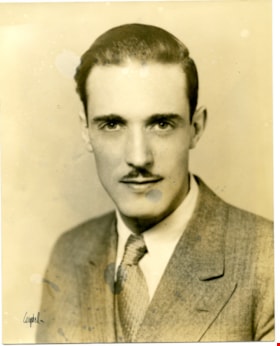
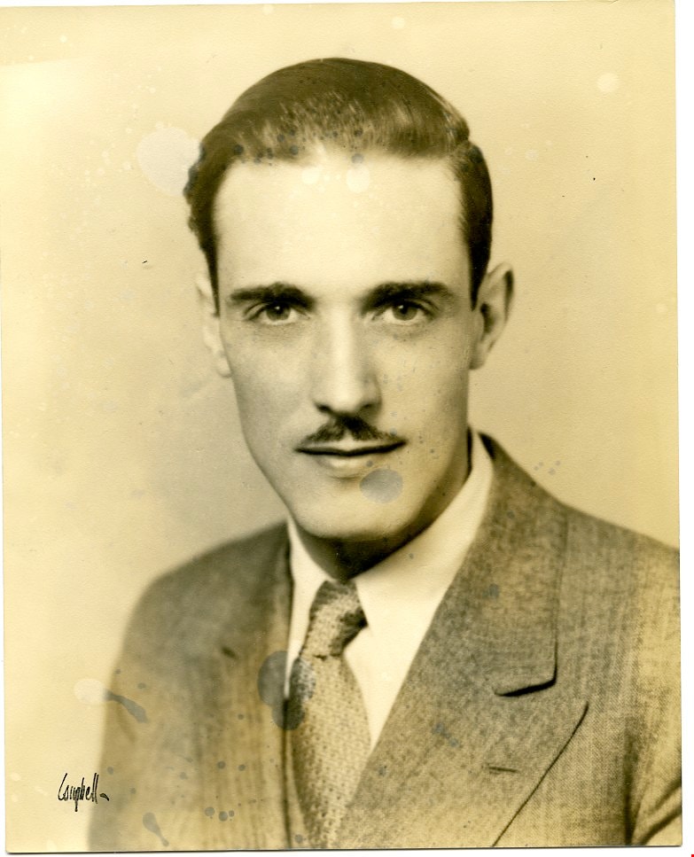
Campaign photo
https://search.heritageburnaby.ca/link/museumdescription3742
- Repository
- Burnaby Village Museum
- Date
- 1933
- Collection/Fonds
- Harold Edward Winch collection
- Description Level
- Item
- Physical Description
- 1 photograph : sepia ; 25.3 x 20.3 cm
- Scope and Content
- Item is a photograph portrait of Harold Winch, taken for his election campaign for BC MLA in Vancouver East as a member of the Co-operative Commonwealth Federation (CCF).
- Repository
- Burnaby Village Museum
- Collection/Fonds
- Harold Edward Winch collection
- Description Level
- Item
- Physical Description
- 1 photograph : sepia ; 25.3 x 20.3 cm
- Scope and Content
- Item is a photograph portrait of Harold Winch, taken for his election campaign for BC MLA in Vancouver East as a member of the Co-operative Commonwealth Federation (CCF).
- Accession Code
- BV013.12.99
- Date
- 1933
- Media Type
- Photograph
- Notes
- Title based on contents of photograph
- Photograph is a part of original scrapbook Item BV013.12.11
Images
Information for Harold Winch biography
https://search.heritageburnaby.ca/link/museumdescription3647
- Repository
- Burnaby Village Museum
- Date
- 1935-2003
- Collection/Fonds
- Harold Edward Winch collection
- Description Level
- File
- Physical Description
- 1 folder of textual records + 1 photograph : col.
- Scope and Content
- File consists of records relating to the development of a biography of Harold Winch, including newspaper clippings, Co-operative Commonwealth Federation (CCF) publicity material, and a photograph of the dedication of MacInnis Park in Vancouver, including Glen Clark, MLA.
- Repository
- Burnaby Village Museum
- Collection/Fonds
- Harold Edward Winch collection
- Description Level
- File
- Physical Description
- 1 folder of textual records + 1 photograph : col.
- Scope and Content
- File consists of records relating to the development of a biography of Harold Winch, including newspaper clippings, Co-operative Commonwealth Federation (CCF) publicity material, and a photograph of the dedication of MacInnis Park in Vancouver, including Glen Clark, MLA.
- Subjects
- Government - Provincial Government
- Accession Code
- BV013.12.4
- Date
- 1935-2003
- Media Type
- Photograph
- Textual Record
- Notes
- Title based on contents of file

Government locks opening in Seattle
https://search.heritageburnaby.ca/link/museumdescription19434
- Repository
- Burnaby Village Museum
- Date
- 11 Oct. 1936
- Collection/Fonds
- Hawkshaw family fonds
- Description Level
- Item
- Physical Description
- 1 photograph : sepia ; 6.5 x 9 cm
- Scope and Content
- Photograph of Hiram M. Chittenden Locks (Ballard Locks) opening in Salmon Bay, Seattle, Washington's Ship Canal. The locks are opening to allow a boat to come through. The locks link Lake Washington to Puget Sound. The Salmon Bay Bridge is visible in the background spanning Salmon Bay.
- Repository
- Burnaby Village Museum
- Collection/Fonds
- Hawkshaw family fonds
- Description Level
- Item
- Physical Description
- 1 photograph : sepia ; 6.5 x 9 cm
- Scope and Content
- Photograph of Hiram M. Chittenden Locks (Ballard Locks) opening in Salmon Bay, Seattle, Washington's Ship Canal. The locks are opening to allow a boat to come through. The locks link Lake Washington to Puget Sound. The Salmon Bay Bridge is visible in the background spanning Salmon Bay.
- Subjects
- Transportation - Boats
- Geographic Features - Channels
- Geographic Features - Bays
- Structures - Bridges
- Water Control
- Accession Code
- BV996.6.118
- Access Restriction
- No restrictions
- Reproduction Restriction
- No known restrictions
- Date
- 11 Oct. 1936
- Media Type
- Photograph
- Scan Resolution
- 600
- Scan Date
- 2023-02-06
- Notes
- Title based on contents of photograph
- Caption beneath photograph reads: "GOVT LOCKS SEATTLE / OPENING"
- Caption of album page reads: "Oct 11/36 / THANKSGIVING / SEATTLE"
- Photograph is part of photograph album BV996.6.1
Images

![B.C. Legislature 1937-41, [1937] thumbnail](/media/hpo/_Data/_BVM_Images/2013/2013_0012_0052_001.jpg?width=280)
B.C. Legislature 1937-41
https://search.heritageburnaby.ca/link/museumdescription3695
- Repository
- Burnaby Village Museum
- Date
- [1937]
- Collection/Fonds
- Harold Edward Winch collection
- Description Level
- Item
- Physical Description
- 1 photograph : sepia ; 22.2 x 34.6 cm
- Scope and Content
- Item is a photograph of members of the legislature of British Columbia outside of the British Columbia Parliament buildings in Victoria. Harold Winch can be seen seated in the front row, second from right; Ernest "Ernie" Winch is directly behind him.
- Repository
- Burnaby Village Museum
- Collection/Fonds
- Harold Edward Winch collection
- Description Level
- Item
- Physical Description
- 1 photograph : sepia ; 22.2 x 34.6 cm
- Scope and Content
- Item is a photograph of members of the legislature of British Columbia outside of the British Columbia Parliament buildings in Victoria. Harold Winch can be seen seated in the front row, second from right; Ernest "Ernie" Winch is directly behind him.
- Subjects
- Government - Provincial Government
- Geographic Access
- Victoria
- Accession Code
- BV013.12.52
- Access Restriction
- No restrictions
- Reproduction Restriction
- No known restrictions
- Date
- [1937]
- Media Type
- Photograph
- Notes
- Title based on contents of photograph
- Photograph is a part of original scrapbook Item BV013.12.11
Images
![B.C. Legislature 1937-41, [1937] thumbnail](/media/hpo/_Data/_BVM_Images/2013/2013_0012_0052_001.jpg)
![Political photographs, [1938-1990], predominant 1938-1953 thumbnail](/media/hpo/_Data/_BVM_Images/2013/2013_0012_0006_001.jpg?width=280)
Political photographs
https://search.heritageburnaby.ca/link/museumdescription3649
- Repository
- Burnaby Village Museum
- Date
- [1938-1990], predominant 1938-1953
- Collection/Fonds
- Harold Edward Winch collection
- Description Level
- File
- Physical Description
- 35 photographs : b&w + col. prints + slides
- Scope and Content
- File consists of photographs relating to Winch's political career, including professional portraits of Harold Winch, tourist photographs of Ottawa, and photographs of Winch with New Democratic Party (NDP) colleagues Dave Barrett (Premier of British Columbia, 1972-1975; also served as MLA and MP) an…
- Repository
- Burnaby Village Museum
- Collection/Fonds
- Harold Edward Winch collection
- Description Level
- File
- Physical Description
- 35 photographs : b&w + col. prints + slides
- Scope and Content
- File consists of photographs relating to Winch's political career, including professional portraits of Harold Winch, tourist photographs of Ottawa, and photographs of Winch with New Democratic Party (NDP) colleagues Dave Barrett (Premier of British Columbia, 1972-1975; also served as MLA and MP) and Dave Stupich (served as MLA and MP). Includes a photograph taken by photographer Ken McAllister of members of the CCF (Co-operative Commonwealth Federation) standing outside of the British Columbia Legislature [ca. 1941].
- Subjects
- Government - Federal Government
- Accession Code
- BV013.12.6
- Access Restriction
- No restrictions
- Reproduction Restriction
- May be restricted by third party rights
- Date
- [1938-1990], predominant 1938-1953
- Media Type
- Photograph
- Scan Resolution
- 600
- Scan Date
- 2023-04-14
- Photographer
- McAllister, Kenneth "Ken"
- Notes
- Title based on contents of file
- Annotation in blue ink on recto of photograph of CCF members [ca. 1941] includes names of people identified; "Arthur Tuenue, Colin Cameron, Laura Jamieson, Grant MacNeil / Wallis Lefeaux, Sam Guthrie, Bernard Webber, / Front: Bert Herridge, Grace MacInnis, Bert Gargrave, Harold Winch, Gretchen Steeves, Len Shepherd, Ernie Winch"
Images
![Political photographs, [1938-1990], predominant 1938-1953 thumbnail](/media/hpo/_Data/_BVM_Images/2013/2013_0012_0006_001.jpg)
![Co-operative Commonwealth Federation party members, [194-?] thumbnail](/media/hpo/_Data/_BVM_Images/2013/2013_0012_0088_001.jpg?width=280)
Co-operative Commonwealth Federation party members
https://search.heritageburnaby.ca/link/museumdescription3731
- Repository
- Burnaby Village Museum
- Date
- [194-?]
- Collection/Fonds
- Harold Edward Winch collection
- Description Level
- Item
- Physical Description
- 1 photograph : b&w ; 12.7 x 18 cm
- Scope and Content
- Item is a photograph of Ernest "Ernie" Winch, Grace MacInnis, and Grant MacNeil, all of whom served as Co-operative Commonwealth Federation (CCF) MLAs in the 1940s.
- Repository
- Burnaby Village Museum
- Collection/Fonds
- Harold Edward Winch collection
- Description Level
- Item
- Physical Description
- 1 photograph : b&w ; 12.7 x 18 cm
- Scope and Content
- Item is a photograph of Ernest "Ernie" Winch, Grace MacInnis, and Grant MacNeil, all of whom served as Co-operative Commonwealth Federation (CCF) MLAs in the 1940s.
- Subjects
- Government - Provincial Government
- Accession Code
- BV013.12.88
- Date
- [194-?]
- Media Type
- Photograph
- Notes
- Title based on contents of photograph
- Photograph is a part of original scrapbook Item BV013.12.11
Images
![Co-operative Commonwealth Federation party members, [194-?] thumbnail](/media/hpo/_Data/_BVM_Images/2013/2013_0012_0088_001.jpg)
![Notice, [before 1973] thumbnail](/media/hpo/_Data/_BVM_Images/1973/1973_0041_0003_001.jpg?width=280)
Notice
https://search.heritageburnaby.ca/link/museumdescription994
- Repository
- Burnaby Village Museum
- Date
- [before 1973]
- Collection/Fonds
- Burnaby Village Museum Photograph collection
- Description Level
- Item
- Physical Description
- 1 photograph : b&w ; 20.6 x 25.4 cm
- Scope and Content
- Photograph of a notice sign that was posted inside a British Columbia Electric Railway tram. It reads; "The Government of the Province of British Columbia / NOTICE / Spitting in this car is contrary to law, and is punishable by fine or imprisonment. / By Order / Provincial Board of Health. / BCER 1…
- Repository
- Burnaby Village Museum
- Collection/Fonds
- Burnaby Village Museum Photograph collection
- Description Level
- Item
- Physical Description
- 1 photograph : b&w ; 20.6 x 25.4 cm
- Scope and Content
- Photograph of a notice sign that was posted inside a British Columbia Electric Railway tram. It reads; "The Government of the Province of British Columbia / NOTICE / Spitting in this car is contrary to law, and is punishable by fine or imprisonment. / By Order / Provincial Board of Health. / BCER 1203-B42."
- Subjects
- Transportation - Electric Railroads
- Accession Code
- HV973.41.3
- Access Restriction
- No restrictions
- Reproduction Restriction
- No known restrictions
- Date
- [before 1973]
- Media Type
- Photograph
- Related Material
- For an earlier donation made by the same donor in regards to BCER tram, see accession HV972.202.
- Scan Resolution
- 600
- Scan Date
- 2023-05-09
- Scale
- 100
- Notes
- Title based on contents of photograph
Images
![Notice, [before 1973] thumbnail](/media/hpo/_Data/_BVM_Images/1973/1973_0041_0003_001.jpg)
Planning Department fonds
https://search.heritageburnaby.ca/link/archivedescription102
- Repository
- City of Burnaby Archives
- Date
- 1940-2016
- Collection/Fonds
- Planning Department fonds
- Description Level
- Fonds
- Physical Description
- 80 m of textual records and other material
- Scope and Content
- Fonds consists of those records created during the regular conduct of business by the Planning Department and its predecessor agencies according to their mandate of providing professional and technical advice to Council on the current and future uses of City land and resources.
- Repository
- City of Burnaby Archives
- Date
- 1940-2016
- Collection/Fonds
- Planning Department fonds
- Physical Description
- 80 m of textual records and other material
- Description Level
- Fonds
- File Class
- 71000 10 (add. 2020)
- 71000 20 (add. 2020)
- 71000 30 (add. 2020)
- 71000 40 (add. 2020)
- Access Restriction
- Subject to FOIPPA
- Reproduction Restriction
- Reproductions subject to FOIPPA.
- Scope and Content
- Fonds consists of those records created during the regular conduct of business by the Planning Department and its predecessor agencies according to their mandate of providing professional and technical advice to Council on the current and future uses of City land and resources.
- History
- The City of Burnaby Planning Department was established on October 9, 1956, when the City Council unanimously carried the motion to create a distinct department to deal with planning issues within the City and appointed Mr. William John Blakely as its head. This decision followed a report and recommendation made by the City’s Chief Administrative Officer which indicated that the role of the Planning Engineer and his staff had quickly expanded to become a separate division within the Engineering Department and that they were functioning as an independent unit in all but name. The proposed separation of the Engineering and Planning departments had been in the works since the early part of 1956 when staff changes and restructuring within the Engineering Department’s Planning Division illustrated the undermanned condition of the Planning Engineer’s office. As a result, Council asked the Chief Administrative Officer to undertake a study examining the feasibility of creating a distinct Planning Department. This report was delivered to Council on July 3, 1956, but was laid over until a Committee of the Council had the opportunity to study the functions of the Planning department to determine the necessity of the proposal. The Committee’s findings were in line with the initial report and the Planning Department was established with a staff of nine (the head Planning Engineer, an Administrative Planner, three Research Planning Assistants, a Draughtsman, a Subdivision Control Clerk, a department Clerk and a Clerk Stenographer). This new department was to offer advice and carry out the work intensive in matters such as zoning and rezoning applications, subdivision control, traffic and transportation planning, and general City planning schemes. Prior to the creation of the Planning Department, a number of bodies within the City had been responsible for fulfilling the functions carried out by this new unit. In the earliest years of the City, the members of Council were responsible for matters of planning and were assisted in their job by the City’s Engineer or any number of hired consultants (e.g. surveyors, cartographers). By 1906, however, the provincial laws surrounding the subdivision process had changed, and local governments were charged with the task of approving all private subdivision plans in their respective Municipalities. In Burnaby, the City Council passed a bylaw decreeing that all subdivision plans were to be submitted to Council for review and the City Engineer was responsible for ensuring compliance with the law. After the first Town Planning Bylaw in 1924 which restricted the type and size of construction that could occur in certain City areas, the Engineering and Building departments were to work together to oversee the enforcement of the Bylaw and the development of City plans. The scope and competence required to carry out this work grew as Burnaby’s population expanded, and in 1930 Council passed the Town Planning Commission Bylaw (No. 1028) that saw the creation of a permanent body – the Town Planning Commission – which was to serve as an advisory body to help direct the planning activities in the City while the actual work continued to be carried out by the Engineering Department. This body was comprised of the Reeve, the Chairman of the School Board, the Chairman of the Park Committee (later, the Board of Parks Commissioners), and six appointed citizens who served three-year terms. Council referred all matters of subdivisions, transportation planning, and rezoning to this Commission, which was later supported in its work by several other special or standing committees such as the Subdivision Committee, the Apartment Committee, the Transportation Committee or the Town Planning Board of Appeal. By 1953, it had become apparent that the advisory committees that were dedicated to these planning issues needed a permanent staff to carry out the work intensive, so a restructuring of the Engineering department resulted in a permanent Planning Engineer’s office being created. The Town Planning Commission continued in its advisory capacity even after the determination came in 1956 to create a separate Planning Department. When Bylaw No. 4473 was passed in 1963, the Town Planning Commission was disbanded in favour of a new Advisory Planning Commission that would turn over all routine matters such as subdivision and rezoning applications to the Planning Department but would offer advice and community input into the more complex planning schemes within the City and act as an intermediary in cases where Council and Planning staff were in disagreement. A new Advisory Planning Commission Bylaw (No. 7600) was adopted in 1980 which allowed for even greater community participation in the planning process. The Planning Department was initially responsible to report directly to Council, but in 1957, the administrative structure of Municipal staff changed with the introduction of the Burnaby Municipal Manager Bylaw (No. 3859) and from that point on, the head of the Planning Department held a direct reporting relationship to the Municipal Manager, who in turn was responsible for reporting the activities of the Department to the City Council. Over the years, the internal structure and the scope of responsibilities of the Department have changed during periods of staff reorganizations. Under the larger umbrella of the Planning and Building Department, Planning has come to be comprised of two divisions: the Current Planning Division and the Long Range Planning Division. The functions of the Current Planning Division include rezoning, subdivision, development plan areas, preliminary plan approvals, urban design, heritage planning, and urban trails and bicycle routes. The Long Range Planning Division is responsible for environmental planning concerns, transportation planning, housing, neighbourhood area planning, social planning and planning information services. In 2022, the Planning and Building Department was reorganized to better align functions with delivery of services. The Climate Action and Engery Division moved from Corporate Services to the Planning and Building Department, while Indigenous Relations and Facilities Management moved to Corporate Services and Lands and Facilities, respectively. The position of Director of Planning and Building was changed to General Manager, Planning and Development. The following individuals have served as Planning Engineer and/or Director of the Planning Department and/or General Manager, Planning and Development for the City of Burnaby: William John Blakely 1954-1956 (as Planning Engineer) 1956-1963 (as Head of the Department) Anthony P. Parr 1964-1993 Don G. Stenson 1993-2001 Jack S. Belhouse 2001-2006 Basil Luksun 2006-2012 Lou Pelletier 2012-2019 Edward Kozak 2019-present
- Formats
- Microforms exist for some records. See series descriptions.
- Media Type
- Textual Record
- Photograph
- Moving Images
- Creator
- City of Burnaby
- Notes
- Title based on contents of fonds
The Fraser Canyon and Okanagan
https://search.heritageburnaby.ca/link/archivedescription66720
- Repository
- City of Burnaby Archives
- Date
- [194-]
- Collection/Fonds
- Maurice Phillips collection
- Description Level
- Item
- Physical Description
- 1 map : col. on paper ; 42.5 x 49 cm, folded to 23 x 10 cm
- Scope and Content
- Item is a map of "the Fraser Canyon and Okanagan / Scenic Highway Loop of British Columbia, Canada" published by the British Columbia Government Travel Bureau, Department of Trade and Industry.
- Repository
- City of Burnaby Archives
- Date
- [194-]
- Collection/Fonds
- Maurice Phillips collection
- Physical Description
- 1 map : col. on paper ; 42.5 x 49 cm, folded to 23 x 10 cm
- Material Details
- Scale not indicated
- Description Level
- Item
- Record No.
- MSS158-003
- Accession Number
- 2011-13
- Scope and Content
- Item is a map of "the Fraser Canyon and Okanagan / Scenic Highway Loop of British Columbia, Canada" published by the British Columbia Government Travel Bureau, Department of Trade and Industry.
- Media Type
- Cartographic Material
- Notes
- Transcribed title
Kapoor Singh Siddoo series
https://search.heritageburnaby.ca/link/museumdescription21422
- Repository
- Burnaby Village Museum
- Date
- [1940-1947] (date of originals), copied 2004
- Collection/Fonds
- In the Shadow by the Sea collection
- Description Level
- Series
- Physical Description
- 31 photographs (tiffs)
- Scope and Content
- Series consists of copies of photographs pertaining to the family of Kappoor Singh Siddoo and the Kapoor Sawmills Limited that were published in the book "In the Shadow by the Sea: Recollections of Burnaby's Barnet Village".
- Repository
- Burnaby Village Museum
- Collection/Fonds
- In the Shadow by the Sea collection
- Description Level
- Series
- Physical Description
- 31 photographs (tiffs)
- Scope and Content
- Series consists of copies of photographs pertaining to the family of Kappoor Singh Siddoo and the Kapoor Sawmills Limited that were published in the book "In the Shadow by the Sea: Recollections of Burnaby's Barnet Village".
- History
- Kapoor Singh Siddoo was born in 1885 in the Punjab village of Kharaudi, India. Kapoor was one of the pioneer South Asian Canadian Sikhs who first immigrated to America in 1906, arriving in San Francisco in 1906 with twenty illiterate compatriots seeking employment. As the only one among them with a formal education, Kapoor acted as their interpreter, manager, and accountant. They worked along the Southern Pacific Railway line near Marysville, California, as it inched toward Reno, Nevada. At the same time, Kapoor was asked to help raise funds for a mining company in British Columbia founded by a Punjabi spiritual leader. Kapoor attempted to join the company in British Columbia (attracted partly by stories of the province’s natural beauty), but was turned back at the international border at Blaine several times before entering via Victoria in 1912. Once settled, he operated a successful dairy, invested in various businesses, and socialized with other South Asian immigrants interested in politics. However, emotions of those around Kapoor began to heat up; frustration among opponents of British rule in Indian grew intense. Kapoor left the explosive situation for Ontario in June 1914, determined to find a place for himself in Canadian society. He tried homesteading in the “Clay Belt” of northern Ontario, but like others found the extreme winter conditions intolerable. He returned to British Columbia in 1916, invited by a group of Sikh sawmill workers to help them manage the accounts at a Fraser Valley sawmill they had leased. Kapoor found his niche in the sawmill industry. Fraser Valley timber sat on land granted by the Dominion government to railways to help finance their construction. South Asian workers could get timber rights on these lands, unlike on Crown Lands elsewhere in the province. Kapoor and his new partners, particularly Mayo Singh, looked for other promising “railway belt” locations for another sawmill and found an ideal location on Vancouver Island near Duncan. Kapoor and his colleagues opened a large, modern mill in 1918 and despite various setbacks, prospered for the next decade and a half. In 1923, with a change in immigration laws, Kapoor arranged for his wife, Besant Kaur, to emigrate from India. Besant came to Canada with Kapoor’s older brother, Bhagwan. Kapoor and Besant had two daughters while in Duncan: Jagdis Kaur Siddoo (1925) and Sarjit Kaur Siddoo (1926), both of whom eventually became physicians. Kapoor’s lumber business on Vancouver Island flourished until 1935, when a fire destroyed the original mill. He moved his family to Vancouver, although retaining interest in another Vancouver Island mill. In 1939, he purchased a large piece (45 acres) of the former Barnet Mill in Burnaby, recently acquired by the Municipality as payment for tax default during the Depression. Kapoor named the mill Modern Sawmills and finalized the purchase though a business agent to get around Burnaby’s bylaw prohibiting the sale to a non-White person. Eventually he changed the mill’s name to Kapoor Sawmills Limited. The mill received timber in log booms from Vancouver Island, and once processed, the wood was then shipped via the Canadian Pacific Railway that ran past the mill, and still does today. Kapoor’s younger brother, Tara, who had earlier worked with Kapoor in other sawmills, joined the venture as a shareholder. Tara and his wife, Beant, took up residence in Barnet from 1943-1945 with their family: sons Lakhbeer, Gurdeb, Gurcharn, Baldev, Hardev and daughters Harjeet (Sangha), Runjeet (Basi) and Buckshish (Sarai). Tara oversaw the regular delivery of logs from Vancouver Island to the Barnet mill. He also became known as a local Burnaby philanthropist, donating to Burnaby General Hospital. The Kapoor sawmill prospered but burned to the ground on January 14, 1947. A smaller mill was rebuilt on the site and remained a successful financial operation until 1959. When he retired in 1959, Kapoor Siddoo was one of Vancouver’s most influential men in the South Asian Community. He was a leading businessman, but had also fought to give South Asian Canadians the right to vote. The year he retired, the family set up the Kapoor Singh Siddoo Foundation and with help from his wife and daughters opened a hospital in the Punjab village of Aur. In 1964, Kapoor died in India at the age of 79 years.
- Accession Code
- BV019.32
- Date
- [1940-1947] (date of originals), copied 2004
- Media Type
- Photograph
- Related Material
- See also, City of Burnaby Archives: Burnaby Historical Society fonds - "In the Shadow by the Sea subseries"
- Notes
- Title based on contents of series
![Two boys in front of Seaforth School, [1945] (date of original), copied ca. 1996 thumbnail](/media/hpo/_Data/_Archives_Images/_Unrestricted/316/355-007.jpg?width=280)
Two boys in front of Seaforth School
https://search.heritageburnaby.ca/link/archivedescription37343
- Repository
- City of Burnaby Archives
- Date
- [1945] (date of original), copied ca. 1996
- Collection/Fonds
- Burnaby Historical Society fonds
- Description Level
- Item
- Physical Description
- 1 photograph : b&w ; 6 x 6.5 cm print
- Scope and Content
- Photograph of two boys, each holding a puppy, sitting alongside the Seaforth School building. Neither boy has been indentified.
- Repository
- City of Burnaby Archives
- Date
- [1945] (date of original), copied ca. 1996
- Collection/Fonds
- Burnaby Historical Society fonds
- Subseries
- Seaforth School subseries
- Physical Description
- 1 photograph : b&w ; 6 x 6.5 cm print
- Description Level
- Item
- Record No.
- 355-007
- Access Restriction
- No restrictions
- Reproduction Restriction
- No known restrictions
- Accession Number
- BHS1997-14
- Scope and Content
- Photograph of two boys, each holding a puppy, sitting alongside the Seaforth School building. Neither boy has been indentified.
- Subjects
- Animals - Dogs
- Names
- Seaforth School
- Media Type
- Photograph
- Notes
- Title based on contents of photograph.
- Geographic Access
- Government Road
- Deer Lake Avenue
- Street Address
- 7881 Government Road
- 6501 Deer Lake Avenue
- Historic Neighbourhood
- Lozells (Historic Neighbourhood)
- Planning Study Area
- Government Road Area
Images
![Two boys in front of Seaforth School, [1945] (date of original), copied ca. 1996 thumbnail](/media/hpo/_Data/_Archives_Images/_Unrestricted/316/355-007.jpg)
![Two children in front of Seaforth School, [1945] (date of original), copied [1996] thumbnail](/media/hpo/_Data/_Archives_Images/_Unrestricted/316/355-008.jpg?width=280)
Two children in front of Seaforth School
https://search.heritageburnaby.ca/link/archivedescription39814
- Repository
- City of Burnaby Archives
- Date
- [1945] (date of original), copied [1996]
- Collection/Fonds
- Burnaby Historical Society fonds
- Description Level
- Item
- Physical Description
- 1 photograph : b&w ; 6.5 x 9 cm print
- Scope and Content
- Photograph of two children standing in front of the Seaforth School building. Both children are wearing costumes but neither have been identified.
- Repository
- City of Burnaby Archives
- Date
- [1945] (date of original), copied [1996]
- Collection/Fonds
- Burnaby Historical Society fonds
- Subseries
- Seaforth School subseries
- Physical Description
- 1 photograph : b&w ; 6.5 x 9 cm print
- Description Level
- Item
- Record No.
- 355-008
- Access Restriction
- No restrictions
- Reproduction Restriction
- No known restrictions
- Accession Number
- BHS1997-14
- Scope and Content
- Photograph of two children standing in front of the Seaforth School building. Both children are wearing costumes but neither have been identified.
- Subjects
- Clothing - Costumes
- Names
- Seaforth School
- Media Type
- Photograph
- Notes
- Title based on contents of photograph
- Geographic Access
- Government Road
- Deer Lake Avenue
- Street Address
- 7881 Government Road
- 6501 Deer Lake Avenue
- Historic Neighbourhood
- Lozells (Historic Neighbourhood)
- Planning Study Area
- Government Road Area
Images
![Two children in front of Seaforth School, [1945] (date of original), copied [1996] thumbnail](/media/hpo/_Data/_Archives_Images/_Unrestricted/316/355-008.jpg)
![Children in front of Seaforth School, [1945] (date of original), copied [1996] thumbnail](/media/hpo/_Data/_Archives_Images/_Unrestricted/316/355-009.jpg?width=280)
Children in front of Seaforth School
https://search.heritageburnaby.ca/link/archivedescription39815
- Repository
- City of Burnaby Archives
- Date
- [1945] (date of original), copied [1996]
- Collection/Fonds
- Burnaby Historical Society fonds
- Description Level
- Item
- Physical Description
- 1 photograph : b&w ; 6.5 x 8.7 cm print
- Scope and Content
- Photograph of three children standing in front of the Seaforth School building - all are unidentified.
- Repository
- City of Burnaby Archives
- Date
- [1945] (date of original), copied [1996]
- Collection/Fonds
- Burnaby Historical Society fonds
- Subseries
- Seaforth School subseries
- Physical Description
- 1 photograph : b&w ; 6.5 x 8.7 cm print
- Description Level
- Item
- Record No.
- 355-009
- Access Restriction
- No restrictions
- Reproduction Restriction
- No known restrictions
- Accession Number
- BHS1997-14
- Scope and Content
- Photograph of three children standing in front of the Seaforth School building - all are unidentified.
- Names
- Seaforth School
- Media Type
- Photograph
- Notes
- Title based on contents of photograph.
- Geographic Access
- Government Road
- Deer Lake Avenue
- Street Address
- 7881 Government Road
- 6501 Deer Lake Avenue
- Historic Neighbourhood
- Lozells (Historic Neighbourhood)
- Planning Study Area
- Government Road Area
Images
![Children in front of Seaforth School, [1945] (date of original), copied [1996] thumbnail](/media/hpo/_Data/_Archives_Images/_Unrestricted/316/355-009.jpg)